Embed Size (px)
Citation preview

““Eye in the sky Eye in the sky ––
what are you looking for?“ what are you looking for?“ Remotely Piloted Aircraft Systems for Remotely Piloted Aircraft Systems for
Gordon Morris, MScGordon Morris, MSc
Geospatial and Remote SensingGeospatial and Remote Sensing
forfor
Engineers Without BordersEngineers Without Borders
Remotely Piloted Aircraft Systems for Remotely Piloted Aircraft Systems for
Humanitarian Assistance and Infrastructure DevelopmentHumanitarian Assistance and Infrastructure Development

Disclaimer
This presentation may not necessarily
represent the opinion of Hawkeye UAV Ltd. or
its associates.
This briefing is classified
UNCLASSIFIED//OPEN SOURCE

Objective
Provide you, the EWB Volunteer, as
a potential user of UAV
technology in an Humanitarian
Assistance and infrastructure Assistance and infrastructure
development situation,
considerations for safe and
effective use of UAV.

Contents
Part 1 – The UAV
Part 2 – Employment Contexts of UAV
Part 3 – Deployment considerations
Humanitarian AssistanceHumanitarian Assistance
Infrastructure Development
Part 4 – Hotwash

1918 - KETTERING BUG1849 – Austrian over Venice
1933 - DH.82B QUEEN BEE

Why UAV?Darley Stinger

Imagery
Data
Remote In-Situ
Products from sUAV
Comms
LiDAR Hyper-
spectral
FMV Still Point Cloud
Mapping DTM
spectral
Payload and Sensor Options

Payload and Sensor Options

Classes of UAV
• Weight
• Endurance and Range
• Maximum Altitude
• Wing Loading
• Engine Type • Engine Type
• Power/Thrust Loading

Hawkeye RQ-84Z AreoHawk

RPA/UAV are part
of a system,
hence RPAS/UAShence RPAS/UAS
EADS Harfang

Part 2. Employment Contexts of UAV
OPERATIONAL
STRATEGIC
OPERATIONAL
TACTICAL

OPERATIONAL
STRATEGICPlanning
including OTH
Immediate
Communications
(relay)
Five Main Uses of UAV in HA/DR
OPERATIONAL
TACTICAL
Immediate
assessment[area, linear, point]
Search and rescue
Close
protection

Airspacesafety
Part 3 – Deployment considerations
Legal requirements
Economicviability

handout

UAV for Humanitarian Assistance
Considerations for UAV deployment
• Sustained operations
• Location of LRP or “split site”
• Terrain and WX• Terrain and WX
– Precip, Wind, Temp, Fog, Vis

UAV for Humanitarian Assistance
• Sensor considerations
Will you “defeat the night?”
Post-production
• Remote Terminal considerations• Remote Terminal considerations
Frequency Management
• Dissemination Considerations
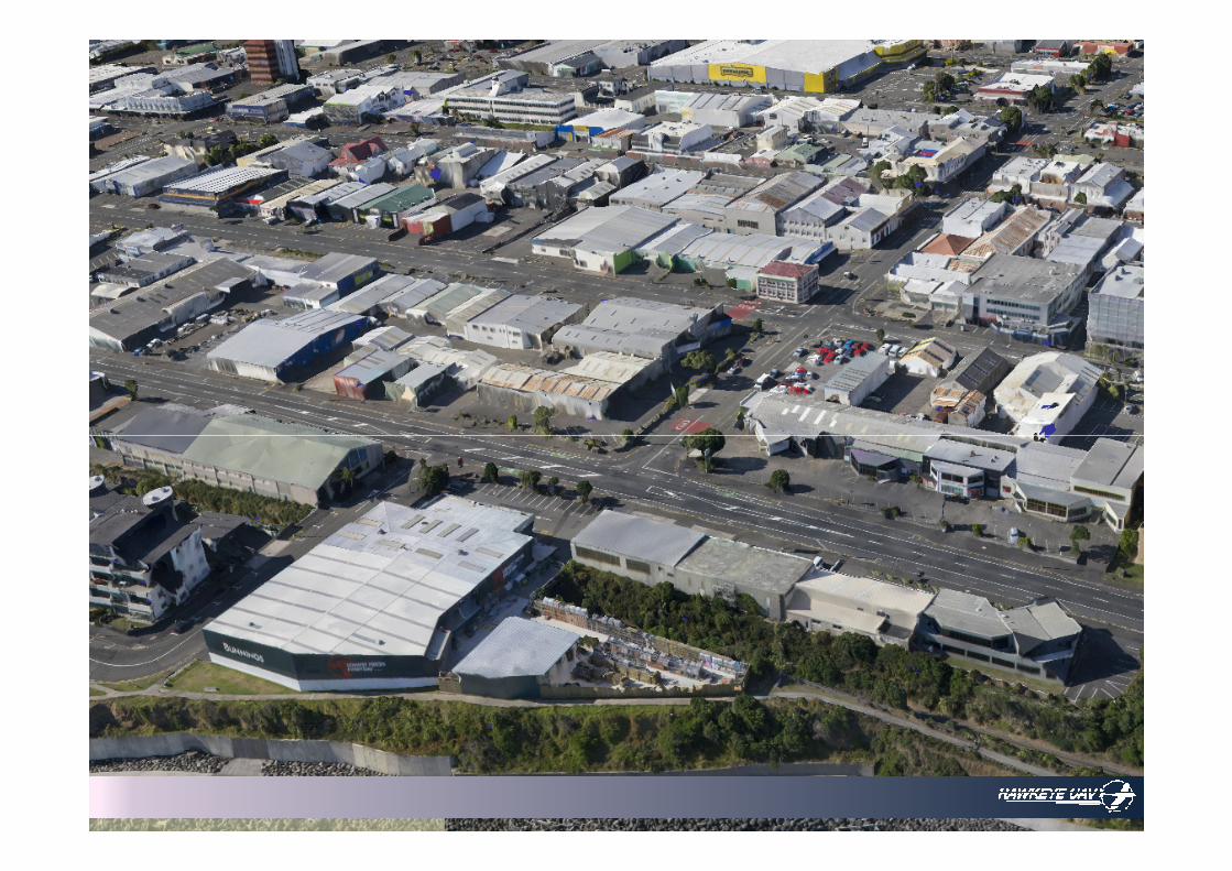
Examples

San Francisco [1906]
Lawrence Captive Airship (kite photography) flown by George Lawrence
Comment: An earthquake of probable
magnitude 7.5 M occurred in San Francisco
USA on 18 April 1906. Approximately 3,000 people were killed, and fires destroyed approximately 80% of the urban area.

Haiti
SenseFly eBee
Trimble UX5

Philippines
[Typhoon Yolanda (Haiyan) ]
Trimble UX5
Human factors?
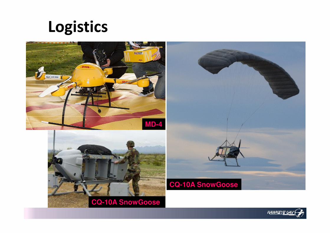
Logistics
MD-4
CQ-10A SnowGoose
CQ-10A SnowGoose

UAV in Infrastructure Development
Using a UAV is
• Non-invasive
• “Envisions a spatial fabric” [COP]
• Detailed and continuous • Detailed and continuous

Mongolia
The Cadastral Survey and Land Registration Project
(project) was designed to establish the institutional
basis for land administration and for the development of
Mongolia’s property market.
Specifically, it envisaged to facilitate efficient issuance Specifically, it envisaged to facilitate efficient issuance
and administration of property and land-lease
certificates, which were expected to enhance collection
of land fee payments and property taxes for urban and
agricultural development and to operate a private
property market.
- Asian Development Bank
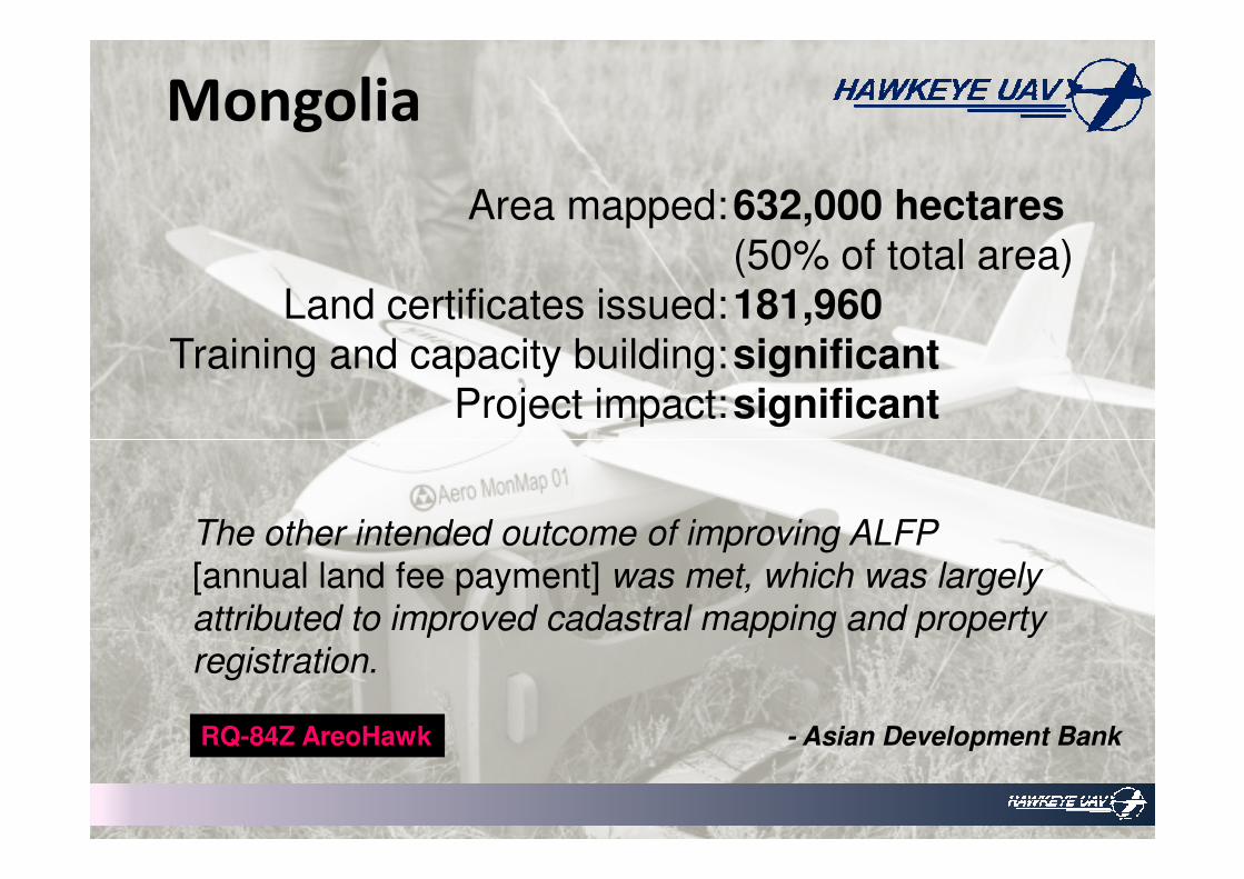
Mongolia
632,000 hectares
(50% of total area)
181,960
significant
significant
Area mapped:
Land certificates issued:
Training and capacity building:
Project impact:
The other intended outcome of improving ALFP
[annual land fee payment] was met, which was largely
attributed to improved cadastral mapping and property
registration.
- Asian Development BankRQ-84Z AreoHawk

Suriname
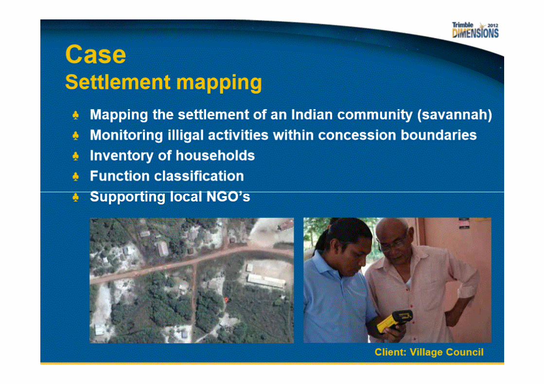

southern Africa
[Counter-Poaching]
RQ-84Z AreoHawk

RPA/UAV are part of a system
Part 4 – Hotwash
Legal
requirements
Economic
viability
Airspace
safety
UAV employment considerations
UAV deployment considerations• Sustainment• Location• Terrain and WX• Sensor• Remote Terminal &
Frequency Management• Dissemination
UAV – Infrastructure Development
Using a UAV• Non-Invasive• Common Operating Picture• Detailed and Continuous

The last word ...Control control control

Extra Slides

Fukushima, Japan
Honeywell RQ-16A T-Hawk


