Embed Size (px)
Citation preview
52C13MM0015 OM91-O17 MENARY 010
WESTERN TROT CAPITAL RESOURCES IHC.
EXPLORATION PROGRAMME ON
THE MENARY TOWNSHIP PROPERTY
MENARY TOWNSHIP
DISTRICT OF KENORA
ONTARIO
by: Christopher A. Wagg Wayne E. Holmstead
December 15, 1991
H. E. HOLMSTEAD AND ASSOCIATES INC.

S2C13NW0015 OU91-017 MENARY 01OC
TABLE OF CONTENTS
Introduction............................................l
Property Description....................................2
Previous Work...........................................3
Oeol097.................................................5
Present Exploration Programme...........................8
Results................................................10Agassiz Gold Showings.............................10Wagg Ooid Showings................................ 12Galbraith Gold Showings...........................18Other Gold Showings...............................19
Discussion.............................................20
Conclusions............................................22
Recommendations........................................23
Bibliography...........................................24
Certificates...........................................25
APPENDICES
Appendix 1: Sample Descriptions and Assays Appendix 2: Photos of Veins at Wagg Showing
Figure 1: Figure 2: Figure 3: Figure 4: Figure 5: Figure 6: Figure 7: Figure 8: Figure 9: Figure 10: Figure 11: Figure 12:
FIGURES
Property Location and Regional GeologyPast Exploration WorkGeophysical CompilationRegional GeologyAgassiz Gold ShowingAgassiz Gold Showing, South ExposureVein Locations, Wagg ShowingVeins A and B, Wagg Showing,Veins C and D, Wagg ShowingVeins E and F, south portion. Wagg ShowingVein F, north portion. Wagg ShowingAgassiz Gold Showing, New Discovery
MAPS
Map 1: Gold Showings, Topography and Claim Local ions Map 2: Property Compilation, North Sheet Map 3: Property Compilation, South Sheet
INTRODUCTION
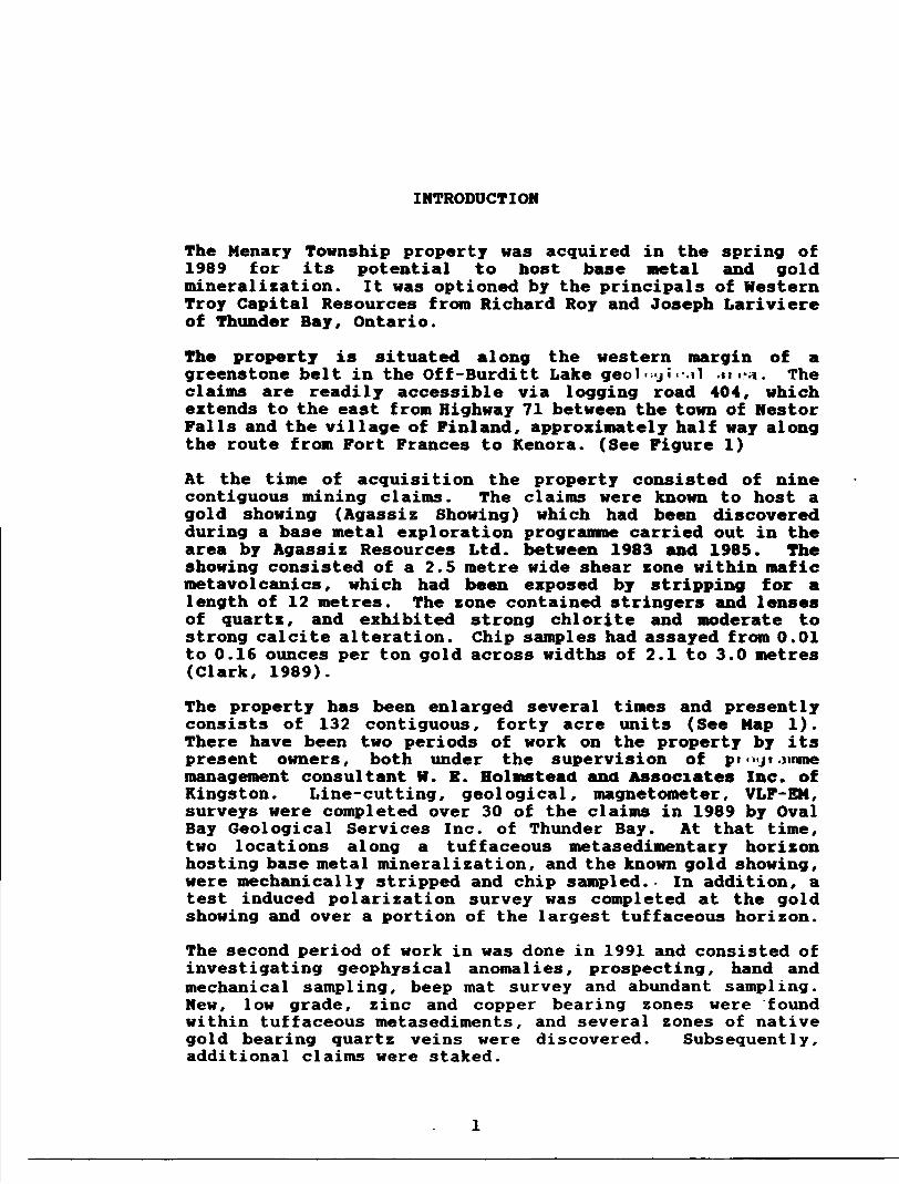
The Menary Township property was acquired in the spring of 1989 for its potential to host base metal and gold mineralization. It was optioned by the principals of Western Troy Capital Resources from Richard Roy and Joseph Lariviere of Thunder Bay, Ontario.
The property is situated along the western margin of a greenstone belt in the Off-Burditt Lake geol •-j i--.il .m-a. The claims are readily accessible via logging road 404, which extends to the east from Highway 71 between the town of Nestor Falls and the village of Finland, approximately half way along the route from Fort Frances to Kenora. (See Figure 1)
At the time of acquisition the property consisted of nine contiguous mining claims. The claims were known to host a gold showing (Agassiz Showing) which had been discovered during a base metal exploration programme carried out in the area by Agassiz Resources Ltd. between 1983 and 1985. The showing consisted of a 2.5 metre wide shear zone within mafic metavolcanics, which had been exposed by stripping for a length of 12 metres. The zone contained stringers and lenses of quartz, and exhibited strong chlorite and moderate to strong calcite alteration. Chip samples had assayed from 0.01 to 0.16 ounces per ton gold across widths of 2.1 to 3.0 metres (Clark, 1989).
The property has been enlarged several times and presently consists of 132 contiguous, forty acre units (See Map 1). There have been two periods of work on the property by its present owners, both under the supervision of pr ...jt .unme management consultant H. E. Holmstead and Associates Inc. of Kingston. Line-cutting, geological, magnetometer, VLF-EM, surveys were completed over 30 of the claims in 1989 by Oval Bay Geological Services Inc. of Thunder Bay. At that time, two locations along a tuffaceous metasedimentary horizon hosting base metal mineralization, and the known gold showing, were mechanically stripped and chip sampled.- In addition, a test induced polarization survey was completed at the gold showing and over a portion of the largest tuffaceous horizon.
The second period of work in was done in 1991 and consisted of investigating geophysical anomalies, prospecting, hand and mechanical sampling, beep mat survey and abundant sampling. New, low grade, zinc and copper bearing zones were found within tuffaceous metasediments, and several zones of native gold bearing quartz veins were discovered. Subsequently, additional claims were staked.

OQ
S St
udy
56 M
ap 2
49*0
0'
w
vvvv
V VVV
vvvvvvv
vvvvvvvv
vvvvvvvvv
vvvvvvvvvv
vvvvvvvvvv
vvvvvvvvvvv
vvvvvvvvvvv
vvvvvvvvvvv
vvvvvvvvvvv
vvvvvvvvvvv
VV
V V
.HU
.V V
VV
Rai
ny
Rlv
sr
_J
Fs
lslc
Int
rusi
ve R
ocks
y Vi
Inte
rmed
iate
Int
rusl
vs R
ocks
T*1
Maf
ic a
nd U
ltram
afic
In'ti
uslv
s Ro
cks
Clas
tic M
etas
sdlm
ents
ry R
ocks
|.'.;.
;1 Fs
lslc
to
Inte
rmed
lats
Met
avol
canl
o Ro
cks
Ivvv
l M
afic
Met
avol
cant
o Ro
cks
Fort
Fran
ces
30'
10
20km

PROPERTY DESCRIPTION
The Menary Township property consists of 132 contiguous mining claims. Claim locations are shown on Map l which depicts the claim group and the primary logging roads crossing the property. The roads are in good shape, and gravel deposits on claims 1092636, 1092637, and 1092641 contain sufficient material to maintain or expand the road system.
Timber harvesting operations were completed over most of the property within the past fifteen years. The regrowth is primarily natural, with jackpine being commonest in areas of frequent outcrop, and poplar and lesser birch becoming abundant where soil depths increase. Red and white pines are found almost exclusively within a few small planted areas. Spruce and cedar are infrequent and largely restricted to damp or swampy areas.
Outcrop exposure is good to excellent except along the northwestern margin of the claim group, where swamps or gravel deposits connonly.overlie the contact between met a volcanics to the southeast and the poorly exposed granitic rocks to the northwest. The remainder of the property is dominated by gentle slopes, wicn areas oetween outcrops covered by gravelly glacial deposits rarely exceeding a few metres thickness. Several linear swamps, creek valleys, and northwesterly facing cliffs, which parallel the northeasterly trend of rock units, provide topographic relief of up to twenty five metres in places.

PREVIOUS WORK
In the Off-Burditt Lake area, the first documented exploration work was undertaken in the 1930's. Most work has taken place a considerable distance to the east of the property, within an intermixed mafic to felsic volcanic cycle which is younger than the predominantly mafic cycle (Blackburn, 1976) within which the property is situated. Most of the recent efforts have been initiated by major mining companies seeking base metal deposits.
The only significant exploration to have taken place around the Menary Township property occurred in the early 1970's and again in the early 1980's.
In 1974, Hudson Bay Exploration and Development Company Ltd. drilled two holes totalling 509 feet near the northeast corner of the current property, as shown in Figure 2. The holes intersected an intermediate to felsic, tuffaceous horizon mineralized with pyrrhotite, pyrite, minor sphalerite and chalcopyrite.
Between 1983 and 1985, Agassiz Resources Ltd. held claims covering much of the original property. Magnetometer, VLF-EM, geological, and lithogeochemical surveys were completed in search of base metal deposits. Some horizontal loop (EM) work and stripping was completed in areas exhibiting the greatest potential to host base metal sulphides. The gold showing located at L 15+15 N, 12+60 E on the present grid, was discovered during this time.
A 1976 report by C.E. Blackburn, currently the Kenora District Resident Geologist with the Ministry of Northern Development and Mines, contains the most recent government geology map to include Menary Township at a scale appropriate for the purposes of exploration.
A reconnaissance till sampling report by A.F. Bajc, published in 1988 by the Ontario weoiuyi.c*i OULV***, j.o*ntitied an area in the south-central part of the claim group where high numbers of gold grains occur within till. The approximate position of a sample containing ten abraded gold grains is shown in Figure 3.

l lV•1•l i•l•l l
l
l
l
l
l
l
l
Logging Rood 4O4
X ^-rz^i ^/GolGold Showing
Xj l 1 K aoW grail
jL .I.. -. . in till son/Exiting Property _x?* "~ ' ~—— - - C . UT .
grains samp
(expired) Agassiz Res.
LEGEND
^"*~- Geological Contact•*" j- Foliation
-o—o- HLEM Conductor. Diamond Drill Hole
FIGURE 3.
MEHAJtT TOUHSHIP PROPERTY HORTHUESTERN ONTARIO
REGIONAL OGHPILATIOH MAP OF PREVIOUS WORK
Scale: |":'/2 Mile

Figure 3 is a compilation of the work completed on the property up to the end of 1989. It was prepared by Oval Bay Geological Services Inc., and is included in a report on the exploration potential of the Menary Township property (Clark, 1989b). The report includes more thorough sections on previous work and regional geology than does this report, and also contains complete discussions of the geological, magnetometer, and VLF surveys completed in 1989.
A test induced polarization survey and some stripping was completed during 1989, over both the gold showing and a stratigraphic unit known to host base metal mineralization. The induced polarization survey did not detect an anomaly at the gold showing, and revealed a very weak conductive zone around the base metal mineralization. The results of the stripping and sampling programme did not warrant immediate drill testing of either target.
An airborne magnetometer and VLF-EM survey, which covers portions of the topographic map sheets 52C/13 and 52F/4, includes most of the property within the boundaries of Map 81507. The survey was flown tor the Ontario Geological Survey, and the maps released late in 1990. Several VLF anomalies are shown as occurring within the claim group. Of the anomalies on the original property, all but one have been investigated to some degree by previous operators and the current property owners. The untested anomaly is plotted on Figure 3. It has a strike length exceeding two hundred metres, and exhibits the strongest (airborne) response of any of the anomalies on the property. The anomaly parallels a northeasterly striking lineament, and is coincident at its western end with a swamp through which lines were not cut because ot standing water. At its eastern end a weak response to ground VLF was previously dismissed as being due to conductive overburden within the lineament.

Hudson Bay Exploration t Development 5Z py. 5X pa, -5-1X sph over 10 ft.
— A —— O —
LEGEND
Granitic Rocks Tuff. Crystal Tuff Andesitic Hetavolcanics Basaltic Hetavolcanics
RoadsFaultFoliationVLF ConductorHLEM ConductorDiamond Drill HoleGeological Contact
MINERALS
Au Py Po Sph
Gold Pyrite Pyrrhotite Sphalerite
FIGURES
HBUUtr TOUNSHIP PROPERTY KKTHUESTE2N ONTARIO
PROPERTT CmPILATION HAP
SCALE 1: 20.000
400 800
METRES

GEOLOGY
The claim group is situated along the northwestern margin of a greenstone belt of Early Precambrian age (See Figures l and 4). The belt strikes northeast-southwest in the area of Menary Township, and is about eight kilometres wide. Blackburn (1976) has observed two distinct sequences of metavolcanic rocks in the surrounding region. An upper sequence of mafic to felsic metavolcanics overlies a lower sequence of massive, porphyritic , and pillowed mafic flows intruded by numerous quartz-feldspar porphyry dykes. Each sequence has been subdivided into a number of zones based upon the predominant type of rock in the area. The present property encompasses the lower mafic sequence and includes a portion of each of the five zones (Blackburn, 1976). The me tavolcanics young to the southeast and appear not to have been disrupted by any major folding.
Several periods of intermediate to felsic intrusive activity have been interpreted to be concurrent with deformation and regional metamorphism (Blackburn, 1976). Metamorphic grade varies from lower greenschist throughout most of the greenstone, increasing to lower amphibolite around the intrusives and the margins of the belt. Northwesterly trending diabase dykes postdate regional metamorphism.
Figures l and 4 illustrate the location of the property and the distribution of major rock types in the region. The claim group covers a portion of the oldest metavolcanic rocks in the area, along the contact with the Sabaskong Batholith of trondhjemitic composition.
A considerable distance to the north along the volcanic- intrusive contact, near the northeastern termination of the batholith, there is a gold showing which displays characteristics similar to one of the new showings on the Menary Township property. The Bethune Occurrence appears on Map 243O iKawaras, x90A; *ua is described as a quartz vein in mafic metavolcanics near the contact with a gabbroic intrusive.
A report by Clark (1989b) describes in some detail the rock types, textures, and structures encountered on the property. The accompanying map is accurate, and the author of this report suggests only one significant modification. The distinction between the rocks mapped as andesitic and those mapped as basaltic is likely due to a subtle alteration of plagioclase to albite and epidote ( */- quartz), in proximity to the margin of the batholith; and probably does not reflect any initial difference in bulk chemistry prior to the emplacement of the batholith.

mm
mm
mm
mm
/^
MEN
XiRY
Diobasc Di
ko
Quar
tz M
onzonite
Tron
oftj
cmit
e Horizon i
tc
Syenodiorite
Fels
ic M
etov
otca
nics
Mafic
Hotovolcanics
MENA
RY TOUNSH1P P
ROPERTY
NORT
HWES
TERN
ON
TARI
O
REGIONAL G
EOLOGY M
AP
Claim
Bloc
kGe
olog
ical
Con
tact
Foul
tRo
odLake
Gold
Showing
SCAL
E 1:97,400

A brief summary of the property's geological characteristics, from northwest to southeast, is as follows. The contact between the fairly massive rocks of the Sabaskong Batholith and the well foliated metavolcanics strikes 40 to 50 degrees, dipping sub-vertically to 70 degrees to the east. Adjacent to the batholith, there is a package of massive to pillowed metabasalts exposed for a thickness of about 400 metres in the southwest part of the property, which increases to around 1000 metres thick along the northern claim line. The pillowed flows occasionally exhibit a poorly developed variolitic texture.
Granitic dykes and numerous small bodies of feldspar and quartz-feldspar porphyry have been emplaced subparallel to the northeasterly trend of individual flows and foliation. Shear zones up to two and a half metres wide, displaying varying degrees of chloritization, calcite alteration, pyrite mineralization, and quartz veining or silicification, are not uncommon. The shears are commonest and best developed immediately adjacent to porphyries.
Overlying the package of metabasalts described above, is a series of flows containing a number of tuffaceous to chemical metasedimentary horizons. The flows range from gabbroic textured to pillowed, with porphyritic varieties occurring in places along the eastern property boundary. Altered shear zones are present in the lower section of this upper package of metabasalts, but were not seen further to the southeast.
A number of tuffaceous horizons are present in the southeastern third of the property. They range from mafic- intermediate, through to intermediate-felsic in composition, and all contain some clastic or chemical sedimentary component. The tuffs strike approximately 30 degrees and dip on average 75 degrees to the east. All of the tuffaceous horizons are sheared to some extent, but exhibit no significant alteration. Only one non-tuffaceous shear zone was found within this portion of the property, suggesting that altered and quartz veined shear zones will be largely confined to the older series of flows to the northwest, where permeability along developing shears appears to have been sufficient for large scale fluid migration during deformation.

One pyritic alteration zone with quartz stringers was found near the northeastern corner of the property, however, in contrast to the previously described zones, a strong and pervasive iron carbonate alteration had occurred, without shearing or chloritization accompanying it. The zone was found close to the edge of a sizeable body of quartz-feldspar porphyry, and likely bears some genetic relationship to it. The margins of this large body of porphyry do not appear to have been a particularly favourable site for quartz veins or gold mineralization to have developed.

PRESENT EXPLORATION PROGRAMME
The 1991 exploration programme commenced in May with three weeks of fieldwork by the Chris Wagg, assisted by Mel Galbraith of Emo, Ontario. During this period, the known gold and base metal showings were re-examined briefly, all areas exhibiting anomalous geophysical responses were prospected, and a relatively thorough search for new zones of mineralization was carried out over the entire property.
Beepmats manufactured by Instrumentation GDD Inc. were used to localize conductive zones detected by geophysical surveys, and for much of the prospecting. Beepmats are electromagnetic instruments capable of detecting sufficiently conductive or magnetic material through up to five feet of overburden. Although the beepmats did not pick up every mineralized portion of the tuffaceous horizons, they were useful in discriminating mineralization worthy of sampling from weaker mineralization containing very low base metal values.
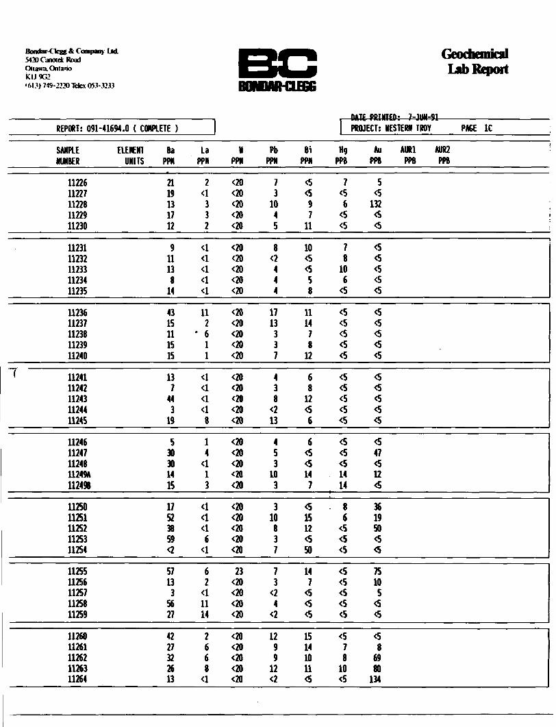
A total of 93 rock samples were collected from the property during May. Sample locations appear either on the large maps accompanying this report, the detail map of the northern gold showing, or on the trench plans of the Wagg gold showing. Sample results are presented in Appendix l which also contains descriptions of the samples. Sample analyses were performed by Bondar-Clegg and Company Ltd. of Ottawa. Eight samples in which the presence of native gold was known or suspected were subjected to a pulp metallies (sieve) analysis. The remainder were analyzed for gold and 29 other elements with the ICP (geochemical) method.
A second period of fieldwork was completed between mid July and late August. The author was assisted during this time by Mel Galbraith of Emo, Ontario, and Robert Dillman of London, Ontario. The programme consisted of intensive prospecting of the metabasalts adjacent to the contact with the batholith. A programme of overburden trenching, using explosives and a pressure pump, was completed at the Wagg gold showing. Systematic chip and channel sampling was carried out, and the immediate vicinity of the showing was mapped at a scale of 1:500. The results of the mapping appear as Figures 7-11.
A total of ninety samples were collected from the property and the surrounding area. Forty samples were obtained from stripped quartz veins at the Wagg showing. Another eleven were collected nearby. The remaining samples were collected during prospecting, and virtually all were from quartz veins.
8
All samples were analyzed by Accurassay Laboratories, a division of Barringer Laboratories Limited. All of the samples from stripped areas, and a few of those obtained during prospecting were analyzed using the cyanide leach method. The remainder were fire assayed. The leach method involves crushing the sample submitted to "reject" size, randomizing, and the splitting off of a 300 gram to 1500 gram sub-sample. The sub-sample is then crushed to 98 percent -150 mesh, and about 80 percent of the pulp is tumbled in a hot cyanide solution for several hours. The cyanide solution is then analyzed for gold content, and the pulp residue fire assayed. The total gold content, and the percentage of gold recovered by cyanidation was then calculated. This method provides more statistically reliable analyses of rocks containing free gold than do either conventional fire assays or pulp metallies assays. The primary advantage of the leach method over others, is that a much larger percentage of the sample submitted is subjected to analysis. This is especiall y important for samples containing a sizeable grains rather than many small particles of gold.

RESULTS
The initial work on the property was focused on the sulphide bearing tuffaceous units and the results of geophysical surveys done in 1989. Samples from tuffaceous metasedimentary units typically returned gold values well below 100 ppb. Excluding one grab sample result of 1.18 percent copper, and a sample from a glacially transported boulder of 4.03 percent zinc, all copper values were below 0.4 percent, and all zinc values were below 0.6 percent.
An Ontario government airborne geophysical survey released in 1990 shows a strong conductor occurring within a swampy area in the southeastern part of the property (see Map 1). Ground geophysical surveys in 1989 did not cover the area because of the standing water and ground follow-up was not successful due to heavy overburden cover.
Several new areas of gold mineralization were discovered during prospecting and each of these are described below.
Agassiz Gold Showings
At the original gold showing, discovered by Agassiz Resources Ltd., deformed quartz lenses and stringers occur within a north-south striking, discontinuous, chloritized and calcite altered shear zone mineralized with minor pyrite (See Figure 5). The shear is up to 3.0 metres wide in places, dips sub- vertically, and is associated with the margins of irregularly shaped quartz-feldspar dykes. Grab samples of quartz lenses have returned gold values up to 1.65 oz./ton, and chip samples have returned up to 0.666 oz./ton across two metres (0.427 oz./ton across 4.0 metres) (Larouche, 1990) from an area at L 15+52 N, 12+55 E located just north of the road crossing theshowing. The zone could not be traced further to the north, but it appears to be curving to the west somewhat at its northern end. The zone has been traced by stripping for about sixty metres to the south. South of the road, most chip samples have assayed only trace levels of gold. A few samples have returned values up to 0.055 oz./ton gold.
This zone was not stripped or re-sampled in 1991. Assays suggest the presence of native gold within quartz lenses and stringers, however, the sheared rock appears to carry little if any gold.
10

20
FIGURE^"
HEHART TOUNSHIP PROPERTY HaRTHUESTERN ONTARIO
MAIN SHOUIHG
IP V6
LEGEND
Porphyry Andesite
G) Pillows
""^Z—^ Quartz Veins
^X*ff Shear Zone Contact
Zf-I-Z-I Sheared Volcanics
—— —— Geological Contacts
17359x Sanple Mmfcer
GRAB SAMPLES
SAMPLE Au ASSAY NUMBER (ppb) (oz/ton)
178591178592 17E593178594178595178596178597178598178599311783117931180311813118231183
2093421393
802191216226515213306
0.0180.6090.6230.0020.0640.0630.0080.0440.0960.0281.051.650.130.0260.01
4 l
SCALE 1:100
pi 21
FIGURE
MENARY TOUHSHIP PROPERTT NORTHWESTERN ONTARIO
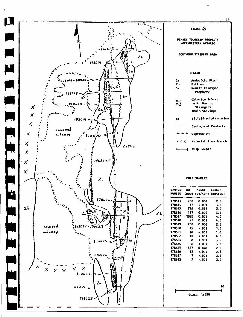
SOUTHERN STRIPPED AREA
23 2b 6a
* t
LEGEND
Andesitic Flow PillowsQuartz-Feldspar
Porphyry
Chlorite Schist with QuartzStringers
(Main Showing)
Silicified Alteration
— Geological Contacts
— -1- Depression
X Material from Trench
—l Chip Soople
CHIP SAMPLES
SAMPLE Au ASSAY LENGTH NUMBER (ppb) (oz/ton) (metres)
178613 1786 K178615178616178617178618178619178620178621178622178623178624178625178626178627178623
28247724167169827
20215101086
13771277
0.008 0.001 0.021 0.005 O.OS5 0.001 0.006•e.001•c.001•c. 001•c.001 t.001 0.040•c.001•c.001•c.001
2.5 3.5 3.0 3.5 4.0 4.0 2.5 1.0 1.0 4.0 3.5 3.0 2.0 2.5 2.5 2.0
10H
SCALE 1:250

About 100 metres to the west of the original showing, (L15+50N, 11+50E) a new gold showing was discovered during the present work programme. Grab samples from quartz lenses have assayed 0.376, 0.987 (1.129 check), and 2.548 ounces per ton gold. Several closely spaced quartz lenses strike 10 to 20 degrees and dip sub-vertically to about 60 degrees westerly. The stripped area and sample locations are depicted in Figure 6. The lenses measure about ten centimetres wide by two to three metres long,: and appear to fill di l at ion/fracture zones within well foliated to weakly sheared mafic metavolcanics. The quartz is sugary and iron stained, and contains several percent fine pyrite and a similar amount of chlorite disseminated as flakes. There is no noticeable alteration to wallrocks. The stripping could not be continued to the north or west due to increasing depth of the gravelly overburden. No evidence of veining was observed immediately across the road to the south.
About 100 metres across strike to the west from the latter showing, a poorly exposed zone of silicification and veining was grab sampled in three locations near L15+50N, 10+50E (See Map 3). The samples returned gold values of 1467 ppb (0.043 oz./ton), 49 ppb, and 75 ppb. No mineralization was observed within any of the samples. The zone approaches 2.5 metres in width where exposed, strikes north-south, and dips about 75 degrees to the west. The silicious zone outcrops again about 25 metres to the south, but was not sampled at this point.
11

North
Roadgravel
overburden 020
L 15 +
61) ^ O 1 O
about 100 metres to original showing
metres
Southern Showing

Wagg Gold Showings
During the summer stripping and sampling programme, the area around the Nagg Showing was mapped at a scale of 1:500. Following a mechanical stripping programme completed in September, new exposures of quartz were sampled. Figure 7 shows the position of each of the main veins that were sampled. This figure was derived from a photo taken from above from a helicopter and this slightly oblique view was used as a key map for photos of individual veins in Appendix 2.
Figures 8-11 show all samples taken from the major veins at the Nagg Showing. Additional samples numbered 11432 to 11461 were collected every 15 to 25 meters, beginning at the granitic contact and extending in an easterly direction to cross the area of the Nagg showing. The samples were analyzed for gold and 29 other elements by the ICP method in order to determine if there is an identifiable alteration halo, trace element enrichment or depletion in the country rocks in the vicinity ot the gold mineralized quartz veins.
Figure 7 shows how the distribution of the major quartz lenses that have been stripped suggests that they are folded boudins resulting from several periods of deformation which affected a single continuous quartz vein. The quartz lenses commonly display bifurcations and irregular offshoots. Evidence of both brittle and ductile deformation can be recognized in the veins and the surrounding country rock. The lenses pinch and swell, and frequently exhibit tight minor folds which plunge moderately to steeply, primarily to the south. Nails o f. t he major quartz lenses vary from curvilinear to jointing controlled, and smaller more planar veins frequently jump irregularly along joints while maintaining a relatively constant north to northeasterly strike.
The quartz lenses which have been exposed by stripping average from 0.5 to 2.0 metres in width, and most dip steeply to the west. "Vein D", which trends roughly east-west at the south end, dips to the north.
12

100 m
to s
ampl
es 1
1387
an
d 11
389
3540
0 N
stringers

Vein A is located at the most easterly point of the zone (See Figure 8). Here a 0.5 to 1.75 meter wide vein was uncovered for a length of about 13 meters. At the south end the vein terminates into quartz stringers and at the north end the vein runs into a swamp. A 10 kilogram, representative, composite sample from this vein averaged 0.939 ounces per ton gold. The arithmetic average of 7 samples taken in the quartz vein was 2.932 oz/ton. The following samples were taken from this vein;
Sample Type11055 grab11319 grab11324 channel(1.0 m)11325 channel(O.85 m)11335 chip(1.0 m)11336 grab
6old(oz/ton)0.0643.1712.8480.7650.77811.96
Commentquartzquartzquartzquartzquartzquartz
Further sampling of this vein was not possible due to flooding at the north end.
Vein B was located about 10 meters west of Vein A (See Figure 8). The vein here averages 0.5 meters in width and was traced for about 13 meters. At the north end the vein is cut by a porphyry intrusive and at the south end the vein runs into an area that was covered with mud and water.* A 10 kg, composite sample of the vein assayed 1.046 oz/ton gold. The arithmetic average of eleven samples taken in the quartz was 1.251 oz/ton. The following are the samples taken on this vein;
Sample Type11051 chip(0.3 m)11052 grab11053 chip11054 chip11056 grab11320 channel(0.6m)11321 channel(0.45 m)11322 channel(0.7 m)11323 channel(O.35 m)11486 chip(0.6 m)11487 chip(O.4 m)11488 chip(0.2 m)11489 chip(0.5 m)11490 chip(0.3 m)
6old(oz/ton)0.215108 ppb61 ppb48 ppb20 ppb0.4250.0740.1660.0803.5760.0821.4756.4950.127
Commentquartzmaficmaficmaficporphyryquartzquartzquartzquartzquartzquartzquartzquartzquartz
13

11374 (15 Sg)
1 2 3 metres
Vein A
030-O35-
1105611051
65
metavolcanics11487
11490
1054 11322 , 1320sheared wallrodt
11053 "— l 1 1321 11052
11338 (15 kg) North 2 3 metres
Vein B

Vein C was located about 20 meters west of Vein B (See figure 9). The vein averaged 0.45 to 0.75 meters wide and was traced for a length of 12 meters. At the north end the vein appears to be terminated by a bedrock lineament and at the south end the vein appears to terminate at the end of the outcrop. The arithmetic average of six samples taken in the quartz was 1.912 oz/ton. The following samples were taken from this vein;
Sample11043110441104511046110481134611347
Typegrabchip(O.6m)chip(0.7m)grabgrabchip(O.45m)chip(0.75m)
Cold(oz/ton)0.0339.1490.2591.4350.0170.6070.005
Commentwallrockquartzquartzquartzquartzquartzquartz
In Vein D, located about 15 meters west of Vein C, the vein was 0.7 to 0.85 meters wide and was traced for about 24 meters (See figure 9). The vein appears to be open at both ends. A 10 kg composite sample from this vein averaged 1.406 oz/ton gold. At the east end of the trench a composite sample was made from 5 in-situ blocks of quartz covering a length of about 1.75 meters and this sample assayed 0.345 oz/ton gold. The arithmetic average of sixteen samples taken in the quartz was 0.786 oz/ton. The samples from the Vein D are as follows;
Sample1133011331113321133311334
11340
11478
11479
11480114811148211483
114841148511486
Typechip(O.85 m) chip(0.75 m) chip(0.7 m) chip(0.7 m) chip(O.65 m)
chip(1.75 m)
chip(O.5 m)
chip(0.5 m)
chip(0.4 m) - chip(O.3 m) chip(0.2 m) chip(0.5 m)
chip(0.25 m) chip(0.5 m) chip(0.6 m)
Gold(oz/ton)1.5980.4490.4110.3110.010
0.345
0.310
0.194
2.2920.4040.2280.477
0.4750.0893.576
Commentquartzquartzquartzquartzmafic andqtzqtz, alongstrikequartzoffshootquartz andwallrockquartzquartzquartzquartzoffshootquartzquartzquartz
14

11042 not admitted for analysis
15 metres
11
metavolcanics
11337 (15 kg)
11340
0123 metres
11049 A 11331 no longer in place

Vein B was located about 10 meters north of the south end of Vein D and the quarts vein here varied from 0.8 to 0.9 meters in width and was traced for a length of about 11 meters (See Figure 10). The vein appears to be open at both ends. A 10 kg composite sample from this vein averaged 2.045 ox/ton gold. The arithmetic average of ten samples taken from the quarts was 1.274 OK/ton. The following samples were taken from this vein;
Sample113261132711328113291147311474
114751147611477
Typechip(0.8 m) chip(0.9 m) chip(O.85 m) grabchip(0.3 m) chip(1.1 m)
chip(0.5 m) chip(O.7 m) chip(0.9 m)
Gold(osAon)0.0921.7662.5174.0860.0940.354
0.8890.7140.183
quartsquartsquartsquartsquartsqts, alongstrikequartsquartsquarts
Vein P starts at about 20 meters north of Vein B and extends for about 46 meters north (See Figure 10 and 11). The vein varies from 0.3 to 2.0 meters wide and possibly connects with Vein E to the south and terminates at a porphyry intrusive to the north. A secondary offshoot vein parallels Vein F about 2 to 5 meters southeast of Vein F. Assays from the offshoot vein were considerably lower than those from Vein F. A 10 kg composite sample from Vein F assayed 0.850 os/ton. The arithmetic average of twenty three samples taken from the. quarts was 1.137 os/ton. The following samples were taken from this vein;
Sample11059110601106111341113421134311344113451134811349
11350113511135211353113541135511356
Typechip(1.0m)grabchip(O.3m)chip(O.7m)chip(0.85m) chip(0.6m) chip(0.3m) chip(1.5m) chip(1.3m) grab
chip(l.lm) chip(1.35m) chip(O.5m) chip(O.4m) chip(0.5m) chip(O.9m) chip(O.25m)
Gold(os/ton)1.4790.0020.1513.0542.1351.9660.8900.0441.3837.453
0.2600.4600.0960.0400.0740.0930.085
Commentquartsquartsquartsquartsquartsquartsquartsquartsquartssilicifieds onequartsquartsquartzquartsquartsquartsquarts
15

netavolcanic wallxodc
*-wallrodt replai limit
6 1 5 i
Vein E
5.5 metres on 115*to sancde 11473, Vein E
nafic
Vein F
Southern Exposure
11470 11376 (15 kg)
0123 metres
stringers
*- waUrock replaaanert
F/6-u/et 1 0

quar
tz p
ods
over
burd
en11
060
Vei
n F
Nor
ther
n E
xpos
ure
Nor
th
1146
6
1135
2
maf
ic m
etav
olca
iCB
Fi(,(
j*.e
. it

11462 grab11463 chip(O.45 m)
11464 chip(0.6 m)
11465 chip(0.6 m)
11466 chip(0.8 m)
11467 chip(0.75 m)11468 chip(1.0 m)11469 chip(1.5 m)
11470 chip(2.0 m)11471 chip(1.5 m)
11472 chipd.5 m)
7.007 162 ppb
192 ppb
15 ppb
47 ppb
1.3181.0680.033
2.3290.815
0.082
quartsoffshootquartzoffshootquart*offshootquartzoffshootquartsquartsquartsquarts andwallquartsquarts andwallquarts
The veins are composed of fine to medium grained sugary quarts, and vary in colour from white to light brown to dark red. The veins tend to be fairly porous throughout, and vuggy sections are cannon.
Mineralisation consists of fine to occasionally coarse native gold, one to two percent fine pyrite,.lesser chalcopyrite often coated by covellite, and minute quantities of bornite, molybdenite and native copper. Hematite and limonite amount to one to two percent of the veins as stain and vug coatings. Black hematite crystals were observed at one location and traces of tourmaline have been observed within float vein material. A pinkish-white mineral that may be either a weathering product or a species of potassium feldspar was encountered with some regularity along fractures and the walls of sealed fissures. Gold is most abundant near and along vein walls, in and around vuggy portions of the veins, and in areas exhibiting some degree of structural complexity or strong iron staining. There appears to be little if any correlation between local sulphide abundance and gold content.
Country rock is essentially unaltered adjacent to most veins, and contacts are generally sharp. This appears to indicate that the veins were emplaced along dilation zones controlled by fracturing and jointing. Immediately adjacent to some veins, the rock is more strongly foliated than in the surrounding outcrops. In these areas the rock commonly contains one to 2 percent pyrite, pyrrhotite, or chalcopyrite, and exhibits subtle chloritization, and possibly tourmalinization. Along the margins of Veins B and D for up to 0.5 metres on either side, a sheared, silicified zone with quartz stringers is mineralized with several percent pyrite. Sampling of this zone did not yield appreciable gold values to date.
16

As can be seen on Figure 7, tbe zone of veining can be described as an arcuate lone about 125 metres in length and up to 25 metres in width. It extends fro* about L 36-1-00 H, 12+15 E around to L 35-1-40 M, 12+85 E. Several promising assays have been returned by samples taken along strike from either end of the cone of veining. Sample 11316 from L 36+43 H, 12+22 E, where a large number of quarts blocks were discovered, returned 0.238 OK.7ton gold. Limited explosive stripping at this location failed to uncover any quarts vein, but given the number of pieces of quarts and the southeasterly direction of ice advance, it is assumed that a source vein is located nearby. At the south end of Vein A, around L 35+OON, 13+75E, a number of veins up to 0.2 metres wide were discovered. Two were observed to contain native gold. Grab samples 11387 and 11389 returned 1.820 and 0.287 os. l ton gold respectively. The results from the three samples indicate that there is potential for additional veining to be discovered in the vicinity of the showing through additional stripping or diamond drilling.
17
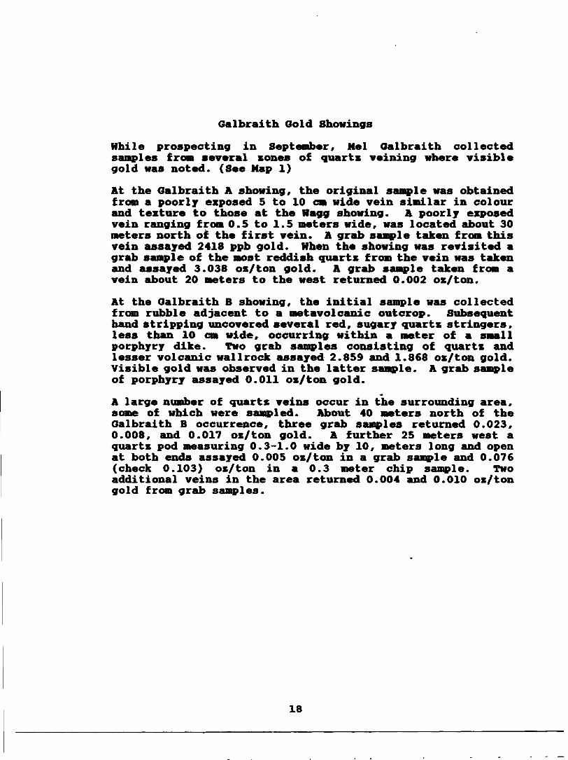
Galbraith Gold Showings
While prospecting in September, Nel Galbraith collected samples from several zones of quartz veining where visible gold was noted. (See Map 1)
At the Galbraith A showing, the original sample was obtained from a poorly exposed 5 to 10 cm wide vein similar in colour and texture to those at the Wagg showing. A poorly exposed vein ranging from 0.5 to 1.5 meters wide, was located about 30 meters north of the first vein. A grab sample taken from this vein assayed 2418 ppb gold. When the showing was revisited a grab sample of the most reddish quartz from the vein was taken and assayed 3.038 oz/ton gold. A grab sample taken from a vein about 20 meters to the west returned 0.002 oz/ton.
At the Galbraith B showing, the initial sample was collected from rubble adjacent to a metavolcanic outcrop. Subsequent hand stripping uncovered several red, sugary quartz stringers, less than 10 cm wide, occurring within a meter of a small porphyry dike. Two grab samples consisting of quartz and lesser volcanic wallrock assayed 2.859 and 1.868 oz/ton gold. Visible gold was observed in the latter sample. A grab sample of porphyry assayed 0.011 oz/ton gold.
A large number of quartz veins occur in the surrounding area, some of which were sampled. About 40 meters north of the Galbraith B occurrence, three grab samples returned 0.023, 0.008, and 0.017 oz/ton gold. A further 25 meters west a quartz pod measuring 0.3-1.0 wide by 10, meters long and open at both ends assayed 0.005 oz/ton in a grab sample and 0.076 (check 0.103) oz/ton in a 0.3 meter chip sample. Two additional veins in the area returned 0.004 and 0.010 oz/ton gold from grab samples.
18

Other Ooid Showings
A large number of additional quartz veins and shear zones were sampled for their potential to host gold mineralization. Samples from four areas of the property returned gold values worthy ot mention. (See Naps 2 and 3)
The area around L 29+00 N, 13+25 E was expected to return values comparable to those obtained from the original gold showing. A 2.4 metre wide, chloritized and calcite altered, pyritic, shear zone in mafic volcanics contains a 0.15 metre wide hematite stained, sugary vein of quartz. The zone occurs adjacent to a sheared and altered quartz-feldspar porphyry, containing narrow quartz stringers and carrying several percent pyrite. Although the zone did not return any appreciable gold values, its presence is an encouraging sign. Further work in the immediate area may reveal additional structures or mineralization.
A grab sample taken from a 0.2 to 0.5 metre wide quartz vein exposed for about 20 metres near L 27+55 N, 21+00 E returned a value of 851 ppb gold, and slightly elevated values of chromium, silver, tellurium, lead and bismuth. No further work has been done at this location since the sample was taken.
A grab sample of loose angular vein quartz returned 2059 ppb, 1253 ppb and 2064 ppb gold (average 0.052 oz./ton) from L 21+15 H, 13+10 E, near the major fault striking subparallel to the metavolcanics in the central part of the property. When this area was revisited in August, traces of native gold were observed in the loose piece of rock from which the initial sample was taken. It remains uncertain if the piece sampled is of local origin. Veins exposed in the immediate vicinity have a slightly different texture, and appear to be too narrow to be the source of the loose rock. A grab sample of a narrow quartz vein with sheared wall rocks returned a value of 267 ppb gold (0.008 oz./ton). The presence of quartz veining and several small bodies of porphyry adjacent to a major lineament, and the presence of a 0.5 metre wide quartz vein about 175 metres to the north, suggests that there is some potential for gold mineralization associated with the fault.
19
DISCUSSIOH
Several companies have in the past examined various parts of the property in search of base metal mineralization. Results suggest that both the grade and tonnage of the mineralised horizons are too low to constitute an economic deposit in the foreseeable future. However, previous work has missed the strongest airborne VLP anomaly that occurs within the claim group. . An Ontario government airborne geophysical survey released in 1990 shows a strong conductor occurring within a swampy area in the southeastern part of the property. Ground geophysical surveys did not cover the area because of the standing water. The conductor should be evaluated further as it may be due to better base metal mineralization than any yet encountered on the property. Other sulphide mineralization located on the property did not appear to respond to the airborne geophysical survey.
Gold mineralization has been discovered in several areas of the property during the present investigation. Gold values seem to be restricted to quartz veins within mafic metavolcanics, with the better values being obtained from veins in the older series of mafic flows along the contact with the batholith. Porphyry and felsic dykes ar* common within this part of the metavolcanic stratigraphy. Shear zones occurring around porphyry intrusions occasionally host gold bearing quartz veins, and it is likely that both the porphyry melts, and the gold bearing fluids responsible for the quartz veining, were generated by the same fundamental processes in the course of regional metamorphism and felsic intrusive activity.
Several new gold showings have been discovered on the property during the present work programme. One of these was exposed immediately next to a road, only about a hundred metres from the Agassiz showing. The Wagg showing, located two kilometres to the north, contains abundant visible gold, and was well enough exposed that it should have been discovered by past work. This indicates that surface prospecting for gold in the vicinity of the property has been of a cursory nature in the past and should be included in all future exploration programmes.
On a regional scale, the contact between the batholith and the metavolcanics may be an excellent exploration target. The similar stratigraphic positioning of other gold occurrences in relation to the batholith contact would seem to imply this. Access to the batholith margin northeast of the property is quite poor, and in all likelihood this area has seen only very limited prospecting.
20

Within the claim group, quartz veins at the Agassiz showings contain ore-grade gold mineralization, but are narrow and discontinuous. The gold occurs with chlorite and minor pyrite in two different types of quartz veining. The original showing is lenses and pods of cracked and sealed, fairly massive and fine grained, white quartz within sheared volcanics. The shear zone occurs alongside a folded quartz- feldspar porphyry and appears to cross the dyke in places. The newer showing is stringers or small lenses of brownish, medium grained, sugary quartz filling fractures in relatively unsheared volcanics. The style of veining and its high grade bear more resemblance to the Wagg showing than to the Agassiz showing nearby. Additional closely spaced, high grade lenses, or a larger vein may be found nearby. Much of the surrounding bedrock is covered by a layer of gravel at least a half metre thick. There is a possibility of encountering quartz veins mineralized with gold of either type in this area through additional stripping and diamond drilling.
At the fiagg showing a significant occurrence of gold is in the early stages of evaluation. A number of quartz lenses cross cut or truncated by small pods of porphyry have been exposed by stripping and found to contain ore grade concentrations of native gold and trace quantities of sulphide minerals. Many small veins and stringers are present around and between the larger lenses. Although the lenses appear to be boudins attributable to polyphase deformation of a single large vein, many features observed suggest the existence of a fracture controlled vein system.
The Wagg showing is best described as an arcuate zone of veining measuring about 125 metres long and up to 25 metres wide. A concentration of quartz blocks along strike to the north, and the presence of native gold in two narrow veins along strike to the southeast suggest that further work will extend the zone of veining along strike in both directions. As the showing has not yet been drilled, the vertical extent of the larger quartz lenses and of the zone as a whole is uncertain.
Sampling to date has concentrated on determining the average grade of the larger lenses/veins. Assay results suggest grades likely in excess of 1.0 oz./ton gold for most of the larger lenses. Because of the way native gold is distributed, smaller veins and stringer zones can best be sampled by trenching or drilling.
21

CONCLUSIONS
There appears to be little potential for the discovery of a base metal deposit on the property, however, one strong airborne VLP anomaly merits further investigation.
There are several zones of vein hosted gold mineralization worthy of further work on the Menary Township property. At least one (ftagg showing) may be of sufficient size and grade to be a potentially- economic deposit. A considerable amount of surface work, diamond drilling, and bulk sampling will need to be completed before the significance of the showings can be properly be assessed.
22
RECOMMEMDATIOH8
1) Detailed prospecting should be done on all of the newly acquired claims. To date this has been the most effective method for finding new gold showings.
2) The known gold showings should be investigated to see if there is ;a geophysical or geochemical signature associated with the gold mineralization. If a signature could be found this would aid in the exploration of ground covered in overburden.
3) Recently discovered gold showings should be stripped and sampled in detail, especially the Galbraith A and B gold showings.
4) The conductor detected by the airborne survey should be covered by cut lines and surveyed by magnetic and electromagnetic instruments. Basal till sampling may aid in identifying the source of the conductor.
5) A bulk sample should be taken at the Wagg Showing to see if the gold may be extracted with a small scale mining set-up.
6) The Wagg Showing should be drilled to determine the depth extent of the gold mineralization.
Chris Wagg Wayne E. HolmsJtead
23

BIBLIOGRAPHY
Bajc, A.P. 1988:Reconnaissance Till Sampling in the Port Prances-Rainy River District, in Summary of Pield Work and Other Activities 1988, Ontario Geological Survey Miscellaneous Paper 141, pp. 417-420.
Blackburn, C.B. 1976:Geology of the Off-Burditt Lake Area, District of Rainy River, Ontario Department of Nines Geological Report 140, Nap 2325, l inch = l mile.
Clark, J.G. 1989:Evaluation of the Exploration Potential on the Menary Township Property, District of Kenora, for Western Troy Capital Resources Inc., 20 p.
Larouche, C. 1990:Results of Trenching, Menary Township Property, for Western Troy Capital Resources Inc., 20 p.
Ontario Geological Survey, 1990Airborne Electromagnetic and Total Intensity Magnetic Survey, Rainy River Area.
24

CERTIFICATION
I, Christopher Anthony Wagg, residing at R.R.fi,
village cf Denbigh, Ontario, KOH 1LO, do hereby
certify that:
1... " I hold a Bachelor of Science degree (Honours
Geology) received at the University of Western
Ontario in 1989.
2... I have been employed as a consulting geologist
since 1987, and have been practicing my
profession continuously since 198*9.
3... My report on the Menary Township Property of
Western Troy Capital Resources Inc., is based
upon a review of published and unpublished
information concerning the property and the
surrounding area, and upon personal knowledge
of the property's geology obtained over the
course of approximately three months of
fieldwork completed between April and November
of 1991.
4... My report on the Menary Township Property has
been written entirely, and in all respects,:as
an independent consultant.
5... I hold no interest, direct or indirect, in the
properties or securities of Western Troy
Capital Resources Inc., or in any adjacent
properties, nor do I intend to acquire any
such interest.
Dated this 10 th day of December, 1991,
Christopher A.. Wagg
Prop. Lot 17/Exploration
Wagg Mineral Exploration and Consulting Inc. (1991)

CERTIFICATE
I, Nayne E.' Holmstead, of the City of Kingston in the Province of Ontario, DO HEREBY CERTIFY THAT:
1. I am a Consulting Geologist with address at 1074 Dillingham Street, Kingston, Ontario, Canada.
2. I graduated from the University of Toronto with a Bachelor of Science in Geology in 1976 and have been practising my profession since.
3. I am a Director of Western Troy Capital Resources Inc. and I hold a ^^Net Smelter Return on the property that is the subject of this report.
4. This report is based upon the sources listed in the Bibliography and from my personal experience on the property as Managing Consultant for the exploration programme.
Dated at Kingston, Ontario, this 15th day of December, 1991.
Nayne E. Holmstead, B.Se.

APPEHDIX l
SAMPLE DESCRIPTIONS AMD ASSAYS

Abbreviated Descriptions of All Samples Collected
from the Menary Township Property and Vicinity by
C.A. Wagg during 1991.
Sample
11226112271122811229
11230112311123211233
1123411235
11236
Type
Grab Grab Grab Grab
Grab Grab Grab Chip
Grab Grab
Material Mineralization
tuffaceous horizon Agglcmeratic tuff Pelsic-Int. tuff W Sheared tuff, quartz and porphyry stringers ——
Minor Py and Po Minor Py, tr Cp 5* Py and Po, tr Cp
Tuffaceous horizon Quartz vein Same vein as 11231 20 cm shear in Pillowed Volcanics
horizon
Minor PyMinor Oil, tr Py and MaTr Py
Minor Po and PySheared aggfLcmeratictuff, quartz stringers Minor PySheared volcanics with
112371123811239112401124111242112431124411245
1124611247
11O401 I fnO
11249A11249B
11250
11251
11252
112531125411255
Chip 1.0 mGrabGrabGrabGrabGrab/^W^llhGrabGrabchip 2.0 m
GrabChip 1.0 m
f*.- -j- ,Grab
GrabGrab
Grab
Grab
Grab
GrabGrabGrab
quartz stringers Minor Pycfto^ppfi v*1 TIT i5 Minf "yQuartz pod in tuff Minor Oil, tr PyAngular quartz rubble 5* PyTuffaceous horizon Minor Py, tr Po and CpTuffaorans horizon S-10% Py, tr Po and CpQuartz vein in tuff ^ Py, tr Po and CpTnffanaems hnr-ivnn SSt Vyl nrfm- Vnf t-r rp
Angular vein quartz Tr Cp and PySheared, calcite alt.wl/canifcs M Li ir f ivwtz strinfjprF tr PyNarrow quartz vein —Quartz stringers infelsic dyke : Minor Chl, tr PyQuartz uLLinyuLb and pods in sheared' vole. Minor PySilicified unlmnirs S-lfMt Vytf&date rich felsicintrusive Minor PyIron carbonate alt.vole. , quartz stringersMinor PySheared and alteredvolcanics 1M Py
i ^ ^ 9 4snearea, iron-carb.volcanics Minor Py and Cbl +X- FuchSheared porphyry Tr Py20 cm wide quartz vein Minor Chl.Py, tr Tourm, CalciteTllfffinufliata unli-isivjOR 1* Pv

112561125711258
1125911260
11261
11262112631126411265
112661126711268
11269112701127111272112731127411275112761127711278
11278112801128111282112831128411285112861128711288112891129011291112921129311294112951129611297112981129911300
Grab Grab Chip 1.7
Grab Chip 2.4
Grab
Chip 1.6 Chip 2.5 Grab Grab
Grab Grab Chip 0.8 i
Grab Grab Grab Grab Grab Grab Grab Grab Grab Grab
GrabGrabGrabGrabGrabGrabGrabGrabGrabGrabGrabChip 1.0Grab
10-15 cm quartz vein Loose vein quartz Iron-carb. alt. porphyry with quartz stringers Minor Py Stringer rich porphyry Minor Py Sheared, calcite alt. volcanics Minor Py 10-15 cm quartz vein hosted within 11260
horizonTuffacouus hprizon 10-15 cm quartz vein
volcanicswith quartz stringers Loose vein quartz Sheared volcanics Sheared, cilirHfieri
horizon material
Loose quartz vein
45
S-10% Py, tr Cp S-10% Py Minor Py
Minor Py, tr Po and Cp Minor Chl, tr Py 5* Py, minor Po
5% Py and Po, Miner Cp and Sp2-3* SpTr Py, Po, ChlMinor Py, Po, tr Cp, Sp5% PyMinor Py, Po, tr CpMinor Py, Po tr CpMinor Py, PoMinor Py and Chl5%Py, trSp
Minor Py, Sp, tr Cp Tr Py Tr PyMinor Py, Po, tr Cp Minor Py, Po, Chl, tr Cp, Cu 5* Py, Po, tr Cp
wide quartz vein Tr Py, Te
Volcanics
horizon horizon
Tuffacoues horizon 15 cmqtz vein
fiff
float,
fbllxock to 11277 cs-n-irn-F-ioH volcanics Tuffaceous horizcn Quartz vein to 1 .0 m
Mg horizon
Tuffa horiznoTuffaceous horizon Tuffaceous horizon Tuffaceous horizon Tuffaceous horizon Sheared volcanicsSilirrifiart volcanics
Rep. explosivesRep. enplosives sampleMinor PoMinor Po, tr Cp5%Po, tr CpMinor PoMinor Py
Grab
Sutherland Twp. Hick's field. Sem Twp. Off lake Area Off Lake Area Off Lake Area Off Lake Area Off Lake Area Off Lake Area Tuffaceous horizcn S-7% Po, Py, Minor Cp, tr Sp

1102611027110281102911030
1103111032
11033110341103511036110371103811039110401104111042
Grab Grab Grab Grab Chip 75 en
Grab Grab
Grab Grab Grab Grab Grab Grab Grab Grab Grab
Thiffanftnig horizon i^rFfaoonig horizon
Tuffaceous horizon Porphyry with quartz stringers Quartz stringers Sheared volcanics with qtz. stringers
Minor Py, trCp Minor Py, Po, tr Cp Minor PC, Py, tr CJp Minor Po, tr Cp
Minor Py Tr Py
Minor Py Tr PyMinor Py, Po
5*Po
volcanics Tuffaceous horizon Tuffaceous horizan10-15 * Cp, Quartz vein Quartz vein Porphyry and sil. volc.Minor Py Tuffaceous horizon 15* Po, tr Cp Tuffaceous horizon Minor Po, Py, tr Cp Quartz vein 10* Chl, tr Po
no sample submitted
Wagg Shoving Area
11043 Grab
110441104511046
11047
11048
1104911050
11051
11052
11053
11054
11055
11056
11057
110581105911060
ChipChipGrab
Grab
Grab
GrabGrab
Chip
Grab
Chip
Chip
Grab
Grab
Grab
GrabChipGrab
0.6m0.7 m
O.25oi
0.45m
0.3 m
1.0 m
11061 Chip 0.3 m
Unremarkable wallrockto vein C 2-3* fine Po and Py, tr CpVein C tr-1% Py, native AuVein C unexanrinedVein C, barren locking,with native gold (1 speck) removedMinor vein betweenD and E Vein C, loose blockweighing about 5 kg unexaminedLoose quartz (vein D?) Tr Py, Cp, Tourm15 cm wide vein about10 m east of 11387 Tr cp, Ma, PyChannel, north end ofvein B10 cm wide minor veinin hanging wall cf BSheared hanging wallof vein BSheared footwall ofvein B7 kg; rep. of originalexposure of vein APorphyry pod at nuLlhend of vein B tt Py0.5 to 1.0 m diameter tt Py (withquartz boulders 150 m NW of shovingQuartz porphyry Tr PyVfeil"! P UTm33P*lH TVy^
Centre of N end ofvein F Miite and lv" r "" of mineralizationVein F and wallrock/inclusions unexamined
mBXEnmd
3-5* Py, tr-1% Cp
2-3* Py, 5-10* stringers
Tr Py
granitic Inclusion*)

1130111302
113031130411305
11306
1130711308
1130911310
11311
11312
11313113141131511316
11317
11318
GrabGrab
GrabGrabGrab
-Grab
GrabChip 0.6 m
Chip 0.3 mGrab
Grab
Grab
GrabGrabGrabGrab
Grab
Grab
1.0 by 0.15 m quartz lens —Alt. zone with quartzstringers 2-^ PyQuartz stringers Tr PyShfieW^BC* VOljCSTHC?? MUTIOIT l^T* PU
Quartz veins and quartzporphyry —Quartz stringers inporphyry —Quartz and Porphyry Tr PyQuartz stringers inhybrid grante or porphyry Minor PyAlt. , magnetic volcanics Minor Py5 cm wide quartz veinSouthern stripped area Tr Py10-15 cm wide quartz veinSouthern stripped area Tr Py, ChlQuartz stringers involcanics Tr Py30 cm wide quartz vein Tr PyLoose vein quartz Tr PyQuartz pod —Large ganp^o of veinquartz rubble —Si Unions porphyry with
Quartz vein to 20 cm wide —
Wagg Shoving Area11319
11320113211132211323113241132511326113271132811329
1133011331113321133311334
1133511336
Grab
Channel 0.6 mChannel 0.45arChannel 0.7 mChannel 0.35mChannel 1.0 mChannel 0.85m
Chip 0.8 mChip 0.9 mChip 0.85mGrab
Chip 0.85mChip 0.75mChip 0.7 mChip 0.7 mChip 0.65m
Chip 1.0 mGrab
Centre of Vein A; rep ofhigh grade pocket Native Au, tr Py, CpVein B unexantned
Vein BVein AVein AVein E
Voin R; rep. nf high lammmiiiMil
gradR pocket native AuVein D unexandned
Vein D; wallrock andtilxiuguxsVein AVein A; high grade pocket
anf-ifinnml fVYlH native* Ali

Magg Showing
1133711338
11340
113411134211343113441134511346113471134811349
113501135111352113531135411355 11356
1133911357
1135811359113601136111362
11363113641 1*K*f*IIJOO1136611367113681136911370
113711137211373
Haijcj Showing .
113741137511376
Area
BulkBulk
Chip 1.75m
Chip 0.65mChip 0.85mChip 0.6 mChip 0.3 mChip 1.2 mChip 0.45mChip 0.75mChip 1.3 mChip 0.3 m
Chip 1.1 mChip 1.35mChip 0.5 mChip 0.4 mChip 0.5 mChip 0.9 mChip 0.25m
GrabGrab
GrabGrabGrabGrabGrab
GrabGrab/••.r— j-.GrabGrab/^--.j.GrabGrabGrabGrab
GrabGrabGrab
Area
BulkBulkBulk
Vein D; 15 kg of gnan pieces unexaminedVein B unexamined
Vein D; non-continuous chipalong strike of vein "Vein F : *" :VeinF "VeinF "Vein F "VeinF "Vein C "Vein C. north end "Vein F unBjicBuinQQVein F, hanging wall native AuSilicification and stringersVein F unexanrinedVeinF "VeinF "Vein F "VeinFVeinF " VeinF unexamined
Quartz pod Tr PyQuartz stringers to 10 cmwide in 1 m wide shear —Quartz vein to 50 cm wide Minor Oil, tr PyQuartz vein to 45 cm wide —Quartz vein to 60 cm wide —5 cm wide vein in porphyryMinor PySheared volcanics adjacentto porphyry Minor PyQuartz pod —Quartz vein Minor sericite, Cbl, PyQuartz stringers in vole. —Quartz vein to 3O cm wide 5* Cbl, 2-^ Fte-carb, tr PyQuartz stringers : Tr PySubrounded vein qtzr. flaatMinor Py, tr Cp1^^pl**5pcfl^j5 nonTwn ^ifinr ^r*30 cm wide utclriyet zonein 1 m wide shear in volc.Tr Py, CpTuffaoaous horizon Minor Po, tr CpQuartz stringers in tuff Tr Py10-30 cm wide quartz vein located about 3 km S of
fuopetty
Vein A unexaodnedVein E "Vein E-F (Vein F, south end) "

11377 to113851138611387
11388
11389
113901139111392
11393
1139411395113961139711398
11399
114001140111402
1140311404114051140611407 to1140911410
1141111412
11413
114141141511416 to1141811419 and1142011421
Off Lake AreaOff Lake AreaOff Lake AreaGrab Angular vein quartz Grab 10-20 cm wide quartz Native Au
vein located about 100 m SE of Vein A Grab Quartz vein to 50 cm wide
exceed for 8 m 2-^ Chl, tt Py, T-2% Bn, tr Ser Grab 8-15 cm wide quartz vein
exceed for 2 m Native Au, tt Py, Po Grab Quartz stringer zone Tr Py Grab Quartz pod Minor Chl Grab Stringer-sil. -alt. - Sample 3ft stringers to 1 cm
qiiphirto zone 25 m NW of vein A (on Strike) Grab Stringer zone in alt. Chl vs. Gnt-Biot banding
volcanics Minor Chl, tr Cp Grab 10 cm by 2.5 m quartz pod Grab 15 cm wide sUinyar zone Grab Small quartz vein tt Cp Grab 20 cm wide quartz vein Ser along contacts Grab Porphyry dyke with quartz
stringers in and around it- Grab Quartz sUinger in loose
angular volcanics No Sample SubmittedGrab 20-30 cm by 10 m vein tt Chl, Py, tr Cp Grab Quartz vein to 1.5 m wide
next to a porphyry dyke Some volcanic inclusions Grab Narrow vein filling joint tt Py Grab Quartz pods in porphyry Minor Chl Grab 15-200 cm wide quartz podSTr Py, Chl alt. inclusions Grab Narrow quartz pods tt Py, tr Mo Grab Quartz viens/stringers
along the contact betweenGrab greenstone and granite Minor Py Grab Quartz vein avg. 45 cm
in a stringer zone Tr PyGrab Sev. pods to 25 cm by 6 m Minor Chl, tr Py Grab Same as 11411 bat 3 B
awaw across strike Minor coarse Py Grab Quartz stringers less than
10 cm wide occurring near Tr gi* i ^ fin/t^ma small porphyry dyke tt Py
Grab Same as 11413 Native Au, tt Py Grab Porphyry of 11413, 11414 Tr Py Grab Quartz vein to 30 cm by
15 m occurring 25 m NW ofGrab 11413-11415 t-2% Py, tr Cp Grab 30-100 cm by 10 m vein in
3 m wide stringer zone;Grab 25 m W of 11416-11418 Minor Chl, tr-1% Py Grab 30-40 cm wide quartz vein Minor Chl, tr Cp, Py

114221142311424
1142511426
11427to114291143011431
GrabGrabGrab
GrabGrab
- Grab
GrabStream sed.
Grab
Vein quartz rubble Minor Py, Cp, tr MaSame as 11407-11409 Tr PyNarrow quartz vein iniron-carb. alt. shear Minor Py, AnkQuartz pod tr Py, CpSubrounded quartz honTdpr,porphyry or granite wreck Minor PyQuartz veins in a wide chlshear alxng (fault?) contactBetween greenstone -i- granite Minor PyCollected from creek running along 11427-11429Angular 15 on quartz float Minor Cph tr Py
11432 to 11462 Samples collected for ftiole Rock Analysis^ ^
Sj 8 lineament.
125-
G-granite P-porphyry V-volxanics, mostly pillowed and
S-sheared wallrock O-vein quartz ^^^^^o 25 DU11460S-veinD 1T461S-vein B 11462Q-High sulphide(2-3%) from vein F
Wagg Showing Area
114631146411465114661146711468114691147011471
114721147311474114751147611477114781147911480114811148211483114841148511486
Chip 0.45mChip 0.6 mChip 0.6 mChip 0.8 mChip 0.75 mChip 1.0mChip 1.5 mChip 2.0 mChip 1.5m
Chip 1.5mChip 0.3 mChip 1.1 mChip 0.5 mChip 0.7 mChip 0.9 mChip 0.5 mChip 0.5 mChip.3-.4 mChip 0.3 mChip 0.2 mChip 0.5 mChip 0.25mChip.4-.5 mChip.55-.6m
Minor vein several m east of vein F
1-a Py, tr Mo
unexanLned
serin
Vein FVein F "Vein F (45 cm vein remainder week withVein F (vein only)Vein F (alxng strike of vein trend, across trend
of fold noses; 5Cft altered wallrock) Vein F (parallel to contact with porphyry) Vein EVein E (sample alxng strike; enposed width 25 cm) Vein E unexamiiied Vein EVein E (did not reach W contact doe to water) Minor vein; offshoot from vein O Vein D (2^ sheared wallrock) Vein DVein D " vein D " Minor vein; offshoot from vein D Vein D " vein D " Vein B
)

Wagg Showing Area
11487 chip. 35-.4m Vein B unexanrined11488 Chip 0.2 m Vein B "11489 Chip 0.5 m Vein B11490 Chip 0.3 m Vein B "
11491 Grab Quartz stringers in Oiland calcite alt. vole, float tr Py
11492 Grab Quartz stringers in Chl andiron-orb, alt. vole, float Minor Cbl, Py, tr Rich

Bondar-Ckgg ft C ornpam LidS420Canoiek RradOttawa. OntarioK l J 9G2•613! 749-2220 Tefcx 053-3233
Gcochemical Lab Report
REPORT: 091-41694.0 ( COMPLETE ) l
SAMPLEUMBER
ELEMENT A1UNITS PCT
Fe TotPCT
MnPPH
"9PCT
CaPCT
PROJECT: HESTER* TROY
NaPCT
KPCT
VPPM
CrPPM
PAGE 1A
CoPPM
HiPPM
.
1122611227112281122911230
0.731.481.440.721.05
2.145.39
HO.OO1.913.56
200400800200200
0.301.200.480.410.33
1.621.192.051.101.88
0.020.040.010.040.03
0.140.420.090.240.08
4267323551
13218495
135137
2151
1621830
5767
1614370
1123111232112331123411235
2.981.125.380.880.95
4.682.217.702.843.03
600300
1100200300
3.221.085.850.480.85
0.860.831.781.350.95
4.010.02
4.010.02
4.01
0.050.050.020.070.07
7837
1933945
410239543180150
3215493113
8742
140105
35
1123611237112381123911240
2.685.010.861.931.72
5.896.08r.si6.065.13
600900200300300
2.155.350.571.551.23
2.843.390.651.331.01
0.030.010.050.020.01
0.110.040.040.410.22
115115247663
141291166132
92
3846189966
111163
37112116
1 1124111242112431124411245
2.080.492.800.314.40
5.323.826.070.987.42
400200500100
1200
1.680.482.300.123.54
1.090.861.480.566.42
0.024.010.03
4.010.02
0.380.241.650.030.04
8927
12114
235
111158171153167
738055
738
9960823097
11246112471124811249A112496
0.920.520.941.811.20
1.821.213.598.051.53
400200300500200
0.530.360.811.310.21
0.930.421.170.933.58
0.010.060.030.040.02
4.010.080.270.090.01
2614375047
238158151162111
125
605917
4311657835
1125011251112521125311254
0.171.320.651.030.05
2.445.915.951.391.30
40014001200200100
0.452.922.040.580.07
1.91HO.OO
9.310.770.07
0.020.020.020.05
4.01
0.100.650.280.13
4.01
11763715
4
18159
10251
222
114856
82
26739310
7
1125511256112571125811259
0.480.12
4.010.580.26
3.781.700.701.421.04
4002004
300200
0.320.05
4.010.220.03
5.170.140.020.690.10
0.030.02
4.010.060.09
0.260.060.010.240.10
617284
23416121780
104
547176
6214
41110
1126011261112621126311264
4.270.441.130.920.83
6.962.046.794.941.37
1500200200100200
3.770.430.590.460.33
8.080.090.730.602.18
4.014.010.010.010.02
0.330.100.160.170.02
14820422248
208225
8984
222
448
9863
9
8822
1418413

Bandar-(Vgg ft Company Lid.5430'Canotet RoadOttawa. OntarioKIJ9G2'613) T.9-21W Tdex 053-3233
Gcodmnic&l Lab Report
7-1IU-Q1
REPORT: 091-41694.0 ( COMPLETE )
SAMPLENUMBER
ELEMENT Cu ZnUNITS PPM PPM
| PROJECT: HESTERN TROY
As SrPPM PPM
YPPM
MoPPM
AgPPM
Cd SnPPM PPM
PAGE IB
SbPPM
TePPM
1122611227112281122911230
381 22714 39
2343 2602268 101827 50
S 193 14^ 7 -10 1411 23
57647
1065
304
4.24.24.24.20.3
4.2 ^4.2 ^3.6 ^
4.2 W4.2 *tt
^^^^5
<1040404040
1123111232112331123411235
245 7065 2940 93
411 2397 36
17 5^ 713 103 109 5
33854
22
44
1
4.24.24.24.24.2
4.2 ^4.2 ^4.2 ^4.2 ^4.2 ^
14^^^<5
1340404040
1123611237112381123911240
( 1124111242112431124411245
216 10370 68
159 '22373 44543 34
324 47696 18431 71175 7110 91
26 2434 126 87 14
16 13
6 11^ 216 11^ 512 27
106598
8282
13
1252
27434
985
522
10
4.24.20.2
4.24.2
4.24.24.24.24.2
4.2 ^4.2 ^4.2 ^4.2 ^4.2 ^
4.2 W4.2 ^4.2 ^4.2 ^4.2 ^
<512<5^
6
<5<5<5^<5
4013
404040
4040
114040
11246112471124811249A112496
47 1921 1957 20
643 19473 55
9 87 13
S 1515 159 48
22548
32
441
4.24.24.24.24.2
4.2 W4.2 K204.2 ^4.2 ^4.2 W
6<5<5
8^
4040404040
1125011251112521125311254
58 17371 61171 48
16 349 2
4 2812 1609 1423 43*5 1
2543
4
225
42
4.24.24.24.20.6
4.2 ^4.2 ^4.2 K204.2 *JQ4.2 ^
56
<5^<5
401115
4022
1125511256112571125811259
272 849 10
5 130 298 8
4 564 4^ 45 22
*5 7
32
423
44444
1.30.2
4.20.2
4.2
4.2 ^4.2 ^4.2 W4.2 ^4.2 ^
5<5<5
6^
1040404040
1126011261112621126311264
125 7916 15
775 2418716 2091293 26
28 519 76 16
20 18*5 7
92883
27782'
4.24.24.20.40.2
4.2 ^0.5 ^5.0 ^4.5 ^
4.2 ^
105
<57^
114040
1140
Bondar-Clegg ft Company Ud5420Canotek RoadOttawa OntarioKIJ9G2' 613) 749-2230 Tdex 05.1-.IU3
Geocfaemical Lab Report
lUTC DPI Mf Cft. 7-1IUI-01
REPORT: 091-41694.0 ( COMPLETE )
SAMPLENUMBER
ELEMENT BaUNITS PPM
LaPPM
| PROJECT: NESTERN TROY PAGE 1C ;
HPPM
PbPPM
BiPPM
HgPPB
Au AUR1 AUR2 'PPB PPB PPB
1122611227112281122911230
2119131712
2ci
332
C20C20c20c20c20
73
1045
c5c597
11
7c56
c5c5
5c5
132 ;c5 ic5
1123111232112331123411235
911138
14
cicicicici
c20c20c20c20c20
8c2
444
10c5c558
78
106
c5
c5c5c5c5c5
1123611237112381123911240
1124111242112431124411245
4315111515
137
443
19
112- 611
d^dd8
c20c20c20C20C20
c20c20c20c20c20
1713
337
438
c213
1114
78
12
68
12c56
c5c5c5c5c5
c5c5c5c5c5
c5c5c5c5c5
c5c5c5c5c5
11246112471124811249A112496
530301415
14
ci13
c20c20C20c20c20
453
103
6c5c514
7
c5c5c51414
c547c512c5
.
1125011251112521125311254
17523859c2
cicid
6d
c20c20c20c20c20
310837
C51512c550
. 86
c5c5c5
361950c5C5
1125511256112571125811259
5713
35627
62
ci1114
23c20C20C20C20
73
c24
c2
147
c5c5c5
c5c5c5c5c5
75105
c5c5
1126011261112621126311264
4227322613
2668
ci
c20c20c20C20c20
1299
12c2
15141011c5
c578
10c5
c58
6980
134

Bandar-Cfcgg 4 Company Ud5420 Canon* RoadOttawa. OntarioKIJ9G2'613) 749-2220 Tdex 053-3233
Geocbemical Lab Report
7-1IIU-Q1
REPORT: 091-41694.0 ( COMPLETE )
SAMPLENUMBER
ELEMENT AlUNITS PCT
Fe TotPCT
| PROJECT: WESTER* TROY
MnPPM
"9PCT
CaPCT
MaPCT
KPCT
VPPM
CrPPM
PAGE 2A
CoPPM
NiPPM
.
1126511266112671126811269
1.230.092.211.320.98
2.030.576.918.146.83
3004
500300200
0.650.051.840.930.82
1.770.070.910.700.34
0.084.010.070.040.04
0.054.010.030.040.04
626
313326
1522008098150
122
607080
2148393102
1127011271112721127311274
0.080.322.020.780.17
0.862.064.808.011.88
4100500200a
0.060.271.960.410.03
0.090.210.590.710.08
4.010.020.070.030.02
4.014.010.010.050.07
51876243
16920811784
195
622284124
1027885815
1127511276112771127811279
' 112801128111282112838207
0.690.300.250.231.88
1.701.390.292.900.44
1.362.218*.31
no.oo4.49
4.288.291.797.87
)io.oo
100200100200600
600400200
1300200
0.160.190.150.081.31
1.200.950.232.050.21
0.330.580.140.071.62
2.170.790.050.720.60
0.050.010.020.010.10
0.060.044.010.030.05
0.204.014.014.010.04
0.050.040.030.050.04
1211147
98
7543117613
115177140135107
968119313052
79
10112033
3879226922
610
14214793
899821
10534
82088209821082118212
1.560.550.780.221.33
)10.007.473.851.114.42
300200300100300
0.920.400.870.090.50
1.750.741.030.260.29
0.170.050.060.040.10
0.090.020.480.140.67
2814651931
85150148130110
7160188
35
12191679
8213 0.28 2.17 100 0.19 0.20 0.02 0.03 20 221 24 74

r
Bondar-Clegg A Company Ud 5420 Canuck toad Ottawa Ontario KM 9G2X '
—'6131^2220 ibex 053-3233
Geochemical Lab Report
REPORT: 091-41694.0 ( COMPLETE )
SAMPLE ELEMENTNUMBER UNITS
Cu ZnPPN PPH
As SrPPN PPN
PROJECT: HESTERN TROY PAGE 2B
Y No AaPPH PPN PPN
CdPPN
SnPPM
SbPPN
TePPN
1126511266112671126811269
145 5187 3
1567 8801913 5294348 8126
^ 8^ 417 103 97 5
54
364
3 0.22 0.34 0.37 O.27 O.2
O.2O.21.1
13.925.7
tttttttttt
*53^^^
4040
114040
1127011271112721127311274
175 56724 131210 164
2937 5085442 83
4 27 4^ 4^ 7^ 2
42
6 0.39 0.4
4 4 0.25 6 0.44 4 O.2
0.20.2
O.220.10.2
tttttttttt
tf6^63
404040
1440
1127511276112771127811279
__
1 112801128111282112838207
196 63568 10276 5907778 ^000217 817
343 1751319 429
168 40509 440715 23
^ 8^5 5^ 1^ 16 14
8 133 13^ 1
7 6^ 5
2 4 O.222
3 2.98 0. 2
2 19 O.27
73154
5 O.2
1 O.23 0. 22 ^.22 0.22 O.2
0.2O.237.4
126.52.5
0.2O.20.20.2O.2
tttttttttt
tttttttttt
0^^14^
^0^^^
404040
2140
4040404040
82088209821082118212
54 493541 20113 58
39 6458 55
^ 34 25 203 153 19
528
1 O.22 O.23 O.2
2 13 O.28 6 0.2
O.20.2O.2O.2O.2
tttttttttt
^tf^^^
4040404040
8213 883 2 0.2 O.2 40

Bondar-Ckgg A Company Lid. 5420 Cant** Road Ottawa. Ontario KIJ9G2 M3) 749-2220 Tetex OS3-EJ3
Lab Report
DATF PRINTED; 14-JUN-91REPORT: 091-41753.0 ( CONPLETE ) |
SMPLENUMBER
ELEMENT AlUNITS PCT
Fe TotPCT
HnPPN
"9PCT
CaPCT
PROJECT: HESTERN TROY
NaPCT
KPCT
VPPN
CrPPN
PAGE 1A
CoPPN
HiPPH
8214821582161102611027
2.781.060.160.200.99
no.oo9.592.262.557.81
800300300100300
1.640.170.140.190.43
0.112.094.130.160.82
4.010.024.014.010.01
0.060.020.020.010.09
353498
21
5764
223267151
961094233
118
201534839
124
1102811029110301103111032
1.370.831.590.861.91
8.778.973.271.593.62
400300400300800
0.890.321.080.551.44
0.990.782.641.851.16
0.020.020.030.020.06
0.080.110.050.030.24
3421723873
8990
193313201
129168242027
141167527643
1103311034110351103611037
-
' 1103811039110401104111043
4.391.070.710.154.01
2.390.471.400.152.98
7.246.33061.640.63
6.439.574.770.844.95
11004002001004
700100500100600
3.930.780.450.120.01
1.490.131.280.122.80
1.100.840.430.370.05
1.520.732.110.371.29
0.020.070.024.014.01
0.130.040.084.010.05
0.020.060.044.014.01
0.380.030.640.020.06
172682073
8816711388
173140193213314
17452
221173155
476781121
30172101
738
64119121206
702211091167
1104611049110501105211053
0.060.050.370.912.67
0.640.500.912.935.41
4100100300900
0.090.070.190.722.45
0.080.120.720.272.00
4.014.010.010.020.01
4.014.014.010.140.31
651535
103
233268235295229
2161934
65112873
'
1105411056110571105811060
2.151.060.050.180.09
4.751.690.340.420.73
7002004^4
1.930.620.060.030.08
2.560.530.080.150.03
0.020.064.010.074.01
0.480.360.030.044.01
962633
12
175122223147239
408225
561154
10
1128411285112861128711288
0.040.741.690.850.91
0.906.427.031.399.41
4200300200400
0.030.191.410.360.38
0.040.620.410.801.04
0.030.050.020.050.03
0.020.020.070.160.05
424299
28
2222069514893
274836
130
595113
6117
1128911290112911129211293
0.780.571.831.621.07
8.141.83
)10.006.42
1 4.93
300100300
1400700
0.370.281.220.760.66
1.160.850.021.910.11
0.020.034.010.190.02
0.040.140.170.100.06
1921497016
13981115215129
10826653518
1165157
11724

Bondar-Oegg ft Company Ud5420 Canon* toadOttawa. OntarioKIJ9G2•613) 749-2220 Tdex 05.1-32.1.1
Geochemical Lab Report
DATE PRINTED: K-JUN-91REPORT: 091-41753.0 ( COMPLETE )
SAMPLENUMBER
ELEMENT Cu ZnUNITS PPM PPM
As SrPPM PPM
PROJECT: HESTERN TROY PACE 18
Y Mo AgPPM PPM PPM
Cd SnPPM PPM
SbPPM
TePPM
m
8214821582161102611027
tfOOOO 1596200 885
15139 16350 73
3798 504
3 4S 318 12^ 1c5 9
46
3 16.14 2.3
2 4 38.116
3 4.27 0.5
4.0 264.0 W4.9 W
4.0 ^4.0 W
^^<5^<5
<1040404040
1102811029110301103111032
965 16791805 2848121 6962 55
160 298
S 10^ 73 313 283 14
66644
4 4.25 4.25 4.23 4.23 4.2
1.1 ^4.6 W
4.0 ^4.0 ^04.0 W
<5<5<5^<5
4040404040
1103311034110351103611037
( 1103811039110401104111043
229 362559 3931
11891 9881142 79
28 110
301 71939 5129434 89
94 13620 54
3 8^ 43 5*5 23 4
3 173 83 11^ 3^ 8
6741
3 4.24 4.25 3.54 0.4
4 4 4.2
6 180 4.27624
7 4.22 4.27 4.22 4.2
4.0 ^10.9 W1.4 W
4.0 W4.0 ^0
4.0 W25.6 ^4.0 ^4.0 W4.0 ^
<5<5<5^<5
<5<5<5^<5
4040404040
4040404040
1104611049110501105211053
27 447 5
342 18174 17369 55
^ 43 43 10^ 43 15
4 4 3.14 4 4.22 '37
1 0.52 4.24 4.2
4.0 ^4.0 ^4.0 ^4.0 ^4.0 ^
<5<5<5^<5
4040404040
1105411056110571105811060
109 4134 46S 4
32 760 4
3 243 283 2*5 33 2
6 2 4.23 4 4.24 4 4.221
1 4.23 4.2
4.0 ^4.0 ^4.0 ^4.0 ^4.0 ^
<5<5<5^<5
4040404040
1128411285112861128711288
18 21205 35341647 2459
72 861446 137
*5 13 10^ 73 133 12
4 4 15.15 5 4.25 12 4.23 4 4.25 4 4.2
4.0 ^9.8 ^6.4 ^
4.0 ^4.0 ^
<5<5<5^<5
7040404040
1128911290112911129211293
505 174186 49
1564 149230 31179 189
3 11^ 911 2S 1115 4
433
5 4.23 4.24 1.7
5 4 4.22 1 4.2
4.0 ^4.0 ^4.0 W4.0 W4.0 W
<5<5<5^<5
4040404040

Bondar-Ctegg St Company Ltd.5430 Canolek RoadOttawa. OntarioKIJ9G2'613) 749-2220 Tdex 053-32X1
Lab Report
DATE PRINTED: 14-JUH-91REPORT: 091-41753.0 ( COMPLETE )
SAMPLENUMBER
ELEMENT BaUNITS PPM
LaPPM
HPPM
PbPPM
PROJECT: HESTERN TROY PAGE 1C
Bi Hg AuPPM PI1 PPB
RASAHTkg ii
8214821582161102611027
10864
16
112^^
5
c20c20c20c20c20
181692
35
73 100 8914 c5 4927 35 44311
6 1796 72
it
1102811029110301103111032
1924201550
432^^
c20c20c20C20C20
810
43
53
9106
c5
c5 27c5 45c5 37c5 86
6 c5 14
1103311034110351103611037
' 1103811039110401104111043
221310
3c2
761013
411
13
. 2^^
ci9
cici
1
c20C20c20C20c20
C20c20C20C20c20
10214
7c2
2
514
4c2
4
9 c5 127 c5 19
21c5c5
'5 24c5 139 7
7 c5 159 42 126 c5 16
c5 C5 107 c5 1131 2.28
1104611049110501105211053
32o4160
ci^cici^
C20c20C20C20c20
c2c2
326
3c5 *
7 HOMOc5 1105
c5 c5 725 c5 1088 c5 61
0.921.672.902.451.33
1105411056110571105811060
10375684
111ci
21
c20c20C20c20C20
5427
c2
6c5 *c5 *c5 *C5
c5 48c5 20c5 24c5 29c5 51
0.610.942.491.484.28
1128411285112861128711288
36
284516
ci6734
C20C20C20C20c20
161315c2
8
57 (5 8519 10 20
11c5 '
7
7 132c5 18c5 74
1128911290112911129211293
1319213221
42^ci
1
C20C20C20c20c20
74
195
33
C5 c5 27c5 *c5 4513 c5 241
65
c5 348 37

Bondar-Ckgg A Company Ud5420 Canwek RoadOttawa. OntarioKIJ9G2'6131 749-2220 Telex 053-3233
Lab Report
DATE PRINTED: 14-JUN-91REPORT: 091-41753 .0 ( COMPLETE )
SAMPLE ELEMENT Al NUMBER UNITS PCT
Fe Tot PCT
Mn PPM
N9 PCT
Ca PCT
Na PCT
PROJECT:
K PCT
WESTERN TROY
V PPM
Cr PPM
PAGE 2A
Co PPM
Mi PPM
11294 11295 11296 11297 11298
2.07 3.98 0.98 1.95 0.60
9.98 ^0.00
7.33 HO.OO HO. 00
1700 900
2200 300 300
1.35 2.20 0.55 1.00 0.27
4.09 0.03 1.36
4.01 0.04
0.01 4.01 4.01 4.01 4.01
0.09 4.01 4.01 4.01 4.01
98 120 43 75 24
58 54
185 43
188
49 66 23 77 43
10 33 19
107 204
11299 11300
4.10 1.08
ao.ooMO. 00
3500 400
1.76 0.55
0.07 0.64
4.01 0.01
4.01 0.11
101 18
35 65
60 194
39 225
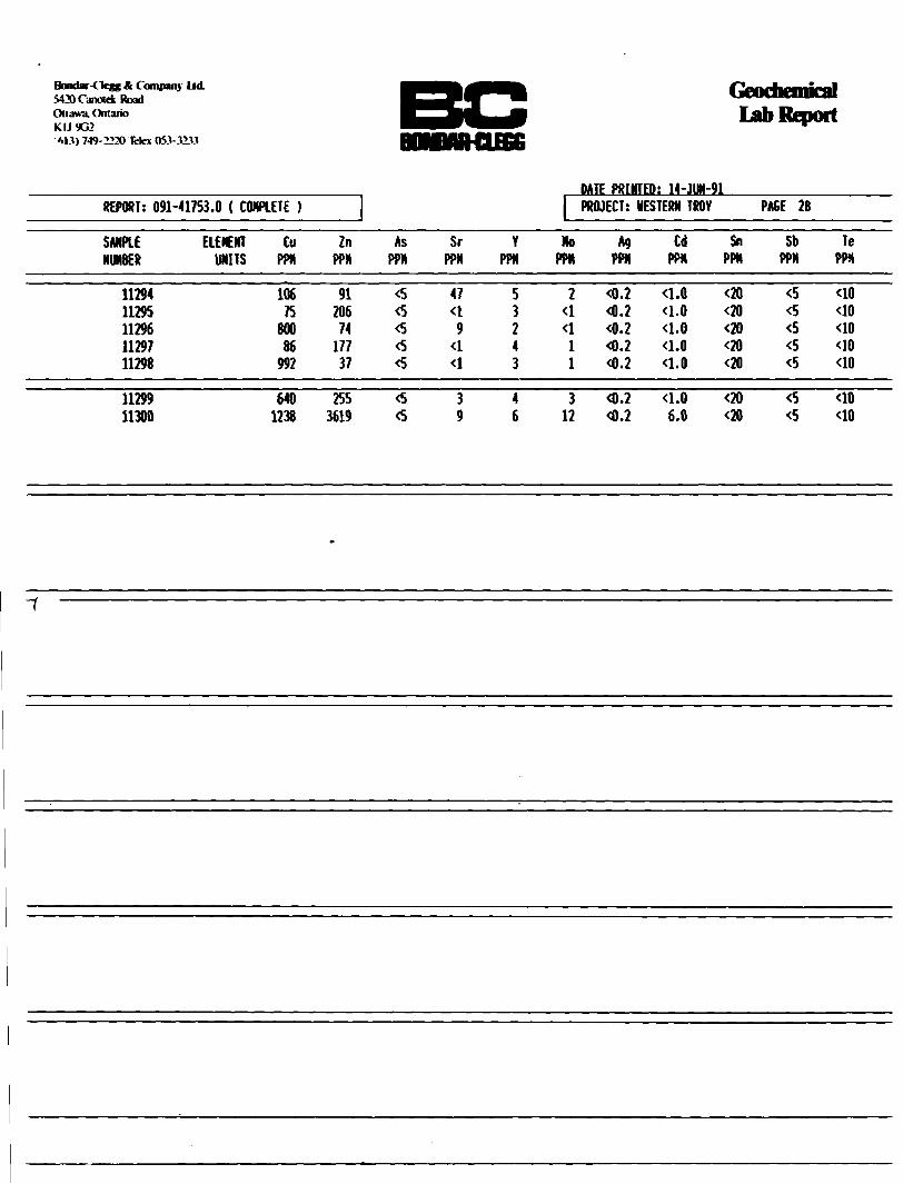
Bondar-Clegg * Company LidvIMCanrtdc RoadOttawa. OntarioKIJ9G2'M jl) 749-2220 Tefcx flH-JdU
Lab Report
DATE PRINTED: 14-JUN-91REPORT: 091-41753.0 ( COMPLETE )
SAMPLE ELEMENT NUMBER UNITS
Cu Zn PPN PPN
As Sr PPH PPN
Y PPN
1No
PPN
PROJECT:
AgPPN
WESTERN TROY
Cd PPN
Sn PPN
PAGE 2B
Sb PPN
Te PPN
11294 11295 11296 11297 11298
106 91 75 206
800 74 86 177
992 37
3 47
3 9 *5 4
5 3 2 43
2
1 1
4.2
4.2 4.2
4.0W W W ^
333
40 40 40
40
11299 11300
640 255 1238 3619
^ 3 3 9
4 6
3 12
4.2 4.2 eio W
33
40 40

Bondar-Clegg ft Company l id5420 Canotdc RoadOttawa. OntarioKIJ9G2•613) 749-2220 Tdex 05.1-J2.U
Geochemical Lab Report
DATE PRINTED: 14-JUN-91REPORT: 091-41753 .0 ( COMPLETE )
SANPLE ELENENT Ba La NUNBER UNITS PPN PPN
H Pb PPN PPN
PROJECT: WESTERN TROY PAGE 2C
Bi Kg Au PPH PP8 PPB
RASAHTkg
11294 11295 11296 11297 11298
39 ^ <2 <l <2 <l 3 <l
3 3
^ 8 <20 21 <20 9 ^ 29 <20 5
8 4 3006 16 13 57 6 3 17
23 S 68 5 <5 32
11299 11300 16 8
^ 15 <20 13
17 23
c5 14 7 262

ACCURASSAY LABORATORIESA DIVISION OF BARRINGER LABORATORIES LIMITED, REXDALE. ONTARIO
BOX 426KIRKLAND LAKE, ONTARIO. CANADA P2N 3J1
TEL.: (705) 567-3361
President: Dr. GEORGE DUNCAN, M.SC.. Ph. o., c. dm tom.}, c. Cham IU.K.I. M.C.I.C.. M.R.S.C.. A.R.C.S.T.
42944 Certificate of RnolysisUayne Holmstead Geocom Consulting Ltd. 1074 Dillingham Street Kingston, Ontario K7P-2P4
SAMPLE NUMBERS Accurassay Customer
548916548917548918548919548920548921C 8922048923548924548925548925548926548927548928548929548930548931548932548932
11301113021130311304113051130611307113081130911310113101131111312113131131411315113171131811318
Gold PPb
116
6556
14674975
339O73880812927
771319^11146
Page: l
August 14 91
Mor k Order # Project
Gold Oz/T
: T91O555 : 1991-O2
^.001 0.002 O.OO2 0.043 O.OO1 O.OO2
KO.OOl 0. 987l .129 Check 0. 376 0.002
0.001 <O.O01 <O.OO1 <O.OO1 <O.OOi Check

ACCURASSAY LABORATORIESA DIVISION OF BARRINGER LABORATORIES LIMITED, REXDALE, ONTARIO
BOX 426KIRKLAND LAKE, ONTARIO, CANADA P2N 3J1
TEL.: (705) 567-3361
President: Dr. GEORGE DUNCAN, M.SC.. PH. o., c. crm (Onu. c. chem CU.K.I. M.C.I.C.. M.R.S.C.. A.R.C.S.T.
42993 Certificate of AnalysisMayne HoInstead Page #lGeocom Consulting Ltd. 1O74 Dillingham Street KINGSTON, ON K7P 2P4
August 15, 1991
WORK ORDER: T910556 PROJECT: RE: CHRIS WAGG
SAMPLE NUMBERS ACCURASSAY CUSTOMER
WEIGHT PULP (g)
GOLD Oz/T
RESIDUE Oz/T
TOTAL ASSAY PERCENT Oz/T RECOVERY
548933548934548935548936548937548938548939548940548941548942548943548944548945548946548947548948548949548950548951548952548953
113161131911320113211132211323113241132511326113271132811329113301133111332113331133411335113361133711338
491 .0 g376. O g440.0 g456. 0 g431. O g448.0 g422. O g45O.O g384. O g527. O g297.0 g357. O g424.0 g413. O g382. O g416.0 g429.0 g476. O g446.0 g1391.0 g1423. O g
0.2343.1190.4190.0730. 1640. 0782.7790. 751O.O9O1.7272.5044.0451.5690. 4440.4O50.3060.0100.776
11.8511.2581.OO9
O.O032O.O518O.OO60O.OO11O.OO160.0014O.O693O.O148O. OO180. 03950.01290.0414O.O292O.OO52O.OO590 .00450.00040 .OO25O. 10920.08430.0751
0.238 3.171 0.425 O.O74 0.166 O.O80 2.848 0.765 0.092 1.766 2.517 4.086 1.598 0.449 0.411 0.311 0.010 0.778
11.960 1.343 1.084
9998999899989898989899999899 99 99 96 1OO 99 94 93
two

ACCURASSAY LABORATORIESA DIVISION OF BARRINGER LABORATORIES LIMITED. REXDALE. ONTARIO
BOX 426KIRKLAND LAKE, ONTARIO. CANADA P2N 3J1
TEL.: (705) 567-3361
President: Dr. GEORGE DUNCAN, M.SC.. Ph. D., c. aim (Om.i. c. ctwm (U.K.I. M.C.I.C.. M.R.S.C.. A.R.C.S.T.
41448 Certificate of RnalysisWayne Holmstead Geocom Consulting Ltd. 1O74 Dillingham Street Kingston, Ontario K7P-2P4
SAMPLE NUMBERS Accurassay Customer
549204549205549206549207549208549209
i 921O049211549212549213549213549214
549217549218549219549220 54922O
11357113581135911360113611136211363113641136511366113661136711368113691137011371113721137311373
Gold ppb
267
8
117
2185910121494512101214
Page:
August 21 91
Work Order Project
Gold Oz/T
O.OO8 ^.001
: T91O569 : Chris Uagg
KO.OOl
^.001 O.OO1 KO.OOl KO.OOl ^.001
Check
KO.OOl ^.OOl O.OO1 <O.OO1 ^,OO1 <O.OO1 <O.OO1 Check
IF40 Per: \ •^^Q^*ocv^^. V^twi

ACCURASSAY LABORATORIESA DIVISION OF BARRINGER LABORATORIES UMITED. REXDALE. ONTARIO
BOX 426KIRKLAND LAKE. ONTARIO, CANADA P2N 3J1
TEL.: (705) 567-3361
President: Dr. GEORGE DUNCAN, M.SC.. PH. D., c. dwm (Om.i. c. dwm IU.K.I. M.C.I.C.. M.R.S.C.. A.R.C.S.T.
41430 Certificate of AnalysisWayne Holmstead Geocom Consulting Ltd. 1O74 Dillingham Street Kingston, Ontario K7P-2P4
SAMPLE NUMBERS Silver Accurassay Customer ppm
Page: l
August 21 91
549216549218
1136911371
Mork Order Project
Copper
O.O13 O.O51
# : T910569 : Chris Wagg
Lead Zinc ppm ppm
2 23 2 1OO
IMO

ACCURASSAY LABORATORIESA DIVISION OF BARRINGER LABORATORIES UMITED, REXDALE. ONTARIO
BOX 426KIRKLAND LAKE. ONTARIO, CANADA P2N 3J1
TEL.: (705) 567-3361
President: Dr. GEORGE DUNCAN, M.SC.. Ph. D., c. ctwm (Om.i. c. am (U.K.). M.C.I.C.. M.R.S.C.. A.R.C.S.T.
41558 Certificate of RnalusisWayne Holmstead Page #1Geocom Consulting Ltd. 1O74 Dillingham Street KINGSTON, ON K7P 2P4
August 23, 1991
WORK ORDER: T91O57O PROJECT: RE: CHRIS WAGG
SAMPLEACCURASSAY
549221549222549223549224549225549226549227549228549229549230549231549232549233549234549235549236549237549238549239 A549239 B549239 C54924O A549240 B549240 C549241 A549241 B549241 C
NUMBERSCUSTOMER
113391134O1134111342113431134411345113461134711348113491135O113511135211353113541135511356
a 11374b 11374c 11374a 11375b 11375c 11375a 11376b 11376c 11376
WEIGHTPULP (g)
1173.0 g594.0 g3*31 .0 g518.0 g44O.O g489. O g702.0 g1135.0 g1095.0 g1174.0 g1O14.O g1160.0 g843.0 g482.0 g800.0 g499. O g11OO.O g1216.0 g120O.O g12O1.O g1229.0 g1223.0 g1264. O g1264.0 g1292.0 g1227.0 g1273.0 g
GOLDOz/T
^.004O.34O3.0142.1121.9290.877O.O410.574O.OO41 .2197.1290.2380.446O.O940.0390.072O.O850.0790.8O90.8960. 8192.0821.9391.7860.7450.7740.925
RESIDUEOZ/T
0.0008O.OO470.04O10.0228O.O3650.0131O.OO27O. 0322O.OO140 . 164O0.3246O. 02190.0140O.OO190.00140 .OO23O.OO81O .OO61O.O7180.17440.0461O. 10330.13520. 09130.0608O.O3360.0136
TOTAL ASSAYOZ/T
(O.OO40.345310542.1351.9660.8900.044O.6O70.0051.3837.4530. 260O.46OO.O960.0400.074O.O93O.O850.8811.O710. 8652.1852.0741.8770.8060.8070.938
PERCENTRECOVERY
9999999899949572889692979896979193928495959395929699
From W.O.#T910556 548952 A a 11337548952 B b 11337548953 A a 11338 548953 B b 11338
1311.0 g1247.0 g13O9.O g1303.0 g
1.3081.4181.0251.030
O.O419O .O4350.01380. 0227
1.3501.4611.O391.O52
97979998

ACCURASSAY LABORATORIESA DIVISION OF BARRINGER LABORATORIES LIMITED. REXDALE. ONTARIO
BOX 426KIRKLAND LAKE, ONTARIO. CANADA P2N 3J1
TEL.: (705) 567-3361
President: Dr. GEORGE DUNCAN, M.SC.. PH. o., c. owm (Om.). c. Chem (U.K.I. M.C.I.C.. M.R.S.C.. A.H.C.S.T.
41559 Certificate of AnalysisWayne Holmstead Geocom Consulting Ltd. 1O74 Oillingham Street Kingston, Ontario K7P-2P4
SAMPLE NUMBERS Accurassay Customer
549800549801549802549803549804•" 198O5,98O6
549807549808549809549809549810549811549812549813549813
11377113781137911380113811138211383113841138511394113941139511396113981139911399
Gold ppb
2319
5433029348
24525
17619326686
6450
Page:
August 26 91
Work Order Project
Gold Oz/T
0.001 0.001 0.016 O.OO1 O.OO1 0.001
: T91O606 : C. Wagg
O.O07 O.OO1 O.OO5 0.006 0.001 0.002
Check
O.OO2 O.OO1 Check
LMO

ACCURASSAY LABORATORIESA DIVISION OF BARRINGER LABORATORIES LIMITED. REXDALE. ONTARIO
BOX 426KIRKLAND LAKE. ONTARIO. CANADA P2N 3J1
TEL.: (705) 567-3361
President: Dr. GEORGE DUNCAN. M.SC.. Ph. o., c. Chem (Cm i. c. dm (U.K.). M.C.I c.. M.R.S.C.. A.R.C.S.T.
41589 Certificate of flnalysisWayne Holmstead Page #1Geocom Consulting Ltd. 1O74 Dillingham Street KINGSTON, ON K7P 2P4
August 28, 1991
WORK ORDER: T91O6O5 PROJECT: RE: CHRIS WAGG
SAMPLE NUMBERS ACCURASSAY CUSTOMER
549791549792549793549794549795549796549797549798549799
113861138711388113891139011391113921139311397
WEIGHT PULP (g)
1004.O g 1O02.0 g 1OOO.O g 1014.0 g 976.O g 1022.0 g 1O34.0 g 1036.0 g 1016.0 g
GOLD Oz/T
l .764 <O.OOA0.272 <0.004O.OO4
^.004 ^.004
RESIDUE Oz/T
0.00020.0560<O.00020.0150<O.0002O.OOO4O.OOO2O.O0110.0022
TOTAL ASSAY PERCENT Oz/T RECOVERY
^.004 1.820
0.287
O.OO4 ^.004
97
95
91
^.004
lf-30

Ul - 11IL. \Lft_IX. 1J.-II. \AM . oia aoa oaou;? z/ 2
ACCURASSAY LABORATORIESA DIVISION OF BARRINGER LABORATORIES UMITED, REXDALE, ONTARIO
BOX 426KIRKLAND LAKE, ONTARIO, CANADA P2N 3J1
TEL.: (705) 567-3361
President: Dr. GEORGE DUNCAN. M.SC.. m. o., c. cum (Onur c chm (U.K.). M.C.I.C.. M.R.S.C.. A B C.S.T.
41688 Certificate of AnalysisHolmstead Page #
G* -com consulting Ltd.1074 Dillingham StreetKINGSTON, ONK7P 2P4
WORK ORDER: T910639PROJECT: RE: BONOAR-CLEGG REJECTS
September 05. 1991
SAMPLE NUMBERS ACCURASSAY CUSTOMER
550268550269550270550271 A 550271 B550271 C550272 A 550272 B550272 C550273550274 A 550274 B550274 C550275
WEIGHT GOLD RESIDUE TOTAL ASS PERCENT PULP (g) OZ/T Oz/T Oz/T RECOVERY
11043110441104511O48 A11048 B11048 C11051 A11O51 B11051 C1105311055 A11055 B11055 C11059
1494. O g1336.0 g1O77.0 91513.0 g1490.0 g1457.0 g1483.0 g1514.0 g1529.0 g872.0 g15OO.O g1497.0 g1527.0 g1513. O g
0.0329.0130.1760.0110.0110.0120.1950. 1830. 1850.0060.1310.113O.O9O1.805
0.01130.3431O.O0460.00090.0005O.OO78O.OO530.01110.00710.00050.0055O.OO31O.OO320. 1170
O.O43 9.356 0.18O 0.012 0.012 0.019 0.2OO 0.195 0.192 O.OO7 0.136 0.116 0.093 1.922
7496979396609794969296979794

ACCURASSAY LABORATORIESA DIVISION OF BARRINGER LABORATORIES LIMITED. REXDALE. ONTARIO
BOX 426KIRKLAND LAKE. ONTARIO. CANADA P2N 3J1
TEL.: (705) 567-3361
President: Dr. GEORGE DUNCAN. M.SC.. ph. D., c. Chm (Onu. c. cum IU.K.I. M.C.I.C.. M.R.S.C., A.R.C.S.T.
42807 Certificate of RnalysisUayne Holmstead Page #1Geocom Consulting Ltd.1O74 Dillingham StreetKINGSTON. ON August O2, 1991K7P 2P4
WORK ORDER: T9iosi7PROJECT: RE: CHRIS WAGG
SAMPLE NUMBERS WEIGHT GOLD RESIDUE TOTAL ASSAY PERCENT ACCURASSAY CUSTOMER PULP (g) Oz/T Oz/T Oz/T RECOVERY
548101 11043 343.0 g O.O34 O.OO1S O.O36 96548102 11O53 282.O g KO.OO4 O.OOO3 <O.O04548103 11O44 333.O g 3.OO9 O.O468 3.O56 98548104 11045 316.O g O.119 O.O044 O.123 96548105 11O48 296.O g O.O13 O.OOO5 0.014 96548106 11O51 323.O g O.O69 O.OO32 O.O72 96548107 11O55 326.O g O.O24 O.OO03 O.O24 99548108 11O59 225.O g O.966 O.O103 O.977 99
LF-30

l Id Certificate of Analysis
\ ' ).".M()\0! IV li- \l'l
REPORT; 091^1753.5 ( COMPLETE )
f LSTIVG SERVICESDATE PRINTED: 19-JUN-91PROJECT; yESTEH TROY PAGE l
SMPLE ELEMENT Au-150 Au+150 Au Ave -15WT *150VT NUMBER UNITS OPT OPT OPT gis gis
UM6 0.480 12.899 435 516J

Ifc*kl.ir4 k-jy; K ( 011(1:1111 lid
l)ll;iv.L (Vl.ri 'K i.i'*.:idl.'i ?4'* V1 "" i- *\ : • ; :-:.V!
\IK\N
REPORT: 091-41753.4 ( COMPLETE )
SAMPLENUNBER
ELEMENT Au-150UNITS OPT
BC^9Wd BOMMR-CUG
i\H !\i li M'l INSIM(1I()\\
Au+150 Au AveOPT OPT
-150IT9"S
'150NTgis
i Certificate of Analysis
GTESTING SERVICES
DATE PRINTED: 10-JUN-91IPROJECT: WESTERN TROY PAGE i
RASAVT1(9
m
1104411045110471104811051
3.4880.1200.0050.0150.084
172.6292.8370.0100.071
9.1490.2590.0050.017
2.347 0.215
367.6347.2297.1358.1356.1
12.7318.6820.1113.6421.81
1.871.650.755.516.94
110551105911061
0.0201.0240.131
0.8498.644
0.0641.479
0.491 0.151
358.7256.4303.6
19.9616.2918.30
6.972.502.87

Certificate of Analysis
BONDAIHlffiG
DATE PglKTEO: 19-JUH-91REPORT: 091-41694.5 ( COHPLETE PROJECT: HESTERN TROY PAGE l
SAKPLE ELEMENT Au-150 Au^lSO Au Ave -15MT +150HT NUMBER UNITS OPT OPT OPT gis gts
11276 1.952 14.398 2.548 518.1 26.05

• if Analysis BONDAR-CLEGG
3A:i ?OM;: -4-.l l1l-9I. . 3EPKT: 091-41694.4 ( CWPLETt i OSGJECT: -rfEv^N :RGY PAGE l
SAHPiE ELEHENT ZnVJS8ES UNITS ?CT
11278 4.03

Geochemical Report
BONDAR-CI.EGG
REPORT: 091-43285.1 ( CONPLETEDATE PRINTED: 29-NOV-91 PROJECT: NONE PAGE l
SAHPLENUMBER
1142511426114271142811429
1143111448114621146311464
1146511466
ELEMENT Au AMI AUR2UNITS PPB PPB PPB
117
*54j
J6
286
HOOOO ^0000 *0000162192
1547

2
"i
* 11 ~t SiilUKrx

i K Geochemical Lab Report
BONDARCLEGG
REPORT: 091-43300.0 ( COMPLETE )
SAMPLE NUMBER
1149111492
ELEMENT UNITS
Au PPB
518
DATE PRINTED: J8-NOV-91 PROJECT: NONE PAGE l

60
, ''C^'"'"1 ;"" ' v i y'( '
™ ' ' i ' i -' v" ,K i i j leasable wakhoilt \7—"~\J ,' '' ?
, i ' v x1" h unt)4 km,to Hwy.TlXVUM, ^,
i , l
80 10-
"' IH ni./. V
HI)
\ \xi
H"
Vi, li/l
1 i.iii. , i^-^L l J
by*ODM M*p 2325 *! C.E:", 1976 1 "
4:63 160 ,, " ,,
..li. 1 H M
- -1" /i U-^^f y-i ^/''SY/."•N /''L' 1 -HI
A
11^427-4^0
1^'
^n 114948.
^[E^
IBH\ , ('1 )/ ' A',,, H424
4(|i) (
1149482
X ,W11410*
r
\14949M\
HI.
V
\, '1 1\9500
, i a \S
HI) x"
1149496
JlL " v''k -7'"), 1 MafipS.to^'iLtntermediate,1V' ) \ \ ( l
,'i ,'A49499
1149492
(8),(*\ ! , l WjU ; ,\
l '
11 ^9501
f 10fi . .u,'
••Ull*
h -PC 4041 .
r"lt49481^|
1?r-\l( tU j n
R
93 0 48
^ ' BU "fr^HD' "^
l Ut!
: l 4II4
'. A
30W
-\IFl^
/
, f *im J
' ^ l X l./'f'/
*HI)
Sabaskong H ' J Bathblith \
•-^Jl j^^1l i*^ s
Mafic tA lnterm*dia't'4\ ^^M [ 4 n "41" 1,1 1 ria ' . ^ ,xU .
HI) \
l 4nu
- v r- ,//,/' A\ Klshtl
'"(2) J
V HM92A
\M49502
.i 11
3^1ale-tocK}
J ' /rl S * f'x* w •A/M" BU
,J ' - 'f™
' ' 'tV1(' r\ VxQ
60
•lor, i
/s,,'f f Ml 4 U,
"\
JP D orothy
^
^^o*e
^•-Q. graham Lake
[ l
w \piabase—^' i ^ N ' ^n ^ )XN' //^j.'i' ''^ ^M
wovarea ny^ OGS Map 243^ i /^ ^ },-\ . ,Edwarde, l G .R.,. .1981 pf;]r \ , \V /'Settle/1:3.1 680 -" K y ' /Y/
X 11149504
.DiabaseI^nu
jf
\ ' / /M.
'\ ( '
l 4"o /
RD^
\K.
,, -V. -^ ' '(M. ;AV. j M . ,, M ^
/- viO V
Covered by ODM Map ,, ; ( ^/Blackburn, C. E., 7
•,HT 'If Scale 1:63 360^
Intermediate fco PalateMetavolcSrtics
•w- rv- i^, . ^
\, ,,-0 (
\N
111 li
ni."*' HI)
01"
u,,, Q ,,,
Y
,-V J*l v ;
) f ^ " { 4\U ^ \
*-^—lir-|2'"km Uio' Hwyv V,)
, ;lxl Original' K"7—— ———K M afi*' tp7 ZA^ermediate ,,'( ..' y f ~ .110 .a'
Metavoloanics ito Felsic
, //Iv } l li1 Ar •x - - (A-x -\/f o ^; /- ~ --"
, Metavolcar\ic;s;//^^ /. V", ?
/, r' | lbil1 f \\ ' '
Rurditt
YJ|(.
y"j .U-. 3"S
|)| j^jJ-^'i~^ jyfc \]^ \ \ *;
fr), ' i j,,, V1 /,J ,i, / l
^ M/ * - ""\ , ' /- M ^ -,*Mt . /l/ /W
[11 )\
:(y \l /POflO^O/^O
/"' LEGEND
1 V '"X-s
11310,311
.l x ' V. -a
)"/' \ / v '"'" ", \"^i V ,; - ^', -Hi," ' n
' ! (-MO V l ,
"' ^- V.
Banana Luke \vX-^' -'V^
,VH,, " i
/f i . , .---';' i'" -V' '''"V. ,- /"-; .w....:. : ';;'•Q-/ { ' -^to-1 X -'l \ , ) \ M\Ii ' X - ' ' M \ \\i\\ " 'iV'" 1 ' '.'i 1 """ur"
J^:"^L i
Dm TF;T
('
^'1
7•^i
,'
X l/(i/, f. L ft ^
f
' ^ " ,xf y '
,/ /) \
'ffi ' *l^\
(, " '/; ; " 4i if , 1•..,^)
;\ o* 1 ? 1 *V ;4 f -V
1 ,, *- ,, v, Wl^ 1
f'" , 'XX
V 7 , {/* M 1
f 'X--\ y iJ/ 0 y•' ^ \ f J'l ; ' C Bf/^ ) M
y
^ /' /^-v ^
HI)
x . . Gold Showing
^ . . Vein yuartz Debris
11400.. Sample Number
1 149480. . Claim Number
Case top by Surveys and Mapping Branch Ministry of Natural Resources. Published 1984.
WESTERN TROY CAPITAL RESOURCESr\A* *
MENARY TOWNSHIP PROPERTY
COMPILATION MAP
Gold Showings and Autumn 1991 Sample Locations
Programna Management: W. E. tfeunstead Inc.
Consulting Project Geologist:C. A. Vfagg/Lot 17 E)y)l oration reg'd
Buckhom Point
V/ Diabase
200 600 1000 1400 1800
Lo k.me tr es
400 800 1200 1600 2 00U

MINERALISATION AND STRUCTURE
Additional Main Showing Sampling25 fliotro
•ample mtorvof
H3l9HI356ch , 11374—11376 S
11463-1(490 eh, JI462 high cuiphldo qtz. (a-3%)Sabaskong batholith
( Trondhjemitic)Whole Rock
AnatyM* 11432— f f 461 12.5 ut camp/* interval •o*t of ((445
11051 eh.25-30 : h m In shear
,hHOG9
(ChW*y)AU7
h m (Pyjbur)AU
rr043a,w.rac* HO44ch,6O
hm HO46g,AU 11048 G
LEGEND
GEOLOGY AND SYMBOLS
See underlay bv Clarke, 1989
Metabasoitsla, carb (Py) ROCK SAMPLES
90 *f(3ei q*t Bedrock
GrabLarge grab Representative chip
Sawn channelLength in centimetres
Glacial drift Angular Subangular Subrounded
11226* .(PT
113630 ' I o, q*
fnt. —f otefc fragnwntal
porphyry il258cM70
Py ,qs, (colc.hm)CM.Py
(Cole. Tour]
porphyry hl
ALTERATION
1149484fT49482CpPo H035|G ^Py
X27O9 iJ/tfllZ 1127(9 30.
(11239* "238. ChUPy)
-r sil,carb,(ructo)
frr
R235a, 11236 ch^24Oto Hwy. 71
5O 25 O l 5O E metr400 200 O
GalenaMalachiteFuchsite
CalciteCopper
Telluride (AuAgBD
Native gold Gold values Chalcopyrite Chlorite Pyrrhotite
Pyrite S priderite
Tourmaline Quartz vein
Quartz stringers or small lenses or veiniets Minor constituent Minor shear Shear zone
ChloritizationCalcium carbonatisation
Iron carbonatisationHemattsarion, limonitisation (veins or porphyries)SilicificationMinor
WESTERN TROY CAPITAL RESOURCES inc.
MENARY TOWNSHIP PROPERTY CN part)
1991 PROGRAMME (COMPILATION)
Programme ManagementSurveys and Drafting
Dec rniber 1991
W. E. Holmsteod and Associates Inc.
C. A. Wagg 7 Lot 17 Exploration reg'd.
MAP

028 (chi,Py) /to 80 E
65-J 025T H366 g(Chl.Py.Po.Cp)
SABASKONG BATHOLITH
(TRONDHJEMITIC)
BASALTIC ROCKS
SL- PyPo'r-k.^w * * i t**.*** f .
4OO ZOO O t imetres North
Sheet
To Hwy. 71
5O 25 O 5O•^
metres
LEGENH
1 BASALtlC METAVOLCANICS la ^Massrve Ible porphyritic Id
2 ANDESIflC METAVOLCANICS
2 a kfassrve2 b Piflowed2 c (WioIftic2d Gabbroic
l.
3 TUFFACEOUS METAVOLCANICS 'ir
3 a Mafic Tuff3 b Quartz—eye Tuff
4 MAFIC INTRUSIVES 4a Gabbro 4b Lamprophyre
5 GRANITIC INTRUSIVES5 a Trondhjemite
6 FELSIC INTRUSIVES6a Quartz and Quartz— Feldspar Porphyry
6 b Intrusive Breccia with Metavolcantc Fragments Sn a Porphyry Matrix
Notes-.- Legend after Clarke, 1989, no relative age
relationships implied, l Consisting m part of both clastic and
chemical sediment.
WESTERN TRClY CAPfTAL RESOURCES inc.
MENARY TOWNSHIP PROPERTY (s part)
1991 PROGRAMME (COMPILATION)
Programme Management; 'V. E. Holmstead and Associates Inc.
Surveys and Drafting: C. A. Wagg X Lot 17 Exploration regU
December 1991
52C13NW00150II91-017 MENARY