Embed Size (px)
Citation preview
FAA UAS Test Study GuideCreated by Kelsey Mason, B.S.
PhD Candidate Geological SciencesUniversity of Texas at El Paso
Advice● Use common sense● When in doubt pick the most conservative answer● There will likely be some questions that you don’t know● Study!!● Use the sectional chart key at the front of the book● Take your time
** = definitely will be on the test
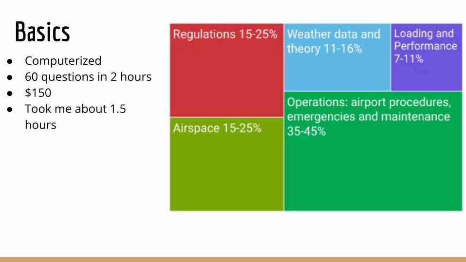
Basics● Computerized● 60 questions in 2 hours● $150● Took me about 1.5
hours
Regulationshttps://www.faasafety.gov/
Online coursehttps://3dr.com/faa/study-guides/regulations-cheatsheet/
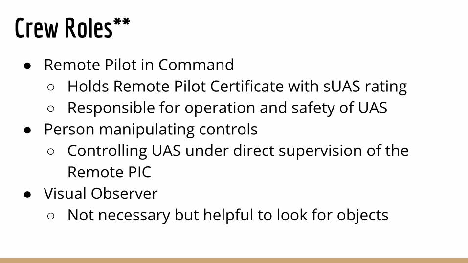
Crew Roles**● Remote Pilot in Command
○ Holds Remote Pilot Certificate with sUAS rating○ Responsible for operation and safety of UAS
● Person manipulating controls ○ Controlling UAS under direct supervision of the
Remote PIC● Visual Observer
○ Not necessary but helpful to look for objects
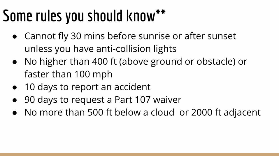
Some rules you should know**● Cannot fly 30 mins before sunrise or after sunset
unless you have anti-collision lights● No higher than 400 ft (above ground or obstacle) or
faster than 100 mph● 10 days to report an accident● 90 days to request a Part 107 waiver● No more than 500 ft below a cloud or 2000 ft adjacent
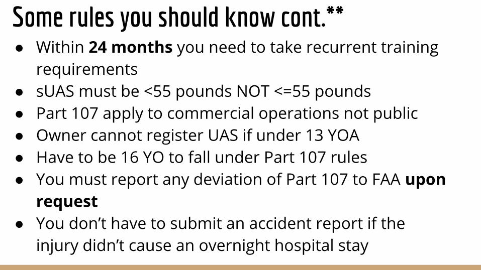
● Within 24 months you need to take recurrent training requirements
● sUAS must be <55 pounds NOT <=55 pounds● Part 107 apply to commercial operations not public● Owner cannot register UAS if under 13 YOA● Have to be 16 YO to fall under Part 107 rules● You must report any deviation of Part 107 to FAA upon
request● You don’t have to submit an accident report if the
injury didn’t cause an overnight hospital stay
Some rules you should know cont.**
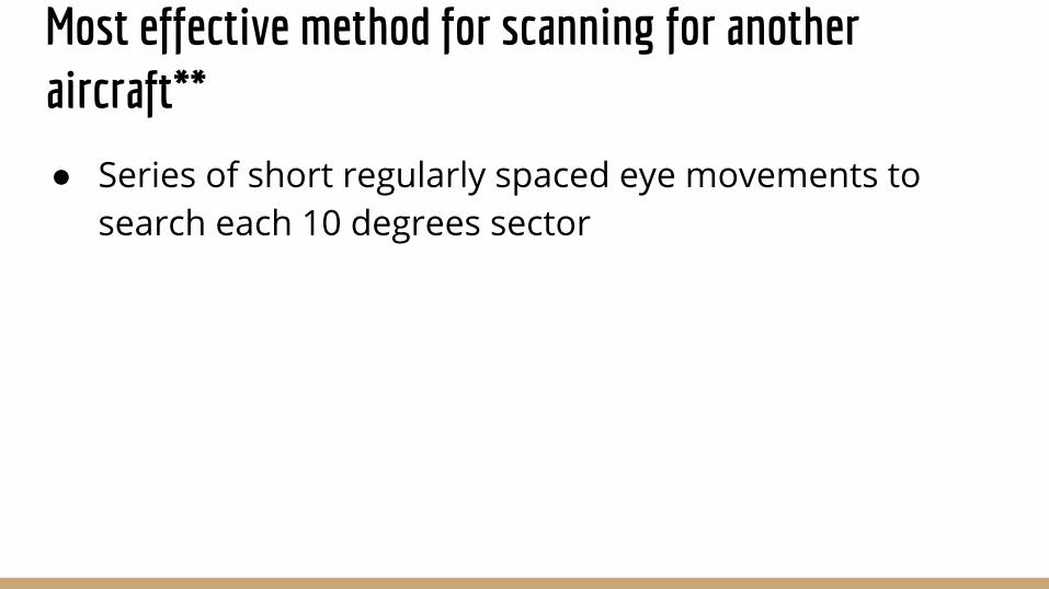
Most effective method for scanning for another aircraft**
● Series of short regularly spaced eye movements to search each 10 degrees sector
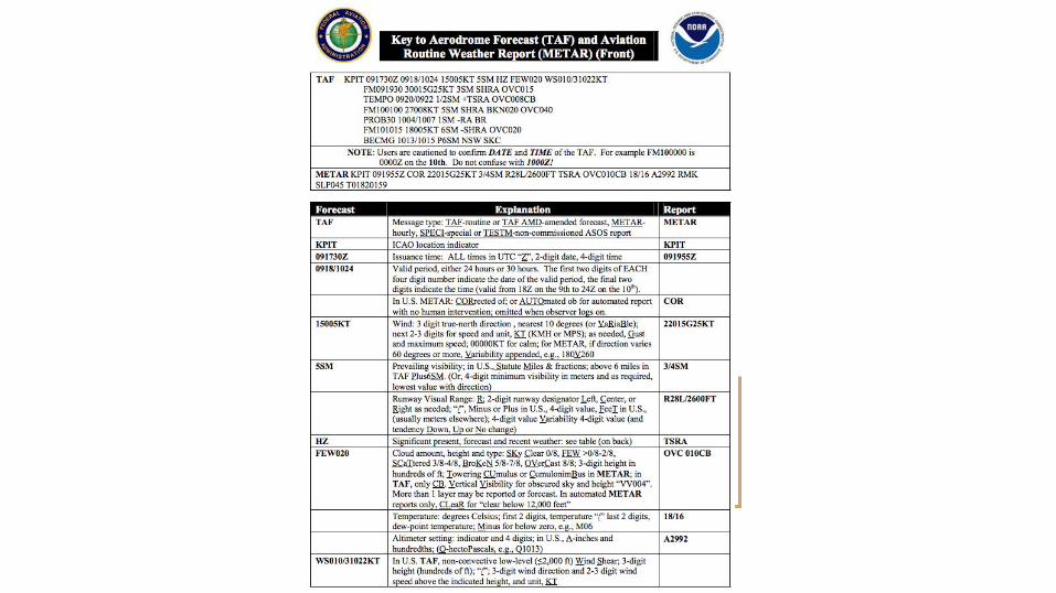
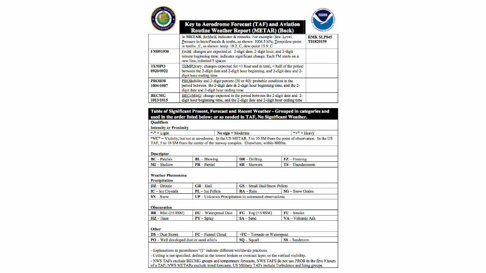
Weather - TAFs (future) and
METARs (current)**
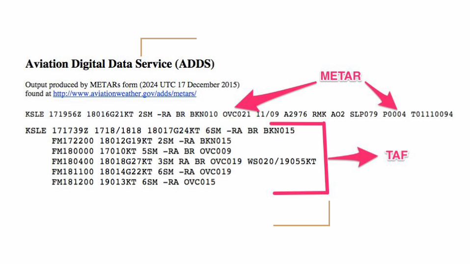
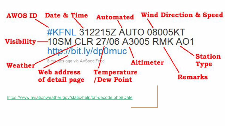
https://www.aviationweather.gov/static/help/taf-decode.php#Date
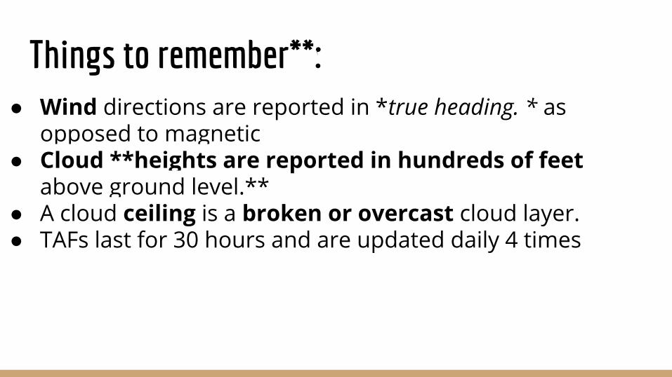
Things to remember**:● Wind directions are reported in *true heading. * as
opposed to magnetic● Cloud **heights are reported in hundreds of feet
above ground level.**● A cloud ceiling is a broken or overcast cloud layer.● TAFs last for 30 hours and are updated daily 4 times
Other weather sources:
Doppler radar, ASOS (automated)
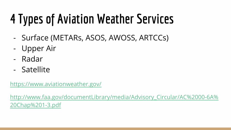
4 Types of Aviation Weather Services- Surface (METARs, ASOS, AWOSS, ARTCCs)- Upper Air- Radar- Satellite
https://www.aviationweather.gov/
http://www.faa.gov/documentLibrary/media/Advisory_Circular/AC%2000-6A%20Chap%201-3.pdf
Types of BriefingsStandard, Abbreviated and Outlook
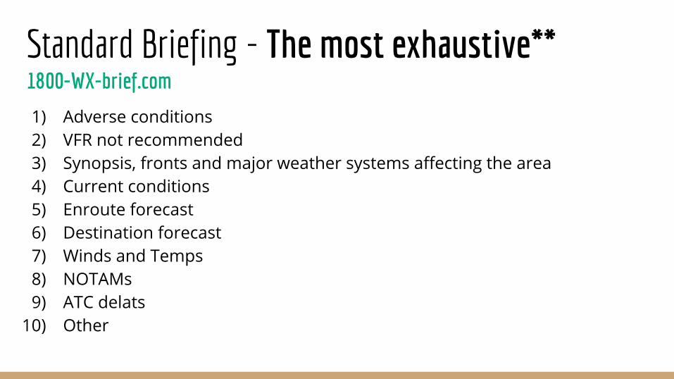
Standard Briefing - The most exhaustive**1800-WX-brief.com
1) Adverse conditions2) VFR not recommended3) Synopsis, fronts and major weather systems affecting the area4) Current conditions5) Enroute forecast6) Destination forecast7) Winds and Temps8) NOTAMs9) ATC delats
10) Other
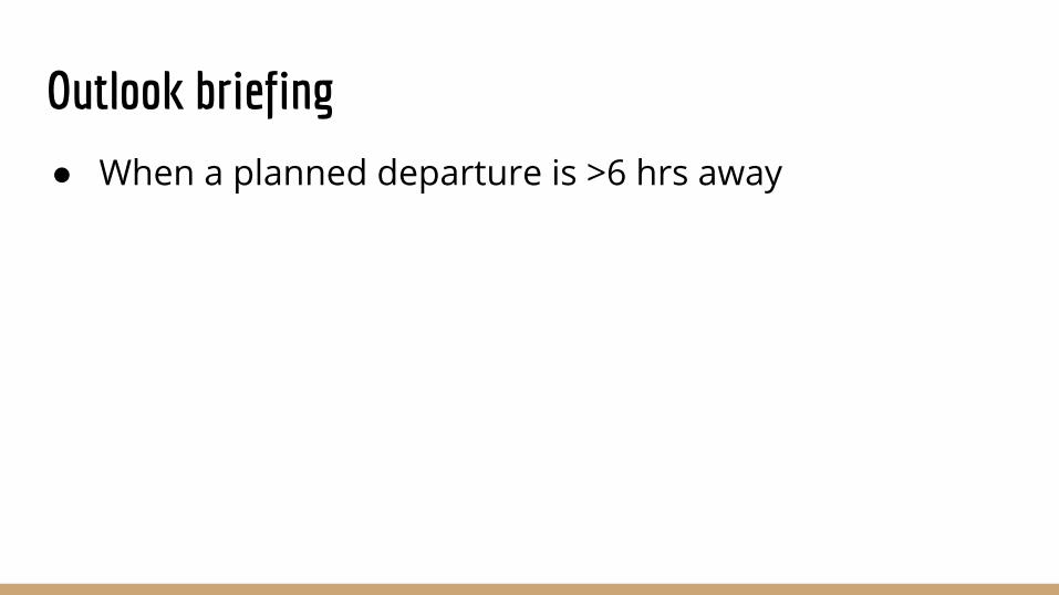
Outlook briefing
● When a planned departure is >6 hrs away
Weather theory stuff
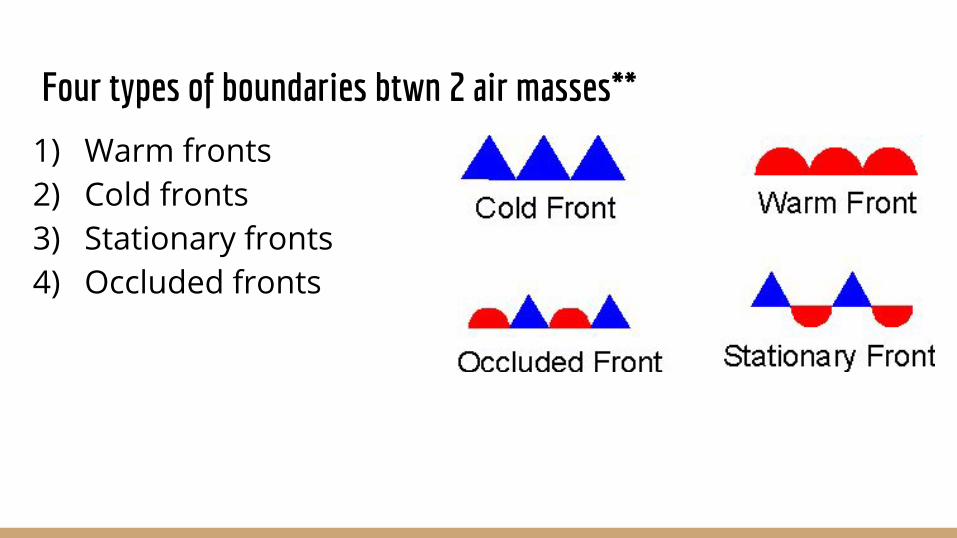
Four types of boundaries btwn 2 air masses**
1) Warm fronts2) Cold fronts3) Stationary fronts4) Occluded fronts
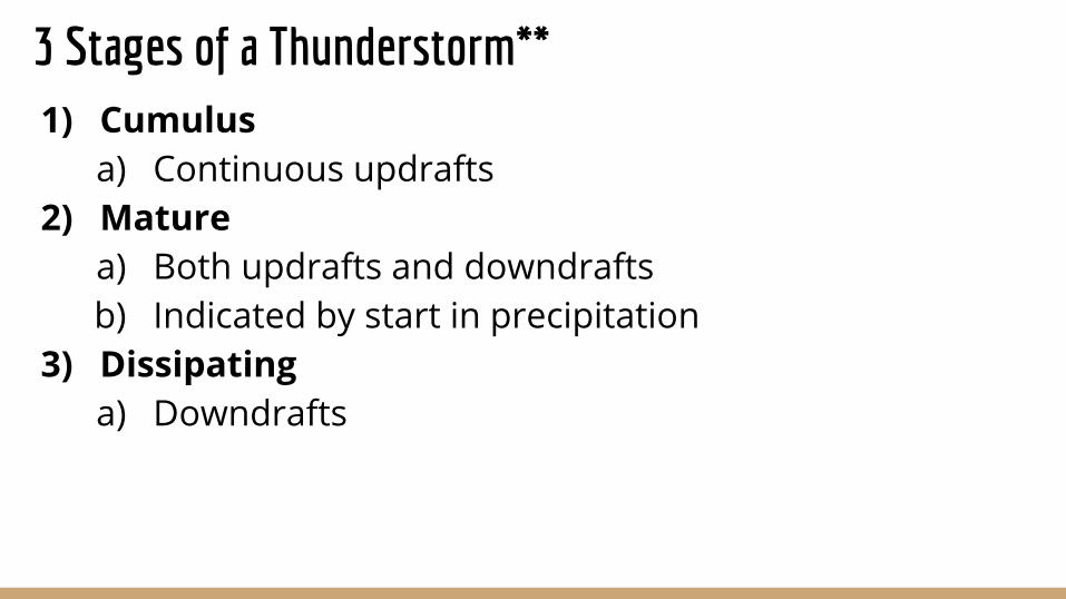
3 Stages of a Thunderstorm**1) Cumulus
a) Continuous updrafts2) Mature
a) Both updrafts and downdraftsb) Indicated by start in precipitation
3) Dissipating a) Downdrafts
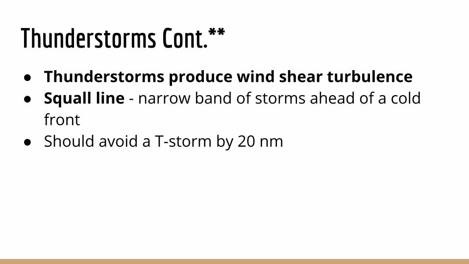
Thunderstorms Cont.**● Thunderstorms produce wind shear turbulence● Squall line - narrow band of storms ahead of a cold
front● Should avoid a T-storm by 20 nm
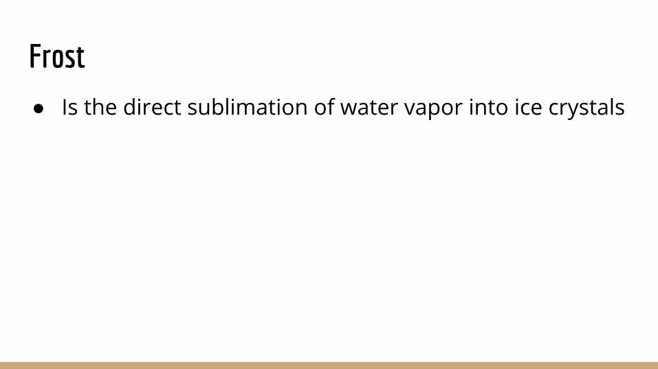
Frost
● Is the direct sublimation of water vapor into ice crystals
Radiation Fog (Shallow Fog)● Occurs in a clear sky, little or no wind and a small
temp/dew point spread
To calculate the base of a cloud
● Divide the temp/dew difference by 4.4 F and multiply by 1000
Lapse rate● Decrease in temp with increase in altitude ● The higher the lapse rate the more unstable
Temperature Inversions**● Result in a stable layer of air● Caused by terrestrial radiation ● Develops on the ground and cool nights when wind is
light● Smooth air with limited visibility below
Lenticular clouds
● May contain winds of 50 kt or more
Density Altitude Stuff**● Flying in dense air is ideal.
● Density Altitude is a measure of air density.
● In standard conditions, true altitude (above sea
level) = density altitude.
● In standard atmospheric conditions (ISA), the density
altitude at the beach in San Diego (sea level) is 0 feet,
while the density altitude in Denver is 5500 feet.
.
Density Altitude Stuff Cont.**● However, if temperature increases, humidity increases or air
pressure decreases from standard, the density altitude goes
up (the air becomes less dense).
● Hot + Humid + Low Pressure = High Density altitude
● For example on a hot summer day in Denver, with high humidity
and a temperature over 100º F, the density altitude would be over
10,000 feet even though the true altitude of 5500 feet is
unchanged. The aircraft "feels" as if it was at 10,000 feet and its
performance will be decreased
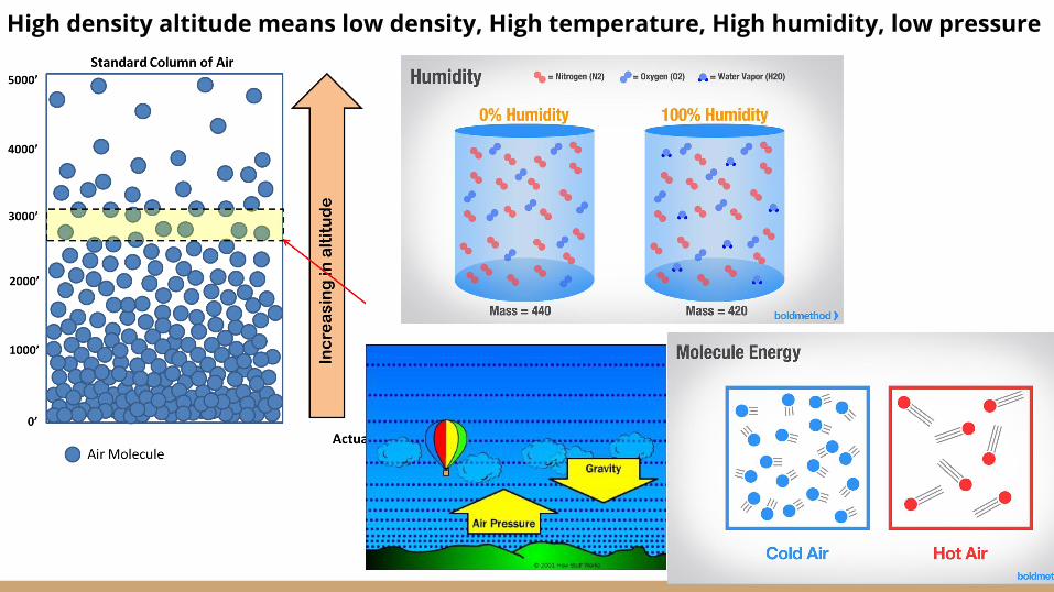
High density altitude means low density, High temperature, High humidity, low pressure
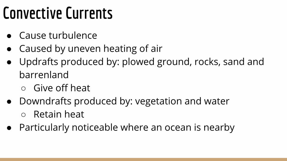
Convective Currents● Cause turbulence● Caused by uneven heating of air● Updrafts produced by: plowed ground, rocks, sand and
barrenland○ Give off heat
● Downdrafts produced by: vegetation and water○ Retain heat
● Particularly noticeable where an ocean is nearby
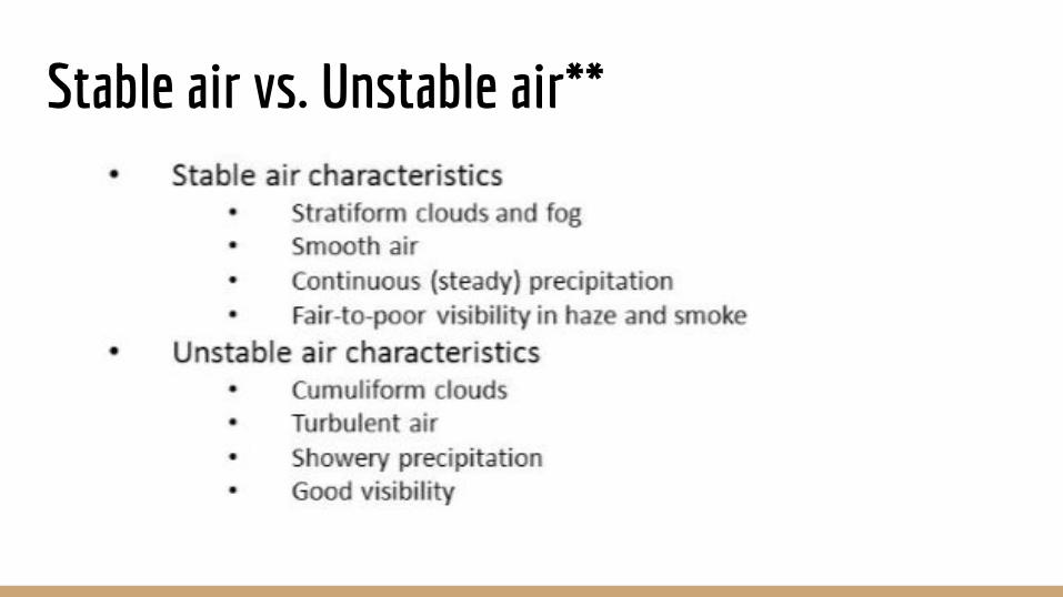
Stable air vs. Unstable air**
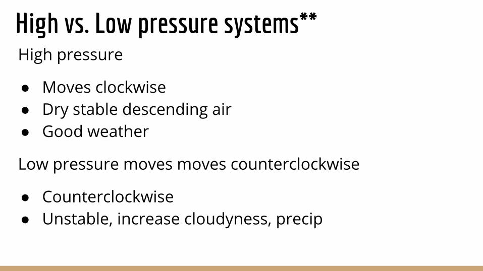
High vs. Low pressure systems**High pressure
● Moves clockwise● Dry stable descending air● Good weather
Low pressure moves moves counterclockwise
● Counterclockwise● Unstable, increase cloudyness, precip
Loading/Performance
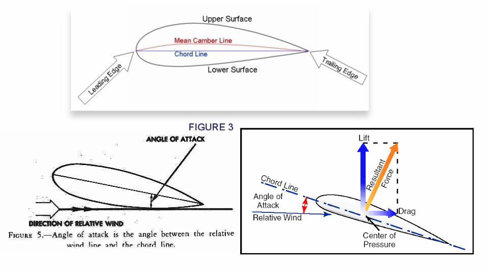
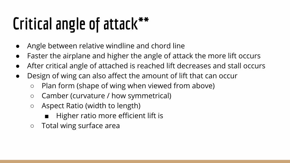
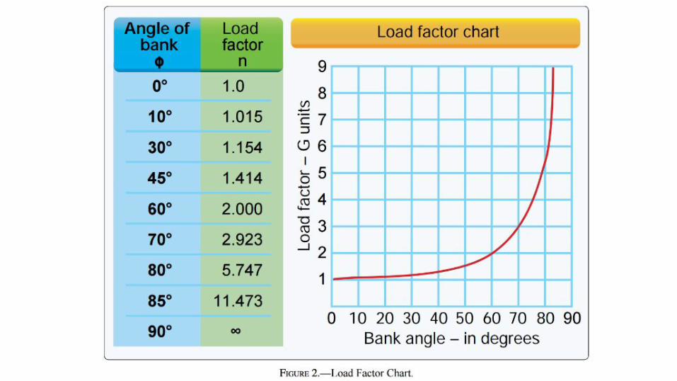
Critical angle of attack**● Angle between relative windline and chord line● Faster the airplane and higher the angle of attack the more lift occurs● After critical angle of attached is reached lift decreases and stall occurs● Design of wing can also affect the amount of lift that can occur
○ Plan form (shape of wing when viewed from above)○ Camber (curvature / how symmetrical)○ Aspect Ratio (width to length)
■ Higher ratio more efficient lift is○ Total wing surface area
Lift is limited by ● Airfoil design ● Angle of attack● Air speed ● Air density
When airplane is in flight it is affected by 4 forces:
1) Lift2) Weight3) Thrust 4) Drag
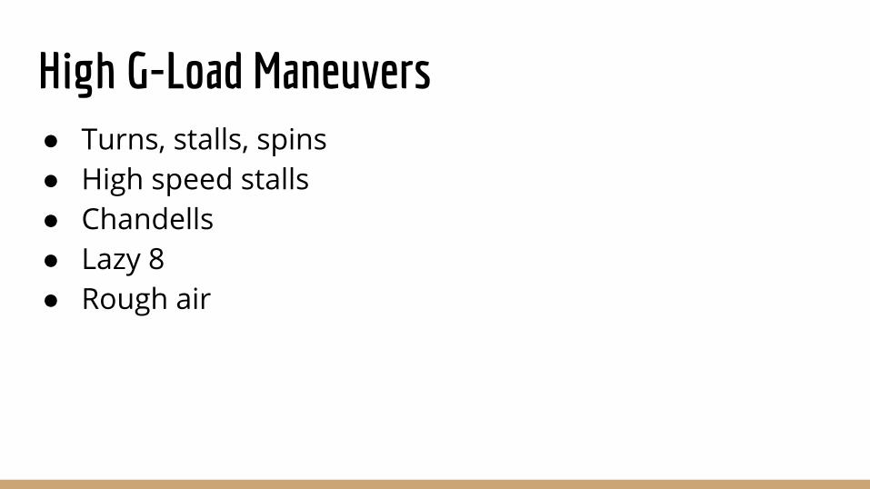
High G-Load Maneuvers● Turns, stalls, spins● High speed stalls ● Chandells ● Lazy 8 ● Rough air
Operations: Airport
procedures
What is the CTAF for?
Airports without control tower
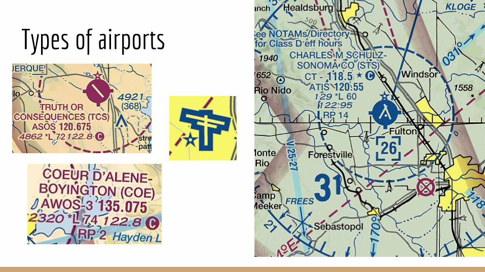
Types of airports
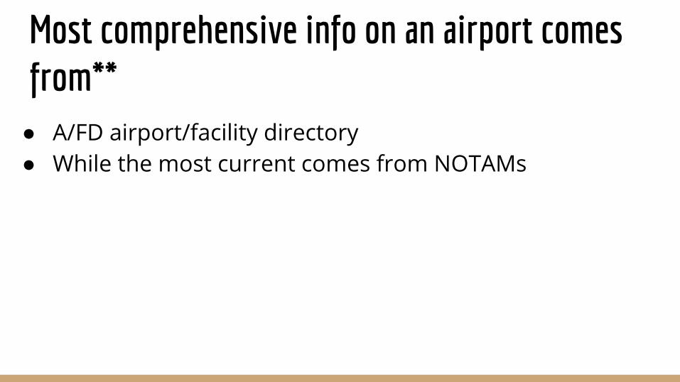
Most comprehensive info on an airport comes from**● A/FD airport/facility directory● While the most current comes from NOTAMs
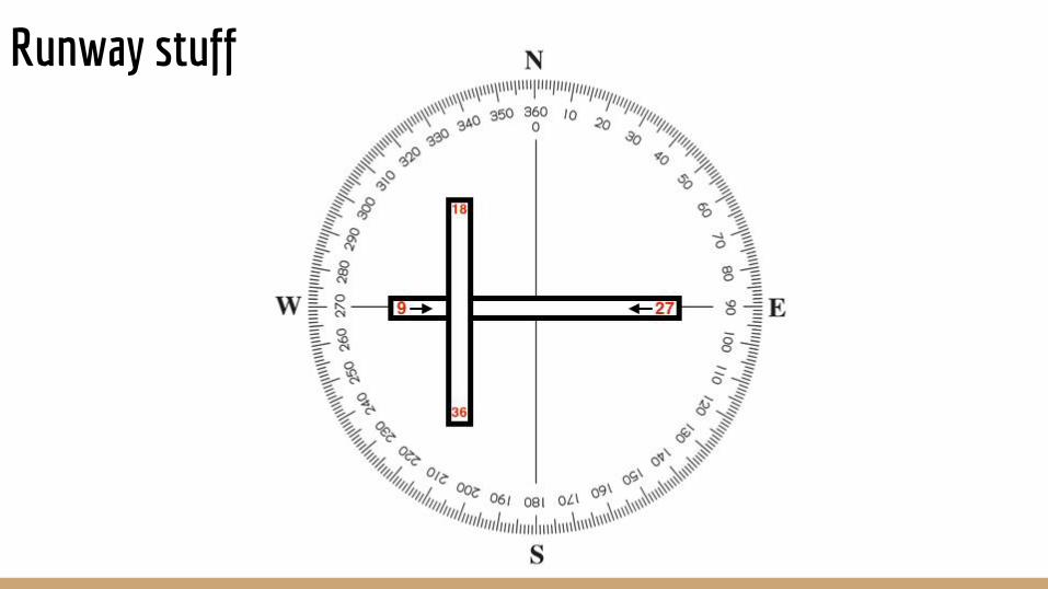
Runway stuff
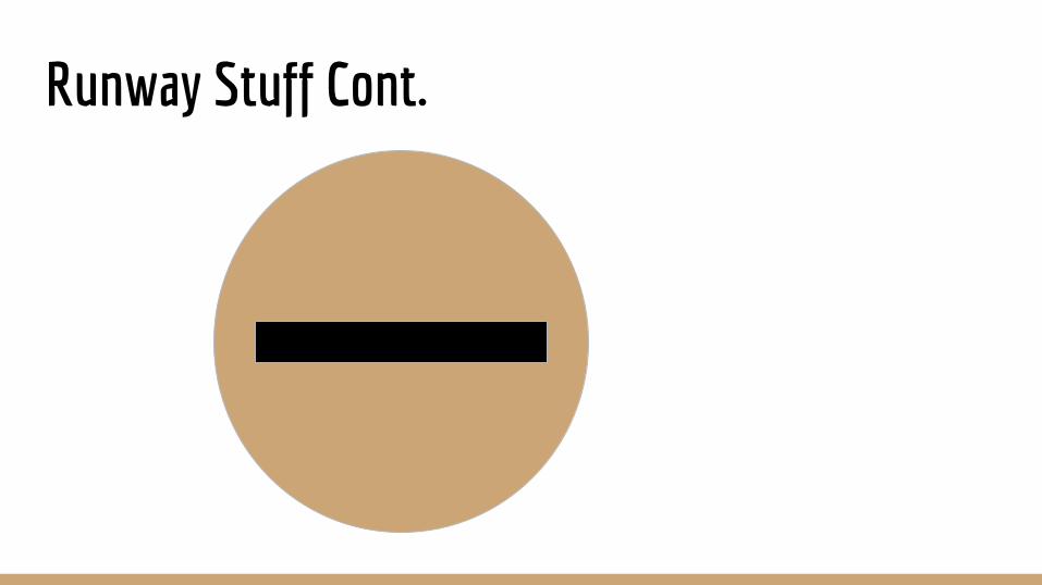
Runway Stuff Cont.
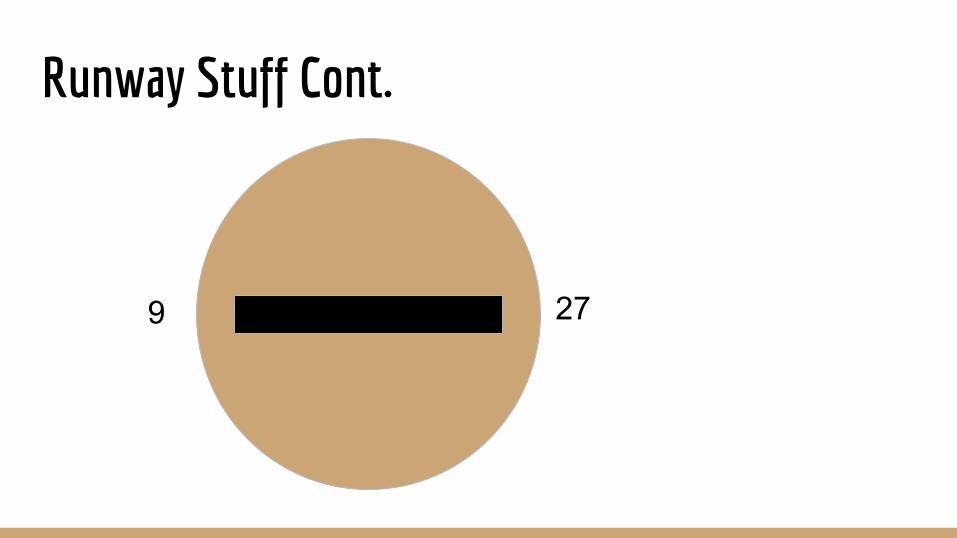
Runway Stuff Cont.
279
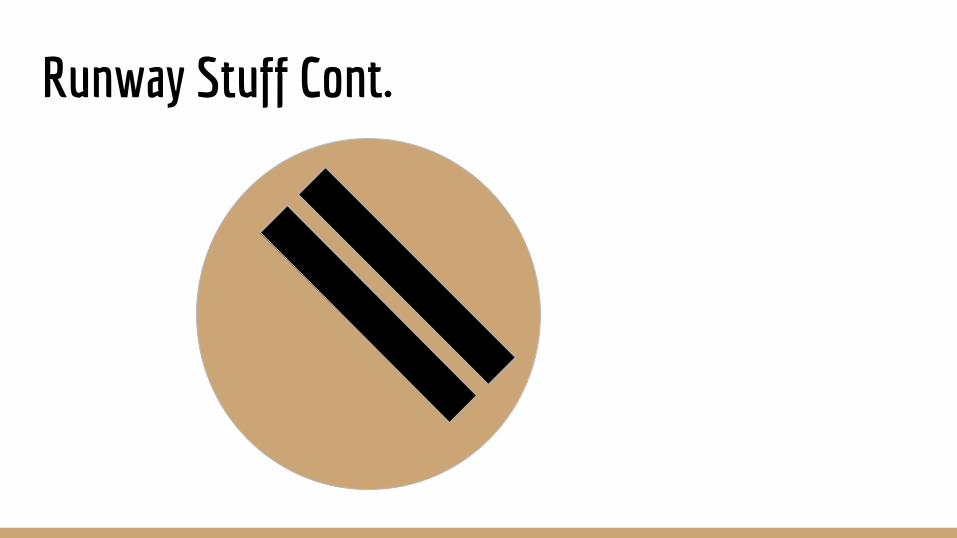
Runway Stuff Cont.
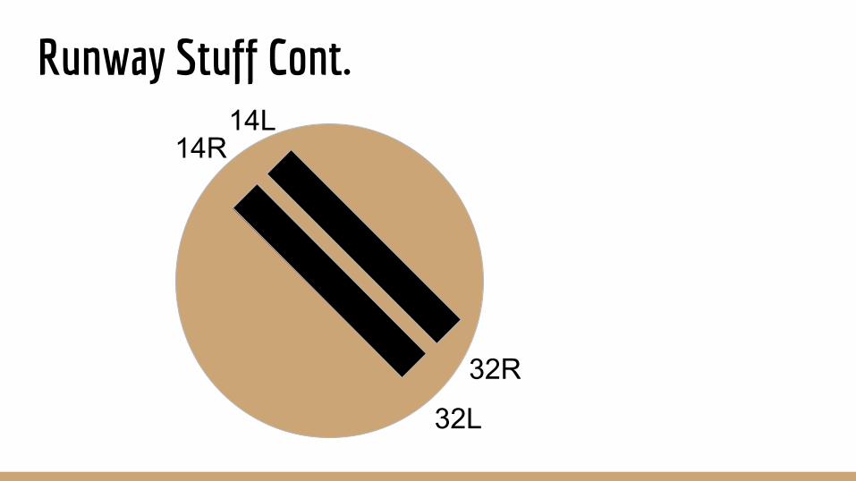
Runway Stuff Cont.
14R
32R
14L
32L
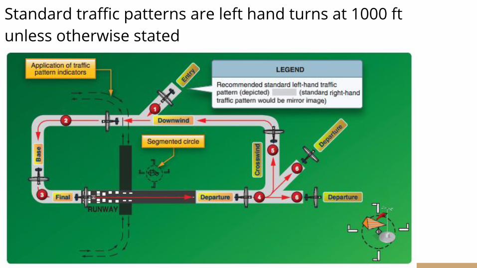
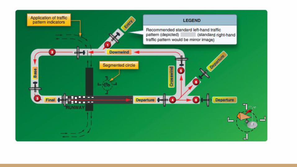
Standard traffic patterns are left hand turns at 1000 ft unless otherwise stated
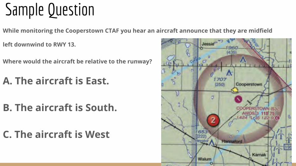
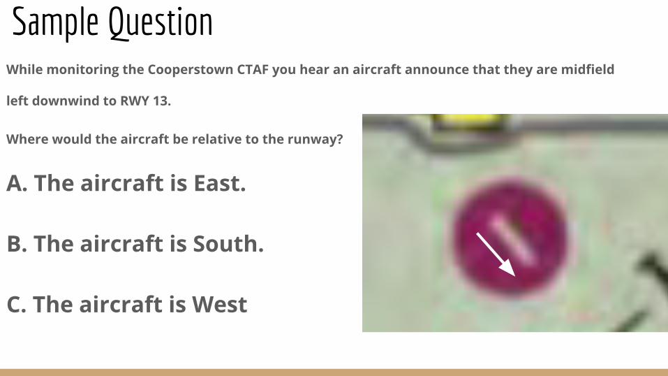
Sample QuestionWhile monitoring the Cooperstown CTAF you hear an aircraft announce that they are midfield
left downwind to RWY 13.
Where would the aircraft be relative to the runway?
A. The aircraft is East.
B. The aircraft is South.
C. The aircraft is West
Sample QuestionWhile monitoring the Cooperstown CTAF you hear an aircraft announce that they are midfield
left downwind to RWY 13.
Where would the aircraft be relative to the runway?
A. The aircraft is East.
B. The aircraft is South.
C. The aircraft is West
Sample QuestionWhile monitoring the Cooperstown CTAF you hear an aircraft announce that they are midfield
left downwind to RWY 13.
Where would the aircraft be relative to the runway?
A. The aircraft is East.
B. The aircraft is South.
C. The aircraft is West
Sample QuestionWhile monitoring the Cooperstown CTAF you hear an aircraft announce that they are midfield
left downwind to RWY 13.
Where would the aircraft be relative to the runway?
A. The aircraft is East.
B. The aircraft is South.
C. The aircraft is West
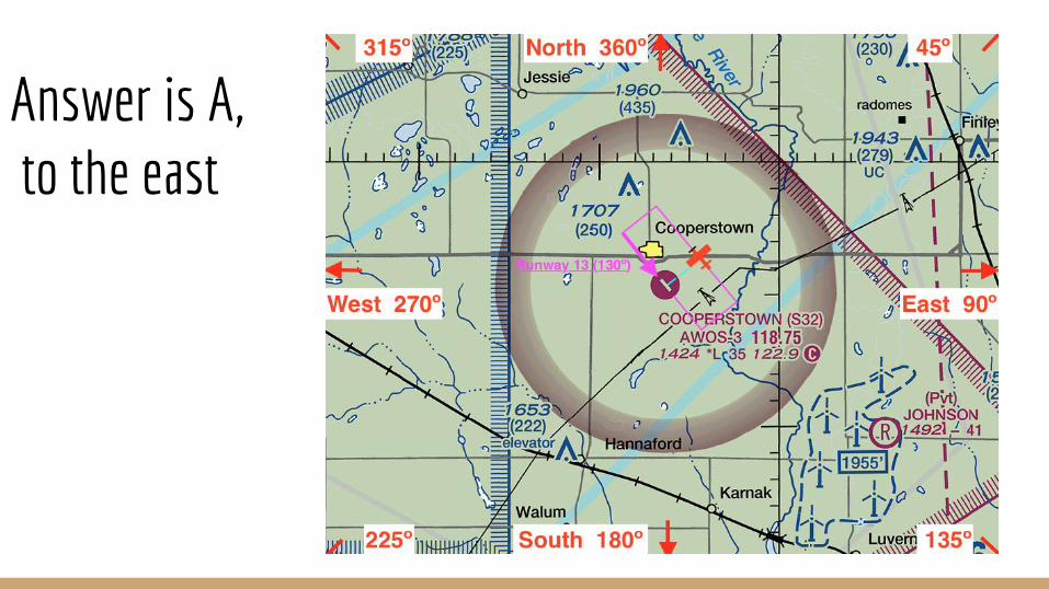
Answer is A, to the east
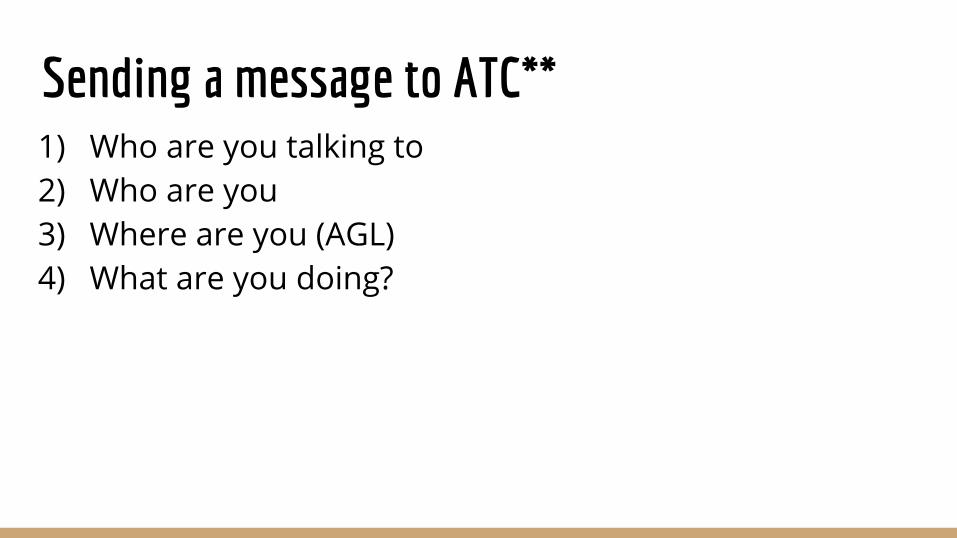
Sending a message to ATC**1) Who are you talking to 2) Who are you3) Where are you (AGL)4) What are you doing?
Aeronautical Decision Making
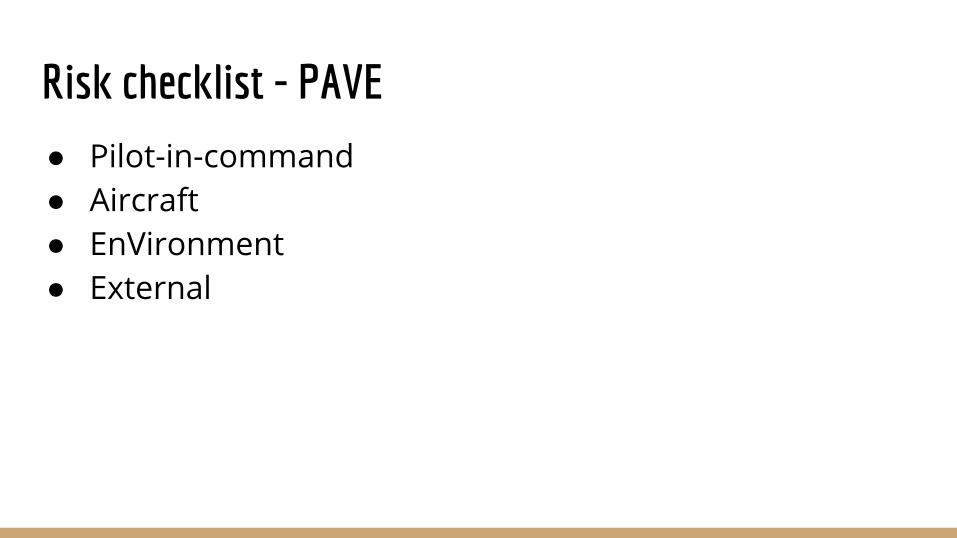
Risk checklist - PAVE
● Pilot-in-command● Aircraft● EnVironment● External

Stress Management ● Environmental ● Physiological● Psychological
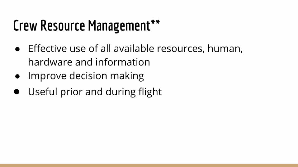
Crew Resource Management**
● Effective use of all available resources, human, hardware and information
● Improve decision making● Useful prior and during flight
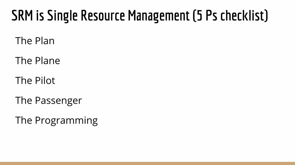
SRM is Single Resource Management (5 Ps checklist)
The Plan
The Plane
The Pilot
The Passenger
The Programming
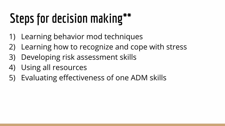
Steps for decision making**1) Learning behavior mod techniques2) Learning how to recognize and cope with stress3) Developing risk assessment skills4) Using all resources5) Evaluating effectiveness of one ADM skills
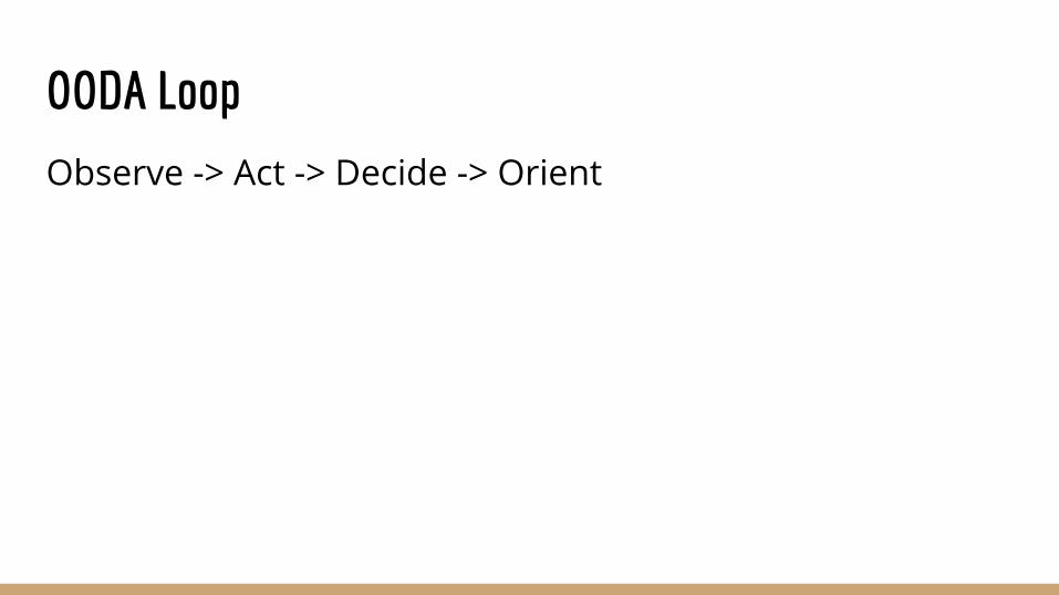
OODA Loop
Observe -> Act -> Decide -> Orient
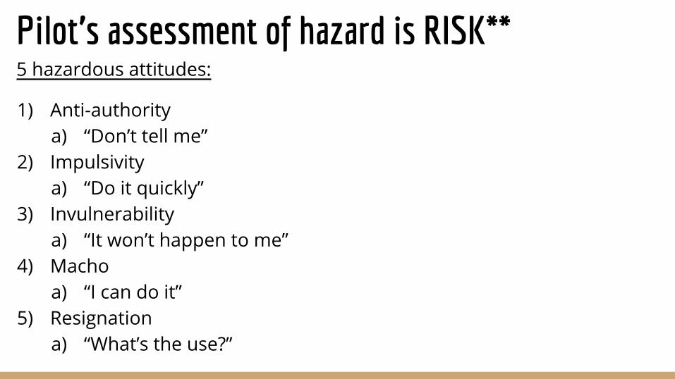
Pilot’s assessment of hazard is RISK**5 hazardous attitudes:
1) Anti-authority a) “Don’t tell me”
2) Impulsivitya) “Do it quickly”
3) Invulnerabilitya) “It won’t happen to me”
4) Machoa) “I can do it”
5) Resignationa) “What’s the use?”
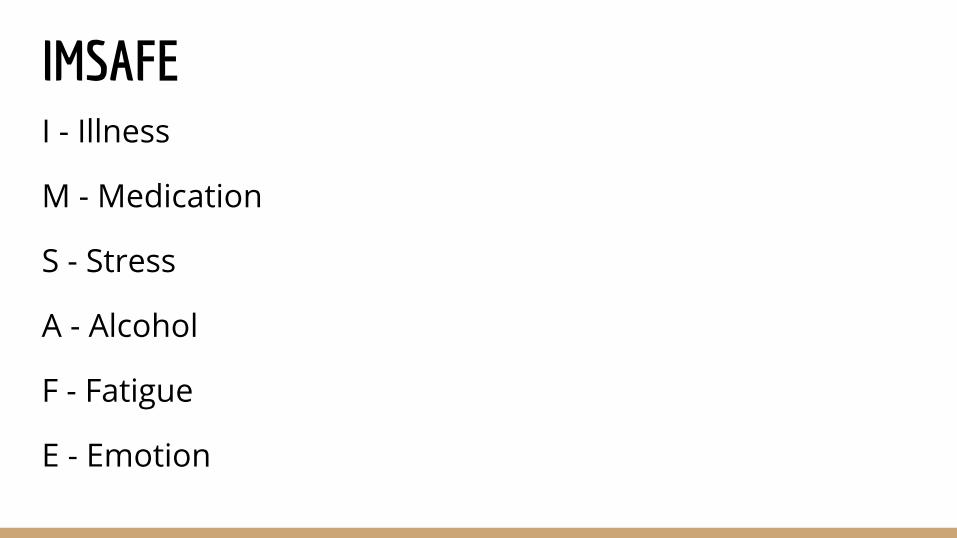
IMSAFEI - Illness
M - Medication
S - Stress
A - Alcohol
F - Fatigue
E - Emotion
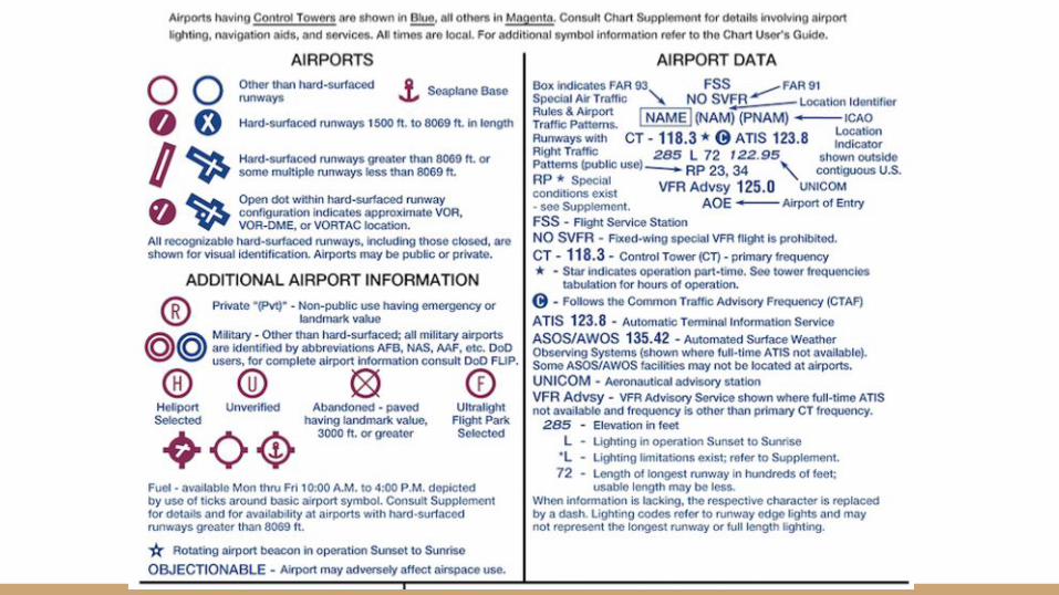
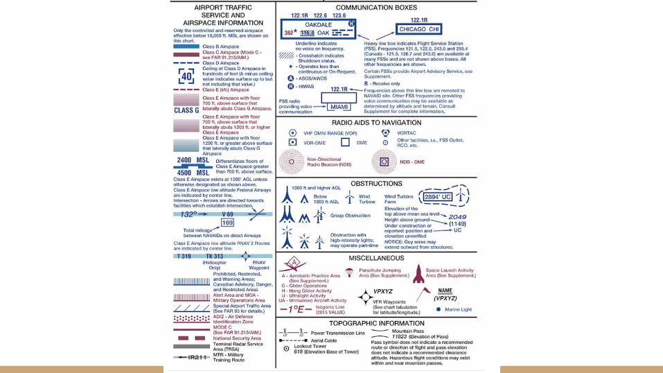
Sectional Chartshttps://cessnachick.com/525-2/
https://skyvector.com/
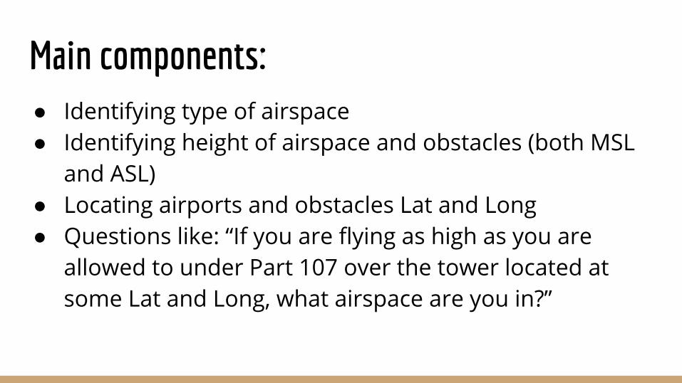
Main components:● Identifying type of airspace● Identifying height of airspace and obstacles (both MSL
and ASL)● Locating airports and obstacles Lat and Long● Questions like: “If you are flying as high as you are
allowed to under Part 107 over the tower located at some Lat and Long, what airspace are you in?”
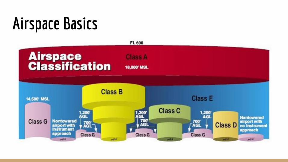
Airspace Basics
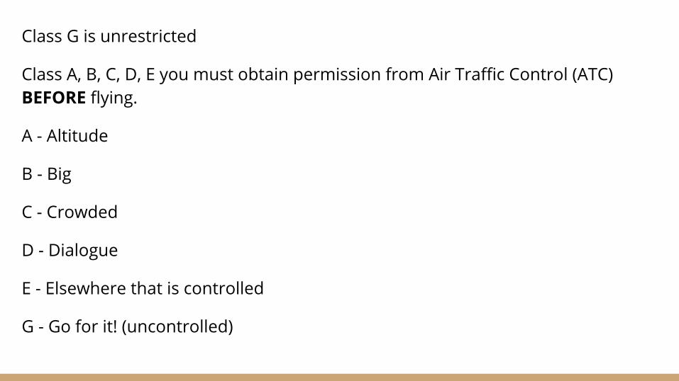
Class G is unrestricted
Class A, B, C, D, E you must obtain permission from Air Traffic Control (ATC) BEFORE flying.
A - Altitude
B - Big
C - Crowded
D - Dialogue
E - Elsewhere that is controlled
G - Go for it! (uncontrolled)
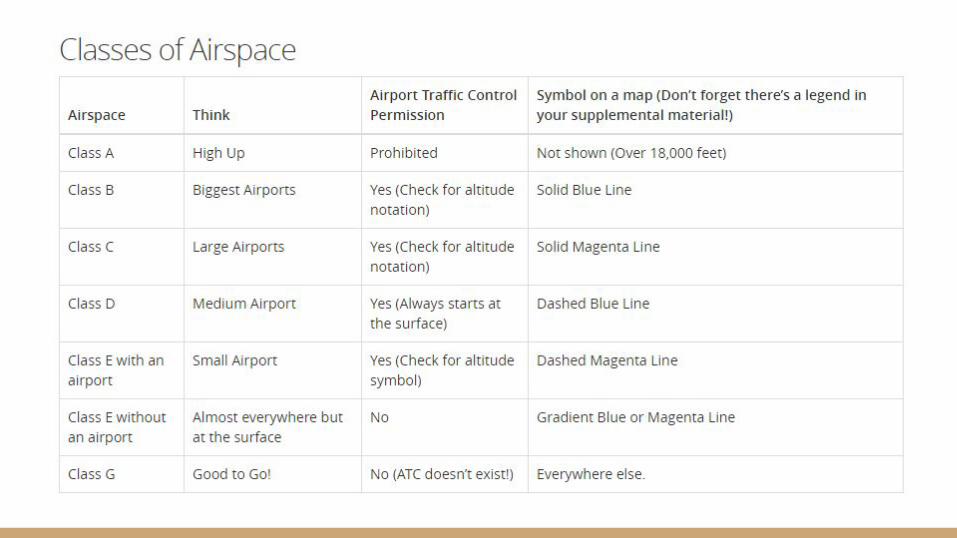
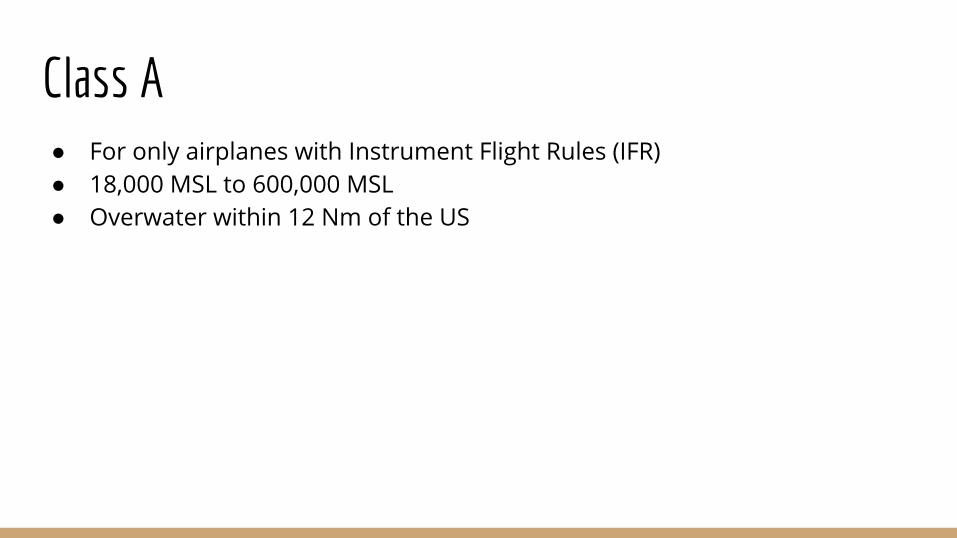
Class A● For only airplanes with Instrument Flight Rules (IFR)● 18,000 MSL to 600,000 MSL● Overwater within 12 Nm of the US
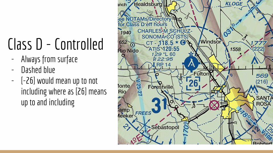
Class D - Controlled- Always from surface- Dashed blue- [-26] would mean up to not
including where as [26] means up to and including
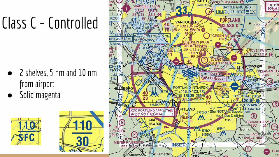
Class C - Controlled
● 2 shelves, 5 nm and 10 nm from airport
● Solid magenta
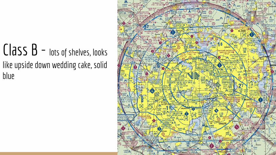
Class B - lots of shelves, looks like upside down wedding cake, solid blue
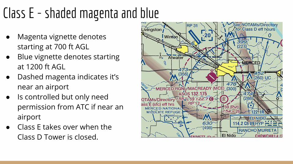
Class E - shaded magenta and blue
● Magenta vignette denotes starting at 700 ft AGL
● Blue vignette denotes starting at 1200 ft AGL
● Dashed magenta indicates it’s near an airport
● Is controlled but only need permission from ATC if near an airport
● Class E takes over when the Class D Tower is closed.
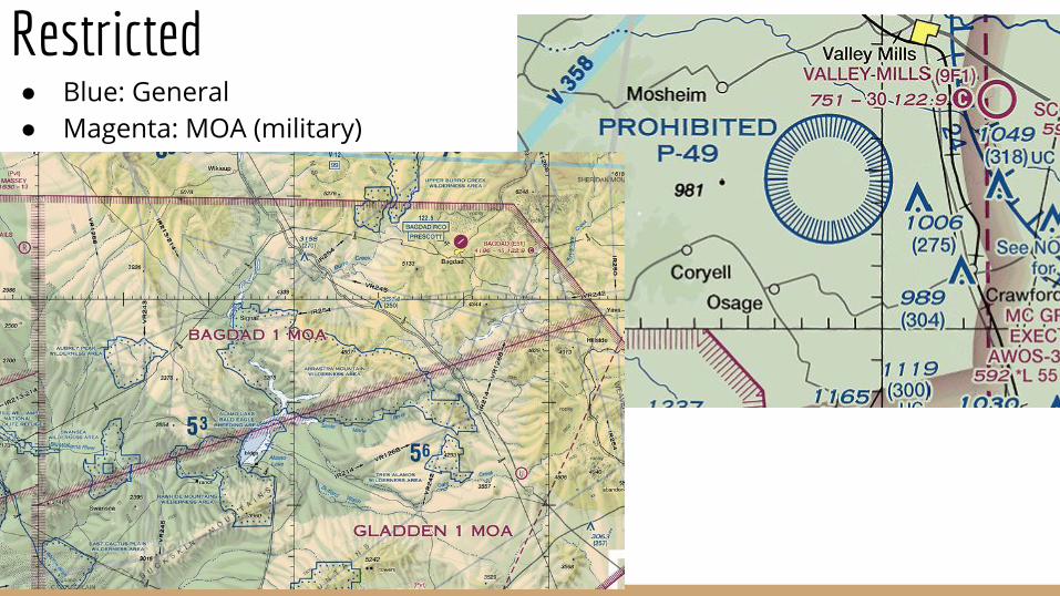
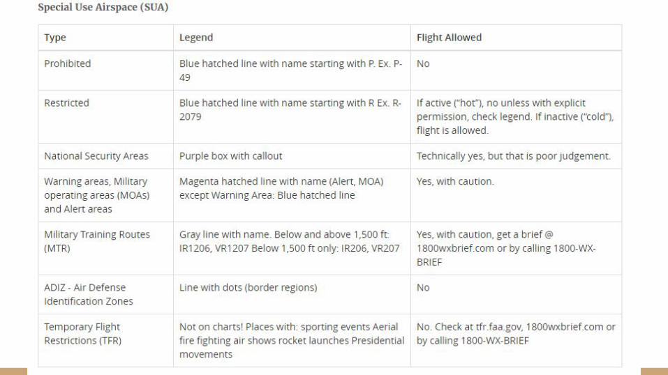
Restricted● Blue: General● Magenta: MOA (military)
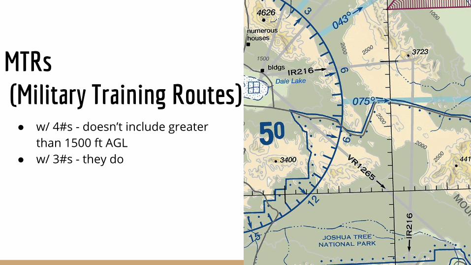
MTRs (Military Training Routes) ● w/ 4#s - doesn’t include greater
than 1500 ft AGL● w/ 3#s - they do
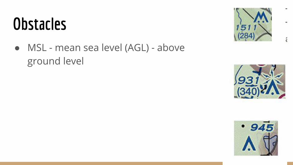
Obstacles● MSL - mean sea level (AGL) - above
ground level
Now let’s go over some sample questions together:https://3dr.com/faa/drone-practice-tests/
Now what- Sign up - call: 800-947-4228 (CATS)- Take 3DR practice test and look at 3DR study guide
https://3dr.com/faa/drone-practice-tests/
- Watch Youtube videos if you are still confused on the material

Some Youtube Videos (There are many more available)
https://www.youtube.com/watch?v=de1JxnfzZNA&list=PLVRVuxlBc2AFJwkB-GoiXrAObY9lPAM4q&index=20
https://www.youtube.com/watch?v=ovIvhBFa6yY&list=PLVRVuxlBc2AFJwkB-GoiXrAObY9lPAM4q&index=24
https://www.youtube.com/watch?v=v2HNTMJMtZg&list=PLVRVuxlBc2AFJwkB-GoiXrAObY9lPAM4q&index=25
https://www.youtube.com/watch?v=93e5k8122qo
https://www.youtube.com/watch?v=ObNZr26Yz48
https://www.youtube.com/watch?v=QkSXec0aEb0
https://www.youtube.com/watch?v=qH4KR_T98Nk
https://www.youtube.com/watch?v=_80mGHl_gFo
https://www.youtube.com/watch?v=6ITjUfl80bs
What to bring● Valid ID● Calculator (the simple kind!)● They will provide you with pencil and paper