Embed Size (px)
Citation preview
Company Profile www.foresightsurveyors.com
Table of Contents
Managing Director’s Message ................................................................................................... 2
Company Overview ..................................................................................................................... 3 Mission Statement ..................................................................................................................................... 3 Our Vision .................................................................................................................................................. 3 Our Corporate Philosophy ......................................................................................................................... 4
Our Team ..................................................................................................................................... 4 Executive Management ............................................................................................................................. 5 Our Work Process ...................................................................................................................................... 5 Employee Training & Development ........................................................................................................... 6
Technology .................................................................................................................................. 6 Unmanned Aerial Vehicle (UAV) Mapping ................................................................................................. 8
Services ....................................................................................................................................... 9
Clients ........................................................................................................................................ 10
Highlighted Portfolio ................................................................................................................ 11
Partners ..................................................................................................................................... 13 ComNav Technologies Ltd., China ......................................................................................................... 13 CDE Consulting, Maldives ....................................................................................................................... 13 Aeromao, Canada .................................................................................................................................... 13
Location & Contact Details ...................................................................................................... 14

Foresight Surveyors (Pvt) Ltd.– Company Profile | Profile last updated on 2/20/16 1:43:22 PM www.foresightsurveyors.com - (Company Registration No. C-0068/2014) - Page 2 of 14
Managing Director’s Message Since the start of our service in 2011, we have being thriving to
bring the best service in the country and our pursuit for
excellence is the motivation force that drives our company to
grow and gain the trust of our loyal clients.
Equipped with the best technology we provide comprehensive
range of survey, which includes topographical survey,
bathymetry survey and engineering survey.
Today again the company is proud to star its newest service,
UAV mapping (Unmanned Aerial Vehicle mapping) the first
company to introduce this service to MALDIVES.
Foresight Surveyors with its team of professionals are the key to
the companies’ impressive growth during this short period of
time. And our sincere thanks to our clients for their support. We
are truly committed to provide you with professional service “for
all your surveyors’ job”.
Thank you.
Ahmed Nuaim
Managing Director
Foresight Surveyors (Pvt) Ltd.– Company Profile | Profile last updated on 2/20/16 1:43:22 PM www.foresightsurveyors.com - (Company Registration No. C-0068/2014) - Page 3 of 14
Company Overview FORESIGHT SURVEYORS (Pvt) Ltd. is a privately held company founded as a local investment
in the year 2011, and registered under the Companies act no. 10/96 of the Republic of Maldives
in the year 2014. Our company is headquartered in the capital island Malé city. We are engaged
in the trade of providing a comprehensive range of surveying services, using traditional
techniques and modern technologies to produce well-presented and accurate data.
FORESIGHT SURVEYORS consists of a well-experienced team of registered surveyors and a
professional management team. Our team has the technical expertise, equipment and the
technology to deliver the best solutions to our clients; and to our clients’ our company is known to
be reliable, delivers projects on time and within a agreed budget, and adheres to the highest
ethical industry standards.
MISSION STATEMENT
Our company roadmap begins with our mission,
which is dynamic and enduring. It declares our
purpose and serves as the principle against
which we weigh our actions and decisions. It is
to host “Survey” oriented services and products
in Maldives that offers the latest in the market.
We are committed to providing our clients
with the very best. Our aim is to complete
every project to its finest standards within
the agreed timeframe by both parties. In
deliverance of our services, we also
endeavor to give a prospective contribution
to the surveying field in Maldives by
investing in the latest technologies, and
training our employees accordingly.
OUR VISION
Our vision serves as the framework for our
roadmap and guides every aspect of our
business by defining what we need to
accomplish in order to continue achieving
sustainable and quality growth. We are
determined to be the preferred surveying and
survey consultancy service provider in the
country.
We are determined to be the preferred
Surveying and Survey Consultancy service
provider in the Maldives. Our team thrives
for delivering excellent service to our clients
on time and on budget.
Foresight Surveyors (Pvt) Ltd.– Company Profile | Profile last updated on 2/20/16 1:43:22 PM www.foresightsurveyors.com - (Company Registration No. C-0068/2014) - Page 4 of 14
OUR CORPORATE PHILOSOPHY
Our philosophy is simple. We will:
• Provide our services that are the very best available in the market and will never compromise on
service standards on any circumstances;
• Deliver a level of service that exceeds our clients’ expectations;
• Develop and embrace new technologies and techniques to the advantage of our clients and our
business;
• Ensure the company’s services conserve the integrity of the environment;
• Educate & train the youth interested in this growing field, thereby contributing to the community-
at-large.
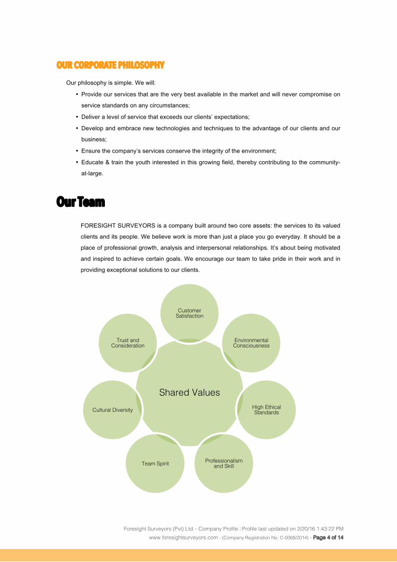
Our Team FORESIGHT SURVEYORS is a company built around two core assets: the services to its valued
clients and its people. We believe work is more than just a place you go everyday. It should be a
place of professional growth, analysis and interpersonal relationships. It’s about being motivated
and inspired to achieve certain goals. We encourage our team to take pride in their work and in
providing exceptional solutions to our clients.
Shared Values!
Customer Satisfaction!
Environmental Consciousness!
High Ethical Standards!
Professionalism and Skill!Team Spirit!
Cultural Diversity!
Trust and Consideration!
Foresight Surveyors (Pvt) Ltd.– Company Profile | Profile last updated on 2/20/16 1:43:22 PM www.foresightsurveyors.com - (Company Registration No. C-0068/2014) - Page 5 of 14
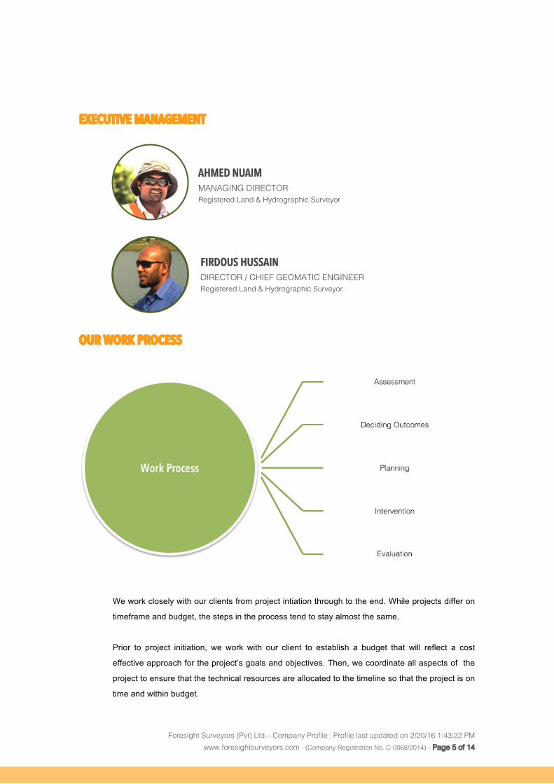
EXECUTIVE MANAGEMENT
OUR WORK PROCESS
We work closely with our clients from project intiation through to the end. While projects differ on
timeframe and budget, the steps in the process tend to stay almost the same.
Prior to project initiation, we work with our client to establish a budget that will reflect a cost
effective approach for the project’s goals and objectives. Then, we coordinate all aspects of the
project to ensure that the technical resources are allocated to the timeline so that the project is on
time and within budget.
AHMED NUAIM MANAGING DIRECTOR!Registered Land & Hydrographic Surveyor!
FIRDOUS HUSSAIN DIRECTOR / CHIEF GEOMATIC ENGINEER!Registered Land & Hydrographic Surveyor!
Foresight Surveyors (Pvt) Ltd.– Company Profile | Profile last updated on 2/20/16 1:43:22 PM www.foresightsurveyors.com - (Company Registration No. C-0068/2014) - Page 6 of 14
EMPLOYEE TRAINING & DEVELOPMENT
Employee training and development is essential for both new and existing businesses. In order for an
employee to perform their job well, it is important for us to give them the training and tools they need to be
responsible productive team members. At FORESIGHT SURVEYORS we conduct workshops & on-site
training programs for all our employees. Our company also attends conferences and seminars to keep our
employees up-to-date in new techniques and technologies in their respective field of work.
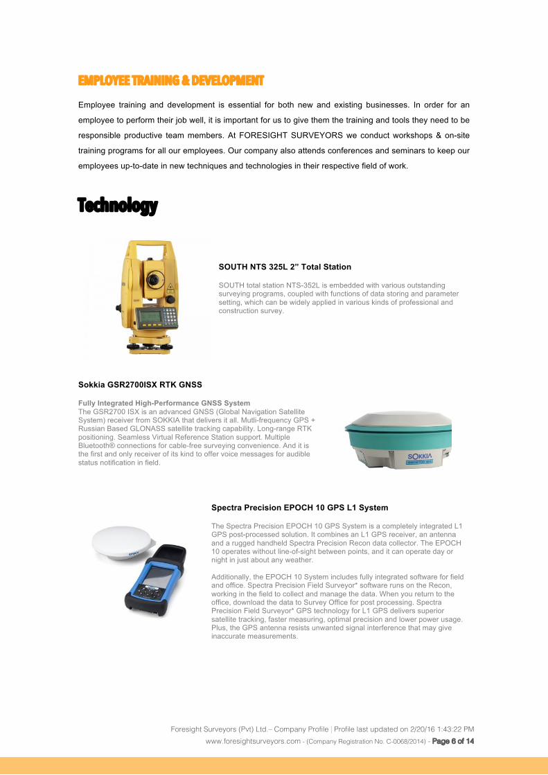
Technology SOUTH NTS 325L 2” Total Station SOUTH total station NTS-352L is embedded with various outstanding surveying programs, coupled with functions of data storing and parameter setting, which can be widely applied in various kinds of professional and construction survey.
Sokkia GSR2700ISX RTK GNSS Fully Integrated High-Performance GNSS System The GSR2700 ISX is an advanced GNSS (Global Navigation Satellite System) receiver from SOKKIA that delivers it all. Mutli-frequency GPS + Russian Based GLONASS satellite tracking capability. Long-range RTK positioning. Seamless Virtual Reference Station support. Multiple Bluetooth® connections for cable-free surveying convenience. And it is the first and only receiver of its kind to offer voice messages for audible status notification in field.
Spectra Precision EPOCH 10 GPS L1 System The Spectra Precision EPOCH 10 GPS System is a completely integrated L1 GPS post-processed solution. It combines an L1 GPS receiver, an antenna and a rugged handheld Spectra Precision Recon data collector. The EPOCH 10 operates without line-of-sight between points, and it can operate day or night in just about any weather. Additionally, the EPOCH 10 System includes fully integrated software for field and office. Spectra Precision Field Surveyor* software runs on the Recon, working in the field to collect and manage the data. When you return to the office, download the data to Survey Office for post processing. Spectra Precision Field Surveyor* GPS technology for L1 GPS delivers superior satellite tracking, faster measuring, optimal precision and lower power usage. Plus, the GPS antenna resists unwanted signal interference that may give inaccurate measurements.
Foresight Surveyors (Pvt) Ltd.– Company Profile | Profile last updated on 2/20/16 1:43:22 PM www.foresightsurveyors.com - (Company Registration No. C-0068/2014) - Page 7 of 14
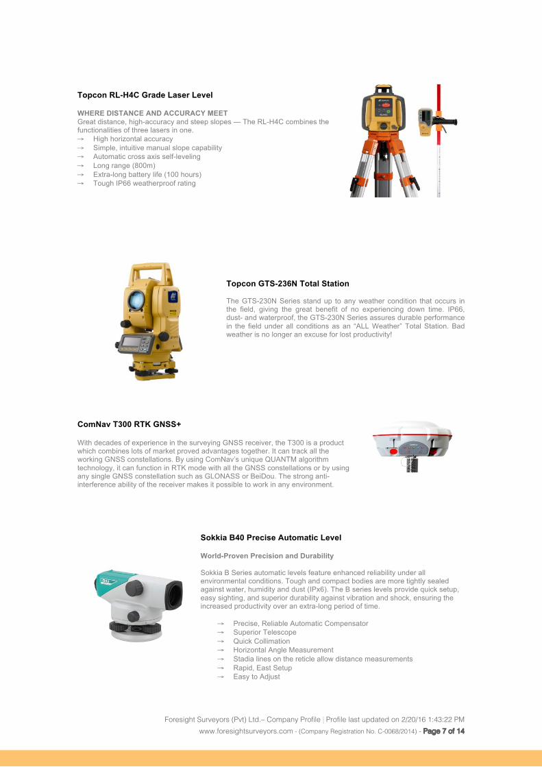
Topcon RL-H4C Grade Laser Level WHERE DISTANCE AND ACCURACY MEET Great distance, high-accuracy and steep slopes — The RL-H4C combines the functionalities of three lasers in one. → High horizontal accuracy → Simple, intuitive manual slope capability → Automatic cross axis self-leveling → Long range (800m) → Extra-long battery life (100 hours) → Tough IP66 weatherproof rating
Topcon GTS-236N Total Station The GTS-230N Series stand up to any weather condition that occurs in the field, giving the great benefit of no experiencing down time. IP66, dust- and waterproof, the GTS-230N Series assures durable performance in the field under all conditions as an “ALL Weather” Total Station. Bad weather is no longer an excuse for lost productivity!
ComNav T300 RTK GNSS+ With decades of experience in the surveying GNSS receiver, the T300 is a product which combines lots of market proved advantages together. It can track all the working GNSS constellations. By using ComNav’s unique QUANTM algorithm technology, it can function in RTK mode with all the GNSS constellations or by using any single GNSS constellation such as GLONASS or BeiDou. The strong anti-interference ability of the receiver makes it possible to work in any environment.
Sokkia B40 Precise Automatic Level World-Proven Precision and Durability Sokkia B Series automatic levels feature enhanced reliability under all environmental conditions. Tough and compact bodies are more tightly sealed against water, humidity and dust (IPx6). The B series levels provide quick setup, easy sighting, and superior durability against vibration and shock, ensuring the increased productivity over an extra-long period of time.
→ Precise, Reliable Automatic Compensator → Superior Telescope → Quick Collimation → Horizontal Angle Measurement → Stadia lines on the reticle allow distance measurements → Rapid, East Setup → Easy to Adjust
Foresight Surveyors (Pvt) Ltd.– Company Profile | Profile last updated on 2/20/16 1:43:22 PM www.foresightsurveyors.com - (Company Registration No. C-0068/2014) - Page 8 of 14
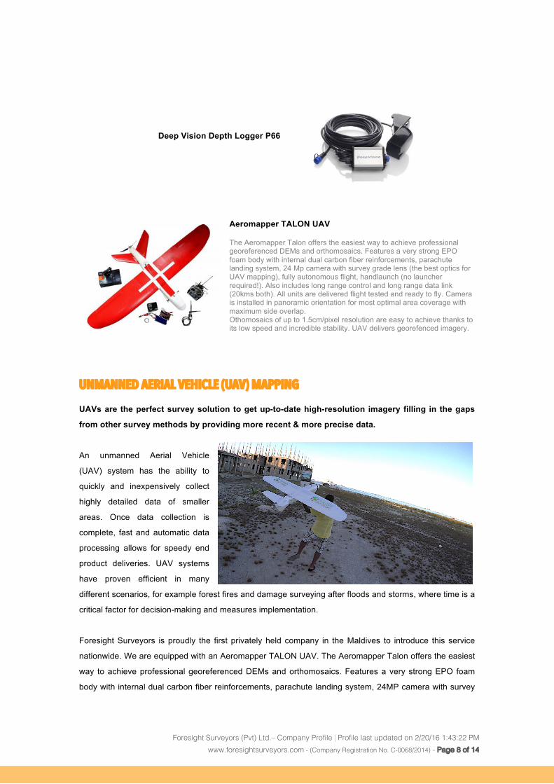
Deep Vision Depth Logger P66
Aeromapper TALON UAV The Aeromapper Talon offers the easiest way to achieve professional georeferenced DEMs and orthomosaics. Features a very strong EPO foam body with internal dual carbon fiber reinforcements, parachute landing system, 24 Mp camera with survey grade lens (the best optics for UAV mapping), fully autonomous flight, handlaunch (no launcher required!). Also includes long range control and long range data link (20kms both). All units are delivered flight tested and ready to fly. Camera is installed in panoramic orientation for most optimal area coverage with maximum side overlap. Othomosaics of up to 1.5cm/pixel resolution are easy to achieve thanks to its low speed and incredible stability. UAV delivers georefenced imagery.
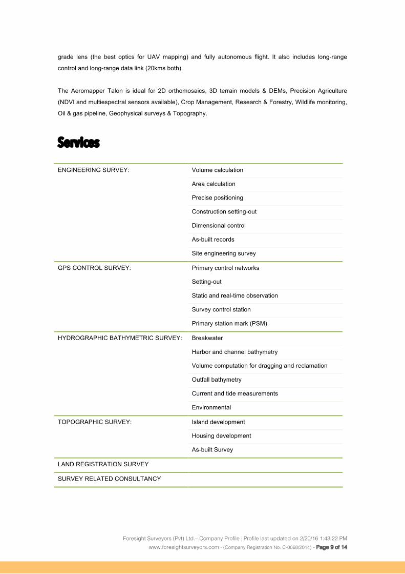
UNMANNED AERIAL VEHICLE (UAV) MAPPING
UAVs are the perfect survey solution to get up-to-date high-resolution imagery filling in the gaps
from other survey methods by providing more recent & more precise data.
An unmanned Aerial Vehicle
(UAV) system has the ability to
quickly and inexpensively collect
highly detailed data of smaller
areas. Once data collection is
complete, fast and automatic data
processing allows for speedy end
product deliveries. UAV systems
have proven efficient in many
different scenarios, for example forest fires and damage surveying after floods and storms, where time is a
critical factor for decision-making and measures implementation.
Foresight Surveyors is proudly the first privately held company in the Maldives to introduce this service
nationwide. We are equipped with an Aeromapper TALON UAV. The Aeromapper Talon offers the easiest
way to achieve professional georeferenced DEMs and orthomosaics. Features a very strong EPO foam
body with internal dual carbon fiber reinforcements, parachute landing system, 24MP camera with survey
Foresight Surveyors (Pvt) Ltd.– Company Profile | Profile last updated on 2/20/16 1:43:22 PM www.foresightsurveyors.com - (Company Registration No. C-0068/2014) - Page 9 of 14
grade lens (the best optics for UAV mapping) and fully autonomous flight. It also includes long-range
control and long-range data link (20kms both).
The Aeromapper Talon is ideal for 2D orthomosaics, 3D terrain models & DEMs, Precision Agriculture
(NDVI and multiespectral sensors available), Crop Management, Research & Forestry, Wildlife monitoring,
Oil & gas pipeline, Geophysical surveys & Topography.
Services
ENGINEERING SURVEY: Volume calculation
Area calculation
Precise positioning
Construction setting-out
Dimensional control
As-built records
Site engineering survey
GPS CONTROL SURVEY: Primary control networks
Setting-out
Static and real-time observation
Survey control station
Primary station mark (PSM)
HYDROGRAPHIC BATHYMETRIC SURVEY: Breakwater
Harbor and channel bathymetry
Volume computation for dragging and reclamation
Outfall bathymetry
Current and tide measurements
Environmental
TOPOGRAPHIC SURVEY: Island development
Housing development
As-built Survey
LAND REGISTRATION SURVEY
SURVEY RELATED CONSULTANCY

Foresight Surveyors (Pvt) Ltd.– Company Profile | Profile last updated on 2/20/16 1:43:22 PM www.foresightsurveyors.com - (Company Registration No. C-0068/2014) - Page 10 of 14
Clients These are few of our valued-clients we have worked with. Our team thrives to deliver excellent services to
our clients on time and on budget.
Foresight Surveyors (Pvt) Ltd.– Company Profile | Profile last updated on 2/20/16 1:43:22 PM www.foresightsurveyors.com - (Company Registration No. C-0068/2014) - Page 11 of 14
Highlighted Portfolio A.A Rasdhoo island detail Topography Survey
GMR Ibrahim Nasir International Airport Volumetric Survey
K. Thilafushi Causeway set-out Survey
K. Guraidhoo Island detail topography survey for sewer network design
Detail Bathymetric Survey of K. Tholhimarahuraa
Seabed sediment investigation of K. Tholhimarahuraa
As-built Survey of Thulusdhoo Island Guesthouse land plot
Channel Bathymetry of K. Gaafaru
Strata title survey for Gulhifalhu residential zone
Boundary setting-out and Boundary Despite Survey of MWSC Gulhifalhu land
As-built survey of Gulhifalhu Island
New Boundary Survey of Gulhifalhu Island
Detail Bathymetric for N. Dhigurah
As-built Survey of Dh. Vilureef
Boundary Survey of Four Season Kudahura
Volumetric Survey for Sand Stockpiles Hulhumale’ Phase 2
Land Registration Survey
• Diamond Thundufushi Beach and Water Villas
• Diamond Athuruga Beach and Water Villas
• Kanuhuraa Maldives
• Angaga Island Resort and Spa
• Thulhagiri Island Resort and Spa
• Sonevafushi
• M. Madifushi
• Th. Maalefushi
• Th. Lavah-dhoo
• Dh. Aluvifushi
• N. Dhigurah
• K. Sifavaru (UTF)
• B. Dhigufaruvinagandu
• N. Thaburudhufushi
Foresight Surveyors (Pvt) Ltd.– Company Profile | Profile last updated on 2/20/16 1:43:22 PM www.foresightsurveyors.com - (Company Registration No. C-0068/2014) - Page 12 of 14
Topographic Survey
• Ha. Dhapparu
• N. Thaburudhufushi
• N. Maakurandhoo
• B. Vovah
• R. Maamunagau
• R. Dhigali
• Th. Lavah-dhoo
• Dh. Aluvifushi
• N. Dhigurah
• K. Sifavaru (UTF)
• B. Dhigufaruvinagandu
• Ga. Maanagala
• R. Faarufushi
• R. Fasmendhoo
• R. Dhigali
• K. Vahbohuraa
• Th. Buruni
• Th. Madifushi
• Haa Dhaalu. Naykurendhoo
• N. Medhufaru
Survey Support and Consultancy for Sonevafushi
As-built Survey for One and Only Reethirah
Revetment Survey for
• Dhaalu Meedhoo
• B. Eydhafushi
• Dh. Kudahuvadhoo
Foresight Surveyors (Pvt) Ltd.– Company Profile | Profile last updated on 2/20/16 1:43:22 PM www.foresightsurveyors.com - (Company Registration No. C-0068/2014) - Page 13 of 14
Partners
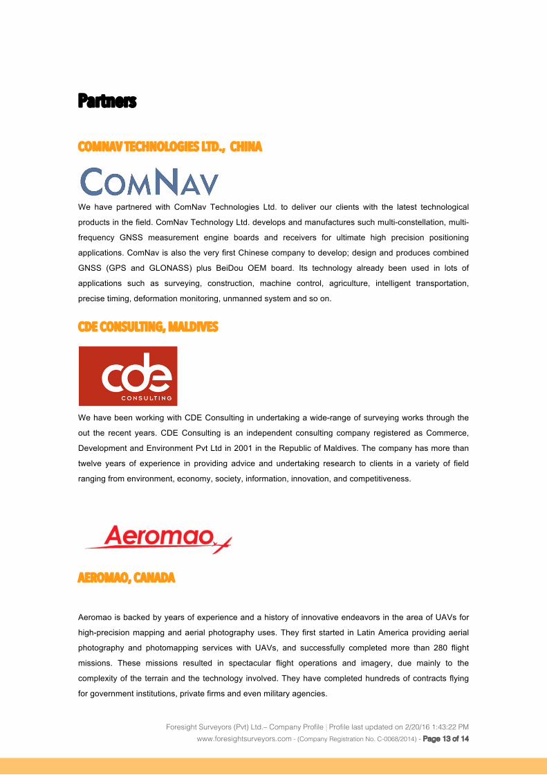
COMNAV TECHNOLOGIES LTD., CHINA
We have partnered with ComNav Technologies Ltd. to deliver our clients with the latest technological
products in the field. ComNav Technology Ltd. develops and manufactures such multi-constellation, multi-
frequency GNSS measurement engine boards and receivers for ultimate high precision positioning
applications. ComNav is also the very first Chinese company to develop; design and produces combined
GNSS (GPS and GLONASS) plus BeiDou OEM board. Its technology already been used in lots of
applications such as surveying, construction, machine control, agriculture, intelligent transportation,
precise timing, deformation monitoring, unmanned system and so on.
CDE CONSULTING, MALDIVES
We have been working with CDE Consulting in undertaking a wide-range of surveying works through the
out the recent years. CDE Consulting is an independent consulting company registered as Commerce,
Development and Environment Pvt Ltd in 2001 in the Republic of Maldives. The company has more than
twelve years of experience in providing advice and undertaking research to clients in a variety of field
ranging from environment, economy, society, information, innovation, and competitiveness.
AEROMAO, CANADA
Aeromao is backed by years of experience and a history of innovative endeavors in the area of UAVs for
high-precision mapping and aerial photography uses. They first started in Latin America providing aerial
photography and photomapping services with UAVs, and successfully completed more than 280 flight
missions. These missions resulted in spectacular flight operations and imagery, due mainly to the
complexity of the terrain and the technology involved. They have completed hundreds of contracts flying
for government institutions, private firms and even military agencies.
Foresight Surveyors (Pvt) Ltd.– Company Profile | Profile last updated on 2/20/16 1:43:22 PM www.foresightsurveyors.com - (Company Registration No. C-0068/2014) - Page 14 of 14
Location & Contact Details
FORESIGHT SURVEYORS (PVT) LTD.
Raanee Villa, Machangolhi,
Nikahgas Magu, Male’ City,
20162, Republic of Maldives
URL: www.foresightsurveyors.com
General Inquires
Telephone: +960 333 0567 / +960 7567299
Fax: +960 333 0567
Email: [email protected]
Management
Mr. Ahmed Nuaim
Managing Director
(Registered Land & Hydrographic Surveyor)
Email: [email protected]
Mr. Firduos Hussain
Chief Geomatic Engineer
(Registered Land & Hydrographic Surveyor)
Email: [email protected]
Mr. Sikandar Kamaldeen (Siku)
Business Development Manager
Email: [email protected]