Embed Size (px)
Citation preview

13228169.4.2
Notice of Intent
Former Harbor Fuel Tank Farm Decommissioning Project Nantucket, MA
PREPARED FOR Winthrop Nantucket Nominee Trust c/o Peter Braverman, Trustee Two Liberty Square, 9th Floor Boston, MA 02109
PREPARED BY
101 Walnut Street PO Box 9151 Watertown, MA 02471 617.924.1770
May 2021

13228169.4.2
Table of Contents
Notice of Intent Forms › WPA Form 3› Fee Transmittal Form› Copies of Filing Fee Checks
Notice of Intent Figures › Figure 1 – USGS Locus Map› Figure 2 – Aerial Map› Figure 3 – NHESP Map› Figure 4 – FEMA Map› Figure 5 – Site Layout
Attachment A – Notice of Intent Narrative Introduction .................................................................................................................................................. 1 Site Description ........................................................................................................................................... 2 Work Description ........................................................................................................................................ 4 Mitigation Measures ................................................................................................................................. 5 Stormwater Management ....................................................................................................................... 8 Regulatory Compliance ............................................................................................................................ 8 Summary ........................................................................................................................................................ 9
Attachment B – Abutter Notification Attachment C – Stormwater Memorandum Attachment D – Permitting Plans

\\vhb\gbl\proj\Wat-EV\07924.11 Nantucket Tank Farm\Reports\NOI\CL - Nantucket Tank Farm.docx
May 20, 2021
Ref: 07924.11
Mrs. Ashley Erisman, Chair Nantucket Conservation Commission 2 Bathing Beach Road Nantucket, Massachusetts 02554
Re: Notice of Intent: Former Harbor Fuel Tank Farm Decommissioning Nantucket, Massachusetts
Dear Mrs. Erisman,
On behalf of Winthrop Nantucket Nominee Trust and c/o Peter Braverman, Trustee (the Applicants), Vanasse Hangen Brustlin, Inc. (VHB) respectfully submits this Notice of Intent (NOI) for the Former Harbor Fuel Tank Farm Decommissioning Project in Nantucket, Massachusetts. The Project consists of the demolition and removal of above ground petroleum storage tanks, related piping and meters, removal of concrete structures and pads, and further site investigation
Wetland resource areas in the vicinity of the site include Land Subject to Coastal Storm Flowage (LSCSF) and Coastal Bank, both of which are regulated under the Wetlands Protection Act and the Nantucket Wetland Protection Regulations. Proposed work will occur only within the previously disturbed LSCSF and the 100-foot buffer zone to Coastal Bank. No work is proposed in the locally regulated 25-foot and 50-foot buffer zones. The full scope of work is described in the attached NOI narrative.
A check made payable to the Town of Nantucket in the amount of $262.50 is enclosed for the payment of the local share of the state filing fee. A check made payable to the Commonwealth of Massachusetts in the amount of $237.50 has been sent directly to the DEP Lock Box. Also enclosed are separate checks in the amounts of $25 for the Bylaw filing fee, $200 for the Reviewer fee, and $201.07 for the Advertising fee.
In compliance with the Wetlands Protection Act and the Nantucket Bylaw, notification to abutters within 100 feet of the project regarding this NOI has been made by certified, return-receipt mail on this date.

Nantucket Conservation Commission May 20, 2021 Page 2
\\vhb\gbl\proj\Wat-EV\07924.11 Nantucket Tank Farm\Reports\NOI\CL - Nantucket Tank Farm.docx\\vhb\gbl\proj\Wat-EV\07924.11 Nantucket Tank Farm\Reports\NOI\CL - Nantucket Tank Farm.docx
Please advertise this matter for public hearing at the Commission’s next scheduled meeting. Should you have any questions concerning this submittal, or require additional information please contact me at (617) 607-2 .
Very truly yours,
VANASSE HANGEN BRUSTLIN, INC.
cc: DEP Southeast Regional Office Winthrop Nantucket Nominee Trust c/o Peter Braverman, Trustee

Notice of Intent Forms
› WPA Form 3A› NOI Wetland Fee Transmittal Form› Copies of Filing Fee Checks

������������� �����������������������
��������� ��!! "���#$�%&##%
'�(��)*%�+� ,�,%-(.#% ��/�0(� � 12334
������5 � 4��2677", �����8��5 � 91�1"3":;
<�$�0*�=��> 42�7�� 8������=*���> 6"
2��00=������
?� �@� 5�= A�8���B�����
��C��!�,�D� �#%#& '���!�,�D� E&�F#&$�,
��A�8���B����� ;?,%G&A�,�,%-(.#%,A$?,##%&-�%
�$��=��8� ��!! %;A�?E#&%H�I-�&#J"%GC�AA&
��(��)*%�+� EA�%A, <������ $� 8�/�0(� � 12�1"
K��K���,5D'�� ��C�L ��#D��= �E��@��D��M<��!�+���K��0���D
7����0���)A+����
D����K������+���
��C��!�,�D� �#%#& '���!�,�D� E&�F#&$�,
��A�8���B����� ;?,%G&A�,�,%-(.#%,A$?,##%&-�%
�$��=��8� ��!! %;A�?E#&%H�I-�&#J"%GC�AA&
��(��)*%�+� EA�%A, <������ $� 8�/�0(� � 12�1"
K��K���,5D'�� ��C�L ��#D��= �E��@��D��M<��!�+���K��0���D
4�&�0��!������@��
��C��!�,�D� ;?��?�$ '���!�,�D� %�E#&
��A�8���B����� F�,���#G�,N#,E&-�%�?,J?,(�
�$��=��8� ��!! �1�;��,-%�%&##%J�AEAO"�3�
��(��)*%�+� ;�%#&%A;, <������ $� 8�/�0(� � 1249�
K��K���,5D'�� �:�P9:1P9:�� ��C�L ��#D��= ;%�'��MFGE���D
3�%���=;��C����� Q�5��D�����==)��!���� <��D,A?;��=�� C��%���!D����=C��DR�
��%���=C����� 311�11 '������C����� 279�31 ��(��)*%�+�C����� 2:2�31
:�N�����=�������S�!���0�����
S#$A�?%?A,�,S&#$AF��AC�EAF#N&A-,S�#%&A�#-$�%A&�N#%�,.�J&#��%#S�?�?,N�,S
$#%#&�J&#$AF��AC(A,(&#%#�%&-(%-&#��,S��S�J�,SC-&%G#&�?%#?,F#�%?N�%?A,�%%G#
CA&$#&G�&EA&C-#��%�,.C�&$?,,�,%-(.#%J$���##�%%�(G#S,A?,�&&�%?F#CA&(A$��#%#
;A&.S#�(&?�%?A,�
9���������%)0��
�� ���8=�C�D�=)G�D� 2� &�!� �����=�5' �@�!���
7� ��D��� �������S��@�+�)(��!!��8 4� (�DD�����=*?� 5!����=
3� S��T*���� :� -��=����!
9� (��!��=#�8�������8���5��5�� 6� �8���5=�5��Q�8�J����'�����!J<���!��)R
V�WW�XYZW���W[�\��� �����]����� �����
_����X����
E5���5�<&�!�5�������������P;��=�� !
`_�a�� bcd���X��������$�!!��K5!���!;��=�� !�������������$�N������7�Je41
���@� � ')$�!!S#��
$�!!S#�C�=�>�
�S#�%���!������>��29"�42
(��)*%�+��,�,%-(.#%
fghijklmnopoqrstuvqqtfw

�� ���������� � � ����
��������������������������������������������������������������������������������� � !"�� �#$�%�����&�����
!"�� �'��%������&(
�� )�� * ������+����������,������������������������������������-
#��.������/����
0�/�������������������"���������1�������-
23456789: ;34<=8>?>@28<: @3A55B: C3D2E<:
*F*�G HI� '�' �$
A3�A6??<=�J57<�K�L<M56=@<�N=<2�OPQ2@8M�R8<PQ5=2=9�K�Q<=P27<78S��T������U���V�"�������F�����������%��������V���������&-
����������T������U�������������W� ���X��������������������������������T������U�������T��������Y�������Z�����+
�������T��X+��� �����"�������F����
#��������"�������F����-�%[����� � !"�� �'$�W�� �'0+����������������+����[�����T���� �����"�������F����&
"�������F��� [�\����/������F������ /������"����������%������&
�� T��X
������������� #������������
�� T��������Y�������Z�����
����]�������� #���]��������
�� .����������Z�������������Z���,���
���[]�������� #���]��������
����������������������
�� T��������.����[������������
����]�������� #���]��������
��������������������������� $��������������������
�� �������.����[������������
����]��������
#�������������������������� ���������������������
�� "��������F���
���*������Z���,���%������&
#��Z������"��������F����%����X���& #'����W�1���������1�������1��������F��������
� ����W�*�,�����������������������
# ����W�F�������������
��������������"��������F������������������������������
�]��������
$��/������F������������"��������F���-
a2MM2@b6M<88M�c<Q2=8P<78�5?�d7e>=57P<782f
D=58<@8>57
T��������"�������/������W�Z������
gDN�h5=P�i�j�k58>@<�5?�O78<78!�����������Z�������/������F��!�l�.��������+�m$
/����������!���1I/-
!���1I/�����n-
�1I/�����������n-�#���$#
��o�,�-*F*�G HI�
pqrs�t�uv�w�x�yzy{|}~��{�{~p��������������������������

������������������ �������������������������� ������������� ��������������
�����������
������������������������������� ���������������������������������������� ��� ��
��!��������������������������������"�"������������"������#$����%��&& � ��� ��
'�(�������)������#���*�+,���'���(-)�������.����'�/
)������#�� ,�0�����1�"�����#�������� 1�"�����)�"����2����+������/
�� 3���$������1���#��� �����������0����� 4������������������ ����%
� 4����5�������������
������������
���� �����������$��
�� 6����6������ �����������0������(�������6����������7��(��������3���%� ����
�� (�������6������
������������ ���� �������� ����������2���
�� (�������3���
������������ ���� �����������������2���
�� (�������6��8�
�������������
$� )��8������������,����
������������
�� ,����-�����
������������ ������������������%���� %�����
�� 4����5����,����1����
������������
���� �����������$��
9� 4����(��������$�,��������
������������
8� :����)�� �����������0������(�������6��8�%��������6��8%�4����5�������������%����7���������4���
5����!��� ����������!�������%�� ���
���� �����������$��
�� 4����, 9�������(������
,��2�:����$�
��� ;
������������
<�)���������7=������2���
�)���������7)�"����2���
�������"�9��������������""�������������$�����������$��������������������������������������������������$����������� ���
����������,�������6��� ���6�'���� ���%�"�����������������������������2��������
����������������6>! ���������������,����-���
UKPPKJCSPDBBP�DGKEBTDNB�[_�VN\IE[NTDNBKH
ZE[BDJBI[N
6������)������1���������.�!�������
YZF�[ET�a�b�c[BIJD�[_�dNBDNB-������������!��������1���������#���-�e�4������'�%�f<�
1������� ��-���3=1*
-���3=1�:����g*
�3=1�h����������g*��;&�<�
(���7h���*�#�h5(i=h
jklm�n�op�q�r�stsuvwxyzu�uxj{�������������������������
���������� ���������������� �
��������� ���������������� �
�������������� ���������������� ���������� ������ ��������� ������������ �� ������������������ ���������� ��
��� ��������� ������������ � ��� ������������������ ���������� �
��� !"#$�%&&'()*+'#�,!*-.*$./�*-.�0#12($#3#-!/,!$#*3'(-#.�4*//*)"2/#!!/�5-.*-6#$#.�,&#)(#/�%)!78#!'*-./�9$:!#)!(:-�%)!�0#;(#<
=���� >������ �������������?�������������?�� �5/!(3*!#.�@*+(!*!�:A�0*$#�8('.'(A#���� ?����?�� �����������
B����?�C�����D���������EF��?�G����H��� ?�H��?������������?��>����I������C����������B ?� ����?���������������
JICB��KL
*� M� I�
���>���� ���?���������������� ������� ?�?������>����IN���O
I������C�������� ?�B ?� ����?�������
�������
P����� ����Q�������� ?�H��?����
=�G�����C����G��?
H����������DR�S=�T=
���P���������OQGND�DR��U�BHBG
���>���������������������������D�������B ?� ����?��������R��JDB�RK��������JVW=��DG�=S�=TK����
����������������� ���� ������� �����B ?� ����?��������G������X�J����Y���Z������>�����>K
=� ������ ���������������������>�����������?O
J�K����� �H��� ?�G�������R�������� �����������
J�K����?��G�������R�������� �����������
W� �R���[�D����������E��E��>���� ������
V� ����������� ������ ���������������� ���?� ������ ?��������������� ?���������?��������� ?�����?���� ������ �
�Z�� ��� ?�������?��� ?��� ���Z�� ��� ?�������?������������ ������� ���� ���� ?�������>�?�������?������������Y�XX
�� �������?������� �J� ���?� ��?������� �������������?��������� ?��������������\��������]� �K
�� ����������������� �������������
�� �DB�R����� ������J����� ������� ������������O���O�������������������� ����?���?��� �����E����������������>E
���������E� ?� ����?E�����E��E�������E���E���?��������K
D�Y������Y���>�������I������C�������\�B ?� ����?��������Q� ?�� ?�3*('�!:�_@5,9����������??��
abcdefg�hifdajkl�mn�op�qopr�stpru�bv�ihkwx�higb�gyz{jf|
?� U������ �������>������������
�� ���������� ����� ��������>�\�B����?�C�������� ?����
?��NG�����Y�N ��������������� �
=� �����������Z���������DB�R���������R����������� ������� ?���� ��������DB�R��Z����� ���������J����VW=
�DG�=S�=}����O�������������������� ����?���?������E�������� �����VW=E���E=SSSE�������E� ?� ����?E
�����E������~=S�=}�����IN������������� ���ICB���������������������� ������?������������ ���V=S��DG
=S�V��� ?�=S����K
W� ���������DB�R��������� ��� ��
4*//*)"2/#!!/��#&*$!3#-!�:A�5-;($:-3#-!*'
9$:!#)!(:-
����������G�������������� �E�H��� ?
89%��:$3�����_:!()#�:A��-!#-!D�������H��� ?�������� �R��D���F�����=V=���}S
�����?�?��>�D�PB�O
D�PB��Q����~O
�PB����� ���� �~O=W��=}W
��>���� OIRI����B�
������������������������������������������������������

�� ������������ ������������������� ������������������������������������������������� ������� ��
����!"#$"%$&"�$�������%���'
���()*�+�,��%����(�����
���-�������������()*�+
�� �� ������*�����.������ /����
0�/����� �����()*�+�1���,�%�1����������������.�/��� �����.�����2�����������+���������� ��.��� /���
3����� ��4���567����*�������)������������/��������+�������)������������������()*�+���.������
8�9�������/� ��4�����/���������� ������������ �� ����� ��4��/�������/��������������������/��������������������:
�� �(��� /���/��&� ��4����������/�������������������/�
�� ��� (�
0���������/���� �����������/��������������/�.�������(;0��������'
�����������&� ���������������0�/������������ � ��2�0�/����'
-�.����������������9���������&�
���������������9��������������
��'�*�.��������/���.�����
<�#�����������9�����=/.��
(���=������������8>??
(����������&�)�//���(���)�� �����'
-�.����������������9���������&�
(����������;����
��'�*�.��������/���.�����
���*��������.����
@/�������������A��
0����������������������� �� ���A��/�������9�������/������������(��������������� /�������������-*+B��=�����;�����
9�������/���������������������������� /�������������-*+B�����������������/�������
��0������ ������������ �� ����� ��4������������������� ����/�*�.��������/� ������"� * $:
�� ��� (�0������� ��.������������� * �"����������������C+�
9���������-*+�C����������� * �/������$��D67EF
�/��������/����/�%����C������
���� * �(���
?�0������ ������������ �� ����� ��4��������������������������������;�����������������C����";�C$�������������������
������������������C����G��/���������������?� ���?���:
�� ��� (�
!�0������ �������������������4������C�/��������������;��������������0�/����C�/����������������"��@�H��������I
?��$������� ����/�C�/����������������"��@�H��������I���!$:
�� ��� (�
#�0������ ��4�����4���� ��.�����������������-*+����������������������������:
�� � /���������H���0� ��-�.�/� ����"H0-$������������������"����������������������������������)������%
J�/�8�� �� ����$
8��� ����������������������������.�/� ���
��+�� �������=�+��������/�����������������������������������
�� (���*K /����������� ��4������K�� '
WQXXQYZ[XE77X�LE\QU7VE57�6T�]5PU65VE57QR
_U67EY7P65
=�����������������+�������&�C�/����
`_N�a6UV�b�c�D67PYE�6T�S57E57�����������C�/�����+�����������@�H���������I?�
+��.������������-*+'
����-*+�9�/��d'
�-*+�,���������d'�8>A�?8
��e,���'(�(,f g*,
hijk�l�mn�o�p�qrqstuvwxs�svhy�������������������������

������������ ����
���������� ����������
����������������������������������������������� ������!"���� ������������������������� ������������!"����
����������#���$%����������������&�������'�����
()*++,-,./012/3.450-,./'�����������������������"����%���%�������6������"7������687$����������������"����������
9/1,/:;<:4<='�������������������������������������������� ��������������$"���� �"���"����%�����"�������� ��
�����������>���������� ������������������ �
��?�@������������"�������������%������������������������A�"�������� $������������""��������"��������"�����
&�����������&���������������>������������������������������������"������� �������������$
��B����������" ���������������"��������������������������������������������������������C��������D��������E������
FCDEG���������������������������������������$������������������������"�����""������������������
��7�����" ���������"��CDE��������������������������� �������������H���>�BCDE����>��������$�
>�������������"'����������� A8�����"��������'���>����������A����$A�����������������������"������������� �
�I��������������������"������������������������������������%�������687�
0)J10/K,-1:= L)J10/J4:M04:+NO= P)J10/Q,R/:+SQ-05M:+NO=P)T:U,<:+V,/01(0-:=:)QP01:=
�?C>7D7�786BI'6
8I'6>
6'6W?&X�WW'6X
'�H>�H8I7W786
�'��Y���I>H'6A
76&�I'6>
�?�D�Y8��
D�C Z� Z�[[� \Z� Z�[��
\�7"������������������������� �%���A������������������"������������ �%�������������������"����
]�'���������"�"�������"��6����������������������������������B������A�"�������
�'���������"�"�������"��H������������>��������"H�������������A�"�������
_�'�����687E��������W��������������
�'����������%����������A�"�������
e0<<0Pfg<:--<(:M04-5:/-.3a/U,4./5:/-01
J4.-:P-,./
C������"��������B���������!E�������
hJ*V.45ijk.-,P:.32/-:/-H������������E�������B���������'��H�@�I������Al [
B�������� H���>�Bc
H���>�B���mc
�>�BW����������mc�� � �
&�� ZW�%�c6'6W?&X�W
nopqrstuvwxwyz{|}~yy|n�
4/24/2002
5/14/2021
1" = 20'
1" = 40'


������������� ����
�������������
������������ !"#"$ %�&������� '$�("$)��
���*�+���,���-� ./�#0$*!����#123"#��*)/�""�#$14#
5��)�����+��55� �� #.*�&/'"$#6�471�$"8�9#0��&**$
��2��:;#-<� '*4#*� =��4��� )� +��>���2-5 ?@�?9
A��!A-� ��B�% � �����C D��"���� !'��E ����F=����<���A�-���-�
@�!�-� ��:�*<� ��G�=�5�== � ��H
������������ !"#"$ %��&������� '$�("$)��
���*�+���,���-� ./�#0$*!����#123"#��*)/�""�#$14#
5��)�����+��55� �� #.*�&/'"$#6�471�$"8�9#0��&**$
��2��:;#-<� '*4#*� =�4��� )� +��>���2-5 ?@�?9
A��!A-� ��B�% � �����C D�"���� !'��E ����F=����<���A�-���-�
I��!�-D ���&-����-��
���4�� ���55� �� 9�4�&")�4#$""# %��2��:;#-<� ���#123"#
�� �:-B� C ��� 5�=�-��� J�
K LM�� �<����% � C ��� 5��=�:-B��� �-� �-=��A �=-��-<��+�
2��:;#-<�;2-B��:;N�������
)B��������0-B���+��B�A-���:
/�5����#��% �0-B���+��B�A-���:
)'#�
4��� ��+ ��� ���� �-��:� C �����=��A �= ����� ����A���O�??
P��QLLR
���S�T�UT�L���S�T
KV�WL����S�T�QLL XQ�YV�����L� ZVW�U ��
[�H���6�*#0"$��2#/(/#6��*#�/��2�#"\*$6
�8I8]8�*$�_� ??�?? ??�??
2��:;#-<���A�� �-=�=�����+�=
O@_@�?
4��� ��A�� �-=�=����+�=
O@Ia�?
#-����!�-D ����
O??�??
Y�RR��bVRLR�cL����L� ��dS�� �L���e� L�� 'B� �B�-=�$ �-B�� �!�-� ���-��f�. ����5�
ge��Q ���h�i�K ��L� ��gL��j�QLLU��R����
Q ��)�����AB� ����. ����5��!�-� ���-������)�\�&������I�8�k]?
!�-E�5 5�%:�)���N"!�
)���N"!���� �l�
N"!�#��������-��l��@a9�]@
2��:;#-<�����#123"#
mnop�q�rs�q�t�uvuwxyz{|w�wzm}�������������������������
Notice of Intent Figures
› Figure 1 – Site Location Map› Figure 2 – Aerial Map› Figure 3 – NHESP Map› Figure 4 – FEMA Map› Figure 5 – Site Layout

Harbor Fuels Tank Farm Partial Demolition Nantucket, MA
FIGURE 1
Figure 1 - USGS Locus MapSource Info: USGS, MassGIS, VHB
0 2000 40001000 Feet
April 29, 2021\\
vhb.
com
\gis\
proj
\Wat
-EV\
0792
4.11
Nan
tuck
et Ta
nk F
arm
\Pro
ject
\NO
I Fig
ures
4-2
9-21
.apr
x
Project Location
Legend
Project Location
UNION STREETFAIR STREET
ORANG
E STREET
MAIN STREET
WASHINGTONSTREET
BROAD STREET
INDIA STREE T
EASY
STR
EET
LYON STREET
FEDERAL STREET
CENTRE STREET
SALEM STREET
SOU
THBEACH
STREET
PINE STREET
SEA STREET
CA
NDLESTREET
COURTYARD
TWIN STREET
SOUTHW
ATERSTREET
NEW W
HALE STREET
NORTH WATER STREETCOFFIN
STREET
FAYETT
E STR
EET
ASH LANE
PLUMB LANE
FARMER STREET
FLORA ST REET
OAK STREET
MEADER STREET
HILLERS LANE
FRANCIS STREET
DARLING STREET
ROSE LANE
RAYS COURT
MULBERRY STREET
OLD NORTH WHARF
MARTINS LANE
SCHOOL STREET
LIBERTY STREET
STEAMBOAT WHARF
CHARTER STREET
CHESTNUT STREET
COMMERCIAL STREET
STILL DOCK STREET
COAL ALLEY
STRAIGHT WHARFNORTH UNION STREET
STONE ALLEYGARDNER COURT
TATTLE COURT
CASHS COURT
logos FIGURE 2April 29, 2021\\
vhb.
com
\gis\
proj
\Wat
-EV\
0792
4.11
Nan
tuck
et Ta
nk F
arm
\Pro
ject
\NO
I Fig
ures
4-2
9-21
.apr
x
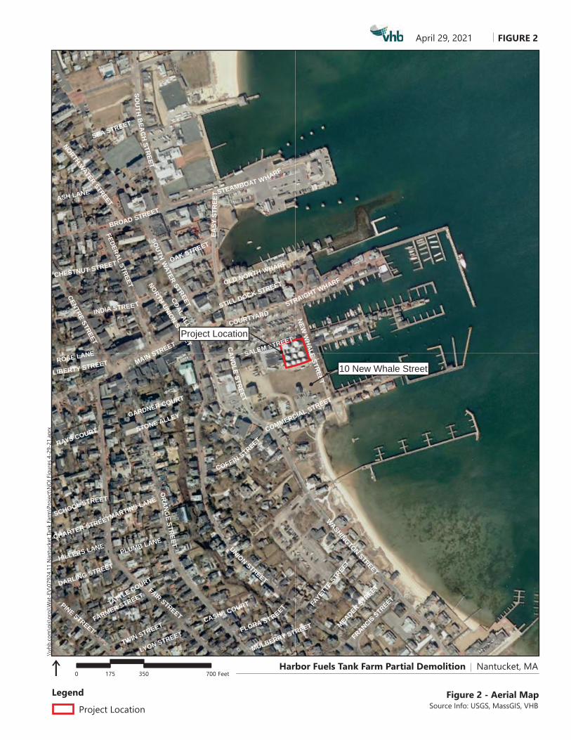
Figure 2 - Aerial MapSource Info: USGS, MassGIS, VHB
Project Location
0 350 700175 Feet
Legend
Project Location
10 New Whale Street
Harbor Fuels Tank Farm Partial Demolition Nantucket, MA

PH 945EH 756
logos FIGURE 3
0 750 1500375 Feet
April 29, 2021\\
vhb.
com
\gis\
proj
\Wat
-EV\
0792
4.11
Nan
tuck
et Ta
nk F
arm
\Pro
ject
\NO
I Fig
ures
4-2
9-21
.apr
x
Figure 3 - NHESP MapSource Info: USGS, MassGIS, VHB
Legend
Project Location
NHESP Priority Habitats of Rare Species
NHESP Estimated Habitats of Rare Wildlife
NHESP Potential Vernal Pools - None Present
NHESP Certified Vernal Pools - None Present
Project Location
Harbor Fuels Tank Farm Partial Demolition Nantucket, MA

UNION STREET
WEYMOUTH
STREET
ROSE LANE
PLEASANT
STREET
GORHAMS
COURT
EAST DOVER
STREET
ORANGE
STREET
STEAMBOAT
WHARF
CENTRE
STREET
FEDERALSTREET
MAIN STREET
STONEALLEY
ACADEM
Y LANE
SOUT
HM
ILL
STRE
ET
MILL STREET CASHS
COURT
COTTAGE
COURT
TATTLE
COURT
CENTRE
STREET
CENTER
STREET
COURTYARD
CORNISHCOURT
LILY
STRE
ET
UNIONSTREET
EXTENSION
STEP LANE
STONE
ALLEY
EDITHSW
AY WARREN
STREET
INDEP ENDENCELANE
COAL
ALLEY
FAIR
STREET GARDNER COURT
HIGH
STREET
SALEM STREET
EASY
STR
EET
NORTH
AVENUE
STARBUCK
COURT
DOLPHIN
COURT
WA
LNUT
LANE
STRAIGHT
WHARFOAKSTREET
INDIA STREET
CONSUE
SPRING
HARBOR VIEW W AY
CLIFFROAD
SWAINS
WHARF ROAD
OLD SOUTH
WHARF
OAK
STREET
WHALERS
LANE
SUMMER
STREET
CHURCHCOURT
MARTINS
LANE
CAMBRIDGE
STREET
CHESTNUT
STREET
STILL DOCK
STREET
PLUMB
LANEW
INTER
STREETTRADERS
LANE
COMMERCIAL
STREET
WILLARD
STREET
FLORA
STREETFRANCIS
STREET
EAST YORK
STREET
TWIN STREET MEADER
STREET
SALTMARSH WAY
FARMER
STREET
CORNISHSTREET
EAGLE LANE
MULBERRY
STREET
OLD NORTH
WHARF
COON STREET
BEAVER
STREET
ASH STREET
WALSH
STREET
SEA STREET
COFFIN STREET
CHARTER
STREET
FAYETT
ESTR
EET
MACKAY WAY
JUDITH
CHASE LANE
DARLING
STREET
SCHOOL
STREET
HILLERS LANE
ASH LANE
GAY STREETW
ASHINGTONSTREET
BROADSTREET
LIBERTYSTREET
CANDLE
HOUSE LANE
QUINCE STREET
NEWW
HALE
STREET
CANDLE
STREET
RAYS COURT
SWAIN STREET
JEFFERSON
LANE
ANGOLA STREET
HUSSEY STREET
SOUTHW
ATER
STREET
SILVER STREET
LYON STREET
WEST DOVER STREET
NORTH BEACH
STREET
YORK STREET
SOUTH
BEACH
STREET
NORTHWATER
STREET
EASTON STREET
PINESTREET
logos FIGURE 4
0 500 1000250 Feet
April 29, 2021\\
vhb.
com
\gis\
proj
\Wat
-EV\
0792
4.11
Nan
tuck
et Ta
nk F
arm
\Pro
ject
\NO
I Fig
ures
4-2
9-21
.apr
x
Figure 4 - FEMA MapSource Info: USGS, MassGIS, VHB
Legend
Project Location
FEMA Flood Zone Designations
AE: 1% Annual Chance ofFlooding, with BFE
VE: High Risk Coastal Area
X: 0.2% Annual Chance ofFlooding
Project Location
Harbor Fuels Tank Farm Partial Demolition Nantucket, MA
Not to Scale
\\Mawatr\ev\07924\graphics\FIGURES\7924tanks.indd p1 7/29/08
Attachment A Notice of Intent Narrative
› Introduction› Site Description› Work Description› Mitigation Measures› Regulatory Compliance› Summary

1 Attachment A: Notice of Intent Narrative
Attachment A - Notice of Intent Narrative This Notice of Intent (“NOI”) is filed pursuant to the Massachusetts Wetlands Protection Act (“WPA”) (MGL Chapter 131, Section 40) and its implementing regulations (310 CMR 10.00) and the Town of Nantucket Wetlands Bylaw Rules and Regulations1 (the “Bylaw”).
Introduction On behalf of Winthrop Nantucket Nominee Trust (“Trust” or “the Proponent”), Vanasse Hangen Brustlin, Inc. (“VHB”) is submitting this NOI for the demolition and removal of above ground petroleum storage tanks, related piping and meters, removal of concrete structures and pads, and further site investigation at the former Harbor Fuels Tank Farm located by Nantucket Harbor at 9 Salem Street (the “Project Site”). A new replacement Tank Farm has been constructed in the vicinity of the Nantucket Memorial Airport.
The Project Site was formerly the fuel supply depot for the Island of Nantucket. The facility was originally constructed in the late 1940s and early 1950s to serve the Boat Basin and customers through out the Island. The Project Site contains eleven (11) above ground fuel tanks with an aggragate capacity of just under one million gallons. In addition, the Site contains piping, pumps, fuel meters, concrete pads, a fire suppression system, electrical systems and is surrounded by a concrete dike with chain-link fencing. At this time nine (9) of the tanks have been emptied and cleaned. Two tanks are still in operation providing marine fuel to the Boat Basin. These two tanks are to be replaced at a later time with two new 9,900 gallon tanks to provide fuel to the Boat Basin. The Trust proposes to conduct the work in phases starting with the removal of eight tanks followed by a soil investigation of the areas under the tanks to determine potential remedial requirements. Additional future work to be permitted under a separate NOI will include potential remedial actions, the installation of two new tanks and appurtenances, and the removal of the three remaining tanks and concrete dike walls.
The Site is a listed disposal Site under the Massachusetts Contingency Plan (MCP, 310 CMR 40.0000) under Release Tracking Number (RTN) 4-702 related to the historical release of petroleum products to soil and groundwater.
The Project will require work within Land Subject to Coastal Storm Flowage (“LSCSF”) as well as the 100-foot buffer zone to Coastal Bank, both of which are regulated by the
1 Town of Nantucket, Massachusetts, Rev. 2013. Wetland Protection Regulations.

2 Attachment A: Notice of Intent Narrative
WPA and the Bylaw. As proposed, the Project will only occur within the previously disturbed LSCSF and 100-foot buffer zones to Coastal Bank.
All resource areas and buffer zones will be protected from impacts through the implementation of an erosion and sedimentation control program. This program includes provisions to minimize areas of disturbance through phasing and sequencing, limit erosion through stabilization, and prevent sediment from leaving the Site by installing structural controls. Since the Project will not add any impervious surfaces or alter drainage features, the Proponent has not prepared any calculations pertaining to stormwater management. A stormwater memo has been prepared to address the stormwater guidelines for Massachusetts. The Project will result in a net reduction of impervious area on the Site.
The following sections provide a detailed discussion of the existing Project Site conditions and work description. The narrative also includes a discussion of the best management practices that will be used to minimize temporary impacts.
Site Description The Project Site is composed of a parcel of land (Map 42.3.1 Parcel 89 Lot 6B) totaling approximately 15,167 square feet, located in Nantucket, Massachusetts (Figure 1). The Site lies within the surface watershed of Nantucket Harbor and is bounded by the Stop and Shop parking lot to the north, New Whale Street to the east, parcels of land owned by Nantucket Electric Company to the south, and the downtown Stop and Shop to the west. Figures 1 and 2 show a USGS map and an aerial map of the Project Site.
According to the most recently available data provided by the Massachusetts Natural Heritage and Endangered Species Program2 (“NHESP”), the Project is not located within Priority Habitat of Rare Species or Estimated Habitat of Rare Wildlife. There are no certified or potential vernal pools located on or adjacent to the Project (Figure 3).
The Project Site is not located within or near an Area of Critical Environmental Concern3 (“ACEC”). According to the Massachusetts Department of Environmental Protection (“DEP”), the Project Site is not located within an Outstanding Resource Water4 area, or an area designated as a Zone II Wellhead Protection Area5. The Natural Resources Conservation Service6 (“NRCS”) soil survey has classified soils within the entire Project Site as Beaches, sand-Verrazano-Urban land complex, with 0 to 8 percent slopes.
The most recently issued Flood Insurance Rate Map7, produced by the Federal Emergency Management Agency (“FEMA”), indicates that the entire Project Site is within the mapped Zone AE 100-year floodplain (Figure 4).
2 NHESP, 2017. Massachusetts Natural Heritage Atlas, 14th Edition. 3 DEP, Ecology & ACEC Program. https://www.mass.gov/service-details/acec-program-overview. 4 DEP, 1993. Designated Outstanding Resource Waters of Massachusetts. 5 DEP, 2012. Approved Wellhead Protection Areas (Zone II). 6 Soil Survey Staff, Natural Resources Conservation Service, United States Department of Agriculture. Web Soil Survey. 7 Federal Emergency Management Agency, National Hazard Flood Layer, Digital Flood Insurance Rate Map (DFIRM).

3 Attachment A: Notice of Intent Narrative
Wetland resource areas near the Project Site are described below.
Wetland Resource Areas
Wetland resource areas on and adjacent to the Project Site have been estimated using aerial imagery and FEMA flood mapping. The following sections of this narrative describe the wetlands and identify resource areas that are regulated under the WPA Regulations (310 CMR 10.00) and/or the Bylaw. The on-site resource area and buffer zone are depicted on the attached FEMA Map (Figure 4) and Demolition Plan (Attachment D), respectively.
The resource areas identified on or near the Site subject to state regulations under the WPA include LSCSF and Coastal Bank. The resource areas are defined under the WPA (310 CMR 10.00) as follows:
› LSCSF: As defined in 310 CMR 10.04: “land subject to any inundation caused by coastal storms up to and including that caused by the 100-year storm, surge of record or storm of record.”
› Coastal Bank: as defined in 310 CMR 10.30(2): “the seaward face or side of any elevated landform, other than a coastal dune, which lies at the landward edge of a coastal beach, land subject to tidal action, or other wetland.”
The following section describes the resource areas at or near the Project Site which are regulated by the WPA and Bylaw.
Land Subject to Coastal Storm Flowage
According to FEMA flood mapping8, the Special Flood Hazard Area with a 1% chance of flooding (100-year storm) at this Site extends to an elevation of 10 feet NAND 88, which means that areas at or below this elevation and are thus subject to coastal storm flowage (Figure 4). The entire Project Site is therefore within LSCSF. Within the Project Site, LSCSF consists entirely of previously disturbed paved and gravel areas.
Coastal Bank
Coastal Bank is present on a parcel adjacent to the Site. East of the Site, Coastal Bank consists of a hardscaping in the form of a sheet pile bulkhead. Proposed work will only occur in the outer 50 feet of the 100-foot buffer zone to Coastal Bank.
Buffer Zone
The WPA regulations (310 CMR 10.02(2)(b)) and the Bylaw establish a 100-foot buffer zone from the limits of Coastal Bank. The Bylaw also establishes a 25-foot undisturbed vegetative buffer zone and a 50-foot structure-free buffer zone to wetland resource areas. No work is proposed in the locally regulated 25- and 50-foot buffer zones.
8 Federal Emergency Management Agency, National Hazard Flood Layer, Digital Flood Insurance Rate Map (DFIRM). Accessed May 12,
2021.

4 Attachment A: Notice of Intent Narrative
Within the Project Site, the 100-foot buffer zone consists entirely of previously disturbed impervious areas, such as concrete pads which support the fuel storage tanks on Site.
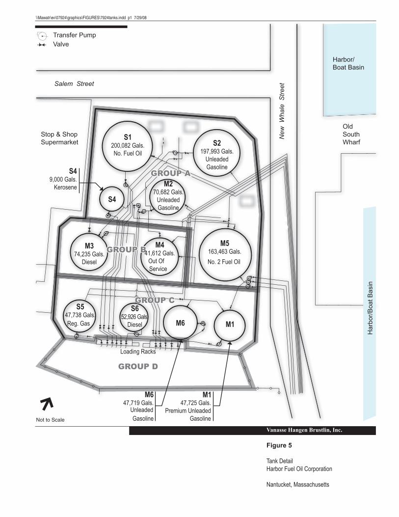
Work Description The Site is the former fuel depot for the Island of Nantucket and contains eleven (11) above ground fuel tanks, piping, pumps, fuel meters, concrete pads, and a fire suppression system. The tanks are surrounded by an approximately six-foot tall concrete dike wall with chain-link fencing on top to provide secondary containment and security. Refer to Figure 5 for the site layout. A new fuel depot has been constructed for the Island, which is located by the Airport. All existing structures at the Site, including 11 tanks, piping, utilites and containment walls are to be eventually removed and the Site prepared for future development. Two new tanks will be designed and constructed on the Site to provide marine fuel to the Boat Basin; this work will be proposed in a future, separate NOI and will be conducted by others.
At this time nine (9) of the tanks have been emptied, cleaned, and certified gas free. Two tanks (M-1 & S-6) are still in operation providing marine fuel to the Boat Basin. At this time the Proponent is proposing to remove eight (8) of the empty tanks with their associated piping and concrete pads. Several of the interior concrete dike walls will also be removed, but the dike wall that surrounds the three remaining tanks will be left in place. In order to remove the tanks, the Proponent is proposing to remove a 15 to 20-foot section of the outer concrete dike wall on the north side of the Site to provide access to the tanks for demolition and removal. The remaining outer dike walls will be left in place until the balance of the Site is demolished, as the dike walls provide erosion control for the Site and restrict Site access.
Hydraulic sheers attached to large excavators will be used to disassemble the tanks and piping. The scrap metal will be loaded onto flatbed trucks for recycling off-island. Concrete dike walls and pads will be removed from the site for recycling. Erosion control measures will be used to keep soils onsite and temporary fencing will be used to provide security. The contractor will use the abutting Stop & Shop parking lot for staging and loading of materials onto trucks. The contractor performing the work will be required to clean all equipment tracks and wheels prior to leaving the Site. More details regarding the erosion control measures are provided in the following sections.
The ultimate goal of the Project following the demolition of tanks will be to further investigate existing contamination at the Site and then to remediate the Site to achieve a Permanent Solution under the Massachusetts Contingency Plan (MCP) 310 CMR 40.0000. Once the eight (8) tanks and piping have been removed, soil samples will be collected along with the installation and sampling of groundwater monitoring wells, and possibly soil gas points.
The results of the assessment will be used to identify, evaluate, and select a future remedial strategy for the Site. Once a remedial plan is developed, it will be submitted to the Massachusetts Department of Environmental Protection in accordance with MCP requirements. The remedial plan will be the subject of a separate NOI before the start of any remedial work on Site.

5 Attachment A: Notice of Intent Narrative
Other future work at the Site will be the installation of two new double-walled steel marine fuel tanks to supply the Boat Basin. The tanks are anticipated to be about 9,900 gallons each for gasoline and diesel fuel. The tanks will be located inside a concrete dike with chain-link fencing to provide additional containment and security. Once the installation of the new fuel tanks, piping, pumps, appurtenances, and diking have been installed, the two operating tanks will be emptied, cleaned, and certified gas free. Then demolition of the three remaining tanks and the remaining concrete diking will be conducted. The work for the two future tanks will also be the subject of a future Notice of Intent filing.
The site will be fully stabilized before sediment and erosion controls are removed.
Work in wetland resource areas and/or the 100-foot buffer zone is described below. This work fully complies with all applicable performance standards as demonstrated in the Regulatory Compliance section of this Narrative.
Work in Land Subject to Coastal Storm Flowage
Work proposed in LSCSF includes demolition and removal of above ground petroleum storage tanks and related piping and meters, removal of concrete structures and pads, and further site investigation. The Project involves temporary construction disturbance within approximately 15,167 square feet of LSCSF. There will be a reduction in impervious surface of more than 4,800 sf as a result of the proposed work.
Work in Buffer Zone
Work proposed in buffer zone also includes removal of above ground petroleum storage tanks and related piping and meters, removal of concrete structures and pads, and further site investigation. The Project involves temporary alterations within approximately 4,750 square feet (+/- 10%) of the outer 50 feet of the 100-foot buffer zone.
Mitigation Measures › A suite of mitigation measures is proposed to prevent short- and long-term impacts to
wetland resource areas. Mitigation measures proposed for this project include an erosion and sedimentation control program, which will include structural and non-structural practices.
Erosion and Sediment Control
An erosion and sedimentation control program will be implemented to minimize temporary impacts to wetland resource areas during the construction phase of the

6 Attachment A: Notice of Intent Narrative
project. The program incorporates Best Management Practices (“BMPs”) specified in guidelines developed by the DEP9 and the U.S. EPA10.
Proper implementation of the erosion and sedimentation control program will:
› minimize exposed soil areas through sequencing and temporary stabilization; › place structures to manage stormwater runoff and erosion; and › establish a permanent vegetative cover or other forms of stabilization as soon as
practicable.
The following sections describe the controls that will be used and practices that will be followed during construction. These practices comply with criteria contained in the National Pollutant Discharge Elimination System (“NPDES”) General Permit for Discharges from Large and Small Construction Activities issued by the EPA.
Non-Structural Practices
Non-structural practices to be used during construction include temporary stabilization, pavement sweeping, and dust control. These practices will be initiated as soon as practicable in appropriate areas at the site.
Temporary Stabilization
The temporary stockpiling of excess soils generated by Project work will be managed in a manner that will prevent the migration of soil or sediment to wetland areas. This management may include encircling stockpiled soils with erosion control barriers and broadcasting straw or trucking soils off site. All construction debris that is generated from the Project that is not soil will be removed and disposed of following state and federal guidelines.
Pavement Sweeping
The interior roads and the portions of the streets that front the site shall be swept as needed during construction. The sweeping program will remove sediment and other contaminants directly from paved surfaces before their release into stormwater runoff. Pavement sweeping has been demonstrated to be an effective initial treatment for reducing pollutant loading into stormwater. A street sweeper shall be kept at the site or at a nearby location to facilitate this practice.
Dust Control
The erosion and sediment control program includes provisions to minimize the generation of dust during dry and windy conditions. When necessary, larger areas of exposed soil will be wetted to prevent wind borne transport of fine-grained sediment.
9 DEP, 1997. Massachusetts Erosion and Sediment Control Guidelines for Urban and Suburban Areas: A Guide for Planners, Designers, and
Municipal Officials. 10 EPA, 2007. Interim Developing Your Stormwater Pollution Prevention Plan: A Guide for Construction Sites. Office of Water. Report EPA
833-R-060-04.

7 Attachment A: Notice of Intent Narrative
Enough water shall be applied to wet the upper 0.5 inches of soil. The water will be applied as a fine spray to prevent erosion. A water truck will be kept on the property (or at a nearby location) to facilitate this practice. Also, dust monitors with project-specific dust action levels calculated under the Release Abatement Measure (RAM) Plan will be deployed during earthwork activities.
Permanent Seeding
Upon completion of final grading, any areas not covered by pavement, other forms of stabilization, or other methods of landscaping will be seeded with either the New England Wildflower Mix or the Erosion Control/Restoration Mix for Dry Sites by New England Wetland Plants, Inc.
Structural Practices
Structural erosion and sedimentation controls to be used on the site include barriers, stabilized construction entrances/exits, and catch basin inlet protection.
Sediment Control Barriers
Prior to any ground disturbance, a sediment control barrier will be installed at the downgradient limit of work. As construction progresses, additional barriers will be installed around the base of stockpiles and other erosion prone areas. Where feasible, the barriers will be entrenched into the substrate to prevent underflow.
If sediment has accumulated to a depth that impairs proper functioning of the barrier, the sediment will be removed by hand or by machinery operating upslope of the barriers. This material will be either reused at the Site or disposed of at a suitable offsite location. Any damaged sections of the barrier will be repaired or replaced immediately upon discovery.
Stabilized Construction Entrances/Exits
Stone anti-tracking pads will be installed at each access point to the work area to prevent the offsite transport of sediment by construction vehicles. The stabilized construction exits will be at least fifty feet long and will consist of a 4-inch thick layer of crushed stone (1.5 to 2.5 inches in diameter). The stone will be placed over a layer of non-woven filter fabric. The anti-tracking pads will remain in place until a binder coat of pavement has been established on paved surfaces.
Catch Basin Inlet Protection
The inlets of existing and proposed catch basins will be protected from sediment inflow during the work period by surrounding them with a barrier of staked straw bales or by installing Siltsacks®, or other approved, similar drop inlet protector. If straw bales are used, a layer of non-woven filter fabric shall be placed beneath the grate of each basin. If sediment has collected behind the barrier or in the inlet protector to a point where it impairs proper functioning, the sediment will be removed and will be either reused onsite or disposed of at a suitable offsite location.

8 Attachment A: Notice of Intent Narrative
Stormwater Management The Project will not significantly change any drainage patterns or flow of stormwater off the Project Site. Stormwater flow and treatment will not be significantly altered by the Project. The WPA regulations at 310 CMR 10.05(6)(k) establish 10 Stormwater Standards11 (“the Standards”) that projects must comply with unless they are determined to be exempt. While the Project is not exempt from the Standards, the proposed final conditions will not generate total suspended solids, oils or other pollution as would occur in runoff from roadways, parking lots, or other newly paved surfaces. No new stormwater conveyances or additional impervious area is proposed as part of the Project. The Project will decrease impervious area on the site by replacing more than 4,800 sf of impervious concreate pads with newly seeded pervious greenspace. The Project therefore is not proposing any new stormwater best management practices. A Stormwater Checklist is included in Attachment C. A plan to control construction-related impacts including erosion, sedimentation and other pollutant sources during construction and land disturbance activities is outlined in the Mitigation Measures section above.
Regulatory Compliance › As demonstrated below, the Project work fully complies with applicable performance
standards contained in the WPA and Bylaw for wetland resource areas and the 100-ft Buffer Zone. Compliance with each of the applicable performance standards is described in more detail below.
Work in Land Subject to Coastal Storm Flowage
All activities included in this NOI take place within LSCSF. The WPA regulations do not include any performance standards for LSCSF. However, as identified in the Bylaw,
“1. The work shall not reduce the ability of the land to absorb and contain flood waters, or to buffer inland areas from flooding and wave damage.
2. Projects shall not cause ground, surface, or salt water pollution triggered by coastal storm flowage. All septic tanks and leach facilities shall be located outside the 100- year floodplain.
3. All private underground fuel tanks shall be outside the 100-year floodplain. Commercial tanks shall be outside the 100-year floodplain, or if the Commission determines this is not practicable, the commercial tanks shall be secured so that they cannot float loose.
4. Building upon areas subject to coastal storm flowage in locations where such structure would be subject to storm damage may not be permitted. If permitted, all construction must be in compliance with state and local building code regulations for flood hazard areas.
11 310 Code of Massachusetts Regulations (CMR) 10.05(6) (k).

9 Attachment A: Notice of Intent Narrative
5. Fertilizers shall be used in accordance with the “Best Management Practices for Landscape Fertilizer Use on Nantucket Island” (a copy of which is attached to these regulations as appendix A).
6. The Commission may impose such additional requirements as are necessary to protect the Interests Protected By the Bylaw.”
The proposed Project has been designed to address these requirements and minimize impacts to LSCSF. The proposed Project will result in a decrease of +4,800 sf of impervious surface on Site, ultimately improving the land’s ability to absorb and contain storm waters. Any future proposed tanks will be smaller, will conform to requirements for secondary containment, and will be built within the containment area, thereby reducing the possibility of causing slat water pollution. Any new fuel tanks would also be securely installed so that they cannot float loose. However, under this NOI The Project proposes only to remove fuel tanks on the Site, all of which currently exist within LSCSF.
Work in Buffer Zone
As identified in 310 CMR 10.53(1) of the WPA regulations, “the issuing authority should consider the characteristics of the buffer zone, such as the presence of steep slopes, that may increase the potential for adverse impacts on resource areas. Conditions may include limitations on the scope and location of work in the buffer zone as necessary to avoid alteration of resource areas. The issuing authority may require erosion and sedimentation controls during construction, a clear limit of work, and the preservation of natural vegetation adjacent to the resource area and/or other measures commensurate with the scope and location of the work within the buffer zone to protect the interests of the Act.”
Additionally, as stated in the Bylaw, “Based on available information, the Commission has determined that, generally, maintenance of a 25-foot undisturbed vegetative buffer zone and a 50-foot structure-free buffer zone will serve to protect most wetland resource areas from adverse impacts related to development elsewhere within the Buffer Zone.”
The proposed Project has been designed to address these requirements and minimize impacts to the 100-foot buffer zone. As identified in the Mitigation Measures section of this attachment, Best Management Practices will be implemented to prevent adverse impacts during construction. Alterations within the 100-foot buffer zone include fuel tank demolition and removal, removal of piping, removal of concrete structures and pads, and additional environmental assessment and investigation. The Project Site is very flat and highly disturbed. No new permanent structures or changes to vegetation within the buffer zone are proposed. No work is proposed within the 25-foot or 50-foot buffer zone.
Summary The Proponent is proposing removal of above ground petroleum storage tanks and related piping and meters, removal of concrete structures and pads, and further site investigation at the former Harbor Fuel Tank Farm at 9 Salem Street in Nantucket, Massachusetts. The proposed Project requires work within Land Subject to Coastal Storm

10 Attachment A: Notice of Intent Narrative
Flowage and the outer 100-foot buffer zone to Coastal Bank as regulated by the WPA and Bylaw. All wetland resource areas will be protected from impacts during construction by provisions to minimize areas of disturbance through phasing and sequencing, limit erosion through stabilization, and prevent sediment from leaving the site by installing structural controls.
Winthrop Nantucket Nominee Trust respectfully requests that the Nantucket Conservation Commission find these measures adequately protective of the interests identified in the WPA and Bylaw and issue an Order of Conditions approving the work described in this NOI and shown on the accompanying plans.

Attachment C: Stormwater Memorandum
Attachment C Stormwater Memorandum

\\vhb\gbl\proj\Wat-EV\07924.11 Nantucket Tank Farm\Reports\NOI\StormwaterMemorandum.doc
Attachment Stormwater Memorandum
The proposed project consists of the demolition of a former Fuel Storage Terminal, an environmental investigation, and the potential remediation of petroleum impacted soil. Future development of the Site will include the installation of two marine fuel tanks to supply the Boat Basin. Permitting for the new tanks is not included as part of this submission. The project area is in the coastal zone and drains to tidal waters and no runoff rate calculations have been prepared. Furthermore, since there will be a reduction in impervious surface, there will be no increase in the rate of runoff.
The proposed project area is located by Nantucket Harbor. The area is well developed with commercial uses and roadways surrounding the project area. The well-developed nature of the area has eliminated opportunity to incorporate stormwater management features such as detention basins or water quality swales in the project design. The demolition project will be managed to prevent impacted stormwater and impacted soil from the project impacting the Harbor.
The following lists the Stormwater Management Standards, and how this project complies with them to the maximum extent possible.
Standard 1: (Untreated discharges) No new stormwater conveyances (e.g., outfalls) may discharge untreated stormwater directly to or cause erosion in wetlands or waters of the Commonwealth. Same rule applies for new developments and redevelopments.
All stormwater onsite will be re-infiltrated onsite. No stormwater runoff will be discharged directly to the Harbor by the project.
Standard 2: (Peak rate control and flood prevention) Stormwater management systems must be designed so that post-development peak discharge rates do not exceed pre-development peak discharge rates. This Standard may be waived for land subject to coastal storm flowage. Full compliance for any component that is not a redevelopment.
This project discharges runoff to land subject to coastal storm flowage and therefore this standard may be waived. Furthermore, the project reduces the amount of impervious surfaces so the post-construction rates of runoff would be lower than the existing rates.
Attachment – Stormwater Memorandum
\\vhb\gbl\proj\Wat-EV\07924.11 Nantucket Tank Farm\Reports\NOI\StormwaterMemorandum.doc
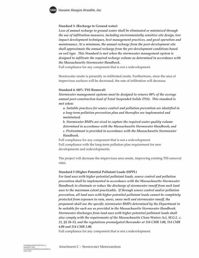
Standard 3: (Recharge to Ground water) Loss of annual recharge to ground water shall be eliminated or minimized through the use of infiltration measures, including environmentally sensitive site design, low impact development techniques, best management practices, and good operation and maintenance. At a minimum, the annual recharge from the post-development site shall approximate the annual recharge from the pre-development conditions based on soil type. This Standard is met when the stormwater management system is designed to infiltrate the required recharge volume as determined in accordance with the Massachusetts Stormwater Handbook. Full compliance for any component that is not a redevelopment.
Stormwater onsite is presently re-infiltrated onsite. Furthermore, since the area of impervious surfaces will be decreased, the rate of infiltration will decrease.
Standard 4: (80% TSS Removal) Stormwater management systems must be designed to remove 80% of the average annual post-construction load of Total Suspended Solids (TSS). This standard is met when:
a. Suitable practices for source control and pollution prevention are identified ina long-term pollution prevention plan and thereafter are implemented andmaintained;b. Stormwater BMPs are sized to capture the required water quality volumedetermined in accordance with the Massachusetts Stormwater Handbook; andc. Pretreatment is provided in accordance with the Massachusetts StormwaterHandbook.
Full compliance for any component that is not a redevelopment. Full compliance with the long-term pollution plan requirement for new developments and redevelopments.
The project will decrease the impervious area onsite, improving existing TSS removal rates.
Standard 5 (Higher Potential Pollutant Loads (HPPL) For land uses with higher potential pollutant loads, source control and pollution prevention shall be implemented in accordance with the Massachusetts Stormwater Handbook to eliminate or reduce the discharge of stormwater runoff from such land uses to the maximum extent practicable. If through source control and/or pollution prevention, all land uses with higher potential pollutant loads cannot be completely protected from exposure to rain, snow, snow melt and stormwater runoff, the proponent shall use the specific stormwater BMPs determined by the Department to be suitable for such use as provided in the Massachusetts Stormwater Handbook. Stormwater discharges from land uses with higher potential pollutant loads shall also comply with the requirements of the Massachusetts Clean Waters Act, M.G.L. c. 21, §§ 26-53, and the regulations promulgated thereunder at 314 CMR 3.00, 314 CMR 4.00 and 314 CMR 5.00. Full compliance for any component that is not a redevelopment.
Attachment – Stormwater Memorandum

\\vhb\gbl\proj\Wat-EV\07924.11 Nantucket Tank Farm\Reports\NOI\StormwaterMemorandum.doc
Full compliance with pollution prevention requirements for new developments and redevelopments.
Once the Site has met the requirements set by the Massachusetts Contingency Plan (MCP) the project area will not be identified as a land use of higher potential pollutant load.
Standard 6 (Critical Areas) Stormwater discharges to a Zone II or Interim Wellhead Protection Area of a public water supply and stormwater discharges near or any other critical area require the use of the specific source control and pollution prevention measures and the specific stormwater best management practices determined by the Department to be suitable for managing discharges to such area, as provided in the Massachusetts Stormwater Handbook. A discharge is near a critical area if there is a strong likelihood of a significant impact occurring to said area, taking into account site-specific factors. Stormwater discharges to Outstanding Resource Waters or Special Resource Waters shall be set back from the receiving water and receive the highest and best practical method of treatment. A “stormwater discharge,” as defined in 314 CMR 3.04(2)(a)1. or (b), to an Outstanding Resource Water or Special Resource Water shall comply with 314 CMR 3.00 and 314 CMR 4.00. Stormwater discharges to a Zone I or Zone A are prohibited unless essential to the operation of the public water supply. Full compliance for component of project that is not a redevelopment. Full compliance with pollution prevention requirements for new developments and redevelopments.
The Site will re-infiltrate storm water onsite and not discharge stormwater offsite.
Standard 7: A redevelopment project is required to meet the following Stormwater Management Standards only to the maximum extent practicable: Standard 2, Standard 3, and the pretreatment and structural stormwater best management practice requirements of Standards 4, 5, and 6. Existing stormwater discharges shall comply with Standard 1 only to the maximum extent practicable. A redevelopment project shall also comply with all other requirements of the Stormwater Management Standards and improve existing conditions. Redevelopment is defined to include maintenance and improvement of existing roadways, including widening less than a single lane, adding shoulders, correcting substandard intersections, improving existing drainage systems, and repaving;
This project will reduce the amount of impervious surfaces onsite and re-infiltrate stormwater onsite..
Standard 8: (Erosion, Sediment Control) A plan to control construction-related impacts, including erosion sedimentation and other pollutant sources during construction and land disturbance activities (construction period erosion, sedimentation, and pollution prevention plan), must be developed and implemented.
Attachment – Stormwater Memorandum
\\vhb\gbl\proj\Wat-EV\07924.11 Nantucket Tank Farm\Reports\NOI\StormwaterMemorandum.doc
Attachment – Stormwater Memorandum
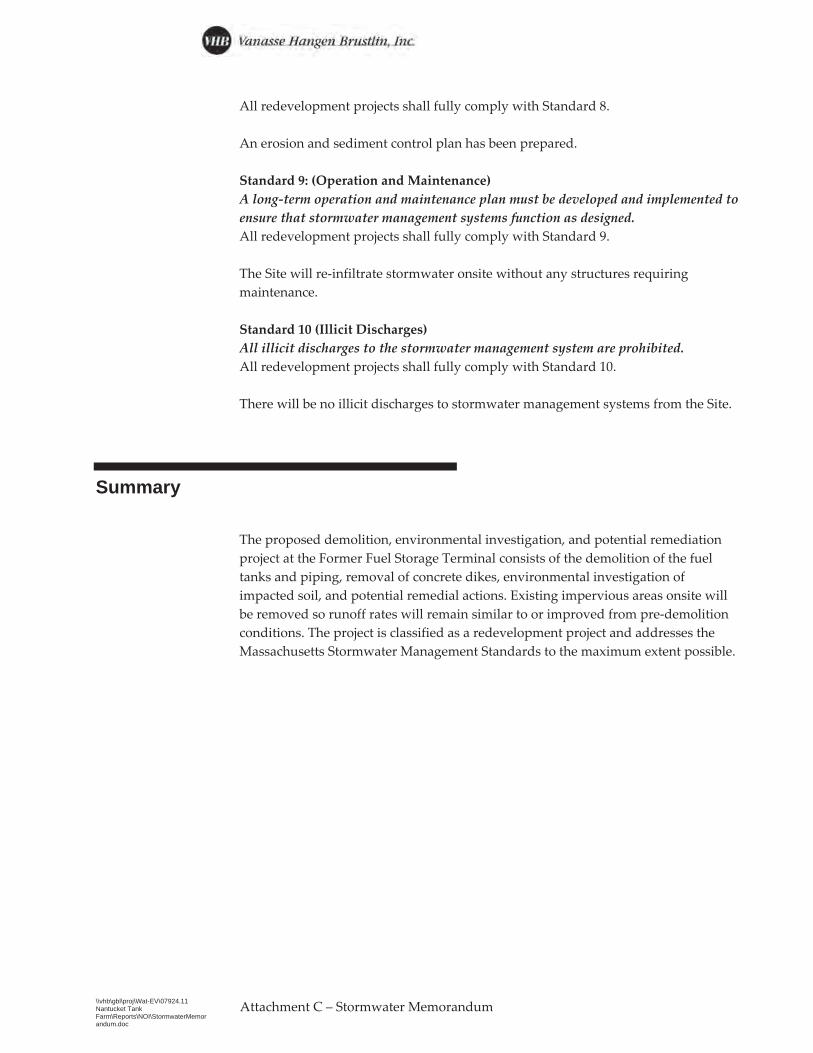
All redevelopment projects shall fully comply with Standard 8.
An erosion and sediment control plan has been prepared.
Standard 9: (Operation and Maintenance) A long-term operation and maintenance plan must be developed and implemented to ensure that stormwater management systems function as designed. All redevelopment projects shall fully comply with Standard 9.
The Site will re-infiltrate stormwater onsite without any structures requiring maintenance.
Standard 10 (Illicit Discharges) All illicit discharges to the stormwater management system are prohibited. All redevelopment projects shall fully comply with Standard 10.
There will be no illicit discharges to stormwater management systems from the Site.
Summary
The proposed demolition, environmental investigation, and potential remediation project at the Former Fuel Storage Terminal consists of the demolition of the fuel tanks and piping, removal of concrete dikes, environmental investigation of impacted soil, and potential remedial actions. Existing impervious areas onsite will be removed so runoff rates will remain similar to or improved from pre-demolition conditions. The project is classified as a redevelopment project and addresses the Massachusetts Stormwater Management Standards to the maximum extent possible.
Attachment D: Permitting Plans
Attachment D Project Plans › Subdivision Plan › Phase I Demolition Plan


I
G
E
B
RW
D
ALB-11/MW
H
OWC
SB/MW-1
SB/MW-2
SB/MW-3SB/MW-4
NEW
WHALE STREET
0 10 20 40 Feet
S-1200,082 GALLONS
FUEL OILS-2
197,993 GALS.UNLEADEDGASOLINE
M-270,682 GALS.UNLEADEDGASOLINE
M-441,612 GALS.
UNLEADED GASPREV AV GAS
M-5163,463 GALS.NO. 2 FUEL OIL
M-374,235 GALS.
DIESEL
S-547,738 GALS.
REG GAS.PREV ETHANOL
S-647,738 GALS.
DIESEL
M-647,719 GALS.
PREM UNLEADEDGAS
M-147,725 GALS.
PREM UNLEADED GAS
S-49,000 GALKEROSENE
ADDITIONAL CONTRACTOR EQUIPMENT STAGING AREAAPPROX 2,750 SQ FT.
1.5
LEAVE CLEARANCEIN FRONT OF RACK FOR FUELDELIVERIES
NEW
WHALE STREET
STOP & SHOPSUPERMARKET
1. PHASE I DEMOLITION NOTES1.1. DEMOLISH EXTERIOR CONCRETE DIKE WALL,
CHAIN-LINK FENCE, AND BARBED WIRE FOREQUIPMENT ACCESS TO SITE.
1.2. SECURE SITE WITH 6-FOOT TEMPORARYFENCING AS DIKE WALLS ARE DEMOLISHED.RETAIN AND REUSE ALL SIGNAGE FROMDEMOLISHED FENCING.
1.3. CLOSE AND FLANGE ALL FIRE SUPPRESSIONPIPING FOR TANKS TO BE DEMOLISHED
1.4. DISCONNECT AND DISPOSE OF ALL OIL ANDVENT PIPING WITH EXCEPTION OF PIPINGASSOCIATED WITH TANKS M-1, M-6, AND S-6.
1.4.1. PIPING WHICH TERMINATESUNDERGROUND SHALL BE CUT ANDCAPPED ABOVEGROUND AT THE POINTOF TRANSITION TO BOAT BASIN.
1.4.2. PROTECT PIPING FROM TANKS M-1 ANDS-6
1.4.3. PROTECT PIPING AT UNDERGROUNDTRANSITION
1.5. IDENTIFY AND PROTECT GROUNDWATERMONITORING WELLS
1.6. DEMOLISH AND DISPOSE OF TANKS S-1, S-2,M-2, S-4, M-3, M-4, AND M-5,
1.7. RETAIN DIKE WALL SURROUNDING TANKSM-1, M-6, S-5, AND S-6.
1.8. REMOVE ALL ABOVEGROUND AND AT-GRADECONCRETE STRUCTURES WITHIN WORK AREA
1.9. FURNISH AND INSTALL TEMPORARY EROSIONCONTROLS INCLUDING SAND BAGS ANDSTRAW WATTLES FOLLOWING DEMOLITION
1.10. FURNISH AND INSTALL TEMPORARY SLATTEDSECURITY FENCING WITH PRIVACYSCREENING FOLLOWING DEMOLITION.
BOAT BASINCOMMERCIALPROPERTIES
1.11.21.10
1.3
1.4.3
1.61.6
SALEM STREET ANDPARKING LOT
SHED(RETAIN)
1.4.3
1.4.1
MONITORINGWELLS
TANKS - DEMOLISH
TANKS - RETAIN
PUMPS - RETAINPUMPS - DEMOLISH
LEGEND
PIPING - RETAIN
PIPING - DEMOLISH
NATIONALGRID PROPERTY
STAGING AREAAPPROX. 5,000 S.F.
ACCESS TO BECOORDINATED FOR
APPROX. 20 PARKINGSPACES.
PROPOSEDFUTURE TANK
PADAPPROX. 12'X26'
TO BE INSTALLEDBY OTHERS
CAP PIPING
TO BOATBASIN
APPROXIMATE 100-FTCOASTAL BANK BUFFER
of
Project Number
Sheet
FIGURE 2 - PHASE I DEMOLITION PLAN
Issued for
Checked byDesigned by
Appvd.DateRevisionNo.
Save
d Fr
iday
, May
14,
202
1 12
:05:
12 P
M M
MAZ
ZON
E Pl
otte
d Fr
iday
, May
14,
202
1 12
:07:
29 P
M M
att M
azzo
ne
\\vhb\gbl\proj\Wat-EV\07924.10 Nantucket Spring Fall\cad\ev\07924.09 Nantucket Tank Farm 2021 v2.dwg
vhb.
com
Date
Nantucket Tank FarmDemolition8 New Whale StreetNantucket, Massachusetts
May 14, 2021
1
07924.11
101 Walnut StreetPO Box 9151Watertown, MA 02471617.924.1770
MJM WST
1
REV1 ADDED 100-FT BUFFER ZONE 05/14/2021 WST