Embed Size (px)
Citation preview
© St. LouiS County, MinneSota GooGLe earth - Land expLorer
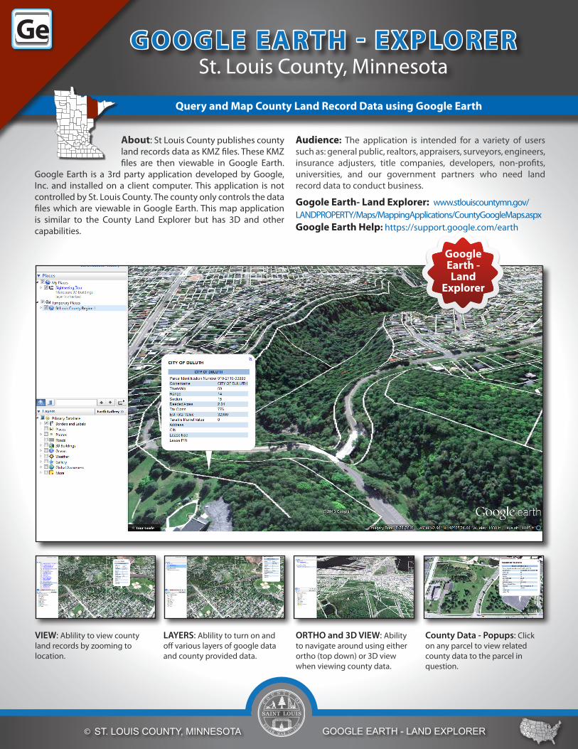
About: St Louis County publishes county land records data as KMZ files. These KMZ files are then viewable in Google Earth.
Google Earth is a 3rd party application developed by Google, Inc. and installed on a client computer. This application is not controlled by St. Louis County. The county only controls the data files which are viewable in Google Earth. This map application is similar to the County Land Explorer but has 3D and other capabilities.
Audience: The application is intended for a variety of users such as: general public, realtors, appraisers, surveyors, engineers, insurance adjusters, title companies, developers, non-profits, universities, and our government partners who need land record data to conduct business.
Gogole Earth- Land Explorer: www.stlouiscountymn.gov/LANDPROPERTY/Maps/MappingApplications/CountyGoogleMaps.aspx Google Earth Help: https://support.google.com/earth
LAYERS: Ablility to turn on and off various layers of google data and county provided data.
VIEW: Ablility to view county land records by zooming to location.
ORTHO and 3D VIEW: Ability to navigate around using either ortho (top down) or 3D view when viewing county data.
County Data - Popups: Click on any parcel to view related county data to the parcel in question.
GooGLE EArtH - ExpLorErSt. Louis County, Minnesota
Query and Map County Land record Data using Google Earth
Google Earth - Land
Explorer
GeGeGeGe

Contact St. Louis County, Minnesota
Planning and Development Department 218-725-5000Revision 8-2013
© St. LouiS County, MinneSota GooGLe earth - Land expLorer
Toolbar Buttons: Tools that allow users to draw on map, record a tour, place locations, display histocial imagery, email, measure, and much more.
Places Panel: Use this to locate, save, organize, and revisit placemarks.
File Menu: Allows users to save, print, copy, and add content.
County Data Popup: Click on parcel to obtain data for that parcel based upon county data.
Layers Panel: Use this to display points of interest.
Search in Places: Find places quickly by searching for them.
View Data
FunC tionALit y HiGHLiGHts