Embed Size (px)
Citation preview
GEMINI PROJECT EA Application: Information Request PREPARED FOR MAGNETIC SOUTH PTY LTD DECEMBER 2020
Information Request December 2020 AARC Environmental Solutions Pty Ltd E [email protected] AARC.NET.AU
Document History and Status
Issue Rev. Issued To Qty Date Reviewed Approved
1 0 MS 1 15/12/20 HC HC
1 1 Internal 1 21/12/20 HC HC
Author: Ellie Furlong
Project Manager: Heath Carney
Name of Client : Magnetic South Pty Ltd
Name of Project: Gemini Project
Title of Document: EA Application: Information Request
Document Version: Final
This controlled document is the property of AARC Environmental Solutions Pty Ltd and all rights are reserved in
respect of it. This document may not be reproduced or disclosed in any manner whatsoever, in whole or in part,
without the prior written consent of AARC Environmental Solutions Pty Ltd. AARC Environmental Solutions Pty Ltd
expressly disclaims any responsibility for or liability arising from the use of this document by any third party.
Opinions and judgments expressed herein, which are based on our understanding and interpretation of current
regulatory standards, should not be construed as legal opinions. Information obtained from interviews and contained
in the documentation has been assumed to be correct and complete. AARC Environmental Solutions Pty Ltd does
not accept any liability for misrepresentation of information or for items not visible, accessible, nor able to be
inspected at the sites at the time of the site visits.
Information Request December 2020 AARC Environmental Solutions Pty Ltd E [email protected] AARC.NET.AU
1.0 RESPONSE TO INFORMATION REQUEST .................................................. 1
2.0 REFERENCES .............................................................................................. 92
Table 1 Gemini Project Response to Information Request ................................................... 2
LIST OF TABLES
GEMINI PROJECT EA APPLICATION
INFORMATION REQUEST

Information Request December 2020 AARC Environmental Solutions Pty Ltd E [email protected] AARC.NET.AU
AARC AARC Environmental Solutions Pty Ltd
AEP Annual Exceedance Probability
AHD Australian Height Datum
AQMP Air Quality Management Plan
BoM Bureau of Meteorology
Cd Cadmium
CEC Cation Exchange Capacity
CHPP Coal Handling and Preparation Plant
CO2 Carbon Dioxide
Cr Chromium
Cu Copper
Cwlth Commonwealth
DES Department of Environment and Science
EP Equivalent Person
ESP Exchangeable Sodium Percentage
EVNT Endangered, Vulnerable and Near Threatened
GDE Groundwater Dependent Ecosystem
GHG Greenhouse Gas
GIS Geographical Information System
LOR Limit of Reporting
MEDLI Model for Effluent Disposal through Land Irrigation
MIA Mining Infrastructure Area
MLA Mining Lease Application
PMLU Post-mine Land Use
PPE Personal Protection Equipment
LIST OF ABBREVIATIONS
Information Request December 2020 AARC Environmental Solutions Pty Ltd E [email protected] AARC.NET.AU
QLD Queensland
REMP Receiving Environmental Monitoring Program
ROM Run-of-Mine
Se Selenium
SILO Scientific Information for Land Owners
SMU Soil Management Unit
STP Sewage Treatment Plant
TARP Trigger Action Response Plan
TLO Train Load Out
TPH Total Petroleum Hydrocarbons
TRH Total Recoverable Hydrocarbons
TSP Total Suspended Particles
WQO Water Quality Objectives
Zn Zinc
1
Information Request December 2020 AARC Environmental Solutions Pty Ltd E [email protected] AARC.NET.AU
1.0 RESPONSE TO INFORMATION REQUEST
The Gemini Project is a greenfield, open-cut metallurgical coal mine project, which will produce
pulverised coal injection (PCI) coal and coking coal for export to the international steel making industry.
The Project will be developed and managed by Magnetic South Pty Ltd, a private Australian based
company which was founded in 2006. The executive team of Magnetic South has some 60 years’
experience in the development and operation of metallurgical coal assets and agribusiness in central
Queensland.
The Project is located in the Bowen Basin, approximately 110 km east of Emerald and 125 km southwest
of Rockhampton, in central Queensland. Blackwater, a larger town serving mines in the region, is
located approximately 34 km to the west.
An application for a site-specific environmental authority was submitted by Magnetic South on 23
October 2019. The application reference number is APP0043095. The administering authority
considered the EA application, and issued Magnetic South with an information request on 31 January
2020.
In response to the information request, additional environmental assessments have been undertaken,
and the EA Application Supporting Document has been revised, along with several of the specialist
environmental assessments that form the Appendices to the Supporting Document.
The purpose of this document is to provide a summary of the revisions to the environmental
assessments, specifically addressing each of the issues raised in the information request, and directing
the administering authority to where these issues have been addressed in the EA Application: Revised
Supporting Information document.
2
Information Request December 2020 AARC Environmental Solutions Pty Ltd E [email protected] AARC.NET.AU
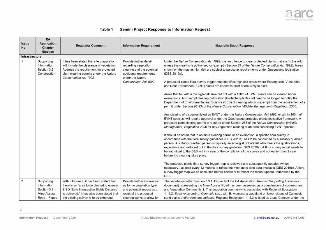
Table 1 Gemini Project Response to Information Request
Issue
No.
EA
Application
Chapter
/Section
Regulator Comment Information Requirement Magnetic South Response
Infrastructure
1 Supporting
information
Section 3.3
Construction
It has been stated that site preparation
will include the clearance of vegetation.
Address the requirement for protected
plant clearing permits under the Nature
Conservation Act 1992.
Provide further detail
regarding vegetation
clearing and the potential
additional requirements
under the Nature
Conservation Act 1992.
Under the Nature Conservation Act 1992, it is an offence to clear protected plants that are ‘in the wild’
unless the clearing is authorised or ‘exempt’ (Section 89 of the Nature Conservation Act 1992). Areas
shown on the map as high risk are subject to particular requirements under Queensland legislation
(DES 2019a).
A protected plants flora survey trigger map identifies high risk areas where Endangered, Vulnerable,
and Near Threatened (EVNT) plants are known to exist or are likely to exist.
Areas that fall within the high-risk area but not within 100m of EVNT plants can be cleared under
exemptions. An Exempt clearing notification (Protected plants) will need to be lodged to notify the
Department of Environmental and Science (DES) of clearing which is exempt from the requirement of a
permit under Section 261ZA of the Nature Conservation (Wildlife Management) Regulation 2006.
Any clearing of a species listed as EVNT under the Nature Conservation Act 1992, or within 100m of
EVNT species, will require approval under the Queensland protected plants legislative framework. A
protected plant clearing permit is required under Section 283 of the Nature Conservation (Wildlife
Management) Regulation 2006 for any vegetation clearing of an area containing EVNT species.
It should be noted that to obtain a clearing permit or an exemption, a specific flora survey in
accordance with the flora survey guidelines (DES 2020a), has to be conducted by a suitably qualified
person. A suitably qualified person is typically an ecologist or botanist who meets the qualifications,
experience and skills set out in the flora survey guideline (DES 2020a). A flora survey report needs to
be submitted to the DES within a year of the completion of the survey and not earlier than 2 year
before the clearing takes place.
The protected plants flora survey trigger map is reviewed and subsequently updated (when
necessary), at least every 12 months to reflect the most up to date data available (DES 2019b). A flora
survey trigger map will be consulted before fieldwork to reflect the recent update undertaken by the
DES.
2 Supporting
information
Section 3.3.1
Mine Access
Road – Figure
Within Figure 9, it has been stated that
there is an “area to be cleared to ensure
SISD (Safe Intersection Sights Distance)
is achieved.” It has also been stated that
the existing culvert is to be extended.
Provide further information
as to the vegetation type
and potential impact as a
result of the proposed
clearing works to allow for
The vegetation within Section 3.3.1, Figure 9 of the EA Application: Revised Supporting Information
document) representing the Mine Access Road has been assessed as a combination of non-remnant
and Vegetation Community 1. This vegetation community is associated with Regional Ecosystem
11.5.2, Eucalyptus crebra, Corymbia spp., with E. moluccana woodland on lower slopes of Cainozoic
sand plains and/or remnant surfaces. Regional Ecosystem 11.5.2 is listed as Least Concern under the
3
Information Request December 2020 AARC Environmental Solutions Pty Ltd E [email protected] AARC.NET.AU
Issue
No.
EA
Application
Chapter
/Section
Regulator Comment Information Requirement Magnetic South Response
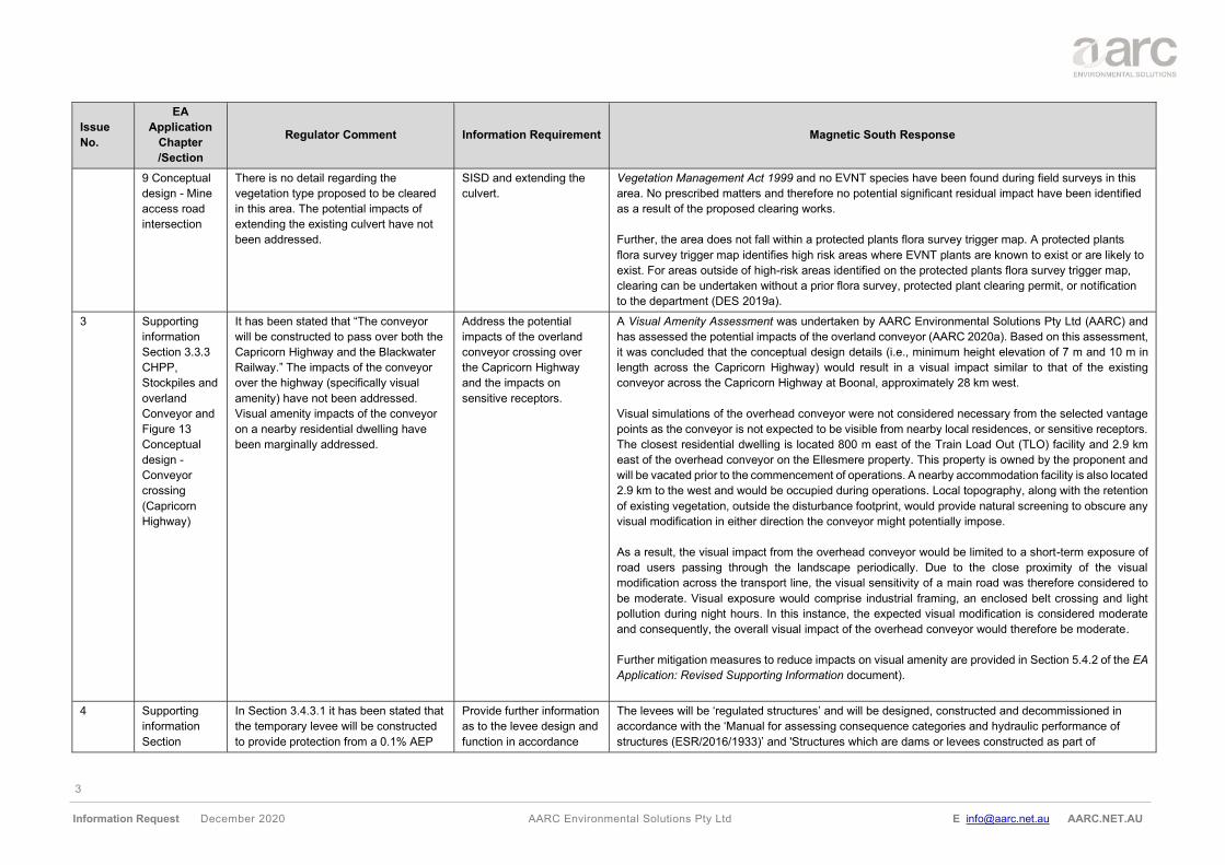
9 Conceptual
design - Mine
access road
intersection
There is no detail regarding the
vegetation type proposed to be cleared
in this area. The potential impacts of
extending the existing culvert have not
been addressed.
SISD and extending the
culvert.
Vegetation Management Act 1999 and no EVNT species have been found during field surveys in this
area. No prescribed matters and therefore no potential significant residual impact have been identified
as a result of the proposed clearing works.
Further, the area does not fall within a protected plants flora survey trigger map. A protected plants
flora survey trigger map identifies high risk areas where EVNT plants are known to exist or are likely to
exist. For areas outside of high-risk areas identified on the protected plants flora survey trigger map,
clearing can be undertaken without a prior flora survey, protected plant clearing permit, or notification
to the department (DES 2019a).
3 Supporting
information
Section 3.3.3
CHPP,
Stockpiles and
overland
Conveyor and
Figure 13
Conceptual
design -
Conveyor
crossing
(Capricorn
Highway)
It has been stated that “The conveyor
will be constructed to pass over both the
Capricorn Highway and the Blackwater
Railway.” The impacts of the conveyor
over the highway (specifically visual
amenity) have not been addressed.
Visual amenity impacts of the conveyor
on a nearby residential dwelling have
been marginally addressed.
Address the potential
impacts of the overland
conveyor crossing over
the Capricorn Highway
and the impacts on
sensitive receptors.
A Visual Amenity Assessment was undertaken by AARC Environmental Solutions Pty Ltd (AARC) and
has assessed the potential impacts of the overland conveyor (AARC 2020a). Based on this assessment,
it was concluded that the conceptual design details (i.e., minimum height elevation of 7 m and 10 m in
length across the Capricorn Highway) would result in a visual impact similar to that of the existing
conveyor across the Capricorn Highway at Boonal, approximately 28 km west.
Visual simulations of the overhead conveyor were not considered necessary from the selected vantage
points as the conveyor is not expected to be visible from nearby local residences, or sensitive receptors.
The closest residential dwelling is located 800 m east of the Train Load Out (TLO) facility and 2.9 km
east of the overhead conveyor on the Ellesmere property. This property is owned by the proponent and
will be vacated prior to the commencement of operations. A nearby accommodation facility is also located
2.9 km to the west and would be occupied during operations. Local topography, along with the retention
of existing vegetation, outside the disturbance footprint, would provide natural screening to obscure any
visual modification in either direction the conveyor might potentially impose.
As a result, the visual impact from the overhead conveyor would be limited to a short-term exposure of
road users passing through the landscape periodically. Due to the close proximity of the visual
modification across the transport line, the visual sensitivity of a main road was therefore considered to
be moderate. Visual exposure would comprise industrial framing, an enclosed belt crossing and light
pollution during night hours. In this instance, the expected visual modification is considered moderate
and consequently, the overall visual impact of the overhead conveyor would therefore be moderate.
Further mitigation measures to reduce impacts on visual amenity are provided in Section 5.4.2 of the EA
Application: Revised Supporting Information document).
4 Supporting
information
Section
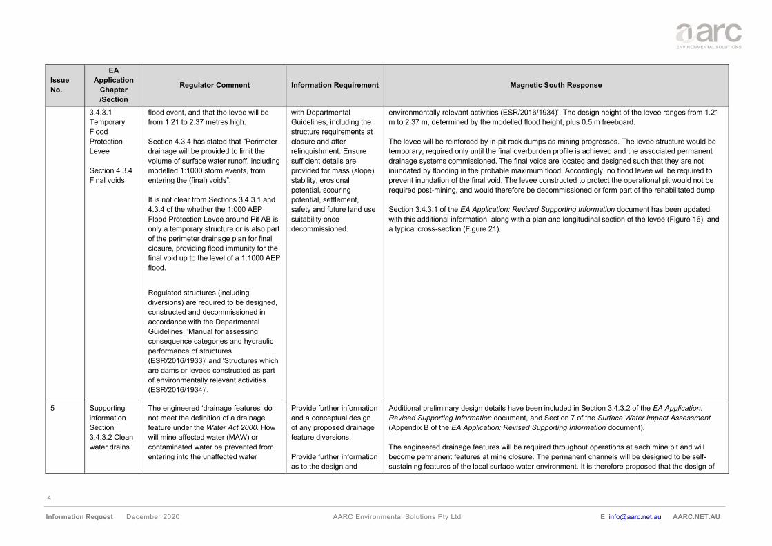
In Section 3.4.3.1 it has been stated that
the temporary levee will be constructed
to provide protection from a 0.1% AEP
Provide further information
as to the levee design and
function in accordance
The levees will be ‘regulated structures’ and will be designed, constructed and decommissioned in
accordance with the ‘Manual for assessing consequence categories and hydraulic performance of
structures (ESR/2016/1933)’ and 'Structures which are dams or levees constructed as part of
4
Information Request December 2020 AARC Environmental Solutions Pty Ltd E [email protected] AARC.NET.AU
Issue
No.
EA
Application
Chapter
/Section
Regulator Comment Information Requirement Magnetic South Response
3.4.3.1
Temporary
Flood
Protection
Levee
Section 4.3.4
Final voids
flood event, and that the levee will be
from 1.21 to 2.37 metres high.
Section 4.3.4 has stated that “Perimeter
drainage will be provided to limit the
volume of surface water runoff, including
modelled 1:1000 storm events, from
entering the (final) voids”.
It is not clear from Sections 3.4.3.1 and
4.3.4 of the whether the 1:000 AEP
Flood Protection Levee around Pit AB is
only a temporary structure or is also part
of the perimeter drainage plan for final
closure, providing flood immunity for the
final void up to the level of a 1:1000 AEP
flood.
Regulated structures (including
diversions) are required to be designed,
constructed and decommissioned in
accordance with the Departmental
Guidelines, ‘Manual for assessing
consequence categories and hydraulic
performance of structures
(ESR/2016/1933)’ and 'Structures which
are dams or levees constructed as part
of environmentally relevant activities
(ESR/2016/1934)’.
with Departmental
Guidelines, including the
structure requirements at
closure and after
relinquishment. Ensure
sufficient details are
provided for mass (slope)
stability, erosional
potential, scouring
potential, settlement,
safety and future land use
suitability once
decommissioned.
environmentally relevant activities (ESR/2016/1934)’. The design height of the levee ranges from 1.21
m to 2.37 m, determined by the modelled flood height, plus 0.5 m freeboard.
The levee will be reinforced by in-pit rock dumps as mining progresses. The levee structure would be
temporary, required only until the final overburden profile is achieved and the associated permanent
drainage systems commissioned. The final voids are located and designed such that they are not
inundated by flooding in the probable maximum flood. Accordingly, no flood levee will be required to
prevent inundation of the final void. The levee constructed to protect the operational pit would not be
required post-mining, and would therefore be decommissioned or form part of the rehabilitated dump
Section 3.4.3.1 of the EA Application: Revised Supporting Information document has been updated
with this additional information, along with a plan and longitudinal section of the levee (Figure 16), and
a typical cross-section (Figure 21).
5 Supporting
information
Section
3.4.3.2 Clean
water drains
The engineered ‘drainage features’ do
not meet the definition of a drainage
feature under the Water Act 2000. How
will mine affected water (MAW) or
contaminated water be prevented from
entering into the unaffected water
Provide further information
and a conceptual design
of any proposed drainage
feature diversions.
Provide further information
as to the design and
Additional preliminary design details have been included in Section 3.4.3.2 of the EA Application:
Revised Supporting Information document, and Section 7 of the Surface Water Impact Assessment
(Appendix B of the EA Application: Revised Supporting Information document).
The engineered drainage features will be required throughout operations at each mine pit and will
become permanent features at mine closure. The permanent channels will be designed to be self-
sustaining features of the local surface water environment. It is therefore proposed that the design of
5
Information Request December 2020 AARC Environmental Solutions Pty Ltd E [email protected] AARC.NET.AU
Issue
No.
EA
Application
Chapter
/Section
Regulator Comment Information Requirement Magnetic South Response
system? Are the proposed structures
temporary or permanent?
Regulated structures (including
diversions) are required to be designed,
constructed and decommissioned in
accordance with the Departmental
Guidelines, ‘Manual for assessing
consequence categories and hydraulic
performance of structures
(ESR/2016/1933)’ and 'Structures which
are dams or levees constructed as part
of environmentally relevant activities
(ESR/2016/1934)’.
function of the ‘drainage
features’ in accordance
with Departmental
Guidelines, including the
structure requirements at
closure and after
relinquishment.
Provide further information
on whether the proposed
infrastructure is temporary
or permanent. If
permanent discuss
residual risks and
relinquishment upon
surrender.
the drains will take into account key design principles and requirements for the functionality of
permanent diversions, including for operations, maintenance, monitoring and revegetation.
6 Supporting
information
Section
3.4.3.3 Water
storages
Risk of water storages (regulated
structures) overtopping or failing, as well
as the potential impacts and mitigation
have not been discussed.
Provide information
regarding the risk of
regulated structures failing
or having inadequate
freeboard to contain site
waters, MAW and the
potential impacts on
environmental values.
A Preliminary Consequence Category Assessment has been included in Section 3.4.4 of the EA
Application: Revised Supporting Information document with more detailed discussion of the
assessment protocols and criteria provided in Section 5.5 of the Surface Water Impact Assessment
(Appendix B of the EA Application: Revised Supporting Information document).
The coal handling and processing plant (CHPP), mining infrastructure (MIA), Dams, Raw Water Dam
and Sediment Dams are all considered to be of ‘Low’ consequence, with the main Mine Water Dam
and Levee assessed as ‘Significant’ category.
7 Supporting
information
Section 3.5.3
Sewerage
In relation to the release of treated
effluent to land, the application states
that the design of the system will ensure
no runoff from the disposal area occurs.
Further information is to
be provided on the
following:
• Any predicted overflows
to the environment from
any storage needs to be
justified in terms of
environmental impact.
A Model for Effluent Disposal through Land Irrigation (MEDLI) was used to assess the suitability of
dispersal in the surrounding area (Appendix N of the EA Application: Revised Supporting Information
document). The MEDLI modelling exercise confirmed that by applying a scheduled 2 mm/day over 3.8
ha in mine construction phase and 1.9 ha in mine operation phase, no overflow events would occur.
Although the model indicated that effluent irrigation could occur every day, in day to day
operations there are times when irrigation should not occur. Such events would include during
substantial rain events when the ground is showing signs of saturation (such as surface water pooling).
In order to account for such events, 3 days of wet weather storage (in tanks) were accounted for in the
model as is recommended in the QLD Government Technical Guideline For Disposal of Effluent via
Irrigation. As a result, at least 168 m3 tank capacity will be available.
6
Information Request December 2020 AARC Environmental Solutions Pty Ltd E [email protected] AARC.NET.AU
Issue
No.
EA
Application
Chapter
/Section
Regulator Comment Information Requirement Magnetic South Response
• The assessments
should be carried out for
the proposed and future
effluent disposal rates.
Assessments have been based on a construction phase (accommodating up to 280 persons) and the
operational phase (accommodating up to 140 persons).
• Description of
management measures
to be implemented to
ensure the irrigation of
effluent does not
exceed water holding
capacity of the soil or
the uptake capacity of
the crop (that may, as a
consequence, result in
water logging, surface
runoff or excessive
deep drainage).
In the absence of site-specific soil sample data, the assessment was informed by the Soil and Land
Suitability Assessment (Appendix I of the EA Application: Revised Supporting Information document) to
analyse the response based on modelling of extremely conservative soil types. One being an
extremely permeable sand, and the other being an extremely impermeable clay.
The design irrigation rate and area and chosen pasture were sufficient to prevent waterlogging, surface
runoff or excessive deep drainage in either extreme soil type. This has been validated through the
MEDLI model as shown in Appendix N of the EA Application: Revised Supporting Information
document.
• Description of the
capacity of the
vegetation and soils in
the irrigation area(s) to
assimilate these salts
on a long-term
sustainable basis.
Rhodes grass was assumed to be the pasture which will be irrigated on site. Modelling using Rhodes
Grass (moderately salt-tolerant) indicates the resulting salinity would be too low to impact upon the
health of the grass. The proportion of years that crop yields would be expected to fall below 90% of
potential due to salinity (fraction) was 0% for both construction and operations.
• Description of irrigation
application method and
scheduling (triggered).
Application will be undertaken in accordance with 'AS/NZS 1547:2012 On-Site Domestic Wastewater
Management' through a spay irrigation system method. The pump system and pipeline will contain a
separate effluent chamber with storage volume to match the electrical starting requirements of the
irrigation pump motor. Additionally, a discharge capability of at least 50% more than the maximum 30-
minute flow rate and capacity to withstand at least 150% of the shut-off head of the pump. The
selected spray-irrigation system will evenly distribute effluent and control the droplet size, throw, and
plume through the use of coarse spray heads suitable for effluent application.
Given the designated irrigation site is isolated and significant in size, management would only warrant
a secondary treatment quality to contain negligible risk of human exposure, aerosol drift and odour
nuisance to offsite locations. The following management measures will be implemented to ensure the
7
Information Request December 2020 AARC Environmental Solutions Pty Ltd E [email protected] AARC.NET.AU
Issue
No.
EA
Application
Chapter
/Section
Regulator Comment Information Requirement Magnetic South Response
limits identified in the National Guidelines for Water Recycling of Appendix N (Table 9-1) in the EA
Application: Revised Supporting Information document are achieved:
• no access during and after irrigation, until dry (1-4 hours);
• spray drift control (low-throw sprinklers - 180º inward throw);
• restricted irrigation when wind direction is not favourable, or temperature inversions present; and
• irrigation timing during the day when residents are not localised.
• Description of risks of
human exposure from
irrigation of effluent or
aerosol drift.
The adopted irrigation application regime described in issue number 7 combined with the achieved
setback distances as recommended by the QLD Government Technical Guideline For Disposal of
Effluent via Irrigation finds the risk of aerosol drift negligible.
Section 9.1 of Appendix N of the EA Application: Revised Supporting Information document has been
updated to provide further details on the risk of aerosol drift.
• Description of risks
aerosol drift to off-site
locations and cause
odour nuisance.
The adopted irrigation application regime described in issue number 7 combined with the achieved
setback distances as recommended by the Qld Government Technical Guideline For Disposal of
Effluent via Irrigation finds the risk of odour negligible.
Section 9.2 of Appendix N of the EA Application: Revised Supporting Information document has been
updated to provide further details on the risk of odour.
• Description of buffer
zones from all sensitive
receptors to the
irrigation area and
sewage treatment plant.
The irrigation management area is close to the primary source of domestic wastewater
(accommodation facilities) and domestic wastewater from the MIA can be practically pumped to this
location.
The following buffer zones will be adopted in accordance with the Qld Government Technical Guideline
For Disposal of Effluent via Irrigation to ensure environmental care and exposure to all sensitive
receptors is negligible:
• natural waterways >100 m;
• residential facility or public amenities >50 m;
• domestic water bore > 250 m;
• drinking water catchment and aquatic ecosystems with high ecological value > 250 m;
• town water supply bore > 1000 m;
• groundwater bore used for potable water supply >250 m; and
• groundwater table at a depth >3 m.
How these buffer distances will be achieved is shown in Figure 12-1 of Appendix N of the EA
Application: Revised Supporting Information document.
8
Information Request December 2020 AARC Environmental Solutions Pty Ltd E [email protected] AARC.NET.AU
Issue
No.
EA
Application
Chapter
/Section
Regulator Comment Information Requirement Magnetic South Response
8 It has been stated that the proponent will
operate a sewage treatment plant (STP)
located at the accommodation facility.
This STP will have a maximum capacity
of 140 equivalent person (EP). The
expected workforce at the site
accommodation is about 140 persons in
“normal” conditions, the accommodation
facility will be constructed to
accommodate up to 280 persons (see
page 54 of the Supporting Information
report).
Justify the proposed
capacity of 140 EP given
the accommodation
capacity. Consideration to
contingencies following a
STP failure event and
maintenance issues in line
with risks noted in the
above requirement should
be provided.
The sewage treatment plant (STP) has been assessed to cater for the accommodation facilities under
two conservative scenarios (i.e., maximum equivalent persons (EP) capacity during
construction of 280 EP = 56,000 L/day and during operations of 140 EP = 28,000 L/day.
It is however unlikely that all 280 workers will all be on site on a given day and generate their entire
volume of wastewater, as many may utilise off site accommodation facilities. Therefore, estimates are
conservative and cater for a greater risk.
Section 4.1 of Appendix N of the EA Application: Revised Supporting Information document has been
updated to provide further details.
9 Additional
information -
Requirements
for effluent
release to land
As the proposed activity involves the
release of treated effluent to land, the
following should be submitted in relation
to effluent sources and type:
• Type of treatment applied – include
description of treatment process,
design details including size/volumes,
peak design capacity of the sewage
treatment system.
• Quantity, description of average and
maximum wastewater flows. Also
include dry versus wet weather period
over time.
• Quality (key contaminants of concern),
describe and quantify the
concentrations of key contaminants
including total nitrogen, total
phosphorous, electrical
conductivity/total dissolved salts and
sodium/sodium absorption ratio.
• Include average and maximum
concentrations of treated effluent
generated at the site.
• Quality (other contaminants) – provide
a risk assessment of other
Address the effluent
sources and type in
relation to the releases of
treated effluent releases.
During both construction and operation phases, workers will generate domestic wastewater from
accommodation, offices, and facilities. The wastewater will include material which is generated from
the following:
• toilets (often classed as black water); and
• showers, kitchen facilities and laundry (often classed as grey water).
In accordance with the Environmental Protection Regulation 2019, wastewater has been estimated
using each worker as an EP with each EP generating 200 L/day. During construction, a total of 280
workers (280 EP) will be onsite and generate their total maximum volume of 56, 000 L/day. During
operations, only 140 workers (140 EP) will be present onsite and will generate their total maximum
volume of 28, 000 L/day.
All domestic wastewater will be channelled to a single treatment plant and disposal area. The sewage
treatment plant has been designed for a 280 EP maximum capacity with a closed wet weather storage
tank designed for a three-day maximum capacity (168m3) before any overflow events would occur. The
proposed method e.g., daily irrigation rate (2mm/day) will maintain a consistent wastewater flow rate
determined based on local weather patterns (wet and dry periods) and soil conditions.
Conservative assumptions on the treated wastewater quality have been provided in
Section 4.2 of Appendix N of the EA Application: Revised Supporting Information document and are
anticipated to achieve the target objectives set out in the National Guidelines for Water Recycling:
Managing Health and Environmental Risks (Phase 1) 2006. The quality is reflective of a standard
secondary treated effluent. Once further detailed designs are available for the irrigation regime, more
specific treated effluent quality data can be estimated.
9
Information Request December 2020 AARC Environmental Solutions Pty Ltd E [email protected] AARC.NET.AU
Issue
No.
EA
Application
Chapter
/Section
Regulator Comment Information Requirement Magnetic South Response
contaminants including Heavy metals,
Pharmaceuticals, Toxins, Pathogens
including E.coli and quantify of treated
effluent generated at the site.
The risks associated with contaminants such as pathogens, odour, toxicants have been
discussed in Section 9 of Appendix N of the EA Application: Revised Supporting Information document.
Majority of risk management measures are based upon exposure reduction measures (i.e., lessening
aerosol production via spay method, irrigation timing and use of buffer zones). These risks are
considered negligible and easily managed using the irrigation application regime described in issue
number 7.
10 No standard conditions apply to STPs of
more than 100 EP.
As the proposed activity involves the
release of treated effluent to land,
identify the location of effluent discharge
(irrigation scheme) and include a layout
plan showing:
• property boundaries;
• proposed irrigation area boundary,
location of any wet weather storage
infrastructure, sampling and discharge
points including GPS Co-ordinates
(Latitude, Longitude) and Elevation;
• topography including drainage lines,
water courses or any ‘waters’;
• any sensitive receiving environments
such as sensitive / high ecological
value areas in close vicinity of the
irrigation scheme; and
• any buffer distances to any sensitive
receivers.
As the proposed activity involves the
release of treated effluent to land, the
following should be submitted in relation
to historic climate data for area used for
designing the scheme:
• Provide a description of most locally
relevant climate data, weather
Additional information
such as disposal area and
size, wet weather storage
capacity is required along
with an appropriate risk
assessment of the
potential impact of this
activity to the relevant
environmental values. The
STP capacity, disposal
area location and size as
well as the wet weather
storage capacity should be
included in the proposed
conditions.
Address historic climate
data to support the
proposed irrigation
scheme.
A layout plan of the proposed irrigation scheme is illustrated in Appendix F attached to, Appendix N of
the EA Application: Revised Supporting Information document.
The proposed irrigation management area boundary (approximately 195m x 195m) is located at the
following GPS points:
• northwest (E 726480.51, N 7384618.95);
• northeast (E 726678.87, N 7384618.95);
• southwest (E 726480.51, N 7384427.74); and
• southeast (E 726678.87, N 7384427.74).
The irrigation management area is positioned within the north-western portion of the mining lease and
south of the Capricorn Highway and rail line. This area is close to the primary source of domestic
wastewater (accommodation facilities) and accessible from the proposed camp access road. The wet
weather storage capacity will be located at the sewage treatment plant, anticipated to hold 3 days
storage capacity (168m3). Sampling and discharge points will be determined during the detailed design
phase.
The reasonably flat nature of the designated area and distance from significant watercourses is ideal
for irrigation. The topography falls in a north to south direction. The irrigation area lacks any significant
drainage lines / watercourses and sits on the divide between the catchment of Stanley Creek towards
the north and the catchment of Charlevue Creek to the south. Two minor drainage lines off Charlevue
Creek are present to the east and west of the irrigation management area. Stanley Creek and
Charlevue Creek are highly ephemeral flowing only after substantial rainfall events. The area has
already been cleared and therefore contains limited ecological value.
Sufficient buffers from sensitive receivers such as waterways, ecosystems, and the residents/mining
camp listed in Section 3.5.3.1 of the EA Application: Revised Supporting Information document are
maintained.
Climate data was obtained from the Queensland Government Scientific Information for Landowners
(SILO) for the closest grid point (-24.55, 149.25). The site has a relatively dry climate, with evaporation
10
Information Request December 2020 AARC Environmental Solutions Pty Ltd E [email protected] AARC.NET.AU
Issue
No.
EA
Application
Chapter
/Section
Regulator Comment Information Requirement Magnetic South Response
patterns which can be obtained from
Silo DataDrill (web link) data.
• Provide a description of the frequency
of inundation in the area and assess if
this is a risk. The location of the
sewage treatment plant and any other
high-risk areas of the activity should
be located above the Q100 floodplain.
rates exceeding rainfall throughout the year. A distinctive dry/wet season pattern is observed, whereby
the winter period from April to September is traditionally dry, with higher rainfall (typically from storms)
received over the summer months from September to January. Even during the wet season, the
evaporation rates still exceed rainfall rates. Detailed illustrations of SILO data is provided in the Section
2.2 of the EA Application: Revised Supporting Information document.
A review of the Central Highlands Regional Council Flood Hazard Overlay indicates that the area and
the greater proposed mine are located a substantial distance away from Q100 floodplain based on the
1% Annual Exceedance Probability (AEP) + climate change allowance.
11 As the proposed activity involves the
release of treated effluent to land, the
following should be submitted in relation
to the soil characteristics of the
proposed effluent irrigation area and the
site suitability. Based on site
investigation and available data, provide
the following:
• description of soil profile including
erodibility, texture, structure,
impermeable layers and any evidence
of rising water table:
o hydraulic properties:
o moisture content at field
capacity, permanent wilting
point and saturation
o saturated hydraulic conductivity
• chemical properties:
o nitrogen content, especially
organic nitrogen;
o phosphorus content;
o phosphorus sorption capacity;
o exchange sodium percentage;
o background concentration of
any contaminants;
• proposed vegetation for effluent
irrigation area:
Describe the soil
characteristics of the
proposed effluent irrigation
area.
In the absence of site-specific soil sample data, soil characteristics have been informed by the Soil and
Land Suitability Assessment (Appendix I of the EA Application: Revised Supporting Information
document) to analyse the response to extremely conservative soils. One being an extremely
permeable sand, and the other being an extremely impermeable clay.
As a result, interpolation of the assessment indicates the irrigation area is within the Soil Management
Unit (SMU) defined as the Geoffrey SMU which covers approximately two thirds of the mining lease.
The Geoffrey SMU consists of texture contrast soils (loamy sands to sandy light clays) with soft surface
conditions, associated with undulating plains and rises. Where these soils are exposed, extensive
washouts and large erosion gullies occur. Overland flow has removed coarse sandy material, leaving
the easily eroded clays exposed to surface runoff. The permeability of the soil profile is very slow, with
a moisture content percentage of 0.8 % - 9 %.
The chemical and physical properties of the soil profile pH are described as moderately acidic in the
upper loamy profile (5.8-6), with a sudden shift to weakly alkaline in the underlying clay profile (8.1). An
increased cation exchange capacity (CEC) was observed at greater depths (0.4 – 8.8 meq / 100g) and
also a general increase in salts, as is evident in the higher EC (0.004 – 0.137), chloride and sodicity in
the bottom clay layer. Exchange sodium percentage ranges from non-sodic in the upper profile (1 –
1.8%) to strongly sodic in the lower profile (22.1%).
Topsoil nutrients are generally quite limited with nitrate (3 mg/kg), phosphorous (8 mg/kg) and
potassium (<200 mg/kg) below desirable levels. Boron (0.2 mg/kg) and sulphate (<10 mg/kg) are also
lower than guideline recommendations for suitable plant growth medium. For extractable metals,
manganese (16.0 mg/kg) and zinc (2.16 mg/kg) are within the desirable range, though iron (166 mg/kg)
is elevated, and copper (<1.0 mg/kg) is below reportable levels. The nature of the soil is generally
supportive of spray irrigation, though the sodicity in the lower soil profile will need to be managed to
ensure the soil does not become dispersive.
11
Information Request December 2020 AARC Environmental Solutions Pty Ltd E [email protected] AARC.NET.AU
Issue
No.
EA
Application
Chapter
/Section
Regulator Comment Information Requirement Magnetic South Response
o species of plant cover; and
• Management of plant biomass. It is
department’s expectation the plant
biomass be cut and removed from the
irrigation/ disposal area.
The proposed vegetation for the effluent irrigation area has been modelled using Rhodes Grass. The
MEDLI model indicates that mowing (with removal of clippings) would only be required approximately 3
times per year to maintain sufficient growth and subsequent nutrient uptake. Modelling indicates that
plant biomass is unlikely to be impacted by the irrigation of effluent and sufficient setbacks would be
appropriate to manage any impacts.
12 As the proposed activity involves the
release of treated effluent to land, the
following should be submitted in relation
to groundwater:
• Presence of groundwater or
temporary perched water tables,
levels over time and background
water quality.
• Any risk of effluent reaching
groundwater.
Describe the impacts to
groundwater of the
proposed treated effluent
release.
The closest registered bore (RN122470) indicates that the regional groundwater table may be present
at approximately ~ 46 m below ground level. Estimated depth is within the suitability selection criteria
of greater than 1.2m recommended by the AS/NZS 1547:2012 On-Site Domestic Wastewater
Management. QLD Government groundwater dependent ecosystem (GDE) mapping indicates a
potential (low level confidence) GDE may be present in the riparian zone around Stanley Creek.
Detailed groundwater quality and background levels are provided in Section 8.2 of the EA Application:
Revised Supporting Information document.
Elevated levels of nitrogen can be leached into the groundwater table when more nitrogen is added
than removed to the soil (i.e., heavy rain periods). Modelling of the designed irrigation rate, area and
chosen pasture resulted in negligible concentrations of nutrient leaching in either extreme soil type.
Results for construction and operational scenarios indicate the average nitrate is predicted to leach
0.17 kg/ha/year via deep drainage during extremely impermeable conditions and during extremely
permeable conditions an average of 1.29 kg/ha/year. These findings are well within the accepted limit
of 5 kg/ha/year.
The irrigation scheme will still need to be managed via use of an appropriate irrigation rate and set
back distances to minimise any impact on groundwater and any potential GDEs. These are detailed in
Section 3 and Section 12 of the EA Application: Revised Supporting Information document.
13 As the proposed activity involves the
release of treated effluent to land, the
following should be submitted in relation
to the irrigation management area:
• irrigation regime proposed (how
irrigation is triggered and applied);
• irrigation method and infrastructure
required; and
Describe the proposed
irrigation management
area.
In accordance with AS/NZS 1547:2012 On-Site Domestic Wastewater Management, the irrigation
regime comprises a set daily irrigation rate and does not require trigger limits. The infrastructure
required will include a sewage treatment plant, a wet weather storage tank, closed pond, pump system,
pump chamber, pipeline, flush and release valve, supply header and secondary treatment unit. The
STP will operate a membrane bioreactor with an appropriately sized pump station to minimise the
retention of raw sewage to less than eight hours to mitigation potential odour and volatile organic
compounds.
The irrigation layout is shown in Appendix F attached to Appendix N of the EA Application: Revised
Supporting Information document.
12
Information Request December 2020 AARC Environmental Solutions Pty Ltd E [email protected] AARC.NET.AU
Issue
No.
EA
Application
Chapter
/Section
Regulator Comment Information Requirement Magnetic South Response
• management of any potential aerosol
drift generated from above ground
irrigation.
When combined with the setback distances discussed above in issue number 7, the risk of aerosol
exposure is negligible.
14 As the proposed activity involves the
release of treated effluent to land, the
following should be submitted in relation
to wet weather storage management:
• type and volume;
• how any overflows will be managed;
• algae management if proposing open
lagoon or pond;
• if open storage, design of the wet
weather storage including lining to
ensure any potential of effluent
leaching to groundwater is prevented;
and
• contingency plans.
Describe wet weather
storage management.
The MEDLI modelling confirmed that by applying a scheduled 2mm/day over 3.8 ha in mine
construction phase and 1.9 ha in mine operation phase, no overflow events would occur. However, in
accordance with the QLD Government Technical Guideline For Disposal of Effluent via Irrigation,
during substantial rain events when the ground is showing signs of saturation (such as surface water
pooling) wet weather storage for 3 days must be accounted for. This equates to a maximum tank
capacity of at least 168 m3 – length 19.5m, width 19.5m, overflow outlet depth 3m.
As closed tanks will be used instead of ponds, there are negligible risks with algae
blooms or leaching into the groundwater.
Once detailed design information is available, a site-specific contingency plan will be developed to
manage the wet weather storage tanks, sewage treatment plant shutdowns and maintenance periods
when >3 days storage may be required.
15 As the proposed activity involves the
release of treated effluent to land,
address the predicted environmental
impacts of the proposed effluent
irrigation scheme. The preferred model
is MEDLI. This model assesses the
hydraulic load applied to the irrigation
areas, the fate of nitrogen, phosphorus
and salts, and required wet weather
storage volume. The results of the
MEDLI assessment is to be provided
and include the following:
• the proposed size of the irrigation
area(s);
• the proposed wet weather storage
volumes;
• irrigation rates;
• frequency of overtopping ;
• irrigation rates;
The department requires a
“water balance method”
(typically “MEDLI”) to
determine the suitable wet
weather storage volume
and size and locations of
effluent irrigation areas
based on the volume of
wastewater generated at a
facility, taking into account
climatic conditions,
vegetation being irrigated,
effluent quality with regard
to TN, TP, TDS, EC and
soil properties to ensure
no runoff from the effluent
irrigation disposal area(s)
and wet weather storage,
MEDLI modelling was undertaken by Cardno (2020a) and is provided in Appendix N of the EA
Application: Revised Supporting Information document.
Four (4) MEDLI model scenario input and output files can be provided to DES upon request.
13
Information Request December 2020 AARC Environmental Solutions Pty Ltd E [email protected] AARC.NET.AU
Issue
No.
EA
Application
Chapter
/Section
Regulator Comment Information Requirement Magnetic South Response
• soil water balance;
• soil nutrients balance;
• any risk of contamination to
groundwater and measures to be
implemented to protect groundwater
• crop performances;
• predicted irrigation-induced annual
deep drainage rate (mm/year);
• predicted average deep drainage
Nitrate and Phosphorus annual
concentrations (mg/L); and
• interpretation of output details.
For assessments using MEDLI model
Version 1.3, the following model input
and output files are to be provided:
• those files that end with “IPT.SUM”
(Input Summary); and
• those files that end with “SUMM.STA”
(Summary Output).
Each file name begins with a 4-digit
reference number and neither file
contents nor the format is to be altered
or changed.
For assessments using MEDLI model
Version 2.0, the following model input
and output files are to be provided:
• *.medr (Output file)
• *.med (Scenario file)
with minimal “irrigation-
induced deep drainage”.
Where MEDLI is not used,
a justification for the
validity and calibration for
the model is required.
16 Supporting
information
Section 3.6.2
Mine schedule
Figure 19
The temporary levee is proposed to be
positioned along the south-eastern side
of Pit AB. The diverted drain is located at
the southern end of Pit AB. As the pit is
proposed to progress toward the mining
Demonstrate that the
active mining pit will not be
impacted during flood
events given that this area
Flood modelling in Appendix B of the EA Application: Revised Supporting Information document has
concluded the active mining of Pit AB will not be subject to flooding inundation during a 1% AEP flood
event and instead flood impacts from Springton Creek would extend off the lease area onto land
owned by Magnetic South.
14
Information Request December 2020 AARC Environmental Solutions Pty Ltd E [email protected] AARC.NET.AU
Issue
No.
EA
Application
Chapter
/Section
Regulator Comment Information Requirement Magnetic South Response
Mine stage
plan - Year 06
lease area (MLA) boundary, the
applicant has proposed that the levee
would extend the length of the drain to
prevent possible in-pit flooding from the
drain.
has a high probability of
flooding.
Although as shown in Figure 7.7, Appendix B of the EA Application: Revised Supporting Information
document, there is potential for flood waters to come into contact with overburden dumps on the
southern side of Pit AB due to water overflowing from the unnamed tributary of Springton Creek
upstream of the inlet to the engineered drainage feature. The temporary levee is expected to protect
this section of the dump during operations and avoid any inflow into Pit AB, limiting impacts to
overburden run-off.
In events up to the 0.1% AEP design flood, modelled flow velocities are less than 1 m/s along most of
the length of the proposed levee. Such flows would be non-erosive and especially given the relatively
short flow durations in this small catchment, the risk of migration of sediment in floodwaters would be
minimal. A Site Water Management Plan described in Section 7.4.1 of the EA Application: Revised
Supporting Information document will be developed for the Project to address flooding mitigation and
surface water runoff from overburden dumps.
17 Supporting
information
Section 3.6.2
Mine schedule
Figure 20
Mine stage
plan - Year 08
Figure 20 shows that the active spoil
dumps extend to be in close proximity to
the diverted drainage feature. Risk of the
dump slopes failing and impacting the
drain has not been discussed.
Provide further information
on the proximity of dumps
to the drain and the
potential impacts to
environmental values.
Figure 20 is now Figure 26 of EA Application: Revised Supporting Information document and shows
the progressively rehabilitated outer extent of the waste rock dump already reshaped, sloped to a
1V:10H ratio (where maximum slopes adhere to 6°), topsoiled, seeded, and erosion controls installed.
The limit for the working waste dump face would be up to 100m inside the identified boundaries of
these outer extents shown in Figure 26 to allow for the spoil dump to be reshaped for the final landform
and rehabilitated.
The 100 m distance provides a suitable buffer from the drainage feature and allows Magnetic South to
adjust the dumping strategy in response to any signs of instability. As shown in Figure 17 of the EA
Application: Revised Supporting Information document, there is an approximate distance of 55m
between the mining lease application (MLA) boundary and the identified outer extents of the spoil
dump. As the conceptual level design of the drainage feature will be 1m deep, containing a low flow
channel with 5 m base width and high flow channel with a 15 m base width (i.e., full conservative cross
section width of 29 m). There is an additional 20 m buffer Magnetic South could utilise to ensure the
drain is constructed at a greater distance away from the dump, inclusive of additional protective berms,
as necessary. Noting the slopes proposed for spoil dumps are at the lower end of typical design
practice in the Bowen Basin and are already considered conservative.
18 Supporting
information
Section 3.6.2
Mine schedule
Figure 22
Mine stage
plan - Year 12
Figure 22 shows that Pit AB is in close
proximity to the MLA eastern boundary.
Limited information has been provided
as to whether there is going to be
adequate space to complete
rehabilitation works. If the pit is on the
MLA boundary, how will pushing or
Provide further information
regarding the rehabilitation
of land surrounding Pit AB.
Figure 35 of the EA Application: Revised Supporting Information document has identified where Pit AB
abuts the MLA boundary as corresponding to rehabilitation area 4 (a residual void high wall), which will
be rehabilitated to native vegetation supporting fauna habitat.
The technical parameters for Pit AB high wall slopes are provided in Table 19 of the EA Application:
Revised Supporting Information document and are considered suitable to ensure the stability of the
final landform. Monitoring of rehabilitated highwalls, including the surrounding landform, will be
15
Information Request December 2020 AARC Environmental Solutions Pty Ltd E [email protected] AARC.NET.AU
Issue
No.
EA
Application
Chapter
/Section
Regulator Comment Information Requirement Magnetic South Response
fencing occur? Figure 26 Mine stage
plan - Final landform shows no
established vegetation at the location
where the pit abuts the MLA boundary.
There could be a risk of pit or dump
failure, which may result in
environmental impacts off-lease.
undertaken as detailed in Section 4.8 of the EA Application: Revised Supporting Information document
to ensure risks of rehabilitation failure, erosion and landform instability are addressed. In addition,
safety assessments of the final void highwalls, including the surrounding landform, will be undertaken
by a suitably qualified person prior to relinquishment of the EA to ensure geotechnical stability of the
post-mine land use (PMLU) has been achieved.
It is further noted Magnetic South currently owns the properties east of the MLA on Lot 2 Plan HT138
and Lot 47 on Plan H406 where this concern has been pointed out. As a result, Magnetic South will
ensure no off-lease environmental impacts, with respect to rehabilitation of the highwall to Pit AB,
occur.
19 Supporting
information
Section 3.8
Road
Transport
It has been stated that “These local
roads and tracks will be temporarily
closed to the public for the Project…to
maintain the connection of Cooinda
Road to the Capricorn Highway (via
Sanders Road and Namoi Road), the
access track extending from Sanders
Road is proposed to be diverted. This
diversion will be approximately 2km in
length and will connect onto Cooinda
Road approximately 1.0-1.2km south of
its current connection. The diversion
works are located outside of the MLA
and will be subject to a separate
approval from the Central Highlands
Regional Council (CHRC) (i.e., approval
is not being sought by this EA
application).”
Information has not been provided
regarding the road diversion construction
timing and how this coincides with the
temporary closure. Will the diversion be
constructed in advance of the road
closure, so the public are minimally
affected?
Provide further information
regarding the timing of the
road closure and diversion
construction.
Provide alternatives if the
road diversion is not
approved.
Mine construction activities are scheduled to commence in July 2021, subject to the granting of the
Project ML and EA. Approvals through council for the road diversion would be sought prior to any
construction activities taking place and the granting of relevant approvals. The closure of Cooinda
Road would only occur following the construction of the road diversion via Sanders Road and Namoi
Road to ensure the public are not affected.
Preliminary conceptual designs for the proposed road diversion entail a 3546m long rural road, with
150mm thick pavement and 1 culvert crossing. Construction of the road diversion is anticipated to take
33 days. The Traffic Impact Assessment undertaken by Cardno (2020b) provided in Appendix A of the
EA Application: Revised Supporting Information document identified that the road diversion would have
minimal disturbance to local road users.
It is also noted that Magnetic South has purchased the property Lot 2 on Plan HT138 whereby the road
diversion would be constructed and therefore minimising impacts on immediate local road users.
An alternative road diversion was also considered further south on Namoi road past Sanders Road,
and partially uses an existing road reserve boundary, then ties into Cooinda Road. However, this
option would require an extension of the existing road reserve through Lot 2 on Plan HT138 also
owned by Magnetic South.
The current proposed road alignment described in the EA Application: Revised Supporting Information
was considered the most appropriate to minimise impacts such as driving times and distance to local
road users. In addition, road users would not be exposed to any impact on visual amenity for either
road diversion options.
16
Information Request December 2020 AARC Environmental Solutions Pty Ltd E [email protected] AARC.NET.AU
Issue
No.
EA
Application
Chapter
/Section
Regulator Comment Information Requirement Magnetic South Response
If approval of the diversion (off-lease) is
subject to council approvals, it is
assumed that the diversion and road
closure will not go ahead if approvals are
not received. Alternatives will need to be
considered.
Rehabilitation
20 Supporting
Information
4.2.4 Topsoil
Resources
Table 12
Estimated
topsoil
volumes
available for
rehabilitation
The table states that the Normanby soil
management unit (SMU) will not be
disturbed, but there will be a stripping
depth of 0.9m. Topsoil stripping is
considered surface disturbance.
Are topsoil seedbank and topsoil
subsoils calculated separately?
Ensure Table 12 values
are accurate.
Identify depth of topsoil
seedbank and topsoil sub-
soil and volumes
Section 4.2.4 of the EA Application: Revised Supporting Information document has been amended to
differentiate the depth and volumes of topsoil (seedbank) and subsoil. The top 30cm of recoverable soil
has been distinguished as the primary source of dormant seed contributing to revegetation success.
The deeper subsoils, while still suitable for use in rehabilitation, are unlikely to contain a viable source
of seed. Updates have been made to the topsoil balance, handling, stockpiling and placement
practices described in Sections 4.2.4 and 4.4.2.
Appendix I (Soil and Land Suitability) of the EA Application: Revised Supporting Information document
has also been updated to reflect this differentiation of subsoils and topsoils.
The Project will not result in any disturbance of the Normanby SMU. The stripping depth of 0.9 m
indicated a possible stripping depth. Table 14 has been updated to reflect stripping depths from areas
of planned disturbance, available for use in rehabilitation.
21 Supporting
Information
Section 4.3.1
Post-Mining
Land Use
It has been stated that the rehabilitated
low wall slopes will be capable of
supporting a grazing land use. However,
in Table 14 – Nominated post-mining
land use (PMLUs) show that residual low
walls are planned for native vegetation
supporting fauna habitat – this is
inconsistent information.
The void low wall will be rehabilitated to
a final gradual slope for safe access and
grazing by cattle. What is the gradient/
degree of the low wall in voids? This
should also be included in Table 18 as a
performance criterion.
Provide clarification on the
rehabilitation outcome for
the low walls as there is
conflicting information
throughout the
rehabilitation section.
Demonstrate that the low
walls can sustain the
PMLU of native vegetation
and identify what
additional stabilisation
methods are required.
Section 4 of the EA Application: Revised Supporting Information document has been updated to
provide clarification on the low wall PMLU and correct any inconsistencies in the original application.
The low walls have been designed to achieve a PMLU of grazing. Void low wall slopes will be
reshaped to a maximum of 6 °. This design criterion has been incorporated into the proposed
rehabilitation completion criteria for the Project.
17
Information Request December 2020 AARC Environmental Solutions Pty Ltd E [email protected] AARC.NET.AU
Issue
No.
EA
Application
Chapter
/Section
Regulator Comment Information Requirement Magnetic South Response
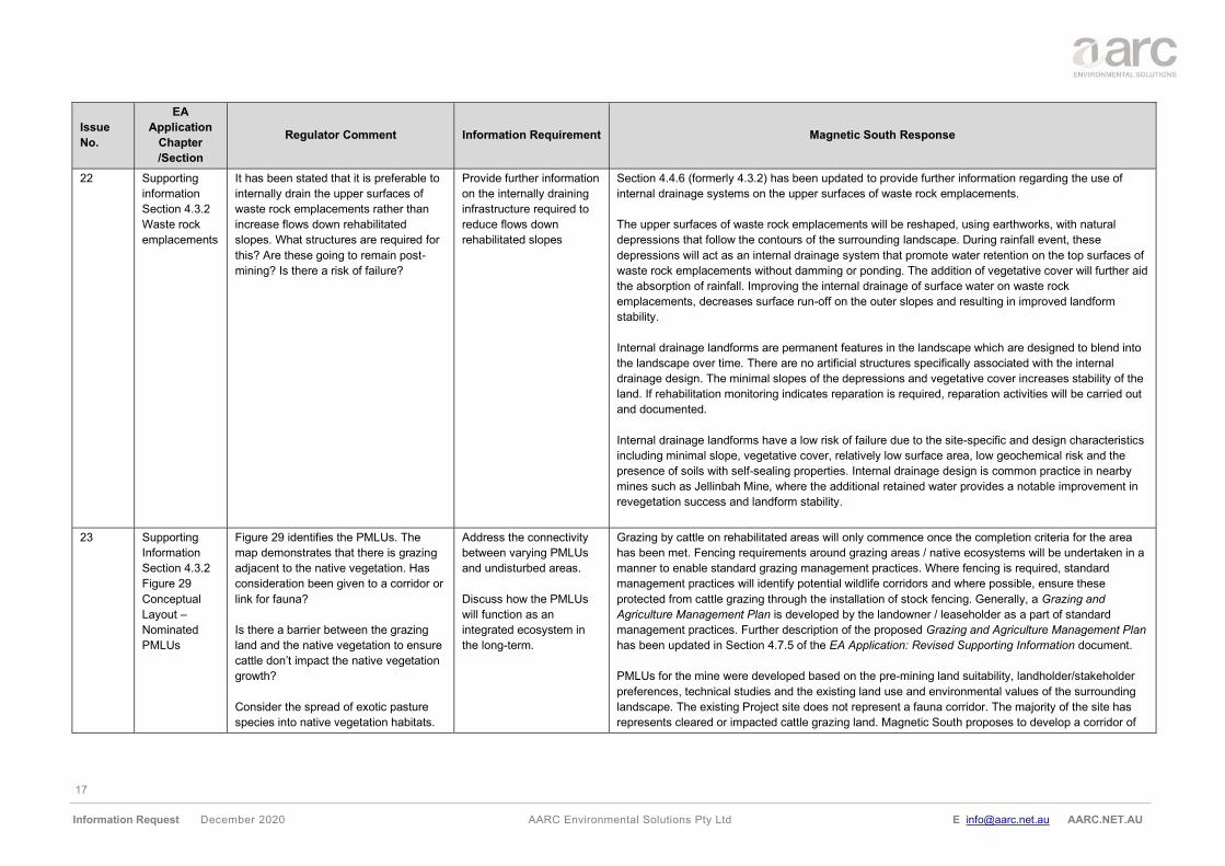
22 Supporting
information
Section 4.3.2
Waste rock
emplacements
It has been stated that it is preferable to
internally drain the upper surfaces of
waste rock emplacements rather than
increase flows down rehabilitated
slopes. What structures are required for
this? Are these going to remain post-
mining? Is there a risk of failure?
Provide further information
on the internally draining
infrastructure required to
reduce flows down
rehabilitated slopes
Section 4.4.6 (formerly 4.3.2) has been updated to provide further information regarding the use of
internal drainage systems on the upper surfaces of waste rock emplacements.
The upper surfaces of waste rock emplacements will be reshaped, using earthworks, with natural
depressions that follow the contours of the surrounding landscape. During rainfall event, these
depressions will act as an internal drainage system that promote water retention on the top surfaces of
waste rock emplacements without damming or ponding. The addition of vegetative cover will further aid
the absorption of rainfall. Improving the internal drainage of surface water on waste rock
emplacements, decreases surface run-off on the outer slopes and resulting in improved landform
stability.
Internal drainage landforms are permanent features in the landscape which are designed to blend into
the landscape over time. There are no artificial structures specifically associated with the internal
drainage design. The minimal slopes of the depressions and vegetative cover increases stability of the
land. If rehabilitation monitoring indicates reparation is required, reparation activities will be carried out
and documented.
Internal drainage landforms have a low risk of failure due to the site-specific and design characteristics
including minimal slope, vegetative cover, relatively low surface area, low geochemical risk and the
presence of soils with self-sealing properties. Internal drainage design is common practice in nearby
mines such as Jellinbah Mine, where the additional retained water provides a notable improvement in
revegetation success and landform stability.
23 Supporting
Information
Section 4.3.2
Figure 29
Conceptual
Layout –
Nominated
PMLUs
Figure 29 identifies the PMLUs. The
map demonstrates that there is grazing
adjacent to the native vegetation. Has
consideration been given to a corridor or
link for fauna?
Is there a barrier between the grazing
land and the native vegetation to ensure
cattle don’t impact the native vegetation
growth?
Consider the spread of exotic pasture
species into native vegetation habitats.
Address the connectivity
between varying PMLUs
and undisturbed areas.
Discuss how the PMLUs
will function as an
integrated ecosystem in
the long-term.
Grazing by cattle on rehabilitated areas will only commence once the completion criteria for the area
has been met. Fencing requirements around grazing areas / native ecosystems will be undertaken in a
manner to enable standard grazing management practices. Where fencing is required, standard
management practices will identify potential wildlife corridors and where possible, ensure these
protected from cattle grazing through the installation of stock fencing. Generally, a Grazing and
Agriculture Management Plan is developed by the landowner / leaseholder as a part of standard
management practices. Further description of the proposed Grazing and Agriculture Management Plan
has been updated in Section 4.7.5 of the EA Application: Revised Supporting Information document.
PMLUs for the mine were developed based on the pre-mining land suitability, landholder/stakeholder
preferences, technical studies and the existing land use and environmental values of the surrounding
landscape. The existing Project site does not represent a fauna corridor. The majority of the site has
represents cleared or impacted cattle grazing land. Magnetic South proposes to develop a corridor of
18
Information Request December 2020 AARC Environmental Solutions Pty Ltd E [email protected] AARC.NET.AU
Issue
No.
EA
Application
Chapter
/Section
Regulator Comment Information Requirement Magnetic South Response
native vegetation along the rehabilitated clean diversion water channels dissecting the site. These
corridors aim to improve on the existing connectivity values to the extent that is practical.
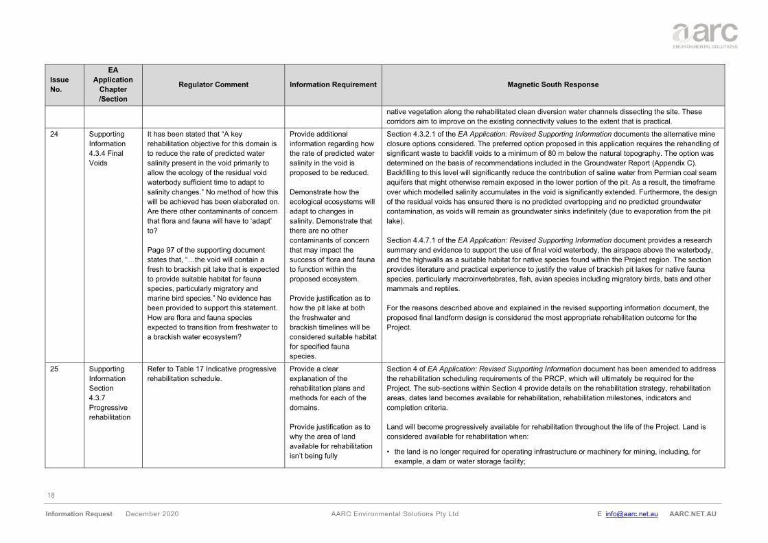
24 Supporting
Information
4.3.4 Final
Voids
It has been stated that “A key
rehabilitation objective for this domain is
to reduce the rate of predicted water
salinity present in the void primarily to
allow the ecology of the residual void
waterbody sufficient time to adapt to
salinity changes.” No method of how this
will be achieved has been elaborated on.
Are there other contaminants of concern
that flora and fauna will have to ‘adapt’
to?
Page 97 of the supporting document
states that, “…the void will contain a
fresh to brackish pit lake that is expected
to provide suitable habitat for fauna
species, particularly migratory and
marine bird species.” No evidence has
been provided to support this statement.
How are flora and fauna species
expected to transition from freshwater to
a brackish water ecosystem?
Provide additional
information regarding how
the rate of predicted water
salinity in the void is
proposed to be reduced.
Demonstrate how the
ecological ecosystems will
adapt to changes in
salinity. Demonstrate that
there are no other
contaminants of concern
that may impact the
success of flora and fauna
to function within the
proposed ecosystem.
Provide justification as to
how the pit lake at both
the freshwater and
brackish timelines will be
considered suitable habitat
for specified fauna
species.
Section 4.3.2.1 of the EA Application: Revised Supporting Information documents the alternative mine
closure options considered. The preferred option proposed in this application requires the rehandling of
significant waste to backfill voids to a minimum of 80 m below the natural topography. The option was
determined on the basis of recommendations included in the Groundwater Report (Appendix C).
Backfilling to this level will significantly reduce the contribution of saline water from Permian coal seam
aquifers that might otherwise remain exposed in the lower portion of the pit. As a result, the timeframe
over which modelled salinity accumulates in the void is significantly extended. Furthermore, the design
of the residual voids has ensured there is no predicted overtopping and no predicted groundwater
contamination, as voids will remain as groundwater sinks indefinitely (due to evaporation from the pit
lake).
Section 4.4.7.1 of the EA Application: Revised Supporting Information document provides a research
summary and evidence to support the use of final void waterbody, the airspace above the waterbody,
and the highwalls as a suitable habitat for native species found within the Project region. The section
provides literature and practical experience to justify the value of brackish pit lakes for native fauna
species, particularly macroinvertebrates, fish, avian species including migratory birds, bats and other
mammals and reptiles.
For the reasons described above and explained in the revised supporting information document, the
proposed final landform design is considered the most appropriate rehabilitation outcome for the
Project.
25 Supporting
Information
Section
4.3.7
Progressive
rehabilitation
Refer to Table 17 Indicative progressive
rehabilitation schedule.
Provide a clear
explanation of the
rehabilitation plans and
methods for each of the
domains.
Provide justification as to
why the area of land
available for rehabilitation
isn’t being fully
Section 4 of EA Application: Revised Supporting Information document has been amended to address
the rehabilitation scheduling requirements of the PRCP, which will ultimately be required for the
Project. The sub-sections within Section 4 provide details on the rehabilitation strategy, rehabilitation
areas, dates land becomes available for rehabilitation, rehabilitation milestones, indicators and
completion criteria.
Land will become progressively available for rehabilitation throughout the life of the Project. Land is
considered available for rehabilitation when:
• the land is no longer required for operating infrastructure or machinery for mining, including, for
example, a dam or water storage facility;
19
Information Request December 2020 AARC Environmental Solutions Pty Ltd E [email protected] AARC.NET.AU
Issue
No.
EA
Application
Chapter
/Section
Regulator Comment Information Requirement Magnetic South Response
rehabilitated in Year 8 and
Year 12.
Clarify where the values in
column 5 for ‘Total area
rehabilitated (ha)’ have
been derived from.
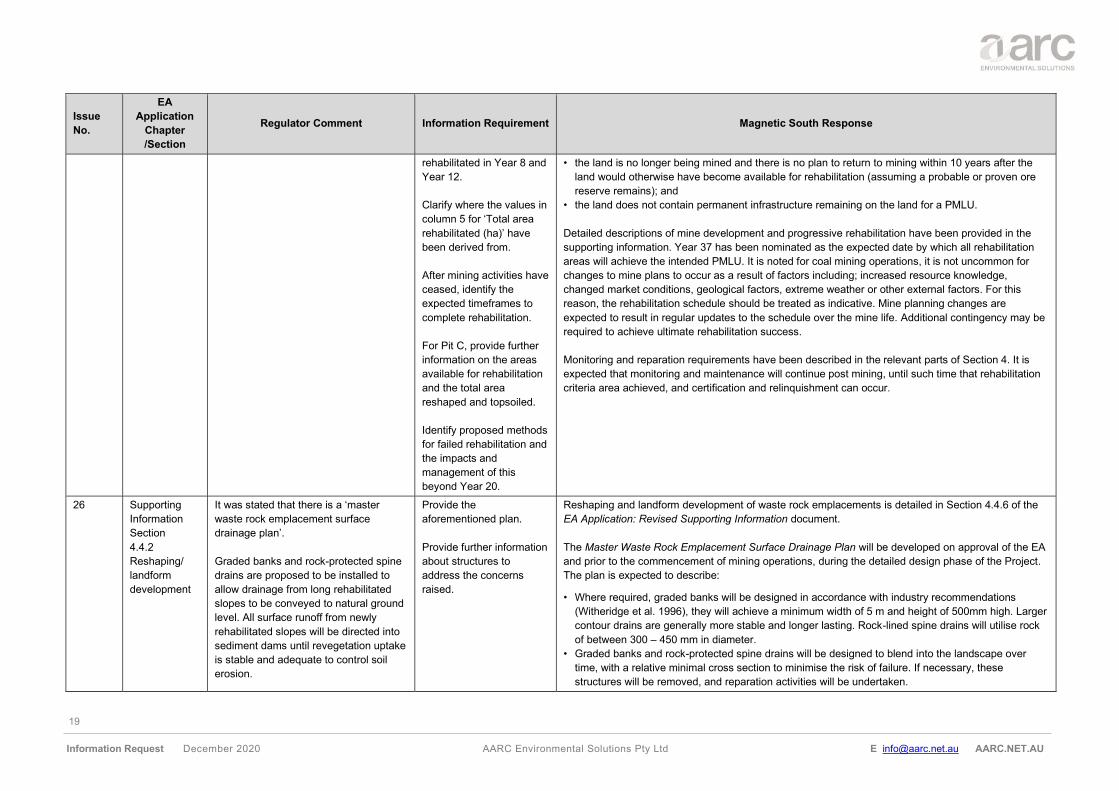
After mining activities have
ceased, identify the
expected timeframes to
complete rehabilitation.
For Pit C, provide further
information on the areas
available for rehabilitation
and the total area
reshaped and topsoiled.
Identify proposed methods
for failed rehabilitation and
the impacts and
management of this
beyond Year 20.
• the land is no longer being mined and there is no plan to return to mining within 10 years after the
land would otherwise have become available for rehabilitation (assuming a probable or proven ore
reserve remains); and
• the land does not contain permanent infrastructure remaining on the land for a PMLU.
Detailed descriptions of mine development and progressive rehabilitation have been provided in the
supporting information. Year 37 has been nominated as the expected date by which all rehabilitation
areas will achieve the intended PMLU. It is noted for coal mining operations, it is not uncommon for
changes to mine plans to occur as a result of factors including; increased resource knowledge,
changed market conditions, geological factors, extreme weather or other external factors. For this
reason, the rehabilitation schedule should be treated as indicative. Mine planning changes are
expected to result in regular updates to the schedule over the mine life. Additional contingency may be
required to achieve ultimate rehabilitation success.
Monitoring and reparation requirements have been described in the relevant parts of Section 4. It is
expected that monitoring and maintenance will continue post mining, until such time that rehabilitation
criteria area achieved, and certification and relinquishment can occur.
26 Supporting
Information
Section
4.4.2
Reshaping/
landform
development
It was stated that there is a ‘master
waste rock emplacement surface
drainage plan’.
Graded banks and rock-protected spine
drains are proposed to be installed to
allow drainage from long rehabilitated
slopes to be conveyed to natural ground
level. All surface runoff from newly
rehabilitated slopes will be directed into
sediment dams until revegetation uptake
is stable and adequate to control soil
erosion.
Provide the
aforementioned plan.
Provide further information
about structures to
address the concerns
raised.
Reshaping and landform development of waste rock emplacements is detailed in Section 4.4.6 of the
EA Application: Revised Supporting Information document.
The Master Waste Rock Emplacement Surface Drainage Plan will be developed on approval of the EA
and prior to the commencement of mining operations, during the detailed design phase of the Project.
The plan is expected to describe:
• Where required, graded banks will be designed in accordance with industry recommendations
(Witheridge et al. 1996), they will achieve a minimum width of 5 m and height of 500mm high. Larger
contour drains are generally more stable and longer lasting. Rock-lined spine drains will utilise rock
of between 300 – 450 mm in diameter.
• Graded banks and rock-protected spine drains will be designed to blend into the landscape over
time, with a relative minimal cross section to minimise the risk of failure. If necessary, these
structures will be removed, and reparation activities will be undertaken.
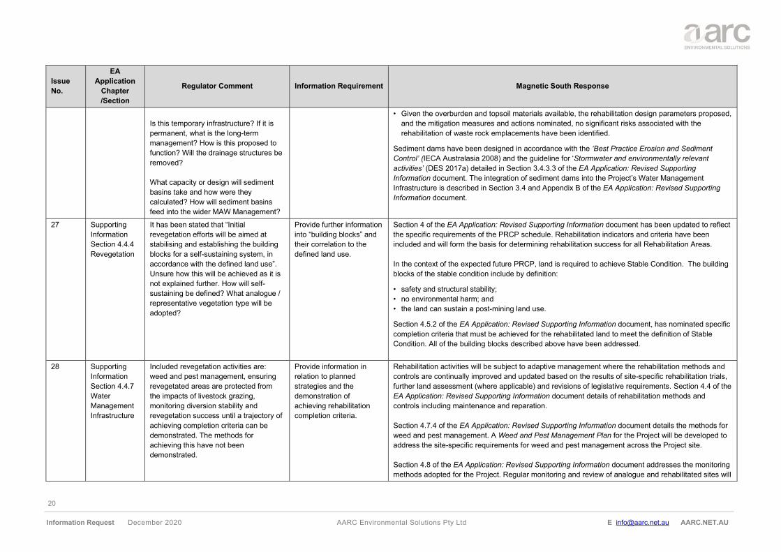
20
Information Request December 2020 AARC Environmental Solutions Pty Ltd E [email protected] AARC.NET.AU
Issue
No.
EA
Application
Chapter
/Section
Regulator Comment Information Requirement Magnetic South Response
Is this temporary infrastructure? If it is
permanent, what is the long-term
management? How is this proposed to
function? Will the drainage structures be
removed?
What capacity or design will sediment
basins take and how were they
calculated? How will sediment basins
feed into the wider MAW Management?
• Given the overburden and topsoil materials available, the rehabilitation design parameters proposed,
and the mitigation measures and actions nominated, no significant risks associated with the
rehabilitation of waste rock emplacements have been identified.
Sediment dams have been designed in accordance with the ‘Best Practice Erosion and Sediment
Control’ (IECA Australasia 2008) and the guideline for ‘Stormwater and environmentally relevant
activities’ (DES 2017a) detailed in Section 3.4.3.3 of the EA Application: Revised Supporting
Information document. The integration of sediment dams into the Project’s Water Management
Infrastructure is described in Section 3.4 and Appendix B of the EA Application: Revised Supporting
Information document.
27 Supporting
Information
Section 4.4.4
Revegetation
It has been stated that “Initial
revegetation efforts will be aimed at
stabilising and establishing the building
blocks for a self-sustaining system, in
accordance with the defined land use”.
Unsure how this will be achieved as it is
not explained further. How will self-
sustaining be defined? What analogue /
representative vegetation type will be
adopted?
Provide further information
into “building blocks” and
their correlation to the
defined land use.
Section 4 of the EA Application: Revised Supporting Information document has been updated to reflect
the specific requirements of the PRCP schedule. Rehabilitation indicators and criteria have been
included and will form the basis for determining rehabilitation success for all Rehabilitation Areas.
In the context of the expected future PRCP, land is required to achieve Stable Condition. The building
blocks of the stable condition include by definition:
• safety and structural stability;
• no environmental harm; and
• the land can sustain a post-mining land use.
Section 4.5.2 of the EA Application: Revised Supporting Information document, has nominated specific
completion criteria that must be achieved for the rehabilitated land to meet the definition of Stable
Condition. All of the building blocks described above have been addressed.
28 Supporting
Information
Section 4.4.7
Water
Management
Infrastructure
Included revegetation activities are:
weed and pest management, ensuring
revegetated areas are protected from
the impacts of livestock grazing,
monitoring diversion stability and
revegetation success until a trajectory of
achieving completion criteria can be
demonstrated. The methods for
achieving this have not been
demonstrated.
Provide information in
relation to planned
strategies and the
demonstration of
achieving rehabilitation
completion criteria.
Rehabilitation activities will be subject to adaptive management where the rehabilitation methods and
controls are continually improved and updated based on the results of site-specific rehabilitation trials,
further land assessment (where applicable) and revisions of legislative requirements. Section 4.4 of the
EA Application: Revised Supporting Information document details of rehabilitation methods and
controls including maintenance and reparation.
Section 4.7.4 of the EA Application: Revised Supporting Information document details the methods for
weed and pest management. A Weed and Pest Management Plan for the Project will be developed to
address the site-specific requirements for weed and pest management across the Project site.
Section 4.8 of the EA Application: Revised Supporting Information document addresses the monitoring
methods adopted for the Project. Regular monitoring and review of analogue and rehabilitated sites will
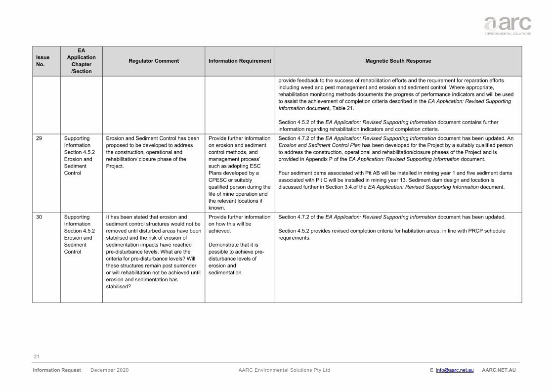
21
Information Request December 2020 AARC Environmental Solutions Pty Ltd E [email protected] AARC.NET.AU
Issue
No.
EA
Application
Chapter
/Section
Regulator Comment Information Requirement Magnetic South Response
provide feedback to the success of rehabilitation efforts and the requirement for reparation efforts
including weed and pest management and erosion and sediment control. Where appropriate,
rehabilitation monitoring methods documents the progress of performance indicators and will be used
to assist the achievement of completion criteria described in the EA Application: Revised Supporting
Information document, Table 21.
Section 4.5.2 of the EA Application: Revised Supporting Information document contains further
information regarding rehabilitation indicators and completion criteria.
29 Supporting
Information
Section 4.5.2
Erosion and
Sediment
Control
Erosion and Sediment Control has been
proposed to be developed to address
the construction, operational and
rehabilitation/ closure phase of the
Project.
Provide further information
on erosion and sediment
control methods, and
management process’
such as adopting ESC
Plans developed by a
CPESC or suitably
qualified person during the
life of mine operation and
the relevant locations if
known.
Section 4.7.2 of the EA Application: Revised Supporting Information document has been updated. An
Erosion and Sediment Control Plan has been developed for the Project by a suitably qualified person
to address the construction, operational and rehabilitation/closure phases of the Project and is
provided in Appendix P of the EA Application: Revised Supporting Information document.
Four sediment dams associated with Pit AB will be installed in mining year 1 and five sediment dams
associated with Pit C will be installed in mining year 13. Sediment dam design and location is
discussed further in Section 3.4.of the EA Application: Revised Supporting Information document.
30 Supporting
Information
Section 4.5.2
Erosion and
Sediment
Control
It has been stated that erosion and
sediment control structures would not be
removed until disturbed areas have been
stabilised and the risk of erosion of
sedimentation impacts have reached
pre-disturbance levels. What are the
criteria for pre-disturbance levels? Will
these structures remain post surrender
or will rehabilitation not be achieved until
erosion and sedimentation has
stabilised?
Provide further information
on how this will be
achieved.
Demonstrate that it is
possible to achieve pre-
disturbance levels of
erosion and
sedimentation.
Section 4.7.2 of the EA Application: Revised Supporting Information document has been updated.
Section 4.5.2 provides revised completion criteria for habitation areas, in line with PRCP schedule
requirements.
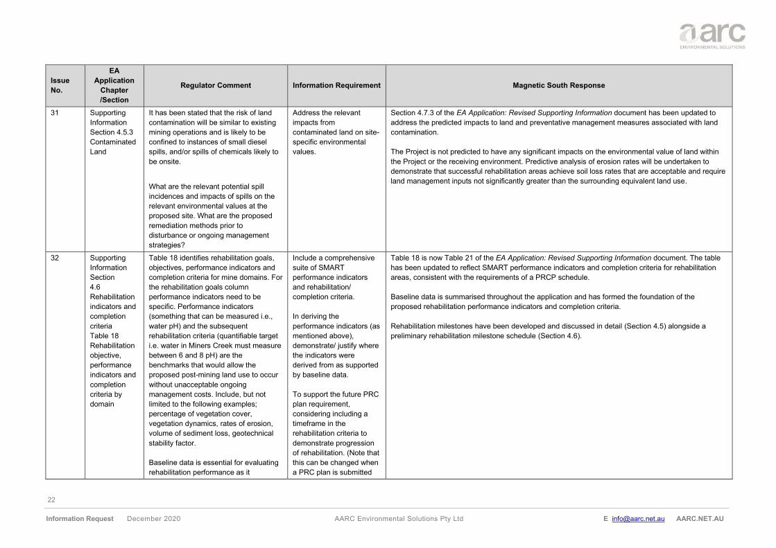
22
Information Request December 2020 AARC Environmental Solutions Pty Ltd E [email protected] AARC.NET.AU
Issue
No.
EA
Application
Chapter
/Section
Regulator Comment Information Requirement Magnetic South Response
31 Supporting
Information
Section 4.5.3
Contaminated
Land
It has been stated that the risk of land
contamination will be similar to existing
mining operations and is likely to be
confined to instances of small diesel
spills, and/or spills of chemicals likely to
be onsite.
What are the relevant potential spill
incidences and impacts of spills on the
relevant environmental values at the
proposed site. What are the proposed
remediation methods prior to
disturbance or ongoing management
strategies?
Address the relevant
impacts from
contaminated land on site-
specific environmental
values.
Section 4.7.3 of the EA Application: Revised Supporting Information document has been updated to
address the predicted impacts to land and preventative management measures associated with land
contamination.
The Project is not predicted to have any significant impacts on the environmental value of land within
the Project or the receiving environment. Predictive analysis of erosion rates will be undertaken to
demonstrate that successful rehabilitation areas achieve soil loss rates that are acceptable and require
land management inputs not significantly greater than the surrounding equivalent land use.
32 Supporting
Information
Section
4.6
Rehabilitation
indicators and
completion
criteria
Table 18
Rehabilitation
objective,
performance
indicators and
completion
criteria by
domain
Table 18 identifies rehabilitation goals,
objectives, performance indicators and
completion criteria for mine domains. For
the rehabilitation goals column
performance indicators need to be
specific. Performance indicators
(something that can be measured i.e.,
water pH) and the subsequent
rehabilitation criteria (quantifiable target
i.e. water in Miners Creek must measure
between 6 and 8 pH) are the
benchmarks that would allow the
proposed post-mining land use to occur
without unacceptable ongoing
management costs. Include, but not
limited to the following examples;
percentage of vegetation cover,
vegetation dynamics, rates of erosion,
volume of sediment loss, geotechnical
stability factor.
Baseline data is essential for evaluating
rehabilitation performance as it
Include a comprehensive
suite of SMART
performance indicators
and rehabilitation/
completion criteria.
In deriving the
performance indicators (as
mentioned above),
demonstrate/ justify where
the indicators were
derived from as supported
by baseline data.
To support the future PRC
plan requirement,
considering including a
timeframe in the
rehabilitation criteria to
demonstrate progression
of rehabilitation. (Note that
this can be changed when
a PRC plan is submitted
Table 18 is now Table 21 of the EA Application: Revised Supporting Information document. The table
has been updated to reflect SMART performance indicators and completion criteria for rehabilitation
areas, consistent with the requirements of a PRCP schedule.
Baseline data is summarised throughout the application and has formed the foundation of the
proposed rehabilitation performance indicators and completion criteria.
Rehabilitation milestones have been developed and discussed in detail (Section 4.5) alongside a
preliminary rehabilitation milestone schedule (Section 4.6).
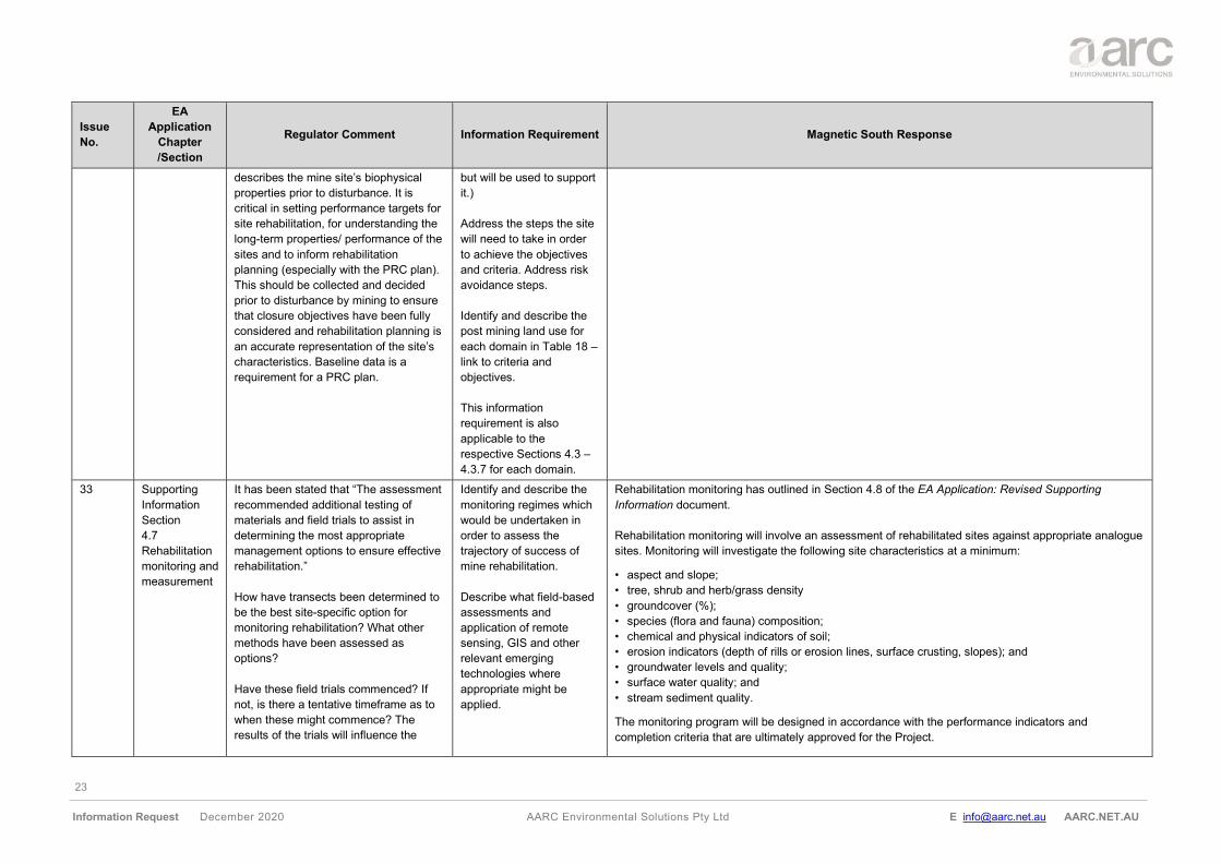
23
Information Request December 2020 AARC Environmental Solutions Pty Ltd E [email protected] AARC.NET.AU
Issue
No.
EA
Application
Chapter
/Section
Regulator Comment Information Requirement Magnetic South Response
describes the mine site’s biophysical
properties prior to disturbance. It is
critical in setting performance targets for
site rehabilitation, for understanding the
long-term properties/ performance of the
sites and to inform rehabilitation
planning (especially with the PRC plan).
This should be collected and decided
prior to disturbance by mining to ensure
that closure objectives have been fully
considered and rehabilitation planning is
an accurate representation of the site’s
characteristics. Baseline data is a
requirement for a PRC plan.
but will be used to support
it.)
Address the steps the site
will need to take in order
to achieve the objectives
and criteria. Address risk
avoidance steps.
Identify and describe the
post mining land use for
each domain in Table 18 –
link to criteria and
objectives.
This information
requirement is also
applicable to the
respective Sections 4.3 –
4.3.7 for each domain.
33 Supporting
Information
Section
4.7
Rehabilitation
monitoring and
measurement
It has been stated that “The assessment
recommended additional testing of
materials and field trials to assist in
determining the most appropriate
management options to ensure effective
rehabilitation.”
How have transects been determined to
be the best site-specific option for
monitoring rehabilitation? What other
methods have been assessed as
options?
Have these field trials commenced? If
not, is there a tentative timeframe as to
when these might commence? The
results of the trials will influence the
Identify and describe the
monitoring regimes which
would be undertaken in
order to assess the
trajectory of success of
mine rehabilitation.
Describe what field-based
assessments and
application of remote
sensing, GIS and other
relevant emerging
technologies where
appropriate might be
applied.
Rehabilitation monitoring has outlined in Section 4.8 of the EA Application: Revised Supporting
Information document.
Rehabilitation monitoring will involve an assessment of rehabilitated sites against appropriate analogue
sites. Monitoring will investigate the following site characteristics at a minimum:
• aspect and slope;
• tree, shrub and herb/grass density
• groundcover (%);
• species (flora and fauna) composition;
• chemical and physical indicators of soil;
• erosion indicators (depth of rills or erosion lines, surface crusting, slopes); and
• groundwater levels and quality;
• surface water quality; and
• stream sediment quality.
The monitoring program will be designed in accordance with the performance indicators and
completion criteria that are ultimately approved for the Project.
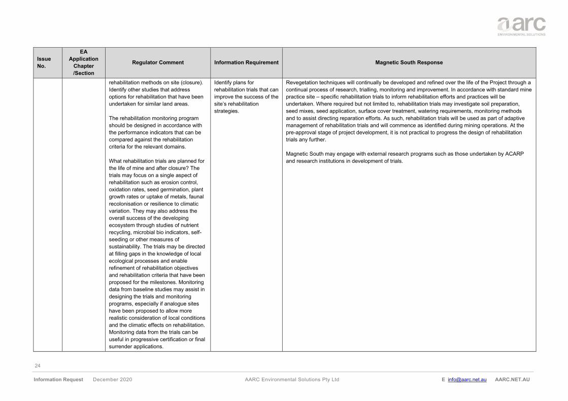
24
Information Request December 2020 AARC Environmental Solutions Pty Ltd E [email protected] AARC.NET.AU
Issue
No.
EA
Application
Chapter
/Section
Regulator Comment Information Requirement Magnetic South Response
rehabilitation methods on site (closure).
Identify other studies that address
options for rehabilitation that have been
undertaken for similar land areas.
The rehabilitation monitoring program
should be designed in accordance with
the performance indicators that can be
compared against the rehabilitation
criteria for the relevant domains.
What rehabilitation trials are planned for
the life of mine and after closure? The
trials may focus on a single aspect of
rehabilitation such as erosion control,
oxidation rates, seed germination, plant
growth rates or uptake of metals, faunal
recolonisation or resilience to climatic
variation. They may also address the
overall success of the developing
ecosystem through studies of nutrient
recycling, microbial bio indicators, self-
seeding or other measures of
sustainability. The trials may be directed
at filling gaps in the knowledge of local
ecological processes and enable
refinement of rehabilitation objectives
and rehabilitation criteria that have been
proposed for the milestones. Monitoring
data from baseline studies may assist in
designing the trials and monitoring
programs, especially if analogue sites
have been proposed to allow more
realistic consideration of local conditions
and the climatic effects on rehabilitation.
Monitoring data from the trials can be
useful in progressive certification or final
surrender applications.
Identify plans for
rehabilitation trials that can
improve the success of the
site’s rehabilitation
strategies.
Revegetation techniques will continually be developed and refined over the life of the Project through a
continual process of research, trialling, monitoring and improvement. In accordance with standard mine
practice site – specific rehabilitation trials to inform rehabilitation efforts and practices will be
undertaken. Where required but not limited to, rehabilitation trials may investigate soil preparation,
seed mixes, seed application, surface cover treatment, watering requirements, monitoring methods
and to assist directing reparation efforts. As such, rehabilitation trials will be used as part of adaptive
management of rehabilitation trials and will commence as identified during mining operations. At the
pre-approval stage of project development, it is not practical to progress the design of rehabilitation
trials any further.
Magnetic South may engage with external research programs such as those undertaken by ACARP
and research institutions in development of trials.
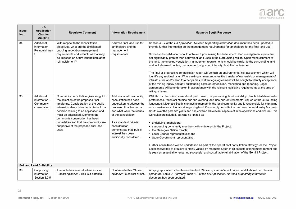
25
Information Request December 2020 AARC Environmental Solutions Pty Ltd E [email protected] AARC.NET.AU
Issue
No.
EA
Application
Chapter
/Section
Regulator Comment Information Requirement Magnetic South Response
34 Additional
information –
Relinquishmen
t
With respect to the rehabilitation
objectives, what are the anticipated
ongoing vegetation management
requirements and restrictions that may
be imposed on future landholders after
relinquishment?
Address final land use for
landholders and the
management
requirements.
Section 4.9.2 of the EA Application: Revised Supporting Information document has been updated to
provide further information on the management requirements for landholders for the final land use.
Successful rehabilitation should achieve a post mining land use where land management inputs are
not significantly greater than equivalent land uses in the surrounding region. Upon relinquishment of
the land. the ongoing vegetation management requirements should be similar to the surrounding land
and include weed control, management of grazing intensity, bushfire controls, etc.
The final or progressive rehabilitation report will contain an environmental risk assessment which will
identify any residual risks. Where relinquishment requires the transfer of ownership or management of
infrastructure and/or land to other parties, written legal agreement will be sought to identify acceptance
of the mining legacy and any outstanding costs of remediation, monitoring and reporting. Legal
agreements will be undertaken in accordance with the relevant legislative requirements at the time of
relinquishment.
35 Additional
information –
Community
consultation
Community consultation gives weight to
the selection of the proposed final
landforms. Consideration of the public
interest is also a ‘standard criteria’ for a
decision relating to an application and
must be addressed. Demonstrate
community consultation has been
undertaken and that the community are
supportive of the proposed final land
uses.
Address what community
consultation has been
undertaken to address the
proposed final landforms
and what were the results
of the consultation.
As a standard criteria
consideration,
demonstrate that ‘public
interest’ has been
sufficiently considered.
PMLUs for the mine were developed based on pre-mining land suitability, landholder/stakeholder
preferences, technical studies and the existing land use and environmental values of the surrounding
landscape. Magnetic South is an active member in the local community and is responsible for managing
an extensive area of local cattle grazing land. Community consultation has been undertaken by Magnetic
South over the past two years and has covered all relevant aspects of mine operations and closure. This
Consultation included, but was no limited to:
• underlying landholders;
• surrounding community members with an interest in the Project;
• the Gaangalu Nation People;
• Local Council representatives; and
• State Government representative.
Further consultation will be undertaken as part of the operational consultation strategy for the Project.
Local knowledge of graziers is highly valued by Magnetic South in all aspects of land management and
is seen as essential for ensuring successful and sustainable rehabilitation of the Gemini Project.
Soil and Land Suitability
36 Supporting
information
Section 5.2.5
The table has several references to
‘Cassia spinarum’. This is a potential
Confirm whether ‘Cassia
spinarum’ is correct or not.
A typographical error has been identified, ‘Cassia spinarum’ is not correct and it should be ‘Carissa
spinarum’. Table 21 (formerly Table 19) of the EA Application: Revised Supporting Information
document has been updated.
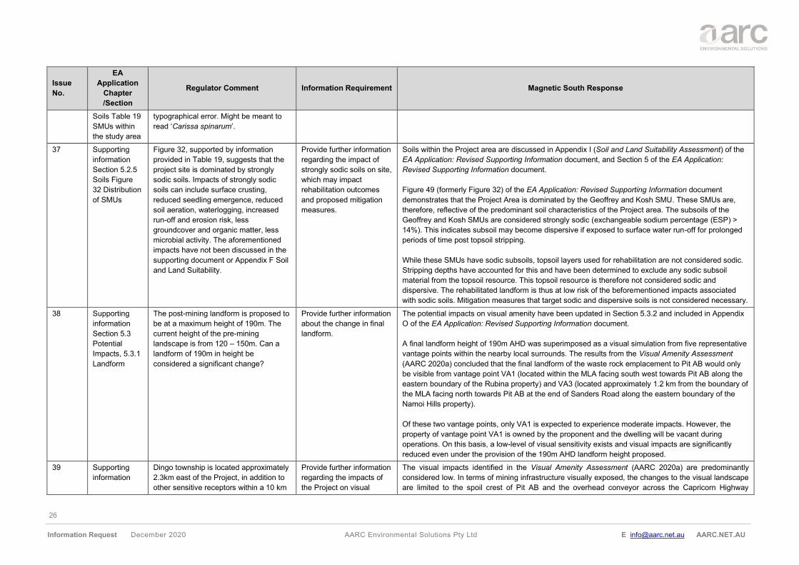
26
Information Request December 2020 AARC Environmental Solutions Pty Ltd E [email protected] AARC.NET.AU
Issue
No.
EA
Application
Chapter
/Section
Regulator Comment Information Requirement Magnetic South Response
Soils Table 19
SMUs within
the study area
typographical error. Might be meant to
read ‘Carissa spinarum’.
37 Supporting
information
Section 5.2.5
Soils Figure
32 Distribution
of SMUs
Figure 32, supported by information
provided in Table 19, suggests that the
project site is dominated by strongly
sodic soils. Impacts of strongly sodic
soils can include surface crusting,
reduced seedling emergence, reduced
soil aeration, waterlogging, increased
run-off and erosion risk, less
groundcover and organic matter, less
microbial activity. The aforementioned
impacts have not been discussed in the
supporting document or Appendix F Soil
and Land Suitability.
Provide further information
regarding the impact of
strongly sodic soils on site,
which may impact
rehabilitation outcomes
and proposed mitigation
measures.
Soils within the Project area are discussed in Appendix I (Soil and Land Suitability Assessment) of the
EA Application: Revised Supporting Information document, and Section 5 of the EA Application:
Revised Supporting Information document.
Figure 49 (formerly Figure 32) of the EA Application: Revised Supporting Information document
demonstrates that the Project Area is dominated by the Geoffrey and Kosh SMU. These SMUs are,
therefore, reflective of the predominant soil characteristics of the Project area. The subsoils of the
Geoffrey and Kosh SMUs are considered strongly sodic (exchangeable sodium percentage (ESP) >
14%). This indicates subsoil may become dispersive if exposed to surface water run-off for prolonged
periods of time post topsoil stripping.
While these SMUs have sodic subsoils, topsoil layers used for rehabilitation are not considered sodic.
Stripping depths have accounted for this and have been determined to exclude any sodic subsoil
material from the topsoil resource. This topsoil resource is therefore not considered sodic and
dispersive. The rehabilitated landform is thus at low risk of the beforementioned impacts associated
with sodic soils. Mitigation measures that target sodic and dispersive soils is not considered necessary.
38 Supporting
information
Section 5.3
Potential
Impacts, 5.3.1
Landform
The post-mining landform is proposed to
be at a maximum height of 190m. The
current height of the pre-mining
landscape is from 120 – 150m. Can a
landform of 190m in height be
considered a significant change?
Provide further information
about the change in final
landform.
The potential impacts on visual amenity have been updated in Section 5.3.2 and included in Appendix
O of the EA Application: Revised Supporting Information document.
A final landform height of 190m AHD was superimposed as a visual simulation from five representative
vantage points within the nearby local surrounds. The results from the Visual Amenity Assessment
(AARC 2020a) concluded that the final landform of the waste rock emplacement to Pit AB would only
be visible from vantage point VA1 (located within the MLA facing south west towards Pit AB along the
eastern boundary of the Rubina property) and VA3 (located approximately 1.2 km from the boundary of
the MLA facing north towards Pit AB at the end of Sanders Road along the eastern boundary of the
Namoi Hills property).
Of these two vantage points, only VA1 is expected to experience moderate impacts. However, the
property of vantage point VA1 is owned by the proponent and the dwelling will be vacant during
operations. On this basis, a low-level of visual sensitivity exists and visual impacts are significantly
reduced even under the provision of the 190m AHD landform height proposed.
39 Supporting
information
Dingo township is located approximately
2.3km east of the Project, in addition to
other sensitive receptors within a 10 km
Provide further information
regarding the impacts of
the Project on visual
The visual impacts identified in the Visual Amenity Assessment (AARC 2020a) are predominantly
considered low. In terms of mining infrastructure visually exposed, the changes to the visual landscape
are limited to the spoil crest of Pit AB and the overhead conveyor across the Capricorn Highway
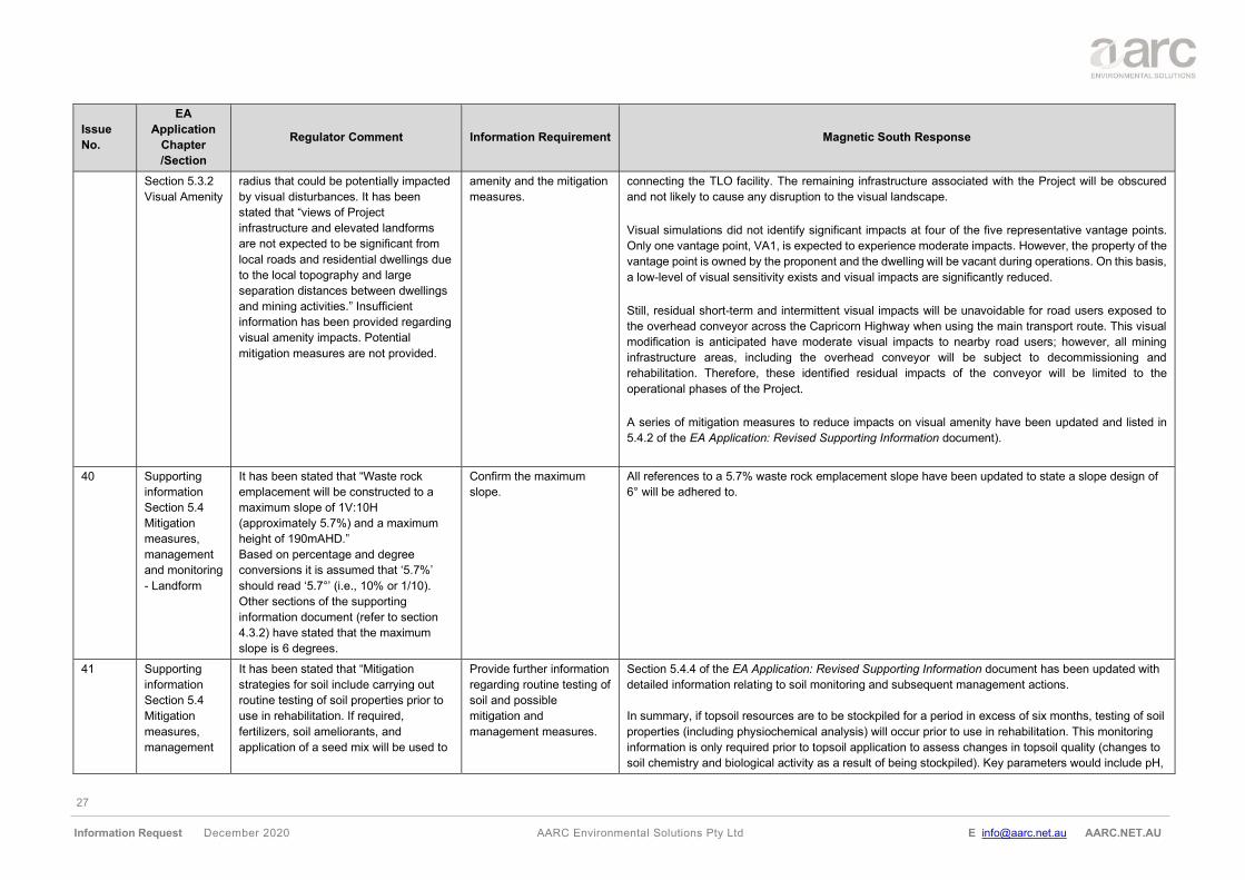
27
Information Request December 2020 AARC Environmental Solutions Pty Ltd E [email protected] AARC.NET.AU
Issue
No.
EA
Application
Chapter
/Section
Regulator Comment Information Requirement Magnetic South Response
Section 5.3.2
Visual Amenity
radius that could be potentially impacted
by visual disturbances. It has been
stated that “views of Project
infrastructure and elevated landforms
are not expected to be significant from
local roads and residential dwellings due
to the local topography and large
separation distances between dwellings
and mining activities.” Insufficient
information has been provided regarding
visual amenity impacts. Potential
mitigation measures are not provided.
amenity and the mitigation
measures.
connecting the TLO facility. The remaining infrastructure associated with the Project will be obscured
and not likely to cause any disruption to the visual landscape.
Visual simulations did not identify significant impacts at four of the five representative vantage points.
Only one vantage point, VA1, is expected to experience moderate impacts. However, the property of the
vantage point is owned by the proponent and the dwelling will be vacant during operations. On this basis,
a low-level of visual sensitivity exists and visual impacts are significantly reduced.
Still, residual short-term and intermittent visual impacts will be unavoidable for road users exposed to
the overhead conveyor across the Capricorn Highway when using the main transport route. This visual
modification is anticipated have moderate visual impacts to nearby road users; however, all mining
infrastructure areas, including the overhead conveyor will be subject to decommissioning and
rehabilitation. Therefore, these identified residual impacts of the conveyor will be limited to the
operational phases of the Project.
A series of mitigation measures to reduce impacts on visual amenity have been updated and listed in
5.4.2 of the EA Application: Revised Supporting Information document).
40 Supporting
information
Section 5.4
Mitigation
measures,
management
and monitoring
- Landform
It has been stated that “Waste rock
emplacement will be constructed to a
maximum slope of 1V:10H
(approximately 5.7%) and a maximum
height of 190mAHD.”
Based on percentage and degree
conversions it is assumed that ‘5.7%’
should read ‘5.7°’ (i.e., 10% or 1/10).
Other sections of the supporting
information document (refer to section
4.3.2) have stated that the maximum
slope is 6 degrees.
Confirm the maximum
slope.
All references to a 5.7% waste rock emplacement slope have been updated to state a slope design of
6° will be adhered to.
41 Supporting
information
Section 5.4
Mitigation
measures,
management
It has been stated that “Mitigation
strategies for soil include carrying out
routine testing of soil properties prior to
use in rehabilitation. If required,
fertilizers, soil ameliorants, and
application of a seed mix will be used to
Provide further information
regarding routine testing of
soil and possible
mitigation and
management measures.
Section 5.4.4 of the EA Application: Revised Supporting Information document has been updated with
detailed information relating to soil monitoring and subsequent management actions.
In summary, if topsoil resources are to be stockpiled for a period in excess of six months, testing of soil
properties (including physiochemical analysis) will occur prior to use in rehabilitation. This monitoring
information is only required prior to topsoil application to assess changes in topsoil quality (changes to
soil chemistry and biological activity as a result of being stockpiled). Key parameters would include pH,
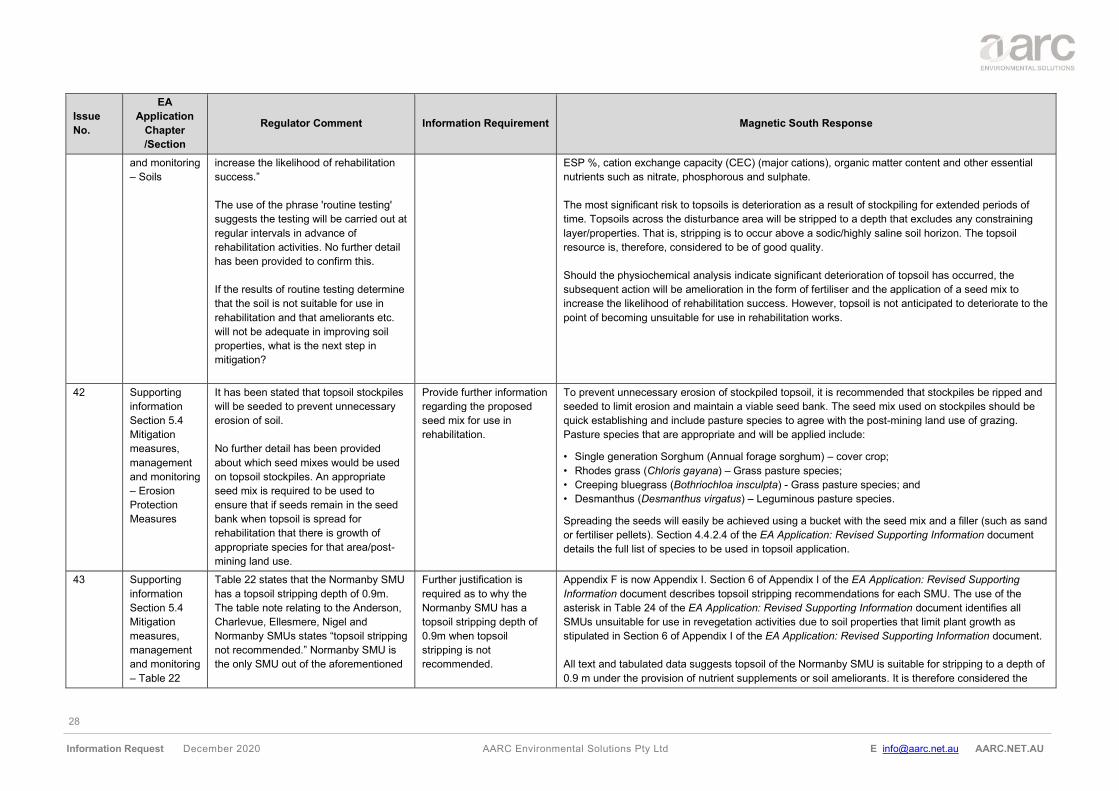
28
Information Request December 2020 AARC Environmental Solutions Pty Ltd E [email protected] AARC.NET.AU
Issue
No.
EA
Application
Chapter
/Section
Regulator Comment Information Requirement Magnetic South Response
and monitoring
– Soils
increase the likelihood of rehabilitation
success.”
The use of the phrase 'routine testing'
suggests the testing will be carried out at
regular intervals in advance of
rehabilitation activities. No further detail
has been provided to confirm this.
If the results of routine testing determine
that the soil is not suitable for use in
rehabilitation and that ameliorants etc.
will not be adequate in improving soil
properties, what is the next step in
mitigation?
ESP %, cation exchange capacity (CEC) (major cations), organic matter content and other essential
nutrients such as nitrate, phosphorous and sulphate.
The most significant risk to topsoils is deterioration as a result of stockpiling for extended periods of
time. Topsoils across the disturbance area will be stripped to a depth that excludes any constraining
layer/properties. That is, stripping is to occur above a sodic/highly saline soil horizon. The topsoil
resource is, therefore, considered to be of good quality.
Should the physiochemical analysis indicate significant deterioration of topsoil has occurred, the
subsequent action will be amelioration in the form of fertiliser and the application of a seed mix to
increase the likelihood of rehabilitation success. However, topsoil is not anticipated to deteriorate to the
point of becoming unsuitable for use in rehabilitation works.
42 Supporting
information
Section 5.4
Mitigation
measures,
management
and monitoring
– Erosion
Protection
Measures
It has been stated that topsoil stockpiles
will be seeded to prevent unnecessary
erosion of soil.
No further detail has been provided
about which seed mixes would be used
on topsoil stockpiles. An appropriate
seed mix is required to be used to
ensure that if seeds remain in the seed
bank when topsoil is spread for
rehabilitation that there is growth of
appropriate species for that area/post-
mining land use.
Provide further information
regarding the proposed
seed mix for use in
rehabilitation.
To prevent unnecessary erosion of stockpiled topsoil, it is recommended that stockpiles be ripped and
seeded to limit erosion and maintain a viable seed bank. The seed mix used on stockpiles should be
quick establishing and include pasture species to agree with the post-mining land use of grazing.
Pasture species that are appropriate and will be applied include:
• Single generation Sorghum (Annual forage sorghum) – cover crop;
• Rhodes grass (Chloris gayana) – Grass pasture species;
• Creeping bluegrass (Bothriochloa insculpta) - Grass pasture species; and
• Desmanthus (Desmanthus virgatus) – Leguminous pasture species.
Spreading the seeds will easily be achieved using a bucket with the seed mix and a filler (such as sand
or fertiliser pellets). Section 4.4.2.4 of the EA Application: Revised Supporting Information document
details the full list of species to be used in topsoil application.
43 Supporting
information
Section 5.4
Mitigation
measures,
management
and monitoring
– Table 22
Table 22 states that the Normanby SMU
has a topsoil stripping depth of 0.9m.
The table note relating to the Anderson,
Charlevue, Ellesmere, Nigel and
Normanby SMUs states “topsoil stripping
not recommended.” Normanby SMU is
the only SMU out of the aforementioned
Further justification is
required as to why the
Normanby SMU has a
topsoil stripping depth of
0.9m when topsoil
stripping is not
recommended.
Appendix F is now Appendix I. Section 6 of Appendix I of the EA Application: Revised Supporting
Information document describes topsoil stripping recommendations for each SMU. The use of the
asterisk in Table 24 of the EA Application: Revised Supporting Information document identifies all
SMUs unsuitable for use in revegetation activities due to soil properties that limit plant growth as
stipulated in Section 6 of Appendix I of the EA Application: Revised Supporting Information document.
All text and tabulated data suggests topsoil of the Normanby SMU is suitable for stripping to a depth of
0.9 m under the provision of nutrient supplements or soil ameliorants. It is therefore considered the
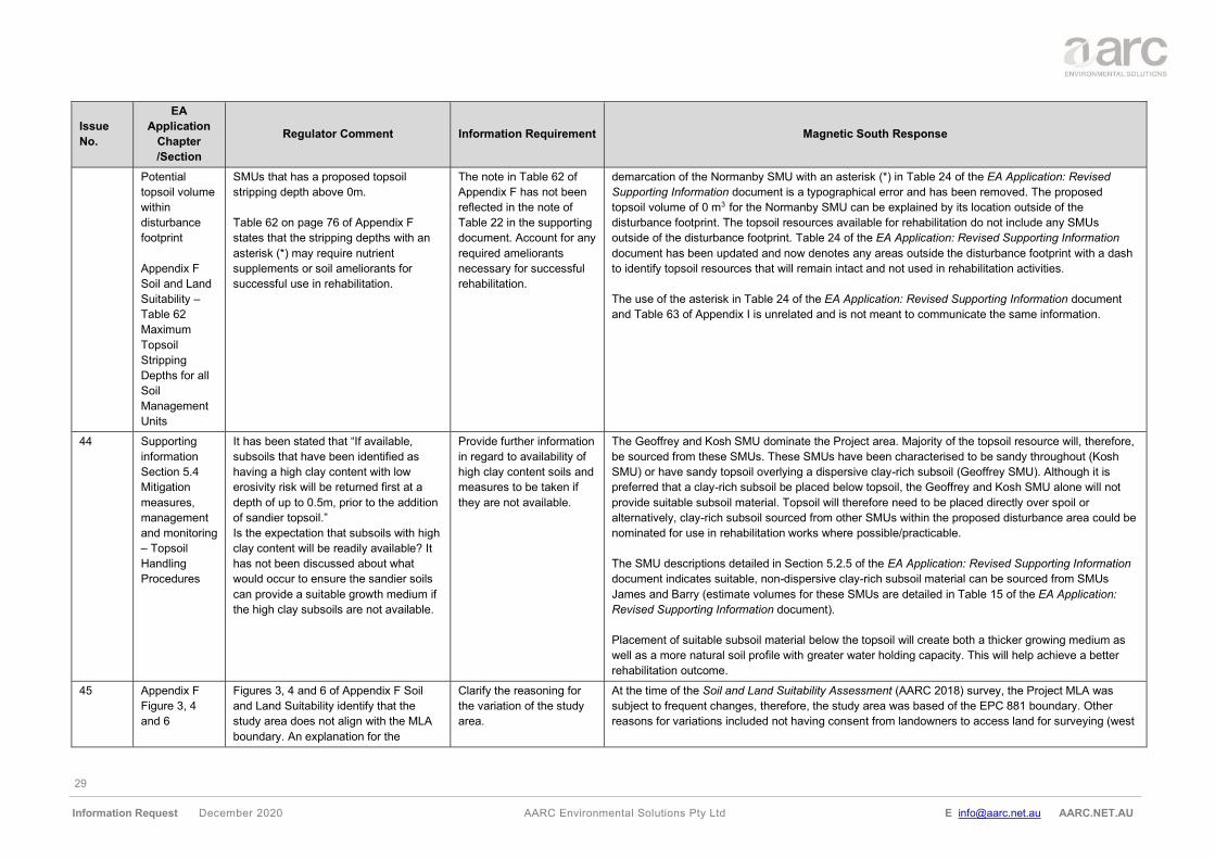
29
Information Request December 2020 AARC Environmental Solutions Pty Ltd E [email protected] AARC.NET.AU
Issue
No.
EA
Application
Chapter
/Section
Regulator Comment Information Requirement Magnetic South Response
Potential
topsoil volume
within
disturbance
footprint
Appendix F
Soil and Land
Suitability –
Table 62
Maximum
Topsoil
Stripping
Depths for all
Soil
Management
Units
SMUs that has a proposed topsoil
stripping depth above 0m.
Table 62 on page 76 of Appendix F
states that the stripping depths with an
asterisk (*) may require nutrient
supplements or soil ameliorants for
successful use in rehabilitation.
The note in Table 62 of
Appendix F has not been
reflected in the note of
Table 22 in the supporting
document. Account for any
required ameliorants
necessary for successful
rehabilitation.
demarcation of the Normanby SMU with an asterisk (*) in Table 24 of the EA Application: Revised
Supporting Information document is a typographical error and has been removed. The proposed
topsoil volume of 0 m3 for the Normanby SMU can be explained by its location outside of the
disturbance footprint. The topsoil resources available for rehabilitation do not include any SMUs
outside of the disturbance footprint. Table 24 of the EA Application: Revised Supporting Information
document has been updated and now denotes any areas outside the disturbance footprint with a dash
to identify topsoil resources that will remain intact and not used in rehabilitation activities.
The use of the asterisk in Table 24 of the EA Application: Revised Supporting Information document
and Table 63 of Appendix I is unrelated and is not meant to communicate the same information.
44 Supporting
information
Section 5.4
Mitigation
measures,
management
and monitoring
– Topsoil
Handling
Procedures
It has been stated that “If available,
subsoils that have been identified as
having a high clay content with low
erosivity risk will be returned first at a
depth of up to 0.5m, prior to the addition
of sandier topsoil.”
Is the expectation that subsoils with high
clay content will be readily available? It
has not been discussed about what
would occur to ensure the sandier soils
can provide a suitable growth medium if
the high clay subsoils are not available.
Provide further information
in regard to availability of
high clay content soils and
measures to be taken if
they are not available.
The Geoffrey and Kosh SMU dominate the Project area. Majority of the topsoil resource will, therefore,
be sourced from these SMUs. These SMUs have been characterised to be sandy throughout (Kosh
SMU) or have sandy topsoil overlying a dispersive clay-rich subsoil (Geoffrey SMU). Although it is
preferred that a clay-rich subsoil be placed below topsoil, the Geoffrey and Kosh SMU alone will not
provide suitable subsoil material. Topsoil will therefore need to be placed directly over spoil or
alternatively, clay-rich subsoil sourced from other SMUs within the proposed disturbance area could be
nominated for use in rehabilitation works where possible/practicable.
The SMU descriptions detailed in Section 5.2.5 of the EA Application: Revised Supporting Information
document indicates suitable, non-dispersive clay-rich subsoil material can be sourced from SMUs
James and Barry (estimate volumes for these SMUs are detailed in Table 15 of the EA Application:
Revised Supporting Information document).
Placement of suitable subsoil material below the topsoil will create both a thicker growing medium as
well as a more natural soil profile with greater water holding capacity. This will help achieve a better
rehabilitation outcome.
45 Appendix F
Figure 3, 4
and 6
Figures 3, 4 and 6 of Appendix F Soil
and Land Suitability identify that the
study area does not align with the MLA
boundary. An explanation for the
Clarify the reasoning for
the variation of the study
area.
At the time of the Soil and Land Suitability Assessment (AARC 2018) survey, the Project MLA was
subject to frequent changes, therefore, the study area was based of the EPC 881 boundary. Other
reasons for variations included not having consent from landowners to access land for surveying (west
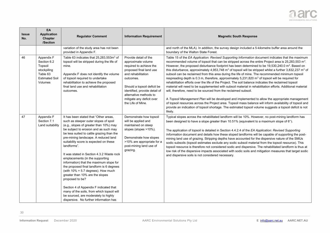
30
Information Request December 2020 AARC Environmental Solutions Pty Ltd E [email protected] AARC.NET.AU
Issue
No.
EA
Application
Chapter
/Section
Regulator Comment Information Requirement Magnetic South Response
variation of the study area has not been
provided in Appendix F.
and north of the MLA). In addition, the survey design included a 5-kilometre buffer area around the
boundary of the Walton State Forest.
46 Appendix F
Section 6.2
Topsoil
stockpiling
Table 63
Estimated Soil
Volumes
Table 63 indicates that 25,283,553m3 of
topsoil will be stripped during the life of
mine.
Appendix F does not identify the volume
of topsoil required to undertake
rehabilitation to achieve the proposed
final land use and rehabilitation
outcomes.
Provide detail of the
approximate volume
required to achieve the
proposed final land use
and rehabilitation
outcomes.
Should a topsoil deficit be
identified, provide detail of
alternative methods to
mitigate any deficit over
the Life of Mine.
Table 15 of the EA Application: Revised Supporting Information document indicates that the maximum
recommended volume of topsoil that can be stripped across the entire Project area is 25,283,553 m3.
However, the proposed disturbance footprint has been determined to be 19,530,240.0 m2. Based on
this disturbance, approximately 4,953,748 m3 of topsoil will be stripped whilst a further 3,832,237 m3 of
subsoil can be reclaimed from this area during the life of mine. The recommended minimum topsoil
respreading depth is 0.3 m, therefore, approximately 5,231,820 m3 of topsoil will be required for
rehabilitation efforts over the life of the Project. The soil balance indicates the reclaimed topsoil
material will need to be supplemented with subsoil material in rehabilitation efforts. Additional material
will, therefore, need to be sourced from the reclaimed subsoil.
A Topsoil Management Plan will be developed and implemented to allow the appropriate management
of topsoil resources across the Project area. Topsoil mass balance will inform availability of topsoil and
provide an indication of topsoil shortage. The estimated topsoil volume suggests a topsoil deficit is not
likely.
47 Appendix F
Section 7.1
Land suitability
It has been stated that “Other areas,
such as steeper outer slopes of spoil
(e.g., slopes of greater than 10%) may
be subject to erosion and as such may
be less suited to cattle grazing than the
pre-mining landscape. A reduced land
suitability score is expected on these
landforms”.
It was stated in Section 4.3.2 Waste rock
emplacements (in the supporting
information) that the maximum slope for
the proposed final landform is 6 degrees
(with 10% = 5.7 degrees). How much
greater than 10% are the slopes
proposed to be?
Section 4 of Appendix F indicated that
many of the soils, from which topsoil will
be sourced, are moderately to highly
dispersive. No further information has
Demonstrate how topsoil
will be applied and
maintained on steep
slopes (slopes >10%).
Demonstrate how slopes
>10% are appropriate for a
post-mining land use of
grazing.
Typical slopes across the rehabilitated landform will be 10%. However, no post-mining landform has
been designed to have a slope greater than 10.51% (equivalent to a maximum slope of 6°).
The application of topsoil is detailed in Section 4.4.2.4 of the EA Application: Revised Supporting
Information document and details how these sloped landforms will be capable of supporting the post-
mining land use of grazing. Stripping depths have accounted for the dispersive nature of the SMUs
sodic subsoils (topsoil estimates exclude any sodic subsoil material from the topsoil resource). This
topsoil resource is therefore not considered sodic and dispersive. The rehabilitated landform is thus at
low risk of the dispersive impacts associated with sodic soils and mitigation measures that target sodic
and dispersive soils is not considered necessary.
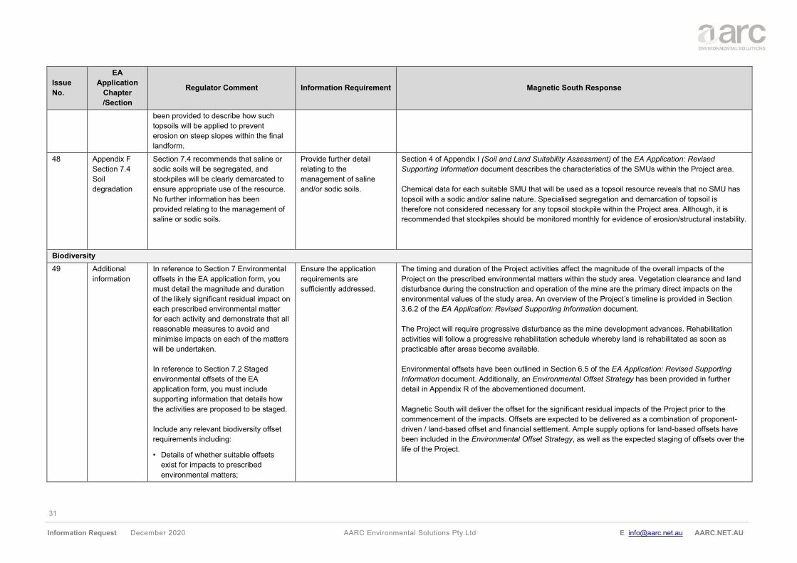
31
Information Request December 2020 AARC Environmental Solutions Pty Ltd E [email protected] AARC.NET.AU
Issue
No.
EA
Application
Chapter
/Section
Regulator Comment Information Requirement Magnetic South Response
been provided to describe how such
topsoils will be applied to prevent
erosion on steep slopes within the final
landform.
48 Appendix F
Section 7.4
Soil
degradation
Section 7.4 recommends that saline or
sodic soils will be segregated, and
stockpiles will be clearly demarcated to
ensure appropriate use of the resource.
No further information has been
provided relating to the management of
saline or sodic soils.
Provide further detail
relating to the
management of saline
and/or sodic soils.
Section 4 of Appendix I (Soil and Land Suitability Assessment) of the EA Application: Revised
Supporting Information document describes the characteristics of the SMUs within the Project area.
Chemical data for each suitable SMU that will be used as a topsoil resource reveals that no SMU has
topsoil with a sodic and/or saline nature. Specialised segregation and demarcation of topsoil is
therefore not considered necessary for any topsoil stockpile within the Project area. Although, it is
recommended that stockpiles should be monitored monthly for evidence of erosion/structural instability.
Biodiversity
49 Additional
information
In reference to Section 7 Environmental
offsets in the EA application form, you
must detail the magnitude and duration
of the likely significant residual impact on
each prescribed environmental matter
for each activity and demonstrate that all
reasonable measures to avoid and
minimise impacts on each of the matters
will be undertaken.
In reference to Section 7.2 Staged
environmental offsets of the EA
application form, you must include
supporting information that details how
the activities are proposed to be staged.
Include any relevant biodiversity offset
requirements including:
• Details of whether suitable offsets
exist for impacts to prescribed
environmental matters;
Ensure the application
requirements are
sufficiently addressed.
The timing and duration of the Project activities affect the magnitude of the overall impacts of the
Project on the prescribed environmental matters within the study area. Vegetation clearance and land
disturbance during the construction and operation of the mine are the primary direct impacts on the
environmental values of the study area. An overview of the Project’s timeline is provided in Section
3.6.2 of the EA Application: Revised Supporting Information document.
The Project will require progressive disturbance as the mine development advances. Rehabilitation
activities will follow a progressive rehabilitation schedule whereby land is rehabilitated as soon as
practicable after areas become available.
Environmental offsets have been outlined in Section 6.5 of the EA Application: Revised Supporting
Information document. Additionally, an Environmental Offset Strategy has been provided in further
detail in Appendix R of the abovementioned document.
Magnetic South will deliver the offset for the significant residual impacts of the Project prior to the
commencement of the impacts. Offsets are expected to be delivered as a combination of proponent-
driven / land-based offset and financial settlement. Ample supply options for land-based offsets have
been included in the Environmental Offset Strategy, as well as the expected staging of offsets over the
life of the Project.
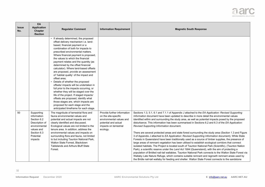
32
Information Request December 2020 AARC Environmental Solutions Pty Ltd E [email protected] AARC.NET.AU
Issue
No.
EA
Application
Chapter
/Section
Regulator Comment Information Requirement Magnetic South Response
• If already determined, the proposed
offset delivery mechanism i.e. land-
based, financial payment or a
combination of both for impacts to
prescribed environmental matters.
Where financial payment is proposed,
the values to which the financial
payment relates and the quantity (as
determined by the offset financial
calculator). Where land-based offsets
are proposed, provide an assessment
of ‘habitat quality’ of the impact and
offset area;
• Details of whether the proposed
offsets/ impacts will be undertaken in
full prior to the impacts occurring, or
whether they will be staged over the
life of the project. If staged impacts/
offsets are proposed, identify what
those stages are, which impacts are
proposed for each stage and the
anticipated timeframe for each stage.
50 Supporting
information
Section 6.2
Description of
environmental
values and
Section 6.3
Potential
impacts
The magnitude of terrestrial flora and
fauna environmental values and
potential and actual impacts are not
clearly identified and discussed.
Ecological values are not limited to the
tenure area. In addition, address the
environmental values and impacts on
surrounding flora and fauna, not limited
to but including Taunton National Park,
Walton State Forrest, Blackdown
Tablelands and Arthurs Bluff State
Forest.
Provide further information
on the site-specific
environmental values and
potential and actual
impacts on terrestrial
ecology.
Sections 1.3, 5.1, 6.1 and 7.1.1 of Appendix J attached to the EA Application: Revised Supporting
Information document have been updated to describe in more detail the environmental values
identified within and surrounding the study area, as well as potential impacts posed by the proposed
disturbance. This information has been summarised in Sections 6.2 and 6.3 of the EA Application:
Revised Supporting Information document.
There are several protected areas and state forest surrounding the study area (Section 1.3 and Figure
3 of Appendix J attached to EA Application: Revised Supporting Information document). While State
Forests in Queensland have been traditionally used as a source of timber supplies, the presence of
large areas of remnant vegetation has been utilised to establish ecological corridors that connect
isolated habitats. The Project is located south of Taunton National Park (Scientific), (Taunton Nation
Park), a scientific reserve under the Land Act 1994 (Queensland), with the aim of protecting a
population of Bridled nail-tail wallabies. Taunton National Park connects to the Walton State Forest via
Wallaby Late Nature Refuge, which contains suitable remnant and regrowth remnant areas used by
the Bridle nail-tail wallaby for feeding and shelter. Walton State Forest connects to the sandstone
33
Information Request December 2020 AARC Environmental Solutions Pty Ltd E [email protected] AARC.NET.AU
Issue
No.
EA
Application
Chapter
/Section
Regulator Comment Information Requirement Magnetic South Response
ridges and plateau located at the west and south of the Project on which is located Arthur’s Bluff State
Forest, Blackdown Tableland National Park and Dawson Range State Forest. Lastly, Dawson Range
Forest connects to Duaringa State Forest, which, like Walton State Forest, is not located in the
sandstone plateau. All the above-mentioned areas are connected to one another by state ecological
corridors.
While the study area is located in the vicinity of several protected areas in the form of two national
parks, one nature refuge and several state forests, none of them are connected to the study area. The
study area is unlikely to provide suitable dispersal habitat for the EVNT fauna species between the
national parks, as the majority of the study area consists of cleared agricultural areas fragmented
remnant vegetation and narrow riparian corridors, not always formed by remnant vegetation. This
fragmentation is result of farming activities, including historical vegetation clearing to facilitate grazing
as well as infrastructure development such as the Capricorn highway and the Blackwater rail network.
Further, the national parks surrounding the Project are mostly in sandstone escarpments while
Taunton National Park, home of the Bridle Nail-tail Wallaby, is characterised by Brigalow vegetation,
the preferred habitat of the species. The state forests in the area provide the connection between these
environmental values in form of continuous remnant vegetation. The study area not only does not
contain the particular vegetation present within the national parks but does not provide the connectivity
between them.
The potential impacts identified as a result of the proposed development will not affect the surrounding
protected areas neither directly or indirectly as none of the proposed disturbance is adjacent to the
protected areas nor will it create natural or artificial barriers to known biodiversity corridors.
51 Appendix G
Section 3.5.1
Groundwater
Dependent
Ecosystems
An explanation on what Figures 7, 8 and
9 identify in terms of GDEs was not
provided.
Provide information on the
figures and what the
information presented in
these figures identify
about the site and the
possible impacts on these
areas that will be impacted
by the mine.
Appendix G is now Appendix J. Section 3.5.1 of Appendix J attached to the EA Application: Revised
Supporting Information document has been updated to provide clarification on the information
presented in Figures 7, 8 and 9.
The Bureau of Meteorology (BoM) GDE Atlas ‘National assessment’ mapping was produced by
conducting a national-scale assessment which involved a nationally consistent methodology using
remote sensing and GIS rules-based analysis (BoM 2019). This mapping shows the potential for
groundwater/ecosystem interaction and it is presented in:
Figure 7: Potential terrestrial GDEs to occur within the study area. A terrestrial GDE is a GDE that
accesses subsurface groundwater to meet all or some of its water requirements (BoM 2019).
34
Information Request December 2020 AARC Environmental Solutions Pty Ltd E [email protected] AARC.NET.AU
Issue
No.
EA
Application
Chapter
/Section
Regulator Comment Information Requirement Magnetic South Response
Figure 8: Potential aquatic GDEs to occur within the study area. An aquatic GDE is a GDE which uses
groundwater after it has been discharged to the surface. This includes all groundwater-fed surface
water bodies, such as rivers, wetlands, lakes and springs. This definition refers only to the aquatic
(inundated) component of a system, and therefore excludes any vegetation which may fringe a surface
water body (BoM 2019).
The GDE classification includes (BoM 2019):
• high potential for groundwater interaction: GDE Atlas terminology used to classify ecosystems
as likely to be interacting with groundwater. It indicates that groundwater is likely to be present, and
the ecosystem is likely to be using it. This categorisation means that the majority of data analysed
indicated a high potential for groundwater interaction, or that the most reliable (and most heavily
weighted) datasets indicated high potential;
• moderate potential for groundwater interaction: GDE Atlas terminology used to classify
ecosystems that may interact with groundwater. It indicates that groundwater is possibly present,
and the ecosystem may use it. Where data is conflicting (some data suggests that groundwater
interaction is occurring, while other data suggests it is not), and it is weighted equally (both datasets
are considered equally good indicators of groundwater interaction), this will be the resulting
categorisation; and
• low potential for groundwater interaction: GDE Atlas terminology used to classify ecosystems as
unlikely to be interacting with groundwater. It indicates that groundwater is unlikely to be present, or
if it is present, the ecosystem is unlikely to use it. This categorisation means that all datasets
suggest groundwater interaction is unlikely, or that the most reliable (and most heavily weighted)
datasets suggest that groundwater interaction is unlikely.
Figure 9 shows graphical representation of potential terrestrial GDEs in Queensland. This figure was
produced based on data from the DES. An incorrect reference has been identified in Section 3.5.1,
although the report cites the data as sourced from the Department of Natural Resources and Mine and
Energy (DNRME), the metadata has been provided from the Department of Environment and Science
(DES 2019c). This dataset provides information about the location and extent of known and potential
GDEs as sourced from expert knowledge, literature and existing datasets.
This mapping identified GDEs that are attributed as ‘derived GDE – low confidence’. These are GDE’s
that have not been field sampled, but according to expert knowledge, there is a low confidence in the
mapping rule set and therefore in the prediction that the mapped ecosystem has some degree of
groundwater dependence (Queensland Government 2012).
35
Information Request December 2020 AARC Environmental Solutions Pty Ltd E [email protected] AARC.NET.AU
Issue
No.
EA
Application
Chapter
/Section
Regulator Comment Information Requirement Magnetic South Response
52 Appendix G
Section 4.0
Methodology
Figure 11
Fauna Survey
Figure 10
Flora Survey
Surveys have not been conducted on
sites located around the mine
(predominately conducted in areas that
the mines themselves/pits are not
located), instead of doing survey sites in
the habitat that currently sits in the areas
being planned for coal extraction. Why
have studies not been conducted in the
relevant areas? This is also applicable
for the flora surveys (Figure 10).
Provide further justification
on sites that were chosen
for surveying and the
importance of the site’s
locations.
Section 4 of Appendix J to the EA Application: Revised Supporting Information document has been
updated to provide clarification on the Methodology followed during the Flora and Fauna surveys as
well as the survey site selection considerations.
Section 1.1 of Appendix J to the EA Application: Revised Supporting Information document identifies
the scope of the flora and fauna field surveys was ‘to develop an inventory of terrestrial flora and fauna
species inhabiting the study area, particularly species of conservation significance’, as such field
surveys were designed using the stratified sampling methods as detailed within the Terrestrial
Vertebrate Fauna Survey Guidelines of Queensland (Eyre et al 2018) and Queensland Herbarium
Methodology for Survey and Mapping of Regional Ecosystems and Vegetation Communities in
Queensland Version 4.0 (Neldner et al 2017). The objective of the study was not to evaluate the impact
of a development (before and after) as such survey sites were not delineated in ‘impact’ and ‘control’
sites. Survey effort was focused upon identifying all potential fauna and flora environmental values
within the study area.
Flora survey sites, in particular secondary sites, were selected to be representative of the regional
ecosystems within the study area, allowing for several secondary sites within each vegetation
community. Where possible, sites were aligned with the proposed disturbance footprint, however,
preference was given to representative vegetation of higher condition. This methodology meets the
recommendations from the Methodology for surveying and mapping regional ecosystems and
vegetation communities in Queensland (V5.0) (Neldner et al 2019), which states that a minimum of
three secondary sites within a regional ecosystem is desirable. Flora was sampled in Autumn, Spring
and Winter seasons to best account for both annual and perennial species assemblages. Sampling
was undertaken at a minimum density of 25 observations per 100 ha to complete mapping at the
1:10,000 scale (Neldner et.al 2019). Survey density was higher in areas with remnant vegetation or
where vegetation types were changing, to accurately reflect the vegetation boundaries in the
vegetation map. Subsequently, the flora sites were projected on a Geographical Information System
(GIS), and used in conjunction with satellite images, aerial photographs, topographical and geological
maps to effectively produce a ground verified vegetation map.
As cited in Section 4.5.1 of Appendix J to the EA Application: Revised Supporting Information
document, the survey was planned according to Terrestrial Vertebrate Fauna Survey Guidelines for
Queensland V2.0 (Eyre et al 2014) (which was the current version at the time of all surveys). As per
these Guidelines, it is a recommendation that each assessment unit (habitat type) has a minimum of
three fauna sites across different seasons. As indicated in Section 4.5.2 of Appendix J, four main
habitat types were identified within the study area. Trapping sites were selected to be representative of
these habitat types. Where possible, sites were aligned with the proposed disturbance footprint,
however, preference was given to representative habitat of higher condition.
36
Information Request December 2020 AARC Environmental Solutions Pty Ltd E [email protected] AARC.NET.AU
Issue
No.
EA
Application
Chapter
/Section
Regulator Comment Information Requirement Magnetic South Response
Access limitations influenced fauna site selection to a minor extent. Regular repeat safe access is
essential to all fauna trapping sites and forms a requirement of the animal ethics permits under which
surveys are completed. However, multiple surveys were conducted by AARC ecologists over a period
of three years to ensure that a comprehensive and representative survey effort was completed for the
site.
While conducting the flora surveys across remnant and non-remnant areas, habitat conditions that met
required conditions for targeted flora or fauna species were searched, and species recorded
opportunistically (e.g., rocky areas for Cerbera dumicola).
Following the surveys’ results and the assessment of the habitat types recorded within the study area,
AARC understands that the survey met the requirements of the flora and fauna guidelines and the
study area has been comprehensively surveyed.
53 Appendix G
Section 4.5.4
Fauna Survey
Effort - Table 9
An inconsistent method of
trapping/monitoring/recording has been
utilised for the different seasons. For
mammal trapping, 4 sites in Autumn, 6
sites in spring and 5 sites in Autumn
have been selected. Why was a survey
not completed in Spring 2018? The
results that have been formulated do not
identify animal correlation between
seasons and species in the MLA as they
cannot be appropriately comparable.
Justification on the amount
of surveying conducted in
the two different seasons
over the course of the
surveying period.
Sections 1.1 and 4.5.4 of Appendix J to the EA Application: Revised Supporting Information document
has been updated to provide clarification on the survey effort undertaken during the Flora and Fauna
surveys. Section 1.1 of the Appendix J identifies the scope of the flora and fauna field surveys was ‘to
develop an inventory of terrestrial flora and fauna species inhabiting the study area, particularly
species of conservation significance’. As such, field surveys were designed using the stratified
sampling methods as detailed within the Terrestrial Vertebrate Fauna Survey Guidelines of
Queensland (Eyre et al 2018) and Queensland Herbarium Methodology for Survey and Mapping of
Regional Ecosystems and Vegetation Communities in Queensland Version 4.0 (Neldner et al 2017).
It is considered that the fauna survey effort comprehensively the addresses the objective of the field
surveys described in Section 1.1 of Appendix J. This objective is to identify terrestrial fauna inhabiting
the study area, particularly species of conservation significance.
The fauna survey was planned according to the Terrestrial Vertebrate Fauna Survey Guidelines for
Queensland V2.0 (Eyre et al 2014), the current version at the time of all surveys. These guidelines
state that trapping should target each habitat unit identified within the study area at least three times
across the identified survey seasons. The Project is located within the Brigalow Belt bioregion, which
the fauna survey guideline recommends surveying during Spring and Autumn (Eyre et al 2014). Due to
access restrictions, the fauna trapping and recording took place in Autumn 2017, Spring 2017 and
Autumn 2018. The Terrestrial Vertebrate Fauna Survey Guidelines for Queensland V2.0 (Eyre et al
2014) states that ‘…at least two surveys undertake in different seasons will be a minimum
requirement…’. As such, it is understood that the fauna survey guidelines requirements have been met
with the three surveys, and no further survey effort was considered necessary in Spring 2018.
37
Information Request December 2020 AARC Environmental Solutions Pty Ltd E [email protected] AARC.NET.AU
Issue
No.
EA
Application
Chapter
/Section
Regulator Comment Information Requirement Magnetic South Response
AARC does not consider the correlation of animal presence between seasons and species to be a
primary objective of the survey. Rather the goal of the survey was to identify presence and habitat for
fauna species at any time during the year. The requirement to trap for fauna at specific seasons
maximises the potential for positive identification of all inhabiting fauna species.
54 Appendix G
Section 5.4.1
Groundwater
Dependent
Ecosystems
Figure 13
Figure 13 is not explained. Riverine
wetlands are identified in the study areas
including in areas where the pits are
proposed to be.
Discuss the impact of
mining on these
groundwater dependent
wetlands, and the impact
from the proposed final
land use.
Following GDE field assessments in June 2020 (Appendix F to the EA Application: Revised Supporting
Information document), Section 5.4.1 of Appendix J to the EA Application: Revised Supporting
Information document has been modified, removing Figure 13 and summarising the findings of the
comprehensive GDE study, included in the EA Application: Revised Supporting Information document.
Two areas within the riverine wetlands have been identified as GDEs within the study area. One of
these GDEs is located within the mine footprint (Springton tributary) whilst the other one is located
upstream of the proposed impact, within the riparian vegetation of the Charlevue Creek. Drawdown
(during and post-mining) will not have an impact on the riparian habitat identified as GDE within
Charlevue Creek based on the limited hydraulic connectivity between the regional groundwater table
and the perched aquifer that supports the GDE (3D Environmental 2020).
55 Appendix G
Section 7.2.1
Fauna
Species of
Conservation
Significance
and Habitat
In this section there are three identified
fauna species of conservation
significance. This does not correlate with
information in other sections which state
there are five fauna species of
conservation significance with only four
listed.
The 3 fauna species that have been
discussed in Section 7.2.1 are the
Squatter pigeon, the Greater Glider and
the Short-beaked Echidna. In Section
6.3.1 it is stated there are five species
with only four listed – southern Squatter
Pigeon, Greater Glider, Short-beaked
Echidna and Rufous Fantail.
Ensure all information
between sections are
correct and correlating. All
species of conservation
significance need to be
discussed in terms of their
potential impacts from
mining activities.
DES has correctly identified an administrative error in Section 6.3.1 of Appendix J to the EA
Application: Revised Supporting Information document where there is a reference to ‘five fauna
species’. This has been corrected to read ‘four fauna species’. Three of these species are listed under
the Nature Conservation Act 1992 (southern Squatter pigeon, Greater glider, and Short-beaked
echidna), while the Rufous fantail is listed as a Migratory species under the Environment Protection
and Biodiversity Conservation Act 1999.
Section 7.2.1 of Appendix J to the EA Application: Revised Supporting Information document has been
updated to address the Rufous fantail. The Project is unlikely to impact the species. Appendix J has
also been updated to reflect the changes above.
56 Appendix G
Table 25
Summary of
Table 26 identifies that an offset is
required for 106.65 ha of essential
habitat. This is not included in the
Ensure all information
correlates between tables
and is correct.
The Project is not a prescribed activity mentioned in schedule 1, item 7(e) of the Environmental Offsets
Regulation (2014) and as such essential habitat of Near Threatened species does not constitute a
prescribed matter. Section 9 and 9.1.2 of Appendix J to the EA Application: Revised Supporting
38
Information Request December 2020 AARC Environmental Solutions Pty Ltd E [email protected] AARC.NET.AU
Issue
No.
EA
Application
Chapter
/Section
Regulator Comment Information Requirement Magnetic South Response
Assessment of
Prescribed
Matters
supporting information and conflicts with
Table 25 (page 99).
Information document have been updated to only address the prescribed matters applicable to the
Project.
57 Table 25 identifies the summary of
assessment of prescribed environmental
matters. Provide further detail and
workings of how the impact assessment
conclusions were reached and assessed
against the Queensland Environmental
Offsets Policy Significant residual impact
guideline (December 2014).
Provide further
information.
Appendix J to the EA Application: Revised Supporting Information document has been updated to
better describe the Project offset requirements.
Table 25 in Section 9.2 of Appendix J to the EA Application: Revised Supporting Information document
summarised the assessment of the prescribed matters identified within the Project area and potentially
impacted by the proposed disturbance. Section 9.1 of Appendix J includes the assessments of each of
the prescribed matters against its correspondent significant residual impact criteria included in the
Queensland Environmental Offsets Policy Significant Residual Impact Guideline (EHP 2014).
58 Appendix H
Section 5.0
Methodology
Two sampling events were completed at
different times of the year of February in
2018 and April in 2019, which means
data cannot be accurately correlated
without externalities considered which
has not been discussed.
Justification into why the
two sampling projects
(2018 and 2019) are
enough to provide critical
information in relation to
the aquatic biodiversity in
the site area.
Appendix H is now Appendix K. Four sampling events were undertaken in different times of the year
due to weather conditions present during the field surveys. The systems present within the study area
are ephemeral and, as such, field work was dependant on rain events sufficiently large enough to
result in water flow occurring in the study area.
All sites were assessed for creek ecology values (See Section 5.5, Appendix K of the EA Application:
Revised Supporting Information document). These assessments provide critical information regarding
the aquatic ecological values of the systems present within the study area (See Section 6.3, Appendix
K of the EA Application: Revised Supporting Information document).
Additional field survey for aquatic trapping was undertaken to supplement the previous surveys. Three
new sites were added to the study area to improve robustness of the data collected focusing the
aquatic methodologies.
59 Appendix H
Section 5.2
Sampling
Sites
Table 5
Many of the assessments and surveys
were completed at different times and
not all at the different survey sites
identified in Figure 6.
Discussion on why specific
sites were chosen for the
assessments completed
compared to the sites that
did not have assessments.
Justification is needed on
the sample sites survey
patterns.
Priority was given to aquatic fauna sampling along the major watercourses; specifically, Charlevue
Creek and Springton Creek. Charlevue Creek and Springton Creek were identified to be of higher
ecological value than the other surrounding waterways. For this reason, additional fauna survey
methods were completed at the chosen sites along Charlevue Creek and Springton Creek in order to
identify any riparian fauna species that are reliant on the existing aquatic values within the study area.
In addition to this, three new sites were added during the 2020 aquatic ecological survey to expand the
study area further upstream and downstream of the Project. These include:
• DAR2: upstream of the Project on Springton Creek;
• DAI7: downstream of the Project on Charlevue Creek; and
• DAI8: downstream of the Project on Duckworth Creek.
Site scoping identified the potential for aquatic trapping to be undertaken along Stanley Creek.
However, due to the aquatic environment of the study area being highly ephemeral, Stanley Creek did
39
Information Request December 2020 AARC Environmental Solutions Pty Ltd E [email protected] AARC.NET.AU
Issue
No.
EA
Application
Chapter
/Section
Regulator Comment Information Requirement Magnetic South Response
not contain enough water to have aquatic fauna trapping undertaken or to allow for macroinvertebrate
sampling to occur.
The survey patterns and effort are therefore highly dependent on rainfall events sufficient enough to
cause creek-flow, which is typically short-lived occurring irregularly during the wet season and
occasionally during the early post-wet season. The low stream order creeks such as, Stanley Creek,
are particularly less likely to be sampled for this reason.
60 Appendix H
Section 5.2
Location of
Survey Sites
Figure 6
No survey sites were located
downstream of the Springton Creek, only
on its tributaries within the site area.
Provide justification as to
why a survey site was not
located for downstream
Springton Creek and why
the information that could
have been provided from
this survey site would not
have been valuable.
Site DWI6 is located downstream of the proposed disturbance for the Project along Springton Creek.
This site was assessed for surface water, stream sediment, creek ecology values, macroinvertebrates,
riparian vegetation and riparian zone fauna (See Table 5 and Figure 5 of Appendix K of the EA
Application: Revised Supporting Information document). To add an additional site further downstream
would not add significant value to the assessment. However, site DAR2 was introduced further
upstream of the Project on Springton Creek during the 2020 survey to provide additional background
data upstream.
61 Appendix H
Section 6.7
Aquatic values
Stated that many of the biodiversity
aspects of ecology have been found to
be “low”.
Provide further justification
of this determination
based on the surveying
completed (why the
amount of surveying
completed in 2019 justifies
the determination).
The ecological biodiversity values identified for the study area were identified as of low value due to the
variety of assessments undertaken. An additional aquatic ecological survey was completed during
2020 to provide a more rigorous support of these previous findings.
While seasonal variations and conditions may contribute to this low value; sampling was undertaken
during optimal conditions for these systems (sampling was undertaken following high rainfall events).
The systems within the study area are ephemeral and are only able to provide habitat to aquatic life for
short periods of time. Throughout the rest of the year, the systems are dry and provide no specific
aquatic biodiversity values. While aquatic fauna trapping and macroinvertebrate sampling was
restricted to sites that contained suitable levels of water, other assessments such as erosion
assessments, habitat bioassessment, condition assessments and riparian vegetation assessments
were undertaken at all sites. These assessments take into consideration long term impacts and assess
the overall condition of the survey sites. Erosion was recorded at all sites, with some sites exhibiting
extensive erosion levels (DWI8, DAI1). Further to this, most sites had a moderate to major impact from
localised influences such as clearing practices disturbing or removing the riparian zone, erosion from
cattle access and increased run-off (due to clearing practices), and ephemeral waterways being
vulnerable to frequent instream and geomorphological changes.
Macroinvertebrates are a strong bio-indicator of a systems health and its biodiversity value (ANZECC
and ARMCANZ 2000). When reviewing the results of the macroinvertebrate sampling, the systems
within the study area are found to be significantly impaired. As well the sampling identified a high
40
Information Request December 2020 AARC Environmental Solutions Pty Ltd E [email protected] AARC.NET.AU
Issue
No.
EA
Application
Chapter
/Section
Regulator Comment Information Requirement Magnetic South Response
presence of tolerant macroinvertebrate taxa across sites. These results indicate the systems are of
poor health.
Aquatic fauna trapping and riparian zone vertebrate fauna surveys resulted in minimal species being
detected. This is likely due to the lack of aquatic habitat values present within the study area.
Water quality sampling was further undertaken across multiple locations across the Project site and
identified frequent exceedances of physico-chemical parameters outside of the Water Quality
Objectives (WQO) along Springton Creek, Stanley and Duckworth Creek and Charlevue Creek.
A combined review of all these assessments indicates that the systems within the study area are in
poor condition and are only able to provide limited aquatic values.
62 Appendix H
Section 7.0
Potential
Impacts
Provide a discussion about the impact of
the proposed mining activity on the
aquatic ecology environment in times of
flood and drought.
Provide further
information.
Flooding Information
Flood impact assessments were undertaken by WRM Water and Environment Pty Ltd, and are
included in Appendix B of the EA Application: Revised Supporting Information document. This flood
impact assessment concluded that flooding impacts will be contained within the mining lease area (1%
AEP flood), and no impacts would occur downstream of the Project. As such any impacts during flood
events to the aquatic ecological values identified would be limited to the mining lease area.
The study further indicated that water runoff would not result in contaminants entering the system
during peak flooding events. The clean water drains along Springton creek tributary (C Pit and AB Pit)
would further not result in a significant increase to flooding depths or velocities; whilst clean water
drains will suitably contain flood waters from extending out into unaffected areas. The development of
the haul road crossing over Charlevue Creek will result in increased flood water levels downstream;
these impacts will be contained within the mine lease area. Additionally, minimal loss of stream
catchments would occur following the decommissioning phase of the mine.
Overall flood impacts resulting from the presence of the Project are not likely to negatively impact the
aquatic ecology values within or downstream of the study area. The clean water drain design is
detailed in Appendix B Section 7. The proposed design would mimic the existing aquatic values of the
diverted waterway and therefore will not lower the quality of the water in the systems, nor will it cause
significant changes during flood events. The Project is short lived and following the decommissioning
of the mine the finals voids will not affect the water quality, habitat availability or flow of the waterways
within the study area.
41
Information Request December 2020 AARC Environmental Solutions Pty Ltd E [email protected] AARC.NET.AU
Issue
No.
EA
Application
Chapter
/Section
Regulator Comment Information Requirement Magnetic South Response
Drought Information
In drought conditions the proposed mining activity is unlikely to impact on the existing aquatic
ecological values as the Project will not result in the release of mine affected water to the waterways.
The systems within the study area are all ephemeral and already experience prolonged dry periods. As
well, the mine site water requirements of the Project can largely be sourced from water collected within
the site water management system, as such the Project is not expected to exacerbate impacts
resulting from drought.
Surface water
63 Supporting
information
Section 7.2.3
Surface water
quality
Background water quality does not meet
the Water Quality Objective (WQO)
guideline values for the protection of
aquatic ecosystems at many sites
including pH (lower pH in 2019),
dissolved oxygen (low DO), turbidity,
suspended solids, ammonia, and
sulphate (as SO42-) on a few occasions.
Petroleum hydrocarbons were also
found to exceed WQO guideline values
at several sites, considered by the
applicant likely due to the highway and
agricultural practices.
Considering the absence
of a specific industrial
source, it is recommended
that these hydrocarbon
results are reviewed and
confirmed.
An oversight has been identified in regard to the petroleum hydrocarbon results. The analysis from
ALS undertaken was specifically targeting ‘TRH’; which refers to total recoverable hydrocarbons which
analyses for more than just petroleum hydrocarbons. The results were interpreted as if the analysis
was for ‘TPH’ which stands for total petroleum hydrocarbons. As such the exceedances of
hydrocarbons cannot be attributed to only an anthropological source as total recoverable hydrocarbons
also includes biogenic sources of hydrocarbons.
A Receiving Environment Monitoring Program (REMP) has been developed as a part of the Project.
This REMP will assess baseline water quality of the receiving environments, including the aquatic
ecology health; the details of this monitoring program have been provided in the REMP Design
Document (Appendix Q of the EA Application: Revised Supporting Information document).
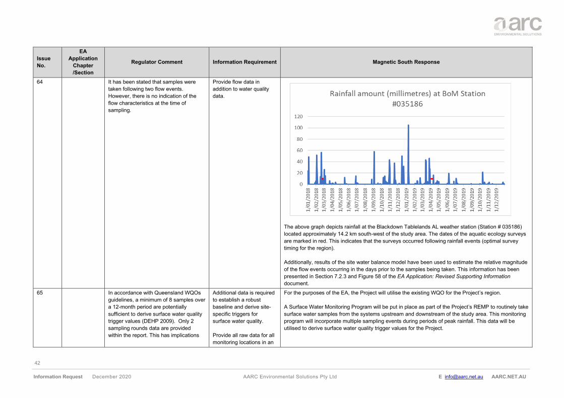
42
Information Request December 2020 AARC Environmental Solutions Pty Ltd E [email protected] AARC.NET.AU
Issue
No.
EA
Application
Chapter
/Section
Regulator Comment Information Requirement Magnetic South Response
64 It has been stated that samples were
taken following two flow events.
However, there is no indication of the
flow characteristics at the time of
sampling.
Provide flow data in
addition to water quality
data.
The above graph depicts rainfall at the Blackdown Tablelands AL weather station (Station # 035186)
located approximately 14.2 km south-west of the study area. The dates of the aquatic ecology surveys
are marked in red. This indicates that the surveys occurred following rainfall events (optimal survey
timing for the region).
Additionally, results of the site water balance model have been used to estimate the relative magnitude
of the flow events occurring in the days prior to the samples being taken. This information has been
presented in Section 7.2.3 and Figure 58 of the EA Application: Revised Supporting Information
document.
65 In accordance with Queensland WQOs
guidelines, a minimum of 8 samples over
a 12-month period are potentially
sufficient to derive surface water quality
trigger values (DEHP 2009). Only 2
sampling rounds data are provided
within the report. This has implications
Additional data is required
to establish a robust
baseline and derive site-
specific triggers for
surface water quality.
Provide all raw data for all
monitoring locations in an
For the purposes of the EA, the Project will utilise the existing WQO for the Project’s region.
A Surface Water Monitoring Program will be put in place as part of the Project’s REMP to routinely take
surface water samples from the systems upstream and downstream of the study area. This monitoring
program will incorporate multiple sampling events during periods of peak rainfall. This data will be
utilised to derive surface water quality trigger values for the Project.
43
Information Request December 2020 AARC Environmental Solutions Pty Ltd E [email protected] AARC.NET.AU
Issue
No.
EA
Application
Chapter
/Section
Regulator Comment Information Requirement Magnetic South Response
for the development of locally relevant
WQOs and mine water release criteria.
excel format (including
additional data obtained
since the last sampling
round presented in the
report).
For further details regarding this surface water monitoring program see (Appendix Q of the EA
Application: Revised Supporting Information document).
66 Supporting
information
Section 7.2.3
Surface water
quality Table
28
WQOs are available for the Mackenzie
River sub-basin and listed on page 129
of the Supporting Information report for
the project. A mistake has been noted
on the Total Nitrogen water quality
objective (WQO) to be 7 µg/L (see Table
28 on page 129) instead of 775 µg/L
proposed in the Environmental
Protection (Water) Policy 2009 (EPP
Water).
Ensure correct information
is provided.
This was a typographical error and has been corrected; the water quality objective for total nitrogen is
<775 µg/L.
67 Supporting
information
Section 7.3.3
Impacts on
surface water
quality
It has been stated that other runoff from
disturbed areas, such spoil dumps, will
be intercepted by sediment dams
designed in accordance with the SWMS.
Discharge from sediment dams directly
into the receiving environment (after
settlement of suspended sediments)
would only occur during rainfall events.
The discharge is expected to have
insignificant impacts on water quality, as
overburden runoff quality is expected to
be relatively benign. As total suspended
solids have the potential to be a major
issue, the erosion and sediment controls
including the sizing of the sediment
ponds requires consideration.
Address total suspended
solids in the Erosion and
Sediment Control Plan
and REMP. It is
recommended Suspended
Solids trigger level be
included in Table F5 –
receiving waters
contaminant trigger levels
of the EA conditions
proposed by the applicant,
as per the Model water
conditions for coal mines
in the Fitzroy basin (2013)
(ESR/2015/1561).
The Project will implement a REMP. The details of this monitoring program have been provided in the
REMP Design Document (Appendix Q of the EA Application: Revised Supporting Information
document). Baseline water quality of the receiving environments, including total suspended solids have
been addressed in the REMP Design Document.
68 Supporting
information
Section 7.4.2
Mine affected
water release
There are potential impacts of
contamination of surface water caused
by releases from mine water dams.
Provide further detail of
the potential and actual
impacts including the
magnitude and duration.
Section 6.9 of the surface water assessment outlines the potential for accumulation of water in the
mine water dam and the mine pits. The mine water dam would overflow to Pit AB. The results show
that the risk of discharge from the Pits is negligible, and that mining operations could be sustained in
the long-term by transferring excess water to Pit AB once mining there was complete. The likelihood of
discharging mine affected water from the pit MAW system is minimal. As mentioned previously, at the
MIA and CHPP, the MAW system has been sized to ensure the likelihood of discharge is small.
44
Information Request December 2020 AARC Environmental Solutions Pty Ltd E [email protected] AARC.NET.AU
Issue
No.
EA
Application
Chapter
/Section
Regulator Comment Information Requirement Magnetic South Response
Water would only be discharged from the system when there are significant flows in the receiving
waters in accordance with the EA conditions.
69 The design and water balance do not
assume any release from the mine water
dams. However, it has been stated that if
any controlled releases are to occur, it
would be in accordance with the EA
conditions. Release limits at the mine
affected water release points as well as
at a downstream monitoring point
proposed in Charlevue Creek are
proposed in the draft EA conditions
provided by the applicant. Proposed
limits and indicators for such release
should be carefully considered.
Demonstrate sulphate is not an issue
before proposing to remove it from
monitoring requirements.
Justify amendments to the
Model water conditions for
coal mines in the Fitzroy
basin (2013)
(ESR/2015/1561) in
relation to the proposed
EA conditions.
It is preferable not to list Sulphate as a release limit, as it is not a parameter which can be
instantaneously measured during a release event. Additionally, sulphate is not considered a significant
source of potential contamination from the Project. As part of the geochemical assessment undertaken
for the project, the sulphate concentration in leachate from all mining waste samples tested was well
below the applied ANZECC & ARMCANZ livestock water quality guideline criterion (1,000 mg/L).
Sulphate has been included in the receiving waters contaminant trigger levels (Table F5 of the
proposed EA Conditions), for monitoring at the background and downstream monitoring locations
nominated in Table F6.
70 Supporting
information
Section 7.4.4
Receiving
water
monitoring
It has been stated that site-specific
reference/baseline values will be
developed after a period of monitoring to
assess future local water quality data.
Provide a detailed
monitoring plan that would
be used to assess the
baseline water quality of
the receiving
environments (including
locations, frequency,
indicators and quality
assurance/control
methods). Data should be
collected according the
methods outlined in the
Monitoring and Sampling
Manual (DES, 2018). All
available data should be
provided in an excel
format, including sampling
conditions (rain, stream
flow etc.).
A REMP has been developed for the Project. The details of this monitoring program have been
provided in the REMP Design Document (Appendix Q of the EA Application: Revised Supporting
Information). Baseline water quality of the receiving environments, including total suspended solids
have been addressed in the REMP Design Document. Annual reporting will be required following
monitoring, and detail all available data including sampling conditions (rain, stream flow, etc). The
frequency of monitoring, including locations, indicators and quality assurance) has been addressed in
the REMP Design Document.
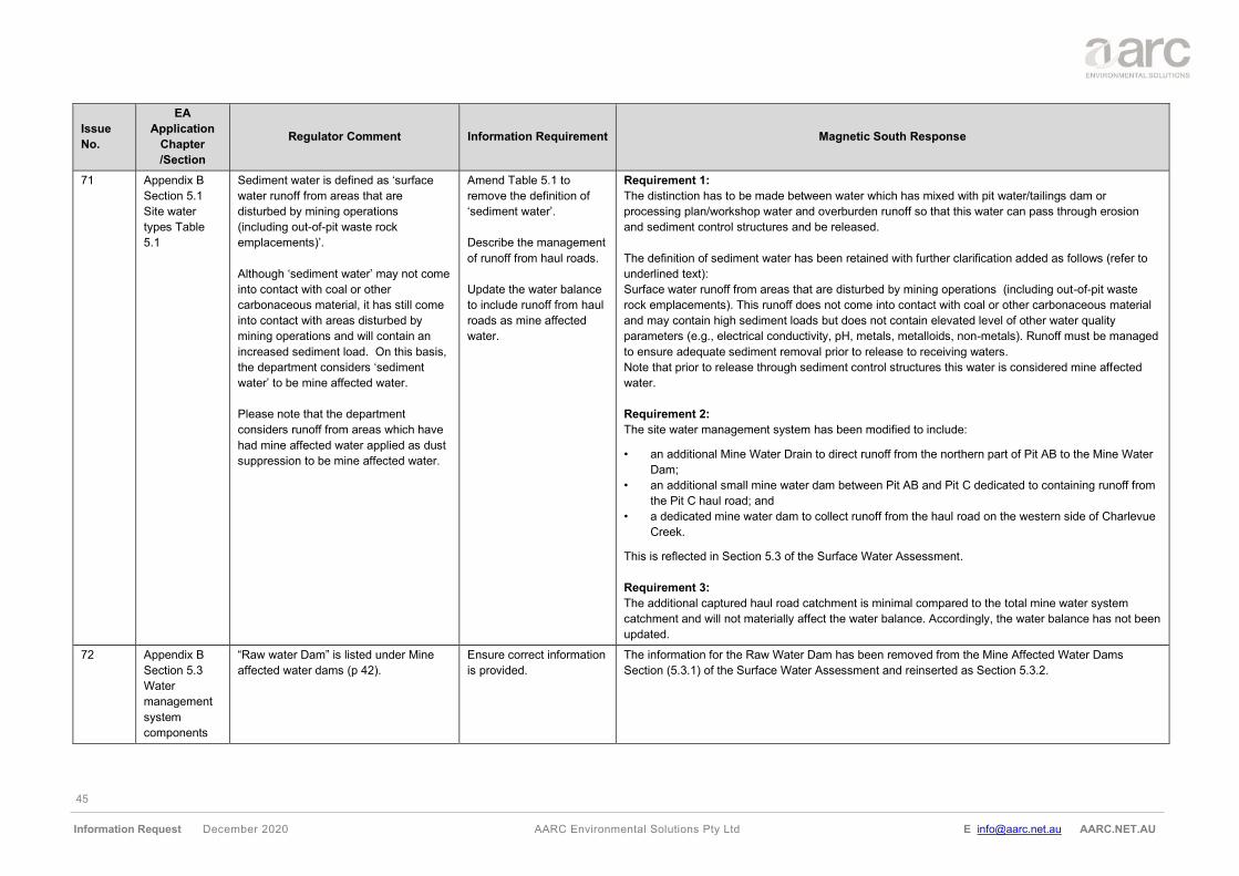
45
Information Request December 2020 AARC Environmental Solutions Pty Ltd E [email protected] AARC.NET.AU
Issue
No.
EA
Application
Chapter
/Section
Regulator Comment Information Requirement Magnetic South Response
71 Appendix B
Section 5.1
Site water
types Table
5.1
Sediment water is defined as ‘surface
water runoff from areas that are
disturbed by mining operations
(including out-of-pit waste rock
emplacements)’.
Although ‘sediment water’ may not come
into contact with coal or other
carbonaceous material, it has still come
into contact with areas disturbed by
mining operations and will contain an
increased sediment load. On this basis,
the department considers ‘sediment
water’ to be mine affected water.
Please note that the department
considers runoff from areas which have
had mine affected water applied as dust
suppression to be mine affected water.
Amend Table 5.1 to
remove the definition of
‘sediment water’.
Describe the management
of runoff from haul roads.
Update the water balance
to include runoff from haul
roads as mine affected
water.
Requirement 1:
The distinction has to be made between water which has mixed with pit water/tailings dam or
processing plan/workshop water and overburden runoff so that this water can pass through erosion
and sediment control structures and be released.
The definition of sediment water has been retained with further clarification added as follows (refer to
underlined text):
Surface water runoff from areas that are disturbed by mining operations (including out-of-pit waste
rock emplacements). This runoff does not come into contact with coal or other carbonaceous material
and may contain high sediment loads but does not contain elevated level of other water quality
parameters (e.g., electrical conductivity, pH, metals, metalloids, non-metals). Runoff must be managed
to ensure adequate sediment removal prior to release to receiving waters.
Note that prior to release through sediment control structures this water is considered mine affected
water.
Requirement 2:
The site water management system has been modified to include:
• an additional Mine Water Drain to direct runoff from the northern part of Pit AB to the Mine Water
Dam;
• an additional small mine water dam between Pit AB and Pit C dedicated to containing runoff from
the Pit C haul road; and
• a dedicated mine water dam to collect runoff from the haul road on the western side of Charlevue
Creek.
This is reflected in Section 5.3 of the Surface Water Assessment.
Requirement 3:
The additional captured haul road catchment is minimal compared to the total mine water system
catchment and will not materially affect the water balance. Accordingly, the water balance has not been
updated.
72 Appendix B
Section 5.3
Water
management
system
components
“Raw water Dam” is listed under Mine
affected water dams (p 42).
Ensure correct information
is provided.
The information for the Raw Water Dam has been removed from the Mine Affected Water Dams
Section (5.3.1) of the Surface Water Assessment and reinserted as Section 5.3.2.
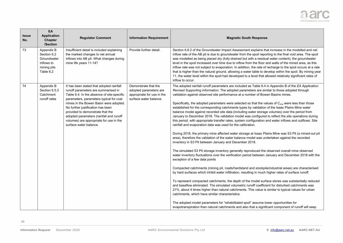
46
Information Request December 2020 AARC Environmental Solutions Pty Ltd E [email protected] AARC.NET.AU
Issue
No.
EA
Application
Chapter
/Section
Regulator Comment Information Requirement Magnetic South Response
73 Appendix B
Section 6.2
Groundwater
inflows to
mining pits
Table 6.2
Insufficient detail is included explaining
the marked changes to net annual
inflows into AB pit. What changes during
mine life years 11-14?
Provide further detail. Section 6.6.2 of the Groundwater Impact Assessment explains that increase in the modelled and net
inflow rate of the AB pit is due to groundwater from the spoil reporting to the final void area. The spoil
was modelled as being placed dry (fully-drained but with a residual water content); the groundwater
level in the spoil increased over time due to inflow from the floor and walls of the mined area, as this
inflow rate was not subject to evaporation. In addition, the rate of recharge to the spoil occurs at a rate
that is higher than the natural ground, allowing a water table to develop within the spoil. By mining year
11, the water level within the spoil had developed to a level that allowed relatively significant rates of
inflow to occur.
74 Appendix B
Section 6.5.2
Catchment
runoff rates
It has been stated that adopted rainfall
runoff parameters are summarised in
Table 6.4. In the absence of site-specific
parameters, parameters typical for coal
mines in the Bowen Basin were adopted.
No further justification has been
provided to demonstrate that the
adopted parameters (rainfall and runoff
volumes) are appropriate for use in the
surface water balance.
Demonstrate that the
adopted parameters are
appropriate for use in the
surface water balance.
The adopted rainfall runoff parameters are included as Table 6.4 in Appendix B of the EA Application:
Revised Supporting Information. The adopted parameters are similar to those adopted through
validation against observed site performance at a number of Bowen Basins mines.
Specifically, the adopted parameters were selected so that the values of Cavg were less than those
established for the corresponding catchments types by validation of the Isaac Plains Mine water
balance model against recorded site data (including water storage volumes) over the period from
January to December 2018. The validation model was configured to reflect the site operations during
this period, with appropriate transfer rates, system configuration and water inflows and outflows. Site
rainfall and evaporation data was used for the calibration.
During 2018, the primary mine affected water storage at Isaac Plains Mine was S3 Pit (a mined-out pit
area), therefore the validation of the water balance model was undertaken against the recorded
inventory in S3 Pit between January and December 2018.
The simulated S3 Pit storage inventory generally reproduced the observed overall mine observed
water inventory fluctuations over the verification period between January and December 2018 with the
exception of a few data points
Compacted catchments (mining pit, roads/hardstand and stockpile/industrial areas) are characterised
by hard surfaces which inhibit water infiltration, resulting in much higher rates of surface runoff.
To represent compacted catchments, the depth of the model surface stores was substantially reduced
and baseflow eliminated. The simulated volumetric runoff coefficient for disturbed catchments was
21%, about 4 times higher than natural catchments. This value is similar to typical values for urban
catchments, which have similar characteristics.
The adopted model parameters for “rehabilitated spoil” assume lower opportunities for
evapotranspiration than natural catchments and also that a significant component of runoff will seep
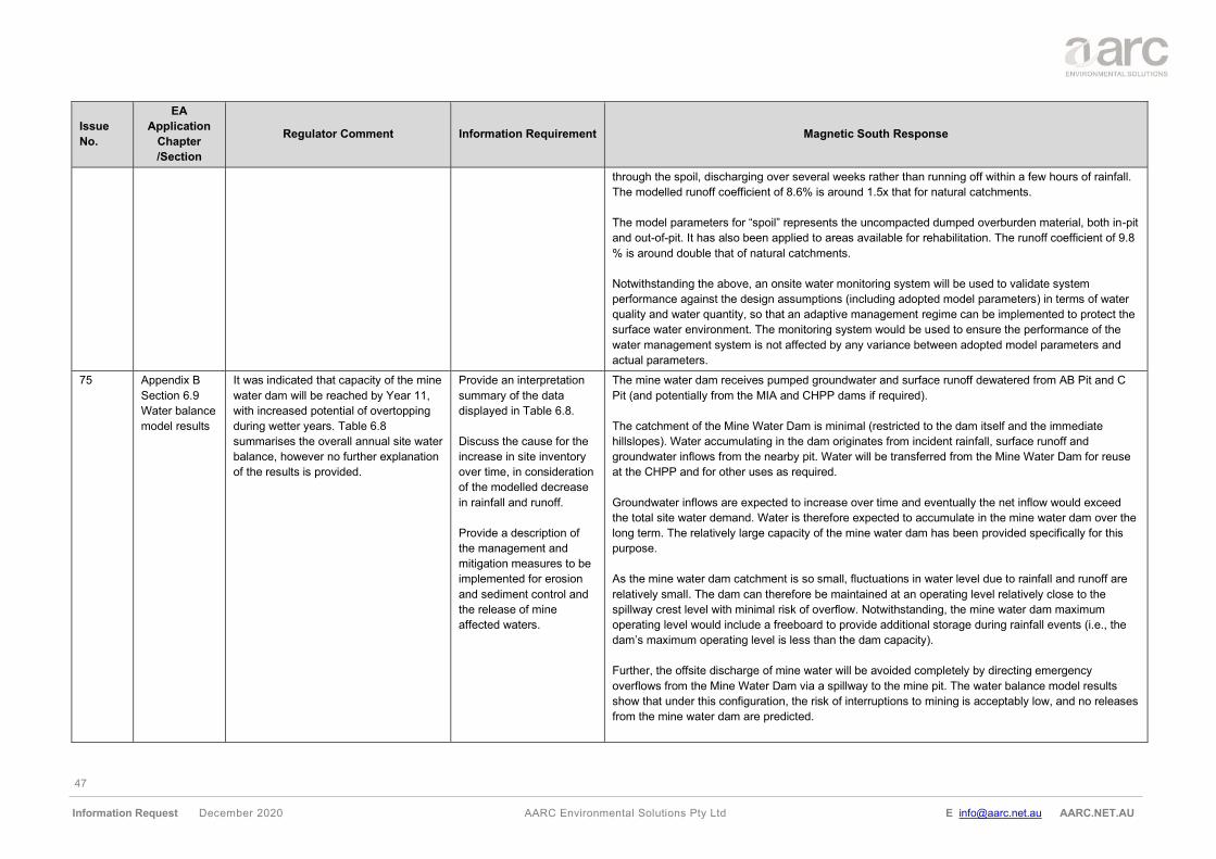
47
Information Request December 2020 AARC Environmental Solutions Pty Ltd E [email protected] AARC.NET.AU
Issue
No.
EA
Application
Chapter
/Section
Regulator Comment Information Requirement Magnetic South Response
through the spoil, discharging over several weeks rather than running off within a few hours of rainfall.
The modelled runoff coefficient of 8.6% is around 1.5x that for natural catchments.
The model parameters for “spoil” represents the uncompacted dumped overburden material, both in-pit
and out-of-pit. It has also been applied to areas available for rehabilitation. The runoff coefficient of 9.8
% is around double that of natural catchments.
Notwithstanding the above, an onsite water monitoring system will be used to validate system
performance against the design assumptions (including adopted model parameters) in terms of water
quality and water quantity, so that an adaptive management regime can be implemented to protect the
surface water environment. The monitoring system would be used to ensure the performance of the
water management system is not affected by any variance between adopted model parameters and
actual parameters.
75 Appendix B
Section 6.9
Water balance
model results
It was indicated that capacity of the mine
water dam will be reached by Year 11,
with increased potential of overtopping
during wetter years. Table 6.8
summarises the overall annual site water
balance, however no further explanation
of the results is provided.
Provide an interpretation
summary of the data
displayed in Table 6.8.
Discuss the cause for the
increase in site inventory
over time, in consideration
of the modelled decrease
in rainfall and runoff.
Provide a description of
the management and
mitigation measures to be
implemented for erosion
and sediment control and
the release of mine
affected waters.
The mine water dam receives pumped groundwater and surface runoff dewatered from AB Pit and C
Pit (and potentially from the MIA and CHPP dams if required).
The catchment of the Mine Water Dam is minimal (restricted to the dam itself and the immediate
hillslopes). Water accumulating in the dam originates from incident rainfall, surface runoff and
groundwater inflows from the nearby pit. Water will be transferred from the Mine Water Dam for reuse
at the CHPP and for other uses as required.
Groundwater inflows are expected to increase over time and eventually the net inflow would exceed
the total site water demand. Water is therefore expected to accumulate in the mine water dam over the
long term. The relatively large capacity of the mine water dam has been provided specifically for this
purpose.
As the mine water dam catchment is so small, fluctuations in water level due to rainfall and runoff are
relatively small. The dam can therefore be maintained at an operating level relatively close to the
spillway crest level with minimal risk of overflow. Notwithstanding, the mine water dam maximum
operating level would include a freeboard to provide additional storage during rainfall events (i.e., the
dam’s maximum operating level is less than the dam capacity).
Further, the offsite discharge of mine water will be avoided completely by directing emergency
overflows from the Mine Water Dam via a spillway to the mine pit. The water balance model results
show that under this configuration, the risk of interruptions to mining is acceptably low, and no releases
from the mine water dam are predicted.
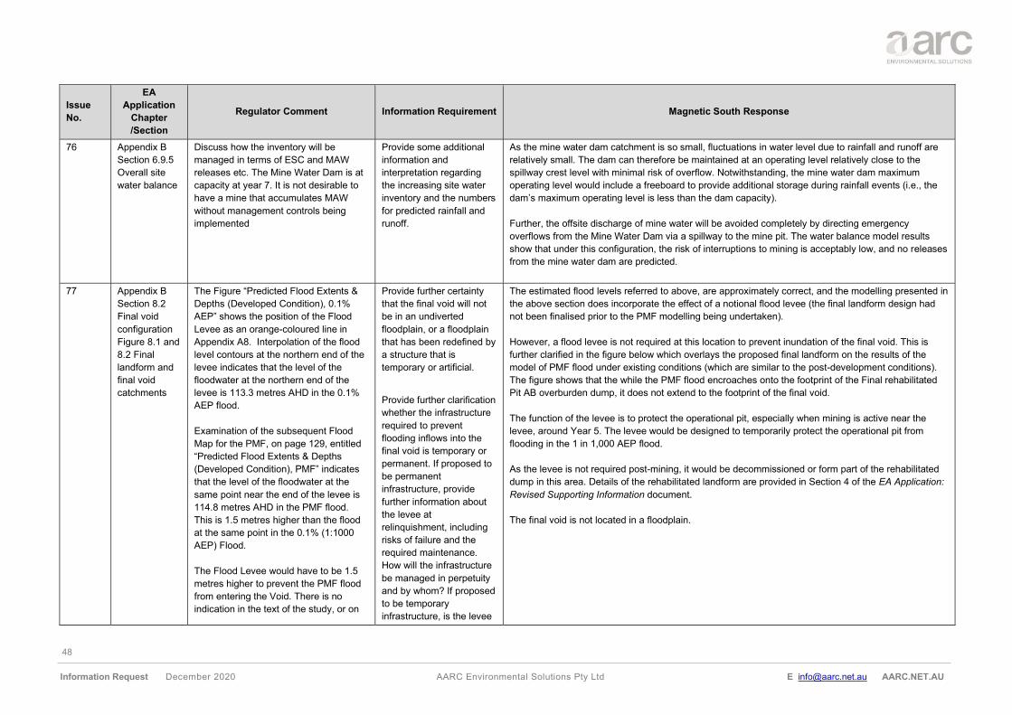
48
Information Request December 2020 AARC Environmental Solutions Pty Ltd E [email protected] AARC.NET.AU
Issue
No.
EA
Application
Chapter
/Section
Regulator Comment Information Requirement Magnetic South Response
76 Appendix B
Section 6.9.5
Overall site
water balance
Discuss how the inventory will be
managed in terms of ESC and MAW
releases etc. The Mine Water Dam is at
capacity at year 7. It is not desirable to
have a mine that accumulates MAW
without management controls being
implemented
Provide some additional
information and
interpretation regarding
the increasing site water
inventory and the numbers
for predicted rainfall and
runoff.
As the mine water dam catchment is so small, fluctuations in water level due to rainfall and runoff are
relatively small. The dam can therefore be maintained at an operating level relatively close to the
spillway crest level with minimal risk of overflow. Notwithstanding, the mine water dam maximum
operating level would include a freeboard to provide additional storage during rainfall events (i.e., the
dam’s maximum operating level is less than the dam capacity).
Further, the offsite discharge of mine water will be avoided completely by directing emergency
overflows from the Mine Water Dam via a spillway to the mine pit. The water balance model results
show that under this configuration, the risk of interruptions to mining is acceptably low, and no releases
from the mine water dam are predicted.
77 Appendix B
Section 8.2
Final void
configuration
Figure 8.1 and
8.2 Final
landform and
final void
catchments
The Figure “Predicted Flood Extents &
Depths (Developed Condition), 0.1%
AEP” shows the position of the Flood
Levee as an orange-coloured line in
Appendix A8. Interpolation of the flood
level contours at the northern end of the
levee indicates that the level of the
floodwater at the northern end of the
levee is 113.3 metres AHD in the 0.1%
AEP flood.
Examination of the subsequent Flood
Map for the PMF, on page 129, entitled
“Predicted Flood Extents & Depths
(Developed Condition), PMF” indicates
that the level of the floodwater at the
same point near the end of the levee is
114.8 metres AHD in the PMF flood.
This is 1.5 metres higher than the flood
at the same point in the 0.1% (1:1000
AEP) Flood.
The Flood Levee would have to be 1.5
metres higher to prevent the PMF flood
from entering the Void. There is no
indication in the text of the study, or on
Provide further certainty
that the final void will not
be in an undiverted
floodplain, or a floodplain
that has been redefined by
a structure that is
temporary or artificial.
Provide further clarification
whether the infrastructure
required to prevent
flooding inflows into the
final void is temporary or
permanent. If proposed to
be permanent
infrastructure, provide
further information about
the levee at
relinquishment, including
risks of failure and the
required maintenance.
How will the infrastructure
be managed in perpetuity
and by whom? If proposed
to be temporary
infrastructure, is the levee
The estimated flood levels referred to above, are approximately correct, and the modelling presented in
the above section does incorporate the effect of a notional flood levee (the final landform design had
not been finalised prior to the PMF modelling being undertaken).
However, a flood levee is not required at this location to prevent inundation of the final void. This is
further clarified in the figure below which overlays the proposed final landform on the results of the
model of PMF flood under existing conditions (which are similar to the post-development conditions).
The figure shows that the while the PMF flood encroaches onto the footprint of the Final rehabilitated
Pit AB overburden dump, it does not extend to the footprint of the final void.
The function of the levee is to protect the operational pit, especially when mining is active near the
levee, around Year 5. The levee would be designed to temporarily protect the operational pit from
flooding in the 1 in 1,000 AEP flood.
As the levee is not required post-mining, it would be decommissioned or form part of the rehabilitated
dump in this area. Details of the rehabilitated landform are provided in Section 4 of the EA Application:
Revised Supporting Information document.
The final void is not located in a floodplain.
49
Information Request December 2020 AARC Environmental Solutions Pty Ltd E [email protected] AARC.NET.AU
Issue
No.
EA
Application
Chapter
/Section
Regulator Comment Information Requirement Magnetic South Response
the Flood Maps, that the Flood Study
has been undertaken with a higher levee
to exclude the PMF flood from the Final
AB Void. The levee is not shown on the
Map as an orange-coloured line, and not
mentioned in the text but the PMF flood
has been excluded along a neat straight
line on the PMF flood Map as if there is
a PMF Levee in position.
It has been stated that “The final void will
be located and designed such that it is
not inundated by flooding in the probable
maximum flood (refer Figure 8.2).” It is
not clear what the function of the 1:100
AEP flood levee is.
Will the structure later be raised higher
than 1.21 and 2.37 metres at closure so
as to definitely exclude the Probable
Maximum Flood from the final void?
Is the infrastructure proposed to be
temporary or permanent?
going to be removed one
the rehabilitation of the
final void has been
completed and approved?
What is preventing mixing
of the void water with
floodwaters once the
infrastructure is removed?
Provide clarification about
the height and function of
the flood levee at mine
closure and upon
surrender and
relinquishment.
The department is unlikely
to approve a void situated
wholly or partially in a
floodplain unless the void
will be rehabilitated to a
safe and stable landform
that is able to sustain an
approved post-mining land
use that does not cause
environmental harm.
78 The proposed surface drain on Pit C has
not been discussed in any of the
information provided. What structures
are required for this? Are these going to
remain post-mining? Is there a risk of
failure?
Provide further information
about the proposed
surface drain.
The surface drain is indicated on Figure 8.2 of the Surface Water Assessment (Appendix B of the EA
Application: Revised Supporting Information).
This drain will be incorporated into the final landform. Its purpose is to direct runoff from the southern
side of the final landform north-east towards Springton Creek, so that it is prevented from entering the
final void. The final void water balance model assumes that the void lake’s catchment will be limited by
the presence of this channel.
50
Information Request December 2020 AARC Environmental Solutions Pty Ltd E [email protected] AARC.NET.AU
Issue
No.
EA
Application
Chapter
/Section
Regulator Comment Information Requirement Magnetic South Response
The channel would be designed in detail as part of design of the final dump landform. It would have a
longitudinal slope similar to the slope of the existing minor Springton Creek tributaries in the area and
would be sized to ensure that it is a stable and self-sustaining component of the final landform.
79 Appendix B
Section 10.3
Final void
lakes
It has been stated that salt will
accumulate within both voids over time.
The void lake salinity is expected to
exceed a TDS of 30,000 mg/L after
approximately 500 years. Final void
modelling suggests that during the first
200 years after closure, apart from short
periods when inflows are very low, and
salt concentrations temporarily increase
rapidly due to evaporation, lake salinities
will be less than 10,000 mg/L.
No further information has been
provided relating to final land use and
rehabilitation outcomes for the voids.
I.e., will the voids be partially backfilled
above the coal seam? Will the highwall
be blasted and shaped to partially
backfill the pit?
Based on the information provided, it
appears that the final voids will not be
able to support a post-mining land use.
Demonstrate that the final landform re-
establishes a functional hydrologic
system that prevents erosion, maximises
connectivity, prevents upstream and
downstream surface and groundwater
contamination in the short and long term
and is consistent with the surrounding
natural topography and landscape.
Include drawings, figures and maps to
illustrate the final landform.
Provide further detail
regarding the final land
use and rehabilitation
outcomes for the final
voids.
Provide the results from a
residual void study to
support the statements
made.
Section 4.3.3.3 of the EA Application: Revised Supporting Information document has been updated to
provide further information on the rehabilitation and PMLU of the final void, including supporting
research on the ability of the final void to support a final land use of fauna habitat.
All areas within the boundaries of the MLA (excluding the undisturbed Capricorn Highway road reserve
parcel) have been assigned a PMLU which is shown in Figure 36 of the EA Application: Revised
Supporting Information document.
51
Information Request December 2020 AARC Environmental Solutions Pty Ltd E [email protected] AARC.NET.AU
Issue
No.
EA
Application
Chapter
/Section
Regulator Comment Information Requirement Magnetic South Response
For areas that do not have a post mining
land use proposed –
o demonstrate that these areas
are limited in number and size
to the extent possible by, for
example, demonstrating that the
land, or any part of the land,
cannot be used for any post-
mining land use; and
o are located to prevent or
minimise environmental harm
by having regard to all
reasonably practical alternatives
for the location, and the nature
of the environmental harm that
may be caused at the proposed
location, and the sensitivity of
the environment surrounding
the proposed location; and
o demonstrate that these areas
are capable of being managed
to achieve best practice
management and minimise
environmental harm.
80 Appendix B
Section 10.5
Impacts on
downstream
flow regime
It has been stated that after mine
closure, the water management system
will be decommissioned but there will be
some residual impact on streamflow due
to drainage to the final voids.
Discuss the impacts on
environmental values and
outline the residual
impacts.
Information on the impacts to downstream flow regimes has been provided in Section 10.5 of the
Surface Water Assessment, and in Section 7.3.2 of the EA Application: Revised Supporting
Information document.
The impact on environmental values as a result of this catchment loss is expected to be negligible,
based on an estimate of the impact of catchment loss on the frequency of low flows, as illustrated in
Figure 10.1 of the Surface Water Assessment.
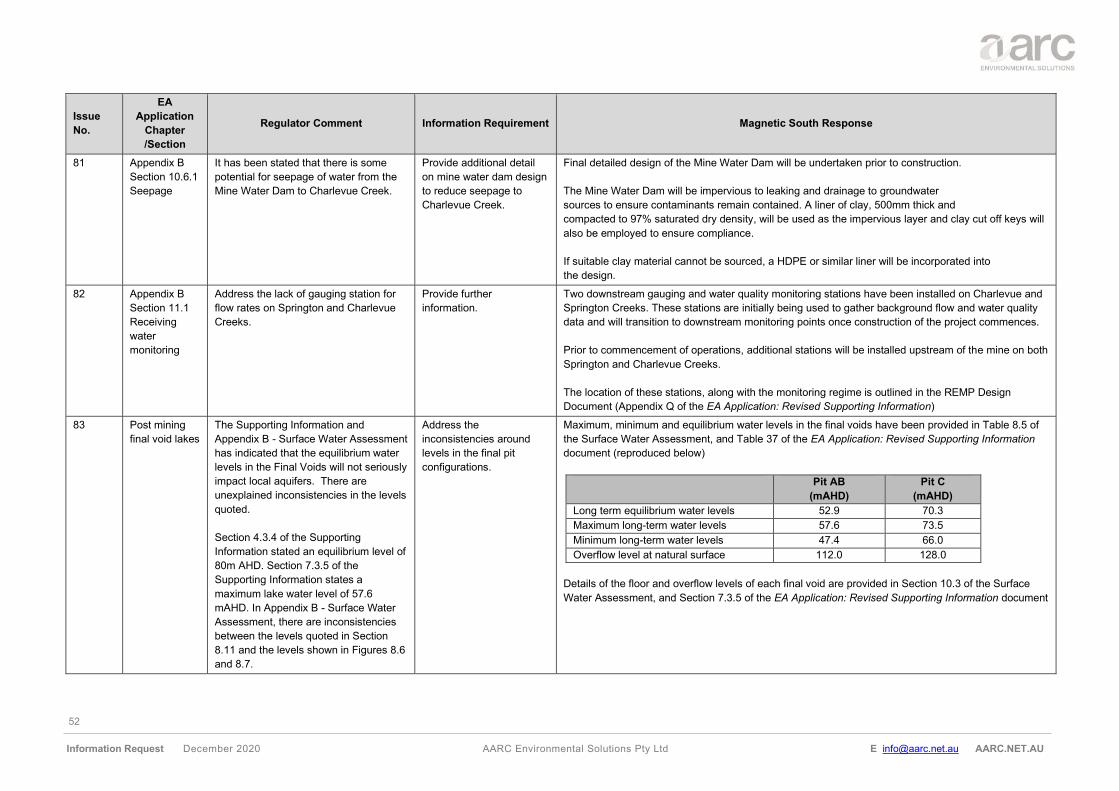
52
Information Request December 2020 AARC Environmental Solutions Pty Ltd E [email protected] AARC.NET.AU
Issue
No.
EA
Application
Chapter
/Section
Regulator Comment Information Requirement Magnetic South Response
81 Appendix B
Section 10.6.1
Seepage
It has been stated that there is some
potential for seepage of water from the
Mine Water Dam to Charlevue Creek.
Provide additional detail
on mine water dam design
to reduce seepage to
Charlevue Creek.
Final detailed design of the Mine Water Dam will be undertaken prior to construction.
The Mine Water Dam will be impervious to leaking and drainage to groundwater
sources to ensure contaminants remain contained. A liner of clay, 500mm thick and
compacted to 97% saturated dry density, will be used as the impervious layer and clay cut off keys will
also be employed to ensure compliance.
If suitable clay material cannot be sourced, a HDPE or similar liner will be incorporated into
the design.
82 Appendix B
Section 11.1
Receiving
water
monitoring
Address the lack of gauging station for
flow rates on Springton and Charlevue
Creeks.
Provide further
information.
Two downstream gauging and water quality monitoring stations have been installed on Charlevue and
Springton Creeks. These stations are initially being used to gather background flow and water quality
data and will transition to downstream monitoring points once construction of the project commences.
Prior to commencement of operations, additional stations will be installed upstream of the mine on both
Springton and Charlevue Creeks.
The location of these stations, along with the monitoring regime is outlined in the REMP Design
Document (Appendix Q of the EA Application: Revised Supporting Information)
83 Post mining
final void lakes
The Supporting Information and
Appendix B - Surface Water Assessment
has indicated that the equilibrium water
levels in the Final Voids will not seriously
impact local aquifers. There are
unexplained inconsistencies in the levels
quoted.
Section 4.3.4 of the Supporting
Information stated an equilibrium level of
80m AHD. Section 7.3.5 of the
Supporting Information states a
maximum lake water level of 57.6
mAHD. In Appendix B - Surface Water
Assessment, there are inconsistencies
between the levels quoted in Section
8.11 and the levels shown in Figures 8.6
and 8.7.
Address the
inconsistencies around
levels in the final pit
configurations.
Maximum, minimum and equilibrium water levels in the final voids have been provided in Table 8.5 of
the Surface Water Assessment, and Table 37 of the EA Application: Revised Supporting Information
document (reproduced below)
Pit AB
(mAHD)
Pit C
(mAHD)
Long term equilibrium water levels 52.9 70.3
Maximum long-term water levels 57.6 73.5
Minimum long-term water levels 47.4 66.0
Overflow level at natural surface 112.0 128.0
Details of the floor and overflow levels of each final void are provided in Section 10.3 of the Surface
Water Assessment, and Section 7.3.5 of the EA Application: Revised Supporting Information document
53
Information Request December 2020 AARC Environmental Solutions Pty Ltd E [email protected] AARC.NET.AU
Issue
No.
EA
Application
Chapter
/Section
Regulator Comment Information Requirement Magnetic South Response
There is no one section in either the
Information Document, or Appendix B,
which is a single point of truth for:
• Maximum or proposed level of
the waste rock backfill in the
two voids.
• Long term equilibrium water
levels in the two voids (based
on modelling).
• Maximum and minimum long-
term water levels in the two
voids (modelled).
• Final proposed floor level in
the two voids.
• Overflow level at natural
surface for the two voids.
The problem of uncertainties about
Levels is further exacerbated by the use
of both mbgl (metres below ground level)
and AHD (Australian Height Datum) as
means of quoting different levels.
Groundwater
84 Baseline
Monitoring
The department is concerned that the
water quality data accumulated to date
are too localised and do not provide
adequate spatial representation of the
site.
The data was obtained over 9 months.
The DSITI guidelines (Using monitoring
data to assess groundwater quality and
potential environmental impacts) (2017)
recommend at least 8 to 12 groundwater
samples be taken over a 12-month
period to establish a robust baseline in
Provide the following
information:
a) Data (water level and
quality) that is spatially
representative of the ML
area (i.e., in addition to
collection of data at
sites 1 to 6) should be
collected for at least 12
months including end of
dry and end of wet
season data (i.e.,
a) Groundwater monitoring (water level and water quality) is undertaken at a total of 39 bores at 17
sites; of these, a total of 6 bores have been dry for all monitoring events, with 5 of these bores in
the Tertiary sediments and 1 bore in the Permian coal measures. The locations of groundwater
monitoring bores are shown in Figure 68 of the EA Application: Revised Supporting Information
and summary bore details are provided in Table 4-1 of the Groundwater Impact Assessment
(Appendix C of the EA Application: Revised Supporting Information document).
Groundwater quality and level data has been collected from bores between December 2018 and
October 20, with quality results summarised in Table 46 of the EA Application: Revised
Supporting Information and both quality and level data presented in full in Appendix D.
b) A baseline data set has been established that includes:
54
Information Request December 2020 AARC Environmental Solutions Pty Ltd E [email protected] AARC.NET.AU
Issue
No.
EA
Application
Chapter
/Section
Regulator Comment Information Requirement Magnetic South Response
order to derive site-specific triggers or
limits for groundwater quality.
should reflect
seasonality).
b) The water quality data
collected above should
then be used as
baseline water quality
data, for determining
and assessing natural
variability and to derive
appropriate site-specific
triggers for the EA (refer
to Using monitoring data
to assess groundwater
quality and potential
environmental impacts.
Version 1. (DSITI,
2017)
c) Data from the Stage 2
bore installation (bores
installed May/June2019)
for which only field-
testing data was
provided should be
updated and used in the
derivation of appropriate
site-specific triggers.
d) All ground water level
data for bores at sites 1
to 5 must be provided.
e) Provide a date by which
bore DW7292W1 be
fitted with a data logger.
f) Describe the streamflow
gauging, including the
locations of and
timeframe for
streamflow gauging that
will take place in order
• for sites 1 to 5, water level and water quality data is available from 19 sampling events at 2-
monthly intervals between December 2018 and November 2019 and from March 2020 to
October 2020; and
• for sites 6 to 17, water level and water quality data is available from 14 sampling events
between September 2019 and October 2020;
Summary statistics for the water quality data (total number of samples, minimum and maximum
values, mean, median, standard deviation, 80th and 95th percentiles) are included in Table 46
and presented in full in Appendix D of the EA Application: Revised Supporting Information.
The water quality data has been reviewed in accordance with the recommended guidelines, Using
monitoring data to assess groundwater quality and potential environmental impacts. Version 1
(DSITI 2017), and proposed trigger levels are provided in Table 51 of the EA Application: Revised
Supporting Information and included in Table E4 of the Draft EA conditions.
Rationale for the proposed trigger values are outlined in Section 8.4 of the EA Application:
Revised Supporting Information document. Data for each of the proposed compliance bores
compared to the proposed trigger levels are shown graphically in Figures 24 to 42 of Appendix D
of the EA Application: Revised Supporting Information document.
c) Data is available as discussed above in (b) and has informed the derivation of site-specific
triggers that are proposed, as discussed in Section 8.4 of the Revised Supporting Information
document.
d) Groundwater data for sites 1 to 17 are included in Appendix D and are shown graphically in
Figures 2 to 7 in that Appendix.
e) For bore DW7292W1 (Springton Creek alluvium - Site 17) a data logger was fitted initially in April
2020. However, the data logger was found to be faulty and the data was unusable. A new data
logger was installed in July 2020 and has been recording at 6-hourly intervals since that time.
Section 8.2.4 of the Revised Supporting Information has been updated to reflect this.
f) Two downstream gauging and water quality monitoring stations have been installed on Charlevue
and Springton Creeks. These stations are initially being used to gather background flow and
water quality data and will transition to downstream monitoring points once construction of the
project commences.
55
Information Request December 2020 AARC Environmental Solutions Pty Ltd E [email protected] AARC.NET.AU
Issue
No.
EA
Application
Chapter
/Section
Regulator Comment Information Requirement Magnetic South Response
to establish the
relationship between
creek flow and ground
water levels that will
take place.
g) Provide all monitoring
data from the data
logger fitted to bore
DW7076W and the date
that it was fitted.
h) Provide all monitoring
data for bores at sites 6
to 17.
Prior to commencement of operations, additional stations will be installed upstream of the mine on
both Springton and Charlevue Creeks.
The location of these stations, along with the monitoring regime is outlined in the REMP Design
Document.
g) For bore DW7076W (Charlevue Creek alluvium - Site 5) a water level data logger is fitted to the
bore that has been logging data at 3-hourly intervals from December 2018 to present. Available
logger data for bore DW7076W and DW7292W is summarised graphically in Figures 2 – 7 of
Appendix D of the Revised Supporting Information.
h) Available water level and quality data has been provided in Appendix D of the EA Application:
Revised Supporting Information document.
85 Monitoring
Network
The groundwater monitoring network
(sites 1 to 5) to establish the baseline
are not considered to be representative
of the project area and should be spread
out across the site and strategically
located to assess any potential source of
contamination.
The monitoring bores should not be
located where there is a high probability
to be directly impacted or destroyed by
the activity, unless replaced by other
bores.
It is noted that the monitoring network
was expanded to include bores at sites 6
to 17 (i.e. the network has been
augmented). The monitoring network
has been described in terms of the
location and screening of bores within
the hydrostratigraphic units but the
intended purpose of each bore and
proposed long term frequency of
monitoring of the bores is not described.
Once sufficient baseline
data has been obtained the
following is required:
a) A review of the
groundwater model
using all the data
collected.
b) Review the proposed
monitoring bores and
justify the consolidated
bore network based on
factors such as the
represented aquifers,
the groundwater flow
directions, the
environmental values
and the impacting
activities on site.
c) A revised conceptual
model of the
hydrogeology of the
mining lease including
updates to the
a) Based on data collected to date, it is assessed that the data and conceptualisation in the model is
still sound and that no update of the groundwater model is required at this stage.
b) The groundwater monitoring bore network was designed based on the following considerations:
• bores are located within all groundwater units present at site (Quaternary alluvium of
Charlevue Creek and Springton Creek, Tertiary sediments, Permian coal seams and inter-
burden units);
• the majority of bores were located in the area of the AB pit, as this pit is planned to be
developed first;
• the bores are broadly aligned in two transects to provide drawdown data within the mined area,
immediately adjacent to the mined area, and at distance towards Charlevue Creek and
Springton Creek.
• bores are located within all groundwater units that exist between the AB Pit and the C Pit, to
provide information on the extent of drawdown between the pits and as a way of providing
drawdown data to validate the groundwater model.
• additional bores are located within and immediately adjacent to the C Pit, within all
groundwater units encountered in that area (to base of mining) to provide both water level and
water quality data in that area.
• the spatial and vertical layout of the bore monitoring network (which includes 39 bores at 17
sites) will allow:
56
Information Request December 2020 AARC Environmental Solutions Pty Ltd E [email protected] AARC.NET.AU
Issue
No.
EA
Application
Chapter
/Section
Regulator Comment Information Requirement Magnetic South Response
The selected bore locations should
reflect the current understanding of the
hydrogeology with an aim to get a more
detailed conceptual understanding of the
hydrogeology, aquifers present, standing
water levels and direction of
groundwater flow. While the augmented
network appears to provide adequate
spatial coverage, very little information is
provided to demonstrate that monitoring
bores have been located giving
consideration to the spatial
representation of hydrostratigraphic units
both up and down stream of the Gemini
Project or in relation to proposed
infrastructure. The bore locations should
be justified through an explanation of
their locations, and the application
should include a figure showing the
location of the monitoring bores relative
to the proposed infrastructure.
The conceptual model and groundwater
monitoring network provided in the
submitted application is not supported by
sufficient fit for purpose baseline
monitoring.
Falling head slug tests were undertaken
on bores 6 to 17 to obtain site specific
hydraulic conductivity data for
groundwater modelling. Falling head
slug tests were not undertaken on the
bores at sites 1 to 6.
An adaptive management program is
anticipated however an ongoing
adaptive management strategy for the
hydrogeology, aquifers
present, standing water
level and the direction of
groundwater flow.
d) The proposed
operational phase
monitoring network
demonstrating that
consideration has been
given to: the revised
conceptual model and
groundwater flow
model, the location of
the mining activities,
potential sources of
contaminants (seepage
from dams and
overburden dumps).
e) Demonstrate that there
is adequate spatial
coverage and
representation of
aquifers both up and
down gradient in
relation to potential
contamination sources.
f) Include a documented
rationale for the spatial
distribution of the
sampling design /
network and the
monitoring frequency.
g) Demonstrate clearly that
the monitoring network
is fit for purpose with
bores classified as
reference/control and
test/compliance and the
o assessment of the variability of water quality across the site and within vertically
separated groundwater units at the same location (e.g., coal measures and
overlying Tertiary sediments);
o assessment of the potential for upward vs downward groundwater movement at a
single location;
o assessment of groundwater flow direction within the distinct groundwater units;
o assessment of recharge potential of the various groundwater units, particularly the
Quaternary alluvium where water level loggers have been fitted to bores DW7076W
and DW7292W.
c) A detailed conceptual model is presented in the Groundwater Impact Assessment (JBT 2019).
Following review of the available water level and water quality data, no major update of the
conceptual model is proposed, with the exception of the following additional observations:
• Available water level data is summarised in Appendix D of the EA Application: Revised
Supporting Information and bore hydrographs for each site are shown in Figures 2 to 7 of that
Appendix. The figures all include a graph that shows monthly rainfall data as well as the rainfall
residual mass curve for the period of monitoring, to allow assessment of rainfall on
groundwater level trends. It is noted that both alluvial monitoring bores (DW7076W and
DW7292W1) record a falling water level trend followed by a rising water level trend that is
interpreted to be related to the above-average rainfall of February 2020, with the water level
then starting to fall again in around July 2020. From the available data, it appears that this is
a seasonal trend for the Quaternary alluvium. A recharge response is either more subdued or
absent in Tertiary and Permian monitoring bores.
• The groundwater flow direction within the Permian sediments is assessed to be from south-
southwest to north-northeast (JBT 2019). It is noted from available water quality data that the
EC of the Permian coal measures is generally lower towards the south (i.e., for bores in the
area of the C Pit) and higher towards the north (i.e., for bores in the area of the AB Pit). This
is consistent with a general degradation in water quality along the groundwater flow line, i.e.,
with increased groundwater residence time.
d) A revised groundwater monitoring network that comprises compliance bore sites and reference
bores sites is presented in Section 8.4 of the EA Application: Revised Supporting Information.
Additional monitoring bores will be installed as required around sources of potential contaminants,
though it is noted that these are best installed once the facilities themselves (e.g., dams) are
installed, to avoid the bores being destroyed during earthworks and to allow targeted bore
placement.
57
Information Request December 2020 AARC Environmental Solutions Pty Ltd E [email protected] AARC.NET.AU
Issue
No.
EA
Application
Chapter
/Section
Regulator Comment Information Requirement Magnetic South Response
collection of data, review and
recalibration of the underground water
model and review of the monitoring
program in order to ensure that impacts
on Environmental values are avoided
and mitigated has not been detailed.
In order to derive site-specific limits for
all bores listed by the applicant in
Section 14 of the supporting document
in Table E1, additional data should be
provided for all the designated bores.
Sufficient data are required in order to
identify natural variability within the
different aquifers, as per the DSITI
guidelines (2017). The proponent should
provide the proposed monitoring plan to
assess the groundwater quality baseline
at each bore or group of bores.
Once sufficient data are obtained, the
proponent is required to nominate
compliance bores and propose limits for
relevant indicators.
target aquifer is
identified.
h) A detailed monitoring
plan to assess the
groundwater quality
baseline at each bore or
group of bores.
i) Provide a detailed
adaptive management
strategy proposed for
the mitigation and
management of
drawdown and potential
water quality impacts;
and
j) Detail any proposed
strategies for the review
and recalibration of the
underground water
model and review of the
monitoring program in
order to ensure that
impacts on
environmental values
are avoided and
mitigated.
e) f) g) Refer to response (a) in issue 84.
h) A Groundwater Monitoring and Management Plan has been prepared and attached to Appendix E
of the EA Application: Revised Supporting Information document.
i) The predictions from groundwater modelling will be reviewed on an ongoing basis once mining
commences and drawdown data becomes available to validate the predictions of the groundwater
model. The groundwater model will be re-calibrated as necessary and updated predictions of
groundwater impacts and mitigations measures made as appropriate.
86 Trigger Values The proposed groundwater monitoring
program should achieve the early
detection of any potential impacts to
groundwater resources at Gemini, to
maintain groundwater at a suitable
background quality.
Trigger values should be
assessed/proposed based on the
guideline Using monitoring data to
assess groundwater quality and potential
Demonstrate that baseline
groundwater monitoring
data has been collected
and that proposed trigger
values are determined in
accordance with the
DISITI Guideline (March
2017).
The water quality data has been reviewed in accordance with the recommended guidelines (Using
monitoring data to assess groundwater quality and potential environmental impacts. Version 1. DSITI,
2017).
Proposed trigger levels are provided in Table 51 of the EA Application: Revised Supporting Information
document. The following observations and comments are made with respect to the proposed trigger
levels:
• The water quality data collected to date represent background data;
• The data is presented with reference to the three groundwater units that have been identified
at site, being:
o Quaternary alluvium associated with Charlevue Creek and Springton Creek;
58
Information Request December 2020 AARC Environmental Solutions Pty Ltd E [email protected] AARC.NET.AU
Issue
No.
EA
Application
Chapter
/Section
Regulator Comment Information Requirement Magnetic South Response
environmental impacts. Version 1.
(DSITI, 2017) guideline. The guideline
details a process for data evaluation to
calculate site specific trigger values for
groundwater. It is recommended that this
guideline is followed, both in the
collection of baseline monitoring data,
and ensuring that baseline monitoring
ensures sufficient data for the statistical
robustness of trigger values as per the
guideline.
Trigger values should be fit for purpose
and conservative enough that when
applied to the investigation bores they
provide an early warning of emerging
potential impacts to the quality of the
groundwater. Applying triggers which are
set too high may not be sensitive
enough to identify current or emerging
contamination issues.
o Tertiary sediments, which are present over the entire lease area. It is noted that 5
out of 11 Tertiary monitoring bores have been dry for the full period of monitoring.
These are the same bores that were noted as being dry during the preparation of
the groundwater impact assessment (JBT 2019) and the conceptualisation that was
presented in that report still stands;
o Permian coal measures (coal seams and interburden/ overburden sediments)
• The three groundwater units contain groundwater with broadly distinct chemistry, therefore
trigger levels are proposed based on the data for each of the groundwater units;
• Trigger levels are proposed for a subset of the bores (the compliance monitoring bores) within
the groundwater monitoring network, with the proposed compliance bores identified in Table
50 of the EA Application: Revised Supporting Information document
• Compliance and reference bores have been selected as follows:
o The compliance bores provide a spatial coverage within all groundwater units
identified at site and where possible are located close to mining areas (within the
zone of predicted impact) but not within the disturbance footprint of mining (i.e.
within the proposed pit area);
o Reference bores have been selected to be located within the same groundwater
units but at locations that are distant from the area where mining is first proposed to
commence (the AB Pit Area). As mining progresses towards the C Pit area, the
existing reference bores are likely to become the compliance bores for that area.
• Because a large number of Tertiary monitoring bores are dry, the proposed compliance bore
network for Tertiary bores is limited to the bores that contain water. One bore (DW7225W1)
is located within the mining footprint of the C Pit, though mining of the AB Pit will occur in
advance of mining in this area. The bore is included to provide spatial coverage of the Tertiary
sediments, but will require replacement once mining in the C Pit area commences.
• The rationale for setting of trigger levels is as follows:
o For EC and sulphate the trigger level is based on the 95th percentile of the data for
each groundwater unit
o For pH, the proposed trigger level range is based on the range of site data;
o For metals/metalloids where the data is generally below the ANZG (2018) aquatic
ecosystem protection limit for moderately disturbed system (95% protection), the
proposed trigger level is based on the ANZG (2018) limits;
o For mercury, the proposed trigger is based on the LOR of the analytical method
FIMS;
o For metals/metalloids where the site background data is generally above the ANZG
(2018) freshwater protection limit, the proposed trigger level is based on the 95th
percentile of the data for each groundwater unit.
59
Information Request December 2020 AARC Environmental Solutions Pty Ltd E [email protected] AARC.NET.AU
Issue
No.
EA
Application
Chapter
/Section
Regulator Comment Information Requirement Magnetic South Response
• For compliance assessment a control charting technique is proposed, with a trigger
exceedance being 2 consecutive samples above the trigger level and a limit exceedance being
4 consecutive samples above the trigger level. This criteria is proposed as it is noted that the
background data at individual compliance bore sites is close to and in some cases exceeds
the proposed trigger, and that an assessment criteria of one exceedance equalling a trigger
event would result in the reporting of trigger exceedances for almost every sample event, even
with pre-mining background data;
• The trigger levels shown in Table 51 of the EA Application: Revised Supporting Information
document are proposed as interim trigger levels and it is proposed that the levels are further
reviewed after collection of an additional 2 years of data
87 Water Balance
modelling
Modelling has been undertaken to
assess the extent of groundwater level
impacts from the proposed project and
the rate of groundwater inflow to the pits.
Provide an updated
numerical model based on
updates to the conceptual
and groundwater flow
direction models,
incorporating groundwater
monitoring data obtained
to date.
Demonstrate that the
proposed water
management strategies
will perform adequately in
terms of maintaining the
capability of reducing mine
affected water inventories
and compliance with any
proposed release criteria.
The water management
system performance must
demonstrate that it is able
to manage excess water
during and after very high
rainfall wet season
conditions.
Based on data collected to date, it is assessed that the data and conceptualisation in the model is still
sound and that no update of the groundwater model is required at this stage.
Water balance modelling, and the performance of the site water management system is summarised in
Section 3.4.5 of the EA Application: Revised Supporting Information document and provided in detail in
Section 6 of the Surface Water Assessment.
60
Information Request December 2020 AARC Environmental Solutions Pty Ltd E [email protected] AARC.NET.AU
Issue
No.
EA
Application
Chapter
/Section
Regulator Comment Information Requirement Magnetic South Response
88 Groundwater
dependent
ecosystems
It cannot be conclusively ruled out that
the groundwater level is beyond the
depth that is accessible to the root zone
of some plants (vegetation adjacent to
Charlevue Creek) or that there is not
continuous saturation below the potential
groundwater dependent ecosystem
(GDE) that has been identified.
Furthermore, the seasonal range of
water level within the alluvium is not
known, and the 2m drawdown contour at
post-mining equilibrium extends under
the area where the potential GDE is
located. Ongoing monitoring has
therefore been recommended, including
monitoring within the alluvium via water
level data loggers. It is noted that a data
logger is already fitted to bore
DW7076W and that it is planned to
install a logger in bore DW7292W1.
The GDEs that may be impacted by the
activity and the expected drawdown
includes Charlevue Creek, Springton
Creek and an 88 ha HES wetland
located approximately 4 km east of the
MLA boundary. The applicant indicates
that this wetland is located within a
shallow depression on an elevated
ridgeline. On page 48 of the Appendix B
Groundwater Impact Assessment report,
it is stated that, “based on modelling,
professional experience and judgement,
…, It is interpreted that the risk posed by
drawdown from the mining operation to
the potential GDE is very low as:
a) Describe a plan for the
ongoing monitoring of
groundwater levels within
the Charlevue and
Springton Creek Alluvium
that is proposed to be
undertaken, including the
locations and frequency of
monitoring.
b) Include the derivation of
indicators, thresholds and
triggers relevant to the
protection of GDE values.
c) Demonstrate that the
monitoring locations
selected for monitoring the
alluvium are adequately
representative of the
alluvium across the site.
d) Provide a date by which
the data logger will be
installed in bore
DW7292W1.
e) Provide detail in relation
to the streamflow
monitoring that is or will be
undertaken in order to
allow the relationship
between creek flow and
water level to be
established over time.
f) Provide information
relating to how the
information collected from
a) Manual water level monitoring is currently undertaken on groundwater monitoring bores at 2-
monthly intervals. In addition to manual water level monitoring, bores that are located within the
Charlevue Creek alluvium (DW7076W) and Springton Creek alluvium (DW7292W1) are fitted with
data loggers, which are recording at 3-6 hourly intervals.
b) Refer to response (b) in issue 84 and to the response to issue 86.
c) Refer to response (b) in issue 85
d) For bore DW7292W1 (Springton Creek alluvium - Site 17) a data logger was fitted initially in April
2020. However, the data logger was found to be faulty and the data was unusable. A new data
logger was installed in July 2020 and has been recording at 6-hourly intervals since that time.
Section 8.2.4 of the EA Application: Revised Supporting Information document has been updated
to reflect this.
e) Two downstream gauging and water quality monitoring stations have been installed on Charlevue
and Springton Creeks. These stations are initially being used to gather background flow and water
quality data and will transition to downstream monitoring points once construction of the project
commences.
Prior to commencement of operations, additional stations will be installed upstream of the mine on
both Springton and Charlevue Creeks. The location of these stations, along with the monitoring
regime is outlined in the REMP Design Document.
f) The predictions from groundwater modelling will be reviewed on an ongoing basis once mining
commences and drawdown data becomes available to validate the predictions of the groundwater
model. The groundwater model will be re-calibrated as necessary and updated predictions of
groundwater impacts and mitigations measures made as appropriate.
g) A revised groundwater monitoring network that comprises compliance bore sites and reference
bores sites is presented above in response (b) in issue 85 and described in Section 8.4 of the
Revised Supporting Information. Additional monitoring bores will be installed as required around
sources of potential contaminants, though it is noted that these are best installed once the facilities
themselves (e.g., dams) are installed, to avoid the bores being destroyed during earthworks and to
allow targeted bore placement.
61
Information Request December 2020 AARC Environmental Solutions Pty Ltd E [email protected] AARC.NET.AU
Issue
No.
EA
Application
Chapter
/Section
Regulator Comment Information Requirement Magnetic South Response
• It is interpreted that the potential GDE
exists in an area where the
groundwater system is very localised
and is perched above the regional
groundwater system; and,
• The groundwater lens that is
interpreted to be located beneath the
potential GDE is likely to be
maintained by seasonal surface water
runoff rather than the regional
groundwater system.”
These vague statements do not provide
certainty that the wetland will not be
impacted by the activity. The figure
below shows that the drawdown extent
is modelled to extend to the HES
wetland.
the monitoring of the
Alluvium will be
incorporated into the
refinement of the
conceptual and numerical
groundwater models. This
should include verification
of specialist opinions
relating to the probability
that the potential GDE’s
are underlain by a perched
groundwater system and
that the riparian vegetation
(within Charlevue and
Springton Creeks) are
reliant on moisture or
perched groundwater
existing for a period of
time after a flow event
rather than being reliant
on groundwater.
g) Review monitoring bore
locations to ensure the
main potentially impacting
activities on site are
monitored, as well as any
potential impact to the
HES Wetland to ensure
detection of any significant
impacts. Provide and
justify the consolidated
monitoring bore network.
89 Drawdown The results of drawdown modelling are
described by a 5m and a 2m drawdown
extent. This selection is based on the
definition of bore trigger thresholds for
As per Section
126A(2)(c)(iii) of the EP
Act provide a description
of the aquifer or aquifers
• The Quaternary alluvium is assessed to be a perched system where water exists within this unit
(i.e. the alluvium is generally hydraulically separated from the underlying regional groundwater
system). It is therefore conceptualised that groundwater level drawdown within the Permian coal
measures will have minimal impact on water levels within the alluvium.
62
Information Request December 2020 AARC Environmental Solutions Pty Ltd E [email protected] AARC.NET.AU
Issue
No.
EA
Application
Chapter
/Section
Regulator Comment Information Requirement Magnetic South Response
the Water Act 2000 and have been used
to estimate the potential impact on
existing groundwater users.
The potential for impact on
environmental values has been
assessed as low risk and the likelihood
dependency of the vegetation on
groundwater for survival is assessed as
unlikely. The assessment does however
conclude that drawdown from mining
may affect water levels in the alluvium at
some locations and ongoing monitoring
is recommended.
Interim groundwater level triggers that
instigate investigations into groundwater
resource impacts, which are informed by
modelling should be selected for the
protection of environmental values.
These are useful for assessing model
predictions, evaluating drawdown
impacts, instigating investigations and
implementing mitigation measures.
The association between stages of
mining/time and drawdown within each
aquifer has not been well described.
It is suggested that the applicant
undertake some preliminary work to
model the rate of drawdown in order to
assess the model and expected impacts
during operation and potential measures
to be taken to ensure the predicted
drawdown is not exceeded.
where the water level in
that aquifer is predicted to
decline because of the
exercise of underground
water rights.
Establish and provide
drawdown triggers
(including a rationale)
based on the identified
Environmental values.
Once sufficient data is
obtained, the proponent is
required to nominate
compliance bores and
propose limits for relevant
indicators.
Undertake further
modelling to determine the
rate of drawdown to fully
assess the expected
impacts and include
sufficient monitoring
controls are in place to
identify and manage any
potential impacts
Consider undertaking a
bore survey to identify the
potential impacts of
drawdown on potentially
impacted properties.
• The water level is predicted to decline primarily within the Permian coal measures in response to
mining. It is noted that the Tertiary sediments are not a continuously saturated unit across the
mine site, though where the unit is saturated it could be expected that drawdown impacts would
extend to this unit within the area of identified drawdown
• A Groundwater Monitoring Plan has been provided as Appendix E to the EA Application: Revised
Supporting Information document, with details of the compliance and reference bores also
outlined in Table 50.
• Once sufficient water level drawdown data is available to validate the model predictions, further
groundwater modelling will be considered if necessary.
• A bore survey of neighbouring properties (i.e. properties that adjoin the MLA) will be undertaken
once the Project is approved
63
Information Request December 2020 AARC Environmental Solutions Pty Ltd E [email protected] AARC.NET.AU
Issue
No.
EA
Application
Chapter
/Section
Regulator Comment Information Requirement Magnetic South Response
The model indicates an impact of the
drawdown on registered bores outside
the MLA boundary.
90 Chapter 3
requirements
(Water Act,
2000) -
Associated
Water
New projects within a regulated
groundwater area have a statutory right
to take underground water (‘associated
water’) under section 334ZP of the
Mineral Resources Act 1989. The project
is therefore subject to the underground
water obligations set out in Chapter 3 of
the Water Act 2000, including the
requirement to prepare Underground
Water Impact Reports (UWIR) and
Baseline Assessment Plans (BAP) before
dewatering begins. Make good provisions
under Chapter 3 of the Water Act 2000
also apply.
The application form indicated that the
Gemini will be exercising their right to
take or interfere with underground water.
Section 126A of the EP Act outlines the
information requirements which must
accompany a site-specific application
where a resource activity involves the
exercise of underground water rights and
ensures that upfront assessment of the
impacts to environmental values from the
exercise of these underground water
rights has been undertaken.
The information requirements detailed in
the guideline Requirements for site-
specific and amendment applications –
underground water rights, V1.01
(ESR/2016/3275) (the guideline), are
required to be met for the Gemini
application. The guideline suggests
Address and provide the
information requirements
in the guideline
Requirements for site-
specific and amendment
applications –
underground water rights,
V1.01 (ESR/2016/3275).
Recalibrate the Numerical
Model and test the
Conceptual Model by
increasing the accuracy of
field data once sufficient
data is available to
improve the certainty of
the model outputs and the
identification of potentially
impacted environmental
values.
The EA Application: Revised Supporting Information, including Appendices C and E, provide
information relevant to the assessment of the EA Application.
Prior to the take of underground water, information required by the guideline Requirements for site-
specific and amendment applications – underground water rights, V1.01 (ESR/2016/3275) will be
packaged into a specific Underground Water Impact Report and Baseline Assessment Plan.
Once sufficient data becomes available to validate the groundwater model, the data will be used to re-
calibrate the numerical groundwater model if required.
64
Information Request December 2020 AARC Environmental Solutions Pty Ltd E [email protected] AARC.NET.AU
Issue
No.
EA
Application
Chapter
/Section
Regulator Comment Information Requirement Magnetic South Response
specific methods and information that the
department believes to be appropriate to
meet the requirements of 126A of the EP
Act, and types of Environmental values
that the department believes to
potentially be affected by the exercise of
underground water rights.
As discussed under previous sections
the limited sampling and representation
of aquifers presents an underlying
source of uncertainty and concern for
the department, due to its limited ability
to capture spatial and temporal
variability. Any modelling (Numerical,
Flow, Conceptual, Water balance)
undertaken on the basis of limited
sampling is thus potentially equally
uncertain.
Recalibration of the Numerical Model
and testing the Conceptual Model by
increasing the accuracy of field data
once sufficient data is available is
considered necessary to improve the
certainty of the model outputs and the
identification of potentially impacted
environmental values.
Air Quality
91 Appendix I
Section 3.3.2
Sensitive
receptors
Figure 4
Location of
sensitive
receptors
Figure 4 shows the locations of each of
the sensitive receptions within close
proximity to the Gemini Coal Project.
However, the figure provided does not
provide sufficient information to assist
the department to make a decision.
Provide a map utilising
satellite imagery and GPS
co-ordinates of all
sensitive receptions,
including those which
have compensation or
purchase agreements to
Figure 77 of the EA Application: Revised Supporting Information document has been updated to
include satellite imagery and the location of all sensitive receptions (including those which have had
compensation or purchase agreements).
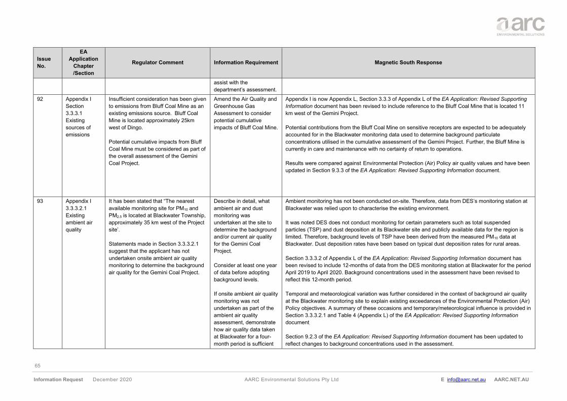
65
Information Request December 2020 AARC Environmental Solutions Pty Ltd E [email protected] AARC.NET.AU
Issue
No.
EA
Application
Chapter
/Section
Regulator Comment Information Requirement Magnetic South Response
assist with the
department’s assessment.
92 Appendix I
Section
3.3.3.1
Existing
sources of
emissions
Insufficient consideration has been given
to emissions from Bluff Coal Mine as an
existing emissions source. Bluff Coal
Mine is located approximately 25km
west of Dingo.
Potential cumulative impacts from Bluff
Coal Mine must be considered as part of
the overall assessment of the Gemini
Coal Project.
Amend the Air Quality and
Greenhouse Gas
Assessment to consider
potential cumulative
impacts of Bluff Coal Mine.
Appendix I is now Appendix L, Section 3.3.3 of Appendix L of the EA Application: Revised Supporting
Information document has been revised to include reference to the Bluff Coal Mine that is located 11
km west of the Gemini Project.
Potential contributions from the Bluff Coal Mine on sensitive receptors are expected to be adequately
accounted for in the Blackwater monitoring data used to determine background particulate
concentrations utilised in the cumulative assessment of the Gemini Project. Further, the Bluff Mine is
currently in care and maintenance with no certainty of return to operations.
Results were compared against Environmental Protection (Air) Policy air quality values and have been
updated in Section 9.3.3 of the EA Application: Revised Supporting Information document.
93 Appendix I
3.3.3.2.1
Existing
ambient air
quality
It has been stated that “The nearest
available monitoring site for PM10 and
PM2.5 is located at Blackwater Township,
approximately 35 km west of the Project
site’.
Statements made in Section 3.3.3.2.1
suggest that the applicant has not
undertaken onsite ambient air quality
monitoring to determine the background
air quality for the Gemini Coal Project.
Describe in detail, what
ambient air and dust
monitoring was
undertaken at the site to
determine the background
and/or current air quality
for the Gemini Coal
Project.
Consider at least one year
of data before adopting
background levels.
If onsite ambient air quality
monitoring was not
undertaken as part of the
ambient air quality
assessment, demonstrate
how air quality data taken
at Blackwater for a four-
month period is sufficient
Ambient monitoring has not been conducted on-site. Therefore, data from DES’s monitoring station at
Blackwater was relied upon to characterise the existing environment.
It was noted DES does not conduct monitoring for certain parameters such as total suspended
particles (TSP) and dust deposition at its Blackwater site and publicly available data for the region is
limited. Therefore, background levels of TSP have been derived from the measured PM10 data at
Blackwater. Dust deposition rates have been based on typical dust deposition rates for rural areas.
Section 3.3.3.2 of Appendix L of the EA Application: Revised Supporting Information document has
been revised to include 12-months of data from the DES monitoring station at Blackwater for the period
April 2019 to April 2020. Background concentrations used in the assessment have been revised to
reflect this 12-month period.
Temporal and meteorological variation was further considered in the context of background air quality
at the Blackwater monitoring site to explain existing exceedances of the Environmental Protection (Air)
Policy objectives. A summary of these occasions and temporary/meteorological influence is provided in
Section 3.3.3.2.1 and Table 4 (Appendix L) of the EA Application: Revised Supporting Information
document.
Section 9.2.3 of the EA Application: Revised Supporting Information document has been updated to
reflect changes to background concentrations used in the assessment.
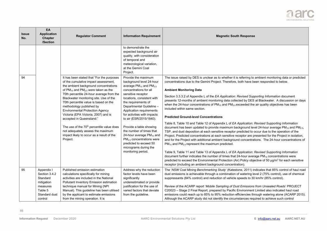
66
Information Request December 2020 AARC Environmental Solutions Pty Ltd E [email protected] AARC.NET.AU
Issue
No.
EA
Application
Chapter
/Section
Regulator Comment Information Requirement Magnetic South Response
to demonstrate the
expected background air
quality, with consideration
of temporal and
meteorological variation,
at the Gemini Coal
Project.
94 It has been stated that “For the purposes
of the cumulative impact assessment,
the ambient background concentrations
of PM10 and PM2.5 were taken as the
70th percentile 24-hour average from the
Blackwater monitoring site. Use of the
70th percentile value is based on the
methodology published by
Environmental Protection Agency
Victoria (EPA Victoria, 2007) and is
accepted in Queensland.”
The use of the 70th percentile value does
not adequately assess the maximum
impact likely to occur as a result of the
Project.
Provide the maximum
background level 24-hour
average PM10 and PM2.5
concentrations for all
sensitive receptor
locations, consistent with
the requirements of
Departmental Guideline –
Application requirements
for activities with impacts
to air (ESR/2015/1840).
Provide a table showing
the number of times that
24-hour average PM10 and
PM2.5 concentrations were
predicted to exceed 50
micrograms during the
monitoring period.
The issue raised by DES is unclear as to whether it is referring to ambient monitoring data or predicted
concentrations due to the Gemini Project. Therefore, both have been responded to below.
Ambient Monitoring Data
Section 3.3.3.2 of Appendix L of the EA Application: Revised Supporting Information document
presents 12-months of ambient monitoring data collected by DES at Blackwater. A discussion on days
when the 24-hour concentrations of PM10 and PM2.5 exceeded the air quality objectives has been
included within same section.
Predicted Ground-level Concentrations
Table 8, Table 10 and Table 12 of Appendix L of EA Application: Revised Supporting Information
document has been updated to provide maximum background level 24-hour average PM10 and PM2.5,
TSP, and dust deposition at each sensitive receptor predicted to occur due to the operation of the
Project. Predicted concentrations at each sensitive receptor are presented for the Project in isolation,
and for the Project with additional ambient background concentrations. The 24-hour concentrations of
PM10 and PM2.5 represent the maximum predicted.
Table 9, Table 11 and Table 13 of Appendix L of EA Application: Revised Supporting Information
document further indicates the number of times that 24-hour average PM10 concentrations were
predicted to exceed the Environmental Protection (Air) Policy objective of 50 μg/m3 for each sensitive
receptor (including an ambient background concentration).
95 Appendix I
Section 3.4.2
Standard
mitigation
measures
Table 5
Standard dust
control
Published emission estimation
calculations specifically for mining
activities are included in the National
Pollutant Inventory Emission estimation
technique manual for Mining (NPI
Manual). This guideline has been utilised
by the applicant to estimate emissions
from the mining operation. It is
Address why the reduction
factor levels have been
significantly
underestimated or provide
justification for the use of
varied factors that deviate
from the guideline.
The ‘NSW Coal Mining Benchmarking Study’ (Katestone, 2011) indicates that 85% control of haul road
dust emissions is achievable through a combination of watering level 2 (75% control), use of chemical
suppressants (84% control) and reduction of vehicle speeds to 30 km/hr (85% control).
Review of the ACARP report ‘Mobile Sampling of Dust Emissions from Unsealed Roads’ PROJECT
C20023 – Stage 2 Final Report, prepared by Pacific Environment Limited also indicated haul road
emissions could reach up to 85% to 95% reduction efficiencies through watering alone (ACARP 2015).
Although the ACARP study did not identify the circumstances required to achieve such control
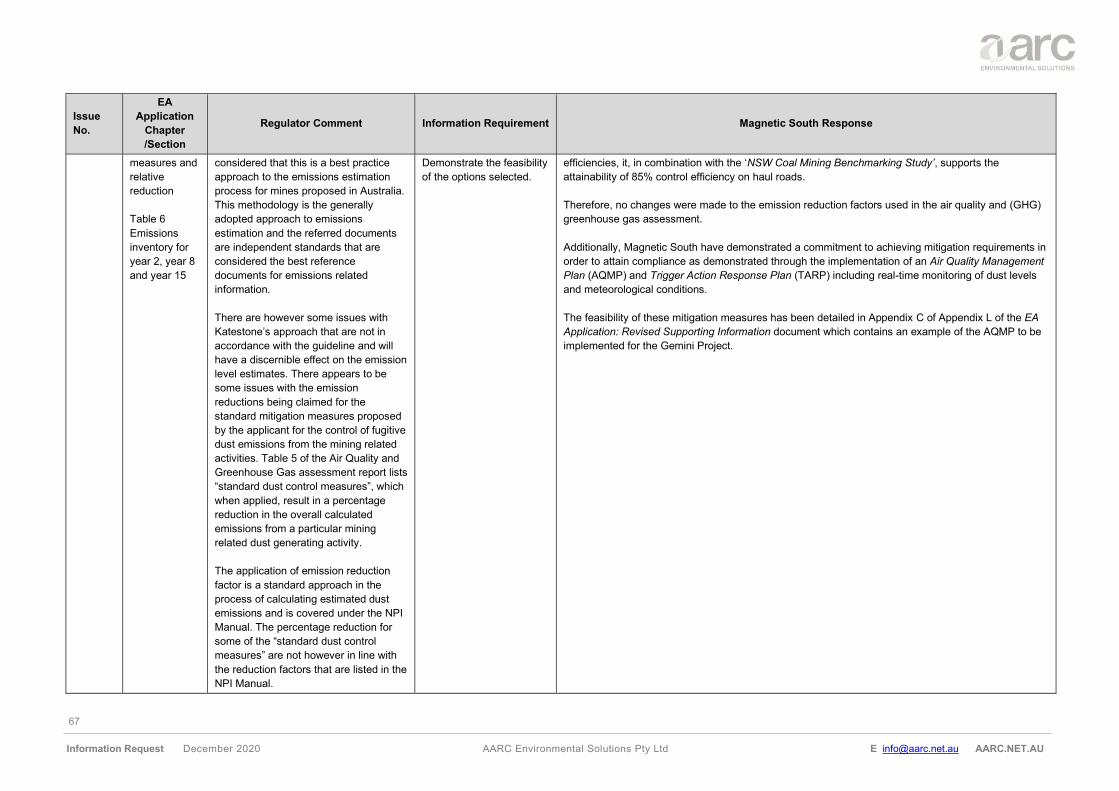
67
Information Request December 2020 AARC Environmental Solutions Pty Ltd E [email protected] AARC.NET.AU
Issue
No.
EA
Application
Chapter
/Section
Regulator Comment Information Requirement Magnetic South Response
measures and
relative
reduction
Table 6
Emissions
inventory for
year 2, year 8
and year 15
considered that this is a best practice
approach to the emissions estimation
process for mines proposed in Australia.
This methodology is the generally
adopted approach to emissions
estimation and the referred documents
are independent standards that are
considered the best reference
documents for emissions related
information.
There are however some issues with
Katestone’s approach that are not in
accordance with the guideline and will
have a discernible effect on the emission
level estimates. There appears to be
some issues with the emission
reductions being claimed for the
standard mitigation measures proposed
by the applicant for the control of fugitive
dust emissions from the mining related
activities. Table 5 of the Air Quality and
Greenhouse Gas assessment report lists
“standard dust control measures”, which
when applied, result in a percentage
reduction in the overall calculated
emissions from a particular mining
related dust generating activity.
The application of emission reduction
factor is a standard approach in the
process of calculating estimated dust
emissions and is covered under the NPI
Manual. The percentage reduction for
some of the “standard dust control
measures” are not however in line with
the reduction factors that are listed in the
NPI Manual.
Demonstrate the feasibility
of the options selected.
efficiencies, it, in combination with the ‘NSW Coal Mining Benchmarking Study’, supports the
attainability of 85% control efficiency on haul roads.
Therefore, no changes were made to the emission reduction factors used in the air quality and (GHG)
greenhouse gas assessment.
Additionally, Magnetic South have demonstrated a commitment to achieving mitigation requirements in
order to attain compliance as demonstrated through the implementation of an Air Quality Management
Plan (AQMP) and Trigger Action Response Plan (TARP) including real-time monitoring of dust levels
and meteorological conditions.
The feasibility of these mitigation measures has been detailed in Appendix C of Appendix L of the EA
Application: Revised Supporting Information document which contains an example of the AQMP to be
implemented for the Gemini Project.
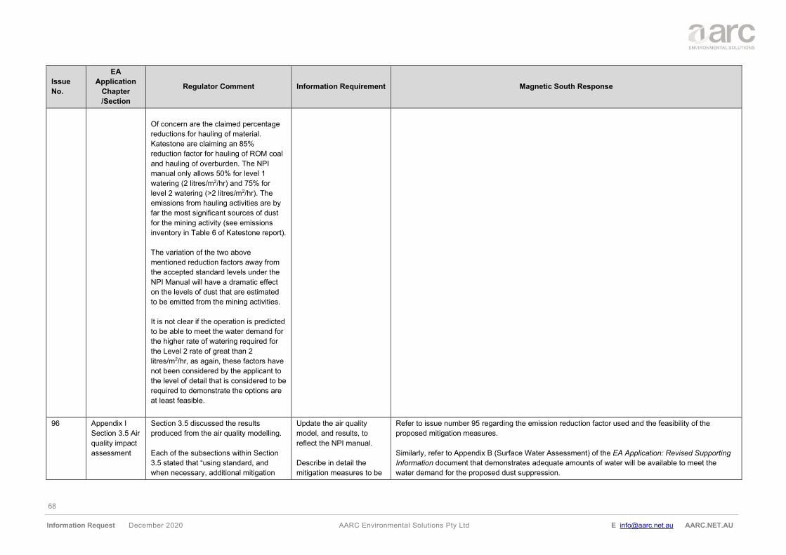
68
Information Request December 2020 AARC Environmental Solutions Pty Ltd E [email protected] AARC.NET.AU
Issue
No.
EA
Application
Chapter
/Section
Regulator Comment Information Requirement Magnetic South Response
Of concern are the claimed percentage
reductions for hauling of material.
Katestone are claiming an 85%
reduction factor for hauling of ROM coal
and hauling of overburden. The NPI
manual only allows 50% for level 1
watering (2 litres/m2/hr) and 75% for
level 2 watering (>2 litres/m2/hr). The
emissions from hauling activities are by
far the most significant sources of dust
for the mining activity (see emissions
inventory in Table 6 of Katestone report).
The variation of the two above
mentioned reduction factors away from
the accepted standard levels under the
NPI Manual will have a dramatic effect
on the levels of dust that are estimated
to be emitted from the mining activities.
It is not clear if the operation is predicted
to be able to meet the water demand for
the higher rate of watering required for
the Level 2 rate of great than 2
litres/m2/hr, as again, these factors have
not been considered by the applicant to
the level of detail that is considered to be
required to demonstrate the options are
at least feasible.
96 Appendix I
Section 3.5 Air
quality impact
assessment
Section 3.5 discussed the results
produced from the air quality modelling.
Each of the subsections within Section
3.5 stated that “using standard, and
when necessary, additional mitigation
Update the air quality
model, and results, to
reflect the NPI manual.
Describe in detail the
mitigation measures to be
Refer to issue number 95 regarding the emission reduction factor used and the feasibility of the
proposed mitigation measures.
Similarly, refer to Appendix B (Surface Water Assessment) of the EA Application: Revised Supporting
Information document that demonstrates adequate amounts of water will be available to meet the
water demand for the proposed dust suppression.
69
Information Request December 2020 AARC Environmental Solutions Pty Ltd E [email protected] AARC.NET.AU
Issue
No.
EA
Application
Chapter
/Section
Regulator Comment Information Requirement Magnetic South Response
measures predicted 24-hour average
and annual average concentrations of
PM10 comply with relevant air quality
objectives at all sensitive receptors.
Additional mitigation measures may
include restricting overburden and ROM
haul to between 7am and 6pm on days
when 24-hour averaged maximum PM10
is predicted to exceed 50 μg/m3.”
Table 5, Section 3.4.2, stated that an
85% reduction factor for hauling of ROM
coal and hauling of overburden has been
applied. The National Pollutant Inventory
Emission Estimation Technique Manual
for Mining (NPI manual) only allows 50%
for level 1 watering (2 litres/m2/hr) and
75% for level 2 watering (>2 litres/m2/hr).
As such, the department considers that
the modelled results are significantly
underestimated.
No further information has been
provided in relation to which mitigation
measures were applied in the model or
in which instances that these mitigations
are likely to be applied.
applied to mitigate impacts
to air quality resultant from
the Gemini Coal Project,
including an assessment
of the feasibility of the
mitigation measures in
application.
Provide information to
confirm that adequate
amounts of water will be
available to meet the
water demand for the
higher rate of watering
required for the Level 2
rate of greater than 2
litres/m2/hr.
97 Appendix I
Section 3.5 Air
quality impact
assessment
Based on a review of the proposed
mining schedule, annual production
schedule and the relative location of the
closest sensitive receptors, Year 2, Year
8, and Year 15 of the Project were
identified as being likely to generate the
worst-case potential for dust impacts
over the life of the Project.
Include modelling of air
quality in the pre-mining
and post-mining phases
as well.
The selected years used within Appendix L of the EA Application: Revised Supporting Information
document are expected to be the worst-case mining years based upon volumes of material extracted.
Modelled impacts from the selected years 2, year 8 and year 15 will be significantly greater than
contributions of emissions to air from pre- or post-mining activities, invalidating the relevance of
assessment of pre- or post-mining activities.
Therefore, no changes to Appendix L of the EA Application: Revised Supporting Information document
was made.
70
Information Request December 2020 AARC Environmental Solutions Pty Ltd E [email protected] AARC.NET.AU
Issue
No.
EA
Application
Chapter
/Section
Regulator Comment Information Requirement Magnetic South Response
Modelling of TSP, PM10, and PM2.5
should be done across all stages of the
project life (in years 1 and 20).
98 Appendix I
Section 3.6
Mitigation
The proposal to enter in discussion and
as appropriate commercial agreements
with surrounding landholders (such as
property purchases and air
conditioner/purifier installations) cannot
be relied upon by the department as
demonstrating the management of
impacts of dust and particulate matter.
No further information has been
provided in relation to the proposed air
quality monitoring network.
Commercial agreement
discussions are not
appropriate at this stage
and further information is
required demonstrating
that the impacts of dust
and particulates will be
managed appropriately.
Describe in detail the
proposed air quality
monitoring network for the
Gemini Coal Project,
including GPS locations,
parameters to be
monitored and monitoring
equipment to be installed.
Three approximate monitoring locations have been proposed as part of the air quality monitoring
network, these locations include:
• northwest corner of the existing MLA boundaries and directly east of the proposed TLO and closest
to SR22 (726358, 7386469);
• east of the MLA boundaries closest the Dingo township at SR07 (737777, 7383220); and
• south of the MLA boundaries closest to SR14 (728569, 7374873).
These approximate locations are provided within Figure C2 (Appendix C) of Appendix L of the EA
Application: Revised Supporting Information document.
At minimum, monitoring of air quality at these locations will include:
• continuous monitoring of PM10 at one primary location;
• continuous monitoring of PM2.5 at one primary location;
• dust deposition monitoring at one primary location; and
• meteorological monitoring (including temperature, wind speed and direction) at a single location
representative of the Project.
Monitoring equipment will be installed in accordance with relevant standards (i.e., dust deposition -
AS/NZS 3580.10.1:2003, wind speed and direction - AS/NZS 3580.14:2014, PM10 - AS3580.9.6 and
PM2.5 - AS3580.9.10) or otherwise approval from the administering authority.
99 Modelling
results
The standard mitigation measures
include watering of haul roads, dust
suppression sprays for drilling and
loading and unloading operations,
enclosure of conveyors and crushers,
and a telescopic chute and sprays on
the train unloader.
Is there sufficient water of the right
quality available for dust suppression
uses as required?
Provide further detail on
how the proposed
standard mitigation
measures will be
implemented.
Demonstrate that sufficient
water volume of sufficient
quality will be available
during the course of the
year for all dust
suppression measures
that they plan to
The potential air quality impacts on sensitive receptors have been updated in Section 9.3 of the EA
Application: Revised Supporting Information document. The assessment has shown that:
• standard and additional mitigation measures may be required throughout the life of the mine to
achieve compliance with the air quality objectives; and
• the number of days per year when the additional mitigation is required may be as many as 50 days
per year.
Magnetic South has demonstrated a commitment to achieving mitigation requirements in order to attain
compliance as demonstrated through the implementation of an AQMP and TARP.
Standard dust control measures include but are not limited to watering and/or suppressants, vehicle
speed reduction, drill dust suppression sprays, water sprays, enclosure and telescopic chute water
71
Information Request December 2020 AARC Environmental Solutions Pty Ltd E [email protected] AARC.NET.AU
Issue
No.
EA
Application
Chapter
/Section
Regulator Comment Information Requirement Magnetic South Response
With only these above-mentioned
standard dust mitigation measures
implemented, it is predicted that the
mining operation would cause
exceedances of the ambient PM10 24h
averaging period criterion of 50 µg/m3
that is specified under the Environmental
Protection (Air) Policy 2019 (EPP Air).
The modelling output shows this to occur
at multiple sensitive receptors, and at
multiple stages throughout the
progression of the mining activities over
the mines projected lifespan. The model
also predicts exceedances of the
ambient PM10 annual averaging period
criterion of 25 µg/m3 that is specified
under the EPP Air.
The exceedances of the EPP Air policy
identifies the potential risk for
unacceptable impacts from dust and
particulates.
To address the identified issue of
excessive PM10 at the surrounding
receptors, the applicant has proposed
additional mitigation measures to help
the proposed operation achieve
compliance with the ambient guideline
values. The Katestone report only states
the following in relation to these
measures:
Additional mitigation measures
may include restricting
overburden and ROM haul to
between 7am and 6pm on
days when 24-hour averaged
implement as fugitive dust
controls.
Provide an Air Quality
Management Plan
(AQMP) which provides
further detail and
information on the
mitigation measures and
management controls that
will ensure the required
impact mitigation is
achieved and must include
the following:
• further detail in relation
to the control measures
that the applicant will
implement to control
fugitive dust sources,
• the proposed monitoring
program for dust and
particulates,
• detail of how the real
time dust monitoring
network will be used to
predict when additional
dust control measures
are required,
• detail in relation to the
operational
implementation of the
additional dust control
measures they will need
to rely upon to ensure
PM10 is effectively
controlled.
sprays. Additional mitigation measures may include but are not limited to the modification of activity
rates or ceasing of certain operations.
Real-time monitoring of dust levels and meteorological conditions will be used as validation and
feedback for the proactive dust management systems. When PM10 monitoring data triggers TARP
threshold values, responsible personnel will receive alerts and operations will be appropriately
managed to minimise the risk of adverse dust levels impacting nearby sensitive receptors.
Air quality and meteorological data will further be reviewed daily by site staff in accordance with a
meteorological forecast system and a dust risk forecast system to assist with the appropriate
management of operations. In the event of any air quality incidents or non-compliance with air quality
criteria, reporting protocols to the administering authority for incidents and non-compliance will be
followed.
Refer to Appendix B (Surface Water Assessment) of the EA Application: Revised Supporting
Information document which demonstrates through the water balance model that adequate amounts of
water will be available to meet the water demand for the proposed mitigation measures. A water
supply pipeline is also proposed to provide make up water during dry periods if required.
72
Information Request December 2020 AARC Environmental Solutions Pty Ltd E [email protected] AARC.NET.AU
Issue
No.
EA
Application
Chapter
/Section
Regulator Comment Information Requirement Magnetic South Response
maximum PM10 is predicted to
exceed µg/m3.
It appears that Katestone have then
applied a percentage reduction in the
emission loadings from overburden and
ROM hauling equal to the corresponding
percentage reduction of time the
activities are conducted through the day
when the additional controls are being
implemented. While such management
options are in theory feasible, they might
be quite difficult from an operational
point of view to actually initiate this in
time to be effective following the
detection of high dust. It would also
potentially be necessary to do this on a
high number of days (in the order of 59
days based on the modelled
predictions), which potentially would
have a high operational impact on
production. The applicant has not
provided any detail on how this will be
achieved, or if it is economically feasible
for the mining operation to do so.
100 Supporting
information
Section 14
Draft EA
conditions
The Air EPP that commenced on 1
September 2019 no longer allows for 5
exceedances of the guideline level. It is
recommended that the proposed
condition B1 shown in section 14 of the
AARC report be amended to remove the
“for no more than five exceedances
recorded each year” text from the point
b) item. It is acknowledged that this is
the wording of the model mining
condition, and was included to
accommodate a previous reference
Amend proposed condition
B1 to remove the “for no
more than five
exceedances recorded
each year” text from the
point b) item.
Section 14 is now Section 15 and EA condition B1 (b) has been amended to reflect the Environmental
Protection (Air) Policy 2019, that commenced on 1 September 2019.
73
Information Request December 2020 AARC Environmental Solutions Pty Ltd E [email protected] AARC.NET.AU
Issue
No.
EA
Application
Chapter
/Section
Regulator Comment Information Requirement Magnetic South Response
attached to the PM10 24h guideline level
specified under the Air EPP, making
allowance for up to five exceedances of
the guideline level per year for bushfires
etc. The recently remade EPP Air
commenced on 1 September 2019. No
exceedances are allowed for now, so the
reference to allowing for exceedances of
the criteria on five occasions for
bushfires etc. should be removed.
101 It is recommended that the applicant
consider an additional proposed
environmental authority condition
requiring that continuous monitoring of
ambient PM10 levels be conducted. This
should be supplementary to the existing
proposed condition B2 shown in section
14 of the AARC report, not replace it.
The recommended form of continuous
monitoring is a tapered element
oscillating microbalance (TEOM),
operated in accordance with AS
3580.9.16. These do however require a
housing hut and access to 240V power,
so there is a chance that a different form
of monitoring more suited to remote
location installation could be proposed
by the applicant and considered by the
department as required.
Associated real time meteorological
station monitoring would also need to be
conducted by the applicant in
accordance with the relevant Australian
Standard (AS/NZS 3580.14), and it is
Include additional EA
condition(s) that
implements real time,
online meteorological
monitoring in accordance
with the relevant
Australian Standard
(AS/NZS 3580.14).
An additional EA condition has been added to ensure real-time PM10 ambient monitoring will occur in
accordance with relevant standards. Section 14 is now Section 15, Section 15 - Schedule B (Air) of the
EA Application: Revised Supporting Information document has been updated accordingly.
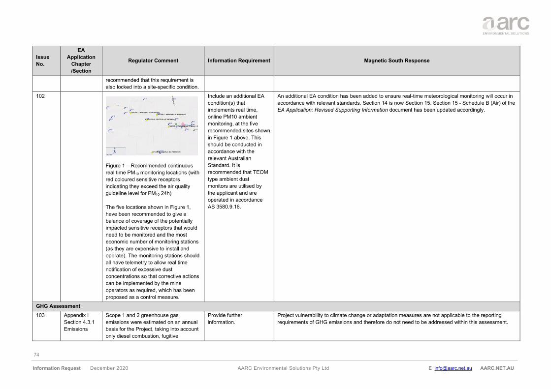
74
Information Request December 2020 AARC Environmental Solutions Pty Ltd E [email protected] AARC.NET.AU
Issue
No.
EA
Application
Chapter
/Section
Regulator Comment Information Requirement Magnetic South Response
recommended that this requirement is
also locked into a site-specific condition.
102
Figure 1 – Recommended continuous
real time PM10 monitoring locations (with
red coloured sensitive receptors
indicating they exceed the air quality
guideline level for PM10 24h)
The five locations shown in Figure 1,
have been recommended to give a
balance of coverage of the potentially
impacted sensitive receptors that would
need to be monitored and the most
economic number of monitoring stations
(as they are expensive to install and
operate). The monitoring stations should
all have telemetry to allow real time
notification of excessive dust
concentrations so that corrective actions
can be implemented by the mine
operators as required, which has been
proposed as a control measure.
Include an additional EA
condition(s) that
implements real time,
online PM10 ambient
monitoring, at the five
recommended sites shown
in Figure 1 above. This
should be conducted in
accordance with the
relevant Australian
Standard. It is
recommended that TEOM
type ambient dust
monitors are utilised by
the applicant and are
operated in accordance
AS 3580.9.16.
An additional EA condition has been added to ensure real-time meteorological monitoring will occur in
accordance with relevant standards. Section 14 is now Section 15. Section 15 - Schedule B (Air) of the
EA Application: Revised Supporting Information document has been updated accordingly.
GHG Assessment
103 Appendix I
Section 4.3.1
Emissions
Scope 1 and 2 greenhouse gas
emissions were estimated on an annual
basis for the Project, taking into account
only diesel combustion, fugitive
Provide further
information.
Project vulnerability to climate change or adaptation measures are not applicable to the reporting
requirements of GHG emissions and therefore do not need to be addressed within this assessment.
75
Information Request December 2020 AARC Environmental Solutions Pty Ltd E [email protected] AARC.NET.AU
Issue
No.
EA
Application
Chapter
/Section
Regulator Comment Information Requirement Magnetic South Response
emissions of methane from mining and
the electricity usage and explosives
(presented in Table 14).
No vulnerability to climate change or
adaptation measures have been
addressed in the application.
Project doesn’t consider all sources of
GHG emissions, which can lead to
possible underestimation of overall
emissions. In particular, there are also
emissions in the site preparation phase,
like scope 1 and scope 3 emissions from
vegetation clearing and preparation,
spreading mulched vegetation; in the
operational phase: from bitumen
transport, road construction, drainage
construction emissions, waste disposal
emissions (landfilling), transport
emissions, indirect emissions (NOx, CO,
NMVOCs, SO2) and emissions in a
closure phase (grassland/other
rehabilitated land emissions/sinks, etc).
Also, include a separate chapter to
address a vulnerability of different
landforms to climate change and
adaptation strategies.
Appendix I is now Appendix L, the GHG assessment has been updated to include GHG emissions
associated with land clearing, refer to Section 4.4.1 of Appendix L of the EA Application: Revised
Supporting Information document.
Section 4.4.2 of Appendix L of the EA Application: Revised Supporting Information document provides
an estimation of Scope 3 emissions. Scope 3 emissions included in the assessment are GHG
emissions associated with the end-use of product coal and rail transport of coal. Scope 3 GHG
emissions included in the Gemini Project assessment does not account for emissions relating to
construction materials (approximate 5% total contribution). Therefore, out of all the possible Scope 3
emissions, the assessment is expected to account for at least 95% of total Scope 3 emissions
associated with the Project.
All estimated GHG emissions have been updated in Section 10.3 of the EA Application: Revised
Supporting Information document.
104 Appendix I
Section 4.3.1
Emissions
Table 14
Modelling has been completed for year 1
– 19 only, despite the mine being
identified to have a 20-year life span.
Are there no emissions associated with
rehabilitation?
Modelling for construction,
operation and
decommission (including
rehabilitation) is required.
See issue number 103 for land clearing. GHG emissions for rehabilitation activities have been
estimated and included in Section 4.4.1 of Appendix L of the EA Application: Revised Supporting
Information document.
105 Appendix I A range of options for Magnetic South
Pty Ltd to manage Project related GHG
Provide and discuss any
site-specific mitigation
Due to the maturity of the coal industry, best practice is generally achieved through the design and
selection of equipment. Section 4.4.4 of Appendix L of the EA Application: Revised Supporting
76
Information Request December 2020 AARC Environmental Solutions Pty Ltd E [email protected] AARC.NET.AU
Issue
No.
EA
Application
Chapter
/Section
Regulator Comment Information Requirement Magnetic South Response
4.4.3 GHG
mitigation and
management
emissions are presented in this chapter.
However, it is very broad and doesn’t
include information about how much is
expected in the reduction of GHGs and
emissions strategies.
scenarios, along with
estimated of possible CO2-
eq reduction (and
associated costs) from
different scenarios.
Include land-use,
construction, waste sector
emissions as well.
Information document has been revised to include further detail on the consideration of energy and fuel
efficiency in the design and selection of processes and equipment.
106 Appendix I
Section 4.4.3
GHG
mitigation and
management
In section General, it states “identifying
opportunities” for GHG emissions.
Provide further information
on the opportunities.
Section 4.4.4 of Appendix L of the EA Application: Revised Supporting Information document was
revised to list further GHG mitigation opportunities.
These include, but are not limited to:
• minimise vegetation clearing at the Project to the authorised areas required for Project development;
• design efficiency to reduce energy and fuel consumption;
• investment in equipment with higher fuel efficiencies;
• spontaneous combustion of coal will be managed to avoid unexpected emission through the burial of
reactive materials, spoil dump design, temperature monitoring and spoil dump ventilation; and
• ongoing monitoring and reporting of GHG emissions including an annual review of energy use to
identify potential energy efficiency opportunities on a regular and ongoing basis.
Additional mitigation measures that be reviewed and implemented where appropriate, include:
• equipment load optimisation, route optimisation and production scheduling;
• equipment maintenance in accordance with supplier guidelines to ensure equipment efficiency is
retained;
• onsite power factor correction optimised to minimise the usage of grid electricity;
• use of solar-powered lighting to reduce electricity demand; and
• adjust peak electricity demand through production scheduling to allow for optimal and well utilised
diesel power generation capacity.
Noise
107
Appendix J
Section 4.4
Noise Logging
Monitoring of environmental noise to
determine background levels L90 [dB]
was conducted between 7 and 19 June
2019. However, this doesn’t represent a
complete seasonal spectrum of levels of
environmental noise.
Monitoring in other
seasons should be
considered before
establishing (adopting)
background levels (at least
two seasons).
Appendix J is now Appendix M. Nose monitoring was conducted by ASK as part of a Noise Impact
Assessment (ASK 2020) in a quiet period (during winter) to achieve conservative background noise
levels.
77
Information Request December 2020 AARC Environmental Solutions Pty Ltd E [email protected] AARC.NET.AU
Issue
No.
EA
Application
Chapter
/Section
Regulator Comment Information Requirement Magnetic South Response
In consultation with Antione David at DES (June 2020), the approach to noise monitoring by ASK was
deemed acceptable and further monitoring for this issue was not required. In this instance, no
amendments to the EA Application: Revised Supporting Information document were undertaken.
108 Appendix J
Section 5.3.3
Background
creep
Background creep has been mentioned
but no information has been provided.
How will background creep be prevented
or minimised?
Give consideration to the requirement in
the Noise Measurement Manual
(EM1107)
Give consideration to the
cumulative impacts on all
affected environmental
values.
Section 11.3.4 of the EA Application: Revised Supporting Information document has been updated to
include an assessment of background creep and cumulative noise impacts.
In consideration of the Noise Measurement Manual (ESR/2016/2195 - formerly EM1107), background
creep is defined as 'a gradual increase in the total amount of background noise in an area or place'
(DES 2020b). Therefore, consideration of cumulative impacts, including other developments, is
required to ensure background creep is minimised in accordance with the subordinate Environmental
Protection (Noise) Policy recommendations.
From this, an assessment of cumulative impacts identified the Bluff Mine as the nearest other existing
mine to the west. The sensitive receptors that have the most potential to be impacted by the Project to
the west are SR22, SR31 and SR32 with night-time noise levels of up to 36 dBA, 33 dBA and 31 dBA
LAeq respectively. The Bluff Mine is over 12 km from these receptors (SR22, SR31 and SR32) and only
1 km from the township of Bluff. Given the requirement to comply with noise criteria in the township, it
would be expected that Bluff Mine noise levels at the receptors would be well below the 35 dBA noise
limit and would not significantly contribute to exceedances at these locations.
Based on the information above, it is unlikely that cumulative impacts would contribute to background
creep due to broadscale noise limits adopted by other mining operations such as the Bluff Mine and
also the Jellinbah Mine in the surrounding region (detailed noise limits are provided in Section 11.3.1 of
the EA Application: Revised Supporting Information document).
Additionally, it is noted that the Bluff Mine is currently in care and maintenance with no certainty of a
return to operations during the life of the Gemini Project.
109 Appendix J
Section 6.4
Modelling
Scenarios
Mining noise emissions from the Gemini
Project have been predicted for the
following three mine year scenarios:
• year 2;
• year 8; and
• year 15
These years were selected to give a
representation of mine noise levels near
Include preparation (years
0 and 1) and post-
mining/closure phases
(year 20) in the modelling.
In consultation with Antione David at DES (June 2020), the approach to noise modelling by ASK for the
three operational years was deemed acceptable and further scenarios not required. In this instance, no
amendments to the EA Application: Revised Supporting Information document were undertaken.
78
Information Request December 2020 AARC Environmental Solutions Pty Ltd E [email protected] AARC.NET.AU
Issue
No.
EA
Application
Chapter
/Section
Regulator Comment Information Requirement Magnetic South Response
the beginning, middle and end of the
project. However, project life is 20 years
and there will be considerate noise
emissions from transport in the mine
closure period (same as in the
clearing/pre-mining phase) that must be
taken into consideration.
110 Appendix J
Section 6.6.2
Cumulative
Noise Impacts
It has been stated that the nearest
existing mine is Bluff Mine which is 12km
to the west. The sensitive receptors that
have the most potential to be impacted
by the Gemini Project to the west are
SR22, SR31 and SR32. The Bluff Mine
is over 10 km from these receptors.
Given the significant distance and that
adverse wind conditions cannot occur for
both mines simultaneously at these
receptors since they are in opposite
directions, it is unlikely that cumulative
noise impacts from both mines will be an
issue.
Further information is required to identify
the potential cumulative impacts.
Present data/charts and
present a scenario with
noise levels under “No
WIND” conditions, to
support statements made.
Cumulative noise is addressed in Section 11.3.4 of the EA Application: Revised Supporting Information
document. Based on the data reviewed for cumulative noise, this is predicted to not be an issue for the
Project, as discussed above.
The obligation for the nearby Bluff Mine and Jellinbah Mine to comply with noise criteria in the township
means that any data acquired from a 'No WIND' scenario is considered not needed to confidently
conclude that cumulative impacts from the Project are unlikely.
Additionally, it is noted that the Bluff Mine is currently in care and maintenance with no certainty of a
return to operations during the life of the Gemini Project.
111 Measurements The noise criteria have not been based
on the Model Mining conditions
(ESR/2016/1936). For night time the
noise criteria following the Model Mining
condition would be 2dB more stringent
than the derivation made using the
Environmental Protection (Noise) Policy
2019 Planning for noise control.
The noise criteria should be derived
using the Model Mining conditions. The
night time criteria should be 35dBA
instead of 37dBA and this worsens the
Provide further
information.
Day and evening noise limit of 40dBA and night limit of 35dBA has been updated in Section 11.3.1 of
the EA Application: Revised Supporting Information document in accordance with the Model Mining
conditions (ESR/2016/1936) (DES 2017b). These limits are conservative and below the limits set for
other mining operations in the nearby region such as the Bluff Mine and Jellinbah Mine.
Under these new noise limits, subsequent modelling results, and relative exceedances have been
updated in Section 11.3.3 of the EA Application: Revised Supporting Information document. It has
been noted that a number of properties have been purchased by Magnetic South since the previous
EA Application submission to DES. As a result, these dwellings are assumed to be vacant prior to the
commencement of operations and thereby, not assessed as sensitive receptors. A full updated list of
the relevant sensitive receptors used within the assessment of noise exceedance is provided in Table
53 and shown in Figure 77 of the EA Application: Revised Supporting Information document.
79
Information Request December 2020 AARC Environmental Solutions Pty Ltd E [email protected] AARC.NET.AU
Issue
No.
EA
Application
Chapter
/Section
Regulator Comment Information Requirement Magnetic South Response
noise exceedances during night time by
2dB with the worse exceedance going
from 13dB to 15dB and add another 3
sensitive receptors in exceedance,
raising the total number from 6 sensitive
receptors exceeding night time noise
criteria to 9 sensitive receptors
exceeding the night time criteria. Further
information is required about the
mitigation of nuisances.
In addition, LA1 (Model Mining
Conditions) and LAmax for sleep
disturbance (EPP Noise 2019) has not
been assessed. Further information is
required.
Moreover, an assessment of sleep disturbance was undertaken in the LAeq parameter rather than LAmax,
LA01 and LA10 parameters. This monitoring decision is due to:
• most mine noise source data being available in the LAeq parameter;
• extraneous noise events (e.g., birds, animal and farm activities) in the LAmax parameter making
compliance monitoring challenging; and
• LA01 and LA10 noise levels are generally dominated by insect noise during warmer months and it is not
strictly possible to remove insect noise from the measured LA01 and LA10 parameters.
In this instance, the use of LAeq was considered the preferred parameter. Where noise limits of LAmax, LA01
and LA10 are specified for the Project, they would be 15, 10 and 5 dBA higher respectively than the LAeq
noise limits.
A sleep disturbance limit of 50dBA LAmax (equating to an indoor limit of 45 dBA LAmax plus 5 dBA) was
used within the assessment. As a result, it was identified that sleep disturbance would not be a significant
issue. Moreover, an investigation by ASK into sleep disturbance measured as LAmax within the
Environmental Protection (Noise) Policy identified no listed noise limits to be aware of.
112 Modelling The weather scenarios considered are
for neutral and adverse meteorological
conditions. South-easterly or westerly
winds have not been measured and
noise impacts would be considered
worse under those conditions. Report
the percentage of days under those
conditions.
Provide modelling for
south-easterly and
westerly wind conditions.
The SoundPLAN model has been formatted to predict all noise levels under unfavourable 'adverse' day
and night meteorological conditions using wind conditions from the south-east and west directions as
per DES’s request. The results have been entirely modelled using these described conditions (i.e.,
100% of days) and updated in Section 11.3.3 of the EA Application: Revised Supporting Information
document.
113 Sound
sources
The sound power levels reported for the
machines modelled are appropriate. The
sound power level of the Drill Caterpillar
MD6420 is not listed specifically but is
listed as drill which may differ. Sound
power level of Cat MD6420 should be
used for the model for accuracy and
should be listed.
Provide further
information.
The drill caterpillar MD6420 was the only drill equipment used to inform the modelled noise results, and
sound power values for this piece of equipment were confirmed with the distributor. All references to
drill noise source power levels within the technical noise report by ASK (2020) have been updated to
list the drill caterpillar MD6420 and ensure consistency.
Waste
80
Information Request December 2020 AARC Environmental Solutions Pty Ltd E [email protected] AARC.NET.AU
Issue
No.
EA
Application
Chapter
/Section
Regulator Comment Information Requirement Magnetic South Response
114 Supporting
information
Table 3
Applicable
ERAs for the
project (page
4)
Incorrect ERA category is referenced –
the correct category should be ERA 63 1
(b)(i).
Update using
Departmental Guideline
for Model operating
conditions ERA 63 –
Sewage Treatment
(ESR/2015/1668).
Table 3 of the EA Application: Revised Supporting Information document has been correct to ERA 63
1 (b)(i).
Table 75 of the EA Application: Revised Supporting Information document has also been corrected to ERA 63 1 (b)(i).
115 Supporting
information
Section 12
General
It is a regulatory requirement for
applicants to demonstrate that they have
considered the waste and resource
management hierarchy for any proposed
ERA.
A cleaner production program should
identify and implement ways of
improving a production process that:
• uses less energy, water or
another input;
• generates less waste; and
• generates waste that is less
environmentally harmful.
Applicants must identify any:
• cleaner production and waste
management strategies to be
implemented; and
cleaner production and waste
management strategies which were
considered but are not going to be
implemented and the reasons for not
implementing them (if applicable).
To ensure the generation
of waste is avoided and/or
waste is re-used as much
as practical, cleaner
production philosophies
and waste management
strategies should be
adopted and detailed in
the application.
Waste management strategies for the Project will be developed and implemented in accordance with
the waste and resource management hierarchy, as detailed in Section 12.5 of the EA Application:
Revised Supporting Information document.
The application of the waste and resource management hierarchy for the Project’s waste management
strategies are detailed in Section 12.3, Table 68 of the EA Application: Revised Supporting Information
document.
Magnetic South will progressively seek cleaner production to maximise operational efficiency whilst
minimising energy consumption and waste generation and disposal. Potential cleaner production
techniques are detailed in the EA Application: Revised Supporting Information document, Section 12.6,
and include, but not limited to, the following:
• improving operation and maintenance practices to reduce the resource consumption and minimise
waste generation (e.g., reuse of water within the mine water management system and CHPP
system);
• selecting best available technology for the CHPP, with consideration of the environmental and
economic factors to maximise water use and energy efficiency, minimise dust emissions and waste
generation;
• site extraction design to minimise the volume of waste rock respective to the excavated coal;
• reusing resources on-site that would be otherwise classified as wastes; and
• closed-loop recycling where a product is recycled and used again in the same form (e.g., wooden
pallets, tyres).
Magnetic South seeks to prioritise cleaner production and waste management strategies for all
generated waste types, unless it is not feasible.
116 Supporting
information
Sewage will be treated in an STP.
Treated effluent will be released for
irrigation. More information is needed to
Describe any waste
treatment processes
proposed and the
anticipated end products
Onsite treatment of waste will be limited to the treatment of sewage effluent within a STP towards the
northwest boundaries of the MLA at the location in Figure 7 of the Revised EA Application: Supporting
Information. Treatment will comprise standard primary (removal of solids) and secondary (nutrient
removal and disinfection) methods.
81
Information Request December 2020 AARC Environmental Solutions Pty Ltd E [email protected] AARC.NET.AU
Issue
No.
EA
Application
Chapter
/Section
Regulator Comment Information Requirement Magnetic South Response
Section 12.5
Waste
management
determine the conditions required to
manage risk.
of these processes
including the quality of the
irrigation water quality.
Include details of any
waste residues from the
process including sludge.
A Land-based Effluent Disposal Assessment Report has been undertaken in accordance with the
current industry standards for wastewater management set out in AS/NZ 1547:2012 On-site Domestic
Wastewater Management and provided in Appendix N of the EA Application: Revised Supporting
Information document. Treated effluent will be released within a designated irrigation management
area and is expected to achieve the water quality parameters set out in the Eligibility Criteria and
Standard Conditions for Sewage Treatment Works (ERA 63) – Version 2. These limits also align with
the quality which would be expected from a basic sewage treatment plant as per Table A3.2 of the
Australian Guidelines for Water Recycling: Managing Health and Environmental Risks (Phase 1).
Sludge will be dewatered on site and the resulting dried sludge will be removed via a licensed
regulated waste contractor. No waste residues are anticipated, and tank system sludge accumulation
is expected to be 0.0kg dwt/year.
117 Paints and miscellaneous chemicals will
be transported offsite by a licensed
regulated waste contractor and treated
at a licensed waste facility before
disposal.
Provide details about how
waste will be treated and
disposed of.
Treating and disposing of waste will be undertaken offsite and will be carried out in a way that causes
least harm to the environment and can be achieved through the following methods:
• employing a bio‐treatment to degrade material into a compound or mixture;
• employing a physico‐chemical treatment (for example, evaporation, drying, calcination, catalytic
processing, neutralisation, precipitation or encapsulation) to obtain a compound or mixture;
• blending or mixing waste to obtain a compound or mixture storing or repackaging waste;
• employing thermal processes, with or without catalysts, to convert waste into a non‐hazardous
material;
• disposal to a landfill; or
• thermal destruction without recovering heat or another secondary product.
Magnetic South will use waste management services within the region such as Cleanaway Emerald
Liquid Waste Services (Cleanaway). Facilities offered by Cleanaway including recycling and treatment
of waste paint (water and solvent-based), metal, plastic, waste oil and coolant will be utilised
(Cleanaway 2019a and Cleanaway 2019b).
Further descriptions of the treatment and disposal of waste are described in Section 12.7 of the EA
Application: Revised Supporting Information document.
118 Disposal of waste is to be considered
when no other economically feasible
option is available. How was it
determined that waste that is proposed
to be disposed of is not economically
Applicants must describe
how they have addressed
the waste and resource
management hierarchy.
Magnetic South will ensure all wastes that are not suitable for onsite reuse, recycling or treatment
would be able to do so at offsite waste facilities. Where practicable, consumable suppliers will collect
and recycle the waste product, and consider off-site recycling services that may be available. Before
disposing of waste to landfill, Magnetic South will consider the reuse and recycling of the waste within
practicable measures.
82
Information Request December 2020 AARC Environmental Solutions Pty Ltd E [email protected] AARC.NET.AU
Issue
No.
EA
Application
Chapter
/Section
Regulator Comment Information Requirement Magnetic South Response
viable to be managed under a more
preferred management option (i.e.,
avoid, reduce, re-use, recycle, recover,
and treat)? In particular, how was it
determined that the only viable option for
scrap tyres is to dispose of in pit?
Outline why other, more
desirable, waste
management strategies
were unsuitable. Provide
information to support their
selected mitigation and
disposal strategies.
Waste that will be disposed of offsite includes general waste, tyres, and wastes that are no longer in
reusable or recyclable conditions such as wooden pallets, refurbishable items and personal protection
equipment (PPE). These waste streams are fundamental to daily operations and other waste
management avenues (e.g., avoid, reduce, reuse, and treat) were considered unsuitable. For instance,
tyres will be transported offsite to a supplier for re-treading for reuse (as addressed in Table 68 of the
EA Application: Revised Supporting Information document) and air filters will be re-used and cleaned
until considered inappropriate.
As recycling of tyres was considered unsuitable and not economically feasible due to extreme travel
distance to facilities. Subject to demonstrating to the administering authority that no other use higher in
the waste management hierarchy can be practically implemented, waste types will be disposed of
onsite in a designated tyre disposal area of the backfilled Pit AB and/or Pit C. These disposal areas will
be managed to avoid any impedance on saturated aquifers, cause contamination or compromise the
stability of the final landform.
Burial of waste tyres can lead to environmental impacts associated with contamination, fire risk and
health risks. There is also a risk that compounds may leach from the tyres and contaminate soil,
groundwater and surface water, and a possibility that tyre piles may become breeding grounds for
insects; particularly mosquitoes, rodents and other animals. Tyres have also been known to cause fires
that release pyrolytic oils and other compounds into the soil and groundwater and through smoke,
coupled with contaminated runoff of water used to extinguish the fire.
To mitigate these impacts, the storage and disposal of tyres generated by mining activities will be in
accordance with ‘Operational Policy for Disposal and storage of scrap tyres at mine sites’
(ESR/2016/2380) (DES 2014). Further details of the disposal of scrap tyres will be addressed in the
Waste Management Plan.
119 The applicant must investigate options
for reusing all wastes generated onsite,
including recycling options for the
wastes. This includes seeking an end of
waste approval to enable reuse of any
regulated wastes generated onsite.
Reuse options should consider both
reusing wastes onsite and offsite, or
between industries. For example, reuse
of sewage sludge obtained from a
Identify waste streams
(types) and provide details
of any potential final reuse
of the wastes. Refer to
https://environment.des.ql
d.gov.au/management/wa
ste/business/end-of-
waste-classification for
further information.
The identified waste streams (types) for the Project are addressed in the Section 12.3 of the EA
Application: Revised Supporting Information document. Table 68 of the EA Application: Revised
Supporting Information document (anticipated waste generation from the construction and operation of
the Project) lists the potential reuse of waste onsite, which includes:
• refurbishable items;
• green waste;
• PPE and other small items;
• timber / reusable pallets;
• waste oils; and
• engine oil / fuel air filters.
83
Information Request December 2020 AARC Environmental Solutions Pty Ltd E [email protected] AARC.NET.AU
Issue
No.
EA
Application
Chapter
/Section
Regulator Comment Information Requirement Magnetic South Response
sewage treatment plant may be
appropriate for land application to
support improved pastures.
120 Supporting
information
Section 12.6
Regulated
waste
management
All non-mobile activities must provide a
drawing or site-plan showing waste
storage areas, processing areas,
recycling or re-processing areas, and
disposal locations. This must include
details for wastes generated onsite, as
well as raw and treated wastes. This
should be used to identify potential risks.
Include a site plan of the
storage, handling and
disposal locations.
A conceptual layout showing the location of waste processing and handling areas (including the CHPP,
MIA, STP, regulated structures and waste rock emplacements) is shown in Figure 7 of the EA
Application: Revised Supporting Information document.
A detailed design layout of the MIA and associated infrastructure, including storage areas, is shown in
Figure 11 of the EA Application: Revised Supporting Information document.
121 Due to differences in the descriptions of
waste disposal for regulated wastes and
waste disposal for general wastes in
permissible waste types, it is important
that the applicant understands the
definitions and significance of the waste
types used in the ERA description. The
waste disposal ERA description includes
the waste descriptors; general;
regulated; limited regulated; and clinical
waste. Definitions of these waste types
are included in the EP Regulation
(Schedule 19).
Provide a description of all
types of waste with regard
to the EP Regulation
definitions.
Table 68 of the of the EA Application: Revised Supporting Information document has been updated to
reflect the waste category descriptions listed in the Environmental Protection Regulation 2019. The
waste categories relevant to the Project include general, green, regulated and limited regulated. A full
list of these waste types generated during construction, operations and decommissioning phases of the
Project is provided in the updated table.
122 Describe the method of transport for the
regulated wastes and details of the
transport.
Where regulated wastes are to leave the
site, provide details of the transporter or
company receiving the wastes.
Provide information on the
machinery and proposed
method of transport for
waste.
All regulated waste generated onsite will be arranged by Magnetic South to be transported offsite for
recycling, treatment or disposal at a licensed facility. Contractors within the region such as JJ Richards
& Sons will be responsible for collection of regulated waste bins as well as collection of recyclable
wastes (e.g., cardboard).
Waste handlers are required to submit waste tracking information to DES as part of the system for
tracking waste listed in Schedule 9 Part 1 of the Environmental Protection Regulation 2019 (i.e.,
regulated wastes). Waste handlers are defined as generators, transporters, and receivers of wastes.
Waste Transport Certificates are to be completed by waste handlers (i.e., generators, transporters, and
receivers of waste) and submitted to DES as part of the process for tracking wastes in Queensland.
Regulated waste will only be removed and transported from the site by a person who holds a current
licence to transport such waste under the Environmental Protection Act 1994. The transport of
84
Information Request December 2020 AARC Environmental Solutions Pty Ltd E [email protected] AARC.NET.AU
Issue
No.
EA
Application
Chapter
/Section
Regulator Comment Information Requirement Magnetic South Response
regulated wastes from the Project will be conducted in compliance the system requirements outlined by
DES in ‘Waste tracking guideline – Overview of managing waste tracking in Queensland
(ESR/2016/2425) Version 2.01’ (DES 2018).
Skip bulk or lift trucks will be used for heavier and/or bulkier waste materials such as empty waste oil
containers, scrap metals and timber pallets. Mine affected water may be piped, trucked via liquid
tankers, or transferred in compliance with EA conditions.
Further information regarding the machinery and proposed method of regulated waste transportation
will be detailed in the Waste Management Plan, which will be developed at a later stage. The
commitment will form part of the contractual arrangements and will be developed with licenced
contractor.
123 Supporting
information
Section 13.1
Environmental
Objectives and
performance
outcomes
Identify the risk of migration of
contaminants from the waste material to
surface water. Also, the potential for
flood waters to interact with waste rock
placements. Sediment is a regulated
waste and the impacts of sediment run
off on the adjacent waterways should be
addressed considering their proximity to
the waste rock emplacements.
Discuss the management
of sediment run off and
mitigation measures
especially for potential
impacts to Charlevue
Creek.
As described in Section 13.4.2 of the EA Application: Revised Supporting Information document,
surface water and seepage from mining waste storage areas will be monitored to ensure that key water
quality parameters remain within appropriate criteria.
Environmental monitoring will be conducted in accordance with a receiving environment monitoring
program to ensure that the receiving environment of Charlevue Creek and Springton Creek are not
impacted by the Project activities. Water quality and stream flow will be monitored.
Erosion and sediment control structures will be developed and implemented during operations in
accordance with Best Practice Erosion and Sediment Control (IECA Australasia 2008). These include
but are not limited to:
• retention of riparian vegetation where possible along Charlevue Creek and Springton Creek;
• limiting land clearing to the minimum required for safe operations of the Project;
• diversion of clean overland flow/runoff from the upper reaches of Springton Creek and Charlevue
Creek around the out-of-pit waste rock emplacement associated with Pit C and Pit AB;
• progressive rehabilitation and seeding of topsoil as soon as possible for landforms;
• waste rock emplacements will be limited to a slope of 1V:10H (adhering to a maximum slope of 6°)
and a maximum height of 190 mAHD; and
• erosion control measures such as bunding and sediment traps will be positioned between receiving
waters (Charlevue Creek and Springton Creek) and disturbed areas (Pit AB and Pit C), roads and
mine water dams during operations in accordance with Best Practice Erosion and Sediment Control
(IECA Australasia 2008).
Section 7.3.6 of the EA Application: Revised Supporting Information document address the potential
for flood waters to come into contact with waste rock emplacements. As a result, it was concluded four
85
Information Request December 2020 AARC Environmental Solutions Pty Ltd E [email protected] AARC.NET.AU
Issue
No.
EA
Application
Chapter
/Section
Regulator Comment Information Requirement Magnetic South Response
waste rock locations could potentially interact with flood waters, however the likelihood of erosion and
migration of sediment from these dumps is minimal due the anticipated low velocities of 0.2 m/s - 1.2
m/s.
124 Supporting
information
13.3.3
Potential
impacts on
surface and
groundwater
resources
Appendix D –
Table B4
The concentration of most trace metals/
metalloids tested for water in contact
with coal reject and mining waste
materials is typically below the LOR and
below the applied water quality guideline
criteria.
Address why the LOR is
greater than the water
quality guideline
recommended limits and
address how results were
achieved that were less
than this limit i.e., the LOR
for Selenium was 0.1
mg/L, the Aquatic
Ecosystem water quality
maximum is 0.011 mg/L
and results of 0.02 mg/L
were found.
The concentration of most trace metals/metalloids tested for water in contact with both coal reject and
mining waste materials is low, typically below the limit of reporting (LOR) for the laboratory analysis,
and below the applied water quality guideline criteria.
It is noted that the LoR used for Selenium (Se), Cadmium (Cd), Chromium (Cr), Copper (Cu) and Zinc
(Zn) in the water extract tests on coal reject samples in Appendix H (Attachment C, Table C4) of the
EA Application: Revised Supporting Information document was below recommended guidelines and all
results were less than this value. Instead, the Kinetic Leach Column Tests results provided adequate
data exhibiting a LOR of below the applied water quality guidelines.
As a result, for these metal course reject dissolved concentrations of Se, Zn, Cr, Cu and Cd exceeded
the trigger values for freshwater aquatic ecosystems (95 % species protection), and Se exceeded
trigger values for livestock drinking water guideline values. Similar results were observed for fine reject
dissolved concentrations.
Whilst there are no specific regulatory criteria for metal/metalloid concentrations in leachate from
mining waste material on mine sites in Queensland. The Australian guideline values for livestock
drinking water and aquatic freshwater eco-systems are provided for context are not intended to be
interpreted as “maximum permissible levels” for site water storage or discharge” (ANZECC and
ARMCANZ 2000).
125 Supporting
information
13.4 Mitigation
measures,
management
and monitoring
It was stated that most mining materials
appear to be susceptible to dispersion
and erosion, additional testing including
field trials, may be needed when the
mine is operational and bulk materials
are being generated. Such tests would
help to determine the most appropriate
management option for progressive
rehabilitation of these materials during
operations at mine closure.
There are a number of studies that have
been completed on the optimum
rehabilitation practices for resource
Provide detail on the
proposed management
options for rehabilitation of
waste rock during
operations. Address other
management options that
were considered.
A detailed summary on the rehabilitation of waste rock emplacements has been updated in Section
4.4.6 of the EA Application: Revised Supporting Information document.
In summary, the technical assessments (Appendix G, Appendix H and Appendix I of the EA
Application: Revised Supporting Information document) identified no significant risks for rehabilitation
and waste rock materials were considered suitable for rehabilitation.
Alternative PMLU options were considered such as dryland cropping, improved pastures and native
pastures were considered, however on the basis of economic value, deemed unsuitable due to limited
soil nutrient deficiencies, soil water availability, soil wetness, erosion and surface condition. As a result,
low intensity grazing was determined the preferred PMLU for waste rock emplacements on the basis of
pre-mining land suitability, landholder/stakeholder preferences, existing land use and environmental
values of the surrounding landscape.
86
Information Request December 2020 AARC Environmental Solutions Pty Ltd E [email protected] AARC.NET.AU
Issue
No.
EA
Application
Chapter
/Section
Regulator Comment Information Requirement Magnetic South Response
activities in the Bowen Basin and best
practice has been established.
126 The waste rock emplacement surface,
during construction and at completion of
the final landform, should be sloped to
direct excess surface drainage towards
collection points such as sediment
dam(s) or the final void.
Describe and illustrate the
location, design and
methods for constructing
dumps for waste rock and
any subsoil that should not
be replaced in
rehabilitation. Also discuss
the inputs and processes
for collection in sediment
dams.
The location of waste rock emplacements, including drainage works, is detailed in Section 4.4.6 of the
EA Application: Revised Supporting Information document.
The design parameters and methods for the construction of waste rock emplacements has been
detailed in Section 4.4.6 of the EA Application: Revised Supporting Information document. In summary,
three waste rock emplacements (one temporary) will be progressively constructed throughout the
course of operations and be designed to have externally draining slopes of 6°, elevation 175 – 190
mAHD and slope length 530 m – 540 m.
Topsoil resources have accounted for a stripping depth that excludes any sodic subsoil material (refer
to Section 4.2.4 of EA Application: Revised Supporting Information document). All surface runoff from
newly rehabilitated slopes will be directed into sediment dams until revegetation uptake is stable and
adequate to control soil erosion. Further details on sediment dam design and methods has been
provided in Section 3.4.3.3 of EA Application: Revised Supporting Information document.
127 Potentially reactive rocks can be clay
rich, saline waste rock typically occurring
in coal overburden, that, when exposed
by mining and used for construction of
waste rock emplacements, stockpiles,
roadways etc. becomes dispersive and
will readily erode. A major issue for mine
sites is the generation of high sediment
loads in storm runoff.
Describe the chemical and
physical properties of the
waste rock and subsoil
and assess the properties
that affect their erosion
potential.
The chemical properties of the mining waste materials are discussed in Section 13, and in Section 4.4
of Appendix G, of the EA Application: Revised Supporting Information document.
In summary, a chemical assessment of waste rock reveals an ESP ranging from low (4.5%) to very
high (31.5%) with an elevated mean of 19.3%. ESP values above 14% are considered strongly sodic.
As a result, waste rock material is likely to have elevated sodicity levels and may be susceptible to
dispersion and erosion. The application of addition of gypsum will be used as necessary to reduce
erosion potential, and fertiliser will be appropriately applied to some mining waste materials to provide
a reasonable growth medium for revegetation and rehabilitation. It is recommended that further field
investigations are undertaken when the mine is operational and bulk waste-material is generated.
The chemical and physical properties of subsoil material are discussed in Table 21 and Section 13.4.5
of the EA Application: Revised Supporting Information document and further detailed in Appendix I of
the EA Application: Revised Supporting Information document. The Geoffrey and Kosh SMU comprise
most of the Project area. Chemical and physical properties of these SMUs are therefore representative
of subsoils characteristics of the Project area. The subsoils of the Geoffrey and Kosh SMUs are
considered strongly sodic (ESP >14%) and may become dispersive and therefore susceptible to
erosion. A physical assessment of these subsoils also revealed medium to medium-heavy clay texture
(>45% clay) of the Geoffrey and Kosh SMU. Clay rich soils may be more susceptible to erosion due to
the small size (<0.002 mm) of clay-sized particles, particularly if soils are dispersive. As a result,
87
Information Request December 2020 AARC Environmental Solutions Pty Ltd E [email protected] AARC.NET.AU
Issue
No.
EA
Application
Chapter
/Section
Regulator Comment Information Requirement Magnetic South Response
subsoil characteristics of each SMU were used to inform stripping depths for topsoil resources and
minimise the risk of dispersion during rehabilitation. Management measures to limit erosion and
sediment run-off is detailed in Section 13.4.1 of the EA Application: Revised Supporting Information
document.
128 Tailings is a waste product. Describe the processes for
storage and handling and
include the management
plans and mitigation
measures for preventing
environmental harm.
The process of handling tailings (fine coal rejects) is described in Section 3.6.3 of the EA Application:
Revised Supporting Information document. In summary, tailings will be dewatered and conveyed to a
rejects bin and combined with the coarse reject material. The combined material will be loaded onto
trucks for placement in out-of-pit or in-pit spoil dumps.
To ensure environmental harm is prevented throughout this process, the following measures will be
implemented:
• operational sampling and geochemical testing of representative samples of all coal reject material
(coarse rejects and tailings) will be strategically undertaken at the CHPP to verify and extend the
findings of the assessment for future management;
• coal reject materials will be transferred from the CHPP and encapsulated within a much larger
volume of NAF overburden material in spoil emplacements with excess neutralising capacity well
away from the outside surface of the final rehabilitated landforms;
• coal reject material will be placed at a depth where there is a lower risk of connectivity to surface
water or groundwater resources;
• if coal reject materials are left exposed to oxidising conditions for an extended period of time prior to
encapsulation, dosing with agricultural limestone would be considered as a contingency measure;
and
• surface water and seepage from the coal reject storage areas will be monitored to ensure that key
water quality parameters remain within appropriate criteria.
129 The likelihood of spontaneous
combustion has not been addressed.
Assess the risk of
spontaneous combustion
for the proposed coal mine
and provide the following
information:
• describe the quality and
quantity of
carbonaceous material
in the waste stream
• discuss the potential of
spontaneous
A discussion of spontaneous combustion potential for the coal has been included as Section 13.3.4 of
the EA Application: Revised Supporting Information document.
The geochemical properties of the Gemini coal provide for a lower propensity for spontaneous
combustion. Notwithstanding, the following prevention and control measures will be adopted to
maintain a low risk of spontaneous combustion:
• dispersal and burying of reactive materials within spoil;
• controlling ventilation through compaction and capping;
• design of spoil dumps to minimize erosion & cracking of capping material avoiding the risk of air
ingress;
• firefighting equipment readily available at appropriate locations;
• regular inspections and maintenance of firefighting equipment; and
88
Information Request December 2020 AARC Environmental Solutions Pty Ltd E [email protected] AARC.NET.AU
Issue
No.
EA
Application
Chapter
/Section
Regulator Comment Information Requirement Magnetic South Response
combustion for coal
waste stockpile areas
• discuss the prevention
and control measures
adopted for
spontaneous
combustion
Describe the likely impacts
of spontaneous
combustion incidents on
the receiving environment.
• operator training.
130 The water balance would assess each of
the major water fluxes into and out of the
final void. These include surface runoff,
groundwater movement, interactions
with waste rock and evaporation.
Conduct a water balance
assessment for the pit
lakes in the final landform.
The water balance has been conducted for the final voids, with the outcomes of the modelling
summarised in Section 7.3.5 of the EA Application: Revised Supporting Information document, and
addressed in detail in Section 8.11 of Appendix B.
General
131 Regulatory
requirements -
Environmental
Objectives
Under Schedule 8, Part 3, Division 1 and
2 of the Environmental Protection
Regulation 2019 (EP Reg), the relevant
environmental objectives for operational
assessment have been stated in the
application. A demonstration of how the
proposal meets the environmental
objectives and performance outcomes
has not been provided.
At this stage, insufficient
information has been
provided to demonstrate
that the environmental
objectives can be met.
Detail how environmental
objectives and
performance outcomes will
be achieved or not
achieved.
Sections 5, 6, 7, 8, 9, 11, 12, 13 of the EA Application: Revised Supporting Information document lists
the corresponding environmental objectives for air, water, wetlands, groundwater, noise, waste, land
detailed in Schedule 8, Part 3, Division 1 and 2 of the Environmental Protection Regulation 2019.
The following sections of the EA Application: Revised Supporting Information document, detail how the
environmental objectives and performance outcomes will be achieved:
• air - Section 9.4;
• surface water - Section 7.4;
• wetlands - Section 6.4;
• groundwater - Section 8.4;
• noise - Section 11.4;
• waste - Section 12.5 and Section 13.4; and
• land - Section 4.4 and Section 5.4.
132 Regulatory
requirements -
Environmental
impacts
Provide further details of the potential or
actual impacts on environmental values
including:
• the associated likelihood, magnitude
and duration of risk;
At this stage, insufficient
information has been
provided to demonstrate
the potential or actual
impacts on environmental
values.
Potential and actual impacts for the Project have been addressed and described throughout the EA
Application: Revised Supporting Information document, including the specific assessments contained
within the Appendices.
Section 14 of the EA Application: Revised Supporting Information document has been updated to
address the potential or actual impacts on environmental values during the construction, operation and
89
Information Request December 2020 AARC Environmental Solutions Pty Ltd E [email protected] AARC.NET.AU
Issue
No.
EA
Application
Chapter
/Section
Regulator Comment Information Requirement Magnetic South Response
• whether any of those impacts might
cause serious environmental harm,
and what is the likelihood of that harm;
• what an acceptable level of impact on
the environmental values is, taking
into account any management
objectives for those values;
• any existing control measures that are
implemented to minimise impacts on
environmental values; and
• whether any conditions need to be
imposed to prescribe how impacts that
carry a risk of causing serious
environmental harm must be
managed.
The following technical guidelines
explain how to provide the necessary
information:
• application requirements for activities
with impacts to air (ESR/2015/1840)
(PDF, 528KB)
• application requirements for activities
with impacts to land (ESR/2015/1839)
(PDF, 177KB)
• application requirements for activities
with noise impacts (ESR/2015/1838)
(PDF, 399KB)
• application requirements for activities
with impacts to water
(ESR/2015/1837) (PDF, 214KB)
• application requirements for activities
with waste impacts –
(ESR/2015/1836) (PDF, 167KB)*
• requirements for site-specific and
amendment applications –
Address the risks and
impacts of each relevant
activity during the
construction, operation
and decommissioning
stages of the Project.
Provide a risk assessment
that identifies the
likelihood of an impact
occurring, the
management/mitigation
measures proposed, the
consequence of the
managed impact and the
overall risk matrix.
Address the following:
• Account for potential
level of residual impact
on environmental and
community values.
• Consider the cumulative
impacts of
environmental values
that would be
generated.
decommissioning stages of the Project in accordance with AS ISO 31000:2018 Risk management –
guidelines.
The risk assessment has been carried out to identify and address associated Project risks, these
include:
• the likelihood of an impact occurring;
• the management/mitigation measures proposed;
• the consequence of the managed impact;
• potential levels of residual impacts on environmental and community values; and
• the cumulative impacts on environmental values.
90
Information Request December 2020 AARC Environmental Solutions Pty Ltd E [email protected] AARC.NET.AU
Issue
No.
EA
Application
Chapter
/Section
Regulator Comment Information Requirement Magnetic South Response
underground water rights
(ESR/2016/3275) (PDF, 505KB).
*The Operational Policy – Disposal and
storage of scrap tyres at mine sites –
ESR/2016/2380 (PDF, 95KB) may also
be relevant.
In addition, use the guidelines relevant
to your proposed environmentally
relevant activities.
133 Management
Plans
Providing the necessary plans can help
to demonstrate how the applicant can
perform their due diligence and meet
their environmental obligations otherwise
conditions might be imposed to require
the implementation of a system to
manage risks to the environment.
Management plans or mitigation
measures mentioned in the Supporting
information report include:
• Sediment and Erosion Control
Management Plan;
• Receiving Environment Monitoring
Program (in accordance with the
Departmental Guideline Receiving
Environment Monitoring Program
guideline (ESR/2016/2399) and
Schedule F – Water in the
Departmental Guideline Model Mining
Conditions (ESR/2016/1936));
• Site Water Management Plan (in
accordance with condition F27 in the
Departmental Guideline Model Mining
Conditions (ESR/2016/1936));
At this stage, insufficient
information has been
provided to demonstrate
that proposed mitigation
strategies will prevent the
occurrence of
environmental harm or
nuisance.
Develop and provide the
relevant mitigation and
management plans to
demonstrate how risks will
be managed and how the
applicant will meet their
environmental objectives
as part of the information
request response
otherwise demonstrate
that a plan is not required
at this stage.
An Erosion and Sediment Control Plan has been provided as Appendix P attached to the EA
Application: Revised Supporting Information document.
A Receiving Environment Monitoring Program Design Document has been provided as Appendix Q
attached to the EA Application: Revised Supporting Information document.
An example Air Quality Management Plan is provided as Appendix C of the Air Quality and GHG
Assessment (Appendix L of the EA Application: Revised Supporting Information document).
Although it is not appropriate to have all listed Management Plans developed at this stage of the
Project’s design and assessment process, management measures within the following sections have
been updated within the EA Application: Revised Supporting Information document to provide
information on how risks will be appropriately managed by Magnetic South, these include:
• Site Water Management (discussed in further detail in Section 7.4.1);
• Land Disturbance Permit System (discussed in further detail in Section 4.5);
• Weed and Pest Management (discussed in further detail in Section 4.5.4);
• Emergency Response and Spill Management Plan (discussed in further detail in Section 5.4.3.1);
• Fuel and Hazardous Liquids Storage and Management Plan (discussed in further detail in Section
5.4.3.2);
• crossing design for fish passage during low and high flow events (discussed in further detail in
Section 6.4.3);
• Topsoil Management Plan (discussed in further detail in Section 4.4.3);
• Cultural Heritage Management Plan (discussed in further detail in Section 5.4.8);
• Noise and Blast Management Plan (discussed in further detail in Section 11.4.2); and
• Non-Mineral Waste Management Plan (discussed in further detail in Section 12.8.1).
91
Information Request December 2020 AARC Environmental Solutions Pty Ltd E [email protected] AARC.NET.AU
Issue
No.
EA
Application
Chapter
/Section
Regulator Comment Information Requirement Magnetic South Response
• Land Disturbance Permit System;
• Weed and Pest Management Plan;
• Emergency Response and Spill
Management Plan;
• Fuel and Hazardous Liquids Storage
and Management Plan;
• Crossing design for fish passage
during low and high flow events;
• Noise and Blast Management Plan;
• Topsoil Management Plan;
• Cultural Heritage Management Plan;
• Air Quality Management Plan; and
• Generated Waste Management Plan.
Specific management plans will be developed following the EA and ML approval, once Project certainty
has been assured and detailed design has progressed.
92
Information Request December 2020 AARC Environmental Solutions Pty Ltd E [email protected] AARC.NET.AU
2.0 REFERENCES
AARC Environmental Solutions Pty Ltd (AARC) 2020a, Visual Amenity Assessment, prepared for Magnetic South
Pty Ltd.
ASK Consulting Engineers (ASK) 2020, Noise Impact Assessment, prepared for Magnetic South.
Australian Coal Association Research Program (ACARP) 2015, Mobile Sampling Of Dust Emissions From
Unsealed Roads C20023, Judith Cox, Pacific Environmental Limited, ACARP.
Australian and New Zealand Environment and Conservation Council (ANZECC) & Agricultural and Resource
Management Council of Australia and New Zealand (ARMCANZ) 2000, Australian and New Zealand Guidelines
for Fresh and Marine Water Quality, Volume 1 Chapters 1-7, National Water Quality Management Strategy,
Paper No. 4, Environment Australia, Canberra, Australian Capital Territory.
Beamish, B.B. and Blazak, D.G 2005, Relationship between ash content and R70 self-heating rate of Callide
coal, International Journal of Coal Geology, 64(1-2), pp.126-132.
Bureau of Meteorology (BoM) (2019) Groundwater Dependant Ecosystem Atlas, Commonwealth of Australia,
Canberra, viewed June 2020 http://www.bom.gov.au/water/groundwater/gde/map.shtml.
Cardno (2020a), Land-Based Effluent Disposal Assessment Report, prepared for Magnetic South.
Cardno (2020b), Traffic Impact Assessment, prepared for Magnetic South.
Cleanaway 2019a, Hazardous Chemical Waste Disposal, viewed March 2019
https://www.cleanaway.com.au/waste/chemicals/.
Cleanaway 2019b, Paint Waste Disposal, viewed March 2019 https://www.cleanaway.com.au/waste/paint/.
Department of Environment and Heritage Protection (EHP), 2014, Queensland Environmental Offsets Policy,
Significant Residual Impact Guideline, Department of Environment and Science, Brisbane, viewed June 2020
https://environment.des.qld.gov.au/assets/documents/pollution/management/offsets/significant-residual-impact-
guide.pdf.
Department of Environment and Heritage Protection (EHP), 2011, Environmental Protection (Water) Policy 2009
Mackenzie River Sub-basin Environmental Values and Water Quality Objectives Basin No. 130 (part), including
all waters of the Mackenzie River Sub-basin, Department of Environment and Heritage Protection, Queensland
Government, Brisbane, viewed October 2020
https://environment.des.qld.gov.au/__data/assets/pdf_file/0031/89068/fitzroy_mackenzie_river_wqo_290911.pdf.
Department of Environment and Science (DES) 2020a, Flora Survey Guidelines - Protected Plants NCS/2016/2534 Version 2.01, Department of Environment and Science, Wildlife and Threatened Species
Operations, State of Queensland, Brisbane, viewed October 2020
https://www.qld.gov.au/__data/assets/pdf_file/0028/99901/gl-wl-pp-flora-survey.pdf.
Department of Environment and Science (DES) 2020b, Noise Measurement Manual [ESR/2016/2195 - formerly
EM1107 Version 4.01, State of Queensland, Brisbane, viewed October 2020
https://environment.des.qld.gov.au/__data/assets/pdf_file/0027/88560/eis-tm-noise-measurement-manual.pdf.
Department of Environment and Science (DES), 2019a, Clearing of protected plants, Department of Environment
and Science, State of Queensland, viewed October 2020 https://www.qld.gov.au/environment/plants-
animals/plants/protected-plants/clearing.
93
Information Request December 2020 AARC Environmental Solutions Pty Ltd E [email protected] AARC.NET.AU
Department of Environment and Science (DES), 2019b, Protected plants flora survey trigger map, Department of
Environment and Science, State of Queensland, viewed October 2020 https://apps.des.qld.gov.au/map-
request/flora-survey-trigger/.
Department of Environment and Science (DES), 2019c, Groundwater dependent ecosystems and potential aquifer
mapping – Queensland, Department of Environment and Science, State of Queensland, viewed October 2020
http://qldspatial.information.qld.gov.au/catalogue//.
Department of Environment and Science (DES) 2018, Waste tracking guideline – Overview of managing waste
tracking in Queensland (ESR/2016/2425) Version 2.01, Department of Environment and Science, Brisbane,
viewed October 2020 http://203.8.128.186/waste/pdf/managing-wt-qld-overview.pdf.
Department of Environment and Heritage Protection (DES) 2017a, Guideline: Stormwater and environmentally
relevant activities, Department of Environment and Science, Brisbane, viewed October 2020
https://environment.des.qld.gov.au/__data/assets/pdf_file/0028/89119/pr-gl-stormwater-guideline-era.pdf.
Department of Environment and Science (DES) 2017b, Model mining conditions [ESR/2016/1936], Version 6.02,
State of Queensland, Brisbane, viewed October 2020
https://environment.des.qld.gov.au/__data/assets/pdf_file/0033/88926/rs-gl-model-mining-conditions.pdf.
Department of Environment and Science (DES) 2014, Disposal and storage of scrap tyres at mine sites
[ESR/2016/2380], State of Queensland, Brisbane, viewed October 2020 https://environment.des.qld.gov.au/__data/assets/pdf_file/0027/88911/rs-op-scrap-tyres-mine-sites.pdf
Department of Environment and Science (DES) 2013, Model water conditions for coal mines in the Fitzroy basin
[ESR/2015/1561], State of Queensland, Brisbane, viewed October 2020
https://environment.des.qld.gov.au/__data/assets/pdf_file/0026/89612/rs-gl-water-conditions-mines-fitzroy.pdf
Department of Science, Information Technology and Innovation (DSITI), 2017, Using monitoring data to assess
groundwater quality and potential environmental impacts. Version 1, Department of Science, Information
Technology and Innovation, Queensland Government, Brisbane, viewed October 2020
https://www.publications.qld.gov.au/dataset/58ae3b77-4953-4fb9-85e6-b8bb66c5ce70/resource/472cc88a-000a-
4bb8-a60d-204cfe7e0238/fs_download/groundwater-quality-assessment-guideline.pdf
Eyre TJ, Ferguson DJ, Hourigan CL, Smith GC, Mathieson MT, Kelly AL, Venz MF, Hogan LD & Rowland J,
2018, Terrestrial Vertebrate Fauna Survey Guidelines for Queensland Version 3.0, Department of Science,
Information Technology, Innovation and the Arts, Queensland Government, Brisbane.
International Erosion Control Association (IECA) Australasia 2008, Best Practice Sediment and Erosion Control
Guideline, Picton, New South Wales.
JBT Consulting (JBT) 2019, Groundwater Impact Assessment Report, prepared for Magnetic South.
Katestone Environmental Pty Ltd (Katestone) 2011, NSW Coal Mining Benchmarking Study: International Best
Practice Measures to Prevent and/or Minimise Emissions of Particulate Matter from Coal Mining, Prepared for
Office of Environment and Heritage KE1006953 June 2011.
Kaymakci, E and Didari, V, 2002, Relations between coal properties and spontaneous combustion parameters,
Journal of Engineering & Environmental Sciences, vol.26, 1, pp. 59-64.
Neldner, VJ, Wilson, BA, Dillewaard, HA, Ryan, TS & Butler, DW 2019, Methodology for survey and mapping of
regional ecosystems and vegetation communities in Queensland (Version 5.0), Queensland Herbarium, Science
and Technology Division, Department of Environment and Science, State of Queensland, Brisbane.
Queensland Government, 2012, Groundwater dependent ecosystem FAQs WetlandInfo Queensland,
Queensland Government, viewed 17 February 2020 https://wetlandinfo.des.qld.gov.au/wetlands/facts-maps/gde-
background/gde-faq/.

94
Information Request December 2020 AARC Environmental Solutions Pty Ltd E [email protected] AARC.NET.AU
RGS 2020, Geochemical Assessment of Coal Reject Material, Gemini Coal Project, prepared for Magnetic South.
RGS 2018, Geochemical Assessment of Mining Waste Materials, Gemini Coal Project, prepared for Magnetic
South.
Standards Australia 1997, Control of the obtrusive effects of outdoor lighting (AS 4282 – 1997), Standards
Australia (Standards Association of Australia).
Tennakoon. S, and Ramsay. I, 2020, Technical Guideline for disposal of effluent via irrigation, Department of
Environment and Science, Brisbane.
3D Environmental 2020, Groundwater Dependent Ecosystems Assessment, prepared for Magnetic South.