Embed Size (px)
Citation preview

Geographical & Environmental Modelling
Dr Nigel Trodd
Coventry University
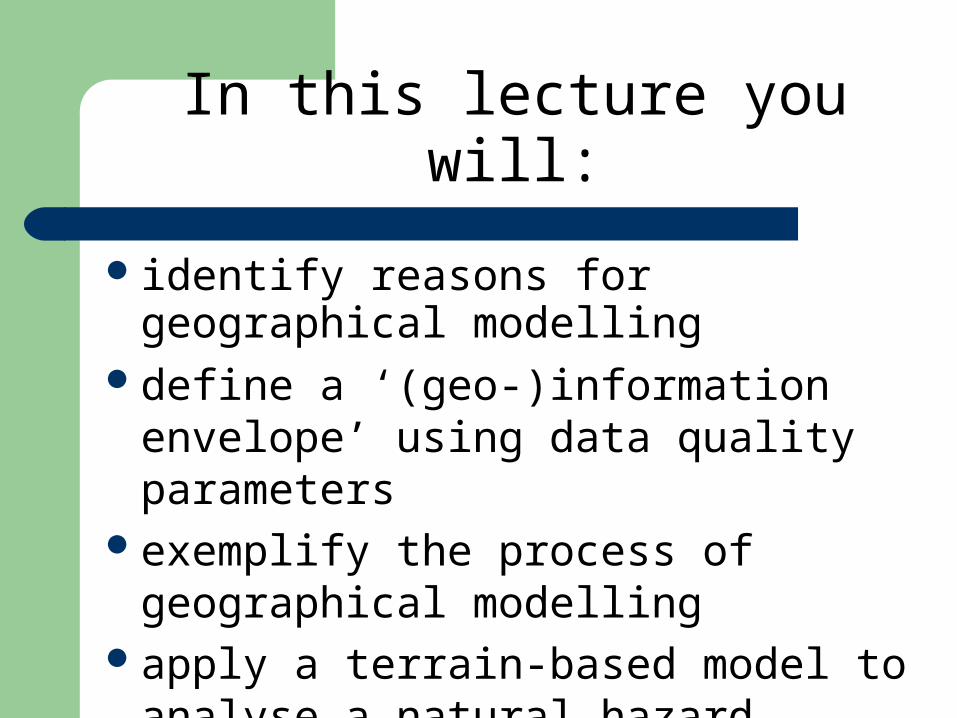
In this lecture you will:
identify reasons for geographical modelling
define a ‘(geo-)information envelope’ using data quality parameters
exemplify the process of geographical modelling
apply a terrain-based model to analyse a natural hazard

ModelsModels
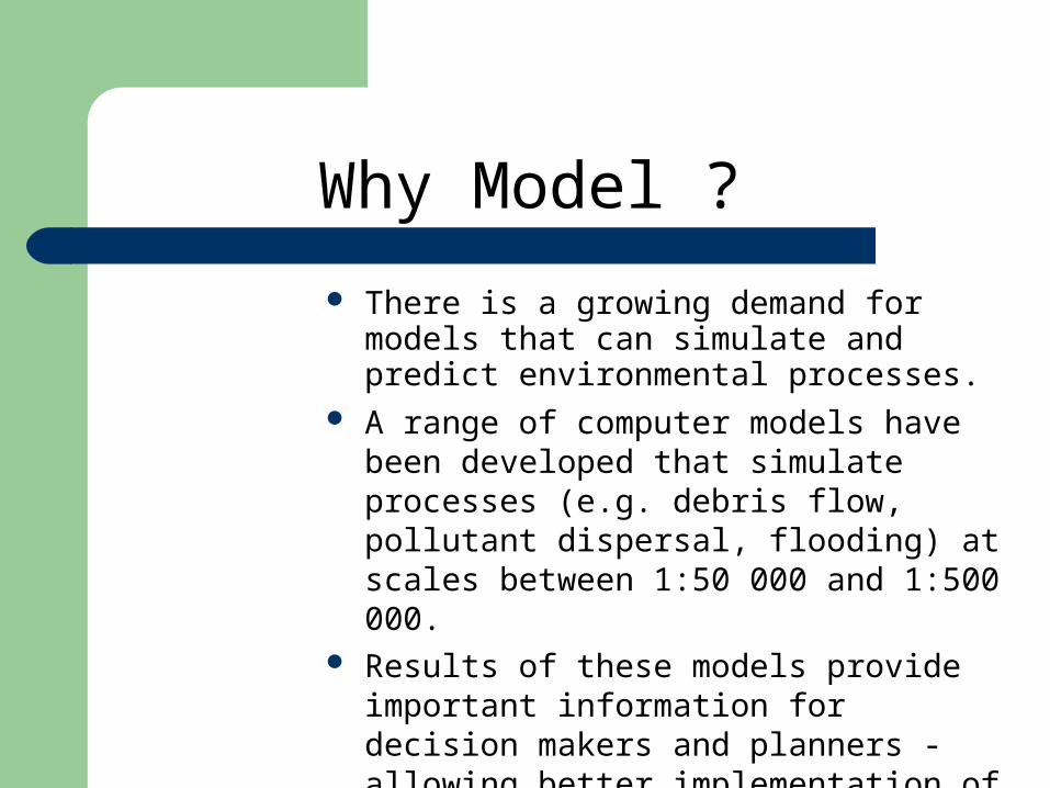
Why Model ?
There is a growing demand for models that can simulate and predict environmental processes.
A range of computer models have been developed that simulate processes (e.g. debris flow, pollutant dispersal, flooding) at scales between 1:50 000 and 1:500 000.
Results of these models provide important information for decision makers and planners - allowing better implementation of appropriate land management measures.
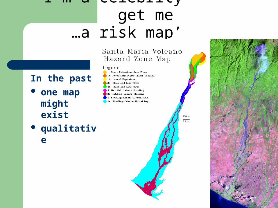
‘I’m a celebrity get me …a risk map’
In the past one map
might exist
qualitative
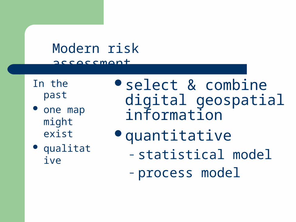
select & combine digital geospatial information
quantitative– statistical model– process model
Modern risk assessment
In the past one map
might exist
qualitative
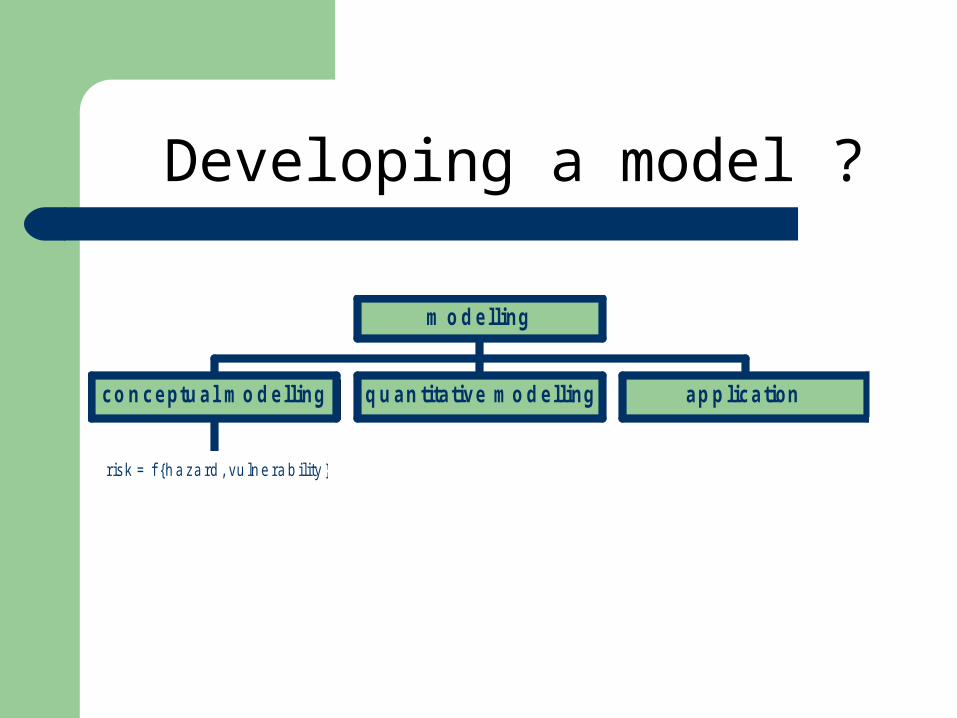
co n ceptu al mo d elling q u an titative mo d elling ap p lication
m o d elling
Developing a model ?
risk = f {hazard, vulnerability }
co n ceptu al mo d elling q u an titative mo d elling ap p lication
m o d elling
co n ceptu al mo d elling
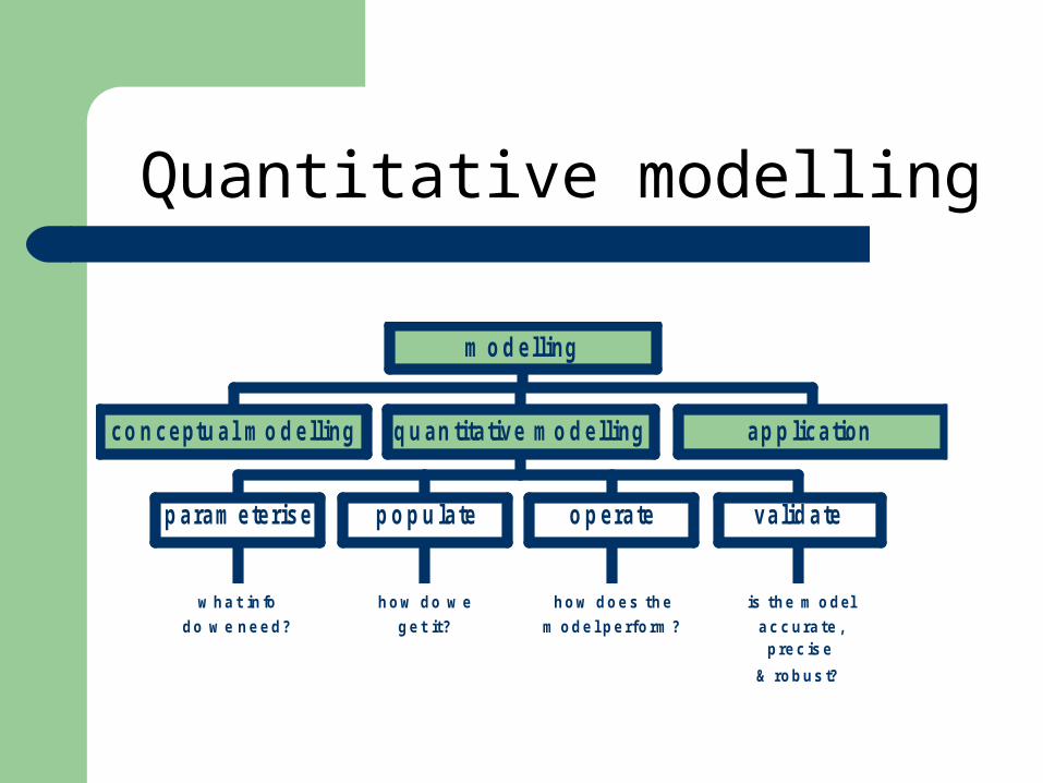
p aram eterise p o p u late o p erate valid ate
q u an titative mo d elling ap p lication
m o d elling
Quantitative modelling
co n ceptu al mo d elling
what info
do we need?
p aram eterise
how do we
get it?
p o p u late
how does the
model perform?
o p erate
is the model
accurate,precise
& robust?
valid ate
q u an titative mo d elling ap p lication
m o d elling
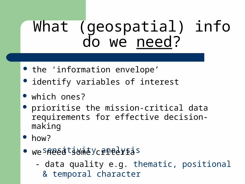
What (geospatial) info do we need?
the ‘information envelope’ identify variables of interest
which ones? prioritise the mission-critical data requirements for
effective decision-making how?
– sensitivity analysis we need some criteria
- data quality e.g. thematic, positional & temporal character
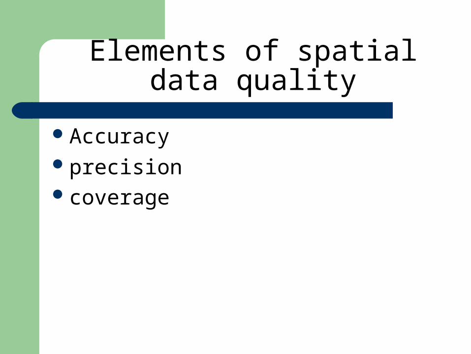
Elements of spatial data quality
Accuracyprecisioncoverage
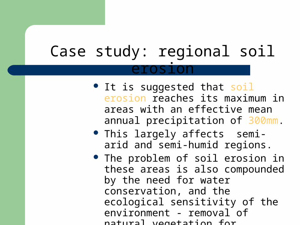
Case study: regional soil erosion
It is suggested that soil erosion reaches its maximum in areas with an effective mean annual precipitation of 300mm.
This largely affects semi-arid and semi-humid regions.
The problem of soil erosion in these areas is also compounded by the need for water conservation, and the ecological sensitivity of the environment - removal of natural vegetation for cultivation can have a major effect.
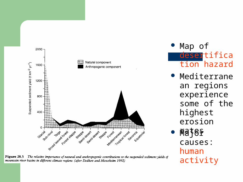
Mediterranean regions experience some of the highest erosion rates
Map of desertification hazard
Major causes: human activity
Factors Factors influencing influencing soil erosionsoil erosion

Factors Influencing Soil Erosion Rate
RainfallRun-offWindSoilSlopePlant CoverConservation Measures
Erosivity
Erodibility
Protection
Modelling Modelling soil erosionsoil erosion
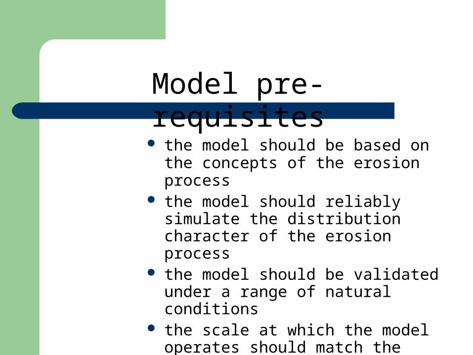
Model pre-requisites
the model should be based on the concepts of the erosion process
the model should reliably simulate the distribution character of the erosion process
the model should be validated under a range of natural conditions
the scale at which the model operates should match the spatial resolution of the EO data and DEM.
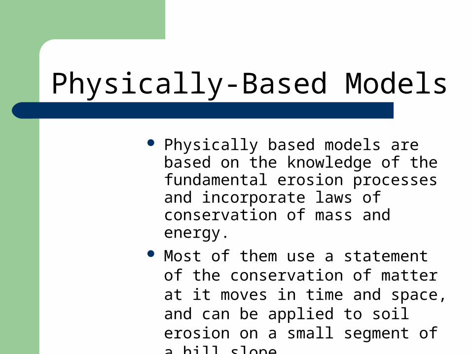
Physically-Based Models
Physically based models are based on the knowledge of the fundamental erosion processes and incorporate laws of conservation of mass and energy.
Most of them use a statement of the conservation of matter at it moves in time and space, and can be applied to soil erosion on a small segment of a hill slope.
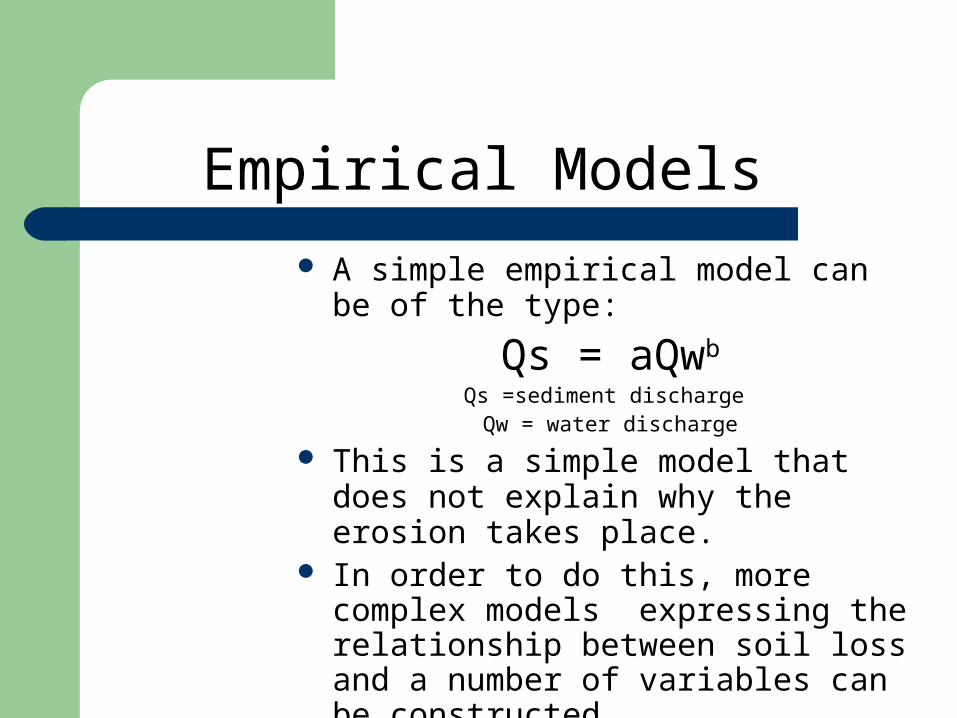
Empirical Models A simple empirical model can be of the
type:
Qs = aQwb
Qs =sediment discharge Qw = water discharge
This is a simple model that does not explain why the erosion takes place.
In order to do this, more complex models expressing the relationship between soil loss and a number of variables can be constructed.
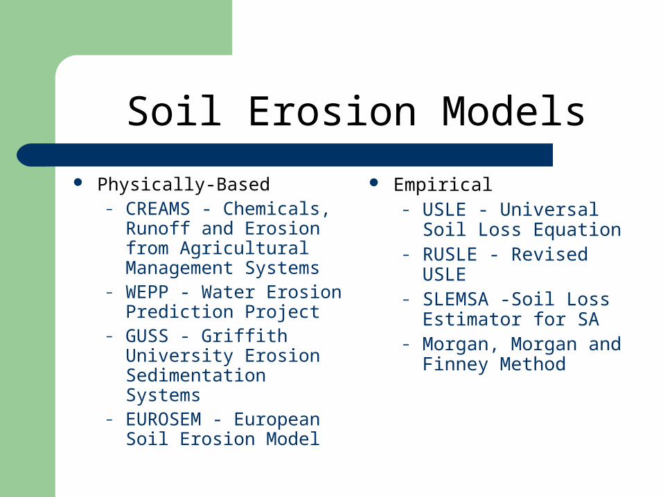
Physically-Based– CREAMS - Chemicals,
Runoff and Erosion from Agricultural Management Systems
– WEPP - Water Erosion Prediction Project
– GUSS - Griffith University Erosion Sedimentation Systems
– EUROSEM - European Soil Erosion Model
Empirical– USLE - Universal Soil
Loss Equation– RUSLE - Revised USLE– SLEMSA -Soil Loss
Estimator for SA– Morgan, Morgan and
Finney Method
Soil Erosion Models
The The Universal Universal Soil Loss Soil Loss EquationEquation
The USLE
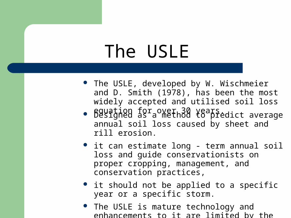
The USLE, developed by W. Wischmeier and D. Smith (1978), has been the most widely accepted and utilised soil loss equation for over 30 years.
Designed as a method to predict average annual soil loss caused by sheet and rill erosion.
it can estimate long - term annual soil loss and guide conservationists on proper cropping, management, and conservation practices,
it should not be applied to a specific year or a specific storm.
The USLE is mature technology and enhancements to it are limited by the simple equation structure.
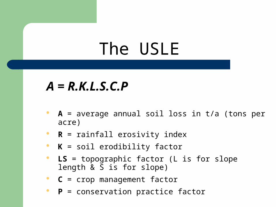
The USLE
A = R.K.L.S.C.P
A = average annual soil loss in t/a (tons per acre)
R = rainfall erosivity index
K = soil erodibility factor
LS = topographic factor (L is for slope length & S is for slope)
C = crop management factor
P = conservation practice factor

Remote Remote sensing & sensing &
GISGIS
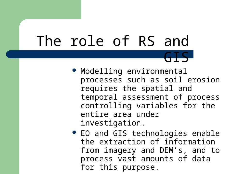
The role of RS and GIS
Modelling environmental processes such as soil erosion requires the spatial and temporal assessment of process controlling variables for the entire area under investigation.
EO and GIS technologies enable the extraction of information from imagery and DEM’s, and to process vast amounts of data for this purpose.
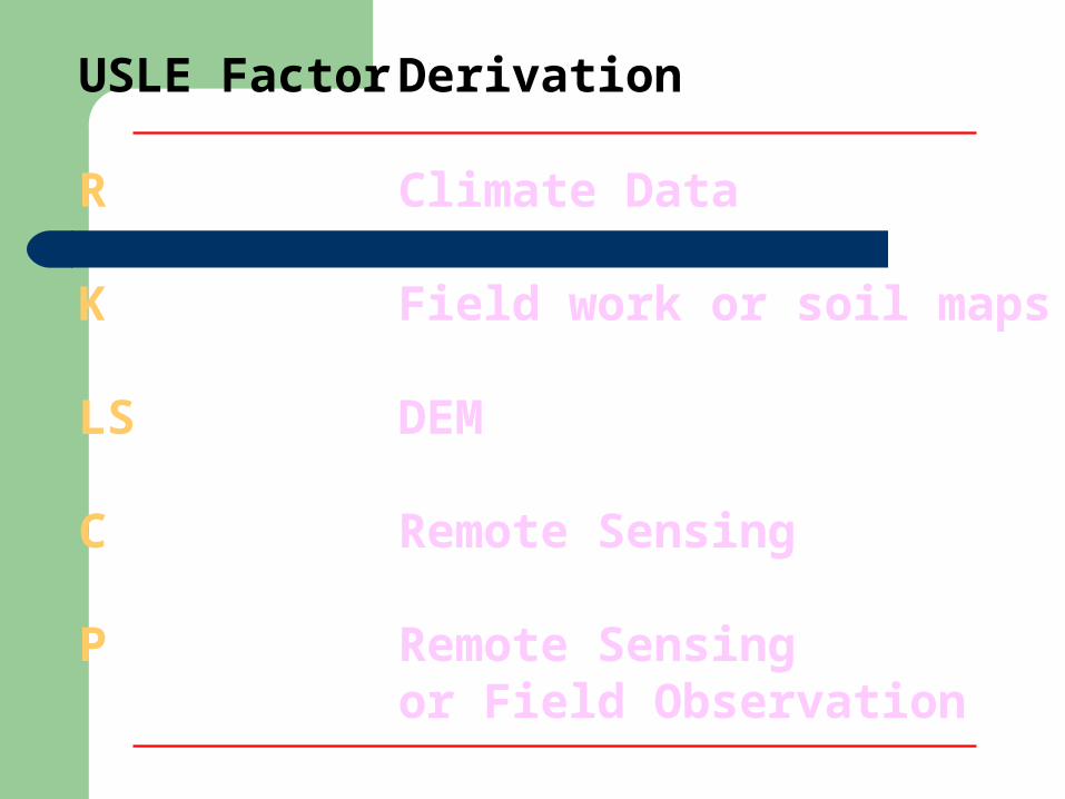
USLE Factor Derivation
R Climate Data
K Field work or soil maps
LS DEM
C Remote Sensing
P Remote Sensing or Field Observation
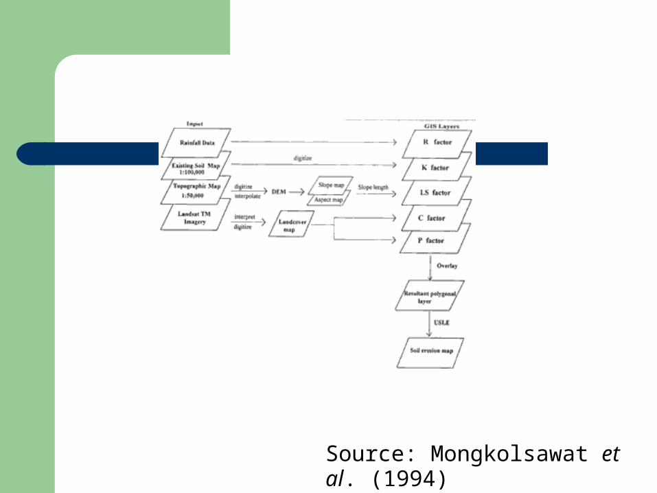
Source: Mongkolsawat et al. (1994)
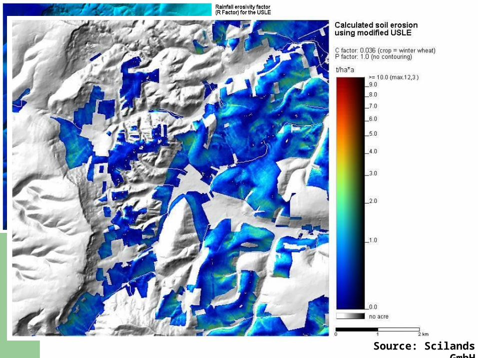
Source: Scilands GmbH
In this lecture you have:
identified reasons for modelling terrain
defined a ‘(geo-)information envelope’
exemplified the process of terrain modelling to analyse natural hazards

![benrayneyr1.files.wordpress.com€¦ · Web viewLorem Ipsum [Insert Date] Coventry University. Lorem Ipsum. Lorem Ipsum [Insert Date] [Insert Date] Coventry University. Coventry](https://img.pdfslide.net/doc/110x75/60e585d30da98301db053ea8/web-view-lorem-ipsum-insert-date-coventry-university-lorem-ipsum-lorem-ipsum.jpg)