Embed Size (px)
Citation preview
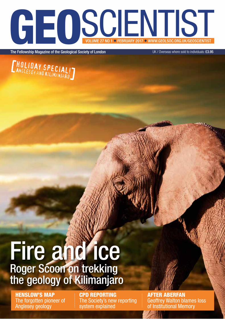
Fire and iceRoger Scoon on trekking the geology of Kilimanjaro
CPD REPORTINGThe Society’s new reporting system explained
AFTER ABERFANGeoffrey Walton blames loss of Institutional Memory
HENSLOW’S MAPThe forgotten pioneer of Anglesey geology
HOLIDAY SPECIAL! Anglesey and Kilimanjaro
[]
GEOSCIENTISTVOLUME 27 NO 1 ◆ FEBRUARY 2017 ◆ WWW.GEOLSOC.ORG.UK/GEOSCIENTIST
The Fellowship Magazine of the Geological Society of London UK / Overseas where sold to individuals: £3.95
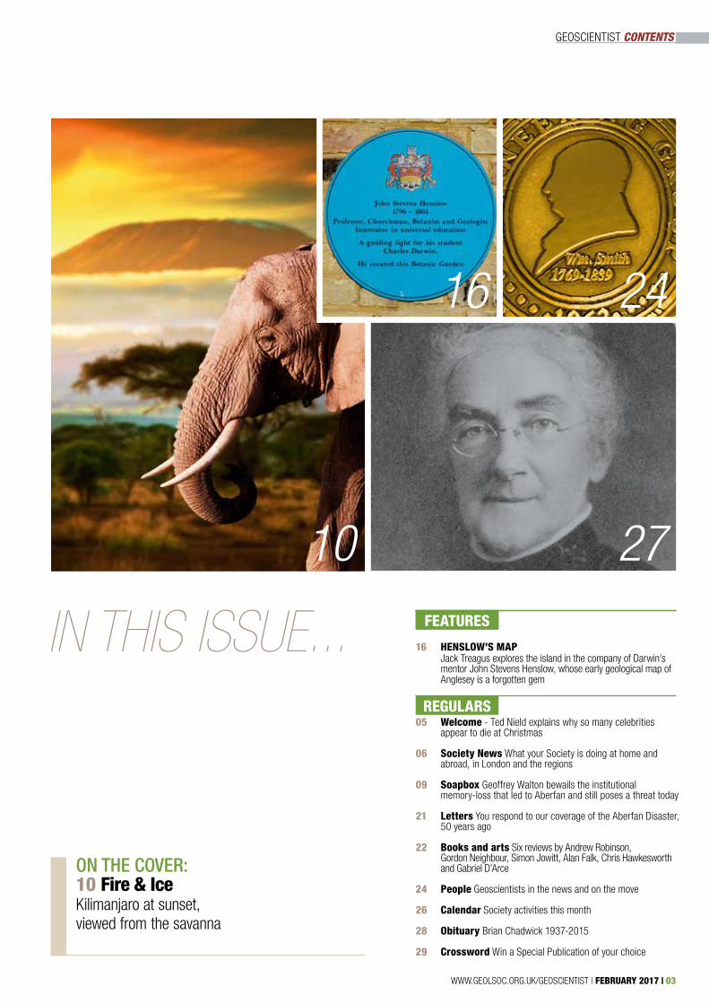
GEOSCIENTIST CONTENTS
16 HENSLOW’S MAP Jack Treagus explores the island in the company of Darwin’s mentor John Stevens Henslow, whose early geological map of Anglesey is a forgotten gem
05 Welcome - Ted Nield explains why so many celebrities appear to die at Christmas
06 Society News What your Society is doing at home and abroad, in London and the regions
09 Soapbox Geoffrey Walton bewails the institutional memory-loss that led to Aberfan and still poses a threat today 21 Letters You respond to our coverage of the Aberfan Disaster, 50 years ago 22 Books and arts Six reviews by Andrew Robinson, Gordon Neighbour, Simon Jowitt, Alan Falk, Chris Hawkesworth and Gabriel D’Arce
24 People Geoscientists in the news and on the move
26 Calendar Society activities this month
28 Obituary Brian Chadwick 1937-2015
29 Crossword Win a Special Publication of your choice
FEATURESFEATURES
REGULARS
WWW.GEOLSOC.ORG.UK/GEOSCIENTIST | FEBRUARY 2017 | 03
2710
2416
ON THE COVER: 10 Fire & Ice Kilimanjaro at sunset, viewed from the savanna
IN THIS ISSUE...
04 | FEBRUARY 2017 | WWW.GEOLSOC.ORG.UK/GEOSCIENTIST
GEOSCIENTIST WELCOME
FROM THE EDITORS DESK:
Death assemblage
“You will see the Ammonitico Rosso”, said my old Prof, Derek Ager concluding his lecture on condensed pelagic
deposits of the Jurassic, “in the floors of the Royal Society ... if you ever get that far.”. I have since seen the facies there and in many other places, including Italy and, more surprisingly perhaps, in Poland – where an Italian geologist on the same excursion (who shall remain nameless) reflected quietly: “Good job we named it first in Italy. Otherwise it would be unpronounceable.”
The Ammonitico Rosso facies forms on sediment-starved seamounts, receiving little terrigenous material but a lot of dead free-swimming animals whose shells rain out of the water column, forming a condensed death-assemblage. I began to think about this as 2016 drew to a close.
The end of that year produced a death assemblage of its own, as celebrities from A A Gill to Z Z Gabor dropped seemingly like flies. And the cry went up – “Oh 2016, when will you finish with killing off our favourite people?”. Yet, as any journalist knows, apparent death-rate among celebrities always rises towards the end of the year. The general public has a short memory and forgets this, so each year it seems to happen afresh. But it is an annual phenomenon.
Why is this? Real death rates do go up and down, and more people die in winter as a rule (there is a slight peak in hot summers too). But the annual Christmas hecatomb of celebrities is mainly a preservation phenomenon, caused simply by lack of other news.
What this means is that celebrity deaths, which would otherwise be missed because of dilution, rise to the top of the news pile and achieve greater notice. Carrie Fisher and Debbie Reynolds dying within a day of one another, might make headlines at any time, but most others not. Except at Christmas. Minor earthquakes also appear to get more frequent then, for the same reason.
News at Christmas is a thin, condensed deposit. For lack of other sediment, fossils make up the bulk. The effect is, if anything, enhanced by social media - which have also created a new phenomenon of people dying more than once. Some deaths are overlooked, and many more are forgotten. So old obituaries, continually thrown back up by algorithms, appear to announce new deaths – and people who don’t read the date on the story spread the rumour.
Jazz master Dave Brubeck, for example, suffered his second ‘death’, by Internet, in December 2016. This time, 2016 was innocent. He actually died on 5 December 2012 – along with another apparent rush to the grave that year.
DR TED NIELD, EDITOR - [email protected] @TedNield @geoscientistmag
WWW.GEOLSOC.ORG.UK/GEOSCIENTIST | FEBRUARY 2017 | 05
NEWS AT CHRISTMAS IS A THIN, CONDENSED DEPOSIT. FOR LACK OF OTHER SEDIMENT, FOSSILS MAKE UP THE BULK
~
~
Geoscientist is the Fellowship magazine of the Geological Society of London
The Geological Society, Burlington House, Piccadilly, London W1J 0BGT +44 (0)20 7434 9944F +44 (0)20 7439 8975E [email protected](Not for Editorial - Please contact the Editor)
Publishing HouseThe Geological Society Publishing House, Unit 7,Brassmill Enterprise Centre, Brassmill Lane, Bath BA1 3JNT 01225 445046F 01225 442836
Library T +44 (0)20 7432 0999F +44 (0)20 7439 3470E [email protected]
EDITOR-IN-CHIEFProfessor Peter Styles
EDITORDr Ted NieldE [email protected]
EDITORIAL BOARDDr Sue BowlerMr Steve BranchDr Robin CocksProf. Tony HarrisDr Howard Falcon-LangMr Edmund NicklessMr David ShilstonDr Jonathan TurnerDr Jan Zalasiewicz
Trustees of the Geological Society of LondonMr Malcolm Brown (President)Mr Rick BrassingtonDr Jason CanningMiss Liv Carroll (Secretary,Professional Matters)Dr Nigel CassidyMr Chris Eccles (Vice president)Dr Marie Edmonds (Secretary,Science)Mr Graham Goffey (Treasurer)Dr Sarah GordonMrs Tricia HentonMr David HopkinsMs Naomi JordanDr Robert LarterDr Jennifer McKinleyProf David NorburyDr Colin North (Secretary,Publications)Dr Sheila PeacockProf Christine PeirceMr Nicholas ReynoldsDr Katherine RoyseMr Keith Seymour(Vice president)Dr Alexander WhittakerMr Michael Young (Secretary,Foreign & External Affairs)Published on behalf of the Geological Society of London by Century One Publishing Alban Row, 27–31 Verulam Road, St Albans, Herts, AL3 4DGT 01727 893 894F 01727 893 895E enquiries@centuryone publishing.ukW www.centuryonepublishing.uk
ADVERTISING SALESHayden McIntosh T 01727 739 184E hayden@centuryone publishing.uk
ART EDITORHeena Gudka
DESIGN & PRODUCTIONJonathan Coke
PRINTED BY Century One Publishing Ltd.
Copyright The Geological Society of London is a Registered Charity, number 210161.ISSN (print) 0961-5628 ISSN (online) 2045-1784
The Geological Society of Londonaccepts no responsibility for the viewsexpressed in any article in this publication. All views expressed, except where explicitly stated otherwise, represent those of the author, and not The Geological Society of London. AllAll rights reserved. No paragraph of this publication may be reproduced, copiedor transmitted save with written permission. Users registered with Copyright Clearance Center: the Journal is registered with CCC, 27 Congress Street, Salem, MA 01970, USA. 0961- 5628/02/$15.00. Every effort has been made to trace copyright holders of material in this publication. If any rights have been omitted, the publishers offer their apologies.
No responsibility is assumed by the Publisher for any injury and/or damage to persons or property as a matter of products liability, negligence orotherwise, or from any use or operation of any methods, products, instructions or ideas contained in the material herein. Although all advertising material is expected to conform to ethical (medical) standards, inclusion in this publication does not constitute a guarantee or endorsement of the quality or value of such product or of the claims made by its manufacturer.
Subscriptions: All correspondencerelating to non-member subscriptions should be addresses to the Journals Subscription Department, Geological Society Publishing House, Unit 7 Brassmill Enterprise Centre, Brassmill Lane, Bath, BA1 3JN, UK. Tel: 01225 445046. Fax: 01225 442836. Email: [email protected]. The subscription price for Volume 26, 2016 (11 issues) to institutions and non-members will be £147 (UK) or £169/$337 (Rest of World).
© 2017 The Geological Societyof London
Geoscientist is printed on FSC® mixed credit - Mixed source products are a blend of FSC 100%, Recycled and/or Controlled fibre. Certified by the ForestStewardship Council®.
SOCIETYNEWS What your society is doing at home and abroad, in London and the regions
06 | FEBRUARY 2017 | WWW.GEOLSOC.ORG.UK/GEOSCIENTIST
A New CPD SystemThere are no fixed or standard approaches
to continuing professional development training and learning, but outcomes of CPD learning should always be clearly apparent, applicable and relevant to the individual. CPD combines different learning methodologies, focused on individual improvement. Professionals should maintain a CPD record of their learning and update it with the details of each CPD event. CPD is a personal commitment and each individual should determine what they wish to learn and what they aspire to achieve in terms of their career development. The great majority of people undertake CPD on technical and business related issues that have a day-to-day bearing on their work. It is thus perceived as being highly pragmatic and relevant.
To maximise benefit from CPD, Fellows should embody recursive or reflective practice as a framework for their learning process. In its simplest form, the three-stage cycle (termed an Experiential or Brathay learning cycle) of recursive CPD practice is represented as a plan g act g reflect cycle, frequently termed a ‘personal development plan’, or ‘PDP cycle’ and is normally conducted on an annual (or sometimes a bi-annual) basis.
At the beginning of each year, one’s personal needs for CPD should be evaluated in relation to current and planned professional activities, as required by many employers’ management schemes. At the end of the year, a review and reflection should be made on the extent to which planned CPD objectives have been achieved. The conclusions should then be recorded and analysed as an input to planning CPD needs for the following year.
‘What CPD to do’ will depend on an individual’s job and their personal circumstances and professional ambitions, but in simple terms the answer is anything that adds to their relevant skills, knowledge and experience is deemed to constitute CPD.
Geologists are employed in a very varied range of jobs and at all levels of responsibility, and it is recognised that their continuing learning needs will be equally varied. The range of subjects that could, in principle, be included in a CPD programme is almost
one’s working life. A vital component of this process comprises tracking and documenting the skills, knowledge and experience that professionals gain, whether formally or informally and self-directed.
CPD can involve any relevant learning activity beyond initial academic training. It is a commitment to life-long learning, invaluable to all people across every professional segment of society. There is now an expectation that all professionals must undertake and record CPD, regardless of their role, sector or level of responsibility.
CPD obligations are now common to all professions worldwide; it is no longer an optional extra to be undertaken according to the random needs or wishes of the individual or to meet some ill-defined, short-term organisational requirement. Its recording is essential to demonstrate that the professional is indeed maintaining the necessary competencies, so that all parties are assured of this. Planned and structured CPD is now vital for survival and prosperity in an increasingly litigious society and it has become particularly important to undertake high quality CPD in today’s fast-moving technological world, where knowledge is the key to success and the pace of change can soon make previous learning out-of-date.
Employers, professional bodies and academic institutions look for individuals to complete structured learning as part of career development and professional competence. This continuous learning also helps to improve industries as a whole. Performing effective CPD is a win-win for the individual, his or her clients, employer and profession, and the nation.
DocumentationTo justify the name, CPD needs to be a documented process; to be self-directed, driven by the professional needs of the individual, not those of his or her employer; to focus on learning from experience, reflective learning and review; to help the individual to set development goals and objectives; and to include both formal and informal learning.
John Talbot & Chris Eccles (Chartership Committee) set out the features of a new, simplified, less time-consuming scheme.
Continuing Professional Development (CPD) is changing! We are introducing an improved system with a significantly reduced time requirement; featuring straight, unweighted hours (no longer weighted points-based); a much wider range of relevant CPD activities; a more structured ‘plan g act g reflect’ annual cycle, set within a longer (three to five year) Career Aspiration Plan cycle; and introducing user-friendly CPD reporting for smart devices, as well as computers, to facilitate easier and quicker recording of your CPD events.
CPD is now also a requirement for all Chartered Fellows, not just the more recently Chartered, Scrutineers and those aspiring to be Chartered. The good news is that doing (and recording) CPD should now be less of a chore and (dare we say it?) even enjoyable!
The Society introduced Chartership in 1990 and has operated the same CPD system for Chartered Geologists and those working towards Chartership for many years. Over this period, practice across all professional sectors has evolved and a review was overdue.
This began in late 2015, with a comprehensive web-based survey of the present CPD arrangements of a wide range of professional bodies across the English-speaking world, in order to assess the existing GSL requirements for CPD in relation to current good practice. A detailed paper presented the findings of this survey and made recommendations for an improved system. Forty Chartered Fellows were asked for feedback, with a view to producing a new system in line with current best practice.
CPD ActivitiesCPD is the systematic acquisition, maintenance, improvement and broadening of knowledge and skills, and the development of professional competence and personal qualities necessary for carrying out professional and technical duties throughout
GEOSCIENTIST SOCIETY NEWS
WWW.GEOLSOC.ORG.UK/GEOSCIENTIST | FEBRUARY 2017 | 07
➤ To see the full version of this piece, with diagrams, please visit Geoscientist Online. Editor.
limitless. However, it is recommended that geologists may need to undertake CPD in the following general areas, in order to develop their expertise on a broad front:a) developing technical knowledge, experience and skills in their current field;b) broadening technical knowledge, experience and skills into fields parallel to their own, thus enabling them to move into another job should the desire, need or opportunity arise; c) acquiring non-technical knowledge, experience and skills, such as: Business practice; Management techniques; Communication and presentational skills; Legal aspects (Health & Safety, Environmental, Employment); Finance; Languages, etc., thus preparing them to assume wider or greater responsibilities when the opportunities arise.
The new system sets out six main categories of activities identified for CPD: ‘Formal learning’; ‘Informal learning’; ‘On-the-Job learning’; ‘Professional practice’; ‘Self-directed study’, and ‘Other’. Each category contains a number of sub-categories and activity types. The range of possible activities is illustrated in the form of a ‘Mind Map’, which you can find in the online version of this piece. This listing is not wholly exhaustive; there may be other valid activities that Fellows might offer as CPD.
Table 1 (available online) provides a comparison between old and proposed new activity areas under which CPD can be categorised. Because an attempt is being made to classify and group a wide range of
diverse things, it is necessarily an artificial and imperfect grouping; there are other equally valid ways of ‘slicing the cake’.
How much to doThe amount of CPD that an individual carries out will vary throughout a career, more or different types of CPD becoming necessary as roles and responsibilities change. The Society’s former system set out a minimum number of points to be achieved, based on a system of weighting hours spent on different activities. The new CPD system is based on unweighted hours.
While there is no upper limit to the amount undertaken in any year, there is a minimum requirement of 90 hours per annum for those in full time employment. CPD in excess of the minimum (up to but not exceeding 20% - 18 hours) may be carried forward to the next year.
CPD is to be recorded over at least three different categories with at least 70% of this focused on career development and skills enhancement associated with work, and with half of this (ie, 35% of the total) in the ‘On-the-Job learning’ category. The other 30% may either continue the focused programme or can be opportunistic or used for broadening knowledge of the geosciences overall. Fellows who are retired or not in work for any reason have different required minimum amounts of CPD, as shown in Table 2 (online).
Who should do itPreviously, the Society recommended that all professional geologists undertake CPD,
but only required Fellows with CSci or EurGeol, those aspiring to Chartership and those having gained CGeol since 2011 to do so and to submit CPD records. When reviewing CPD requirements of other professional institutions it was found that all of them required all of their chartered professionals to carry out CPD. Therefore, in line with these other institutions, the Society now requires that all of our Chartered Fellows perform CPD.
We also recommend that all professionally active Fellows - irrespective of whether or not they are Chartered - should also carry out CPD, as this helps to demonstrate compliance with the Code of Professional Conduct (Regulation R/FP/07).
ConclusionWe have endeavoured to produce a revitalised and improved CPD system for Fellows which is easier to use. In spring this year, the online CPD recording system will be relaunched on www.geolsoc.org.uk, as part of wider improvements to the ‘My GSL’ area. We also plan to provide an electronic career portfolio of personal and professional data and records, to complement and supplement those for CPD.
Dates for meetings of Council and Ordinary General Meetings until June 2017 will be as follows:
FUTURE MEETINGS
u OGMs: 2017: 1 February; 4 April
u Council: 2017: 1 February; 4 & 5 April (residential)
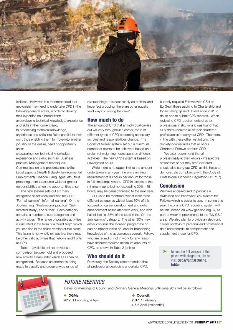
Photo: w
ead/Shutterstock.com
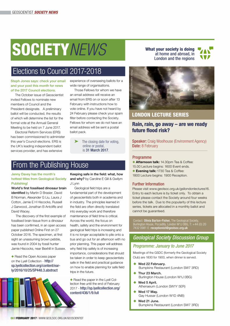
LONDON LECTURE SERIES
Contact: Olivia Barton-Fisher, The Geological Society, Burlington House, Piccadilly, London W1J 0BG, T: +44 (0) 20 7432 0981 E: [email protected]
Rain, rain, go away – are we ready future flood risk?
Speaker: Craig Woolhouse (Environment Agency)Date: 8 February
Programme◆ Afternoon talk: 14.30pm Tea & Coffee: 15.00 Lecture begins: 1600 Event ends.◆ Evening talk: 1730 Tea & Coffee: 1800 Lecture begins: 1900 Reception.
Further InformationPlease visit www.geolsoc.org.uk/gsllondonlectures16. Entry to each lecture is by ticket only. To obtain a ticket please contact the Society around four weeks before the talk. Due to the popularity of this lecture series, tickets are allocated in a monthly ballot and cannot be guaranteed.
Photo: sdecoret/S
hutterstock.com
Elections to Council 2017-2018
From the Publishing House
Steph Jones says: check your email and your post this month for news of the 2017 Council elections.
The October issue of Geoscientist invited Fellows to nominate new members of Council and the President-designate. A preliminary ballot will be conducted, the results of which will determine the list for the formal vote at the Annual General Meeting to be held on 7 June 2017.
Electoral Reform Services (ERS) has been commissioned to administer this year’s Council elections. ERS is the UK’s leading independent ballot services provider, and has extensive
experience of overseeing ballots for a wide range of organisations.
Those Fellows for whom we have an email address will receive an email from ERS on or soon after 13 February with instructions how to vote online. If you have not heard by 24 February please check your spam filter before contacting the Society. Fellows for whom we do not have an email address will be sent a postal ballot pack.
➤ The closing date for voting, online or postal, is 31 March 2017.
GEOSCIENTIST SOCIETY NEWS
SOCIETYNEWS What your society is doing at home and abroad, in London and the regions
Meetings of the GSDC (formerly the Geological Society
Club) are 1830 for 1900, when dinner is served.
Geological Society Discussion Group
Programme: January to June 2017
u Wed 22 February. Bumpkins Restaurant (London SW7 3RD)
u Thur 23 March. Burlington House (London W1J 0BG)
u Wed 5 April. Athenaeum (London SW1Y 5ER)
u Wed 17 May. Gay Hussar (London W1D 4NB)
u Wed 21 June. Bumpkins Restaurant (London SW7 3RD)
Jenny Davey has the month’s hottest titles from Geological Society Publishing!World’s first fossilised dinosaur brain identified by Martin D Brasier, David B Norman, Alexander G Liu, Laura J Cotton, Jamie E H Hiscocks, Russell J Garwood, Jonathan B Antcliffe and David Wacey.
The discovery of the first example of fossilised brain tissue from a dinosaur has been confirmed, in an open access paper published Online First on 27 October 2016. The specimen, at first sight an unassuming brown pebble, was found in 2004 by fossil hunter Jamie Hiscocks, near Bexhill in Sussex.
◆ Read the Open Access paper on the Lyell Collection - http://sp.lyellcollection.org/content/ear-ly/2016/10/25/SP448.3.abstract
Keeping safe in the field: what, how and why? by Caroline E Gill & Gwilym J Lynn
Geological field trips are a fundamental part of the development of geoscientists both in academia and in industry. The principles learned in the field are often directly translated into everyday work and therefore maintenance of field time is critical. Across the world, the focus on health, safety and the environment for geological field trips is increasing and it is no longer acceptable to pile onto a bus and go out for an afternoon with no prior planning. This paper will address why field trip safety is of increasing importance, considerations that should be taken in order to keep geoscientists safe in the field and practical guidance on how to enable planning for safe field trips in the future.
◆ Read the paper in the Lyell Col-lection free until the end of February 2017 - http://sp.lyellcollection.org/content/436/1/9.full
08 | FEBRUARY 2017 | WWW.GEOLSOC.ORG.UK/GEOSCIENTIST
Aberfan & institutional memory
GEOSCIENTIST SOAPBOX
SOAPBOXCALLING!
Loss of corporate memory in a fast-changing industry with high staff turnover remains a serious problem, says Geoffrey Walton
Soapbox is open to contributions from all Fellows. You can always write a letter to the Editor, of course: but perhaps you feel you need more space?
If you can write it entertainingly in 500 words, t the Editor would like to hear from you. Email your piece, and a self-portrait, to [email protected]. Copy can only be accepted electronically. No diagrams, tables or other illustrations please.
Pictures should be of print quality – please take photographs on the largest setting on your camera, with a plain background.
Precedence will always be given to more topical contributions. Any one contributor may not appear more often than once per volume (once every 12 months).
WE SHOULD ACTIVELY SEEK TO THWART THOSE WHO AIM TO PREVENT THE SPREAD OF ENLIGHTENMENT IN GEOTECHNICS
GEOFFREY WALTON ~
~
WWW.GEOLSOC.ORG.UK/GEOSCIENTIST | FEBRUARY 2017 | 09
I
➤ A longer version of this piece may be viewed in online letters. Editor.
found much to agree with in both Aberfan features (Geoscientist 26.09 October 2016), but more could have been said. Tip instability continues to occur in Britain. In this year’s EIG
Ansel Dunham Memorial Lecture ‘Aberfan and after’ in Birmingham, Dr Alan Cobb explained how, in 2013, the Hatfield Colliery tip failure disrupted a four-track main railway line.
Disaster was averted by Network Rail’s diligence. There had been no accurate survey of the tip, design, or stability analysis and the tip report was more than six months old. Those who advise the surface mining and quarrying sector in Great Britain on geotechnics now work with the Quarries Regulations 1999 which are more demanding in their requirements than the 1971 Regulations. However, even with continuous monitoring and investigation, problems still occur.
PrecursorThe most significant precursor event near Aberfan occurred near Abercynon in December 1939. There, a flow slide travelled down the eastern side of the Taff Vale, crossed the main road, a canal, a railway and the River Taff, which it slightly diverted. No-one was killed and the owners Powell Duffryn prepared a comprehensive report detailing future tipping arrangements to avoid such problems. The war and
nationalisation intervened, and although the report was still ‘in the system’, no one paid attention.
This represented in 1966, and remains to this day, a problem of ‘corporate memory’ - a problem in an industry that changes rapidly, with closures and take-overs, and which cuts staff when they may be the only repository of historical knowledge. The Geological Society Engineering Group and other professional interest groups, including IMMM and EIG, should publish key information on these and other things that go wrong, for future use. However, this is often frustrated by companies and lawyers seeking to prevent bad publicity – using litigation or gagging measures to prevent publication of precautionary advice.
One may criticise the Aberfan Tribunal’s work by today’s standards; but it blamed and severely criticised the NCB, was technically sound, relevant, and was made public promptly. The valuable scientific work by Prof Alan Bishop at Imperial College in assessing the instability for the Tribunal, and the subsequent contribution of Dr Roy Taylor of Durham University on the engineering properties of discards, should be applauded.
HorrorsIn spite of the horrors for those involved in the disaster, the event changed the lives of many geo-professionals, often beneficially
- and certainly of those living and working near these structures across the country. We should be grateful to all who contributed to the Tribunal’s main technical report and perhaps more actively seek to thwart those who aim to prevent the spread of enlightenment in geotechnics and other areas of geoscience practice.
Photo: Spelbrook memorial sign Copyright Creative Commons
10 | FEBRUARY 2017 | WWW.GEOLSOC.ORG.UK/GEOSCIENTIST
FIREAND ICE
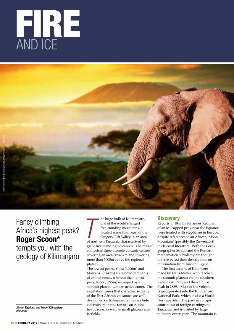
The huge bulk of Kilimanjaro, one of the world’s largest free-standing mountains, is located some 80km east of the Gregory Rift Valley in an area
of northern Tanzania characterised by giant free-standing volcanoes. The massif comprises three discrete volcanic centres covering an area 80x48km and towering more than 5000m above the regional plateau. The lowest peaks, Shira (4006m) and Mawenzi (5149m) are eroded remnants of extinct cones, whereas the highest peak, Kibo (5895m) is capped by a summit plateau with an active crater. The vegetation zones that characterise many of the East African volcanoes are well developed on Kilimanjaro: they include extensive montane forests, an Alpine heath zone, as well as small glaciers and icefields.
DiscoveryReports in 1848 by Johannes Rebmann of an ice-capped peak near the Equator were treated with scepticism in Europe, despite references to an African ‘Moon Mountain’ (possibly the Ruwenzori) in classical literature. Both the Greek geographer Strabo and the Roman mathematician Ptolemy are thought to have based their descriptions on information from Ancient Egypt.
The first ascents of Kibo were made by Hans Meyer, who reached the summit plateau via the southern icefields in 1887, and then Uhuru Peak in 1889. Most of the volcano is incorporated into the Kilimanjaro National Park, which is also a World Heritage Site. The park is a major contributor of foreign earnings to Tanzania, and is visited by large numbers every year. The mountain is
Fancy climbing Africa’s highest peak? Roger Scoon* tempts you with the geology of Kilimanjaro
Above: Elephant and Mount Kilimanjaro at sunset
Image: Yerko Espinoza/shutterstock.com
Photo: P
HO
TOC
RE
O M
ichal Bednarek/S
hutterstock.com
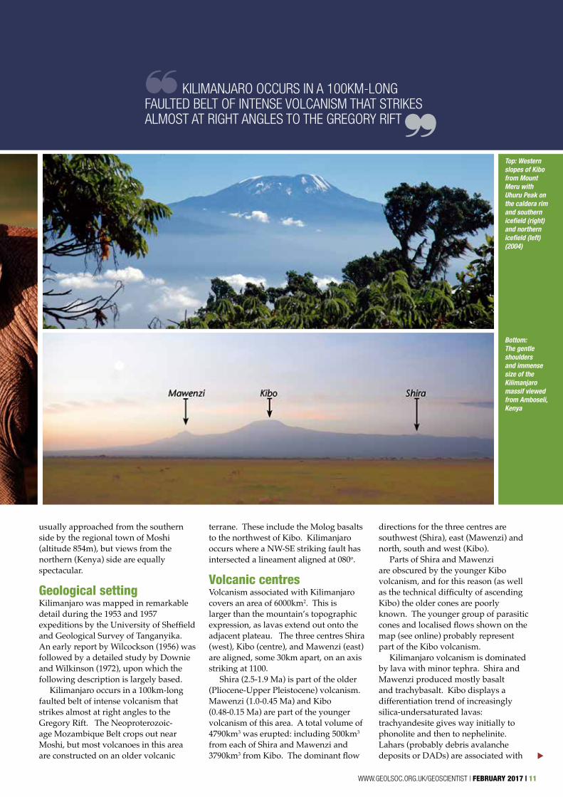
directions for the three centres are southwest (Shira), east (Mawenzi) and north, south and west (Kibo).
Parts of Shira and Mawenzi are obscured by the younger Kibo volcanism, and for this reason (as well as the technical difficulty of ascending Kibo) the older cones are poorly known. The younger group of parasitic cones and localised flows shown on the map (see online) probably represent part of the Kibo volcanism.
Kilimanjaro volcanism is dominated by lava with minor tephra. Shira and Mawenzi produced mostly basalt and trachybasalt. Kibo displays a differentiation trend of increasingly silica-undersaturated lavas: trachyandesite gives way initially to phonolite and then to nephelinite. Lahars (probably debris avalanche deposits or DADs) are associated with
Top: Western slopes of Kibo from Mount Meru with Uhuru Peak on the caldera rim and southern icefield (right) and northern icefield (left) (2004)
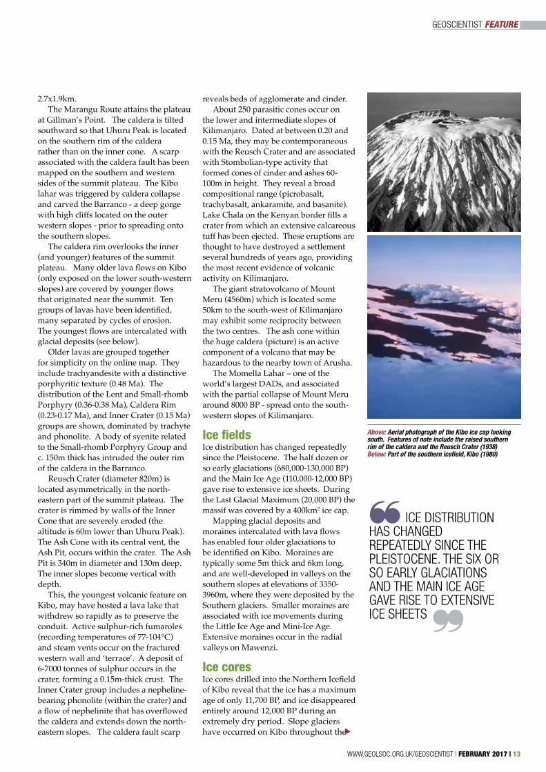
Bottom: The gentle shoulders and immense size of the Kilimanjaro massif viewed from Amboseli, Kenya
KILIMANJARO OCCURS IN A 100KM-LONG FAULTED BELT OF INTENSE VOLCANISM THAT STRIKES ALMOST AT RIGHT ANGLES TO THE GREGORY RIFT
▼
~
~
usually approached from the southern side by the regional town of Moshi (altitude 854m), but views from the northern (Kenya) side are equally spectacular.
Geological settingKilimanjaro was mapped in remarkable detail during the 1953 and 1957 expeditions by the University of Sheffield and Geological Survey of Tanganyika. An early report by Wilcockson (1956) was followed by a detailed study by Downie and Wilkinson (1972), upon which the following description is largely based.
Kilimanjaro occurs in a 100km-long faulted belt of intense volcanism that strikes almost at right angles to the Gregory Rift. The Neoproterozoic-age Mozambique Belt crops out near Moshi, but most volcanoes in this area are constructed on an older volcanic
terrane. These include the Molog basalts to the northwest of Kibo. Kilimanjaro occurs where a NW-SE striking fault has intersected a lineament aligned at 080o.
Volcanic centresVolcanism associated with Kilimanjaro covers an area of 6000km2. This is larger than the mountain’s topographic expression, as lavas extend out onto the adjacent plateau. The three centres Shira (west), Kibo (centre), and Mawenzi (east) are aligned, some 30km apart, on an axis striking at 1100.
Shira (2.5-1.9 Ma) is part of the older (Pliocene-Upper Pleistocene) volcanism. Mawenzi (1.0-0.45 Ma) and Kibo (0.48-0.15 Ma) are part of the younger volcanism of this area. A total volume of 4790km3 was erupted: including 500km3 from each of Shira and Mawenzi and 3790km3 from Kibo. The dominant flow
WWW.GEOLSOC.ORG.UK/GEOSCIENTIST | FEBRUARY 2017 | 11
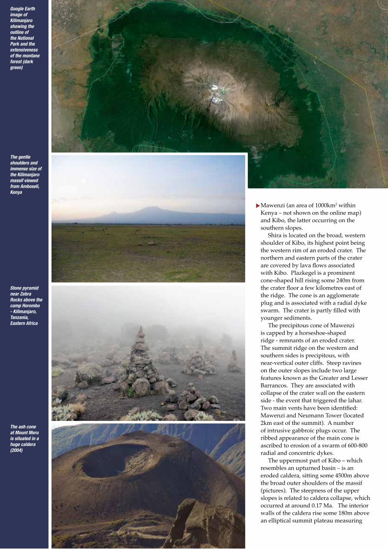
Google Earth image of Kilimanjaro showing the outline of the National Park and the extensiveness of the montane forest (dark green)
The gentle shoulders and immense size of the Kilimanjaro massif viewed from Amboseli, Kenya
The ash cone at Mount Meru is situated in a huge caldera (2004)
Stone pyramid near Zebra Rocks above the camp Horombo - Kilimanjaro, Tanzania, Eastern Africa
▼Mawenzi (an area of 1000km2 within Kenya – not shown on the online map) and Kibo, the latter occurring on the southern slopes.
Shira is located on the broad, western shoulder of Kibo, its highest point being the western rim of an eroded crater. The northern and eastern parts of the crater are covered by lava flows associated with Kibo. Plazkegel is a prominent cone-shaped hill rising some 240m from the crater floor a few kilometres east of the ridge. The cone is an agglomerate plug and is associated with a radial dyke swarm. The crater is partly filled with younger sediments.
The precipitous cone of Mawenzi is capped by a horseshoe-shaped ridge - remnants of an eroded crater. The summit ridge on the western and southern sides is precipitous, with near-vertical outer cliffs. Steep ravines on the outer slopes include two large features known as the Greater and Lesser Barrancos. They are associated with collapse of the crater wall on the eastern side - the event that triggered the lahar. Two main vents have been identified: Mawenzi and Neumann Tower (located 2km east of the summit). A number of intrusive gabbroic plugs occur. The ribbed appearance of the main cone is ascribed to erosion of a swarm of 600-800 radial and concentric dykes.
The uppermost part of Kibo – which resembles an upturned basin – is an eroded caldera, sitting some 4500m above the broad outer shoulders of the massif (pictures). The steepness of the upper slopes is related to caldera collapse, which occurred at around 0.17 Ma. The interior walls of the caldera rise some 180m above an elliptical summit plateau measuring
GEOSCIENTIST FEATURE
Above: Aerial photograph of the Kibo ice cap looking south. Features of note include the raised southern rim of the caldera and the Reusch Crater (1938)Below: Part of the southern icefield, Kibo (1980)
ICE DISTRIBUTION HAS CHANGED REPEATEDLY SINCE THE PLEISTOCENE. THE SIX OR SO EARLY GLACIATIONS AND THE MAIN ICE AGE GAVE RISE TO EXTENSIVE ICE SHEETS
~
~
2.7x1.9km. The Marangu Route attains the plateau
at Gillman’s Point. The caldera is tilted southward so that Uhuru Peak is located on the southern rim of the caldera rather than on the inner cone. A scarp associated with the caldera fault has been mapped on the southern and western sides of the summit plateau. The Kibo lahar was triggered by caldera collapse and carved the Barranco - a deep gorge with high cliffs located on the outer western slopes - prior to spreading onto the southern slopes.
The caldera rim overlooks the inner (and younger) features of the summit plateau. Many older lava flows on Kibo (only exposed on the lower south-western slopes) are covered by younger flows that originated near the summit. Ten groups of lavas have been identified, many separated by cycles of erosion. The youngest flows are intercalated with glacial deposits (see below).
Older lavas are grouped together for simplicity on the online map. They include trachyandesite with a distinctive porphyritic texture (0.48 Ma). The distribution of the Lent and Small-rhomb Porphyry (0.36-0.38 Ma), Caldera Rim (0.23-0.17 Ma), and Inner Crater (0.15 Ma) groups are shown, dominated by trachyte and phonolite. A body of syenite related to the Small-rhomb Porphyry Group and c. 150m thick has intruded the outer rim of the caldera in the Barranco.
Reusch Crater (diameter 820m) is located asymmetrically in the north-eastern part of the summit plateau. The crater is rimmed by walls of the Inner Cone that are severely eroded (the altitude is 60m lower than Uhuru Peak). The Ash Cone with its central vent, the Ash Pit, occurs within the crater. The Ash Pit is 340m in diameter and 130m deep. The inner slopes become vertical with depth.
This, the youngest volcanic feature on Kibo, may have hosted a lava lake that withdrew so rapidly as to preserve the conduit. Active sulphur-rich fumaroles (recording temperatures of 77-104°C) and steam vents occur on the fractured western wall and ‘terrace’. A deposit of 6-7000 tonnes of sulphur occurs in the crater, forming a 0.15m-thick crust. The Inner Crater group includes a nepheline-bearing phonolite (within the crater) and a flow of nephelinite that has overflowed the caldera and extends down the north-eastern slopes. The caldera fault scarp
reveals beds of agglomerate and cinder. About 250 parasitic cones occur on
the lower and intermediate slopes of Kilimanjaro. Dated at between 0.20 and 0.15 Ma, they may be contemporaneous with the Reusch Crater and are associated with Stombolian-type activity that formed cones of cinder and ashes 60-100m in height. They reveal a broad compositional range (picrobasalt, trachybasalt, ankaramite, and basanite). Lake Chala on the Kenyan border fills a crater from which an extensive calcareous tuff has been ejected. These eruptions are thought to have destroyed a settlement several hundreds of years ago, providing the most recent evidence of volcanic activity on Kilimanjaro.
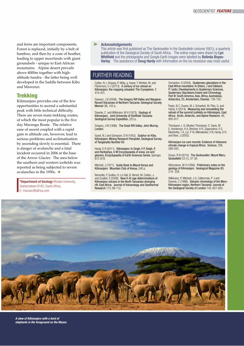
The giant stratovolcano of Mount Meru (4560m) which is located some 50km to the south-west of Kilimanjaro may exhibit some reciprocity between the two centres. The ash cone within the huge caldera (picture) is an active component of a volcano that may be hazardous to the nearby town of Arusha.
The Momella Lahar – one of the world’s largest DADs, and associated with the partial collapse of Mount Meru around 8000 BP - spread onto the south-western slopes of Kilimanjaro.
Ice fieldsIce distribution has changed repeatedly since the Pleistocene. The half dozen or so early glaciations (680,000-130,000 BP) and the Main Ice Age (110,000-12,000 BP) gave rise to extensive ice sheets. During the Last Glacial Maximum (20,000 BP) the massif was covered by a 400km2 ice cap.
Mapping glacial deposits and moraines intercalated with lava flows has enabled four older glaciations to be identified on Kibo. Moraines are typically some 5m thick and 6km long, and are well-developed in valleys on the southern slopes at elevations of 3350-3960m, where they were deposited by the Southern glaciers. Smaller moraines are associated with ice movements during the Little Ice Age and Mini-Ice Age. Extensive moraines occur in the radial valleys on Mawenzi.
Ice coresIce cores drilled into the Northern Icefield of Kibo reveal that the ice has a maximum age of only 11,700 BP, and ice disappeared entirely around 12,000 BP during an extremely dry period. Slope glaciers have occurred on Kibo throughout the
WWW.GEOLSOC.ORG.UK/GEOSCIENTIST | FEBRUARY 2017 | 13
▼
Uhuru Peak (highest summit) on Mount Kilimanjaro in Tanzania, Africa
Kilimanjaro Mountain in Africa on the World Map
last 10,000 years, but the summit icefield appeared and disappeared repeatedly, probably again due to dry cycles.
These cores are an important record of climate change in Africa. Slope glaciers have occurred throughout the last 10,000 years, but the summit icefield has appeared and disappeared repeatedly. The latter is generally ascribed to dry cycles occurring every few hundred years due to precession of the Earth’s orbit.
The African Humid Period (11,000-4500 BP) is recognised as a time when ice sheets and glaciers expanded considerably. During this period, lakes in the Gregory Rift deepened by as much as 100m. Evidence from variations in the Na and F content of the aerosol (important components of alkaline lakes) indicates an anomalously dry period at 8300 BP. (The timing of the catastrophic eruption at Meru is a coincidence that has never been recognised.) A second dry period, which caused recession of the ice at 4000-3700 BP, is known as the First Dark Age. This was so widespread as to have affected civilisations around the Nile River and in the Middle East.
Recession Early reports described Kibo as covered by a large icecap and the first ascent via
the Hans Meyer Notch was made when the summit plateau was almost entirely ice-covered. Only the Reusch Crater was ice-free. This “historical” icecap covered an area of 20km2 with slope glaciers extending to altitudes of 4500m. An aerial photograph taken in 1938 revealed the icecap to have shrunk to 11.4km2. A map of the summit plateau (published by Mitchell, in 1971) reveals three icefields with glaciers named after the early German explorers and geographers. The extent of the ice cap at this time can be compared with the earliest (1912) and latest (2011) maps.
Only eight ice sheets and glaciers now survive, having a combined area of only 1.76km2. The Heim, Great Barranco, and Little Penck are static ice sheets on the caldera rim. The Kersten, Decken, Rebmann, and Credner are slope glaciers, although the minimum altitude is close to 5000m. The Furtwängler is the last of the ice sheets remaining on the summit plateau.
During the last 100 years the ice sheet has receded by an average of 1% a year, some 40% of the ice having disappeared since 1998. The possibility of an increased rate since the 1950s is discounted. Despite air temperatures at 5000m of -70°C, ice is melting due to solar heating of exposed
vertical walls. Most ice is predicted to disappear by 2040.
The absence of permanent ice from the Reusch Crater is due to localized heat sources - fumaroles and steam vents. The summit plateau has a relatively high geothermal flux. Meltwater, with an average temperature of -1.2°C, is transporting heat into the glaciers. The potential disappearance of ice from Kibo would be unprecedented in the Holocene, as even in the extreme 300 year-long drought of the First Dark Age, some ice persisted. Current conditions have not been replicated during the past 10,000 years.
Botanical zonesThe successive botanical and climatic zones of Mt Kilimanjaro are delineated by altitude. The lower slopes (1800-2900m) are covered by dense montane forests, although some sections have been replaced by commercial farms and shambas (small holdings). The southern and western slopes are most favourable for cultivation as they receive the highest rainfall and have nutrient-rich soils.
The wetter forests are dominated by camphor, podocarpus, and fig trees, with junipers and olive trees occurring in drier sections. Vines, Old Man’s Beard,
▼GEOSCIENTIST FEATURE
and ferns are important components. Forest is replaced, initially by a belt of bamboo, and then by a zone of heather, leading to upper moorlands with giant groundsels - unique to East African mountains. Alpine desert prevails above 4000m together with high-altitude tundra - the latter being well developed in the Saddle between Kibo and Mawenzi.
TrekkingKilimanjaro provides one of the few opportunities to ascend a substantial peak with little technical difficulty. There are seven main trekking routes, of which the most popular is the five day Marangu Route. The relative ease of ascent coupled with a rapid gain in altitude can, however, lead to serious problems and acclimatisation by ascending slowly is essential. There is danger of avalanche and a fatal incident occurred in 2006 at the base of the Arrow Glacier. The area below the southern and western icefields was reported as being subjected to severe avalanches in the 1950s. u
A view of Kilimanjaro with a herd of elephants in the foreground on the Maasa
FURTHER READINGCullen, N J, Sirguey, P, Mölg, g, Kaser, T, Winkler, M, and Fitzsimons, S J (2013). A century of ice retreat on Kilimanjaro: the mapping reloaded: The Cryosphere, 7, 419-431.
Dawson, J B (2008). The Gregory Rift Valley and Neogene-Recent Volcanoes of Northern Tanzania: Geological Society Memoir 33, 102 p.
Downie, C and Wilkinson, W H (1972). Geology of Kilimanjaro: Joint University of Sheffield-Tanzania Geological Survey Expedition, 253 p.
Gregory, J W (1896). The Great Rift Valley: John Murray, London.
Guest, N J and Sampson, D N (1952). Sulphur on Kibo, Kilimanjaro: Mining Research Pamphlet, Geological Survey of Tanganyika Number 65.
Hardy, D R (2011). Kilimanjaro: In Singh, V P, Singh, P, and Haritashya, U M Encyclopaedia of snow, ice and glaciers, Encyclopaedia of Earth Sciences Series, Springer, 672-679.
Mitchell, J (1971). Guide Book to Mount Kenya and Kilimanjaro: Mountain Club of Kenya, 240 p.
Nonnotte, P, Guillou, H, Le Gall, B, Benoit, M, Cotten, J, and Scaillet, S (2008). New K-Ar age determinations of Kilimanjaro volcano in the North Tanzanian diverging rift, East Africa: Journal of Volcanology and Geothermal Research 173, 99-112.
Osmaston, H (2004). Quaternary glaciations in the East Africa mountains: In Ehlers, J and Gibbard, P I (eds.) Developments in Quaternary Sciences, Quaternary Glaciations Extent and Chronology Part III: South America, Asia, Africa, Australasia, Antarctica, 2C, Amsterdam, Elsevier, 139-150.
Pepin, N C, Duane, W J, Schaefert, M, Pike, G, and Hardy, D (2014). Measuring and remodelling the retreat of the summit icefields on Kilimanjaro, East Africa: Arctic, Antarctic, and Alpine Research, 46, 905-917.
Thompson, L G, Mosley-Thompson, E, Davis, M E, Henderson, K A, Brecher, H H, Zagorodnov, V S, Mashiotta, T A, Lin, P-N, Mikhalenko, V N, Hardy, D R, and Beer, J (2002).
Kilimanjaro ice core records: Evidence of Holocene climate change in tropical Africa: Science, 298, 589-593.
Scoon, R N (2010). The Geotraveller: Mount Meru, Geobulletin 53 (1), 37-39.
Wilcockson, W H (1956). Preliminary notes on the geology of Kilimanjaro: Geological Magazine 93, 218- 228.
Wilkinson, P, Mitchell, J G, Cattermole, P J and Downie, C (1986). Volcanic chronology of the Meru-Kilimanjaro region, Northern Tanzania: Journal of the Geological Society of London 143, 601-605.
➤ Acknowledgements This article was first published as The Geotraveller in the Geobulletin (volume 59(1)), a quarterly publication of the Geological Society of South Africa. The online maps were drawn by Lyn Whitfield and the photographs and Google Earth images were labelled by Belinda Boyes-Varley. The assistance of Doug Hardy with information on the ice recession was most useful.
GEOSCIENTIST FEATURE
*Department of Geology Rhodes University, Grahamstown 6140, South Africa. E: [email protected]
IN ANGLESEY WITH HENSLOW
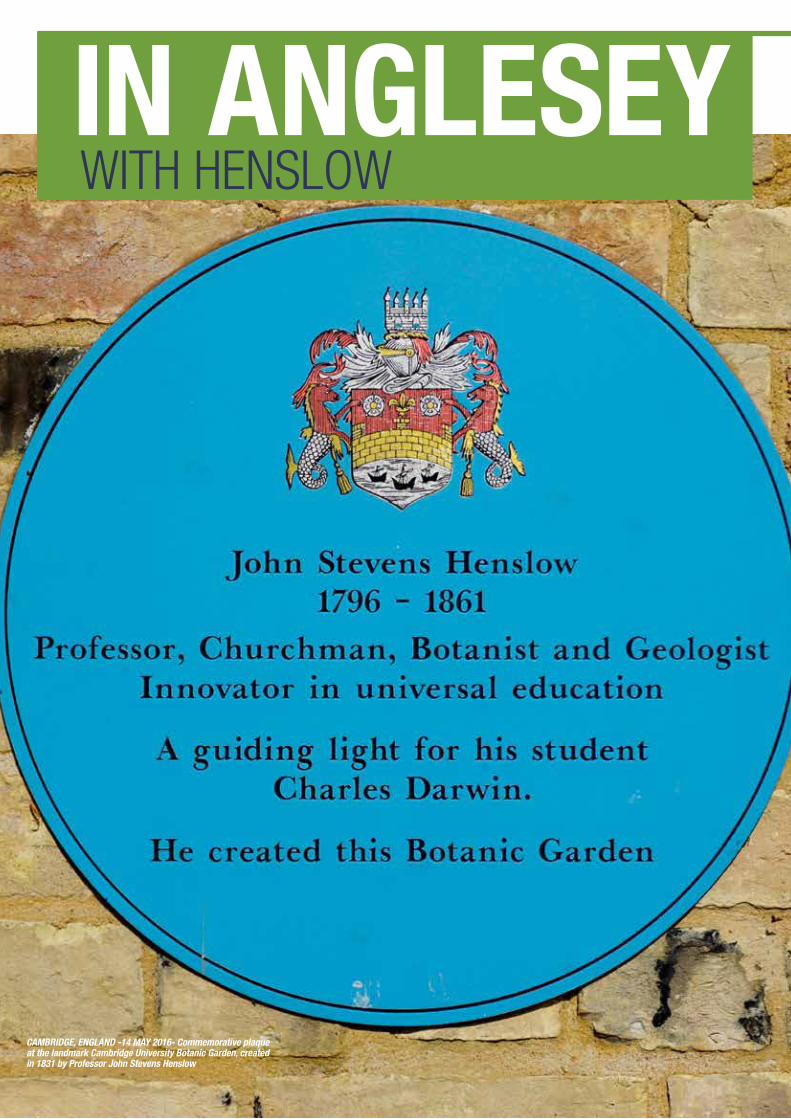
CAMBRIDGE, ENGLAND -14 MAY 2016- Commemorative plaque at the landmark Cambridge University Botanic Garden, created in 1831 by Professor John Stevens Henslow
John Stephens Henslow (1796-1861) is today a totally overlooked figure in the development of geological mapping in Britain. In the
early 19th Century he was a Fellow of St. John’s College Cambridge, where he produced his map of Anglesey (1822), one of the first detailed geological maps ever published of any part of the UK. The British Geological Survey was not founded until 1832 and its first similarly detailed maps not published until 1835.
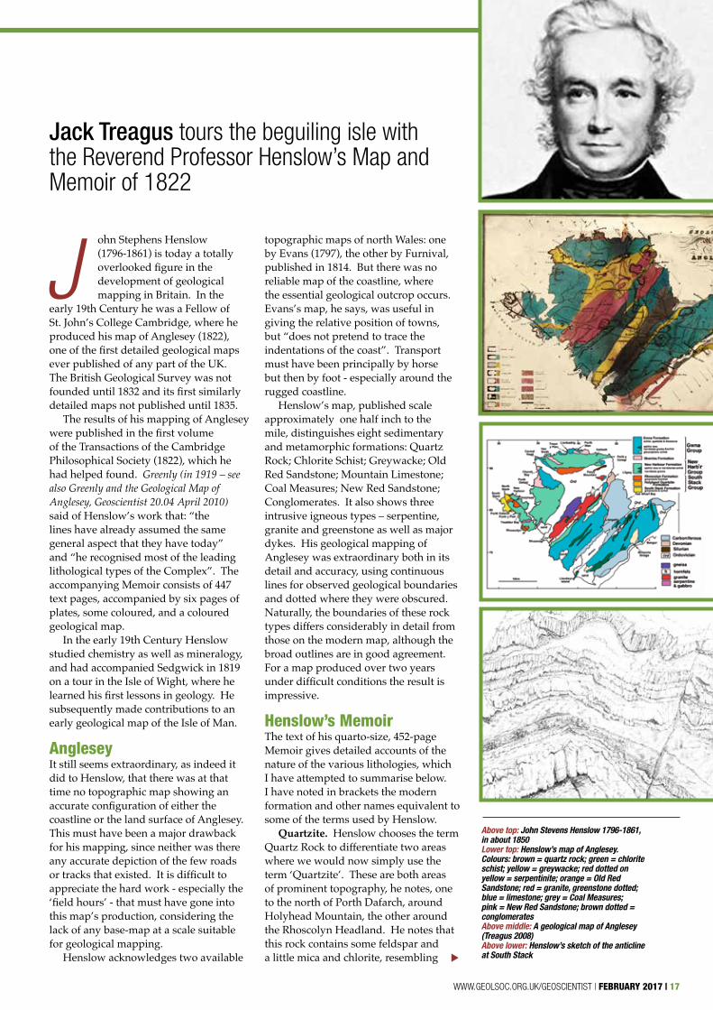
The results of his mapping of Anglesey were published in the first volume of the Transactions of the Cambridge Philosophical Society (1822), which he had helped found. Greenly (in 1919 – see also Greenly and the Geological Map of Anglesey, Geoscientist 20.04 April 2010) said of Henslow’s work that: “the lines have already assumed the same general aspect that they have today” and “he recognised most of the leading lithological types of the Complex”. The accompanying Memoir consists of 447 text pages, accompanied by six pages of plates, some coloured, and a coloured geological map.
In the early 19th Century Henslow studied chemistry as well as mineralogy, and had accompanied Sedgwick in 1819 on a tour in the Isle of Wight, where he learned his first lessons in geology. He subsequently made contributions to an early geological map of the Isle of Man.
AngleseyIt still seems extraordinary, as indeed it did to Henslow, that there was at that time no topographic map showing an accurate configuration of either the coastline or the land surface of Anglesey. This must have been a major drawback for his mapping, since neither was there any accurate depiction of the few roads or tracks that existed. It is difficult to appreciate the hard work - especially the ‘field hours’ - that must have gone into this map’s production, considering the lack of any base-map at a scale suitable for geological mapping.
Henslow acknowledges two available
topographic maps of north Wales: one by Evans (1797), the other by Furnival, published in 1814. But there was no reliable map of the coastline, where the essential geological outcrop occurs. Evans’s map, he says, was useful in giving the relative position of towns, but “does not pretend to trace the indentations of the coast”. Transport must have been principally by horse but then by foot - especially around the rugged coastline.
Henslow’s map, published scale approximately one half inch to the mile, distinguishes eight sedimentary and metamorphic formations: Quartz Rock; Chlorite Schist; Greywacke; Old Red Sandstone; Mountain Limestone; Coal Measures; New Red Sandstone; Conglomerates. It also shows three intrusive igneous types – serpentine, granite and greenstone as well as major dykes. His geological mapping of Anglesey was extraordinary both in its detail and accuracy, using continuous lines for observed geological boundaries and dotted where they were obscured. Naturally, the boundaries of these rock types differs considerably in detail from those on the modern map, although the broad outlines are in good agreement. For a map produced over two years under difficult conditions the result is impressive.
Henslow’s MemoirThe text of his quarto-size, 452-page Memoir gives detailed accounts of the nature of the various lithologies, which I have attempted to summarise below. I have noted in brackets the modern formation and other names equivalent to some of the terms used by Henslow.
Quartzite. Henslow chooses the term Quartz Rock to differentiate two areas where we would now simply use the term ‘Quartzite’. These are both areas of prominent topography, he notes, one to the north of Porth Dafarch, around Holyhead Mountain, the other around the Rhoscolyn Headland. He notes that this rock contains some feldspar and a little mica and chlorite, resembling
Jack Treagus tours the beguiling isle with the Reverend Professor Henslow’s Map and Memoir of 1822
Above top: John Stevens Henslow 1796-1861, in about 1850 Lower top: Henslow’s map of Anglesey. Colours: brown = quartz rock; green = chlorite schist; yellow = greywacke; red dotted on yellow = serpentinite; orange = Old Red Sandstone; red = granite, greenstone dotted; blue = limestone; grey = Coal Measures; pink = New Red Sandstone; brown dotted = conglomerates Above middle: A geological map of Anglesey (Treagus 2008)Above lower: Henslow’s sketch of the anticline at South Stack
WWW.GEOLSOC.ORG.UK/GEOSCIENTIST | FEBRUARY 2017 | 17
▼
greywacke in some places. These areas in part comprise what we now call the Holyhead Quartzite, Rhoscolyn and South Stack Formations of Holy Island.
Chlorite Schist. Although Henslow says that the term Micaceous Schist might be used to include all the oldest schistose stratified rocks, he generally uses the term Chlorite Schist. This schist, he says, in some places succeeds the quartzite unconformably - an interesting early use of this term in the geological literature; but elsewhere, he says, there is a degree of intermixture. Henslow describes in detail the various combinations of chlorite and quartz in the schists and the transitions between rocks that he distinguishes as ‘mica slate’ and ‘clay slate’, in a lower metamorphic state. These areas principally comprise, in modern terms, the New Harbour Formation and Skerries Formation of northwest Anglesey.
Greywacke. These areas mostly comprise the areas of, in modern terms, the Ordovician. The descriptions of the rocks, although detailed, are rather muddled and incomplete. They include principally ‘slate’ and ‘greywacke’.
Structure and metamorphism. There are several points of particular interest in Henslow’s observations of the structure of the quartzite and schists. He notes, for example, that “the greater proportion of the stratified rocks has suffered considerable disturbance”. He illustrates
the structure of the anticline in the South Stack quartzite with a very detailed and accurate drawing. This structure, he says, has the appearance of an artificial stone arch that might be produced “by applying a disturbing force to an unconsolidated mass”. The parallelism of the mica (in the quartzite), he says, gives rise to a deceptive appearance “like an imperfect form of cleavage, (sometimes) resembling stratification”.
The resemblance that some strata bear to sandstone, he says, points to a mechanical origin; a crystalline force, assisted by moisture and pressure, was of sufficient power to produce the texture of these oldest stratified rocks (my paraphrase), so that they frequently occur with a character very different from that which they would have had in an undisturbed state.
Henslow notes that the “arrangement of the mica” in the schists is parallel to the stratification, whereas in the quartz rock it has “arisen later than the contortions of the strata”. He appears to be saying that the cleavage (not a term he uses) in the quartzite, in contrast to that in the schist, is either later than or contemporary with the folding.
He notes that some strings of white quartz (veins) partake equally with the contortions (folds) in the schists but elsewhere conditions are “more complicated”, where the folds of the veins are independent of (later than?) those in
the surrounding mass. He appears to be deducing that there are two generations of quartz veins, pre-dating and post-dating the dominant deformation.
Henslow observes that the average bearing (strike) of the strata is between NE and SW, with dip generally to the NW; but notes some sections have variations and contortions. Much of the text reveals his understandable confusion as to the order of the various areas of schists and their relationship to the quartzite.
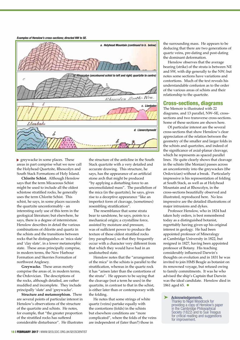
Cross-sections, diagramsThe Memoir is illustrated with 22 diagrams, and 13 parallel, NW–SE, cross-sections and two transverse cross-sections. Some of these sections are shown here.
Of particular interest are the several cross-sections that show Henslow’s clear appreciation of the relation between the geometry of the smaller and larger folds in the schists and quartzites, and indeed of the significance of axial-planar cleavage, which he represents as spaced parallel lines. He quite clearly shows that cleavage in the schists (the Monian) passes across an unconformity into the greywackes (the Ordovician) without a break. Particularly impressive is his representation of folding at South Stack, as well as at Holyhead Mountain and at Rhoscolyn, in the cross-sections beautifully observed and illustrated, reproduced here. No less impressive are the detailed illustrations of major intrusions and dykes.
Professor Henslow, who in 1824 had taken holy orders, is best remembered today as a distinguished botanist, regrettably having given up his original interest in geology. He had been appointed professor of Mineralogy at Cambridge University in 1822, but resigned in 1827, having been appointed professor of Botany. His teaching considerably influenced Darwin’s thoughts on evolution and in 1831 he was invited to join HMS Beagle as botanist on its renowned voyage, but refused owing to family commitments. It was he who advised the ship’s Captain that Darwin was the ideal candidate. Henslow died in 1861 aged 65. u
➤ Acknowledgements. Thanks to Nigel Woodcock for providing a copy of Henslow’s paper in the Cambridge Philosophical Society (1822) and to Sue Treagus for critical reading and suggestions for improvement.
18 | FEBRUARY 2017 | WWW.GEOLSOC.ORG.UK/GEOSCIENTIST
▼
Examples of Henslow’s cross-sections; directed NW to SE.
a. Holyhead Mountain (continued to b. below)
b. Rhoscolyn (uncoloured schist to left and right; quartzite to centre)
c. Llanbabo
d. Llanerchymedd
20 | FEBRUARY 2017 | WWW.GEOLSOC.ORG.UK/GEOSCIENTIST
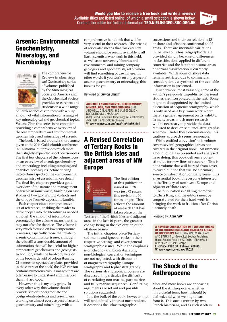
Mesozoic Biotas of Scandinavia and its Arctic Territories
This Geological Society Special Publication presents a number of papers encapsulating the latest research surrounding our understanding of the Mesozoic of
Scandinavia. It is a fascinating read, covering such a wide variety of topics from the pioneering work of Carl Wiman to papers looking at specific fossil bearing localities. The collection of 18 papers has something for everyone and provides an excellent starting point for anyone interested in the Mesozoic in general, or the specifics of the Mesozoic in this area.
Each paper complements the others and provides readers with the opportunity to recognise the many different methods that are now used in studying past palaeoenvironments. It shows the importance of working together to develop our understanding of the world (or previous worlds) around us. Any interdisciplinary book of this nature should have a wider readership, including as it does so many different papers on such a wide variety of
BOOKS & ARTS GEOSCIENTIST PUBLISHED 60 REVIEWS IN 2016!
FOR FULL LIST OF TITLES AVAILABLE, GO TO
WWW.GEOLSOC.ORG.UK/REVIEWS[ ]
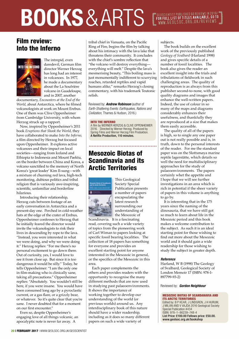
Film review: Into the Inferno
The intrepid, even daredevil, German film director Werner Herzog has long had an interest in volcanoes. In 1977, he made a documentary about the La Soufrière volcano in Guadeloupe, and in 2007, another
documentary, Encounters at the End of the World, about Antarctica, where he filmed volcanologists at work on Mount Erebus. One of them was Clive Oppenheimer from Cambridge University, with whom Herzog struck up a rapport.
Now, inspired by Oppenheimer’s 2011 book Eruptions that Shook the World, they have collaborated to make Into the Inferno, a film directed by Herzog but focused upon Oppenheimer. It explores active volcanoes and their impact on local societies—ranging from Iceland and Ethiopia to Indonesia and Mount Paektu, on the border between China and Korea, a volcano sanctified to the memory of North Korea’s ‘great leader’ Kim Il-sung—with a mixture of churning red lava, high-tech monitoring, dubious politics and tribal religion that is variously awe-inspiring, scientific, unfamiliar and borderline hilarious.
Introducing their relationship, Herzog cuts between footage of an early conversation in Antarctica and a present-day one. Perched in cold-weather hats at the edge of the crater of Erebus, Oppenheimer confesses to Herzog that he initially feared the director would invite the volcanologists to risk their lives in descending by rope to the lava. “Instead, you were interested in what we were doing, and why we were doing it.” Herzog replies: “For me there’s no personal excitement to go down there. Out of curiosity, yes, I would love to see it from close up. But since it is too dangerous it would be silly.” Today, he tells Oppenheimer: “I am the only one in film-making who is clinically sane, taking all precautions.” Oppenheimer replies: “Absolutely. You wouldn’t still be here, if you were insane. You would have been consumed long ago by a pyroclastic current, or a gas flare, or a grizzly bear, or whatever. So it’s quite clear that you’re sane. I never doubted that for a moment on our first encounter.”
Even so, despite Oppenheimer’s engaging love of all things volcanic, an apocalyptic note is never far away. A
tribal chief in Vanuatu, on the Pacific Ring of Fire, begins the film by talking about his intimacy with the lava lake that threatens their community. It concludes with the chief’s sombre reflection that “the volcano will destroy everything—everything will melt.” Despite the lava’s mesmerising beauty, “This boiling mass is just monumentally indifferent to scurrying roaches, retarded reptiles and vapid humans alike,” remarks Herzog’s closing commentary, with his trademark Teutonic relish.
Reviewed by: Andrew Robinson (author of Earth-Shattering Events: Earthquakes, Nations and Civilization, Thames & Hudson, 2016.)
subjects. The book builds on the excellent
work of the previously published Geology of Svalbard (Harland 1998) and gives specific details of a number of fossil localities. The book also gives the reader an excellent insight into the trials and tribulations of fieldwork in such challenging areas. The quality of reproduction is as always from this publisher second-to-none, with good quality diagrams and images that enhance the well-written papers. Indeed, the use of colour in so many of the maps and diagrams considerably enhances their usefulness, and thankfully they are reproduced at a size that makes them easily accessible.
The quality of all of the papers is high, so to single any one paper out is not really possible and is, in truth, down to the personal interests of the reader. For me the standout paper was on the Slottsmøya marine reptile lagerstätte, which details so well the need for multidisciplinary approaches for the study of palaeoenvironments. The papers certainly whet the appetite and I hope that we will see further investigations in an area which is rich in potential if the sheer variety of papers in this volume is anything to go by.
It is interesting that in the 175 years since the naming of the dinosauria, that we have still got so much to learn about life in the Mesozoic period and this book makes a welcome contribution to the subject. As such it is an ideal starting point for those wishing to find out more about the Mesozoic world and it should gain a wide readership for those wishing to study the subject in greater depth.
Reference Harland, W B (1998) The Geology of Svalbard, Geological Society of London Memoir 17 (ISBN: 978-1-897799-93-2)
Reviewed by: Gordon Neighbour
INTO THE INFERNO A film by WERNER HERZOG & CLIVE OPPENHEIMER 2016. Directed by Werner Herzog. Produced by Spring Films and Werner Herzog Film Produktion. A Netflix Production, 110 minutes.
MESOZOIC BIOTAS OF SCANDANAVIA AND ITS ARCTIC TERRITORIESEdited by: B P KEAR, J LINDGREN, J H HURUM, J MILÀN AND V VAJDA 2016 Geological Society Special Publication #434 ISBN: 978–1–86239–748-4 List Price: £100.00 Fellows price: £50.00. www.geolsoc.org.uk/bookshop
WWW.GEOLSOC.ORG.UK/GEOSCIENTIST | FEBRUARY 2017 | 21
A Revised Correlation of Tertiary Rocks in the British Isles and adjacent areas of NW Europe
The first edition of this publication issued in 1978 was just 72 pages; this revision is 10 times longer. This reflects the amount of research that has taken place on the
Tertiary of the British Isles and adjacent areas in the last 40 years, the greatest change being in the exploration of the offshore basins.
The initial chapters place Tertiary sediments and igneous rocks in their respective settings and cover general stratigraphic issues. While the emphasis is on chrono- and biostratigraphy, non-biological correlation techniques are not neglected, with discussion of magnetostratigraphy, isotope stratigraphy and tephrostratigraphy. The various stratigraphic problems are discussed, in particular the difficulty of correlating non-marine, part-marine and fully marine sequences. Conflicting arguments are set out and possible solutions suggested.
It is the bulk of the book, however, that will undoubtedly interest most readers. It describes the lithostratigraphic
The Shock of the Anthropocene
More and more books are appearing about the Anthropocene: whether it is a useful term, how it should be defined, and what we might learn from it. This one is written by two French historians, and as such it offers
Would you like to receive a free book and write a review? Available titles are listed online, of which a small selection is shown below.
Contact the editor for further information [email protected]
ARSENIC: ENVIRONMENTAL GEOCHEMISTRY, MINERALOGY, AND MICROBIOLOGY by R J BOWELL, C N ALPERS, H E JAMIESON, D K NORDSTROM & J MAZJLAN (Eds). 2014 Reviews in Mineralogy & Geochemistry #79. ISBH: 978-0-939950-94-2. W: www.minsocam.org/msa/rim/rim79.html
A REVISED CORRELATION OF TERTIARY ROCKS IN THE BRITISH ISLES AND ADJACENT AREAS OF NW EUROPE by FRED by KING C, GALE A S AND BARRY T L. Geological Society Publishing House Special Report #27, 2016. ISBN 978-1-86239-728-6, sbk. 724pp. List Price: £120.00. Fellows: £60.00. W: www.geolsoc.org.uk/SR027
successions and their correlation in 13 onshore and offshore continental shelf areas. There are inevitable variations in the level of lithostratigraphic detail provided simply because of differences in classifications applied in different countries and the fact that in some areas no formal classification is currently available. While some offshore data remain restricted due to commercial considerations, a synthesis of the available information is presented.
Furthermore, most valuably, some of the author’s previously unpublished personal studies are incorporated in the text. Some might be disappointed by the limited discussion of sequence stratigraphy, which is only used as a key framework where there is general agreement on its validity. In many areas, much more research will be necessary to provide the data required to develop sequence stratigraphic schemes. Under these circumstances, this cautious approach seems reasonable.
While entitled a ‘revision’, this volume covers several geographical areas not covered in the original book. An immense amount of data is presented and analysed. In so doing, this book delivers a potent stimulus for new lines of research. This is not a volume that will be read from cover to cover, but one that will be a primary source of information for many years. It is an essential book for everyone interested in the Tertiary of northwest Europe and adjacent offshore areas.
The publication is a fitting memorial to Chris King and the editors must be congratulated for their hard work in bringing the work to fruition after Chris’s untimely death.
Reviewed by: Alan Falk▼
Arsenic: Environmental Geochemistry, Mineralogy, and Microbiology
The comprehensive Reviews in Mineralogy and Geochemistry series of volumes published by the Mineralogical Society of America and the Geochemical Society provides researchers and students in a wide range
of Earth science disciplines with a huge amount of vital information on a range of key mineralogical and geochemical topics. Volume 79 in this series is no exception, providing a comprehensive overview of the low temperature and environmental geochemistry and mineralogy of arsenic.
The book is based around a short course given at the 2014 Goldschmidt conference in California, but provides much more than slightly expanded short course-notes. The first few chapters of the volume focus on an overview of arsenic geochemistry and mineralogy, including sampling and analytical techniques, before delving into certain aspects of the environmental geochemistry of arsenic in more detail. The final five chapters provide a good overview of the nature and management of arsenic in mine waste, finishing on case studies of two gold mining districts and the unique Tsumeb deposit in Namibia.
Each chapter cites a comprehensive list of references, enabling the reader to delve deeper into the literature as needed, although the amount of information presented by the volume means that this may not often be the case. The volume is very much focused on low temperature processes, especially those that relate to arsenic contamination issues, although there is still a considerable amount of information that will be useful for higher temperature geochemists and geologists. In addition, while the hardcopy version of the book is devoid of colour (barring 22 somewhat spectacular plates provided in the centre of the book) the PDF version contains numerous colour images that are often easier to understand and interpret than in hard copy.
However, this is my only gripe. In every other way this volume should provide senior undergraduate and postgraduate students and researchers working on almost every aspect of arsenic geochemistry and mineralogy with a
comprehensive handbook that will be very useful in their research. The pricing of series also means that this excellent volume should be readily available to all Earth scientists who work in this field, as well as to university libraries and environmental and mining company geologists and geochemists, all of whom will find something of use in here. In other words, if you work on any aspect of arsenic geochemistry or mineralogy, this book is for you.
Reviewed by: Simon Jowitt
Structural Geology
The importance of textbooks is quite often understated. A crucial tool for lecturers and students, a good textbook remains valuable well beyond graduation
- a memory-tool that reminds us of equations half-forgotten; and quality images and diagrams so often sorely lacking in online resources.
Fossen’s Structural Geology is one such book. Ideal for learning, each chapter builds upon the one before into a coherent and comprehensive course. However each is also self-contained, allowing a reader to delve into and explore any area in detail, perhaps for last-minute revision for an impending examination the following morning! Above all, a textbook must deliver information clearly, and Fossen fulfils this requirement admirably. There is no hint of verbose jargonese here.
The book’s quality shines best through its diagrams and images. Geology is a visual and physical science by nature, structural geology perhaps especially so; and to fully understand it requires good-quality illustrations and colour diagrams. Structural Geology is full of
BOOKS & ARTSan interesting and different perspective from many of those presently available.
The Anthropocene is the age of man, in that the human imprint on the global environment now
rivals natural forces. This book sets out to comprehend the Anthropocene through the narratives that can be made of it. It argues that the Anthropocene is not a crisis, in the sense that it is not a transitory state; rather it is a point of no return. It is not about being able to detect human influence in stratigraphy - it reflects a change in the Earth system.
At the core of the book is the argument that the Anthropocene has not come about unexpectedly, many of the consequences of changes, from deforestation in the late 18th Century to the atomic bomb, were discussed at the time. It argues that there is a grand narrative in which we all became geological agents without knowing it, and then élite scientists revealed to us the dramatic and uncertain future of the planet.
In such a narrative scientists are thought to be in command, and serious solutions can come only from experiments and above, not from below. Yet the case is made that we entered the Anthropocene despite very consistent warnings and knowledge, and that sustainable change happens from below, not above.
The notion that nature was always there and there was little we could do in our short human timescale to disturb it, separates the two views in the 19th Century. The history of Earth and life was the domain of natural scientists, and the history of man that of historians and social scientists. This constructed a great ‘external nature’ - slow, immense and undaunted - that made invisible the limits of the planet and the unequal socio-economic relations of nascent fossil-based capitalism.
The rise of geology reinforced this gap between the temporality of the Earth and the temporality of human history. It marked a shift from an understanding of the energy available on the surface (four hectares to make a ton of iron for example) to underground fossil energy that was sufficiently poorly constrained that it could be regarded as infinite. Geology had in a few decades transformed Malthus’ ‘dismal science’ into grounds for
limitless growth.The Anthropocene reverses this
separation between nature and society that had widened in the 19th and 20th Centuries. Nature is no longer viewed as the static scene of our exploits. The authors encourage us to take the measure of the forces of industrialisation and commodification, to challenge the unifying grand narrative of an errant human species, and to abandon the hope of emerging from a temporary environmental crisis. This is our new condition. What histories must we write as we learn to inhabit the Anthropocene? This book offers an excellent starting place.
Reviewed by: Chris Hawkesworth
THE SHOCK OF THE ANTHROPOCENEby CHRISTOPHE BONNEUIL & JEAN-BAPISTE FRESSOZ, Trans. David Fernbach. Verso (2016) ISBN-13: 978-1-78478-079-1 (pbk).List price: £16.99
STRUCTURAL GEOLOGY (2nd Edn.) by HAAKON FOSSEN, 2016. Published by Cambridge University Press. 524pp (hbk) ISBN-13: 978-1107057647 List Price: £50. W: http://folk.uib.no/nglhe/
FOR REVIEWBOOKS
Please contact [email protected] if you would like to supply a review. You will be invited to keep the review copy. See a full up-to-date list at www.geolsoc.org.uk/reviews
◆ NEW! 52 things you should know about rock physics by Matt Hall and Evan Bianco 2016 Agile Libre133 pp sbk◆ NEW! Subsurface Flow and Imaging by Donald Wyman Vasco and Akhil Datta-Gupta 2016 Cambridge UP., 354pp, hbk◆ NEW! Source to Sink Fluxes in undisturbed Cold Environments, by Beylich et al., (eds) 2016 Cambridge UP., 4-8pp, hbk◆ NEW! Developments in Engineering Geology EGSP #27 by Eggers M J et al., Geological Society of London 253pp, hbk.◆ Storm, Nature and Culture by John Withington. 190 pp sbk
them - not just pictures of structural formations, but also diagrams and graphs describing the processes so much more lucidly than can be achieved by even the most elegant prose or set of equations.
Fossen also maintains a website with a plethora of extra images, animated diagrams, and questions and answers that support the book (see reference below). Recent advances in structural geology have been made largely thanks to advances in imaging, and Fossen’s website highlights free programs that best make use of these developments in imaging and data-processing.
The difference between the 1st and 2nd editions is not major. Minor errors have been corrected, improvements made in formatting, and as you would expect, new advances incorporated. One unexpected change is that many of the original images have been exchanged for new, allowing even better preparation for fieldwork.
Although, by definition, a textbook is bound to be didactic, the lightness of Fossen’s prose means that it wears its intentions lightly – managing to entertain even the student in the midst of heavy revision. In short, when it comes to a set textbook for structural geology, Structural Geology will not fail you.
Reviewed by: Gabriel D’Arce
22 | FEBRUARY 2017 | WWW.GEOLSOC.ORG.UK/GEOSCIENTIST
GEOSCIENTIST PUBLISHED 60 REVIEWS IN 2016!
FOR FULL LIST OF TITLES AVAILABLE, GO TO
WWW.GEOLSOC.ORG.UK/REVIEWS[ ]
24 | FEBRUARY 2017 | WWW.GEOLSOC.ORG.UK/GEOSCIENTIST
PEOPLE NEWSIN MEMORIAM WWW.GEOLSOC.ORG.UK/OBITUARIES
Absalom, Sydney Stuart *Armitage, John *Ayers-Morgan, Christopher *Boyd, David Murray *Davis, Robert Vincent *Geddes, James D*§Glasby, Geoffrey Philip *Jenner-Clarke, Hugh Clifford David *Mendus, John Morgan, Daniel *
Palmer, Stephen J *Piffaretti, Joseph*Pipes, Kenneth P *Prichard, Hazel Rawcliffe, Eric *Roberts, John ColeSmith, Robert L *Stokes, David R *Van der Merwe, Roelef *Wright, Ernest *
In the interests of recording its Fellows’ work for posterity, the Society publishes obituaries online, and in Geoscientist. The most recent additions to the list are in shown in bold. Fellows for whom no obituarist has yet been commissioned are marked with an asterisk (*). The symbol § indicates that biographical material has been lodged with the Society.
If you would like to contribute an obituary, please email [email protected] to be commissioned. You can read the guidance for authors at www.geolsoc.org.uk/obituaries. To save yourself unnecessary work, please do not write anything until you have received a commissioning letter.
Deceased Fellows for whom no obituary is forthcoming have their names and dates recorded in a Roll of Honour at www.geolsoc.org.uk/obituaries.
THE SOCIETY NOTES WITH SADNESS THE PASSING OF:
CAROUSEL
All Fellows of the Society are entitled to entries in this column. Please email [email protected], quoting your Fellowsip number.
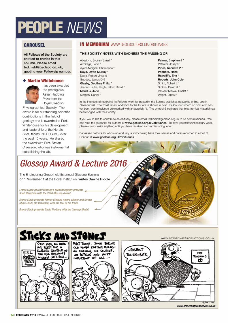
◆ Martin Whitehouse has been awarded the prestigious Assar Hadding Prize from the Royal Swedish
Physiographical Society. The award is for outstanding scientific contributions in the field of geology and is awarded to Prof. Whitehouse for his development and leadership of the Nordic SIMS facility, NORDSIMS, over the past 15 years. He shared the award with Prof. Stefan Claesson, who was instrumental establishing the lab.
www.stonechatproductions.co.uk
Glossop Award & Lecture 2016The Engineering Group held its annual Glossop Evening on 1 November 1 at the Royal Institution, writes Dawne Riddle
Emma Slack (Rudolf Glossop’s granddaughter) presents Scott Davidson with the 2016 Glossop Award.
Emma Slack presents former Glossop Award winner and former Chair, EGGS, Ian Davidson, with the tool of his trade.
Emma Slack presents David Norbury with the Glossop Medal.
WWW.GEOLSOC.ORG.UK/GEOSCIENTIST | FEBRUARY 2017 | 25
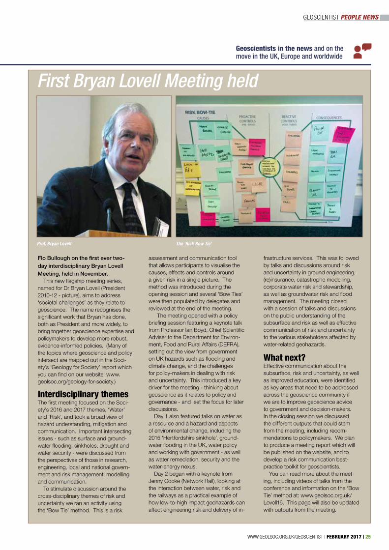
Geoscientists in the news and on the move in the UK, Europe and worldwide
Prof. Bryan Lovell The ‘Risk Bow Tie’
Flo Bullough on the first ever two-day interdisciplinary Bryan Lovell Meeting, held in November.
This new flagship meeting series, named for Dr Bryan Lovell (President 2010-12 - picture), aims to address ‘societal challenges’ as they relate to geoscience. The name recognises the significant work that Bryan has done, both as President and more widely, to bring together geoscience expertise and policymakers to develop more robust, evidence-informed policies. (Many of the topics where geoscience and policy intersect are mapped out in the Soci-ety’s ‘Geology for Society’ report which you can find on our website: www.geolsoc.org/geology-for-society.) Interdisciplinary themesThe first meeting focused on the Soci-ety’s 2016 and 2017 themes, ‘Water’ and ‘Risk’, and took a broad view of hazard understanding, mitigation and communication. Important intersecting issues - such as surface and ground-water flooding, sinkholes, drought and water security - were discussed from the perspectives of those in research, engineering, local and national govern-ment and risk management, modelling and communication.
To stimulate discussion around the cross-disciplinary themes of risk and uncertainty we ran an activity using the ‘Bow Tie’ method. This is a risk
First Bryan Lovell Meeting held
assessment and communication tool that allows participants to visualise the causes, effects and controls around a given risk in a single picture. The method was introduced during the opening session and several ‘Bow Ties’ were then populated by delegates and reviewed at the end of the meeting.
The meeting opened with a policy briefing session featuring a keynote talk from Professor Ian Boyd, Chief Scientific Adviser to the Department for Environ-ment, Food and Rural Affairs (DEFRA), setting out the view from government on UK hazards such as flooding and climate change, and the challenges for policy-makers in dealing with risk and uncertainty. This introduced a key driver for the meeting - thinking about geoscience as it relates to policy and governance - and set the focus for later discussions.
Day 1 also featured talks on water as a resource and a hazard and aspects of environmental change, including the 2015 ‘Hertfordshire sinkhole’, ground-water flooding in the UK, water policy and working with government - as well as water remediation, security and the water-energy nexus.
Day 2 began with a keynote from Jenny Cooke (Network Rail), looking at the interaction between water, risk and the railways as a practical example of how low-to-high impact geohazards can affect engineering risk and delivery of in-
frastructure services. This was followed by talks and discussions around risk and uncertainty in ground engineering, (re)insurance, catastrophe modelling, corporate water risk and stewardship, as well as groundwater risk and flood management. The meeting closed with a session of talks and discussions on the public understanding of the subsurface and risk as well as effective communication of risk and uncertainty to the various stakeholders affected by water-related geohazards.
What next? Effective communication about the subsurface, risk and uncertainty, as well as improved education, were identified as key areas that need to be addressed across the geoscience community if we are to improve geoscience advice to government and decision-makers. In the closing session we discussed the different outputs that could stem from the meeting, including recom-mendations to policymakers. We plan to produce a meeting report which will be published on the website, and to develop a risk communication best-practice toolkit for geoscientists.
You can read more about the meet-ing, including videos of talks from the conference and information on the ‘Bow Tie’ method at: www.geolsoc.org.uk/Lovell16. This page will also be updated with outputs from the meeting.
GEOSCIENTIST PEOPLE NEWS
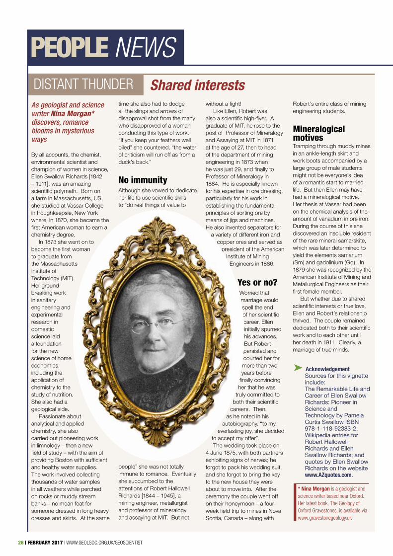
26 | FEBRUARY 2017 | WWW.GEOLSOC.ORG.UK/GEOSCIENTIST
DISTANT THUNDER
By all accounts, the chemist, environmental scientist and champion of women in science, Ellen Swallow Richards [1842 – 1911], was an amazing scientific polymath. Born on a farm in Massachusetts, US, she studied at Vassar College in Poughkeepsie, New York where, in 1870, she became the first American woman to earn a chemistry degree.
In 1873 she went on to become the first woman to graduate from the Massachusetts Institute of Technology (MIT). Her ground-breaking work in sanitary engineering and experimental research in domestic science laid a foundation for the new science of home economics, including the application of chemistry to the study of nutrition. She also had a geological side.
Passionate about analytical and applied chemistry, she also carried out pioneering work in limnology – then a new field of study – with the aim of providing Boston with sufficient and healthy water supplies. The work involved collecting thousands of water samples in all weathers while perched on rocks or muddy stream banks – no mean feat for someone dressed in long heavy dresses and skirts. At the same
time she also had to dodge all the slings and arrows of disapproval shot from the many who disapproved of a woman conducting this type of work. “If you keep your feathers well oiled” she countered, “the water of criticism will run off as from a duck’s back.”
No immunityAlthough she vowed to dedicate her life to use scientific skills to “do real things of value to
people” she was not totally immune to romance. Eventually she succumbed to the attentions of Robert Hallowell Richards [1844 – 1945], a mining engineer, metallurgist and professor of mineralogy and assaying at MIT. But not
without a fight! Like Ellen, Robert was
also a scientific high-flyer. A graduate of MIT, he rose to the post of Professor of Mineralogy and Assaying at MIT in 1871 at the age of 27, then to head of the department of mining engineering in 1873 when he was just 29, and finally to Professor of Mineralogy in 1884. He is especially known for his expertise in ore dressing, particularly for his work in establishing the fundamental principles of sorting ore by means of jigs and machines. He also invented separators for
a variety of different iron and copper ores and served as
president of the American Institute of Mining
Engineers in 1886.
Yes or no?Worried that marriage would spell the end of her scientific career, Ellen initially spurned his advances. But Robert persisted and courted her for more than two years before
finally convincing her that he was
truly committed to both their scientific
careers. Then, as he noted in his
autobiography, “to my everlasting joy, she decided
to accept my offer”. The wedding took place on
4 June 1875, with both partners exhibiting signs of nerves; he forgot to pack his wedding suit, and she forgot to bring the key to the new house they were about to move into. After the ceremony the couple went off on their honeymoon – a four-week field trip to mines in Nova Scotia, Canada – along with
Robert’s entire class of mining engineering students.
Mineralogical motivesTramping through muddy mines in an ankle-length skirt and work boots accompanied by a large group of male students might not be everyone’s idea of a romantic start to married life. But then Ellen may have had a mineralogical motive. Her thesis at Vassar had been on the chemical analysis of the amount of vanadium in ore iron. During the course of this she discovered an insoluble resident of the rare mineral samarskite, which was later determined to yield the elements samarium (Sm) and gadolinium (Gd). In 1879 she was recognized by the American Institute of Mining and Metallurgical Engineers as their first female member.
But whether due to shared scientific interests or true love, Ellen and Robert’s relationship thrived. The couple remained dedicated both to their scientific work and to each other until her death in 1911. Clearly, a marriage of true minds.
Shared interestsAs geologist and science writer Nina Morgan* discovers, romance blooms in mysterious ways
* Nina Morgan is a geologist and science writer based near Oxford. Her latest book, The Geology of Oxford Gravestones, is available via www.gravestonegeology.uk
➤ Acknowledgement Sources for this vignette include: The Remarkable Life and Career of Ellen Swallow Richards: Pioneer in Science and Technology by Pamela Curtis Swallow ISBN 978-1-118-92383-2; Wikipedia entries for Robert Hallowell Richards and Ellen Swallow Richards; and quotes by Ellen Swallow Richards on the website www.AZquotes.com.
PEOPLE NEWS
WWW.GEOLSOC.ORG.UK/GEOSCIENTIST | FEBRUARY 2017 | 27
GEOSCIENTIST CALENDAR
Can’t find your meeting? Visit
www.geolsoc.org.uk/listings
Full, Accurate, Up-To-Date[ ]
Geology of England
Geology of Scotland
Lapworth’s Logs
8-10 February
10-12 February
n/a
Higham Hall College, Bassenthwaite Lake, Cockermouth, Cumbria. Led by Dr Annette McGrath. Fees. See website. Tel: 017687 76276 E: [email protected]
Higham Hall College, Bassenthwaite Lake, Cockermouth, Cumbria. Led by Dr Annette McGrath. Fees. See website. Tel: 017687 76276 E: [email protected]
‘Lapworth’s Logs’ is a series of e-courses involving practical exercises of increasing complexity. Contact: [email protected]. Lapworth’s Logs is produced by Michael de Freitas and Andrew Thompson.
COURSE DATE VENUE AND DETAILS
ENDORSED TRAINING/CPD
Key elements of near-mine gold explorationSouthern Wales Regional
Early Career Geoscientists EveningSouth West Regional
Dinner LectureGeological Society Discussion
London LectureBurlington House
The Bristol Portway - protecting against rock falls
Western RegionalAnnual General Meeting & Early Careers AwardWestern Regional
University Geoscience UK: ‘Future Science - a vision for the next 25 years’
Geological Society, University Geoscience UK (CHUGD), Royal Astronomical Society, British Geological Survey
7 February
8 February
8 February
8 February
14 February
21 February
21-22 February
Venue: LT 1.40 Cardiff University, Main Building, CF10 3AT. Time: 1730 for 1800. Speaker: Dr Chris Bonson, SRK. Contact Simon Hughes. E: [email protected].
Venue: University of Exeter, Penryn Campus, Penryn, Cornwall TR10 9FE. Time: 1830 for 1900. Contact: Sam Hughes E: [email protected]
Venue: Athenaeum Club, Pall Mall. Time: 1830 for 1900. Attendance at the Discussion Group dinner meeting costs £57 per person, for four courses, coffee and port. There is a cash bar for the purchase of wine and other drinks. Contact Caroline Seymour BY FEB 01! E: [email protected]
Venue: Burlington House. See p. 08 for details.
Venue: See website. Speakers: Robert Benton and Robert MacKean. Contact E: [email protected]
Venue: See website. Contact E: [email protected]
Venue: Burlington House.The overarching aim of this meeting is to explore the future and the research challenges for the UK Geoscience Community over the next generation. See website for details. Contact Vicky Hards E: [email protected]
COURSE DATE VENUE AND DETAILS
DIARY OF MEETINGS 2017 PLEASE NOTE THAT THERE ARE MANY MORE MEETINGS FOR WHICH WE DO NOT HAVE SPACE. ALWAYS CHECK WITH WWW.GEOLSOC.ORG.UK/LISTINGS
CENTURY ONE PUBLISHING
AND ADVERTISING SALES AGENCY.
IS THE UK’S BRIGHTEST AWARD-WINNINGCONTRACT PUBLISHING
To plan your ad campaign in Geoscientist magazine contact:
Hayden McIntosht: 01727 739 184e: [email protected]: www.centuryonepublishing.uk
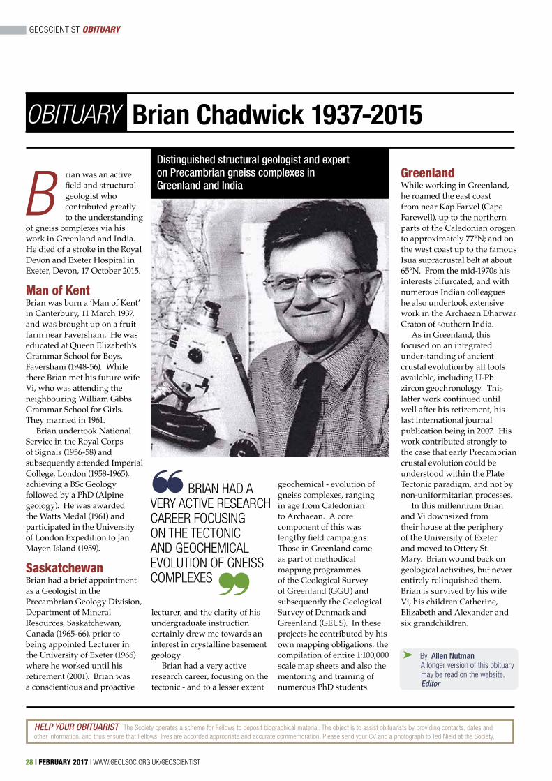
rian was an active field and structural geologist who contributed greatly to the understanding
of gneiss complexes via his work in Greenland and India. He died of a stroke in the Royal Devon and Exeter Hospital in Exeter, Devon, 17 October 2015.
Man of KentBrian was born a ‘Man of Kent’ in Canterbury, 11 March 1937, and was brought up on a fruit farm near Faversham. He was educated at Queen Elizabeth’s Grammar School for Boys, Faversham (1948-56). While there Brian met his future wife Vi, who was attending the neighbouring William Gibbs Grammar School for Girls. They married in 1961.
Brian undertook National Service in the Royal Corps of Signals (1956-58) and subsequently attended Imperial College, London (1958-1965), achieving a BSc Geology followed by a PhD (Alpine geology). He was awarded the Watts Medal (1961) and participated in the University of London Expedition to Jan Mayen Island (1959).
SaskatchewanBrian had a brief appointment as a Geologist in the Precambrian Geology Division, Department of Mineral Resources, Saskatchewan, Canada (1965-66), prior to being appointed Lecturer in the University of Exeter (1966) where he worked until his retirement (2001). Brian was a conscientious and proactive
lecturer, and the clarity of his undergraduate instruction certainly drew me towards an interest in crystalline basement geology.
Brian had a very active research career, focusing on the tectonic - and to a lesser extent
geochemical - evolution of gneiss complexes, ranging in age from Caledonian to Archaean. A core component of this was lengthy field campaigns. Those in Greenland came as part of methodical mapping programmes of the Geological Survey of Greenland (GGU) and subsequently the Geological Survey of Denmark and Greenland (GEUS). In these projects he contributed by his own mapping obligations, the compilation of entire 1:100,000 scale map sheets and also the mentoring and training of numerous PhD students.
GreenlandWhile working in Greenland, he roamed the east coast from near Kap Farvel (Cape Farewell), up to the northern parts of the Caledonian orogen to approximately 77°N; and on the west coast up to the famous Isua supracrustal belt at about 65°N. From the mid-1970s his interests bifurcated, and with numerous Indian colleagues he also undertook extensive work in the Archaean Dharwar Craton of southern India.
As in Greenland, this focused on an integrated understanding of ancient crustal evolution by all tools available, including U-Pb zircon geochronology. This latter work continued until well after his retirement, his last international journal publication being in 2007. His work contributed strongly to the case that early Precambrian crustal evolution could be understood within the Plate Tectonic paradigm, and not by non-uniformitarian processes.
In this millennium Brian and Vi downsized from their house at the periphery of the University of Exeter and moved to Ottery St. Mary. Brian wound back on geological activities, but never entirely relinquished them. Brian is survived by his wife Vi, his children Catherine, Elizabeth and Alexander and six grandchildren.
GEOSCIENTIST OBITUARY
Distinguished structural geologist and expert on Precambrian gneiss complexes in Greenland and India
Brian Chadwick 1937-2015
B
OBITUARY
HELP YOUR OBITUARIST The Society operates a scheme for Fellows to deposit biographical material. The object is to assist obituarists by providing contacts, dates and other information, and thus ensure that Fellows’ lives are accorded appropriate and accurate commemoration. Please send your CV and a photograph to Ted Nield at the Society.
BRIAN HAD A VERY ACTIVE RESEARCH CAREER FOCUSING ON THE TECTONIC AND GEOCHEMICAL EVOLUTION OF GNEISS COMPLEXES
~
~
28 | FEBRUARY 2017 | WWW.GEOLSOC.ORG.UK/GEOSCIENTIST
➤ By Allen Nutman A longer version of this obituary may be read on the website. Editor
GEOSCIENTIST CROSSWORD
WWW.GEOLSOC.ORG.UK/GEOSCIENTIST | FEBRUARY 2017 | 29
ACROSS DOWN
CROSSWORD NO.209 SET BY PLATYPUS
7 (With 12a) Faulting phenomenon in which the curvature of the 21d is contrary to the sense of displacement (7,4)8 Pertaining to negatively charged ions (7)10 Willows grow this way across brooks, according to Shakespeare (6)11 Priesthoods (8)12 See 7a (4)13 Late Precambrian, approximately equaivalent to the Riphean (10)14 Regular movement back and forth (11)19 Printout of a machine that monitors ground shaking (10)22 Mediterranean island ere seeing which Napoleon was able (4)23 Mill wheel over which the stream passes from top to bottom (8)24 Repeated use of old material without significant alteration (6)25 Oil used in extremis (7)26 Wind-borne (7)
1 Erupting thermal waterspouts (7)2 Metric to kilometric-scale bodies of rock composed of chaotic blocks within a finer matrix (8)3 Primary African biological vectors of trypanosomes (6)4 To stop for a time (8)5 A chronicler of the mud (6)6 Anything that comes from the Earth (7)9 Needle-like pointiness (11)15 Line of equal time (8)16 Uncased (4,4)17 Digging deeply; for example, in the Earth (7)18 Deepest ocean (7)20 Smith’s nickname (6)21 Distinctive horizon or bed, useful in lithostratigraphy (6)
The winner of the November Crossword puzzle prize draw was Carrie Soderman of Solihull, UK.
All correct solutions will be placed in the draw, and the winner’s name printed in the April 2017 issue. The Editor’s decision is final and no correspondence will be entered into. Closing date - February 17.
The competition is open to all Fellows, Candidate Fellows and Friends of the Geological Society who are not current Society employees, officers or trustees. This exclusion does not apply to officers of joint associations, specialist or regional groups.
Please return your completed crossword to Burlington House, marking your envelope “Crossword”. Do not enclose any other matter with your solution. Overseas Fellows are encouraged to scan the signed form and email it as a PDF to [email protected]
Name ....................................................
...............................................................
Membership number ...........................
Address for correspondence ..............
...............................................................
...............................................................
...............................................................
...............................................................
...............................................................
Postcode ..............................................
WIN A SPECIALPUBLICATION!
SOLUTIONS NOVEMBERAcross: 7 Keratin 8 Enzymes 10 Domain 11 Ecliptic 12 Kepi 13 Yugoslavia14 Metatarsals 19 Nottingham22 Noel 23 Dulcimer 24 Ludlow25 Ancient 26 Reclaim
Down: 1 Kerogen 2 Kamacite 3 Kidney 4 Analysis5 Myopia 6 Semitic 9 Geographers 15 Agnomens 16 Lonsdale 17 Coquina 18 Meiosis 20 Tocsin 21 Miller

Training Courses
Operations & Wellsite GeologyBasic Drilling Technology
MudloggingWireline & LWD Log Interpretation
Formation Pressure Evaluation
www.stag-geological.com
3 Fortuna CourtCalleva ParkAldermastonReading U.K.
RG7 8UB
Como Corporate CentreSuite 22, 11 Preston
StreetComo
WA 6152West Australia
Westpoint HousePavilion 2, Prospect ParkProspect RoadArnhall Business ParkWesthillAberdeenshireAB32 6FJ
Contact Martin Saunders: [email protected] +44 (0) 118 982 0151
STAG Training courses recognised by The Geological Society
We are pleased to announce that the following courses have received full accreditation:
WO1: Introduction to Drilling & Wellsite GeologyG2: Operations & Wellsite GeologistFE1: Basic Log InterpretationP1: Formation Pressure Evaluation
Measured Distance
Dep
thof
Inve
stig
atio
n
Boundary/Fluid Contact
Course Dates 2017
February06-10 WO1: Introduction to Drilling & WSG Reading13-15 P1: Formation Pressure Evaluation Reading
March22-24 FE1: Basic Log Interpretation Reading27-30 G2: Operations & Wellsite Geologist Reading
April03-07 WO1: Introduction to Drilling & WSG Reading24-26 P1: Formation Pressure Evaluation Reading
May03-05 FE1: Basic Log Interpretation Reading08-11 G2: Operations & Wellsite Geologist Reading
June05-09 WO1: Introduction to Drilling & WSG Reading
July05-07 FE1: Basic Log Interpretation Reading10-12 G2: Operations & Wellsite Geologist Reading
30 | DECEMBER 2016/JANUARY 2017 | WWW.GEOLSOC.ORG.UK/GEOSCIENTIST
CENTURY ONE PUBLISHINGIS THE UK’S BRIGHTEST AWARD-WINNINGCONTRACT PUBLISHINGAND ADVERTISING SALES AGENCY.WE WORK EXCLUSIVELY WITH MEMBERSHIP ORGANISATIONS GENERATINGADVERTISING REVENUESAND MANAGINGALL OR PART OF THEPUBLISHING FUNCTION
To plan your ad campaign in Geoscientist contact:Hayden McIntosht: 01727 739 184e: [email protected]: www.centuryonepublishing.uk