Embed Size (px)
Citation preview
Esri International User Conference | San Diego, CA Technical Workshops |
Geostatistical Analyst - An Introduction
Steve Lynch and Eric Krause Redlands, CA
July 2012
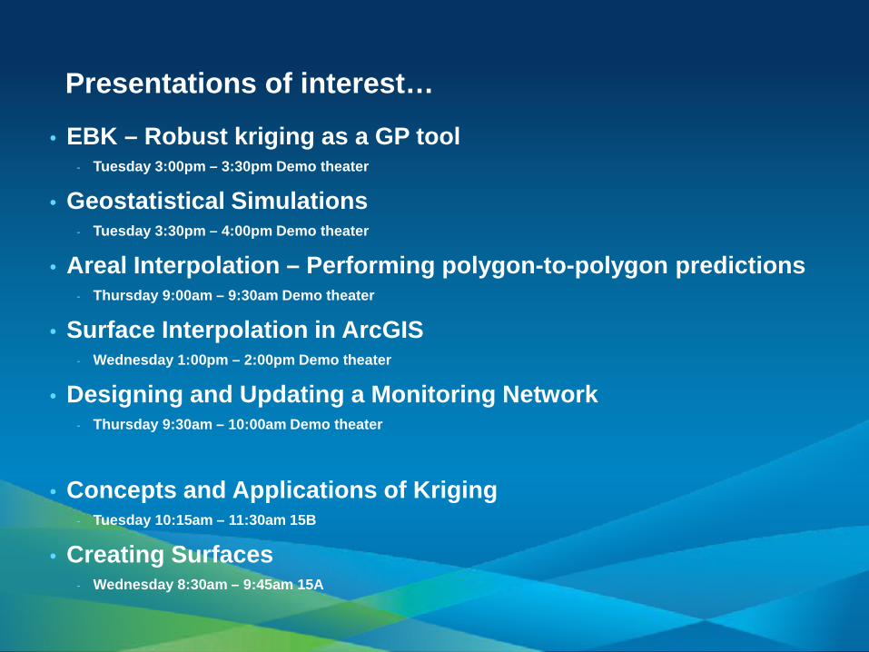
Presentations of interest…
• EBK – Robust kriging as a GP tool - Tuesday 3:00pm – 3:30pm Demo theater
• Geostatistical Simulations - Tuesday 3:30pm – 4:00pm Demo theater
• Areal Interpolation – Performing polygon-to-polygon predictions - Thursday 9:00am – 9:30am Demo theater
• Surface Interpolation in ArcGIS - Wednesday 1:00pm – 2:00pm Demo theater
• Designing and Updating a Monitoring Network - Thursday 9:30am – 10:00am Demo theater
• Concepts and Applications of Kriging - Tuesday 10:15am – 11:30am 15B
• Creating Surfaces - Wednesday 8:30am – 9:45am 15A
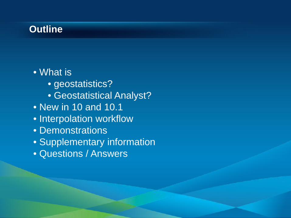
Outline
• What is • geostatistics? • Geostatistical Analyst?
• New in 10 and 10.1 • Interpolation workflow • Demonstrations • Supplementary information • Questions / Answers
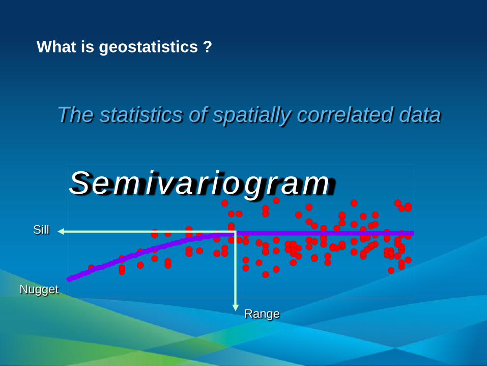
What is geostatistics ?
Range
Sill
Nugget
The statistics of spatially correlated data
Semivariogram
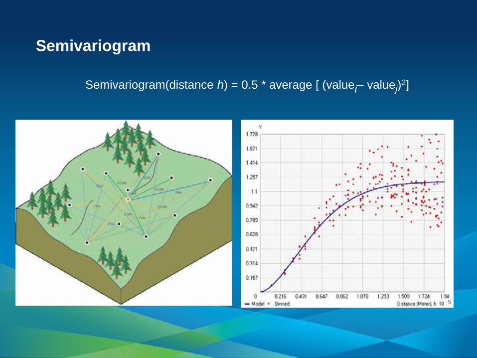
Semivariogram
Semivariogram(distance h) = 0.5 * average [ (valuei– valuej)2]
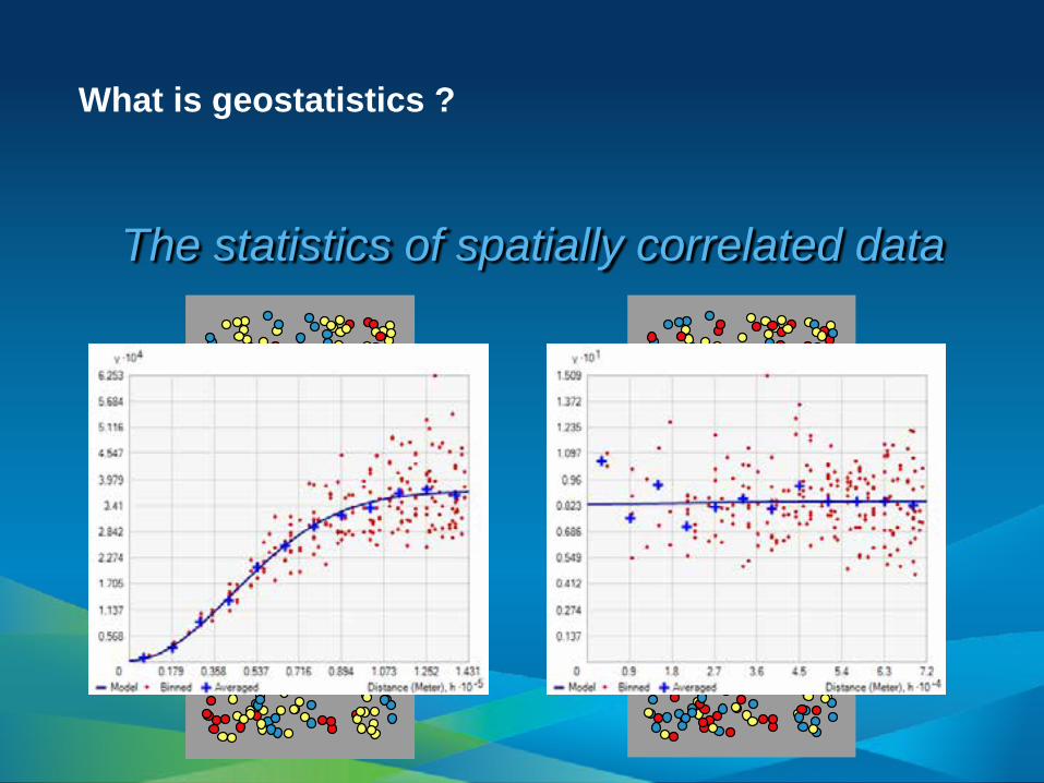
What is geostatistics ?
The statistics of spatially correlated data
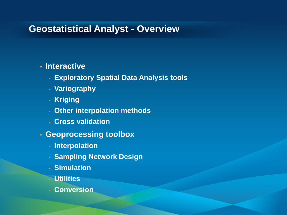
Geostatistical Analyst - Overview
• Interactive - Exploratory Spatial Data Analysis tools - Variography - Kriging - Other interpolation methods - Cross validation
• Geoprocessing toolbox - Interpolation - Sampling Network Design - Simulation - Utilities - Conversion
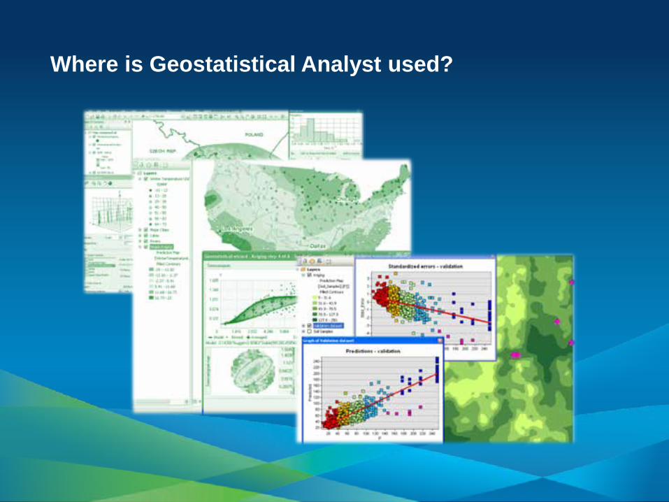
Where is Geostatistical Analyst used?
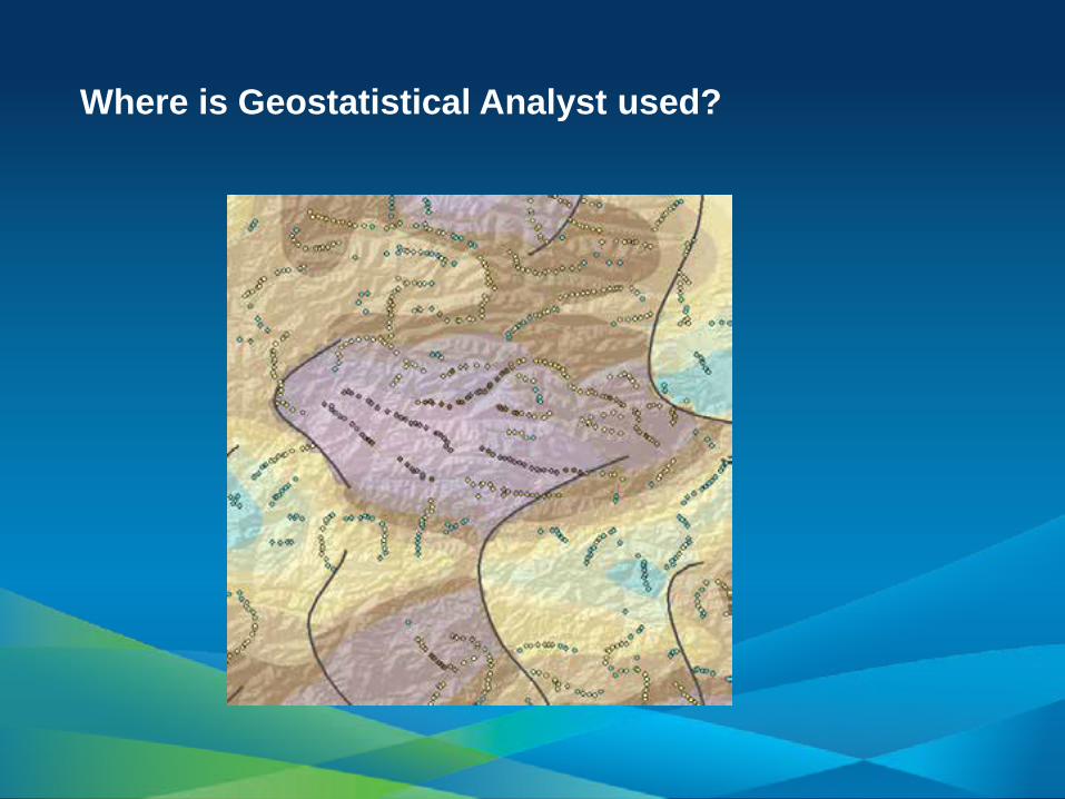
Where is Geostatistical Analyst used?
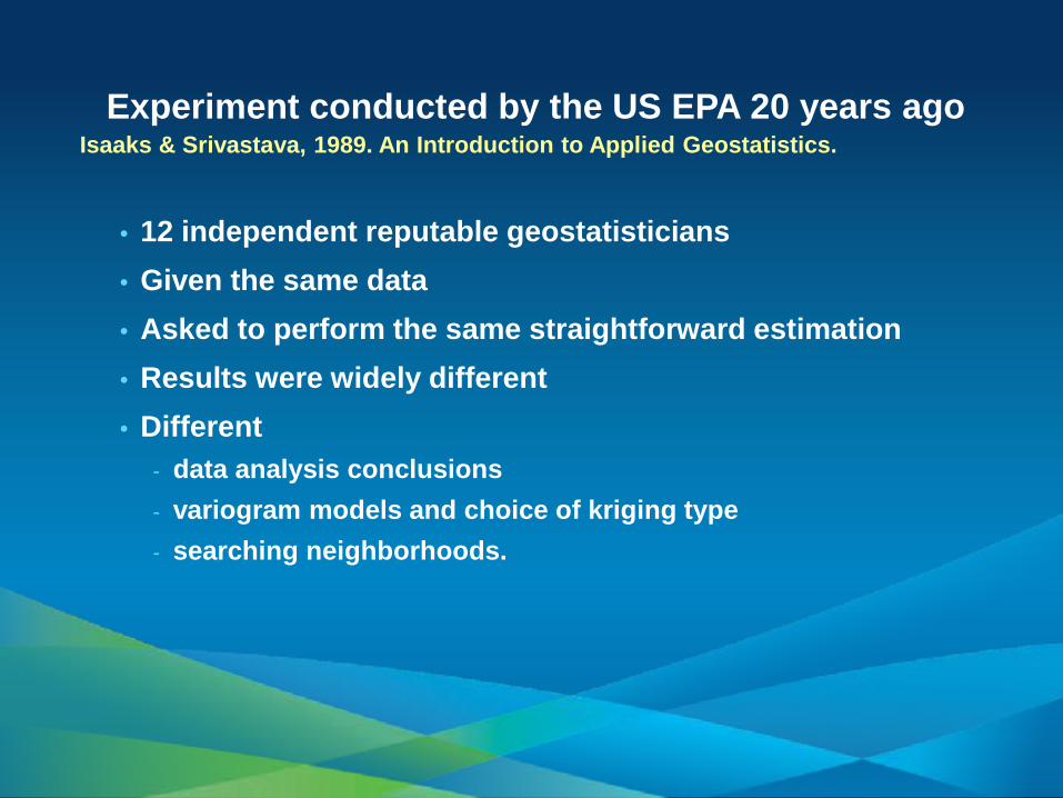
• 12 independent reputable geostatisticians • Given the same data • Asked to perform the same straightforward estimation • Results were widely different • Different
- data analysis conclusions - variogram models and choice of kriging type - searching neighborhoods.
Experiment conducted by the US EPA 20 years ago Isaaks & Srivastava, 1989. An Introduction to Applied Geostatistics.
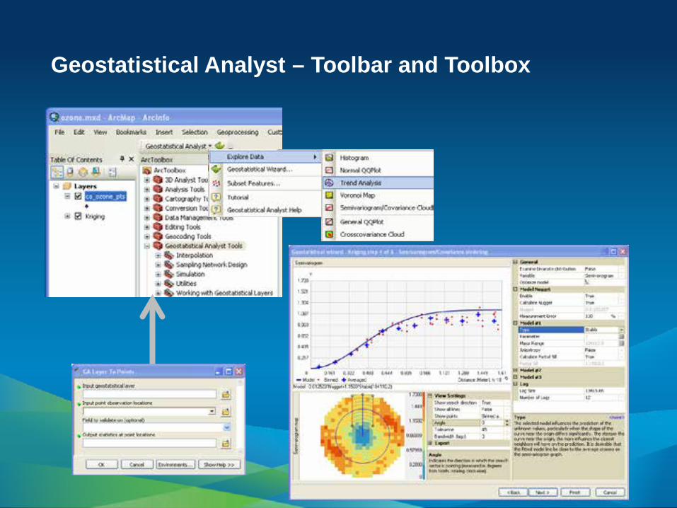
Geostatistical Analyst – Toolbar and Toolbox
Demonstration
Geostatistical Wizard
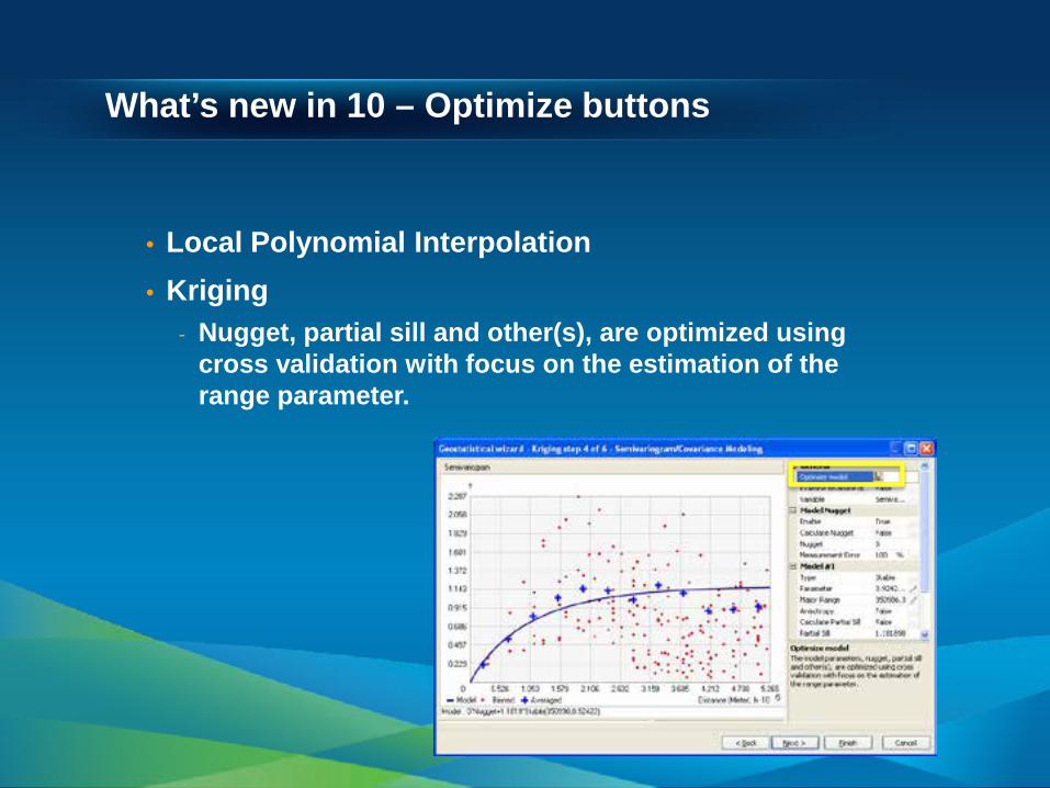
What’s new in 10 – Optimize buttons
• Local Polynomial Interpolation • Kriging
- Nugget, partial sill and other(s), are optimized using cross validation with focus on the estimation of the range parameter.
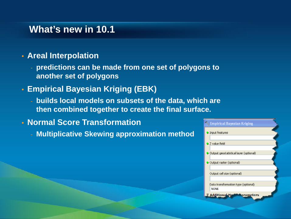
What’s new in 10.1
• Areal Interpolation - predictions can be made from one set of polygons to
another set of polygons
• Empirical Bayesian Kriging (EBK) - builds local models on subsets of the data, which are
then combined together to create the final surface.
• Normal Score Transformation - Multiplicative Skewing approximation method
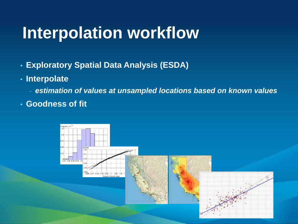
Interpolation workflow
• Exploratory Spatial Data Analysis (ESDA) • Interpolate
- estimation of values at unsampled locations based on known values
• Goodness of fit
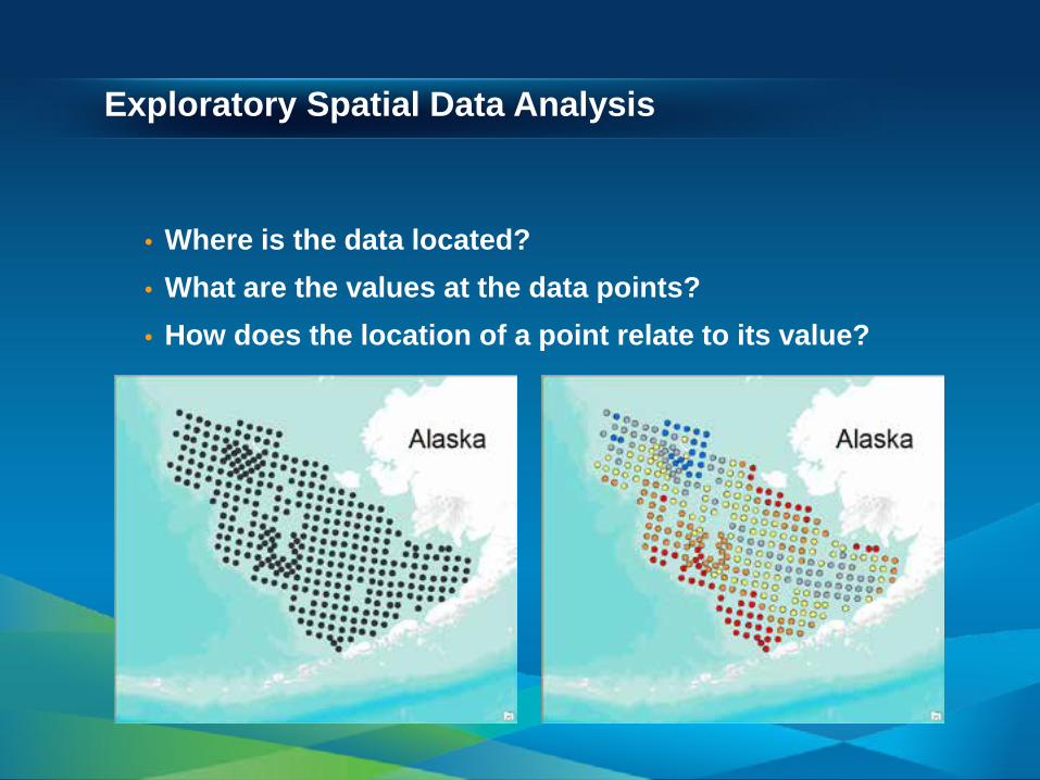
Exploratory Spatial Data Analysis
• Where is the data located? • What are the values at the data points? • How does the location of a point relate to its value?
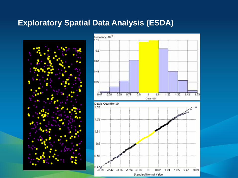
Exploratory Spatial Data Analysis (ESDA)
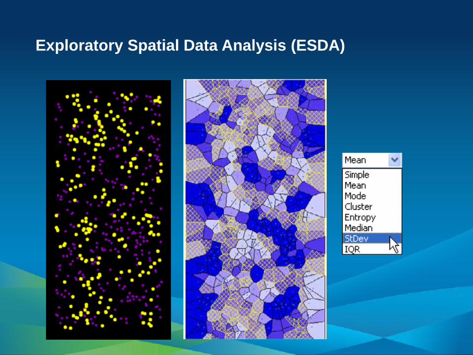
Exploratory Spatial Data Analysis (ESDA)
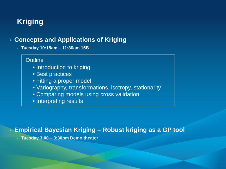
Kriging
• Concepts and Applications of Kriging - Tuesday 10:15am – 11:30am 15B
• Empirical Bayesian Kriging – Robust kriging as a GP tool - Tuesday 3:00 – 3:30pm Demo theater
Outline • Introduction to kriging • Best practices • Fitting a proper model • Variography, transformations, isotropy, stationarity • Comparing models using cross validation • Interpreting results
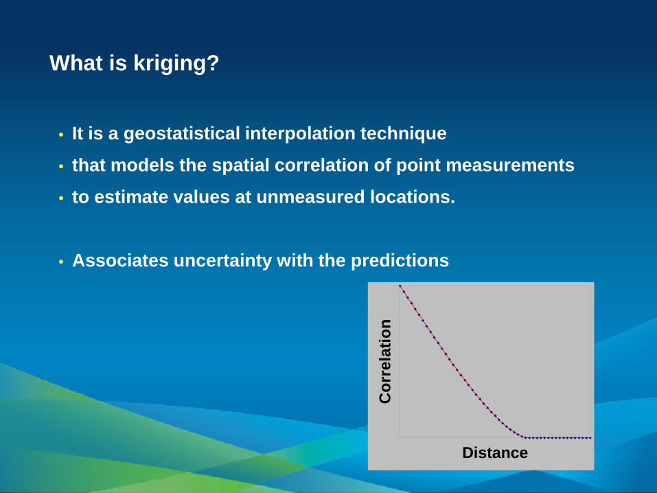
What is kriging?
• It is a geostatistical interpolation technique • that models the spatial correlation of point measurements • to estimate values at unmeasured locations.
• Associates uncertainty with the predictions
Distance
Cor
rela
tion
Demonstration Kriging
Empirical Bayesian Kriging (EBK)
• automates the most difficult aspects of building a valid kriging model
• estimates the semivariogram through repeated simulations • can handle non-stationary input data.
Unlike other kriging methods (use weighted least squares), the semivariogram parameters in EBK are estimated using restricted maximum likelihood (REML).
New in ArcGIS 10.1

For a given distance h, the semivariogram model: γ(h)= Nugget + b|h|α
Empirical Bayesian Kriging (cont)
• Advantages - Requires minimal interactive modeling - Allows accurate predictions of non-stationary data - More accurate than other kriging methods for small datasets - Geoprocessing tool
• Disadvantages - Processing is slower than other kriging methods. - Cokriging and anisotropy are unavailable.
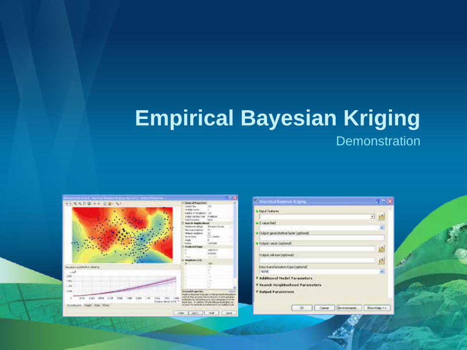
Demonstration Empirical Bayesian Kriging
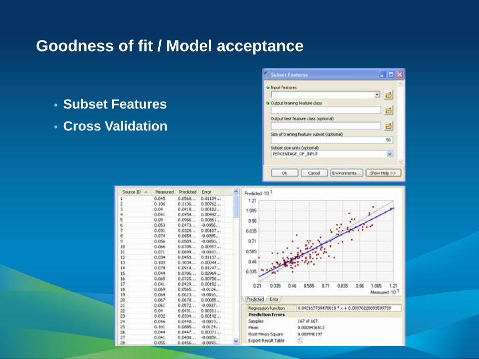
Goodness of fit / Model acceptance
• Subset Features • Cross Validation
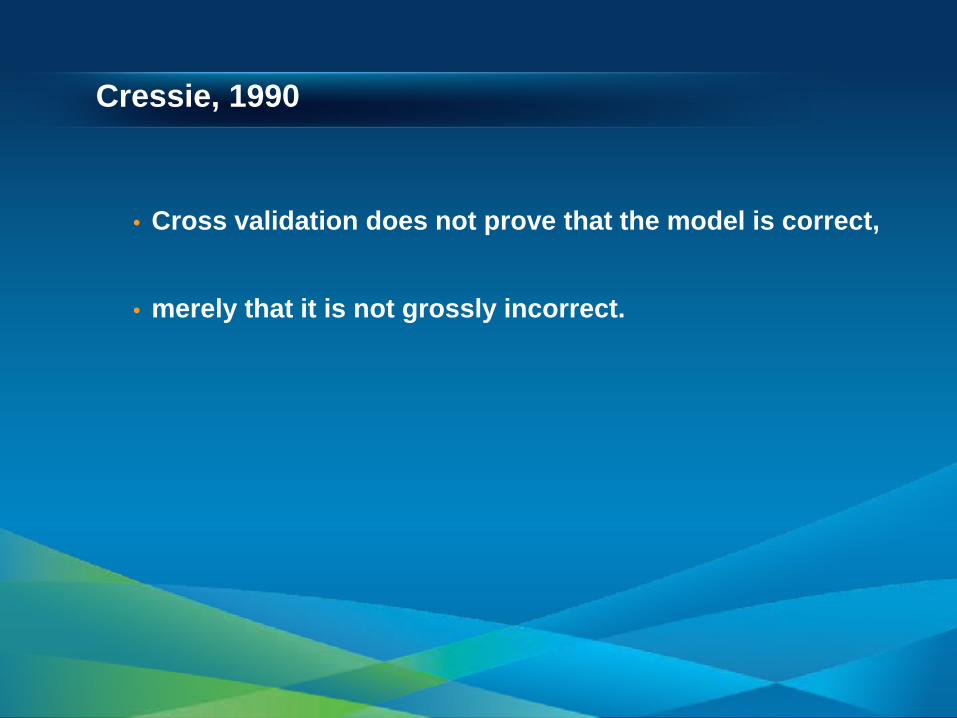
Cressie, 1990
• Cross validation does not prove that the model is correct,
• merely that it is not grossly incorrect.
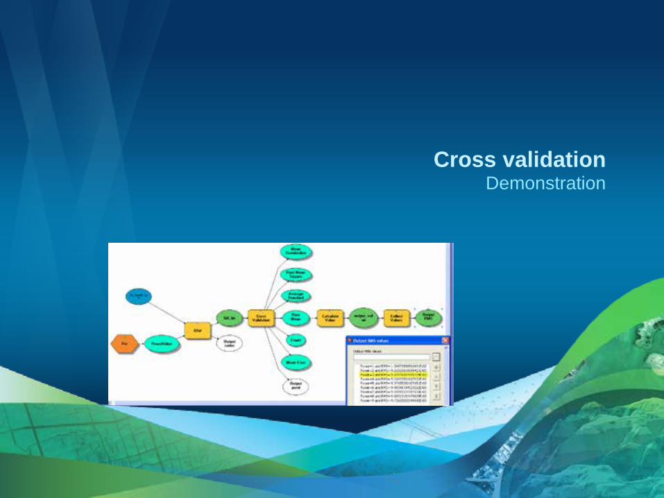
Demonstration Cross validation
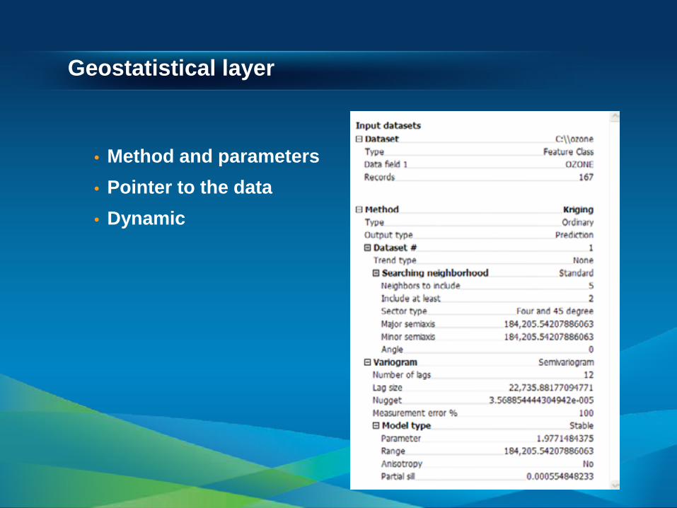
Geostatistical layer
• Method and parameters • Pointer to the data • Dynamic
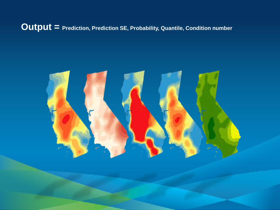
Output = Prediction, Prediction SE, Probability, Quantile, Condition number
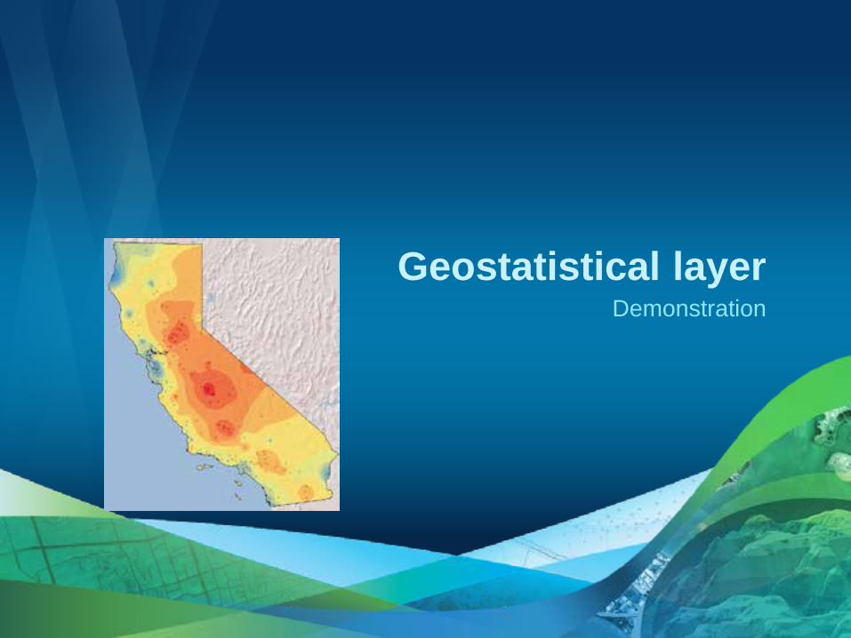
Demonstration Geostatistical layer
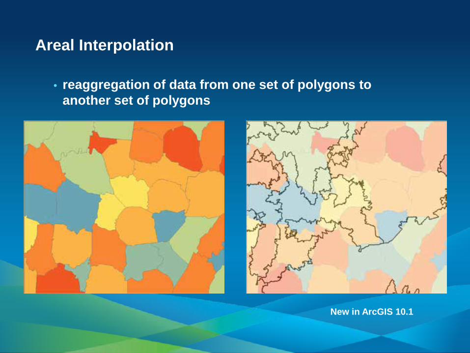
Areal Interpolation
• reaggregation of data from one set of polygons to another set of polygons
New in ArcGIS 10.1
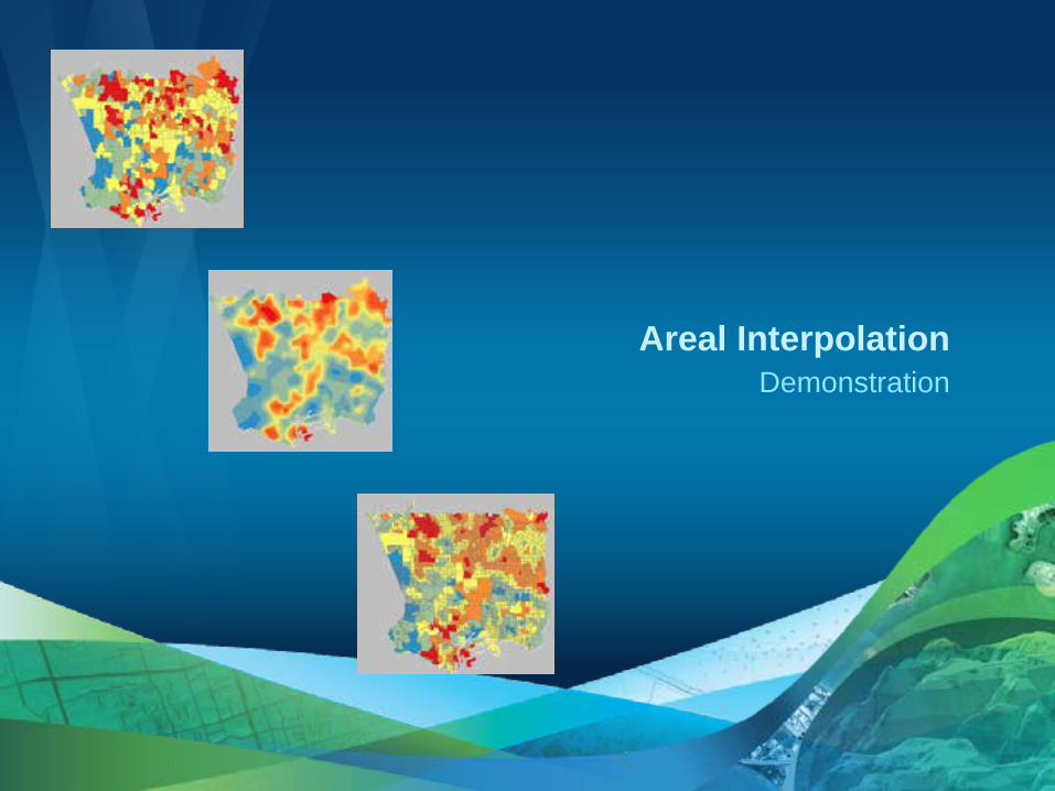
Demonstration Areal Interpolation

Areal Interpolation Thursday 9:00am – 9:30am
Demo theater

N = 8 N = 100 N = 500
Simple kriging
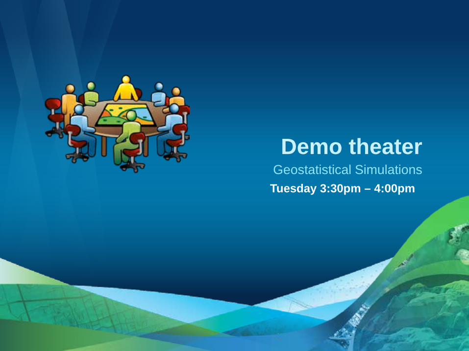
Geostatistical Simulations Tuesday 3:30pm – 4:00pm
Demo theater
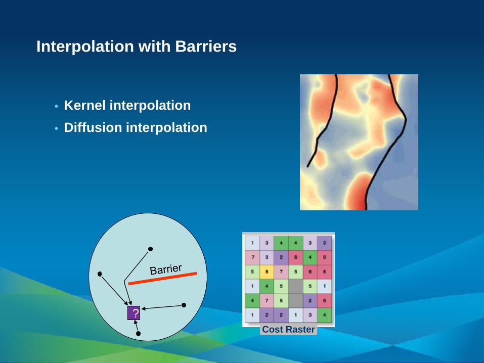
Interpolation with Barriers
• Kernel interpolation • Diffusion interpolation
? Cost Raster
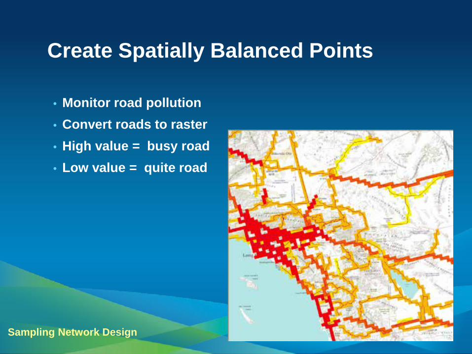
Create Spatially Balanced Points
Sampling Network Design
• Monitor road pollution • Convert roads to raster • High value = busy road • Low value = quite road
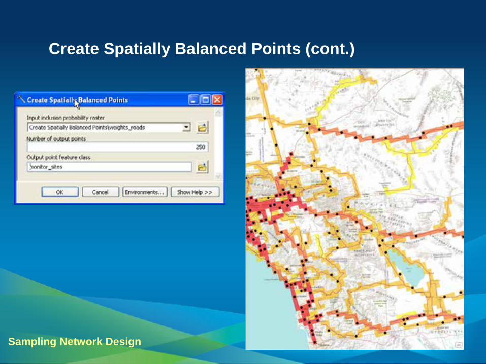
Create Spatially Balanced Points (cont.)
Sampling Network Design
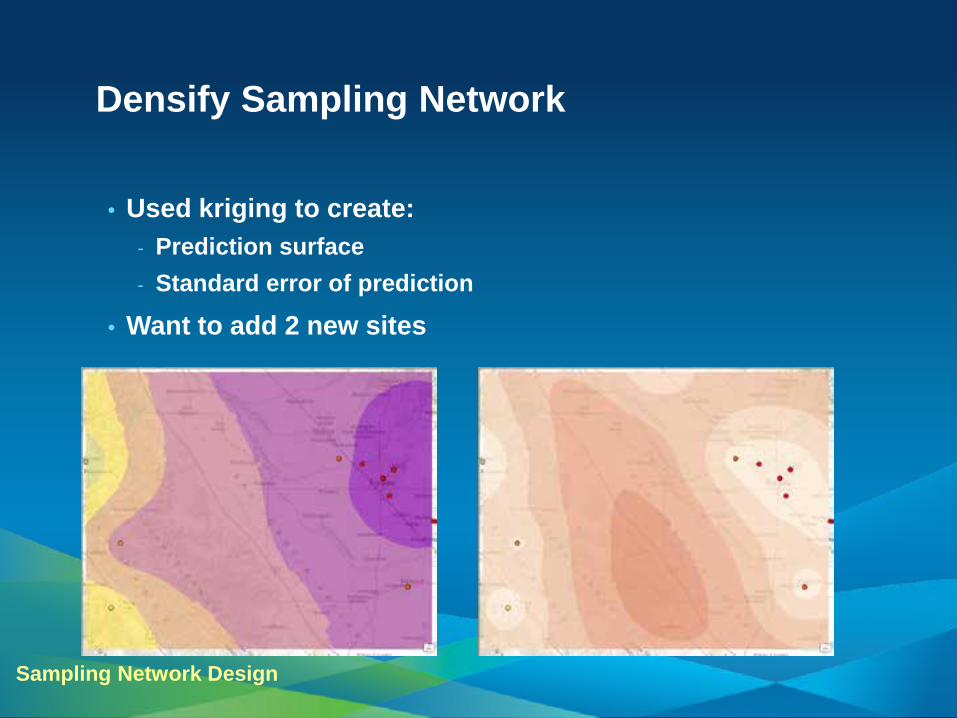
Densify Sampling Network
Sampling Network Design
• Used kriging to create: - Prediction surface - Standard error of prediction
• Want to add 2 new sites
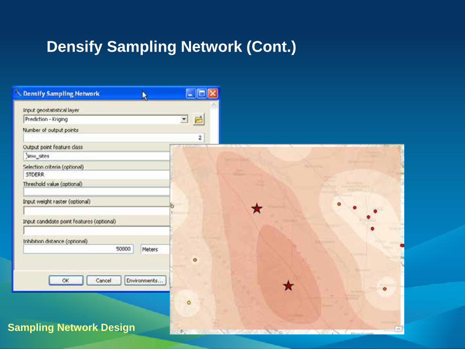
Densify Sampling Network (Cont.)
Sampling Network Design

Designing and Updating a Monitoring Network Thursday 9:30am – 10:00am
Demo theater

resources.arcgis.com


http://esripress.esri.com

• Thank you for attending
• Have fun at UC2012
• Open for Questions
• Please fill out the evaluation:
www.esri.com/ucsessionsurveys
First Offering ID: 637
Second Offering ID: 812