Embed Size (px)
Citation preview
GeoGeoSURSUR
Eric van Praag, GeoSUR Coordinator CAF – The Development Bank of Latin America
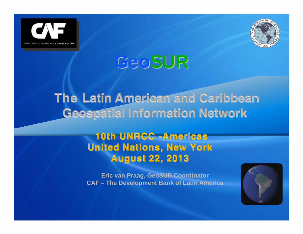
n Area: 21 MM Km2
n Population: 610 MM
n GDP: $ 5.16 trillion
n Countries: 33
n Biodiversity: Highest in the world
n 2050 projection: 2 LAC economies among the worlds 5 biggests (Goldman Sachs)
Scope: Latin America and the Caribbean
21 MM Km2
4.3 MM Km2
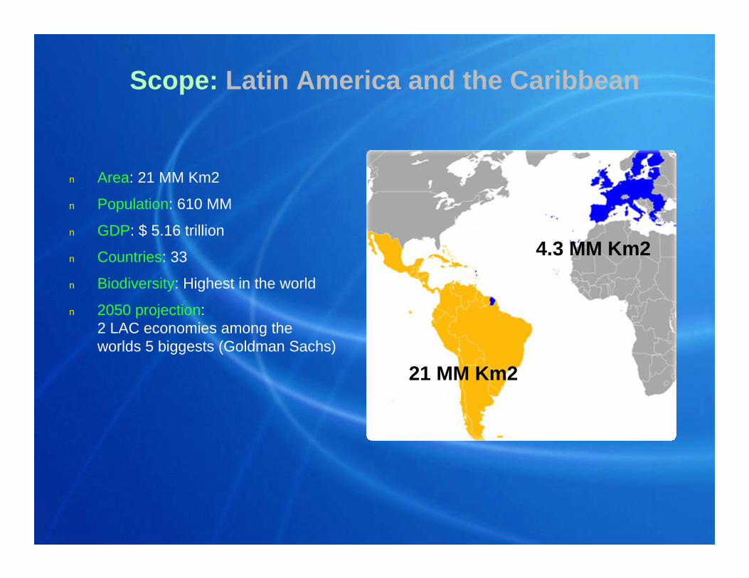
n Supports sustainable development, integration and competitiveness
n Type A member countries : Argentina, Bolivia, Brasil, Colombia, Ecuador, Panamá, Paraguay, Perú, Uruguay and Venezuela
n Type C member countries: Chile, Costa Rica, España, Portugal, Jamaica, México, Portugal, República Dominicana and Trinidad & Tobago
CAF – the Latin American Development Bank
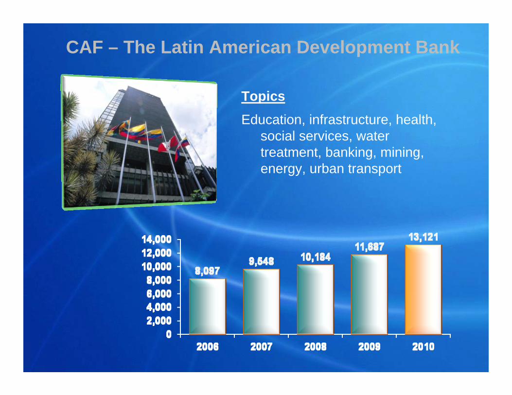
TopicsEducation, infrastructure, health,
social services, water treatment, banking, mining, energy, urban transport
CAF – The Latin American Development Bank
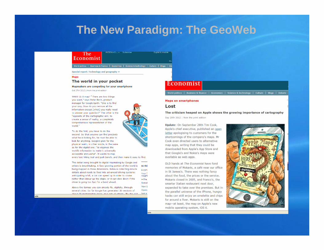
The New Paradigm: The GeoWeb
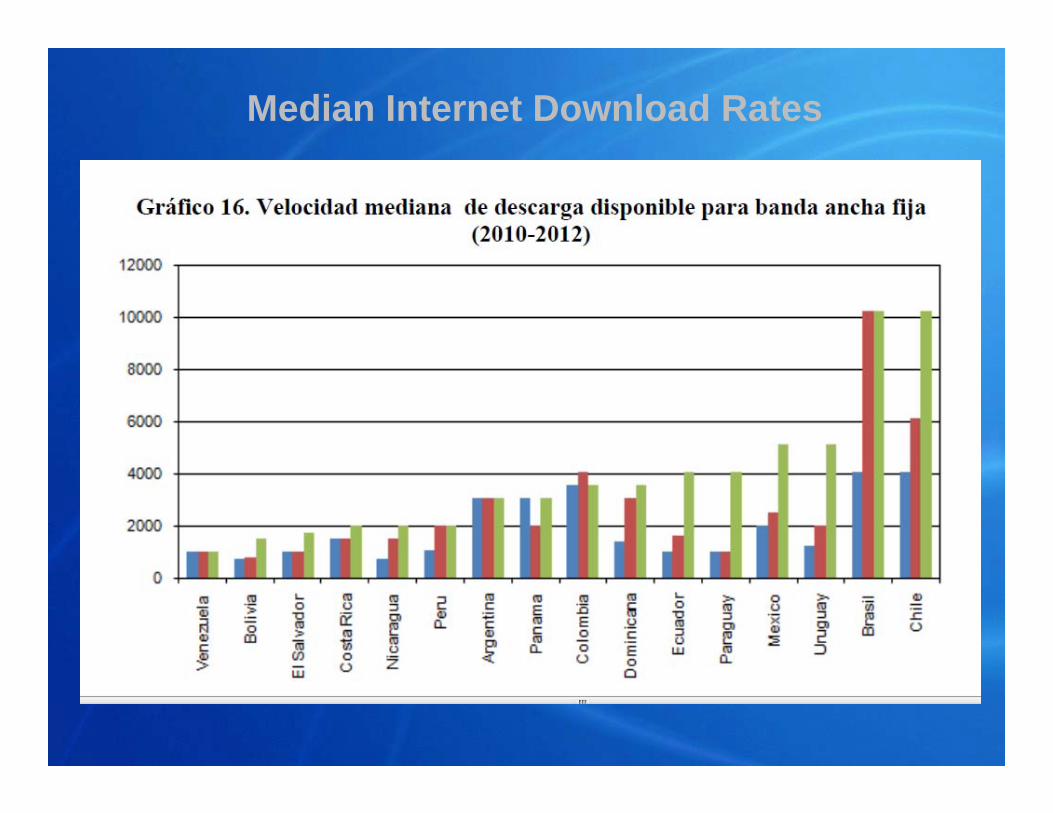
Median Internet Download Rates
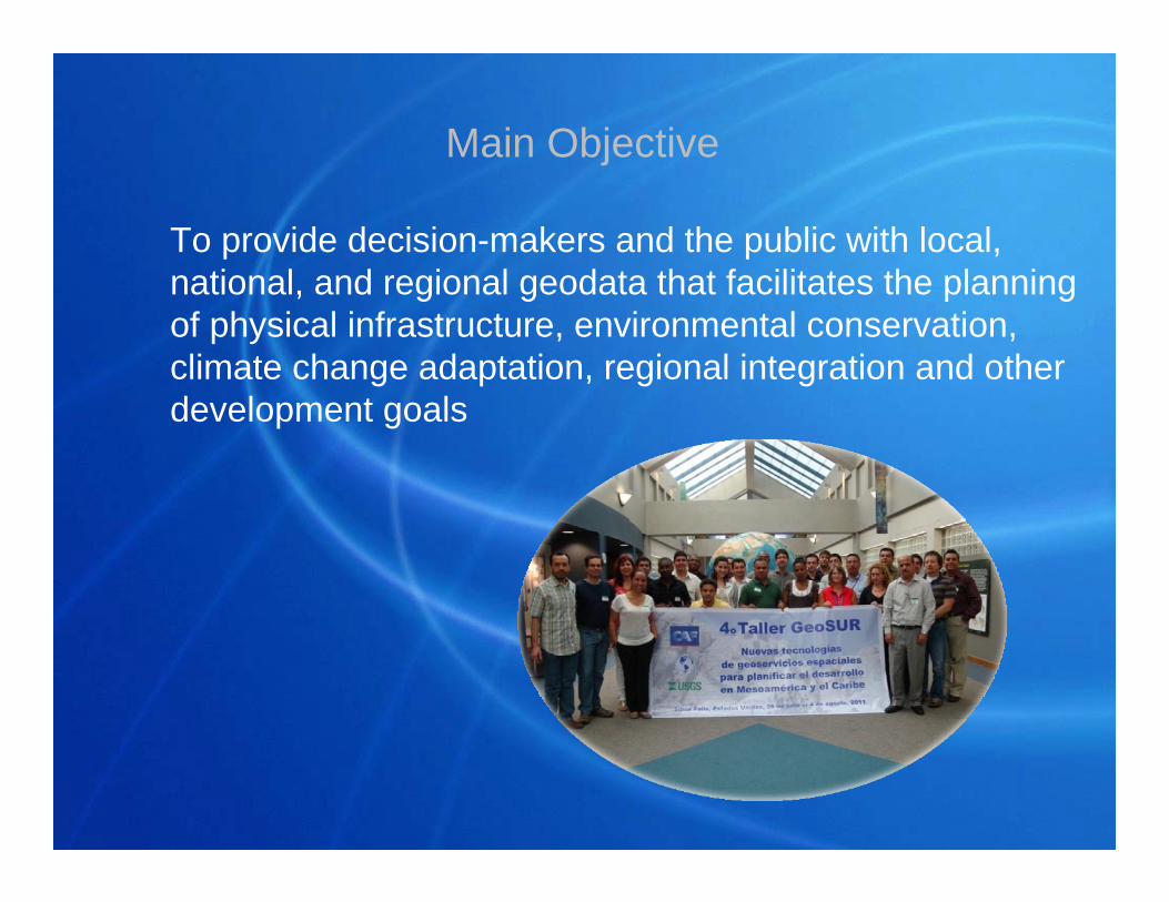
Main Objective
To provide decision-makers and the public with local, national, and regional geodata that facilitates the planning of physical infrastructure, environmental conservation, climate change adaptation, regional integration and other development goals
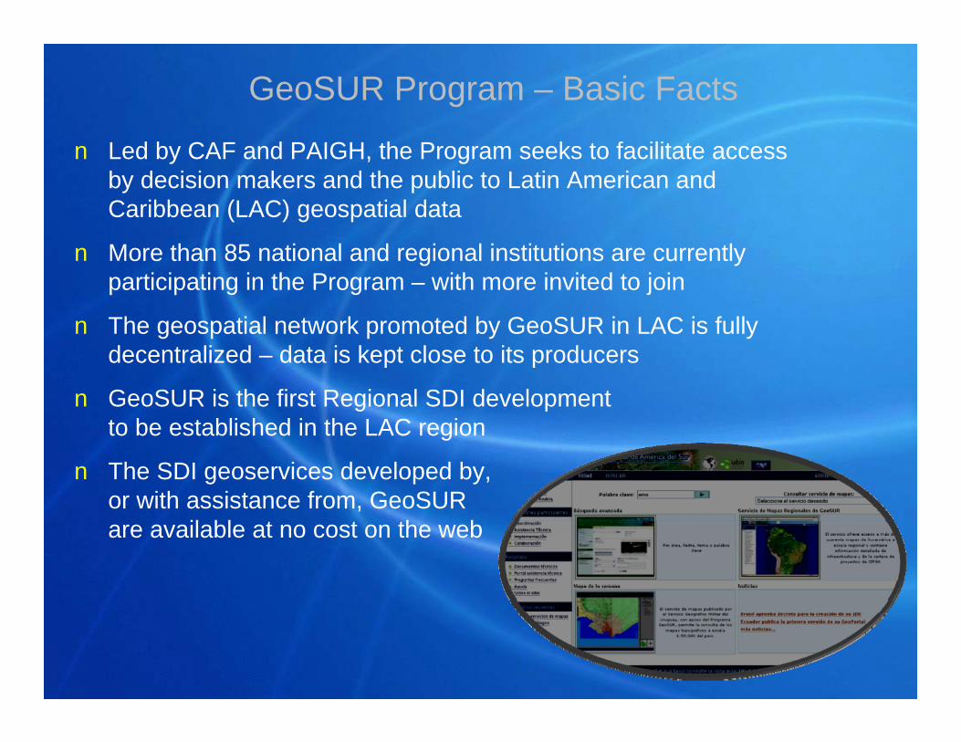
GeoSUR Program – Basic Facts
n Led by CAF and PAIGH, the Program seeks to facilitate access by decision makers and the public to Latin American and Caribbean (LAC) geospatial data
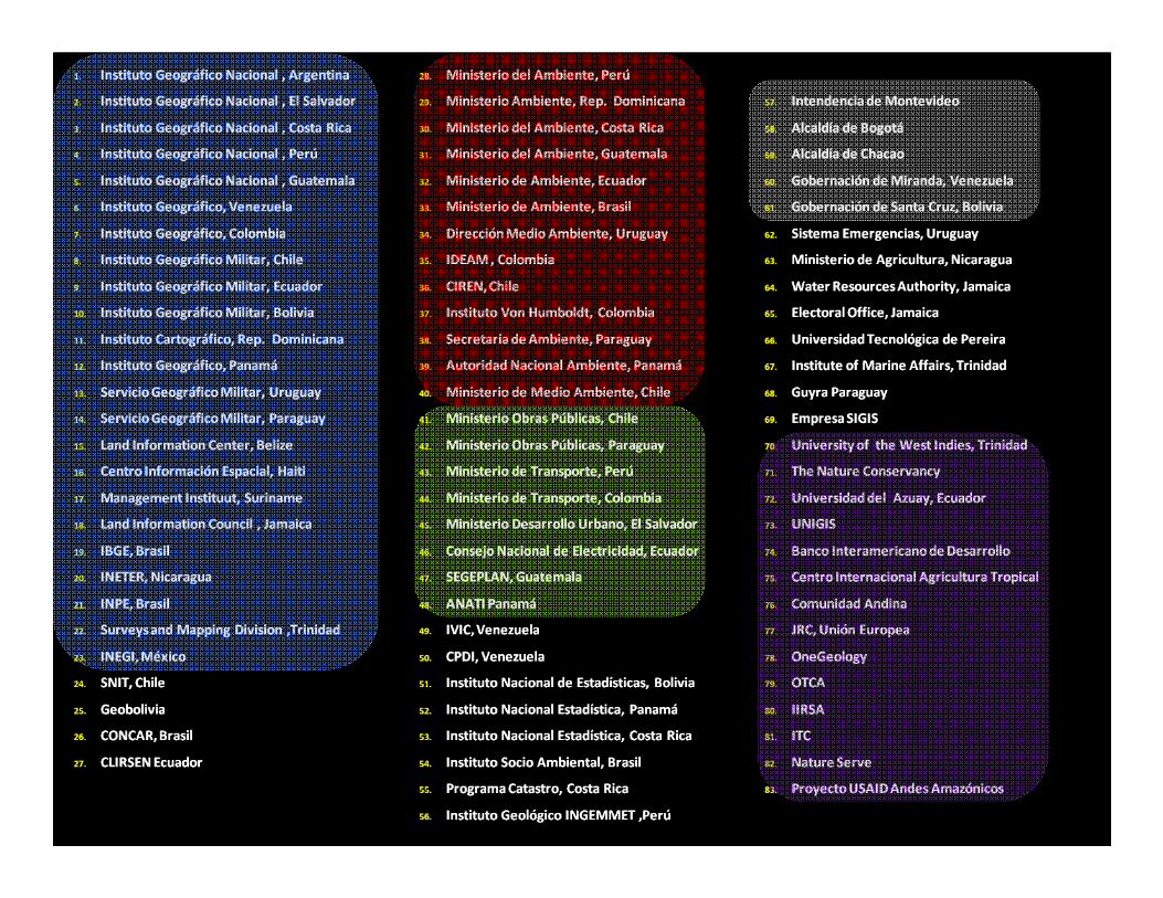
n More than 85 national and regional institutions are currently participating in the Program – with more invited to join
n The geospatial network promoted by GeoSUR in LAC is fully decentralized – data is kept close to its producers
n GeoSUR is the first Regional SDI development to be established in the LAC region
n The SDI geoservices developed by,or with assistance from, GeoSUR are available at no cost on the web
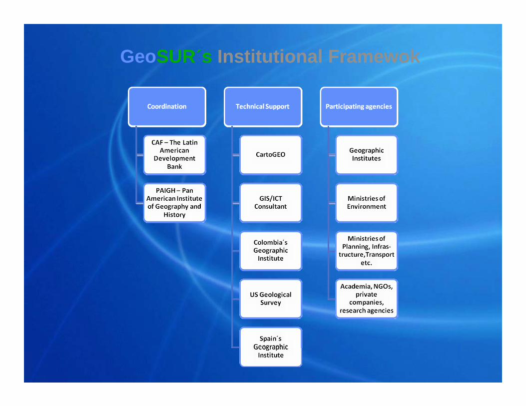
GeoSUR´s Institutional Framewok
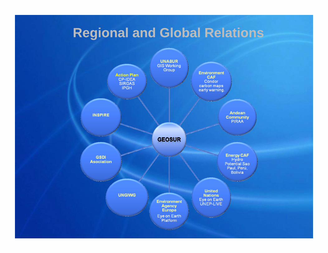
Regional and Global Relations
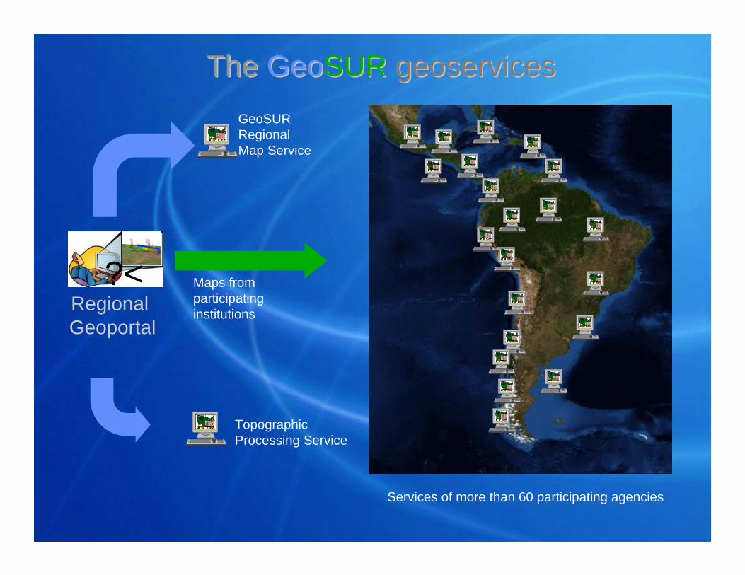
The The GeoGeoSUR SUR geoservicesgeoservices
?<Regional Geoportal
Maps from participating institutions
GeoSUR Regional Map Service
Topographic Processing Service
Services of more than 60 participating agencies
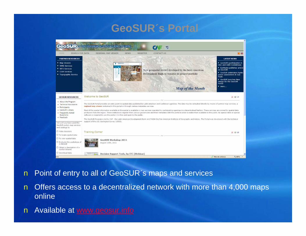
n Point of entry to all of GeoSUR´s maps and services
n Offers access to a decentralized network with more than 4,000 maps online
n Available at www.geosur.info
GeoSUR´s Portal
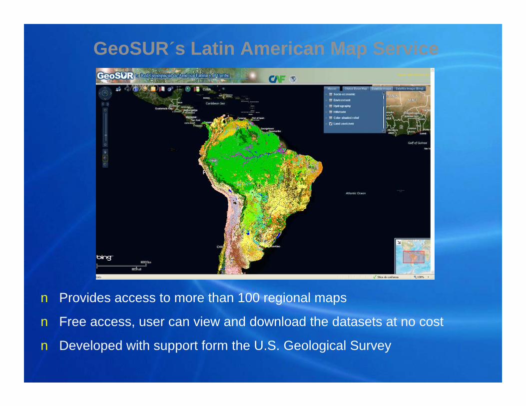
n Provides access to more than 100 regional maps
n Free access, user can view and download the datasets at no cost
n Developed with support form the U.S. Geological Survey
GeoSUR´s Latin American Map Service
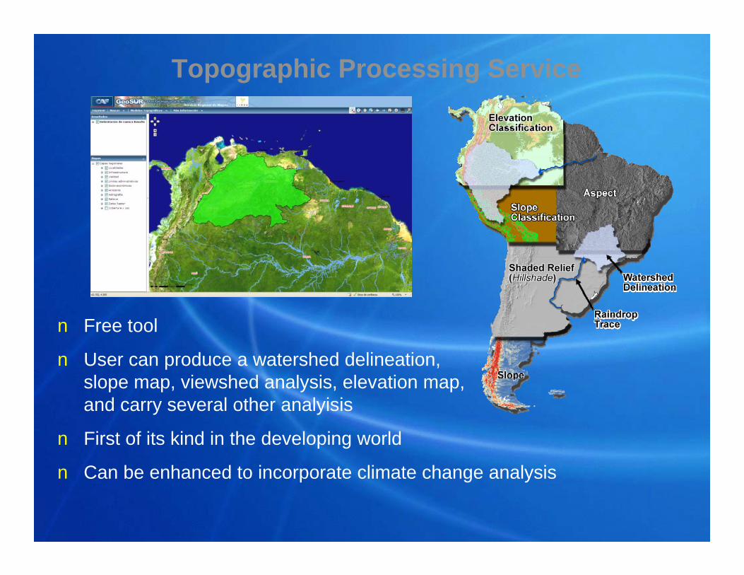
n Free tool
n User can produce a watershed delineation,slope map, viewshed analysis, elevation map, and carry several other analyisis
n First of its kind in the developing world
n Can be enhanced to incorporate climate change analysis
Topographic Processing Service
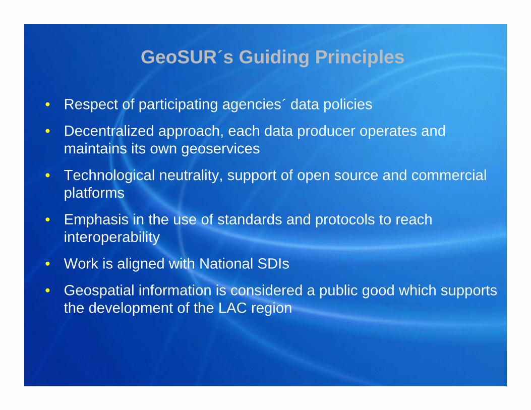
GeoSUR´s Guiding Principles
• Respect of participating agencies´ data policies
• Decentralized approach, each data producer operates and maintains its own geoservices
• Technological neutrality, support of open source and commercial platforms
• Emphasis in the use of standards and protocols to reach interoperability
• Work is aligned with National SDIs
• Geospatial information is considered a public good which supports the development of the LAC region
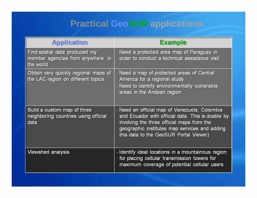
Practical GeoSUR applications
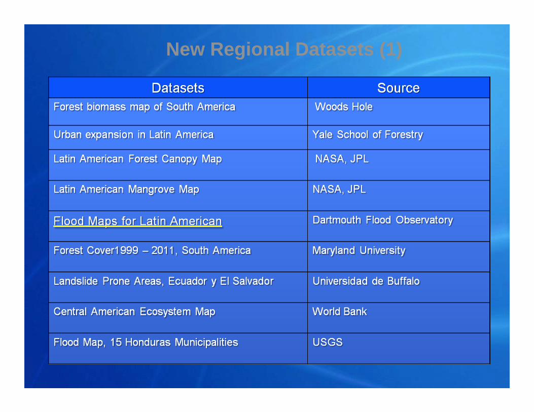
New Regional Datasets (1)
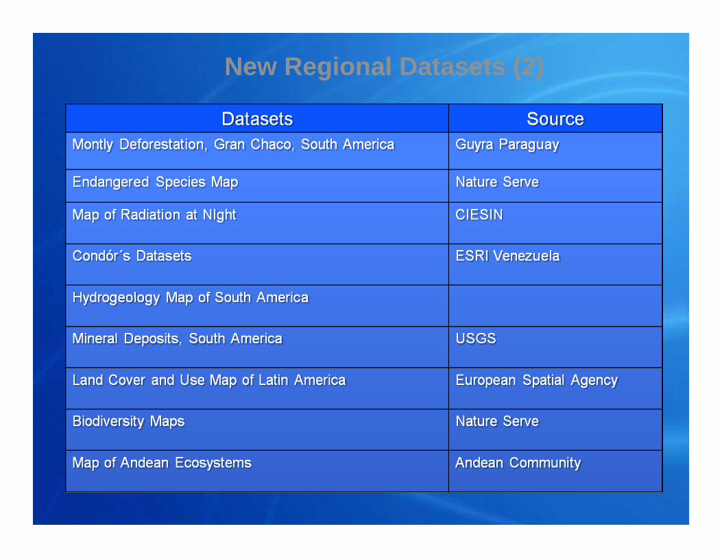
New Regional Datasets (2)
The way forward
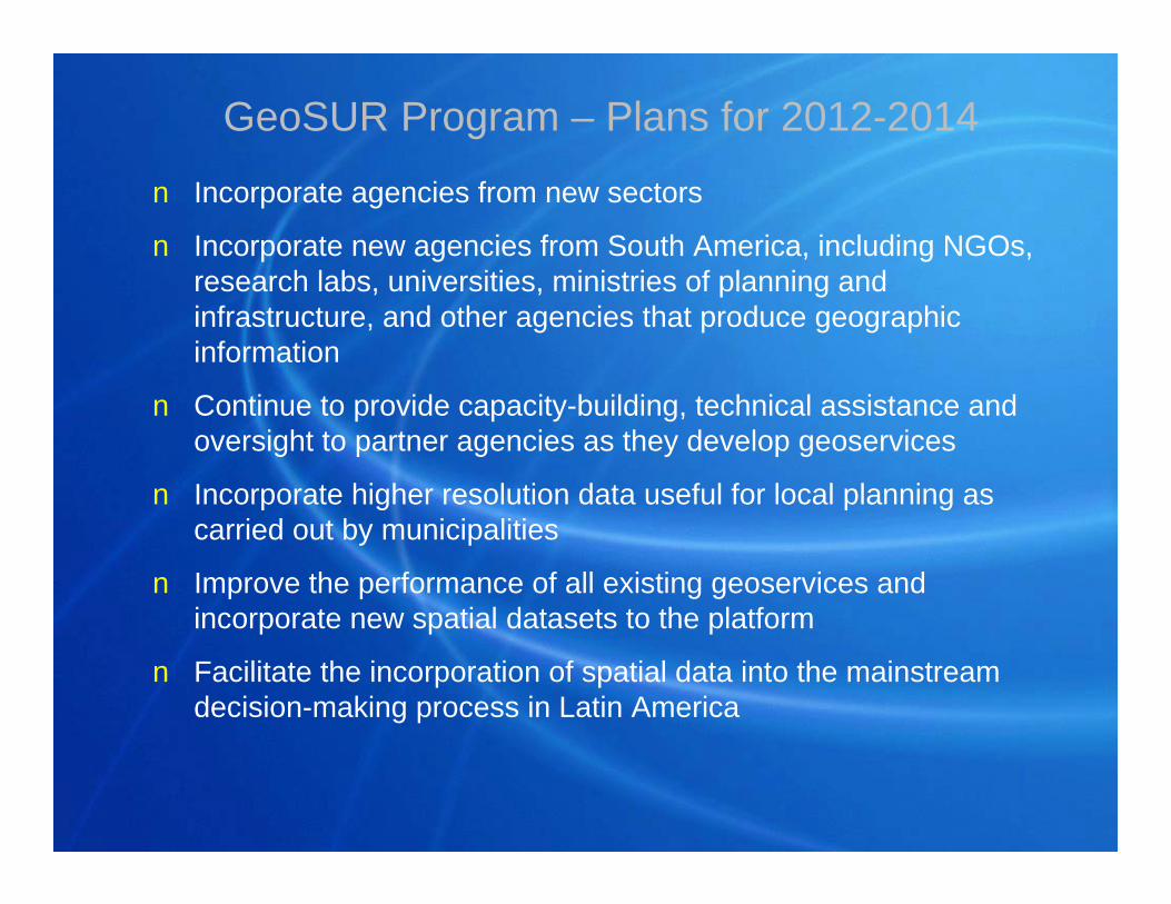
GeoSUR Program – Plans for 2012-2014
n Incorporate agencies from new sectors
n Incorporate new agencies from South America, including NGOs, research labs, universities, ministries of planning and infrastructure, and other agencies that produce geographic information
n Continue to provide capacity-building, technical assistance and oversight to partner agencies as they develop geoservices
n Incorporate higher resolution data useful for local planning as carried out by municipalities
n Improve the performance of all existing geoservices and incorporate new spatial datasets to the platform
n Facilitate the incorporation of spatial data into the mainstreamdecision-making process in Latin America
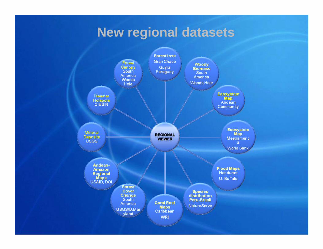
New regional datasets
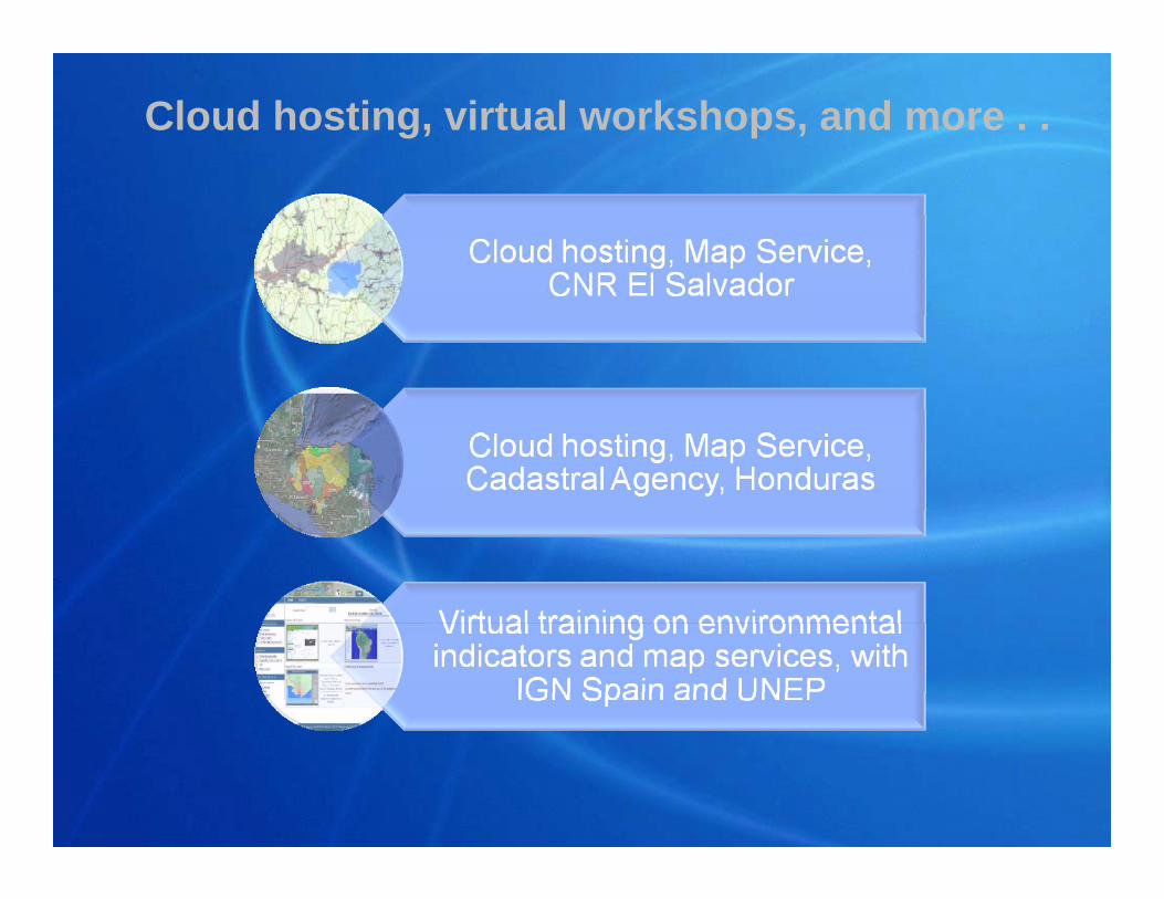
Cloud hosting, virtual workshops, and more . .
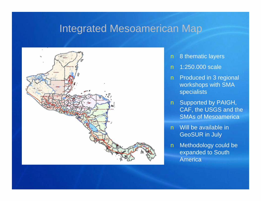
Integrated Mesoamerican Map
n 8 thematic layers
n 1:250.000 scale
n Produced in 3 regional workshops with SMA specialists
n Supported by PAIGH, CAF, the USGS and the SMAs of Mesoamerica
n Will be available in GeoSUR in July
n Methodology could be expanded to South America
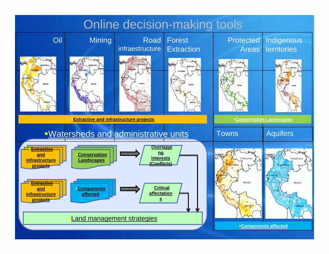
Oil Mining Road infraestructure
Forest Extraction
Protected Areas
Indigenous territories
Towns Aquifers
Extractive and
infrastructure projects
Conservation Landscapes
Components affected
Conservation LandscapesExtractive and infrastructure projects
Components affected
Overlapping
interests (Conflicts)
Extractive and
infrastructure projects
Critical affectation
s
Land management strategies
Watersheds and administrative units
Online decision-making tools
GeoGeoSURSURGeospatial Information
for Latin American and Caribbean Integration
Eric van Praag, Coordinator GeoSURCAF – The Latin American Development Bank
CAF The Latin American Development Bank