Embed Size (px)
Citation preview

Astaraei @ferdowsi.um.ac.ir
mghaemi @gmail.com
negarsiabi @gmail.com
.
GIS
ok
CO-kRK( D-K)
RS

GIS
Corwinlesch
Isaaks
Srivastava
Hengl
Laslettet
GoovaertsBurgessWebster
cokrigingkriging
within stratakriging with external driftregression krigingGoovaerts.

Mcbratney
Deutsch
ECpH
Brejda
d
)Z(xii Z(xi+hZ
hNhh

KerryOlive
nugget
Trangmarrange
Sill
Websteroliver
HenvelinkWebsteranisotropy
h
(anisotropy)
D.G. Krige
Matheron
k
kSanter
Van beersKleijnenWebsteroliver
kPiXi, Yi, Zi
XiYiZiEij
h
WijV
DijPiPj
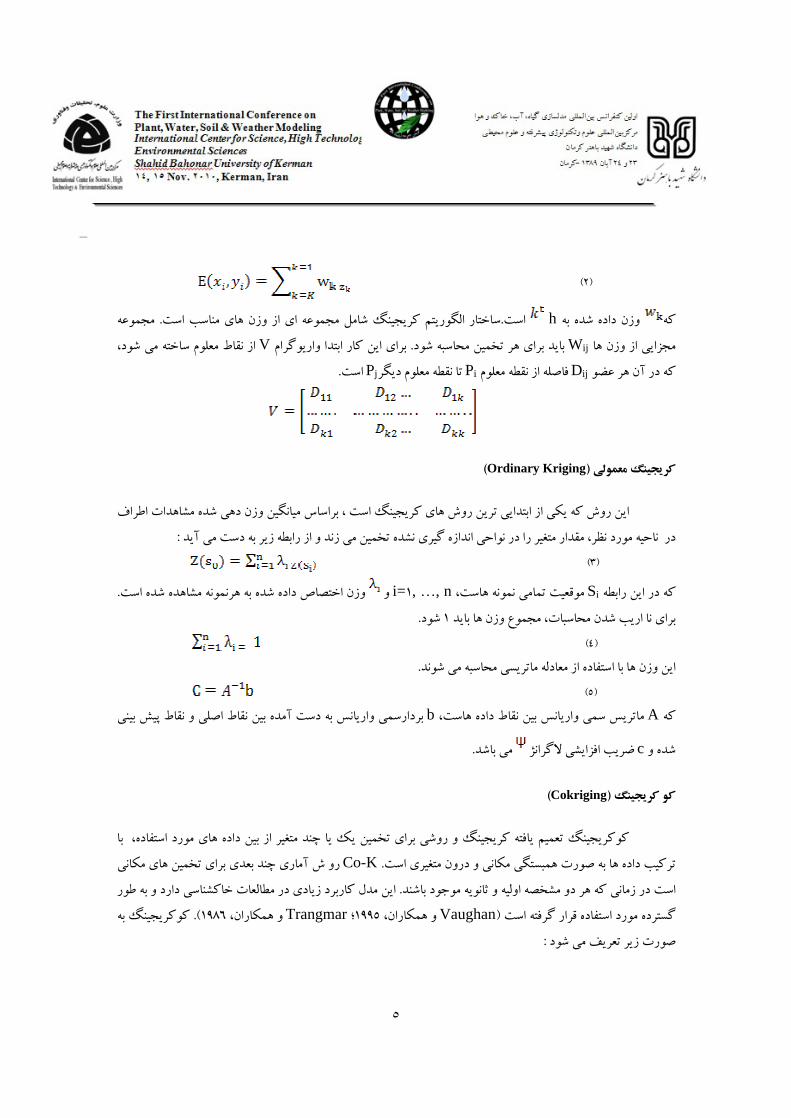
Ordinary Kriging
Sii= , , n
Ab
c
Cokriging
Co-K
VaughanTrangmar

.
S, . . ., n
m
JournelHuijbregts
= I
I
Tco-k
Z(Sj).
i= , , n
Regression Kriging
o-k
AAhmed
DeMarsily
Z(s)
Z(s) = Z(Si) + e(Si) i= , , n
Z(Si)e(Si)
E[e(Si )] = Cov [e(Si), e(Si)] =
, i= , , n Cov[ e(Si), Z(Si)] =
Three
Dimensional Kriging
Gallichand
-DK

-Dk
Pan
MERMSE
VoltzWebster
z(sj ) iz (sj)
iME
i= , , nLaslett
iji
i
Journel
Huijbrets IsaaksSrivastava

ScullOkin
McbratneyWebster
WeindorfZhu
OSD
Webster
oliver
Mc Brateny
saitoGoovaerts
JournelDeutsch
Goovaerts
Hoseini
Bourennane
OdehHengl
PH
IDW
O-KIDW
Yasrebi
RKCo-K OK-DK
RK

OKCo-KCo-K
OKOkLaslettMcBratney
oksill, nugget, range
Co-Km[m(m )]/
-
DK
-DKRS
RS
EldeiryGarcia
IKONOS, LANDSAT,ASTER
IKONOS
RSOdahRK
Co-
K
RKCo-KEldeiryGarcia
nugget /sill


RS

Ahmed, S., DeMarsily, G., . Comparison of geostatistical methods for estimating transmissivity using data on transmissivity and specific capacity. Water Resour. Res. , .
Bourennane, H., King, D., Chery, P., Bruand, A., . Improving the kriging of a soil variable using slope gradient as external drift. European Journal of Soil Science
( ), . Brejda, J.J., Moorman, T.B., Smith, J.L., Karlen, D.L., Allan, D.L., Dao, T.H., . Distribution and
variability of surface soil properties at a regional scale. Soil Sci.Soc. Am. J. , . Burgess, T.M., Webster, R., . Optimal interpolation and isarithmic mapping of soil properties. I. The
semi-variogram and punctual kriging. Journal of Soil Science
( ), . Corwin, D.L., Lesch, S.M., . Characterizing soil spatial variability with apparent soil electrical
conductivity Part II. Case study. Comp. and Electron. Agric, . Deutsch, C.V., Journel, A.G., . GSLIB. Geostatistical Software Library and User's Guide. Oxford
University Press, Oxford, pp. . Eldeiry A., Garcia L. A., . Comparison of Regression Kriging and Co-Kriging Techniques to Estimate
Soil Salinity Using Landsat Images. Presented at the th Annual Hydrology Days, Fort Collins, CO, March - , .
Eldeiry, A., Garcia, L. A., . Spatial Modeling of Soil Salinity Using Remote Sensing, GIS, and Field Data, VDM Verlag, Saarbruken, Germany.
Gallichand, J., Buckland, G.D., Marcotte, D., Hendry, M.J., Spatial interpolation of soil salinity and sodicity for a saline soil in Southern Alberta. Can. J. Soil Res. , .
Goovaerts, P., . Geostatistics for Natural Resources Evaluation. Oxford University Press, New York, NY, pp.
Goovaerts, P., . Geostatistics in soil science: state-of-the-art and perspectives. Geoderma
( ),.
Hengl, T., Heuvelink, G.B.M., Stein, A., . A generic framework for spatial prediction of soil variables based on regression-kriging. Geoderma
( ), . Heuvelink, G.B., Webster, R., . Modelling soil variation: past, present, and future. Geoderma ,
Hosseini, E., Gallichand, J., Marcotte, D., . Theoretical and experimental performance of spatial interpolation methods for soil-salinity analysis. Transactions of the American Society of Agricultural Engineers
( ),
Isaaks,E.H., and R.M. Srivastava. . An introduction to applied (Coleoptera: Chrysomelidae). J. Econ. Entogeostatistics. Oxford Univ. Press, New York
Journel, A.G., Huijbregts, C.H., . Mining geostatistics. Acatual kriging. J. Soil Sci. . demic Press, New York.
Journel, A.G., Deutsch, C.V., . Rank order geostatistics: a proposal for a unique coding and common processing of diverse data. In: Schofield, E.Y.B.a.N.A. (Ed.), Geostatistics Wollongong . Kluwer Academic Publishers, Dordrecht, The Netherlands, pp. .
Kerry, R., Oliver, M.A., . Average variograms to guide soil sampling for land management. The International Journal of Applied Earth Observation and Geoinformation , .
Laslett, G.M., McBratney, A.B., Pahl, P.J., Hutchinson, M.F., . Comparison of several spatial prediction methods for soil pH. J. Soil Sci. , .
Laslett, G.M., McBratney, A.B., . Further comparison of spatial prediction methods for predicting soil pH. Soil Sci. Soc.Am. J. , .
Matheron, G., . Principles of geostatistics. Economic Geology
( ), .
Matheron, G., . Le Krigeage universal. Vol. . Cahiers du Centre de Morphologie Mathematique,Ecole des Mines de Paris, Fontainebleau, p. NA.
McBratney, A. B., Webster, R., . Optimal interpolation and isarithm mapping of soil properties. V. Coregionalization and multiple sampling strategy. Eur. J. Soil Sci. , .

McBratney, A., Odeh, I., Bishop, T., Dunbar, M., Shatar, T., . An overview of pedometric techniques of use in soil survey. Geoderma
(
), . McBratney, A.B., Webster, R., McLaren, R.G., Spiers, R.B., . Regional variation of extractable
copper and cobalt in the topsoil of south-east Scotland. Agronomie , . Odeh, I
O. A., Onus, A., . Spatial Analysis of Soil Salinity and Soil Structural Stability in a Semiarid Region of New South Wales, Australia. Environmental Management, , .
Pan, G., Moss, K., Heiner, T., Carr, J., . A Fortran program for three-dimensional cokriging with case demonstration. Comput. Geosci. , .
Saito, H., Goovaerts, P., . Geostatistical interpolation of positively skewed and censored data in a dioxin-contaminated site. Environ. Sci. Technol. ,
Santner, T.J., Williams, B.J., Notz, W.I., . The design and analysis of computer experiments. Springer-Verlag, New York.
Scull, P., Okin, G. S., . Sampling challenges posed by continental-scale soil landscape modeling. Sci. Total Environ. , .
Trangmar, B.B., Yost, R.S., Uehara, G., . Application of geostatistics to spatial studies of soil properties. Adv Agron
, . Trangmar, B.B., Yost, R.S., Uehara, G., . Spatial dependence and interpolation of soil properties in
west Sumatra, Indonesia: II. Co-kriging regionalisation and co-kriging. Soil Sci. Soc. Am.J. , .
Van Beers, W., Kleijnen, J.P.C., . Kriging for interpolation in random simulation. Journal of the Operational Research Society, no. , pp. - .
Vaughan, P.J., Lesch, S.M., Corwin, D.L., Cone, D.G., . Water content effect on soil salinity prediction: A geostatistical study using cokriging. Soil Sci. Soc. Am. J. , .
Voltz, M., Webster, R., . A comparison of kriging, cubic splines and classification for predicting soil properties from sample information. J. Soil Sci. , .
Webster, R., Oliver, M.A., . Geostatistics for Environmental Scientists. John Wiley and Sons Ltd, Chichester.
Webster, R., Oliver, M.A., . Sample adequately to estimate variograms of soil properties. Journal of Soil Science
( ), . Weindorf, D .C., Zhu, Y., . Spatial Variability of Soil Properties at Capulin Volcano,New Mexico,
USA: Implications for Sampling Strategy. Pedosphere., ( ), . Yasrebi, J., Saffari, M., Fathi, H., Karimian, N., Moazallahi, M., Gazni, R., . Evaluation and
Comparioson of Ordinary Kriging and Inverse Distance Weighting Methoda for Prediction of Spatial Variability of Some Soil Chemical Parameters. Reasearch Journal of Biological Sciences.,
( ), - .

An Investigation into spatial data variation by using geostatistics methods for soil studies
Sanaeinejad, Seyed. Hosein , Astaraei, Alireza , Ghaemi, Marjan
, Siabi, Negar
Dept. of Water-Engineering , Faculty of Agriculture, Ferdowsi University of Mashhad, (e-mail: [email protected])
Dept. of Soil Sciences, Faculty of Agriculture, Ferdowsi University of Mashhad,; ([email protected])
Dept. of Soil Sciences, Faculty of Agriculture, Ferdowsi University of Mashhad, (mghaemi @gmail.com)
Dept. of Water-Engineering , Faculty of Agriculture, Ferdowsi University of Mashhad, (e-mail: negarsiabi @gmail.com)
Abstract Different parts of agricultural activities such as crop production, forestry, animal husbandry and fisheries affected by different variables and parameters, including climatic factors and weather conditions and soil characteristics, vegetation diversity and multiplicity of varieties, environmental and ecological conditions. Therefore, for precise management and planning in this sector these factors and variables should be considered simultaneously. On the other it is hard, time consuming and to some extent impossible to apply all of the parameters simultaneously. Therefore researchers speed up analysis and increased accuracy and power of their analysis by modeling. Currently, new technologies are helping to promote this type of quantitative modeling in agriculture studies. Using Geographic Information Systems (GIS) it is possible to apply geo-statistics methods, including kriging, to increase spatial accuracy of the variables and improve the preparation of maps for different parameters. In this paper four different geo-statistics models were used, including ordinary kriging (ok), co- kriging(CO-k), regression kriging (RK) and three-dimensional kriging ( D-K) to predict soil characteristics and based on their standard deviation and average ranking, the best method was determined. In this method based on production and Spatial Modeling Variogram of the data, which usually includes
of data pairs, Variogram model is fitted and regression coefficient models shall be determined. The model with regression coefficients higher is selected to show the semi-variogeram of the sample. Then the surface maps prepared for different characteristics compared with images obtained from remote sensing (RS). The map derived from the model that corresponds with the highest area of satellite images has been used for spatial analysis of soil parameters. It can be concluded that the results of this study for the interpretation and classification of remote sensing data can also be used. Keywords: spatial analysis, soil properties, geostatistics, kriging, GIS.