Embed Size (px)
Citation preview

GPS Tracking and Time-Geography Applications for Activity Modeling and Microsimulation
Final Report FHWA-sponsored Peer Exchange and CSISS Specialist Meeting
10-11 October 2005
The Upham Hotel Santa Barbara, California
Compiled by Kostas Goulias and Donald Janelle from proceedings of the meeting
http://www.csiss.org/events/meetings/time-geography/
Center for Spatially Integrated Social Science
University of California, Santa Barbara
March 2006

FHWA Peer Exchange and CSISS Specialist Meeting: GPS Tracking and Time Geography
ii
FHWA Peer Exchange and CSISS Specialist Meeting: GPS Tracking and Time Geography
Table of Contents
1. Background, Purpose, and Goals ............................................................................................... 1
Goals of Peer Exchange:........................................................................................................ 4 2. Meeting Preparation and Format ............................................................................................... 5
Participants and Presentation Titles:...................................................................................... 5 3. Meeting Outcomes ..................................................................................................................... 7
Table 1. Recommended Research Initiatives........................................................................ 8 Appendix A: Meeting Agenda ........................................................................................................ 9 Appendix B: Issues Identified by Breakout Groups on GPS Data Collection and Use................ 12
GPS Data Collection and Use: Key Topics, Opportunities, and Barriers............................ 13
GPS Data Collection and Use: Key Topics, Research Uses, Impediments, Action Items, and Projects........................................................................................................................ 16
Appendix C: Recommended Research Initiatives ........................................................................ 20
Topic I: Use of GPS Data to Enhance and Calibrate/Validate Travel Models.................... 21
Topic II: Driver Behavior Profiles for Validating Traffic Microsimulation Models .......... 22
Topic III: Integration of Time-Space Geography in Activity-Based Models...................... 22
Topic IV: Anonymizing GPS Data...................................................................................... 23
Topic V: Geographic Modeling Testbed ............................................................................. 24
Topic VI: Variability in Recurrent and Variety Seeking Activities across Space and Time25
iii

FHWA Peer Exchange and CSISS Specialist Meeting: GPS Tracking and Time Geography
iv

GPS Tracking and Time-Geography Applications for Activity Modeling and Microsimulation
An FHWA-sponsored Peer Exchange and CSISS Specialist Meeting
10-11 October 2005
Santa Barbara, California 1. Background, Purpose, and Goals After years of academic experimentation and testing, activity-based approaches to travel demand
forecasting are slowly finding their way into practice as policy analysis tools. Many planning
agencies in the United States have initiated exploratory projects that eventually will lead to wider
use in policy analysis and transportation management. The spatial and temporal details of these
new methods offer desirable and flexible techniques for transportation modeling practices and
they also provide unprecedented detail in space and time. This detail (resolution) offers unique
opportunities for travel behavior research, modeling, and travel-demand forecasting because we
can now depict decision making processes at the level that decisions are made, i.e., for
individuals, households, or groups of individuals.
Currently, many planning agencies are viewing activity and tour-based models as
desirable and feasible techniques for their transportation modeling practices (e.g., New York
Metropolitan Transportation Council - http://www.nymtc.org/, Portland Metro -
http://www.metro-region.org/). Many other applications are emerging as shown by recent
Transportation Research Board workshops designed for practitioners (see http://www.trb-
forecasting.org/activityBasedApproaches.html). The development and implementation of
activity, tour-based, and micro-simulation modeling approaches, however, require additional and
more specialized data on travel activity patterns. For example, most activity-based approaches
for travel demand forecasting require diary data (a detailed account of travel or activity) for
individuals and possibly for entire households. A consistent movement of all these methods and

FHWA Peer Exchange and CSISS Specialist Meeting: GPS Tracking and Time Geography
models is toward the use of finer resolution in time (e.g., second-by-second actions) and space
(e.g., parcel-by-parcel and meter-by-meter positioning). In fact, many of these model
components not only need detailed data about the movement of people in time and space but also
a substantial amount of data to study cyclical behaviors and to perform statistical testing of
hypotheses. They also need other secondary data that can be used as complementary sources in
model building or “external” data to verify and validate the activity-based simulation models.
Today, lack of sufficiently detailed data is inhibiting the development, testing and verification,
and implementation of activity, tour-based, and micro-simulation modeling approaches.
Potentially valuable sources of data are may be derived from surveys that use geospatial
technologies. These technologies may be used in an automated fashion with very little
interaction with the surveyed person thus solving two thorny issues in data collection: cost and
survey burden. The best known technology of this type is Geographic Positioning System (GPS
– this is a system that uses GPS satellites that broadcast signals. These signals are read by GPS
receivers that in turn compute their location on Earth in terms of longitude, latitude, and altitude
at any given time of a day. With improvements in GPS hardware, we are now able to collect
GPS data over longer periods. Devices of this type can be attached to vehicles or given to
individuals for tracking their movements for much longer periods than typical surveys. They
offer data that are not usually collected by travel surveys, such as the exact route followed by a
traveler. In this way, geospatial technologies may also provide data to directly estimate
components of activity-based models.
Some of the basic theoretical underpinnings of activity-based approaches are from time-
geography (e.g., the movement of individuals and the constraints they face) and microeconomics
(e.g., discrete choice by an individual). Many of these travel demand-forecasting systems
require finer detail of information in time, space, and social context. One of these aspects,
however, concerns the movement of persons in space and the temporal aspects of this movement.
Time geography, within human geography, is concerned with daily, weekly, and seasonal
rhythms of human behavior over space. The approach per Torsten Hägerstrand, one of the first
proponents, claims that we all live in a conceptual bubble due to a variety of constraints (dictated
by constraints imposed by physics and/or by society). This bubble is named the time-space
prism. It took many years and some maturation in the development of Geographic Information
2
FHWA Peer Exchange and CSISS Specialist Meeting: GPS Tracking and Time Geography
Systems (GIS) for empirical studies to emerge that demonstrate the research value of mapping
time-space paths of humans in a city. Many of the original ideas in time geography and the more
recent GIS mapping of the time-space paths are used to develop a new generation of travel-
demand forecasting models that explicitly quantify time-space prisms. GPS and GIS may be the
technologies that make all this possible. For example, it is conceivable we can collect data for
more than 12 months, leading to a full year of personal space-time prisms. In this way, we can
look at where people travel on a regular basis compared to places visited infrequently, or only
once over a long period of time. We can examine the time they travel in relationship to the
locations frequent, and document shifts in their travel times. This new capability, combined with
larger samples of traces, may also lead to better ways to conceptualize and analyze space-time
prisms. GIS is only recently able to process and analyze these quantities of data. This type of
data will be invaluable as travel-demand modeling shifts toward microsimulation. The most
intriguing GPS dataset on household vehicle travel in the United States, so far, is the Commute
Atlanta data, a FHWA-sponsored value pricing project, where 1-second GPS data over 12
months for 270 households with 487 vehicles were collected. Other long period GPS data have
been collected in Borlange, Sweden (www.rattfart.com). Another potential source will be from
another FHWA-sponsored value pricing project, conducted by the Puget Sound Regional
Council in Seattle. The 1995 GPS data collected in the FHWA-sponsored project in Lexington,
KY included 6-days of travel. More commonly, regional household travel surveys have limited
their GPS data collection to 1 or 2 days, which limits their utility in understanding space-time
prisms.
Using as motivation the recently collected large amounts of GPS data from a variety of
studies in the United States and Europe, the Federal Highway Administration (FHWA) decided
to fund a Peer Exchange meeting in Santa Barbara, CA. The intent of this Peer Exchange was to
assemble experts to discuss potential approaches on using GPS vehicle traces for defining space-
time paths and prisms to be used in activity modeling and microsimulation for transportation
analysis. This Peer Exchange brought together travel demand forecasters, experts in travel
behavior and GPS data collection, and geographers to discuss different approaches to analyzing
space-time prisms for transportation forecasting needs. Invitees came from universities, State
DOTs, MPOs, and consulting groups.
3
FHWA Peer Exchange and CSISS Specialist Meeting: GPS Tracking and Time Geography
Goals of Peer Exchange: The more specific goals of this Peer Exchange were to:
a. Discuss methods and techniques for using the GPS data to be applied to activity modeling
and microsimulation.
b. Increase practitioner interest in the potential of GPS data for activity models.
c. Encourage academics and their graduate students to pursue research activities with these
datasets.
d. Develop priorities for research that could be conducted using the Commute Atlanta
dataset after it has been anonymized for public release.
e. Develop priorities for research that could be conducting using other GPS data collected
from other household travel/activity surveys.
4

FHWA Peer Exchange and CSISS Specialist Meeting: GPS Tracking and Time Geography
2. Meeting Preparation and Format
Invited participants prepared and submitted short position statements related to one or more of
the goals listed above. These statements were posted on the CSISS web site in advance of the
meeting (15 September 2005). The Peer Exchange took place over one and one-half days
(starting on the morning of 10 October and ending with lunch on 11 October). Presenters and
participants from state DOTs, MPOs, consultants, and academics gave short presentations and
discussed the variety of issues that emerged directly for the goals above. Appendix A of this
report contains the agenda of the meeting. The presenters and the title of their presentations are
listed below together with panelists and a contributor. The presentation outlines and related
graphic displays are available in pdf format at http://www.csiss.org/events/meetings/time-
geography/participants.html.
Participants and Presentation Titles:
• Terry Bills, ESRI, GPS and Travel Behavior: A Few Research Questions • Larry Blain, Puget Sound Regional Council of Governments, GPS-Assisted Data
Collection to Support Transportation Planning • Mark Bradley, Santa Barbara, Toward GPS Data Collection for Activity Based
Models • Keith Clarke, UCSB, Negative (or Anti-) Time: A Theoretical Approach of Potential
Use in Time-space Trajectory Analysis and Modeling • Helen Couclelis, UCSB, Activity Modeling with GPS Tracking Data: New
Assumptions for the Age of ICT • Mike Goodchild, UCSB, Potential of Dense-tracking Data • Kostas Goulias, UCSB, Travel Data for Activity-based Travel Demand Forecasting
Models • Randy Guensler, Georgia Tech, Commute Atlanta Instrumented Vehicle Data • Donald G. Janelle, UCSB, Synoptic Analysis of Space-time Activity Patterns • Mei-Po Kwan, Ohio State University, Time-Geographic Methods for Analyzing GPS
Data • Mike McNally, University of California, Irvine, The Merging of Travel Forecasting
and Traffic Management Data and Models • Harvey Miller, University of Utah, High-resolution Measurement of Time
Geographic Entities • Elaine Murakami, FHWA, Bringing Geographers and Travel Demand/Activity
Modelers together to Benefit from New GPS Travel Data Resources • Val Noronha, UCSB, GPS and Travel Monitoring • Ram Pendyala, University of South Florida, Collection and Analysis of GPS-based
Travel Data for Understanding and Modeling Activity-travel Patterns in Time and Space
5
FHWA Peer Exchange and CSISS Specialist Meeting: GPS Tracking and Time Geography
• Shih-Lung Shaw, University of Tennessee, Time Geography for Activity Modeling with GPS Tracking Data
Panelists:
• Ayalew Adamu, CALTRANS • Gordon R. Garry, Sacramento Area Council of Governments • Qingquan Li, Wuhan University (China) • Mark Schlappi, Maricopa Association of Governments (Phoenix) • William F. Yim, Santa Barbara County Association of Governments
Contributor:
• Richard Mudge, DELCAN Transportation, provided access to the closed website of the Baltimore Metropolitan Area
6

FHWA Peer Exchange and CSISS Specialist Meeting: GPS Tracking and Time Geography
3. Meeting Outcomes After the presentations and related discussions, breakout groups were formed and each
developed a set of issues to consider further. Four breakout groups produced two sets of
outcomes.
The first outcome includes summaries of issues that require further scrutiny for
facilitating GPS data collection and use. The two breakout groups developed detailed lists of key
issues, topics, and opportunities, and listings of the types of barriers that need to be overcome
prior to effective implementation. Appendix B contains detailed discussion outlines from each
breakout group.
Subsequently, the issues identified in the first round of breakout groups were transformed
into a finite set of recommended research projects for possible funding by public agencies
and/or private enterprises. Table 1 summarizes these potential projects and Appendix C
provides additional details.
The overall consensus was also to advocate the recommended projects with public
agencies, such as the California Department of Transportation as a state project and a project
jointly funded with other states and to develop project statements that can be recommended by
mechanisms such as the National Cooperative Highway Research Program and the new Strategic
Highway Research Program. In addition, portions of these projects as individual tasks can also
be considered by the University Transportation Centers.
7

FHWA Peer Exchange and CSISS Specialist Meeting: GPS Tracking and Time Geography
Table 1. Recommended Research Initiatives
Title Objective Duration Funding Level
Use of GPS Data to Enhance and Calibrate/Validate Travel Models
Identify and improve accuracy of existing four-step models, identify and enhance policy analysis capabilities of four-step models, define the role of GPS data in activity-based model design, development, and application
2-3 years $500K + data collection costs
Driver Behavior Profiles for Validating Traffic Microsimulation Models
Demonstrate applicability of GPS data for developing profiles of driver behavior for validating traffic microsimulation models
1.5-2 years $300K-$400K
Integration of Time-Space Geography in Activity-Based Models
Develop definitions, measurements, and representations of time-space paths; identify the role of ICT in influencing action space; and integrate time-space paths into activity-based models
2 years $350K + data collection costs
Anonymizing GPS data
Identify data needs, convene stakeholder groups to identify privacy risks, develop new techniques for anonymizing data, attempt to break protections, develop specific policy guidelines
1 year $200K
Geographical Modeling Testbed
Develop an education and training tool, with appropriate data and information resources, that is useful for testing hypotheses, testing comparative model development, and developing new analytical techniques
2 years $750K – $1250K
Variability in Recurrent and Variety Seeking Activities across Space and Time
Determine to what degree recurrent and variety-seeking activities vary across households, space, and time, and identify the most important dimensions and measures to describe this variability
1 year 5 Years
Scoping - $50K to $100K $2,500K
Note: These project recommendations are from the FHWA-sponsored Peer Exchange and CSISS Specialist Meeting “GPS Tracking and Time-Geography Applications for Activity Modeling and Microsimulation” in Santa Barbara CA, 10-11 October 2005. See http://www.csiss.org/events/meetings/time-geography for more information.
8

FHWA Peer Exchange and CSISS Specialist Meeting: GPS Tracking and Time Geography
Appendix A
Meeting Agenda
9

FHWA Peer Exchange and CSISS Specialist Meeting: GPS Tracking and Time Geography
Agenda for the Meeting
GPS Tracking and Time-Geography Applications for Activity Modeling and
Microsimulation
An FHWA-sponsored Peer Exchange and CSISS Specialist Meeting 10-11 October 2005
The Upham Hotel –– Santa Barbara, California
Sunday 9 October 2005 Arrival in Santa Barbara
Monday 10 October Garden Room
8:30 Welcome, Kostas Goulias and Don Janelle
8:35 Introductions
8:45 Background Issues and Objectives, Elaine Murakami
9:00 Session I GPS Transportation Data Collection
• Randy Guensler, Georgia Tech, Commute Atlanta Instrumented Vehicle Data • Larry Blain, Puget Sound Regional Council of Governments, GPS-Assisted Data
Collection to Support Transportation Planning • Panel Discussion on Data Needs from State DOT / MPO Perspectives
Ayalew Adamu, CALTRANS Gordon R. Garry, Sacramento Area Council of Governments Mark Schlappi, Maricopa Association of Governments (Phoenix) William F. Yim, Santa Barbara County Association of Governments
10:15 Coffee Break 10:30-11:45 Session II Time-Geography Perspectives on Activity Behavior and Transportation
• Shih-Lung Shaw, University of Tennessee, Time Geography for Activity Modeling with GPS Tracking Data
• Mei-Po Kwan, Ohio State University, Time-Geographic Methods for Analyzing GPS Data
• Harvey Miller, University of Utah, High-resolution Measurement of Time Geographic Entities
• Ram Pendyala, University of South Florida, Collection and Analysis of GPS-based Travel Data for Understanding and Modeling Activity-travel Patterns in Time and Space
12:00 Lunch in garden 1:15 Session III Activity Modeling – Integrating GPS Data and Time Geography
10

FHWA Peer Exchange and CSISS Specialist Meeting: GPS Tracking and Time Geography
• Kostas Goulias, UCSB, Travel Data for Activity-based Travel Demand Forecasting Models
• Helen Couclelis, UCSB, Activity Modeling with GPS Tracking Data: New Assumptions for the Age of ICT
• Mark Bradley, Santa Barbara, Toward GPS Data Collection for Activity Based Models • Keith Clarke, UCSB, Negative (or Anti-) Time: A Theoretical Approach of Potential
Use in Time-space Trajectory Analysis and Modeling 2:00 Session IV GPS-based Data for System-wide Transportation Modeling and Analysis • Terry Bills, ESRI, GPS and Travel Behavior: A Few Research Questions • Mike McNally, University of California, Irvine, The Merging of Travel Forecasting and
Traffic Management Data and Models • Val Noronha, UCSB, GPS and Travel Monitoring • Donald G. Janelle, UCSB, Synoptic Analysis of Space-time Activity Patterns • Mike Goodchild, UCSB, Potential of Dense-tracking Data 2:45 Framing Key Issues A Plenary Discussion, Mike Goodchild, UCSB, moderator 3:15 Coffee Break 3:30 Breakout Sessions 5:30 Plans for Tuesday 5:40 Wine and cheese, compliments of The Upham Hotel 6:30 Dinner – Opal Restaurant, 1325 State Street Tuesday 11 October
6:00 – 8:30 Hike in Santa Ynez Mountains – optional 9:00 Plenary Review of Breakout Sessions Coach House [see results in Appendix B] 9:30 Small-group Planning Sessions • The objective is to initiate drafts of “Scope of Work” for research projects that integrate
transportation tracking data, time geography, and activity modeling. • Groups may convene in the Coach House, the Board Room, on in the garden area 11:15 Plenary Reports from Planning Sessions Coach House [see results in Appendix C] 11:45 Summation and Plans, Kostas Goulias 12:00 Lunch – on your own in Santa Barbara
11

FHWA Peer Exchange and CSISS Specialist Meeting: GPS Tracking and Time Geography
Appendix B
Issues Identified by Breakout Groups on GPS Data Collection and Use
12
FHWA Peer Exchange and CSISS Specialist Meeting: GPS Tracking and Time Geography
GPS Data Collection and Use: Key Topics, Opportunities, and Barriers
Group A: T. Bills, L. Blain, H. Couclelis, M. Goodchild, K. Goulias, M. McNally, R. Pendyala, V. Noronha, S. Shaw R. Pendyala chaired the group discussion and prepared this summary outline. Objective and Charge
• o
• o o
o
Objective Using GPS data to define space-time paths and prisms for activity modeling and microsimulation
Charge Identify key topics – compile a list What is needed to make progress? Action items
What are the barriers to progress?
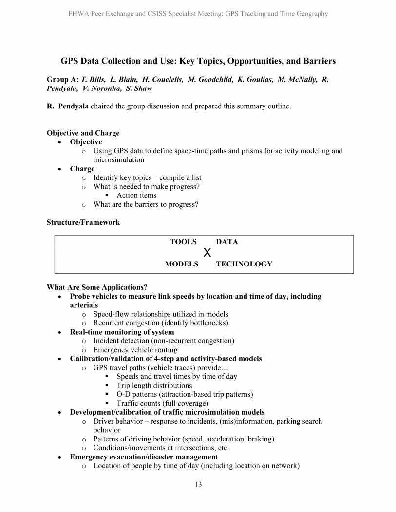
Structure/Framework
TOOLS DATA X
MODELS TECHNOLOGY
What Are Some Applications?
Probe vehicles to measure link speeds by location and time of day, including arterials
•
•
•
•
•
o Speed-flow relationships utilized in models o Recurrent congestion (identify bottlenecks)
Real-time monitoring of system o Incident detection (non-recurrent congestion) o Emergency vehicle routing
Calibration/validation of 4-step and activity-based models o GPS travel paths (vehicle traces) provide…
Speeds and travel times by time of day Trip length distributions O-D patterns (attraction-based trip patterns) Traffic counts (full coverage)
Development/calibration of traffic microsimulation models o Driver behavior – response to incidents, (mis)information, parking search
behavior o Patterns of driving behavior (speed, acceleration, braking) o Conditions/movements at intersections, etc.
Emergency evacuation/disaster management o Location of people by time of day (including location on network)
13

FHWA Peer Exchange and CSISS Specialist Meeting: GPS Tracking and Time Geography
Transportation policy analysis/formulation in real time (endogeneity of policy implementation)
•
• •
• • •
• • •
•
•
•
• • •
•
•
•
•
o Dynamic road pricing o Dynamic reverse lanes/lane closures/directional restrictions o Yield management (e.g., dynamic parking pricing)
Speed management Person-based GPS data applications
o Add multimodal dimension – mode choice (transit, bicycle, walk) o Transit access and egress paths
Data Issues and Action Items
Communications links – on-board processors, receivers, transmitters Standards for data structures/formats Data handling and reduction systems
o On-board and on-site Seamless data fusion (different pieces of information from different devices) Who is custodian/keeper/archiver of data? Data residing in private vs. public sector agencies
o Insurance companies, mapping companies, GPS manufacturers o Review patents in area of GPS technology and data processors
Desire for real-time GPS data o Incentives to get people to agree to transmit data o Establish public/private partnerships (institutional structures)
Legal/ethical use of data Tools and Models: Moving Towards Activity-Based Approaches
Matching GPS data with supporting trip characteristics data – Build an effective interface Simplify data collection process (intelligence in software) Measurement and analysis of time-space paths What characterizes/defines a time-space path?
o Deterministic vs. random components Model validity by spatial resolution
o TAZ Person o Measures of validation by level of spatial resolution/aggregation
Time-space prism definition to account for interactions and ICT use GPS Data and Time-Space Geography for Activity-Based Modeling
A multidimensional taxonomy (matrix) of GPS data use o Planning and policy applications vs. research uses o Model development, calibration, and validation o Real-time (continuous monitoring) vs. static snapshot o Immediate payoff vs. longer-term applications
Proof of concept o Transportation planning applications supported by GPS data – demonstrate worth
of investment in data collection
14
FHWA Peer Exchange and CSISS Specialist Meeting: GPS Tracking and Time Geography
o Information feedback to respondents – demonstrate worth of transmitting/sharing data
Institutional partnerships and incentive structures •
• • • • •
Project Ideas
Use of GPS data to calibrate/validate models (four-step and activity-based models) Driver behavior modeling to validate traffic microsimulation models Data fusion Dynamic real-time policy implementation Influence of ICT on time-space geography
15

FHWA Peer Exchange and CSISS Specialist Meeting: GPS Tracking and Time Geography
GPS Data Collection and Use: Key Topics, Research Uses, Impediments, Action Items, and Projects
Group B: A. Adamu, M. Bradley, G. Garry, R. Guensler, D. Janelle, M-P Kwan, H. Miller, E. Murakami, R. Schlappi, W. Yim H. Miller chaired the group discussion. R. Guensler prepared this summary outline. Key Topics
• Research needs What questions do we want to answer? o
o o o o
o o
o o o o o
o
o
o o
o o o o
Generation of research hypotheses Data needed to test hypotheses Unit of analysis for data collection Development of valid sampling plans
Avoiding self selection bias Validity, consistency, transferability
• Privacy • Funding sources • Identification and participation of stakeholders (theory to practice) • Technology
Person-based technology development Instrumentation costs
• Data retention and warehousing
Research Uses • Verify existing travel demand models
Congested speeds VDF curves Trip tables HBW splits Etc.
• Develop methods to use data to falsify elements of activity-based models • Propagation of adjustments in scheduling and activities through the system
Social network effects • Manage urban systems
Pushing demand out of the peak = pushing demand out of desired schedule into alternative schedule Traveler response to incentives and programs Consequences of change (economic, social, cultural)
• Identify potential time based solutions to transportation problems Operating hours Scheduling Meetings Private/public entity involvement
• Congestion monitoring and mitigation
16

FHWA Peer Exchange and CSISS Specialist Meeting: GPS Tracking and Time Geography
Identifying when and where congestion really occurs o o o o o o
o o
o
o o o
o o o o
o o
o o o o o
o o o o
o o o o
Expanding understanding of conditions under which congestion develops Identifying precursors to congestion Predicting congestion based upon monitored data Feedback to control systems to relieve congestion Identification of infrastructure improvements
• Latent demand Long term monitoring Monitoring changes in trip-making and route choice as a function of changes in land use and transportation infrastructure Effects on trip-making and route choice associated with providing enhanced traveler information to the traveling public
• Development of traffic management systems Replacement of highe-cost monitoring technologies Deployment in new areas (low volume roads and exurban/rural) Operations management research
• Identification of discontinuities in roadway performance characteristics Significant differences in performance on similar roadways Infrastructure impacts on capacity and performance Phase transitions Impact on HCM concepts
• Impact of performance variability (reliability) on route choice Day-to-day variability in travel time and other performance characteristics Impacts by trip purpose
• Time-tolerance in mode choice decision making Panel data (cluster sampling around transit service) Personal and vehicle monitoring Schedule pressures Transit reliability effects Accessibility to activity centers
• Recurrent activity patterns vs. travel variability Home, work, school, day care, etc. vs. new and unique locations Factors affecting the addition of new locations to recurrent activity Learning of new routes Constraints on variety seeking activity
• Integration of other data streams into GPS research o Satellite remote sensing o Video o Land use o Surveys o Counts
• Challenges in using real time data vs. archived data • Determining stakeholder benefits
Agencies, companies, persons, etc. Cost-benefit analysis for various uses Proof of concept work Case study development
17

FHWA Peer Exchange and CSISS Specialist Meeting: GPS Tracking and Time Geography
• Metadata development • Traveler information effects • Simulation model development and calibration
Impediments
• Funding • Researchers and proponents may appear self-serving • Staffing and training • Costs
Equipment o o o
o o
o o
o
o o
o o o
o o o o o
o
o o o o
Service Data Analysis
• Staff expertise and fragmentation of staff in various divisions Action Items
• Education and training Education of decision makers Mainstream GIS training (organizations are getting flatter) GIS as a tool, not as subject of study itself
Skill set maintenance via continuing education Formal programs in land use, transportation, geography
• Privacy survey Identification of public opinion on use of information and level of detail
• Proof of concept case studies for education and benefit estimation purposes Proving to decision makers that we get better answers (that they also like) MPOs need to know that this is a good investment
Demonstrate that costs are worthwhile Benchmarking and side-by-side comparisons
• Avoid advocacy perception Development of a professional research forum Objective peer reviews Identify downsides and risks
• Funding • Data
Enhance data quality and lower data cost (both are improving) Metadata development Integrate with project management Integrate into business process of MPO GIS/GPS need to be a line-item in the budget
Repeatedly called for in past professional forums • Develop reliable resource estimates
New modeling and data collection vs. current demands • Parallel research tracks
Planning Engineering/design Environment Etc.
18

FHWA Peer Exchange and CSISS Specialist Meeting: GPS Tracking and Time Geography
• Develop nexus between models Demand models o
o o o
o o o
o o o o
o o
o
o
o o
Mobility models Simulation models Environmental models
• Information sharing Establishment of professional forum TMIP-type program with combined funding AMPO modeling committee approach
• Focus information and recommendations to policy makers Explain why we need the data Quantify the benefits and to whom they accrue (staff/divisions) Show how the public will benefit Quantify current fragmented spending on multiple projects Identify offsetting expenditure reductions
Determine and argue for staffing needs Importance of research
• Assess impact of uncertainty in this field (enhanced modeling and mobility tracking) on policy outcomes and potential impact on institutional resistance to changes in status quo
• Facilitate effective communication between land use planners, transportation planners, transportation engineers, GIS experts, and IT staff within organizations (reorganize agency structures)
• Facilitate effective communications between stakeholders and modify agency hierarchy when necessary to ensure Federal, State, regional, and local agency staff and resources are dedicated to proposition that good solid GIS systems and dense GPS data can be used effectively in transportation planning and operations
• Pilot studies to examine specific benefits and to compare results across regions
Projects • Anonymizing data • Congestion monitoring and mitigation on specific corridors • Development of adequate sampling plans
Strata and duration of monitoring • Develop GIS-coded city for training future modelers
parcel level data, demand model, simulation model, and example mobility database
• Variability in recurrent and variety seeking activities across regions • Verifying 4-step models and activity-based (time-space paths) models • Evaluation of driver behavior
Parking seeking In-vehicle information systems response
• Use of real-time data for monitoring and operations response
19

FHWA Peer Exchange and CSISS Specialist Meeting: GPS Tracking and Time Geography
Appendix C
Recommended Research Initiatives
20

FHWA Peer Exchange and CSISS Specialist Meeting: GPS Tracking and Time Geography
Recommended Research from Group A
Report from R. Pendyala) Topic I: Use of GPS Data to Enhance and Calibrate/Validate Travel Models 2 to 3 Years - $500,000 + data collection cost Objectives:
• Identify how accuracy of existing four-step models can be improved for both regional and local applications
• Identify how four-step models can be enhanced with regard to policy analysis capabilities • What is the role of GPS data in activity-based model design and development and in
application?
Tasks/Phases: • Pilot study:
o Use speed-flow relationships/link speed measurements in four-step model – check improvement (Atlanta)
• Identify policies of interest to MPO’s in the context of four-step models
o Transit user behavior o flex work hours o telecommuting o time of day pricing, peak spreading
• Analyze GPS data for: o driver/traveler response to incidents, information, policies o time-space patterns (potentially feedback into four-step models)
21

FHWA Peer Exchange and CSISS Specialist Meeting: GPS Tracking and Time Geography
Topic II: Driver Behavior Profiles for Validating Traffic Microsimulation Models 1.5 to 2 Years, $300,000 - $400,000 Objective:
• Demonstrate applicability of GPS data for developing driver behavior profiles for validating traffic microsimulation models
Tasks:
• Develop driver and vehicular movement profiles using GPS data • Data fusion of driver/vehicular movement profiles with loop detector data, real-time
aerial videos, and any other types of field sensors • Identify vehicular movement parameters that can be used in traffic microsimulation
models Topic III: Integration of Time-Space Geography in Activity-Based Models 2 Years, $350,000 + data collection costs Objectives:
• Definition/measurement/representation of time-space paths
• Role of ICT in influencing action space
• Integration of time-space paths into activity-based models
Tasks: • Design and administer GPS data collection experiment that integrates ICT use patterns • Determine how to analyze activity profiles corresponding to time-space paths/patterns
(timing, sequencing, multitasking, substitution, coupling) • Develop operational measures of time-space prism constraints for use in activity-based
models
22
FHWA Peer Exchange and CSISS Specialist Meeting: GPS Tracking and Time Geography
Recommended Research from Group B Report from R. Guensler
Topic IV: Anonymizing GPS Data 1 Year - $200,000.00 Background: Privacy issues must be addressed before public release of GPS mobility data Goal: Identify data needs, convene stakeholder groups to identify privacy risks, develop new techniques for anonmyizing data, attempt to break protections, develop specific policy guidelines Researcher and MPO Meeting
• Census approach • What data do we need at what resolution for what purposes? • Will these require different levels and/or methods of anonymization
General Stakeholder Meeting
• Discussion of locational privacy issues • Risk identification • Prototype examples • Masking technique examples • Data fusion examples • What pieces of data are necessary to identify an individual
o e.g., home and work locations at specific resolution Develop anonymizing techniques
• Peer review of results Develop hacking techniques (break the protections)
• Peer review of results With stakeholders, based upon the results, develop specific policy guidelines
23

FHWA Peer Exchange and CSISS Specialist Meeting: GPS Tracking and Time Geography
Topic V: Geographic Modeling Testbed 2 Years - $750,000.00 to $1,250,000.00 Background: New analytical techniques require new training methods for practitioners and students Goal: Develop an education and training tool that is useful for testing hypotheses, testing comparative model development, and developing new analytical techniques Develop the underlying GIS data for a city
• Self contained city (or subset of a city coded to reflect self-containment) • Identify a smaller city that can be used as the basis (e.g., Boise)
o Potential to collect GPS and additional data • Land use
o Parcel-level land use with employment o Historic data
• Diary data • Transportation infrastructure • Transit network
3-D visualization Modeling networks
• Coded 4-step model example • Simulation model example (operations modeling of freeways and arterials) • Base GPS traces on real data
o Anonymization and adjustment
Peer review of data and models included • Make sure that we are not forcing the data to fit pre-conceived causal relationships
24

FHWA Peer Exchange and CSISS Specialist Meeting: GPS Tracking and Time Geography
Topic VI: Variability in Recurrent and Variety Seeking Activities across Space and Time Scoping - $50,000.00 - $100,000.00 5 Years - $2,500,000.00 Goal: Determine to what degree recurrent and variety-seeking activities vary across households, space, and time and what are the most important dimensions and measures to describe this variability Scoping study Develop a sampling plan that addresses
• Regional effects (sample within multiple regions) o Rural, suburban, urban characteristics o Weather characteristics
• Household strata and land development • Transit accessibility • Effects of changes in transportation infrastructure and land use environments
o Pre- and post-improvements (e.g. I-15 improvement in SLC) • Time effects (longer term monitoring or repeated monitoring)
o Long term monitoring to examine disruptions o Instrumentation deployment time periods
• GPS plus travel diaries Exploratory analysis of new data at different spatial and temporal scales Identification of emergent patterns and responses in recurrent and variety seeking travel to changes in the system and effects of control variables identified above
25

