Embed Size (px)
Citation preview
GRASS GIS intro
Sara LuccaLuana Valentini
Geographic Information Systems (GIS)
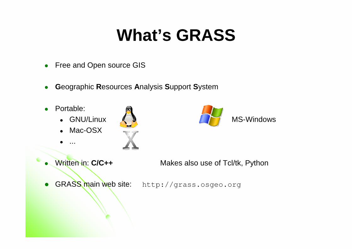
What’s GRASS
� Free and Open source GIS
� Geographic Resources Analysis Support System
� Portable:� GNU/Linux MS-Windows
� Mac-OSX
� ...
� Written in: C/C++ Makes also use of Tcl/tk, Python
� GRASS main web site: http://grass.osgeo.org
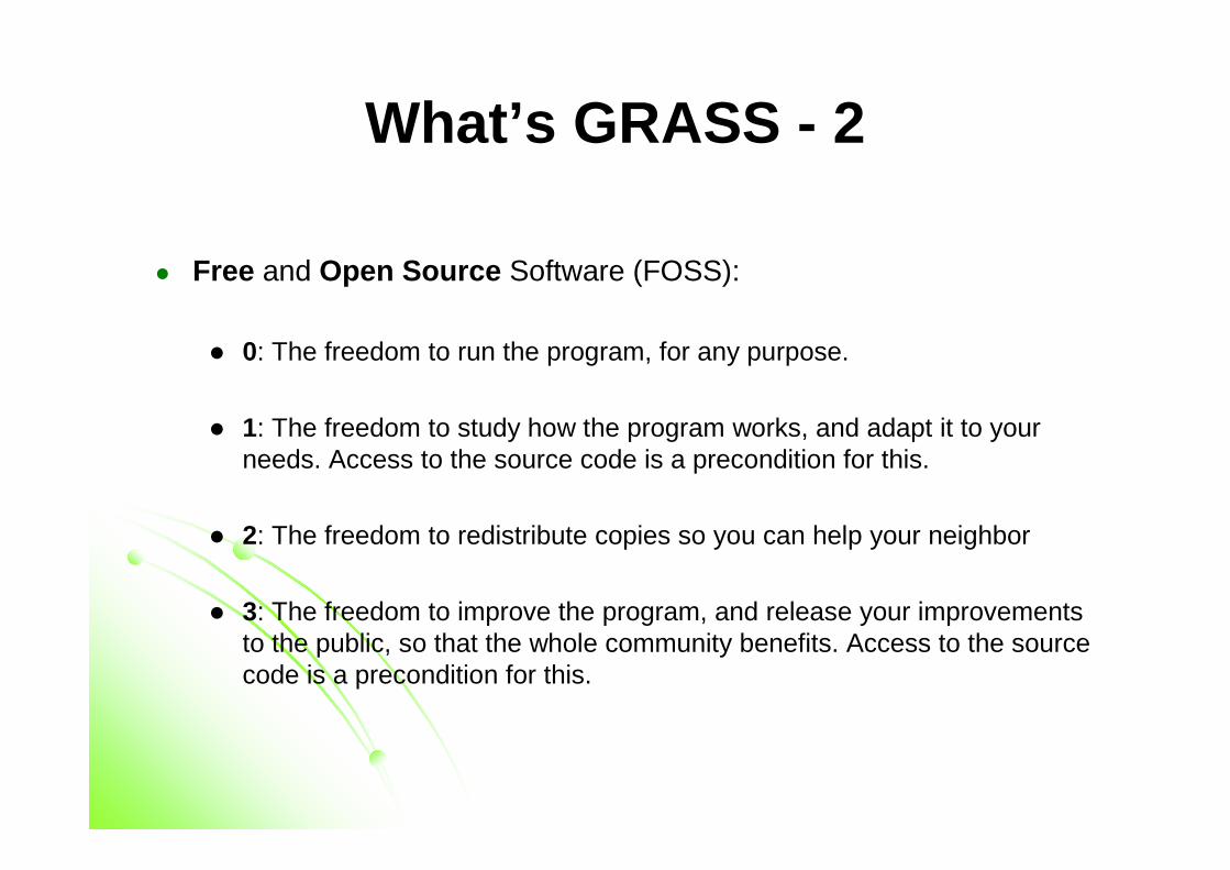
What’s GRASS - 2
� Free and Open Source Software (FOSS):
� 0: The freedom to run the program, for any purpose.
� 1: The freedom to study how the program works, and adapt it to yourneeds. Access to the source code is a precondition for this.
� 2: The freedom to redistribute copies so you can help your neighbor
� 3: The freedom to improve the program, and release your improvementsto the public, so that the whole community benefits. Access to the source code is a precondition for this.
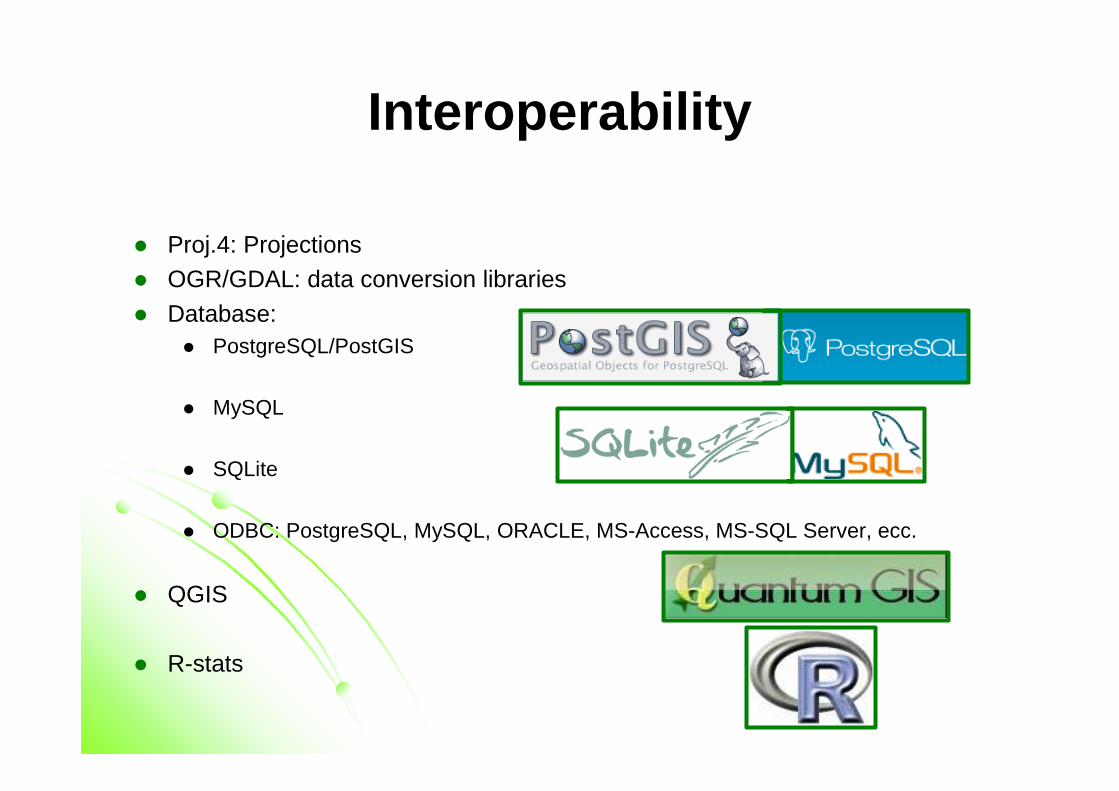
Interoperability
� Proj.4: Projections� OGR/GDAL: data conversion libraries
� Database: � PostgreSQL/PostGIS
� MySQL
� SQLite
� ODBC: PostgreSQL, MySQL, ORACLE, MS-Access, MS-SQL Server, ecc.
� QGIS
� R-stats
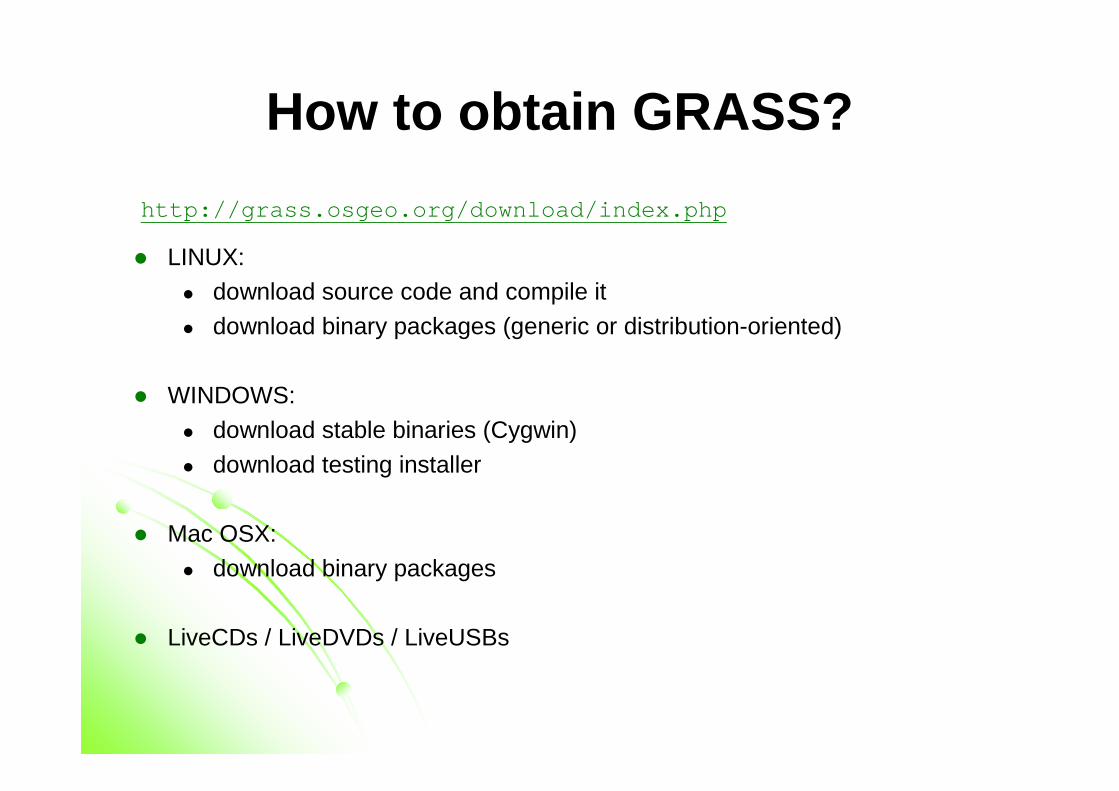
How to obtain GRASS?
http://grass.osgeo.org/download/index.php
� LINUX:� download source code and compile it
� download binary packages (generic or distribution-oriented)
� WINDOWS:
� download stable binaries (Cygwin)
� download testing installer
� Mac OSX:
� download binary packages
� LiveCDs / LiveDVDs / LiveUSBs
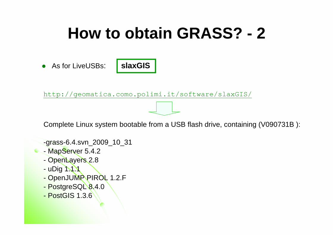
How to obtain GRASS? - 2
� As for LiveUSBs: slaxGIS
http://geomatica.como.polimi.it/software/slaxGIS/
Complete Linux system bootable from a USB flash drive, containing (V090731B ):
-grass-6.4.svn_2009_10_31- MapServer 5.4.2- OpenLayers 2.8 - uDig 1.1.1 - OpenJUMP PIROL 1.2.F - PostgreSQL 8.4.0- PostGIS 1.3.6
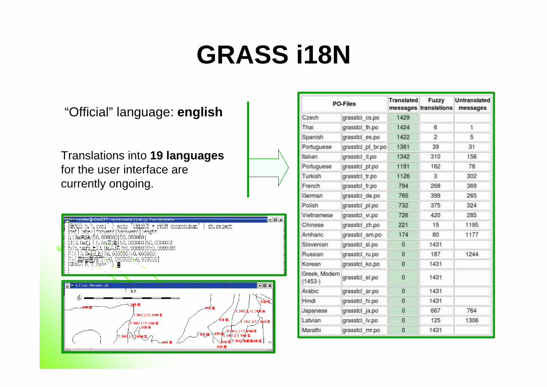
GRASS i18N
“Official” language: english
Translations into 19 languagesfor the user interface are currently ongoing.
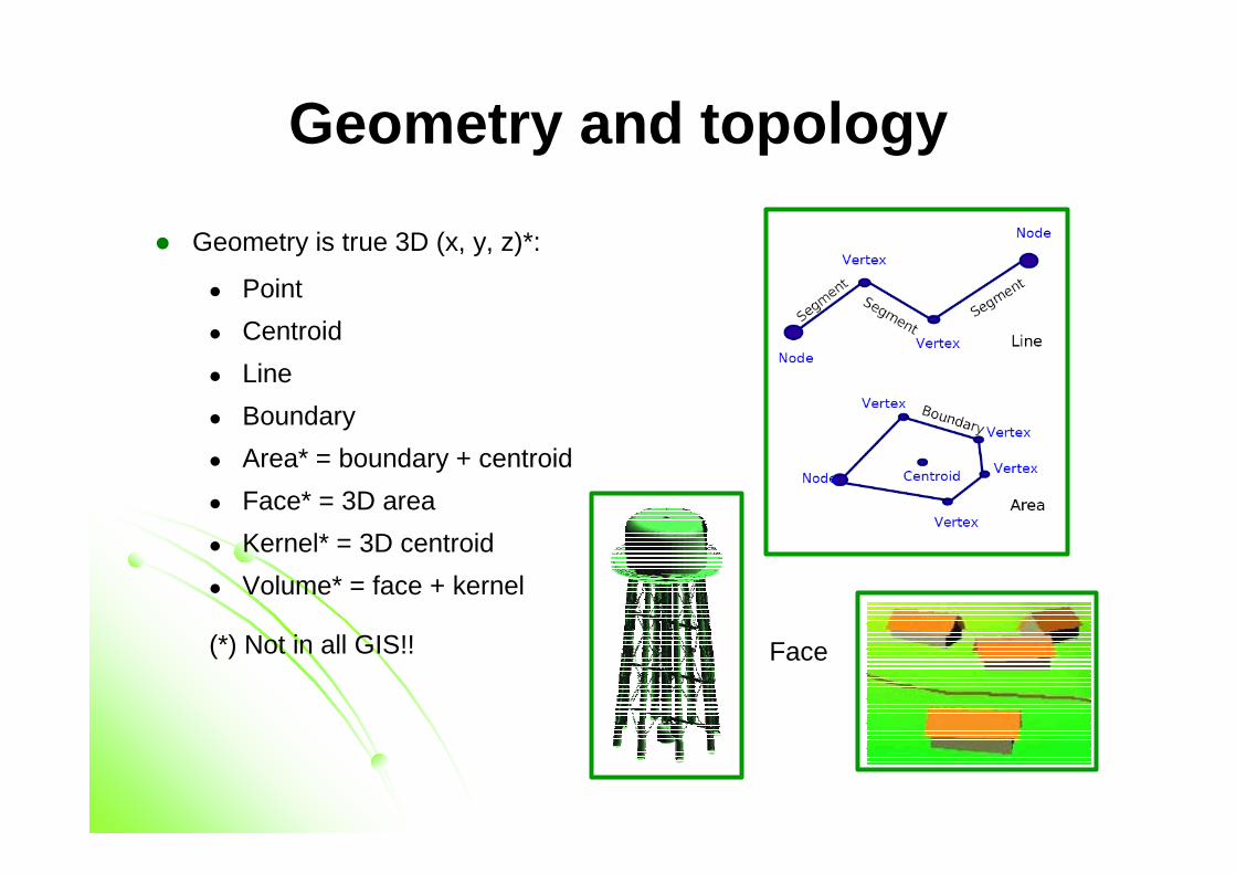
Geometry and topology
� Geometry is true 3D (x, y, z)*:
� Point
� Centroid
� Line
� Boundary
� Area* = boundary + centroid
� Face* = 3D area
� Kernel* = 3D centroid
� Volume* = face + kernel
(*) Not in all GIS!! Face
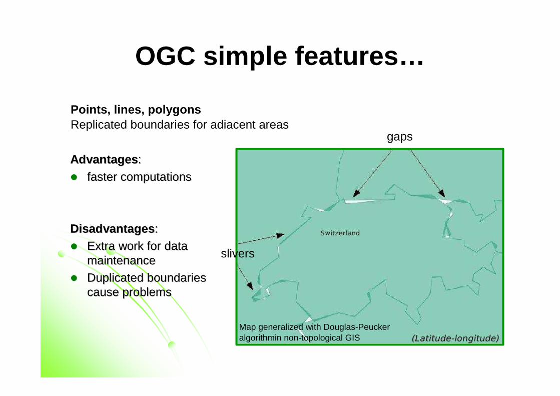
OGC simple features…
Points, lines, polygonsReplicated boundaries for adiacent areas
AdvantagesAdvantages ::
�� fasterfaster computationscomputations
DisadvantagesDisadvantages ::
�� Extra work Extra work forfor data data maintenancemaintenance
�� DuplicatedDuplicated boundariesboundariescause cause problemsproblems
slivers
gaps
Map generalized with Douglas-Peuckeralgorithmin non-topological GIS
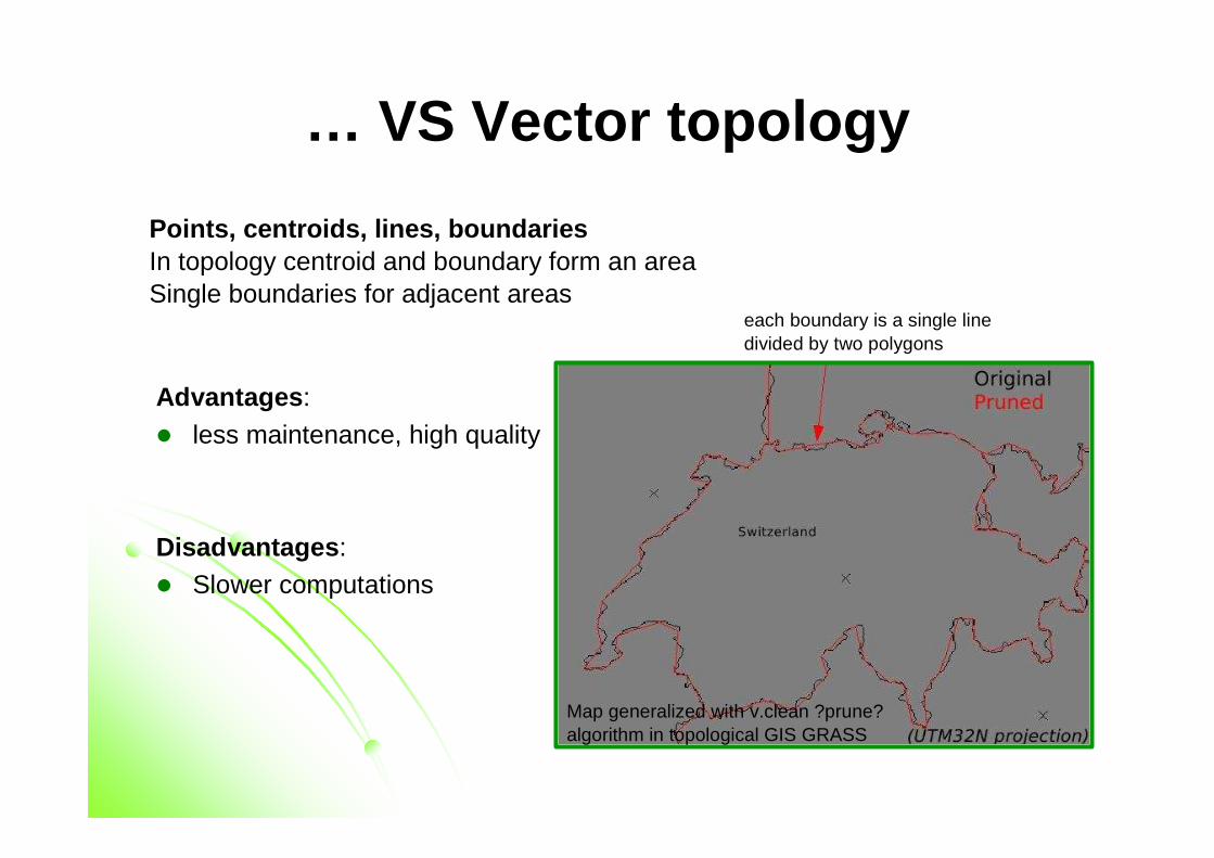
… VS Vector topology
Points, centroids, lines, boundariesIn topology centroid and boundary form an areaSingle boundaries for adjacent areas
Advantages :
� less maintenance, high quality
Disadvantages :� Slower computations
each boundary is a single line divided by two polygons
Map generalized with v.clean ?prune? algorithm in topological GIS GRASS
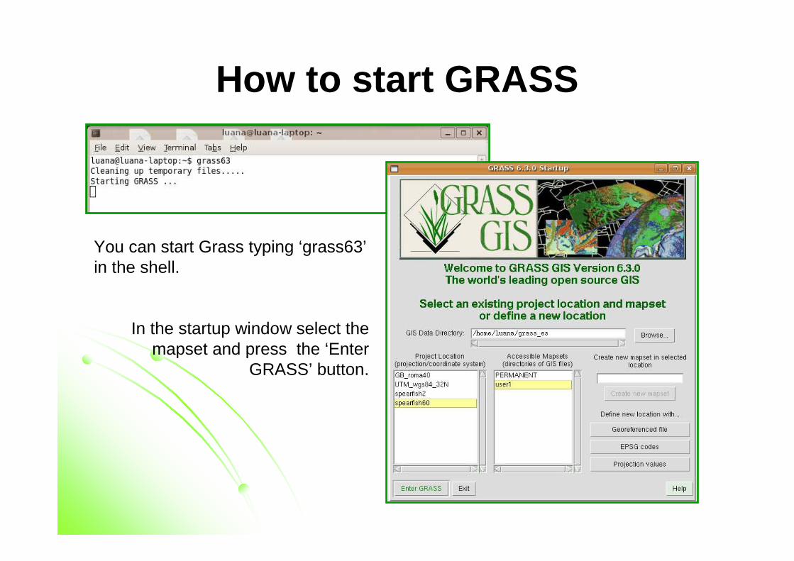
How to start GRASS
You can start Grass typing ‘grass63’in the shell.
In the startup window select the mapset and press the ‘Enter
GRASS’ button.
Data structure
� DATABASE : Contains all GRASS data.
� LOCATION : Defines a coordinate system and a rectangular boundary for a project
� MAPSET(s) : Used to subdivide data by user names or subregions or access rights.
� PERMANENT: is a standard mapset that contains the definitions of the location. May also contain general cartography since it is visible to all the other mapsets.
� Multi-User support: multiple users can work in a single location usingdifferent mapsets. Access rights can be managed per user. No user can modify/delete data of other users.
Each GRASS project is organized in a “Location” directory with subsequent“Mapset” directories
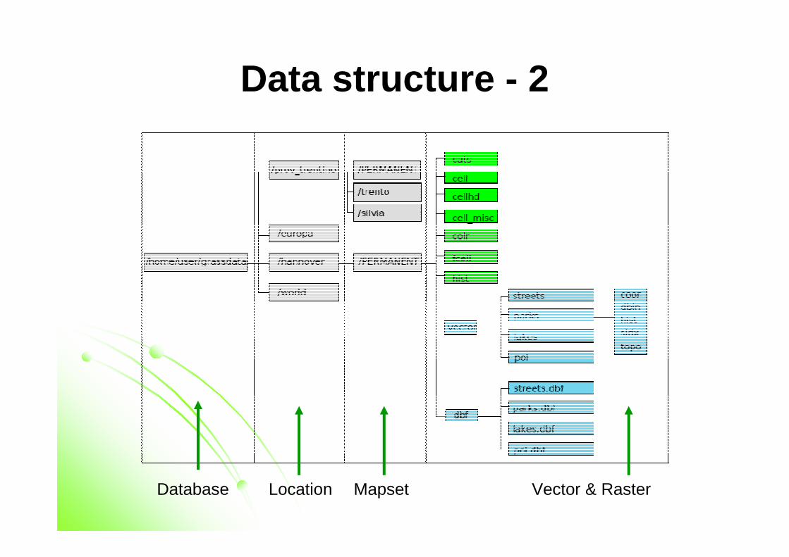
Data structure - 2
Database Location Mapset Vector & Raster
Vector maps structure
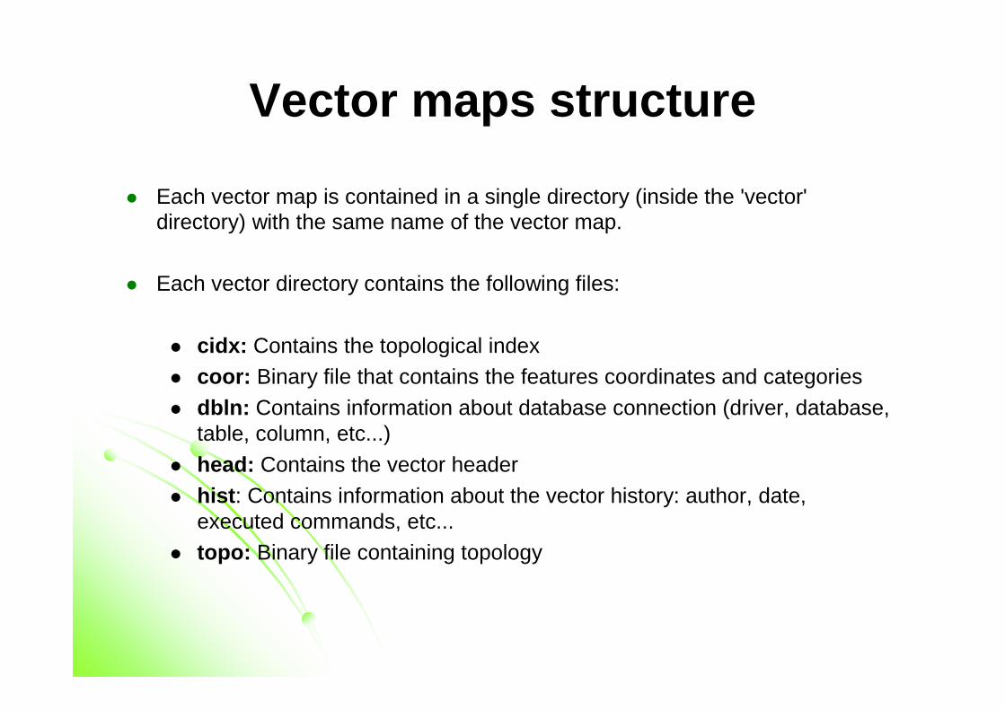
� Each vector map is contained in a single directory (inside the 'vector' directory) with the same name of the vector map.
� Each vector directory contains the following files:
� cidx: Contains the topological index� coor: Binary file that contains the features coordinates and categories
� dbln: Contains information about database connection (driver, database, table, column, etc...)
� head: Contains the vector header
� hist : Contains information about the vector history: author, date, executed commands, etc...
� topo: Binary file containing topology
Raster maps structure
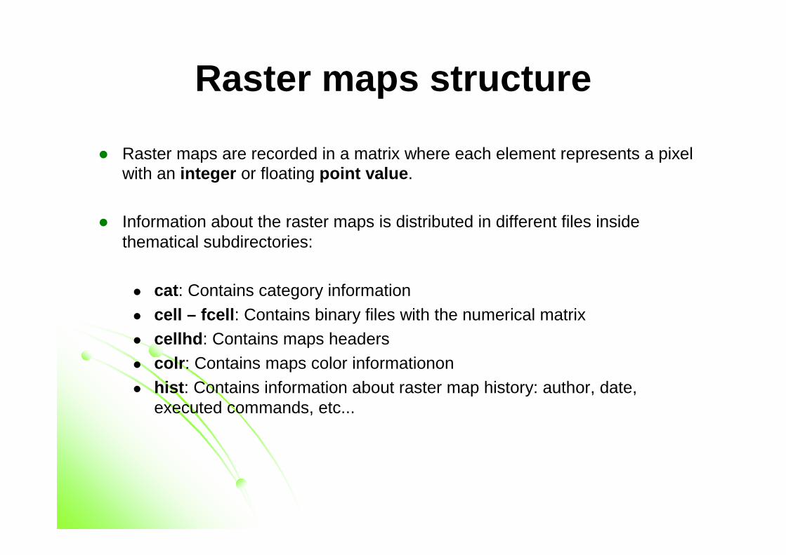
� Raster maps are recorded in a matrix where each element represents a pixel with an integer or floating point value .
� Information about the raster maps is distributed in different files inside thematical subdirectories:
� cat : Contains category information
� cell – fcell : Contains binary files with the numerical matrix� cellhd : Contains maps headers
� colr : Contains maps color informationon
� hist : Contains information about raster map history: author, date, executed commands, etc...
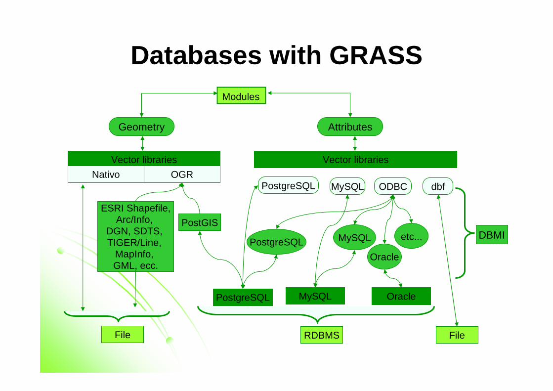
Databases with GRASS
Vector libraries
Nativo OGR
Vector libraries
Geometry Attributes
Modules
PostgreSQL MySQL ODBC dbf
PostgreSQL etc...MySQL
Oracle
MySQL Oracle
FileRDBMS
PostgreSQL
DBMI
ESRI Shapefile,Arc/Info,
DGN, SDTS, TIGER/Line,
MapInfo, GML, ecc.
PostGIS
File
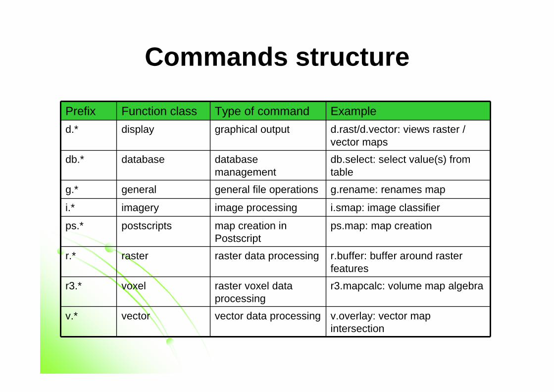
Commands structure
Prefix Function class Type of command Example
d.* display graphical output d.rast/d.vector: views raster / vector maps
db.* database database management
db.select: select value(s) fromtable
g.* general general file operations g.rename: renames map
i.* imagery image processing i.smap: image classifier
ps.* postscripts map creation in Postscript
ps.map: map creation
r.* raster raster data processing r.buffer: buffer around rasterfeatures
r3.* voxel raster voxel data processing
r3.mapcalc: volume map algebra
v.* vector vector data processing v.overlay: vector mapintersection
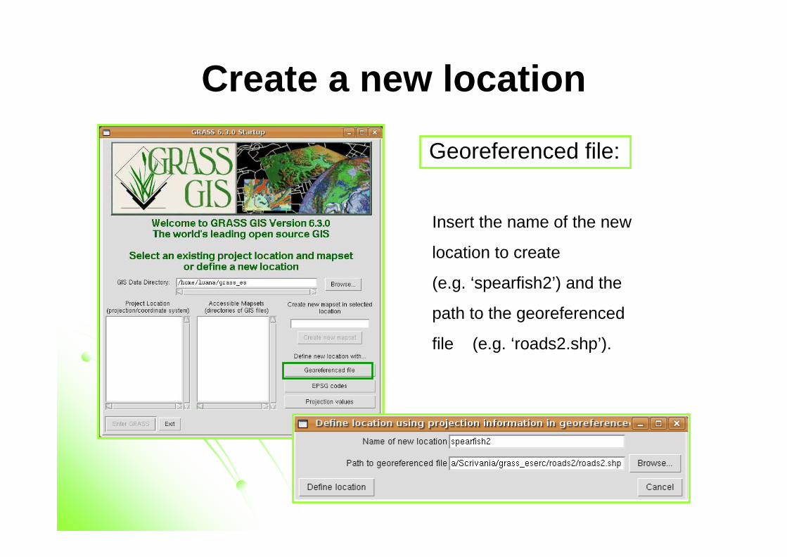
Create a new location
Georeferenced file:
Insert the name of the new
location to create
(e.g. ‘spearfish2’) and the
path to the georeferenced
file (e.g. ‘roads2.shp’).
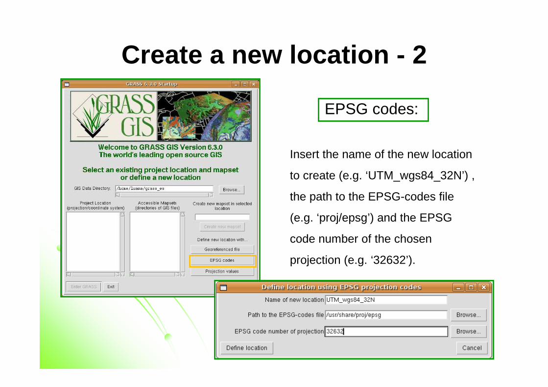
Create a new location - 2
EPSG codes:
Insert the name of the new location
to create (e.g. ‘UTM_wgs84_32N’) ,
the path to the EPSG-codes file
(e.g. ‘proj/epsg’) and the EPSG
code number of the chosen
projection (e.g. ‘32632’).
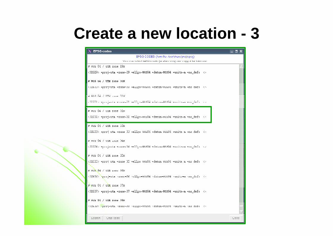
Create a new location - 3
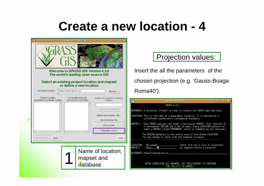
Create a new location - 4
Projection values:
Insert the all the parameters of the
chosen projection (e.g. ‘Gauss-Boaga
Roma40’).
Name of location, mapset and database1
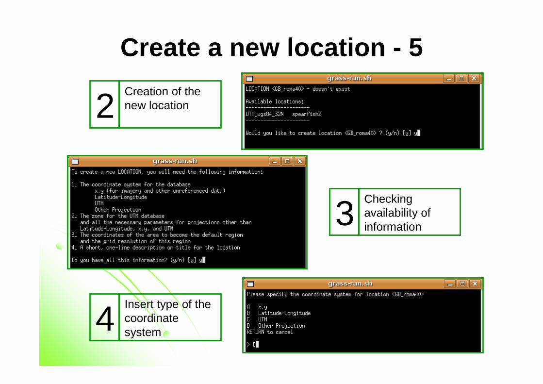
Create a new location - 5
Creation of the new location2
Checkingavailability of information3
Insert type of the coordinate system4
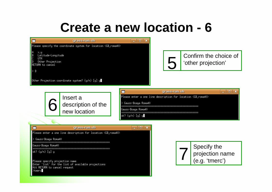
Create a new location - 6
Confirm the choice of ‘other projection’5
Insert a description of the new location6
Specify the projection name(e.g. ‘tmerc’)7
Create a new location - 7
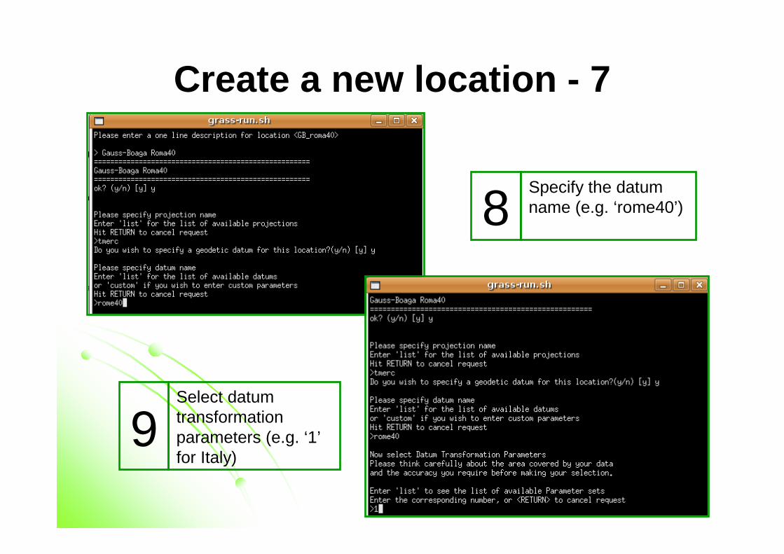
Specify the datumname (e.g. ‘rome40’)8
Select datumtransformationparameters (e.g. ‘1’for Italy)
9
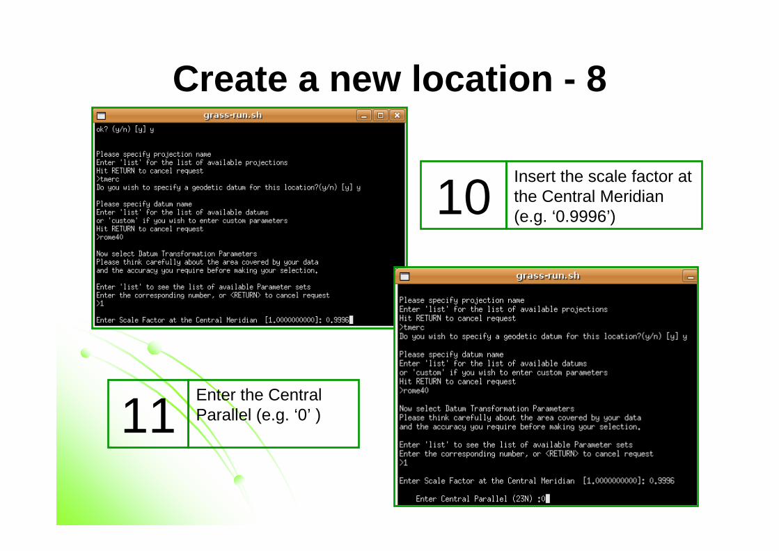
Create a new location - 8
Insert the scale factor at the Central Meridian(e.g. ‘0.9996’)10
Enter the CentralParallel (e.g. ‘0’ )11
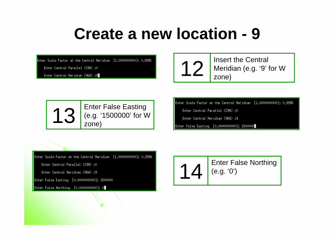
Create a new location - 9Insert the CentralMeridian (e.g. ‘9’ for W zone)12
Enter False Easting(e.g. ‘1500000’ for W zone) 13
Enter False Northing(e.g. ‘0’)14
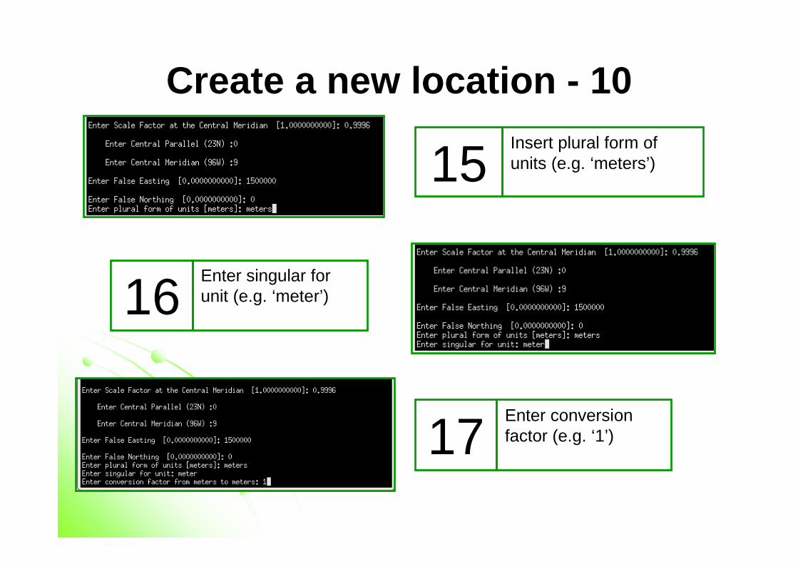
Create a new location - 10Insert plural form of units (e.g. ‘meters’)15
Enter singular forunit (e.g. ‘meter’) 16
Enter conversionfactor (e.g. ‘1’)17
Create a new location - 11
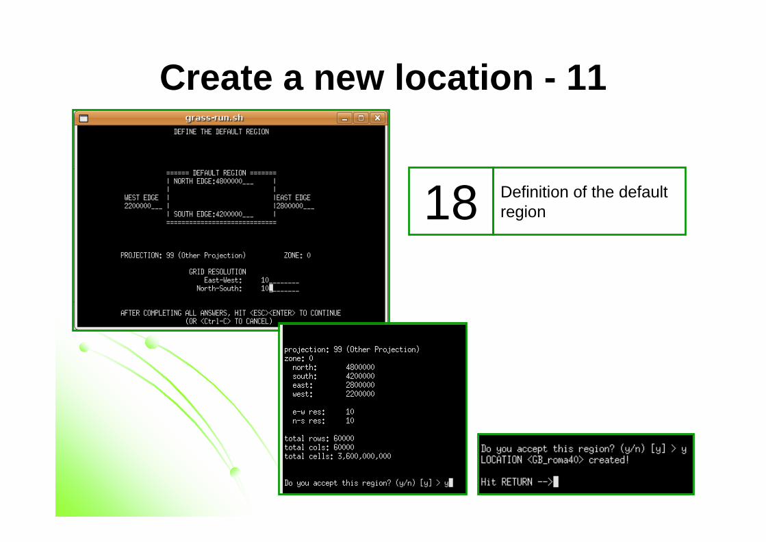
Definition of the default region18
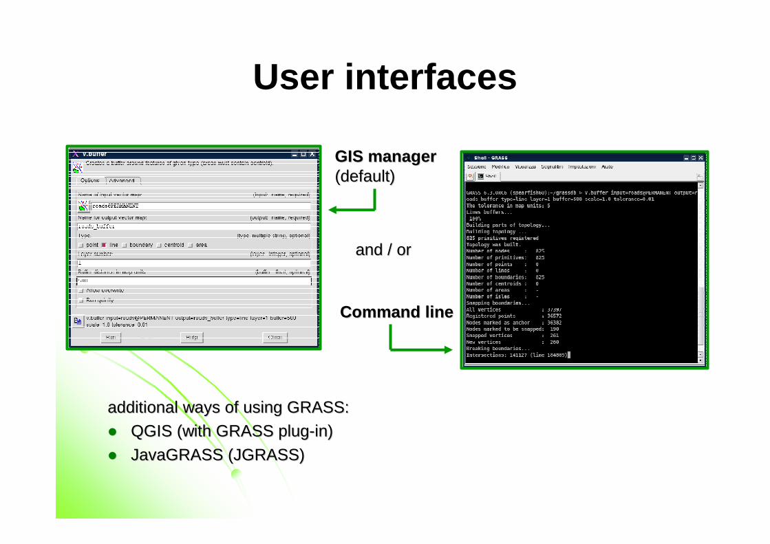
User interfaces
additionaladditional waysways of of usingusing GRASS:GRASS:
�� QGIS (QGIS (withwith GRASS plugGRASS plug--in)in)
�� JavaGRASSJavaGRASS (JGRASS)(JGRASS)
GIS managerGIS manager(default)(default)
CommandCommand lineline
and / orand / or
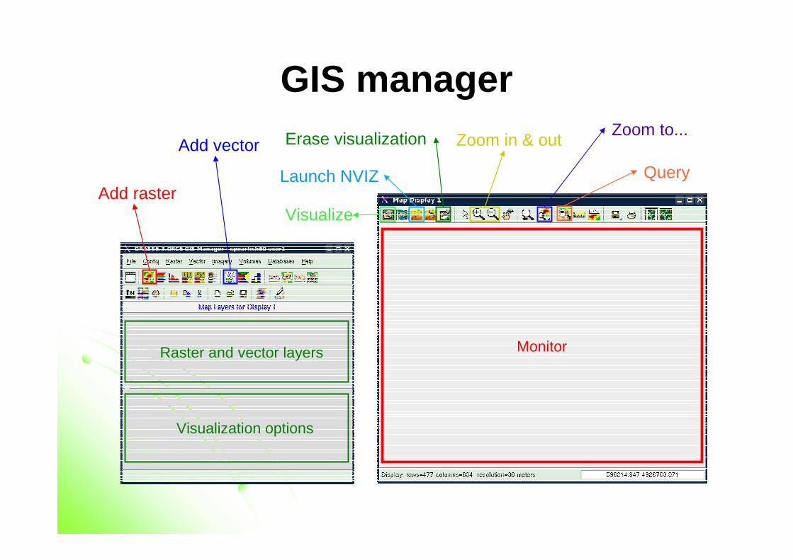
GIS manager
Monitor
Erase visualization
Add raster
Add vector
Visualize
Zoom in & outZoom to...
Raster and vector layers
Visualization options
Launch NVIZ Query
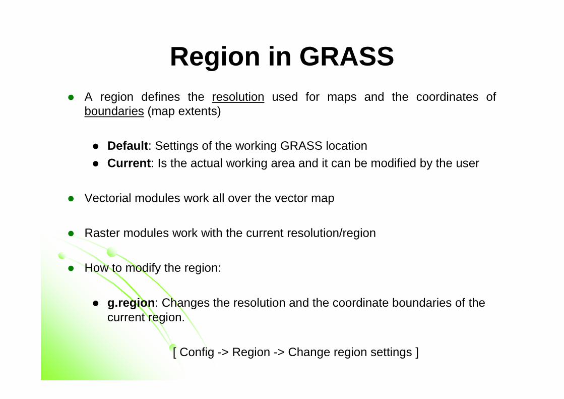
Region in GRASS� A region defines the resolution used for maps and the coordinates of
boundaries (map extents)
� Default : Settings of the working GRASS location� Current : Is the actual working area and it can be modified by the user
� Vectorial modules work all over the vector map
� Raster modules work with the current resolution/region
� How to modify the region:
� g.region : Changes the resolution and the coordinate boundaries of the current region.
[ Config -> Region -> Change region settings ]
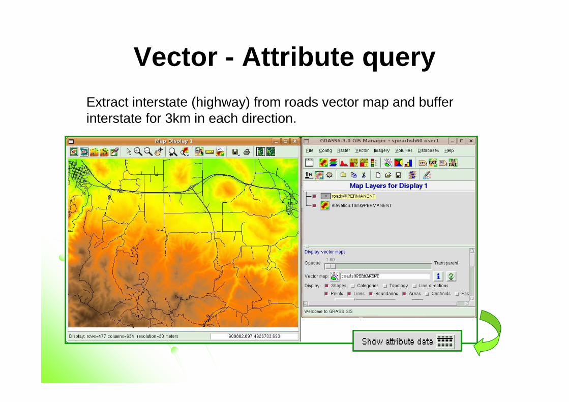
Vector - Attribute query
Extract interstate (highway) from roads vector map and buffer interstate for 3km in each direction.
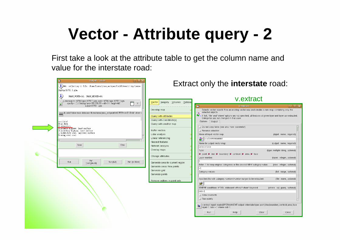
Vector - Attribute query - 2First take a look at the attribute table to get the column name and value for the interstate road:
Extract only the interstate road:
v.extract
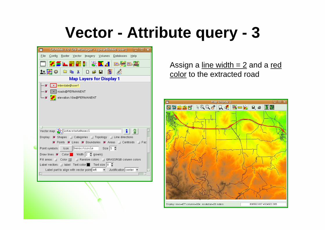
Vector - Attribute query - 3
Assign a line width = 2 and a redcolor to the extracted road
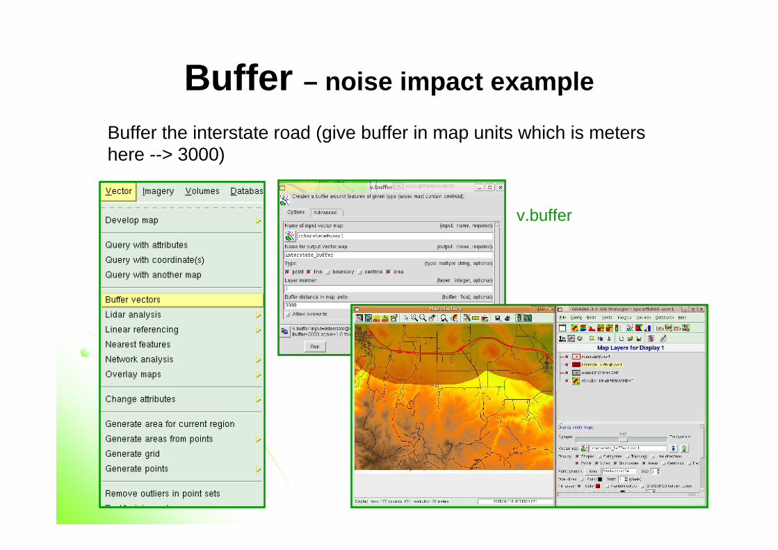
Buffer – noise impact example
Buffer the interstate road (give buffer in map units which is metershere --> 3000)
v.buffer
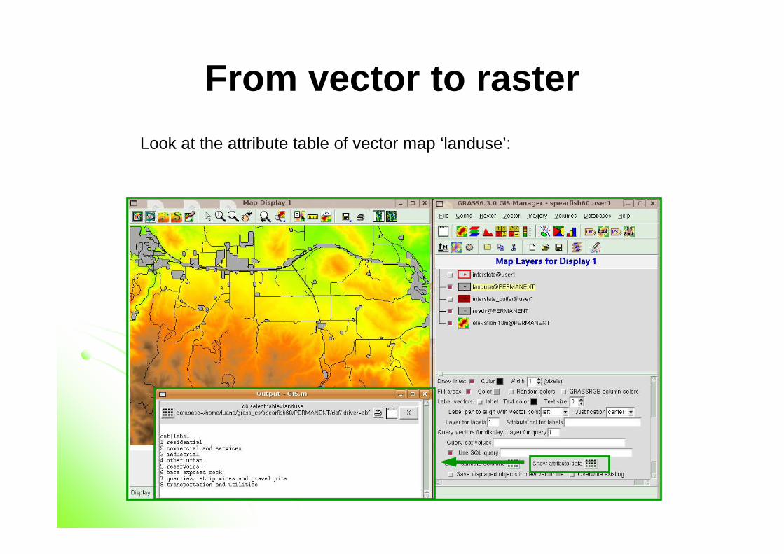
From vector to raster
Look at the attribute table of vector map ‘landuse’:
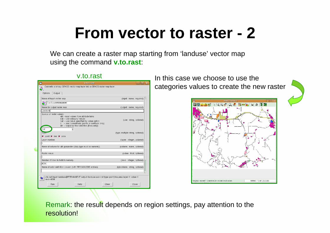
From vector to raster - 2We can create a raster map starting from ‘landuse’ vector mapusing the command v.to.rast :
In this case we choose to use the categories values to create the new raster
v.to.rast
Remark: the result depends on region settings, pay attention to the resolution!
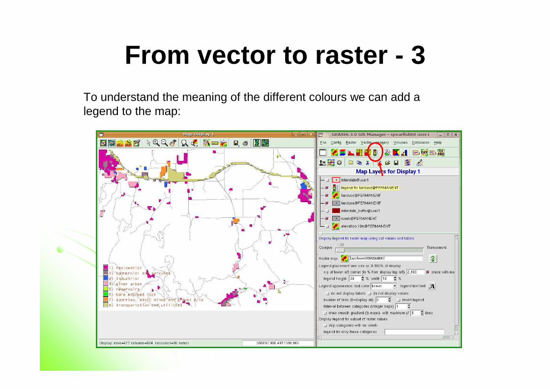
From vector to raster - 3To understand the meaning of the different colours we can add a legend to the map:
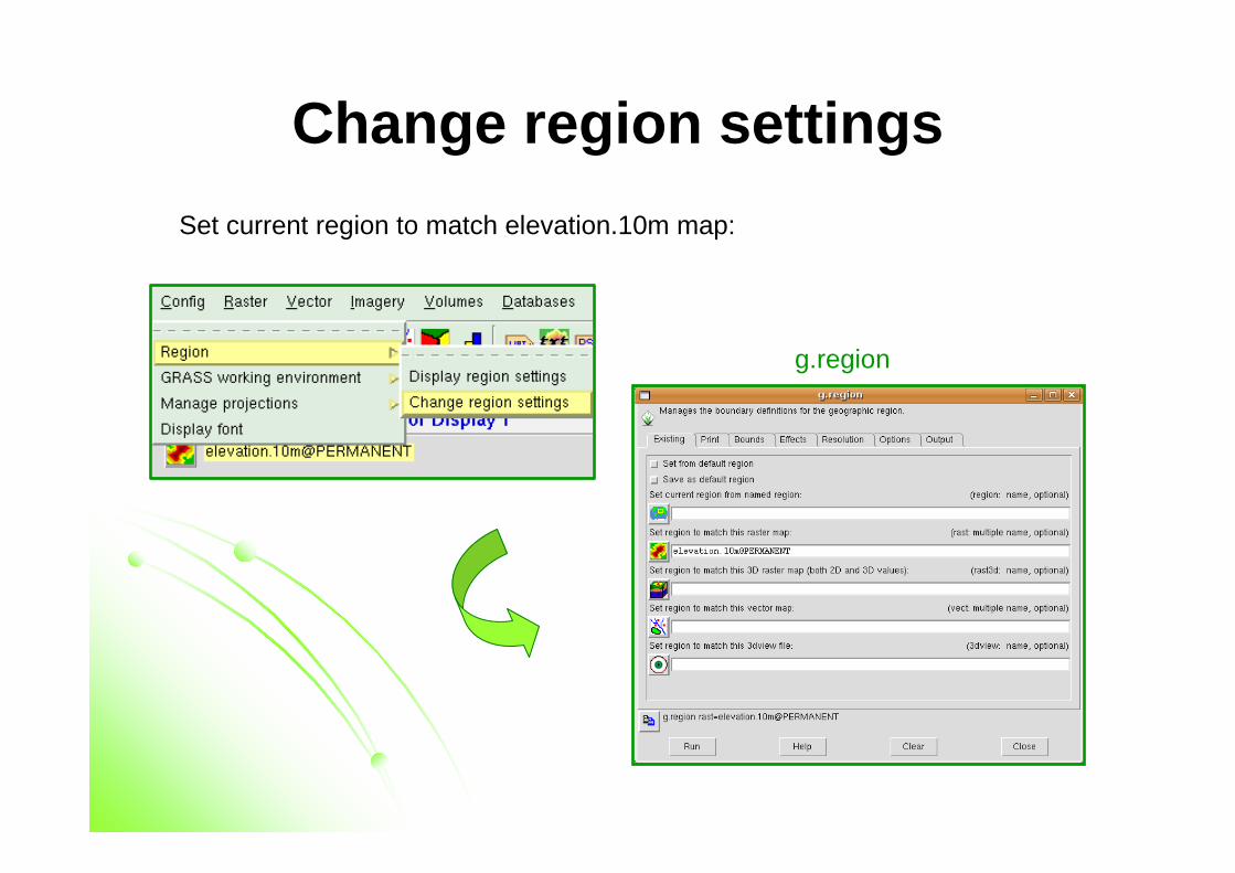
Change region settings
Set current region to match elevation.10m map:
g.region
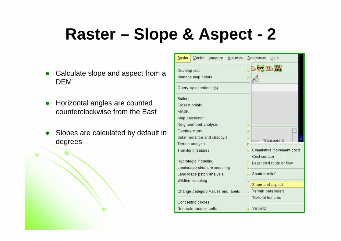
Raster – Slope & Aspect - 2
� Calculate slope and aspect from a DEM
� Horizontal angles are countedcounterclockwise from the East
� Slopes are calculated by default in degrees
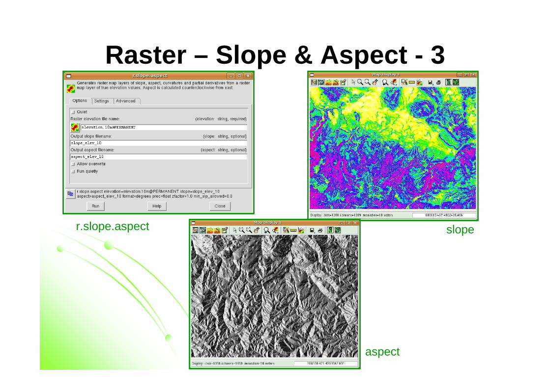
Raster – Slope & Aspect - 3
r.slope.aspect slope
aspect
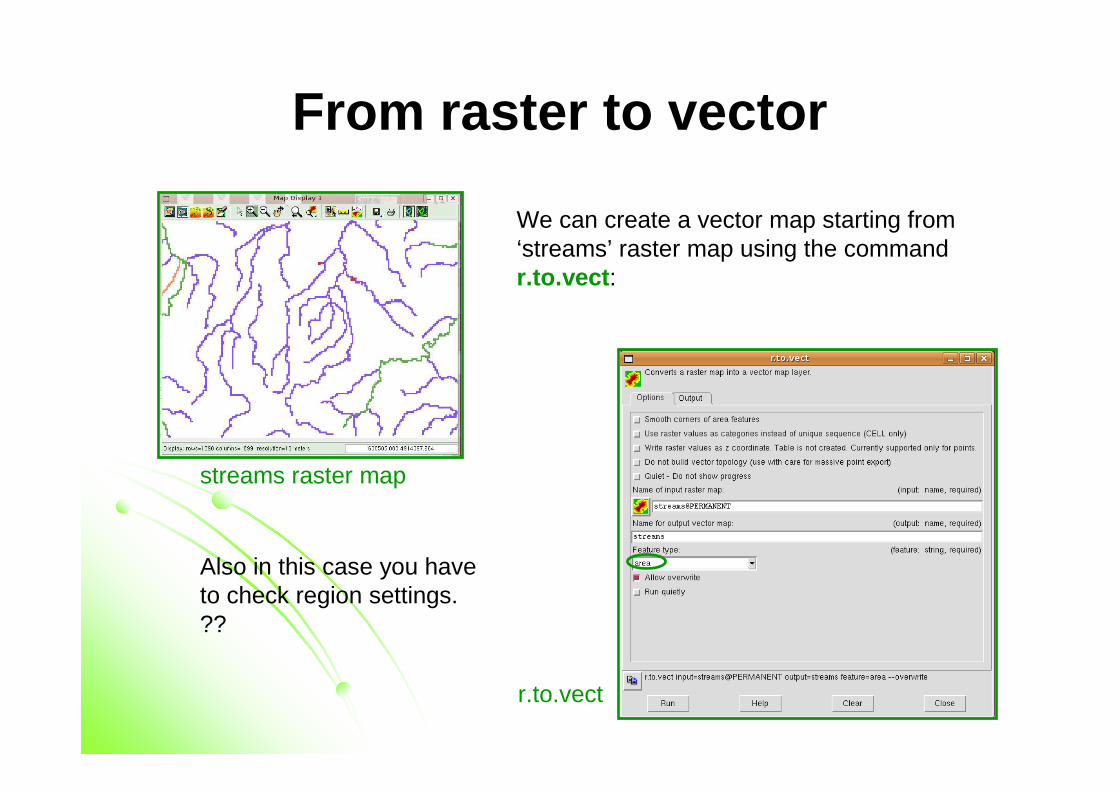
We can create a vector map starting from‘streams’ raster map using the commandr.to.vect :
streams raster map
r.to.vect
Also in this case you haveto check region settings. ??
From raster to vector
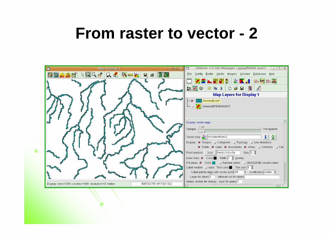
From raster to vector - 2
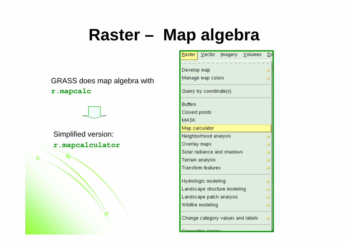
Raster – Map algebra
GRASS does map algebra withr.mapcalc
Simplified version:r.mapcalculator
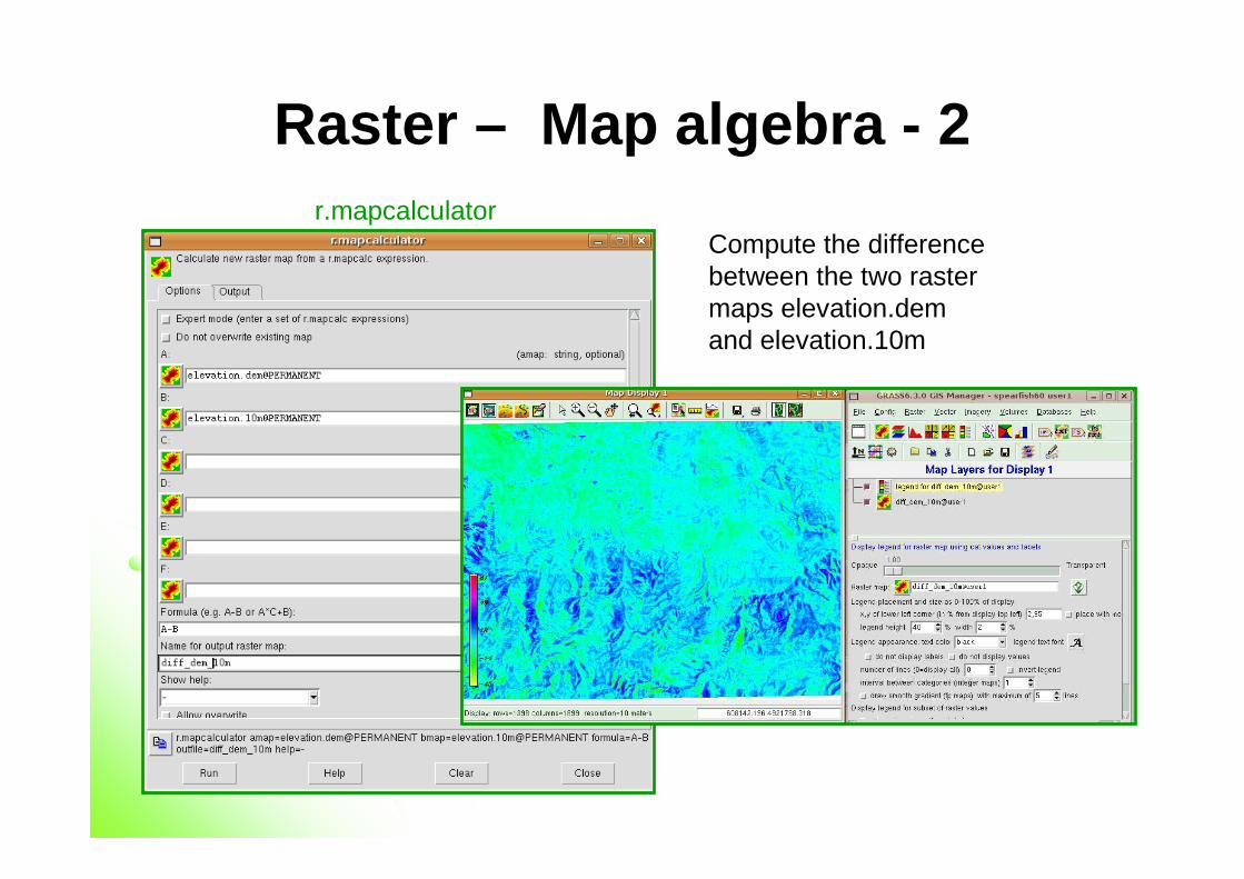
Raster – Map algebra - 2
Compute the differencebetween the two rastermaps elevation.demand elevation.10m
r.mapcalculator
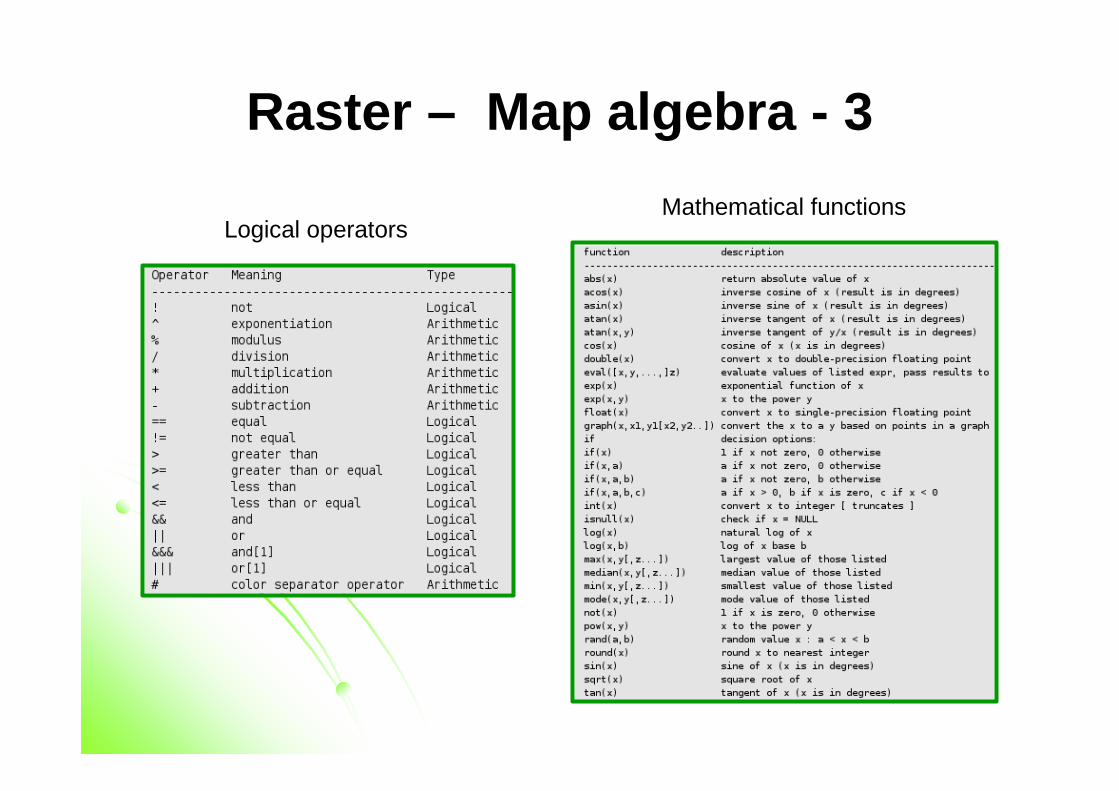
Raster – Map algebra - 3
Logical operatorsMathematical functions
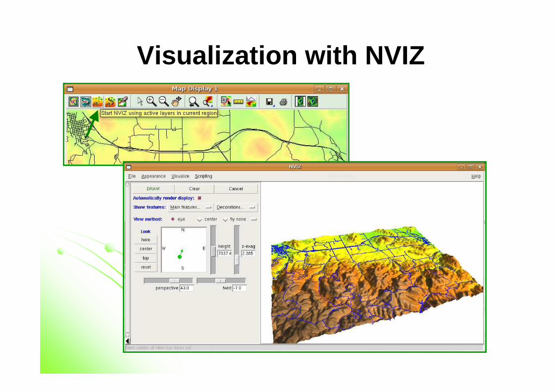
Visualization with NVIZ
Other GRASS functionalities
� Import/Export
� Vector/raster analysis� Rasterization / vectorization
� Overlay
� Queries� Geometry management
� Map algebra
� Neighborhood analysis� Interpolation
� Network analysis
� Datum shifting
� Solar radiance & shadows� Terrain analysis
� Hydrologic modeling
� Wildfire modeling� LiDAR analysis
� Geostatistics
� Optical image processing� 3D analysis
� ….
Network analysis
� Methods:
� Find shortest path along vector network – road navigation �
v.net.path
� Subdivide a network in subnetworks (iso-distances) – how far can I go from a node in all directions � v.net.iso
� Find optimal connection between nodes (Minimum Steiner tree) �v.net.steiner
� Traveling salesman problem � v.net.salesman
� etc...
� Allows to work with values in a attribute table
Interpolation methods
� Interpolation of vector maps in order to create rasters[ Raster -> Interpolate surfaces ]:
� 2D inverse distance weighted � v.surf.idw
� 2D regularized splines with tension (with cross-validation)� v.surf.rst
� 3D regularized splines with tension (with cross-validation) � v.vol.rst
� Bilinear and Bicubic splines with Tychonov regularizator � v.surf.bspline
� 2D/3D kernel densities � v.kernel
� Kriging, predictive models (R-Stats)
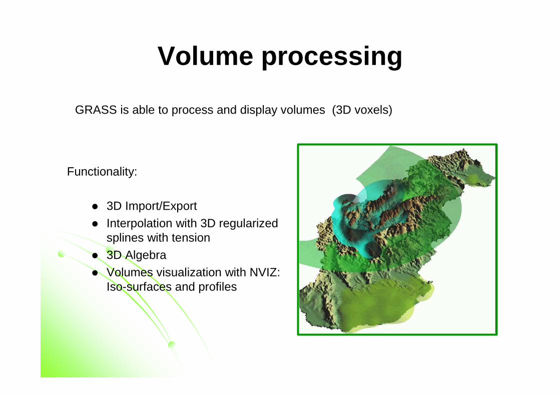
Volume processing
Functionality:
� 3D Import/Export
� Interpolation with 3D regularizedsplines with tension
� 3D Algebra
� Volumes visualization with NVIZ: Iso-surfaces and profiles
GRASS is able to process and display volumes (3D voxels)
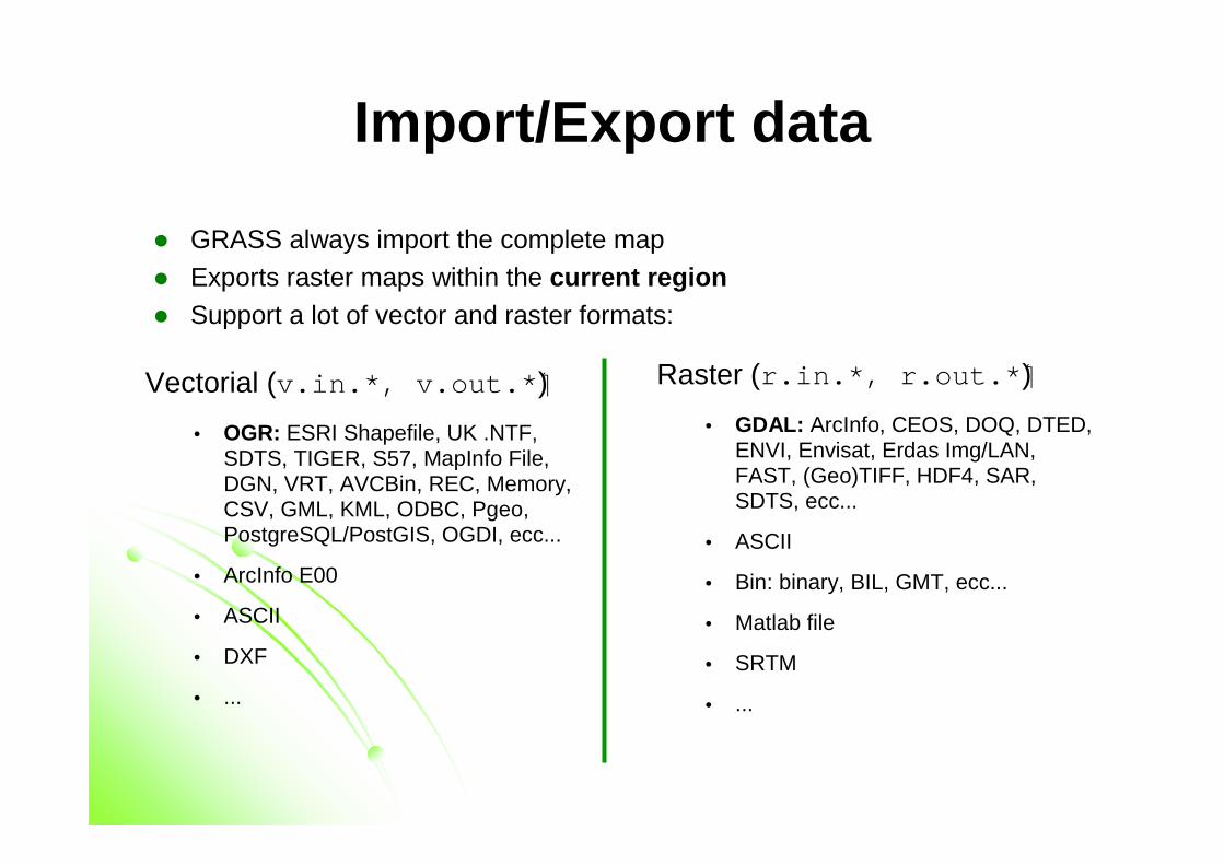
Import/Export data
� GRASS always import the complete map
� Exports raster maps within the current region� Support a lot of vector and raster formats:
Vectorial (v.in.*, v.out.*)�
• OGR: ESRI Shapefile, UK .NTF, SDTS, TIGER, S57, MapInfo File, DGN, VRT, AVCBin, REC, Memory, CSV, GML, KML, ODBC, Pgeo, PostgreSQL/PostGIS, OGDI, ecc...
• ArcInfo E00
• ASCII
• DXF
• ...
Raster (r.in.*, r.out.*)�
• GDAL: ArcInfo, CEOS, DOQ, DTED, ENVI, Envisat, Erdas Img/LAN, FAST, (Geo)TIFF, HDF4, SAR, SDTS, ecc...
• ASCII
• Bin: binary, BIL, GMT, ecc...
• Matlab file
• SRTM
• ...
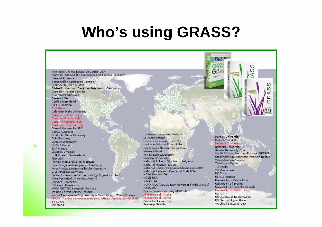
Who’s using GRASS?
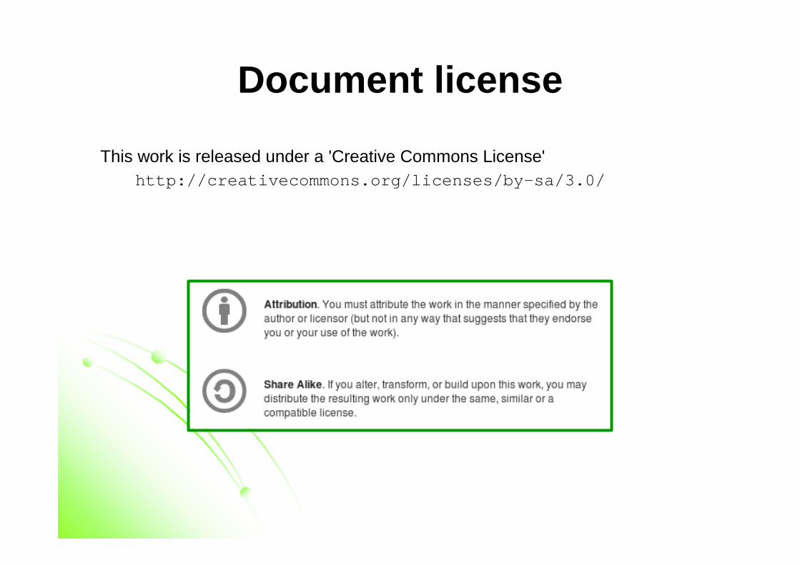
Document license
This work is released under a 'Creative Commons License'http://creativecommons.org/licenses/by-sa/3.0/
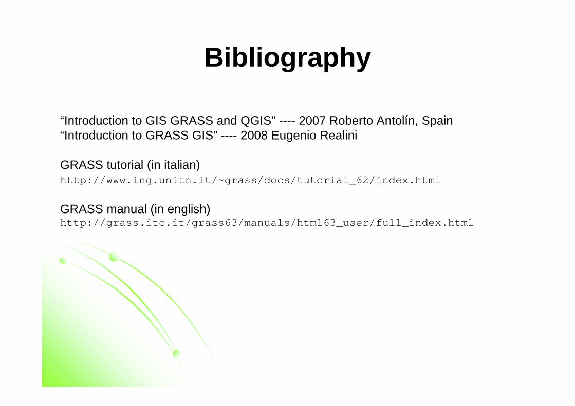
Bibliography
“Introduction to GIS GRASS and QGIS” ---- 2007 Roberto Antolín, Spain“Introduction to GRASS GIS” ---- 2008 Eugenio Realini
GRASS tutorial (in italian)http://www.ing.unitn.it/~grass/docs/tutorial_62/index.html
GRASS manual (in english)http://grass.itc.it/grass63/manuals/html63_user/full_index.html