Embed Size (px)
Citation preview
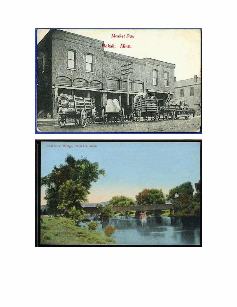
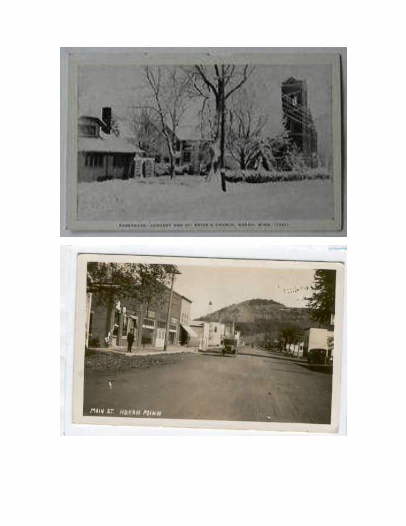
History of Hokah The site of Hokah was, at its founding, an Indian village. The name of Hokah is derived from
their leader, Chief Wecheschatope Hokah. The English translation is Garfish.
Detailed accounts of Edward Thompson finding this site and brining his family here in October
of 1851 have been written in other histories. Edward Thompson erected a sawmill in 1852, a
flour mill in 1853, and in 1866 a dam across the Root River which furnished power for three
flour mills and some cooper shops.
As early as 1854 Edward Thompson began working on a project to build a railroad through the
Root River Valley. The Southern Minnesota Railroad began operations at Hokah in 1866. As a
result, Hokah's population grew from 100 to nearly 1,500 but a census in 1875 counted 1,023
residents. Water power for the railroad shops which were located at the present junction of
Highways 16 and 44 was furnished by a wooden flume which ran from the floodgates of Lake
Como. In June of 1880, when the Chicago, Milwaukee and St. Paul secured possession of the
Southern Minnesota the shops were razed, leaving several hundred without employment. Most of them moved away and the loss of this business had its effect on the flour mills and
cooper shops which closed one by one.
Hokah's first telephone line, built in 1902, by businessmen, extended from the heart of town to
the depot. In 1904 a switchboard was purchased replacing a system of call bells in the Hoffman
Hardware. On June 18, 1906, the Peoples Telephone Company was formed.
In 1917, the first electric lights were furnished by Hoffman and Ender using water power. A cement flume carried the water from the floodgate area to the flour mill that, erected in 1914,
was on the site of the former Weber mill. Power was furnished from 7 pm. to midnight. a 20
horsepower engine provided standy power. This service was provided until 1920 when they sold
out to Northern States Power. The flume continued to supply power for the mill for some time
after and is still intact today although it has been cemented shut.
The dredging of the Root River, starting in 1918 and officially known as Judicial Ditch No. 1,
greatly changed the course of the river north of Hokah. What was left of Edward Thompson's
river dam was also dug up at this time.
A 1933 directory of business places in Hokah would have included: four general stores, three
service stations, two cafes, a bank, car dealership, meat market, flour mill, hardware and lumber
store, cheese factory, creamery, barbershop, newspaper, automotive repair shop, as well as
several individuals engaged in a service type business.
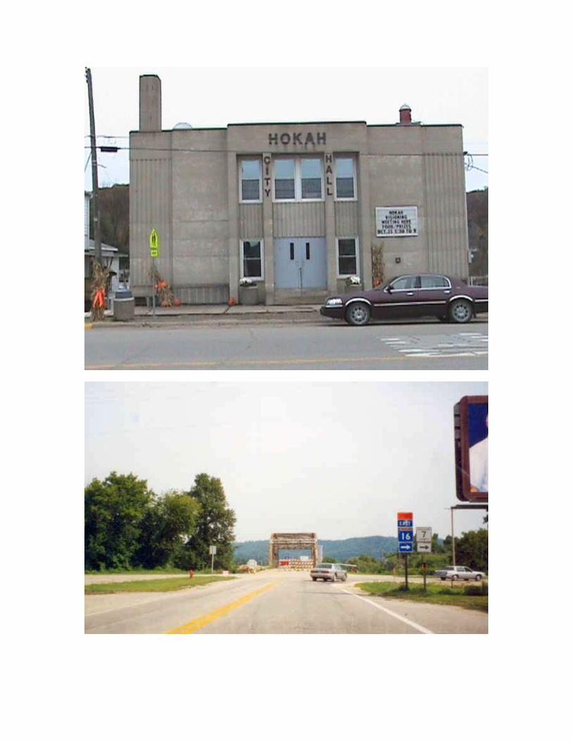
A city hall was built as part of the Works Progress Administration in 1938. The village's share of
the cost of $34,000 was $14,000.
Hokah celebrated its centennial on August 26, 1951. It consisted of a parade and pageants.
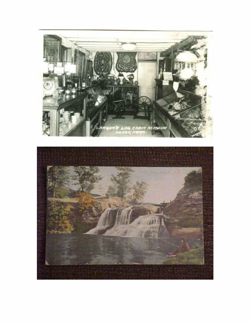
During this time and until 1965 William Langen's Log Cabin Museum was a popular spot for
anyone interested in local history.
Hokah's sewer system was installed in 1959.
Fun Daze, a celebration first held in 1966, has consited of many different recreational sports
including a canoe race held on the Root River.
Como Development Corporation which was organized for much of the same purose as the Lake
Como Park, Inc. built a swimming pool in the old Lake Como bed in 1968. In 1974 the
corporation built a bath house. The pool and surrounding area were turned over to the city in
1981.
In 1981, Hokah improved the water system with a new well, reservoir and water mains.
Summary of Hokah City Hall Renovation as of 2-17-2008
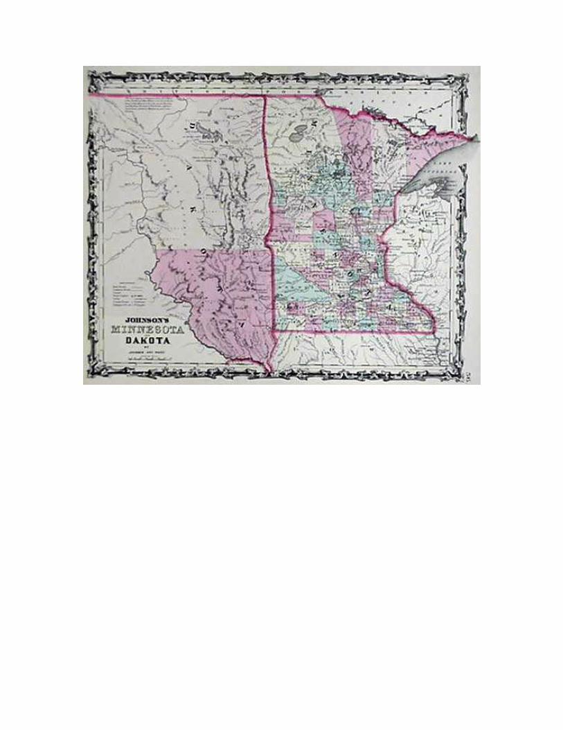
Hokah Township is the second river township from the northern boundary of Houston County, lying south of La Crescent, having Mound Prairie and Union Townships to the west and
Brownsville to the south, with the Mississippi River as the eastern boundary.
The name Hokah is of Indian origin and according to tradition, it was also the name of a
powerful Indian Chief whose village stood on the beautiful spot now occupied by the City of
Hokah.
Root River enters the township from the west and winds in an easterly direction through the
northern half of the township until it empties into the Mississippi. The valley of the river has an
average width of two miles. The river is joined by other streams: the most important of which is
Thompson's Creek which furnished reliable water power.
As of other river townships, Hokah has the usual bluffs facing the Mississippi, with interior
valleys, ridges and plateaus and the scenery is very picturesque. In the early days, the bottom
land was heavily timbered with black walnut, maple, oak and other hardwoods, large quantities
of which were cut and rafted down the river and some of which were sawed in local mills.
The first permanent settler in the township was Edward Thompson, who arrived in the spring of
1851. Attracted by the fine water power, he staked out a claim and brought his wife and family
here.
Butterfield Valley south of the village was first settled in 1853 by Hiram Butterfield who came
from Illinois and took a claim in Section 8. John Densch, who arrived in 1854, was probably the
first settler on the "ridge". His log cabin had a sail for a roof which he brought from the east.
The Root River Brewery was located on Section 28. It was erected in 1867 by Joseph Pfeffer, Jr
at a cost of about $10,000, and it had a capacity of thirty gallons a day.
A union cemetery on Section 10 was divided by an imaginary line into two equal parts;
one half of which belonged to the Roman Catholics and the other half to the German Lutherans
and the German Methodists. The first burial was in 1859, a son of Fred Glassert who was about
12 years of age.
An Academy of the Sisters of Notre Dame was erected in 1866 in the northeast corner of Section
28. There were accommodations for borders as well as day scholars and at times there were as
many as forty regular boarding pupils in this large building of stone on this 200 acre plot of land.
There was a small burial place for the sisters and the priests.
Another cemetery was blessed about the year of 1873 on this land and the wife of J. G. Streigel
was the first burial here. There are still people being buried in this cemetery in the 1980s and the
perpetual care makes it a pleasant resting place.
In the last half of the 20th century, Hokah Township provided excellent building sites for people
who had employment in La Crosse, Wisconsin. The plotted additions that are recorded are as
follows: Brookwood Hills, Sept 7, 1972, First Addition to Brookwood Hills, Aug. 21, 1974,
Wagner Addition, Dec 27, 1971, Root River Terrace, Nov 10, 1970; E. E. Bentahl's Fox Chase
Road Subdivision, March 23, 1973, E. E. Bentahl's Fox Shadows Subdivision, Nov 28, 1978.
The 1982 Township Officials for Hokah Township were: Clerk, Barbara Ratigan; Treasurer,
Gertrude Wieser, Chairperson, Robert F. Tschumper and Supervisors, Lloyd Welke, and Duane
Frauenkron.
Submitted by Barb Bissen 1860 Hokah Census Index for Hokah Township
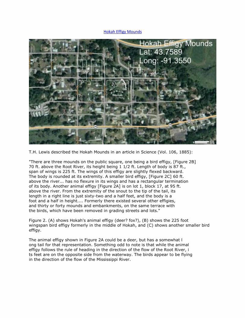
Hokah Effigy Mounds
T.H. Lewis described the Hokah Mounds in an article in Science (Vol. 106, 1885):
"There are three mounds on the public square, one being a bird effigy, [Figure 2B]
70 ft. above the Root River, its height being 1 1/2 ft. Length of body is 87 ft.,
span of wings is 225 ft. The wings of this effigy are slightly flexed backward.
The body is rounded at its extremity. A smaller bird effigy, [Figure 2C] 60 ft.
above the river... has no flexure in its wings and has a rectangular termination
of its body. Another animal effigy [Figure 2A] is on lot 1, block 17, at 95 ft.
above the river. From the extremity of the snout to the tip of the tail, its
length in a right line is just sixty-two and a half feet, and the body is a
foot and a half in height.... Formerly there existed several other effigies,
and thirty or forty mounds and embankments, on the same terrace with
the birds, which have been removed in grading streets and lots."
Figure 2. (A) shows Hokah's animal effigy (deer? fox?), (B) shows the 225 foot
wingspan bird effigy formerly in the middle of Hokah, and (C) shows another smaller bird
effigy.
The animal effigy shown in Figure 2A could be a deer, but has a somewhat l
ong tail for that representation. Something odd to note is that while the animal
effigy follows the rule of heading in the direction of the flow of the Root River, i
ts feet are on the opposite side from the waterway. The birds appear to be flying
in the direction of the flow of the Mississippi River.
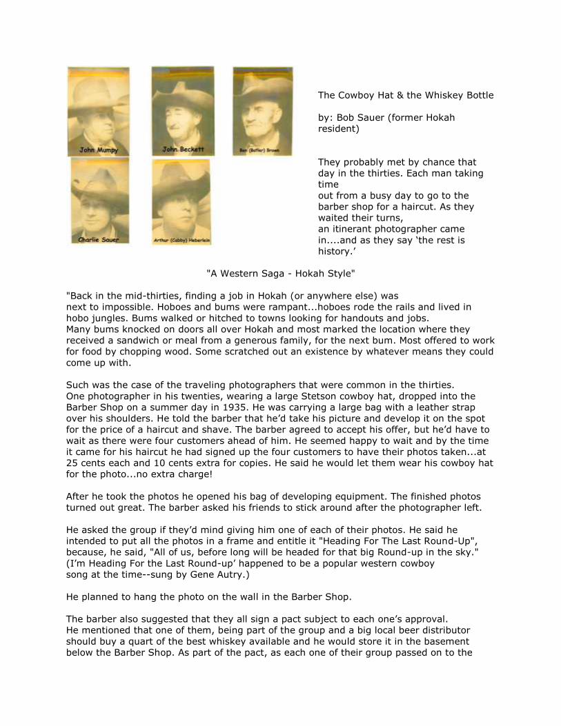
The Cowboy Hat & the Whiskey Bottle
by: Bob Sauer (former Hokah
resident)
They probably met by chance that
day in the thirties. Each man taking
time
out from a busy day to go to the
barber shop for a haircut. As they
waited their turns,
an itinerant photographer came
in....and as they say ‘the rest is
history.’
"A Western Saga - Hokah Style"
"Back in the mid-thirties, finding a job in Hokah (or anywhere else) was
next to impossible. Hoboes and bums were rampant...hoboes rode the rails and lived in
hobo jungles. Bums walked or hitched to towns looking for handouts and jobs.
Many bums knocked on doors all over Hokah and most marked the location where they
received a sandwich or meal from a generous family, for the next bum. Most offered to work
for food by chopping wood. Some scratched out an existence by whatever means they could
come up with.
Such was the case of the traveling photographers that were common in the thirties.
One photographer in his twenties, wearing a large Stetson cowboy hat, dropped into the
Barber Shop on a summer day in 1935. He was carrying a large bag with a leather strap
over his shoulders. He told the barber that he’d take his picture and develop it on the spot
for the price of a haircut and shave. The barber agreed to accept his offer, but he’d have to
wait as there were four customers ahead of him. He seemed happy to wait and by the time
it came for his haircut he had signed up the four customers to have their photos taken...at
25 cents each and 10 cents extra for copies. He said he would let them wear his cowboy hat
for the photo...no extra charge!
After he took the photos he opened his bag of developing equipment. The finished photos
turned out great. The barber asked his friends to stick around after the photographer left.
He asked the group if they’d mind giving him one of each of their photos. He said he
intended to put all the photos in a frame and entitle it "Heading For The Last Round-Up",
because, he said, "All of us, before long will be headed for that big Round-up in the sky."
(I’m Heading For the Last Round-up’ happened to be a popular western cowboy
song at the time--sung by Gene Autry.)
He planned to hang the photo on the wall in the Barber Shop.
The barber also suggested that they all sign a pact subject to each one’s approval.
He mentioned that one of them, being part of the group and a big local beer distributor
should buy a quart of the best whiskey available and he would store it in the basement
below the Barber Shop. As part of the pact, as each one of their group passed on to the
happy hunting ground, the survivors would toast the deceased and all take a pull on the
bottle after the funeral. The last to survive was to finish it off and shove the empty bottle
into the casket with the corpse, or as an alternative, the last one to survive could take
a drink and sprinkle the remaining contents over the grave. The only Irishman in the group
particularly liked this option and asked if this could be amended so that he could run the
remaining contents through his kidneys first.
They voted on it and the idea was accepted, specifically, that the empty bottle was to go
into the casket.
The first to leave this earth was a bachelor, John Mumpy (the Irishman).
The second one to die, a widower, was John Beckett, he owned a horse with "The Halt". His
horse’s rear leg had a defect that would cause it to snap way up and drop down with every
step.
The third to pass on, Benjamin (Butler) Brown owned the farm that Paul Schnedecker now
owns.
The fourth to die was the beer distributor, Arthur (Cabby) Herberlein, who owned a cafe
where the Hokah Country Market is was.
The barber, Charlie Sauer, the last survivor of the pact died in 1979 at age 87."
"In 1980, my brother Jim and I went home to settle Charlie & Kate’s estate. There, in the
basement of the Barber Shop, up on the rafters, lay an old vintage whiskey bottle covered
with soot and dusty old cobwebs. It was an empty quart of Seagram’s 7 Crown, 90 proof.
Charlie was not quick to give up a treasured memory...pact or no pact! It currently rests on
a shelf next to the Barber Pole and the photos of the five cowboys, in my game room, and it
is a treasured memory for me."
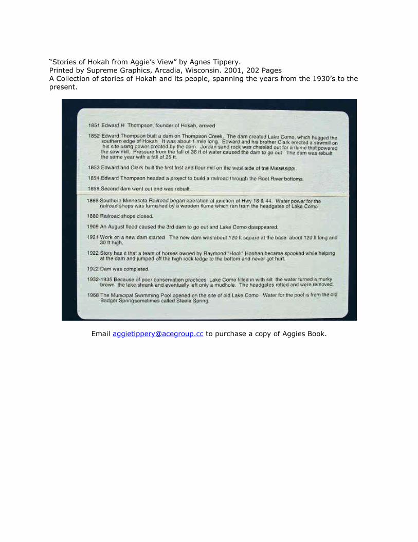
“Stories of Hokah from Aggie’s View” by Agnes Tippery.
Printed by Supreme Graphics, Arcadia, Wisconsin. 2001, 202 Pages
A Collection of stories of Hokah and its people, spanning the years from the 1930’s to the
present.
Email [email protected] to purchase a copy of Aggies Book.
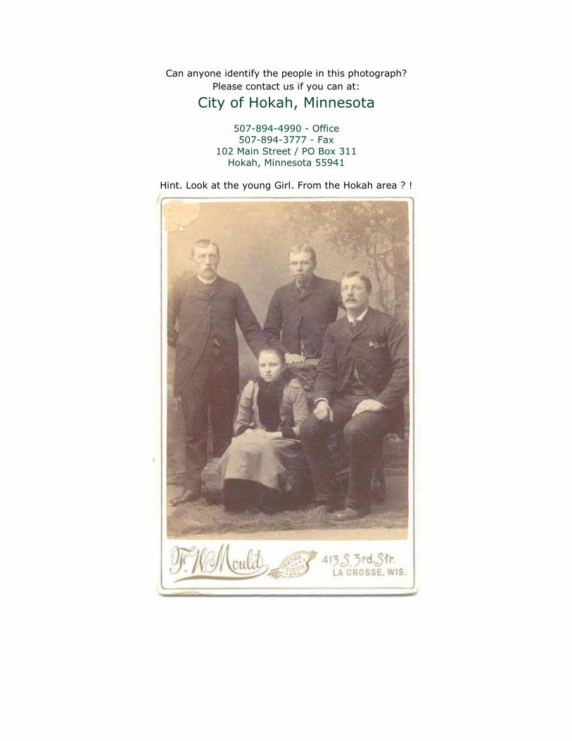
Can anyone identify the people in this photograph?
Please contact us if you can at:
City of Hokah, Minnesota
507-894-4990 - Office
507-894-3777 - Fax
102 Main Street / PO Box 311
Hokah, Minnesota 55941
Hint. Look at the young Girl. From the Hokah area ? !