Embed Size (px)
Citation preview
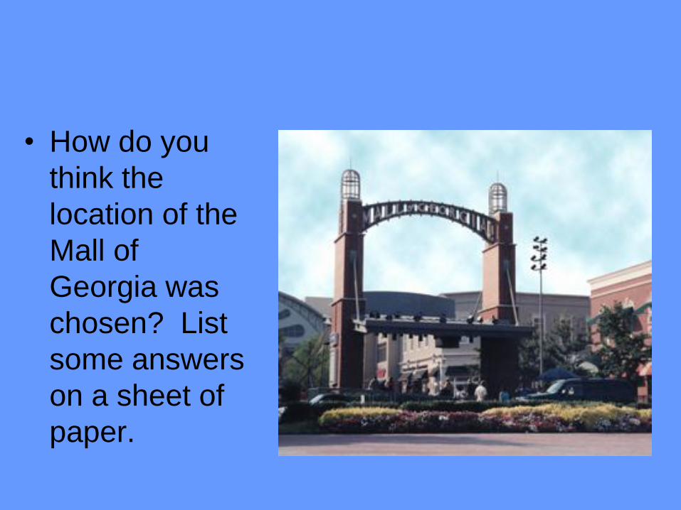
• How do you
think the
location of the
Mall of
Georgia was
chosen? List
some answers
on a sheet of
paper.
Why Understand Geography?
Knowing the FUNDAMENTALS of geography will
help you understand the world around you…People
that are GEOGRAPHICALLY informed understand
the world’s countries and cultures, current events,
and global issues
Geography is a growing field that includes a wide
range of specializations…it offers many career
opportunities
Maps play important roles in people’s daily lives, and
a basic understanding of map elements and design
has great practical value.
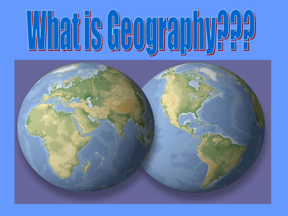
Geography is the study of :
EVERYTHING ON EARTH!!!!
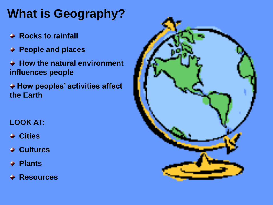
What is Geography?
Rocks to rainfall
People and places
How the natural environment
influences people
How peoples’ activities affect
the Earth
LOOK AT:
Cities
Cultures
Plants
Resources
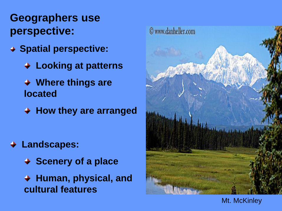
Geographers use
perspective:
Spatial perspective:
Looking at patterns
Where things are
located
How they are arranged
Landscapes:
Scenery of a place
Human, physical, and
cultural features
Mt. McKinley
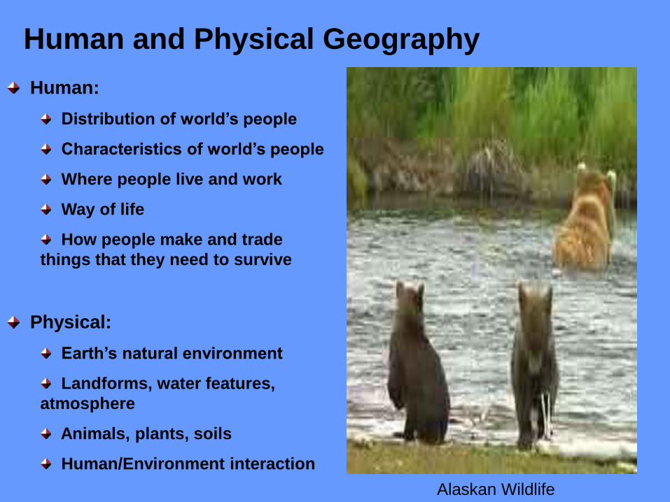
Human and Physical Geography
Human:
Distribution of world’s people
Characteristics of world’s people
Where people live and work
Way of life
How people make and trade
things that they need to survive
Physical:
Earth’s natural environment
Landforms, water features,
atmosphere
Animals, plants, soils
Human/Environment interaction
Alaskan Wildlife
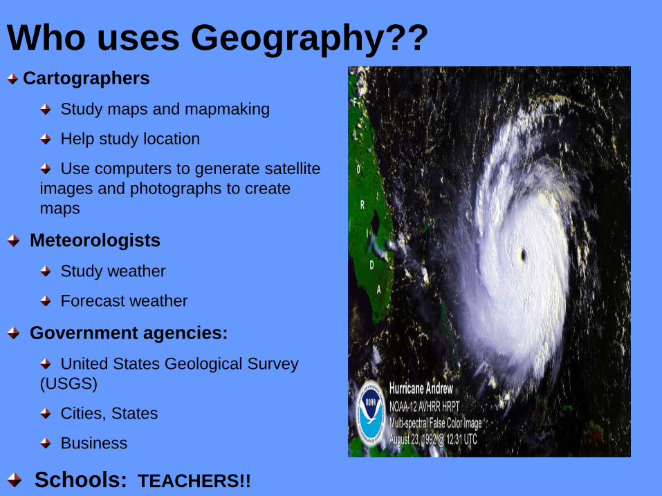
Who uses Geography?? Cartographers
Study maps and mapmaking
Help study location
Use computers to generate satellite
images and photographs to create
maps
Meteorologists
Study weather
Forecast weather
Government agencies:
United States Geological Survey
(USGS)
Cities, States
Business
Schools: TEACHERS!!
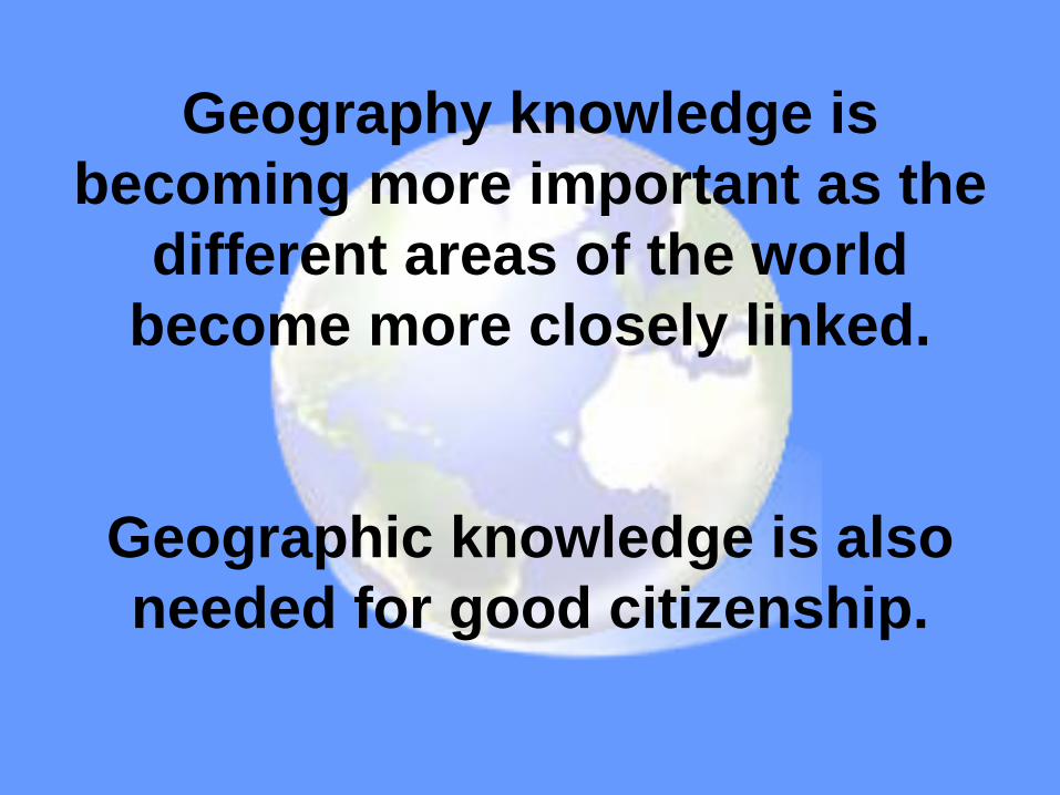
Geography knowledge is
becoming more important as the
different areas of the world
become more closely linked.
Geographic knowledge is also
needed for good citizenship.
How Do We Study Geography?
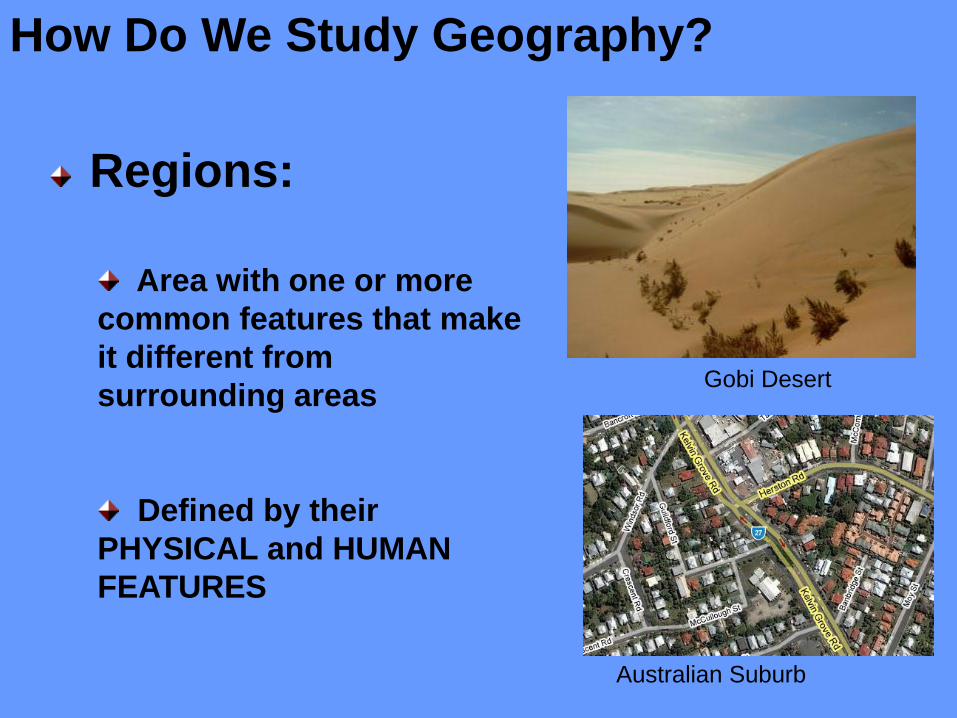
Regions:
Area with one or more
common features that make
it different from
surrounding areas
Defined by their
PHYSICAL and HUMAN
FEATURES
Gobi Desert
Australian Suburb
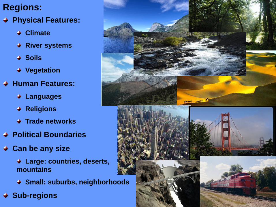
Regions:
Physical Features:
Climate
River systems
Soils
Vegetation
Human Features:
Languages
Religions
Trade networks
Political Boundaries
Can be any size
Large: countries, deserts,
mountains
Small: suburbs, neighborhoods
Sub-regions
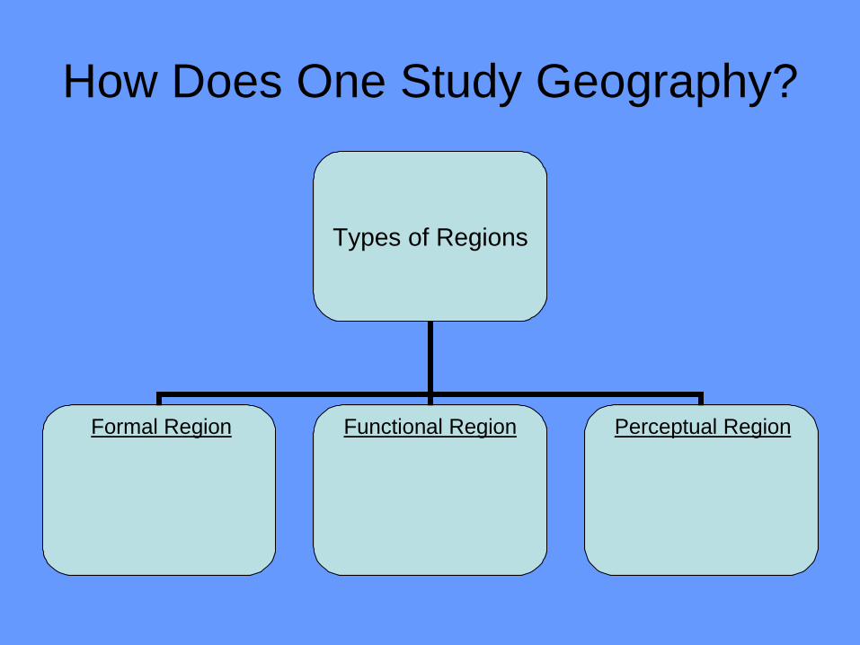
How Does One Study Geography?
Types of Regions
Functional Region Formal Region Perceptual Region
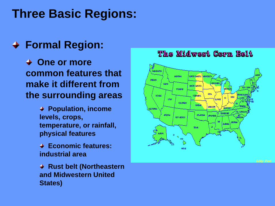
Three Basic Regions:
Formal Region:
One or more
common features that
make it different from
the surrounding areas
Population, income
levels, crops,
temperature, or rainfall,
physical features
Economic features:
industrial area
Rust belt (Northeastern
and Midwestern United
States)
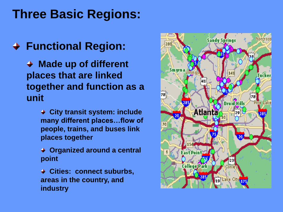
Three Basic Regions:
Functional Region:
Made up of different
places that are linked
together and function as a
unit
City transit system: include
many different places…flow of
people, trains, and buses link
places together
Organized around a central
point
Cities: connect suburbs,
areas in the country, and
industry
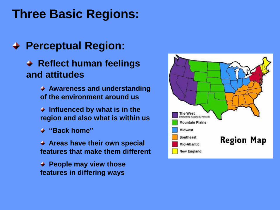
Perceptual Region:
Reflect human feelings
and attitudes
Awareness and understanding
of the environment around us
Influenced by what is in the
region and also what is within us
“Back home”
Areas have their own special
features that make them different
People may view those
features in differing ways
Three Basic Regions:
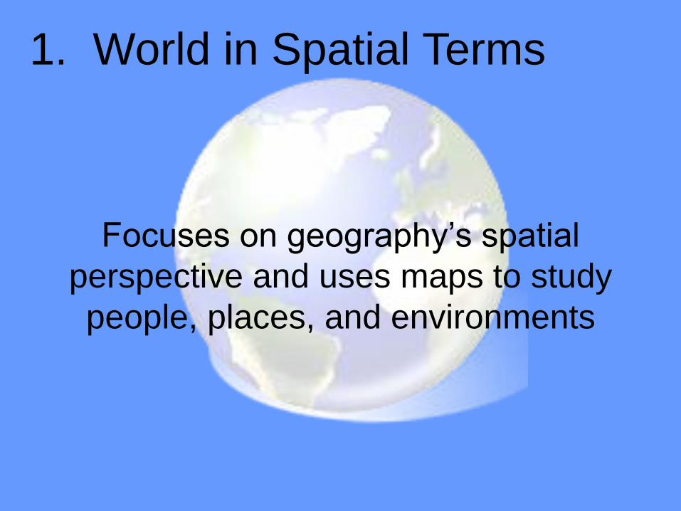
1. World in Spatial Terms
Focuses on geography’s spatial
perspective and uses maps to study
people, places, and environments

2. Places and Regions
Deals with the physical and human
features of those places and how we
define and perceive various regions
Physical systems shape Earth’s
features. Geographers study
earthquakes, mountains, volcanoes,
weather patterns. They also study
how plants and animals relate to
these systems.
3. Physical Systems
Deals with the way of life we follow
and the things we produce and
trade, looks at causes and results of
conflicts between peoples, study of
governments, and settlements we
live in.
4. Human Systems
Looks at human activities and using
what the Earth provides. Basically,
the relationship between people and
the environment.
5. Environment and Society
Helps us understand the
relationships among people, places,
and environments over time. Helps
us interpret the past and present or
to plan for the FUTURE!
6. Uses of Geography
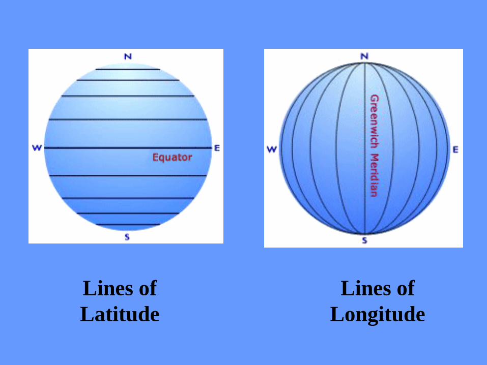
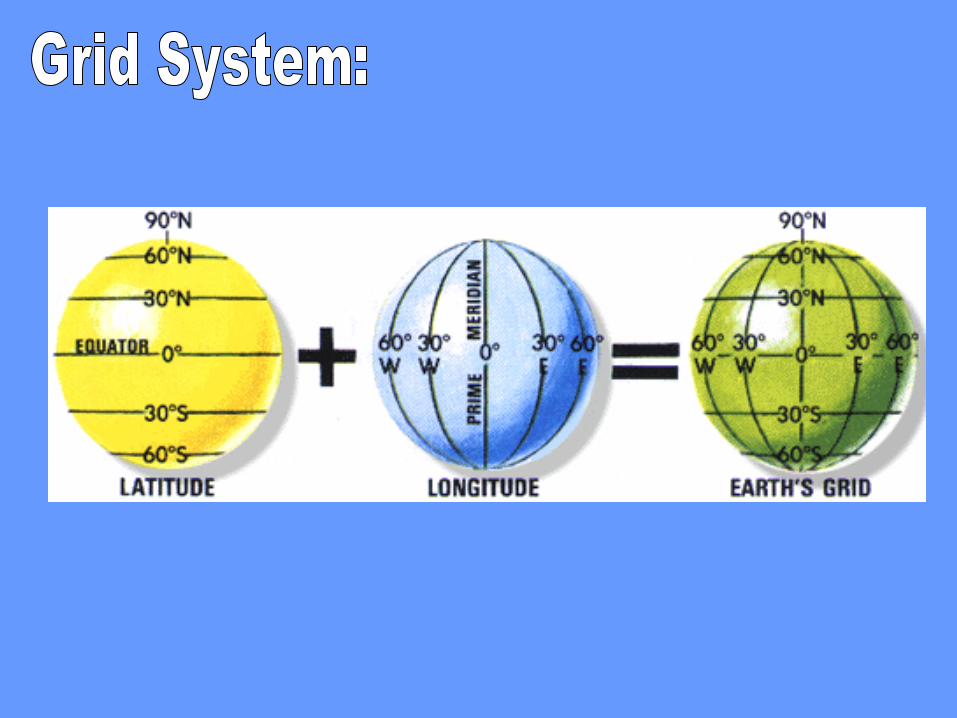
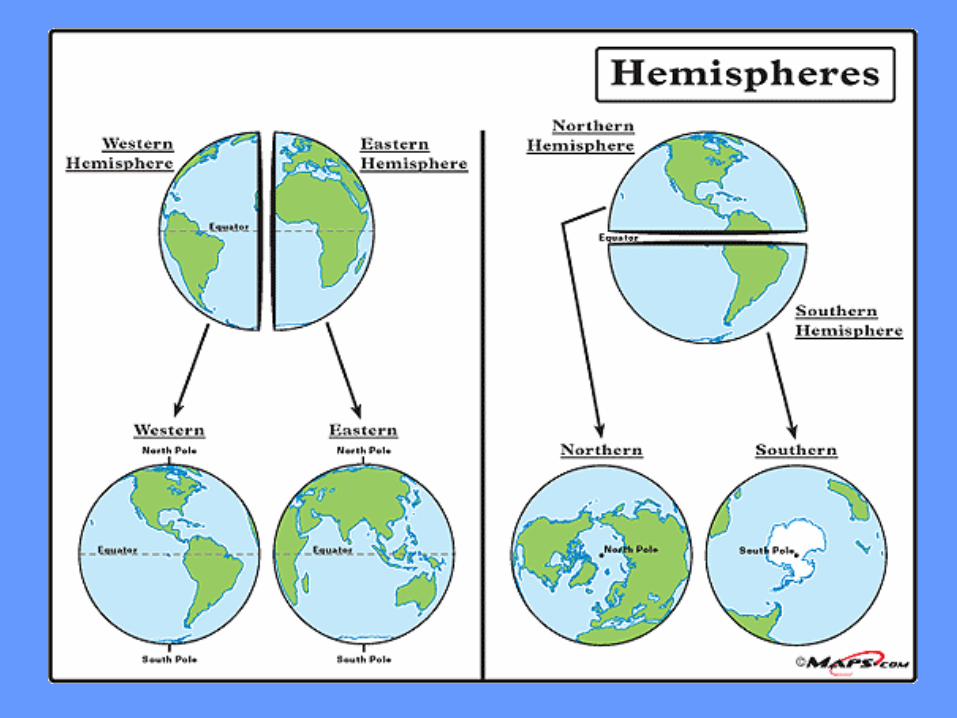
Lines of
Latitude
Lines of
Longitude
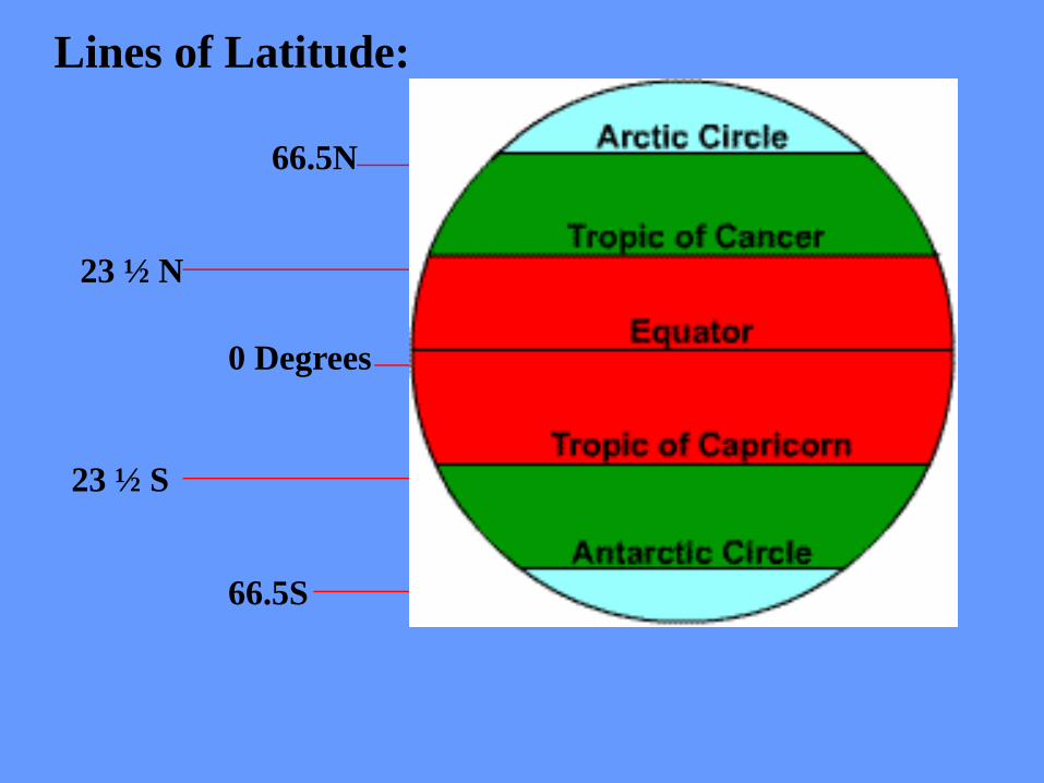
66.5N
23 ½ N
0 Degrees
23 ½ S
66.5S
Lines of Latitude:
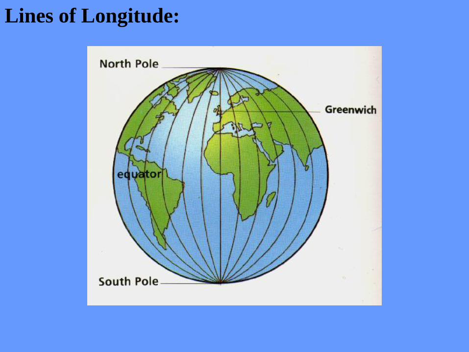
Lines of Longitude:
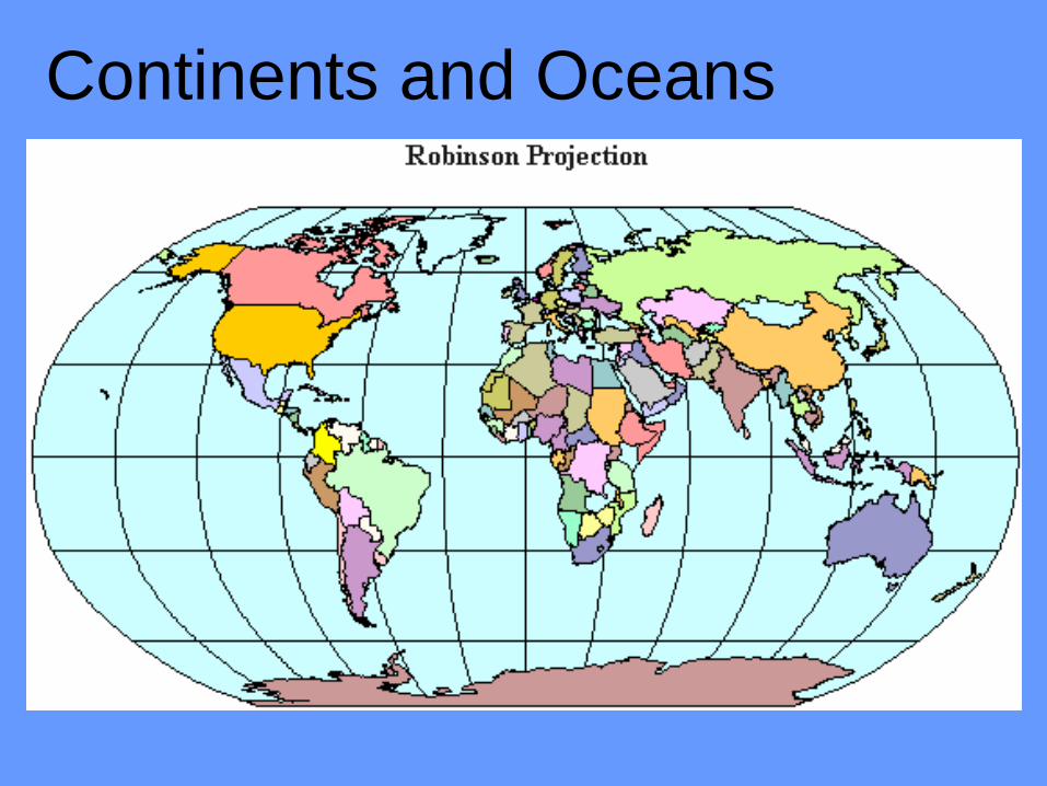
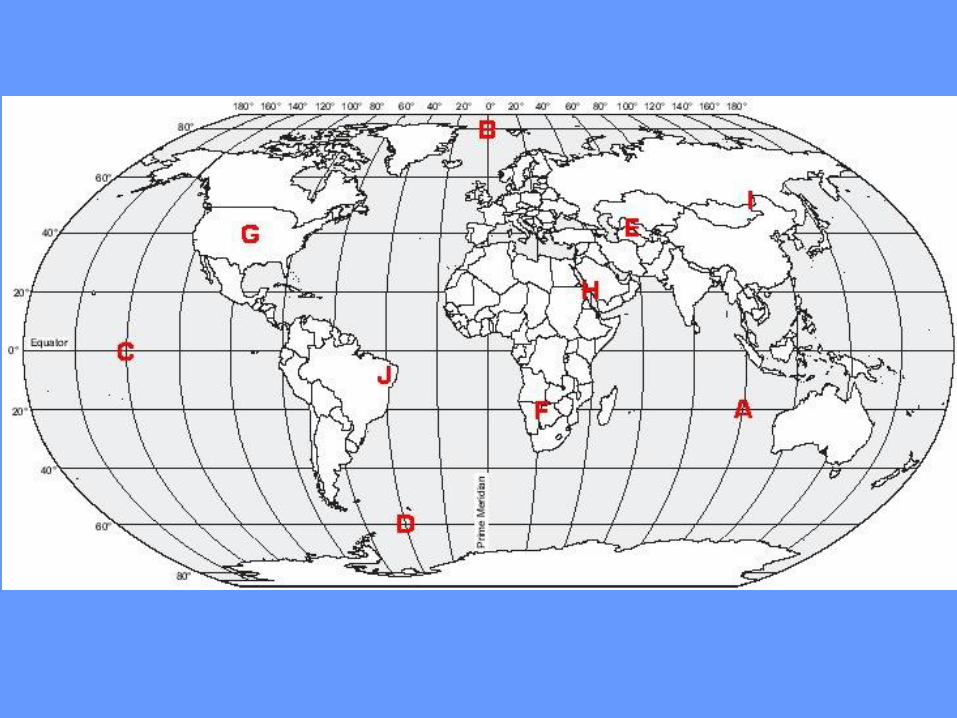
Continents and Oceans
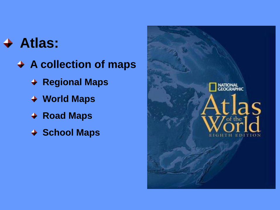
Atlas:
A collection of maps
Regional Maps
World Maps
Road Maps
School Maps
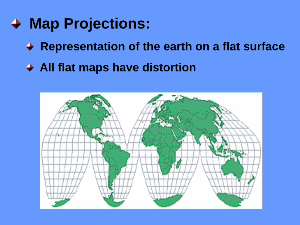
Map Projections:
Representation of the earth on a flat surface
All flat maps have distortion
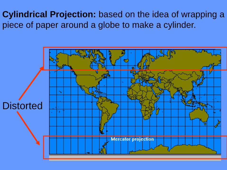
Cylindrical Projection: based on the idea of wrapping a
piece of paper around a globe to make a cylinder.
Distorted
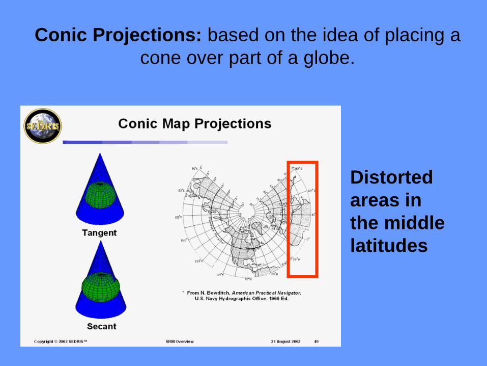
Conic Projections: based on the idea of placing a
cone over part of a globe.
Distorted
areas in
the middle
latitudes
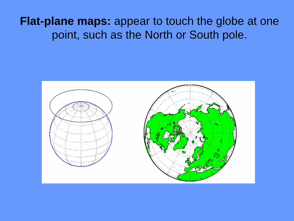
Flat-plane maps: appear to touch the globe at one
point, such as the North or South pole.
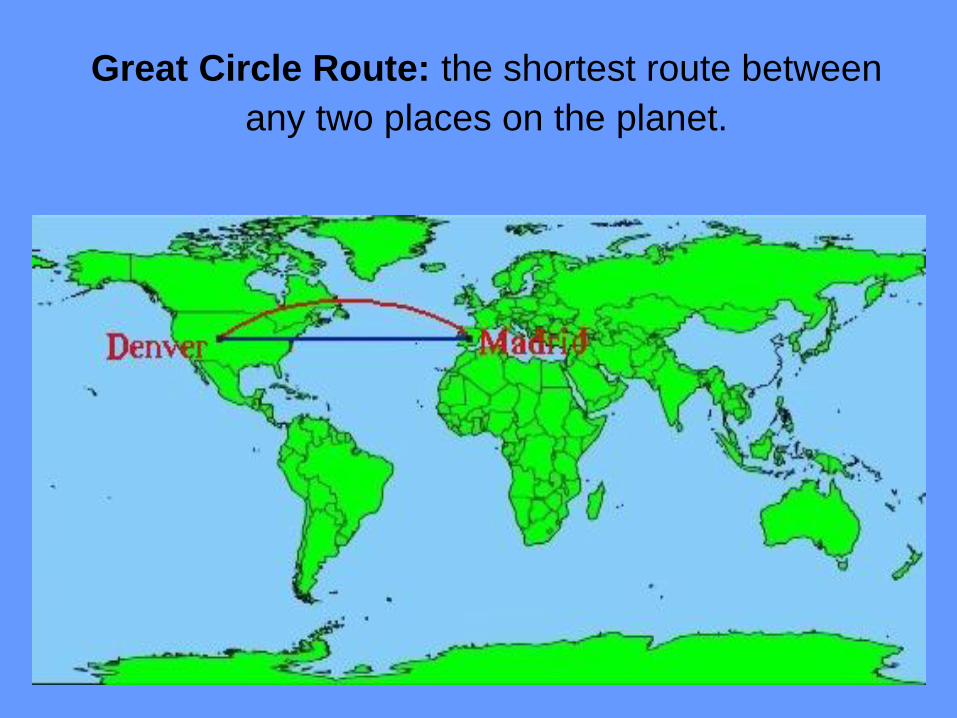
Great Circle Route: the shortest route between
any two places on the planet.

Map Elements:
Distance scales
Directional
indicators/
compass
Legends
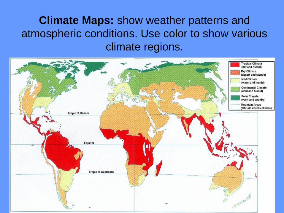
Climate Maps: show weather patterns and
atmospheric conditions. Use color to show various
climate regions.
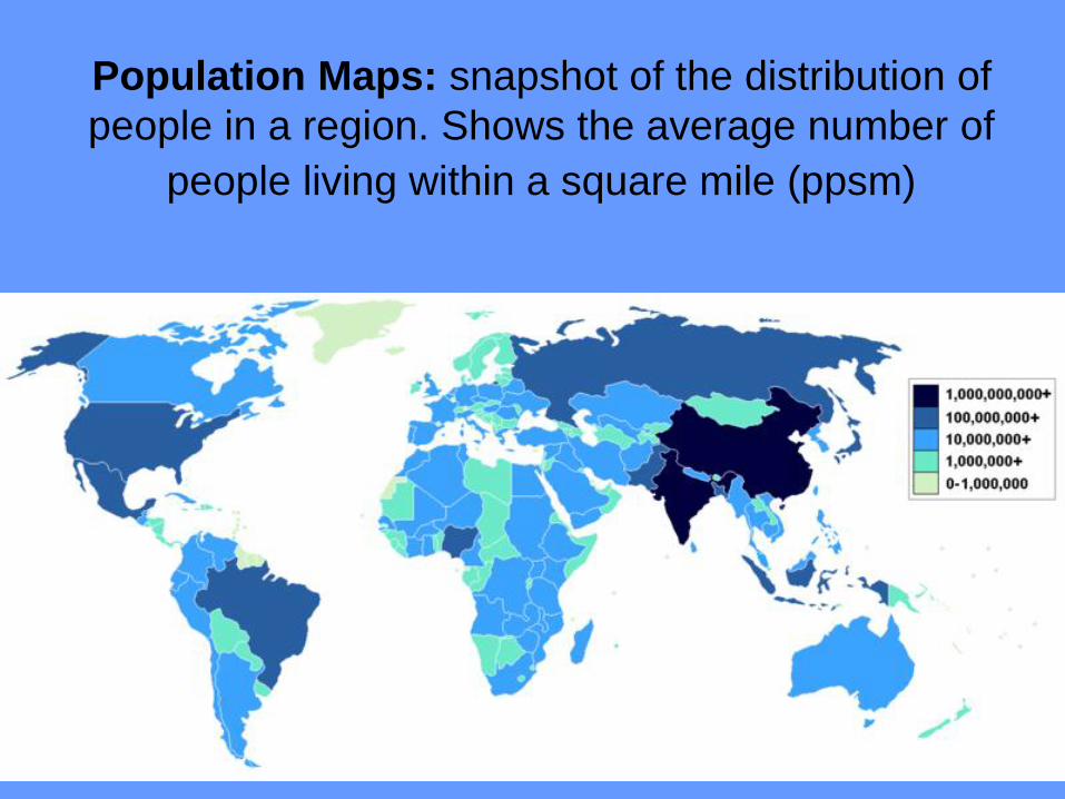
Population Maps: snapshot of the distribution of
people in a region. Shows the average number of
people living within a square mile (ppsm)
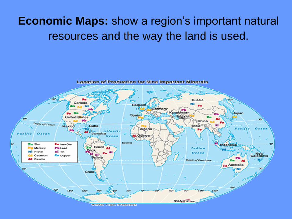
Economic Maps: show a region’s important natural
resources and the way the land is used.
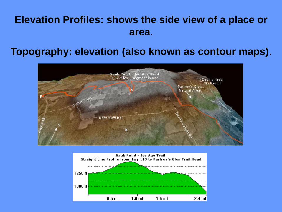
Elevation Profiles: shows the side view of a place or
area.
Topography: elevation (also known as contour maps).
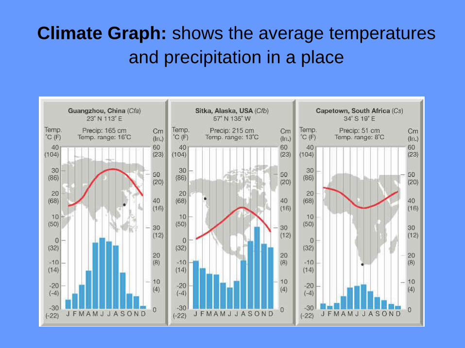
Climate Graph: shows the average temperatures
and precipitation in a place
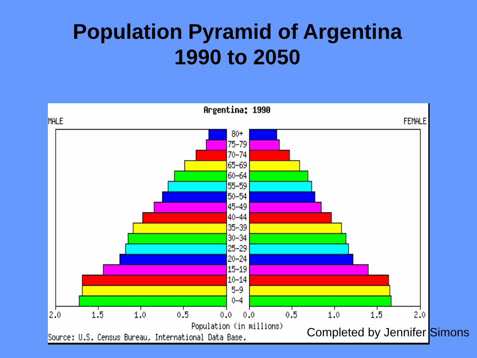
Population Pyramid of Argentina
1990 to 2050
Completed by Jennifer Simons