Embed Size (px)
Citation preview
Imperial College - 19 Feb. 2008
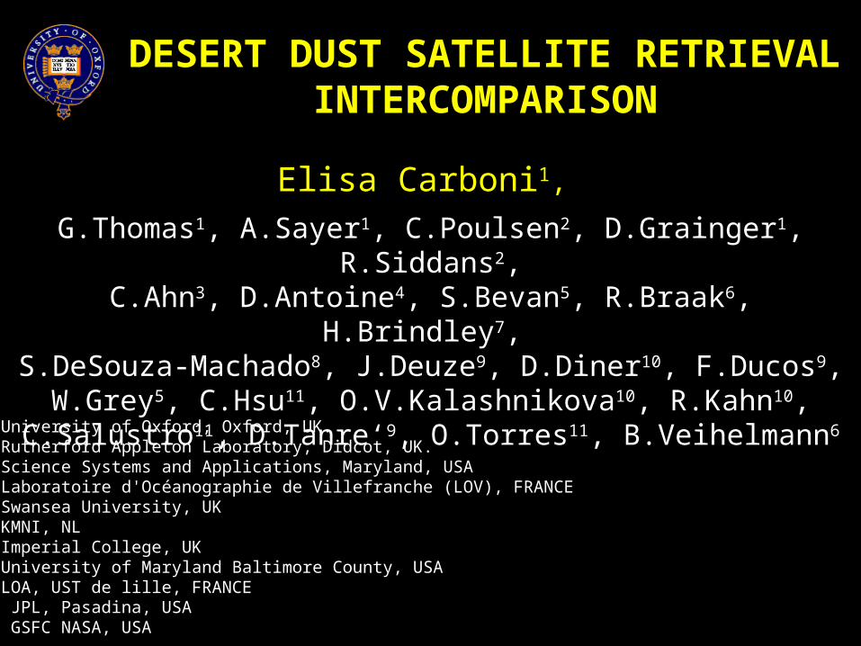
DESERT DUST SATELLITE RETRIEVAL INTERCOMPARISON
Elisa Carboni1,
G.Thomas1, A.Sayer1, C.Poulsen2, D.Grainger1, R.Siddans2,C.Ahn3, D.Antoine4, S.Bevan5, R.Braak6, H.Brindley7,
S.DeSouza-Machado8, J.Deuze9, D.Diner10, F.Ducos9, W.Grey5, C.Hsu11, O.V.Kalashnikova10, R.Kahn10, C.Salustro11, D.Tanre‘9,
O.Torres11, B.Veihelmann6
(1) University of Oxford, Oxford, UK.(2) Rutherford Appleton Laboratory, Didcot, UK.(3) Science Systems and Applications, Maryland, USA(4) Laboratoire d'Océanographie de Villefranche (LOV), FRANCE(5) Swansea University, UK(6) KMNI, NL(7) Imperial College, UK(8) University of Maryland Baltimore County, USA(9) LOA, UST de lille, FRANCE(10) JPL, Pasadina, USA(11) GSFC NASA, USA
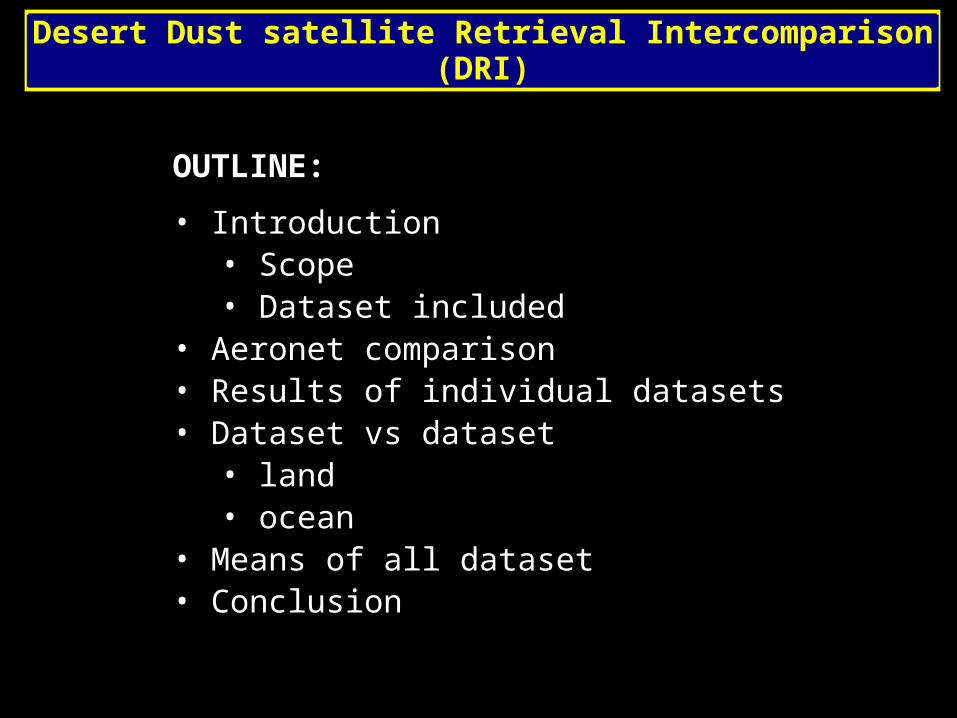
OUTLINE:
• Introduction• Scope • Dataset included
• Aeronet comparison• Results of individual datasets• Dataset vs dataset
• land• ocean
• Means of all dataset• Conclusion
Desert Dust satellite Retrieval Intercomparison (DRI)
Desert dust retrieval intercomparison
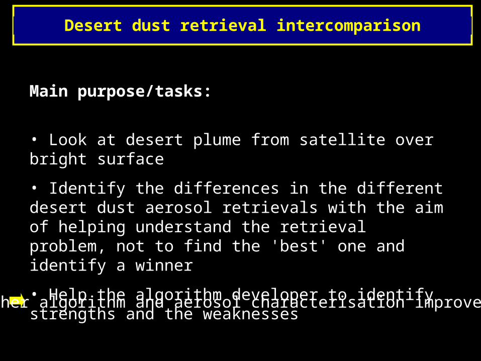
Main purpose/tasks:
• Look at desert plume from satellite over bright surface
• Identify the differences in the different desert dust aerosol retrievals with the aim of helping understand the retrieval problem, not to find the 'best' one and identify a winner
• Help the algorithm developer to identify strengths and the weaknesses
Further algorithm and aerosol characterisation improvements
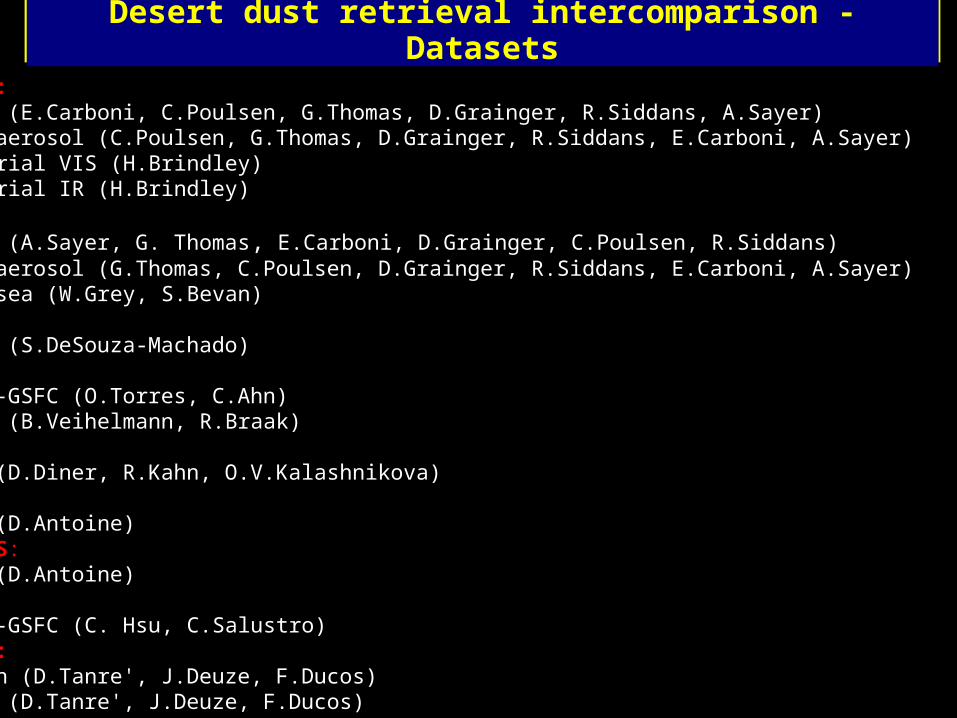
Desert dust retrieval intercomparison - Datasets
SEVIRI: ORAC (E.Carboni, C.Poulsen, G.Thomas, D.Grainger, R.Siddans, A.Sayer) Globaerosol (C.Poulsen, G.Thomas, D.Grainger, R.Siddans, E.Carboni, A.Sayer) Imperial VIS (H.Brindley) Imperial IR (H.Brindley)AATSR: ORAC (A.Sayer, G. Thomas, E.Carboni, D.Grainger, C.Poulsen, R.Siddans) Globaerosol (G.Thomas, C.Poulsen, D.Grainger, R.Siddans, E.Carboni, A.Sayer) Swansea (W.Grey, S.Bevan)AIRS: JCET (S.DeSouza-Machado) OMI: NASA-GSFC (O.Torres, C.Ahn) KNMI (B.Veihelmann, R.Braak)MISR: JPL (D.Diner, R.Kahn, O.V.Kalashnikova)MERIS: LOV (D.Antoine)SEAWIFS: LOV (D.Antoine)MODIS: NASA-GSFC (C. Hsu, C.Salustro) POLDER: Ocean (D.Tanre', J.Deuze, F.Ducos) Land (D.Tanre', J.Deuze, F.Ducos)
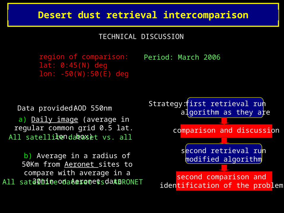
Desert dust retrieval intercomparison
region of comparison:lat: 0:45(N) deg lon: -50(W):50(E) deg
Period: March 2006
Strategy: first retrieval runalgorithm as they are
comparison and discussion
second retrieval runmodified algorithm
second comparison and identification of the problems
AOD 550nm
a) Daily image (average in regular common grid 0.5 lat. lon. box)
b) Average in a radius of 50Km from Aeronet sites to compare with
average in a 30min on Aeronet data
Data provided:
All satellite dataset vs. all
All satellite dataset vs. AERONET
TECHNICAL DISCUSSION
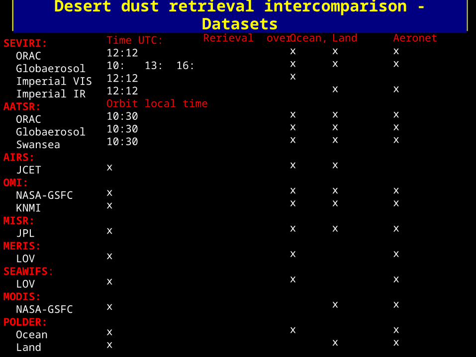
Desert dust retrieval intercomparison - Datasets
SEVIRI: ORAC Globaerosol Imperial VIS Imperial IR AATSR: ORAC Globaerosol Swansea AIRS: JCET OMI: NASA-GSFC KNMI MISR: JPL MERIS: LOV SEAWIFS: LOVMODIS: NASA-GSFC POLDER: Ocean Land
Time UTC:12:1210: 13: 16:12:1212:12Orbit local time10:3010:3010:30
x
xx
x
x
x
x
xx
Ocean,xxx
xxx
x
xx
x
x
x
x
Landxx
x
xxx
x
xx
x
x
x
Aeronetxx
x
xxx
xx
x
x
x
x
xx
Rerieval over:
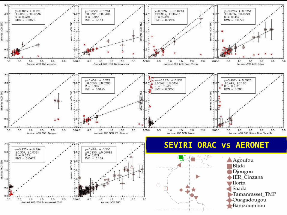
SEVIRI ORAC vs AERONET
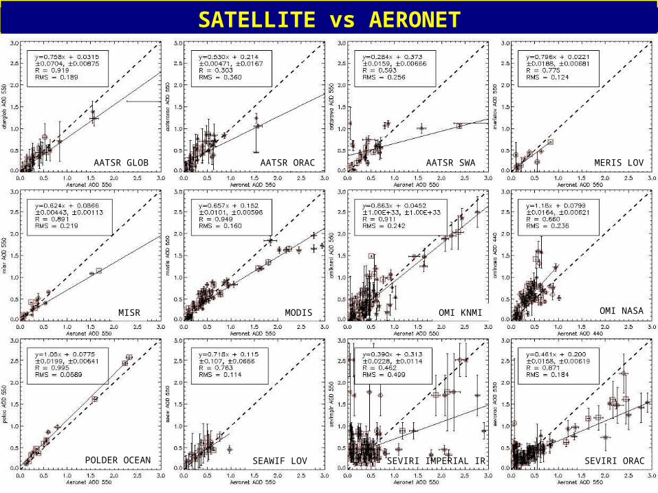
SATELLITE vs AERONET
AATSR ORAC AATSR SWAAATSR GLOB MERIS LOV
MISR OMI KNMIMODIS OMI NASA
SEAWIF LOVPOLDER OCEAN SEVIRI IMPERIAL IR SEVIRI ORAC
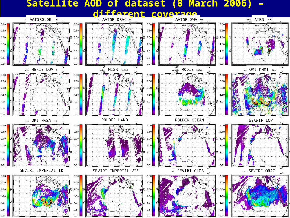
Satellite AOD of dataset (8 March 2006) – different coverage
MERIS LOV
AATSR ORAC AATSR SWA AIRSAATSR GLOB
MISR
OMI NASA
OMI KNMIMODIS
AATSRGLOB
SEAWIF LOVPOLDER OCEANPOLDER LAND
SEVIRI ORACSEVIRI GLOBSEVIRI IMPERIAL IR SEVIRI IMPERIAL VIS
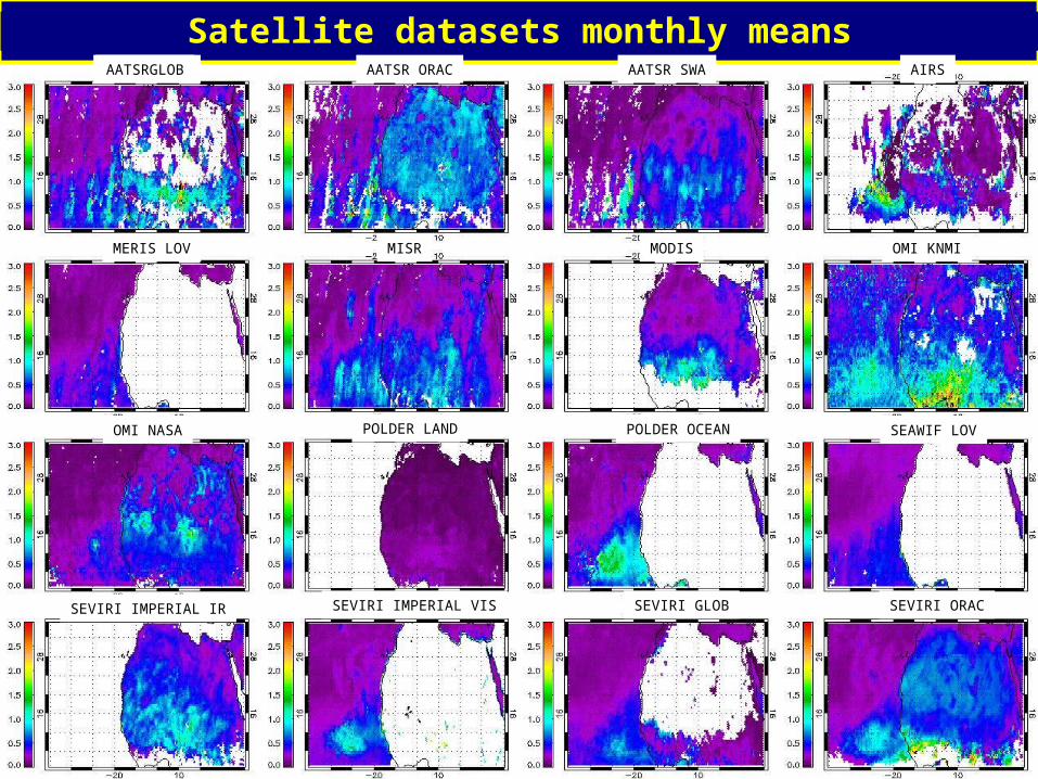
Satellite datasets monthly means
MERIS LOV
AATSR ORAC AATSR SWA AIRSAATSR GLOB
MISR
OMI NASA
OMI KNMIMODIS
AATSRGLOB
SEAWIF LOVPOLDER OCEANPOLDER LAND
SEVIRI ORACSEVIRI GLOBSEVIRI IMPERIAL IR SEVIRI IMPERIAL VIS
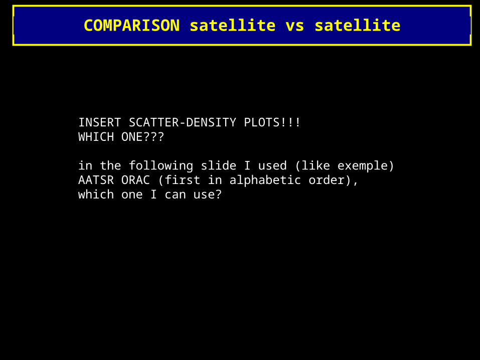
COMPARISON satellite vs satellite
INSERT SCATTER-DENSITY PLOTS!!!WHICH ONE???
in the following slide I used (like exemple) AATSR ORAC (first in alphabetic order), which one I can use?
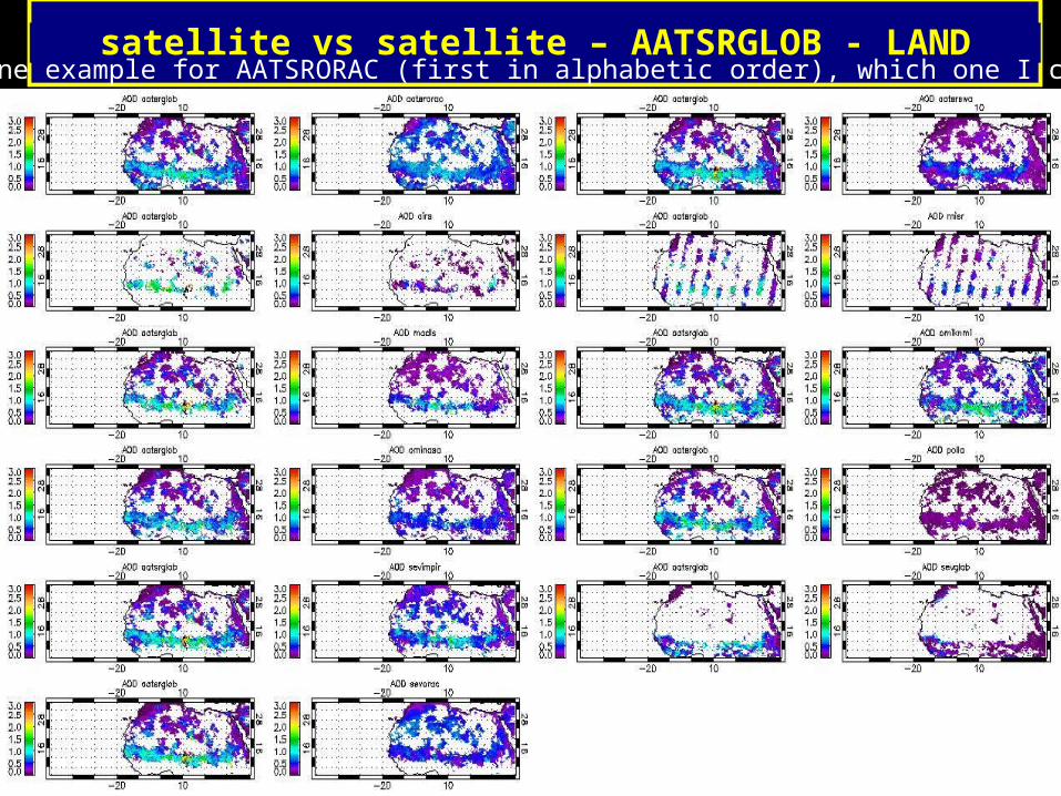
satellite vs satellite – AATSRGLOB - LANDhere one example for AATSRORAC (first in alphabetic order), which one I can use?
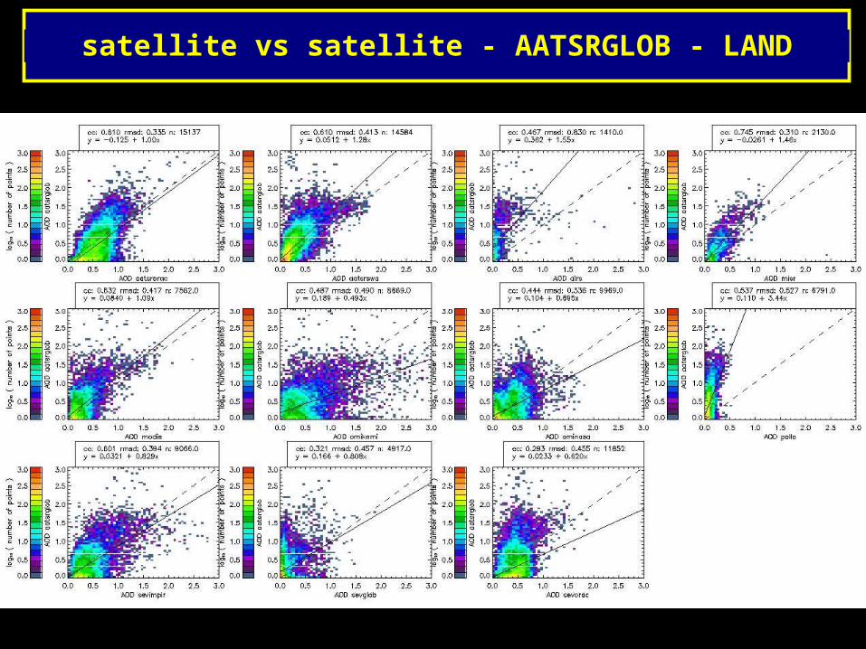
satellite vs satellite - AATSRGLOB - LAND
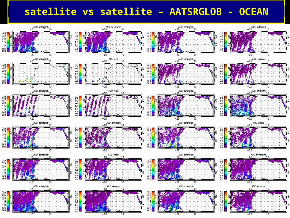
satellite vs satellite – AATSRGLOB - OCEAN
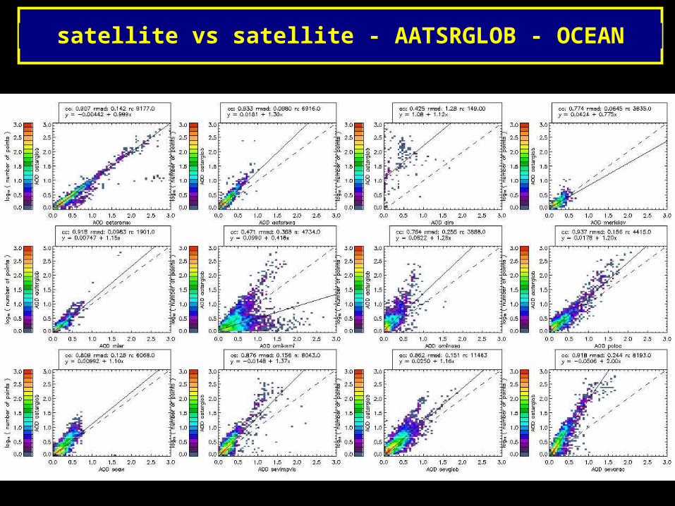
satellite vs satellite - AATSRGLOB - OCEAN
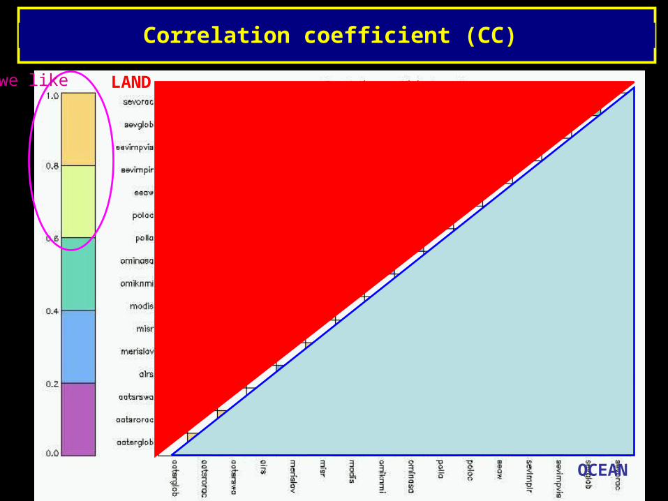
Correlation coefficient (CC)
LAND
OCEAN
we like
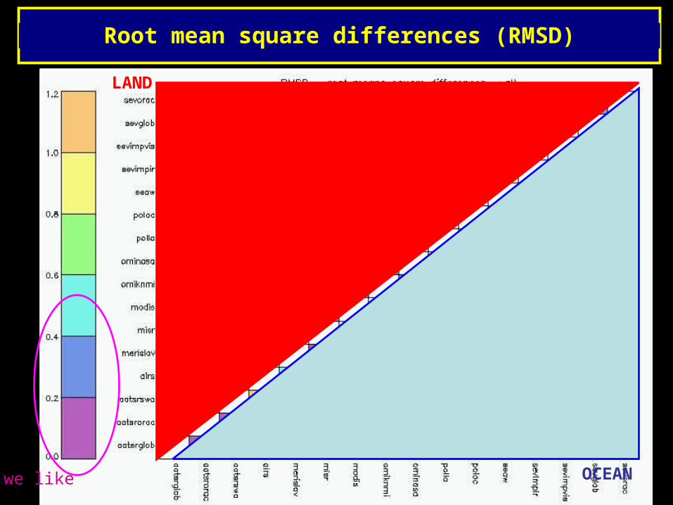
Root mean square differences (RMSD)
LAND
OCEANwe like
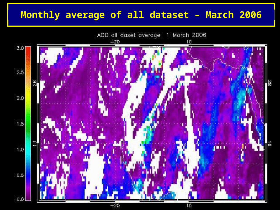
Monthly average of all dataset – March 2006
INSERT AOD MOVIE!!!
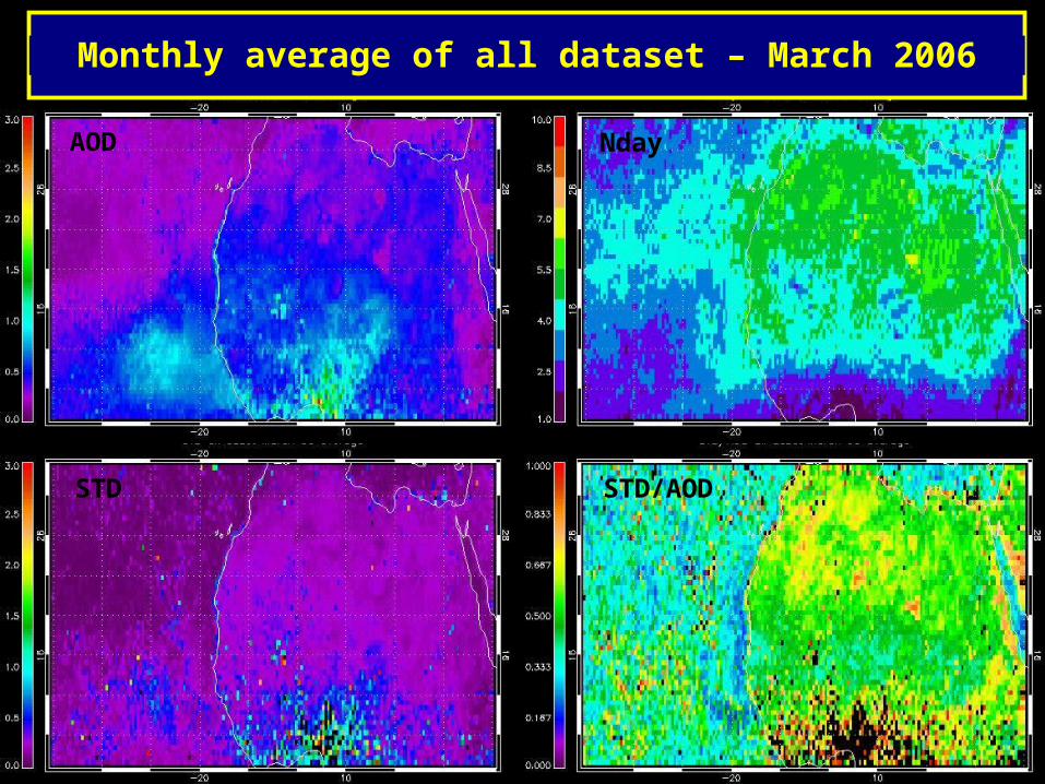
Monthly average of all dataset – March 2006
AOD Nday
STD STD/AOD
DRI - Conclusion
- All dataset show a reasonably good agreement with Aeronet
- the discrepancy increase significantly when compare satellite vs satellite dataset. Possibly due to the fact that Aeronet itself make a good datacut (=> comparison satellite-Aeronet are done only in good conditions).
- the satellite dataset itself could be affect by cloud contaminations and other errors...??
- The monthly mean of the satellite dataset differ, mainly due to different satellite coverage (overpass, swap...) and cut of data.
- Cut of data is one of the more affecting point. e.g. observing the monthly means over ocean (where all the retrieval are more confident, and the general comparisons with aeronet are better) between samesatellite there are still discrepancy, possible due to aerosol model and retrieval algorithm but also due to datacut.
- some dataset make a restrictive data cut and cut mainly the higher part of the plume.
- A way to follow AOD for march 2006 is the average of all dataset and it present incredibly good continuity also in the passage ocean-land and between area with different number of datasets. Anyway STD between dataset are sometime comparable with the value of average AOD itself, and is higher in correspondence with the desert dust plume.STD/AOD could be >1 especially over land bright surface... (unlukly aeronet station are mainly outside this region)