Embed Size (px)
Citation preview

Incident Response, Parking, and Maintenance Weather Systems

Incidents
Could be anything outhouses, Christmas trees in the road or crashes

Incidents in Washington

Incident Management / Emergency Response
• 40-60 percent of delay is related to non-recurring congestion – incidents
• Solution:– Identify and remove incidents– Speed removal by sending the correct
equipment as quickly as possible

Important Safety Aspects
• Protect first responders– Provide a safe working area so they can focus
on medical aid and recovery
• Provide safety traffic flow around incident scene
• Prevent secondary collisions in queue

What Functionality Makes Incident Management Work?
1. Incident detection
2. Incident verification
3. Incident response
4. Management
5. Motorist information

1. Incident Detection
• Now, primarily by cellular phone– Overwhelming 911 call centers– E-911 (location information)
• Also– Traffic surveillance systems– CB radio– Motorist call boxes
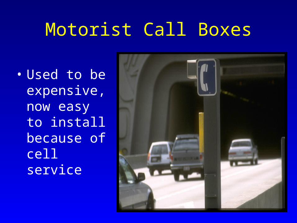
Motorist Call Boxes
• Used to be expensive, now easy to install because of cell service
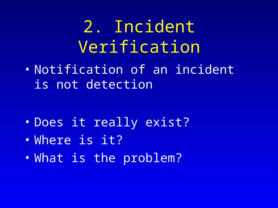
2. Incident Verification
• Notification of an incident is not detection
• Does it really exist?
• Where is it?
• What is the problem?
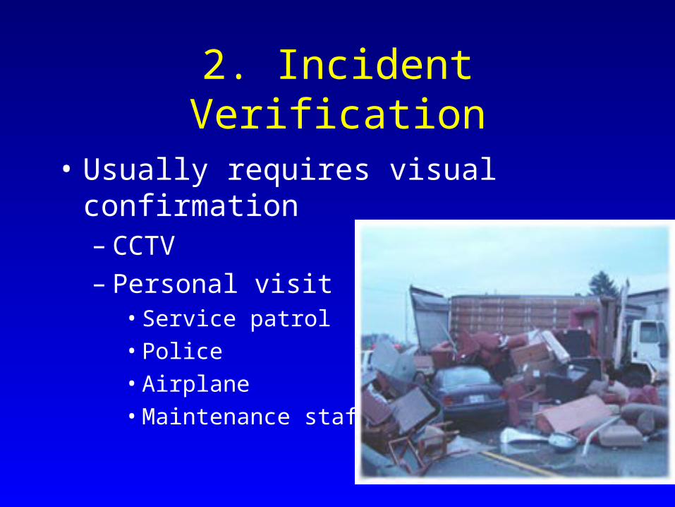
2. Incident Verification
• Usually requires visual confirmation– CCTV– Personal visit
• Service patrol
• Police
• Airplane
• Maintenance staff

WSDOT Incident Response Program
• WSDOT: State operated service patrols. Operates across state
• WSP Cadets: WSP service patrols which operate in Puget Sound Region
• Tow Service Patrols: Contracted private tow company service patrols in Puget Sound region
• Media Assistance Van: Contractedprivate media patrol in the Olympic Region

2. Incident Verification
• Verification allows call out of response
• The faster the proper response, the faster clearance takes place

3. Incident Response• Proper response requires an understanding
of the incident– Basic assistance (gas / a push)
– Tow truck
– Large tow truck
– Fire truck
– EMT
– Hazardous material spill recovery
– Fatal accident investigation team (Police use technology to record and clear scene, e.g. photogrammerty)

One Level of Response

Another Level of Response

4. Management
• Communications are key to management– Between respondents– Call for additional assistance– Coordination of efforts
• Turf wars used to be a big issues• Communications can be a problem
– ITS provides many new cost effective communication options

5. Motorist Information
• Motorist information is a big part of management– Routing information
• Manage facility demand
• Provide better travel alternatives to customers
• Reduce frustration / poor driving behavior
– Manage traveler expectations

5. Motorist Information
• Information needs to be delivered to customers– Radio– VMS / CMS– New electronic devices– Other

Parking Management

Why Parking Management
• Maximize space utilization (if demand is not evenly distributed)
• Reduce VMT caused by searching for a space
• One estimate is up to 30% of urban traffic is “search traffic”

Parking Management Functions
• Requires – Monitoring of space availability– Communication with drivers– A funding source

Parking Management
• Methods for monitoring space availability– Counting in/out movements– Checking individual space availability
• Communication with motorists (guidance systems)– VMS / CMS (location?)
• Reservation Systems– Advanced or en-route

Parking Management
• Who pays for the system?– What’s the incentive to do this?
• Who participates in the system?
• Where are the benefits?– The public?– The private parking companies?

Parking Technologies• Automated parking systems
– Robopark
• Electronic or wireless reservation/payment– Similar to electronic tolls– Use mobile phone or transponders
• Advanced parking meters– Provide real time information if space is
occupied– Rates go up for additional time– Communicate information about violations

Smart Parking at Baltimore Airport
• Signs indicate number of free spaces

Ultrasound sensor checks each space for a vehicle. Green/Red light above space indicates if space available.

Green arrows direct drivers to floors with open spaces

Signs point to open spaces

Open Stall
Changeable signs indicate spaces in rows

Robopark
• Space saving modular parking systems
• Driver parks and pushes button
• Car is automatically moved to a space
• Use access card or code to retrieve car

Underground Parking Silo in Italy

Seattle Center Parking • System installed at
three parking lots and garages
• Loops at entrance/exit tally cars and determine occupancy
• Linked to VMS signs on streets in area and Web

Entry - Exit Sensors
Source : Caltrans

City of Seattle
• Solar powered with a wireless connection
• Each station costs $6,000
• Track revenue & usage

In Vehicle Parking Assist

Maintenance Weather Management

Maintenance Weather Management
• Real time (predictive) knowledge of weather conditions
• Real time knowledge of the position and status of assets
• 22% of vehicle crashes in U.S. occur under adverse road weather conditions

Snow Control / Removal
• Less expensive to prevent snow/ice accumulation than to remove it
• Place anti-icing chemicals prior to ice formation– Only saves money if it actually snows / ices
over

Snow Prediction• Requires extensive weather monitoring
system
• Must track micro-climates
• Need forecasting capabilities
• Can save money

Smart Snowplow Technologies
• Finding and staying on roads– GPS with accurate road database, magnetic paint stripes,
embedded magnetic markers
• Detect hidden objects – Collision warning radar
• Rear end collisions– Strobes
• Driver fatigue– Devices designed with driver comfort in mind
• Friction measurement (for performance info)

Smart Snowplows

Smart Snowplow
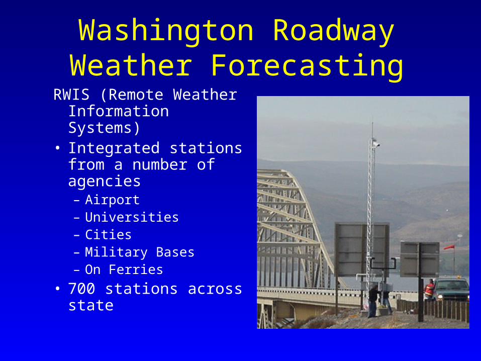
Washington Roadway Weather Forecasting
RWIS (Remote Weather Information Systems)
• Integrated stations from a number of agencies– Airport– Universities– Cities– Military Bases– On Ferries
• 700 stations across state


Forecasting Grids Resolutions
36 Kilometer
12 Kilometer
4 Kilometer(usable for roads)

Route and Road Surface Conditions

ARROWS
• Automated Real Time Weather Information Systems
• Used by WSDOT (not public) to manage weather related maintenance
• Forecasts snow, road icing, etc


Maintenance Decision Support

Snow Avalanches
• In mountainous area, can be a major maintenance issue
• Many DOTs have snow control staffs
• Safety of traveling public and road crews a concern

WSDOT and Avalanche Control
• Routine avalanche control on Stevens and Snoqualmie Passes
• Also when clearing other state roads in Spring
• Snoqualmie Pass is the only Interstate through the Cascades – a two hour closure costs the state's economy over $1 million

Avalanche Control Expensive and sometimes risky


Avalanche Control
• Automated warning systems– Wyoming system triggers lights on signs, sirens
and alarms in maintenance vehicle
• Remote control systems– Propane cannons (GASEX)
• Remote control equipment

Remote Control Loader in Alaska

UAV’s• Unmanned Aerial Vehicles
(UAV)• UAVs are feasible because of
GPS and miniaturized electronics
• Many manufacturers out there – costs are dropping
• Mostly applications are military
• Range in size from handhelds to “real” planes

Unmanned Aircraft and Transportation
• Many potential transportation uses:– Traffic Surveillance and Counting – Crash Scene Photography– Security Monitoring– Surveying and Construction Management
• Transportation applications often relate to micro and mini-UAVs (hand or truck launch)

Issues for Transportation
• Cost of the aircraft • Aircraft reliability • Safety – collisions and crashes • Training of pilots• Legal and privacy concerns
• But the biggest issue is regulatory

Federal Aviation Administration (FAA) Rules
• No FAA regulatory standard for UAV use• “See and Avoid” a big problem • So each UAV operation now requires a Certificate
of Authorization (COA)– Requires keeping UAV in sight or use of spotters or a
chase plane
• FAA under considerable pressure to develop a UAV policy

Dull, Dirty, or Dangerous
• UAV are best for Dull, Dirty, or Dangerous jobs
• They are not an inexpensive alternative for many manned flights
• Pilots are cheap and want hours. A beginning airline pilot makes $27 an hour and often flies only 80 hours a month

WSDOT’s UAV Project Purpose
• Explore the utility of UAVs to WSDOT
• Start by seeing if UAVs can enhance avalanche control programs and search and rescue operations
• Evaluate the larger institutional issues behind the use of UAVs by WSDOT
65
Institutional Study Purpose
• Will UAVs be allowed to fly routinely by the FAA?
• Test the process to obtain an FAA certificate to fly a UAV
• Do UAVs have an institutional role for Departments of Transportation?

66
Avalanche Control Study Purpose
• Explore if a UAV can:– fly autonomously to an area of concern– check artillery target zones for skiers– check out snow conditions– drop charges to trigger avalanches
• Assist in search and rescue

Tested the BAT
• Small autonomous aircraft– 6 foot wing span– 35 pounds with a 5
pound payload– 5 hour endurance
• Costs around $50,000• Video and still
Cameras


Yamaha• Vertical take-off and
landing
• Used in Asia for crop spraying
• 50 pound payload
• Costs around $200,000


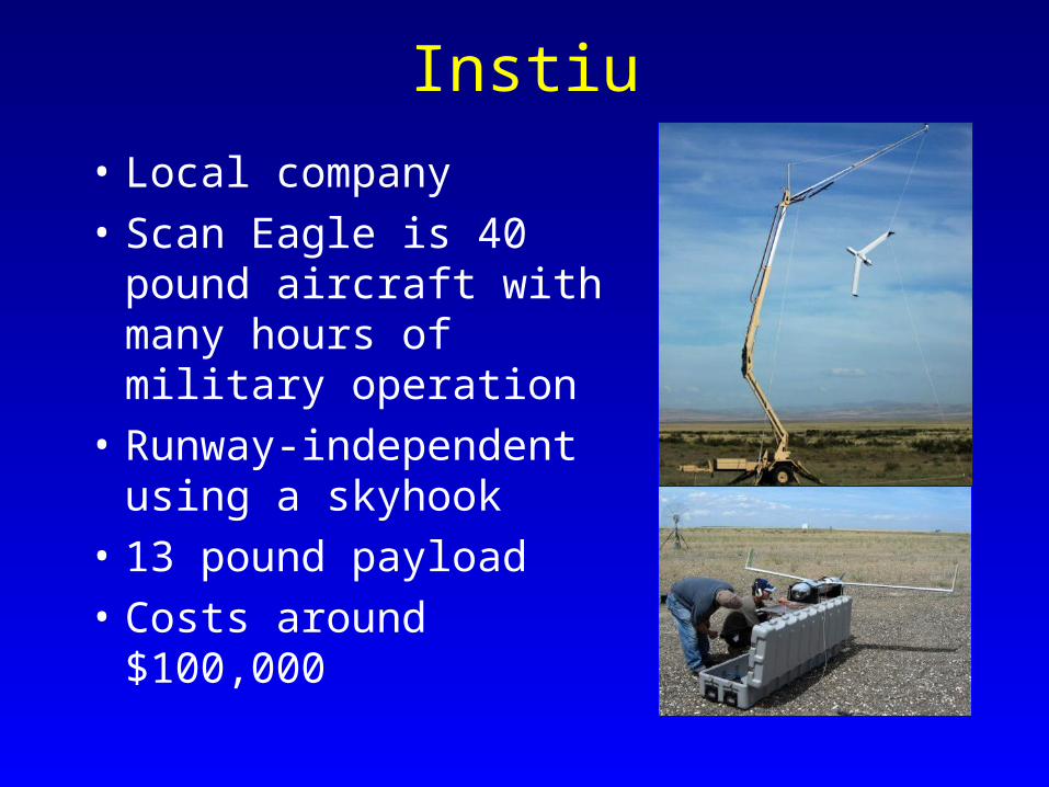
Instiu
• Local company
• Scan Eagle is 40 pound aircraft with many hours of military operation
• Runway-independent using a skyhook
• 13 pound payload
• Costs around $100,000

75
Findings
• UAVs affordable enough to be used by transportation agencies
• Can complete a range of traffic surveillance and monitoring tasks
• Considerable potential for avalanche control
• Institutional limitations to flying a UAV