Embed Size (px)
DESCRIPTION
for general knowledge
Citation preview
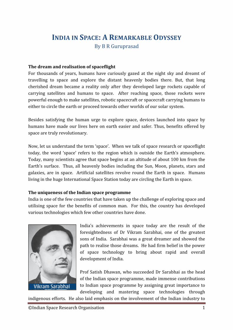
INDIA IN SPACE: A REMARKABLE ODYSSEY By B R Guruprasad
The dream and realisation of spaceflight For thousands of years, humans have curiously gazed at the night sky and dreamt of travelling to space and explore the distant heavenly bodies there. But, that long cherished dream became a reality only after they developed large rockets capable of carrying satellites and humans to space. After reaching space, those rockets were powerful enough to make satellites, robotic spacecraft or spacecraft carrying humans to either to circle the earth or proceed towards other worlds of our solar system. Besides satisfying the human urge to explore space, devices launched into space by humans have made our lives here on earth easier and safer. Thus, benefits offered by space are truly revolutionary. Now, let us understand the term ‘space’. When we talk of space research or spaceflight today, the word ‘space’ refers to the region which is outside the Earth’s atmosphere. Today, many scientists agree that space begins at an altitude of about 100 km from the Earth’s surface. Thus, all heavenly bodies including the Sun, Moon, planets, stars and galaxies, are in space. Artificial satellites revolve round the Earth in space. Humans living in the huge International Space Station today are circling the Earth in space. The uniqueness of the Indian space programme India is one of the few countries that have taken up the challenge of exploring space and utilising space for the benefits of common man. For this, the country has developed various technologies which few other countries have done.
India’s achievements in space today are the result of the foresightedness of Dr Vikram Sarabhai, one of the greatest sons of India. Sarabhai was a great dreamer and showed the path to realise those dreams. He had firm belief in the power of space technology to bring about rapid and overall development of India. Prof Satish Dhawan, who succeeded Dr Sarabhai as the head of the Indian space programme, made immense contributions to Indian space programme by assigning great importance to developing and mastering space technologies through
indigenous efforts. He also laid emphasis on the involvement of the Indian industry to
©Indian Space Research Organisation 1
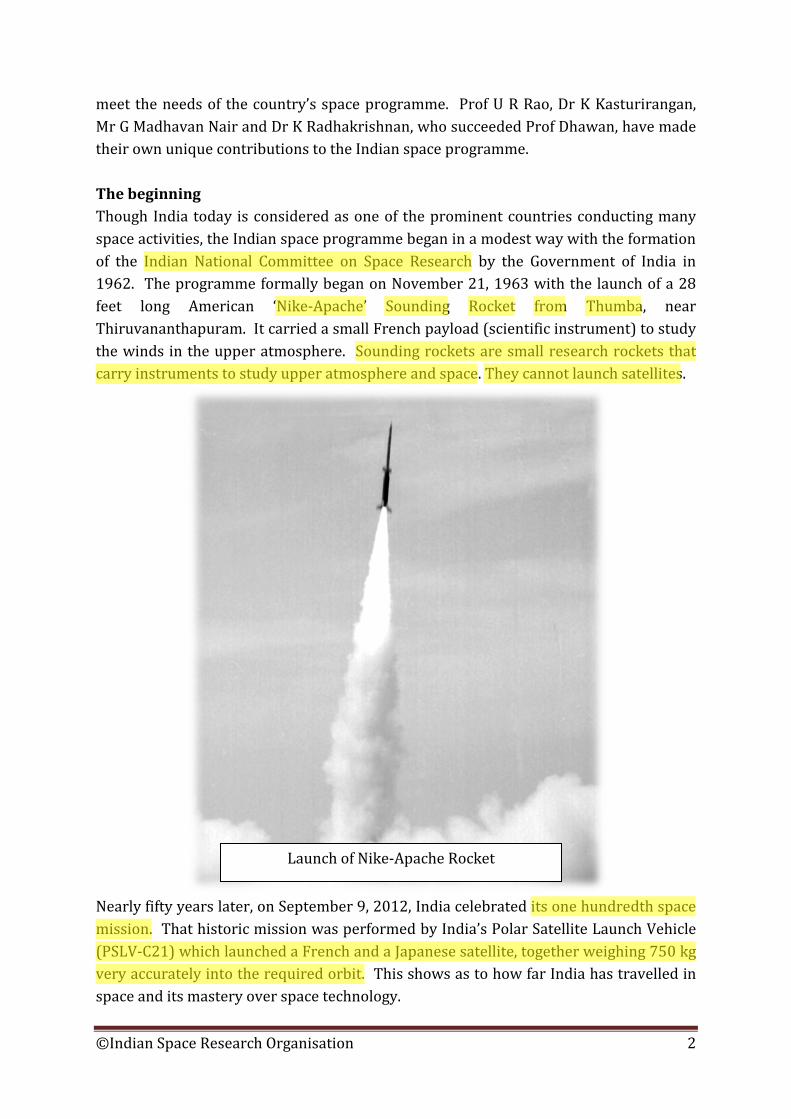
meet the needs of the country’s space programme. Prof U R Rao, Dr K Kasturirangan, Mr G Madhavan Nair and Dr K Radhakrishnan, who succeeded Prof Dhawan, have made their own unique contributions to the Indian space programme. The beginning Though India today is considered as one of the prominent countries conducting many space activities, the Indian space programme began in a modest way with the formation of the Indian National Committee on Space Research by the Government of India in 1962. The programme formally began on November 21, 1963 with the launch of a 28 feet long American ‘Nike-Apache’ Sounding Rocket from Thumba, near Thiruvananthapuram. It carried a small French payload (scientific instrument) to study the winds in the upper atmosphere. Sounding rockets are small research rockets that carry instruments to study upper atmosphere and space. They cannot launch satellites.
Nearly fifty years later, on September 9, 2012, India celebrated its one hundredth space mission. That historic mission was performed by India’s Polar Satellite Launch Vehicle (PSLV-C21) which launched a French and a Japanese satellite, together weighing 750 kg very accurately into the required orbit. This shows as to how far India has travelled in space and its mastery over space technology.
Launch of Nike-Apache Rocket
©Indian Space Research Organisation 2
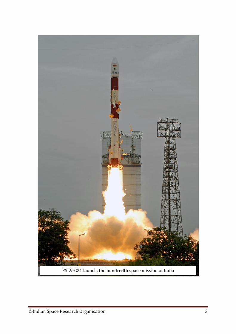
PSLV-C21 launch, the hundredth space mission of India
©Indian Space Research Organisation 3
During the 1960s, India conducted space research mostly through sounding rockets. But, the country also established a ground station to conduct various useful experiments using communication satellites. India's space capabilities Indian space research organisation, which is widely known as ‘ISRO’, is the agency which implements the country’s space programme on behalf of the India’s Department of Space. ISRO came into existence in 1969, the same year humans set foot on the moon for the first time. Various centres of ISRO are now spread all over India. They include Vikram Sarabhai Space Centre (VSSC), situated in Thiruvananthapuram, which designs huge rockets capable of launching large satellites. In the same city is the Liquid Propulsion Systems Centre (LPSC) that develops liquid rocket engines and the more efficient and highly complex cryogenic rocket engines. Bangalore can be called as the space city of India. It has got many space related facilities including the ISRO Satellite Centre (ISAC), which builds Indian satellites. The famous Chandrayaan-1 spacecraft that conclusively discovered the water on the Moon, was built here. Besides, the ISRO headquarters and the Department of Space, which steer the Indian space programme, are in Bangalore. Satellites are launched into space with a firm purpose like relaying the telephone calls, telecasting TV programmes, taking weather pictures of the Earth or observing distant heavenly bodies. Instruments in a satellite which perform these useful tasks are called payloads. ISRO’s Space Applications Centre at Ahmedabad develops such payloads for satellites. National Remote Sensing Centre (NRSC) is another important centre of ISRO. It is situated in Hyderabad and performs the important task of receiving the pictures sent by India’s remote sensing satellites in the form of radio waves. NRSC also processes those pictures to make them accurate and show details clearly. The centre also systematically stores those pictures and distributes them in India. The island of Sriharikota in the Bay of Bengal has ISRO’s Satish Dhawan Space Centre and it is the spaceport of India. Sriharikota lies about 80 km to the North of Chennai and lies in the Nellore district of Andhra Pradesh state. This is the place from where 38 Indian built rockets have lifted off (as on April 2013) and have travelled towards space. Some of them have launched not one but many satellites during a single launch. Sriharikota has vast facilities to manufacture large solid propellant (fuel-oxidiser
©Indian Space Research Organisation 4
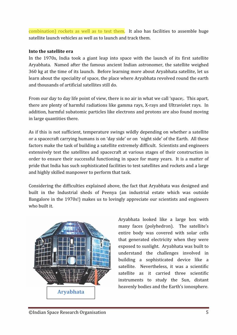
combination) rockets as well as to test them. It also has facilities to assemble huge satellite launch vehicles as well as to launch and track them. Into the satellite era In the 1970s, India took a giant leap into space with the launch of its first satellite Aryabhata. Named after the famous ancient Indian astronomer, the satellite weighed 360 kg at the time of its launch. Before learning more about Aryabhata satellite, let us learn about the speciality of space, the place where Aryabhata revolved round the earth and thousands of artificial satellites still do. From our day to day life point of view, there is no air in what we call ‘space;. This apart, there are plenty of harmful radiations like gamma rays, X-rays and Ultraviolet rays. In addition, harmful subatomic particles like electrons and protons are also found moving in large quantities there. As if this is not sufficient, temperature swings wildly depending on whether a satellite or a spacecraft carrying humans is on ‘day side’ or on ‘night side’ of the Earth. All these factors make the task of building a satellite extremely difficult. Scientists and engineers extensively test the satellites and spacecraft at various stages of their construction in order to ensure their successful functioning in space for many years. It is a matter of pride that India has such sophisticated facilities to test satellites and rockets and a large and highly skilled manpower to perform that task. Considering the difficulties explained above, the fact that Aryabhata was designed and built in the Industrial sheds of Peenya (an industrial estate which was outside Bangalore in the 1970s!) makes us to lovingly appreciate our scientists and engineers who built it.
Aryabhata looked like a large box with many faces (polyhedron). The satellite’s entire body was covered with solar cells that generated electricity when they were exposed to sunlight. Aryabhata was built to understand the challenges involved in building a sophisticated device like a satellite. Nevertheless, it was a scientific satellite as it carried three scientific instruments to study the Sun, distant heavenly bodies and the Earth’s ionosphere.
Aryabhata
©Indian Space Research Organisation 5
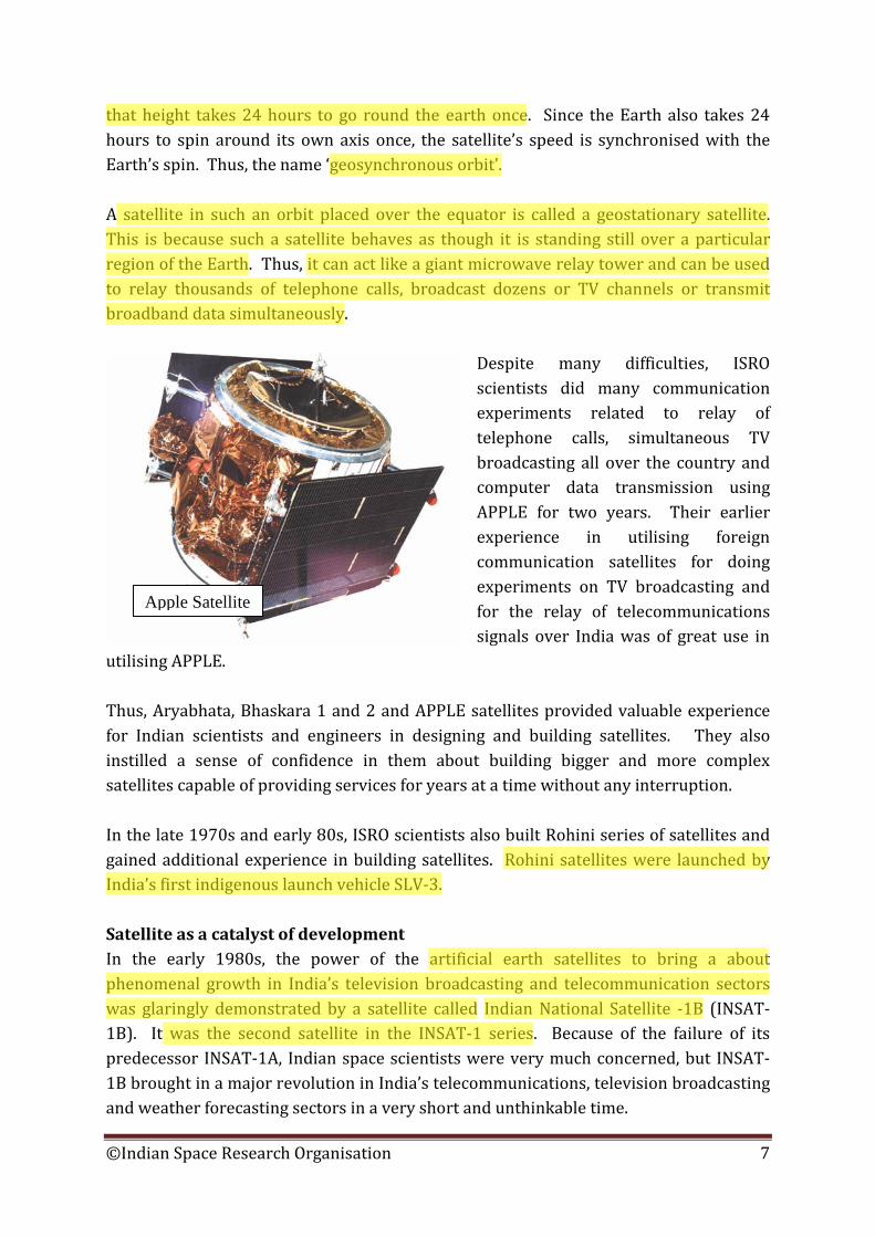
On April 19, 1975, a Soviet Rocket carried Aryabhata into a 600 km high orbit. After separating from that rocket, Aryabhata started circling the Earth on its own. Aryabhata laid a firm foundation to India’s satellite programme. With this, Indian scientists moved ahead and began building Bhaskara 1 satellite. That satellite was intended for Earth observations. Bhaskara 1 was also launched by a Soviet rocket into orbit in June 1979. It carried a TV camera for taking the pictures of Earth’s surface. Besides, it carried a ‘microwave radiometer’ which was also an instrument to study the Earth. A similar satellite, Bhaskara 2, was launched in 1981 on another Soviet rocket. The experience gained during the Bhaskara programme was the foundation stone for the later Indian Remote Sensing (IRS) satellite programme. The success of IRS programme has made India one of the world leaders in the field of remote sensing. When Bhaskara 1 satellite was being built, ISRO found another opportunity which it fully utilised to its advantage. The European Space Agency (ESA) was developing a satellite launching rocket called Ariane. In the mid-70s, ESA asked for proposals from various space agencies around the world to fly their satellite in one of the first few flights of Ariane rocket at free of cost. ISRO responded to this opportunity and against tough competition from other space agencies, ISRO’s proposal was selected. Thus, India’s first experimental communication satellite APPLE (Ariane Passenger Payload Experiment) was built. And, as agreed, it was launched free of cost by Ariane rocket. In fact, the launch of other three experimental satellites of India, namey, Aryabhata, Bhaskara 1 and Bhaskara 2 were also at free of cost. This shows the excellent relationship India maintained with the former Soviet Union and Europe, as well as the respect Indian space scientists had earned outside the country. One more interesting thing about APPLE was that the satellite was launched by Ariane rocket not to its final destination, which of course, was a special orbit called ‘Geosynchronous orbit’. Instead, like many other rockets, Ariane too launched APPLE into a highly elliptical (elongated or egg shaped) orbit around the Earth. From this ‘transfer’ orbit, APPLE was taken its final geosynchronous orbital home by firing a ISRO built rocket which was permanently attached to it. In this way, ISRO scientists gained valuable experience in putting a satellite into a distant orbit. Geosynchronous orbit lies at a height of about 36,000 km from the surface of the Earth, which of course, is almost one tenth of the way to moon. A satellite circling the Earth at
©Indian Space Research Organisation 6
that height takes 24 hours to go round the earth once. Since the Earth also takes 24 hours to spin around its own axis once, the satellite’s speed is synchronised with the Earth’s spin. Thus, the name ‘geosynchronous orbit’. A satellite in such an orbit placed over the equator is called a geostationary satellite. This is because such a satellite behaves as though it is standing still over a particular region of the Earth. Thus, it can act like a giant microwave relay tower and can be used to relay thousands of telephone calls, broadcast dozens or TV channels or transmit broadband data simultaneously.
Despite many difficulties, ISRO scientists did many communication experiments related to relay of telephone calls, simultaneous TV broadcasting all over the country and computer data transmission using APPLE for two years. Their earlier experience in utilising foreign communication satellites for doing experiments on TV broadcasting and for the relay of telecommunications signals over India was of great use in
utilising APPLE. Thus, Aryabhata, Bhaskara 1 and 2 and APPLE satellites provided valuable experience for Indian scientists and engineers in designing and building satellites. They also instilled a sense of confidence in them about building bigger and more complex satellites capable of providing services for years at a time without any interruption. In the late 1970s and early 80s, ISRO scientists also built Rohini series of satellites and gained additional experience in building satellites. Rohini satellites were launched by India’s first indigenous launch vehicle SLV-3. Satellite as a catalyst of development In the early 1980s, the power of the artificial earth satellites to bring a about phenomenal growth in India’s television broadcasting and telecommunication sectors was glaringly demonstrated by a satellite called Indian National Satellite -1B (INSAT-1B). It was the second satellite in the INSAT-1 series. Because of the failure of its predecessor INSAT-1A, Indian space scientists were very much concerned, but INSAT-1B brought in a major revolution in India’s telecommunications, television broadcasting and weather forecasting sectors in a very short and unthinkable time.
Apple Satellite
©Indian Space Research Organisation 7
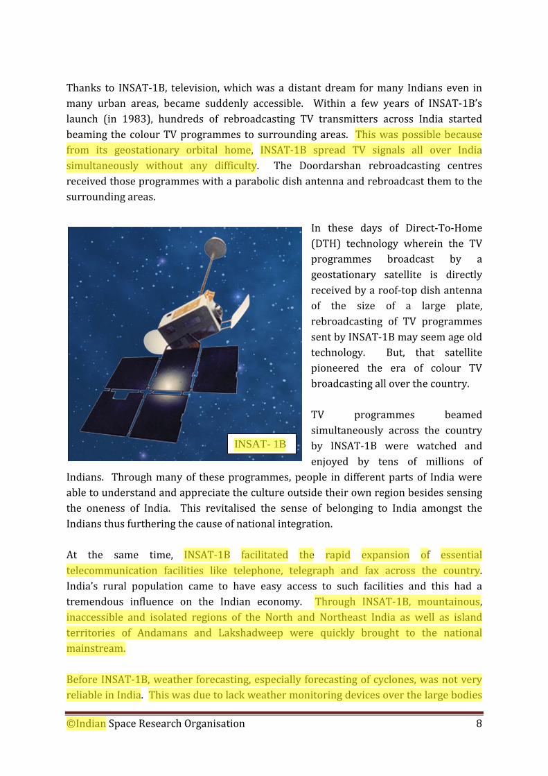
Thanks to INSAT-1B, television, which was a distant dream for many Indians even in many urban areas, became suddenly accessible. Within a few years of INSAT-1B’s launch (in 1983), hundreds of rebroadcasting TV transmitters across India started beaming the colour TV programmes to surrounding areas. This was possible because from its geostationary orbital home, INSAT-1B spread TV signals all over India simultaneously without any difficulty. The Doordarshan rebroadcasting centres received those programmes with a parabolic dish antenna and rebroadcast them to the surrounding areas.
In these days of Direct-To-Home (DTH) technology wherein the TV programmes broadcast by a geostationary satellite is directly received by a roof-top dish antenna of the size of a large plate, rebroadcasting of TV programmes sent by INSAT-1B may seem age old technology. But, that satellite pioneered the era of colour TV broadcasting all over the country. TV programmes beamed simultaneously across the country by INSAT-1B were watched and enjoyed by tens of millions of
Indians. Through many of these programmes, people in different parts of India were able to understand and appreciate the culture outside their own region besides sensing the oneness of India. This revitalised the sense of belonging to India amongst the Indians thus furthering the cause of national integration. At the same time, INSAT-1B facilitated the rapid expansion of essential telecommunication facilities like telephone, telegraph and fax across the country. India’s rural population came to have easy access to such facilities and this had a tremendous influence on the Indian economy. Through INSAT-1B, mountainous, inaccessible and isolated regions of the North and Northeast India as well as island territories of Andamans and Lakshadweep were quickly brought to the national mainstream. Before INSAT-1B, weather forecasting, especially forecasting of cyclones, was not very reliable in India. This was due to lack weather monitoring devices over the large bodies
INSAT- 1B
©Indian Space Research Organisation 8
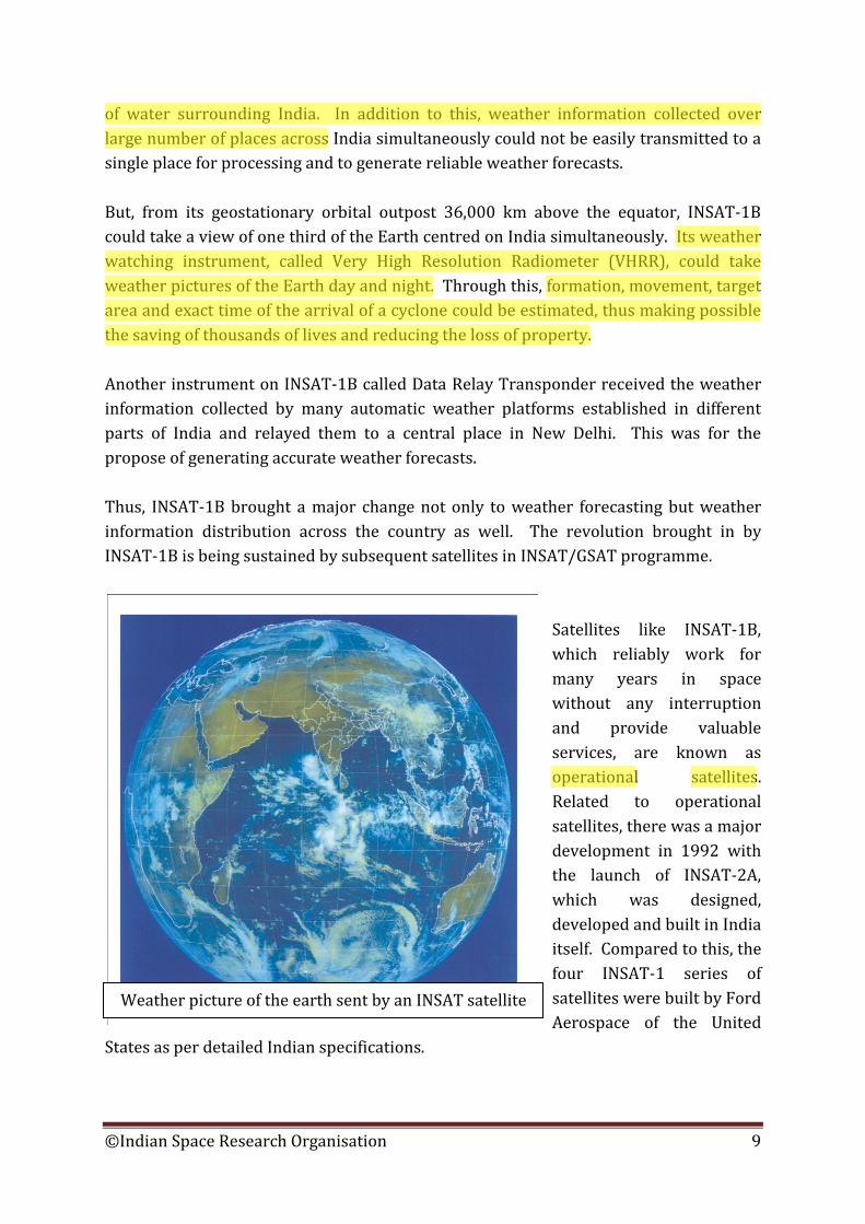
of water surrounding India. In addition to this, weather information collected over large number of places across India simultaneously could not be easily transmitted to a single place for processing and to generate reliable weather forecasts. But, from its geostationary orbital outpost 36,000 km above the equator, INSAT-1B could take a view of one third of the Earth centred on India simultaneously. Its weather watching instrument, called Very High Resolution Radiometer (VHRR), could take weather pictures of the Earth day and night. Through this, formation, movement, target area and exact time of the arrival of a cyclone could be estimated, thus making possible the saving of thousands of lives and reducing the loss of property. Another instrument on INSAT-1B called Data Relay Transponder received the weather information collected by many automatic weather platforms established in different parts of India and relayed them to a central place in New Delhi. This was for the propose of generating accurate weather forecasts. Thus, INSAT-1B brought a major change not only to weather forecasting but weather information distribution across the country as well. The revolution brought in by INSAT-1B is being sustained by subsequent satellites in INSAT/GSAT programme.
Satellites like INSAT-1B, which reliably work for many years in space without any interruption and provide valuable services, are known as operational satellites. Related to operational satellites, there was a major development in 1992 with the launch of INSAT-2A, which was designed, developed and built in India itself. Compared to this, the four INSAT-1 series of satellites were built by Ford Aerospace of the United
States as per detailed Indian specifications.
Weather picture of the earth sent by an INSAT satellite
©Indian Space Research Organisation 9
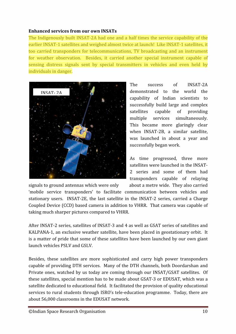
Enhanced services from our own INSATs The Indigenously built INSAT-2A had one and a half times the service capability of the earlier INSAT-1 satellites and weighed almost twice at launch! Like INSAT-1 satellites, it too carried transponders for telecommunications, TV broadcasting and an instrument for weather observation. Besides, it carried another special instrument capable of sensing distress signals sent by special transmitters in vehicles and even held by individuals in danger.
The success of INSAT-2A demonstrated to the world the capability of Indian scientists to successfully build large and complex satellites capable of providing multiple services simultaneously. This became more glaringly clear when INSAT-2B, a similar satellite, was launched in about a year and successfully began work. As time progressed, three more satellites were launched in the INSAT-2 series and some of them had transponders capable of relaying
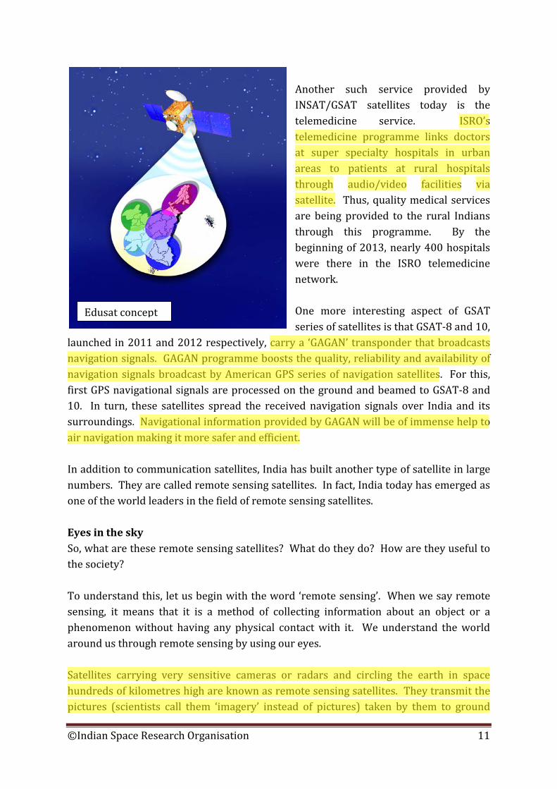
signals to ground antennas which were only about a metre wide. They also carried ‘mobile service transponders’ to facilitate communication between vehicles and stationary users. INSAT-2E, the last satellite in the INSAT-2 series, carried a Charge Coupled Device (CCD) based camera in addition to VHRR. That camera was capable of taking much sharper pictures compared to VHRR. After INSAT-2 series, satellites of INSAT-3 and 4 as well as GSAT series of satellites and KALPANA-1, an exclusive weather satellite, have been placed in geostationary orbit. It is a matter of pride that some of these satellites have been launched by our own giant launch vehicles PSLV and GSLV. Besides, these satellites are more sophisticated and carry high power transponders capable of providing DTH services. Many of the DTH channels, both Doordarshan and Private ones, watched by us today are coming through our INSAT/GSAT satellites. Of these satellites, special mention has to be made about GSAT-3 or EDUSAT, which was a satellite dedicated to educational field. It facilitated the provision of quality educational services to rural students through ISRO’s tele-education programme. Today, there are about 56,000 classrooms in the EDUSAT network.
INSAT- 2A
©Indian Space Research Organisation 10
Another such service provided by INSAT/GSAT satellites today is the telemedicine service. ISRO’s telemedicine programme links doctors at super specialty hospitals in urban areas to patients at rural hospitals through audio/video facilities via satellite. Thus, quality medical services are being provided to the rural Indians through this programme. By the beginning of 2013, nearly 400 hospitals were there in the ISRO telemedicine network. One more interesting aspect of GSAT series of satellites is that GSAT-8 and 10,
launched in 2011 and 2012 respectively, carry a ‘GAGAN’ transponder that broadcasts navigation signals. GAGAN programme boosts the quality, reliability and availability of navigation signals broadcast by American GPS series of navigation satellites. For this, first GPS navigational signals are processed on the ground and beamed to GSAT-8 and 10. In turn, these satellites spread the received navigation signals over India and its surroundings. Navigational information provided by GAGAN will be of immense help to air navigation making it more safer and efficient. In addition to communication satellites, India has built another type of satellite in large numbers. They are called remote sensing satellites. In fact, India today has emerged as one of the world leaders in the field of remote sensing satellites. Eyes in the sky So, what are these remote sensing satellites? What do they do? How are they useful to the society? To understand this, let us begin with the word ‘remote sensing’. When we say remote sensing, it means that it is a method of collecting information about an object or a phenomenon without having any physical contact with it. We understand the world around us through remote sensing by using our eyes. Satellites carrying very sensitive cameras or radars and circling the earth in space hundreds of kilometres high are known as remote sensing satellites. They transmit the pictures (scientists call them ‘imagery’ instead of pictures) taken by them to ground
Edusat concept
©Indian Space Research Organisation 11
stations through radio. Such pictures taken in different ‘colours’ or in black and white, show lot of details. Trained scientists can manipulate and analyse those pictures in computers to understand many things. For example, such pictures can be used to estimate the sown area of a particular crop as well as its yield. More importantly, disease affecting a crop can be detected very early. Such information can help the government in minimising the price fluctuation of a particular commodity because of the related crop failure. Similarly, the probability of finding underground water at a particular place can be estimated using pictures sent by remote sensing satellites. So is the case with minerals. This is because such photos taken in specific ‘colours’ show the type of underlying rocks in a particular place. Trained geologists can understand the nature of those rocks and the materials they contain. This apart, such pictures can be used to estimate our forest wealth, identify forest type and detect and monitor forest fires. This helps in preserving our forests, protect the environment and prevent soil erosion leading to drought. Additionally, wastelands can be identified and classified. More importantly, the reason for certain areas to become wastelands can be understood and measures towards their eventual reclamation can be initiated. Some of the other uses to which pictures from remote sensing satellites can be used are pollution monitoring, biodiversity description, accurate map making (cartography) and watershed development. In this way, there are many uses to which pictures (imagery) sent by remote sensing satellites as a stream of zeros and ones through radio can be used with the help of computers. We may recall that ISRO learnt the basics of conducting remote sensing through satellites from its Bhaskara programme. Based on that experience, ISRO scientists worked hard during the 1980s and built India’s first operational remote sensing satellite IRS-1A by 1988. IRS-1A was also the very first operational satellite built by India.
©Indian Space Research Organisation 12
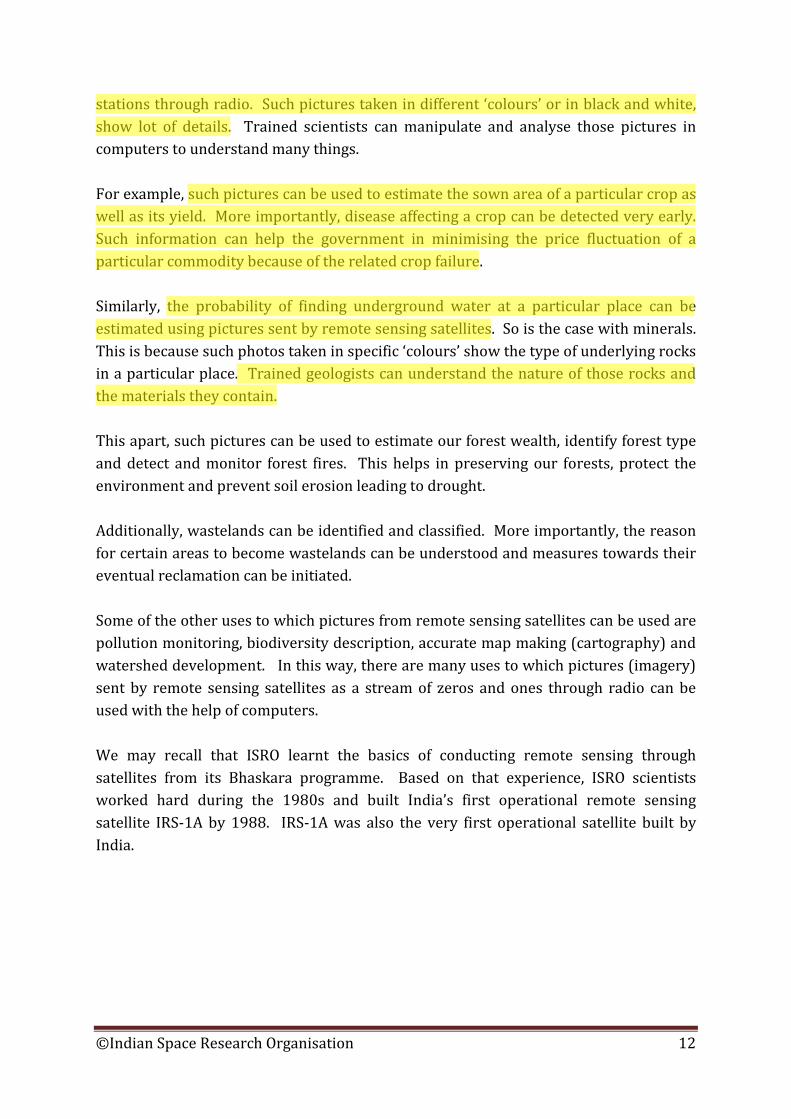
IRS-1A was launched into an orbit that was passing over the polar regions of the earth at a height of about 900 kilometres. The reason for launching remote sensing satellites to such ‘polar orbits’ is to provide them the ability to observe almost the entire earth as they circle north-south. Since earth rotates west to east down below, remote sensing satellites in polar orbit can take a look at almost whole of the earth over a period of time. To be more precise, remote
sensing satellites are normally launched into ‘polar sun synchronous orbits’. Such orbits allow a remote sensing satellite to take the pictures of the earth over a long period of time under almost identical lighting conditions. So, IRS-1A was also launched into a 900 km polar sun synchronous orbit by the Soviet launch vehicle Vostok from Baikanor cosmodrome (launch centre). It was from this launch centre that Yuri Gagarin, the first man in space, had been launched on April 12, 1961. Though it posed lots of challenges to the scientists who built and controlled it, IRS-1A outlived its intended life and worked for more than five years in orbit. In the years since the launch of IRS-1A, ISRO scientists have built remote sensing satellites of increasing sophistication. More importantly, the pictures sent by some of them have been and are being used not only in India but by many other countries as well. This shows as to how far we have progressed in remote sensing satellite field. By the March 2013, ten remote sensing satellites of India were working in orbit. Another feature which tells us about the capability of ISRO scientists is the resolution or the details available in the pictures sent by our remote sensing satellites. In this regard, IRS-1A was capable of taking pictures in which ground features which are about the size of a tennis court (36 metres) could be identified. Today, some of our Cartosat series of remote sensing satellites can take pictures in which features about a metre across can be identified! Besides, India today has remote sensing satellites which can take pictures of the earth day and night as well as in cloudy weather. Besides utilising our communication, weather and remote sensing satellites separately for the specific work for which they were built, ISRO has now blended their capabilities
IRS – 1A
©Indian Space Research Organisation 13

for performing new tasks concerned with country’s development. One of them is the Village Resource Centre (VRC), which aims at taking the benefits of space technology directly to the doorstep of the villages. Another such new use is the Disaster Management System, which aims at effectively managing natural disasters like cyclones, floods and drought. Quenching the thirst for knowledge Communication satellites, weather satellites and remote sensing satellites. These are the satellites that make our life easy, interesting and safe. In addition to this, ISRO scientists have built scientific satellites that quench the human thirst for knowledge, especially to understand our universe. In this regard, remember, India’s very first satellite Aryabhata carried scientific instruments. In the 1980s and early 1990s, ISRO built SROSS series of scientific satellites. Two of them reached orbit in 1992 and 1994 and each carried two scientific instruments, one to understand the nature of ‘gamma ray bursts’, an interesting astronomical phenomenon observed by earlier satellites in space and the other to study a layer of the earth’s atmosphere called ionosphere. Later in 1996, IRS-P3, which was actually an Indian remote sensing satellite, also carried a scientific instrument to detect the X-rays coming from the distant heavenly bodies. Then in 2003, GSAT-2 satellite carried a few scientific instruments to geostationary orbit. But, the satellite, to be more precise, the spacecraft which revealed the prowess of Indian scientists to efficiently explore space was Chandrayaan-1. Since Chandrayaan-1 went towards some other heavenly body instead of permanently circling the Earth, it is appropriate to call it a spacecraft rather than a satellite. Chandrayaan-1 demonstrated many things including India’s ability to do meaningful science at low cost, its ability to assume leadership in a cooperative space venture and develop the essential technology within stipulated time. Chandrayaan-1 made the outside world to look at India with enhanced respect and galvanised student community within India. Chandrayaan-1 became a prominent milestone not only in the history of Indian space programme, but in the history of India itself.
©Indian Space Research Organisation 14

By late 1990s, India had vast experience in building and launching satellites as well as utilising them. Though Indian space programme is mainly oriented towards serving the common man, the spirit of space research had not been forgotten. In this context, scientists thought of sending a small spacecraft to explore our nearest celestial neighbour – the Moon. Moon, which is very familiar to us in the night sky, lies at a distance of about 3,84,000 km (three lakh eighty four thousand kilometres) from here. Since time immemorial, humans have dreamt of travelling to moon. But after the dawn of space age following the launch of sputnik-1, first many unmanned spacecraft, and then human explorers, went to moon and studied that heavenly body.
Though the first wave of lunar exploration came to an end in 1976, the second wave began in 1990 to study moon further. Following the discovery of what appeared to be water ice in the polar regions of the moon by a small American spacecraft in 1994, a sudden interest developed in the scientific community to study the moon more intensely. As part of this, United States, Europe, Japan and China launched unmanned spacecraft towards the moon. India’s Chandrayaan-1 was part of this new wave of exploration of the moon. One of the main objectives of Chandrayaan-1 was to further expand the knowledge horizon about the moon. The other was to further progress in space technologies, especially through miniaturisation, which means shrinking of various internal ‘organs’ of a satellite or a spacecraft. The third was to provide challenging opportunities to India’s large younger generation of scientists to conduct research about the moon. In the opinion of scientists, study of the moon will enable us to understand the history of the earth as well as the history of the solar system itself. In addition to this, a detailed study of the moon will allow us to exploit the mineral and fuel resources available there.
Chandrayaan-1 orbiting the moon, in an artist's veiw
©Indian Space Research Organisation 15
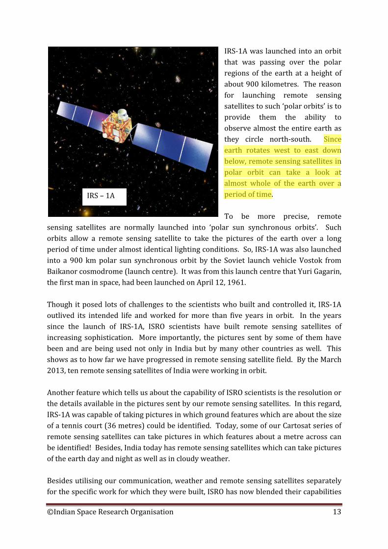
In this regard, scientists are interested in searching a substance called Helium-3 on the moon, which they say can become a relatively clean fuel for the future nuclear fusion reactors. Chandrayaan-1 spacecraft was built in less than five years. At the time of its launch, it weighed 1380 kg. It was of the shape of a large box with a lid at the top. The spacecraft had 11 scientific instruments of which five were Indian and the other six were from the USA, Europe and Bulgaria. They included cameras, spectrometers, a radar and an instrument to measure harmful radiation in space.
By providing opportunity for foreign scientists to fly their scientific instrument on Chandrayaan-1, India showed the world that it gives lot of importance to international co-operation in exploring space and using it for peaceful purposes. Giant leap to moon Chandrayaan-1 was launched on October 22, 2008 from Satish Dhawan Space Centre SHAR in Sriharikota by India’s Polar Satellite Launch Vehicle (PSLV-C11). On that day at 6:22 am in the morning, the 15 story high PSLV majestically rose into the sky on a bright pillar of flame and quickly disappeared into the cloudy sky. In the next 20 minutes or so, it placed Chandrayaan-1 in a highly elongated orbit around the earth that stretched 280 km on one side and about 23,000 km on the other.
Chandrayaan-1 spacecraft undergoing prelaunch tests
©Indian Space Research Organisation 16
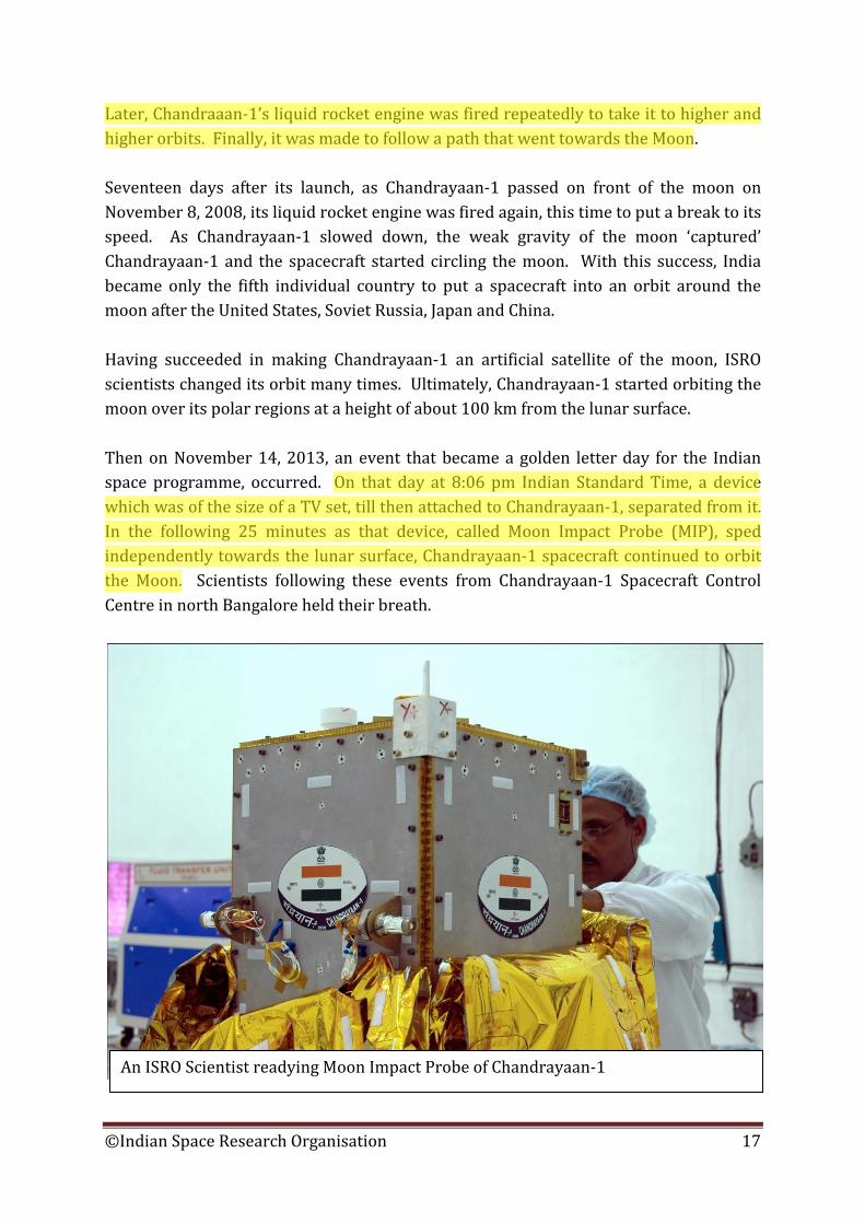
Later, Chandraaan-1’s liquid rocket engine was fired repeatedly to take it to higher and higher orbits. Finally, it was made to follow a path that went towards the Moon. Seventeen days after its launch, as Chandrayaan-1 passed on front of the moon on November 8, 2008, its liquid rocket engine was fired again, this time to put a break to its speed. As Chandrayaan-1 slowed down, the weak gravity of the moon ‘captured’ Chandrayaan-1 and the spacecraft started circling the moon. With this success, India became only the fifth individual country to put a spacecraft into an orbit around the moon after the United States, Soviet Russia, Japan and China. Having succeeded in making Chandrayaan-1 an artificial satellite of the moon, ISRO scientists changed its orbit many times. Ultimately, Chandrayaan-1 started orbiting the moon over its polar regions at a height of about 100 km from the lunar surface. Then on November 14, 2013, an event that became a golden letter day for the Indian space programme, occurred. On that day at 8:06 pm Indian Standard Time, a device which was of the size of a TV set, till then attached to Chandrayaan-1, separated from it. In the following 25 minutes as that device, called Moon Impact Probe (MIP), sped independently towards the lunar surface, Chandrayaan-1 spacecraft continued to orbit the Moon. Scientists following these events from Chandrayaan-1 Spacecraft Control Centre in north Bangalore held their breath.
An ISRO Scientist readying Moon Impact Probe of Chandrayaan-1
©Indian Space Research Organisation 17
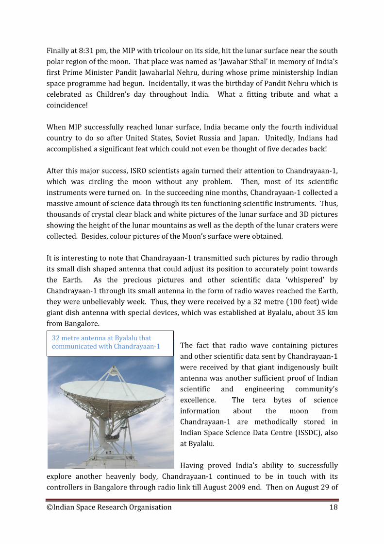
Finally at 8:31 pm, the MIP with tricolour on its side, hit the lunar surface near the south polar region of the moon. That place was named as ‘Jawahar Sthal’ in memory of India’s first Prime Minister Pandit Jawaharlal Nehru, during whose prime ministership Indian space programme had begun. Incidentally, it was the birthday of Pandit Nehru which is celebrated as Children’s day throughout India. What a fitting tribute and what a coincidence! When MIP successfully reached lunar surface, India became only the fourth individual country to do so after United States, Soviet Russia and Japan. Unitedly, Indians had accomplished a significant feat which could not even be thought of five decades back! After this major success, ISRO scientists again turned their attention to Chandrayaan-1, which was circling the moon without any problem. Then, most of its scientific instruments were turned on. In the succeeding nine months, Chandrayaan-1 collected a massive amount of science data through its ten functioning scientific instruments. Thus, thousands of crystal clear black and white pictures of the lunar surface and 3D pictures showing the height of the lunar mountains as well as the depth of the lunar craters were collected. Besides, colour pictures of the Moon’s surface were obtained. It is interesting to note that Chandrayaan-1 transmitted such pictures by radio through its small dish shaped antenna that could adjust its position to accurately point towards the Earth. As the precious pictures and other scientific data ‘whispered’ by Chandrayaan-1 through its small antenna in the form of radio waves reached the Earth, they were unbelievably week. Thus, they were received by a 32 metre (100 feet) wide giant dish antenna with special devices, which was established at Byalalu, about 35 km from Bangalore.
The fact that radio wave containing pictures and other scientific data sent by Chandrayaan-1 were received by that giant indigenously built antenna was another sufficient proof of Indian scientific and engineering community’s excellence. The tera bytes of science information about the moon from Chandrayaan-1 are methodically stored in Indian Space Science Data Centre (ISSDC), also at Byalalu. Having proved India’s ability to successfully
explore another heavenly body, Chandrayaan-1 continued to be in touch with its controllers in Bangalore through radio link till August 2009 end. Then on August 29 of
32 metre antenna at Byalalu that communicated with Chandrayaan-1
©Indian Space Research Organisation 18
that year, it fell silent, earlier than expected. But, the massive amount of scientific data (information) including pictures sent by Chandrayaan-1 had been safely stored at Byalalu and the scientists who built Chandrayaan-1’s scientific instruments were busy in analysing that data. Within a month, Newspapers around the world prominently reported that Chandryaan-1 had conclusively (without any doubt) detected water molecules on the Moon. This was a path breaking discovery indeed! Before Chandryaan-1 went to Moon, scientists were not certain about the presence of water on the moon. Thus, it was India’s Chandrayaan-1 which made a major discovery about the moon. But, the water molecules detected everywhere on the moon by Chandrayaan-1 were in extremely minute quantities and were attached to the top layers of the lunar soil. But, this discovery has far reaching implications from the point of view of future exploration of the moon as well as the exploitation of lunar resources. A few months after this discovery, Chandryaan-1 detected water ice in the polar regions of the moon. This apart, Chandrayaan-1 helped scientists in understanding the chemistry of the moon. Along with this, scientists were able to sense the height and depth of various lunar surface features. Chandrayaan-1 thus became a symbol of India’s success in space. Bringing back from space
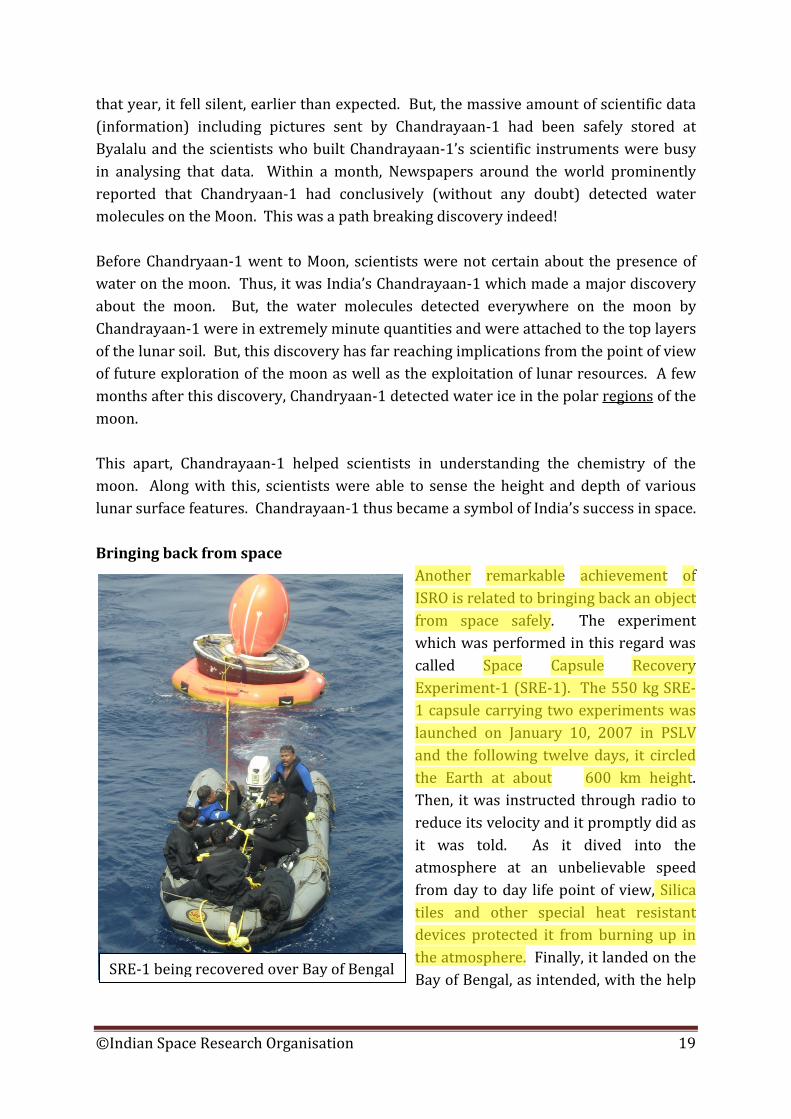
Another remarkable achievement of ISRO is related to bringing back an object from space safely. The experiment which was performed in this regard was called Space Capsule Recovery Experiment-1 (SRE-1). The 550 kg SRE-1 capsule carrying two experiments was launched on January 10, 2007 in PSLV and the following twelve days, it circled the Earth at about 600 km height. Then, it was instructed through radio to reduce its velocity and it promptly did as it was told. As it dived into the atmosphere at an unbelievable speed from day to day life point of view, Silica tiles and other special heat resistant devices protected it from burning up in the atmosphere. Finally, it landed on the Bay of Bengal, as intended, with the help
SRE-1 being recovered over Bay of Bengal
©Indian Space Research Organisation 19
of parachutes. Thus, the very first attempt of India to bring back a device which it had launched into space earlier, was a great success. Launch Vehicles: Key to Spaceflight Satellites might have brought us many comforts, made our lives safer or quenched our thirst for understanding the universe. But, before satellites begin providing their valuable services, they have to be carried to space and provided with sufficient velocity to circle the earth there. Today, there is only one device capable of doing that. It is the rocket. Without mastering rocket technology, the long cherished dream of humans to take up space travel could not be realised. Thus, rockets are very crucial for spaceflight. Large rockets capable of launching satellites and humans to space are not referred to simply as rockets, but as ‘launch vehicles’. A satellite launch vehicle is normally a giant rocket which is built by placing one rocket stage over the other. Each of these stages will be capable of working independently and the bottom most stage or the first stage will be the largest and the heaviest. One of the problems associated with rocket technology is that it can be used to build missiles also. A missile is a rocket that carries a bomb to its target. Thus, no country provides information about rockets easily to others. We may recall that the formal beginning of the Indian space programme was revealed to the outside world by the launch of an American sounding (research) rocket on November 21, 1963. Having learnt the art and science of launching small rockets, Indian space scientists then learnt the techniques of building such rockets from France. At the same time, Vikram Sarabhai, the father of the Indian space programme, gave a lot of encouragement to building sounding rockets of our own. Thus, India later developed many ‘Rohini’ series of sounding rockets and more than two thousand five hundred sounding rockets had been launched by March 2013. By the beginning of 1970s, ISRO scientists were debating amongst themselves about the details of building our own satellite launch vehicle. But, compared to sounding rockets, it is far more difficult to build even a very small satellite launch vehicle. And, the rocket building work began in India without any involvement of the military. This was not the case with most other countries which had successfully built own satellite launch vehicles.
©Indian Space Research Organisation 20
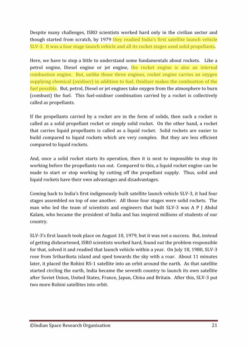
Despite many challenges, ISRO scientists worked hard only in the civilian sector and though started from scratch, by 1979 they readied India’s first satellite launch vehicle SLV-3. It was a four stage launch vehicle and all its rocket stages used solid propellants. Here, we have to stop a little to understand some fundamentals about rockets. Like a petrol engine, Diesel engine or jet engine, the rocket engine is also an internal combustion engine. But, unlike those three engines, rocket engine carries an oxygen supplying chemical (oxidiser) in addition to fuel. Oxidiser makes the combustion of the fuel possible. But, petrol, Diesel or jet engines take oxygen from the atmosphere to burn (combust) the fuel. This fuel-oxidiser combination carried by a rocket is collectively called as propellants. If the propellants carried by a rocket are in the form of solids, then such a rocket is called as a solid propellant rocket or simply solid rocket. On the other hand, a rocket that carries liquid propellants is called as a liquid rocket. Solid rockets are easier to build compared to liquid rockets which are very complex. But they are less efficient compared to liquid rockets. And, once a solid rocket starts its operation, then it is next to impossible to stop its working before the propellants run out. Compared to this, a liquid rocket engine can be made to start or stop working by cutting off the propellant supply. Thus, solid and liquid rockets have their own advantages and disadvantages. Coming back to India’s first indigenously built satellite launch vehicle SLV-3, it had four stages assembled on top of one another. All those four stages were solid rockets. The man who led the team of scientists and engineers that built SLV-3 was A P J Abdul Kalam, who became the president of India and has inspired millions of students of our country. SLV-3’s first launch took place on August 10, 1979, but it was not a success. But, instead of getting disheartened, ISRO scientists worked hard, found out the problem responsible for that, solved it and readied that launch vehicle within a year. On July 18, 1980, SLV-3 rose from Sriharikota island and sped towards the sky with a roar. About 11 minutes later, it placed the Rohini RS-1 satellite into an orbit around the earth. As that satellite started circling the earth, India became the seventh country to launch its own satellite after Soviet Union, United States, France, Japan, China and Britain. After this, SLV-3 put two more Rohini satellites into orbit.
©Indian Space Research Organisation 21
In the 1980s, ISRO built a more capable launch vehicle known as Augmented Satellite Launch Vehicle (ASLV). But, ASLV was successful for the first time only during its third flight in 1992 and launched SROSS-C satellite into an orbit around the earth. Another SROSS satellite was launched by ASLV in 1994. Arrival of the workhorse When ASLV was still in use, ISRO readied its giant Polar Satellite Launch Vehicle (PSLV) for its first flight. Length wise, PSLV was twice as tall as SLV-3 and ASLV. At the time of launch, it weighed 295 tons, which was 17 times heavier than SLV-3 and more than 7 times heavier than ASLV. But, there was another important
difference between PSLV and the two earlier launch vehicles of ISRO. That was related to liquid rocket engines. PSLV was the first Indian launch vehicle to use liquid propellant rocket stages. Of the four stages of PSLV, the first and the third stages were solid rocket stages. Besides, six ‘strap-on’ motors, which provide additional pushing force to PSLV at the time of launch, were also solid rockets. But, the second and the fourth stages of PSLV were liquid rocket stages. Besides this, PSLV had a far more sophisticated electornic ‘brain’ compared to SLV-3 and ASLV.
SLV-3 lifts-off on July 18, 1980
©Indian Space Research Organisation 22
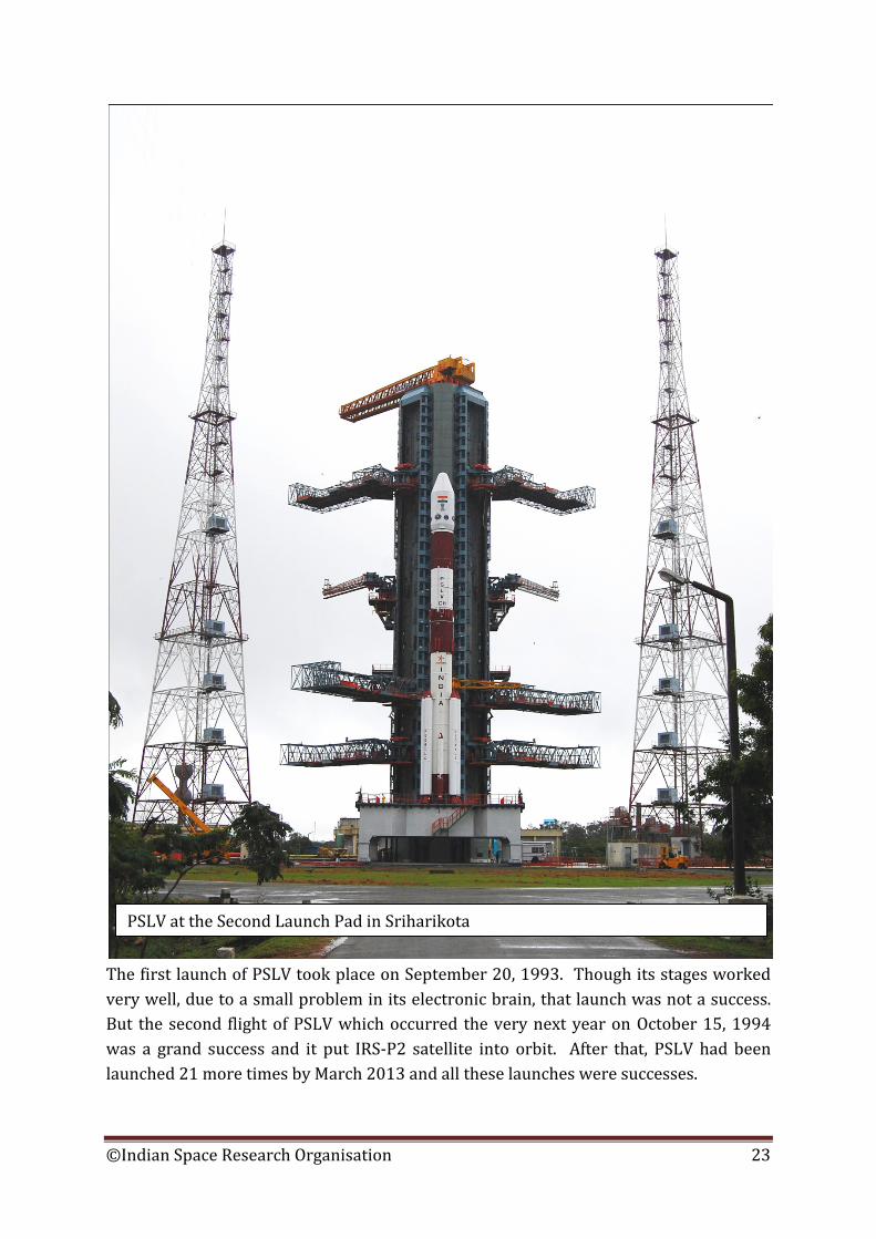
The first launch of PSLV took place on September 20, 1993. Though its stages worked very well, due to a small problem in its electronic brain, that launch was not a success. But the second flight of PSLV which occurred the very next year on October 15, 1994 was a grand success and it put IRS-P2 satellite into orbit. After that, PSLV had been launched 21 more times by March 2013 and all these launches were successes.
PSLV at the Second Launch Pad in Sriharikota
©Indian Space Research Organisation 23
PSLV is not only a reliable vehicle but a very versatile vehicle too. It has launched remote sensing satellites, communication satellites, a weather satellite as well as a spacecraft to explore the moon into different orbits. And, sometimes it has launched more than one satellite during a single launch. In April 2008, it launched 10 satellites in a single launch! PSLV was originally built with the intention of launching Indian Remote Sensing satellites into polar orbits. But, to launch heavier communications and weather satellites towards the 36,000 km high geostationary orbit, ISRO built a more capable, complex and larger launch vehicle called Geosynchronous Satellite Launch Vehicle (GSLV). Like PSLV, GSLV also has an identical solid rocket first stage and a liquid rocket second stage. But, instead of having six solid ‘strap-on’ rockets as PSLV to provide additional pushing force at the time of launch, GSLV has four liquid ‘strap-ons’ for the same purpose. More importantly, instead of having a third ‘solid’ rocket stage and a fourth ‘liquid’ rocket stage like PSLV, GSLV has a only a third rocket stage with a ‘cryogenic’ rocket engine. Cryogenic Challenges A cryogenic rocket engine is a special type of liquid rocket engine. It uses propellants which are gases at normal temperature and pressure but become liquids at very low temperatures. One common cryogenic rocket propellant combination is liquid Hydrogen and Liquid Oxygen. Thus, a cryogenic rocket stage must have special tanks that keep oxygen and hydrogen under liquid condition. The building as well as operating a cryogenic rocket engine is very complex. But a cryogenic engine is very efficient compared to liquid rocket engines. To build GSLV quickly, in 1991 ISRO decided to get cryogenic rocket engine technology from the Soviet Russia. But, due to certain problems in getting that technology which came up later, ISRO got seven cryogenic stages from Russia and not technology. At the same time, work on designing a cryogenic stage of our own was also initiated around mid-1990s.
©Indian Space Research Organisation 24
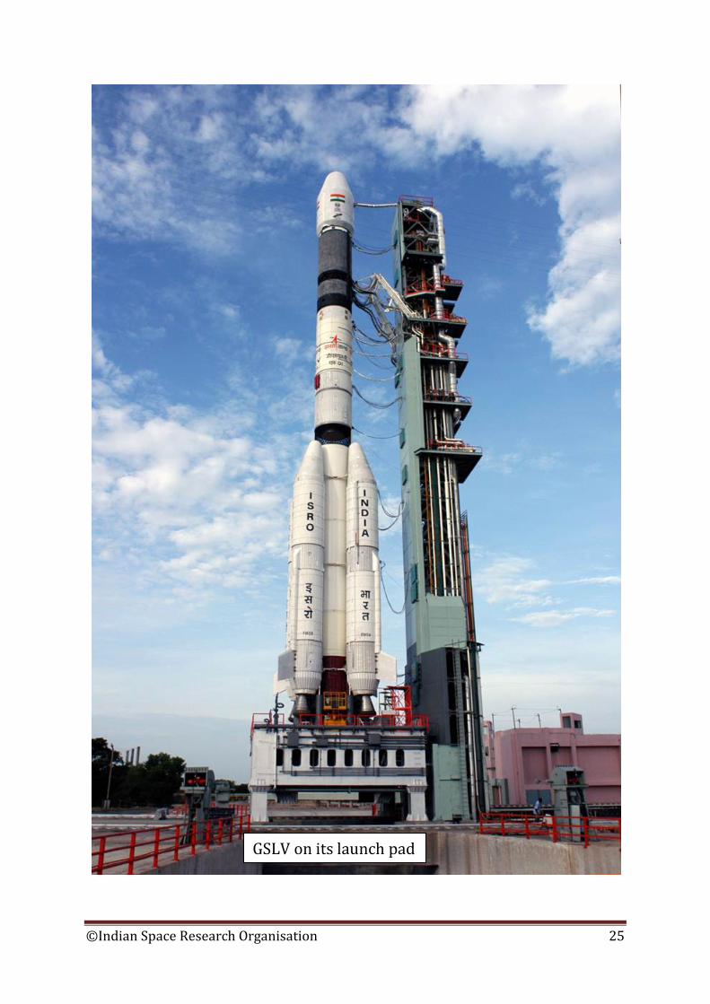
GSLV on its launch pad
©Indian Space Research Organisation 25
GSLV’s very first launch which took place on April 18, 2001 was successful and the GSAT-1 communication satellite carried on top of GSLV was placed in a highly elongated orbit. By March 2013, GSLV has been launched seven times and it had placed four satellites during those launches. In April 2010, GSLV carrying the indigenously built cryogenic stage was launched but did not succeed in putting the GSAT-4 satellite carried on-board. ISRO scientists have carefully analysed that flight to understand the reasons for the failure of GSLV. Launch of yet another GSLV with indigenous cryogenic stage is planned in the second half of 2013. At the same time, ISRO is also building GSLV Mark III, a more powerful and efficient rocket. It will have the capability to launch satellites weighing up to 4 tonnes towards geostationary orbit. And, in order to reduce the cost of launching satellites into space, ISRO scientists are studying special ‘air breathing rocket’ technology and ‘reusable rocket vehicles’. Today’s launch vehicles, whether Indian, American, Russian or European, can be used only once. But, reusable rocket technology is highly complex. Into the future Today, the main purpose of building launch vehicles is to carry satellites, unmanned spacecraft and humans to space. ISRO is now building heavier and more complex communication, weather and remote sensing satellites capable of offering more services. Besides, it is developing an independent navigation satellite system called Indian Regional Navigation Satellite System. It will be capable of providing highly accurate position, speed, direction, and time information to vehicles travelling on land, sea and in the air. Such information can make their journey safer and more fuel efficient. Besides, encouraged by the remarkable success of Chandrayaan-1, ISRO scientists are working hard to build a spacecraft to explore Mars. That spacecraft is planned to be launched by PSLV in October 2013. It will reach Mars in September 2014 and explore that planet while circling it in a highly oval shaped orbit. This apart, ISRO is also active in developing Chandrayaan-2 spacecraft that will orbit the moon and send small a rover (robotic car) to the lunar surface in a lander that will smoothly land there. Also, to study the distant heavenly bodies in detail, ISRO is developing a satellite called ASTROSAT and to study the Sun, it is building Aditya satellite. Along with these, ISRO has conducted studies on sending humans to space.
©Indian Space Research Organisation 26

But, much of ISRO’s efforts are focussed towards the utilisation of space technology in service of the common man and to make our country self-sufficient in space technology.
B R Guruprasad Scientist/Engineer 'SF'
Public Relations Officer Indian Space Research Organisation
___________
©Indian Space Research Organisation 27