Embed Size (px)
Citation preview
INFORMATION EXTRACTION AND DEPENDENCY ON OPEN GOVERNMENT DATA
(OGD) FOR ENVIRONMENTAL MONITORING
Hussein Abdulmuttalib*
Dubai Municipality, GIS Department, Maktoom St., Dubai - [email protected]
ISPRS – UN-GGIM Forum
KEY WORDS: Open Government Data, Environmental Monitoring, GIS Data, spatial Analysis, Geo-design, Geo-knowledge
ABSTRACT:
Environmental monitoring practices support decision makers of different government / private institutions, besides environmentalists
and planners among others. This support helps them act towards the sustainability of our environment, and also take efficient
measures for protecting human beings in general, but it is difficult to explore useful information from 'OGD' and assure its quality
for the purpose. On the other hand, Monitoring itself comprises detecting changes as happens, or within the mitigation period range,
which means that any source of data, that is to be used for monitoring, should replicate the information related to the period of
environmental monitoring, or otherwise it's considered almost useless or history.
In this paper the assessment of information extraction and structuring from Open Government Data 'OGD' , that can be useful to
environmental monitoring is performed, looking into availability, usefulness to environmental monitoring of a certain type, checking
its repetition period and dependences. The particular assessment is being performed on a small sample selected from OGD, bearing
in mind the type of the environmental change monitored, such as the increase and concentrations of built up areas, and reduction of
green areas, or monitoring the change of temperature in a specific area. The World Bank mentioned in its blog that Data is open if it
satisfies both conditions of, being technically open, and legally open. The use of Open Data thus, is regulated by published terms of
use, or an agreement which implies some conditions without violating the above mentioned two conditions. Within the scope of the
paper I wish to share the experience of using some OGD for supporting an environmental monitoring work, that is performed to
mitigate the production of carbon dioxide, by regulating energy consumption, and by properly designing the test area's landscapes,
thus using Geodesign tactics, meanwhile wish to add to the results achieved by many efforts to make OGD useful In General and
specifically for Environmental Monitoring purposes.
* Corresponding author
1. OGD OPEN GEVORNMENT DATA
1.1 OGD, Regulations and Geodesign
“The notion of open data and specifically open government data
- information, public or otherwise, which anyone is free to
access and re-use for any purpose - has been around for some
years.
In 2009 open data started to become visible in the mainstream,
with various governments (such as the USA, UK, Canada and
New Zealand), announcing new initiatives towards opening up
their public information. (Open foundation, Open Data
Handbook Documentation, Release 1.0.0)
Relating openness to Geodesign and Geoknowledge is mostly
expressed by the capability of providing the needed information
and data when mostly required, in the required usable format,
showing an example of which, can be the Vital Landscapes
Project in Hungary aimed to interpret landscape management as
an interactive, integrative, conscious and open procedure.
Geodesign approach supports the frames of the research
workflow and study area activities of the Hungarian project
partner, they have used a knowledge model for the design,
“Knowledge base module is a platform that refers on all other
modules or integrates parts of them. (Sándor JOMBACH&
others,2012)
Hans-Georg SCHWARZ-v and others also used the openness in
his / their phrase phrases, while explaining the ideas behind
Geodesign, “the landscape designers call for a more open,
process-oriented and flexible design process “,(Hans-Georg
SCHWARZ-v, 2012)
Quoting from the World Bank’s blog about Open Government
Data “Data is open if it satisfies both conditions below:
Technically open: available in a machine-readable
standard format, which means it can be retrieved and
meaningfully processed by a computer application
Legally open: explicitly licensed in a way that permits
commercial and non-commercial use and re-use
without restrictions“.
The use of Open Data is regulated by published terms of use or
an agreement which implies some conditions without violating
the above mentioned two conditions.
1.2 Open Knowledge Organization, OGD catalogues
From the Open Knowledge organization an open government
data working group was formalized, which is in fact open by
itself to anyone interested in OGD to join and contribute, the
The International Archives of the Photogrammetry, Remote Sensing and Spatial Information Sciences, Volume XLI-B4, 2016 XXIII ISPRS Congress, 12–19 July 2016, Prague, Czech Republic
This contribution has been peer-reviewed. doi:10.5194/isprsarchives-XLI-B4-79-2016
79
major purposes of this group fall under being central point of
reference for interested parties in OGD, develop the principles
openness of official government data, document the background
and status of initiatives to make official information open in
different countries, and finally provide the Support to develop
OGD catalogues with ensuring interoperability of the different
participating platforms.
The three major products of the working group are the open
data handbook which is a general guide for open data, also
formulating the principles of OGD in guidelines built upon the
Open Knowledge Definition and being developed at:
(http://www.opendefinition.org/government/ ), and the third and
final major product is the Data Catalogues, where an
introductory to the data is provided besides supporting setting
up instances of CKAN www.ckan.net around the world,
which is a tool playing the role between the groups of interest
and the governments providing the row data.
1.3 The Data Handbook
The data handbook answers the questions of why, what, how
and then what is the meaning, after downloading or opening
government data, also highlights the major benefits of making
government data open and give examples for the same, which
are but not limited to:
1. Transparency and democratic control,
2. Participation,
3. Self-empowerment,
4. Improved or new private products and services,
5. Innovation,
6. Improved efficiency of government services,
7. Improved effectiveness of government services,
8. Impact measurement of policies,
9. New knowledge from combined data sources and
patterns in large data volumes.
open data handbook is prepared and published on the website
link:
(http://opendatahandbook.org/pdf/OpenDataHandbook.pdf ) to
guide
1.4 Interoperability and OGD
An important measure which makes open data valuable and
relate it to open knowledge, geoknowledge and geodesign is the
interoperability, and for clarifying the importance of this fact to
OGD some quotations are provided below from the open
handbook that are selected to pin out the important issue.
” Interoperability is important because it allows for different
components to work together. This ability to componentized
and to ‘plug together’ components is essential to building large,
complex systems”.”We face a similar situation with regard to
data.
The core of a “commons” of data (or code) is that one piece of
“open” material contained therein can be freely intermixed with
other “open” material. This interoperability is absolutely key to
realizing the main practical benefits of “openness”: the
dramatically enhanced ability to combine different datasets
together and thereby to develop more and better products and
services”, “Providing a clear definition of openness ensures that
when you get two open datasets from two different sources, you
will be able to combine them together, and it ensures that we
avoid our own ‘tower of Babel’: lots of datasets
but little or no ability to combine them together into the larger
systems where the real value lies.”,(Open foundation, Open
Data Handbook Documentation, Release 1.0.0).
In the discussion of this paper for using OGD to address the
aspect of information extraction and structuring that is of
implantation importance to environmental monitoring and
sustainability, the major three key rules recommend by the
working group for opening up data are assessed in this respect:
1.5 Rules of OGD & Relations to Environmental
Monitoring
1.5.1 Keep it simple
Open Data Recommendations Relations to Environmental
Monitoring
Start out small, simple and fast Fast can relates to data
availability and temporal
accuracy
Small can relates to lack of
data
Simple is not always good for
accuracy
There is no requirement that
every dataset must be made
open right now
Encouraging good for the
long run,
But decencies and requires
commitment
Remember this is about
innovation.
Moving as rapidly as possible is
good because it means you can
build momentum and learn
from experience
Innovation is good for getting
more data and more reliable
data and information
Table 1. Rules of OGD working group
1.5.2 Engage early and engage often
The International Archives of the Photogrammetry, Remote Sensing and Spatial Information Sciences, Volume XLI-B4, 2016 XXIII ISPRS Congress, 12–19 July 2016, Prague, Czech Republic
This contribution has been peer-reviewed. doi:10.5194/isprsarchives-XLI-B4-79-2016
80
Engage with actual and
potential users and re-users
of the data as early and as
often as you can, This will
ensure that the next
iteration of your service is
as relevant as it can better.
Accessibility to data and
improvement
Coverage and temporal accuracy
Improvements towards
reliability and completeness
It is essential to bear in
mind that much of the data
will not reach ultimate users
directly, but rather via
‘info-me diaries’. These are
the people who take the
data and transform or remix
it to be presented
- Readable formats
- Interoperability
- May cause a delay
- May cause data errors
Table 2. More rules of OGD working group
1.5.3 Address common fears and misunderstandings
Identify and address
important fears
- Can add to metadata
- May reduce availability
and accessibility
Table 3. Other rules of OGD working group
1.6 Is Open Data Enough?
These elements are theoretical, but practically it is a subject of
the type of environmental monitoring in hand and depends on
the organization providing the data, and from here the question
arises if only open data is enough or more than that is required,
“Open Data is not enough, we need open tools and community
to utilize open data (Rufus Pollock, 2011), Existing tools such
as those created by different groups for example scarperwiki,
https://scraperwiki.com, which are a sort of computer programs
prepared to assist downloading Government information and
make it more accessible to citizens.
They created websites like:
TheyWorkForYou http://theyworkforyou.com,
or
Another tool such as Google Refine,
http://code.google.com/p/google-
refine/wiki/Importers.
That is to help in understanding a variety of data file formats.
Currently, it tries to guess the format based on the file
extension. For example, .xml files are of course in XML. By
default, an unknown file extension is assumed to be either tab-
separated value (TSV) or comma-separated value (CSV).
Google Refine looks for a tab character; if one is found, it
assumes a TSV format.
The formats currently supported (in version 2.0) include a
bunch of formats which ease the process of searching and using
open data, some of these formats include: TSV, CSV, Excel
(.xls, xlsx), XML, RDF as XML , JSON, Google Spreadsheets
and RDF N3 triples among others.
Also another tools are CKAN and the data hub
tool can be found under, http://ckan.org/,
http://datahub.io/,
CKAN is a powerful data management system that makes data
accessible – by providing tools to streamline publishing,
sharing, finding and using data. CKAN is aimed at data
publishers (national and regional governments, companies and
organizations) wanting to make their data open and available
Coming back to the answer to the question if only open data is
enough or more than that is required and to the second part of
the answer, “Open Data is not enough, we need open tools and
community to utilize open data (Rufus Pollock, 2011), Building
up user communities is the third element in the main set for
OGD, such as:
The community Sunlight found under the link:
http://sunlightfoundation.com/, where they introduce
themselves as:
“The Sunlight Foundation is a nonprofit, nonpartisan
organization that uses the power of the Internet to catalyze
greater government openness and transparency, and provides
new tools and resources for media and citizens, alike. We are
committed to improving access to government information by
making it available online, indeed redefining “public”
information as meaning “online,” and by creating new tools and
websites to enable individuals and communities to better access
that information and put it to use”( quoted from
http://sunlightfoundation.com/,).Some of the important roles
these communities play in benefiting the usage of OGD which
can also ad to the practices of Environmental Monitoring are:
- catalyze greater government transparency
- Demanding policies that will enable to hold
government accountable.
- Develops and encourages new government policies to
make it more open and transparent.
- Make data searchable, sorted and machine readable
databases,
- Builds tools and websites to enable easy access to
information.
- Fosters distributed research projects as a community
building tool.
- Require that government make data available in real
time and trains users.
2. OGD EXAMPLES FOR ENVIRONMENTAL
MONITORING
When coming to practical examples to OGD and especially to
Geographic data that can be of value to environmental
monitoring, examples selected as follows:
From Geo Data Gov:
http://geo.data.gov/geoportal/catalog/search/resource/
details.page?uuid=%7B4216352E-146C-4134-8575-
8869F50DEFC9%7D
La Parguera, Puerto Rico Water Quality Monitoring Data 2003
was chosen for illustrating environmental monitoring open data
type.
The International Archives of the Photogrammetry, Remote Sensing and Spatial Information Sciences, Volume XLI-B4, 2016 XXIII ISPRS Congress, 12–19 July 2016, Prague, Czech Republic
This contribution has been peer-reviewed. doi:10.5194/isprsarchives-XLI-B4-79-2016
81
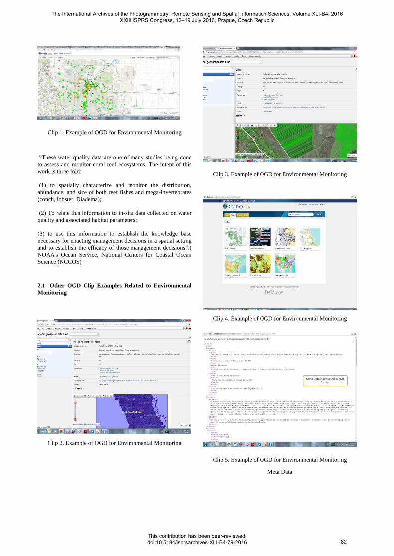
Clip 1. Example of OGD for Environmental Monitoring
“These water quality data are one of many studies being done
to assess and monitor coral reef ecosystems. The intent of this
work is three fold:
(1) to spatially characterize and monitor the distribution,
abundance, and size of both reef fishes and mega-invertebrates
(conch, lobster, Diadema);
(2) To relate this information to in-situ data collected on water
quality and associated habitat parameters;
(3) to use this information to establish the knowledge base
necessary for enacting management decisions in a spatial setting
and to establish the efficacy of those management decisions”.(
NOAA's Ocean Service, National Centers for Coastal Ocean
Science (NCCOS)
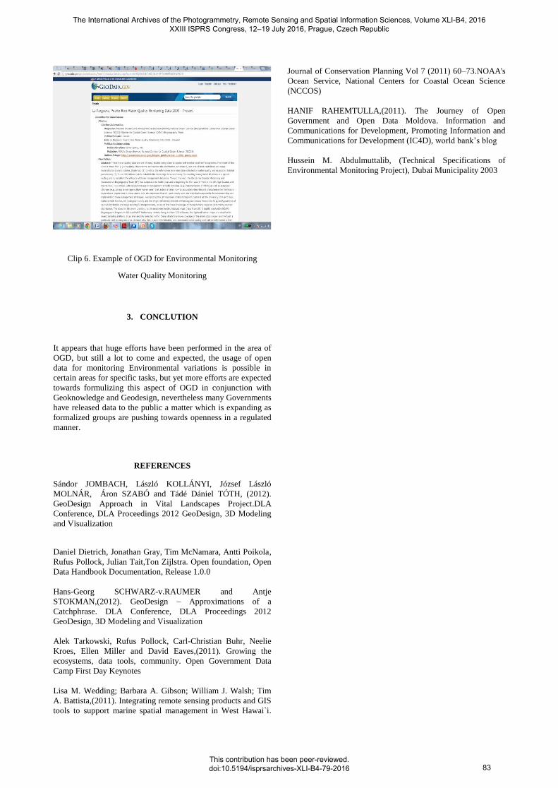
2.1 Other OGD Clip Examples Related to Environmental
Monitoring
Clip 2. Example of OGD for Environmental Monitoring
Clip 3. Example of OGD for Environmental Monitoring
Clip 4. Example of OGD for Environmental Monitoring
Meta Data is provided in XML format
Clip 5. Example of OGD for Environmental Monitoring
Meta Data
The International Archives of the Photogrammetry, Remote Sensing and Spatial Information Sciences, Volume XLI-B4, 2016 XXIII ISPRS Congress, 12–19 July 2016, Prague, Czech Republic
This contribution has been peer-reviewed. doi:10.5194/isprsarchives-XLI-B4-79-2016
82
Clip 6. Example of OGD for Environmental Monitoring
Water Quality Monitoring
3. CONCLUTION
It appears that huge efforts have been performed in the area of
OGD, but still a lot to come and expected, the usage of open
data for monitoring Environmental variations is possible in
certain areas for specific tasks, but yet more efforts are expected
towards formulizing this aspect of OGD in conjunction with
Geoknowledge and Geodesign, nevertheless many Governments
have released data to the public a matter which is expanding as
formalized groups are pushing towards openness in a regulated
manner.
REFERENCES
Sándor JOMBACH, László KOLLÁNYI, József László
MOLNÁR, Áron SZABÓ and Tádé Dániel TÓTH, (2012).
GeoDesign Approach in Vital Landscapes Project.DLA
Conference, DLA Proceedings 2012 GeoDesign, 3D Modeling
and Visualization
Daniel Dietrich, Jonathan Gray, Tim McNamara, Antti Poikola,
Rufus Pollock, Julian Tait,Ton Zijlstra. Open foundation, Open
Data Handbook Documentation, Release 1.0.0
Hans-Georg SCHWARZ-v.RAUMER and Antje
STOKMAN,(2012). GeoDesign – Approximations of a
Catchphrase. DLA Conference, DLA Proceedings 2012
GeoDesign, 3D Modeling and Visualization
Alek Tarkowski, Rufus Pollock, Carl-Christian Buhr, Neelie
Kroes, Ellen Miller and David Eaves,(2011). Growing the
ecosystems, data tools, community. Open Government Data
Camp First Day Keynotes
Lisa M. Wedding; Barbara A. Gibson; William J. Walsh; Tim
A. Battista,(2011). Integrating remote sensing products and GIS
tools to support marine spatial management in West Hawai`i.
Journal of Conservation Planning Vol 7 (2011) 60–73.NOAA's
Ocean Service, National Centers for Coastal Ocean Science
(NCCOS)
HANIF RAHEMTULLA,(2011). The Journey of Open
Government and Open Data Moldova. Information and
Communications for Development, Promoting Information and
Communications for Development (IC4D), world bank’s blog
Hussein M. Abdulmuttalib, (Technical Specifications of
Environmental Monitoring Project), Dubai Municipality 2003
The International Archives of the Photogrammetry, Remote Sensing and Spatial Information Sciences, Volume XLI-B4, 2016 XXIII ISPRS Congress, 12–19 July 2016, Prague, Czech Republic
This contribution has been peer-reviewed. doi:10.5194/isprsarchives-XLI-B4-79-2016
83


![Introduction to Dependency Grammar [0.2cm] and Dependency ...ufal.mff.cuni.cz/~bejcek/parseme/prague/Nivre1.pdf · Introduction to Dependency Grammar and Dependency Parsing Joakim](https://img.pdfslide.net/doc/110x75/5b14bded7f8b9a201a8b9282/introduction-to-dependency-grammar-02cm-and-dependency-ufalmffcuniczbejcekparsemeprague.jpg)