Embed Size (px)
Citation preview
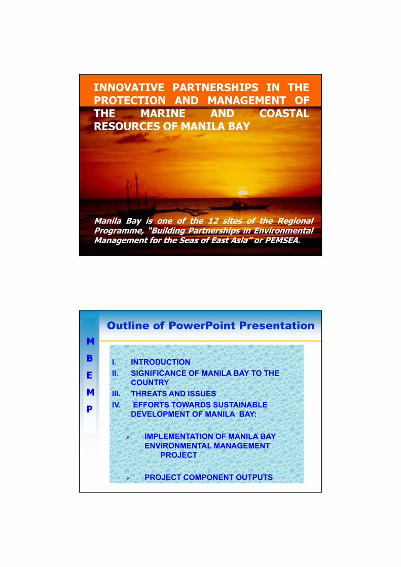
INNOVATIVE PARTNERSHIPS IN THEPROTECTION AND MANAGEMENT OFTHE MARINE AND COASTALRESOURCES OF MANILA BAY
Battle of Manila Bay (May 1, 1898) U.S. Naval Historical Center Photograph
Manila Bay is one of the 12 sites of the RegionalProgramme, “Building Partnerships in EnvironmentalManagement for the Seas of East Asia” or PEMSEA.
Outline of PowerPoint Presentation
I. INTRODUCTIONII SIGNIFICANCE OF MANILA BAY TO THE
M
BII. SIGNIFICANCE OF MANILA BAY TO THE
COUNTRYIII. THREATS AND ISSUESIV. EFFORTS TOWARDS SUSTAINABLE
DEVELOPMENT OF MANILA BAY:
E
M
P
IMPLEMENTATION OF MANILA BAY ENVIRONMENTAL MANAGEMENT
PROJECT
PROJECT COMPONENT OUTPUTS
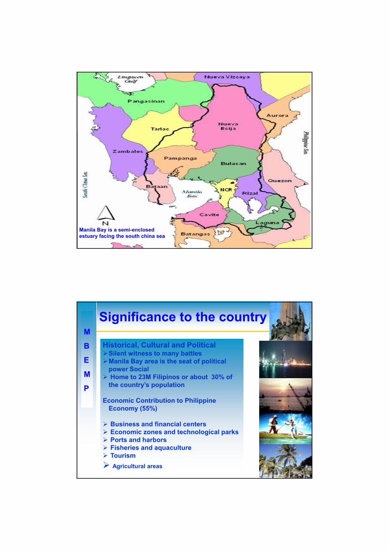
Manila Bay is a semi-enclosed estuary facing the south china sea
M
B
E
Significance to the country
Historical, Cultural and PoliticalSilent witness to many battlesManila Bay area is the seat of politicalE
M
P
Manila Bay area is the seat of political power Social Home to 23M Filipinos or about 30% of the country’s population
Economic Contribution to Philippine Economy (55%)
Business and financial centersEconomic zones and technological parksPorts and harborsFisheries and aquacultureTourism Agricultural areas
M
B
E
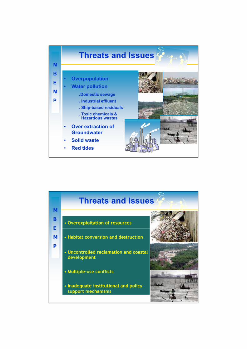
Threats and Issues
• Overexploitation of resources• Overpopulation
E
M
P
• Habitat conversion and destruction
• Uncontrolled reclamation and coastal development
• Multiple-use conflicts
• Water pollution .Domestic sewage . Industrial effluent. Ship-based residuals. Toxic chemicals & Hazardous wastes• Multiple use conflicts
• Inadequate institutional and policy support mechanisms
• Over extraction of Groundwater
• Solid waste• Red tides
M
B
E
Threats and Issues
• Overexploitation of resourcesE
M
P
• Habitat conversion and destruction
• Uncontrolled reclamation and coastal development
• Multiple-use conflicts
• Inadequate institutional and policy support mechanisms
Manila Bay
Environmental
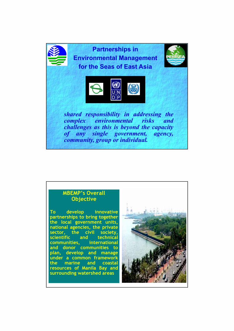
Partnerships in Environmental Management
for the Seas of East Asia
Management
Project (MBEMP)shared responsibility in addressing theshared responsibility in addressing thecomplex environmental risks andchallenges as this is beyond the capacityof any single government, agency,community, group or individual.
MBEMP’s Overall Objective
To develop innovativepartnerships to bring togetherpartnerships to bring togetherthe local government units,national agencies, the privatesector, the civil society,scientific and technicalcommunities, internationaland donor communities toplan develop and manageplan, develop and manageunder a common frameworkthe marine and coastalresources of Manila Bay andsurrounding watershed areas
A product of a series of consultations with stakeholders
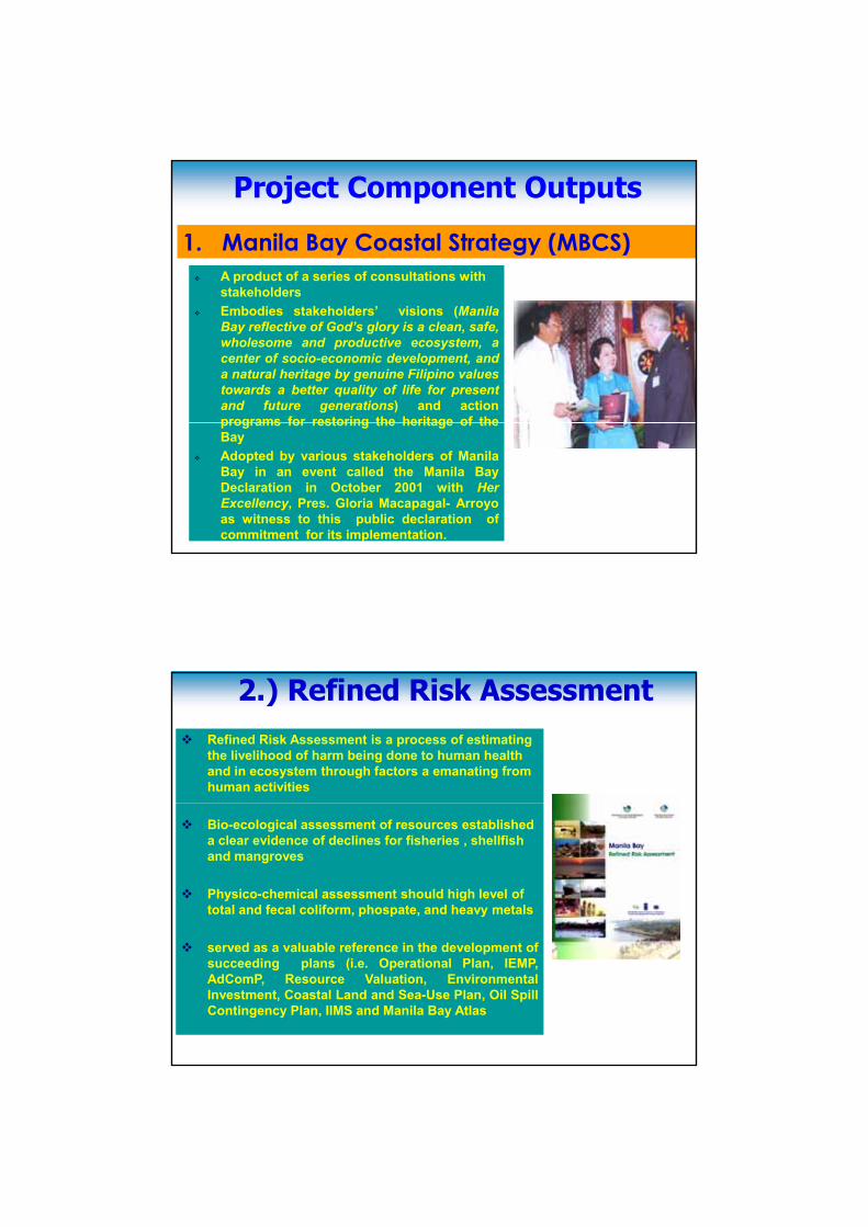
1. Manila Bay Coastal Strategy (MBCS)
Project Component Outputs
stakeholdersEmbodies stakeholders’ visions (ManilaBay reflective of God’s glory is a clean, safe,wholesome and productive ecosystem, acenter of socio-economic development, anda natural heritage by genuine Filipino valuestowards a better quality of life for presentand future generations) and actionprograms for restoring the heritage of theprograms for restoring the heritage of theBayAdopted by various stakeholders of ManilaBay in an event called the Manila BayDeclaration in October 2001 with HerExcellency, Pres. Gloria Macapagal- Arroyoas witness to this public declaration ofcommitment for its implementation.
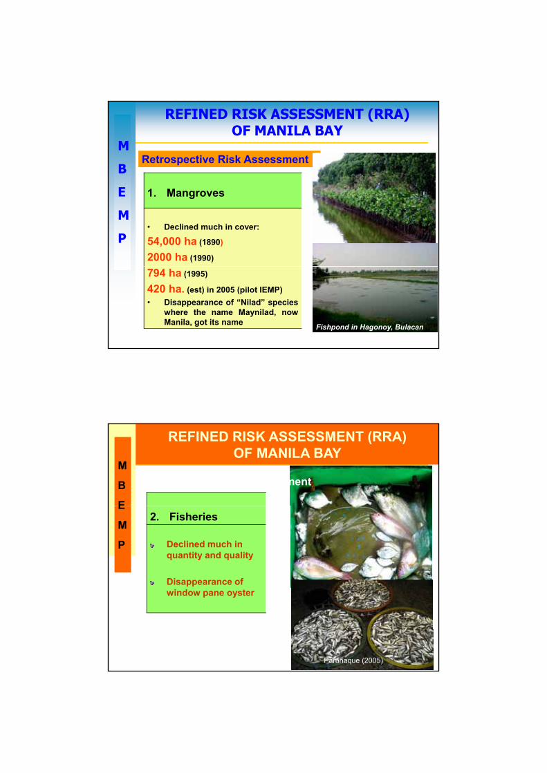
2.) Refined Risk Assessment2.) Refined Risk AssessmentRefined Risk Assessment is a process of estimating the livelihood of harm being done to human health and in ecosystem through factors a emanating from human activities
Bio-ecological assessment of resources established a clear evidence of declines for fisheries , shellfish and mangroves
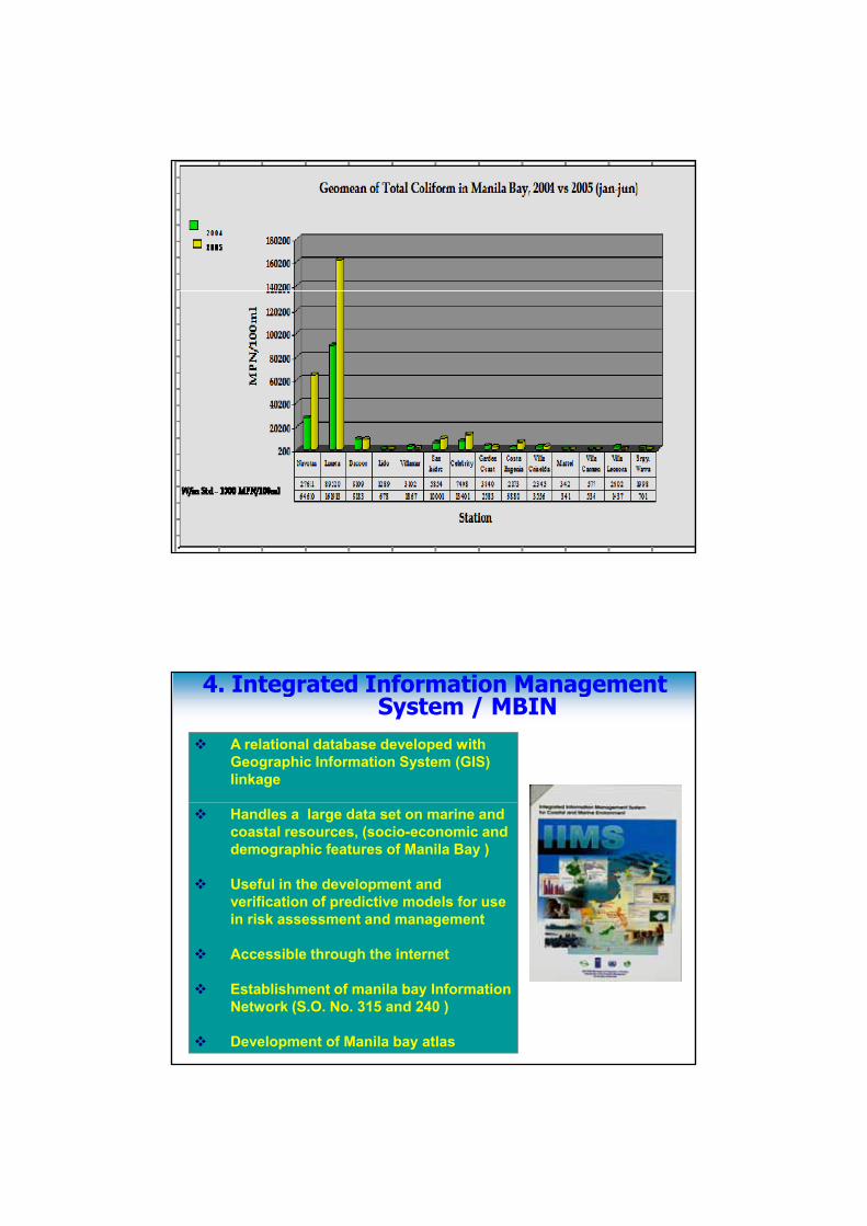
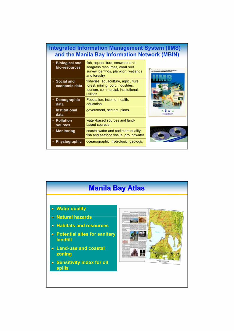
Physico-chemical assessment should high level of total and fecal coliform, phospate, and heavy metals
served as a valuable reference in the development ofsucceeding plans (i.e. Operational Plan, IEMP,AdComP, Resource Valuation, EnvironmentalInvestment, Coastal Land and Sea-Use Plan, Oil SpillContingency Plan, IIMS and Manila Bay Atlas
M
B
REFINED RISK ASSESSMENT (RRA) OF MANILA BAY
Retrospective Risk Assessment
E
M
P
1. Mangroves
• Declined much in cover:
54,000 ha (1890)
2000 ha (1990)
794 ha (1995)
420 ha. (est) in 2005 (pilot IEMP)• Disappearance of “Nilad” species
where the name Maynilad, nowManila, got its name Fishpond in Hagonoy, Bulacan
(2005)
M
B
E
REFINED RISK ASSESSMENT (RRA) OF MANILA BAY
Retrospective Risk Assessment
E
M
P
2. Fisheries
Declined much in quantity and quality
Disappearance of window pane oyster
Parañaque (2005)
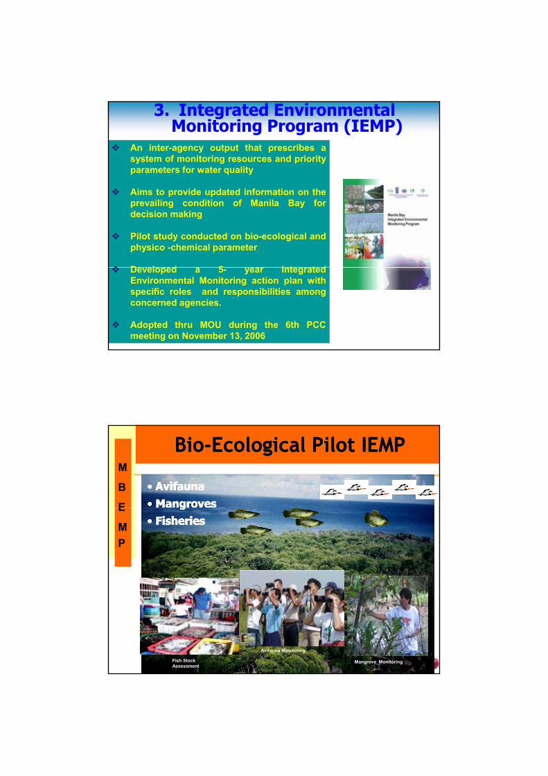
3. Integrated Environmental Monitoring Program (IEMP)
3. Integrated Environmental Monitoring Program (IEMP)
An inter-agency output that prescribes asystem of monitoring resources and priorityparameters for water quality
Aims to provide updated information on theprevailing condition of Manila Bay fordecision making
Pilot study conducted on bio-ecological andphysico -chemical parameter
D l d 5 I t t dDeveloped a 5- year IntegratedEnvironmental Monitoring action plan withspecific roles and responsibilities amongconcerned agencies.
Adopted thru MOU during the 6th PCCmeeting on November 13, 2006
M
B
E
BioBio--Ecological Pilot IEMP Ecological Pilot IEMP
•• AvifaunaAvifauna•• MangrovesMangroves•• AvifaunaAvifauna•• MangrovesMangrovesE
MP
Orani
gg•• FisheriesFisheries
gg•• FisheriesFisheries
Fish Stock Assessment
Avifauna Monitoring
Mangrove Monitoring
M
B
E
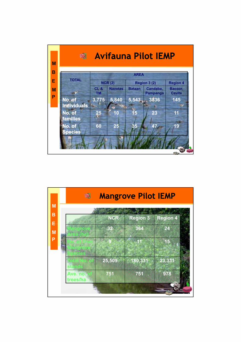
Avifauna Pilot IEMP Avifauna Pilot IEMP Avifauna Pilot IEMP Avifauna Pilot IEMP
TOTALAREA
E
MP
Orani
NCR (2) Region 3 (2) Region 4 CL & TM
Navotas Bataan Candaba, Pampanga
Bacoor, Cavite
No. of No. of IndividualsIndividuals
3,775 5,840 5,543 3836 145
No. of No. of familiesfamilies
25 10 15 23 11familiesfamiliesNo. of No. of SpeciesSpecies
60 25 35 47 19
M
B
E
Mangrove Pilot IEMPMangrove Pilot IEMP
NCR Region 3 Region 4E
MP
OraniMangrove Area (ha)
32 364 24
No. of True Mangrove Species
9 11 15
Total No of 25 509 180 331 23 331Total No. of stands
25,509 180,331 23,331
Ave. no. of trees/ha
751 751 978
Pampanga Bay B U L A C A NMasukol
Samal
M
B
E
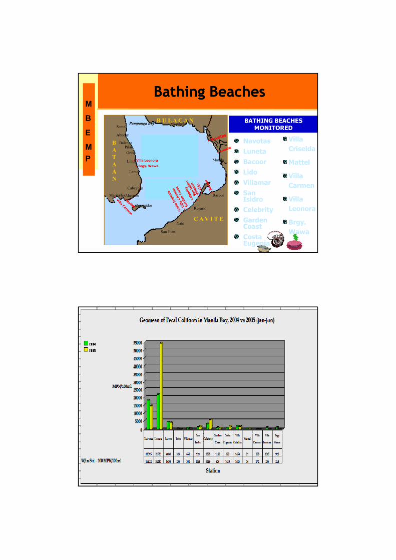
Bathing BeachesBathing Beaches
BATHING BEACHES MONITORED
BATHING BEACHES MONITORED
OraniOraniOraniBATAAN
Abucay
BalangaPilarOrion
Limay
Lamao
Cabcaben
Manila
123
984
765
• Villa Leonora
• Brgy. Wawa
E
MP
NavotasLunetaBacoorLidoVillamarSan
Villa Criselda
Mattel
Villa Carmen
C A V I T E
Corrigidor
Mariveles
San Juan
Naic
Rosario
BacoorAlasasin San IsidroCelebrityGarden CoastCosta Eugenia
Villa Leonora
Brgy. Wawa
4. Integrated Information Management System / MBIN
A relational database developed with Geographic Information System (GIS) linkage
Handles a large data set on marine and coastal resources, (socio-economic and demographic features of Manila Bay )
Useful in the development and verification of predictive models for use in risk assessment and management
Accessible through the internet
Establishment of manila bay Information Network (S.O. No. 315 and 240 )
Development of Manila bay atlas
• Biological and bio-resources
fish, aquaculture, seaweed and seagrass resources, coral reef survey, benthos, plankton, wetlands and forestry
Integrated Information Management System (IIMS) and the Manila Bay Information Network (MBIN)
• Social and economic data
fisheries, aquaculture, agriculture, forest, mining, port, industries, tourism, commercial, institutional, utilities
• Demographic data
Population, income, health, education
• Institutional data
government, sectors, plansdata
• Pollution sources
water-based sources and land-based sources
• Monitoring coastal water and sediment quality, fish and seafood tissue, groundwater
• Physiographic oceanographic, hydrologic, geologic
Water quality
Natural hazards
Manila Bay AtlasManila Bay Atlas
Natural hazards
Habitats and resources
Potential sites for sanitary landfill
Land-use and coastal zoning
Sensitivity index for oil spills
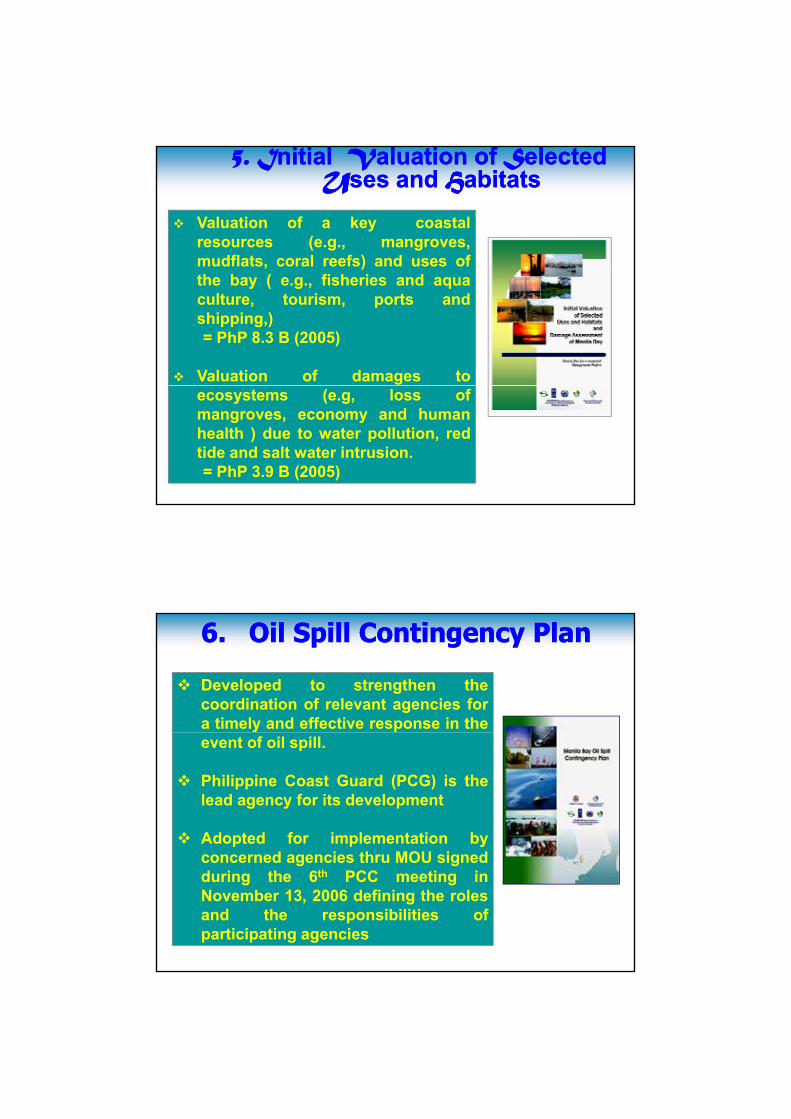
5.5. IInitial nitial VValuation of aluation of SSelectedelectedUUses and ses and HHabitatsabitats
Valuation of a key coastalresources (e.g., mangroves,mudflats, coral reefs) and uses ofmudflats, coral reefs) and uses ofthe bay ( e.g., fisheries and aquaculture, tourism, ports andshipping,)= PhP 8.3 B (2005)
Valuation of damages toecosystems (e.g, loss ofmangroves, economy and humanhealth ) due to water pollution, redtide and salt water intrusion.= PhP 3.9 B (2005)
6.6. Oil Spill Contingency PlanOil Spill Contingency Plan
Developed to strengthen thecoordination of relevant agencies fora timely and effective response in theevent of oil spill.
Philippine Coast Guard (PCG) is thelead agency for its development
Adopted for implementation byd i th MOU i dconcerned agencies thru MOU signed
during the 6th PCC meeting inNovember 13, 2006 defining the rolesand the responsibilities ofparticipating agencies
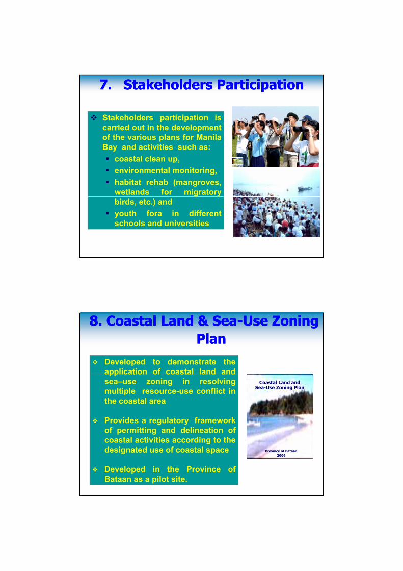
7.7. Stakeholders ParticipationStakeholders Participation
Stakeholders participation iscarried out in the developmentof the ario s plans for Manilaof the various plans for ManilaBay and activities such as:
coastal clean up,environmental monitoring,habitat rehab (mangroves,wetlands for migratorybirds, etc.) andyouth fora in differentschools and universities
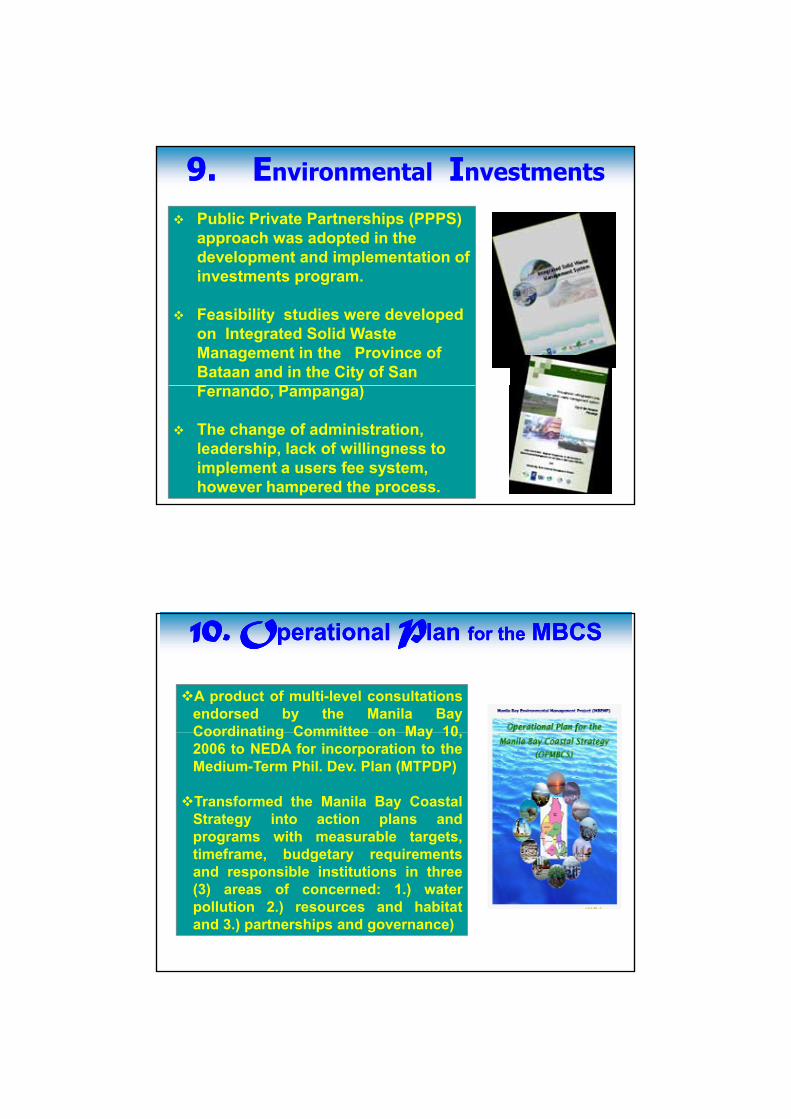
88. Coastal Land & Sea. Coastal Land & Sea--Use Zoning Use Zoning PlanPlan
Developed to demonstrate theapplication of coastal land and
Coastal Land and Sea-Use Zoning Plan
application of coastal land andsea–use zoning in resolvingmultiple resource-use conflict inthe coastal area
Provides a regulatory frameworkof permitting and delineation of
Province of Bataan2006
coastal activities according to thedesignated use of coastal space
Developed in the Province ofBataan as a pilot site.
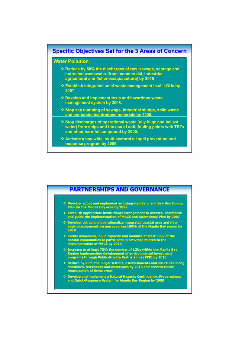
9.9. EEnvironmental IInvestments
Public Private Partnerships (PPPS) approach was adopted in the development and implementation of investments program.
Feasibility studies were developed on Integrated Solid Waste Management in the Province of Bataan and in the City of San F d P )Fernando, Pampanga)
The change of administration, leadership, lack of willingness to implement a users fee system, however hampered the process.
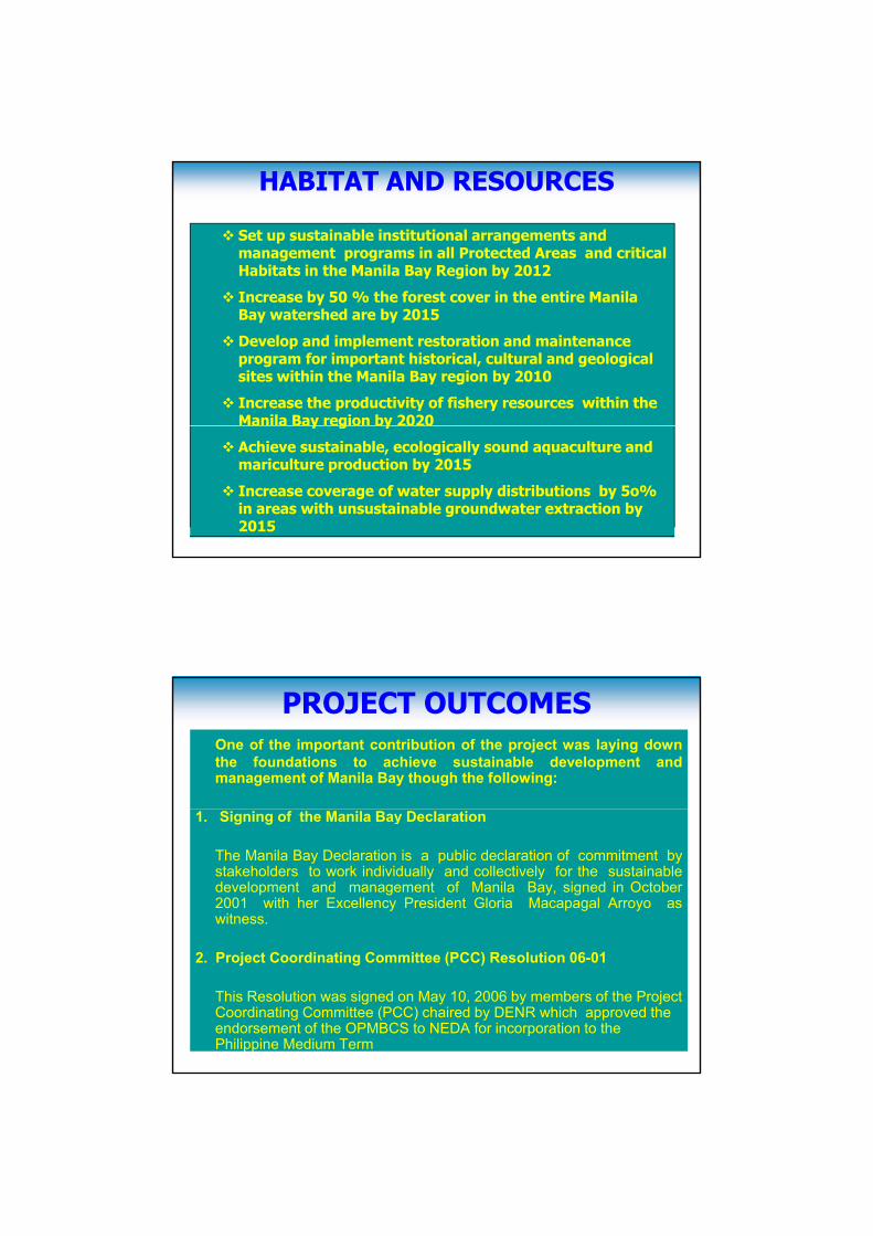
10. O10. Operational perational PPlanlan for thefor the MBCSMBCS10. O10. Operational perational PPlanlan for thefor the MBCSMBCS
A product of multi-level consultationsendorsed by the Manila BayCoordinating Committee on May 10Coordinating Committee on May 10,2006 to NEDA for incorporation to theMedium-Term Phil. Dev. Plan (MTPDP)
Transformed the Manila Bay CoastalStrategy into action plans andprograms with measurable targets,timeframe budgetary requirementstimeframe, budgetary requirementsand responsible institutions in three(3) areas of concerned: 1.) waterpollution 2.) resources and habitatand 3.) partnerships and governance)
Specific Objectives Set for the 3 Areas of Concern
Water PollutionReduce by 50% the discharges of raw sewage, septage and untreated wastewater (from commercial, industrial, agricultural and fisheries/aquaculture) by 2015g q ) y
Establish integrated solid waste management in all LGUs by 2007
Develop and implement toxic and hazardous waste management system by 2008.
Stop sea dumping of sewage, industrial sludge, solid waste and contaminated dredged materials by 2006.g y
Stop discharges of operational waste (oily bilge and ballast water) from ships and the use of anti- fouling paints with TBTs and other harmful compound by 2006.
Activate a bay-wide, multi-sectoral oil spill prevention and response program by 2006
Develop, adopt and implement an Integrated Land and Sea-Use Zoning Plan for the Manila Bay area by 2012
Establish appropriate institutional arrangement to oversee, coordinate and guide the implementation of MBCS and Operational Plan by 2007
PARTNERSHIPS AND GOVERNANCE
Develop, set up and operationalize integrated coastal area and river basin management system covering 100% of the Manila Bay region by 2010
Create awareness, build capacity and mobilize at least 50% of the coastal communities to participate in activities related to the implementation of MBCS by 2010
Increase to at least 75% the number of LGUs within the Manila Bay Region implementing development of environmental investment programs through Public-Private Partnerships (PPP) by 2010programs through Public-Private Partnerships (PPP) by 2010
Reduce by 25% the illegal settlers, establishments and structures along coastlines, riverbanks and waterways by 2010 and prevent future reoccupation of these areas
Develop and implement a Natural Hazards Contingency, Preparedness and Quick-Response System for Manila Bay Region by 2008
Set up sustainable institutional arrangements and management programs in all Protected Areas and critical Habitats in the Manila Bay Region by 2012
I b 50 % th f t i th ti M il
HABITAT AND RESOURCES
Increase by 50 % the forest cover in the entire Manila Bay watershed are by 2015
Develop and implement restoration and maintenance program for important historical, cultural and geological sites within the Manila Bay region by 2010
Increase the productivity of fishery resources within the Manila Bay region by 2020y g y
Achieve sustainable, ecologically sound aquaculture and mariculture production by 2015
Increase coverage of water supply distributions by 5o% in areas with unsustainable groundwater extraction by 2015
PROJECT OUTCOMESOne of the important contribution of the project was laying downthe foundations to achieve sustainable development andmanagement of Manila Bay though the following:
1. Signing of the Manila Bay Declaration
The Manila Bay Declaration is a public declaration of commitment bystakeholders to work individually and collectively for the sustainabledevelopment and management of Manila Bay, signed in October2001 with her Excellency President Gloria Macapagal Arroyo aswitness.
2. Project Coordinating Committee (PCC) Resolution 06-01
This Resolution was signed on May 10, 2006 by members of the Project Coordinating Committee (PCC) chaired by DENR which approved the endorsement of the OPMBCS to NEDA for incorporation to the Philippine Medium Term
3. Memorandum of Understanding (MOU) on the Implementation of the 5-year Integrated Environmental Monitoring Program
The MOU which defines the roles, specific areas of monitoring and theprotocol to be observed in the implementation of the 5-year IEMP. wassigned by the PCC members and other concerned agencies on 13November 2006 (Annex XI)
4. Memorandum of Understanding on the Implementation of Oil SpillContingency Plan
The MOU defines the roles and responsibilities of participating agencies fora timely and effective response to oil spills. This was signed on 13November 2006 (Annex XII)
5. PCC Resolution 06-02
This resolution transformed the Manila Bay Project CoordinatingCommittee, or PCC into the Manila Bay Coordinating Committee orMBCC to strengthen the coordinative roles in the management of ManilaBay, and more towards institutionalization and sustainability. (Annex XIII)
6. DENR Special Order No. 315 series of 2005 as amended bySpecial Order No. 2007-240 dated March 16, 2007 Creating themanila Bay Information Network .
These special orders were issued to strengthen support in themanagement of the Manila Bay Region through the application of anIntegrated Information Management System (IIMS) which providea timely data recording and updating of information for coastaland marine environment (Annex XIV)
7. Department Administrative Order (DAO) No. 2007-28
Institutionalizing the MBEMP within the DENR throughthe implementation of the OPMBCS.
– Established the MBRBCO within the DENR under thesupervision of the River Basin Control Office (RBCO)that will serve as the Secretariat to the MBCC
Thank you !Thank you…!By : Engr. Erlinda A. Gonzales
EMB-MBEMP
23 October 2007
Other Outcome and impacts of the Project
• Inter-agency, intergovernmental and inter-sectoralmechanism [Project Coordinating Committee,(PCC) SiteCoordinating Committees (SCC’s ) and Technical WorkingGroup (TWGs) ], in place, coming up with common vision,mission and strategy and collective decisions/actions;mission and strategy, and collective decisions/actions;
• Capacity of members of TWG was developed andharnessed on component project implementation, and inworking as a multi- disciplinary and inter-sectoral team;
• Formation of a core of scientific, technical andmanagement expertise within the Manila Bay Area
• Information and knowledge sharing was developed and enhanced ; resources were also shared, such as in the pilot Integrated Environmental Management Project and in the development of the Manila Bay Atlas
Other Outcome and impacts of the ProjectIEC, meetings, and consultation-workshop and on-the-ground activities resulted in increased awareness about the issues on Manila Bay;
Improved capacity in mobilizing and empowering theImproved capacity in mobilizing and empowering the stakeholders to action such as advocacy, coastal and river clean-up activities, mangrove rehabilitation and youth forum
Volunteerism among communities, schools and academe and private sectors developed;
Coastal and Sea-Use Zoning Plan adopted by Bataan PCC and Manila Bay PCC;Reduction of multi-use conflicts through the coastal use zoning plan (CUZP) in the province of Bataan;
Replication of coastal use zoning in Cavite and National Capital Region;
Other Outcome and impacts of the Project
•Priority Issues/Concerns identified in the Refined Risk Assessment became the basis for the environmental investment initiatives such as MTSP, Bamboocetum in Parañaque, Nipa Plantation in Minalen Pampanga, Seaweed farm in Ternate Cavite;
•IIMS managed by PMOs and SMOs and Networking in place
•IIMS being used as platform for database of DENR•IIMS being used as platform for database of DENR
•Use of the IIMS and Manilabay Atlas for Policy and Strategic Planning