Embed Size (px)
Citation preview
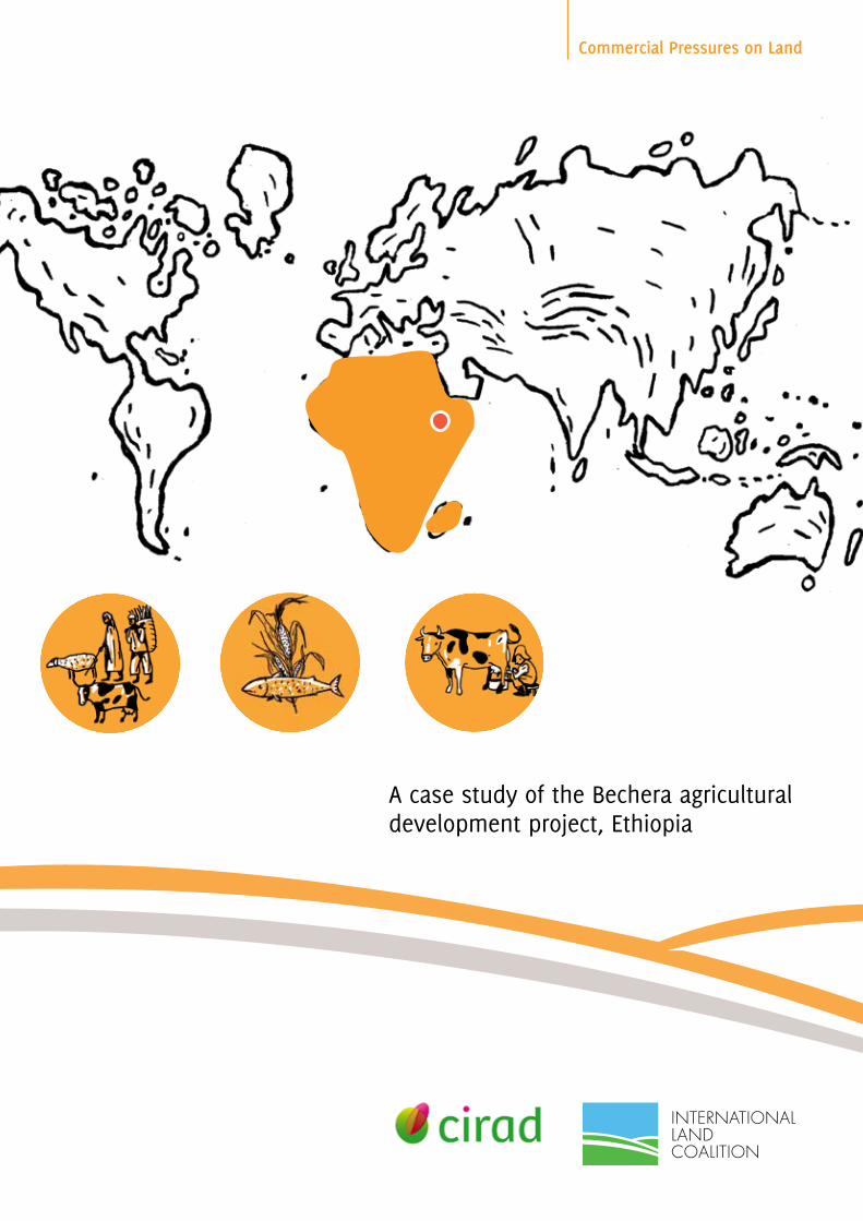
Commercial Pressures on Land
A case study of the Bechera agricultural development project, Ethiopia
This report is part of a wider initiative on Commercial Pressures on Land (CPL). If you would like further information on the initiative and on the collaborating partners, please contact the Secretariat of the International Land Coalition or visit www.landcoalition.org/cpl
International Land CoalitionSecretariat
fax: +39 06 5459 [email protected]
Via Paolo di Dono, 4400142 – Rome, Italytel: +39 06 5459 2445
Cover illustration: © Aldo di Domenico 2011
The opinions expressed in this report are those of the author, and can in no way be taken to reflect the offcial views of the International Land Coalition, its members or donors.
ISBN 978-92-95093-38-6
© 2011 the International Land Coalition
Mr. Messele Fisseha is educated as a Soil Scientist/Land Use Planner (M. Sc). He started work as a land use planner in the Ethiopian Ministry of Agriculture. He soon moved to the Ethiopian Sugar Corporation to work as a researcher on irrigation and drainage management. In 1992 he joined the Ministry of Water Resources as a senior soil and water management expert. In his capacity, he planned, evaluated and assisted the development of medium and large scale irrigation projects nationwide. In 1998, he was assigned to head the Basin Development Studies and Water Utilization Control Department of the Ministry.
At present, he is managing a private consultancy firm specializing in the natural resources management and environmental impact assessment.
Our MissionA global alliance of civil society and intergovernmental organisations working together to promote secure and equitable access to and control over land for poor women and men through advocacy, dialogue, knowledge sharing and capacity building.
Our VisionSecure and equitable access to and control over land reduces poverty and contributes to identity, dignity and inclusion.
CIRAD works with the whole range of developing countries to generate and pass on new knowledge, support agricultural development and fuel the debate on the main global issues concerning agriculture.
CIRAD is a targeted research organization, and bases its operations on development needs, from field to laboratory and from a local to a global scale.
A case study of the Bechera agricultural development project, Ethiopia
Prepared by: Messele Fisseha January 2011
Acknowledgements The research project of the Commercial Pressures on Land Initiative was coordinated in
the ILC secretariat by Michael Taylor, with the support of Andrea Fiorenza. Ward Anseeuw
of CIRAD provided technical support to all studies and the project was based on a
conceptual framework developed by Michel Merlet and Clara Jamart of Agter. A large
number of members and partners of ILC and independent specialists have contributed to
the research, analysis and documentation of the project.
ILC wishes to thank the following donors, whose support made possible the research
under the Commercial Pressures on Land Initiative:
The views expressed herein can in no way be taken to reflect the official opinion of these
donors. ILC Secretariat would appreciate receiving copies of any publication using this
study as a source at [email protected].
Foreword The International Land Coalition (ILC) was established by civil society and multilateral
organisations who were convinced that secure access to land and natural resources is
central to the ability of women and men to get out of, and stay out of, hunger and
poverty.
In 2008, at the same time as the food price crisis pushed the number of hungry over the
one billion mark, members of ILC launched a global research project to better understand
the implications of the growing wave of international large-scale investments in land.
Small-scale producers have always faced competition for the land on which their
livelihoods depend. It is evident, however, that changes in demand for food, energy and
natural resources, alongside liberalisation of trade regimes, are making the competition
for land increasingly global and increasingly unequal.
Starting with a scoping study by ILC member Agter, the Commercial Pressures on Land
research project has brought together more than 30 partners, ranging from NGOs in
affected regions whose perspectives and voices are closest to most affected land users, to
international research institutes whose contribution provides a global analysis on
selected key themes. The study process enabled organisations with little previous
experience in undertaking such research projects, but with much to contribute, to
participate in the global study and have their voices heard. Support to the planning and
writing of each study was provided by ILC member CIRAD.
ILC believes that in an era of increasingly globalised land use and governance, it is more
important than ever that the voices and interests of all stakeholders – and in particular
local land users - are represented in the search for solutions to achieve equitable and
secure access to land.
This report is one of the 28 being published as a part of the global study. The full list of
studies, and information on other initiatives by ILC relating to Commercial Pressures on
Land, is available for download on the International Land Coalition website at
www.landcoalition.org/cplstudies.
I extend my thanks to all organisations that have been a part of this unique research
project. We will continue to work for opportunities for these studies, and the diverse
perspectives they represent, to contribute to informed decision-making. The implications
of choices on how land and natural resources should be used, and for whom, are stark. In
an increasingly resource-constrained and polarised world, choices made today on land
tenure and ownership will shape the economies, societies and opportunities of tomor-
row’s generations, and thus need to be carefully considered.
Madiodio Niasse
Director, International Land Coalition Secretariat
Table of contents Acknowledgements Foreword Table of contents List of tables and photos List of abbreviations Executive summary
1 Introduction 1
2 Overview of the agricultural sector in Ethiopia 3
3 Current institutional environment 4
4 Relevant sectoral institutions 5 Agriculture 5 Irrigation 6 Environment 6
5 Land tenure system 7
6 The investment environment 9
7 Agricultural Investment Support Directorate 10
8 The project area 12 Location 12 Land use and soils 12 Roads and services infrastructure 13 Population (woreda) 13 Agriculture and livestock husbandry 14
9 Stakeholders in the commercial agricultural development 15 Introduction 15 Bechera Agricultural Development Project (BADP) 16 The local community 16 Oromiya Regional State Land and Environment Office 16 Ethiopian Investment Agency (EIA) 17 Ministry of Water Resources (MoWR) 17
10 Results of the household survey 18
Population 18 Agriculture 19
11 Focus group discussions with the local community, kebele administrations, and other stakeholders 22 Bechera Oda Gibe Kebele 22 Oda Gibe Kebele 24 Amerti Gibe Kebele 25 Woreda Agricultural Office 26 Woreda Administration and the Land and Environment Office 26 Employees of the BAPD 27
12 Economic and land use assessment of the project 28 Current land use 28 Future agricultural production 29 Economic status of the project 29
13 Environmental impact 30
14 Conclusion and recommendations 31
References 33 Annex 1: Commercial Pressures on Land in Ethiopia Project
Questionnaire for Sampled Farmers (Gafille Namolee Umata) 34 Annex 2: Questionnaire for Kebele/Woreda Administration
(checklist) 41 Annex 3: Land Request Form 42 Annex 4: Photographs from the fieldwork 44 Annex 5: Maps of the study area 53
List of tables and photos
Tables Households in the survey area 18 Average land use by household 19 Sample household livestock holdings (post-BADP) 20 Percentage of households with a family member employed by
the BADP 21 Percentage of households practising share-cropping 21
Photos Signpost to the investor’s farm 44 Road to the project area 45 Part of the leased land, with a garage owned by the investor 45 Sinkholes and heaving of vertisols 46 A closer look at the soil in the investment area 46 Fenced watering point in the plainlands 47 Collecting water 47 On the way to collect water 48 Non-functional water supply infrastructure 48 Red soil on the higher land cultivated by smallholders 49 Cattle grazing on the crop land 49 Children of wetlands families 50 A typical farmhouse (tookul) with trees used as shade 50 Grass collected for roofing tookul houses 51 A closer look at the construction materials 51 A farmer being interviewed during the fieldwork 52 Consultation with representatives of local youth during the
fieldwork 52
List of abbreviations AISD Agricultural Investment Support Directorate
BADP Bechera Agricultural Development Project
BoARD Bureau of Agriculture and Rural Development (Oromiya Regional State)
BoWRD Bureau of Water Resources Development (Oromiya Regional State)
CPL Commercial pressures on land
DA Development agent
EIA Ethiopian Investment Agency
EPA Environmental Protection Authority
EPLAUA Environmental Protection and Land Administration and Use Authority
FDRE Federal Democratic Republic of Ethiopia
ILC International Land Coalition
MoARD Ministry of Agriculture and Rural Development
KA Kebelle Administration
MoWR Ministry of Water Resources
SNNPRS Southern Nations, Nationalities, and Peoples Regional State
Executive summary
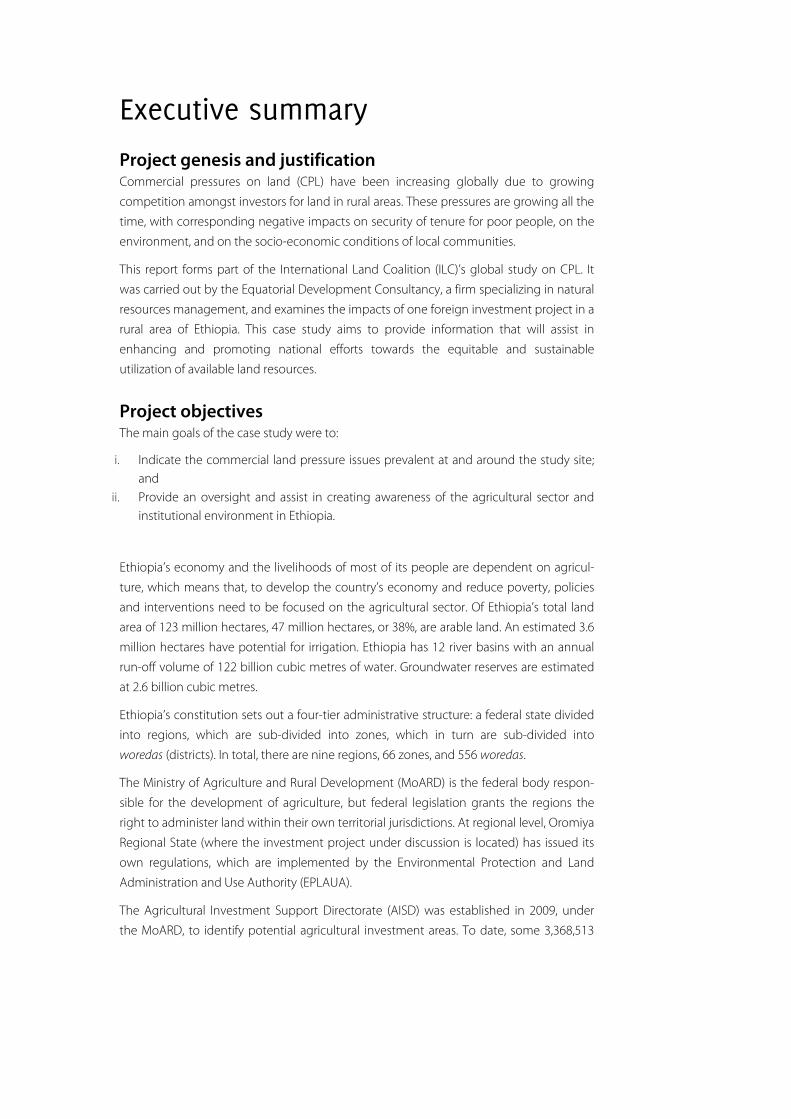
Project genesis and justification Commercial pressures on land (CPL) have been increasing globally due to growing
competition amongst investors for land in rural areas. These pressures are growing all the
time, with corresponding negative impacts on security of tenure for poor people, on the
environment, and on the socio-economic conditions of local communities.
This report forms part of the International Land Coalition (ILC)’s global study on CPL. It
was carried out by the Equatorial Development Consultancy, a firm specializing in natural
resources management, and examines the impacts of one foreign investment project in a
rural area of Ethiopia. This case study aims to provide information that will assist in
enhancing and promoting national efforts towards the equitable and sustainable
utilization of available land resources.
Project objectives The main goals of the case study were to:
i. Indicate the commercial land pressure issues prevalent at and around the study site; and
ii. Provide an oversight and assist in creating awareness of the agricultural sector and institutional environment in Ethiopia.
Ethiopia’s economy and the livelihoods of most of its people are dependent on agricul-
ture, which means that, to develop the country’s economy and reduce poverty, policies
and interventions need to be focused on the agricultural sector. Of Ethiopia’s total land
area of 123 million hectares, 47 million hectares, or 38%, are arable land. An estimated 3.6
million hectares have potential for irrigation. Ethiopia has 12 river basins with an annual
run-off volume of 122 billion cubic metres of water. Groundwater reserves are estimated
at 2.6 billion cubic metres.
Ethiopia’s constitution sets out a four-tier administrative structure: a federal state divided
into regions, which are sub-divided into zones, which in turn are sub-divided into
woredas (districts). In total, there are nine regions, 66 zones, and 556 woredas.
The Ministry of Agriculture and Rural Development (MoARD) is the federal body respon-
sible for the development of agriculture, but federal legislation grants the regions the
right to administer land within their own territorial jurisdictions. At regional level, Oromiya
Regional State (where the investment project under discussion is located) has issued its
own regulations, which are implemented by the Environmental Protection and Land
Administration and Use Authority (EPLAUA).
The Agricultural Investment Support Directorate (AISD) was established in 2009, under
the MoARD, to identify potential agricultural investment areas. To date, some 3,368,513
hectares of land have been delineated for handover to investors. The Ethiopian Invest-
ment Agency (EIA) is responsible for issuing investment licences for such projects.
Land tenure system Radical land reform was introduced in 1975 by Ethiopia’s former military government.
Currently the underlying basis of the country’s land policy is Article 40 of the Constitution,
which states that land is the property of the people but is administered on their behalf by
the State and cannot be sold, exchanged, or mortgaged.
The investment project The investment project is known as the Bechera Agricultural Development Project
(BADP), and is owned by Karuturi Agro Products Plc, a subsidiary of Indian company
Karuturi Global Limited. It is located in the Western part of Oromiya Regional State,
Western Shoa Zone, Bako Tibe Woreda. It covers an area of 10,700 hectares on the Bako
Plains, which is leased from the Ethiopian Government. The company is planning to
cultivate a variety of crops, including maize, rice, and bananas.
The livelihoods of communities in the local area are based on crop cultivation and
livestock husbandry. A household survey conducted in the three kebeles (counties) which
fall within the area (covering 5% of households), obtained the following results:
Total population of the three kebeles = 4,872 people
Average agricultural landholding = 1.3 hectares
Average household size = 8.4 people
Average household agricultural production = 18.6 quintals (qt) (17.1qt cereals, 1.1qt oil
seed, 0.4qt pepper; 1 quintal = 100kg)
Average household cattle holding = 19.6 head.
Group discussions were held with the local community, key informants, kebele officials,
agricultural development agents, agricultural specialists (e.g. agronomists), and planning
staff of different regional, zonal, and woreda offices.
Community representatives explained that they have tried to prevent the takeover of
their grazing land by the BADP investor in a number of ways. They have twice sent a
group of selected elders to the Regional Administration, and have repeatedly appealed to
the Woreda Administration. In Amerti Gibe Kebele, they even went so far as to physically
resist the activities of the investor. However, they have not been successful in winning
their case.
Environmental impact The loss of grazing land is the most serious negative impact of the project. The wetlands
also serve many other functions for the community: for example, river and swamp
vegetation is used for roofing, matting, and for making household utensils. The water-
logged areas help to support the local ecosystem by filtering the water flowing into the
Gibe River and regulating its quality. The BADP is planning to develop the plains, and this
will lead to significant hydrological change in the river systems in and near the project
area. There will also be a negative impact on the area’s biodiversity.
Conclusion and recommendations The main benefit of the Bechera Agricultural Development Project is the creation of
employment opportunities for the community. The loss of community grazing land,
however, is already affecting the livelihoods of local smallholders.
The investor should assist the community by allowing them to let their animals graze
crop residues, constructing water supply schemes, introducing outgrower schemes, and
introducing other services such as schools, health posts, veterinary support, etc. It should
also discuss with the community what benefits it can offer them in the future.
Nationally, it is recommended that regional workshops are conducted to raise the
awareness of stakeholders at all levels of the potential impacts of such investments. There
is also a need to build the capacity of woreda offices to enable them to undertake ground
surveys and to accurately delineate land to be leased before it is handed over to inves-
tors. Regarding the BADP area, there is a need to undertake a baseline environmental
assessment to determine the potential environmental impacts of the commercial
agriculture that is planned there. This study should also recommend mitigation methods.
1
1 Introduction Background The Bechera Agricultural Development Project (BADP) is a typical example of a company
from an emerging economy grabbing land in a poor host nation. The Bako Plains, where
the commercial farm of Karuturi Agro Products Plc, a subsidiary of Indian company
Karuturi Global Limited, is situated (see maps in Annex 5) are environmentally delicate
community grazing lands. The International Land Coalition (ILC), through the Equatorial
Development Consultancy (EDC), set out to investigate the impact of a development of
this kind on the local community and to analyze the roles of the various stakeholders. This
case study is part of a global initiative to increase understanding of the current and
anticipated impacts of commercial land acquisitions on poverty and on the security of
land tenure of poor people.
Objectives and significance of the study The overall goal of this study is to analyze the impacts of commercial pressures on land
(CPL) on a particular community and on the environment, as part of ILC’s broader
investigation of CPL issues. It is intended to contribute to the discussion on CPL and it is
hoped that the lessons learned will help to create awareness that will contribute to
sustainable development.
Methodology and approach The methodology used in data collection and analysis for the study included direct
observation, community discussions, semi-structured interviews (with 29 farming
households), and a review of secondary data. Group discussions were held with commu-
nity representatives in each kebele administration and with key informants, including
BADP employees. Direct observations were also made in the study area to supplement
the discussions (see photographs and maps in Annexes 4–5). A pre-prepared checklist
(see Annex 2) was used to guide discussions with kebele officials, community eld-
ers/members and, where needed, with development agents and employees of the BADP.
This was also used to facilitate focus group discussions.
° Direct observation: During the field study, specific features of the area were ob-served, such as the commercial farm’s activities, the smallholders’ agricultural activities, their livestock, the local water supply, and the environmental condition of the wetlands.
° Community discussion: Group discussions were held with community representa-tives in each kebele and with key informants regarding the commercial farm.
2
° Semi-structured interviews: Individual household surveys were conducted using a semi-structured questionnaire (see Annex 1). The questionnaire was prepared in both English and Oromifa, the local language of the Oromo ethnic group of Oromiya Re-gional State.
° Stakeholder consultation: Apart from the community, stakeholders were consulted at different levels, including Woreda Administration, Woreda Land and Environment Office, Woreda Agricultural Office, local development agents, employees of the com-mercial farm, core planning staff of the Ethiopian Investment Agency, Oromiya Regional State Land and Environmental Office, the Agricultural Investment Support Directorate, and the Ministry of Water Resources. Appointments were scheduled with all these stakeholders following prior notification.
° Review of secondary data: Several federal and regional offices, including ministries, zonal offices, and woreda offices, as well as environmental, research, and educational establishments, were visited to obtain information related to the study.
Content of the report This study first provides an overview of the many aspects of commercial pressures on
land in Ethiopia, including a review of agricultural practices, the national and regional
policy framework, the relevant institutions, the land tenure system, and recent trends in
land use changes.
This is followed by an examination of the Bechera Agricultural Development Project
(BADP), which illustrates the impact of commercial land pressures on both the communi-
ty and the environment.
In conclusion, recommendations are made for a shift to a participatory approach and for
greater control over the implementation of such investment schemes by local, regional,
and federal offices as well as by the affected communities themselves.
3
2 Overview of the agricultural sector in Ethiopia Ethiopia’s economy is based mainly on agriculture. The sector accounted for 45% of GDP
in 2009 and the livelihoods of 85% of the population are directly dependent on natural
resources.
Of Ethiopia’s total land area of 123 million hectares, 47 million hectares, or 38% of the
total, are arable land, while the remaining 77 million hectares, or 62%, are classified as
marginal and non-arable land (UNDP/FAO 1988). About 3.6 million hectares are estimated
as having potential for irrigation; however, the area of land under irrigation so far is only
about 5% (MoWR 1999).
Various studies (such as Hurni 1993) show that soil loss in cultivated land caused by water
erosion affects about 50% of the country’s agricultural areas and reaches alarming levels
of up to 100–200 tonnes/hectare/year. Population densities and livestock herd sizes in
Ethiopia are the highest in Africa and continue to grow rapidly, putting severe pressure
on the land.
Ethiopia has 12 river basins, of which eight have significant flows. Of the remaining four,
one is a lake basin fed by a number of rivers and streams, while three are dry basins that
receive little rainfall. These cannot produce river flows and are significantly affected by
run-off and evaporation. Between them, the 12 river basins have an annual run-off
volume of 122 billion cubic metres of water. There are also an estimated 2.6 billion cubic
metres of groundwater reserves (MoWR 2002).
4
3 Current institutional environment The Ethiopian Constitution sets out four administrative structures: a federal state divided
into regions, zones, and woredas. The country is divided into regions, which are sub-
divided into zones, which in turn are sub-divided into woredas. Currently there are nine
regions, 66 zones, and 556 woredas.
Each of the four levels of the Ethiopian state has the same structure: a legislative body, a
court system, and a number of sector-specific administrative institutions, which, in
addition to the Federal Government, constitute the executive branch.
There are nine Regional States in Ethiopia: Afar, Amhara, Benshangul-Gumz, Harari,
Oromiya, Somali, Southern Nations, Nationalities, and Peoples (SNNP), and Tigrai. The
regional states are entitled to define and implement their own economic, social, and
development policies. They administer land and other natural resources within their
territories, and collect all levies and taxes that are not collected by the Federal Govern-
ment. They set standards for their own civil service pay and conditions and maintain
state-level security forces.
A woreda is an administrative unit which can be equated to a district. Each woreda is
generally composed of a number of kebeles. A kebele can be equated to a county, and is
the smallest formal unit of Ethiopia’s local government administrative structure.
5
4 Relevant sectoral institutions
Agriculture
Federal level The Ministry of Agriculture and Rural Development (MoARD) is the federal body respon-
sible for agricultural development in Ethiopia. Its powers and duties include the
promotion and expansion of rapid and sustainable agricultural and rural development, as
well as the provision of support to private investors engaged in the agricultural sector
(Proclamation No. 256/2001).
With respect to land administration and utilization, the MoARD has enacted the Land
Administration and Utilization Proclamation at the federal level (Proclamation No.
256/2005). This legislation sets out the basic principles and gives the regional states the
power to enact their own land administration and utilization laws (but in compliance
with federal laws). Federal legislation thus clearly grants the regions the right to adminis-
ter the lands within their own territorial jurisdictions.
Regional level With respect to land administration and utilization, Oromiya Regional State has enacted
Proclamation No. 130/2007, plus additional regulation. According to these laws, the
function of land administration and utilization is vested in the region’s Environmental
Protection and Land Administration and Use Authority (EPLAUA) and its woreda offices.
EPLAUA was established under Proclamation No. 122/2009 to administer the provisions
of Proclamation No. 130/2007. Its powers and duties in connection with the use of land
include the following:
° To study the region’s land and determine land use and, if necessary, disseminate this information to users;
° To conduct simple cadastral surveys and issue maps and certificates to each land-holder, specifying the location and size of the plot, and its borders;
° To execute directives or regulations issued for transferring the right to use land possessed by individuals or organizations through heirs or by means of leasing, and other land administration directives or regulations.
6
EPLAUA’s woreda offices and its land administration and utilization committees estab-
lished at kebele and sub-kebele levels play an important role in activities related to land
administration and utilization. Its woreda offices regulate the adherence of landholders
and land users to their legal obligations.
Irrigation
Federal level Responsibility for the development of large- and medium-scale irrigation schemes lies
with the Ministry of Water Resources (MoWR), while the MoARD has responsibility for
encouraging and supporting the expansion of small-scale irrigation schemes (of less than
200 hectares). The MoWR supervises the Water Works Design Enterprise as well as the
Water Works Construction Enterprise.
Regional level At the regional level, both the Oromiya Regional State Bureau of Agriculture and Rural
Development (BoARD) and the Oromiya Regional State Bureau of Water Resources
Development (BoWRD) are responsible for the development of irrigation schemes.
Environment At federal level, the Environmental Protection Authority (EPA) was first established in 1995
for the purpose of environmental protection, regulation, and monitoring, and is respon-
sible for the sustainable use of environmental resources. It was re-established in 2002
(Proclamation No. 295/2002); two important laws followed:
i) Environmental Impact Assessment Proclamation No. 299/2002 states that the EPA is responsible for the evaluation of
environmental impact studies and the monitoring of their implementation;
ii) Environmental Pollution Control Proclamation No. 300/2002 gives the EPA the power to formulate environmental stan-
dards.
At the regional level, EPLAUA has the same responsibilities as the EPA within the state’s
boundaries, and ensures the implementation of federal environmental standards at
regional level.
7
5 Land tenure system Radical land reform was introduced in 1975 by Ethiopia’s former military government. The
system of feudal land tenure in place before the land reform was very unpopular due to
its harsh treatment of tenants. The military regime nationalized all land and redistributed
landholdings according to the size of families. With the change of government after May
1991, directives were issued to ensure that land would remain owned by the State.
At present, the underlying basis of national land policy is Article 40 of the Constitution
(FDRE 1995), which states that Ethiopian peasants have the right to obtain land without
payment. Land is defined as the property of the people but it is administered on their
behalf by the State, and cannot be sold, exchanged, or mortgaged. Land is in effect state
property, and peasant farmers only have usage rights over the plots they have in their
possession. This principle is the same in all nine regional states.
Regional state land laws spell out in some detail the rights and obligations pertaining to
landholdings, the use and administration of land, and rights of transfer or disposal. They
also contain provisions concerning land redistribution, registration, and certification.
A major improvement of the present land policy compared with that of the former
military government is that it allows limited forms of land transfer, such as inheritance
and rental of land. There is a right to rent land, either to fellow farmers or to investors, but
this is tied up with a number of conditions: the main ones include limits on the duration
of the transfer and limits on how much land in an individual’s possession can be rented
out.
A major cause of concern among landholders has been the practice of periodic land
redistribution (Rahmato 2009). Redistribution was, however, more frequent under the
military government than it is under the current one. The largest and most contentious
redistribution occurred in Amhara Regional State in 1997. This has left concerns about
insecurity of tenure in the minds of many peasant farmers, and has tended to discourage
smallholders from caring for or improving their farms, in the belief that another land
redistribution will inevitably occur sooner or later.
The Constitution provides assurances against the eviction of peasants and pastoralists,
except where the land is required for “public purposes”. Proclamation No. 455/2005 on
the Expropriation of Land Holdings for Public Purposes and Payment of Compensation,
however, states:
“A Woreda or an urban administration shall, upon payment in advance of
compensation in accordance with this proclamation, have the power to
expropriate rural or urban landholdings for public purpose where it be-
lieves that it should be used for a better development project to be carried
out by public entities, private investors, cooperative societies or other or-

8
gans, or where such expropriation has been decided by the appropriate
higher regional or federal government organ for the same purpose” (FDRE
2005).
There is no mention here, however, of any need to consult the land user. At present, a
growing number of peasants living near large urban centres or in areas of prime invest-
ment interest are being evicted from their landholdings, which are being leased or
contracted out by public authorities to private investors (Rahmato 2009).
The lessons learned from past development efforts suggest that security of land tenure
should be a key factor in attempting to convince farmers to take a long-term interest in
improving their land. It has been observed in many instances that farmers do not bother
to take simple soil management measures on land on which they have only usage rights.
9
6 The investment environment About 3.4 million hectares of arable land in Ethiopia have been earmarked by the Federal
Government for lease or rental to commercial farming interests. A five-year tax holiday
and very low land lease and rental charges are attracting large companies to lease vast
tracts of land, mainly in Gambela and Oromiya regional states, with most investors
planning to export the produce they grow back to their own countries. The Government
would like to see 1.7 million hectares of land handed over to foreign investors before the
coming harvest season, according to the Agricultural Investment Support Directorate
(AISD) and the MoARD.
Competition for arable land has intensified recently. For example, Saudi Star Agricultural
Development Plc, which was licensed by the Ethiopian Investment Agency (EIA) on 20
August 2009, has obtained 200,000 hectares to grow cereals that it plans to export to
Saudi Arabia. A sister Saudi company, Horizon Ethiopia, is hoping to secure 250,000
hectares for the cultivation of palm trees. Environmental groups have denounced this
deal, as the area in question is wholly covered by forests. Local people have added their
voices to protests, letting the investor and Government officials know that they would be
prepared to use force to stop the land being handed over (Fortune Weekly 2009).
Indian company Karuturi Global Limited1 has secured 300,000 hectares covering vast
areas of Jikawo, Itang, and Lare woredas in Gambela Regional State. This project incorpo-
rates the cultivation of palm trees, rice, and sugar cane, with plans to build a sugar mill.
Karuturi Global’s investments in Ethiopia – through its subsidiary Karuturi Agro Products
Plc – also include the 10,700 hectares of land leased from Oromiya Regional State for a
period of 30 years in Bako Tibe Woreda and another 240 hectares of land in the same
state leased for the development of a cut-rose farm.
In Oromiya Regional State, the regulation and administration of investments of this type
are carried out at various levels. The Investment Board of Oromiya implements policy, and
the Oromiya Investment Commission is a focal institution that serves as “secretary” to the
Investment Board. The Investment Commission grants licences for the acquisition of land
in the region, and has subsidiary offices at the zonal and woreda levels.
Lease periods vary from state to state. In Oromiya Regional State, agricultural land is
permitted to be held on a rental basis from 20–45 years, based on the type, size, and
location of the project.
1 http://www.karuturi.com
10
7 Agricultural Investment Support Directorate The AISD was established under the MoARD in October 2009, and so is a recent devel-
opment in the context of commercial pressures on land in Ethiopia. Its main objectives
are to:
° Identify and delineate potential agricultural investment areas; ° Transfer agricultural investment lands to investors; ° Provide comprehensive support to investors (MoARD 2009).
The commitments of the MoARD have been stated as follows:
° Provide all necessary support to investors in a transparent and efficient manner; ° Prepare contractual agreements, maps of investment land, and all necessary related
formalities; ° Attribute signed contractual land agreements, maps, and other related documents to
investors and stakeholders at a national level. An agreement is signed by the EIA or the regional government on one side and the investor on the other.
The regional states are expected to create a conducive investment environment, so that
investors will not face social, economic, or infrastructure problems, by:
° Performing necessary follow-up and providing timely solutions; ° Providing agricultural inputs; ° Providing the necessary technical and administrative support; ° Creating a conducive and attractive environment for investors in the agricultural
sector.
11
Pre-conditions expected from investors have been set as follows:
° Payment to the Zonal or Regional Finance Office for the allocated investment land and other necessary expenses (payment for land lease, which is insignificant com-pared with other countries);
° Preparation of an appropriate and implementable business plan; ° Signing of a contract agreement with the relevant zonal, regional, or federal office
before starting any development activities; ° Provision of company profile and evidence of past experience in the sector; ° Memorandum of association and memorandum of articles of the company; ° Investment permit for foreign investors; ° Investment licence; ° Preparation of an Environment Impact Assessment.2
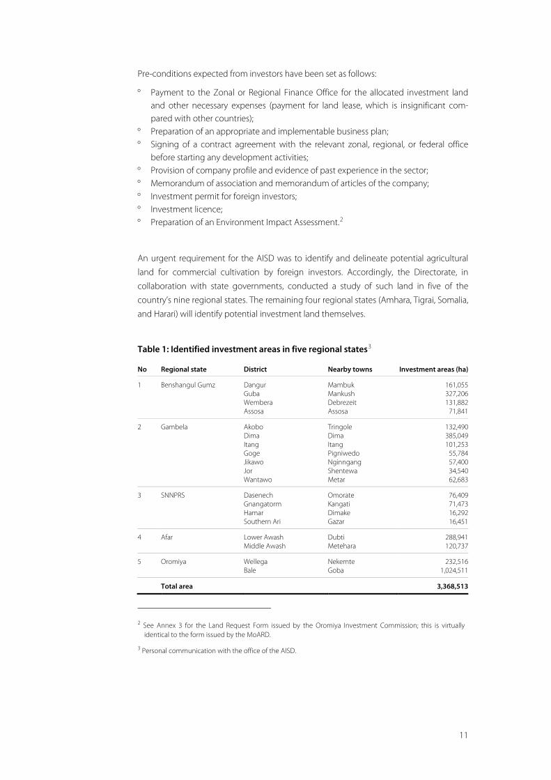
An urgent requirement for the AISD was to identify and delineate potential agricultural
land for commercial cultivation by foreign investors. Accordingly, the Directorate, in
collaboration with state governments, conducted a study of such land in five of the
country’s nine regional states. The remaining four regional states (Amhara, Tigrai, Somalia,
and Harari) will identify potential investment land themselves.
Table 1: Identified investment areas in five regional states3
No Regional state District Nearby towns Investment areas (ha)
1 Benshangul Gumz Dangur Guba Wembera Assosa
Mambuk Mankush Debrezeit Assosa
161,055 327,206 131,882
71,841
2 Gambela Akobo Dima Itang Goge Jikawo Jor Wantawo
Tringole Dima Itang Pigniwedo Nginngang Shentewa Metar
132,490 385,049 101,253
55,784 57,400 34,540 62,683
3 SNNPRS Dasenech Gnangatorm Hamar Southern Ari
Omorate Kangati Dimake Gazar
76,409 71,473 16,292 16,451
4 Afar Lower Awash Middle Awash
Dubti Metehara
288,941 120,737
5 Oromiya Wellega Bale
Nekemte Goba
232,516 1,024,511
Total area 3,368,513
2 See Annex 3 for the Land Request Form issued by the Oromiya Investment Commission; this is virtually
identical to the form issued by the MoARD.
3 Personal communication with the office of the AISD.
12
8 The project area
Location The study area is located in Bako Tibe Woreda, West Shoa Zone of Oromiya Regional
State, between approximately 8º 56’ and 9º 06’ Northern Latitude, 37º 01’ and 37º 12’
Eastern Longitude (see maps in Annex 5). Bako, the nearest town, is situated at the
northern edge of the Omo-Gibe river basin just above the Bako Plains, which cover an
area of about 35,000 hectares. The land was allocated to the investor before the potential
investment land listed in Table 1 was identified.
The plains contain four woredas of West Shoa Zone – Bako Tibe, Gobu Seyo, Boneya
Bushe, and Chelia. Bako Tibe Woreda comprises 28 rural kebeles. The woreda lies at an
altitude of between 1,550 and 1,670 metres above sea level, and has a mean monthly
temperature range of 18.8ºC–22.4ºC. The Gibe and Amara rivers provide the main sources
of water in the area for both humans and livestock.
Land use and soils The soils of the hills surrounding the plains are lateritic (rich in iron and aluminium) and in
the lower parts are intensively cultivated in the wet season. Due to increased population
pressure, cultivation appears to be extending to areas higher up the hills and on the
steeper slopes. The gradients of the slopes in the cultivated areas vary between 3% and
10%.
Between the hills and the plains, there is an intermediate strip of colluvial soils (sediment)
with a slope of less than 3%. These soils vary in texture according to their elevation, but
they tend to be medium-textured and free from waterlogging. They are intensively
cultivated with maize, teff (a fine-grained cereal that is a staple food for most farmers),
and pepper.
The Bako Plains are flat (with a gradient of less than 1%) and the soils are vertisols4 and
are subject to waterlogging (Land Resources Survey 1996). The plains are used mainly for
grazing in the dry season but isolated pockets are cultivated for teff, niger seed (known
locally as noug), and sorghum. On the right bank, the river floods small areas of land,
which are cultivated in the dry season using residual moisture.
4 Vertisols are clay-rich soils characterized by vertical cracking during the dry season.
13
The Omo-Gibe River Basin Integrated Development Master Plan Study (MoWR and
Woodroofe 1996) describes a typical soil profile pit (OGP 104), opened in the middle of
the Bako Plains, as follows:
“The soil classification is Eutric Vertisol, petroferric phase. The drainage is
imperfect and the permeability is low. The mean rate for hydraulic conduc-
tivity of top soil is 0.19 m/day whereas for the subsoil it is 0.03 m/day. The
human influence has been indicated as overgrazing. All the three horizons
of the profile pit contain strong evidence that the land remains wet for a
considerable time of the year, including ferrigenous nodules, yellowish
mottles and massive structure in the subsoil.”
Roads and services infrastructure The area lies approximately 125km from Ambo (the zonal capital) and 250km from Addis
Ababa, and is served by a national road. The study area is about 16km from Bako Town,
some 6km off the main road. Bako is on the national electricity transmission network and
has a reliable electricity supply.
Population (woreda) The people in the area are settled farmers. The 1994 census estimated the rural popula-
tion of Bako Tibe Woreda to be about 77,000, with males making up about 49% and
females 51%. By 2007, however, the Population and Housing Census estimated the
population of the woreda at 123,558, with 61,266 males and 62,292 females, and a growth
rate of about 2.9%.
14
Agriculture and livestock husbandry The community’s livelihoods are derived from both the cultivation of crops and livestock
husbandry. There is intensive cultivation of rain-fed crops such as maize, teff, pepper, and
niger seed. In areas near the Gibe and Amora rivers there are a few irrigated patches of
land.
The Bako Plains are partly waterlogged each year for a period of about three months
during the wet season (July–September). Low-lying parts of the plains are flooded by
tributaries of the Gibe River, but the course of the river stays within a relatively narrow
flood plain. Cattle are not grazed on these parts of the plains during this period, because
the waterlogging may cause disease problems. In the dry season (October–June),
however, the plains are used for communal grazing.
The soils of the plains are relatively uniform, being imperfectly to poorly drained black
cracking clays with evidence of surface waterlogging, often with gleyed subsoil (Omo-
Gibe Master Plan 1996). The gleyed subsoil is indicative of a permanent high water table.
The hydric soils, the length of the periods of waterlogging and flooding, as well as the
hydromorphic vegetation qualify the Bako Plains to be considered as wetlands (see
photographs in Annex 4).
Farmers from all five kebeles of Bako Tibe Woreda use the plains to graze their livestock, as
do farmers from the adjacent kebeles of the Boneya Bushe, Gobu Seyu, and Chelia
woredas (see map in Annex 5).
15
9 Stakeholders in the commercial agricultural development
Introduction This study has attempted to incorporate the attitudes of all stakeholders to the develop-
ment of the commercial farm owned by the Indian investor. Primary and secondary
information was collected from the stakeholders themselves and discussions were held
with the relevant professionals.
The identified stakeholders are:
° Bechera Agricultural Development Project (BADP), owned by Karuturi Agro Products Plc
° The local community ° Woreda Administration (Bako Tibe Woreda) ° Woreda Land and Environment Office (Bako Tibe Woreda) ° Woreda Agriculture Office (Bako Tibe Woreda) ° Western Shoa Zone Land and Environment Office ° Oromiya Regional State Land and Environment Office ° Oromiya Regional State Investment Office ° Agricultural Investment Support Directorate (MoARD) ° Ethiopian Investment Agency (EIA) ° Ministry of Water Resources.
16
Bechera Agricultural Development Project (BADP) The farm is owned by Karuturi Agro Products Plc, a subsidiary of Indian company Karuturi
Global Ltd, which in 2008 leased 10,700 hectares of land from Oromiya Regional State for
a period of 30 years. So far, about 4,000 hectares have been cultivated, with maize and
palm tree nurseries. Field trials are being carried out on plots of about 1.5 hectares each
for rice, bottle gourd, bananas, pepper, and different varieties of maize. The farm is rain-
fed, except for the nursery and trial plots.
The BADP employs about 30 Indian and 50 Ethiopian workers as supervisors, technicians,
and drivers. Over 500 seasonal workers are employed during peak agricultural activities.
Construction of living quarters and a guesthouse near the farm has recently been
completed. The company has a large storage facility for produce in Bako Town, about
16km from the farm.
The local community To investigate the attitudes of the local community, group meetings were arranged in
three kebeles – Bechera Oda Gibe Kebele, Oda Gibe Kebele, and Amerti Gibe Kebele –
with the assistance of the Woreda Administration and development agents of the
Woreda Agricultural Office. A letter was sent to each kebele administration indicating the
dates and the issues to be discussed. A questionnaire was prepared for a household
survey in both the local language (Oromifa) and English (see Annex 1).
Oromiya Regional State Land and Environment Office The office was established in 2008 by a directive from the Oromiya Regional State
government, as part of a restructuring of state bodies. The region’s former Land Man-
agement Department and Environment Authority were merged to establish the new
entity, which is mandated to implement Proclamation No. 130/2007 (Oromiya Rural Land
Use and Administration) issued in 2007, in cooperation with the Oromiya Agricultural and
Rural Development Bureau. According to this Proclamation, women have equal rights
with men to possess, use, and administer rural lands.
Article 20 of Proclamation No. 130/2007 deals with wetland management, and states the
following:
17
° Rural land users are obliged to refrain from conducting activities that cause damage to the wetland and springs.
° Mismanagement and improper utilization of wetland are prohibited. ° The wetland shall be used for agricultural purposes, with the consent of the commu-
nity and technical support of professionals.
The office is also mandated to register and issue landholding certificates, while the Zonal
and Woreda Land and Environment Offices execute the mandate at zonal and woreda
levels. Certificates are issued at two levels. The first level is essentially a registration of size
of land held, its use, and fertility status. The second level involves the landholding being
surveyed with geo-referenced boundaries and maps prepared, with this information to
be stored in data centres established for this purpose. The office is at present issuing first-
level certificates, and farmers in all three of the kebeles in which the household survey was
conducted had received these.
Ethiopian Investment Agency (EIA) The mission of the EIA is to enhance investment, both foreign and local, in Ethiopia by
promoting the potential of its resources and its investment opportunities. The agency is
responsible for all foreign investments involving more than 5,000 hectares, and issues
investment licences.
There is no clear differentiation between the mandates of the EIA and the recently
established AISD. The AISD, however, handles requests for land related to agricultural
investment (usually large-scale land earmarked for development). Negotiations and the
actual handover of leased land are carried out by the regional state in which it is located.
Ministry of Water Resources (MoWR) The Ethiopian Water Resources Management Proclamation No. 197/200 and the Ethio-
pian Water Resources Management Regulation No. 115/2005 emphasize the importance
of measures that facilitate the development of water resources to meet the agricultural
and domestic needs of farmers and pastoralists. The management of wetlands and
biodiversity resources is included in the provisions. The importance of the ecology and
the economic functions of wetlands and their biodiversity to sustainable livelihoods is an
issue that the MoWR needs to highlight at a national level (see photographs in Annex 4).
18
10 Results of the household survey
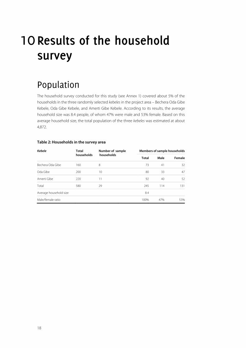
Population The household survey conducted for this study (see Annex 1) covered about 5% of the
households in the three randomly selected kebeles in the project area – Bechera Oda Gibe
Kebele, Oda Gibe Kebele, and Amerti Gibe Kebele. According to its results, the average
household size was 8.4 people, of whom 47% were male and 53% female. Based on this
average household size, the total population of the three kebeles was estimated at about
4,872.
Table 2: Households in the survey area
Kebele Total households
Number of sample households
Members of sample households
Total Male Female
Bechera Oda Gibe 160 8 73 41 32
Oda Gibe 200 10 80 33 47
Amerti Gibe 220 11 92 40 52
Total 580 29 245 114 131
Average household size 8.4
Male/female ratio 100% 47% 53%
19
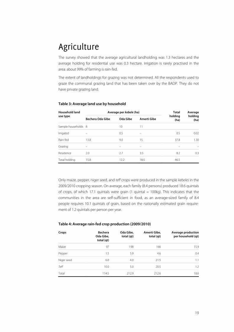
Agriculture The survey showed that the average agricultural landholding was 1.3 hectares and the
average holding for residential use was 0.3 hectare. Irrigation is rarely practised in the
area: about 99% of farming is rain-fed.
The extent of landholdings for grazing was not determined. All the respondents used to
graze the communal grazing land that has been taken over by the BADP. They do not
have private grazing land.
Table 3: Average land use by household
Household land use type
Average per kebele (ha) Total holding
(ha)
Average holding
(ha) Bechera Oda Gibe Oda Gibe Amerti Gibe
Sample households 8 10 11
Irrigated – 0.5 – 0.5 0.02
Rain-fed 13.8 9.0 15 37.8 1.30
Grazing – – – – –
Residence 2.0 2.7 3.5 8.2 0.3
Total holding 15.8 12.2 18.5 46.5
Only maize, pepper, niger seed, and teff crops were produced in the sample kebeles in the
2009/2010 cropping season. On average, each family (8.4 persons) produced 18.6 quintals
of crops, of which 17.1 quintals were grain (1 quintal = 100kg). This indicates that the
communities in the area are self-sufficient in food, as an average-sized family of 8.4
people requires 10.1 quintals of grain, based on the nationally estimated grain require-
ment of 1.2 quintals per person per year.
Table 4: Average rain-fed crop production (2009/2010)
Crops Bechera Oda Gibe,
total (qt)
Oda Gibe, total (qt)
Amerti Gibe, total (qt)
Average production per household (qt)
Maize 97 198 166 15.9
Pepper 1.5 5.9 4.6 0.4
Niger seed 6.0 4.0 21.5 1.1
Teff 10.0 5.0 20.5 1.2
Total 114.5 212.9 212.6 18.6
20
Livestock-keeping is also an important agricultural activity in the study area. Oxen are
used for ploughing and for other agricultural activities such as threshing grain and pulling
carts to transport farm produce.
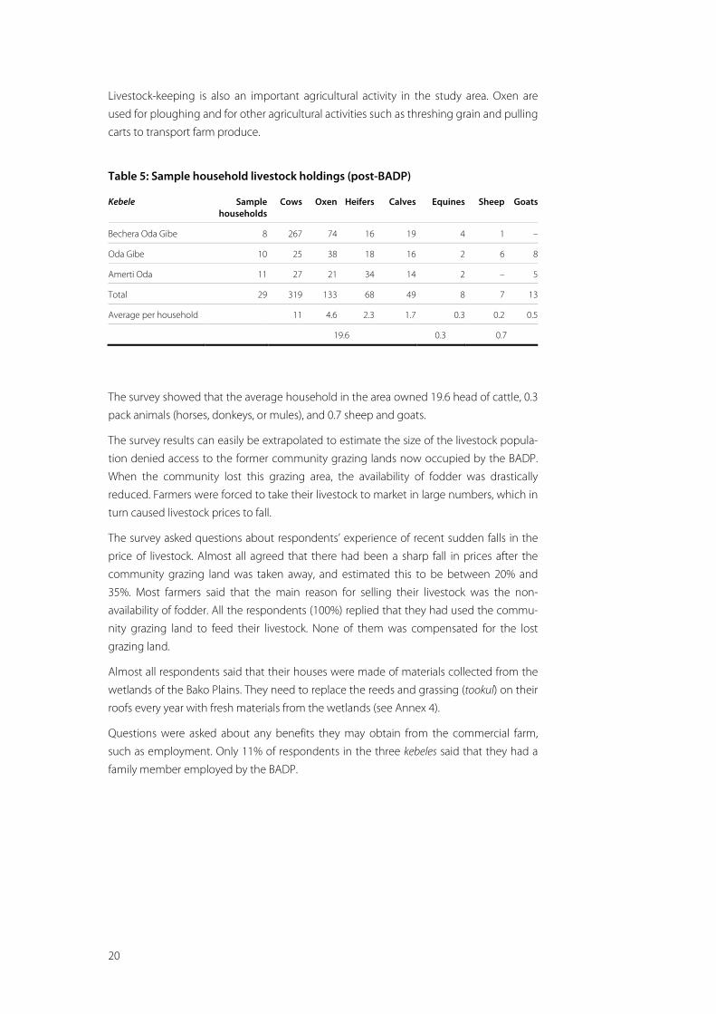
Table 5: Sample household livestock holdings (post-BADP)
Kebele Sample households
Cows Oxen Heifers Calves Equines Sheep Goats
Bechera Oda Gibe 8 267 74 16 19 4 1 –
Oda Gibe 10 25 38 18 16 2 6 8
Amerti Oda 11 27 21 34 14 2 – 5
Total 29 319 133 68 49 8 7 13
Average per household 11 4.6 2.3 1.7 0.3 0.2 0.5
19.6 0.3 0.7
The survey showed that the average household in the area owned 19.6 head of cattle, 0.3
pack animals (horses, donkeys, or mules), and 0.7 sheep and goats.
The survey results can easily be extrapolated to estimate the size of the livestock popula-
tion denied access to the former community grazing lands now occupied by the BADP.
When the community lost this grazing area, the availability of fodder was drastically
reduced. Farmers were forced to take their livestock to market in large numbers, which in
turn caused livestock prices to fall.
The survey asked questions about respondents’ experience of recent sudden falls in the
price of livestock. Almost all agreed that there had been a sharp fall in prices after the
community grazing land was taken away, and estimated this to be between 20% and
35%. Most farmers said that the main reason for selling their livestock was the non-
availability of fodder. All the respondents (100%) replied that they had used the commu-
nity grazing land to feed their livestock. None of them was compensated for the lost
grazing land.
Almost all respondents said that their houses were made of materials collected from the
wetlands of the Bako Plains. They need to replace the reeds and grassing (tookul) on their
roofs every year with fresh materials from the wetlands (see Annex 4).
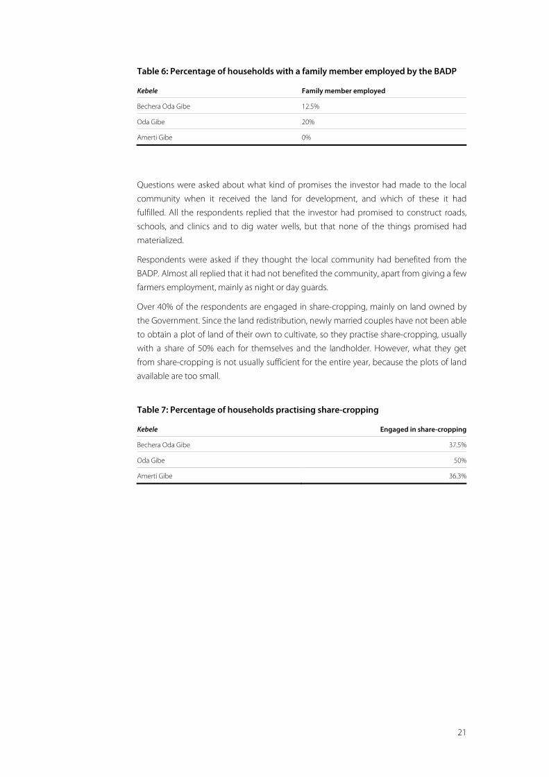
Questions were asked about any benefits they may obtain from the commercial farm,
such as employment. Only 11% of respondents in the three kebeles said that they had a
family member employed by the BADP.
21
Table 6: Percentage of households with a family member employed by the BADP
Kebele Family member employed
Bechera Oda Gibe 12.5%
Oda Gibe 20%
Amerti Gibe 0%
Questions were asked about what kind of promises the investor had made to the local
community when it received the land for development, and which of these it had
fulfilled. All the respondents replied that the investor had promised to construct roads,
schools, and clinics and to dig water wells, but that none of the things promised had
materialized.
Respondents were asked if they thought the local community had benefited from the
BADP. Almost all replied that it had not benefited the community, apart from giving a few
farmers employment, mainly as night or day guards.
Over 40% of the respondents are engaged in share-cropping, mainly on land owned by
the Government. Since the land redistribution, newly married couples have not been able
to obtain a plot of land of their own to cultivate, so they practise share-cropping, usually
with a share of 50% each for themselves and the landholder. However, what they get
from share-cropping is not usually sufficient for the entire year, because the plots of land
available are too small.
Table 7: Percentage of households practising share-cropping
Kebele Engaged in share-cropping
Bechera Oda Gibe 37.5%
Oda Gibe 50%
Amerti Gibe 36.3%
22
11 Focus group discussions with the local community, kebele administrations, and other stakeholders The main findings of these discussions are set out below.
Bechera Oda Gibe Kebele The first issue raised was aimed at establishing whether the community was using the
land taken by the BADP as community grazing area and cropping land.
The community members explained that a few people used to cultivate the plains. Later
on, all newly married couples were given farm plots in the wetlands as part of the
government’s land redistribution to smallholders, as were all those who were landless.
Some individuals from nearby towns also used to cultivate plots of land on the plains.
However, this situation got out of hand and local communities were unable to secure
sufficient grazing land for their livestock. They also became aware that if the situation
continued as it was, all of the plains could be converted to farmland.
Focus group participants said that representatives of all the kebeles adjoining the plains
met and discussed the issue extensively. They finally agreed to reserve the whole of the
plains as communal grazing land, and since then no cultivation has been allowed in the
wetlands. Landless couples and individuals were engaged to tend town-dwellers’ cattle
for reasonable payment (based on the number of head of cattle). Participants also said
that, traditionally, communal grazing lands on black clay soils, which are wet for a
considerable part of the year, are not measured for tax purposes.
They spoke bitterly about their exclusion from the wetlands, which they have used all
their lives. They said that officials gave the plains to the Indian investor on the pretext that
it was non-cultivated land. The lease negotiations were conducted between the investor
and federal and regional officials, and the community became aware of what was
happening only when the investor came to take possession of the land. The woreda
officials told the community that the land had been taken for investment purposes.
The community members said that the investor wanted to cultivate land near farmers’
smallholdings before cultivating the wetland further away, and that this has caused
23
frequent confrontations between smallholders and employees of the investor. They also
complained that the investor has blocked roads used by local farmers to access the rivers
and other watering points, and that they now have to travel longer distances to water
their livestock.
In 2009 a group of about 20 elders was selected to explain the situation to the Regional
Administration. They went to Addis Ababa twice, and on both occasions were told that
the Regional Council would instruct the Zonal Administration in writing and after that the
Zonal Administration would instruct the Woreda Administration in writing, so that
immediate action would be taken against the investor.
The group said that, after this, officials from the Zonal Administration came and talked to
both community members and to the investor’s representatives. The company, however,
responded by saying that it was paying tax on the investment land it had been given and
that nobody could take grass from this land, either to feed livestock or for tookul roof
thatching. When the officials from the Zonal Administration instructed the company to
arrange a livestock corridor through the plain so that farmers could water their livestock,
it replied by asking why they would need water when there was no grass to feed their
animals. The community members said that the Zonal Administration officials then left,
and that they have heard nothing more since then.
The second issue raised was aimed at establishing the opinions of community members
on the benefits they currently obtain, or aspire to obtain, from the BADP. Many of them
said that they were not benefiting at all, although some explained that they had bene-
fited. A 65-year-old farmer, who has used the plains for the past 35 years, said that he
worked as a night guard for the company and was paid Birr 300 per month5 because he
owns a gun. Night guards who do not have their own guns are paid Birr 200 per month.
This farmer said that his son also worked for the investor. The average salary for skilled
labourers was about Birr 800 per month. The salary for the guards is relatively low
because they are considered to work on a part-time basis (while they continue their farm
activities).
5 As at 25 March 2010, Birr 13.35 = USD 1.
24
Oda Gibe Kebele The discussion began by asking participants how much of the plains they used for
grazing their livestock. They gave different figures, with some estimating that the plains
could extend to anything between 35,000 hectares and 80,000 hectares. The farmers did
not know the exact area of the land leased to the investor nor the extent of the plains on
which they used to graze their livestock. Neither the woreda officials nor the investor had
made any effort to inform the community of the precise extent of the leased land.
The participants said that community representatives had gone frequently to the relevant
offices to complain about their situation after the wetlands were given to the investor.
The local officials told them that the order to transfer the land had come from higher
authorities and that the local administration did not have any power to influence the
decision. The woreda officials had, however, notified the Regional Investment Office that
the leased land was ready to be handed over for investment. Generally, it is only when
officials at the woreda level confirm the availability of land to be leased to foreign
investors that negotiations are initiated at the regional and federal levels.
Discussion group participants recounted that six individuals had been selected to voice
the community’s complaints to the Woreda Administration in September 2009, but that
the administration had told these representatives never to come back again with the
same issue.
They also said that in 2004 about 300 people from Oda Gibe Kebele had made an
agreement at the Kebele Administration office never to cultivate any part of the plains, so
that the whole area would be kept for community grazing. No part of the grazing land,
they said, had been cultivated since then. Now they believe that this decision, which
stopped cultivation by local farmers, had tempted the authorities to give the land to a
foreign investor.
They also pointed out that the investor had dug a deep ditch alongside its farm (for
drainage purposes), so local people could not cross the farmland to water their livestock
at the Gibe River.
25
Amerti Gibe Kebele Focus group participants were asked how the land tenure system was affecting the way
that community members earned their livings. The younger members of the community
complained that when they have been to the Kebele Administration to ask for plots of
agricultural land, officials told them that there was no unutilized land to give them.
Instead, the administration advised them to organize themselves and try to raise a loan.
They said that a group of 14 young people had organized themselves into a youth
cooperative named “Hawi” (“Brothers”). They had filed a request for Birr 31,000 three
months before the focus group discussion took place, but had not received anything to
date. They said that they could not borrow money from unofficial lenders due to the very
high rates of interest they charged compared with banks and credit associations (such
lenders usually lend money to those who are in desperate need). They added that they
could not borrow money from the Oromiya Micro Finance Organization either, as it lends
money only to those who are married and have been allocated a farm plot. They said that
nobody was interested in helping young people who were landless and unmarried.
Older members of the group said that some individuals used to keep over 150 head of
cattle on the plains. Many smallholders paid a nominal fee to leave their livestock with
people who owned large herds, so that they had enough time for their farming activities.
They said that the situation at present was bizarre. The youth used to find employment
with the large herd-owners but now, with fodder very scarce, livestock numbers have
been reduced and there are no large herds any more.
A community member who had cultivated the fringe lands of the plains for the past 20
years said that employees of the investor had recently come to the wetland near his farm
plot. They had started to clear what they claimed was investment land a long way from
the land they were currently cultivating. Some 200 community members gathered at the
spot in no time and forced the workers to stop clearing the land. The community
members said that they had not seen the company’s workers near their farms since then.
They say that such incidents occurred because the investor wanted to claim more land
than it was entitled to, and because the officials concerned had made no effort to
demarcate the leased land officially or to inform community members of its boundaries.
26
Woreda Agricultural Office A discussion was held with the relevant professionals and development agents (DAs)
regarding their working relationships with the investor. At present, community members
are unable to solve their problems with the investor through mutual understanding.
Some important points were raised by the respondents in this regard. For instance, they
said, the company was not making any effort to win the support or good will of the
community. It needed to approach the community and to delineate a livestock corridor
to allow farmers to take their livestock to water points. It also needed to allow livestock
onto the developed land after the corn has been harvested to graze the crop residue,
something that would help the community very much. They added that the investor had
dug one deep well near the development area for use by the community there, but they
had not seen farmers using it (they thought that the pump was not working yet). The
participants thought, however, that the investor would make a lot of profit from the farm,
as the land is very fertile and therefore may not require fertilizer.
Woreda Administration and the Land and Environment Office The Woreda Administration includes the Woreda Administrator and other officials at the
woreda level. The Land and Environment Office is responsible for issuing landholding
certificates. The investor first requested the land for the BADP in order to grow palm oil
trees. The Woreda Administrator said he was happy that the company had come to invest
and assist the development of the woreda. Participants in the discussion were of the
opinion that misunderstandings between the community and the investor had origi-
nated because of language barriers.
27
Employees of the BAPD In this discussion, questions were asked of mainly middle- and lower-ranking employees
of the BAPD regarding the project’s current agricultural activities. The participants
explained that activities currently included field trials and nurseries for palm oil trees. The
company has also leased about 300,000 hectares of land in Gambela Regional State for
palm oil cultivation, and the BAPD was supplying this project with tree seedlings. They
also said that different crops were under trial, including rice and bananas.
According to the participants, Karuturi Agro Products pays daily labourers about Birr 10
per day. An operator of heavy machinery is paid about Birr 3,500 per month, and a tractor
driver about Birr 1,500 per month. They said that the owner and managing director of the
company, Sai Rama Krishna Karuturi, rarely comes to the farm. He was, however, inter-
viewed in August 2009 by Fortune Weekly, an Ethiopian newspaper, and said the
following: “Ethiopia needs more people like Karuturi. The Ethiopian Government has
allocated 2.7 million hectares of agricultural land to those who want to invest in Ethiopia
from the 74 million hectares of arable land.”
Asked about the economic and financial benefits of the project, the participants hesitated
to reveal information about crop yields or the use of inputs. However, they anticipated
that cropping patterns would become more diversified in the future. They said that the
price of corn was not stable; it was currently at a low of Birr 200 per quintal, which did not
cover the costs of production. They added that in 2010 maize prices had dropped from
Birr 300 per quintal in January to less than Birr 200 per quintal in March.
They said that the farm budgets prepared at the beginning of the investment project had
overrun significantly due to the construction of drainage ditches and farm roads. They
also said that the staff living quarters had been built on a hillside, draining the budget
unexpectedly due to higher construction and labour costs. They said that it was difficult
to calculate the economic costs, as the gross financial margins had not yet been worked
out. With respect to the oil palm nursery, they said that a good job had been done and
that this was going according to plan. However, they said that it was not possible to
estimate the financial and capital costs separately for agricultural activities in Bako and
the transport and planting of palm oil tree seedlings in Gambela. They added, however,
that the investor could not realistically expect to make a profit in the near future.
28
12 Economic and land use assessment of the project
Current land use The total area of the BADP is thought to be 10,700 hectares, but this is only an estimate.
The company started cultivating the land allocated to it – delineated by the Gibe River in
the west and the north and the edge of the plainlands in the east and southeast – on the
understanding that an accurate measurement of the project area would follow, but this
has not yet been done and the land has not yet been officially handed over.
This situation is a cause of anxiety for the local community, who fear that the investor is
claiming more land than it is entitled to. When the fieldwork for this study was carried
out, the Administrator of the Bako Tibe Woreda explained that surveyors were due to
come from the Zonal Administration to delineate the leased 10,700 hectares. The total
area of the Bako Plains is estimated to be about 35,000 hectares; the remainder of this lies
in other woredas which adjoin Bako Tibe Woreda.
Karuturi Agro Products’ original plan was to cultivate all 10,700 hectares straight away,
but so far less than half the land – about 4,000 hectares – has been planted with corn,
field trials for different crops, and the palm oil nursery. The company had not constructed
any elaborate drainage system when it began cultivating the land in the 2009/2010
cropping season. Its production of maize in the first season also fell far short of the
expected output. The harvested corn is currently being kept in a large storage facility in
Bako Town, and the future local market price of corn will determine when the company
sells this year’s harvest.
29
Future agricultural production The project aspires to obtain higher crop yields and to achieve a better sustainable
exploitation of the plains. This, however, would require more capital to install more
elaborate drainage systems and to diversify crops. It is anticipated that in the future most
of the agricultural produce grown will be exported directly to India to replace current
imports of food items from the international market. A substantial increase in production
is anticipated, with more technological and material inputs, as the project acquires more
experience of managing wetlands and of flood control. Future gains, however, cannot be
calculated as the value of the current crop (still in store at the time of the field study) has
not yet been determined. Similarly, increases in production levels for the various diversi-
fied crops to be grown later cannot be determined at this early stage.
Economic status of the project It is not possible to establish the economic costs of the project at this stage, for the
reasons already explained. No cost could be determined for environmental mitigation,
and project management costs could not be determined because expenditures on the
nursery development field trials and corn production could not be separated out. Once
the stored corn is sold on the local market and its value determined, this will assist project
staff in carrying out a financial and economic analysis of the project.
30
13 Environmental impact The families living near the project area use mainly pond and river water for all their own
needs and for those of their animals. A few families living at a distance from rivers use
water from wells (either deep or shallow). Sanitary conditions in the villages around the
project area are unsatisfactory. Wetland ponds may no longer be available as the com-
mercial farm will utilize all the wetland.
The adverse impacts of the commercial agricultural development on the plains are as
follows.
i. Loss of grazing land is a major negative impact. Herders have not been compen-sated for the grazing land they have lost. The company does not allow them to graze their animals on crop residues, and the crop residue on their own farms does not last long. They have been forced to sell their livestock, even though the price has fallen significantly in local markets.
ii. The wetlands store water and sustain biodiversity. Farms within walking distance of the wetlands used to be able to use water for themselves and their livestock. Once the wetland is cultivated, however, there will likely be an alteration in hydrological conditions. The headwaters of the Gibe River may no longer be recharged during the dry season, and this will change the flow of the river, affecting downstream us-ers too. Apart from the Gibe River, three other rivers cross the project area.
iii. Aquatic organisms will be lost when the plains are drained. The wetland is com-posed of depressed sites with permanent swamps and waterlogged basins. Hence, loss of biodiversity is very likely.
iv. In developing a mechanized commercial farming project, the investor is likely to use fertilizers and pesticides in large quantities, and large-scale chemical run-off is very likely to occur. The potentially most adverse impacts of the use of agrochemicals in-clude a deterioration in water quality, both locally and downstream, increased vulnerability of the ecosystem, and physical harm to both humans and livestock.
Smallholders living around the project area depend on the ponds and river water for all
their needs. A piped water supply would reduce the negative impact of surface water
contamination by agrochemicals, although it would not be a long-term solution.
Environmental surveys are usually required for irrigation projects in Ethiopia, but the
BADP investment project has not undertaken such a survey.
31
14 Conclusion and recommendations Alternative employment and livelihood opportunities are needed to absorb the rapidly
growing population in the study area. The Bechera Agricultural Development Project has
created some employment opportunities for the local community. However, the com-
munity expected the project to provide social services such as water supply, health care,
sanitation, schools, and roads. It complains that none of these promises of social services
or infrastructure have been implemented.
The loss of traditional community grazing land has severely affected the livelihoods of
local smallholders. They complain that the investor does not even allow them to graze
their livestock on crop residues. The community also complains that it is denied access to
water points and rivers.
It is recommended that Karuturi Agro Products Plc holds discussions with the local
community to find solutions to their grievances. Representatives could meet once a
month or once a fortnight to exchange views. Organizing a field visit to the project farm
to introduce its activities to local people would help. The smallholders would like to see
some benefits from the investment that would improve their livelihoods. Such benefits
could include setting up an outgrowers scheme to produce crops; allowing the grazing
of crop residues; assisting the community by introducing new fodder production
techniques (e.g. the cultivation of alfalfa in low-lying fields); etc.
It was observed during discussions with stakeholders that there was a lack of consultation
with the community regarding the intended changes in land use in the area. It was also
observed that local authorities and officials play a significant role in allocating appropriate
sites for agricultural investment, and that they too could help to improve relations
between the investor and the community. The community should be informed of the
process of land acquisition by any investor in a transparent way, as well as of the benefits
of any such investment at the local, regional, and national levels.
It is recommended that awareness-raising workshops be conducted for officials con-
cerned with land administration and agriculture to help the relevant authorities make
informed decisions. Besides workshops, awareness-raising could take many forms,
including short training sessions, the preparation of flyers, audiovisual presentations, and
study tours.
Some of the land areas allocated for investment have not been surveyed or measured.
The identification of large areas of land for investment was done using the latest satellite
32
imagery, but the delineation of areas of land for individual investors requires a field survey
to be undertaken, including physical pegging of boundaries. The woreda offices con-
cerned require some assistance with this task.
A baseline environmental survey needs to be undertaken to determine the current status
of the local environment, against which future monitoring and evaluation of the project
can be compared. The environmental impacts of the investment project should be
monitored, starting from the current cropping season. The baseline survey should also
recommend mitigation methods to minimize the effect of agricultural activities both
within the project area and for downstream users.
33
References Federal Democratic Republic of Ethiopia (FDRE). Federal Negarit Gazeta, 11th Year, 2005.
No. 43. Addis Ababa.
Federal Democratic Republic of Ethiopia (FDRE). 1995. The Constitution of the Federal
Democratic Republic of Ethiopia. Addis Ababa.
Fortune Weekly newspaper. 13 September 2009. Vol. 10, No. 489.
Hurni, H. 1993. Land Degradation, Famines and Resource Scenarios in Ethiopia, Volume 3.
University of Berne, Switzerland.
Ministry of Agriculture and Rural Development (MoARD). Agriculture Investment
Support Directorate. 2009. Addis Ababa.
Ministry of Water Resources (MoWR). 2002. Water Sector Development Programme
2002–2016.
Ministry of Water Resources (MoWR). 1999. Water Management Policy of Ethiopia.
MoWR, Addis Ababa.
Ministry of Water Resources (MoWR) and Richard Woodroofe & Associates. 1996. Land
Resources Survey. Omo-Gibe River Basin Integrated Development Master Plan
Study. Volume V. Pre-Feasibility Studies. Addis Ababa.
Rahmato, D. 2009. “Ethiopia: Agricultural Policy Review”. In Taye Assefa (ed). Digest of
Ethiopia’s National Policies, Strategies and Programs. Addis Ababa
UNDP/FAO. 1988. Master Land Use Plan.
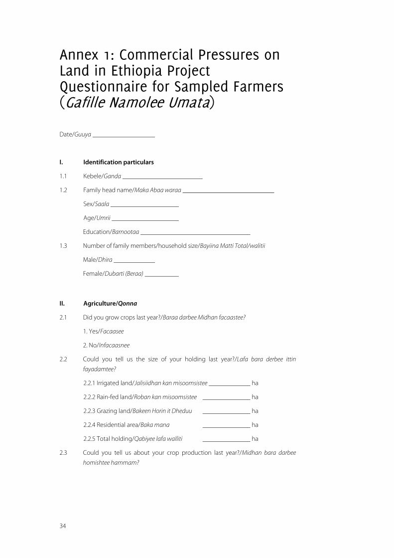
34
Annex 1: Commercial Pressures on Land in Ethiopia Project Questionnaire for Sampled Farmers (Gafille Namolee Umata)
Date/Guuya
I. Identification particulars
1.1 Kebele/Ganda
1.2 Family head name/Maka Abaa waraa
Sex/Saala
Age/Umrii
Education/Barnootaa
1.3 Number of family members/household size/Bayiina Matti Total/walitii
Male/Dhira
Female/Dubarti (Beraa)
II. Agriculture/Qonna
2.1 Did you grow crops last year?/Baraa darbee Midhan facaastee?
1. Yes/Facaasee
2. No/Infacaasnee
2.2 Could you tell us the size of your holding last year?/Lafa bara derbee ittin
fayadamtee?
2.2.1 Irrigated land/Jalisiidhan kan misoomsistee ha
2.2.2 Rain-fed land/Roban kan misoomsistee ha
2.2.3 Grazing land/Bakeen Horin it Dheduu ha
2.2.4 Residential area/Baka mana ha
2.2.5 Total holding/Qabiyee lafa walliti ha
2.3 Could you tell us about your crop production last year?/Midhan bara darbee
homishtee hammam?
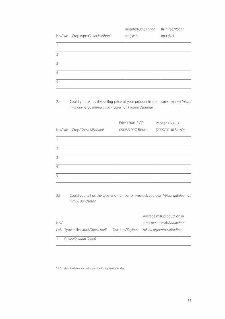
35
No./Lak. Crop type/Gossa Miidhanii
Irrigated/Jalissidhan
(qt.) (ku.)
Rain-fed/Roban
(qt.) (ku.)
1
2
3
4
5
2.4 Could you tell us the selling price of your product in the nearest market?/Gatti
midhanii yeroo amma gaba irra jiru nuti Himmu dendesa?
No./Lak. Crop/Gossa Miidhanii
Price (2001 E.C)6
(2008/2009) Birr/qt
Price (2002 E.C)
(2009/2010) Birr/Qt
1
2
3
4
5
2.5 Could you tell us the type and number of livestock you own?/Horri qubduu nuti
himuu dandenta?
No./
Lak. Type of livestock/Gossa horii Number/Bayinaa
Average milk production in
litres per animal/Annan hori
tokora argammu litirodhan
1 Cows/Sawaan (looni)
6 E.C. refers to dates according to the Ethiopian Calendar.
36
2 Oxen/Qotiyoo (sangaa)
3 Heifers/Radda
4 Calves/Jabiilota
5 Equines/Haree, fardafi/gangee
6 Sheep/Holaa
7 Goats/Raee
2.6 Do you sell milk?/Anaan gurgurtee bekta?
1. Yes/Gurguree beka
2. No/Gurguree hindeku
If yes to question, what is the price per litre?/Erga gurgurtee bektee gattin hamami?
Cow milk/Annan horii Birr per litre
Goat milk/Annan raee Birr per litre
2.7 Have you sold livestock in the last year?/Bara darbe kessati horri gurgurte?
1. Yes/Gurguree
2. No/Hingurguree
2.8 If yes, which type and how many?/Gattif bayinni hammami?
No./Lak. Type of livestock/Iynata horii Number/Bayina
1 Cows/Sawaan (looni)
2 Oxen/Qotiyoo (sangaa)
3 Heifers/Radda
4 Calves/Jabiilota
5 Equines/Haree, fardafi/gangee
6 Sheep/Holaa
7 Goats/Raee
37
2.8.1 Was there a sudden fall in price in the last three years?/Wagoota Sadan darban
keessatti gadi-bu’iinsi gatii akka tasaa mudate jiraa?
1. Yes/Naf gaya
2. No/Naf ingayu
2.8.2 If the answer is yes, what was the reason?/Yoo deebiin eyyee dha ta’e, sababnissa
maal?
2.8.3 How much?/Hammamiin?
2.9 What are the main problems of livestock in the area?/Horii horssisu Kessati rakon
jiru mallfadha?
Feed/Nyata horii
Water/Bishan
Livestock diseases/Dhibee horii
Market/Gabaa
Others/Rako adaadaa
2.10 What is the main reason in your kebele for selling livestock?/Urgurtaa horii
kmanaa keessatti rakkoo guddaan Gandas keessan keessa jiru maali?
2.11 What would you like to be done in order to improve livestock production?/Jirru
ke foyessu Hori mal aka hojatamu barbada?
2.12 Extension service/Tajiilaa mala qonnai
2.12.1 How often do you meet the DA?/Ittigafatama missoma gizee meqaa issin ilaala?
2.12.2 What advice did you get from the DA?/Hojjata missoma irraa gorssa mall fa
argatu?
2.13. Did you produce sufficient food for home consumption?/Wagati wan homishtoo
mattii ketif gnataf sigaya?
Yes/Naf gaya
No/Naf ingayu
2.14 If your production was not sufficient for home consumption, what did you do to
feed your family?/Wani omishtee yoo sifi ingeegnee mallin fayadamta?
1. Purchased/Gaba irra bitaudhan
38
2. Gift (received)/Gossa irra fudhedhaa (firran nakenee)
3. Borrowed/Nan ligeefadha
4. Others (specify)/Baka adaada argadha
2.15 If you purchased food crops, what was your source of income?/Erga midhan bitu
tatee malidhan bitaa?
III. Social services/Tajajilaa Hawwassuma
3.1 Do you use the following services?/Tajajilaa assin gadi bereffamee itin fayadam-
taa?
Service/Tajajila
Yes/Itin
tejajilama
No/Itin
tejajilama
injiru
Distance (km) if
yes/Fagegna km
dhan
Reason for not using the
service/Malif itin
infayedamtu
School/Manna
barnota
Health ser-
vice/Mana yalaa
Grain mill/Manna
daku
Telephone/Silki
Post office/Manna
posta
Bank/Banki
3.2 What is your house made of?/Manna kee malira ljartee?
1. Roof/Baaxii
2. Wall/Gidgidaa
3.3 Did you get the material to build your house from the Bako Wetlands?/Iddoo
jiidhaa baakkoo keessaa waanta ittiin mana keessan ijaarrattan argattaniittuu?
3.4 Would you like to be employed in the commercial farms near you and work as a
labourer?/Warsha kessati qaxaramu infeta?
1. Yes/Nanfedha
2. No/Hinfedhu
39
3.5 Do you have members of your family employed in large commercial farms near
you?/Miseensota maatii keessanii keessaa naannoo keessanitti o’iruu daldaalaa
guddaa irratti qaxaramaniiruu?
1. Yes/Itin jiradha
2. No/Itin ijiradhu
3.5.1 If the answer is yes, are they happy with what they are paid?/Yoo deebiin eyyee
dha ta’e, Kaffaltii kafalameefitti gammadaniiruu?
3.5.2 What is the name of the commercial farm?/Maqaan O’iruu Daldalaa sun maal
jedhama?
3.5.3 What is the amount they are paid? (for which type of job?)/Hanga isaan kaffalaa
turan hammam?
3.6 What promises did the commercial farms near you give when they were given
land for cultivation?/O’iruun Daldalaa sun yommuu lafti qommaaf yommuu ken-
nameef uummata naannoo sanaaf maal akka godhaniif abdachiisan?
Roads/Karaa
School/Mana barunsaa
Clinic/Mana Yaalaa
Water wells/Boollaa Bishaanii/eelaa
3.7 Which of the promises have they fulfilled?/Wantta abdachiifame keessaa maaltu
fixaan ba’ e?
3.8 Did you use the land before it was given to investors for crops or grazing?/Uttu
laftichi abbootii qabeenyaaf qonnaa fi dheedichaan hin kennamiiniin dura itti
fayyadamaa turtanii?
3.9.1 What was the size of the cropland or community grazing land?/Lafti mnuan
qabanee jiruu fi kan fheedichaa hangam ture?
3.9.2 Have you been compensated for what you have lost by the investors?/Sababa
abbootii qabeenyaaf wonnaa isin duraa badeef beenyaan isiniit kaffalameeraa?
3.10 Where do you send your livestock during the dry season?/Yeroo bonaa bee’illada
keessan eessatti ergitu?
3.11 Do you think the investors of the commercial farms benefit the local communi-
ty?/Abbootti qabeenyaa namoota naannoo sanaa fayyadan isintti fakkaataa?
1. Yes/Naf gaya
2. No/Naf ingayu
3.11.1 If the answer is yes, in what ways?/Yoo deebiin eyyee dha ta’e, akkamitiin?
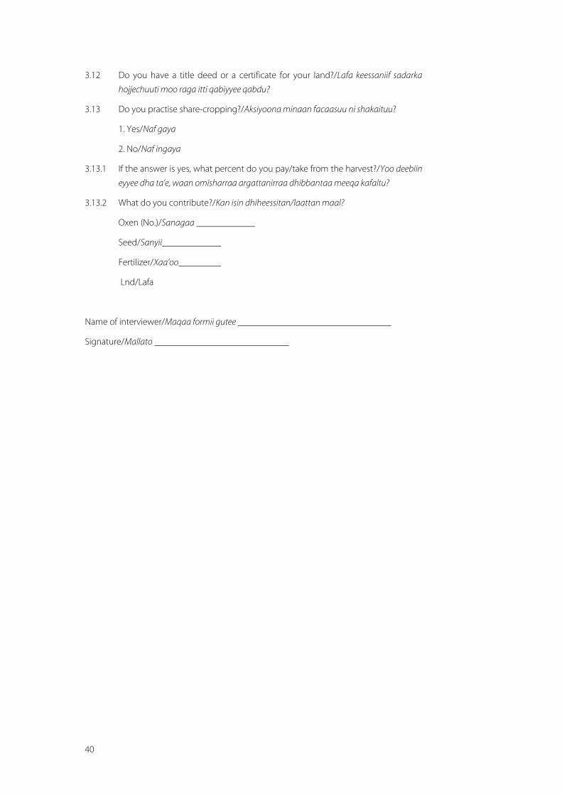
40
3.12 Do you have a title deed or a certificate for your land?/Lafa keessaniif sadarka
hojjechuuti moo raga itti qabiyyee qabdu?
3.13 Do you practise share-cropping?/Aksiyoona minaan facaasuu ni shakaituu?
1. Yes/Naf gaya
2. No/Naf ingaya
3.13.1 If the answer is yes, what percent do you pay/take from the harvest?/Yoo deebiin
eyyee dha ta’e, waan omisharraa argattanirraa dhibbantaa meeqa kafaltu?
3.13.2 What do you contribute?/Kan isin dhiheessitan/laattan maal?
Oxen (No.)/Sanagaa
Seed/Sanyii
Fertilizer/Xaa’oo
Lnd/Lafa
Name of interviewer/Maqaa formii gutee
Signature/Mallato
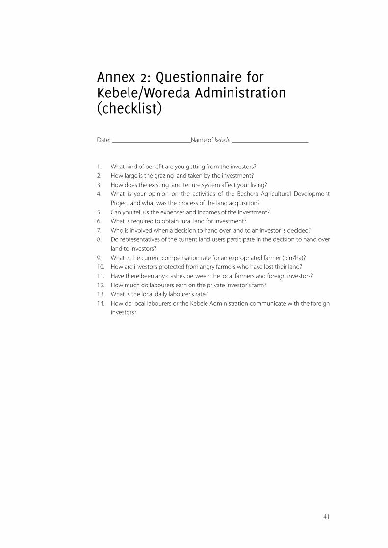
41
Annex 2: Questionnaire for Kebele/Woreda Administration (checklist)
Date: Name of kebele
1. What kind of benefit are you getting from the investors? 2. How large is the grazing land taken by the investment? 3. How does the existing land tenure system affect your living? 4. What is your opinion on the activities of the Bechera Agricultural Development
Project and what was the process of the land acquisition? 5. Can you tell us the expenses and incomes of the investment? 6. What is required to obtain rural land for investment? 7. Who is involved when a decision to hand over land to an investor is decided? 8. Do representatives of the current land users participate in the decision to hand over
land to investors? 9. What is the current compensation rate for an expropriated farmer (birr/ha)? 10. How are investors protected from angry farmers who have lost their land? 11. Have there been any clashes between the local farmers and foreign investors? 12. How much do labourers earn on the private investor’s farm? 13. What is the local daily labourer’s rate? 14. How do local labourers or the Kebele Administration communicate with the foreign
investors?
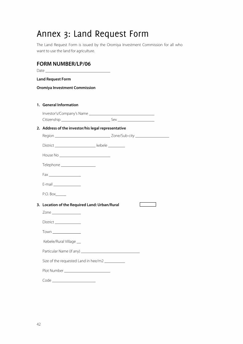
42
Annex 3: Land Request Form The Land Request Form is issued by the Oromiya Investment Commission for all who
want to use the land for agriculture.
FORM NUMBER/LP/06 Date
Land Request Form
Oromiya Investment Commission
1. General Information
Investor’s/Company’s Name
Citizenship Sex
2. Address of the investor/his legal representative
Region Zone/Sub-city
District kebele
House No
Telephone
Fax
P.O. Box
3. Location of the Required Land: Urban/Rural
Zone
District
Town
Kebele/Rural Village
Particular Name (if any)
Size of the requested Land in hee/m2
Plot Number
Code
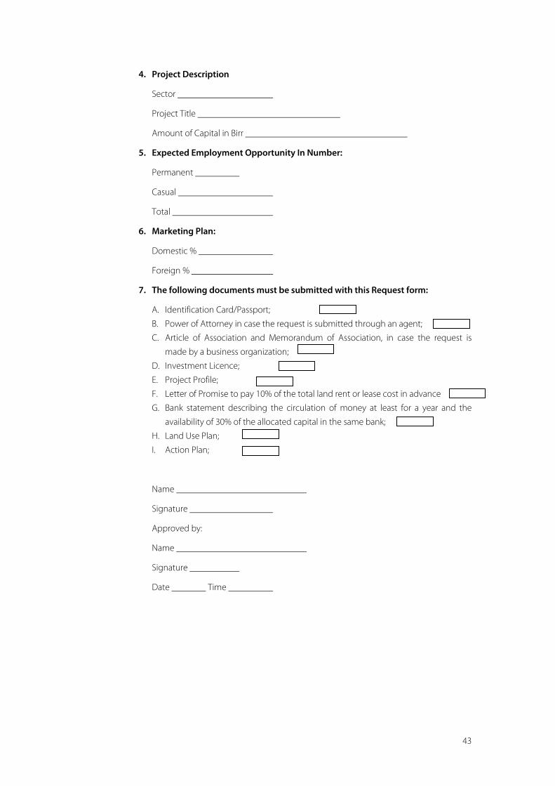
43
4. Project Description
Sector
Project Title
Amount of Capital in Birr
5. Expected Employment Opportunity In Number:
Permanent
Casual
Total
6. Marketing Plan:
Domestic %
Foreign %
7. The following documents must be submitted with this Request form:
A. Identification Card/Passport;
B. Power of Attorney in case the request is submitted through an agent;
C. Article of Association and Memorandum of Association, in case the request is
made by a business organization;
D. Investment Licence;
E. Project Profile;
F. Letter of Promise to pay 10% of the total land rent or lease cost in advance
G. Bank statement describing the circulation of money at least for a year and the
availability of 30% of the allocated capital in the same bank;
H. Land Use Plan;
I. Action Plan;
Name
Signature
Approved by:
Name
Signature
Date Time
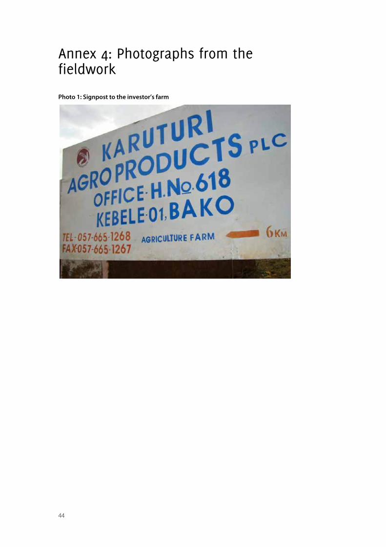
44
Annex 4: Photographs from the fieldwork
Photo 1: Signpost to the investor’s farm
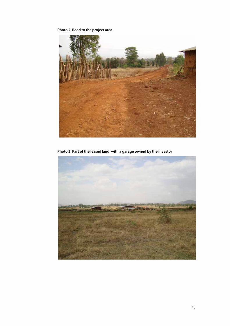
45
Photo 2: Road to the project area
Photo 3: Part of the leased land, with a garage owned by the investor
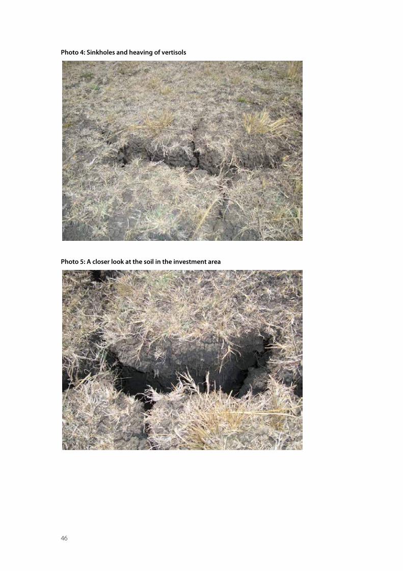
46
Photo 4: Sinkholes and heaving of vertisols
Photo 5: A closer look at the soil in the investment area
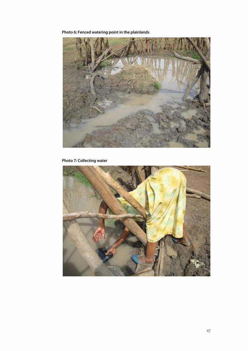
47
Photo 6: Fenced watering point in the plainlands
Photo 7: Collecting water
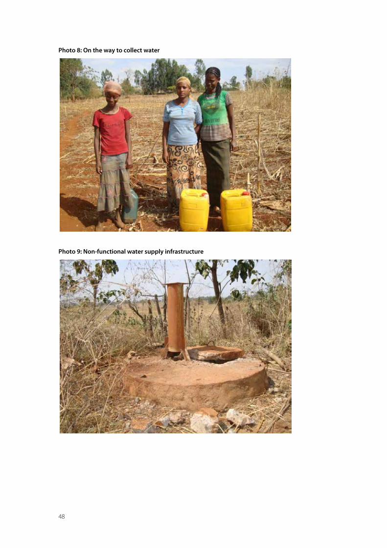
48
Photo 8: On the way to collect water
Photo 9: Non-functional water supply infrastructure
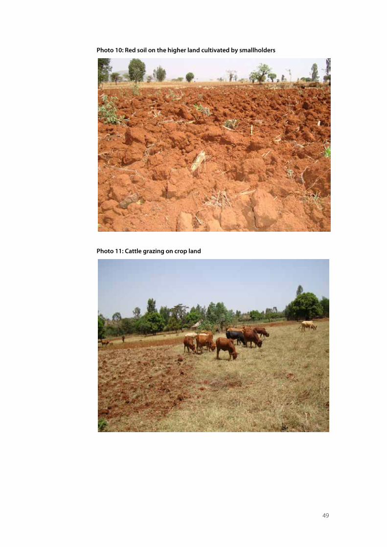
49
Photo 10: Red soil on the higher land cultivated by smallholders
Photo 11: Cattle grazing on crop land
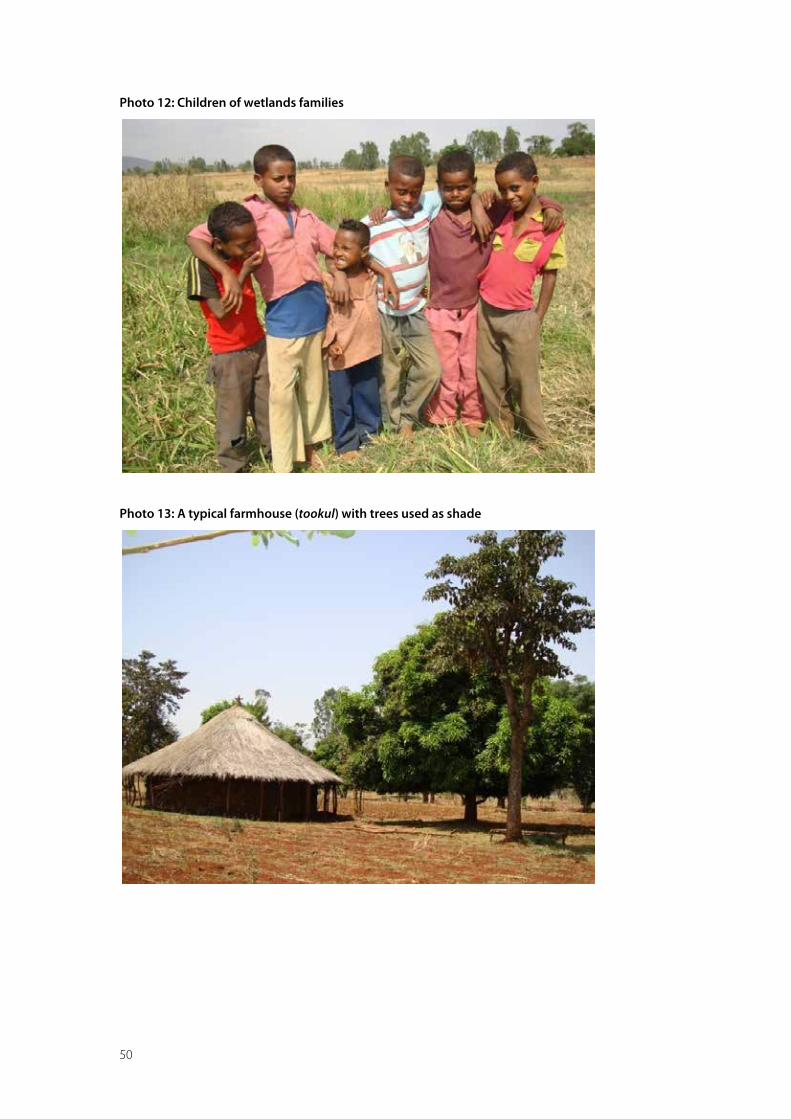
50
Photo 12: Children of wetlands families
Photo 13: A typical farmhouse (tookul) with trees used as shade
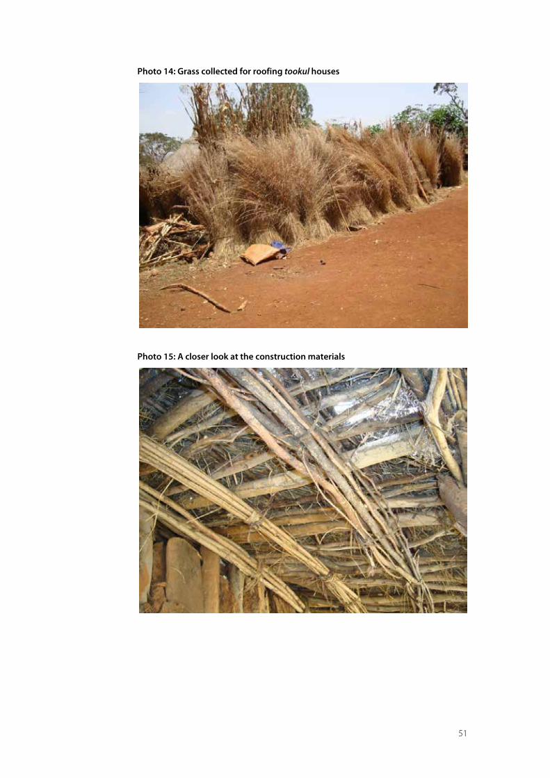
51
Photo 14: Grass collected for roofing tookul houses
Photo 15: A closer look at the construction materials
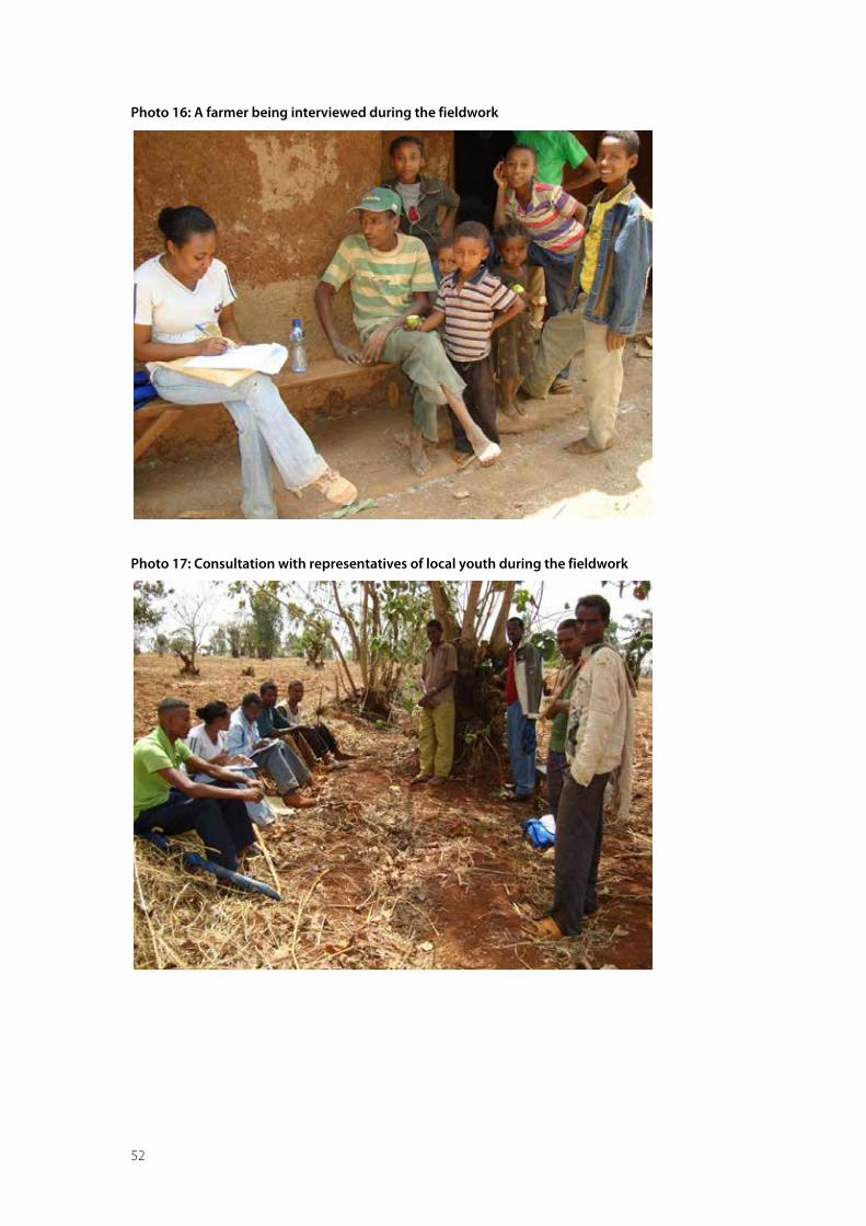
52
Photo 16: A farmer being interviewed during the fieldwork
Photo 17: Consultation with representatives of local youth during the fieldwork

53
Annex 5: Maps of the study area
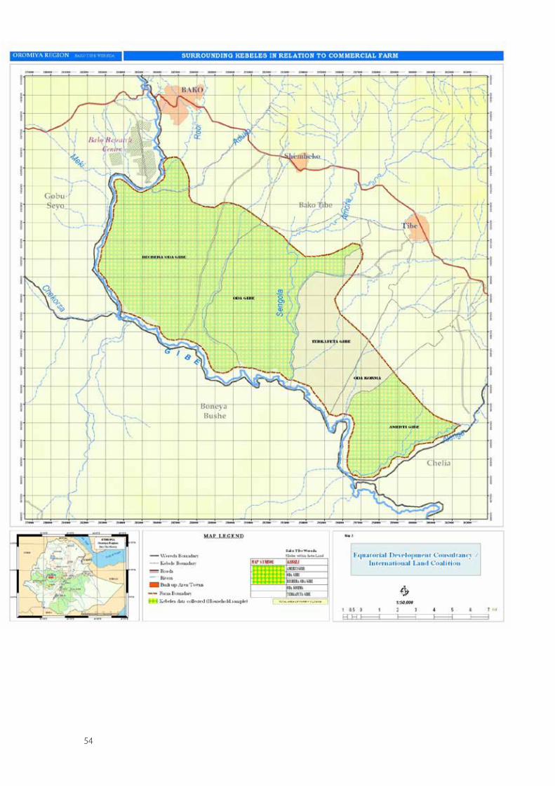
54

Cover illustration: © Aldo di Domenico 2011
The opinions expressed in this report are those of the author, and can in no way be taken to reflect the offcial views of the International Land Coalition, its members or donors.
ISBN 978-92-95093-38-6
© 2011 the International Land Coalition
Mr. Messele Fisseha is educated as a Soil Scientist/Land Use Planner (M. Sc). He started work as a land use planner in the Ethiopian Ministry of Agriculture. He soon moved to the Ethiopian Sugar Corporation to work as a researcher on irrigation and drainage management. In 1992 he joined the Ministry of Water Resources as a senior soil and water management expert. In his capacity, he planned, evaluated and assisted the development of medium and large scale irrigation projects nationwide. In 1998, he was assigned to head the Basin Development Studies and Water Utilization Control Department of the Ministry.
At present, he is managing a private consultancy firm specializing in the natural resources management and environmental impact assessment.
Our MissionA global alliance of civil society and intergovernmental organisations working together to promote secure and equitable access to and control over land for poor women and men through advocacy, dialogue, knowledge sharing and capacity building.
Our VisionSecure and equitable access to and control over land reduces poverty and contributes to identity, dignity and inclusion.
CIRAD works with the whole range of developing countries to generate and pass on new knowledge, support agricultural development and fuel the debate on the main global issues concerning agriculture.
CIRAD is a targeted research organization, and bases its operations on development needs, from field to laboratory and from a local to a global scale.
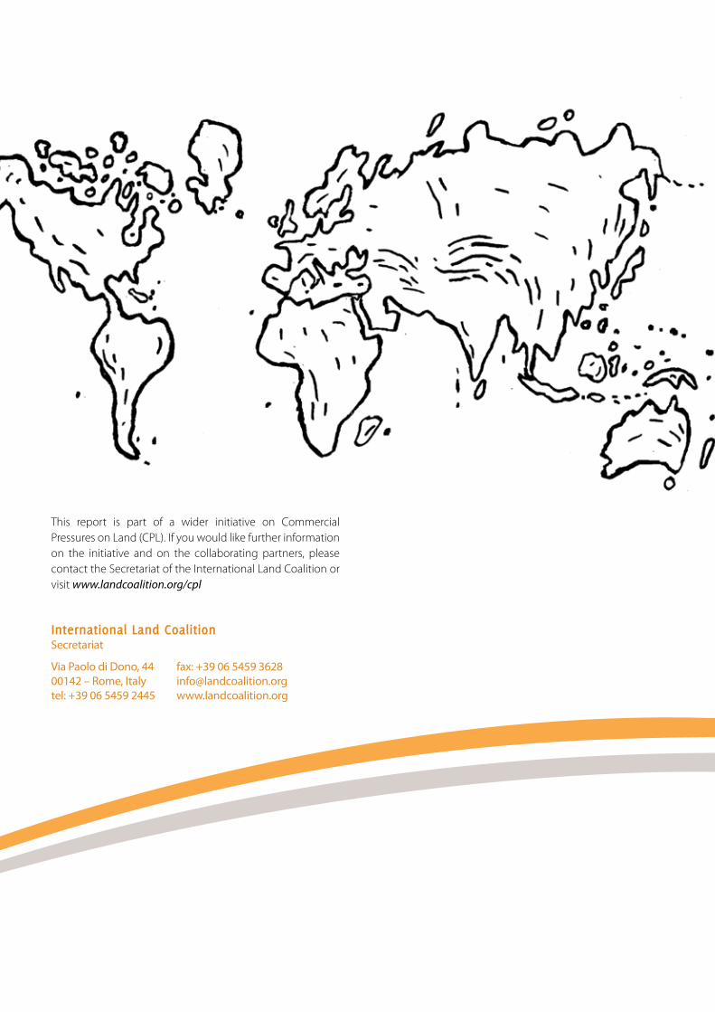
Commercial Pressures on Land
A case study of the Bechera agricultural development project, Ethiopia
This report is part of a wider initiative on Commercial Pressures on Land (CPL). If you would like further information on the initiative and on the collaborating partners, please contact the Secretariat of the International Land Coalition or visit www.landcoalition.org/cpl
International Land CoalitionSecretariat
fax: +39 06 5459 [email protected]
Via Paolo di Dono, 4400142 – Rome, Italytel: +39 06 5459 2445