Embed Size (px)
Citation preview
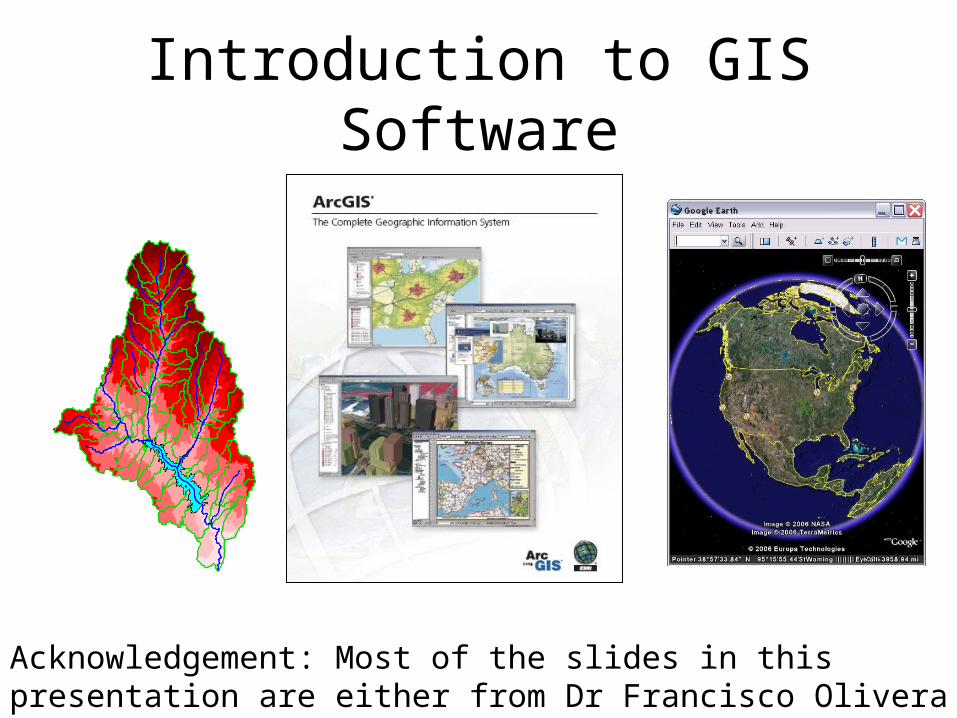
Introduction to GIS Software
Acknowledgement: Most of the slides in this presentation are either from Dr Francisco Olivera (TAMU) or Dr David Maidment (UT, Austin)
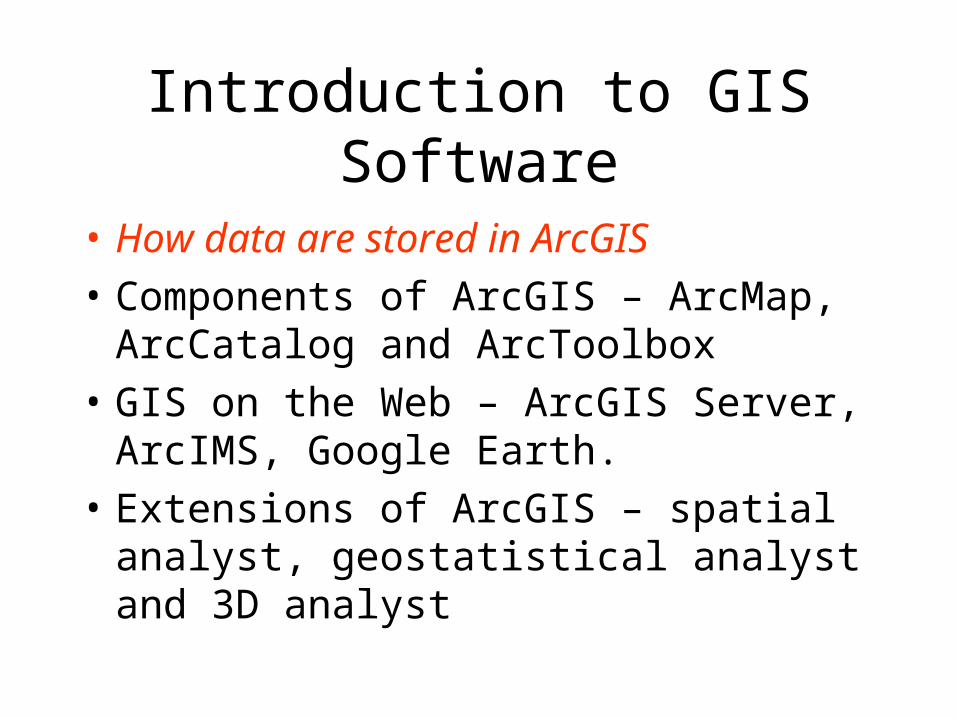
Introduction to GIS Software
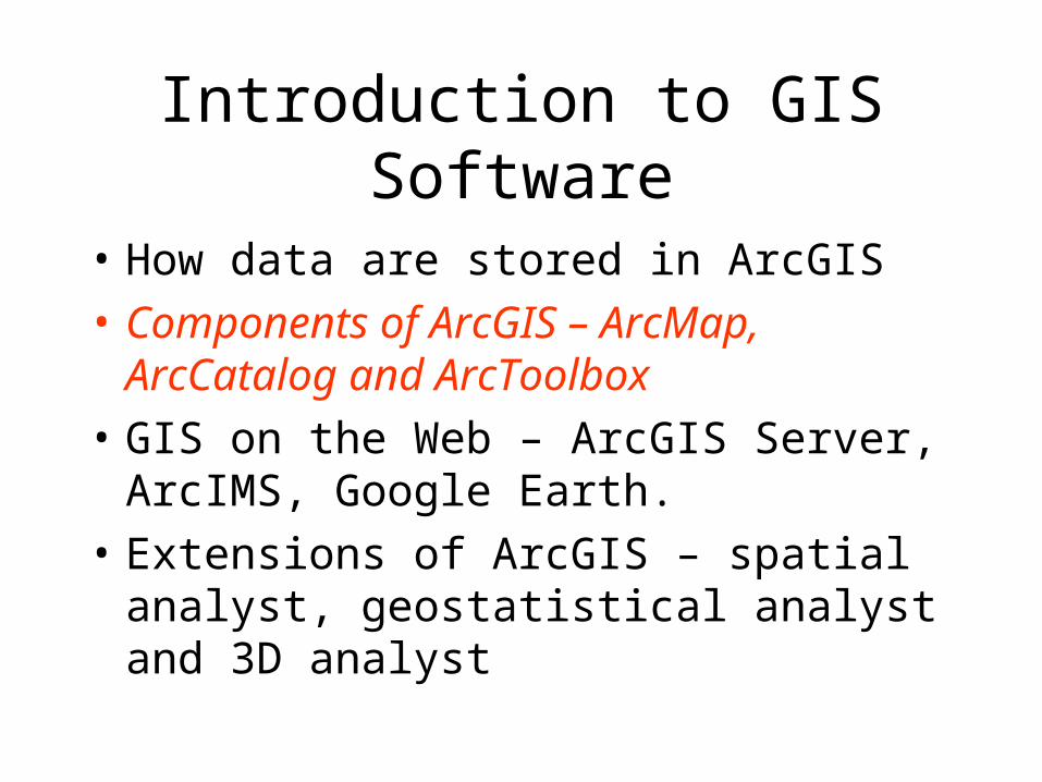
• How data are stored in ArcGIS
• Components of ArcGIS – ArcMap, ArcCatalog and ArcToolbox
• GIS on the Web – ArcGIS Server, ArcIMS, Google Earth.
• Extensions of ArcGIS – spatial analyst, geostatistical analyst and 3D analyst
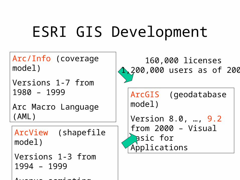
ESRI GIS Development
Arc/Info (coverage model)
Versions 1-7 from 1980 – 1999
Arc Macro Language (AML)
ArcView (shapefile model)
Versions 1-3 from 1994 – 1999
Avenue scripting language
ArcGIS (geodatabase model)
Version 8.0, …, 9.2 from 2000 – Visual Basic for Applications
160,000 licenses1,200,000 users as of 2004
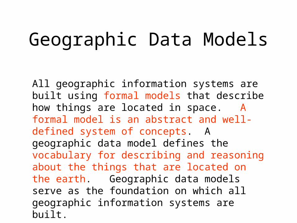
Geographic Data Models
All geographic information systems are built using formal models that describe how things are located in space. A formal model is an abstract and well-defined system of concepts. A geographic data model defines the vocabulary for describing and reasoning about the things that are located on the earth. Geographic data models serve as the foundation on which all geographic information systems are built.
Scott Morehouse, Preface to “Modeling our World”

Data Models
• A geographic data model is a structure for organizing geospatial data so that it can be easily stored and retrieved.
Geographic coordinates
Tabular attributes
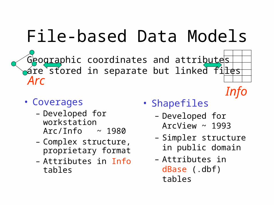
File-based Data Models
• Coverages– Developed for
workstation Arc/Info ~ 1980
– Complex structure, proprietary format
– Attributes in Info tables
• Shapefiles– Developed for
ArcView ~ 1993
– Simpler structure in public domain
– Attributes in dBase (.dbf) tables
Geographic coordinates and attributesare stored in separate but linked files
ArcInfo
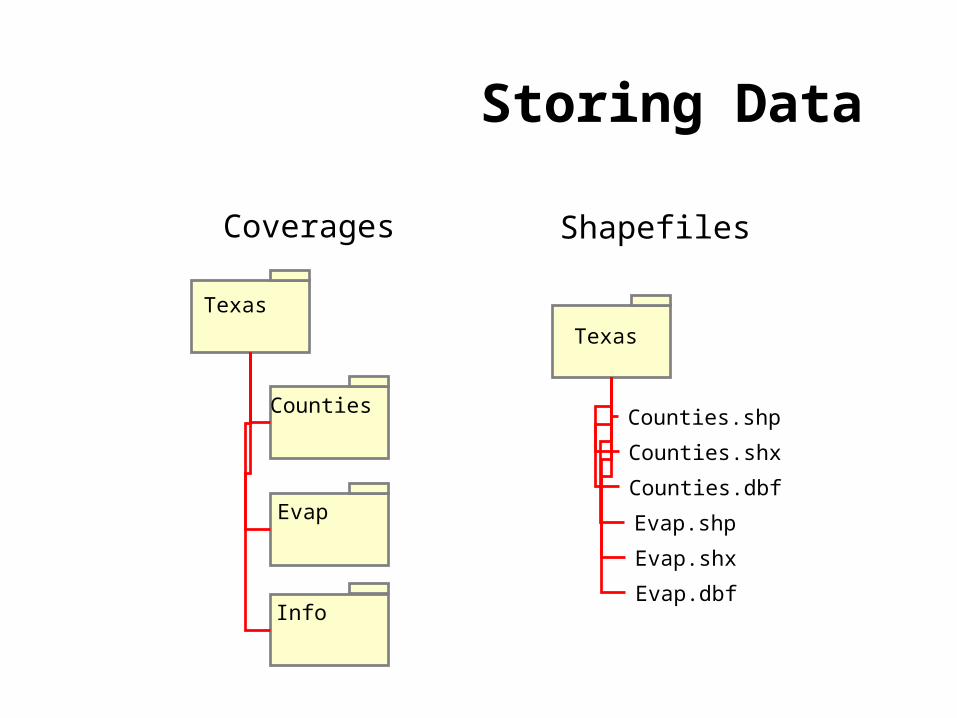
Storing Data
Coverages Shapefiles
Texas
Counties
Evap
Info
Texas
Counties.shp
Counties.shx
Counties.dbf
Evap.shp
Evap.shx
Evap.dbf

Storing Data• Coverages and Shapefiles
– Coverages are stored partially in their own folder and partially in the common INFO folder. Shapefiles are stored in three to five files (with extensions .shp, .shx, .dbf, .sbx and .sbn).
– Coverages store common boundaries between polygons only once, to avoid redundancy. Shapefiles store all the geometry of each polygon regardless of redundancy.
– Coverage features are single lines or single polygons. Shapefiles allow features to have multiple, disconnected, intersecting and overlapping components.
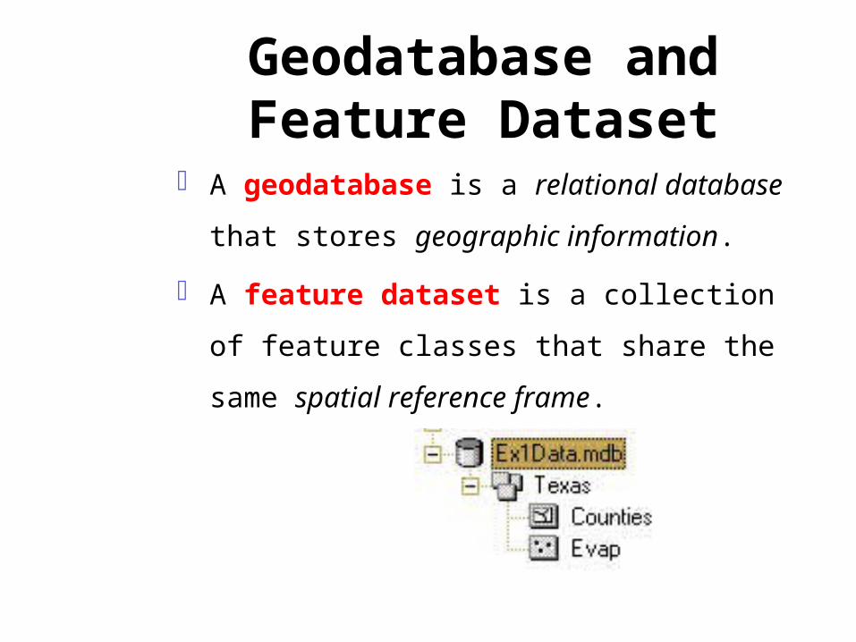
Geodatabase and Feature Dataset
A geodatabase is a relational database
that stores geographic information.
A feature dataset is a collection of
feature classes that share the same
spatial reference frame.
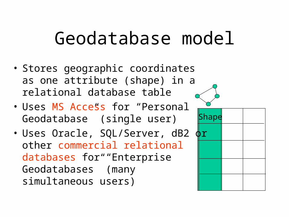
Geodatabase model
• Stores geographic coordinates as one attribute (shape) in a relational database table
• Uses MS Access for “Personal Geodatabase” (single user)
• Uses Oracle, SQL/Server, dB2 or other commercial relational databases for “Enterprise Geodatabases” (many simultaneous users)
Shape
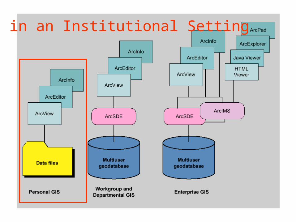
GIS in an Institutional Setting

ArcGIS Geodatabase
Geodatabase
Feature Dataset
Feature Class
Geometric Network
Object Class
Relationship
Workspace
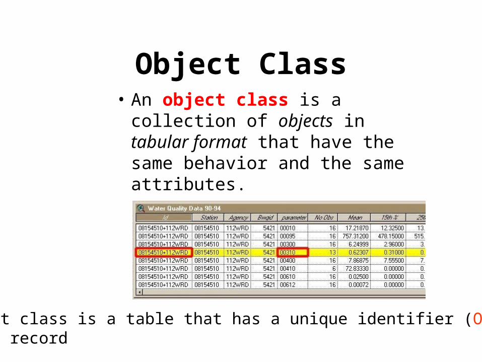
Object Class• An object class is a collection of
objects in tabular format that have the same behavior and the same attributes.
An object class is a table that has a unique identifier (ObjectID)for each record
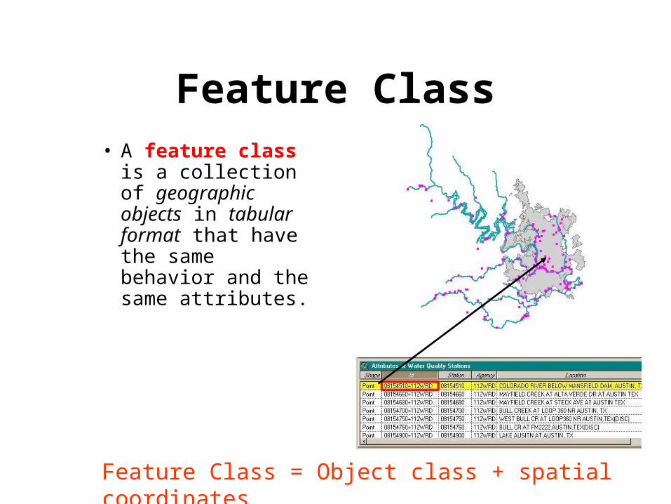
Feature Class
• A feature class is a collection of geographic objects in tabular format that have the same behavior and the same attributes.
Feature Class = Object class + spatial coordinates

Relationship
• A relationship is an association or link between two objects in a database.
• A relationship can exist between spatial objects (features in feature classes), non-spatial objects (objects in object classes), or between spatial and non-spatial objects.

RelationshipRelationship between non-spatial objects
Water QualityData
Water Quality Parameters
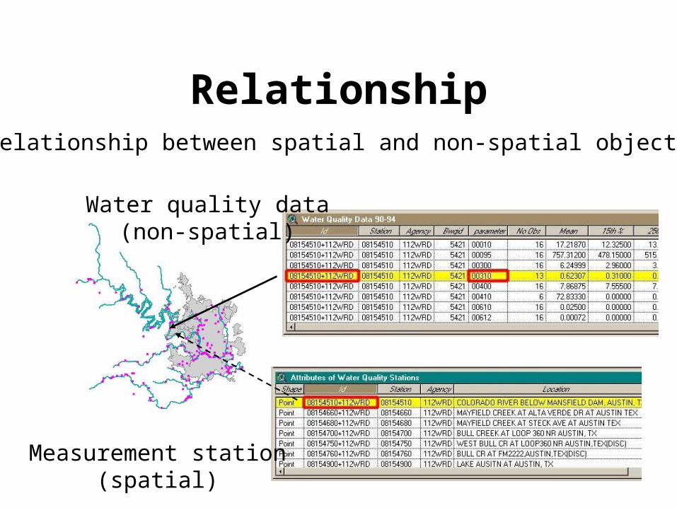
RelationshipRelationship between spatial and non-spatial objects
Water quality data(non-spatial)
Measurement station(spatial)
Network
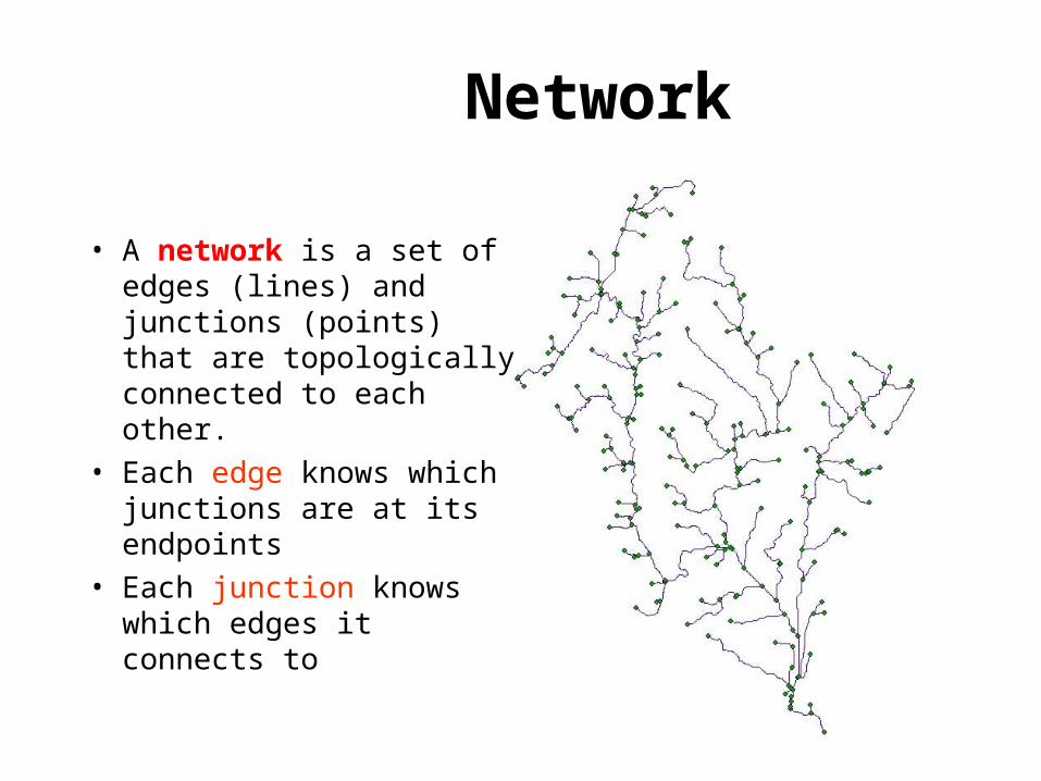
• A network is a set of edges (lines) and junctions (points) that are topologically connected to each other.
• Each edge knows which junctions are at its endpoints
• Each junction knows which edges it connects to
Introduction to GIS Software
• How data are stored in ArcGIS
• Components of ArcGIS – ArcMap, ArcCatalog and ArcToolbox
• GIS on the Web – ArcGIS Server, ArcIMS, Google Earth.
• Extensions of ArcGIS – spatial analyst, geostatistical analyst and 3D analyst
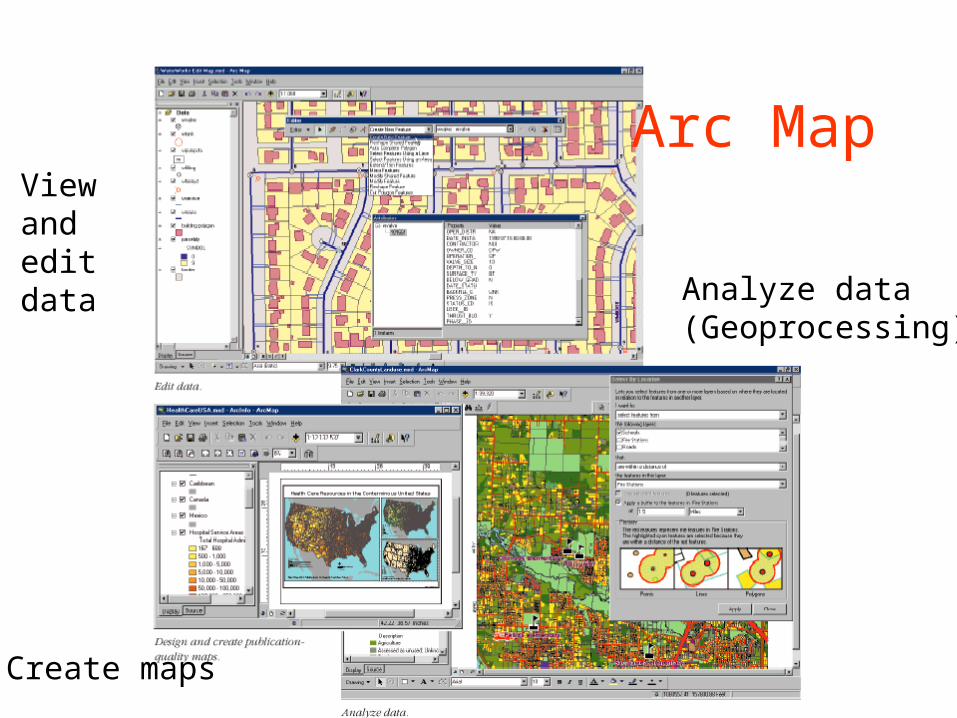
Arc Map
Create maps
Viewand edit data Analyze data
(Geoprocessing)
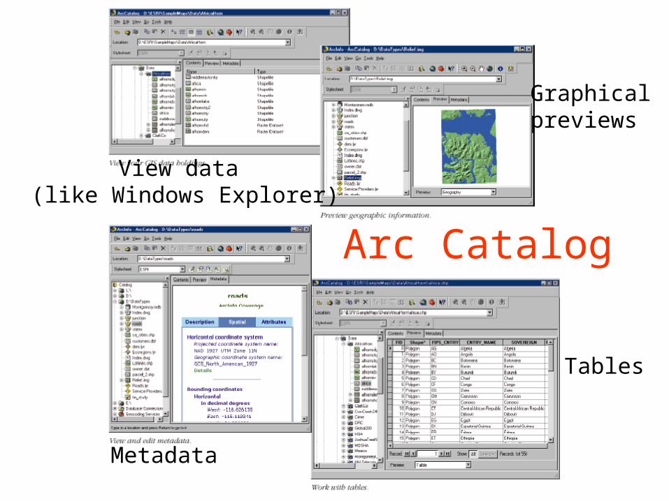
Arc Catalog
View data (like Windows Explorer)
Graphicalpreviews
Metadata
Tables
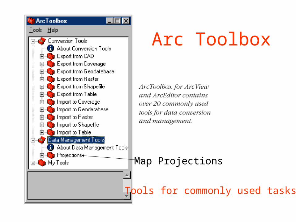
Arc Toolbox
Map Projections
Tools for commonly used tasks
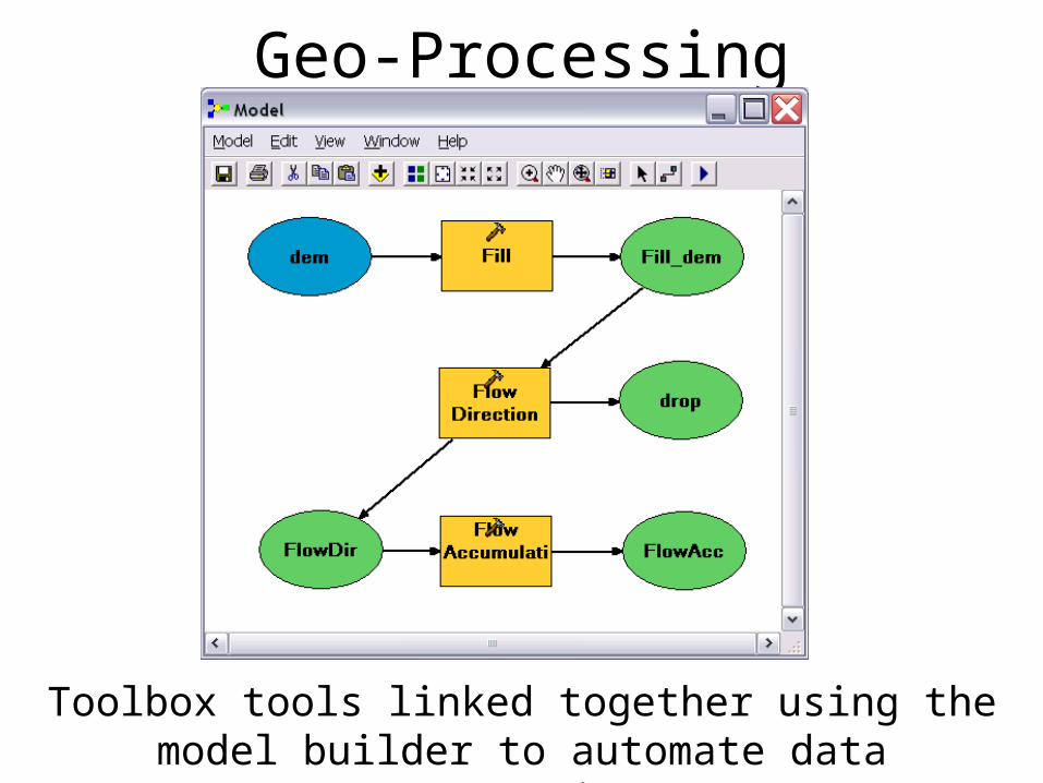
Geo-Processing
Toolbox tools linked together using the model builder to automate data processing
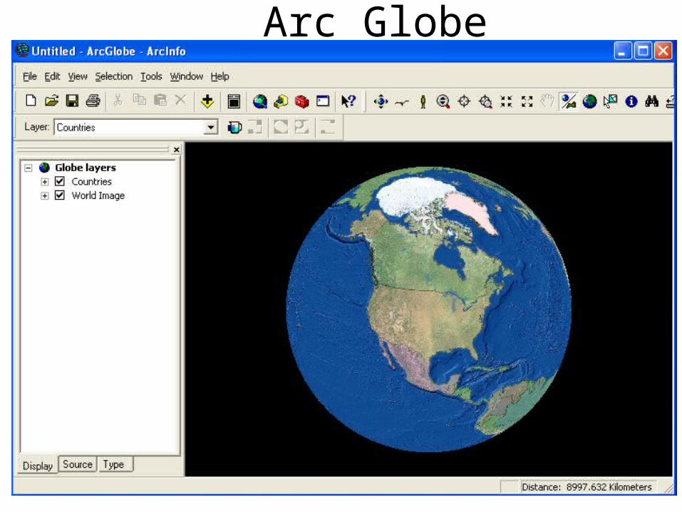
Arc Globe
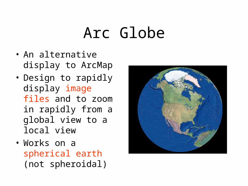
Arc Globe• An alternative display
to ArcMap• Design to rapidly
display image files and to zoom in rapidly from a global view to a local view
• Works on a spherical earth (not spheroidal)
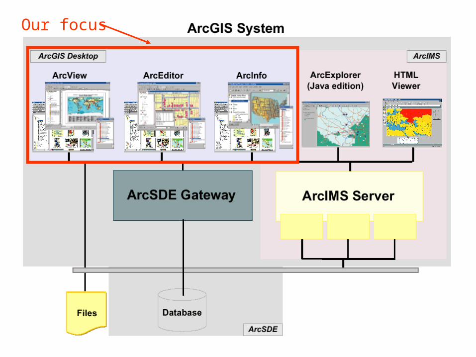
Our focus

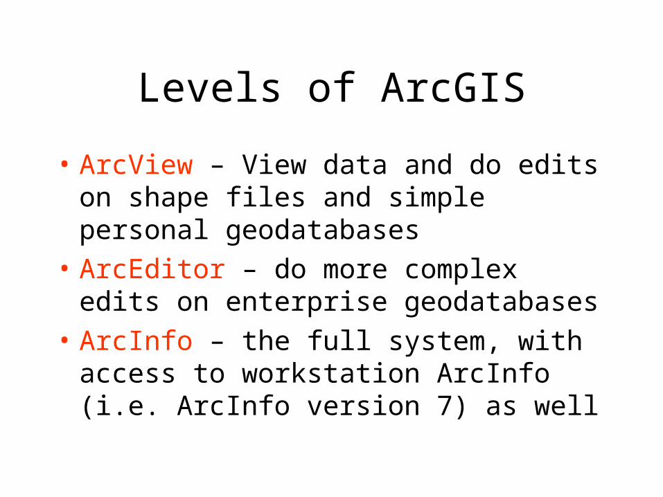
Levels of ArcGIS
• ArcView – View data and do edits on shape files and simple personal geodatabases
• ArcEditor – do more complex edits on enterprise geodatabases
• ArcInfo – the full system, with access to workstation ArcInfo (i.e. ArcInfo version 7) as well

Licenses and Keycodes
License manager keeps track of number of simultaneous users and limits them to allowable number. If you can’t get an available license in LRC, ask the proctor to restart the ArcGIS license manager. At USU contact Paul Rew to get the license manage restarted.
Introduction to GIS Software
• How data are stored in ArcGIS
• Components of ArcGIS – ArcMap, ArcCatalog and ArcToolbox
• GIS on the Web – ArcGIS Server, ArcIMS, Google Earth.
• Extensions of ArcGIS – spatial analyst, geostatistical analyst and 3D analyst
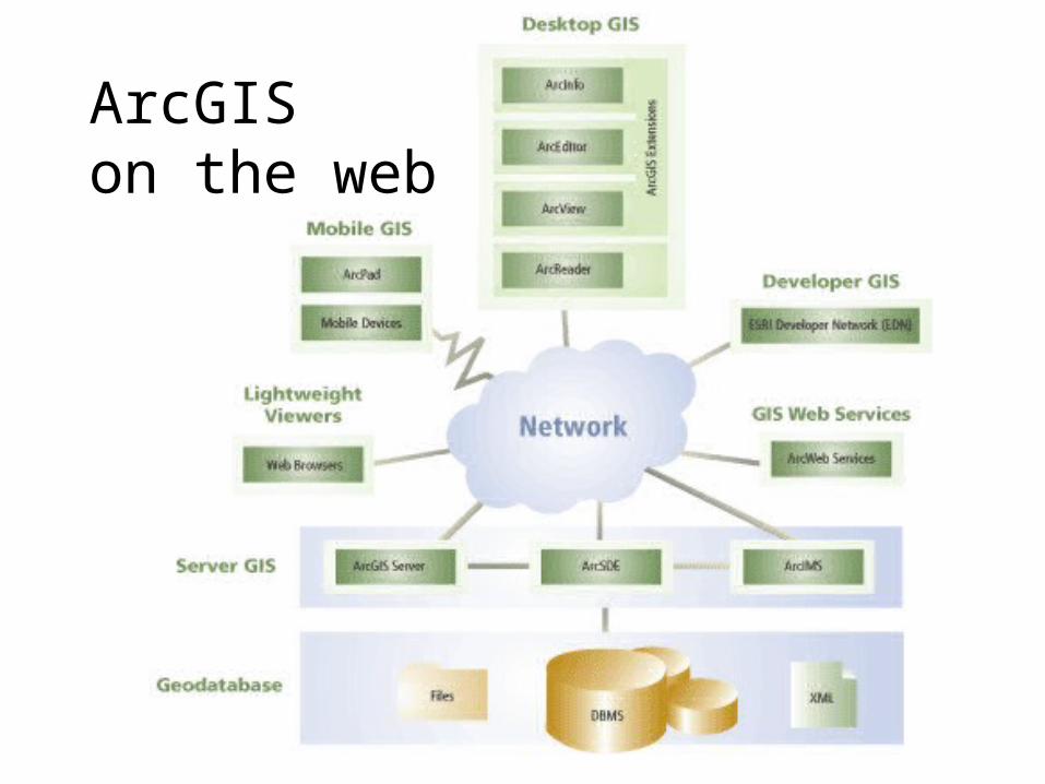
ArcGIS on the web

An ArcIMS based Watershed Information System Map Server
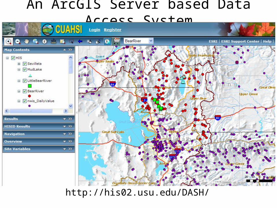
An ArcGIS Server based Data Access System
http://his02.usu.edu/DASH/
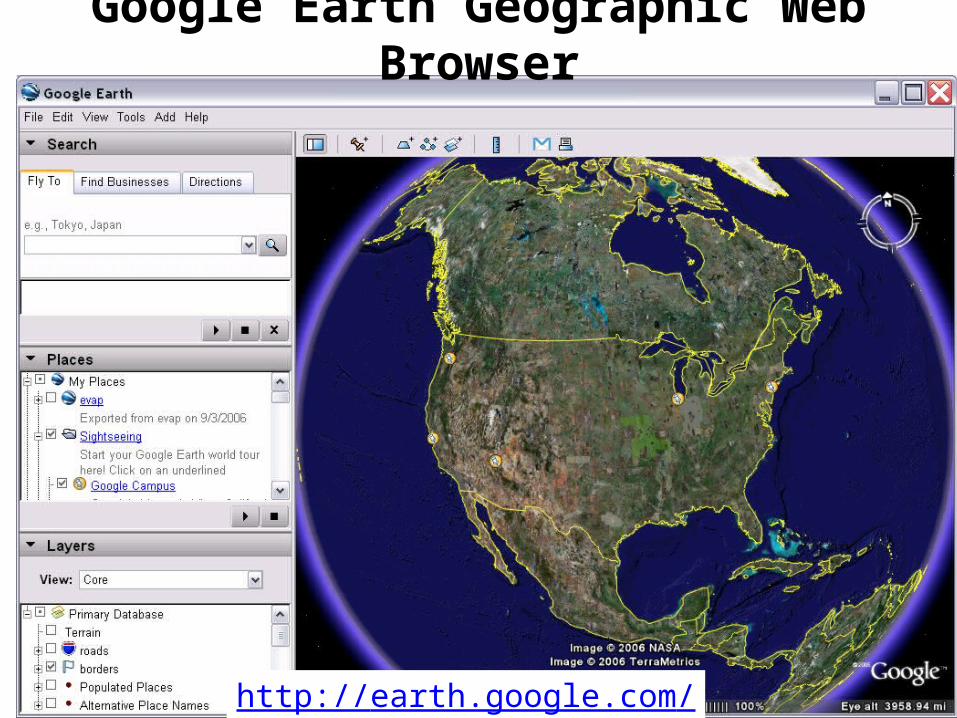
Google Earth Geographic Web Browser
http://earth.google.com/
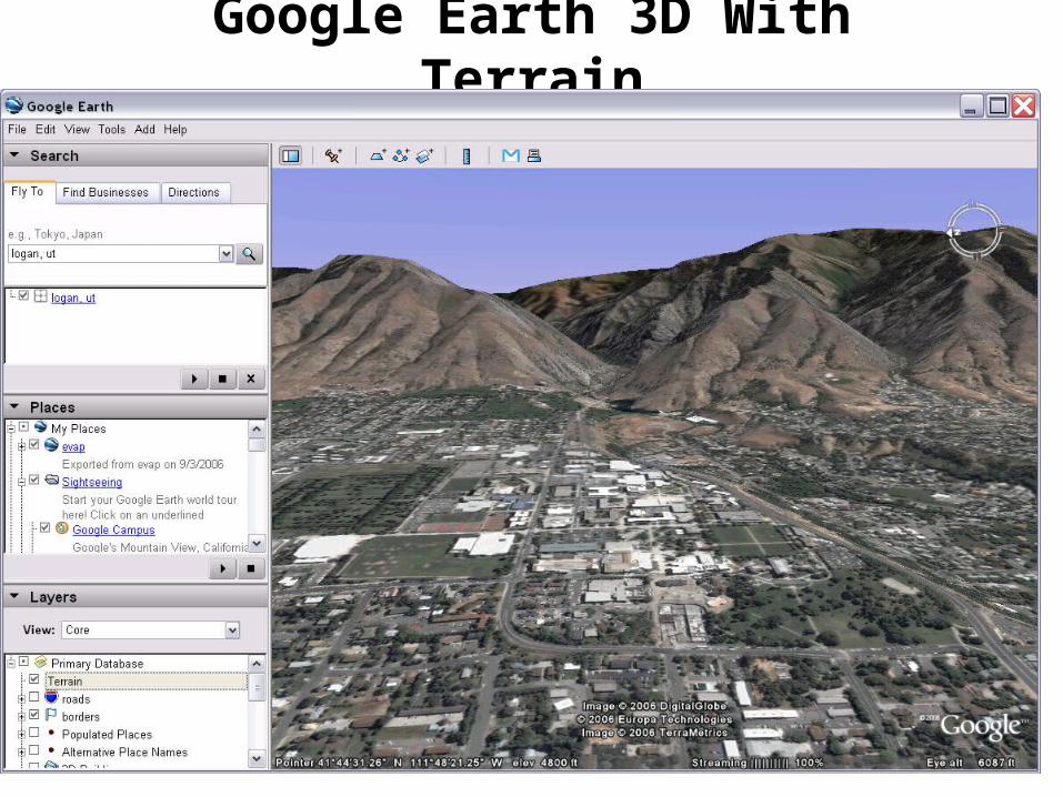
Google Earth 3D With Terrain
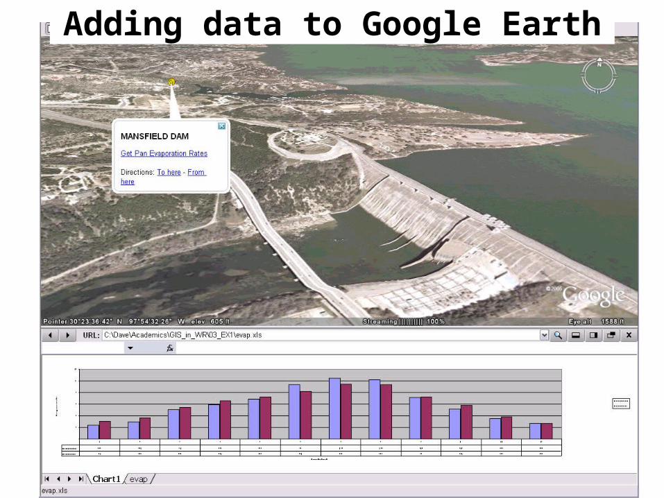
Adding data to Google Earth
Introduction to GIS Software
• How data are stored in ArcGIS
• Components of ArcGIS – ArcMap, ArcCatalog and ArcToolbox
• GIS on the Web – ArcGIS Server, ArcIMS, Google Earth.
• Extensions of ArcGIS – spatial analyst, geostatistical analyst and 3D analyst
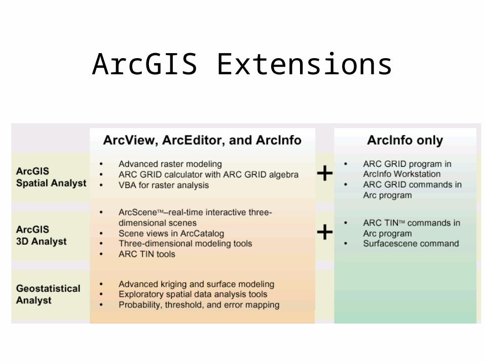
ArcGIS Extensions
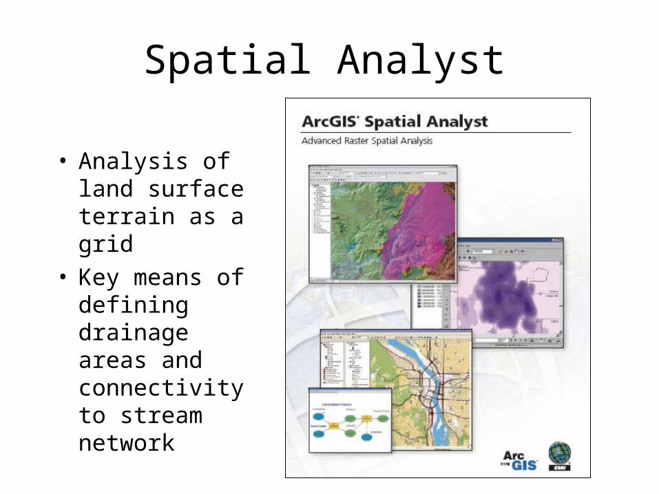
Spatial Analyst
• Analysis of land surface terrain as a grid
• Key means of defining drainage areas and connectivity to stream network

Grid Datasets• Cellular-based data structure composed of square
cells of equal size arranged in rows and columns.• The grid cell size and extension (number of rows
and columns), as well as the value at each cell have to be stored as part of the grid definition.
Number of columns
Num
ber
of
row
s
Cell size
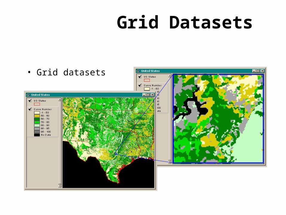
Grid Datasets
• Grid datasets

Geostatistical Analyst
• Interpolation of points to a grid using statistical correlation
• Produces a standard error of estimate of each map location
AlaskaSiberia
Biomass in the Arctic Ocean
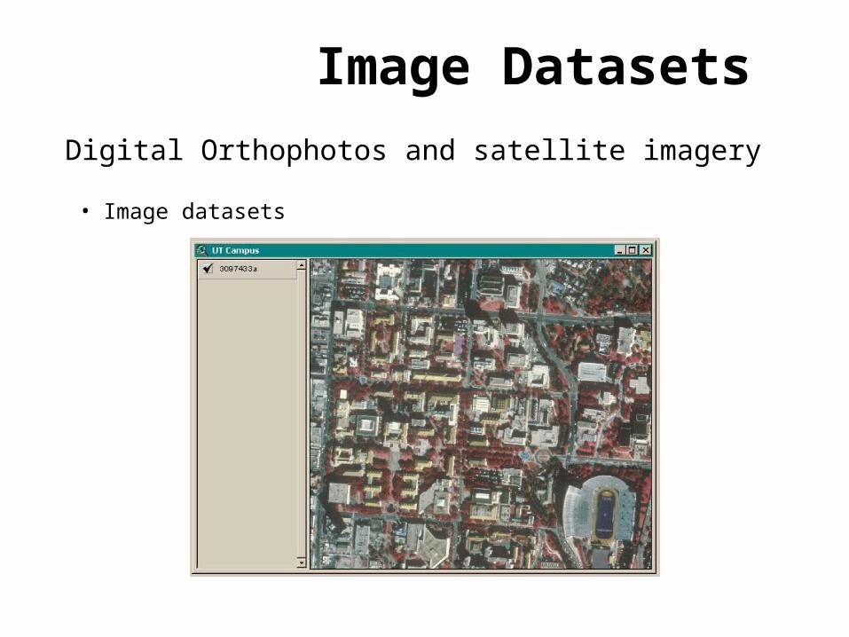
Image Datasets
• Image datasets
Digital Orthophotos and satellite imagery
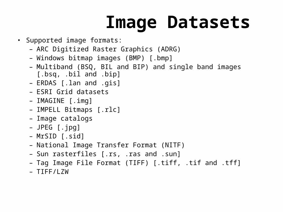
Image Datasets• Supported image formats:
– ARC Digitized Raster Graphics (ADRG)– Windows bitmap images (BMP) [.bmp]– Multiband (BSQ, BIL and BIP) and single band images [.bsq, .bil
and .bip]– ERDAS [.lan and .gis]– ESRI Grid datasets– IMAGINE [.img]– IMPELL Bitmaps [.rlc]– Image catalogs– JPEG [.jpg]– MrSID [.sid]– National Image Transfer Format (NITF)– Sun rasterfiles [.rs, .ras and .sun]– Tag Image File Format (TIFF) [.tiff, .tif and .tff]– TIFF/LZW
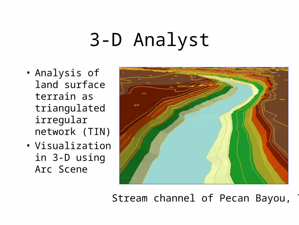
3-D Analyst
• Analysis of land surface terrain as triangulated irregular network (TIN)
• Visualization in 3-D using Arc Scene
Stream channel of Pecan Bayou, TX

TIN Datasets
• TIN datasets
Points and breaklines from which a TIN is
constructed.
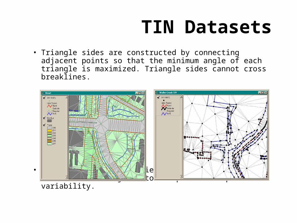
• Triangle sides are constructed by connecting adjacent points so that the minimum angle of each triangle is maximized. Triangle sides cannot cross breaklines.
• The TIN format is efficient to store data because the resolution adjusts to the parameter spatial variability.
TIN Datasets
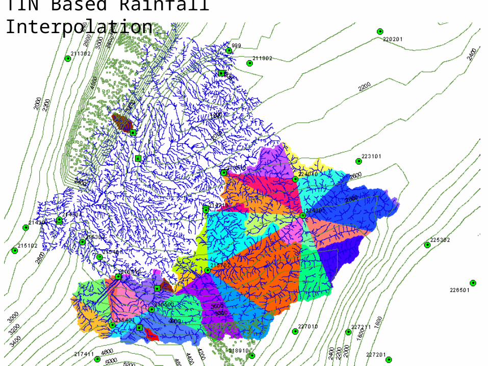
TIN Based Rainfall Interpolation
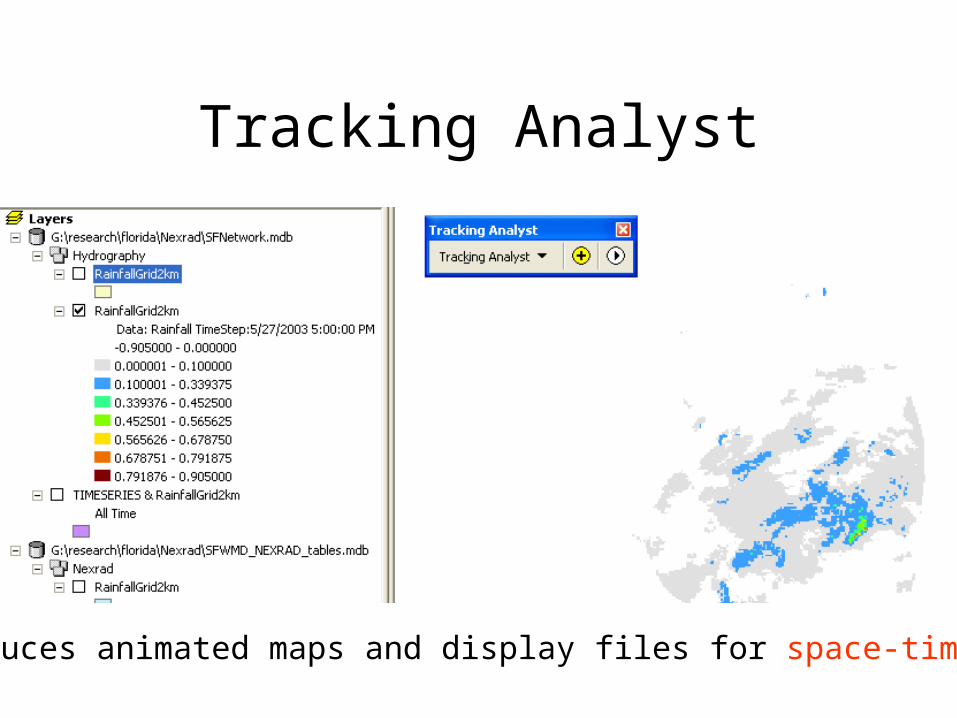
Tracking Analyst
Produces animated maps and display files for space-time data

ESRI Online Reference Materials
• http://www.esri.com/library/ Reference material and brochures about ESRI products
• ArcGIS summary: http://www.esri.com/library/brochures/pdfs/arcgis.pdf
• Spatial Analyst summary: http://www.esri.com/library/brochures/pdfs/spatialanalystbro.pdf
• ESRI Virtual Campus – provides online training http://campus.esri.com/