Embed Size (px)
Citation preview

Jordan Meteorological Department (JMD)
WMO Workshop on Climate Monitoring including the implementation of
Climate Watch Systems in West AsiaJordan Country Report
Dr.Ahmad Abu obeid
Amman-Jordan 27-29 May
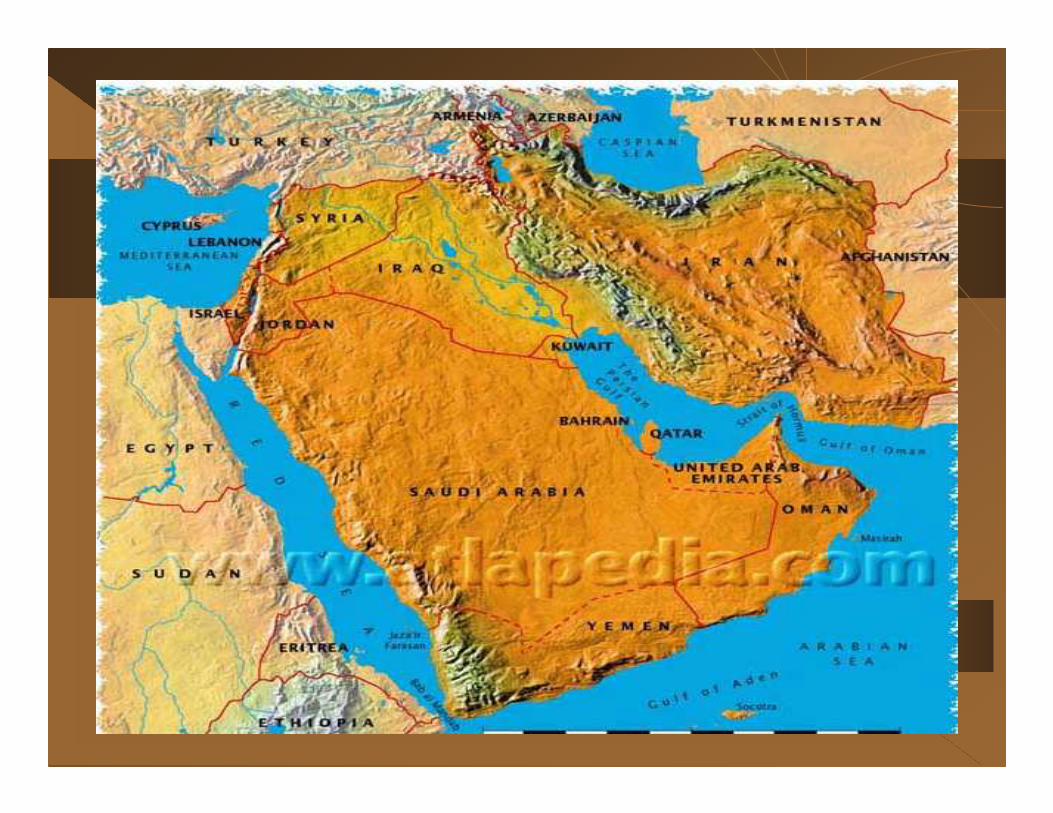

Areatotal: 92,300 sq km land: 91,971 sq km water: 329 sq km26 km coast line
lowest point: Dead Sea -408 m highest point: Jabal Ram 1,734 m
mostly desert plateau in east, highland area in west; Great Rift Valley separates East and West Banks of the Jordan River
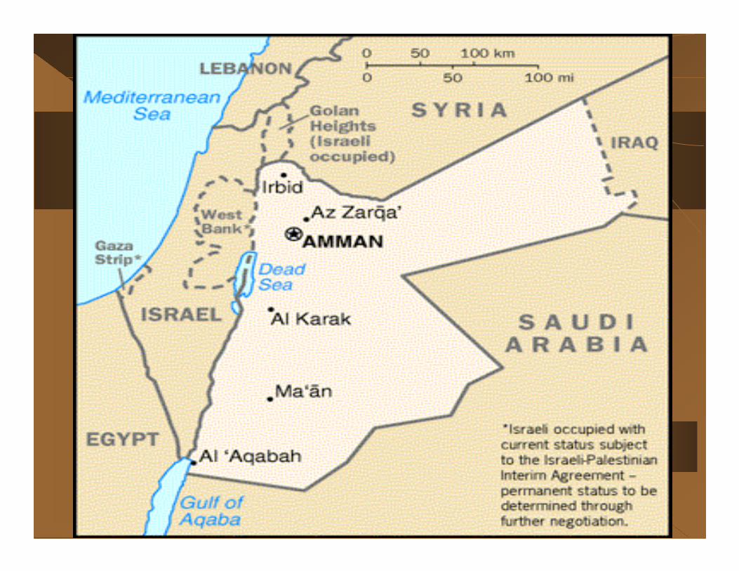
Jordan climate can be divided into 3 main types:-1. Hilly regions
2. The Ghor( Jordan valley)
3. Desert

Jordan climateMajor characteristic:-
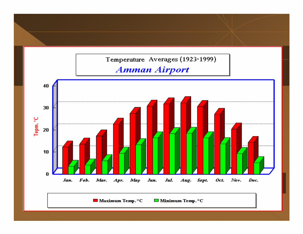
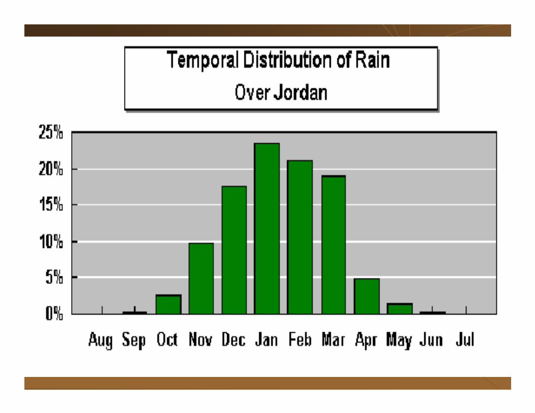
• Rainy season (November to April )and very dry weather for the rest of the year.•Hot, dry, uniform summers and cool, variable winters during which all of the precipitation occurs.• Jordan has a Mediterranean-style climate.. • Jordan long summer reaches a peak during August.• January is usually the coolest month. • Wide ranges of temperature during a twenty-four-hour period are greatest during the summer months .
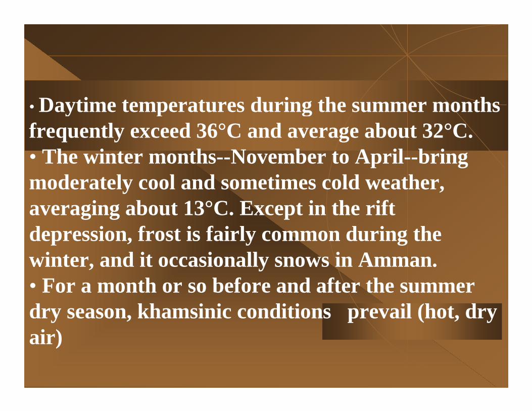
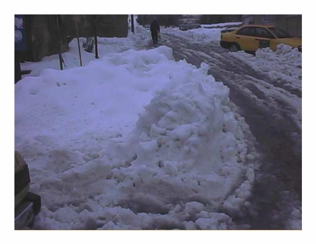
• Daytime temperatures during the summer months frequently exceed 36°C and average about 32°C. • The winter months--November to April--bring moderately cool and sometimes cold weather, averaging about 13°C. Except in the rift depression, frost is fairly common during the winter, and it occasionally snows in Amman.• For a month or so before and after the summer dry season, khamsinic conditions prevail (hot, dry air)
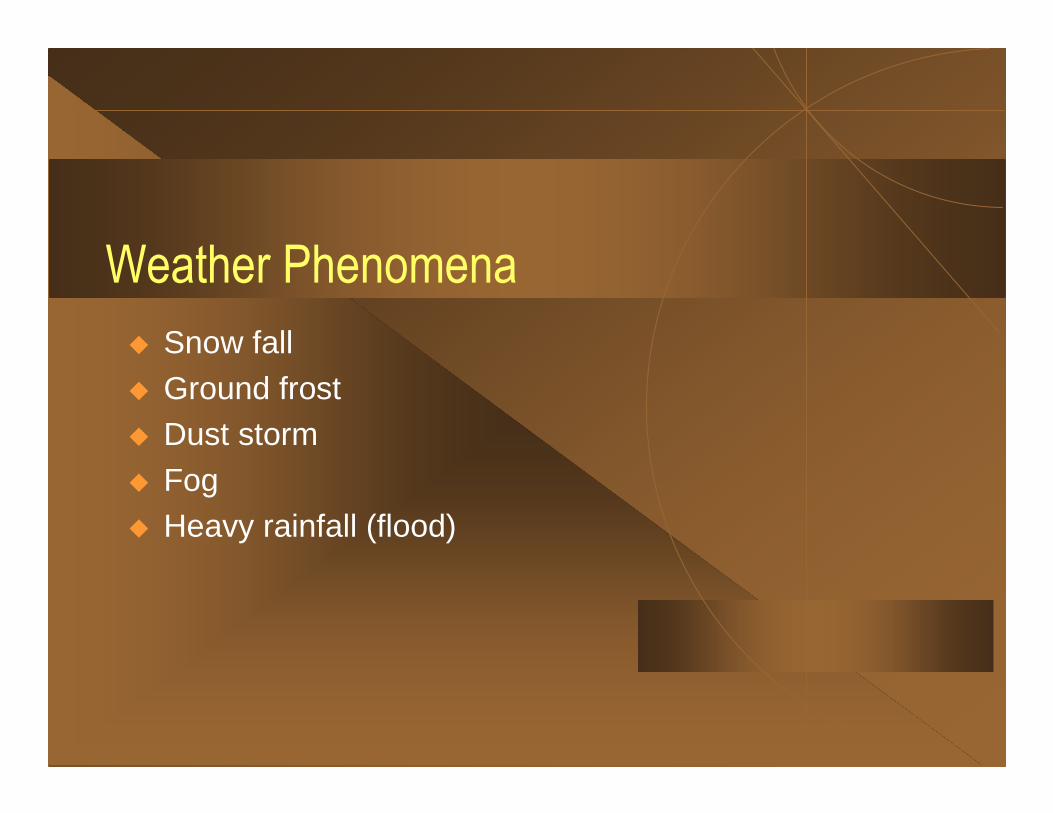
Weather Phenomena
� Snow fall� Ground frost� Dust storm� Fog� Heavy rainfall (flood)
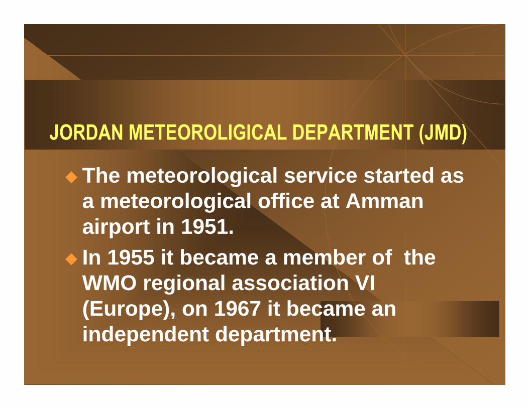
JORDAN METEOROLIGICAL DEPARTMENT (JMD)
� The meteorological service started as a meteorological office at Amman airport in 1951.
� In 1955 it became a member of the WMO regional association VI (Europe), on 1967 it became an independent department.
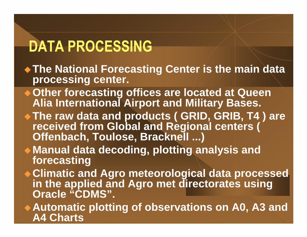
DATA PROCESSING
�The National Forecasting Center is the main data processing center.
�Other forecasting offices are located at Queen Alia International Airport and Military Bases.
�The raw data and products ( GRID, GRIB, T4 ) are received from Global and Regional centers ( Offenbach, Toulose, Bracknell ...)
�Manual data decoding, plotting analysis and forecasting
�Climatic and Agro meteorological data processed in the applied and Agro met directorates using Oracle “CDMS”.
�Automatic plotting of observations on A0, A3 and A4 Charts

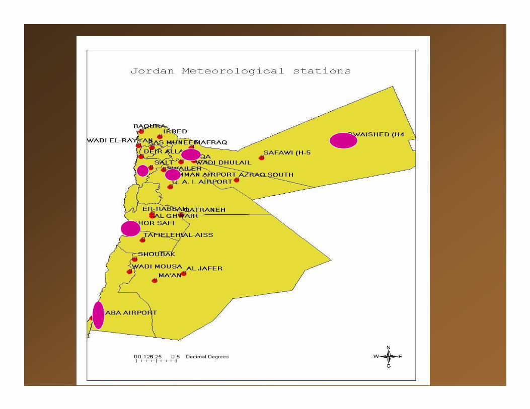
Observation Network in Jordan:� 25 Synoptic Stations� 7 Station for Aviation purposes� 10 Stations for Agriculture Observation� 36 Stations for climate observation� 8 Automatic stations� 1 Radiosonde station� Satellite station� 50 sites for Rain measurement
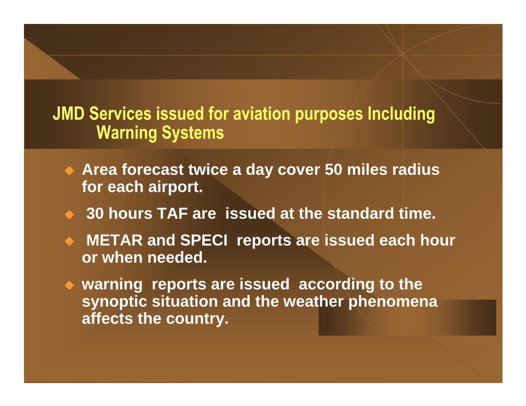
JMD Services issued for aviation purposes IncludingWarning Systems
� Area forecast twice a day cover 50 miles radius for each airport.
� 30 hours TAF are issued at the standard time.
� METAR and SPECI reports are issued each hour or when needed.
� warning reports are issued according to the synoptic situation and the weather phenomena affects the country.
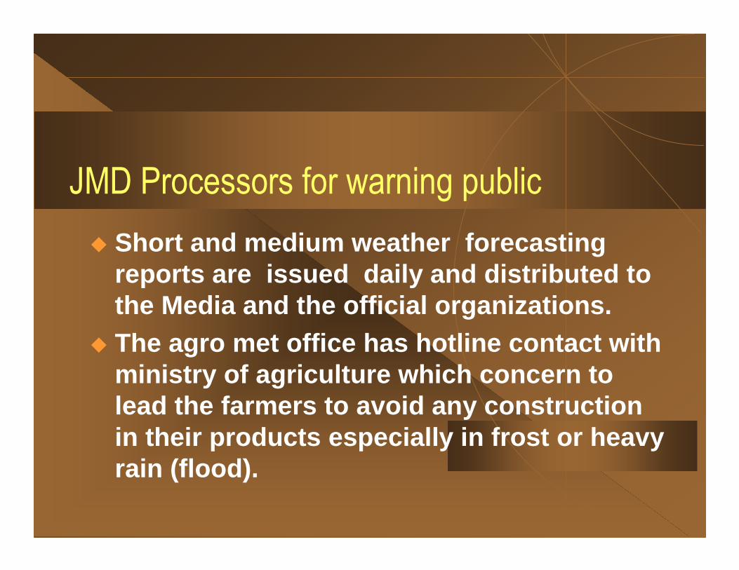
JMD Processors for warning public
� Short and medium weather forecasting reports are issued daily and distributed to the Media and the official organizations.
� The agro met office has hotline contact with ministry of agriculture which concern to lead the farmers to avoid any construction in their products especially in frost or heavy rain (flood).
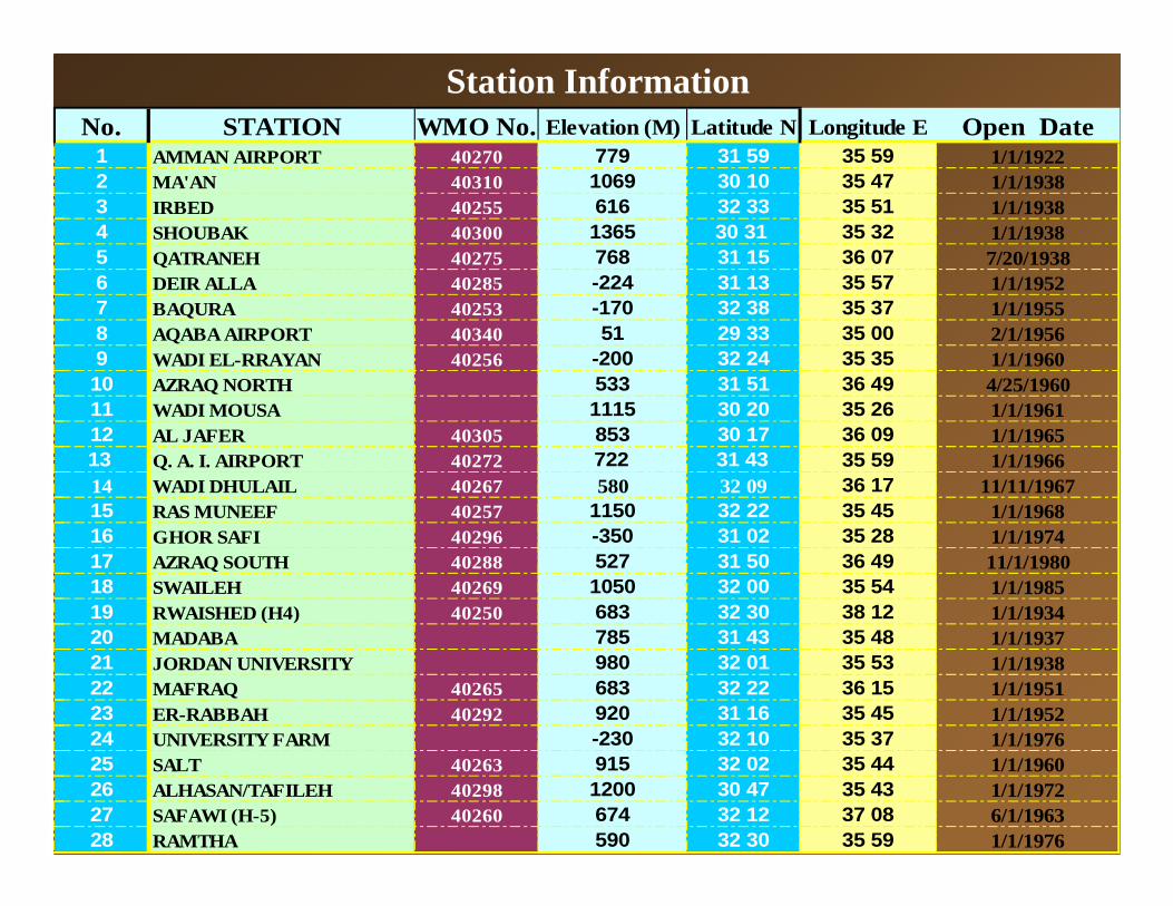
Station InformationNo. STATION WMO No. Elevation (M) Latitude N Longitude E Open Date
1 AMMAN AIRPORT 40270 779 31 59 35 59 1/1/19222 MA'AN 40310 1069 30 10 35 47 1/1/19383 IRBED 40255 616 32 33 35 51 1/1/19384 SHOUBAK 40300 1365 30 31 35 32 1/1/19385 QATRANEH 40275 768 31 15 36 07 7/20/19386 DEIR ALLA 40285 -224 31 13 35 57 1/1/19527 BAQURA 40253 -170 32 38 35 37 1/1/19558 AQABA AIRPORT 40340 51 29 33 35 00 2/1/19569 WADI EL-RRAYAN 40256 -200 32 24 35 35 1/1/196010 AZRAQ NORTH 533 31 51 36 49 4/25/196011 WADI MOUSA 1115 30 20 35 26 1/1/196112 AL JAFER 40305 853 30 17 36 09 1/1/196513 Q. A. I. AIRPORT 40272 722 31 43 35 59 1/1/196614 WADI DHULAIL 40267 580 32 09 36 17 11/11/196715 RAS MUNEEF 40257 1150 32 22 35 45 1/1/196816 GHOR SAFI 40296 -350 31 02 35 28 1/1/197417 AZRAQ SOUTH 40288 527 31 50 36 49 11/1/198018 SWAILEH 40269 1050 32 00 35 54 1/1/198519 RWAISHED (H4) 40250 683 32 30 38 12 1/1/193420 MADABA 785 31 43 35 48 1/1/193721 JORDAN UNIVERSITY 980 32 01 35 53 1/1/193822 MAFRAQ 40265 683 32 22 36 15 1/1/195123 ER-RABBAH 40292 920 31 16 35 45 1/1/195224 UNIVERSITY FARM -230 32 10 35 37 1/1/197625 SALT 40263 915 32 02 35 44 1/1/196026 ALHASAN/TAFILEH 40298 1200 30 47 35 43 1/1/197227 SAFAWI (H-5) 40260 674 32 12 37 08 6/1/196328 RAMTHA 590 32 30 35 59 1/1/1976
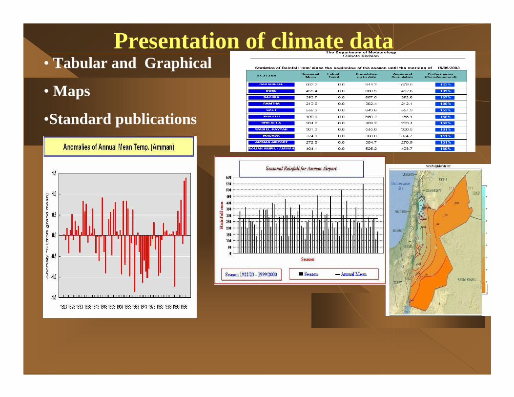
Presentation of climate data• Tabular and Graphical
• Maps
•Standard publications
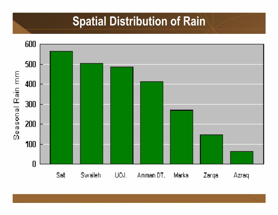
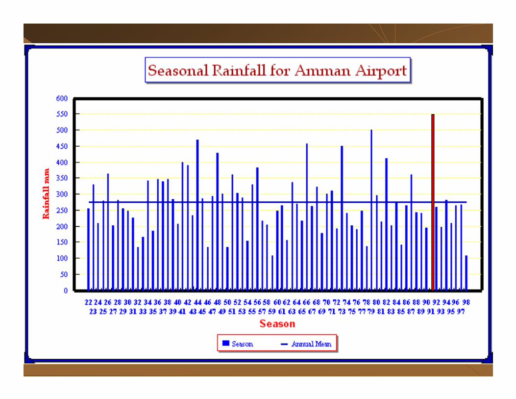
Spatial Distribution of Rain