Embed Size (px)
Citation preview
Date: 28.06.2019
Place: AGGF
Classroom: 3a
University of Banja Luka
Knowledge FOr Resilient
soCiEty
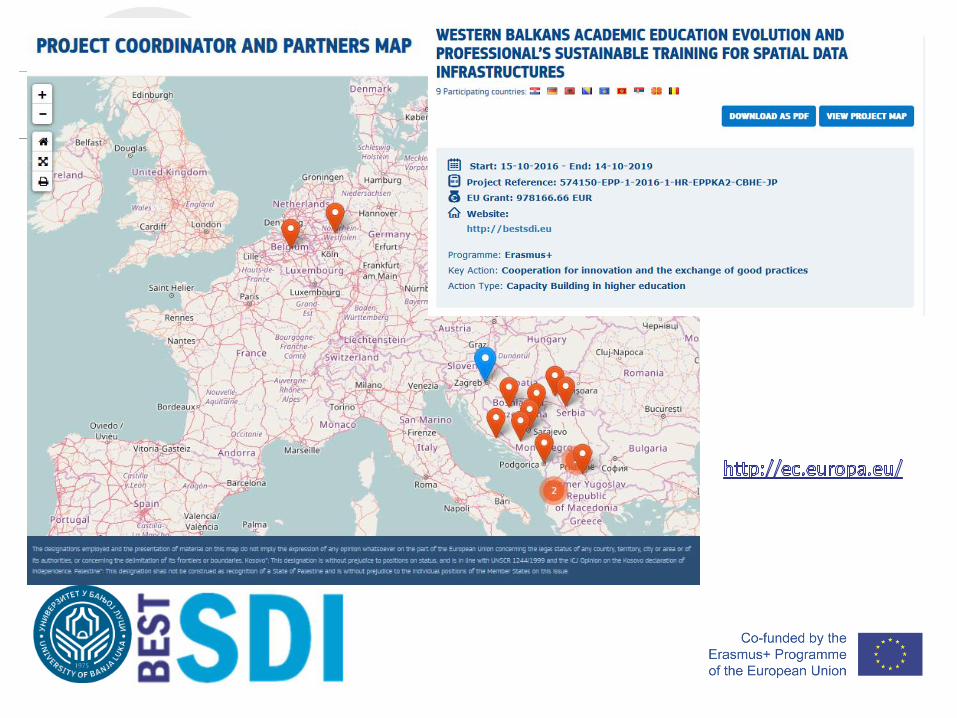
WESTERN BALKANS ACADEMIC EDUCATION EVOLUTION AND
PROFESSIONAL’S SUSTAINABLE TRAINING FOR SPATIAL DATA
INFRASTRUCTURES
The European Commission support for the production of this publication does not constitute an endorsement of the contents which reflects theviews only of the authors, and the Commission cannot be held responsible for any use which may be made of the information contained therein.
BESTSDI Project
Slavko Vasiljević
Mladen Amović

• The wider objectives of the BESTSDI project is to improve thequality of higher education in Geographical Science andTechnology field, SDI and geodesy, enhance its relevance forthe labor market and society and to improve the level ofcompetences and skills in HEI's by
• Developing new and innovative education programs within thefield of SDI. These wider objectives are fully compliant with thepriorities of the Capacity Building projects within the Erasmus+program.
BESTSDI objectives
• The specific project objectives are to develop, test and adaptnew curricula, courses, learning material and tools within thefield of SDI. In doing so, existing undergraduate and graduategeodesy and geoinformatics curricula’s in the academicinstitutions in the WB region will be lifter to higher levels,recognizing the of spatial data for modern society and itsdevelopment. By the incorporation of SDI concept and othermodern concepts based on spatial data and information, thestudents of the new courses will have the ability to provideefficiently spatial data and services to SDI users.
BESTSDI objectives
• In parallel, the project also introduces SDI and related conceptsin undergraduate and graduate study programs on academicinstitutions which profiles are well recognized as SDI users,raising awareness among the students and professionals aboutthe relevancy of SDI and advantages of well organized spatialdata.
BESTSDI objectives
• A Spatial Data Infrastructure (SDI) is a framework to share,discover and re-use spatial data among public authorities, theprivate sector and citizens. SDI’s are based on a “coordinatedseries of agreements on technology standards, institutionalagreements, and policies” (Kuhn 2005) that unlock geospatialinformation resources for a wide range of application fields, forinstance environmental monitoring and policy making,transportation planning, health care, physical planning, nationalsecurity, etc.
• They are an integral part of the e-government movement andopen data initiatives.
SDI concept
• INSPIRE is an EU Directive (2007/2/EC) aiming to establish an infrastructure forspatial information in Europe to support Community environmental policies andpolicies or activities which may have an impact on the environment(http://inspire.ec.europa.eu/). The Directive addresses problems regarding theavailability, quality, organization, accessibility and sharing of spatial information.INSPIRE may be seen as the legal framework of a European SDI.
• SDI is introduced in national legislation of all EU countries
• SDI is introduced also in national legislation of partner countries as:
• Independent law (Albania, Macedonia)
• Part of State Survey and Cadaster law (Kosovo, Serbia, Montenegro, Republic of Srpska – BiH)
• Governmental Decree (Federation of Bosnia and Herzegovina – BiH)
SDI framework
Use this font
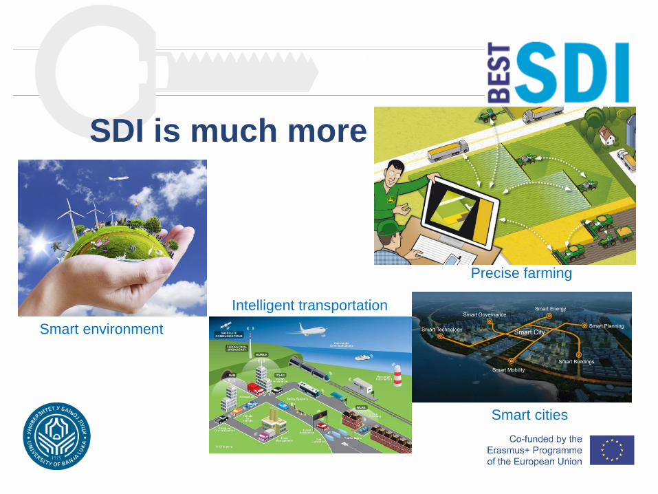
SDI is much more
Precise farming
Smart cities
Smart environment
Intelligent transportation
Project coordinator:• Sveučilište u Zagrebu (University in Zagreb) – Croatia
Program countries:• Katholieke Universiteit Leuven (Catholic University of Leuven) – Belgium
• Sveučilište u Splitu (University of Split) – Croatia
• Univerzitet “Sv. Kiril i Metodij” Skopje (Ss. Cyril and Methodius University in Skopje) – Macedonia
• Hochschule Bochum (Bochum University of Applied Sciences) – Germany
BESTSDI partners
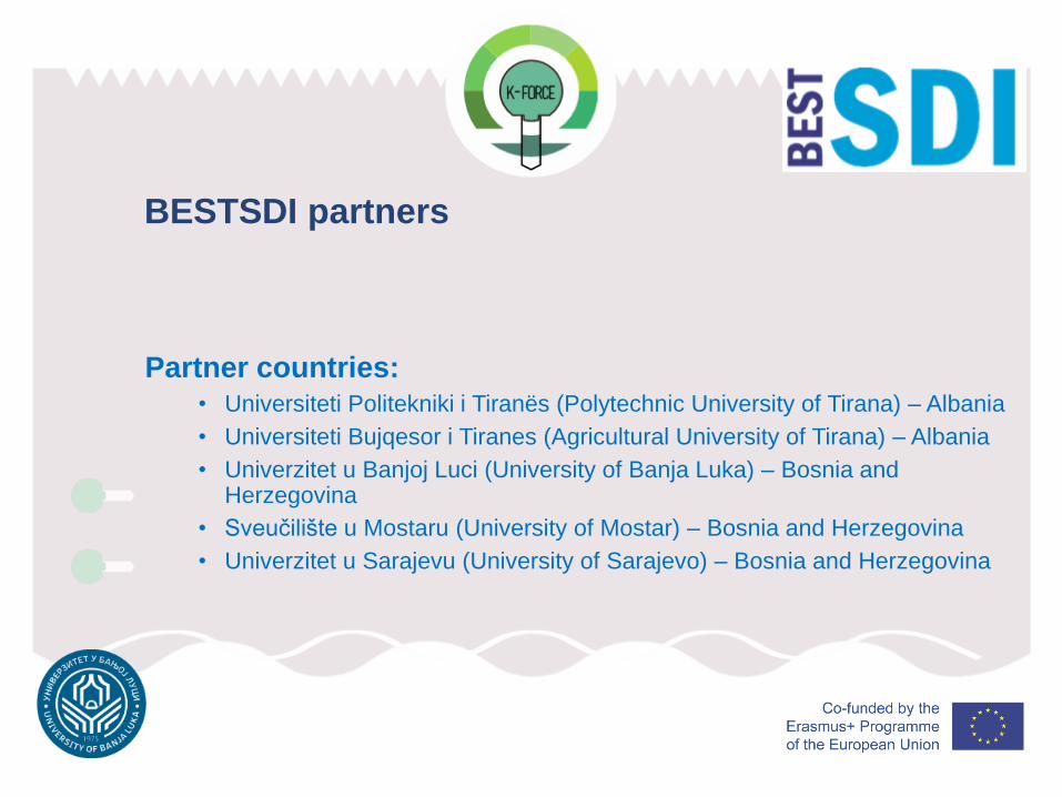
Partner countries:• Universiteti Politekniki i Tiranës (Polytechnic University of Tirana) – Albania
• Universiteti Bujqesor i Tiranes (Agricultural University of Tirana) – Albania
• Univerzitet u Banjoj Luci (University of Banja Luka) – Bosnia and Herzegovina
• Sveučilište u Mostaru (University of Mostar) – Bosnia and Herzegovina
• Univerzitet u Sarajevu (University of Sarajevo) – Bosnia and Herzegovina
BESTSDI partners
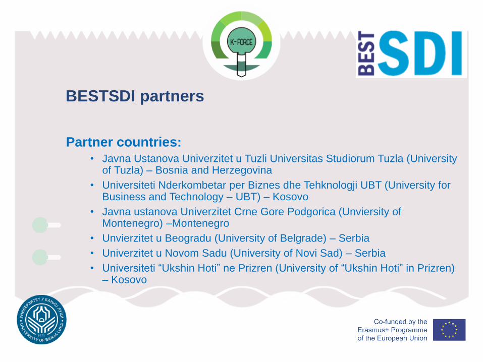
Partner countries:• Javna Ustanova Univerzitet u Tuzli Universitas Studiorum Tuzla (University
of Tuzla) – Bosnia and Herzegovina
• Universiteti Nderkombetar per Biznes dhe Tehknologji UBT (University for Business and Technology – UBT) – Kosovo
• Javna ustanova Univerzitet Crne Gore Podgorica (Unviersity of Montenegro) –Montenegro
• Unvierzitet u Beogradu (University of Belgrade) – Serbia
• Univerzitet u Novom Sadu (University of Novi Sad) – Serbia
• Universiteti “Ukshin Hoti” ne Prizren (University of “Ukshin Hoti” in Prizren) – Kosovo
BESTSDI partners
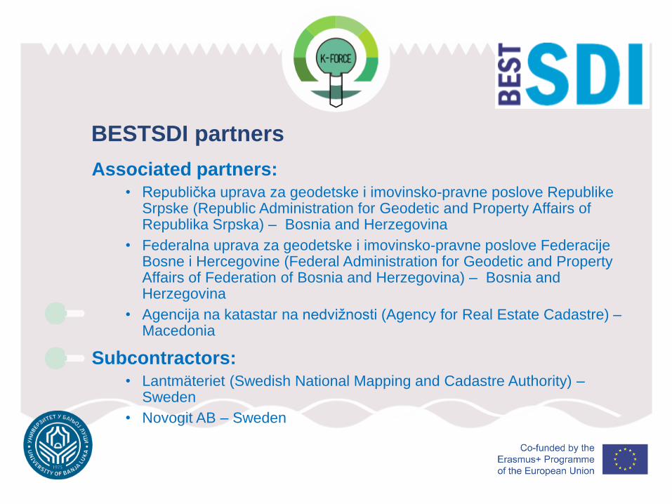
Associated partners:• Republička uprava za geodetske i imovinsko-pravne poslove Republike
Srpske (Republic Administration for Geodetic and Property Affairs of Republika Srpska) – Bosnia and Herzegovina
• Federalna uprava za geodetske i imovinsko-pravne poslove FederacijeBosne i Hercegovine (Federal Administration for Geodetic and Property Affairs of Federation of Bosnia and Herzegovina) – Bosnia and Herzegovina
• Agencija na katastar na nedvižnosti (Agency for Real Estate Cadastre) –Macedonia
Subcontractors:• Lantmäteriet (Swedish National Mapping and Cadastre Authority) –
Sweden
• Novogit AB – Sweden
BESTSDI partners
Use this font
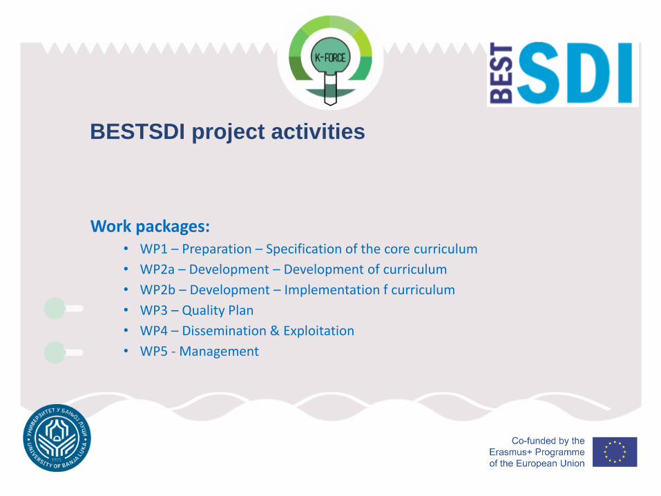
Work packages:• WP1 – Preparation – Specification of the core curriculum
• WP2a – Development – Development of curriculum
• WP2b – Development – Implementation f curriculum
• WP3 – Quality Plan
• WP4 – Dissemination & Exploitation
• WP5 - Management
BESTSDI project activities
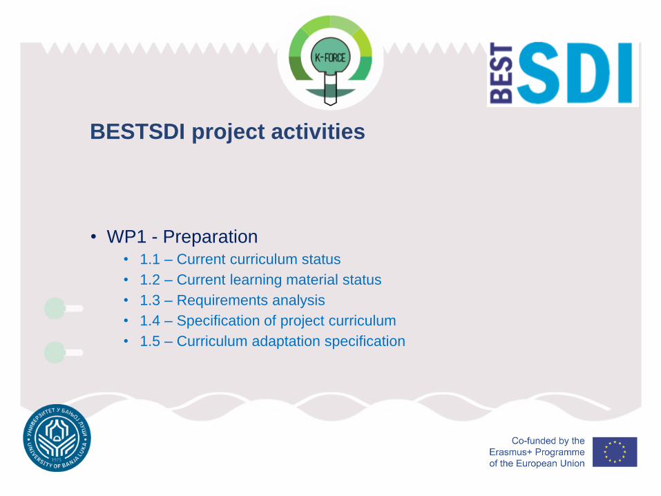
• WP1 - Preparation• 1.1 – Current curriculum status
• 1.2 – Current learning material status
• 1.3 – Requirements analysis
• 1.4 – Specification of project curriculum
• 1.5 – Curriculum adaptation specification
BESTSDI project activities
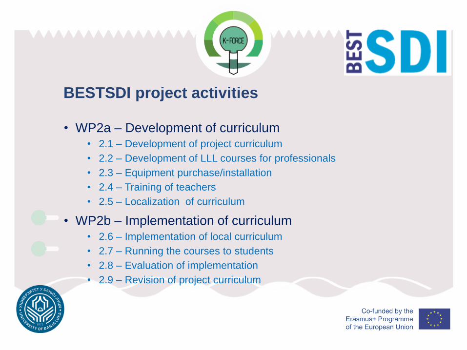
• WP2a – Development of curriculum• 2.1 – Development of project curriculum
• 2.2 – Development of LLL courses for professionals
• 2.3 – Equipment purchase/installation
• 2.4 – Training of teachers
• 2.5 – Localization of curriculum
• WP2b – Implementation of curriculum• 2.6 – Implementation of local curriculum
• 2.7 – Running the courses to students
• 2.8 – Evaluation of implementation
• 2.9 – Revision of project curriculum
BESTSDI project activities
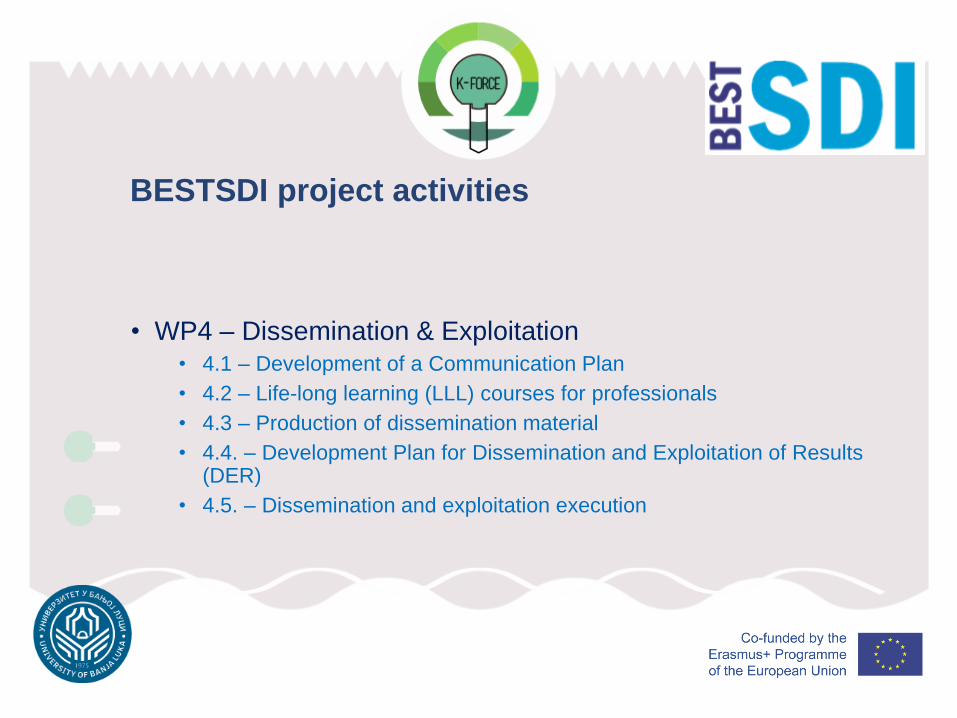
• WP4 – Dissemination & Exploitation• 4.1 – Development of a Communication Plan
• 4.2 – Life-long learning (LLL) courses for professionals
• 4.3 – Production of dissemination material
• 4.4. – Development Plan for Dissemination and Exploitation of Results (DER)
• 4.5. – Dissemination and exploitation execution
BESTSDI project activities
• WP5 - Management• 5.1 – Project Office and Management Structure
• 5.2 – Project Coordination, Administration and Monitoring
• 5.3 – National Stakeholder Coordination
BESTSDI project activities
To develop appropriate curricula, courses and their content for both targetgroups (SDI providers and SDI users) of academic institutions. Thisincludes the development of:
• SDI compulsory course for undergraduate study programs in geodesy
• SDI modules for graduate study programs in geodesy and geoinformatics
• SDI user course components (not necessary full courses) for undergraduate studyprograms of partner faculties
• SDI elective courses for graduate study program of partner faculties (SDI users)
• Development of sustainable training courses (life-long education) of broad scope ofprofessionals
BESTSDI expected results
• To disseminate the project experiences and results in order to create additional value andmultiply the impact of the results. As a consequence, dissemination will be made about bestpractices in teaching on SDI, the content of the developed courses, experience inintroduction of newly developed courses and training courses for professionals toprofessional society. Theses dissemination activities are made to targeted audience likeprofessional bodies, public authorities etc.
• To establish the necessary foundation for the participation of partner universities in theacademic SDI arena.
• To provide equipment for implementation of modernized curricula to partner universities sothat new kind of professionals will be equipped with broad cognition, knowledge and skillsabout SDI and other modern spatial data related concepts will be result of education processin involved institutions.
BESTSDI expected results
• New level of communication and cooperation among the partneruniversities with the emphasis on SDI but expanding it on institutionaland project cooperation.
• Exchange of students and staff will be fostered through the projectactivities and information about activities conducted by the partnerscommunicated among the partner universities (like InternationalDoctoral Seminar in Dubrovnik starting in 2017).
BESTSDI additional benefits
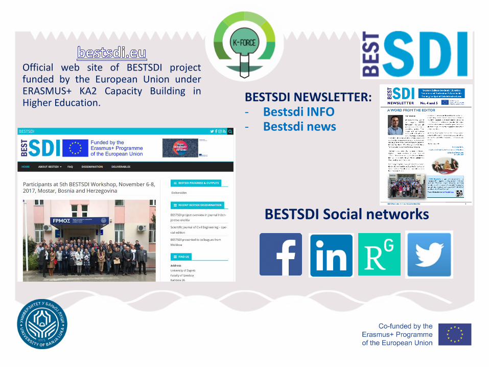
Official web site of BESTSDI projectfunded by the European Union underERASMUS+ KA2 Capacity Building inHigher Education. BESTSDI NEWSLETTER:
- Bestsdi INFO- Bestsdi news
BESTSDI Social networks
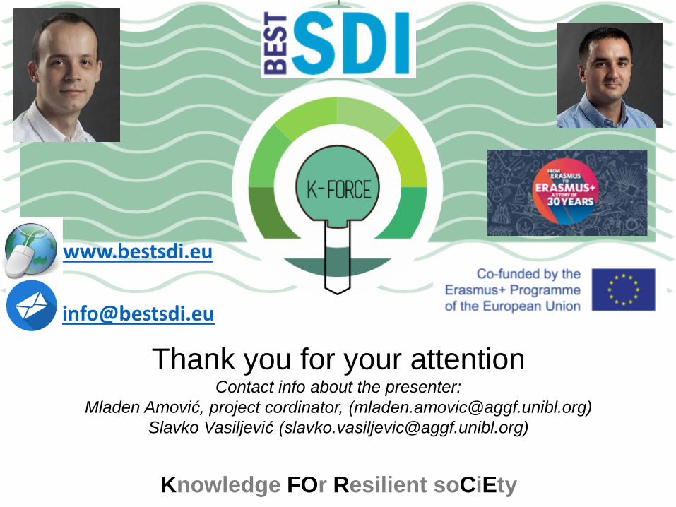
Thank you for your attentionContact info about the presenter:
Mladen Amović, project cordinator, ([email protected])
Slavko Vasiljević ([email protected])
Knowledge FOr Resilient soCiEty