Embed Size (px)
Citation preview

Land Use Change of Las Vegas, Nevada
Charles N. Hahn
UP 507-W

Project Objectives
Use satellite imagery along with other GIS datasets to show land use and population change for the Las Vegas Valley area over a substantial amount of time covering the beginning of Las Vegas to modern day
The first resort opened in 1941and was called the El Rancho

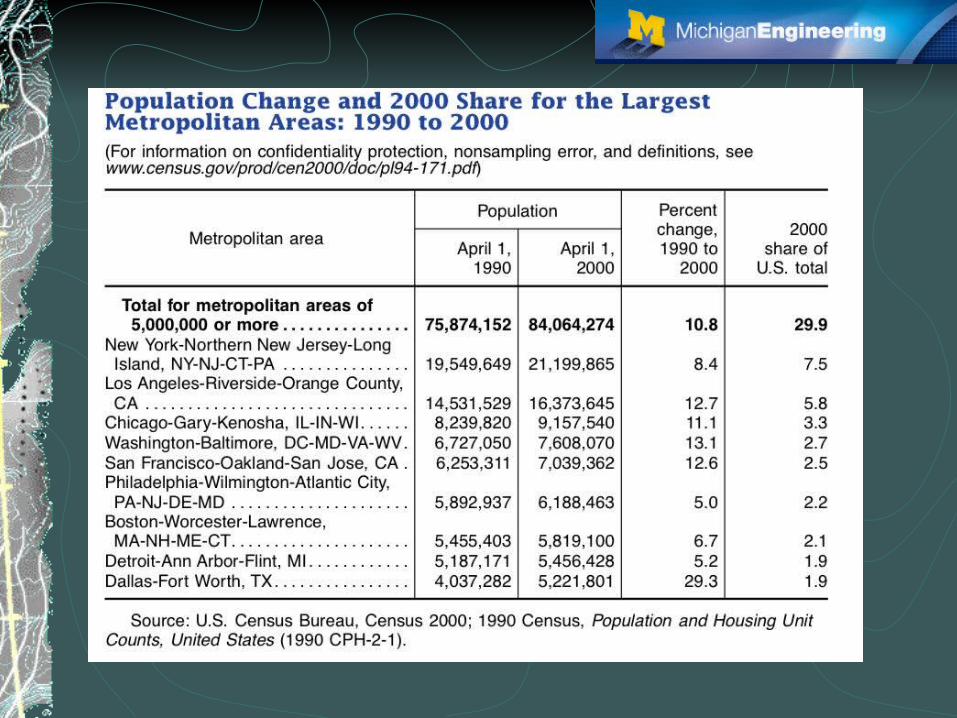
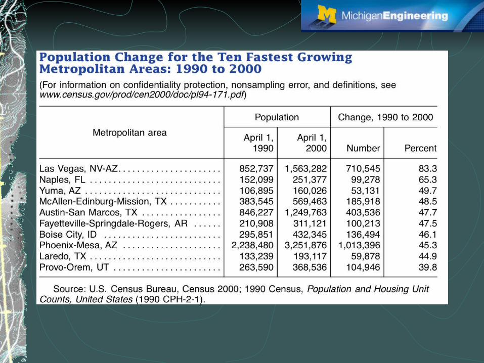
Why Las Vegas?According to the U.S. Census Bureau LV is the fastest growing metropolitan area in the U.S.From 1990 to 2000 their population change was + 83.3%This type of population growth can put a major strain on an area that is already a very dry regionThis amount of growth makes it a very exciting place to do land use/land cover analysis


Data1972 MSS path 35 row 39 image1992 MSS path 35 row 39 image1999 ETM+ path 35 row 39 imageUSGS dem for the covered area consisting of 4 quad sheetsSpreadsheets of population data from U.S. Census BureauTiger road filesPersonally collected GPS datasets for ground truthMany ArcInfo data sets from the Mojave Desert Ecosystem Program through a USGS contact including hotels, geological cover, vegetative cover, etc…

1972 MSS

1992 MSS
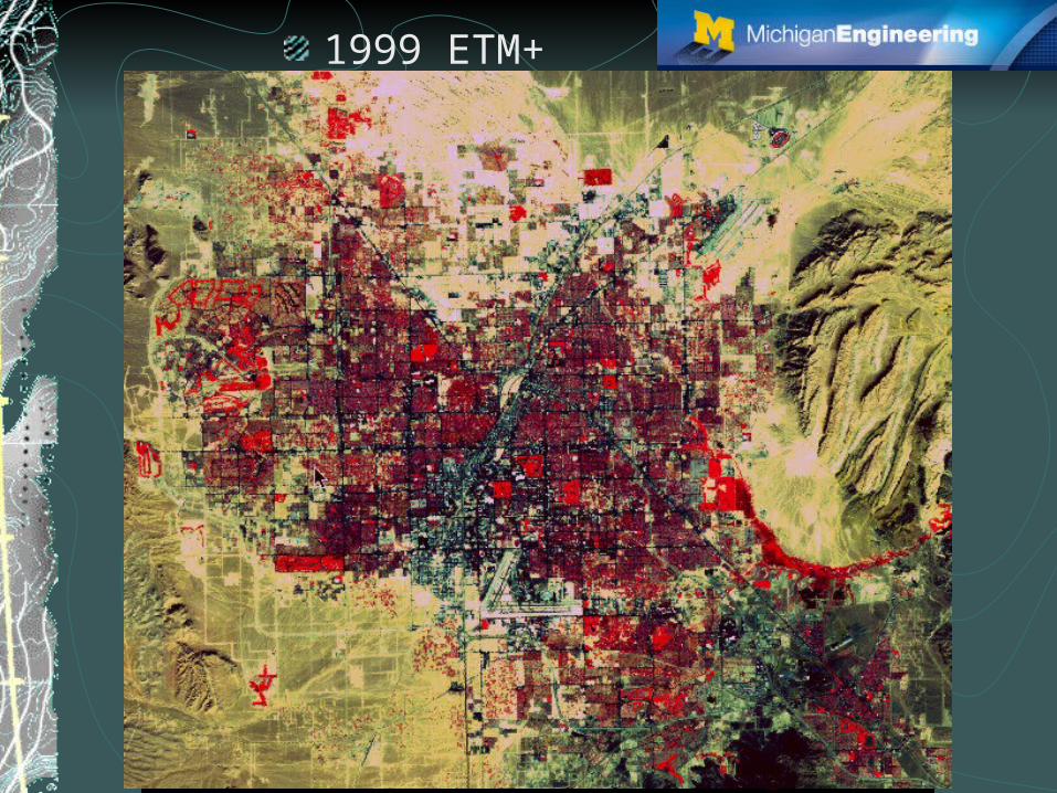
1999 ETM+

USGS dem
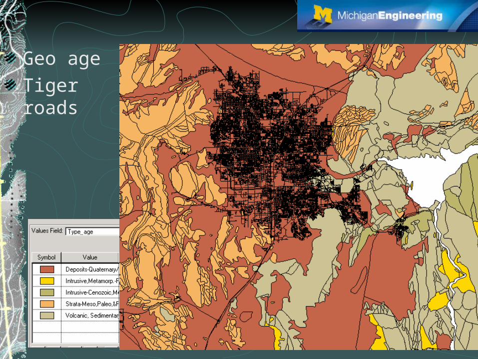
Geo age
Tiger roads
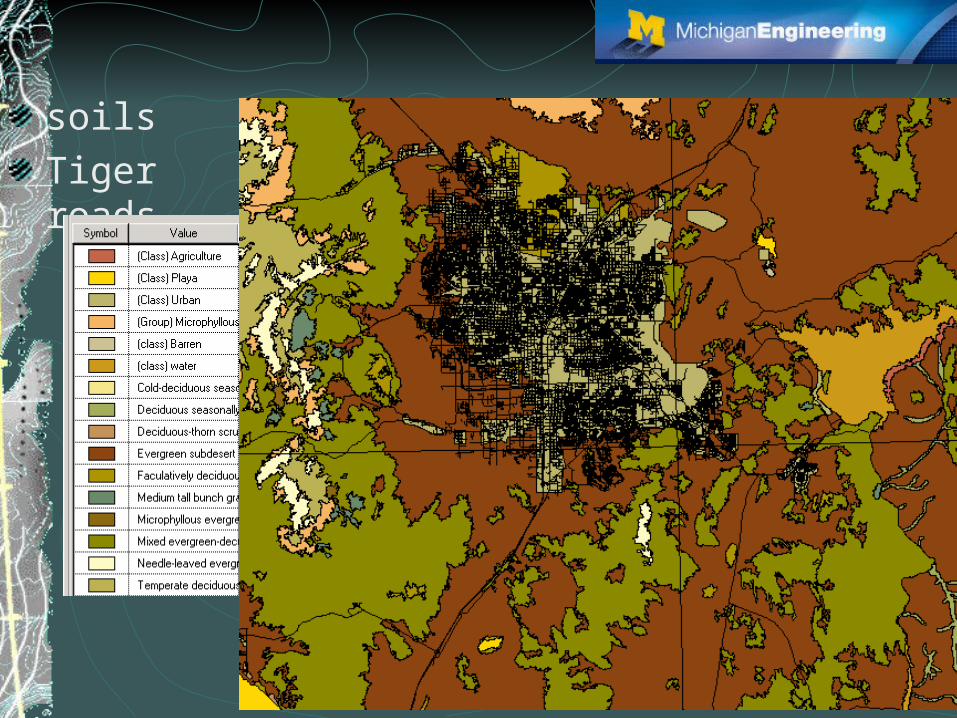
soils
Tiger roads

0
200000
400000
600000
800000
1000000
1200000
1400000
1600000
1900 1920 1940 1960 1980 2000
people
Population from U.S. Census

Flow Chart
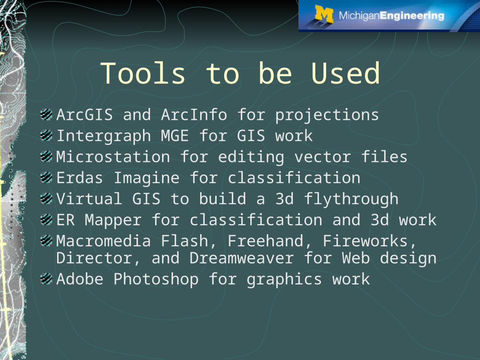
Tools to be UsedArcGIS and ArcInfo for projectionsIntergraph MGE for GIS workMicrostation for editing vector filesErdas Imagine for classificationVirtual GIS to build a 3d flythroughER Mapper for classification and 3d workMacromedia Flash, Freehand, Fireworks, Director, and Dreamweaver for Web designAdobe Photoshop for graphics work