Embed Size (px)
Citation preview

Land Use in Mato Grosso
Cattle & Cropland
Fred Ortiz

Overview
Study area: Mato Grosso, Brazil
Exploration of land use of the cattle industry
Deforestation via Google Earth animation
Supportive USDA slides
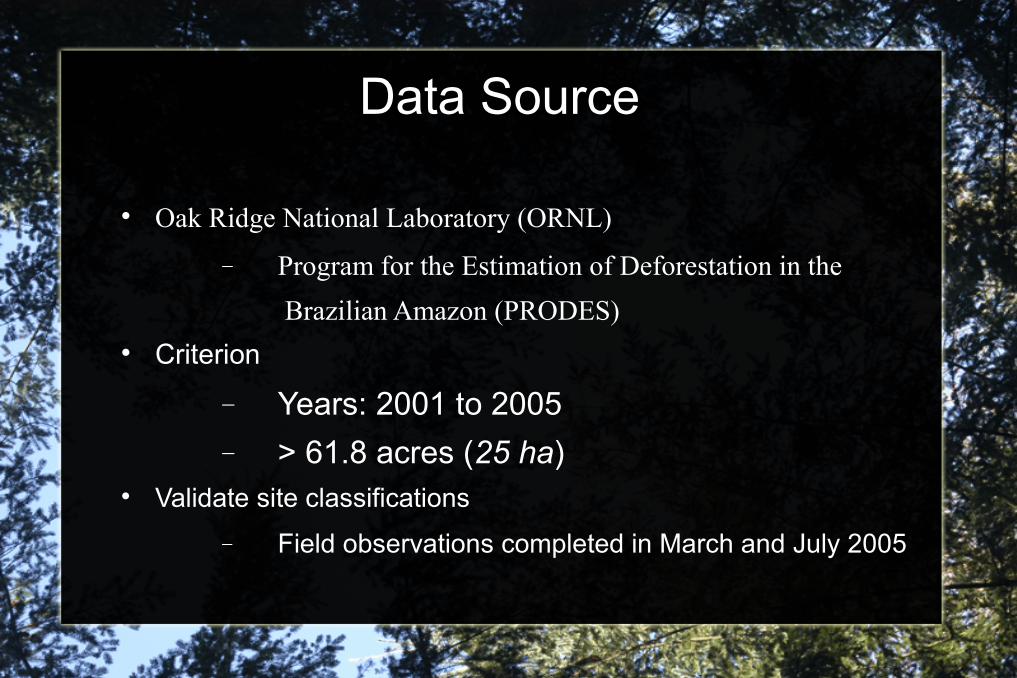
Data Source
Oak Ridge National Laboratory (ORNL)
Program for the Estimation of Deforestation in the
Brazilian Amazon (PRODES) Criterion
Years: 2001 to 2005
> 61.8 acres (25 ha) Validate site classifications
Field observations completed in March and July 2005

Classification Classes
0 = UNCLASSIFIED (areas not covered by MODIS tiles H12V10, H12V09 or H13V10)
1 = CROPLAND
2 = PASTURE
3 = NOT IN PRODUCTION (deforested areas that were never fully
cleared or returned immediately to secondary forest)

Post deforestation Land Use, Mato Grosso, Brazil: 2001-2005

Land Use: 2001-2005
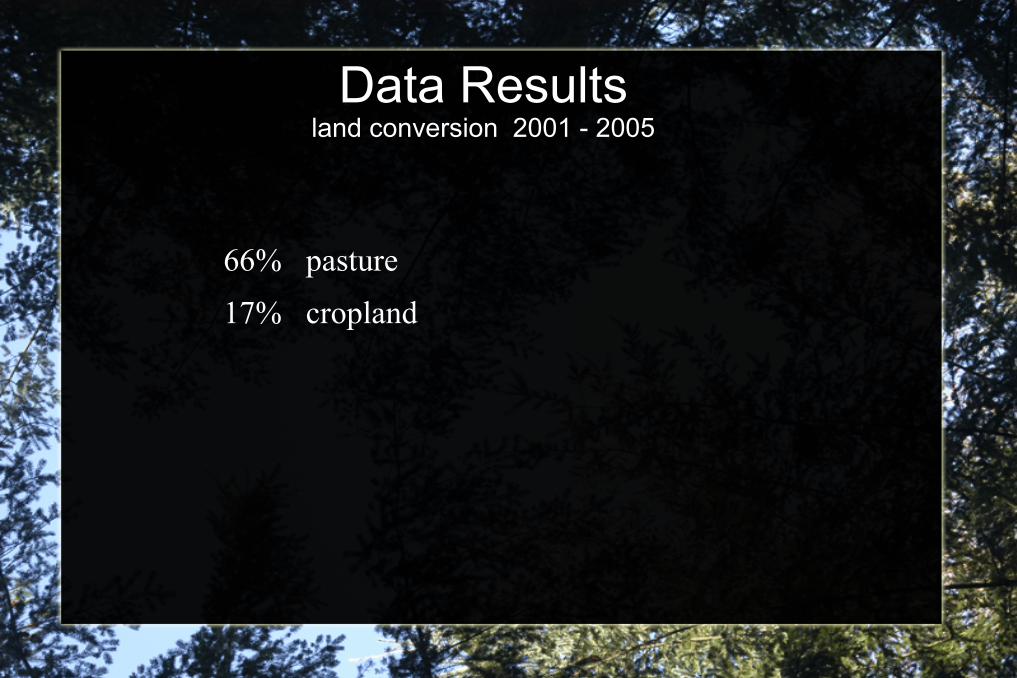
Data Resultsland conversion 2001 - 2005
66% pasture
17% cropland

Slaughterhouses, Mato Grosso along major road BR-163

USDA - slides

USDA - slides

USDA - slides

USDA - slides

USDA - slides