Embed Size (px)
Citation preview
Landfill Grading Using
GPS Machine Control
NC SWANA
April 2018
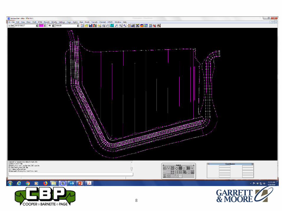
Presented by:
Bernie Garrett, PE
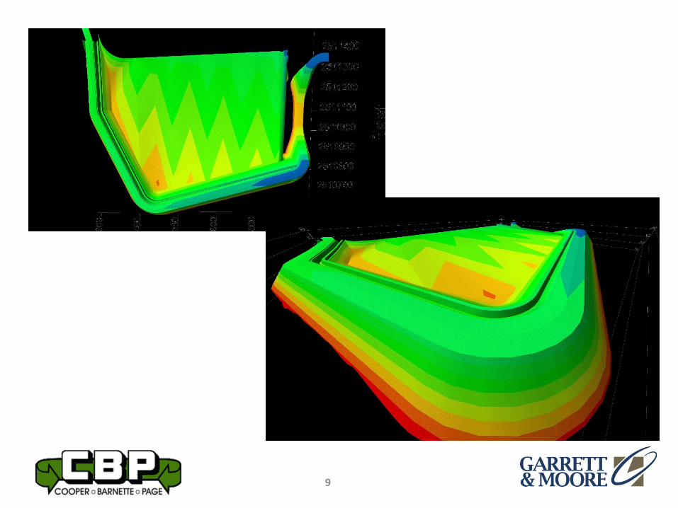
Garrett & Moore Inc.
&
Gabe Leach
Cooper Barnette & Page Inc.
1
Purpose
2
• Work flow processes used by Engineers,
Surveyors, and Contractors to construct
landfill base grades using GPS Machine
Control Technology
Background
3
• Global Positioning Systems (GPS) have
evolved in recent years to the point where
reliability and accuracy of GPS is utilized to
control construction equipment used for
grading
• CADD programs utilized by Engineers have
capabilities to efficiently develop 3-D
models of grading plans.
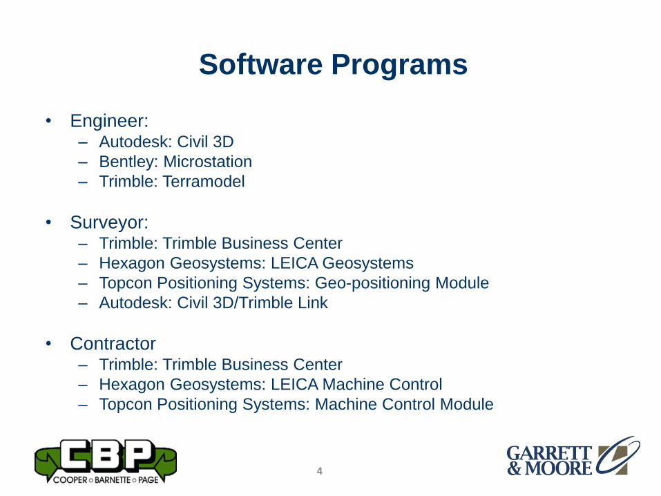
Software Programs
4
• Engineer:– Autodesk: Civil 3D
– Bentley: Microstation
– Trimble: Terramodel
• Surveyor:– Trimble: Trimble Business Center
– Hexagon Geosystems: LEICA Geosystems
– Topcon Positioning Systems: Geo-positioning Module
– Autodesk: Civil 3D/Trimble Link
• Contractor– Trimble: Trimble Business Center
– Hexagon Geosystems: LEICA Machine Control
– Topcon Positioning Systems: Machine Control Module
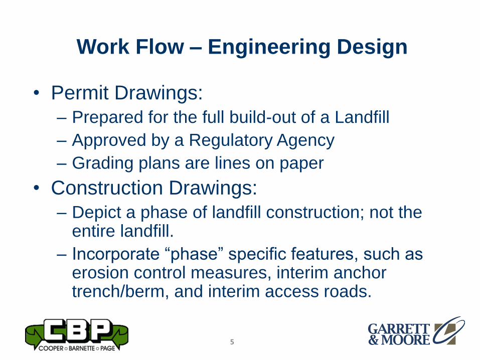
Work Flow – Engineering Design
5
• Permit Drawings:
– Prepared for the full build-out of a Landfill
– Approved by a Regulatory Agency
– Grading plans are lines on paper
• Construction Drawings:
– Depict a phase of landfill construction; not the entire landfill.
– Incorporate “phase” specific features, such as erosion control measures, interim anchor trench/berm, and interim access roads.
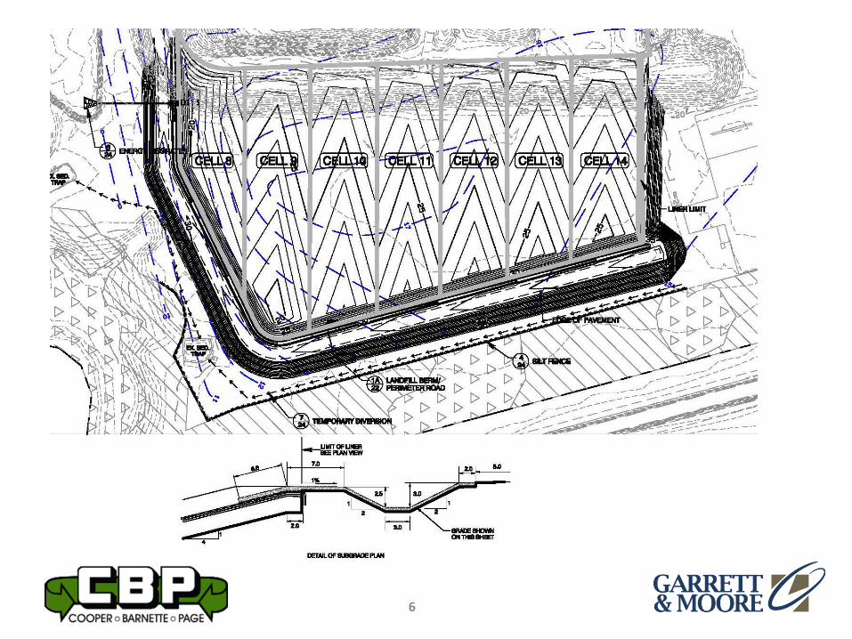
6
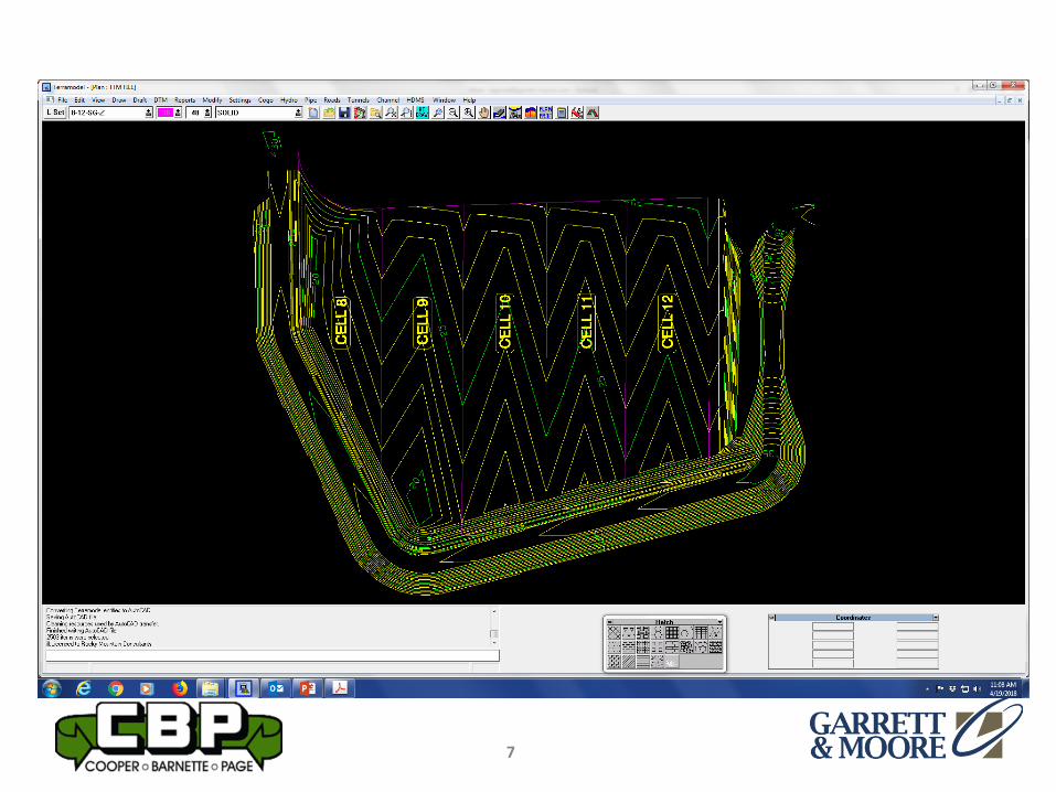
7
8
9
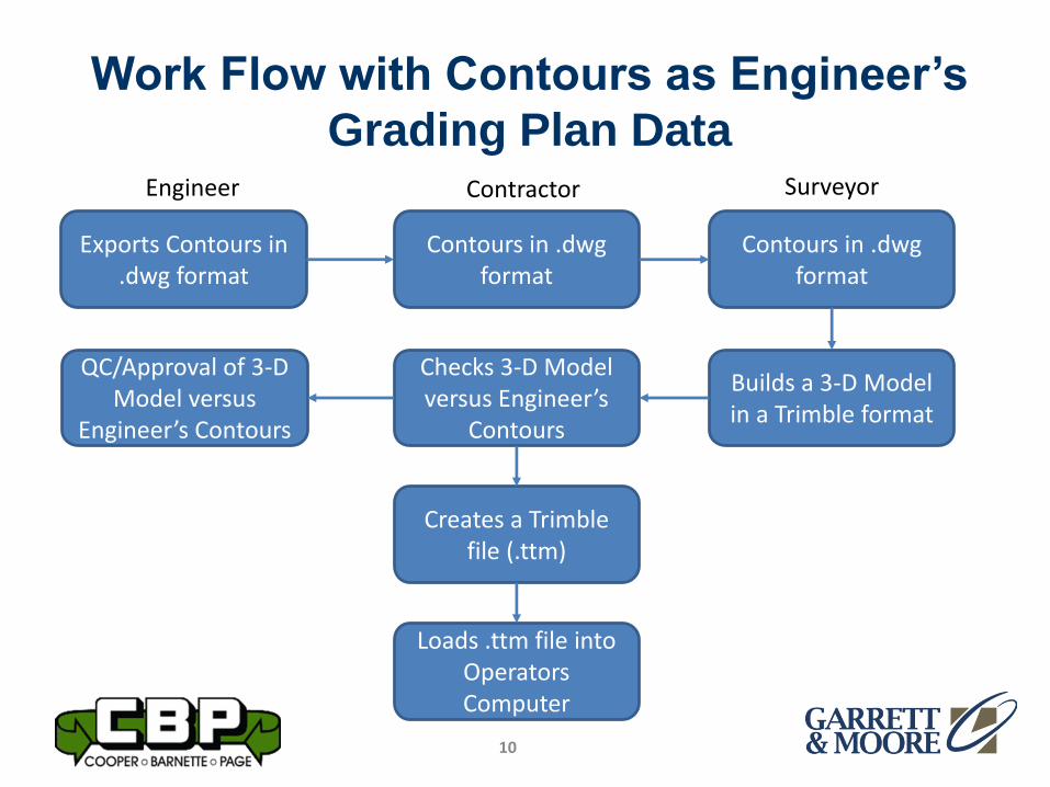
Work Flow with Contours as Engineer’s
Grading Plan Data
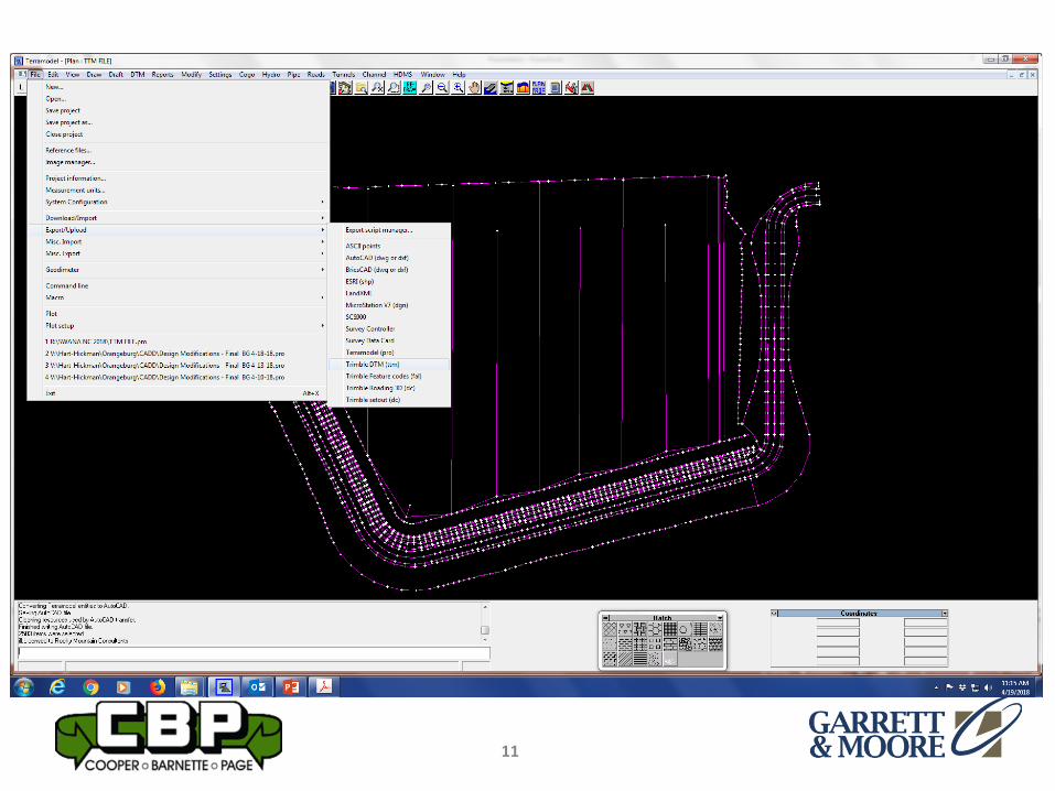
10
Exports Contours in .dwg format
Contours in .dwgformat
Engineer Contractor Surveyor
Contours in .dwgformat
Builds a 3-D Model in a Trimble format
Checks 3-D Model versus Engineer’s
Contours
Creates a Trimble file (.ttm)
Loads .ttm file into Operators Computer
QC/Approval of 3-D Model versus
Engineer’s Contours
11
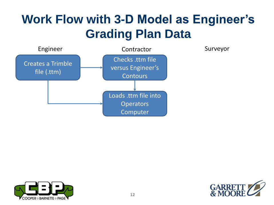
Work Flow with 3-D Model as Engineer’s
Grading Plan Data
12
Creates a Trimble file (.ttm)
Checks .ttm file versus Engineer’s
Contours
Engineer Contractor Surveyor
Loads .ttm file into Operators Computer
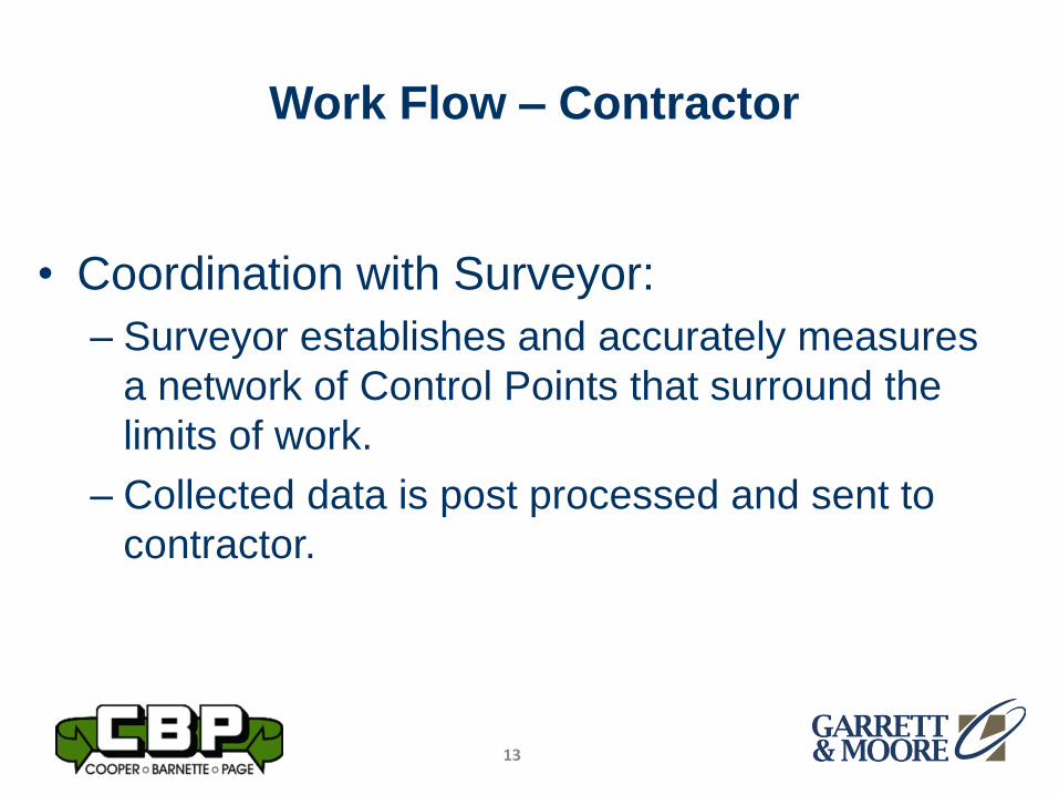
Work Flow – Contractor
13
• Coordination with Surveyor:
– Surveyor establishes and accurately measures
a network of Control Points that surround the
limits of work.
– Collected data is post processed and sent to
contractor.
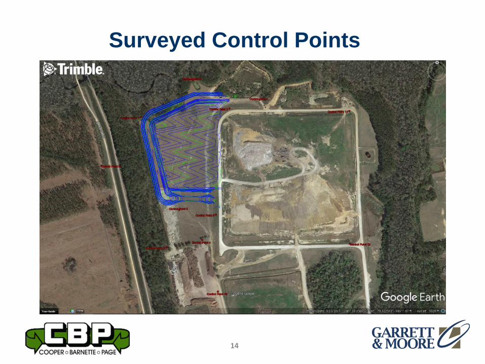
Surveyed Control Points
14
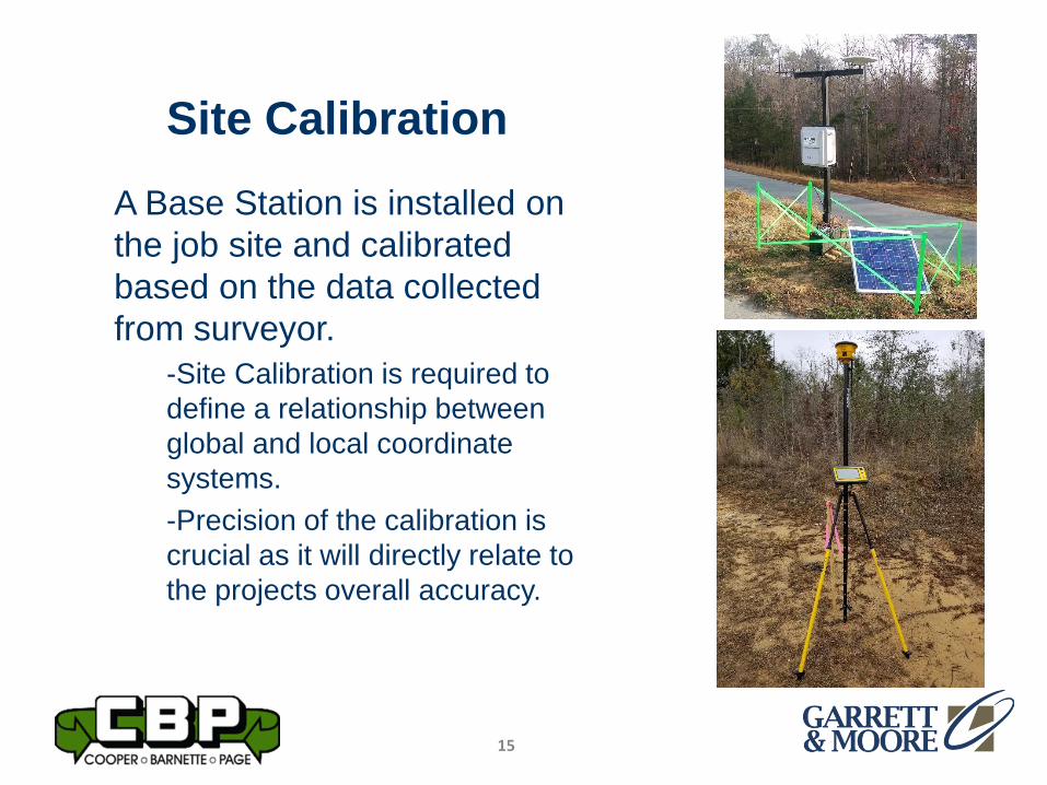
Site Calibration
A Base Station is installed on
the job site and calibrated
based on the data collected
from surveyor.
-Site Calibration is required to
define a relationship between
global and local coordinate
systems.
-Precision of the calibration is
crucial as it will directly relate to
the projects overall accuracy.
15
Office Data Prep
• CAD Data Import
– CAD data from the design engineer is
imported and organized according to scope of
work.
– All CAD data is compared to the official
Construction Drawings.
– Once the CAD files are verified Digital Terrain
Models are built to represent the Construction
Drawings.
16
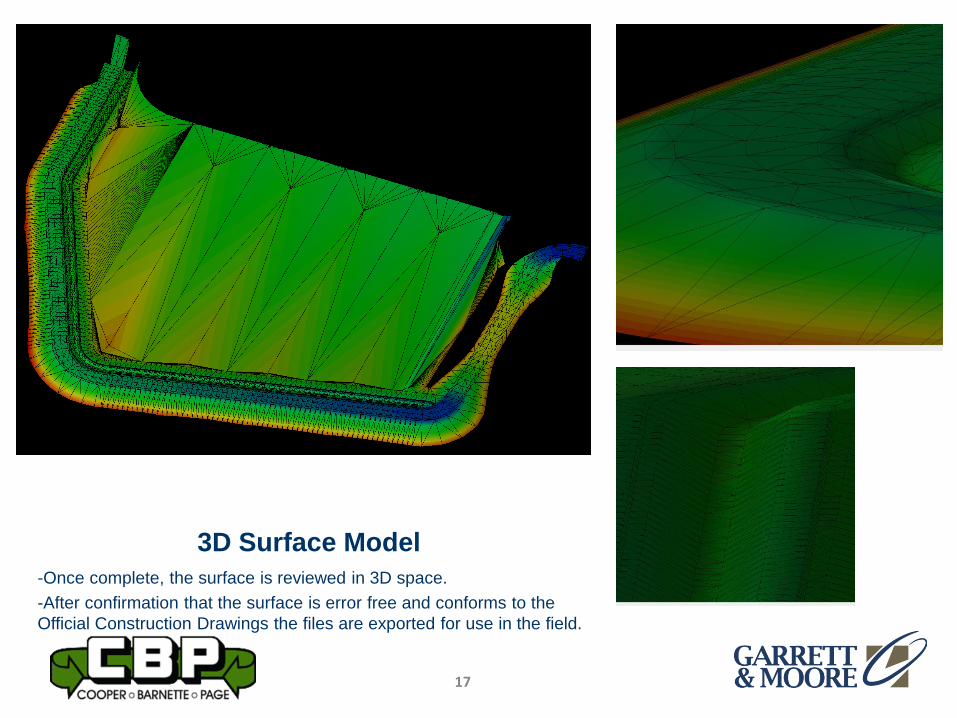
3D Surface Model
-Once complete, the surface is reviewed in 3D space.
-After confirmation that the surface is error free and conforms to the
Official Construction Drawings the files are exported for use in the field.
17
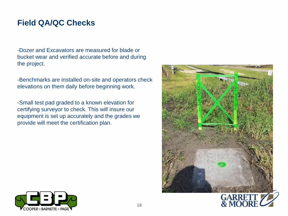
Field QA/QC Checks
-Dozer and Excavators are measured for blade or
bucket wear and verified accurate before and during
the project.
-Benchmarks are installed on-site and operators check
elevations on them daily before beginning work.
-Small test pad graded to a known elevation for
certifying surveyor to check. This will insure our
equipment is set up accurately and the grades we
provide will meet the certification plan.
18
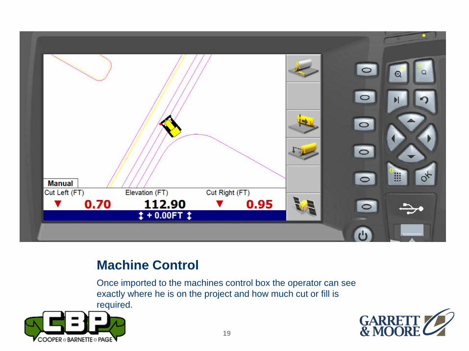
Machine Control
Once imported to the machines control box the operator can see
exactly where he is on the project and how much cut or fill is
required.
19
Why Do We Use Machine Control?
• Gives us a technical edge over our competitors.
• Saves time and resources on the job.– Decreased stakeout work by up to 90%
– Eliminates reworked areas to meet certification grades.
• Increase productivity– Decreased material handling and material waste.
– Decreases operator fatigue.
– Increased accuracy. Grades can be met the first time accurately and efficiently.
20
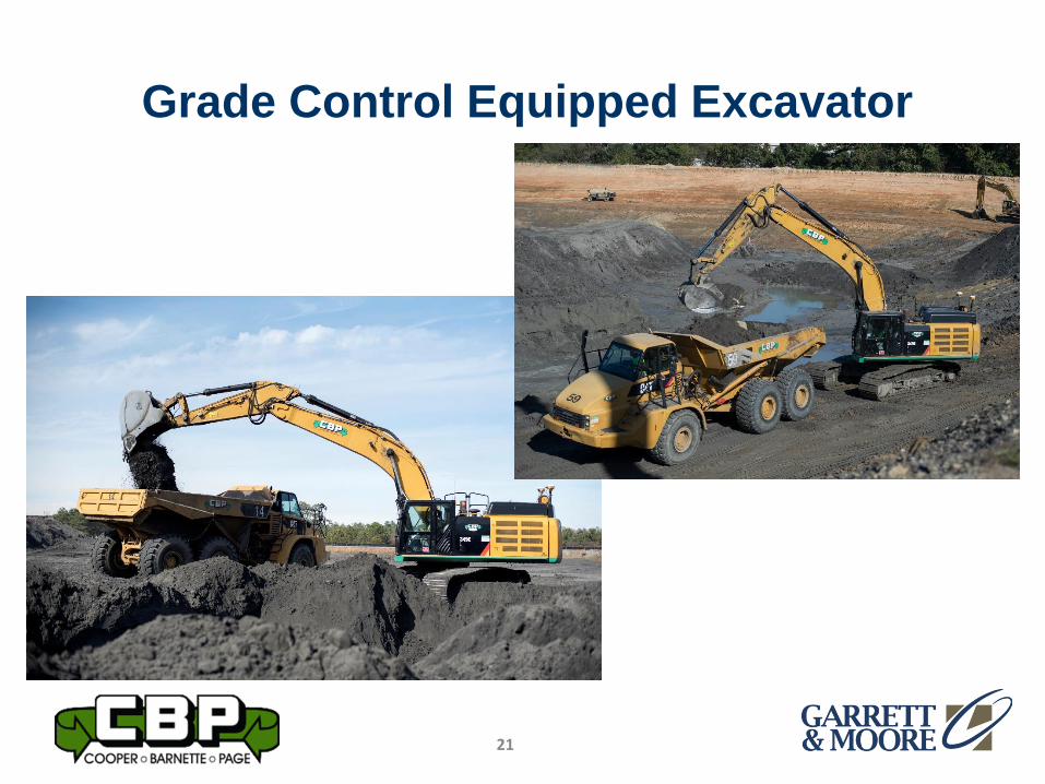
Grade Control Equipped Excavator
21
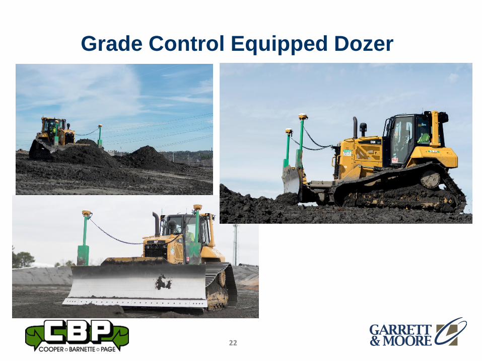
Grade Control Equipped Dozer
22
Technical Abilities Required for GPS
Manager
• High level computer skills for managing and organizing multiple file types over multiple job sites.
• Proficiency with AutoCAD software.
– Take-Offs for bids.
– Surface creation and export once job is awarded.
– Assist with material quantity updates for production studies throughout the job.
• Solid understanding of heavy construction equipment and practices.
23
Technical Abilities Required for
GPS Manager
• Basic knowledge of Survey principals for
Site Calibration, Topos, and Stakeouts as
needed.
• Extensive knowledge of GPS components
installed on machines for maintenance,
repair, and operator training.
24

Summary
• Landfill Owners – Be certain that your
Engineer, Surveyor, and Contractor are all
utilizing the best technology available.
25