Embed Size (px)
Citation preview
Discover the Blue…shores of eastern Michigan
Lighthouse Tour
The Blue Water Area along the shores of Lake Huron has a multiplicity of Lights, guiding sailors past and present. Along the Lake Huron shoreline from Algonac to Port Austin you can sightsee, tour, drive and boat to ten of the area lights. Starting your tour at the south end of the Blue Water Area Algonac/Clay Township going north to Port Austin, enjoy your journey of the history presented by these beacons of nautical lore.
**** Blue Stars indicate open to the public, information provided
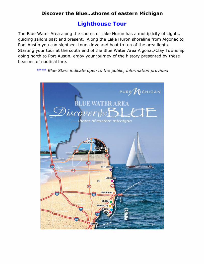
South to North Blue Water Area Clay Township to Port Austin
Colony Water Tower – Lake St. Clair
Latitude N 42° 37.920 / Longitude W 082° 36.942
The Colony Tower is a circular water tower which measures twenty-eight feet in diameter at the base, and contains a 60,000-gallon steel water tank elevated on six columns. Constructed with curtain walls and steel plates to resemble a lighthouse, it demonstrates the early twentieth-century penchant for disguising the utilitarian function of high visible structures. A light shone from atop the tower, aiding boat and aircraft navigation from 1925 until 1937, when the light was extinguished due to its high operating costs."
The commonly used name of the subdivision, "The Colony", is emblazoned in Old English script on the water tank's northwest side facing the direction from which most traffic could be expected to come. Viewing only Located on the southwest side of M-29 (Pointe Tremble/Dyke Road), Clay Township
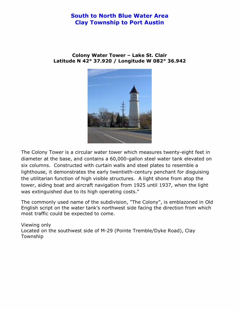
St. Clair Flats Front Range Light – Lake St. Clair Latitude 42°32’15.88”N/Longitude 82°41’35.56”W
St. Clair Flats Rear Range Light – Lake St. Clair
Latitude 42°32’21.56”N/Longitude
St. Clair Flats Front and Rear Range Lights are two lighthouse structures situated off the southeastern tip of Harsens Island. Constructed 1855–1859 the Old South Channel Range Lights were built to guide ships into the fresh water delta once known as the Venice of America.
The front light began to lean in 1875 and was dismantled and rebuilt on the same stone and timber crib that it had been built on originally. It remained but is again leaning and in very bad condition from erosion of the base. In 1990, a steel cell was placed around the base, reinforced and filled with limestone for temporary support until a permanent seawall cold be built. In the fall of 1996, a permanent seawall was completed around the front light island.
The rear light was built on the same type of crib but has weathered the elements over the years. There was a large keeper's house on the island surrounding the light that was taken down in the early 1930s. Vandalism has played a part in the overall deterioration and, combined with age and the elements, the rear light is also in need of major foundation work. Current restoration is taking place by the “Save Our South Channel Lights” group.
http:// www.soschannellights.org Visible only by private or charter boat Tours can be arranged by appointment by contacting 810-748-1888 Find on Twitter/Facebook
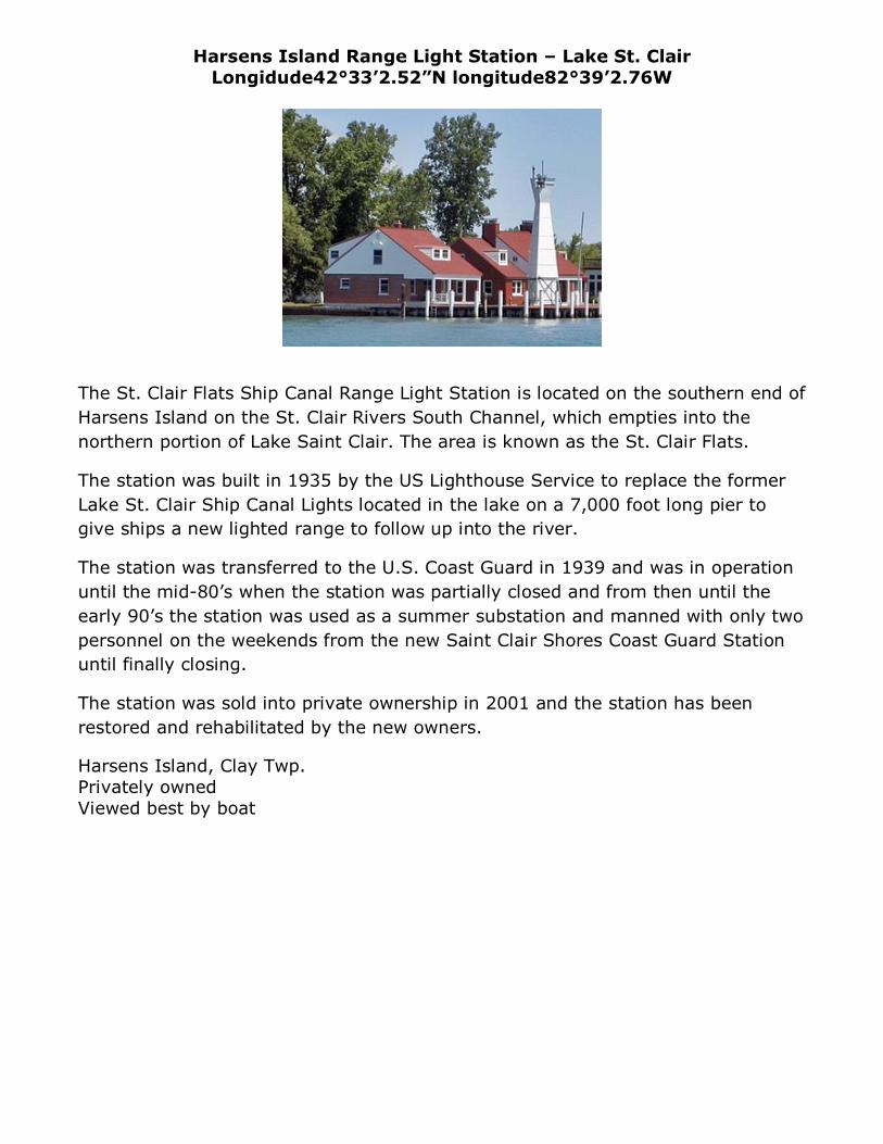
Harsens Island Range Light Station – Lake St. Clair Longidude42°33’2.52”N longitude82°39’2.76W
The St. Clair Flats Ship Canal Range Light Station is located on the southern end of Harsens Island on the St. Clair Rivers South Channel, which empties into the northern portion of Lake Saint Clair. The area is known as the St. Clair Flats.
The station was built in 1935 by the US Lighthouse Service to replace the former Lake St. Clair Ship Canal Lights located in the lake on a 7,000 foot long pier to give ships a new lighted range to follow up into the river.
The station was transferred to the U.S. Coast Guard in 1939 and was in operation until the mid-80’s when the station was partially closed and from then until the early 90’s the station was used as a summer substation and manned with only two personnel on the weekends from the new Saint Clair Shores Coast Guard Station until finally closing.
The station was sold into private ownership in 2001 and the station has been restored and rehabilitated by the new owners.
Harsens Island, Clay Twp. Privately owned Viewed best by boat
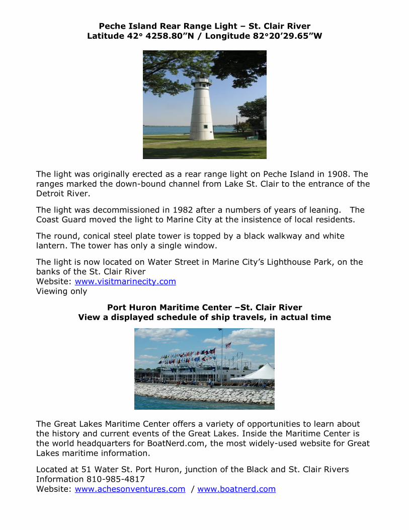
Peche Island Rear Range Light – St. Clair River Latitude 42° 4258.80”N / Longitude 82°20’29.65”W
The light was originally erected as a rear range light on Peche Island in 1908. The ranges marked the down-bound channel from Lake St. Clair to the entrance of the Detroit River.
The light was decommissioned in 1982 after a numbers of years of leaning. The Coast Guard moved the light to Marine City at the insistence of local residents.
The round, conical steel plate tower is topped by a black walkway and white lantern. The tower has only a single window.
The light is now located on Water Street in Marine City’s Lighthouse Park, on the banks of the St. Clair River Website: www.visitmarinecity.com Viewing only
Port Huron Maritime Center –St. Clair River View a displayed schedule of ship travels, in actual time
The Great Lakes Maritime Center offers a variety of opportunities to learn about the history and current events of the Great Lakes. Inside the Maritime Center is the world headquarters for BoatNerd.com, the most widely-used website for Great Lakes maritime information. Located at 51 Water St. Port Huron, junction of the Black and St. Clair Rivers Information 810-985-4817 Website: www.achesonventures.com / www.boatnerd.com
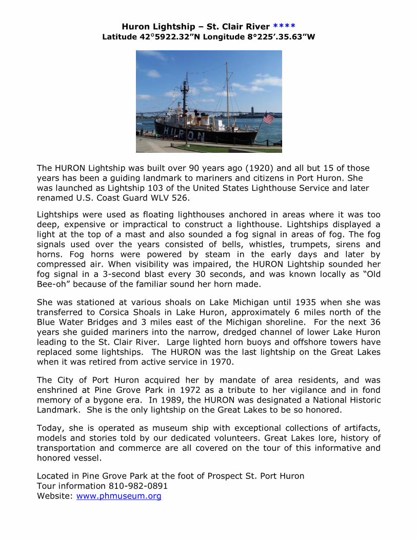
Huron Lightship – St. Clair River **** Latitude 42°5922.32”N Longitude 8°225’.35.63”W
The HURON Lightship was built over 90 years ago (1920) and all but 15 of those years has been a guiding landmark to mariners and citizens in Port Huron. She was launched as Lightship 103 of the United States Lighthouse Service and later renamed U.S. Coast Guard WLV 526. Lightships were used as floating lighthouses anchored in areas where it was too deep, expensive or impractical to construct a lighthouse. Lightships displayed a light at the top of a mast and also sounded a fog signal in areas of fog. The fog signals used over the years consisted of bells, whistles, trumpets, sirens and horns. Fog horns were powered by steam in the early days and later by compressed air. When visibility was impaired, the HURON Lightship sounded her fog signal in a 3-second blast every 30 seconds, and was known locally as “Old Bee-oh” because of the familiar sound her horn made.
She was stationed at various shoals on Lake Michigan until 1935 when she was transferred to Corsica Shoals in Lake Huron, approximately 6 miles north of the Blue Water Bridges and 3 miles east of the Michigan shoreline. For the next 36 years she guided mariners into the narrow, dredged channel of lower Lake Huron leading to the St. Clair River. Large lighted horn buoys and offshore towers have replaced some lightships. The HURON was the last lightship on the Great Lakes when it was retired from active service in 1970.
The City of Port Huron acquired her by mandate of area residents, and was enshrined at Pine Grove Park in 1972 as a tribute to her vigilance and in fond memory of a bygone era. In 1989, the HURON was designated a National Historic Landmark. She is the only lightship on the Great Lakes to be so honored.
Today, she is operated as museum ship with exceptional collections of artifacts, models and stories told by our dedicated volunteers. Great Lakes lore, history of transportation and commerce are all covered on the tour of this informative and honored vessel.
Located in Pine Grove Park at the foot of Prospect St. Port Huron Tour information 810-982-0891 Website: www.phmuseum.org
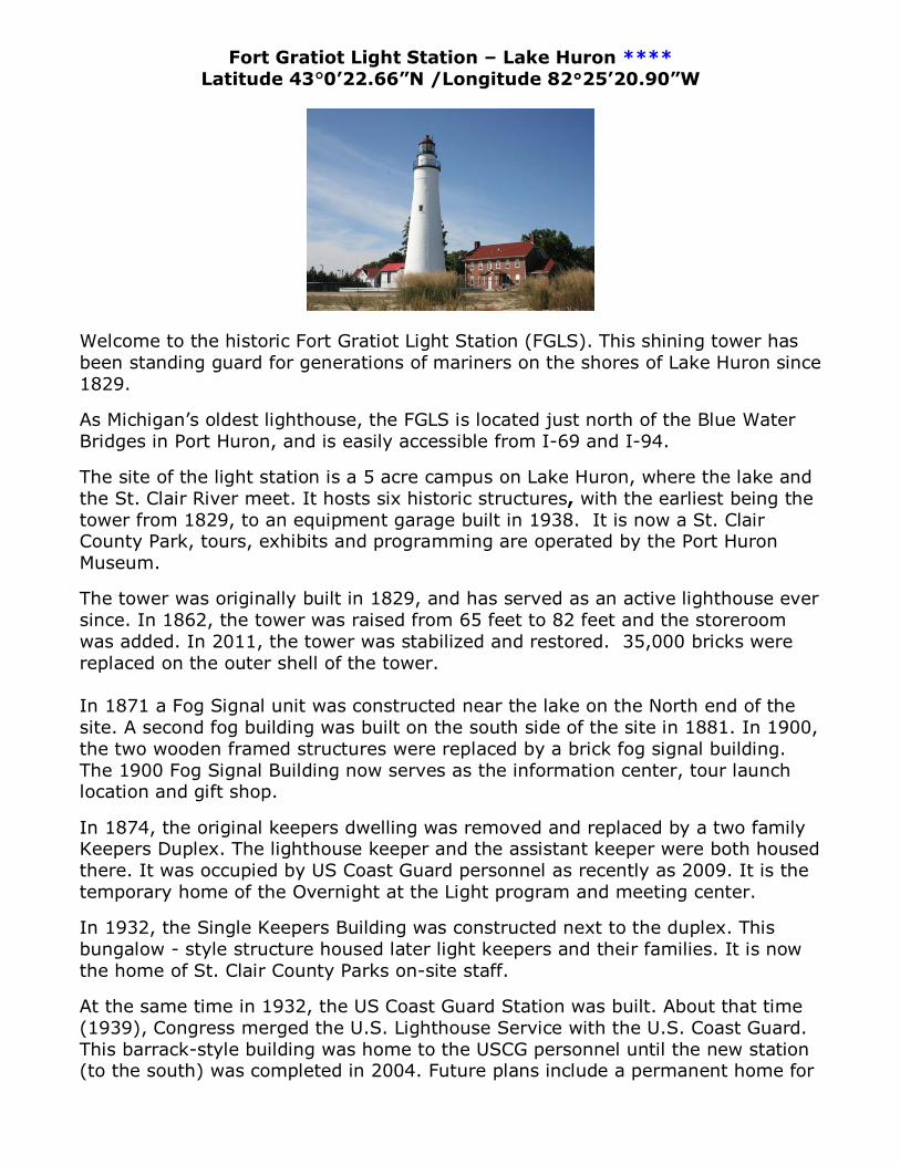
Fort Gratiot Light Station – Lake Huron **** Latitude 43°0’22.66”N /Longitude 82°25’20.90”W
Welcome to the historic Fort Gratiot Light Station (FGLS). This shining tower has been standing guard for generations of mariners on the shores of Lake Huron since 1829.
As Michigan’s oldest lighthouse, the FGLS is located just north of the Blue Water Bridges in Port Huron, and is easily accessible from I-69 and I-94.
The site of the light station is a 5 acre campus on Lake Huron, where the lake and the St. Clair River meet. It hosts six historic structures, with the earliest being the tower from 1829, to an equipment garage built in 1938. It is now a St. Clair County Park, tours, exhibits and programming are operated by the Port Huron Museum.
The tower was originally built in 1829, and has served as an active lighthouse ever since. In 1862, the tower was raised from 65 feet to 82 feet and the storeroom was added. In 2011, the tower was stabilized and restored. 35,000 bricks were replaced on the outer shell of the tower.
In 1871 a Fog Signal unit was constructed near the lake on the North end of the site. A second fog building was built on the south side of the site in 1881. In 1900, the two wooden framed structures were replaced by a brick fog signal building. The 1900 Fog Signal Building now serves as the information center, tour launch location and gift shop.
In 1874, the original keepers dwelling was removed and replaced by a two family Keepers Duplex. The lighthouse keeper and the assistant keeper were both housed there. It was occupied by US Coast Guard personnel as recently as 2009. It is the temporary home of the Overnight at the Light program and meeting center.
In 1932, the Single Keepers Building was constructed next to the duplex. This bungalow - style structure housed later light keepers and their families. It is now the home of St. Clair County Parks on-site staff.
At the same time in 1932, the US Coast Guard Station was built. About that time (1939), Congress merged the U.S. Lighthouse Service with the U.S. Coast Guard. This barrack-style building was home to the USCG personnel until the new station (to the south) was completed in 2004. Future plans include a permanent home for
the Overnight at the Light program and the Education Center for the entire campus.
The Equipment Garage was built in 1938 and housed equipment for the station. When restored, it will offer additional shop, exhibit and meeting space.
A 25 year plan is in place to restore the station to its 1930s appearance, but we are proud to share a glimpse of our rich maritime heritage today.
Located at 2802 Omar St. Port Huron Tours, information 810-982-0891 www.fortgratiotlightstation.org / www.phmuseum.org
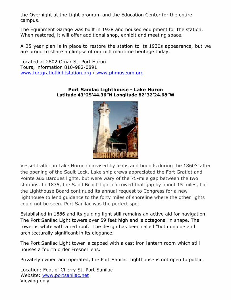
Port Sanilac Lighthouse - Lake Huron
Latitude 43°25’44.36”N Longitude 82°32’24.68”W
Vessel traffic on Lake Huron increased by leaps and bounds during the 1860’s after the opening of the Sault Lock. Lake ship crews appreciated the Fort Gratiot and Pointe aux Barques lights, but were wary of the 75-mile gap between the two stations. In 1875, the Sand Beach light narrowed that gap by about 15 miles, but the Lighthouse Board continued its annual request to Congress for a new lighthouse to lend guidance to the forty miles of shoreline where the other lights could not be seen. Port Sanilac was the perfect spot
Established in 1886 and its guiding light still remains an active aid for navigation. The Port Sanilac Light towers over 59 feet high and is octagonal in shape. The tower is white with a red roof. The design has been called "both unique and architecturally significant in its elegance.
The Port Sanilac Light tower is capped with a cast iron lantern room which still houses a fourth order Fresnel lens.
Privately owned and operated, the Port Sanilac Lighthouse is not open to public.
Location: Foot of Cherry St. Port Sanilac Website: www.portsanilac.net Viewing only
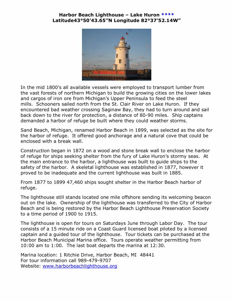
Harbor Beach Lighthouse – Lake Huron **** Latitude43°50’43.65”N Longitude 82°37’52.14W”
In the mid 1800’s all available vessels were employed to transport lumber from the vast forests of northern Michigan to build the growing cities on the lower lakes and cargos of iron ore from Michigan’s Upper Peninsula to feed the steel mills. Schooners sailed north from the St. Clair River on Lake Huron. If they encountered bad weather crossing Saginaw Bay, they had to turn around and sail back down to the river for protection, a distance of 80-90 miles. Ship captains demanded a harbor of refuge be built where they could weather storms.
Sand Beach, Michigan, renamed Harbor Beach in 1899, was selected as the site for the harbor of refuge. It offered good anchorage and a natural cove that could be enclosed with a break wall.
Construction began in 1872 on a wood and stone break wall to enclose the harbor of refuge for ships seeking shelter from the fury of Lake Huron’s stormy seas. At the main entrance to the harbor, a lighthouse was built to guide ships to the safety of the harbor. A skeletal lighthouse was established in 1877, however it proved to be inadequate and the current lighthouse was built in 1885.
From 1877 to 1899 47,460 ships sought shelter in the Harbor Beach harbor of refuge.
The lighthouse still stands located one mile offshore sending its welcoming beacon out on the lake. Ownership of the lighthouse was transferred to the City of Harbor Beach and is being restored by the Harbor Beach Lighthouse Preservation Society to a time period of 1900 to 1915.
The lighthouse is open for tours on Saturdays June through Labor Day. The tour consists of a 15 minute ride on a Coast Guard licensed boat piloted by a licensed captain and a guided tour of the lighthouse. Tour tickets can be purchased at the Harbor Beach Municipal Marina office. Tours operate weather permitting from 10:00 am to 1:00. The last boat departs the marina at 12:30.
Marina location: 1 Ritchie Drive, Harbor Beach, MI 48441 For tour information call 989-479-9707 Website: www.harborbeachlighthouse.org
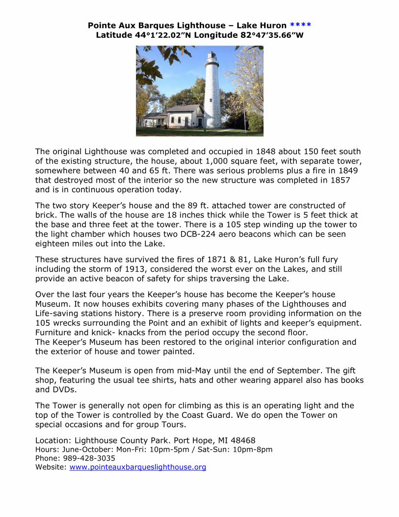
Pointe Aux Barques Lighthouse – Lake Huron **** Latitude 44°1’22.02”N Longitude 82°47’35.66”W
The original Lighthouse was completed and occupied in 1848 about 150 feet south of the existing structure, the house, about 1,000 square feet, with separate tower, somewhere between 40 and 65 ft. There was serious problems plus a fire in 1849 that destroyed most of the interior so the new structure was completed in 1857 and is in continuous operation today.
The two story Keeper’s house and the 89 ft. attached tower are constructed of brick. The walls of the house are 18 inches thick while the Tower is 5 feet thick at the base and three feet at the tower. There is a 105 step winding up the tower to the light chamber which houses two DCB-224 aero beacons which can be seen eighteen miles out into the Lake.
These structures have survived the fires of 1871 & 81, Lake Huron’s full fury including the storm of 1913, considered the worst ever on the Lakes, and still provide an active beacon of safety for ships traversing the Lake.
Over the last four years the Keeper’s house has become the Keeper’s house Museum. It now houses exhibits covering many phases of the Lighthouses and Life-saving stations history. There is a preserve room providing information on the 105 wrecks surrounding the Point and an exhibit of lights and keeper’s equipment. Furniture and knick- knacks from the period occupy the second floor. The Keeper’s Museum has been restored to the original interior configuration and the exterior of house and tower painted. The Keeper’s Museum is open from mid-May until the end of September. The gift shop, featuring the usual tee shirts, hats and other wearing apparel also has books and DVDs.
The Tower is generally not open for climbing as this is an operating light and the top of the Tower is controlled by the Coast Guard. We do open the Tower on special occasions and for group Tours.
Location: Lighthouse County Park. Port Hope, MI 48468 Hours: June-October: Mon-Fri: 10pm-5pm / Sat-Sun: 10pm-8pm Phone: 989-428-3035 Website: www.pointeauxbarqueslighthouse.org
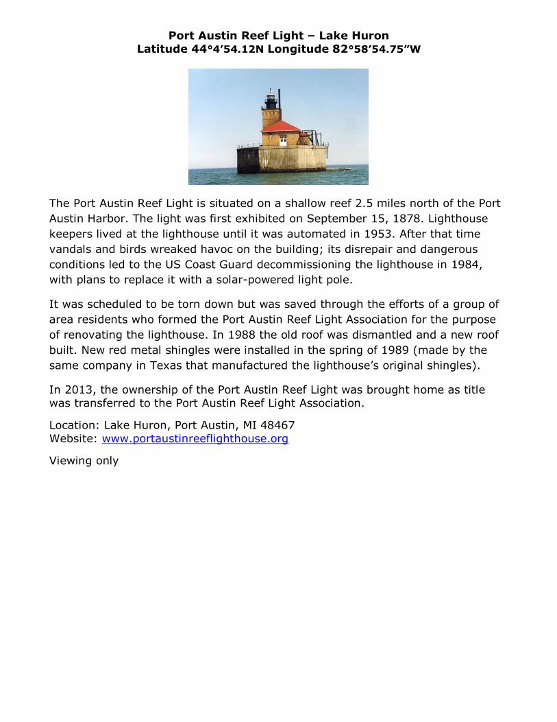
Port Austin Reef Light – Lake Huron Latitude 44°4’54.12N Longitude 82°58’54.75”W
The Port Austin Reef Light is situated on a shallow reef 2.5 miles north of the Port Austin Harbor. The light was first exhibited on September 15, 1878. Lighthouse keepers lived at the lighthouse until it was automated in 1953. After that time vandals and birds wreaked havoc on the building; its disrepair and dangerous conditions led to the US Coast Guard decommissioning the lighthouse in 1984, with plans to replace it with a solar-powered light pole.
It was scheduled to be torn down but was saved through the efforts of a group of area residents who formed the Port Austin Reef Light Association for the purpose of renovating the lighthouse. In 1988 the old roof was dismantled and a new roof built. New red metal shingles were installed in the spring of 1989 (made by the same company in Texas that manufactured the lighthouse’s original shingles).
In 2013, the ownership of the Port Austin Reef Light was brought home as title was transferred to the Port Austin Reef Light Association.
Location: Lake Huron, Port Austin, MI 48467 Website: www.portaustinreeflighthouse.org
Viewing only
Just for fun! How Far is the Horizon? How far away can you see the Lighthouse?
It's simple, really. If you want to know the distance to the horizon you simply have to know your height of eye. That is the distance that your eyes are off the surface of the water. If you were standing at the water's edge, your height of eye is the distance from your eye to your feet. If sitting in a boat your height of eye may be 9 feet.
Once you know your height of eye you simply plug that into the following formula: 1.17 times the sq. root of your height of eye = Distance to the horizon in nautical miles For example, let's say you are on the water in a friend's sport fishing boat and your height of eye is 9 feet above the surface of the water. The formula to calculate distance to the horizon is: 1.17 times the square root of 9 = Distance to the horizon in nautical miles. 1.17 * 3 = 3.51 nautical miles If you want to calculate the distance at which an object becomes visible, you must know your height of eye and the height of the object. You then do the same calculation for your distance to the horizon and the object's distance to the horizon and add the distances together. For example: You have the same height of eye of 9 feet so your distance to the horizon is still 3.51 nautical miles. You're approaching a port that has a lighthouse that is shown on your chart to have a height of 81 feet. Using the same formula you would find that 1.17 times the square root of 81 (1.17 * 9) = 10.53 nautical miles (the light house can be seen 10.53 nautical miles over the horizon) By adding the two together: 3.51 + 10.53 = 14.04 nautical miles, you should be able to see the lighthouse when you are 14.04 nautical miles away.
As you can see from the illustration, because of the curvature of the earth, the higher your height of eye the farther you can see, and vice versa.
BoatSafe.com