Embed Size (px)
Citation preview
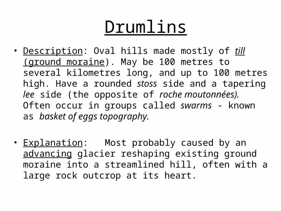
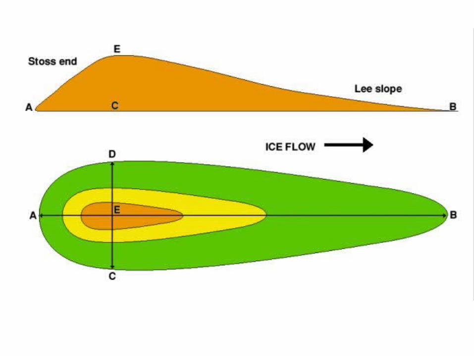
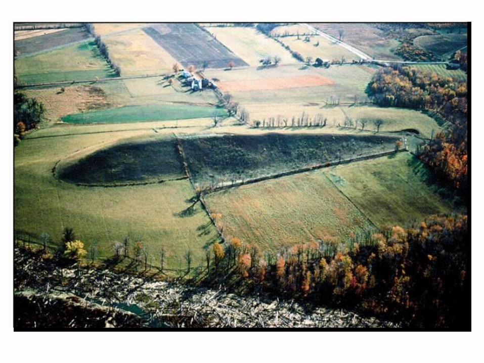
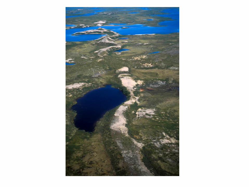
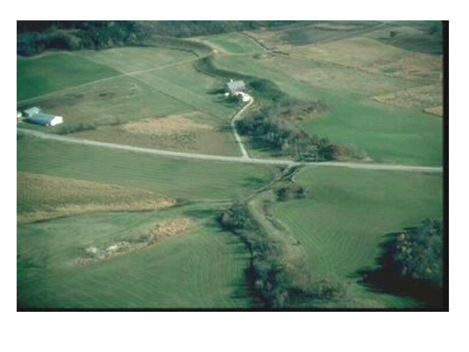
Drumlins• Description: Oval hills made mostly of till (ground
moraine). May be 100 metres to several kilometres long, and up to 100 metres high. Have a rounded stoss side and a tapering lee side (the opposite of roche moutonnées). Often occur in groups called swarms - known as basket of eggs topography.
• Explanation: Most probably caused by an advancing glacier reshaping existing ground moraine into a streamlined hill, often with a large rock outcrop at its heart.
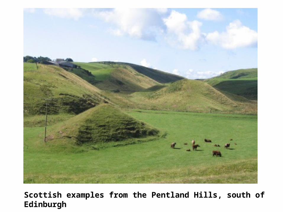
Scottish examples from the Pentland Hills, south of Edinburgh
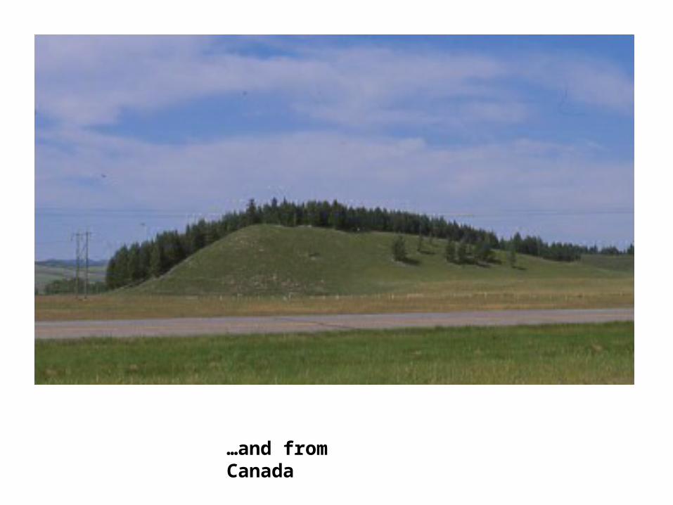
…and from Canada
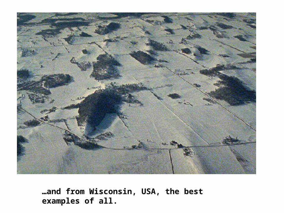
…and from Wisconsin, USA, the best examples of all.
FLUVIOGLACIAL DEPOSITS
These deposits are different from till (glacial deposits) because the material is sorted and layered.
Heaviest material is deposited 1st
The material is also more rounded and comprises of mainly sand
and gravels.
Eskers
• Description: Long, sinuous (twisting) ridges of mostly sand and gravel. An esker is a fluvio-glacial deposit. May be several kilometres long and up to 100 metres high.
• Explanation: Eskers are the beds of rivers which once flowed on, in or, most commonly, under a glacier (sub-glacial streams). When the glacier melted, these temporary river beds were left on the surface of the ground, but now without the rivers which formed them.
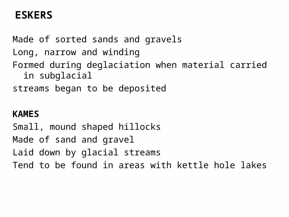
ESKERS
Made of sorted sands and gravelsLong, narrow and windingFormed during deglaciation when material carried in
subglacial streams began to be deposited
KAMESSmall, mound shaped hillocksMade of sand and gravelLaid down by glacial streamsTend to be found in areas with kettle hole lakes
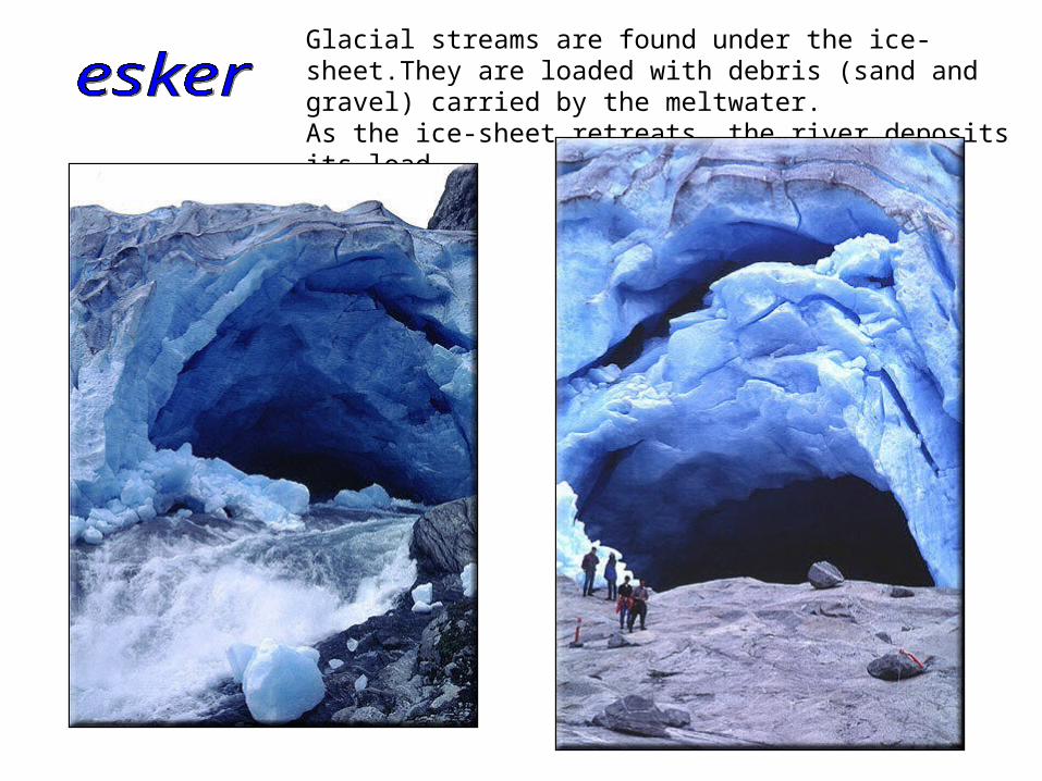
Glacial streams are found under the ice-sheet.They are loaded with debris (sand and gravel) carried by the meltwater.As the ice-sheet retreats, the river deposits its load.
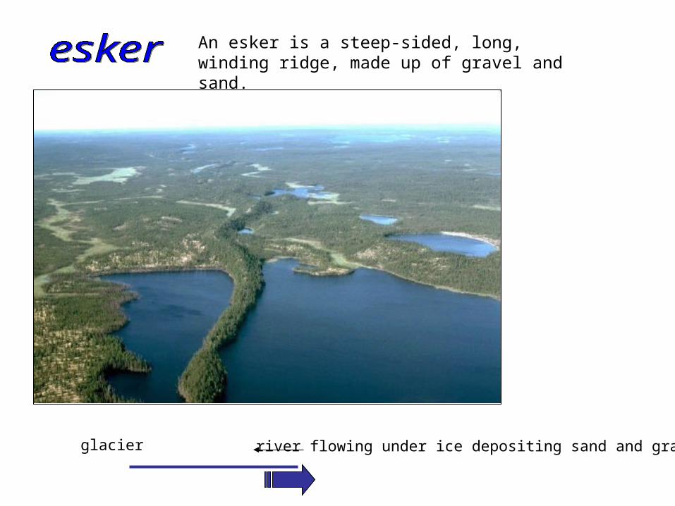
An esker is a steep-sided, long, winding ridge, made up of gravel and sand.
glacier river flowing under ice depositing sand and gravel
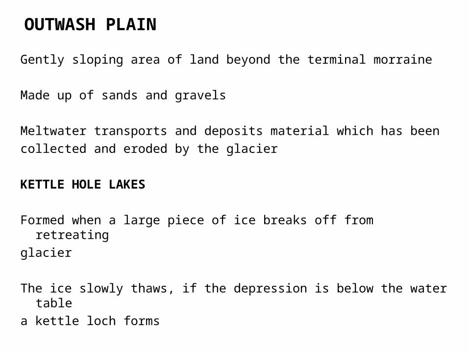
OUTWASH PLAIN
Gently sloping area of land beyond the terminal morraine
Made up of sands and gravels
Meltwater transports and deposits material which has been collected and eroded by the glacier
KETTLE HOLE LAKES
Formed when a large piece of ice breaks off from retreating glacier
The ice slowly thaws, if the depression is below the water table
a kettle loch forms
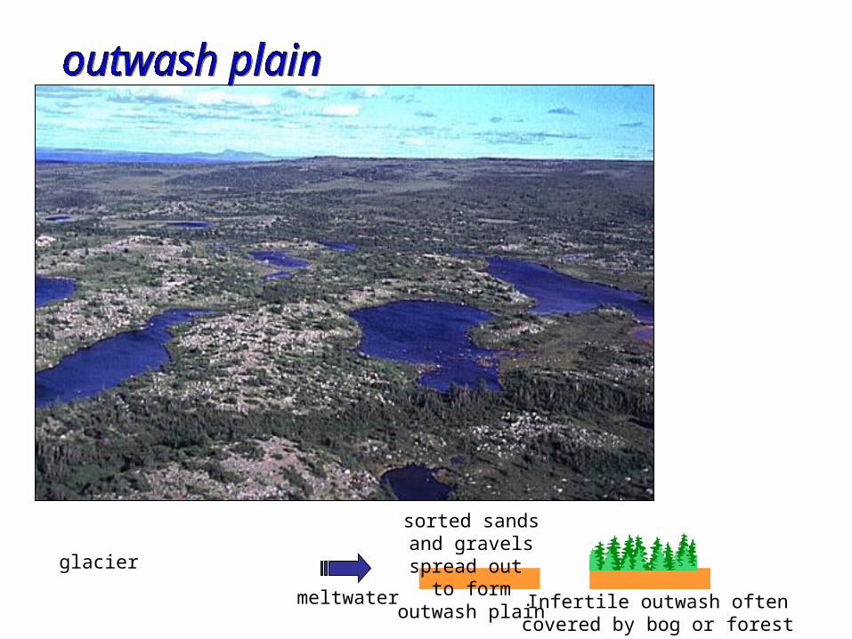
meltwater
glacier
sorted sandsand gravelsspread out
to formoutwash plain Infertile outwash often
covered by bog or forest
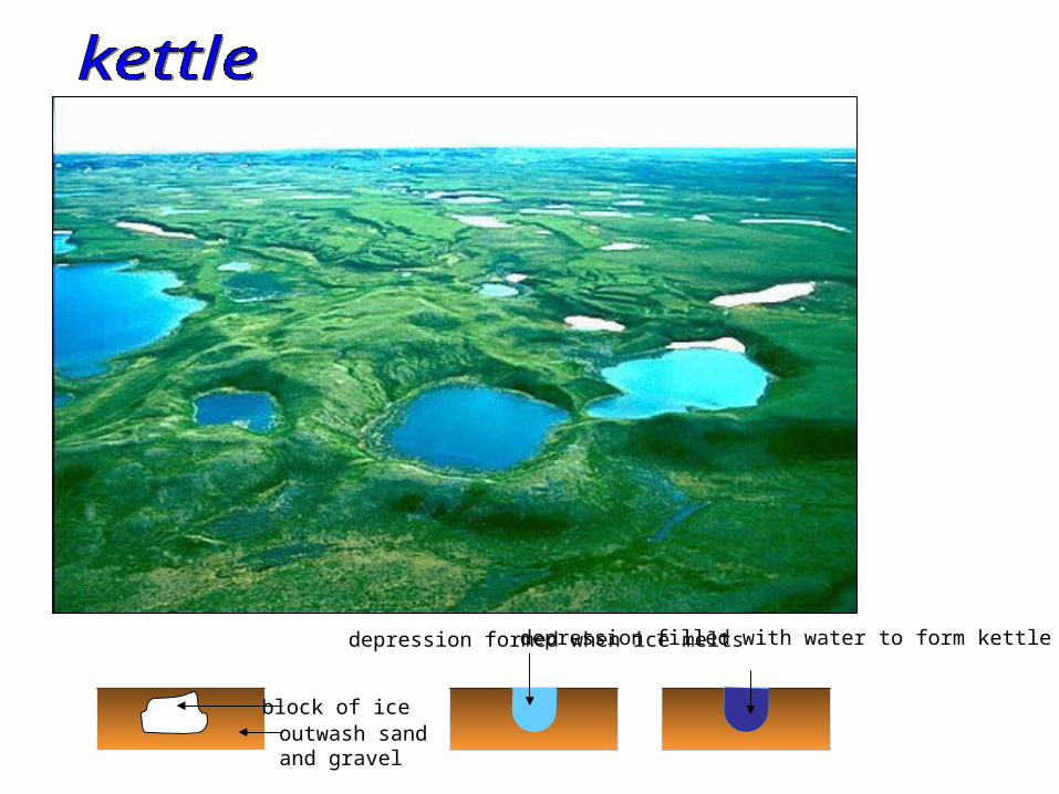
block of iceoutwash sand and gravel
depression formed when ice meltsdepression filled with water to form kettle lake
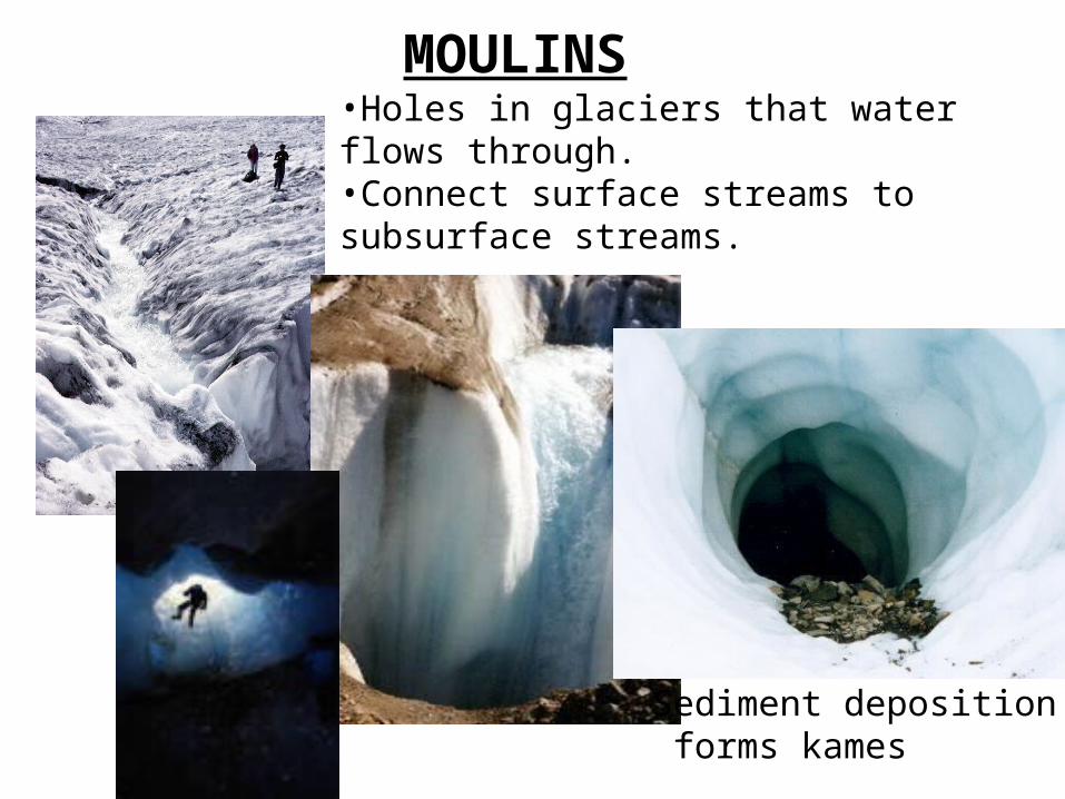
MOULINS•Holes in glaciers that water flows through.•Connect surface streams to subsurface streams.
Sediment deposition forms kames
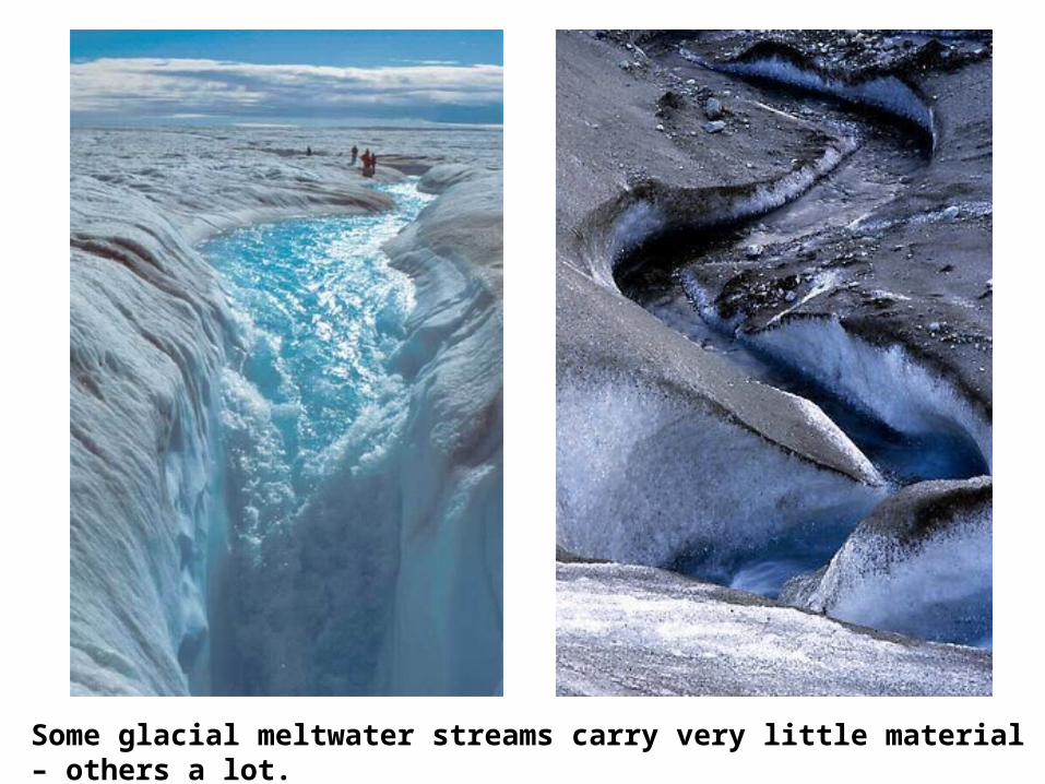
Some glacial meltwater streams carry very little material – others a lot.
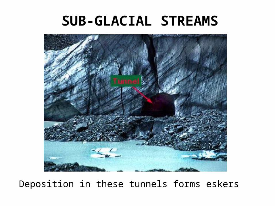
SUB-GLACIAL STREAMS
Deposition in these tunnels forms eskers
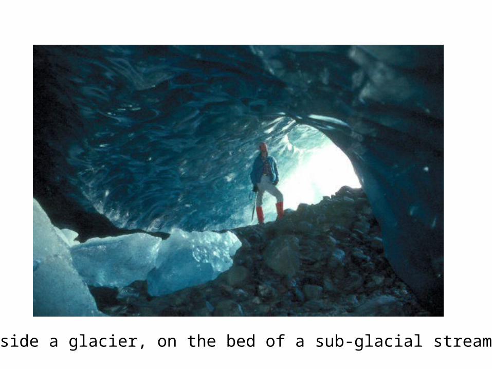
Inside a glacier, on the bed of a sub-glacial stream;
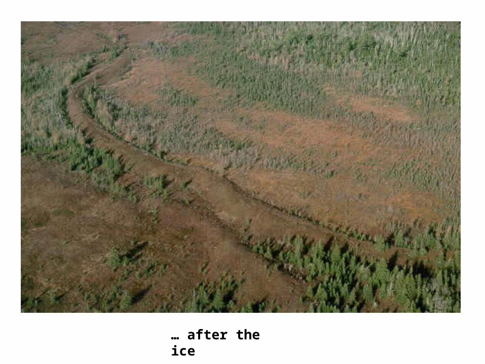
… after the ice
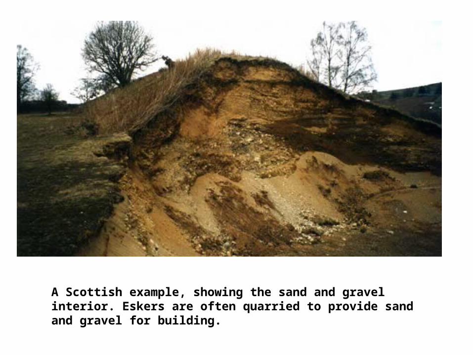
A Scottish example, showing the sand and gravel interior. Eskers are often quarried to provide sand and gravel for building.
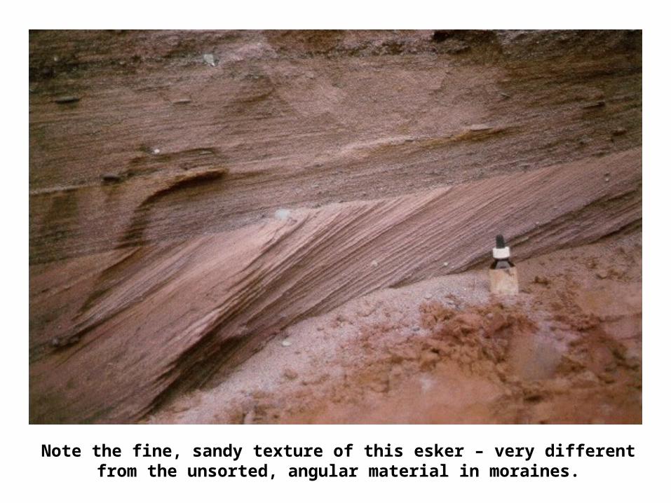
Note the fine, sandy texture of this esker – very different from the unsorted, angular material in moraines.
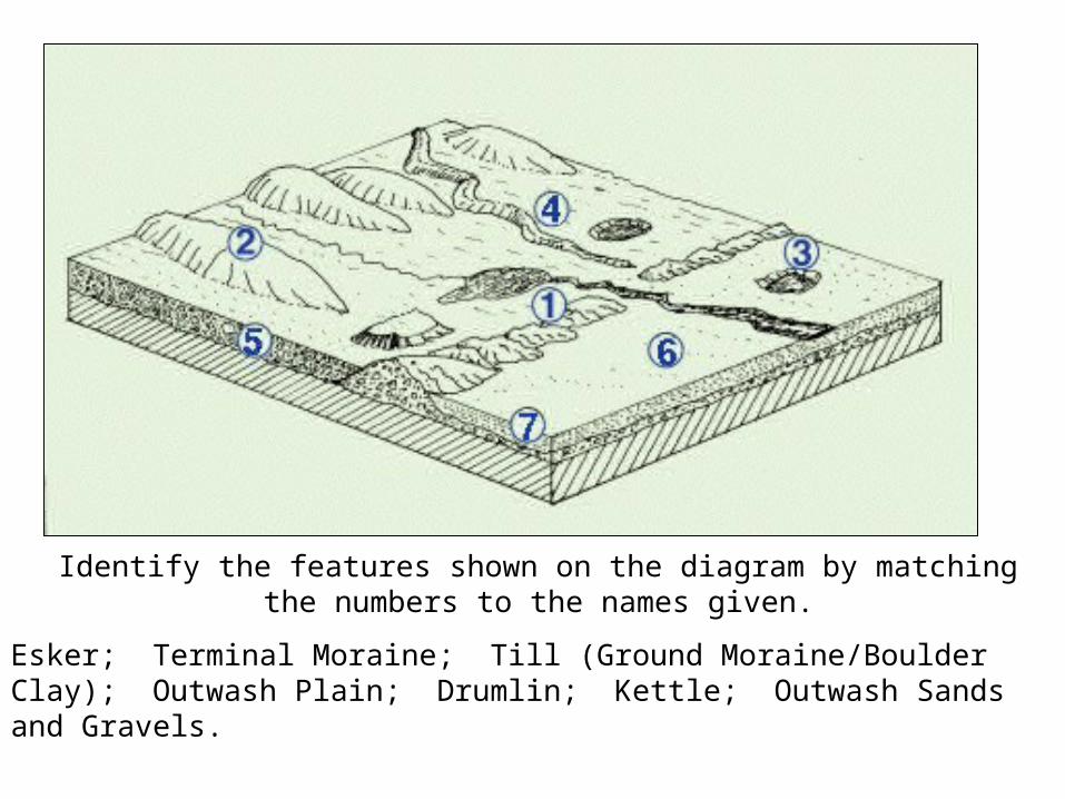
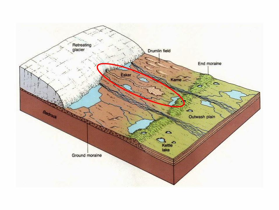
Identify the features shown on the diagram by matching the numbers to the names given.
Esker; Terminal Moraine; Till (Ground Moraine/Boulder Clay); Outwash Plain; Drumlin; Kettle; Outwash Sands and Gravels.
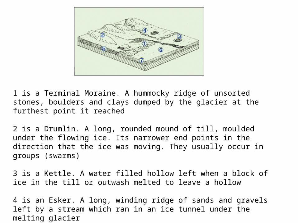
1 is a Terminal Moraine. A hummocky ridge of unsorted stones, boulders and clays dumped by the glacier at the furthest point it reached
2 is a Drumlin. A long, rounded mound of till, moulded under the flowing ice. Its narrower end points in the direction that the ice was moving. They usually occur in groups (swarms) 3 is a Kettle. A water filled hollow left when a block of ice in the till or outwash melted to leave a hollow
4 is an Esker. A long, winding ridge of sands and gravels left by a stream which ran in an ice tunnel under the melting glacier
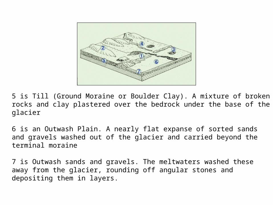
5 is Till (Ground Moraine or Boulder Clay). A mixture of broken rocks and clay plastered over the bedrock under the base of the glacier
6 is an Outwash Plain. A nearly flat expanse of sorted sands and gravels washed out of the glacier and carried beyond the terminal moraine
7 is Outwash sands and gravels. The meltwaters washed these away from the glacier, rounding off angular stones and depositing them in layers.
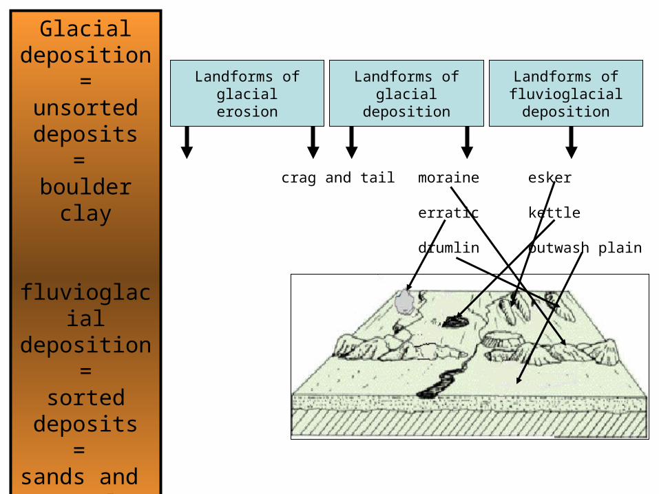
Landforms offluvioglacialdeposition
Landforms ofglacial
deposition
Landforms ofglacialerosion
crag and tail moraine
erratic
drumlin
esker
kettle
outwash plain
Glacial deposition
=unsorted deposits
= boulder clay
fluvioglacialdeposition
=sorted
deposits=
sands and gravels
ACTIVITIES
HUMAN ACTIVITY IN GLACIATED LANDSCAPES
Discussion:Land uses? What are the pros and cons of these areas?
Read p. 106 108
Think about:FarmingForestryCommunicationsSettlementIndustryLeisure and Recreation
ACTIVITIES
OS MAP AND CAIRNGORM
Use the map of Cairngorm on page 92
Work through questions 1 6 on page 142
HOMEWORK: (Wednesday to Wednesday)Choose any 2 features of glacial erosion and with the aid of diagrams explain their formation 5 marks
Choose any 2 features of glacial deposition and with the aid of
diagrams explain their formation 5 marks
Ablation
Abrasion
Alluvial fan
Alpine glacier
Arête
Boulder clay
Cirque
Continental glacier
Corrie
Corrie lochan
Crag & tail
Crevasse
Cwm
Drumlin
melting and evaporation of glacial ice at its snout
sand-papering effect that smoothes and polishes rocks
fan shaped deposit of silt when a river flows on to a plain
valley glacier
sharp, knife-edged ridge between two corries
ground moraine
armchair shaped hollow at the head of a glacial valley
ice sheet
cirque
tarn
steep rock face with a gentle slope of boulder clay
deep vertical crack formed in ice
cirque
elongated mound of ground moraine
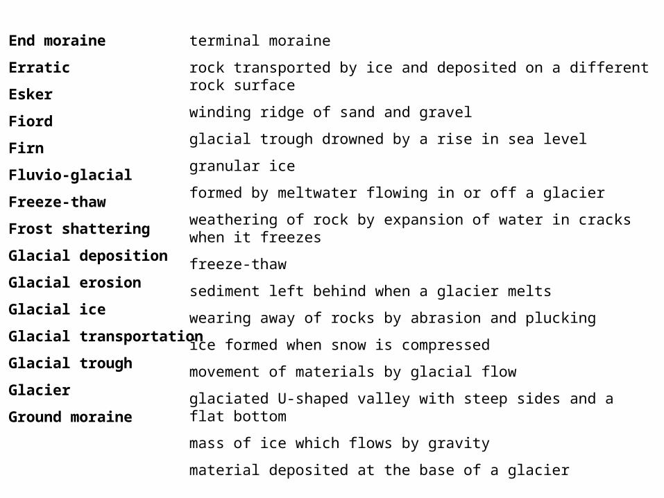
End moraine
Erratic
Esker
Fiord
Firn
Fluvio-glacial
Freeze-thaw
Frost shattering
Glacial deposition
Glacial erosion
Glacial ice
Glacial transportation
Glacial trough
Glacier
Ground moraine
terminal moraine
rock transported by ice and deposited on a different rock surface
winding ridge of sand and gravel
glacial trough drowned by a rise in sea level
granular ice
formed by meltwater flowing in or off a glacier
weathering of rock by expansion of water in cracks when it freezes
freeze-thaw
sediment left behind when a glacier melts
wearing away of rocks by abrasion and plucking
ice formed when snow is compressed
movement of materials by glacial flow
glaciated U-shaped valley with steep sides and a flat bottom
mass of ice which flows by gravity
material deposited at the base of a glacier
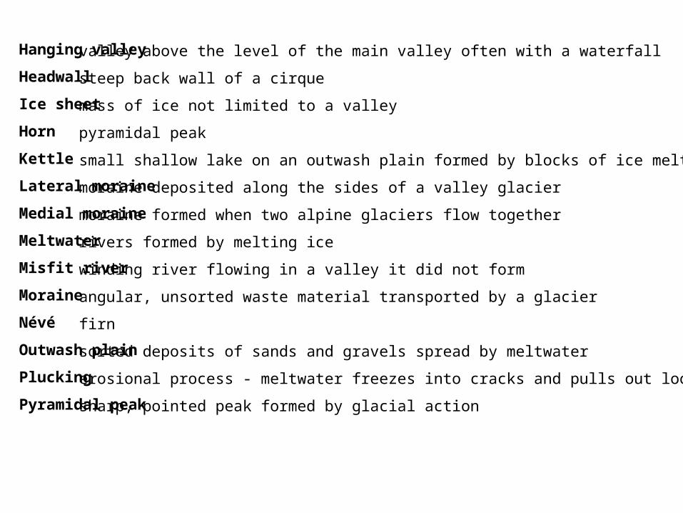
Hanging valley
Headwall
Ice sheet
Horn
Kettle
Lateral moraine
Medial moraine
Meltwater
Misfit river
Moraine
Névé
Outwash plain
Plucking
Pyramidal peak
valley above the level of the main valley often with a waterfall
steep back wall of a cirque
mass of ice not limited to a valley
pyramidal peak
small shallow lake on an outwash plain formed by blocks of ice melting.
moraine deposited along the sides of a valley glacier
moraine formed when two alpine glaciers flow together
rivers formed by melting ice
winding river flowing in a valley it did not form
angular, unsorted waste material transported by a glacier
firn
sorted deposits of sands and gravels spread by meltwater
erosional process - meltwater freezes into cracks and pulls out loose rock
sharp, pointed peak formed by glacial action
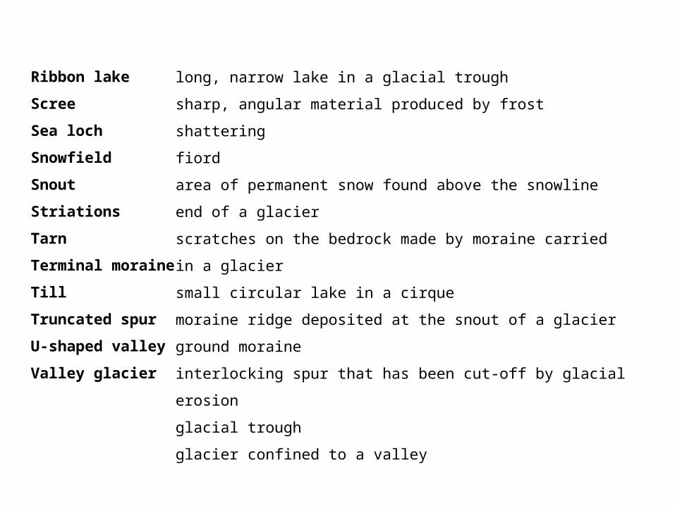
Ribbon lake
Scree
Sea loch
Snowfield
Snout
Striations
Tarn
Terminal moraine
Till
Truncated spur
U-shaped valley
Valley glacier
long, narrow lake in a glacial trough
sharp, angular material produced by frost shattering
fiord
area of permanent snow found above the snowline
end of a glacier
scratches on the bedrock made by moraine carried in a
glacier
small circular lake in a cirque
moraine ridge deposited at the snout of a glacier
ground moraine
interlocking spur that has been cut-off by glacial erosion
glacial trough
glacier confined to a valley