Embed Size (px)
Citation preview
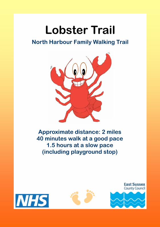
Lobster Trail
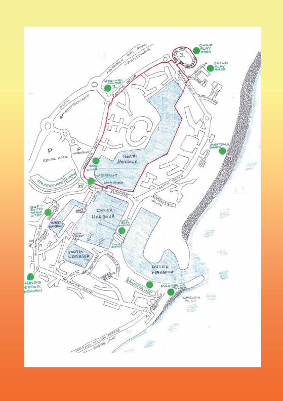
North Harbour Family Walking Trail
Approximate distance: 2 miles 40 minutes walk at a good pace
1.5 hours at a slow pace (including playground stop)
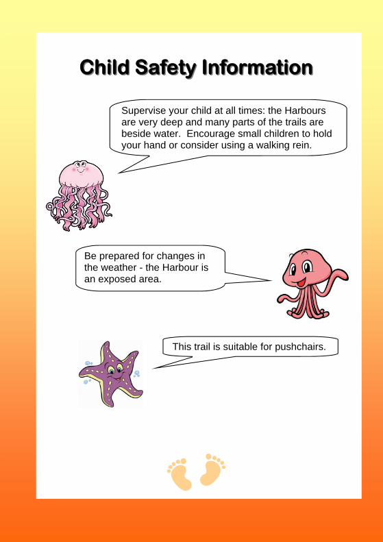
Child Safety InformationChild Safety Information
Supervise your child at all times: the Harbours are very deep and many parts of the trails are beside water. Encourage small children to hold your hand or consider using a walking rein.
Be prepared for changes in the weather - the Harbour is an exposed area.
This trail is suitable for pushchairs.
Lobster Trail
Plans to develop the land on the left beyond the Medical Centre are still under discussion. You can follow proposals about the Sovereign Harbour Development Plan on the Eastbourne Borough Council website.
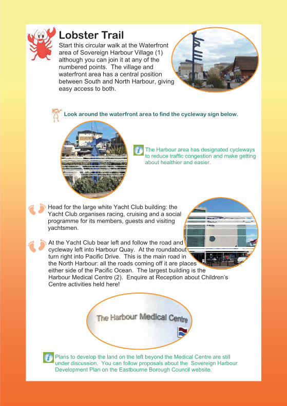
Start this circular walk at the Waterfront area of Sovereign Harbour Village (1) although you can join it at any of the numbered points. The village and waterfront area has a central position between South and North Harbour, giving easy access to both.
The Harbour area has designated cycleways to reduce traffic congestion and make getting about healthier and easier.
Head for the large white Yacht Club building: the Yacht Club organises racing, cruising and a social programme for its members, guests and visiting yachtsmen.
At the Yacht Club bear left and follow the road and cycleway left into Harbour Quay. At the roundaboutturn right into Pacific Drive. This is the main road inthe North Harbour: all the roads coming off it are placeseither side of the Pacific Ocean. The largest building is the Harbour Medical Centre (2). Enquire at Reception about Children’s Centre activities held here!
Look around the waterfront area to find the cycleway sign below.
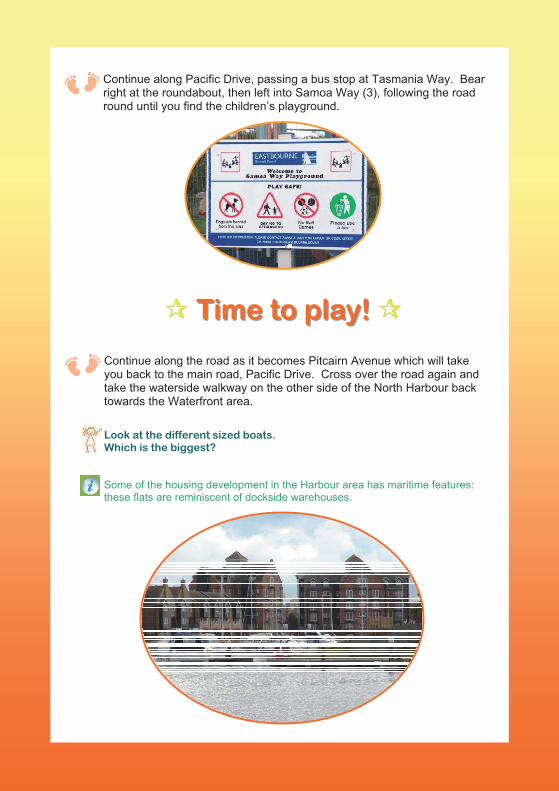
Some of the housing development in the Harbour area has maritime features: these flats are reminiscent of dockside warehouses.
Continue along Pacific Drive, passing a bus stop at Tasmania Way. Bear right at the roundabout, then left into Samoa Way (3), following the road round until you find the children’s playground.
��� Time to play! Time to play! ���
Continue along the road as it becomes Pitcairn Avenue which will take you back to the main road, Pacific Drive. Cross over the road again and take the waterside walkway on the other side of the North Harbour back towards the Waterfront area.
Look at the different sized boats. Which is the biggest?
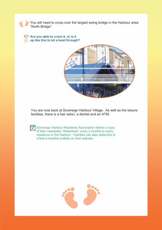
Sovereign Harbour Residents Association deliver a copy of their newsletter “Waterlines” every 2 months to every residence in the Harbour. Families can also subscribe to a free e-monthly bulletin on their website.
You will need to cross over the largest swing bridge in the Harbour area: “North Bridge”.
Are you able to cross it, or is it up like this to let a boat through?
You are now back at Sovereign Harbour Village. As well as the leisure facilities, there is a hair salon, a dentist and an ATM.
Check out the other family walking trails available:
Starfish Jellyfish Octopus
Crab Lobster
Acknowledgements/Further Information
www.eastbourne.gov.uk
www.premiermarinas.com/pages/sovereign_harbour_marina
www.shra.co.uk
www.shyc.co.uk/index-en.htm
Sovereign Harbour Public Exhibition (Eastbourne Borough Council)
This leaflet has been produced by Val King, Health Visitor supported by Children’s Public Health Specialists
Tel 01323 440022 x 4107
East Sussex Healthcare NHS Trust
Partners in delivery: East Sussex Sure Start Children’s Centres
Funded by NHS Sussex
www.esht.nhs.uk
Information for Families 0345 60 80 192
Email: [email protected]