Embed Size (px)
Citation preview
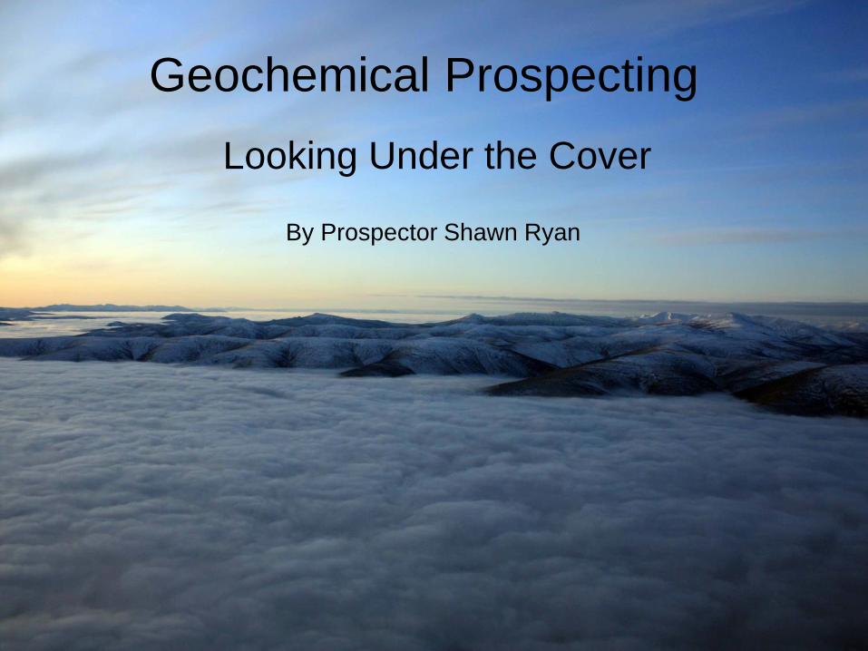
Geochemical Prospecting
Looking Under the Cover
By Prospector Shawn Ryan
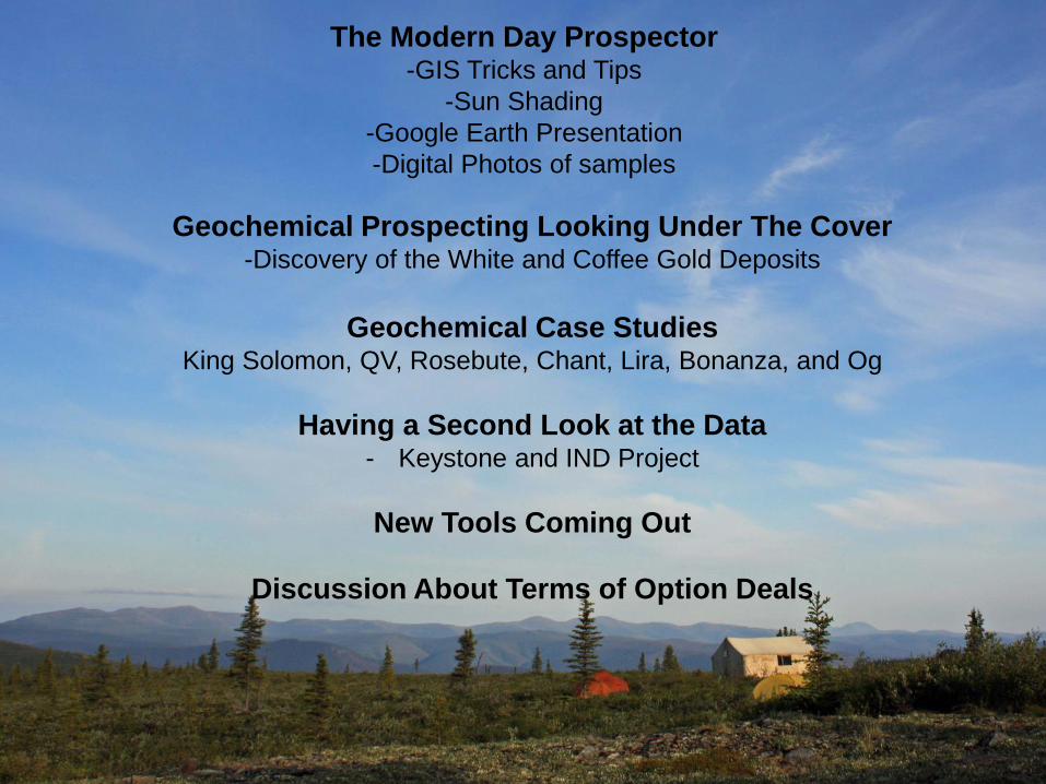
The Modern Day Prospector -GIS Tricks and Tips
-Sun Shading
-Google Earth Presentation
-Digital Photos of samples
Geochemical Prospecting Looking Under The Cover -Discovery of the White and Coffee Gold Deposits
Geochemical Case Studies King Solomon, QV, Rosebute, Chant, Lira, Bonanza, and Og
Having a Second Look at the Data - Keystone and IND Project
New Tools Coming Out
Discussion About Terms of Option Deals
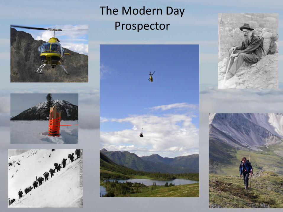
The Modern Day Prospector
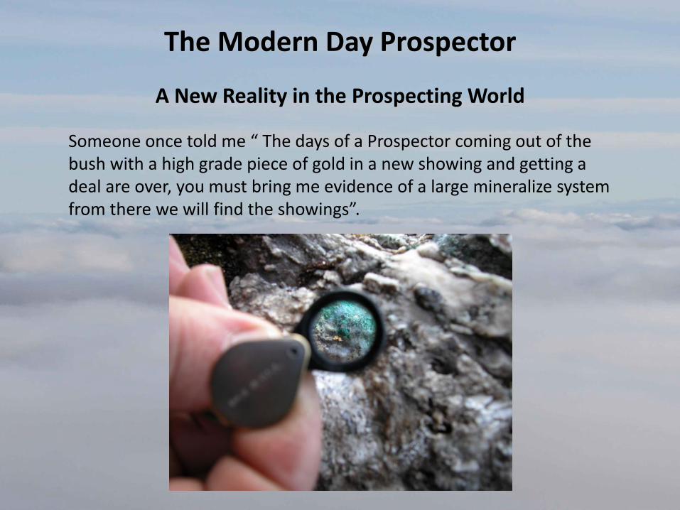
The Modern Day Prospector
A New Reality in the Prospecting World
Someone once told me “ The days of a Prospector coming out of the bush with a high grade piece of gold in a new showing and getting a deal are over, you must bring me evidence of a large mineralize system from there we will find the showings”.
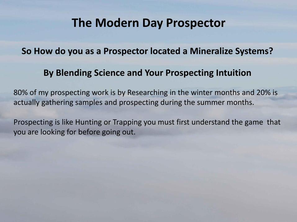
The Modern Day Prospector
So How do you as a Prospector located a Mineralize Systems?
By Blending Science and Your Prospecting Intuition
80% of my prospecting work is by Researching in the winter months and 20% is actually gathering samples and prospecting during the summer months. Prospecting is like Hunting or Trapping you must first understand the game that you are looking for before going out.
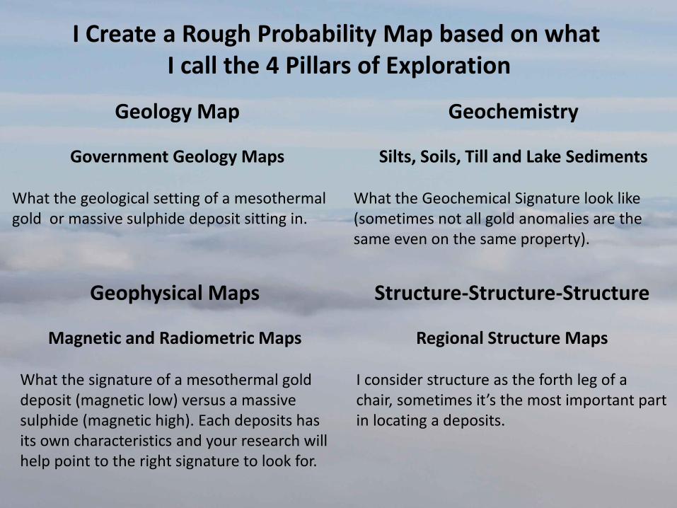
I Create a Rough Probability Map based on what I call the 4 Pillars of Exploration
Geology Map
Government Geology Maps What the geological setting of a mesothermal gold or massive sulphide deposit sitting in.
Geochemistry
Silts, Soils, Till and Lake Sediments What the Geochemical Signature look like (sometimes not all gold anomalies are the same even on the same property).
Geophysical Maps
Magnetic and Radiometric Maps What the signature of a mesothermal gold deposit (magnetic low) versus a massive sulphide (magnetic high). Each deposits has its own characteristics and your research will help point to the right signature to look for.
Structure-Structure-Structure
Regional Structure Maps I consider structure as the forth leg of a chair, sometimes it’s the most important part in locating a deposits.
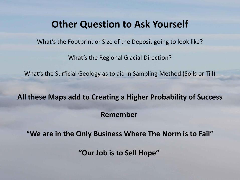
Other Question to Ask Yourself
What’s the Footprint or Size of the Deposit going to look like?
What’s the Regional Glacial Direction?
What’s the Surficial Geology as to aid in Sampling Method (Soils or Till)
All these Maps add to Creating a Higher Probability of Success
Remember
“We are in the Only Business Where The Norm is to Fail”
“Our Job is to Sell Hope”
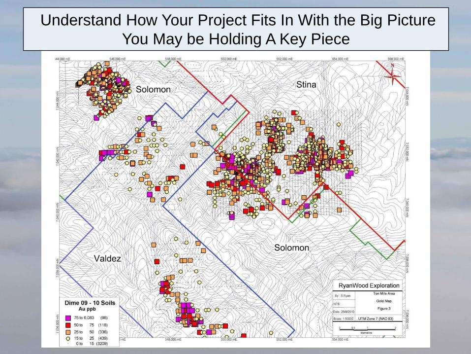
Understand How Your Project Fits In With the Big Picture
You May be Holding A Key Piece
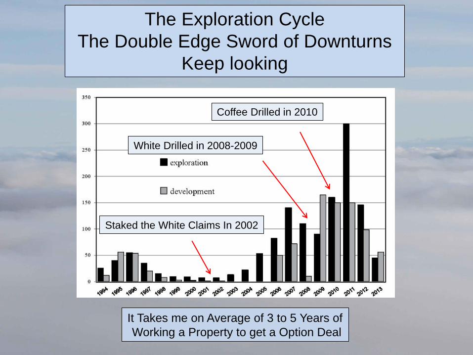
The Exploration Cycle
The Double Edge Sword of Downturns
Keep looking
Staked the White Claims In 2002
It Takes me on Average of 3 to 5 Years of
Working a Property to get a Option Deal
White Drilled in 2008-2009
Coffee Drilled in 2010
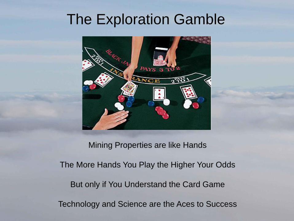
The Exploration Gamble
Mining Properties are like Hands
The More Hands You Play the Higher Your Odds
But only if You Understand the Card Game
Technology and Science are the Aces to Success
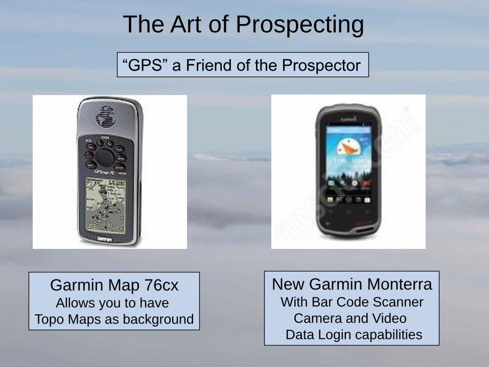
The Art of Prospecting
“GPS” a Friend of the Prospector
Garmin Map 76cx Allows you to have
Topo Maps as background
New Garmin Monterra With Bar Code Scanner
Camera and Video
Data Login capabilities
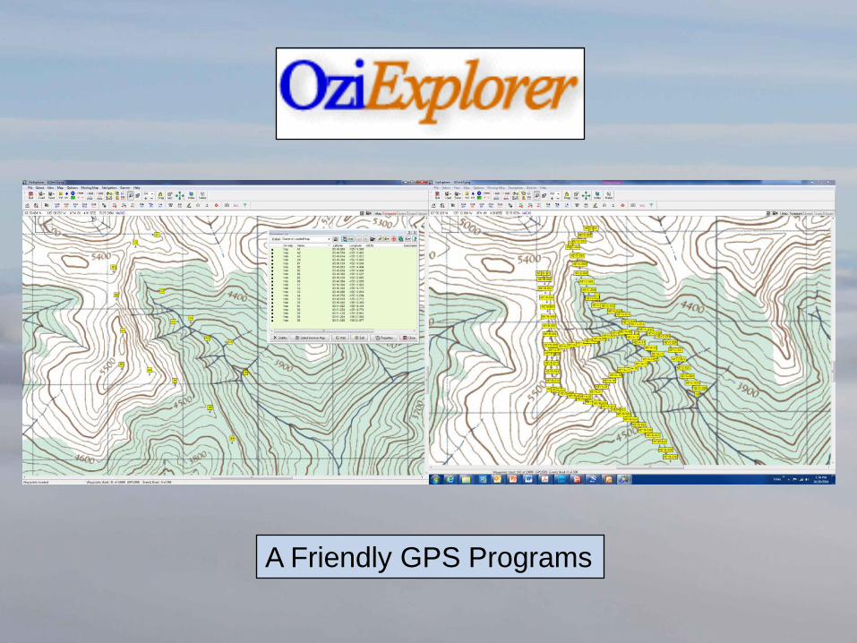
A Friendly GPS Programs
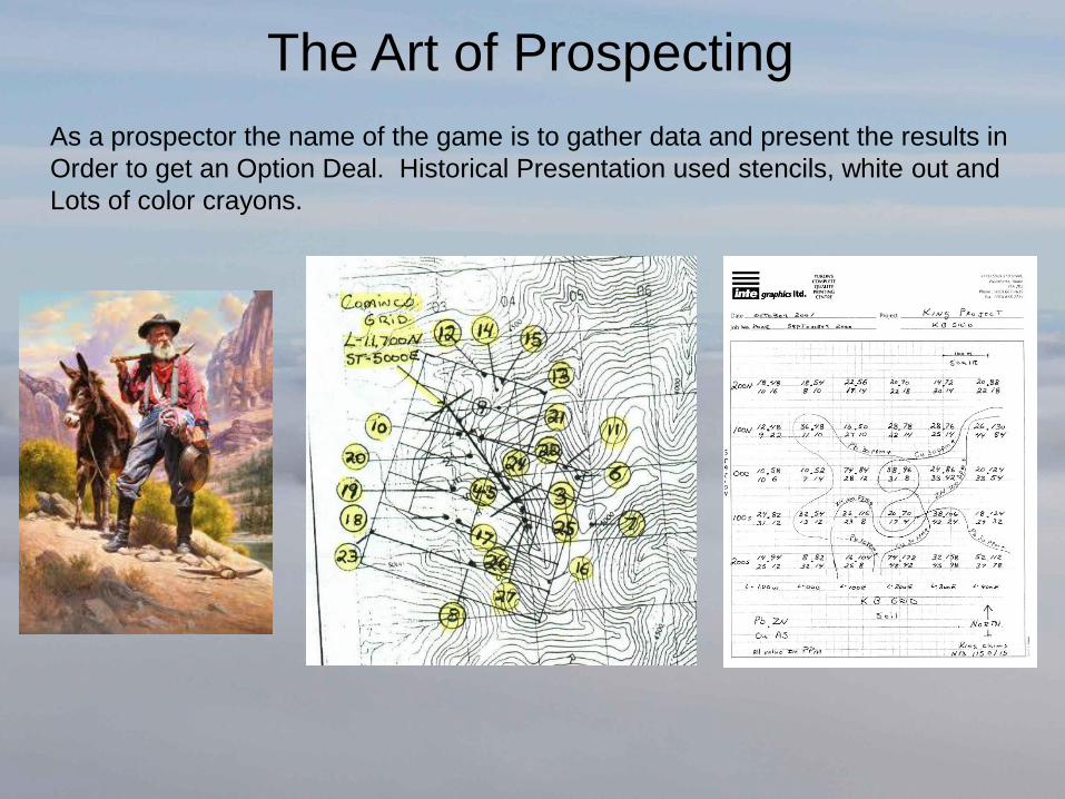
The Art of Prospecting
As a prospector the name of the game is to gather data and present the results in
Order to get an Option Deal. Historical Presentation used stencils, white out and
Lots of color crayons.
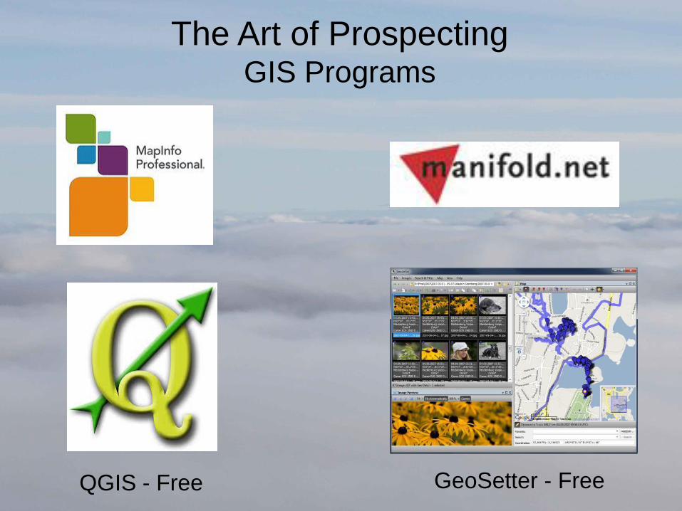
The Art of Prospecting GIS Programs
QGIS - Free GeoSetter - Free
Tricks and Tips
To Help with
Presentation
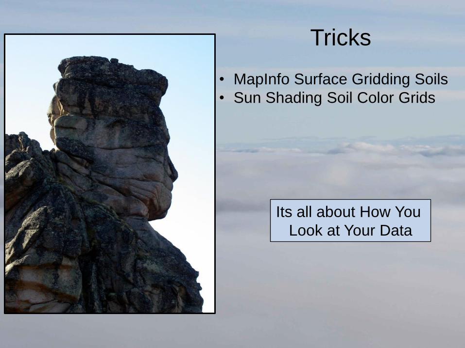
Tricks
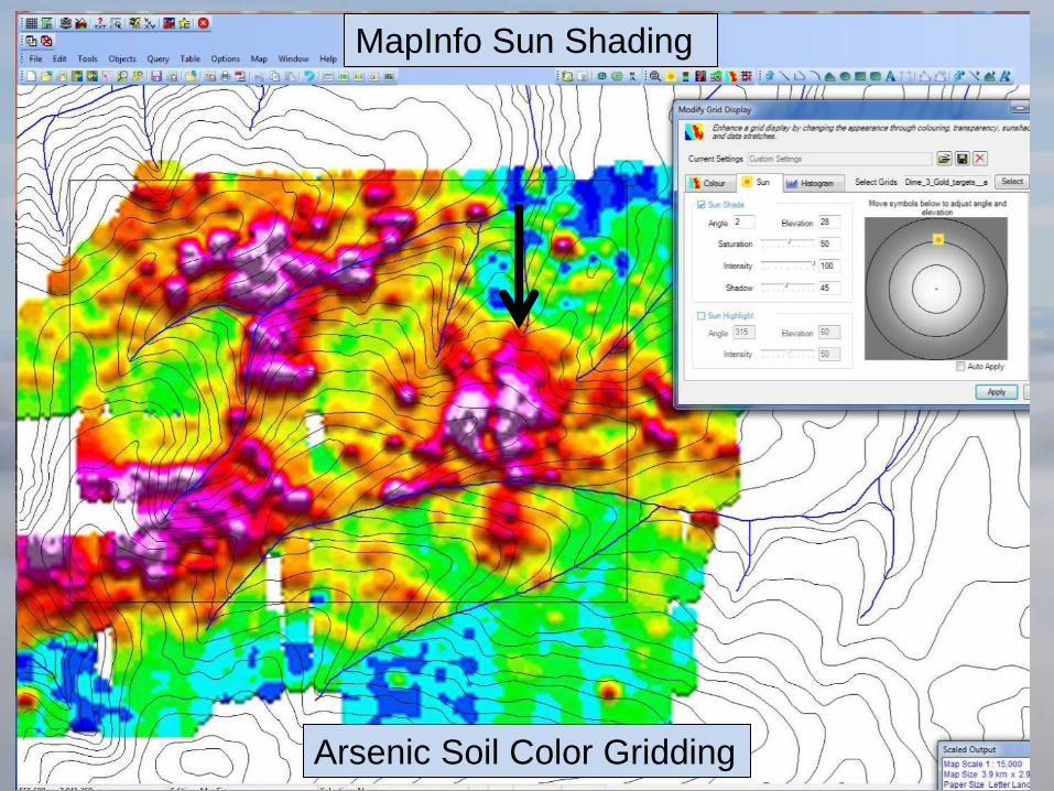
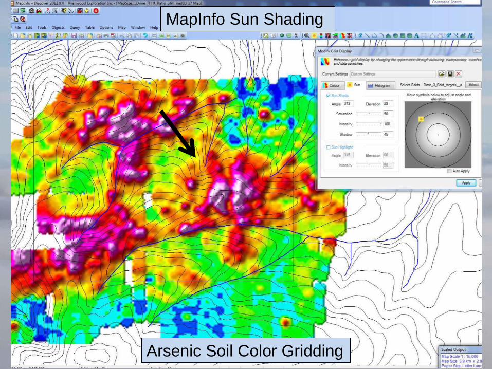
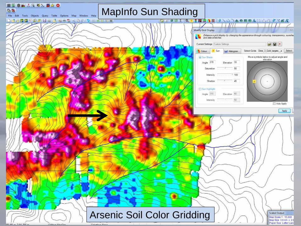
• MapInfo Surface Gridding Soils
• Sun Shading Soil Color Grids
Its all about How You
Look at Your Data
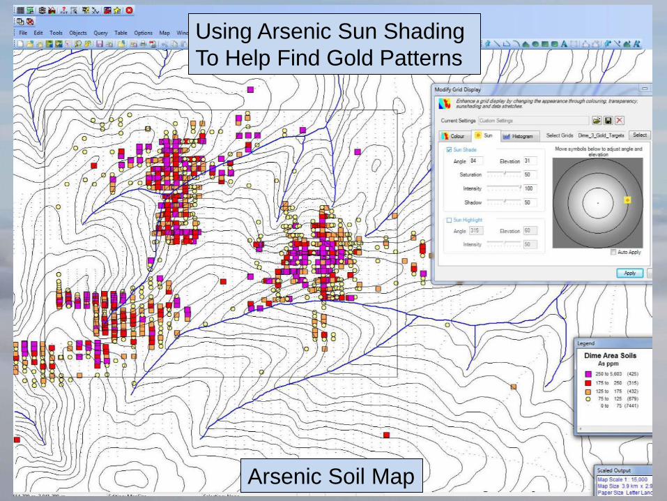
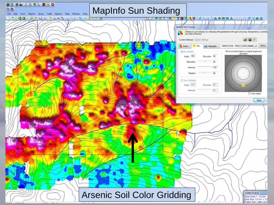
Arsenic Soil Map
Using Arsenic Sun Shading
To Help Find Gold Patterns
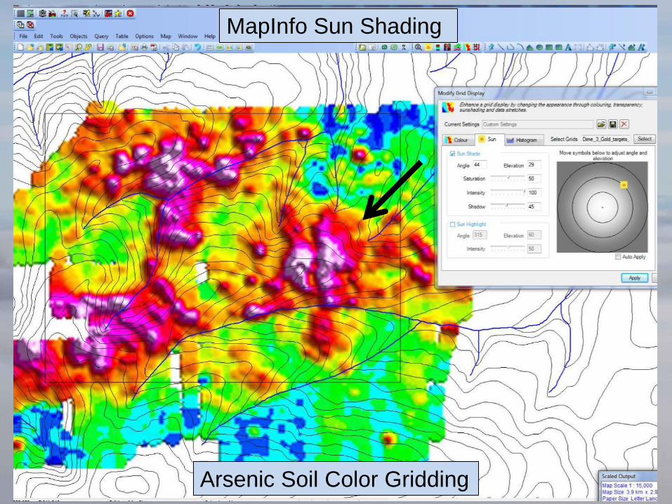
Arsenic Soil Color Gridding
MapInfo Sun Shading
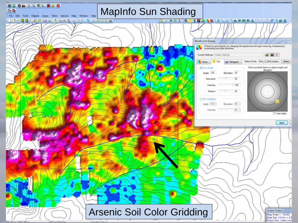
MapInfo Sun Shading
Arsenic Soil Color Gridding
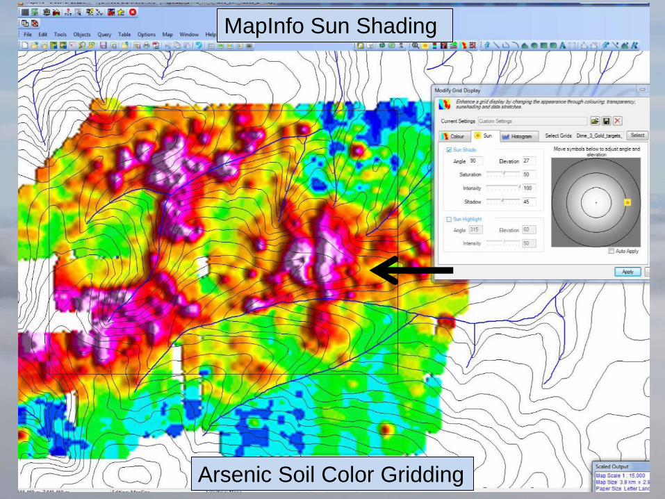
MapInfo Sun Shading
Arsenic Soil Color Gridding
MapInfo Sun Shading
Arsenic Soil Color Gridding
MapInfo Sun Shading
Arsenic Soil Color Gridding
MapInfo Sun Shading
Arsenic Soil Color Gridding
MapInfo Sun Shading
Arsenic Soil Color Gridding
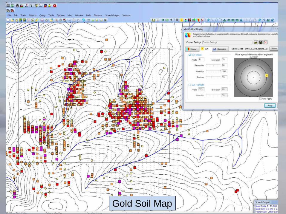
Gold Soil Map
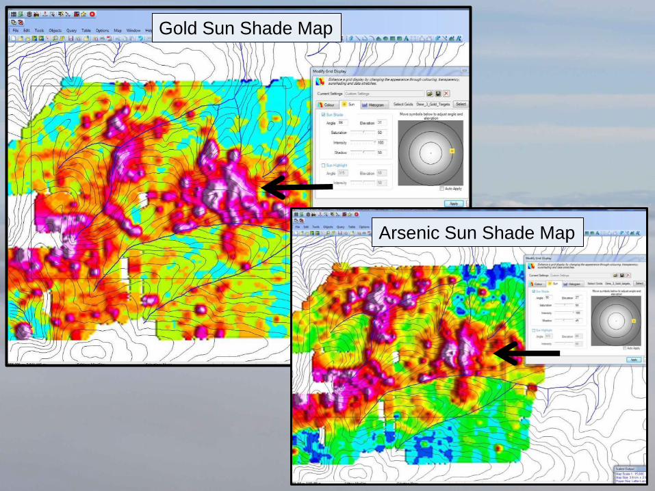
Gold Sun Shade Map
Arsenic Sun Shade Map
Google Earth
For Presentation
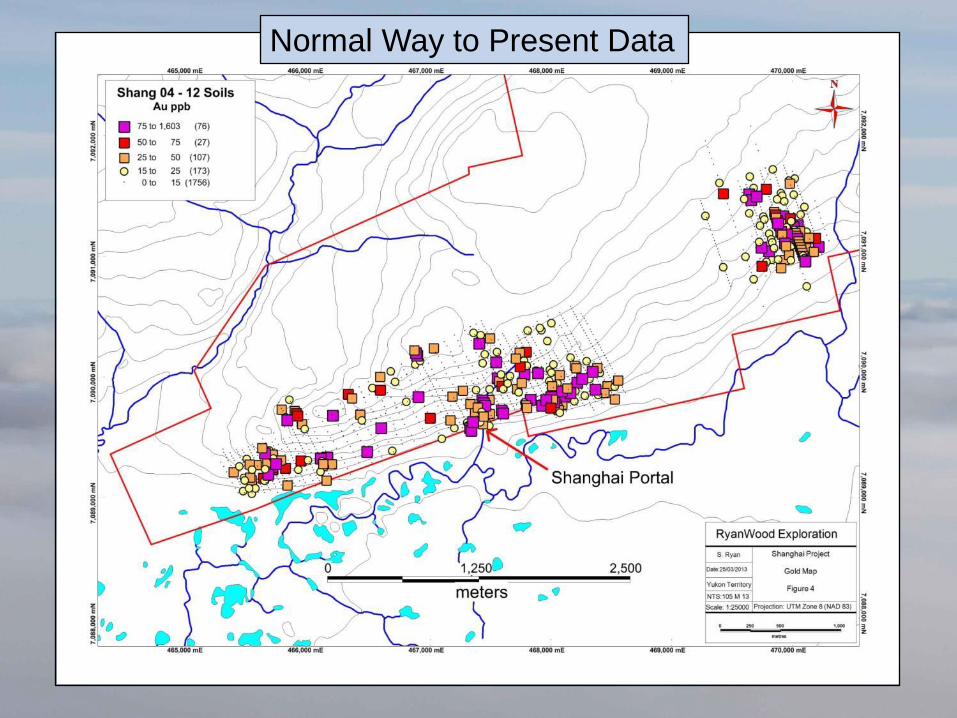
Normal Way to Present Data
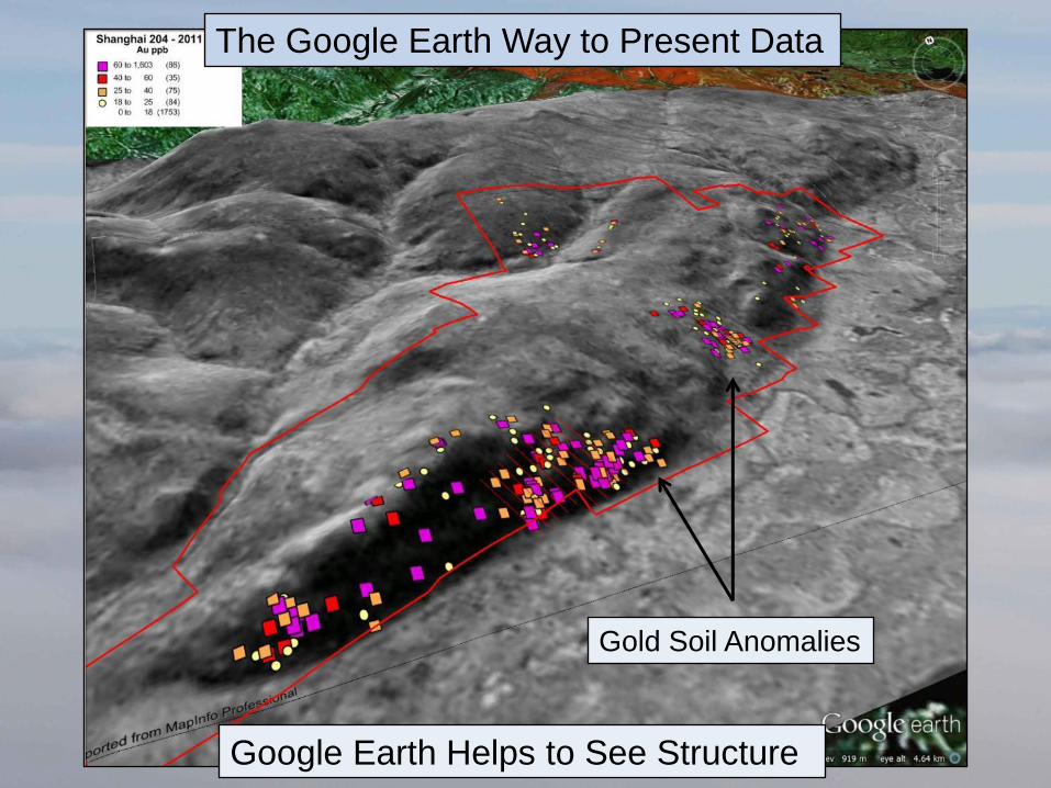
Gold Soil Anomalies
Google Earth Helps to See Structure
The Google Earth Way to Present Data
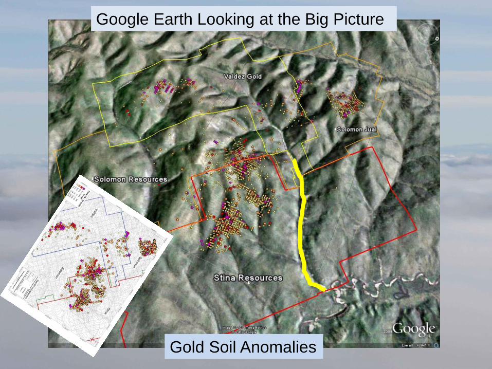
Google Earth Looking at the Big Picture
Gold Soil Anomalies
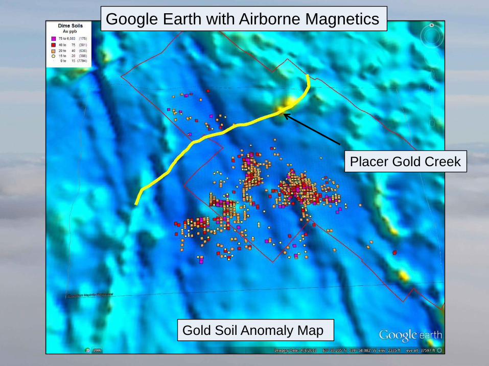
Gold Soil Anomaly Map
Google Earth with Airborne Magnetics
Placer Gold Creek
The Art of Prospecting
GIS Programs
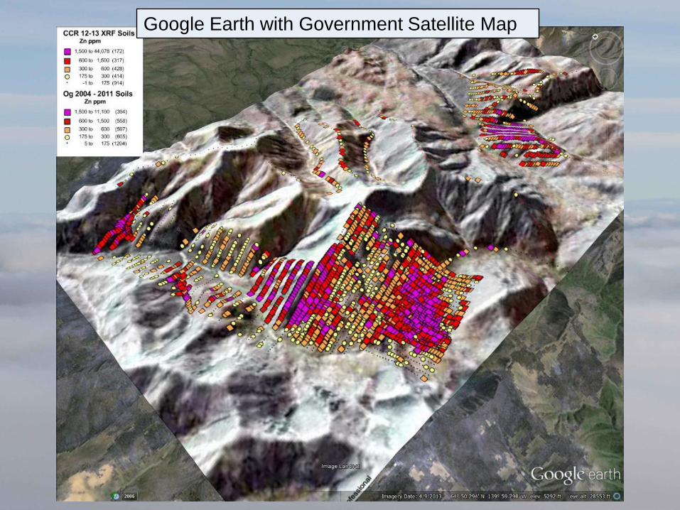
Google Earth with Government Satellite Map
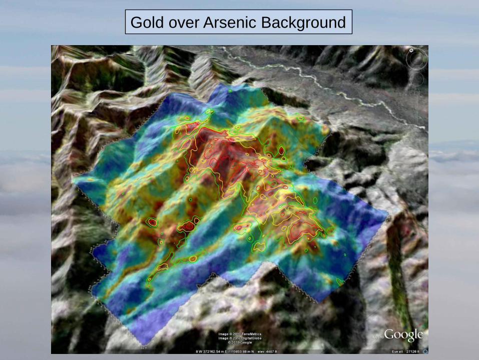
Gold over Arsenic Background
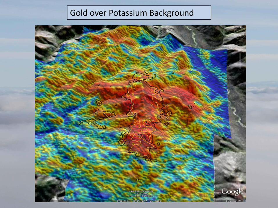
Gold over Potassium Background
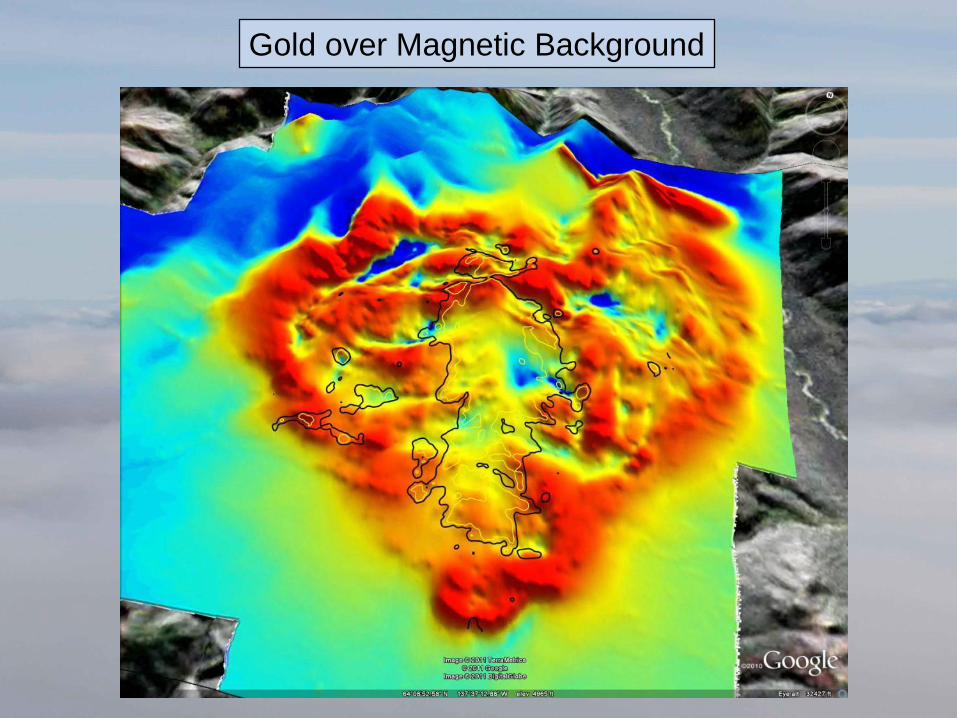
Gold over Magnetic Background
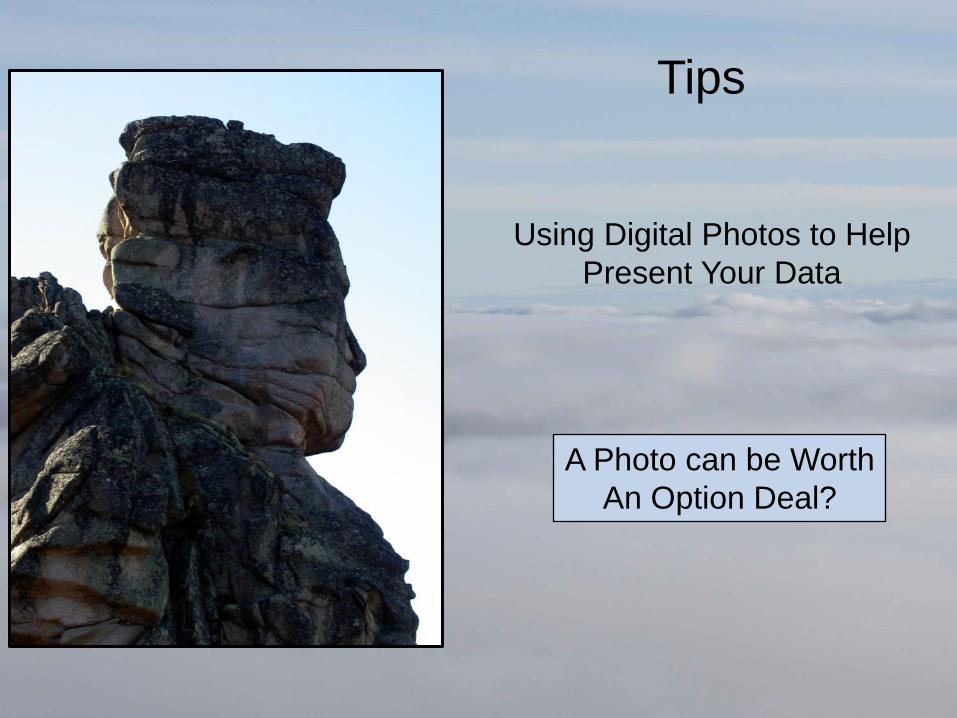
Tips
A Photo can be Worth
An Option Deal?
Using Digital Photos to Help
Present Your Data
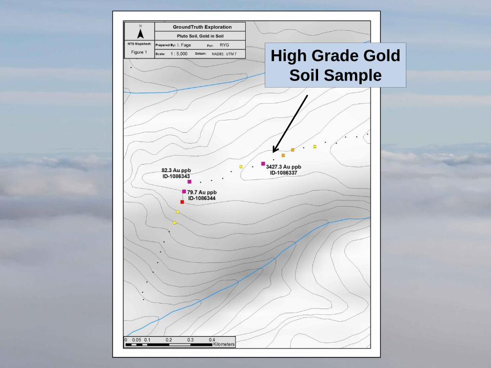
High Grade Gold
Soil Sample
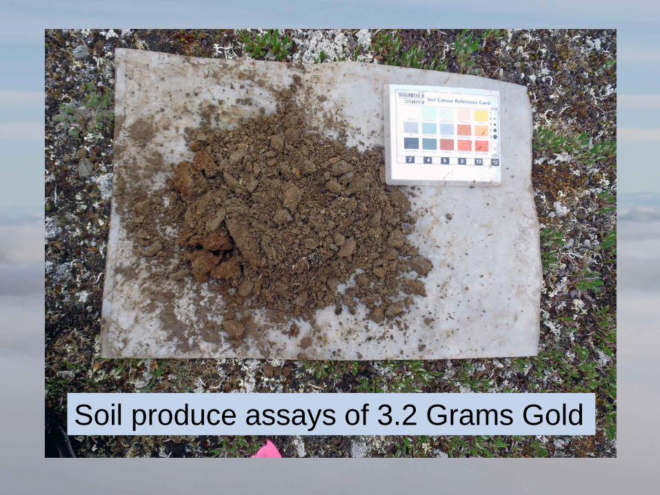
Soil produce assays of 3.2 Grams Gold
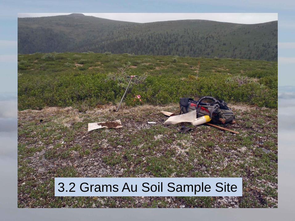
3.2 Grams Au Soil Sample Site
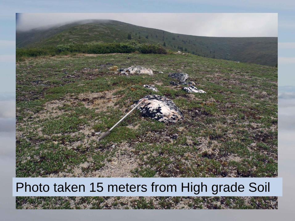
Photo taken 15 meters from High grade Soil
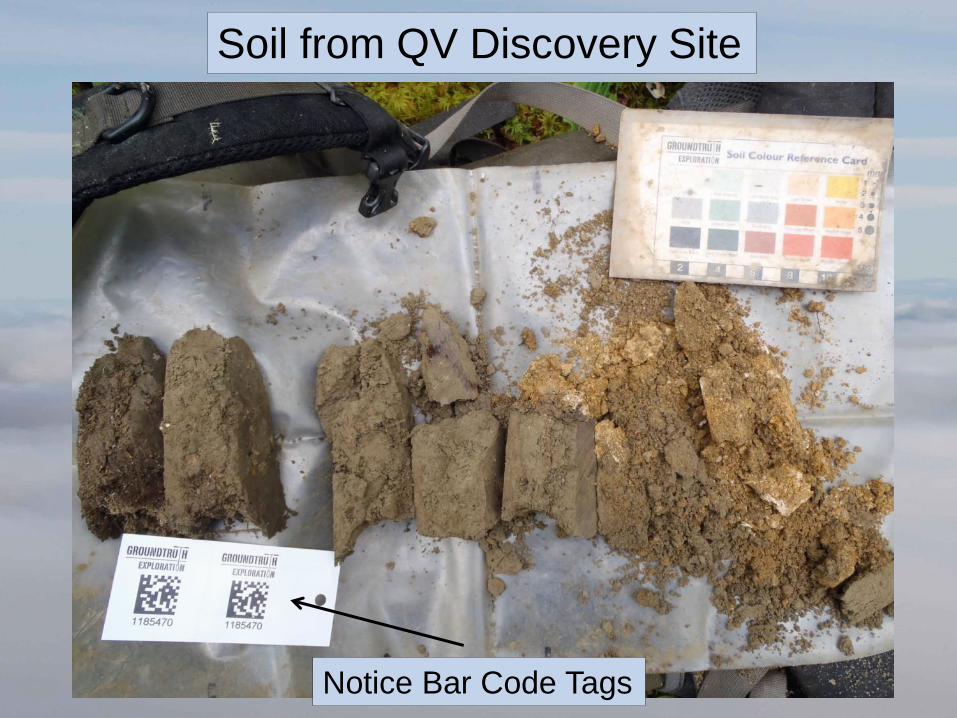
Soil from QV Discovery Site
Notice Bar Code Tags
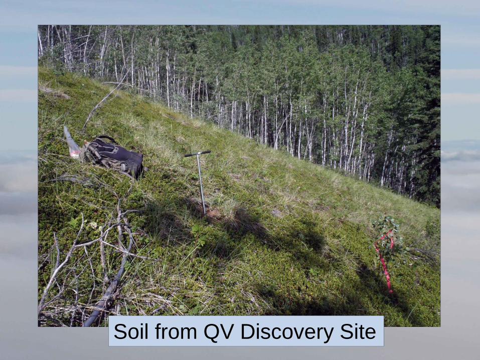
Soil from QV Discovery Site
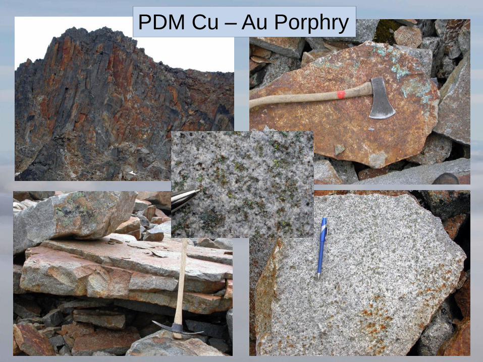
PDM Cu – Au Porphry
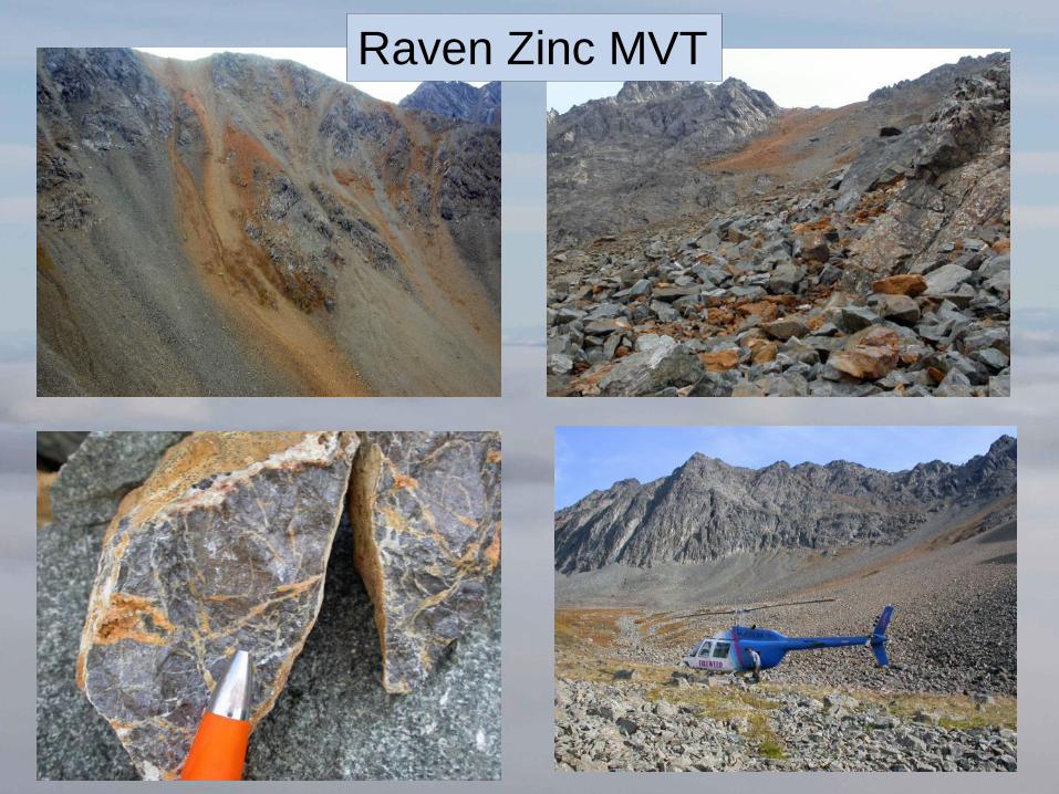
Raven Zinc MVT
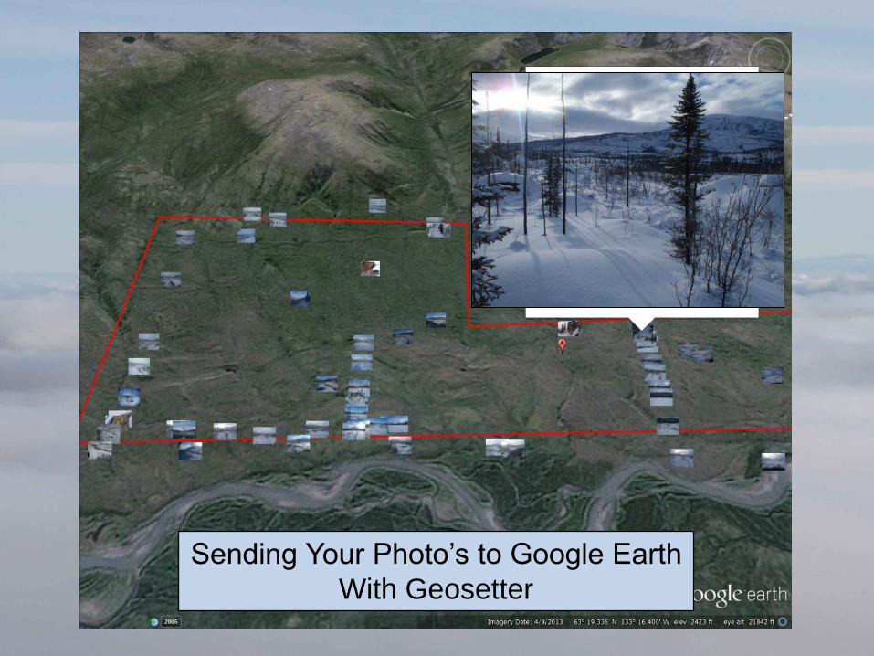
Sending Your Photo’s to Google Earth
With Geosetter