Embed Size (px)
Citation preview
Esri Maritime | Professional ServicesGEBCO Science Day |
Managing Bathymetry in the Cloud with GISTimothy Kearns & Beata Van Esch
Tuesday, October 4, 2011
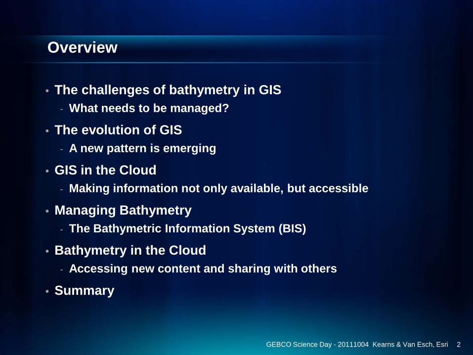
Overview
• The challenges of bathymetry in GIS- What needs to be managed?
• The evolution of GIS- A new pattern is emerging
• GIS in the Cloud- Making information not only available, but accessible
• Managing Bathymetry- The Bathymetric Information System (BIS)
• Bathymetry in the Cloud- Accessing new content and sharing with others
• Summary
GEBCO Science Day - 20111004 Kearns & Van Esch, Esri 2
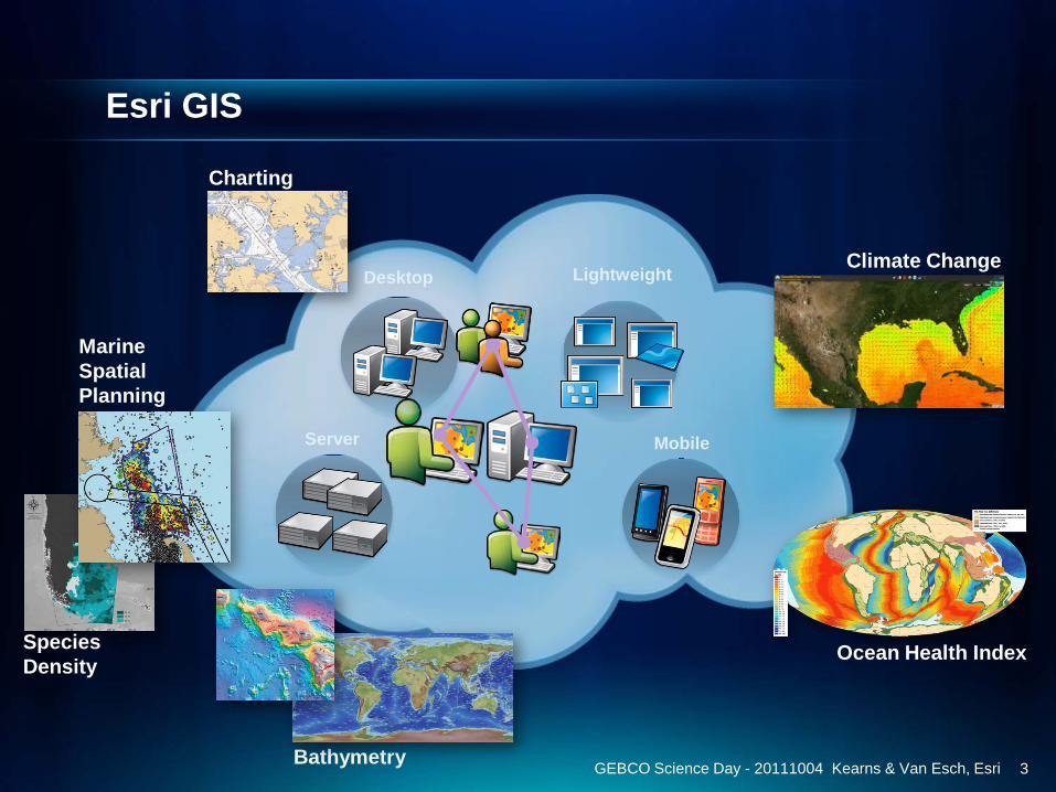
Esri GIS
3GEBCO Science Day - 20111004 Kearns & Van Esch, Esri
Server
Desktop
Mobile
Lightweight
Charting
Climate Change
Ocean Health Index
Bathymetry
Species Density
Marine Spatial Planning
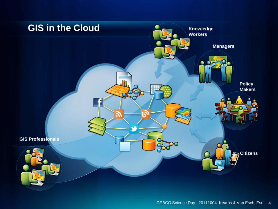
GIS in the Cloud
4GEBCO Science Day - 20111004 Kearns & Van Esch, Esri
GIS Professionals
Knowledge Workers
Managers
Policy Makers
Citizens
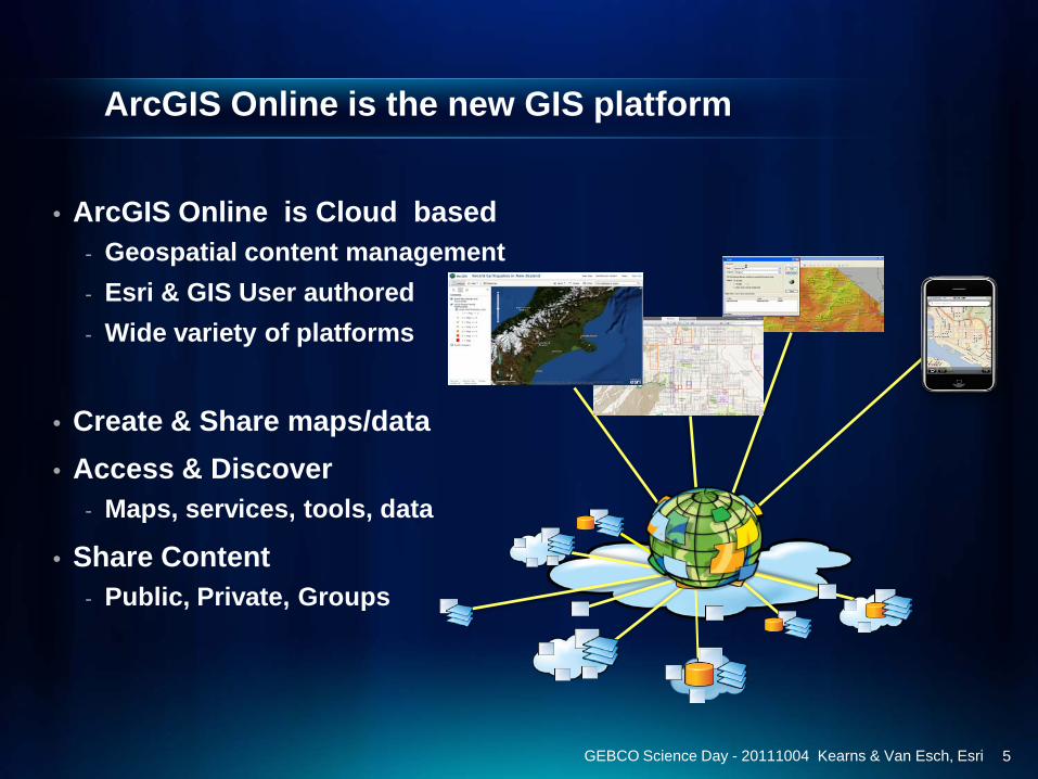
ArcGIS Online is the new GIS platform
• ArcGIS Online is Cloud based- Geospatial content management- Esri & GIS User authored- Wide variety of platforms
• Create & Share maps/data• Access & Discover
- Maps, services, tools, data
• Share Content- Public, Private, Groups
GEBCO Science Day - 20111004 Kearns & Van Esch, Esri 5
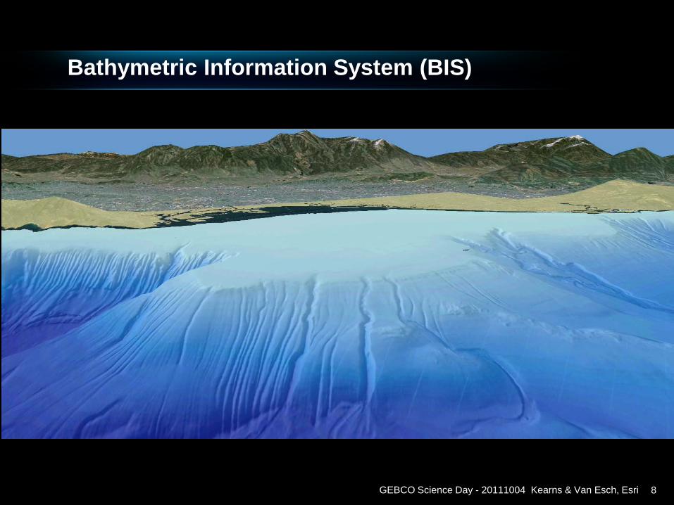
Bathymetric Information System (BIS)
GEBCO Science Day - 20111004 Kearns & Van Esch, Esri 8
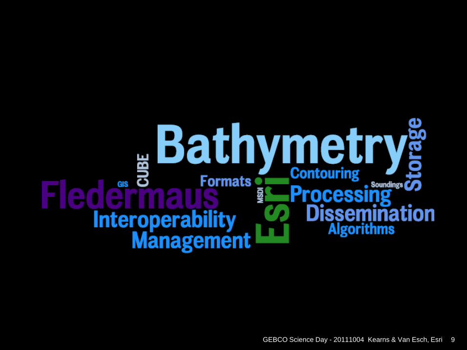
GEBCO Science Day - 20111004 Kearns & Van Esch, Esri 9
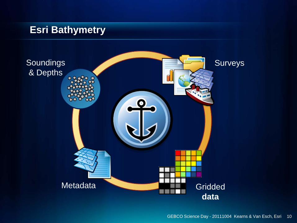
Esri Bathymetry
10GEBCO Science Day - 20111004 Kearns & Van Esch, Esri
Metadata Griddeddata
SurveysSoundings & Depths
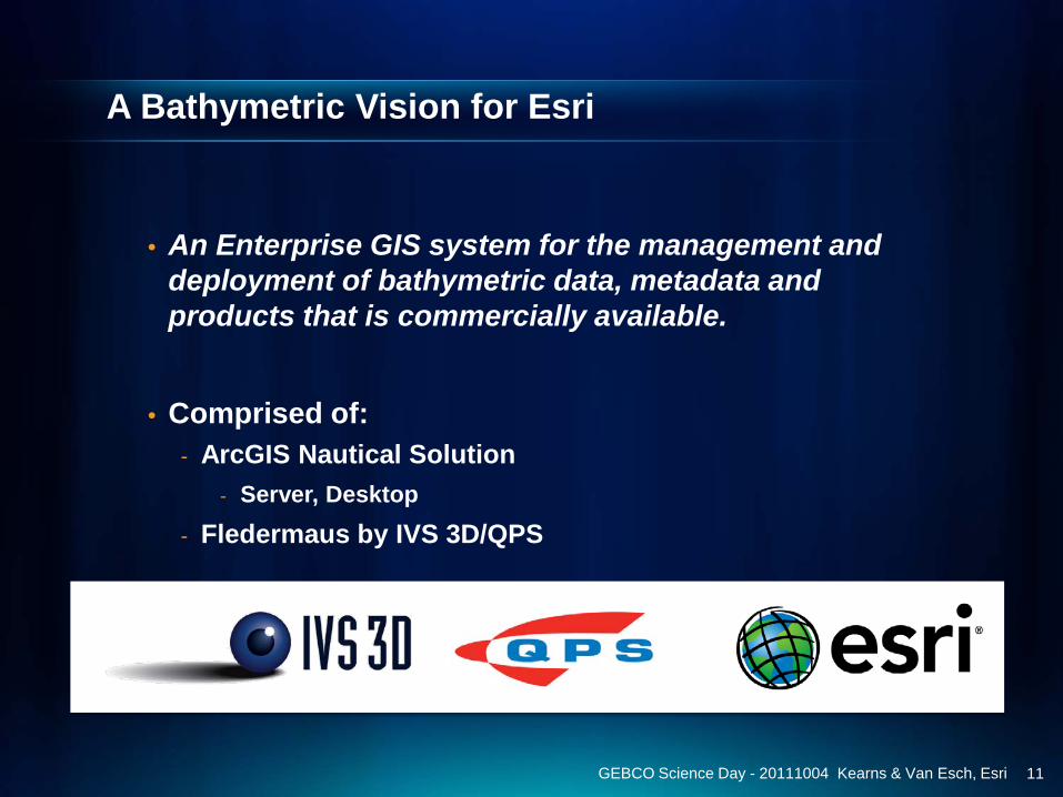
A Bathymetric Vision for Esri
• An Enterprise GIS system for the management and deployment of bathymetric data, metadata and products that is commercially available.
• Comprised of:- ArcGIS Nautical Solution
- Server, Desktop- Fledermaus by IVS 3D/QPS
GEBCO Science Day - 20111004 Kearns & Van Esch, Esri 11
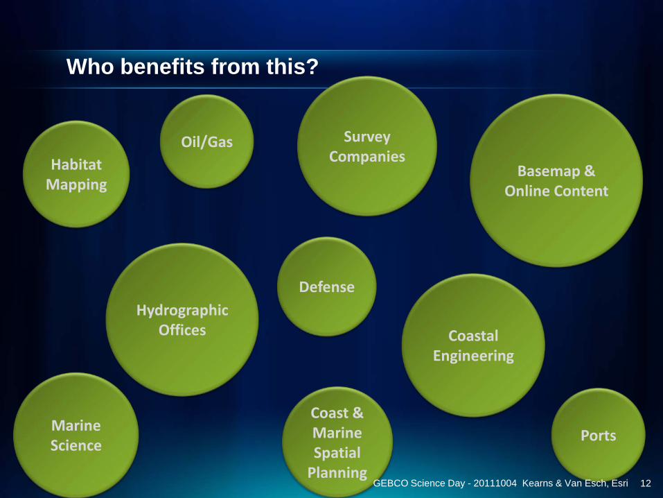
Marine Science
Oil/Gas
Who benefits from this?
Basemap & Online Content
Survey Companies
Hydrographic Offices
Defense
Ports
Habitat Mapping
CoastalEngineering
Coast & Marine Spatial
PlanningGEBCO Science Day - 20111004 Kearns & Van Esch, Esri 12
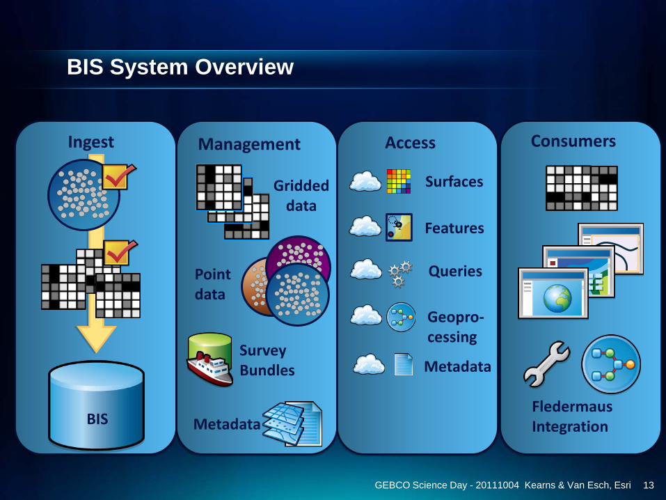
BIS System Overview
BIS
Ingest Management
Griddeddata
Pointdata
SurveyBundles
Metadata
Access
Surfaces
52 Features
Queries
Geopro-cessing
Metadata
Consumers
FledermausIntegration
GEBCO Science Day - 20111004 Kearns & Van Esch, Esri 13
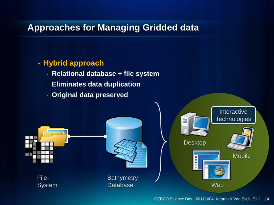
Approaches for Managing Gridded data
• Hybrid approach- Relational database + file system - Eliminates data duplication- Original data preserved
GEBCO Science Day - 20111004 Kearns & Van Esch, Esri
Web
Mobile
Desktop
BathymetryDatabase
File-System
InteractiveTechnologies
14

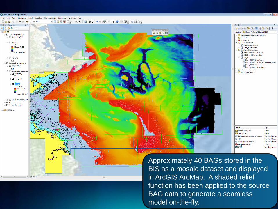
Mosaic Dataset technology
GEBCO Science Day - 20111004 Kearns & Van Esch, Esri
The Esri Mosaic Dataset compiles gridded data as a source to generate on-the-fly mosaicked images according to a variety of user-specified configurations.
15
16GEBCO Science Day - 20111004 Kearns & Van Esch, Esri
Approximately 40 BAGs stored in the BIS as a mosaic dataset and displayed in ArcGIS ArcMap. A shaded relief function has been applied to the source BAG data to generate a seamless model on-the-fly.
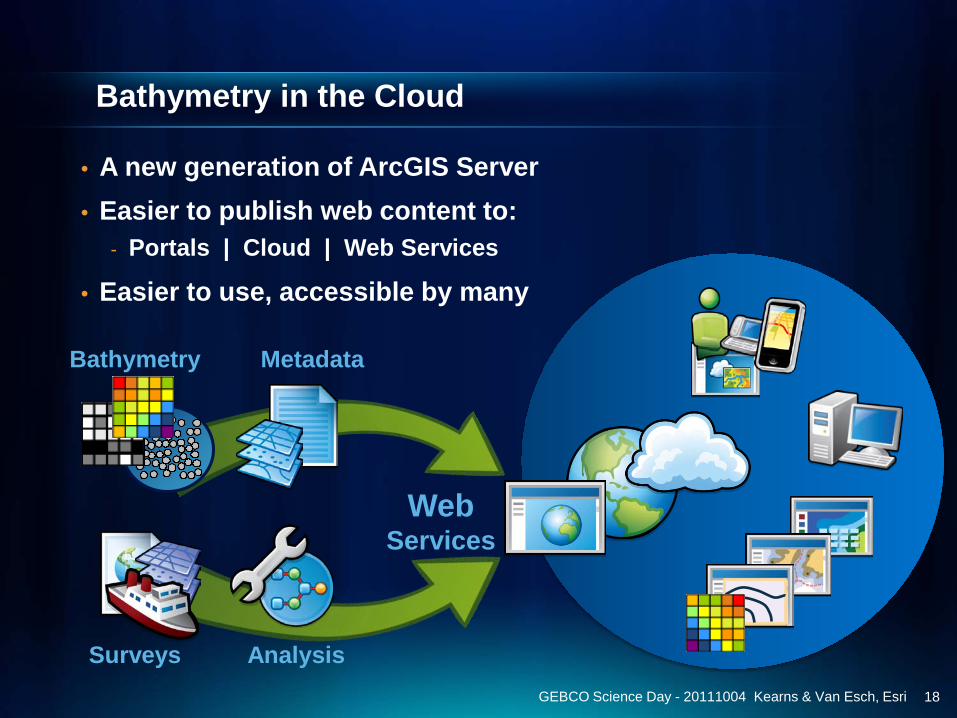
Bathymetry in the Cloud
• A new generation of ArcGIS Server• Easier to publish web content to:
- Portals | Cloud | Web Services
• Easier to use, accessible by many
Metadata
Surveys
Bathymetry
Analysis
WebServices
GEBCO Science Day - 20111004 Kearns & Van Esch, Esri 18
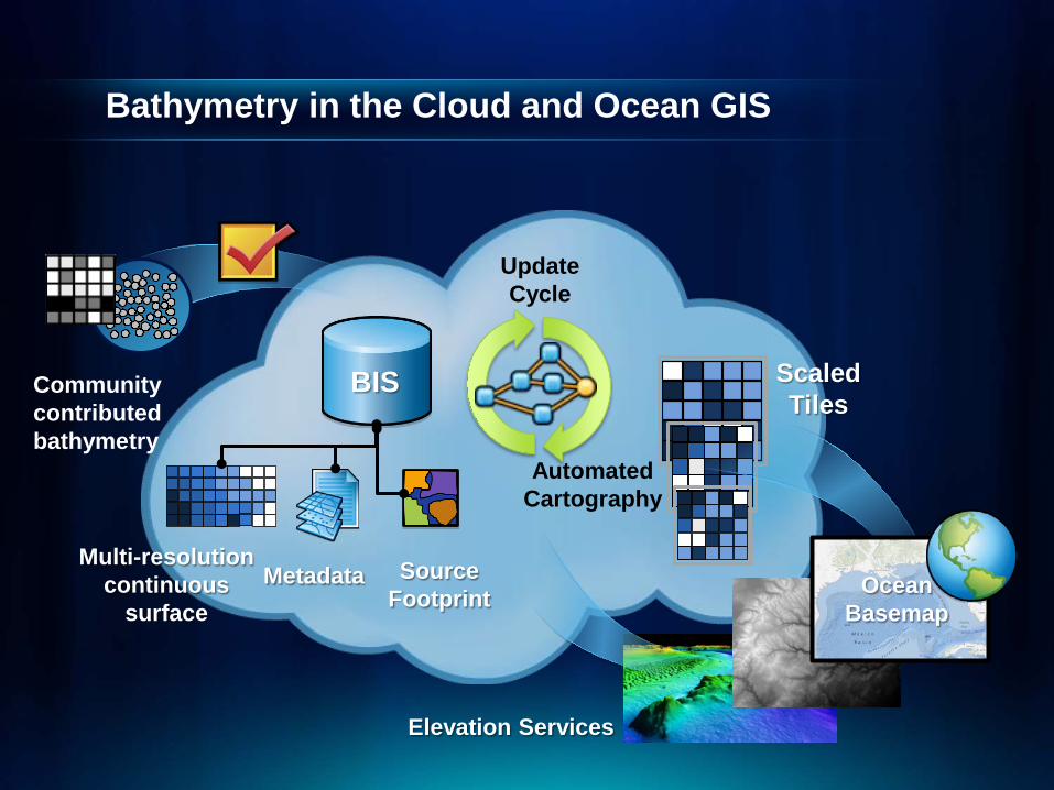
Bathymetry in the Cloud and Ocean GIS
Update Cycle
ScaledTiles
AutomatedCartography
Elevation Services
OceanBasemap
Community contributedbathymetry
Metadata SourceFootprint
Multi-resolutioncontinuous
surface
BIS


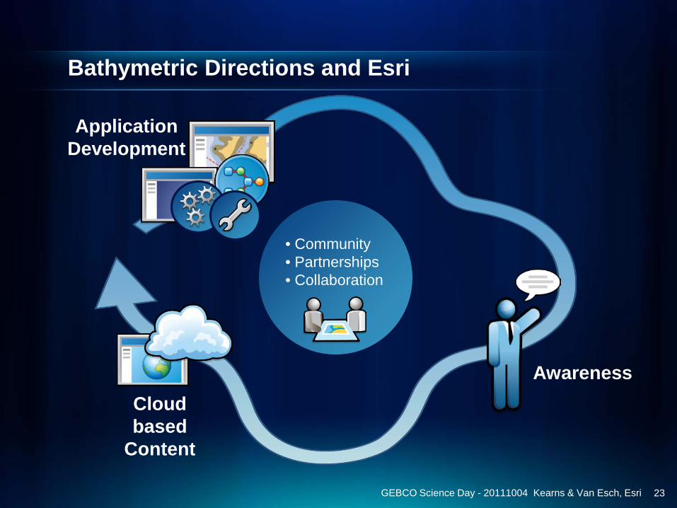
Bathymetric Directions and Esri
• Community• Partnerships • Collaboration
Cloud based
Content
ApplicationDevelopment
Awareness
GEBCO Science Day - 20111004 Kearns & Van Esch, Esri 23

Summary & Contact
• GIS has evolved to a new platform• Bathymetry and GIS are merging• Cloud computing allows accessibility• Ocean basemap and Elevation Services allow for
sharing and creation of intelligent maps
Contact:• Timothy Kearns, [email protected]
• Beata Van Esch, [email protected]
• Bathymetry Team, [email protected]
Company Site: www.esri.com
24GEBCO Science Day - 20111004 Kearns & Van Esch, Esri
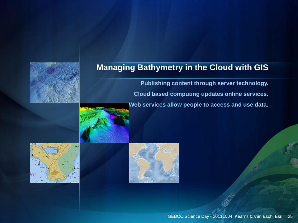
Publishing content through server technology.
Cloud based computing updates online services.
Web services allow people to access and use data.
Managing Bathymetry in the Cloud with GIS
GEBCO Science Day - 20111004 Kearns & Van Esch, Esri 25