Embed Size (px)
Citation preview
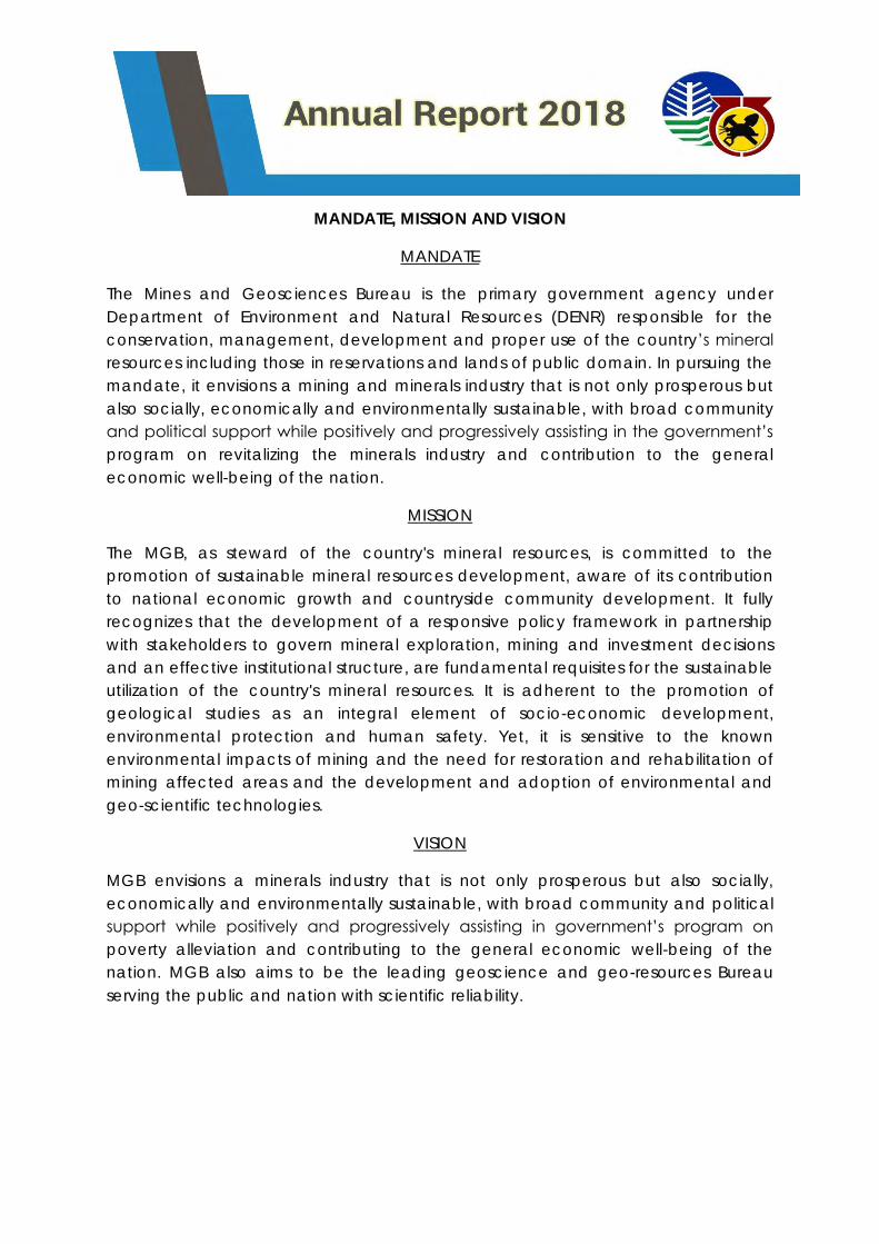
MANDATE, MISSION AND VISION
MANDATE
The Mines and Geosciences Bureau is the primary government agency under
Department of Environment and Natural Resources (DENR) responsible for the
conservation, management, development and proper use of the country’s mineral
resources including those in reservations and lands of public domain. In pursuing the
mandate, it envisions a mining and minerals industry that is not only prosperous but
also socially, economically and environmentally sustainable, with broad community
and political support while positively and progressively assisting in the government’s
program on revitalizing the minerals industry and contribution to the general
economic well-being of the nation.
MISSION
The MGB, as steward of the country's mineral resources, is committed to the
promotion of sustainable mineral resources development, aware of its contribution
to national economic growth and countryside community development. It fully
recognizes that the development of a responsive policy framework in partnership
with stakeholders to govern mineral exploration, mining and investment decisions
and an effective institutional structure, are fundamental requisites for the sustainable
utilization of the country's mineral resources. It is adherent to the promotion of
geological studies as an integral element of socio-economic development,
environmental protection and human safety. Yet, it is sensitive to the known
environmental impacts of mining and the need for restoration and rehabilitation of
mining affected areas and the development and adoption of environmental and
geo-scientific technologies.
VISION
MGB envisions a minerals industry that is not only prosperous but also socially,
economically and environmentally sustainable, with broad community and political
support while positively and progressively assisting in government’s program on
poverty alleviation and contributing to the general economic well-being of the
nation. MGB also aims to be the leading geoscience and geo-resources Bureau
serving the public and nation with scientific reliability.
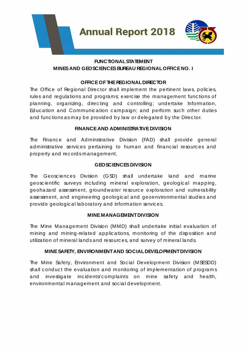
FUNCTIONAL STATEMENT
MINES AND GEOSCIENCES BUREAU REGIONAL OFFICE NO. I
OFFICE OF THE REGIONAL DIRECTOR
The Office of Regional Director shall implement the pertinent laws, policies,
rules and regulations and programs; exercise the management functions of
planning, organizing, directing and controlling; undertake Information,
Education and Communication campaign; and perform such other duties
and functions as may be provided by law or delegated by the Director.
FINANCE AND ADMINISTRATIVE DIVISION
The Finance and Administrative Division (FAD) shall provide general
administrative services pertaining to human and financial resources and
property and records management.
GEOSCIENCES DIVISION
The Geosciences Division (GSD) shall undertake land and marine
geoscientific surveys including mineral exploration, geological mapping,
geohazard assessment, groundwater resource exploration and vulnerability
assessment, and engineering geological and geoenvironmental studies and
provide geological laboratory and information services.
MINE MANAGEMENT DIVISION
The Mine Management Division (MMD) shall undertake initial evaluation of
mining and mining-related applications, monitoring of the disposition and
utilization of mineral lands and resources, and survey of mineral lands.
MINE SAFETY, ENVIRONMENT AND SOCIAL DEVELOPMENT DIVISION
The Mine Safety, Environment and Social Development Division (MSESDD)
shall conduct the evaluation and monitoring of implementation of programs
and investigate incidents/complaints on mine safety and health,
environmental management and social development.
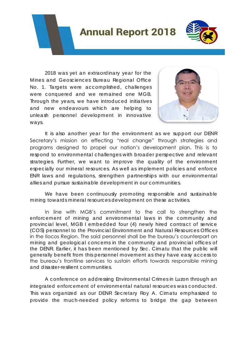
2018 was yet an extraordinary year for the
Mines and Geosciences Bureau Regional Office
No. 1. Targets were accomplished, challenges
were conquered and we remained one MGB.
Through the years, we have introduced initiatives
and new endeavours which are helping to
unleash personnel development in innovative
ways.
It is also another year for the environment as we support our DENR
Secretary’s mission on effecting “real change” through strategies and
programs designed to propel our nation’s development plan. This is to
respond to environmental challenges with broader perspective and relevant
strategies. Further, we want to improve the quality of the environment
especially our mineral resources. As well as implement policies and enforce
ENR laws and regulations, strengthen partnerships with our environmental
allies and pursue sustainable development in our communities.
We have been continuously promoting responsible and sustainable
mining towards mineral resources development on these activities.
In line with MGB’s commitment to the call to strengthen the
enforcement of mining and environmental laws in the community and
provincial level, MGB I embedded four (4) newly hired contract of service
(COS) personnel to the Provincial Environment and Natural Resources Offices
in the Ilocos Region. The said personnel shall be the bureau’s counterpart on
mining and geological concerns in the community and provincial offices of
the DENR. Earlier, it has been mentioned by Sec. Cimatu that the public will
generally benefit from this personnel movement as they have easy access to
the bureau’s frontline services to sustain efforts towards responsible mining
and disaster-resilient communities.
A conference on addressing Environmental Crimes in Luzon through an
integrated enforcement of environmental natural resources was conducted.
This was organized as our DENR Secretary Roy A. Cimatu emphasized to
provide the much-needed policy reforms to bridge the gap between
achieving environmental justice and enforcement of environmental laws. He
directed DENR officials to crack down violators and act immediately on
activities related to the destruction of the environment particularly on priority
ENR law enforcement issues including illegal logging, illegal and destructive
mining, environmental pollution, illegal wildlife collection & trade and illegal
land conversion. MGB have identified several mining-related environmental
crimes and common modus operandi in illegal mining. In response to this,
MGB launched a campaign against illegal mining, collaborated with other
government agencies/task forces, NGOs/POs and continues the public
awareness campaign on mining regulations and responsible mining.
The 1st Costal Watch Summit was also conducted to identify issues and
problems confronting effective management of beach areas especially the
quality of the water. Also it intended to enhance the level of understanding
of different stakeholders on the various laws, rules and regulations governing
the management of the coastal areas.
MGB I discussed on the Coastal Geohazard Mapping and Assessment
Program which shall give the public substantial information on coastal areas
or shorelines that are experiencing erosion or prone to erosion and accretion.
The said program aims to provide vital information to policymakers and the
public in order to make them understand the risk of hazards, enhance
preparedness, reinforce response, foster resilience and minimize the adverse
impacts of disasters.
We have also issued a cease and desist order to 14 quarry operators
along the Bolo river covering the municipalities of Bangui, Dumalneg,
Pagudpud for operating without the necessary permits from the MGB or from
the provincial government of Ilocos Norte. Prior to this, a field inspection and
assessment was done by our office in coordination with PENRO Ilocos Norte.
Based on the report, these sand and gravel quarrying activities along the
Bolo river are not in accordance with the concept and parameters of aimed
at promoting Responsible Mining. The extraction of sand and gravel had
been carried out irresponsibly and unsystematically. Thus, allowing this to
continue may put harm to the lives and properties of the communities.

We also have conducted the orientation on the standardized checklist
for the Monitoring of Tenements and Safety, Health, Environmental and Social
Development Programs. This is in line with the streamlining of checklists of
requirements of various mining applications for their guidance in compliance
with the directives of President Rodrigo R. Duterte to simplify procedures,
streamline requirements and cut red tape in Government operations.
To further enhance the scientific understanding of participants towards
Global Earth Observation System of Systems (GEOSS), only on the fields of
disaster, health, and water through ocean and land based system approach,
IT specialists from the MGB Central Office conducted a training on
Geographic Information System (GIS). The basic training on ArcGIS software
application shall enable our technical personnel to interactively navigate the
earth spatial features and attributes towards realistic outcome that will be
used for real and present situation decisions.
And to keep up with our international recognition through the ISO
certification which we have attained last year, we have done our
management review to discuss and set our game plan for the upcoming ISO
audit. Further, we would like to ensure that our Quality management system,
Environmental Management System, and the Occupational Health and
Safety Assessment remains suitable, adequate and effective. We have
envisioned to develop a more professional culture, increase customer
satisfaction and understand and communicate the bureau’s processes and
services well fit for global standards.
Through these activities, we aim to restore and enhance the quality of
our environment and mineral resources and be more responsible stewards of
the Earth and learn to co-exist with nature.
As we move forward to another year, we shall carry on the knowledge
and learnings we gained and remain steadfast in our commitment to
building a more resilient and sustainable environment through effective
policies and urgent action.
CARLOS A. TAYAG
OIC, Regional Director
GENERAL MANAGEMENT AND SUPPORT SERVICE
FINANCE AND ADMINISTRATIVE DIVISION (FAD)
ADMINISTRATIVE SECTION
The Region has fully complied with all the requirements of the conditions
of Good Governance by posting the Transparency Seal on the MGB-I
Regional Website which consists of the mandate and function of the
Office, List of personnel, approved Work and Financial Plan, Annual
Procurement Plan and PHILGEPS certification; the Citizens’ Charter and
each divisions SECSIME were also posted in a conspicuous area in the
office;
The Human Resource and Management Service maintains records of 37
permanent, 5 Co-Terminus with the Incumbent (CTI) and 27 Contract of
Services.
Various trainings were coordinated, attended/ conducted for bettering
the performance, gaining more knowledge of individuals and
sharpening their skills.
All plantilla personnel submitted their respective Statement of Assets,
Liabilities and Networth (SALN) for CY 2017 in compliance to Section 8 of
Republic Act No. 6713 otherwise known as “Code of Conduct and
Ethical Standards for Public Officials and Employees”, updated Personal
Data Sheet (PDS), Individual Performance Commitments Review (IPCR),
among other as required by the Civil Service Commission.
FINANCE SECTION
The Department of Budget and Management (DBM), through the General
Appropriations Act (GAA) has released P51,343,000.00 budget for CY 2018,
P28,109,000.00 for Personnel Services (PS) and P23,234,000.00 for Maintenance
and Other Operating Expenses (MOOE). Personnel Services (PS) has
P1,177,000.00 for Administration of Personnel Benefit (Terminal Leave Benefit) of
Ms. Natividad Fabella, Mining Claims Examiner III who retired on December 25,
2018. Additional budget for Other Professional Services amounting P513,108.36
Maintenance and Other Operating Expenses (MOOE) was released by MGB
Central Office, for the Integration of MGB Programs and staff to PENROs and
CENROs also MGB Central Office downloaded P449,866.31 Personnel Services
(PS) for the Hazard Pay of the three approved MGB RO I personnel. An
allotment of P1,000,000.00 budget was granted for the conduct of National
Mineral Reservation Program under SAGF Fund338. For the C.N.A. Benefits an
amount of P1,075,000.00 was re-aligned from Maintenance and Other
Operating Expenses (MOOE) to Personnel Services (PS) and approved by the
DBM. Thus, the total allotment for the year ending December 31, 2018
amounted to P53,305,974.67, of which PS of P29,633,866.31 and MOOE Fund101
P22,672,108.36 and Fund338 P1,000,000.00.
As of December 31, 2018, Allotment for MOOE was P23,672,108.36, Budget
Utilization Rate (BUR 1) (Obligation/Allotment) for MOOE have reached 100%,
Obligation of P23,526,433.95. Budget Utilization Rate (BUR 2)
(Disbursement/Obligation) reached 98%, Disbursement of P22,997,429.12. A
new Budget Utilization Rate (BUR 3) (Disbursement/Cash Allocation) to measure
financial performance of an operating unit was introduced by DBM. As of
December 31, 2018, Budget Utilization Rate (BUR 3) (Disbursement/Cash
Allocation) reached 100% at year-end.

All advances to special disbursing officers and employees were liquidated and
aging of cash advances was verified by Commission on Audit (COA).
An orientation on the Proper Liquidation of Cash Advances of Special
Disbursing Officers (SDOs) was conducted by the Mines and Geosciences
Bureau I-Finance and Administrative Division last May 15, 2018 at the Max’s
Restaurant in San Fernando City, La Union. This aimed to properly guide the
SDOs on the processes and emphasize on the importance of accomplishing
timely liquidation reports equipped with the required supporting documents
and attachments. This is in line with the Commission on Audit rule that cash
advances must be liquidated within the prescribed periods depending upon
the nature and purpose of the particular cash advance. as provided under
COA Circular No. 97-002 dated February 10, 1997, restating with amendments
(the rules and regulations on the granting, utilization and liquidation of cash
advances).
Chief Geologist Mr. Socrates Gaerlan discussing issues
and concerns of SDOs with Accountant III Ms. Haydee
Ofiaza
Also, it served as a venue to achieve improvements in accountability and
government performance by combining transparency with participation and
collaboration, through partnerships to lay down the true cost and benefit of
government activities.
In addition, Budget and Financial Accountability Reports (BFARs) were
submitted accurately and timely to MGB Central Office, COA and DBM.
Budget Proposals, Cash Programs, Monthly and Quarterly Financial Reports
were all prepared and submitted. Likewise, activities such as processing of
vouchers and payrolls, reports preparation, and other related financial matters
were 100% accomplished.
PLANNING MANAGEMENT SERVICES
Monthly Physical Accomplishment Reports, Performance Information Report
and Fund Utilization Reports were regularly submitted to MGB Central Office.
To improve the reporting of accomplishments of every Division as well as
records filing and safekeeping, planning coordinators were designated in the
respective divisions to effectively coordinate with the planning officer for the
timely submission of reports.
Periodic assessment of accomplishments vis-à-vis target is conducted and
timely feedbacks are provided to the division concerned for immediate and
appropriate course of action.
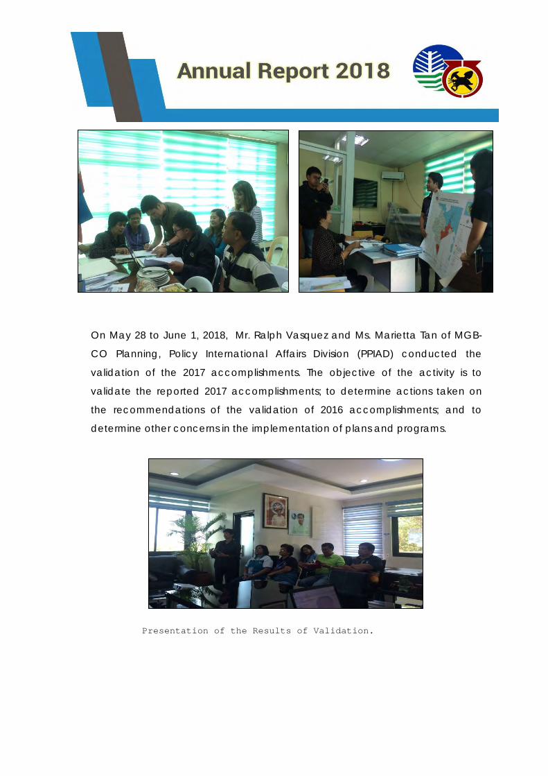
On May 28 to June 1, 2018, Mr. Ralph Vasquez and Ms. Marietta Tan of MGB-
CO Planning, Policy International Affairs Division (PPIAD) conducted the
validation of the 2017 accomplishments. The objective of the activity is to
validate the reported 2017 accomplishments; to determine actions taken on
the recommendations of the validation of 2016 accomplishments; and to
determine other concerns in the implementation of plans and programs.
Presentation of the Results of Validation.
On September 12-14, 2018, the Regional Planning Officer also attended
the Workshop for MGB RO Planning Officers where strategies on the reporting
of Monthly Accomplishments through the online system and reportorial
requirements of the implementation of programs/projects/activities were
discussed.
01: NATURAL RESOURCES SUSTAINABLY MANAGED - PROGRAM 1: MINERAL
RESOURCES ENFORCEMENT AND REGULATORY PROGRAM
MINERAL INVESTMENT PROMOTION PROGRAM
Issuance of Mining Permits/Contracts
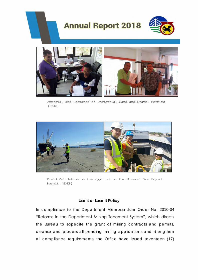
The Mining Tenement Evaluation Section (MTES) issued seventeen (17)
Industrial Sand and Gravel (ISAG) Permits, two (2) Mineral Processing
Permits (MPP), a total of one hundred fifty three (153) Ore Transport
Permits, one hundred twenty seven (127) Mineral Ore Export Permits
(MOEP), and four (4) Certificates of Accreditation.
Nine (9) Certificate of Environmental Management and Community
Relations Record (CEMCRR) together with one (1) Certificate of
Exemption of the new ISAG application of Mark Bradley A. Salcedo
were also issued.
Use it or Lose It Policy
In compliance to the Department Memorandum Order No. 2010-04
“Reforms in the Department Mining Tenement System”, which directs
the Bureau to expedite the grant of mining contracts and permits,
cleanse and process all pending mining applications and strengthen
all compliance requirements, the Office have issued seventeen (17)
Approval and issuance of Industrial Sand and Gravel Permits
(ISAG)
Field Validation on the application for Mineral Ore Export
Permit (MOEP)
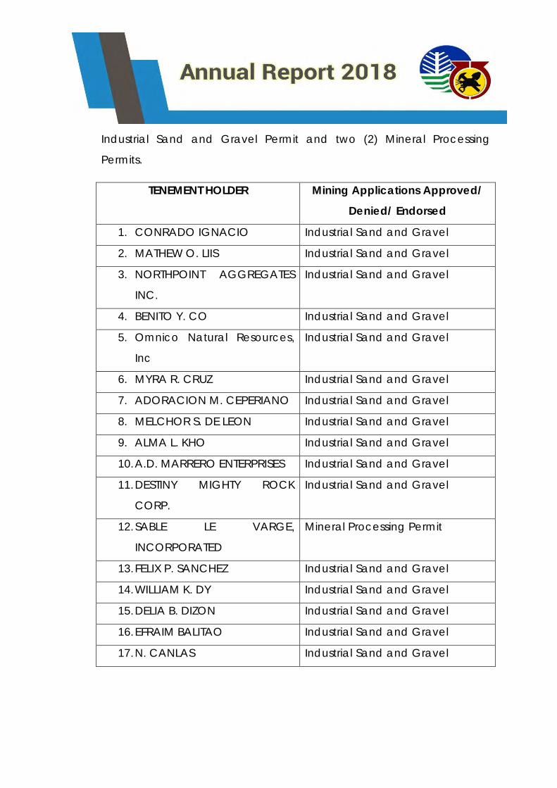
Industrial Sand and Gravel Permit and two (2) Mineral Processing
Permits.
TENEMENT HOLDER Mining Applications Approved/
Denied/ Endorsed
1. CONRADO IGNACIO Industrial Sand and Gravel
2. MATHEW O. LIIS Industrial Sand and Gravel
3. NORTHPOINT AGGREGATES
INC.
Industrial Sand and Gravel
4. BENITO Y. CO Industrial Sand and Gravel
5. Omnico Natural Resources,
Inc
Industrial Sand and Gravel
6. MYRA R. CRUZ Industrial Sand and Gravel
7. ADORACION M. CEPERIANO Industrial Sand and Gravel
8. MELCHOR S. DE LEON Industrial Sand and Gravel
9. ALMA L. KHO Industrial Sand and Gravel
10. A.D. MARRERO ENTERPRISES Industrial Sand and Gravel
11. DESTINY MIGHTY ROCK
CORP.
Industrial Sand and Gravel
12. SABLE LE VARGE,
INCORPORATED
Mineral Processing Permit
13. FELIX P. SANCHEZ Industrial Sand and Gravel
14. WILLIAM K. DY Industrial Sand and Gravel
15. DELIA B. DIZON Industrial Sand and Gravel
16. EFRAIM BALITAO Industrial Sand and Gravel
17. N. CANLAS Industrial Sand and Gravel
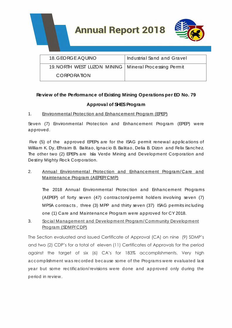
18. GEORGE AQUINO Industrial Sand and Gravel
19. NORTH WEST LUZON MINING
CORPORATION
Mineral Processing Permit
Review of the Performance of Existing Mining Operations per EO No. 79
Approval of SHES Program
1. Environmental Protection and Enhancement Program (EPEP)
Seven (7) Environmental Protection and Enhancement Program (EPEP) were
approved.
Five (5) of the approved EPEPs are for the ISAG permit renewal applications of
William K. Dy, Efhraim B. Balitao, Ignacio B. Balitao, Delia B. Dizon and Felix Sanchez.
The other two (2) EPEPs are Isla Verde Mining and Development Corporation and
Destiny Mighty Rock Corporation.
2. Annual Environmental Protection and Enhancement Program/Care and
Maintenance Program (AEPEP/CMP)
The 2018 Annual Environmental Protection and Enhancement Programs
(AEPEP) of forty seven (47) contractors/permit holders involving seven (7)
MPSA contracts , three (3) MPP and thirty seven (37) ISAG permits including
one (1) Care and Maintenance Program were approved for CY 2018.
3. Social Management and Development Program/Community Development
Program (SDMP/CDP)
The Section evaluated and issued Certificate of Approval (CA) on nine (9) SDMP’s
and two (2) CDP’s for a total of eleven (11) Certificates of Approvals for the period
against the target of six (6) CA’s for 183% accomplishments. Very high
accomplishment was recorded because some of the Programs were evaluated last
year but some rectification/revisions were done and approved only during the
period in review.
4. Annual Social Development and Management Program (ASDMP) evaluation
and issuance of certificate of approval.
The Section had evaluated and issued Certificate of Approval (CA) on forty seven
(47) ASDMP’s for the period against the target of eighteen (18) CA’s for 261%
accomplishments. Very high accomplishment was recorded because seventeen
programs by Permit Holders operated by Omnico Natural Resources, Inc. (ONRI) and
other newly approved mining permits which are not included in the universe had
their ASDMP’s approved during the period in review.
5. Annual Safety and Health Program (ASHP)
Forty (40) ASHP’s were evaluated and approved for the CY of 2018.
6. Environmental Work Program endorsed to MMD (EWP)
One (1) EWP was endorsed to Mine Management Division for the renewal of
the Exploration Period of Cunickel Mining and Industrial Corporation.
7. National Greening Project
Four (4) Consolidated Quarterly National Greening Program (NGP) Reports
were submitted for the period in review. The said reports belonged to Holcim
Phils, Inc., Northern Cement Corporation and Heirs of Elias E. Olegario which
are holders of Mineral Production Sharing Agreement Contracts located in
Bacnotan, La Union and Agno, Pangasinan, Sison, Pangasinan and
Mangatarem, Pangasinan, respectively
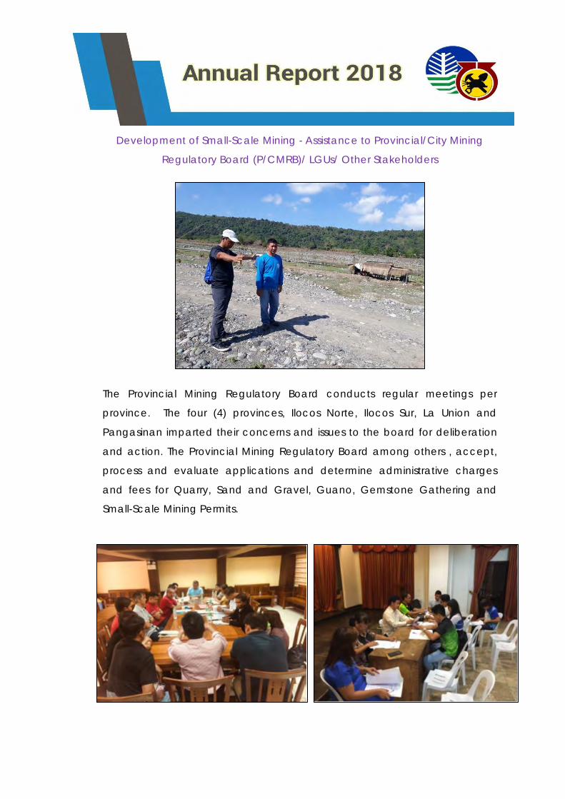
Development of Small-Scale Mining - Assistance to Provincial/City Mining
Regulatory Board (P/CMRB)/ LGUs/ Other Stakeholders
The Provincial Mining Regulatory Board conducts regular meetings per
province. The four (4) provinces, Ilocos Norte, Ilocos Sur, La Union and
Pangasinan imparted their concerns and issues to the board for deliberation
and action. The Provincial Mining Regulatory Board among others , accept,
process and evaluate applications and determine administrative charges
and fees for Quarry, Sand and Gravel, Guano, Gemstone Gathering and
Small-Scale Mining Permits.
MINING INDUSTRY AND DEVELOPMENT PROGRAM
Monitoring/Audit of Mining Permits/Contracts/Leases/Claims/JOAs (including those
within Mineral Reservations) as to compliance with the Terms and
Conditions/Requirements and implementation of approved Work Program/Safety,
Health, Environmental and Social Development Programs
MONITORING OF WORK PROGRAM
The Monitoring and Technical Services Section (MTSS) is primarily
responsible for validation of mineral reserves of mining operations, mineral
statistical analysis and monitoring of the disposition and utilization of mineral
lands and resources. It aims to monitor existing contracts and permits once a
year to ensure full compliance of the contractors, permittees and permit
holder to the terms and conditions of the approved mining contracts/permits,
and other applicable mining laws, rules and regulations. Compliance
monitoring also emphasizes on the implementation of the approved work
program, timely submission of reportorial requirements, attendance to fiscal
obligations and even employment equity.
For the period in review, MTSS has audited a total of twenty-seven(27)
contracts and permits. These include fourteen (14) MPSA Contracts, one (1)
FTAA Contract, one (1) Mineral Processing Permit, and eleven (11) Industrial
Sand and Gravel Permits. Following the issuance of MGB MC 2018-02,
otherwise known as Guidelines for Compliance Monitoring and
Rating/Scorecard of Mining Permits/Contracts, dated July 3, 2018, MPSAs
were monitored using the standardized Tenement (Exploration) and
Tenement (Development/Operating) checklists.
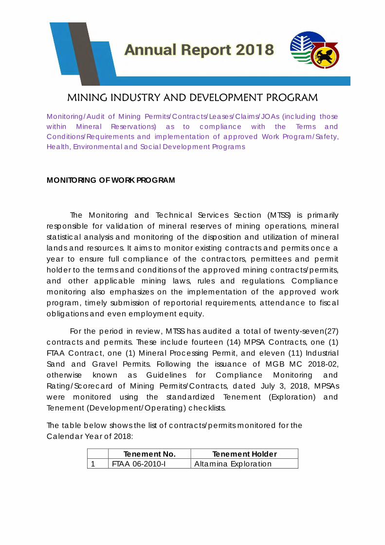
The table below shows the list of contracts/permits monitored for the
Calendar Year of 2018:
Tenement No. Tenement Holder
1 FTAA 06-2010-I Altamina Exploration
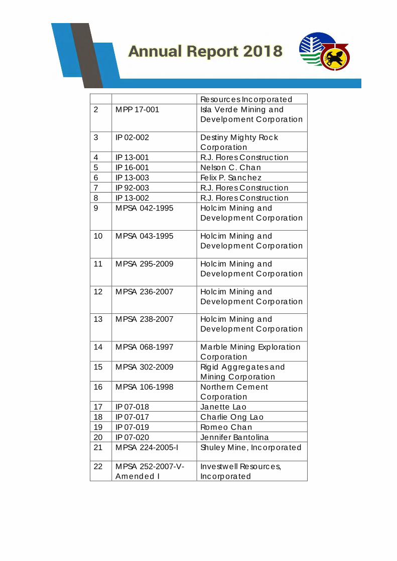
Resources Incorporated
2 MPP 17-001 Isla Verde Mining and
Develpoment Corporation
3 IP 02-002 Destiny Mighty Rock
Corporation
4 IP 13-001 R.J. Flores Construction
5 IP 16-001 Nelson C. Chan
6 IP 13-003 Felix P. Sanchez
7 IP 92-003 R.J. Flores Construction
8 IP 13-002 R.J. Flores Construction
9 MPSA 042-1995 Holcim Mining and
Development Corporation
10 MPSA 043-1995 Holcim Mining and
Development Corporation
11 MPSA 295-2009 Holcim Mining and
Development Corporation
12 MPSA 236-2007 Holcim Mining and
Development Corporation
13 MPSA 238-2007 Holcim Mining and
Development Corporation
14 MPSA 068-1997 Marble Mining Exploration
Corporation
15 MPSA 302-2009 Rigid Aggregates and
Mining Corporation
16 MPSA 106-1998 Northern Cement
Corporation
17 IP 07-018 Janette Lao
18 IP 07-017 Charlie Ong Lao
19 IP 07-019 Romeo Chan
20 IP 07-020 Jennifer Bantolina
21 MPSA 224-2005-I Shuley Mine, Incorporated
22 MPSA 252-2007-V-
Amended I
Investwell Resources,
Incorporated
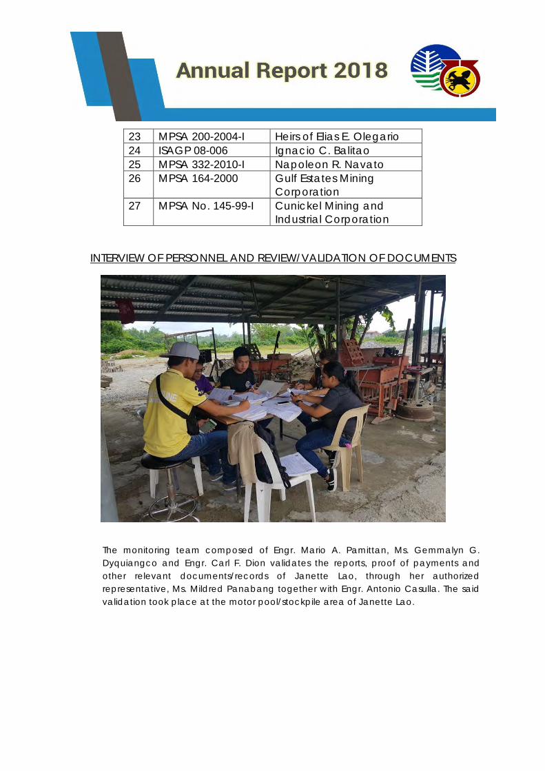
23 MPSA 200-2004-I Heirs of Elias E. Olegario
24 ISAGP 08-006 Ignacio C. Balitao
25 MPSA 332-2010-I Napoleon R. Navato
26 MPSA 164-2000 Gulf Estates Mining
Corporation
27 MPSA No. 145-99-I Cunickel Mining and
Industrial Corporation
INTERVIEW OF PERSONNEL AND REVIEW/VALIDATION OF DOCUMENTS
The monitoring team composed of Engr. Mario A. Pamittan, Ms. Gemmalyn G.
Dyquiangco and Engr. Carl F. Dion validates the reports, proof of payments and
other relevant documents/records of Janette Lao, through her authorized
representative, Ms. Mildred Panabang together with Engr. Antonio Casulla. The said
validation took place at the motor pool/stockpile area of Janette Lao.
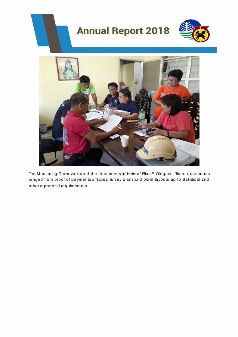
The Monitoring Team validated the documents of Heirs of Elias E. Olegario. These documents
ranged from proof of payments of taxes, survey plans and plant layouts, up to statistical and
other reportorial requirements.
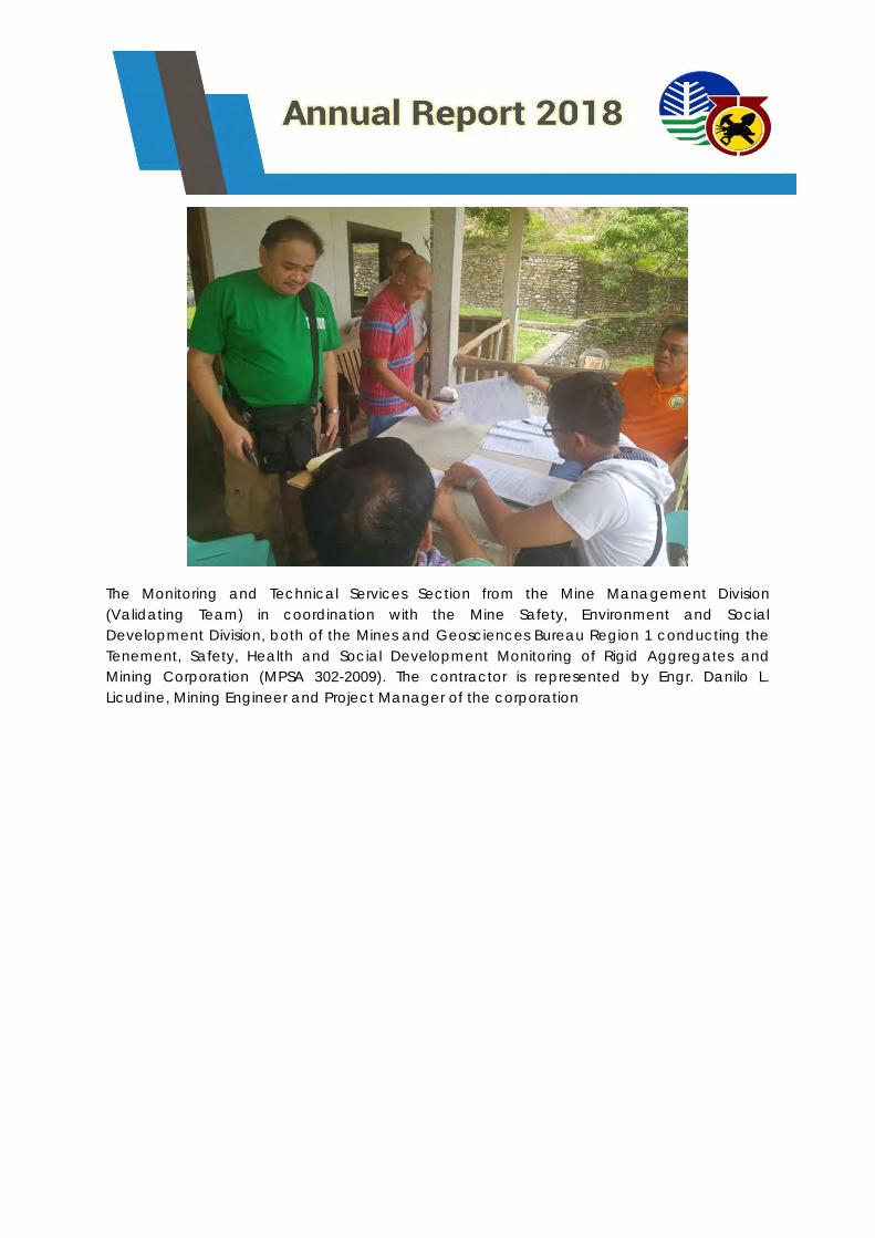
The Monitoring and Technical Services Section from the Mine Management Division
(Validating Team) in coordination with the Mine Safety, Environment and Social
Development Division, both of the Mines and Geosciences Bureau Region 1 conducting the
Tenement, Safety, Health and Social Development Monitoring of Rigid Aggregates and
Mining Corporation (MPSA 302-2009). The contractor is represented by Engr. Danilo L.
Licudine, Mining Engineer and Project Manager of the corporation
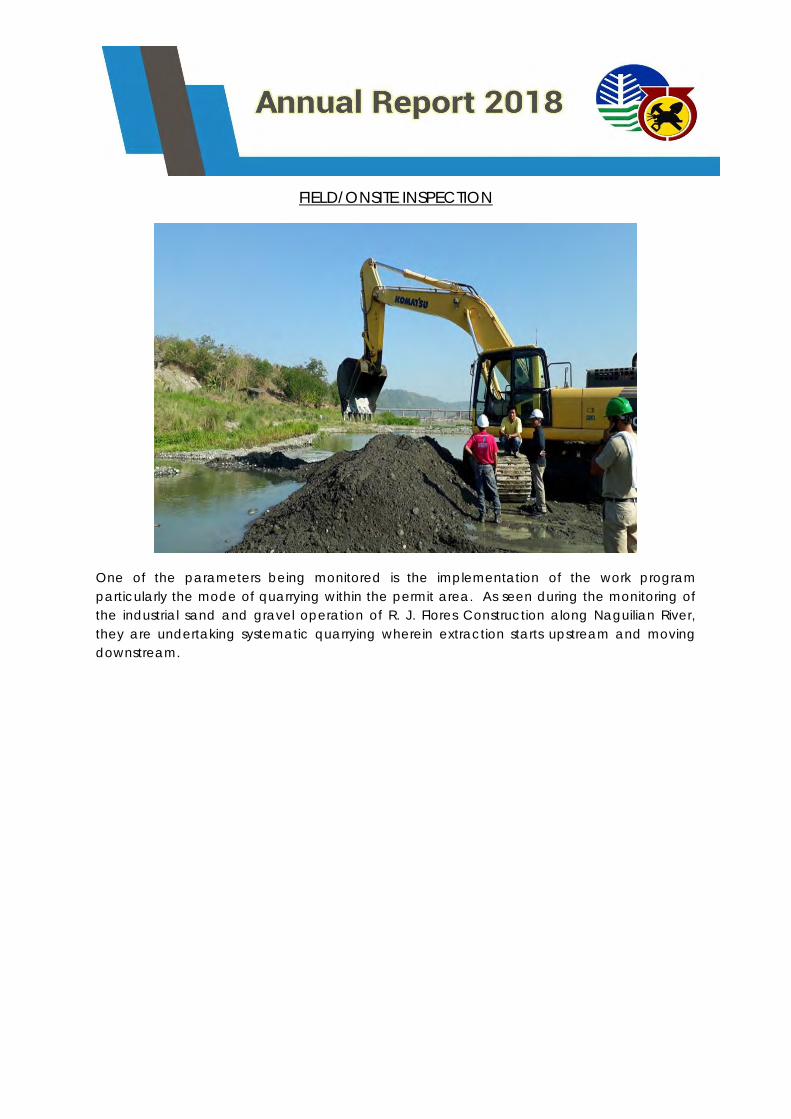
FIELD/ONSITE INSPECTION
One of the parameters being monitored is the implementation of the work program
particularly the mode of quarrying within the permit area. As seen during the monitoring of
the industrial sand and gravel operation of R. J. Flores Construction along Naguilian River,
they are undertaking systematic quarrying wherein extraction starts upstream and moving
downstream.
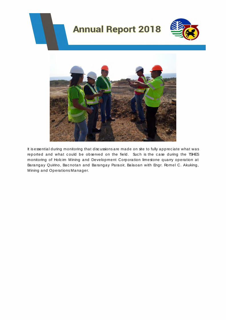
It is essential during monitoring that discussions are made on site to fully appreciate what was
reported and what could be observed on the field. Such is the case during the TSHES
monitoring of Holcim Mining and Development Corporation limestone quarry operation at
Barangay Quirino, Bacnotan and Barangay Paraoir, Balaoan with Engr. Romel C. Akuking,
Mining and Operations Manager.
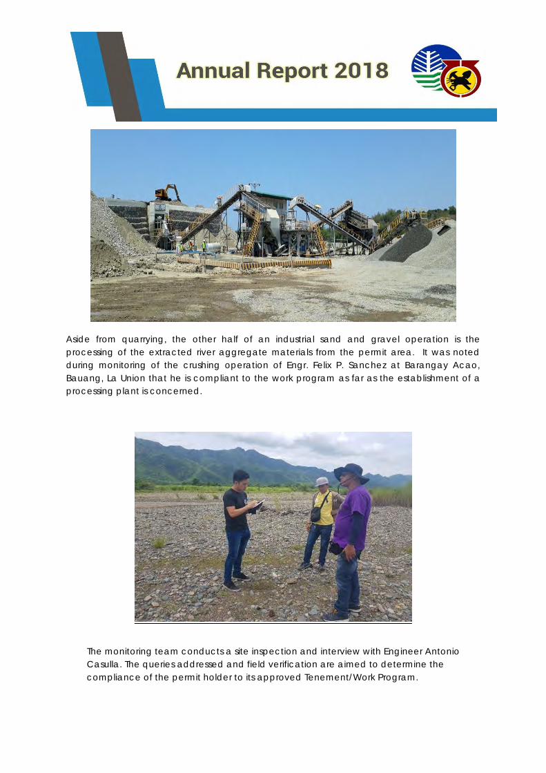
Aside from quarrying, the other half of an industrial sand and gravel operation is the
processing of the extracted river aggregate materials from the permit area. It was noted
during monitoring of the crushing operation of Engr. Felix P. Sanchez at Barangay Acao,
Bauang, La Union that he is compliant to the work program as far as the establishment of a
processing plant is concerned.
The monitoring team conducts a site inspection and interview with Engineer Antonio
Casulla. The queries addressed and field verification are aimed to determine the
compliance of the permit holder to its approved Tenement/Work Program.
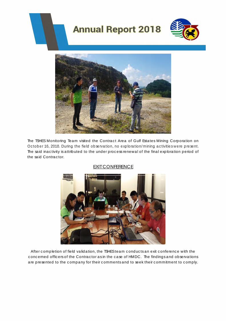
The TSHES Monitoring Team visited the Contract Area of Gulf Estates Mining Corporation on
October 16, 2018. During the field observation, no exploration/mining activities were present.
The said inactivity is attributed to the under process renewal of the final exploration period of
the said Contractor.
EXIT CONFERENCE
After completion of field validation, the TSHES team conducts an exit conference with the
concerned officers of the Contractor as in the case of HMDC. The findings and observations
are presented to the company for their comments and to seek their commitment to comply.
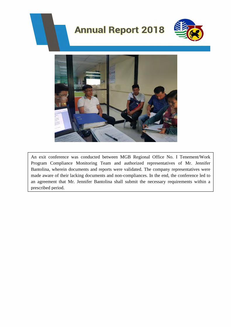
An exit conference was conducted between MGB Regional Office No. I Tenement/Work
Program Compliance Monitoring Team and authorized representatives of Mr. Jennifer
Bantolina, wherein documents and reports were validated. The company representatives were
made aware of their lacking documents and non-compliances. In the end, the conference led to
an agreement that Mr. Jennifer Bantolina shall submit the necessary requirements within a
prescribed period.
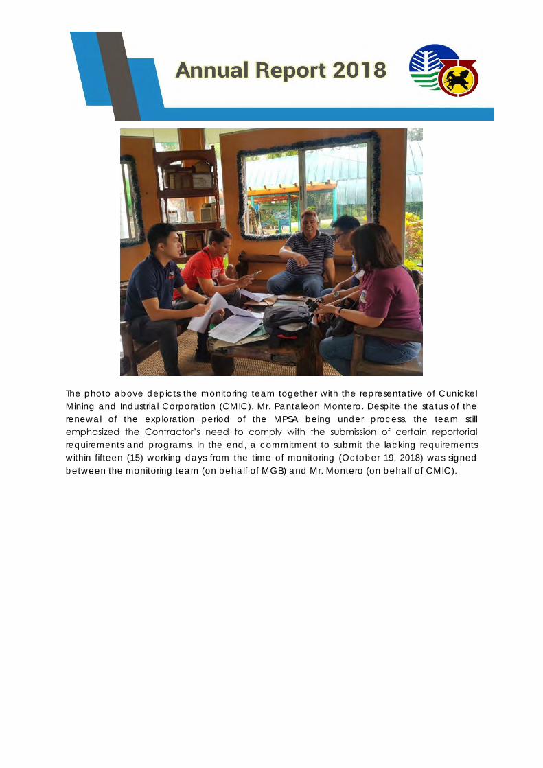
The photo above depicts the monitoring team together with the representative of Cunickel
Mining and Industrial Corporation (CMIC), Mr. Pantaleon Montero. Despite the status of the
renewal of the exploration period of the MPSA being under process, the team still
emphasized the Contractor’s need to comply with the submission of certain reportorial
requirements and programs. In the end, a commitment to submit the lacking requirements
within fifteen (15) working days from the time of monitoring (October 19, 2018) was signed
between the monitoring team (on behalf of MGB) and Mr. Montero (on behalf of CMIC).
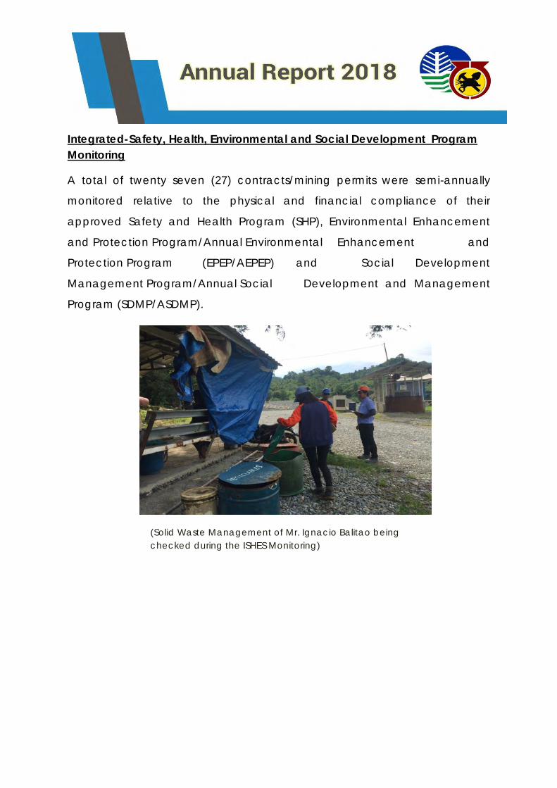
Integrated-Safety, Health, Environmental and Social Development Program
Monitoring
A total of twenty seven (27) contracts/mining permits were semi-annually
monitored relative to the physical and financial compliance of their
approved Safety and Health Program (SHP), Environmental Enhancement
and Protection Program/Annual Environmental Enhancement and
Protection Program (EPEP/AEPEP) and Social Development
Management Program/Annual Social Development and Management
Program (SDMP/ASDMP).
(Solid Waste Management of Mr. Ignacio Balitao being
checked during the ISHES Monitoring)
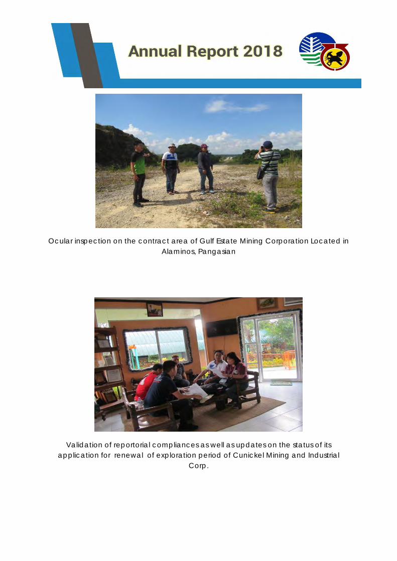
Ocular inspection on the contract area of Gulf Estate Mining Corporation Located in
Alaminos, Pangasian
Validation of reportorial compliances as well as updates on the status of its
application for renewal of exploration period of Cunickel Mining and Industrial
Corp.
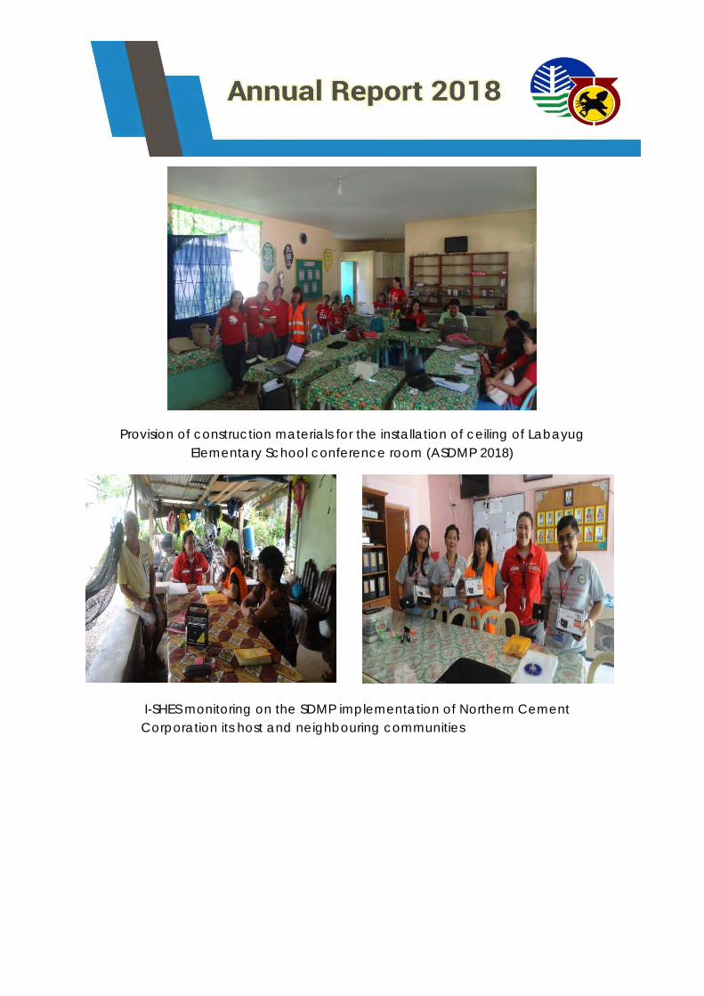
Provision of construction materials for the installation of ceiling of Labayug
Elementary School conference room (ASDMP 2018)
I-SHES monitoring on the SDMP implementation of Northern Cement
Corporation its host and neighbouring communities
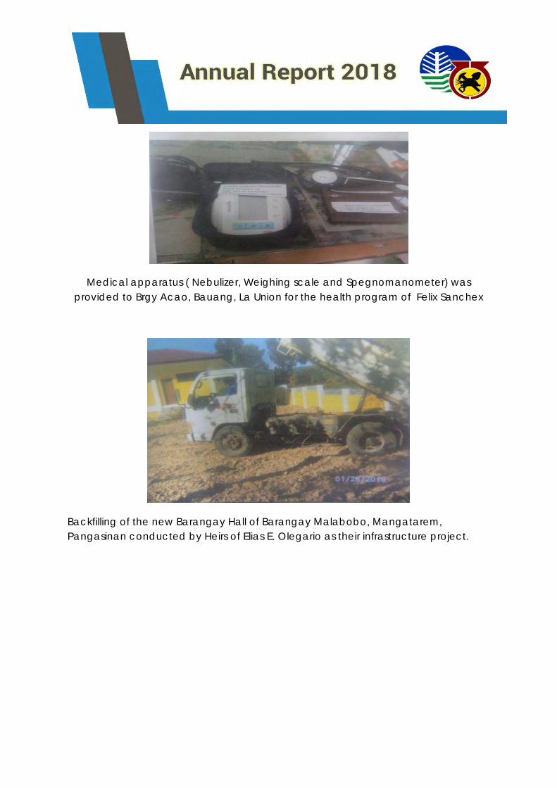
Medical apparatus ( Nebulizer, Weighing scale and Spegnomanometer) was
provided to Brgy Acao, Bauang, La Union for the health program of Felix Sanchex
Backfilling of the new Barangay Hall of Barangay Malabobo, Mangatarem,
Pangasinan conducted by Heirs of Elias E. Olegario as their infrastructure project.
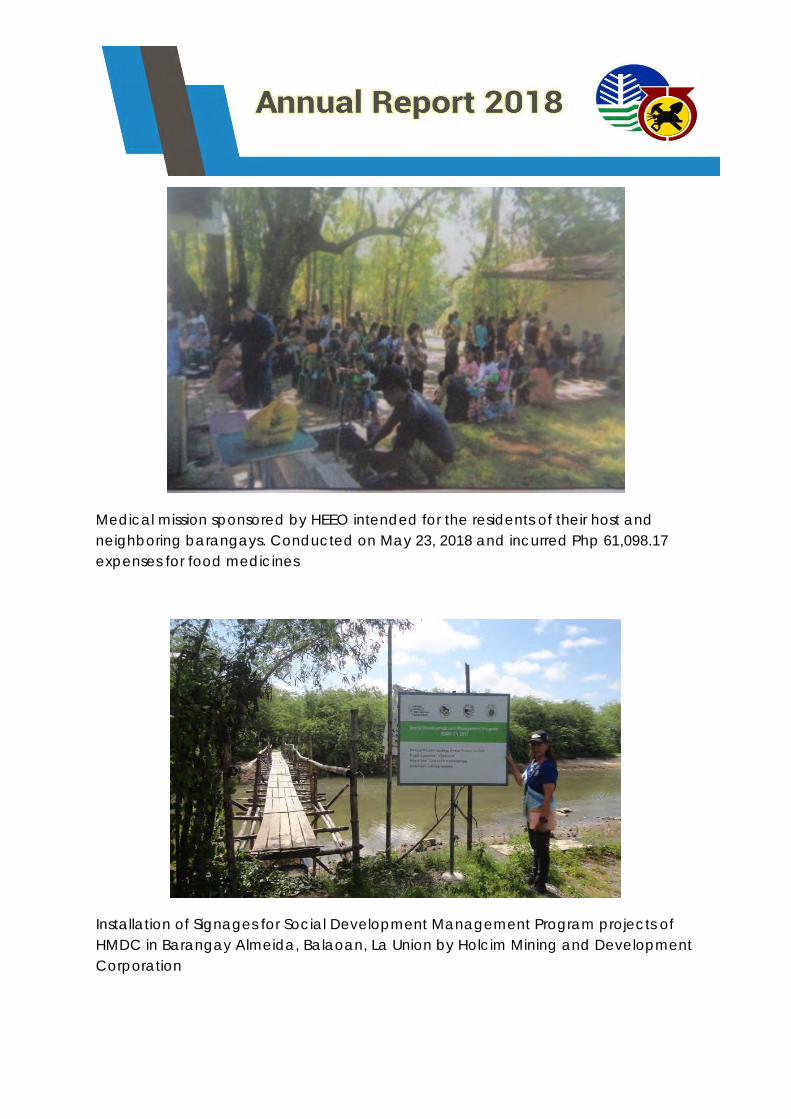
Medical mission sponsored by HEEO intended for the residents of their host and
neighboring barangays. Conducted on May 23, 2018 and incurred Php 61,098.17
expenses for food medicines
Installation of Signages for Social Development Management Program projects of
HMDC in Barangay Almeida, Balaoan, La Union by Holcim Mining and Development
Corporation
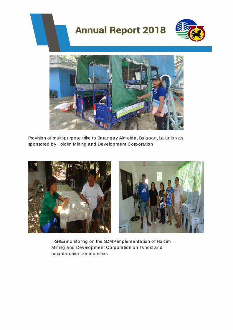
Provision of multi-purpose trike to Barangay Almeida, Balaoan, La Union as
sponsored by Holcim Mining and Development Corporation
I-SHES monitoring on the SDMP implementation of Holcim
Mining and Development Corporation on its host and
neighbouring communities
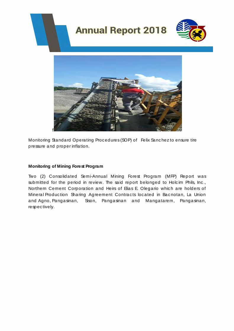
f
Monitoring Standard Operating Procedures (SOP) of Felix Sanchez to ensure tire
pressure and proper inflation.
Monitoring of Mining Forest Program
Two (2) Consolidated Semi-Annual Mining Forest Program (MFP) Report was
submitted for the period in review. The said report belonged to Holcim Phils, Inc.,
Northern Cement Corporation and Heirs of Elias E. Olegario which are holders of
Mineral Production Sharing Agreement Contracts located in Bacnotan, La Union
and Agno, Pangasinan, Sison, Pangasinan and Mangatarem, Pangasinan,
respectively.
Occupational Safety and Health Inspection
Occupational Safety and Health Inspection (OSHI) is divided into two (2) activities
the quarterly conduct of OSHI for large scale mining companies (HMDC comprising
of 5 MPSA areas, NCC and HEEO) and the semestral conduct of OSHI in all MGB
issued Permit Holders. The MSHS accomplished thirty one (31) OSHI for CY 2018.
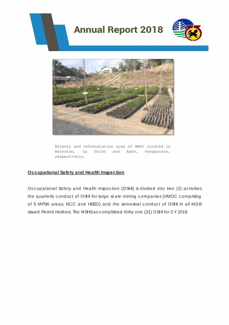
Nursery and reforestation area of HMDC located in
Bacnotan, La Union and Agno, Pangasinan,
respectively.
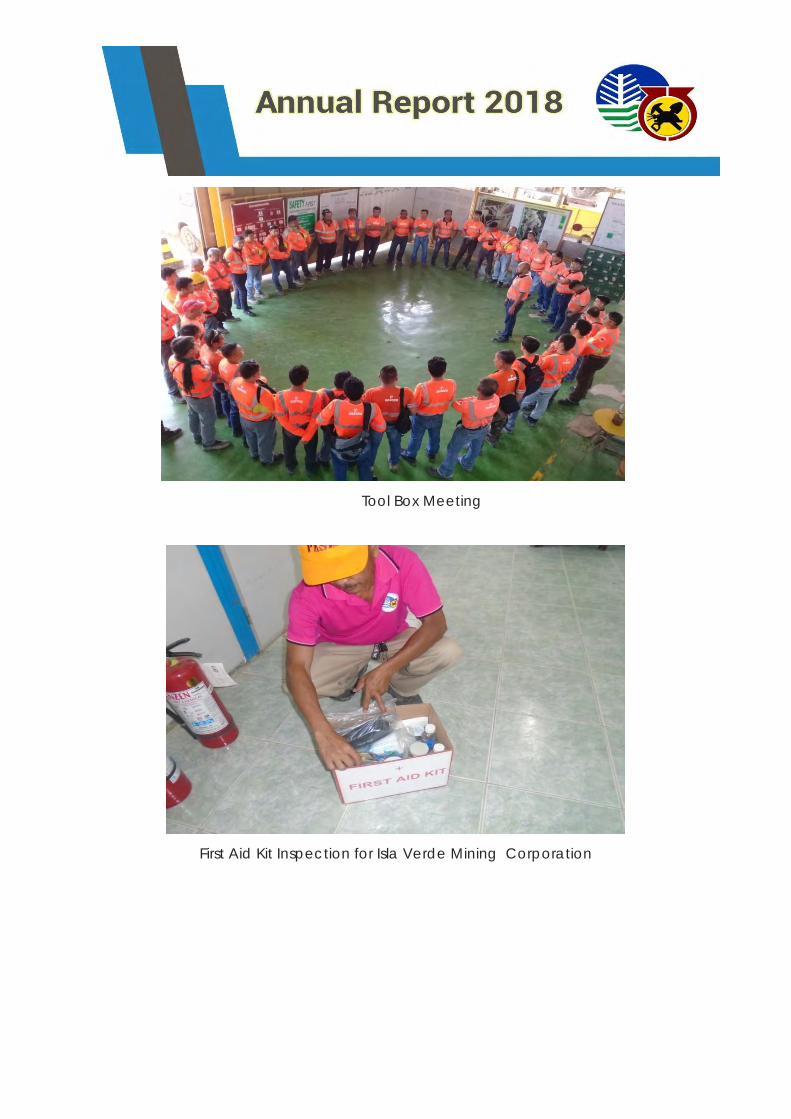
Tool Box Meeting
First Aid Kit Inspection for Isla Verde Mining Corporation
Mechanical and Electrical Inspections and Permit Issuance
This activity is client dependent. For CY 2018 , the MSHS conducted fourteen (14)
ME/EE inspections on mining companies that filed their intention to renew permit to
operate mechanical/electrical installation.
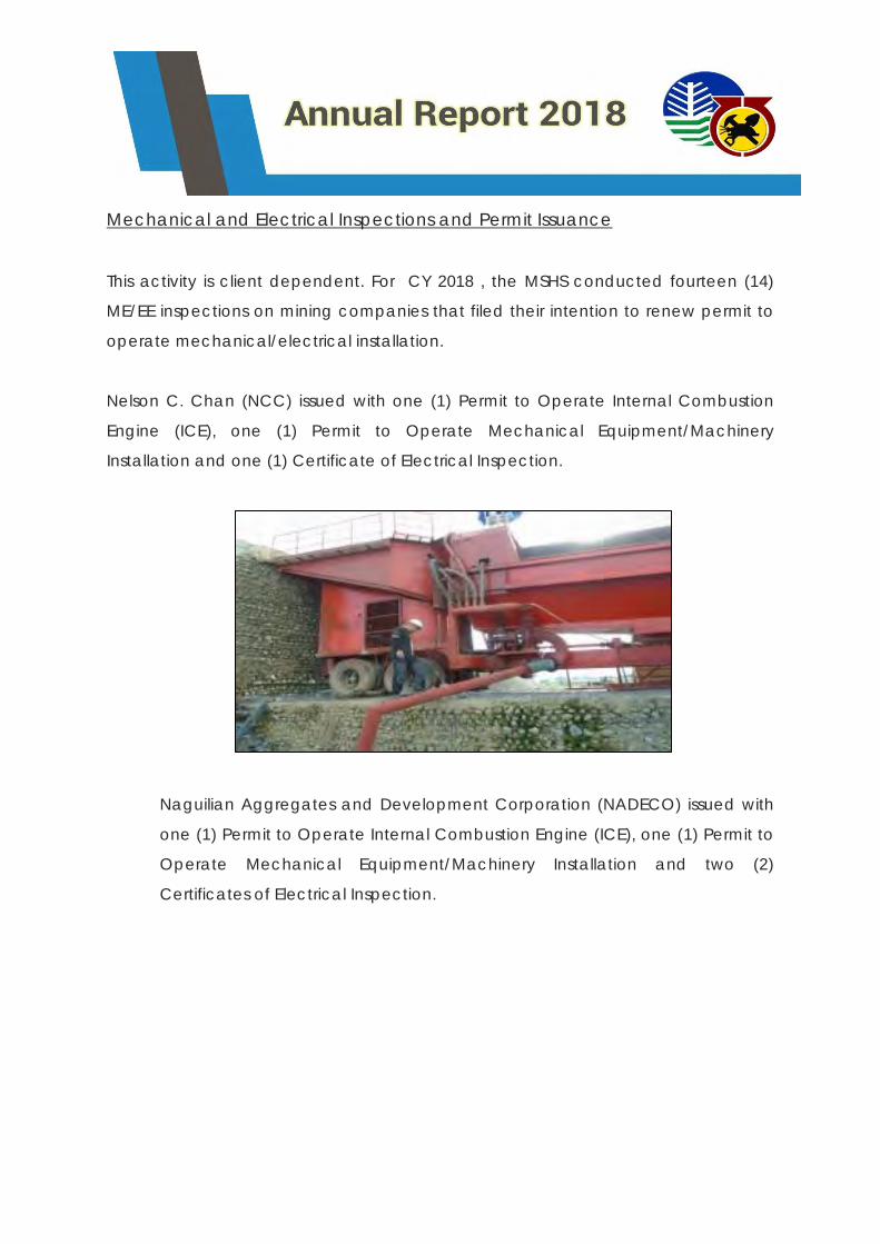
Nelson C. Chan (NCC) issued with one (1) Permit to Operate Internal Combustion
Engine (ICE), one (1) Permit to Operate Mechanical Equipment/Machinery
Installation and one (1) Certificate of Electrical Inspection.
Naguilian Aggregates and Development Corporation (NADECO) issued with
one (1) Permit to Operate Internal Combustion Engine (ICE), one (1) Permit to
Operate Mechanical Equipment/Machinery Installation and two (2)
Certificates of Electrical Inspection.
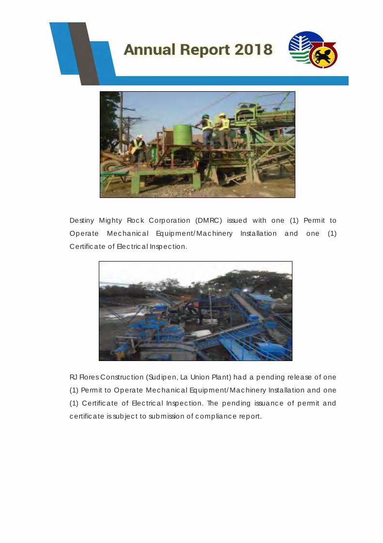
Destiny Mighty Rock Corporation (DMRC) issued with one (1) Permit to
Operate Mechanical Equipment/Machinery Installation and one (1)
Certificate of Electrical Inspection.
RJ Flores Construction (Sudipen, La Union Plant) had a pending release of one
(1) Permit to Operate Mechanical Equipment/Machinery Installation and one
(1) Certificate of Electrical Inspection. The pending issuance of permit and
certificate is subject to submission of compliance report.
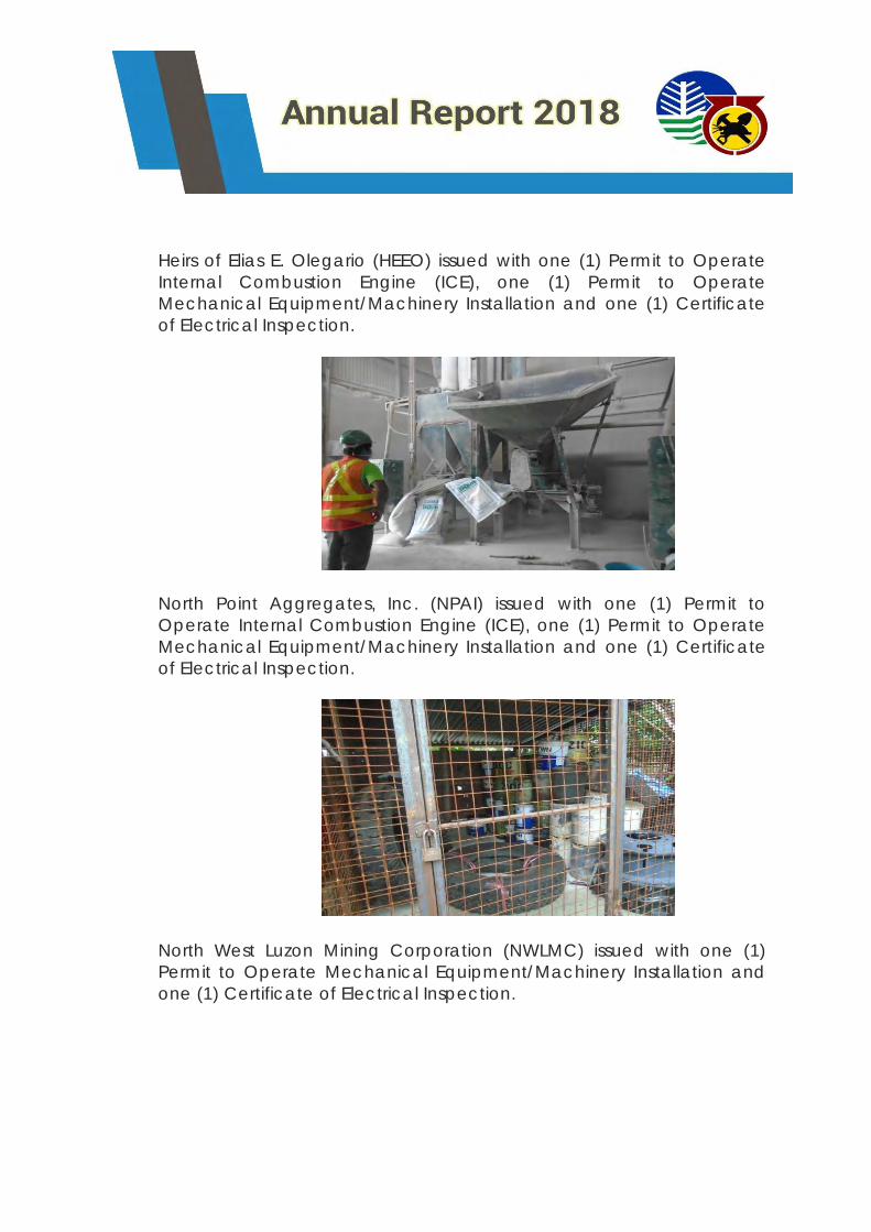
Heirs of Elias E. Olegario (HEEO) issued with one (1) Permit to Operate
Internal Combustion Engine (ICE), one (1) Permit to Operate
Mechanical Equipment/Machinery Installation and one (1) Certificate
of Electrical Inspection.
North Point Aggregates, Inc. (NPAI) issued with one (1) Permit to
Operate Internal Combustion Engine (ICE), one (1) Permit to Operate
Mechanical Equipment/Machinery Installation and one (1) Certificate
of Electrical Inspection.
North West Luzon Mining Corporation (NWLMC) issued with one (1)
Permit to Operate Mechanical Equipment/Machinery Installation and
one (1) Certificate of Electrical Inspection.
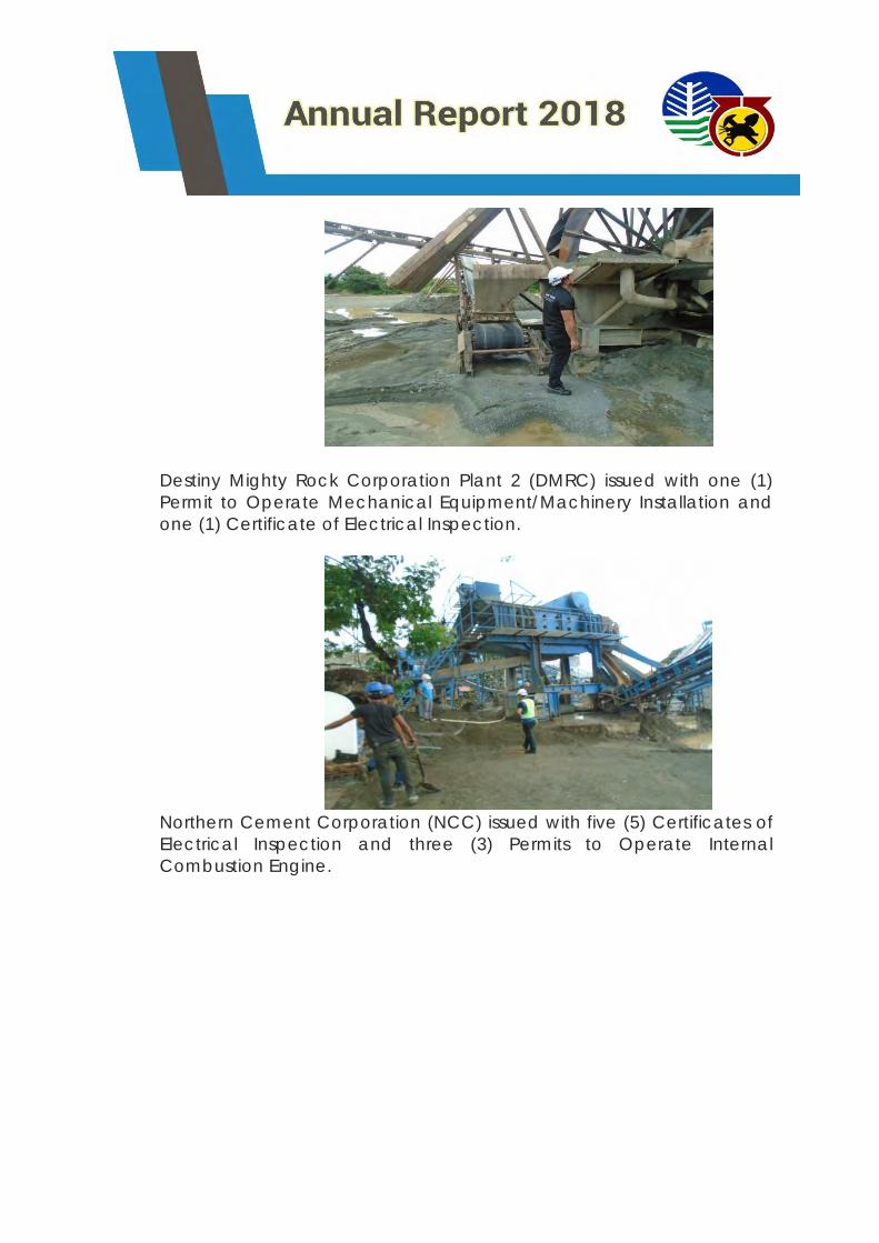
Destiny Mighty Rock Corporation Plant 2 (DMRC) issued with one (1)
Permit to Operate Mechanical Equipment/Machinery Installation and
one (1) Certificate of Electrical Inspection.
Northern Cement Corporation (NCC) issued with five (5) Certificates of
Electrical Inspection and three (3) Permits to Operate Internal
Combustion Engine.
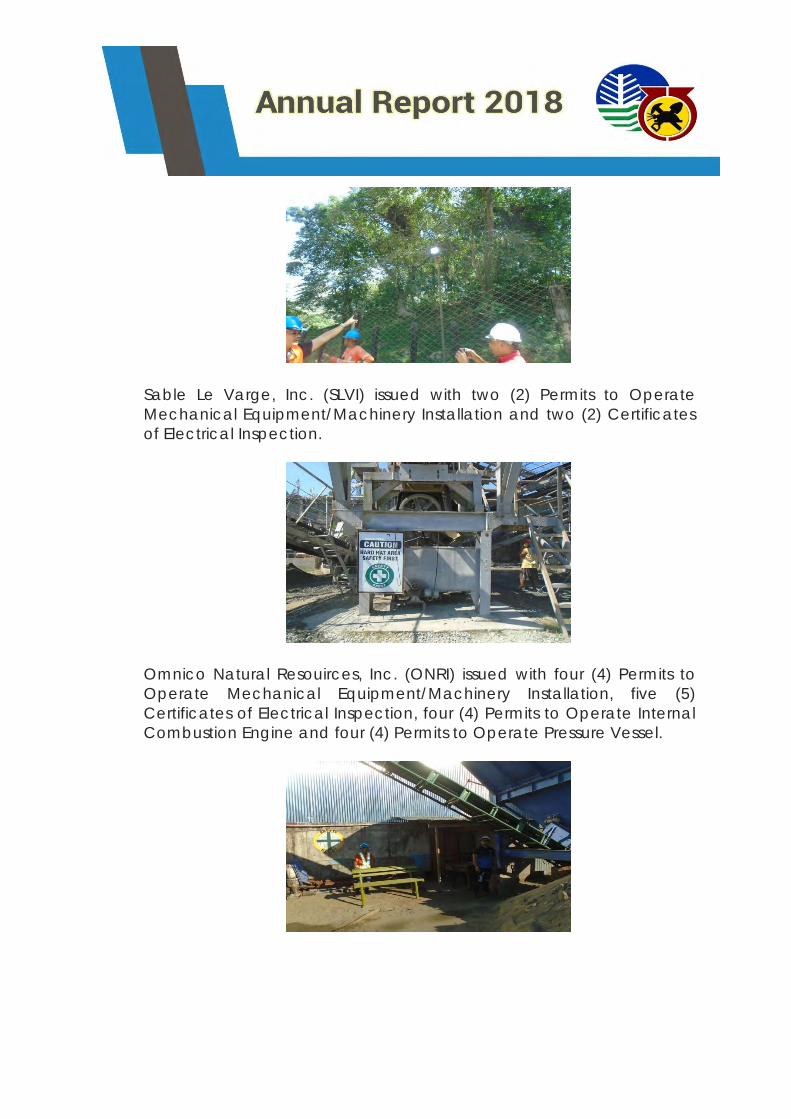
Sable Le Varge, Inc. (SLVI) issued with two (2) Permits to Operate
Mechanical Equipment/Machinery Installation and two (2) Certificates
of Electrical Inspection.
Omnico Natural Resouirces, Inc. (ONRI) issued with four (4) Permits to
Operate Mechanical Equipment/Machinery Installation, five (5)
Certificates of Electrical Inspection, four (4) Permits to Operate Internal
Combustion Engine and four (4) Permits to Operate Pressure Vessel.
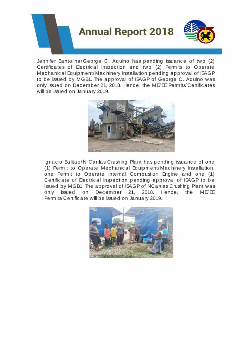
Jennifer Bantolina/George C. Aquino has pending issuance of two (2)
Certificates of Electrical Inspection and two (2) Permits to Operate
Mechanical Equipment/Machinery Installation pending approval of ISAGP
to be issued by MGB1. The approval of ISAGP of George C. Aquino was
only issued on December 21, 2018. Hence, the ME/EE Permits/Certificates
will be issued on January 2019.
Ignacio Balitao/N Canlas Crushing Plant has pending issuance of one
(1) Permit to Operate Mechanical Equipment/Machinery Installation,
one Permit to Operate Internal Combustion Engine and one (1)
Certificate of Electrical Inspection pending approval of ISAGP to be
issued by MGB1. The approval of ISAGP of NCanlas Crushing Plant was
only issued on December 21, 2018. Hence, the ME/EE
Permits/Certificate will be issued on January 2019.
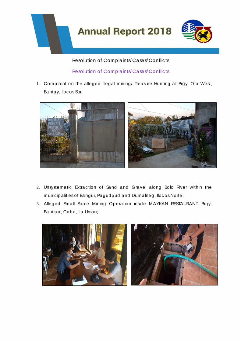
Resolution of Complaints/Cases/Conflicts
Resolution of Complaints/Cases/Conflicts
1. Complaint on the alleged Illegal mining/ Treasure Hunting at Brgy. Ora West,
Bantay, Ilocos Sur;
2. Unsystematic Extraction of Sand and Gravel along Bolo River within the
municipalities of Bangui, Pagudpud and Dumalneg, Ilocos Norte;
3. Alleged Small Scale Mining Operation inside MAYKAN RESTAURANT, Brgy.
Bautista, Caba, La Union;
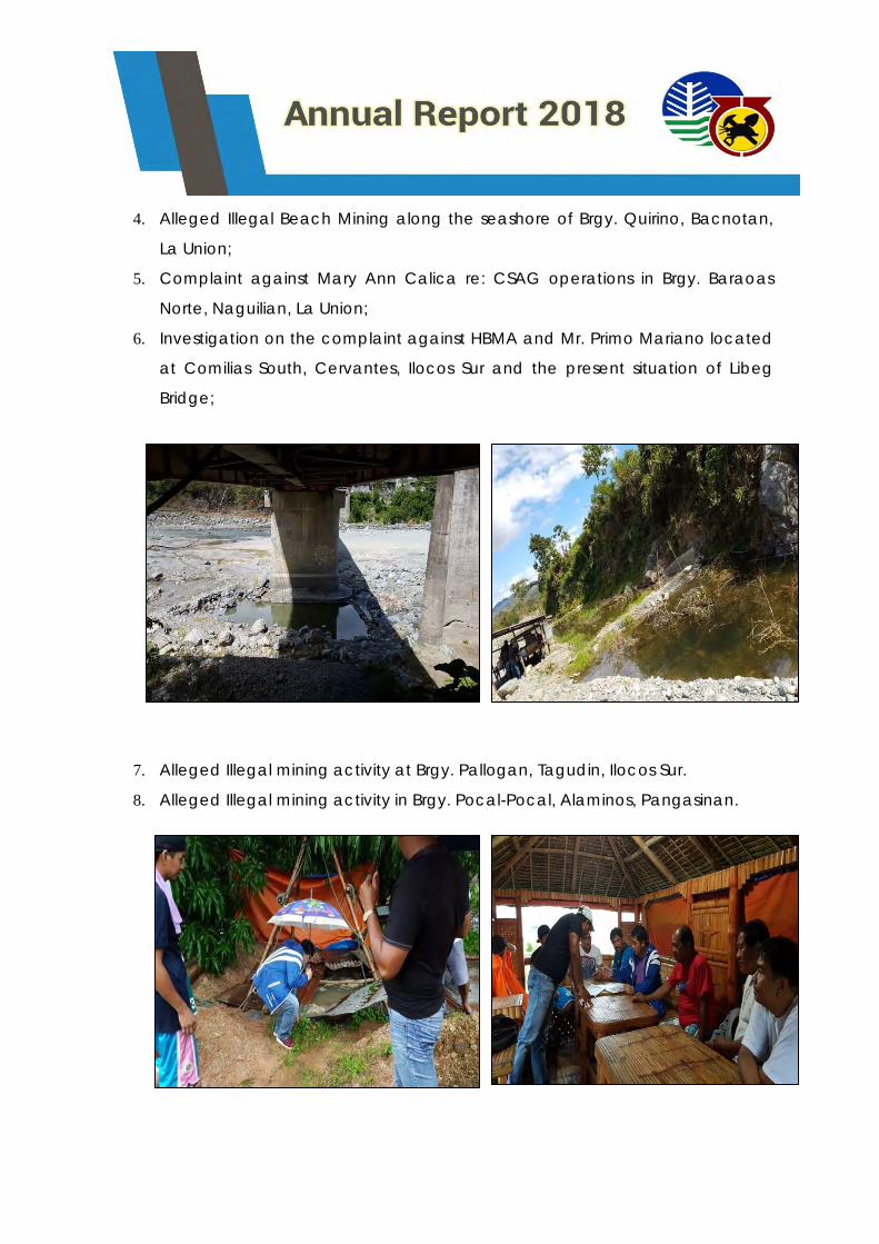
4. Alleged Illegal Beach Mining along the seashore of Brgy. Quirino, Bacnotan,
La Union;
5. Complaint against Mary Ann Calica re: CSAG operations in Brgy. Baraoas
Norte, Naguilian, La Union;
6. Investigation on the complaint against HBMA and Mr. Primo Mariano located
at Comilias South, Cervantes, Ilocos Sur and the present situation of Libeg
Bridge;
7. Alleged Illegal mining activity at Brgy. Pallogan, Tagudin, Ilocos Sur.
8. Alleged Illegal mining activity in Brgy. Pocal-Pocal, Alaminos, Pangasinan.
9. Alleged Illegal Mining Activity at Brgy. Amaronan, Umingan, Pangasinan
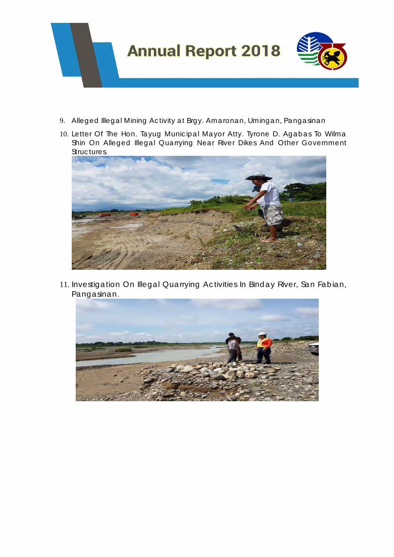
10. Letter Of The Hon. Tayug Municipal Mayor Atty. Tyrone D. Agabas To Wilma
Shin On Alleged Illegal Quarrying Near River Dikes And Other Government
Structures.
11. Investigation On Illegal Quarrying Activities In Binday River, San Fabian,
Pangasinan.
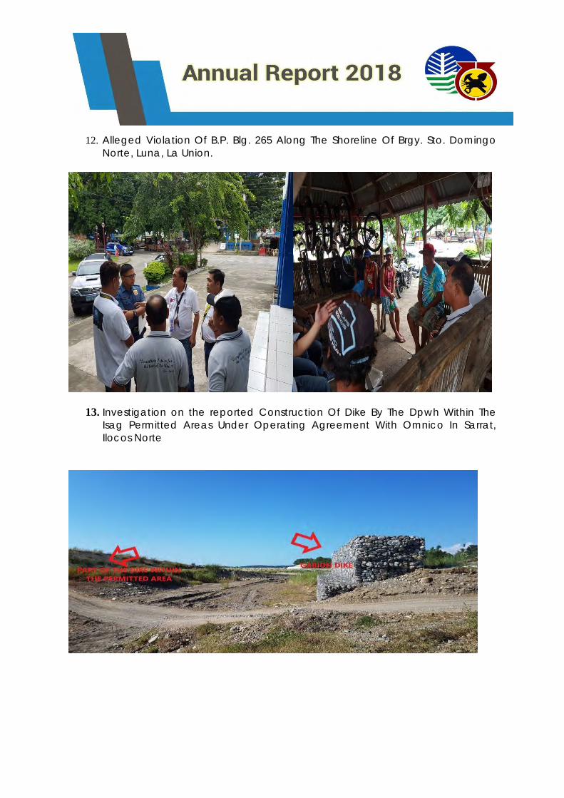
12. Alleged Violation Of B.P. Blg. 265 Along The Shoreline Of Brgy. Sto. Domingo
Norte, Luna, La Union.
13. Investigation on the reported Construction Of Dike By The Dpwh Within The
Isag Permitted Areas Under Operating Agreement With Omnico In Sarrat,
Ilocos Norte
14. Investigation on the complaint re: REFUSAL OF PAYMENT OF OCCUPATION FEE
OF SHULEY MINE INCORPORATED BY THE MUNICIPAL TREASURER OF THE
MUNICIPALITY OF BURGOS, ILOCOS NORTE.
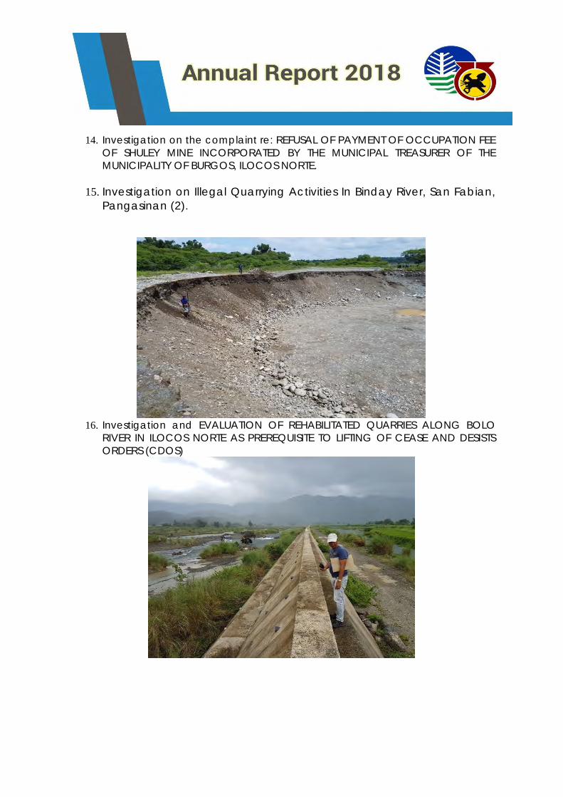
15. Investigation on Illegal Quarrying Activities In Binday River, San Fabian,
Pangasinan (2).
16. Investigation and EVALUATION OF REHABILITATED QUARRIES ALONG BOLO
RIVER IN ILOCOS NORTE AS PREREQUISITE TO LIFTING OF CEASE AND DESISTS
ORDERS (CDOS)
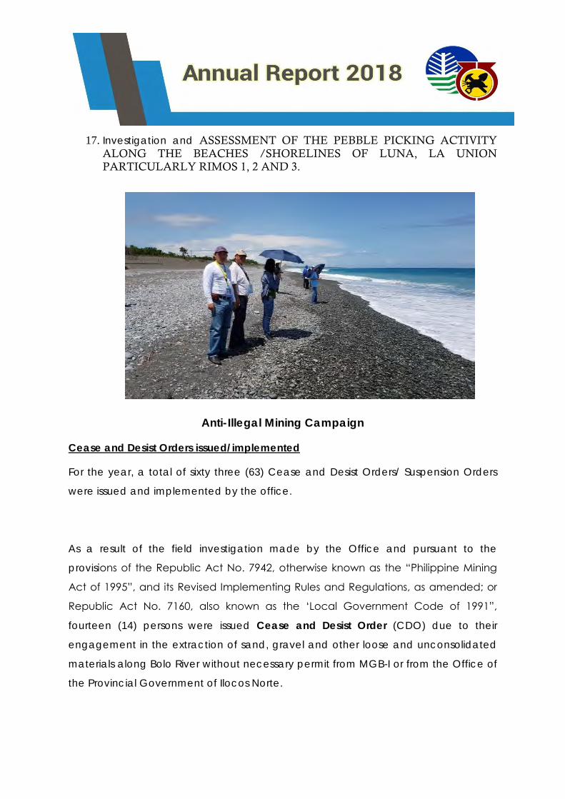
17. Investigation and ASSESSMENT OF THE PEBBLE PICKING ACTIVITY
ALONG THE BEACHES /SHORELINES OF LUNA, LA UNION PARTICULARLY RIMOS 1, 2 AND 3.
Anti-Illegal Mining Campaign
Cease and Desist Orders issued/implemented
For the year, a total of sixty three (63) Cease and Desist Orders/ Suspension Orders
were issued and implemented by the office.
As a result of the field investigation made by the Office and pursuant to the
provisions of the Republic Act No. 7942, otherwise known as the “Philippine Mining
Act of 1995”, and its Revised Implementing Rules and Regulations, as amended; or
Republic Act No. 7160, also known as the ‘Local Government Code of 1991”,
fourteen (14) persons were issued Cease and Desist Order (CDO) due to their
engagement in the extraction of sand, gravel and other loose and unconsolidated
materials along Bolo River without necessary permit from MGB-I or from the Office of
the Provincial Government of Ilocos Norte.
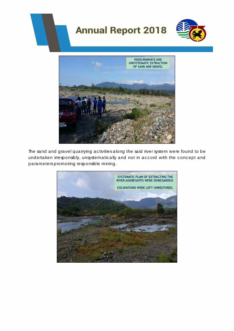
The sand and gravel quarrying activities along the said river system were found to be
undertaken irresponsibly, unsystematically and not in accord with the concept and
parameters promoting responsible mining.
In addition, the office issued a total of 49 suspension orders to quarry and
industrial sand and gravel operations in the Region on September 24, 2018.
This is in view of the landslide incidents occurred in Naga City, Cebu and
Itogon, Benguet.
Charges filed with the Provincial/City Prosecutors Office
1. Criminal complaints filed for violation of BP Blg. 265 and for theft of
minerals pursuant to Section 103 of R.A. No. 7942 against individuals
namely: Lida B. Ayala, Filipino, of legal age and Mr. Francisco B.
Aguinaldo, Jr., Filipino, of legal age who are both residents address at
Bgry. Magallanes, Luna, La Union in extracting / removing / performing
other activities such as buying those 100 sacks of Luna pebbles (minus
5mm sizes) and 180 sacks of Luna pebbles (20-30 mm sizes) from the
beach/es of Brgy. Magallanes, Luna, La Union without any permit to do
so.
2. Complaints filed as to the violation of Section 103 of R.A. 7942 against
TERESITA N. SIY and her driver JOHNNY PASCUAL y CLAVERIA in the
extracting of minerals (500 sacks of white coralline sand) from the
beaches of Burgos, Ilocos Norte and on the process of disposing the
same by transporting it en route to Novaliches, Quezon City where Siy’s
client is located.
Strengthen Multi-partite monitoring system
MMT Operationalized
Eleven (11) Multi-Partite Monitoring Teams were operationalized for the year.
Multi-partite Monitoring Team Date of Inspection
1st Qtr
Date of Inspection
2nd Qtr
Date of
Inspection
3rd Qtr
Date of
Inspection
4th Qtr
1. MMT-Heirs of Elias E.
Olegario
March 20-22, 2018 June 26-27, 2018
September 26-
27, 2018
October 29-30,
2018
2. MMT-Holcim Philippines, Inc.
February 19-23,
2018 June 4-8, 2018
August 23-
25/August 29-
31,2018
November 14-16,
2018
3. MMT-Pangasinan Group III &
V
February 21-23,
2018 May 15-17, 2018
August 15-17,
2018
October 18-19,
2018
4. MMT-Pangasinan Group II
February 8-9, 2018 May 10-11, 2018 August 9-10, 218
November 6-7,
2018
5. MMT-Pangasinan Group IV February 27-28,
2018 May 24-25, 2018
September 4-5,
2018
November 13-
14,2018
6. MMT-ISAG La Union February 27-
March 2, 2018 June 5-6, 2018
September 18-
21, 2018
November 13-16,
2018
7. MMT-ONRI February 7-9, 2018 May 2-4, 2018 July 24-27, 2018 November 6-9,
2018
8.MMT-ISAG Ilocos Sur February 13-16,
2018 May 8-11., 2018
August 7-10,
2018
November 6-9,
2018
9. MMT-Pangasinan Group 1 &
February 6-7, 2018 May 3-4, 2018 August 7-8, 2018
November 8-9,
2018
10. MMT-Northern Cement
Corporation
January 30-31/
February 1-2 April 17-20, 2018
August 14-16,
2018
October 29-30,
2018
11. Isla Verde Mining
Corporation - - -
November 12-14,
2018
001: NATURAL RESOURCES SUSTAINABLY MANAGED – PROGRAM 2: MINERAL
RESOURCES AND GEOSCIENCES DEVELOPMENT PROGRAM
COMMUNICATION PLAN FOR MINERAL RESOURCES AND GEOSCIENCE
DEVELOPMENT
Conduct of Awareness and Advocacy on Mineral Resources and
Geosciences Development (MRGD)
Multi-partite Monitoring Team (MMT) Monitoring
Dialogues with Sangguniang Panlalawigan / Bayan /
Panlungsod/Barangay:
Awareness and Advocacy on Mineral Resources and Geosciences
(MRGS)
Dialogues with Sangguniang Bayan
MGB I reported significant accomplishments for the calendar
year 2018 pursuant to its mandate. As part of its Awareness and
Advocacy campaign for Minerals Development, MGB I remained
steadfast in building and maintaining better and productive
partnerships amongst its environmental partners such as the Local
Government Units.
Further, MGB I acknowledges the importance of these
partnerships as they take a strong role in the promotion of sustainable
development on planning & implementing policies and mobilizing
local public participation. Moreover, the office believes that good
governance is the foundation of sustainable development particularly
in the mineral-based plans and programs in the Ilocos Region.
For the year 2018, several awareness and advocacy on mineral
resources were made with the different LGUs in the region to heighten
their awareness and understanding on the minerals industry.
1. LGU - Aguilar, Pangasinan.
Unsystematic and indiscriminate mineral resources utilization had
prompted the Local Government of Aguilar, Pangasinan to pass
an Ordinance prohibiting the extraction of sand and gravel
along its major creeks and rivers. Land degradation resulting in
the erosion and siltation of farmlands is another concern.
During the regular session of the Sanggunian Bayan, the
following discussion points were explained and discussed for the
information of the Honorable SB Members relative to the
Ordinance prohibiting sand and gravel quarrying within their
territorial jurisdiction, viz:
A. To prohibit sand and gravel extraction along the creeks and river
systems in the municipality shall not help the problem of
unsystematic and indiscriminate mineral extraction in the area.
The Ordinance only increases the incidents of illegal mining
activities in the area. The better option therefore is for these
quarry operators operating in a “guerilla” manner to be legalized
for the LGU to have a better control over them.
B. Unsystematic and indiscriminate quarrying can be properly
addressed by implementing an efficient monitoring protocols.
The rule of law must prevail, excepting no one. It was stressed
that it is only in this manner that illegal quarrying can be curbed,
and the MGB may take a greater role in empowering the local
officials and residents in terms of effecting apprehension and
confiscation of illegally mined, extracted, removed and
disposed sand mineral resources in their area.
C. The prohibition runs counter to the constitutional provision as
enunciated in the declaration of policy mandating the state to
promote the exploration and rational development of the
country’s mineral resources at the same promoting
environmental protection and preserving options of future
generations.
2. LGU – Cervantes, Ilocos Sur.
Honorable Mayor Benjamin Maggay III and the entire Sanggunian
Bayan Members of the municipality were present. The discussion is
focused on the opposition of the residents of the municipality to the
application for exploration permit of Cordillera Exploration Company,
Inc. (CExCI), the area of which covers nine (9) barangays.
Mayor Maggay informs the MGB of the following adverse impacts the
application had cause to the local community, viz:
1. It has caused “division” among the local residents, thus, he
urgently requested the MGB to temporarily hold the processing
of said application until such time that the issue has been
resolved at the local level.
2. The issue may cause disruption of the peace and order being
enjoyed in the area.
3. The sentiments of the residents may be heard and given weight,
letting to them to decide, considering that it is their fate and
destiny that are at stake.
The MGB shares the sentiments of the Honorable Mayor, the entire
membership of the Sanggunian Bayan and the people of Cervantes.
However, it was explained that the issue which concerns the settlement
of the opposition raised by the Indigenous Peoples of Cervantes, Ilocos
Sur is within the mandate of the National Commission on the
Indigenous Peoples. The MGB is a mere “observant”.
As to the request for the temporary holding of the application, the
Honorable Mayor was informed that the MGB has no legal basis to do
so considering that the Philippine Mining Act of 1995 does not provide
for it. The Honorable Mayor and his group was however, assured that
their issues, complaints, protests and oppositions against application for
Exploration Permit must have to be resolved prior to its approval.
3. LGU – Bangui, Ilocos Norte
The observations of the Honorable Secretary of the DENR on the sand
and gravel quarrying/processing along Bolo River was the major point
of discussion.
The LGU Officials headed by Honorable Mayor Fidel A. Cimatu was
informed of the events that had transpired which led to the issuance of
Cease and Desist Orders. To date, fourteen (14) Cease and Desist
Orders were issued to various quarry/crushing plant operators along the
said river system. The seriousness of the Honorable Secretary in
protecting the river systems was echoed to the local officials.
The 2nd dialogue with Honorable Mayor Fidel A. Cimatu and the
member of the Sanggunian Bayan was very engaging, informative and
productive for the reason that the major focus was the preservation of

the aesthetic and ecological value of the Bolo River. DENR officials led
by Regional Director Reynulfo A. Juan led the discussion and provided
insights on the effects of the sand and gravel quarrying in the area
without due to regard to the environment thereby placing in harm’s
way the lives, limbs and properties of local residents.
Among the matters discussed were:
A. The proposed Bolo River Quarry Development Plant
(BRQDP);
B. The protocol for the possible lifting of the CDOs;
C. The creation of a 24/7 monitoring team;
D. The conduct of deputation seminar; 24/7 monitoring
personnel;
E. The conduct of a seminar on acceptable and prescribed
quarrying methodologies to promote Responsible Mining.
4. LGU – San Fabian, Pangasinan
The appearance of personnel from the MGB Regional Office No. I
before the Members of the Sanggunian Bayan of San Fabian,
Pangasinan was precipitated by the “ban” on sand and gravel
quarrying in Brgy. Binday, San Fabian, Pangasinan issued by the MGB,
Regional Office No. I.
A query was posed by the local officials on the following:
a. Unabated extraction of sand and gravel in the area despite the
existence of the “ban”;
b. The level of coordination between the MGB and Provincial
Government of Pangasinan in terms of monitoring the sand and
gravel quarrying in the area;
c. The participation of the LGU in the processing, issuance and
approval of sand and gravel permits, specifically in the issuance
of the required Endorsement; and
d. Possible entry points of the LGU in addressing the issue on illegal
mining; and
e. Sharing of the proceeds derived from the sand and gravel
quarrying in the area; and
f. Status of the boundary dispute the Municipalities of San Fabian
and San Jacinto.
It was clarified that there is no ban issued by the MGB. Instead a
Suspension Order was issued to certain quarry operators in the area for
violations to the terms and conditions of their permits.
The dialogue was attended together with DENR PENRO Raymund
Gayo of the Province of Pangasinan, DENR CENRO Celso Salazar of
Dagupan City, Mr. Mixon Flores of the Environment and Natural
Resources Office/Natural Resources Regulatory Group of the Province
of Pangasinan.
5. LGU – Tagudin, Ilocos Sur
On July 2018, a team from the Mine Management Division participated
in a dialogue with the Sangguniang Bayan of Tagudin, Ilocos Sur to
discuss the alleged illegal mining activity in Brgy. Pallogan, Tagudin,
Ilocos Sur.
6. LGU – Burgos, Ilocos Sur
The Local Government of Burgos in the Province of Ilocos Norte
discussed with MGB on the non-acceptance of occupation fees by
Shuley Mine on October, 2018.
7. LGU – San Fabian
8. LGU- Tayug, Pangasinan
An IEC Campaign on mining was conducted in Binday, San Fabian
with a follow-up investigation on the bued river issue along san Fabian,
Pangasinan. Meeting with the Hon. Mayor Agabas of Tayug on Sand
and Gravel activities in Agno River. Meeting with Mayor Uy of Sison,
Pangasinan with the CSAG & ISAG Permittees re: sand and gravel
activities within the Bued River and proposed quarry channel upstream
of Bued River.
9. LGU – San Nicolas, Pangasinan,
10. LGU – Sudipen, La Union
11. LGU - San Juan, La Union
Officials from LGU San Nicolas, Pangasinan participated in the IEC on
the creation of the Municipal Anti-Environment Task Force. Also, the
Sangguniang Bayan meeting discussed on the issues on illegal sand
and gravel quarrying in Sudipen and San Juan in the Province of La
Union
12. LGU – Bangui, Ilocos Norte
Discussed with LGU officials on the result of the ocular inspection and
survey of the Bolo River in Bangui, Ilocos Norte for the preparation of
the Proposed Bolo River Quarry Development Plan.
The MGB Regional Office No. I is cognizant of the role played by the
civil society in the implementation of mineral – based programs and
projects and in the enforcement of Environment and Natural Resources
laws, rules and regulations. The need to continuously solicit their pro-
active participation, unwavering support and cooperation is therefore
imperative.
Dialogue with other groups (Religious Groups, CSO, Academe, etc.)
The MGB Regional Office No. I is cognizant of the role played by the civil
society in the implementation of mineral – based programs and projects and
in the enforcement of Environment and Natural Resources laws, rules and
regulations. The need to continuously solicit their pro-active participation,
unwavering support and cooperation is therefore imperative.
For the year, six (6) dialogues were conducted.
1. Quarry Operators and Concerned Residents in the Municipality of Bangui,
Ilocos Norte.
A dialogue explaining to the quarry/crushing plant operators on the
impacts of their respective quarry operations to the Bolo River
ecosystem and to the local residents residing within the immediate
vicinity of said river system was conducted.
An urgent call was made requiring them to immediately rehabilitate
the disturbed areas within their respective permit areas. It was
emphasized that sand and gravel quarrying may only resume after the
necessary rehabilitation measures had been implemented and
properly validated by DENR PENRO Ilocos Norte and MGB Regional
Office No. I personnel.
The quarry/crushing plant operators agreed to the terms laid - out to
ensure Responsible Mining is carried – out in their subsequent
quarrying/crushing operations.
2. Selected College Students of Pangasinan State University.
The college students were treated to a presentation on the following:
a. Operational structure of the MGB Regional Office;
b. Programs and projects and their impacts to the target beneficiaries;
c. A profile of the minerals industry in the region and its direct
contributions to local and regional and national economy;
d. Linkages ad networking strategies to widen the backbone of
participation of the civil society in the mineral development and
utilization process.
e. Problems and opportunities faced by the industry; and initiatives aimed
at making it a catalyst for economic development at the grass root
level.
3. National Commission on Indigenous Peoples.
A dialogue was done with personnel of the National Commission on
Indigenous Peoples – Ilocos Sur Province (NCIP-IS) in relation to the
status of the Free and Prior Informed Consent (FPIC) being secured by
Cordillera Exploration Corporation, Inc. (CExCI), of which most of the
area is in the Municipality of Cervantes, Ilocos Sur.
Initially, the Local Government of Cervantes, Ilocos Sur passed a
number of Resolutions expressing their oppositionto the application of
CExCI for Exploration Permit.
Led by Atty. Jonathan Bansigan, OIC – Regional Director of NCIP, he
informed the body of the retraction of the “YES” votes of some of the
affected barangays to the proposed exploration activity. And
considering that the issue has become very intense and at times
resulted in the misunderstanding between and among the residents,
the NCIP have decided to momentarily stop the processing of the
FPIC.
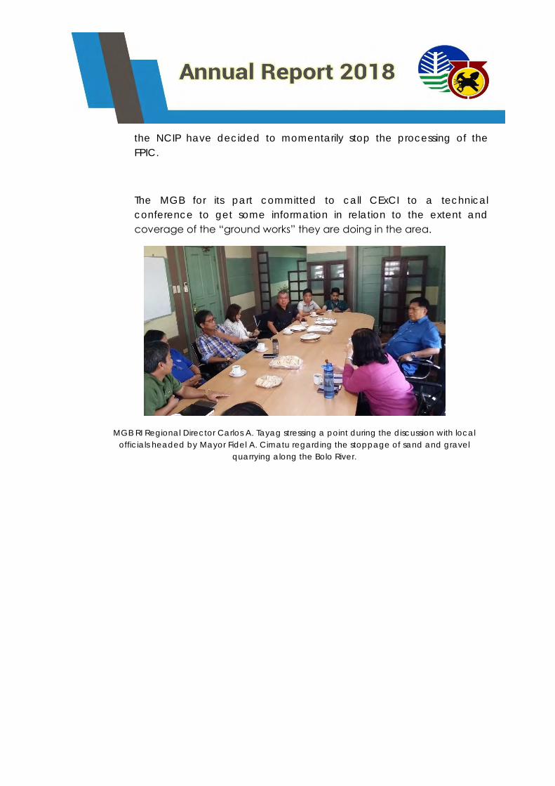
The MGB for its part committed to call CExCI to a technical
conference to get some information in relation to the extent and
coverage of the “ground works” they are doing in the area.
MGB RI Regional Director Carlos A. Tayag stressing a point during the discussion with local
officials headed by Mayor Fidel A. Cimatu regarding the stoppage of sand and gravel
quarrying along the Bolo River.
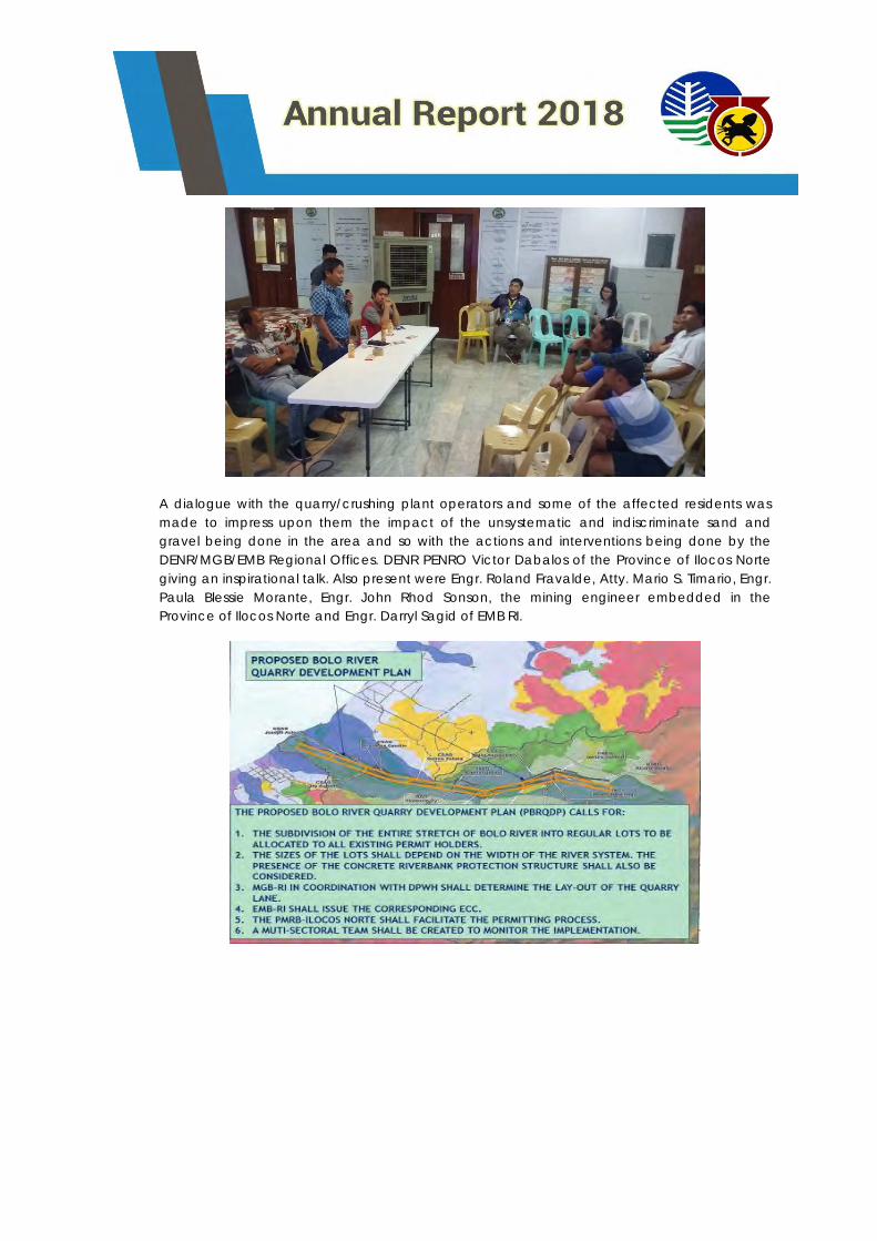
A dialogue with the quarry/crushing plant operators and some of the affected residents was
made to impress upon them the impact of the unsystematic and indiscriminate sand and
gravel being done in the area and so with the actions and interventions being done by the
DENR/MGB/EMB Regional Offices. DENR PENRO Victor Dabalos of the Province of Ilocos Norte
giving an inspirational talk. Also present were Engr. Roland Fravalde, Atty. Mario S. Timario, Engr.
Paula Blessie Morante, Engr. John Rhod Sonson, the mining engineer embedded in the
Province of Ilocos Norte and Engr. Darryl Sagid of EMB RI.
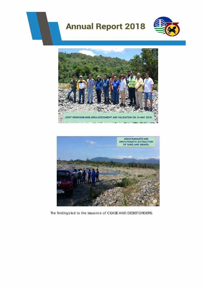
The findings led to the issuance of CEASE AND DESIST ORDERS.
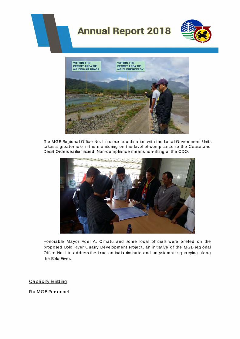
The MGB Regional Office No. I in close coordination with the Local Government Units
takes a greater role in the monitoring on the level of compliance to the Cease and
Desist Orders earlier issued. Non-compliance means non-lifting of the CDO.
Honorable Mayor Fidel A. Cimatu and some local officials were briefed on the
proposed Bolo River Quarry Development Project, an initiative of the MGB regional
Office No. I to address the issue on indiscriminate and unsystematic quarrying along
the Bolo River.
Capacity Building
For MGB Personnel
1. Seminar on the Standardization Checklist for the Monitoring of Tenements,
Safety, Environment and Social Development Programs;
2. 6th Mines Adjudication Board and Panel of Arbitrator’s Seminar-Workshop on
Mining Conflict/Dispute Resolution;
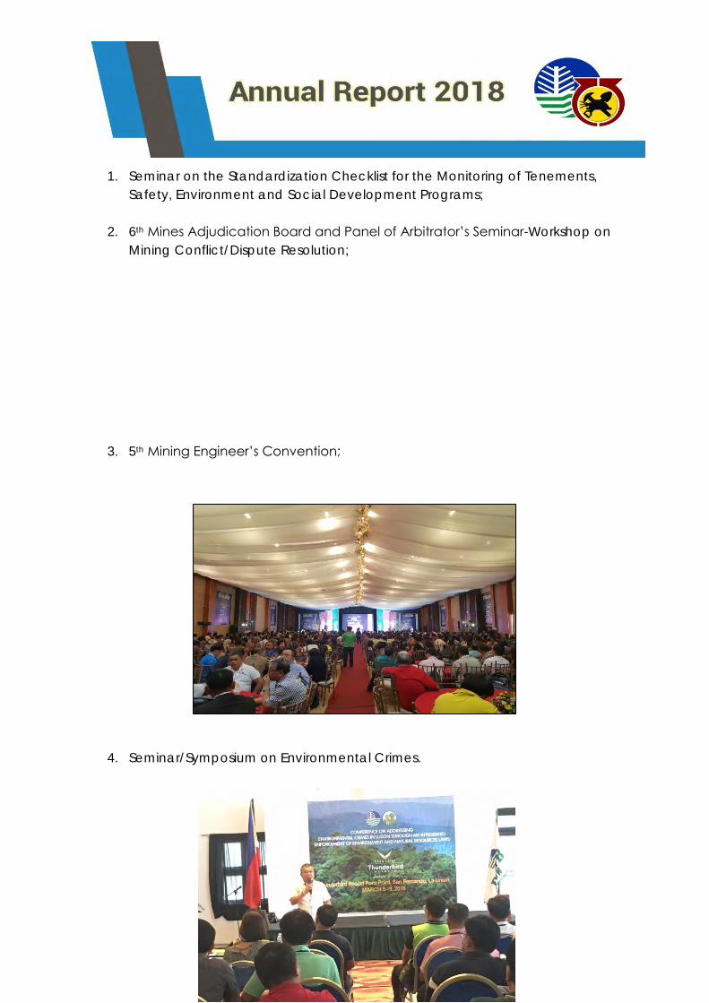
3. 5th Mining Engineer’s Convention;
4. Seminar/Symposium on Environmental Crimes.
5. Environmental Law Enforcement Management Information System
(ELEMIS) Regional Roll-Out
The Knowledge and Information System Service (KISS) introduced
Environmental Law Enforcement Management Information System (ELEMIS) to
facilitate the preparation of necessary documents in filing of case/s in
violation of environmental laws and record all these to generate reports.
The main objective of the training program is to introduce ELEMIS as a tool to
facilitate in the preparation of filing of cases for person / business that
violated specific environmental laws for the Biodiversity, Forestry and Mining
sector.
The seminar aims to train all DENR personnel who are involved in Law
Enforcement to use the system, develop an action plan and to gather
recommendation to enhance the system.
During the Seminar, the following was conducted:
➢ Lecture on the function and features of ELEMIS was presented by one
of the members of the ELEMIS Development Team;
➢ Participants profile was gathered in preparation of their user
credentials for the system;
➢ Step by step demonstration of ELEMIS was introduced for the
participant’s familiarization of the system;
➢ Hands-on training proceeded using the existing cases brought by each
agency;
➢ Discussion on the system issues, comments and recommendations; and
➢ Action Planning Workshop.
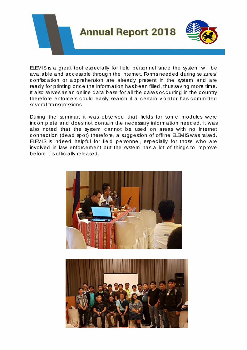
ELEMIS is a great tool especially for field personnel since the system will be
available and accessible through the internet. Forms needed during seizures/
confiscation or apprehension are already present in the system and are
ready for printing once the information has been filled, thus saving more time.
It also serves as an online data base for all the cases occurring in the country
therefore enforcers could easily search if a certain violator has committed
several transgressions.
During the seminar, it was observed that fields for some modules were
incomplete and does not contain the necessary information needed. It was
also noted that the system cannot be used on areas with no internet
connection (dead spot) therefore, a suggestion of offline ELEMIS was raised.
ELEMIS is indeed helpful for field personnel, especially for those who are
involved in law enforcement but the system has a lot of things to improve
before it is officially released.
6. 65th Annual National Mine, Safety and Environment Conference
(ANMSEC)
For LGUs and other stakeholders (NGAs, CSOs, etc.) and Small Scale Miners
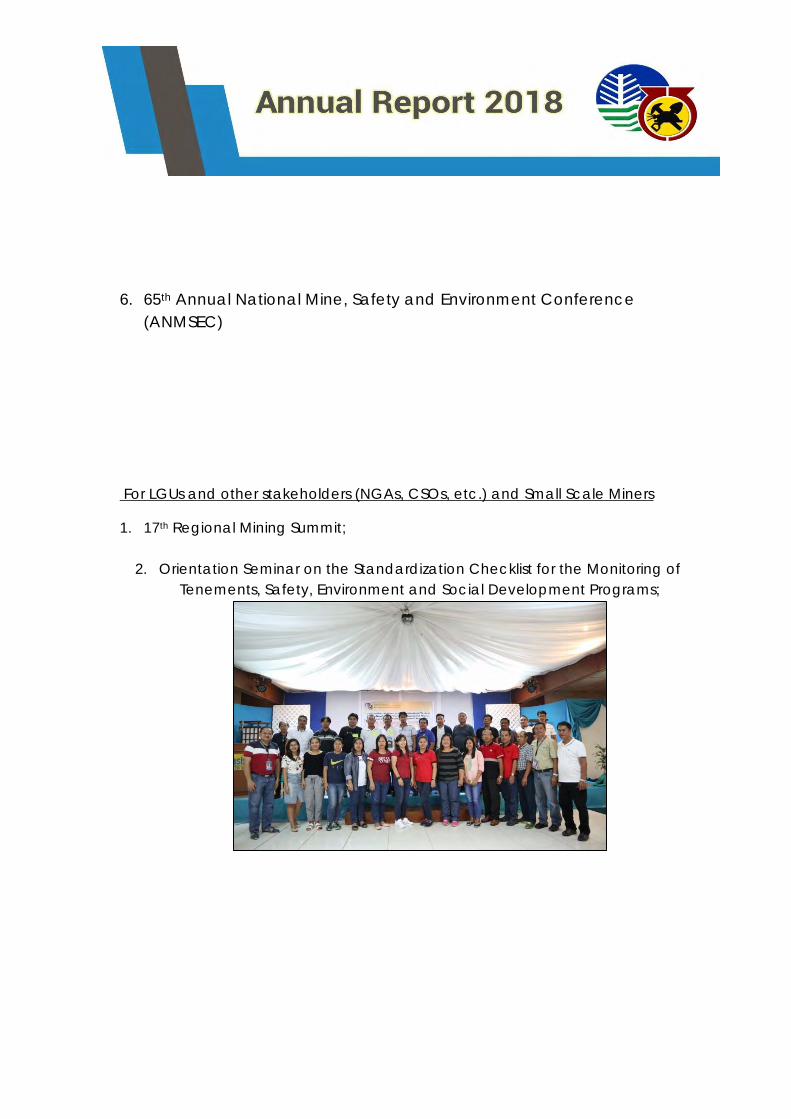
1. 17th Regional Mining Summit;
2. Orientation Seminar on the Standardization Checklist for the Monitoring of
Tenements, Safety, Environment and Social Development Programs;
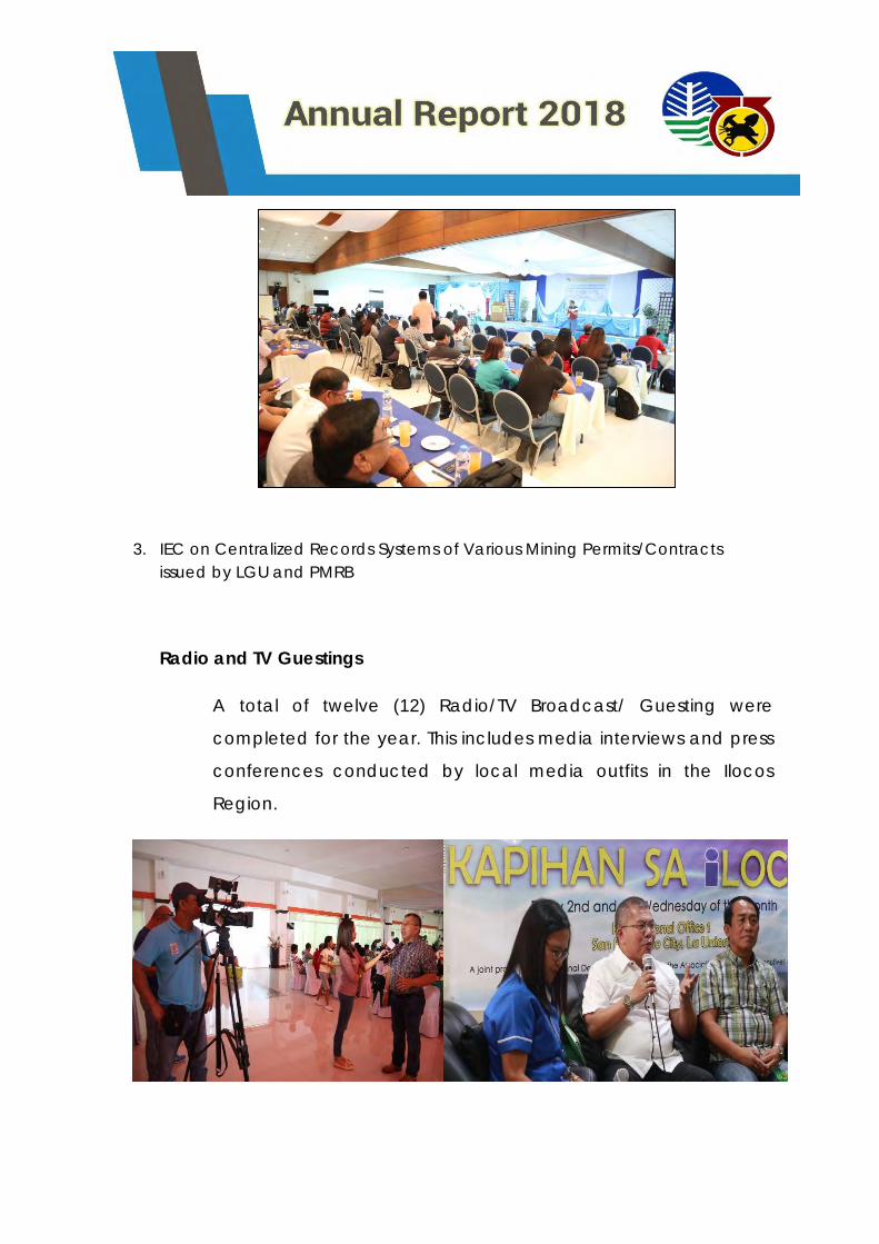
3. IEC on Centralized Records Systems of Various Mining Permits/Contracts
issued by LGU and PMRB
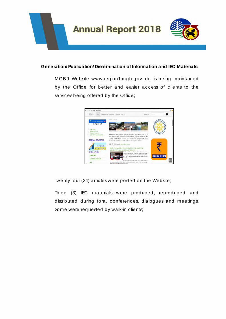
Radio and TV Guestings
A total of twelve (12) Radio/TV Broadcast/ Guesting were
completed for the year. This includes media interviews and press
conferences conducted by local media outfits in the Ilocos
Region.
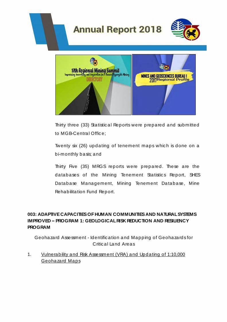
Generation/Publication/Dissemination of Information and IEC Materials:
MGB-1 Website www.region1.mgb.gov.ph is being maintained
by the Office for better and easier access of clients to the
services being offered by the Office;
Twenty four (24) articles were posted on the Website;
Three (3) IEC materials were produced, reproduced and
distributed during fora, conferences, dialogues and meetings.
Some were requested by walk-in clients;
Thirty three (33) Statistical Reports were prepared and submitted
to MGB-Central Office;
Twenty six (26) updating of tenement maps which is done on a
bi-monthly basis; and
Thirty Five (35) MRGS reports were prepared. These are the
databases of the Mining Tenement Statistics Report, SHES
Database Management, Mining Tenement Database, Mine
Rehabilitation Fund Report.
003: ADAPTIVE CAPACITIES OF HUMAN COMMUNITIES AND NATURAL SYSTEMS
IMPROVED – PROGRAM 1: GEOLOGICAL RISK REDUCTION AND RESILIENCY
PROGRAM
Geohazard Assessment - Identification and Mapping of Geohazards for
Critical Land Areas
1. Vulnerability and Risk Assessment (VRA) and Updating of 1:10,000
Geohazard Maps
The Philippines, being an island arc system; situated at the Pacific Ring
of Fire and Typhoon belt at the equator, is bombarded by many geologic
hazards induced by plate tectonics and extreme weather conditions that are
aggravated by climate change in the recent years. As an attempt to assess
the risk exposures of the people, road networks, and built-up areas to
geologic hazards, more specifically, rain-induced flooding and landslide, the
Mines and Geosciences launched the Vulnerability and Risk Assessment
Program. The output of this program aims to give a general assessment and
quick overview on the levels of exposure of each barangay to said hazards.
For CY 2018, a total of 12 municipalities, three (3) for each province in
Ilocos Region, were targeted for the VRA and Updating project.
Below the list of the targeted and accomplished municipalities:
Municipality/City Province
1. San Nicolas
2. Vintar Ilocos Norte
3. Batac City
4. Santa Catalina
5. San Vicente Ilocos Sur
6. San Emilio
7. Aringay
8. Bacnotan La Union
9. Nagulian
10. Alcala
11. Calasiao Pangasinan
12. Binmaley
The said assessment consists of two components namely: data gathering and
Geographic Information System (GIS) analysis.
A. Data Gathering
During assessments, spatial and non-spatial data were gathered from
both Municipal and Barangay Government Units. The 1:10000 scale
Geohazard maps were updated and validated by obtaining geographic
coordinates of barangay halls or multi-purpose halls, schools, churches,
hospitals or health centers and other critical infrastructures for each
barangay and historical data of the occurrence of rain-induced landslides
and flooding gathered through interviews of barangay officials in every
barangay.
Site visits of areas prone or affected to/by landslide and flooding provide a
more detailed information of the current situation of the barangay. Changes
in conditions through the years were also gathered from anecdotes of locals
to discern the worst-case scenario that the area has experienced to provide
a proper rating of the hazard susceptibility.
One of the main hitches encountered during the conduct of the assessment
is the gathering of data provided by the LGU. On several occasions, the
interviewees or barangay officials are unavailable or preoccupied at an
equally important task and for another, it is difficult to obtain data/updated
information from these concerned officials (exempli gratia: population data).
B. Data Processing
Using the updated geohazard maps as the main basis, the data
gathered will serve as thematic layers that are processed and interpreted
using a software called Arcgis 10.3 to generate the risk exposure maps. The
output maps produced provide information regarding the exposure of
different elements, namely: population, road network, and built-up areas to
different flood and landslide hazard susceptibility which may be utilized by
the municipality/city in their comprehensive land use planning, development
and infrastructure projects and disaster and risk management programs.
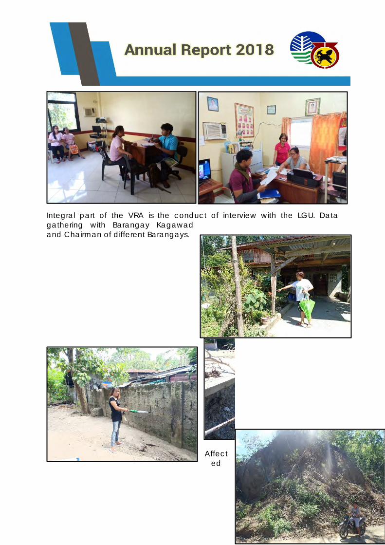
Integral part of the VRA is the conduct of interview with the LGU. Data
gathering with Barangay Kagawad
and Chairman of different Barangays.
Affect
ed
areas by rain induced flooding and landslides.
Areas that are vulnerable to rain-induced landslides among the targeted
municipalities are generally along road cuts in mountainous region
commonly along the eastern highlands of Ilocos region, several barangays
along Bacnotan, La Union are also prone to landslides due to high elevation.
On the other hand, target municipalities in Pangasinan are situated in low
elevation which makes them prone to different flood susceptibility. Similarly,
areas situated near peripheries of main river channels or small tributaries and
coastal regions are prone to low to very high flooding.
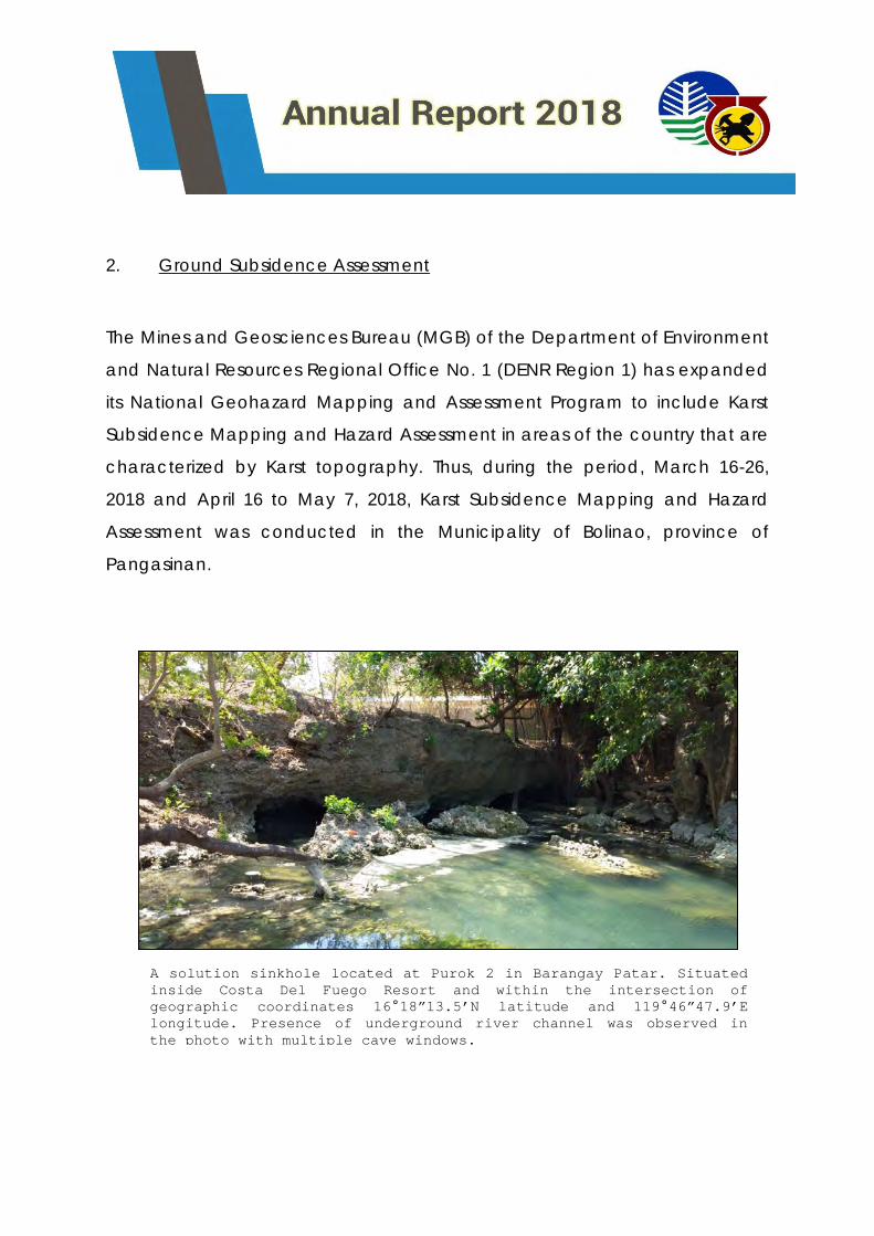
2. Ground Subsidence Assessment
The Mines and Geosciences Bureau (MGB) of the Department of Environment
and Natural Resources Regional Office No. 1 (DENR Region 1) has expanded
its National Geohazard Mapping and Assessment Program to include Karst
Subsidence Mapping and Hazard Assessment in areas of the country that are
characterized by Karst topography. Thus, during the period, March 16-26,
2018 and April 16 to May 7, 2018, Karst Subsidence Mapping and Hazard
Assessment was conducted in the Municipality of Bolinao, province of
Pangasinan.
A solution sinkhole located at Purok 2 in Barangay Patar. Situated
inside Costa Del Fuego Resort and within the intersection of
geographic coordinates 16°18”13.5’N latitude and 119°46”47.9’E
longitude. Presence of underground river channel was observed in
the photo with multiple cave windows.
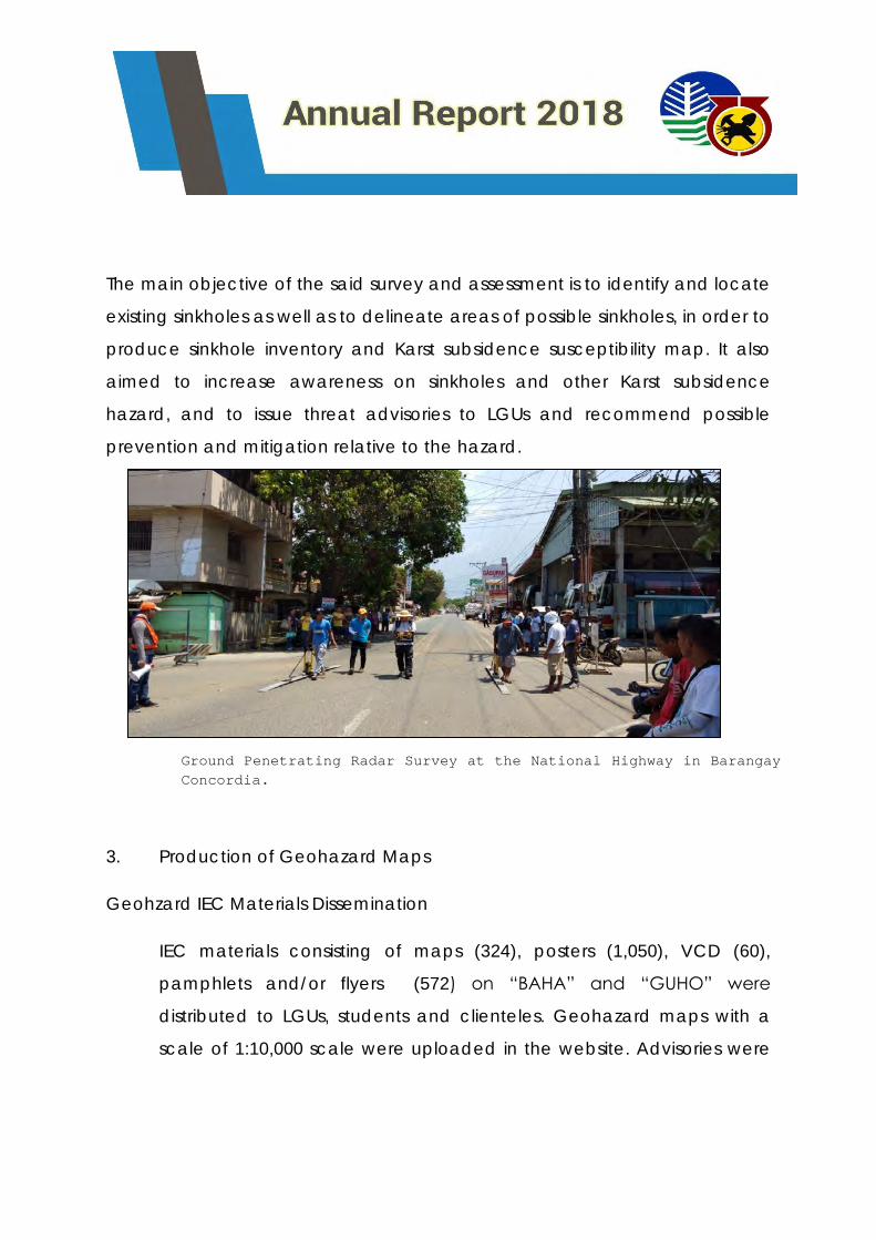
The main objective of the said survey and assessment is to identify and locate
existing sinkholes as well as to delineate areas of possible sinkholes, in order to
produce sinkhole inventory and Karst subsidence susceptibility map. It also
aimed to increase awareness on sinkholes and other Karst subsidence
hazard, and to issue threat advisories to LGUs and recommend possible
prevention and mitigation relative to the hazard.
3. Production of Geohazard Maps
Geohzard IEC Materials Dissemination
IEC materials consisting of maps (324), posters (1,050), VCD (60),
pamphlets and/or flyers (572) on “BAHA” and “GUHO” were
distributed to LGUs, students and clienteles. Geohazard maps with a
scale of 1:10,000 scale were uploaded in the website. Advisories were
Ground Penetrating Radar Survey at the National Highway in Barangay
Concordia.

likewise re-issued to all cities and municipalities in the region. Two (2)
signages were also installed in Brgy. Amigued, Candon, Ilocos Sur.
4. Capacity Building
a. Sir Socrates G. Gaerlan attended on Seminar Workshop on
Strategic Planning for Marine Geological Survey and Research last
January 22-25, 2018 at Tagaytay City;
b. Sir Socrates G. Gaerlan together with Ms. Vilma A. Vecino,
Zipporah Seth A. Oliveros, Louie Francis U. Oliver , Clara Mia P.
Namingit and Mr. Crispin G. Ebuen, Jr. attended the Geoscience
Workshop of the Mines and Geosciences Bureau which was re-
scheduled on February 1-7, 2018 at Patio De San Jose, Malilipot,
Albay as per amended Special Order 2018-19 dated January 30,
2018;
c. Ms. Vilma A. Vecino attended the forthcoming consultation
workshop with the National Economic Development Authority
(NEDA) in tracking up the steps in the formulation of SIAD Action
Plan for the Cabugao Watershed at the Municipality of Cabugao,
Ilocos Sur on February 7-8, 2018;
d. Mr. Crispin G. Ebuen Jr. attended the Training Program on
GEOVIA SURPAC scheduled on March 5-14, 2018 as per Special
Order No. 2018-47 held at Selah Garden Hotel Park, Pasay City;
e. Sir Socrates G. Gaerlan together with Mr. Louie Francis U.
Oliver attended the Basic Training in Safety Of Life At Sea (SOLAS)
scheduled on March 21-26, 2018 as per Special Order 2018-61 at
Angeles City, Pampanga;
f. Ms. Zipporah Seth A. Oliveros together with Engr. Nandry Clae
Lagman attended the Basic and Advance GIS Mapping last June
17-23, 2018 held at Pamulinawen, Ilocos Norte
g. Sir Socrates Gaerlan, Vilma Vecino, Zipporah Seth Oliveros,
Louie Francis Oliver , Ricky B. Corono, Mark Joshua Novero, Crispin
Ebuen Jr. , Marie Rose Aguda, Precious T. Endaya and Yancey
seve Guinto participate in the 2018 Annual Geological Convention
of the Society of the Philippines last Dec. 10-13, 2018.
h. Sir Socrates GAerlan and Louie Francis Oliver attended to the
training on open water scuba diving in connection with the
"Geological studies mineral exploration of the Philippine rise
project" on Dec. 13-20,2018
Conduct of IEC to LGUs
SEMINARS/ WORKSHOPS FOR LGUs
In order to increase awareness and provide additional technical input
to the LGU regarding Risk Exposure Analysis and its importance to attain
sustainable development through comprehensive land-use,
development and disaster risk management planning, Information,
Education and Communication Campaign for VRA project was
conducted.
IEC ON VULNERABILITY RISK ASSESSMENT (VRA) MAPS
MUNICIPALITY DATE NUMBER OF
BARANGAYS
1. Vigan City, Ilocos Sur April 26-28, 2018 39
2. Candon City, Ilocos Sur April 19-21, 2018 42
3. Santa, Ilocos Sur April 23-25, 2018 26
4. Urdaneta, Pangasinan May 24-26, 2018 34
5. Villasis, Pangasinan May 9-11, 2018 21
6. Alaminos City, Pangasinan May 29-31, 2018 39
7.Dagupan City, Pangasinan July 18-20, 2018 31
8.City of San Fernando, La
Union
July 24, 2018 59
9.Mangaldan, Pangasinan August 2-4, 2018 30
10. San Nicolas, Pangasinan August 7-11, 2018 23
11. Santa Maria, Pangasinan August 7-11, 2018 33
12. Laoag City, Ilocos
Norte
October 17-19, 2018 80
LECTURES PRESENTED
1. Lecture on Geohazards last January 17-19, 2018 at Barangay
Namalangan , Rizal, Sacuya, Santa Ilocos Sur as part of their
Development of Mining Technology and Geosciences (DMTG) of Ms
Jennifer Bantolina. (Socrates G. Gaerlan/Randie Ceasar A. Apilado);
2. Ms. Vilma A. Vecino attended as Lecturer / Learning Service Provider to
discuss on the topic “ Geohazard Assessment Groundwater Assessment
and Responsible Mining “ which is scheduled on February 15, 2018 as
per invitation of PENRO La Union who will be conducting a Learning
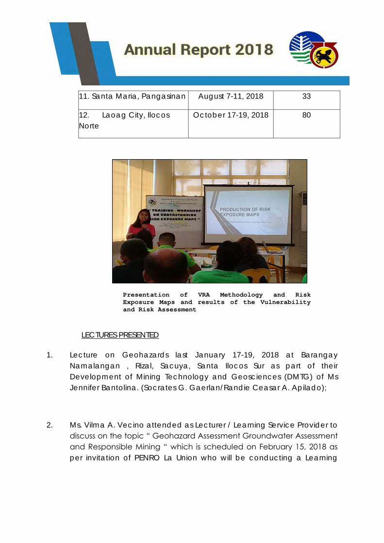
Presentation of VRA Methodology and Risk
Exposure Maps and results of the Vulnerability
and Risk Assessment
Event on Environmental and Natural Resources (ENR) Concerns on
February 13-15, 2018 at Puerto San Juan Resort , San Juan , La Union;
3. Ms. Vilma A. Vecino attended as lecturer/ speaker re: “Understanding
Geological Hazards and Understanding Landslides and Subsidence
Hazards” on the Two-day DRRM Course for Cooperative Sector for the
Province of Ilocos Norte held at Rivermount Hotel and Resort, Brgy. 18,
San Isidro, Sarrat, Ilocos Norte last February 22-23, 2018;
4. Ms. Vilma A. Vecino attended as lecturer/ speaker re: “Understanding
Geohazards” and “Geohazard Map Reading” and “Rain Induced
Landslides” on the One Day DRRM Management Course for Women
Sector for the Province of La Union held at Oasis Country Resort, San
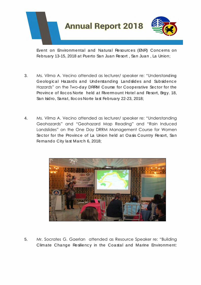
Fernando City last March 6, 2018;
5. Mr. Socrates G. Gaerlan attended as Resource Speaker re: “Building
Climate Change Resiliency in the Coastal and Marine Environment:

Focus on Coastal Geohazards, its Prevention, and Management” last
April 4-5, 2018 at Leisure Coast Resort, Dagupan City, Pangasinan;
6. Mr. Socrates G. Gaerlan attended as Resource Speaker on the
“Workshop for the Formulation of Foreshore Area Management and
Development Plan RE: Resource Profiling and Mapping” to discuss the
results of geologic analysis of the region which will be used as part of
the baseline data for the foreshore baseline mapping last April 12-13,
2018 at Dagupan Village Hotel, Dagupan City;
7. Ms. Vilma A. Vecino attended as Subject Matter Expert/ Lecturer re:
”Understanding Geological Hazards and Understanding Landslides and
Subsidence Hazards” on the two-day Disaster Risk Reduction and
Management (DRRM) Course for Workers in the Informal Sector of the
Province of Ilocos Norte on May 3-4, 2018 at Rivermount Hotel, Sarrat,
Ilocos Norte;
8. Ms. Vilma A. Vecino attended as Subject Matter Expert (SME) to
discuss the topics on “Understanding Geological Hazards and
Understanding Landslides and Subsidence Hazards” on the One -day
Basic Disaster Risk Reduction and Management Training for Youth and
Student Sector scheduled on May 23, 2018;
9. Ms. Vilma A. Vecino attended as Resource Speaker in the DRRM
Training Course for Senior Citizens in Dagupan City and facilitate topics
for the World Vision's Training on Disaster Preparedness in Lingayen last
June 18-20, 2018; and
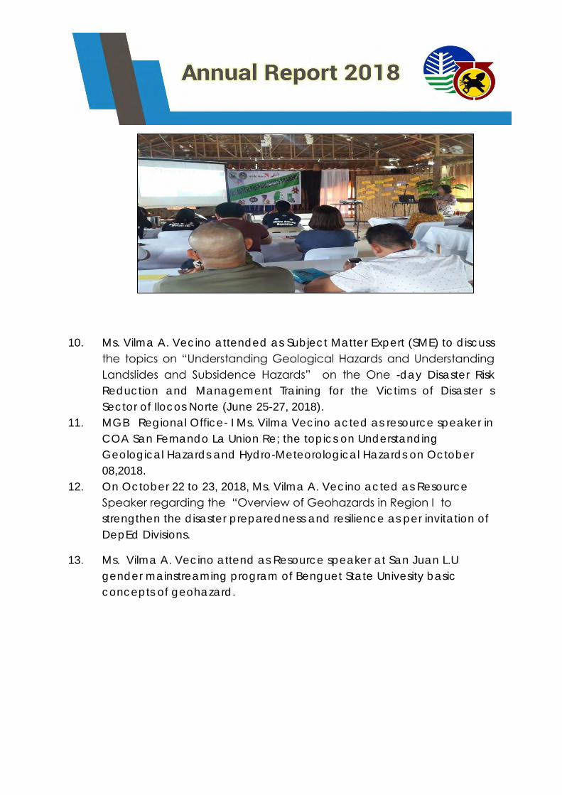
10. Ms. Vilma A. Vecino attended as Subject Matter Expert (SME) to discuss
the topics on “Understanding Geological Hazards and Understanding
Landslides and Subsidence Hazards” on the One -day Disaster Risk
Reduction and Management Training for the Victims of Disaster s
Sector of Ilocos Norte (June 25-27, 2018).
11. MGB Regional Office- I Ms. Vilma Vecino acted as resource speaker in
COA San Fernando La Union Re; the topics on Understanding
Geological Hazards and Hydro-Meteorological Hazards on October
08,2018.
12. On October 22 to 23, 2018, Ms. Vilma A. Vecino acted as Resource
Speaker regarding the “Overview of Geohazards in Region I to
strengthen the disaster preparedness and resilience as per invitation of
DepEd Divisions.
13. Ms. Vilma A. Vecino attend as Resource speaker at San Juan L.U
gender mainstreaming program of Benguet State Univesity basic
concepts of geohazard.
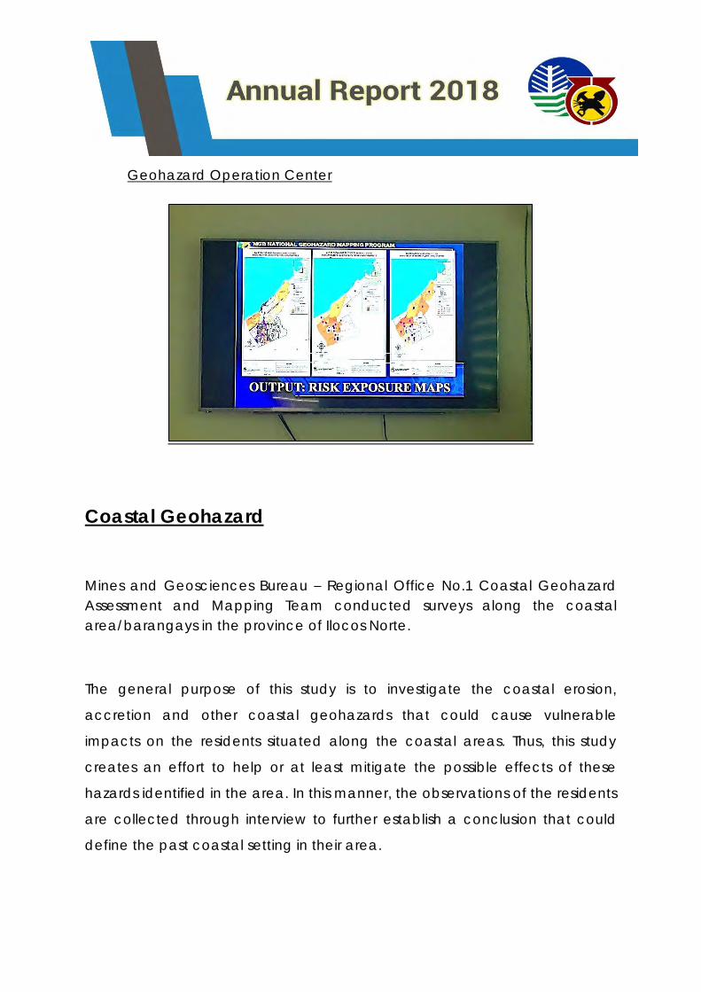
Geohazard Operation Center
Coastal Geohazard
Mines and Geosciences Bureau – Regional Office No.1 Coastal Geohazard
Assessment and Mapping Team conducted surveys along the coastal
area/barangays in the province of Ilocos Norte.
The general purpose of this study is to investigate the coastal erosion,
accretion and other coastal geohazards that could cause vulnerable
impacts on the residents situated along the coastal areas. Thus, this study
creates an effort to help or at least mitigate the possible effects of these
hazards identified in the area. In this manner, the observations of the residents
are collected through interview to further establish a conclusion that could
define the past coastal setting in their area.
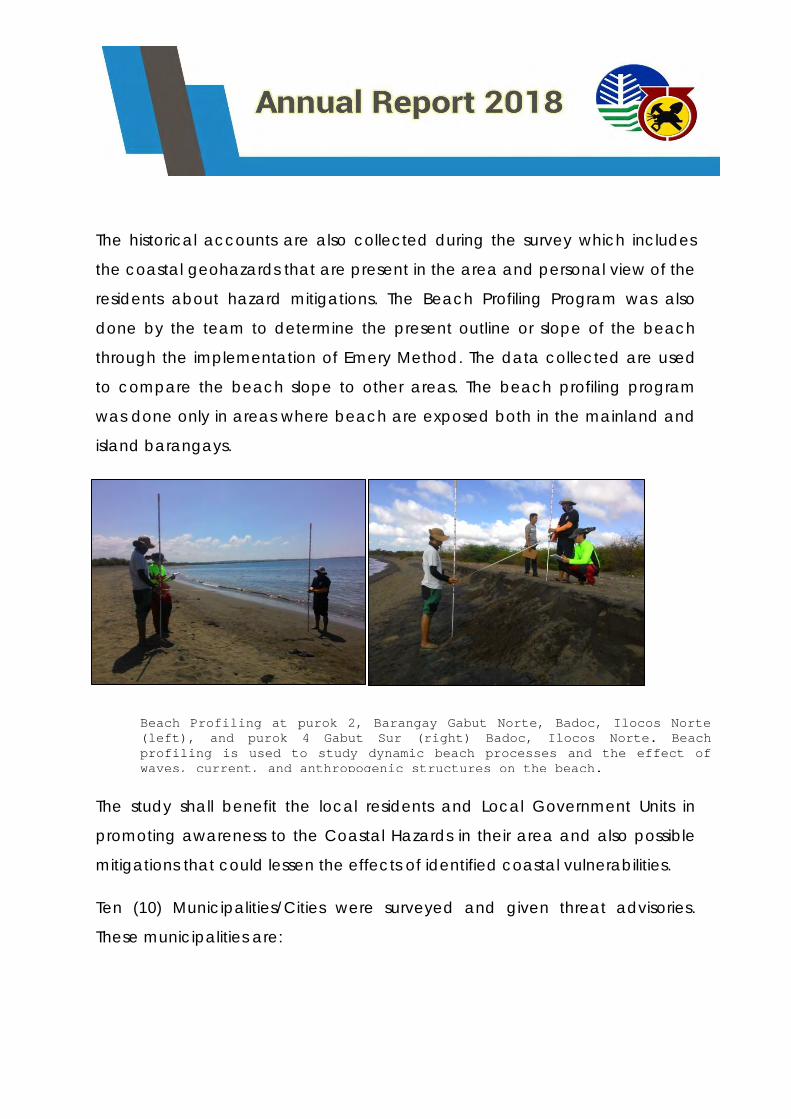
The historical accounts are also collected during the survey which includes
the coastal geohazards that are present in the area and personal view of the
residents about hazard mitigations. The Beach Profiling Program was also
done by the team to determine the present outline or slope of the beach
through the implementation of Emery Method. The data collected are used
to compare the beach slope to other areas. The beach profiling program
was done only in areas where beach are exposed both in the mainland and
island barangays.
The study shall benefit the local residents and Local Government Units in
promoting awareness to the Coastal Hazards in their area and also possible
mitigations that could lessen the effects of identified coastal vulnerabilities.
Ten (10) Municipalities/Cities were surveyed and given threat advisories.
These municipalities are:
Beach Profiling at purok 2, Barangay Gabut Norte, Badoc, Ilocos Norte
(left), and purok 4 Gabut Sur (right) Badoc, Ilocos Norte. Beach
profiling is used to study dynamic beach processes and the effect of
waves, current, and anthropogenic structures on the beach.
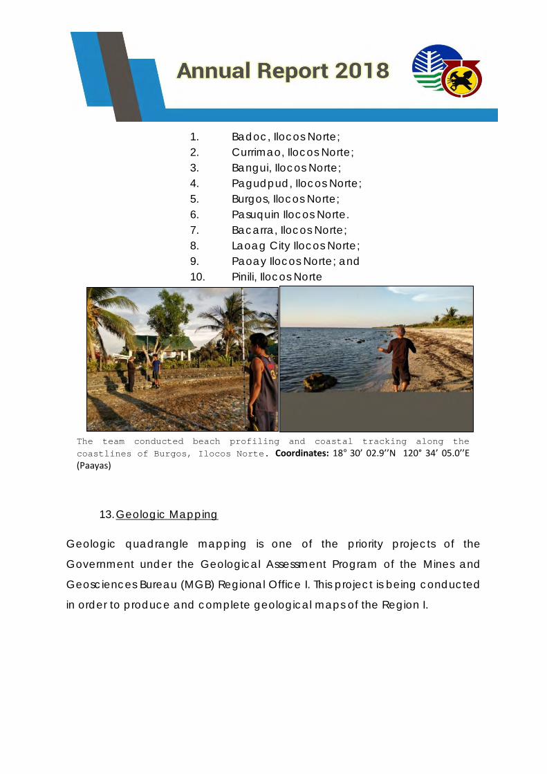
1. Badoc, Ilocos Norte;
2. Currimao, Ilocos Norte;
3. Bangui, Ilocos Norte;
4. Pagudpud, Ilocos Norte;
5. Burgos, Ilocos Norte;
6. Pasuquin Ilocos Norte.
7. Bacarra, Ilocos Norte;
8. Laoag City Ilocos Norte;
9. Paoay Ilocos Norte; and
10. Pinili, Ilocos Norte
13. Geologic Mapping
Geologic quadrangle mapping is one of the priority projects of the
Government under the Geological Assessment Program of the Mines and
Geosciences Bureau (MGB) Regional Office I. This project is being conducted
in order to produce and complete geological maps of the Region I.
The team conducted beach profiling and coastal tracking along the
coastlines of Burgos, Ilocos Norte. Coordinates: 18° 30’ 02.9’’N 120° 34’ 05.0’’E (Paayas)
The generated 1:500 scale geologic maps will serve as the base map for
other geological surveys like geo-hazard assessment, hydrogeological survey
and other geological resources mapping and can be used for land use
development planning of the local government units (LGUs).
SURVEYED AREAS
There are three (3) updating quadrangle maps and two (2) no data
quadrangles that were accomplished this year 2018 by the quadrangle
mapping team of Geosciences Division. The three (3) updating quadrangles
with unpublished geological maps are the areas of Sinait, Cabugao and
Vigan Quadrangles while the two (2) no data quadrangles are the areas of
Solsona and Maruayo Quadrangles.
On March 20 to March 28, 2018, a team of geologists from Mines and
Geosciences Bureau – Regional Office No. 1 conducted geological mapping
in Sinait Quadrangle. This quadrangle is bounded by Geographical
coordinates of North 17° 50’ 00” – 18° 00’ 00” Latitude and East 120° 15’ 00” –
120° 30’ 00” Longitude. Sinait Quadrangle comprises of four (4) municipalities
such as Sinait, Badoc, Pinili and Currimao in the provinces of Ilocos Sur and
Ilocos Norte.
On April 17 to May 31, 2018, the office conducted a geological mapping in
Solsona Quadrangle. Solsona Quadrangle is bounded by geographic
coordinates of 18°10’0” to 18°0’0” North latitude and 120°45’0” to 121°0’0”
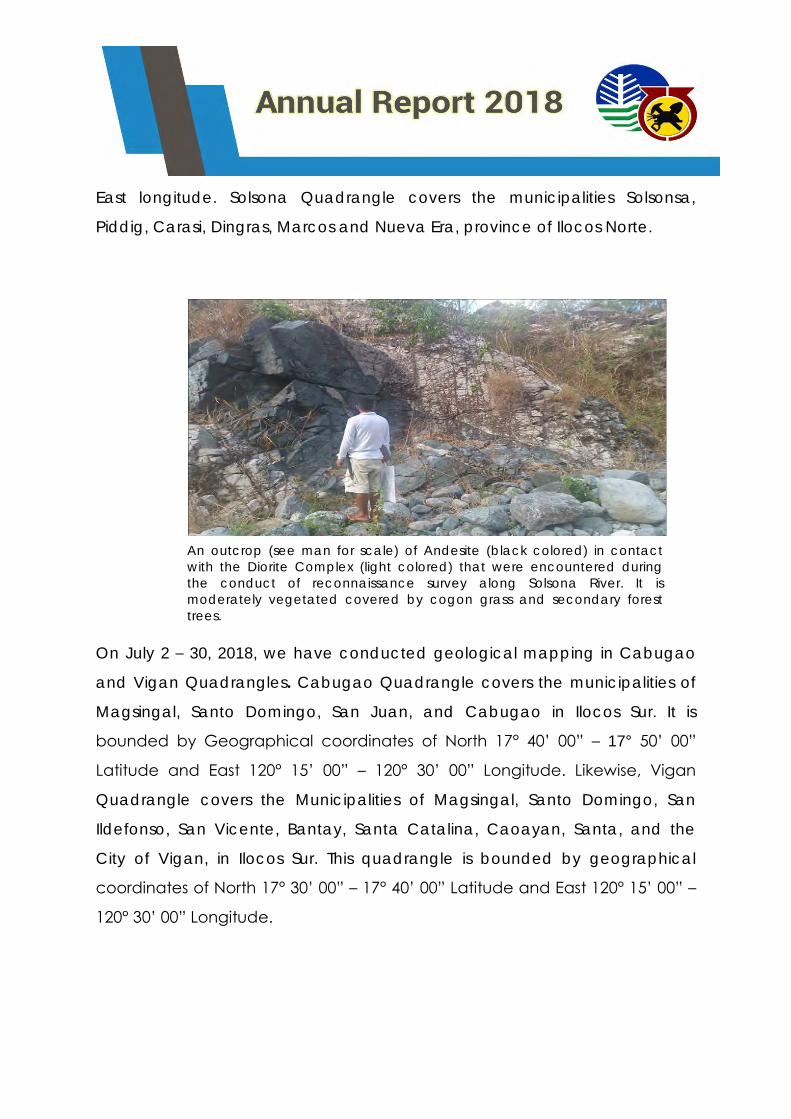
East longitude. Solsona Quadrangle covers the municipalities Solsonsa,
Piddig, Carasi, Dingras, Marcos and Nueva Era, province of Ilocos Norte.
On July 2 – 30, 2018, we have conducted geological mapping in Cabugao
and Vigan Quadrangles. Cabugao Quadrangle covers the municipalities of
Magsingal, Santo Domingo, San Juan, and Cabugao in Ilocos Sur. It is
bounded by Geographical coordinates of North 17° 40’ 00” – 17° 50’ 00”
Latitude and East 120° 15’ 00” – 120° 30’ 00” Longitude. Likewise, Vigan
Quadrangle covers the Municipalities of Magsingal, Santo Domingo, San
Ildefonso, San Vicente, Bantay, Santa Catalina, Caoayan, Santa, and the
City of Vigan, in Ilocos Sur. This quadrangle is bounded by geographical
coordinates of North 17° 30’ 00” – 17° 40’ 00” Latitude and East 120° 15’ 00” –
120° 30’ 00” Longitude.
An outcrop (see man for scale) of Andesite (black colored) in contact
with the Diorite Complex (light colored) that were encountered during
the conduct of reconnaissance survey along Solsona River. It is
moderately vegetated covered by cogon grass and secondary forest
trees.
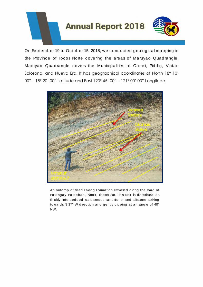
On September 19 to October 15, 2018, we conducted geological mapping in
the Province of Ilocos Norte covering the areas of Maruyao Quadrangle.
Maruyao Quadrangle covers the Municipalities of Carasi, Piddig, Vintar,
Solosona, and Nueva Era. It has geographical coordinates of North 18° 10’
00” – 18° 20’ 00” Latitude and East 120° 45’ 00” – 121° 00’ 00” Longitude.
An outcrop of tilted Laoag Formation exposed along the road of
Barangay Baracbac, Sinait, Ilocos Sur. This unit is described as
thickly interbedded calcareous sandstone and siltstone striking
towards N 37° W direction and gently dipping at an angle of 40°
NW.
Calcareous Sandstone
Calcareous Siltstone
N 17°50'11.8" E 120°29'34.3"
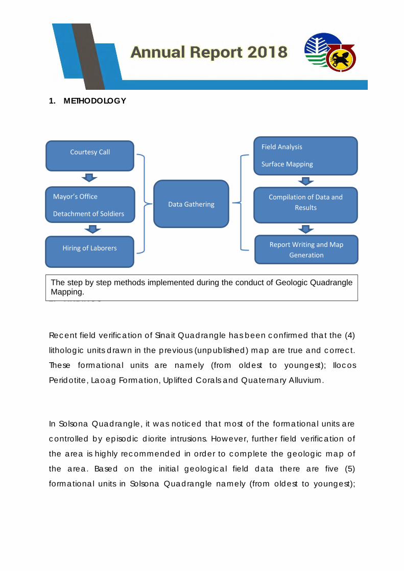
1. METHODOLOGY
2. FINDINGS
Recent field verification of Sinait Quadrangle has been confirmed that the (4)
lithologic units drawn in the previous (unpublished) map are true and correct.
These formational units are namely (from oldest to youngest); Ilocos
Peridotite, Laoag Formation, Uplifted Corals and Quaternary Alluvium.
In Solsona Quadrangle, it was noticed that most of the formational units are
controlled by episodic diorite intrusions. However, further field verification of
the area is highly recommended in order to complete the geologic map of
the area. Based on the initial geological field data there are five (5)
formational units in Solsona Quadrangle namely (from oldest to youngest);
Hiring of Laborers Report Writing and Map
Generation
Courtesy Call
Data Gathering Compilation of Data and
Results
Mayor’s Office
Detachment of Soldiers
Field Analysis
Surface Mapping
The step by step methods implemented during the conduct of Geologic Quadrangle Mapping.
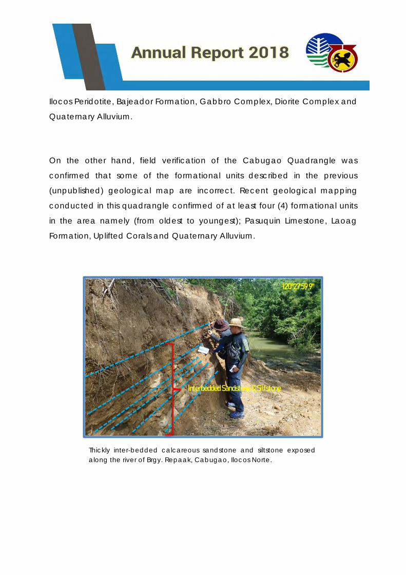
Ilocos Peridotite, Bajeador Formation, Gabbro Complex, Diorite Complex and
Quaternary Alluvium.
On the other hand, field verification of the Cabugao Quadrangle was
confirmed that some of the formational units described in the previous
(unpublished) geological map are incorrect. Recent geological mapping
conducted in this quadrangle confirmed of at least four (4) formational units
in the area namely (from oldest to youngest); Pasuquin Limestone, Laoag
Formation, Uplifted Corals and Quaternary Alluvium.
120°27'59.9"
17°49'12.7"
Thickly inter-bedded calcareous sandstone and siltstone exposed
along the river of Brgy. Repaak, Cabugao, Ilocos Norte.
Interbedded Sandstone & Siltstone
In contrast, Vigan Quadrangle was confirmed that all the formational units
and geological structures drawn in the previous (unpublished) geological
map are true and correct. Based on the recent geological field verification,
there are five (5) formational units in the area namely (from oldest to
youngest); Bojeador Formation, Pasaleng Quartz Diorite, Pasuquin Limestone,
Laoag Formation and Quaternary Alluvium.
Meanwhile, based on the initial geological field data gathered in Maruayo
Quadrangle there are five (5) formational units were identified in this area
namely (from oldest to youngest); Ilocos Peridotite, Bangui Formation,
Magabobo Limestone, Cordillera Diorite Complex and Quaternary Alluvium.
However, field mapping of the eastern side of the quadrangle and
petrographic analysis are highly recommended to properly establish the rock
ages of the lithologic sequence in the area and also to complete its
geological map.
There are several difficulties may have experienced during the geological
assessment. For quadrangle mapping, you may encounter conflicts such as
bad weather conditions, poor road networks, varying topography of the
mapping area especially those elevated areas, communication during
courtesy call when the municipal officers are not around, hiring of laborers
which is time consuming, safety in remote areas and health issues when you
can only drink water from the river. In fact, these difficulties are the cause of
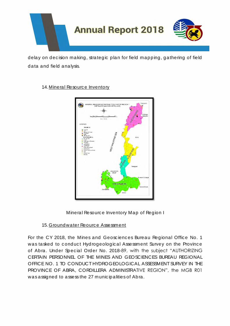
delay on decision making, strategic plan for field mapping, gathering of field
data and field analysis.
14. Mineral Resource Inventory
Mineral Resource Inventory Map of Region I
15. Groundwater Reource Assessment
For the CY 2018, the Mines and Geosciences Bureau Regional Office No. 1
was tasked to conduct Hydrogeological Assessment Survey on the Province
of Abra. Under Special Order No. 2018-89, with the subject “AUTHORIZING
CERTAIN PERSONNEL OF THE MINES AND GEOSCIENCES BUREAU REGIONAL
OFFICE NO. 1 TO CONDUCT HYDROGEOLOGICAL ASSESSMENT SURVEY IN THE
PROVINCE OF ABRA, CORDILLERA ADMINISTRATIVE REGION”, the MGB R01
was assigned to assess the 27 municipalities of Abra.
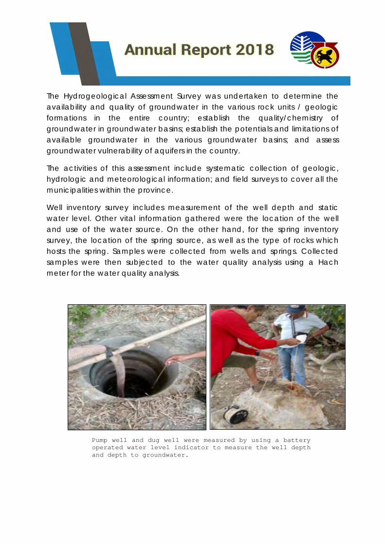
The Hydrogeological Assessment Survey was undertaken to determine the
availability and quality of groundwater in the various rock units / geologic
formations in the entire country; establish the quality/chemistry of
groundwater in groundwater basins; establish the potentials and limitations of
available groundwater in the various groundwater basins; and assess
groundwater vulnerability of aquifers in the country.
The activities of this assessment include systematic collection of geologic,
hydrologic and meteorological information; and field surveys to cover all the
municipalities within the province.
Well inventory survey includes measurement of the well depth and static
water level. Other vital information gathered were the location of the well
and use of the water source. On the other hand, for the spring inventory
survey, the location of the spring source, as well as the type of rocks which
hosts the spring. Samples were collected from wells and springs. Collected
samples were then subjected to the water quality analysis using a Hach
meter for the water quality analysis.
Pump well and dug well were measured by using a battery
operated water level indicator to measure the well depth
and depth to groundwater.
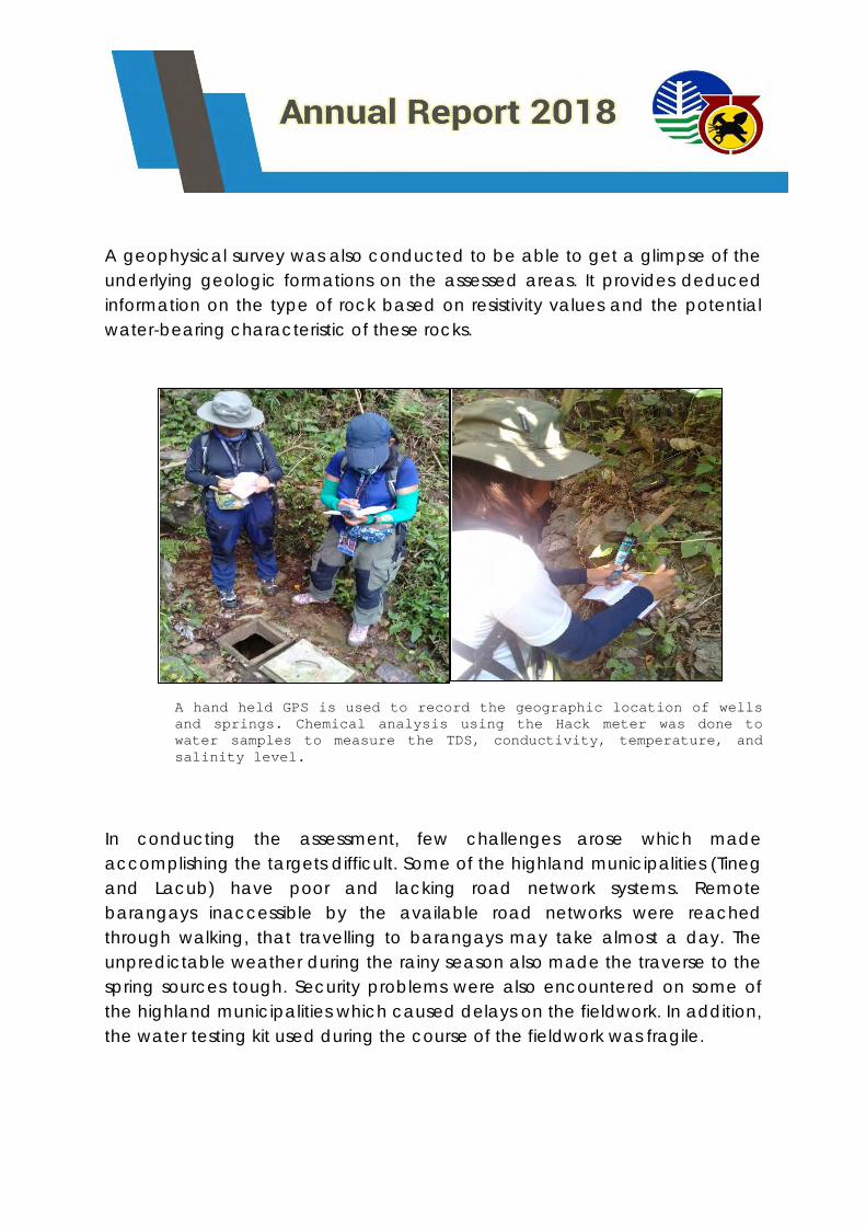
A geophysical survey was also conducted to be able to get a glimpse of the
underlying geologic formations on the assessed areas. It provides deduced
information on the type of rock based on resistivity values and the potential
water-bearing characteristic of these rocks.
In conducting the assessment, few challenges arose which made
accomplishing the targets difficult. Some of the highland municipalities (Tineg
and Lacub) have poor and lacking road network systems. Remote
barangays inaccessible by the available road networks were reached
through walking, that travelling to barangays may take almost a day. The
unpredictable weather during the rainy season also made the traverse to the
spring sources tough. Security problems were also encountered on some of
the highland municipalities which caused delays on the fieldwork. In addition,
the water testing kit used during the course of the fieldwork was fragile.
A hand held GPS is used to record the geographic location of wells
and springs. Chemical analysis using the Hack meter was done to
water samples to measure the TDS, conductivity, temperature, and
salinity level.
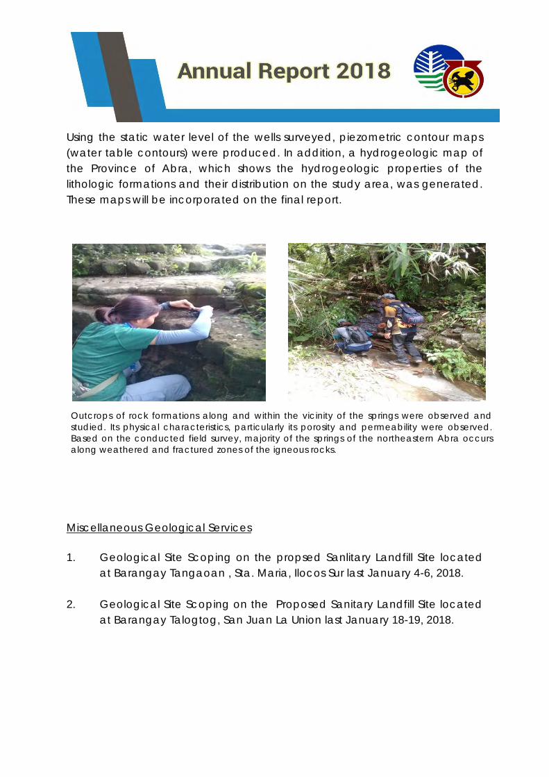
Using the static water level of the wells surveyed, piezometric contour maps
(water table contours) were produced. In addition, a hydrogeologic map of
the Province of Abra, which shows the hydrogeologic properties of the
lithologic formations and their distribution on the study area, was generated.
These maps will be incorporated on the final report.
Miscellaneous Geological Services
1. Geological Site Scoping on the propsed Sanlitary Landfill Site located
at Barangay Tangaoan , Sta. Maria, Ilocos Sur last January 4-6, 2018.
2. Geological Site Scoping on the Proposed Sanitary Landfill Site located
at Barangay Talogtog, San Juan La Union last January 18-19, 2018.
Outcrops of rock formations along and within the vicinity of the springs were observed and
studied. Its physical characteristics, particularly its porosity and permeability were observed.
Based on the conducted field survey, majority of the springs of the northeastern Abra occurs
along weathered and fractured zones of the igneous rocks.
3. Geological Site Scoping on the proposed Engineered Sanitary Landfill
facility located at Barangay Saoay, City of San Fernando, La Union last
January 30-31, 2018.
4. Hydrogeological and Georesistivity Survey at Sentinella Hill of Bangui ,
Ilocos Norte as per request of Mayor Flidel Cimatu of Bangui, IN last
February 13-16, 2018.
5. Geological and structural assessment to locate and propose Small
Water Impounding dams and pinky watersheds in the Municipality of
Bangui, Ilocos Norte last February 20-24, 2018.
6. Geological assessment and test pit inspection in the proposed sanitary
landfill site in the City of San Fernando City, La Union last March 1, 2018.
7. Geological Site Scoping on the proposed Ecozone of about 306
hectares located in Mt. Tapao, Barangay Poblacion, Suyo, Ilocos Sur
last March 17-19, 2018.
8. Geohazard Identification Survey (GIS) for the proposed Beverly Hills
Subdivision in Brgy. Sta. Rita West, Aringay, La Union last March 20, 2018.
9. Geologic Assessment of Sanitary Landfill in Brgy. San Agustin Norte,
Agoo, La Union last March 21-23, 2018.
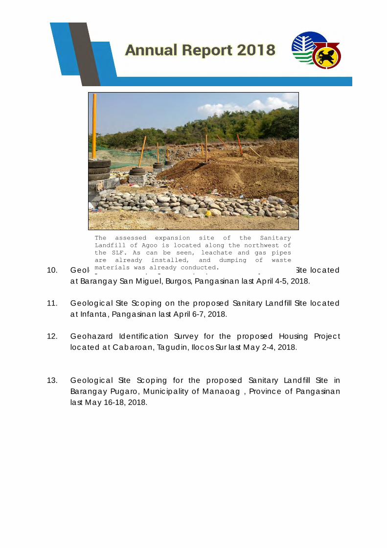
10. Geological Site Scoping on the proposed Sanitary Landfill Site located
at Barangay San Miguel, Burgos, Pangasinan last April 4-5, 2018.
11. Geological Site Scoping on the proposed Sanitary Landfill Site located
at Infanta, Pangasinan last April 6-7, 2018.
12. Geohazard Identification Survey for the proposed Housing Project
located at Cabaroan, Tagudin, Ilocos Sur last May 2-4, 2018.
13. Geological Site Scoping for the proposed Sanitary Landfill Site in
Barangay Pugaro, Municipality of Manaoag , Province of Pangasinan
last May 16-18, 2018.
The assessed expansion site of the Sanitary
Landfill of Agoo is located along the northwest of
the SLF. As can be seen, leachate and gas pipes
are already installed, and dumping of waste
materials was already conducted.
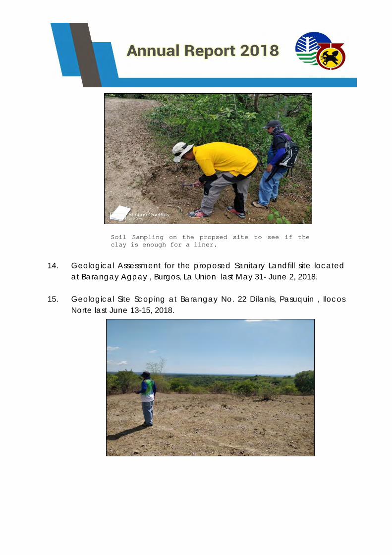
14. Geological Assessment for the proposed Sanitary Landfill site located
at Barangay Agpay , Burgos, La Union last May 31- June 2, 2018.
15. Geological Site Scoping at Barangay No. 22 Dilanis, Pasuquin , Ilocos
Norte last June 13-15, 2018.
Soil Sampling on the propsed site to see if the
clay is enough for a liner.
16. Marie Rose Aguda and Precious T. Endaya Conduct geological
assessment on the proposed Sanitary landfill at Quirino Ilocos Sur, last
July 4-5, 2018
17. Sir Crispin Ebuen Jr. and Yancey Seve Guinto conducted geological
assessment on the proposed Sanitary landfill at Sugpon Ilocos Sur last
July 4-5,2018.
18. Socrates Gaerlan, Lester Valdez, Mark Joshua Novero, Crispin G. Ebuen
Jr. and Arnel S. Montemayor conducted geohazard assessment on the
reported impending landslide in Brgy. Amguid City of Candon,
Province of Ilocos Sur last August 13-14, 2018.
19. Mr. Socrates Gaerlan, Lester T. Valdez and Yancey Seve Guinto
conducted Geologic and geohazard Assessment on the reported
landslide in Alilem, Ilocos Sur last August 27-28, 2018.
20. Sir Socrates G. Gaerlan, Randie Ceasar Apilado and Lester T. Valdez
conducted geological site scoping on the proposed eco-tourism area
in Barangay Lucap, Alaminos City, Pangasinan.
21. Sir Socrates GAerlan, Mark Joshua Novero and Ricky B. Corono
conducted geological assessment of SWIS in Brgy. Nagyubuyuban San
Juan and San Gabriel La Union last September 10, 2018.
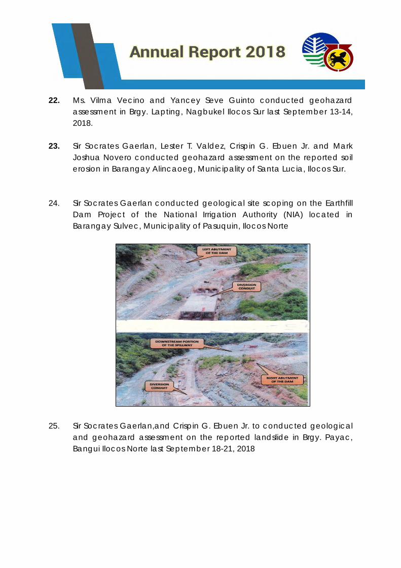
22. Ms. Vilma Vecino and Yancey Seve Guinto conducted geohazard
assessment in Brgy. Lapting, Nagbukel Ilocos Sur last September 13-14,
2018.
23. Sir Socrates Gaerlan, Lester T. Valdez, Crispin G. Ebuen Jr. and Mark
Joshua Novero conducted geohazard assessment on the reported soil
erosion in Barangay Alincaoeg, Municipality of Santa Lucia, Ilocos Sur.
24. Sir Socrates Gaerlan conducted geological site scoping on the Earthfill
Dam Project of the National Irrigation Authority (NIA) located in
Barangay Sulvec, Municipality of Pasuquin, Ilocos Norte
25. Sir Socrates Gaerlan,and Crispin G. Ebuen Jr. to conducted geological
and geohazard assessment on the reported landslide in Brgy. Payac,
Bangui Ilocos Norte last September 18-21, 2018
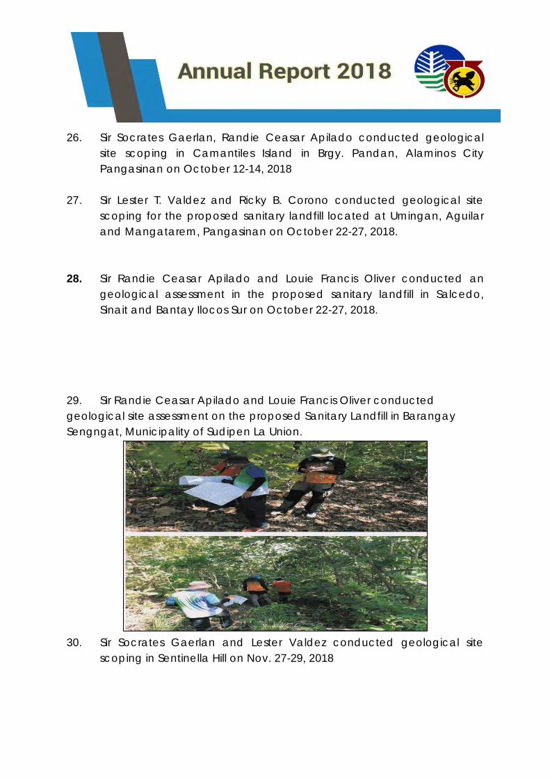
26. Sir Socrates Gaerlan, Randie Ceasar Apilado conducted geological
site scoping in Camantiles Island in Brgy. Pandan, Alaminos City
Pangasinan on October 12-14, 2018
27. Sir Lester T. Valdez and Ricky B. Corono conducted geological site
scoping for the proposed sanitary landfill located at Umingan, Aguilar
and Mangatarem, Pangasinan on October 22-27, 2018.
28. Sir Randie Ceasar Apilado and Louie Francis Oliver conducted an
geological assessment in the proposed sanitary landfill in Salcedo,
Sinait and Bantay Ilocos Sur on October 22-27, 2018.
29. Sir Randie Ceasar Apilado and Louie Francis Oliver conducted
geological site assessment on the proposed Sanitary Landfill in Barangay
Sengngat, Municipality of Sudipen La Union.
30. Sir Socrates Gaerlan and Lester Valdez conducted geological site
scoping in Sentinella Hill on Nov. 27-29, 2018
31. Sir Socrates G. Gaerlan conducted geological site scoping in the
Municipality of Pagudpud and Currimao Ilocos Norte on December 04-
08, 2018
32. Sir Randie Ceasar Apilado and Louie Francis Oliver conducted
Geological assessment on the proposed site for Sanitary Landfill of
Nagbukel Ilocos Sur last December 17-21, 2018
33. Sir Yancey Seve Guinto conducted geological site scoping in the
operation of cottages along Pila river, Barangay Pacalat, Mangatarem
Pangasinan.
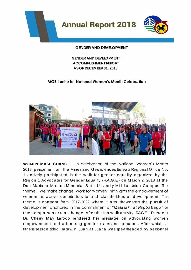
GENDER AND DEVELOPMENT
GENDER AND DEVELOPMENT
ACCOMPLISHMENT REPORT
AS OF DECEMBER 31, 2018
I.MGB I unite for National Women’s Month Celebration
WOMEN MAKE CHANGE – In celebration of the National Women’s Month
2018, personnel from the Mines and Geosciences Bureau Regional Office No.
1 actively participated in the walk for gender equality organized by the
Region 1 Advocates for Gender Equality (R.A.G.E.) on March 2, 2018 at the
Don Mariano Marcos Memorial State University-Mid La Union Campus. The
theme, “We make change. Work for Women” highlights the empowerment of
women as active contributors to and claimholders of development. This
theme is constant from 2017-2022 where it also showcases the pursuit of
development anchored in the commitment of “Malasakit at Pagbabago” or
true compassion or real change. After the fun walk activity, RAGE-1 President
Dr. Cherry May Laroco rendered her message on advocating women
empowerment and addressing gender issues and concerns. After which, a
fitness session titled Hataw ni Juan at Juana was spearheaded by personnel
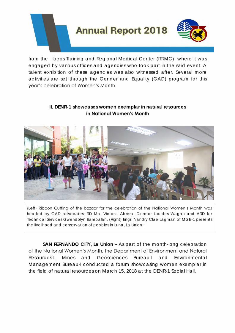
from the Ilocos Training and Regional Medical Center (ITRMC) where it was
engaged by various offices and agencies who took part in the said event. A
talent exhibition of these agencies was also witnessed after. Several more
activities are set through the Gender and Equality (GAD) program for this
year’s celebration of Women’s Month.
II. DENR-1 showcases women exemplar in natural resources
in National Women’s Month
SAN FERNANDO CITY, La Union – As part of the month-long celebration
of the National Women’s Month, the Department of Environment and Natural
Resources-I, Mines and Geosciences Bureau-I and Environmental
Management Bureau-I conducted a forum showcasing women exemplar in
the field of natural resources on March 15, 2018 at the DENR-1 Social Hall.
(Left) Ribbon Cutting of the bazaar for the celebration of the National Women’s Month was
headed by GAD advocates, RD Ma. Victoria Abrera, Director Lourdes Wagan and ARD for
Technical Services Gwendolyn Bambalan. (Right) Engr. Nandry Clae Lagman of MGB-1 presents
the livelihood and conservation of pebbles in Luna, La Union.
Along with this, a bazar featuring products from different people’s
organizations in the region was established in the parking area of the DENR-1
building. This also includes services and products of persons with disabilities
(PWDs). The ribbon cutting ceremony was led by ARD Gwendolyn
Bambalan, ARD Leduina Co, EMB-1 Regional Director Ma. Victoria Abrera
and Director Lourdes Wagan.
After which, the forum followed; GAD champion, ARD Gwendolyn
Bambalan rendered the opening remarks to the participants which were
composed of DENR, EMB and MGB employees, as well as members of
people’s organizations in the four provinces of the Region.
This year’s theme “WE Make Change Work for Women” ensures that
men and women will be partners in the pursuit of the country’s economic,
social, cultural commitment of Malasakit at Pagbabago or True Compassion
and Real Change. Guest speaker Director Wagan shared that women
empowerment enables one to confidently engage to various programs and
activities which enable everyone to benefit from development and change.
To give a glimpse on the GAD activities and best practices of the
People’s Organizations and National Government Agencies (such as DENR-
MGB, DENR-EMB, TESDA, DMMMSU and DA) various women leaders
presented and discussed. While, a representative from the Department of
Science and Technology (DOST) gave the some tips on how to further
improve their respected GAD activities in the future.
ARD for Management Services Leduina Co wrapped up the said forum
where she thanked the active participation of everyone in one of the event
highlights of the celebration of the National Women’s Month. Further, she
encouraged everyone to continue supporting Gender and Development
activities and programs to increase empowerment both to men and women.
III. TRAINING ON ENHANCED GENDER
MAINSTREAMING EVALUATION FRAMEWORKON APRIL 2-6, 2017
AT THE MICROTEL BY WYNDHAM IN DILIMAN, QUEZON CITY
The Mines and Geosciences Bureau through the GAD Focal Point
System (GFPS) conducted the said 5-day training which also included
members of the GAD Regional Technical Working Group.
It aimed to increase the knowledge of the participants on the GMEF
which is a tool to measure the extent of the gender mainstreaming efforts of
organizations, National Government Agencies and Local Government Units. It
is also meant to assist the GFPS members in measuring gains and success, as
well as pinpoint areas for improvement in the way they mainstream the
gender and development in their organization.
Ms. Lorenza A Umali, a GAD Specialist and Lead Facilitator of the said
training presented and discussed the historical background of the GMEF as
well as the Entry Points on Gender Mainstreaming, Levels of Gender
Mainstreaming, GMEF Descriptors per entry point, Accomplishing GMEF
questionnaires, Analyzing Results and Means of Verification. In the Enhanced
GMEF, new and emerging gender issues, new policy issuances (especially the
Magna Carta of Women) are take into account and outdated indicators in
the old tool were revised. . It has also adopted the scoring system of the
Harmonized Gender and Development Guidelines (HGDG) of “No”, “Partly
Yes” and “Yes” instead of denoting only the absence or presence of a GAD
element.
Participants were grouped into 3 for the hosting of the day to day
workshop.
On the next day, Ms. Umali discussed the People Descriptors which was
followed by the workshop on the assessment of the said entry point.
Participants later presented the outputs on the workshop which were then
subjected for critiquing. Participants came up with scores using the new
scoring system which takes into consideration the GAD efforts of the
organization that are still underway, such as draft policies and plans to
establish GAD mechanisms.
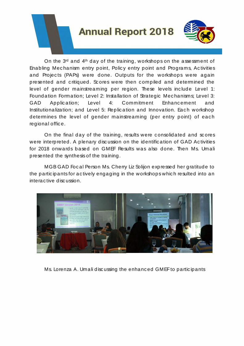
On the 3rd and 4th day of the training, workshops on the assessment of
Enabling Mechanism entry point, Policy entry point and Programs, Activities
and Projects (PAPs) were done. Outputs for the workshops were again
presented and critiqued. Scores were then compiled and determined the
level of gender mainstreaming per region. These levels include Level 1:
Foundation Formation; Level 2: Installation of Strategic Mechanisms; Level 3:
GAD Application; Level 4: Commitment Enhancement and
Institutionalization; and Level 5: Replication and Innovation. Each workshop
determines the level of gender mainstreaming (per entry point) of each
regional office.
On the final day of the training, results were consolidated and scores
were interpreted. A plenary discussion on the identification of GAD Activities
for 2018 onwards based on GMEF Results was also done. Then Ms. Umali
presented the synthesis of the training.
MGB GAD Focal Person Ms. Cherry Liz Solijon expressed her gratitude to
the participants for actively engaging in the workshops which resulted into an
interactive discussion.
Ms. Lorenza A. Umali discussing the enhanced GMEF to participants
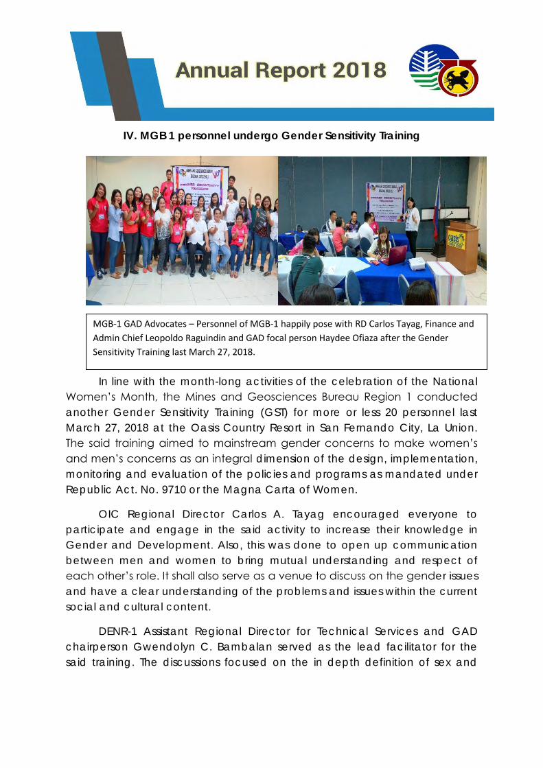
IV. MGB 1 personnel undergo Gender Sensitivity Training
In line with the month-long activities of the celebration of the National
Women’s Month, the Mines and Geosciences Bureau Region 1 conducted
another Gender Sensitivity Training (GST) for more or less 20 personnel last
March 27, 2018 at the Oasis Country Resort in San Fernando City, La Union.
The said training aimed to mainstream gender concerns to make women’s
and men’s concerns as an integral dimension of the design, implementation,
monitoring and evaluation of the policies and programs as mandated under
Republic Act. No. 9710 or the Magna Carta of Women.
OIC Regional Director Carlos A. Tayag encouraged everyone to
participate and engage in the said activity to increase their knowledge in
Gender and Development. Also, this was done to open up communication
between men and women to bring mutual understanding and respect of
each other’s role. It shall also serve as a venue to discuss on the gender issues
and have a clear understanding of the problems and issues within the current
social and cultural content.
DENR-1 Assistant Regional Director for Technical Services and GAD
chairperson Gwendolyn C. Bambalan served as the lead facilitator for the
said training. The discussions focused on the in depth definition of sex and
MGB-1 GAD Advocates – Personnel of MGB-1 happily pose with RD Carlos Tayag, Finance and
Admin Chief Leopoldo Raguindin and GAD focal person Haydee Ofiaza after the Gender
Sensitivity Training last March 27, 2018.
gender, situation of men and women then and now, gender biases, major
GAD policies and laws, and Magna Carta of Women.
MGB-1 GAD focal person Haydee Ofiaza expressed her sincere
gratitude to the participants and speaker for the training. She mentioned that
the training is a big step to the more activities for GAD advocacy.
The training concluded with the awarding of awards to the participants
such as the most participative, early bird and leadership award.
V. Gender and Development (GAD) bulletin board maintained at the
MGB Conference Hall
The GAD Focal person established and maintained a bulletin board
intended for employees featuring Gender related reports and concepts like
2018 Accomplishment report, Gender Stereotypes and birthday celebrants
for the month.
Another bulletin board will be established this month to be placed in
the DENR lobby intended for clients containing readily available IEC
materials.
VI. Participation of women in the Information Education and
Communication Campaign
The Geosciences Division of MGB RO1 conducted Workshop on
Vulnerability and Risk Assessment and Geohazard Mapping at La Union,
Pangasinan, Ilocos Norte and Ilocos Sur. The invitation letter to barangays
reiterated the participation of at least two (2) women barangay officials to
attend the said workshop. Part of the program was discussion of GAD
concepts and Violence Against Women and Children (RA 9262). At least 500
IEC materials for GAD were distributed to the participants.
VI. Participation of women in Disaster Risk Reduction Management
(DRRM)
On August 23, 2018, Ms. Vilma A. Vecino, Senior Geologist was invited
by the Benguet State University (BSU) employees to be a resource speaker in
their Gender Sensitivity Training held the The Final Options, San Juan, La
Union. She discussed the importance of women participation in DRRM and
IEC materials were distributed like flashlights, t-shirts, fans, etc. to active
particpants.
VII. Participation in 18-day Campaign to End Violence Against Women
(VAW)
The Region 1 Advocates for Gender Equality (RAGE-1) hosted different
activities to be participated by government agencies in Region 1 in relation
to the 18-day Campaign to End Violence Against Women.
A tarpaulin designed by the Philippine Commission on Women (PCW)
was displayed in front of MGB RO1 building to signify its participation in the
said advocacy.
On November 23, 2018, the two employees joined the Forum on
Violence Against Women (VAW) held the Bangko Sentral ng Pilipinas which
was spearheaded by the Ilocos Training and Regional Medical Center
(ITRMC) employees.
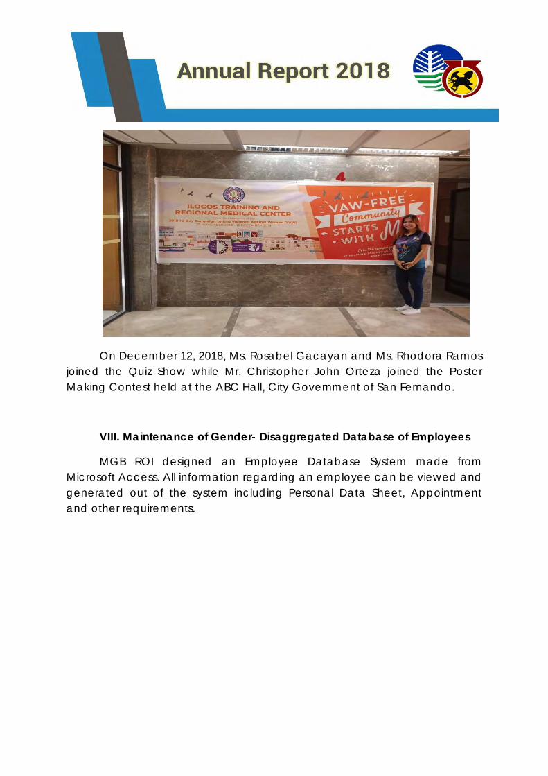
On December 12, 2018, Ms. Rosabel Gacayan and Ms. Rhodora Ramos
joined the Quiz Show while Mr. Christopher John Orteza joined the Poster
Making Contest held at the ABC Hall, City Government of San Fernando.
VIII. Maintenance of Gender- Disaggregated Database of Employees
MGB ROI designed an Employee Database System made from
Microsoft Access. All information regarding an employee can be viewed and
generated out of the system including Personal Data Sheet, Appointment
and other requirements.
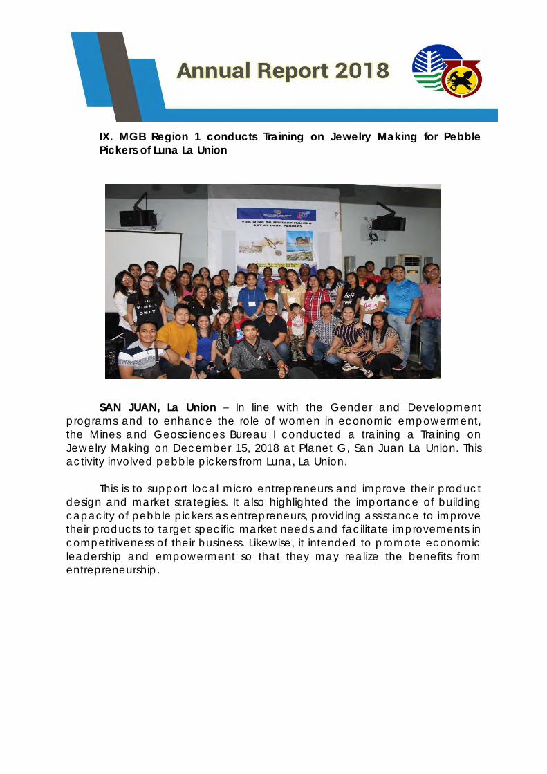
IX. MGB Region 1 conducts Training on Jewelry Making for Pebble
Pickers of Luna La Union
SAN JUAN, La Union – In line with the Gender and Development
programs and to enhance the role of women in economic empowerment,
the Mines and Geosciences Bureau I conducted a training a Training on
Jewelry Making on December 15, 2018 at Planet G, San Juan La Union. This
activity involved pebble pickers from Luna, La Union.
This is to support local micro entrepreneurs and improve their product
design and market strategies. It also highlighted the importance of building
capacity of pebble pickers as entrepreneurs, providing assistance to improve
their products to target specific market needs and facilitate improvements in
competitiveness of their business. Likewise, it intended to promote economic
leadership and empowerment so that they may realize the benefits from
entrepreneurship.
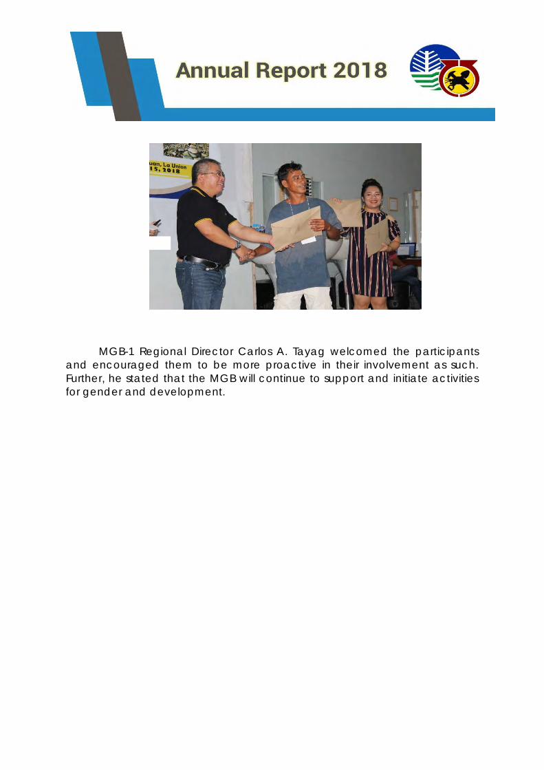
MGB-1 Regional Director Carlos A. Tayag welcomed the participants
and encouraged them to be more proactive in their involvement as such.
Further, he stated that the MGB will continue to support and initiate activities
for gender and development.
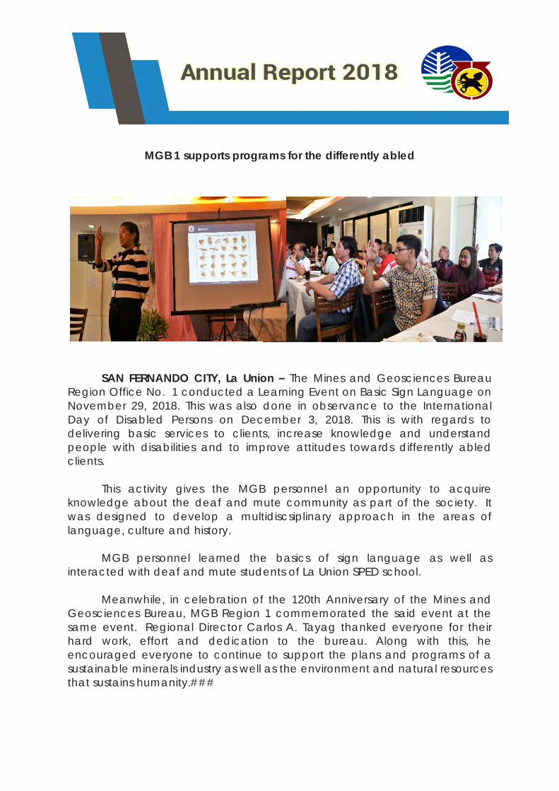
MGB 1 supports programs for the differently abled
SAN FERNANDO CITY, La Union – The Mines and Geosciences Bureau
Region Office No. 1 conducted a Learning Event on Basic Sign Language on
November 29, 2018. This was also done in observance to the International
Day of Disabled Persons on December 3, 2018. This is with regards to
delivering basic services to clients, increase knowledge and understand
people with disabilities and to improve attitudes towards differently abled
clients.
This activity gives the MGB personnel an opportunity to acquire
knowledge about the deaf and mute community as part of the society. It
was designed to develop a multidiscsiplinary approach in the areas of
language, culture and history.
MGB personnel learned the basics of sign language as well as
interacted with deaf and mute students of La Union SPED school.
Meanwhile, in celebration of the 120th Anniversary of the Mines and
Geosciences Bureau, MGB Region 1 commemorated the said event at the
same event. Regional Director Carlos A. Tayag thanked everyone for their
hard work, effort and dedication to the bureau. Along with this, he
encouraged everyone to continue to support the plans and programs of a
sustainable minerals industry as well as the environment and natural resources
that sustains humanity.###