Embed Size (px)
Citation preview
Maritime Investigation Report

Maritime Investigation Report: Version 1 – June 2016 1
Maritime Investigation Report
Subject: Spirit of Tasmania II breakaway from Station Pier Port Melbourne Wednesday 13 January 2016.
Release date: 31 May 2016

2 Maritime Investigation Report: Version 1 – June 2016
Maritime Investigation Report: Version 1 – June 2016 3
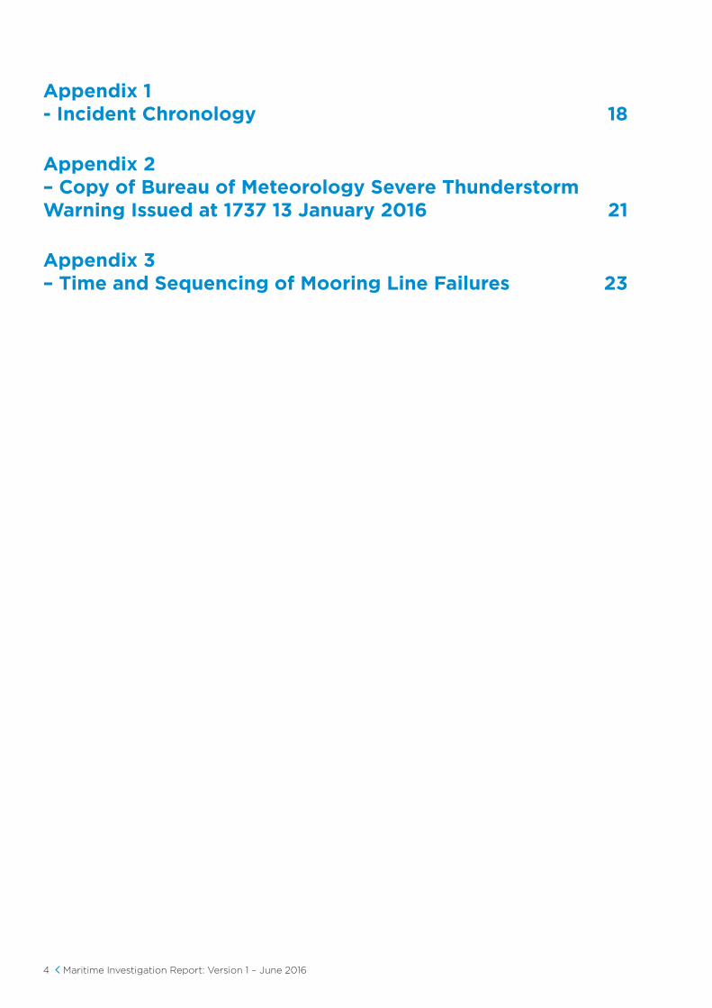
Summary of Events 5
Powers to Investigate 5
Scope of the Investigation 5
Other Regulatory Agencies 5
Investigation Summary 6
Master and Chief Officer of Spirit Of Tasmania II 6
The Spirit of Tasmania II 6
The Incident 8
Incident Outcomes 10
Facts 11
Causes of the Incident 14
Breaches of the Marine Safety Act 15
Actions to Address Systemic Issues Identified 15
Actions Undertaken 16
Contents
4 Maritime Investigation Report: Version 1 – June 2016
Appendix 1 - Incident Chronology 18
Appendix 2 – Copy of Bureau of Meteorology Severe Thunderstorm Warning Issued at 1737 13 January 2016 21
Appendix 3 – Time and Sequencing of Mooring Line Failures 23
Maritime Investigation Report: Version 1 – June 2016 5
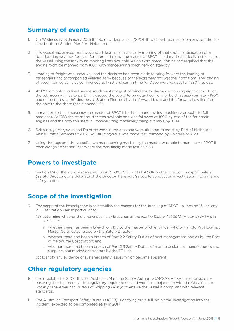
Summary of events
1. On Wednesday 13 January 2016 the Spirit of Tasmania II (SPOT II) was berthed portside alongside the TT-Line berth on Station Pier Port Melbourne.
2. The vessel had arrived from Devonport Tasmania in the early morning of that day. In anticipation of a deteriorating weather forecast for later in the day, the master of SPOT II had made the decision to secure the vessel using the maximum mooring lines available. As an extra precaution he had required that the engine room be manned from 1600 with manoeuvring machinery on standby.
3. Loading of freight was underway and the decision had been made to bring forward the loading of passengers and accompanied vehicles early because of the extremely hot weather conditions. The loading of accompanied vehicles commenced at 1730, and sailing time for Devonport was set for 1930 that day.
4. At 1752 a highly localised severe south westerly gust of wind struck the vessel causing eight out of 10 of the set mooring lines to part. This caused the vessel to be detached from its berth at approximately 1800 and come to rest at 90 degrees to Station Pier held by the forward bight and the forward lazy line from the bow to the shore (see Appendix 3).
5. In reaction to the emergency the master of SPOT II had the manoeuvring machinery brought to full readiness. At 1758 the stern thruster was available and was followed at 1800 by two of the four main engines and the bow thrusters, all manoeuvring machinery being available by 1804.
6. Svitzer tugs Marysville and Daintree were in the area and were directed to assist by Port of Melbourne Vessel Traffic Services (MVTS). At 1810 Marysville was made fast, followed by Daintree at 1828.
7. Using the tugs and the vessel’s own manoeuvring machinery the master was able to manoeuvre SPOT II back alongside Station Pier where she was finally made fast at 1950.
Powers to investigate
8. Section 174 of the Transport Integration Act 2010 (Victoria) (TIA) allows the Director Transport Safety (Safety Director), or a delegate of the Director Transport Safety, to conduct an investigation into a marine safety matter.
Scope of the investigation
9. The scope of the investigation is to establish the reasons for the breaking of SPOT II’s lines on 13 January 2016 at Station Pier. In particular to:
(a) determine whether there have been any breaches of the Marine Safety Act 2010 (Victoria) (MSA), in particular:
a. whether there has been a breach of s165 by the master or chief officer who both hold Pilot Exempt Master Certificates issued by the Safety Director
b. whether there had been a breach of Part 2.2 Safety Duties of port management bodies by the Port of Melbourne Corporation; and
c. whether there had been a breach of Part 2.3 Safety Duties of marine designers, manufacturers and suppliers and marine contractors by the TT-Line
(b) Identify any evidence of systemic safety issues which become apparent.
Other regulatory agencies
10. The regulator for SPOT II is the Australian Maritime Safety Authority (AMSA). AMSA is responsible for ensuring the ship meets all its regulatory requirements and works in conjunction with the Classification Society (The American Bureau of Shipping (ABS)) to ensure the vessel is compliant with relevant standards.
11. The Australian Transport Safety Bureau (ATSB) is carrying out a full ‘no blame’ investigation into the incident, expected to be completed early in 2017.
6 Maritime Investigation Report: Version 1 – June 2016
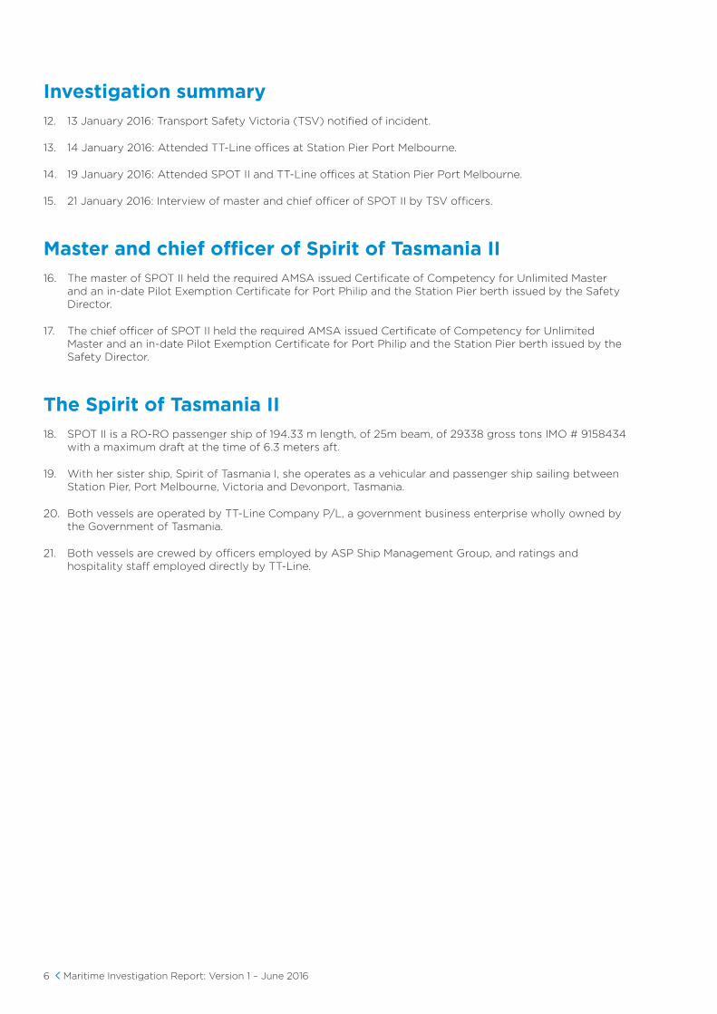
Investigation summary
12. 13 January 2016: Transport Safety Victoria (TSV) notified of incident.
13. 14 January 2016: Attended TT-Line offices at Station Pier Port Melbourne.
14. 19 January 2016: Attended SPOT II and TT-Line offices at Station Pier Port Melbourne.
15. 21 January 2016: Interview of master and chief officer of SPOT II by TSV officers.
Master and chief officer of Spirit of Tasmania II
16. The master of SPOT II held the required AMSA issued Certificate of Competency for Unlimited Master and an in-date Pilot Exemption Certificate for Port Philip and the Station Pier berth issued by the Safety Director.
17. The chief officer of SPOT II held the required AMSA issued Certificate of Competency for Unlimited Master and an in-date Pilot Exemption Certificate for Port Philip and the Station Pier berth issued by the Safety Director.
The Spirit of Tasmania II
18. SPOT II is a RO-RO passenger ship of 194.33 m length, of 25m beam, of 29338 gross tons IMO # 9158434 with a maximum draft at the time of 6.3 meters aft.
19. With her sister ship, Spirit of Tasmania I, she operates as a vehicular and passenger ship sailing between Station Pier, Port Melbourne, Victoria and Devonport, Tasmania.
20. Both vessels are operated by TT-Line Company P/L, a government business enterprise wholly owned by the Government of Tasmania.
21. Both vessels are crewed by officers employed by ASP Ship Management Group, and ratings and hospitality staff employed directly by TT-Line.
Maritime Investigation Report: Version 1 – June 2016 7
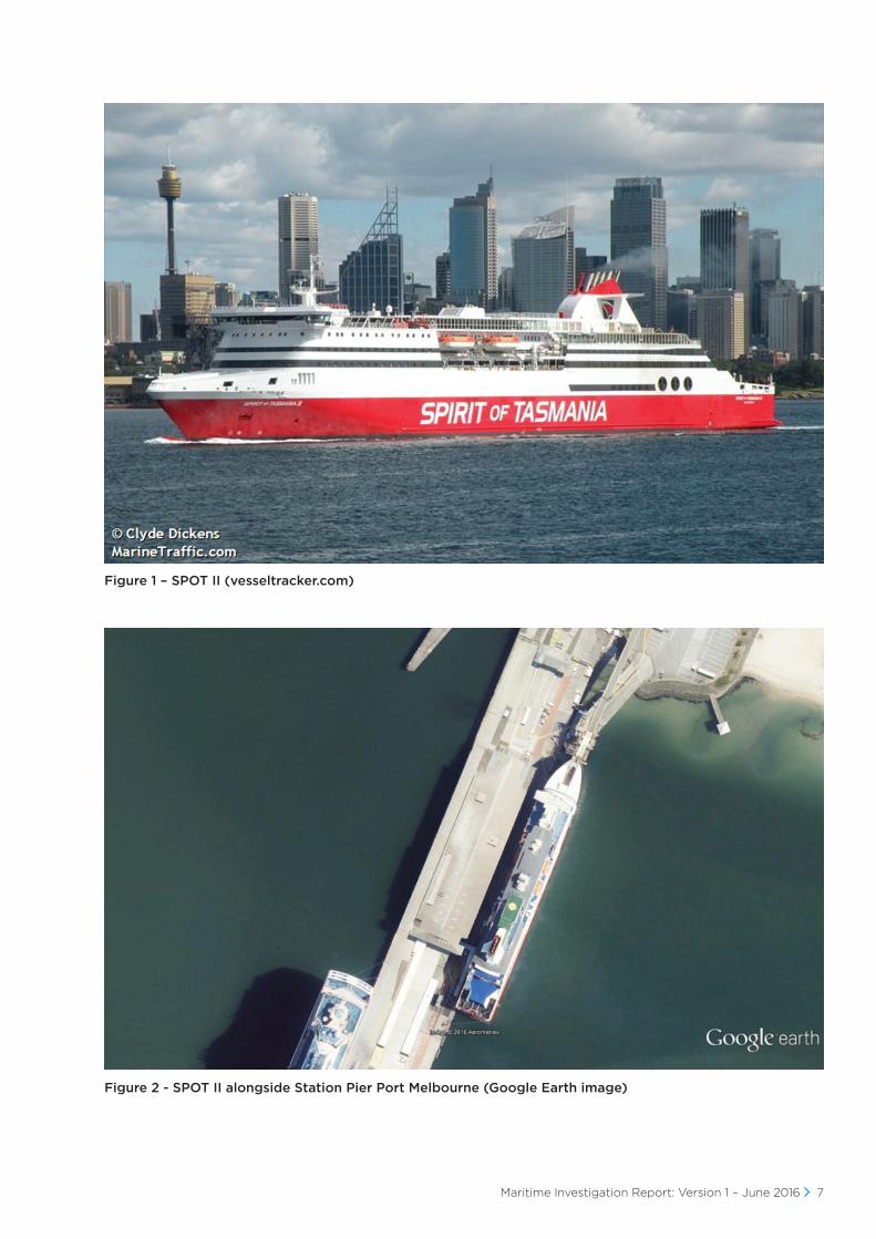
Figure 1 – SPOT II (vesseltracker.com)
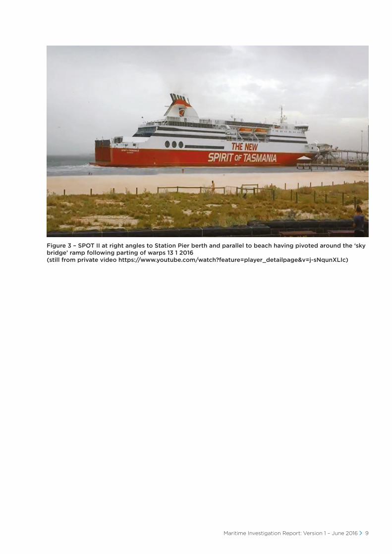
Figure 2 - SPOT II alongside Station Pier Port Melbourne (Google Earth image)

8 Maritime Investigation Report: Version 1 – June 2016
The incident
22. An incident chronology is contained in Appendix 1.
23. On Wednesday 13 January 2016 at approximately 0600 SPOT II arrived following her overnight passage from Devonport, Tasmania and made fast at the TT-Line berth at Station Pier, Port Melbourne.
24. The master in recognition of the poor weather forecast for the day issued by the Bureau of Meteorology (BOM), especially the strong wind forecast for around 2100 eastern daylight time (EDT), had made fast with a full mooring pattern of six lines aft and four lines forward. He also required the engine room to be manned from 1600 that day with engines on standby in case manoeuvring machinery was required.
25. The discharge of freight, passengers and their vehicles was accomplished without incident. The back loading of freight for Tasmania started at 1300 and continued throughout the afternoon.
26. The chief officer and duty officer made regular appearances on the bridge during the day carrying out routine work and monitoring the weather.
27. By mid-afternoon extreme heat conditions were being experienced by passengers in cars. The decision was therefore made to commence loading passengers and their vehicles early, at 1730, over the lower loading ramp. Cars were also positioned at the barrier at the bottom of the upper link span in preparation for boarding from 1800.
28. At 1630 the master checked the MetEye1 page on the BOM website and noted that a 34 knot (65 kph) wind gust had been noted at St Kilda at about 1330. At 1700 the master went to the bridge and noted the prevailing weather conditions and did not notice anything overtly threatening out towards the west and returned to his cabin.
29. Shortly after 1745 the master again checked the BOM MetEye website, noticed that a severe wind warning had been issued for Port Philip and went to the bridge. As he passed the anemometer display outside his cabin he noticed that the wind alarm had registered at its set point of 35 kts and that the alarm had recorded a 59 knot (101 kph) wind gust in the previous 10 minutes. At 1752 an extreme gust of westerly wind hit the ship’s port side. The intensity and strength of this gust was sufficient to displace SPOT II away from Station Pier. The displacement stretched the aft mooring lines to the point where, at 17:53:11 the first stern line parted. The remaining aft mooring lines parted sequentially with the final line parting at 17:54:47. With the after moorings gone the stern of the ship was free to swing away from her berth coming to rest at 90 degrees to Station Pier at 1759 with only the forward bight and lazy line attached ashore.
30. The chief officer contacted the master who was making his way up onto the bridge and told him that the ship was moving off the berth due to a strong wind.
31. At 1753 the master called MVS urgently requiring tug assistance. MVTS dispatched the Svitzer tug Marysville to assist. Marysville was on passage to take up station in the Webb Dock in response to an earlier instruction from the harbour master Melbourne issued in anticipation of the weather event mentioned in para 24. above.
32. At 1755 the master, using the PA system, instructed the engine room to start the transverse thrusters. This required extra generators to be started to provide sufficient power and the stern thruster became available at 1758. By 1800 manoeuvring machinery control was passed to the bridge, with thrusters available with main engines one and four clutched in and ready, main engines two and three were clutched in and ready by 1804. The master then began manoeuvring SPOT II to prevent her being driven into shallow water off Port Melbourne Beach.
33. Tug Marysville arrived on scene at 1810, put a line up to the SPOT II port quarter and assisted holding SPOT II from taking the ground. Tug Daintree arrived on scene at 1820 and secured portside forward.
34. Using the SPOT II engines and thrusters with assistance from both tugs the master manoeuvred the ship back alongside her berth at Station Pier. She was resecured at 1950 and the tugs were dispatched at 2014.
1 Meteye is a BOM on-line product enabling the weather at a particular position to be monitored.
Maritime Investigation Report: Version 1 – June 2016 9
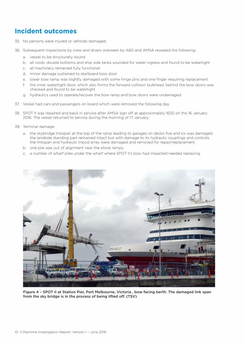
Figure 3 – SPOT II at right angles to Station Pier berth and parallel to beach having pivoted around the ‘sky bridge’ ramp following parting of warps 13 1 2016 (still from private video https://www.youtube.com/watch?feature=player_detailpage&v=j-sNqunXLIc)
10 Maritime Investigation Report: Version 1 – June 2016
Incident outcomes
35. No persons were injured or vehicles damaged.
36. Subsequent inspections by crew and divers overseen by ABS and AMSA revealed the following:
a. vessel to be structurally sound
b. all voids, double bottoms and ship side tanks sounded for water ingress and found to be watertight
c. all machinery remained fully functional
d. minor damage sustained to starboard bow door
e. lower bow ramp was slightly damaged with some hinge pins and one finger requiring replacement
f. the inner watertight door, which also forms the forward collision bulkhead, behind the bow doors was checked and found to be watertight
g. hydraulics used to operate/recover the bow ramp and bow doors were undamaged.
37. Vessel had cars and passengers on board which were removed the following day.
38. SPOT II was repaired and back in service after AMSA sign off at approximately 1630 on the 16 January 2016. The vessel returned to service during the morning of 17 January.
39. Terminal damage:
a. the skybridge linkspan at the top of the ramp leading to garages on decks five and six was damaged. the landside standing part remained intact but with damage to its hydraulic couplings and controls. the linkspan and hydraulic tripod array were damaged and removed for repair/replacement.
b. one pile was out of alignment near the shore ramps.
c. a number of wharf piles under the wharf where SPOT II’s bow had impacted needed replacing.
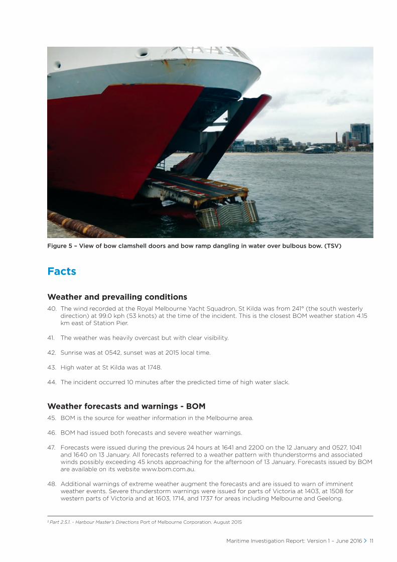
Figure 4 – SPOT II at Station Pier, Port Melbourne, Victoria , bow facing berth. The damaged link span from the sky bridge is in the process of being lifted off. (TSV)
Maritime Investigation Report: Version 1 – June 2016 11
Figure 5 – View of bow clamshell doors and bow ramp dangling in water over bulbous bow. (TSV)
Facts
Weather and prevailing conditions40. The wind recorded at the Royal Melbourne Yacht Squadron, St Kilda was from 241° (the south westerly
direction) at 99.0 kph (53 knots) at the time of the incident. This is the closest BOM weather station 4.15 km east of Station Pier.
41. The weather was heavily overcast but with clear visibility.
42. Sunrise was at 0542, sunset was at 2015 local time.
43. High water at St Kilda was at 1748.
44. The incident occurred 10 minutes after the predicted time of high water slack.
Weather forecasts and warnings - BOM45. BOM is the source for weather information in the Melbourne area.
46. BOM had issued both forecasts and severe weather warnings.
47. Forecasts were issued during the previous 24 hours at 1641 and 2200 on the 12 January and 0527, 1041 and 1640 on 13 January. All forecasts referred to a weather pattern with thunderstorms and associated winds possibly exceeding 45 knots approaching for the afternoon of 13 January. Forecasts issued by BOM are available on its website www.bom.com.au.
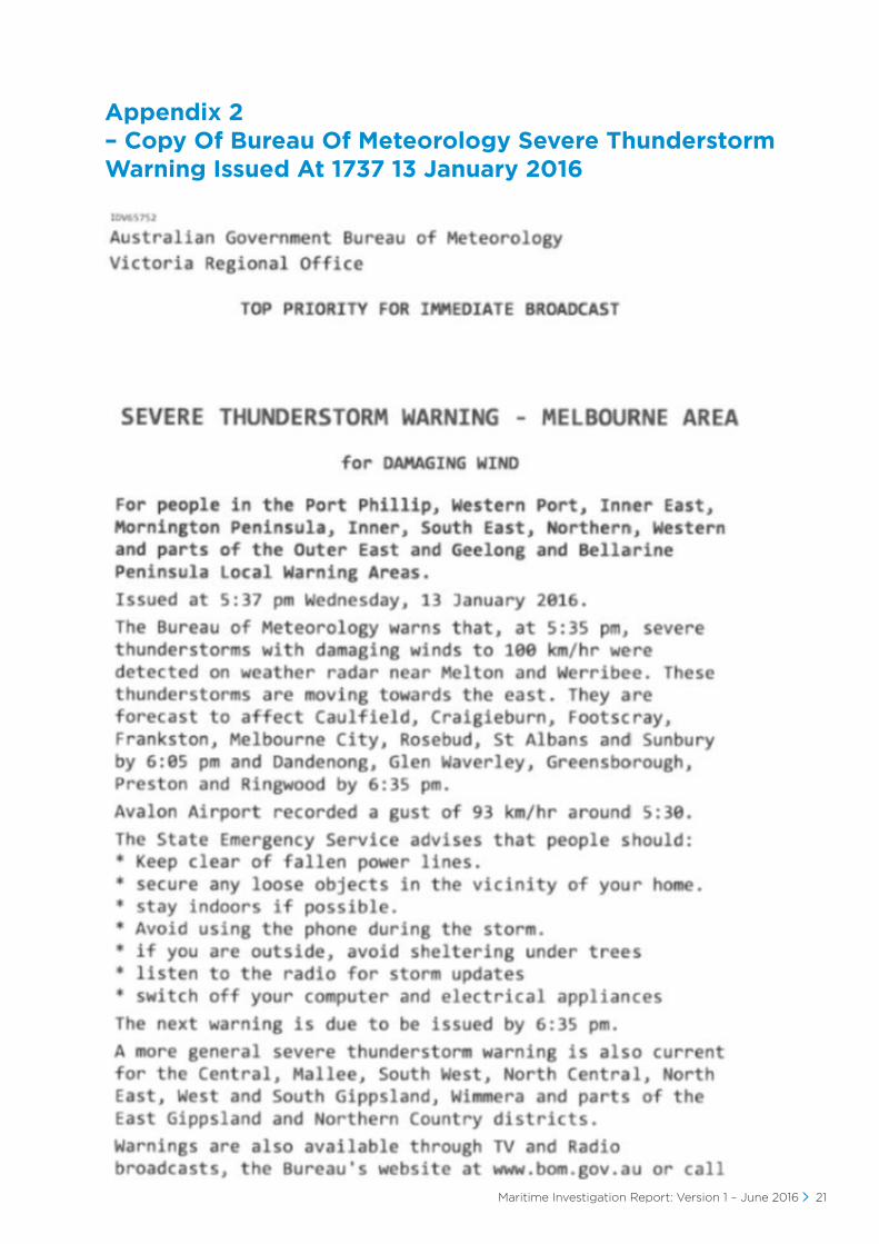
48. Additional warnings of extreme weather augment the forecasts and are issued to warn of imminent weather events. Severe thunderstorm warnings were issued for parts of Victoria at 1403, at 1508 for western parts of Victoria and at 1603, 1714, and 1737 for areas including Melbourne and Geelong.
2 Part 2.5.1. - Harbour Master’s Directions Port of Melbourne Corporation. August 2015
12 Maritime Investigation Report: Version 1 – June 2016
49. Forecasts and warnings were re-broadcast on marine radio by Coast Radio Melbourne. It broadcast an advisory on VHF channel 16 stating that the weather broadcast would be on VHF channel 67.
50. The MVTS has direct email notification of weather events from BOM. Investigation following the events of 13 January indicated that elements of this service had dropped out sometime prior to the 13 January. This would explain MVTS not being immediately aware of the extreme winds forecast on the BOM website.
51. The Port of Melbourne Harbour Master’s Directions included a requirement for the master of a vessel in port waters of the Port of Melbourne to monitor weather conditions, obtain weather forecasts from the BOM and to monitor VHF 16/67 for weather reports issued by Coast Radio Melbourne,2 which did not include vessels at a berth.
52. Weather information was also re-broadcast via a number of mobile phone apps.
Available means for SPOT II to obtain BOM weather information.53. Deck officers are able to monitor weather forecasts and warnings via direct access to the BOM website
either from the bridge or other IT access points.
54. Weather information is also provided to the SPOT II’s bridge via ‘weather fax’.
55. Deck officers are able to monitor VHF Channel 12 which provides any weather information broadcast by MVTS. This includes weather information from other vessels which may report weather events to MVTS. Note in this instance MVTS did not directly rebroadcast BOM information for the reason given at 50. above or alert radio listeners to the approaching wind event. There were however calls from shipping on VHF 12 which may have alerted SPOT II to the event.
56. Deck officers are able to monitor VHF channel 16 for notice of weather broadcasts given by Coast Radio Melbourne.
57. When SPOT II is alongside the wharf and involved in cargo operations the practice is to not hold a continuous bridge watch. The wheelhouse also serves as the ship’s office and is periodically visited by deck officers as part of their duties.
58. TT-Line stevedore staff are responsible for managing the linkspan including monitoring weather during loading/discharge operations and ceasing cargo operations, including vehicular movement, and disconnecting ramps in adverse weather conditions.
59. No adverse weather warning from the TT-Line stevedores terminal staff was received by the officers on SPOT II.
Provision of weather information by MVTS60. MVTS was monitoring weather forecasts provided by direct email notification from BOM (see 50. above
regarding failure of these notifications) and the rain radar via the BOM website. It is unclear whether the severe thunderstorm warnings issued by BOM on its website were monitored at the time of the incident.
61. At 1622 MVTS received a mobile phone call from the Port of Melbourne harbour master advising of the BOM severe thunderstorm warning issued at 1603. This warning was not specific enough to generate an urgent response in warning shipping.
62. MVTS did not receive the severe thunderstorm warning issued by BOM at 1714.
63. Between 1622 and 1721 there does not appear to have been any additional action taken by MVTS to alert vessels, vessel agents or terminals about the wind warnings contained within the severe weather warning, beyond those taken earlier in the day following previous weather forecast issued by BOM.
64. It should be noted that the harbour master had required Svitzer tugs to be relocated to Webb Dock to stand by vessels in anticipation of the earlier extreme weather warning.
65. At 1721 MVTS received a telephone call from a pilot in Geelong warning them of 50 knot winds at Geelong from the south west and heading towards Melbourne.
Maritime Investigation Report: Version 1 – June 2016 13
66. At 1721 the pilot on the ship Stealth Majestic, inwards from Geelong South Anchorage to the Viva terminal in the Port of Geelong, broadcast on VHF Channel 12 to the Port of Geelong that they had 70 knot winds blowing across the deck.
67. At 1722 MVTS commenced contacting ships, terminals and shipping agents advising that a severe wind event was likely.
68. MVTS did not contact SPOT II or TT-Line directly with this information. The process for notifying port users was developed as a result of a previous incident concentrated on high risk vessels such as those at anchor and car carriers.
Findings69. That the SPOT II was compliant with regulatory and classification requirements as required by AMSA and
ABS.
70. That the SPOT II was fully manned as required by AMSA to meet the various regulations pertaining to a vessel of her class.
71. That the master had taken precautionary action in anticipation of the predicted adverse weather condition in that the engine room was manned and the manoeuvring machinery was on standby at the time of the incident.
72. That the master had moored the vessel in accordance with TT-Line’s requirements for the anticipated weather conditions.
73. That SPOT II came close to touching bottom with her starboard side in approximately 8 m of water off Port Melbourne beach.
74. That divers found no evidence of SPOT II taking the ground in terms of damage to the bottom plates, bilge keel, rudder assemblies or propellers when she was inspected after the event.
75. That the master’s reaction to the situation and the ships ability to change operational status from standby to ready in four minutes prevented SPOT II from grounding and the attendant possibility of pollution of a significant city recreational area.
76. That the master stated, during interview, that if he had received a warning by 1740 that he would have had the bow and stern thrusters running and the vessel’s moorings would not have parted.
77. That the bridge was periodically visited throughout the day by the chief officer, duty officer or master.
78. That at the time of the wind event the bridge was not manned.
79. There was a period of 59 minutes between the harbour master advising MVTS of the wind warning and the on the spot alerts from the pilot in Geelong and the pilot on the Stealth Majestic. During this time MVTS apparently did not alert its customers to the potential wind event.
80. The actions taken by the master and chief officer following the breaking of lines by SPOT II minimised the potential effects of the incident by preventing any damage to the hull of SPOT II. By keeping SPOT II from grounding, they prevented any likelihood of a pollution or stranding event.
14 Maritime Investigation Report: Version 1 – June 2016
Causes of the incident
81. The factors causal to the incident were determined as:
• causal factor 1 – unexpected changes to predicted weather
• causal factor 2 – the speed of the unexpected changes in predicted weather limited BOM’s ability to provide timely severe weather warnings for the Melbourne area via its website and/or coast radio stations
• causal factor 3 – the failure of SPOT II to receive timely warning of the unexpected changes to the predicted weather by any means.
82. The factors which contributed to the incident were determined as:
• contributing factor 1 – despite periodically visiting the bridge and regular monitoring of the BOM website SPOT II’s master and officers did not receive timely warning of the unexpected change from BOM or MVTS sources
• contributing factor 2 – non-receipt by MVTS of direct email advice from BOM (as described in 50.) containing the severe thunderstorm warnings issued at 1714 and 1737. This meant they did not broadcast the warnings as per the process in the Harbour Master’s Directions outlined in 51. above
• contributing factor 3 – MVTS personnel on watch did not communicate any warning of the potential weather events to the SPOT II or her agent (TT-Line) as they did with other convention ships in port at the time.
Maritime Investigation Report: Version 1 – June 2016 15
3 Victorian Notices to Mariners No. 032-2016 –Amendment to Harbour Master’s Directions – Requirement to maintain listening watch on VHF Channel 12 at berth. Port of Melbourne Corporation. 29 January 2016
Breaches of the MSA
83. The master and chief officer both hold Pilot Exemption Certificates issued by the Safety Director.
84. There is no evidence to support any breach of Section 165 of the MSA by either the master or chief officer.
85. Therefore it is recommended no action be taken in relation to the Pilot Exemption Certificates held by the master or chief officer.
86. In relation to the Port of Melbourne Corporation there is no evidence to support any breach of Part 2.2 Safety Duties of port management bodies. Systemic issues however were identified, see below, which if addressed could reduce the likelihood of a similar incident occurring within the Port of Melbourne.
87. In relation to TT-Line there is no evidence to support any breach of Part 2.3 Safety Duties of marine designers, manufacturers and suppliers and marine contractors, however systemic issues were identified, see below, which if addressed could reduce the likelihood of a similar incident occurring at the TT-Line terminal at Station Pier.
Recommended actions to address systemic issues identified
Actions to be undertaken by TT-Line88. Investigate the provision of improved and more timely notifications of pending and localised weather
events to both ship and shore staff via BOM. This should include an assessment of alternate independent weather forecast providers.
89. Assess the vessel’s safety management system in relation to weather monitoring and the associated protocols in securing the vessel prior to localised weather events or times of heavy weather. TT-Line should further consider shore protocols with respect to duty of care and workplace health and safety for terminal services staff and stevedores to support the vessels potential response mechanisms.
Actions to be undertaken by Port of Melbourne Corporation90. MVTS is to ensure that TT-Line is included in any promulgation of BOM adverse weather or navigation
warnings that would affect a TT-Line vessel berthed at Station Pier.
91. That MVTS work with Maritime Safety Victoria in investigating the perceived timeliness and method of delivery of extreme weather warnings affecting shipping in the Port Philip area.
92. In response to this incident the Port of Melbourne released a Victorian Notice to Mariners on 29 January 2016 amending the Harbour Master’s Directions.3 The Notice advises that MVTS will be broadcasting severe weather warning reports on VHF Channel 12 as a ‘Securitie’ message which requires ‘the master of vessels in port waters to ensure that the vessel maintains a listening watch at all times, including vessels at anchor and at a berth.’
Actions to be undertaken by the Safety Director 93. As a result of the incident the Safety Director will determine the practicality of the ports of Geelong,
Hastings, Portland and Gippsland establishing timely broadcasts warning of adverse weather to their maritime communities where they may not currently exist. The broadcasts would be similar to those in the Port of Melbourne’s revised Harbour Master Directions outlined in 92. above.
16 Maritime Investigation Report: Version 1 – June 2016
Actions undertaken
Actions undertaken by Port of Melbourne Corporation (PoMC).93. PoMC as the port manager has safety duties under the MSA and, as such, disseminates all available
information in its possession which has safety implications for the users of the Port of Melbourne.
94. An identified contributory factor for this incident relates to the dissemination of meteorological information about an unexpected meteorological event. This requirement is predicated on the basis that MVTS actually receives the information. Post event BOM advised PoMC that its automated severe thunder storm warning email distribution system had failed to disseminate the storm warnings to PoMC.
95. This issue has now been rectified by BOM and successfully tested. As a contingency, warnings continue to be transmitted by other means such as Coast Radio Melbourne and are available on the BOM website.
96. This incident highlighted a shortcoming in the MVTS strong wind notification procedures to vessels in the Port of Melbourne. The procedures had been in place since the APL Sydney incident on 13 December 2008. It was identified that not all vessels, and in this particular case SPOT II, would have received any warning issued as it was not (then) SPOT II’s practice to monitor MVTS VHF radio traffic when alongside.
97. As a result the PoMC procedure for communicating immediate weather warnings to vessels in the Port of Melbourne has been revised requiring all vessels to monitor the port working radio channel when alongside and working cargo. Immediate weather warnings are now broadcast by MVTS as an urgent message.
98. Post event an all-agency debrief was conducted by PoMC on 9 March 2016. It focussed on the actions and decisions relating to the Victorian State Emergency Management Framework and the connectivity of all agencies in response to the incident. All agencies affected attended the meeting held at Station Pier.
99. The debrief was themed and concentrated on the following points:
a extreme weather notification
b incident notification including timeliness of response activation
c assessment of the incident and initial actions
d effectiveness of tactics/strategies
e multi-agency liaison/interaction
f media coverage
g consequence management/impact assessment.
100. It should be noted that TT-Line has reacted positively to the actions taken by PoMC and has required that its vessel masters and chief officers carry a portable VHF radio set to the port working radio channel while its vessels are alongside in Melbourne.
Actions undertaken by TT-Line.101. Following the incident and investigative reports, TT-Line has grouped its action into the following three
distinct categories:
a. category 1 - Weather alerts and avenues for on board personnel to receive such alerts in a timely manner
b. category 2 - Review and embellish TT-Line’s existing procedures
c. category 3 – Assessment of the adequacies of Spirit of Tasmania I and II’s current mooring array at Inner East Station Pier (IESP), Melbourne.
Maritime Investigation Report: Version 1 – June 2016 17
Category 1 – Weather alerts
102. Numerous meetings with BOM by TT-Line’s senior management has resulted in measures being put in place including smart phone access by masters and chief officers and relevant shore based personnel. They are now receiving direct notifications from BOM in relation to related area wind summaries, wind warnings and thunderstorm warnings. Masters have reported these measures to be a significant improvement.
103. TT-Line is investigating the possibility of access to an early warning network that will provide a package of information tailored to specified criteria. This package of information will be based on predicted weather in one or more identified areas where wind speeds exceeding 25 knots for an extended period and/or localised thunderstorm activity can be expected and/or significant weather is predicted (30 knots plus) covering the following areas:
a. Station Pier (Port Melbourne);
b. Northern end of Port Philip Bay and
c. Devonport – Bass Strait Ferry Terminal (Tasmania) and the approaches to the port.
These reports will be made on a positive reporting basis only, that is, when there is something to report.
Category 2 – TT-Line’s procedures
104. As a result of the 13 January incident, amendments/enhancements have been made to improve the overall effectiveness of the existing procedures as listed below:
a. maximise moorings in relation to expected conditions
b. monitor weather updates
c. advise engine room of thrusters and/or engines requirement/timing
d. have the bridge manned continuously
e. close the passenger side ramp
f. request stevedores to detach and retract the Skybridge
g. retract the bow ramp and close the bow doors
h. engage thrusters and/or engines
i. request tug assistance
j. deploy anchor (discretionary)
k. emergency let go (if able).
105. In addition, a review of the use of vessels’ mooring arrangements has been undertaken, including the adoption of common mooring rope types.
106. TT-Line is also seeking to enhance duty of care provisions and associated Standard Operating Procedures (SOP) with Qube Ports, TT-Lines third party stevedore provider, so as to reflect and support measures taken by the ships and TT-Line itself.
Category 3 – Mooring array
107. TT-Line has given serious consideration to the mooring arrangements of vessels at Station Pier and also Devonport and has identified inconsistencies between the ships with regard to mooring line types. As a result the supply of mooring lines with a common breaking strain and elongation under stress is being considered. In addition all the mooring lines will be secured on the mooring winch brakes rather than relying on some of the lines using the self-tensioning mechanism of the winch as was the case previously.
108. In addition TT-Line has modified the shore-side bungee tail lines to shorten them to address spring back issues experienced during this incident with the lines when they parted.
109. TT-Line has identified an organisation to conduct an investigation and analysis of the existing mooring arrangements and measures currently taken. The report is expected to be delivered later this year.

18 Maritime Investigation Report: Version 1 – June 2016
APPENDIX 1 - INCIDENT CHRONOLOGY
This chronology of the incident was derived from the following:
• interview with the master of SPOT II on 21 January 2016
• interview with the chief officer of SPOT II on 21 January 2016
• engine log of SPOT II
• engine room log of SPOT II
• recordings of VHF radio and telephone conversations supplied by MVTS
• automatic identification system (AIS) information provided by MVTS
• radar records supplied by MVTS.
Time (13.1.2016) Actions
0600 SPOT II arrived alongside at berth. Based on Port Phillip Bay forecast seen the previous evening, the master decided to have engines and thrusters ready for immediate use from 1600 onwards and advised engine room accordingly.
SPOT II moored with 10 lines using the standard mooring pattern which was put in place following an earlier incident for the expected weather conditions for the day.4
This comprised:
aft - three offside lines, one backspring, two bungies.
forward - three bights, one lazy line.
Throughout morning SPOT II’s master checked forecast for Port Phillip using BOM and its MetEye weather forecasting tool.
Indications were that some sort of frontal system would pass across the Bay about 2100, with stronger winds in the south of the Bay heading into Bass Strait.
1300 SPOT II’s crew and stevedores commenced loading of trucks via lower forward bow ramp.
1330 SPOT II’s master turned in for afternoon nap.
1600 SPOT II’s engine room and machinery confirmed ready for immediate use.
1603 A severe thunderstorm warning for damaging wind for areas including Melbourne was issued by BOM. It mentioned that a gust exceeding 87 km/h (47 knots) was recorded at Rutherglen.
1622 The Port of Melbourne harbour master telephoned MVTS to report BOM’s 1603 weather warning.
1630 SPOT II’s master woken by a pre-set alarm. Prior to getting out of bed the master looked at MetEye and Melbourne weather observations and noted that a wind gust of 34 Knots (63 km/h) had been recorded at St Kilda about 1330.
1645 A severe thunderstorm warning for damaging wind for areas including Melbourne issued by BOM. It mentioned that a gust exceeding 87 km/h (47 knots) was recorded at Rutherglen.
1700 approx. SPOT II’s master went to the bridge for a cup of tea, did not see anything untoward out to west, cloud but nothing overtly threatening.
4 Mooring Diagram – Melbourne. P.S.T. Inner East Station Pier TT-Line
Maritime Investigation Report: Version 1 – June 2016 19
5 See Appendix 2
Time (13.1.2016) Actions
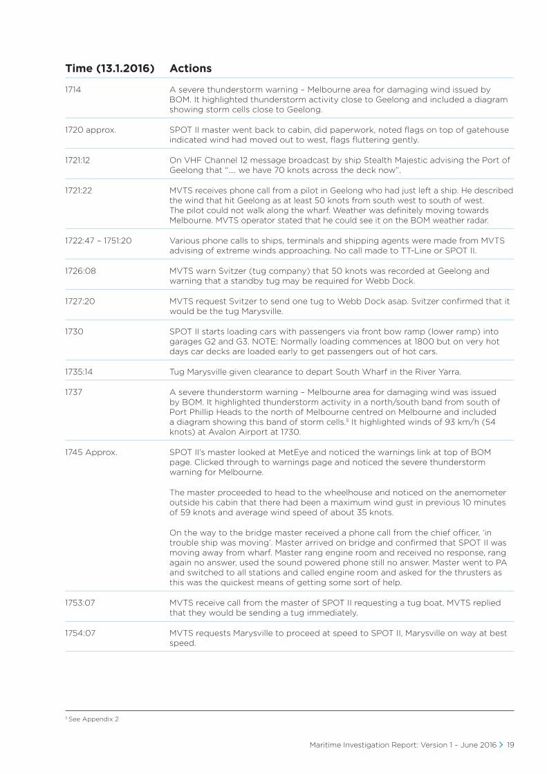
1714 A severe thunderstorm warning – Melbourne area for damaging wind issued by BOM. It highlighted thunderstorm activity close to Geelong and included a diagram showing storm cells close to Geelong.
1720 approx. SPOT II master went back to cabin, did paperwork, noted flags on top of gatehouse indicated wind had moved out to west, flags fluttering gently.
1721:12 On VHF Channel 12 message broadcast by ship Stealth Majestic advising the Port of Geelong that “…. we have 70 knots across the deck now”.
1721:22 MVTS receives phone call from a pilot in Geelong who had just left a ship. He described the wind that hit Geelong as at least 50 knots from south west to south of west. The pilot could not walk along the wharf. Weather was definitely moving towards Melbourne. MVTS operator stated that he could see it on the BOM weather radar.
1722:47 – 1751:20 Various phone calls to ships, terminals and shipping agents were made from MVTS advising of extreme winds approaching. No call made to TT-Line or SPOT II.
1726:08 MVTS warn Svitzer (tug company) that 50 knots was recorded at Geelong and warning that a standby tug may be required for Webb Dock.
1727:20 MVTS request Svitzer to send one tug to Webb Dock asap. Svitzer confirmed that it would be the tug Marysville.
1730 SPOT II starts loading cars with passengers via front bow ramp (lower ramp) into garages G2 and G3. NOTE: Normally loading commences at 1800 but on very hot days car decks are loaded early to get passengers out of hot cars.
1735:14 Tug Marysville given clearance to depart South Wharf in the River Yarra.
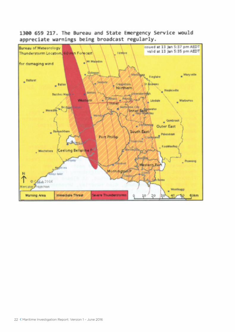
1737 A severe thunderstorm warning – Melbourne area for damaging wind was issued by BOM. It highlighted thunderstorm activity in a north/south band from south of Port Phillip Heads to the north of Melbourne centred on Melbourne and included a diagram showing this band of storm cells.5 It highlighted winds of 93 km/h (54 knots) at Avalon Airport at 1730.
1745 Approx. SPOT II’s master looked at MetEye and noticed the warnings link at top of BOM page. Clicked through to warnings page and noticed the severe thunderstorm warning for Melbourne.
The master proceeded to head to the wheelhouse and noticed on the anemometer outside his cabin that there had been a maximum wind gust in previous 10 minutes of 59 knots and average wind speed of about 35 knots.
On the way to the bridge master received a phone call from the chief officer, ‘in trouble ship was moving’. Master arrived on bridge and confirmed that SPOT II was moving away from wharf. Master rang engine room and received no response, rang again no answer, used the sound powered phone still no answer. Master went to PA and switched to all stations and called engine room and asked for the thrusters as this was the quickest means of getting some sort of help.
1753:07 MVTS receive call from the master of SPOT II requesting a tug boat, MVTS replied that they would be sending a tug immediately.
1754:07 MVTS requests Marysville to proceed at speed to SPOT II, Marysville on way at best speed.
20 Maritime Investigation Report: Version 1 – June 2016
Time (13.1.2016) Actions
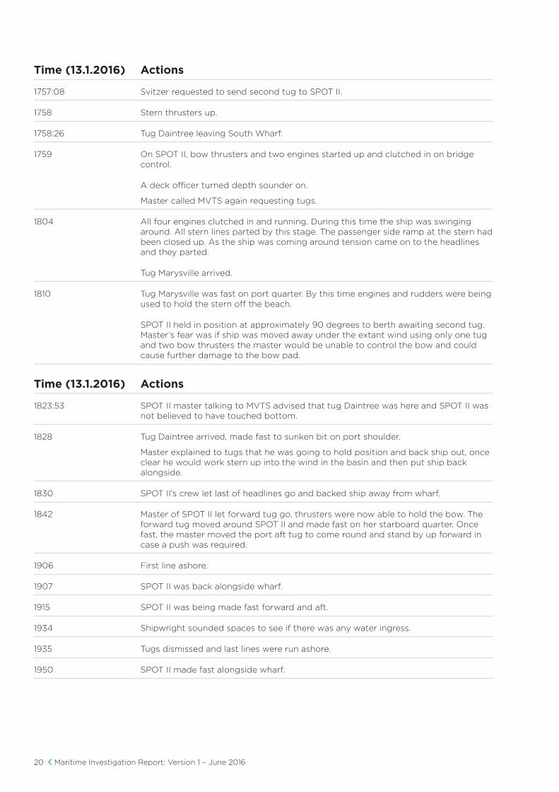
1757:08 Svitzer requested to send second tug to SPOT II.
1758 Stern thrusters up.
1758:26 Tug Daintree leaving South Wharf.
1759 On SPOT II, bow thrusters and two engines started up and clutched in on bridge control.
A deck officer turned depth sounder on.
Master called MVTS again requesting tugs.
1804 All four engines clutched in and running. During this time the ship was swinging around. All stern lines parted by this stage. The passenger side ramp at the stern had been closed up. As the ship was coming around tension came on to the headlines and they parted.
Tug Marysville arrived.
1810 Tug Marysville was fast on port quarter. By this time engines and rudders were being used to hold the stern off the beach.
SPOT II held in position at approximately 90 degrees to berth awaiting second tug. Master’s fear was if ship was moved away under the extant wind using only one tug and two bow thrusters the master would be unable to control the bow and could cause further damage to the bow pad.
Time (13.1.2016) Actions
1823:53 SPOT II master talking to MVTS advised that tug Daintree was here and SPOT II was not believed to have touched bottom.
1828 Tug Daintree arrived, made fast to sunken bit on port shoulder.
Master explained to tugs that he was going to hold position and back ship out, once clear he would work stern up into the wind in the basin and then put ship back alongside.
1830 SPOT II’s crew let last of headlines go and backed ship away from wharf.
1842 Master of SPOT II let forward tug go, thrusters were now able to hold the bow. The forward tug moved around SPOT II and made fast on her starboard quarter. Once fast, the master moved the port aft tug to come round and stand by up forward in case a push was required.
1906 First line ashore.
1907 SPOT II was back alongside wharf.
1915 SPOT II was being made fast forward and aft.
1934 Shipwright sounded spaces to see if there was any water ingress.
1935 Tugs dismissed and last lines were run ashore.
1950 SPOT II made fast alongside wharf.
Maritime Investigation Report: Version 1 – June 2016 21
Appendix 2 – Copy Of Bureau Of Meteorology Severe Thunderstorm Warning Issued At 1737 13 January 2016
22 Maritime Investigation Report: Version 1 – June 2016
Maritime Investigation Report: Version 1 – June 2016 23
Appendix 3 – Time and Sequencing of Mooring Line Failures
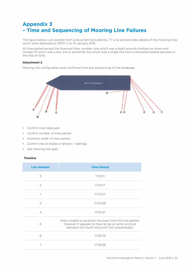
The figure below is an excerpt from a document provided by TT-Line and provides details of the mooring lines which were deployed by SPOT II on 13 January 2016.
All lines parted except the foremost lines, number nine which was a bight around a bollard on shore and number 10 which was a lazy line or preventer line which was a single line from a shoreside bollard secured on the ship on bitts.
Attachment 2
Mooring line configuration and confirmed time and sequencing of line breakage.
• Confirm lines deployed
• Confirm number of lines parted
• Ascertain order of lines parted
• Confirm line on brake or tension + settings
• Get mooring line spec
Timeline
Line Number Time Parted
3 17:53:11
2 17:53:17
1 17:53:27
5 17:54:08
4 17:54:47
6Note: Unable to ascertain the exact time this line parted,
however, it appears to have let go at some juncture between the fourth and sixth line (sequentially)
8 17:55:33
7 17:56:58

24 Maritime Investigation Report: Version 1 – June 2016