Embed Size (px)
Citation preview

May 18, 2011
RISING TIDES:West Coast Sea Level Rise Implications
for Infrastructure Improvements and Coastal Flood Protection
Darryl Hatheway, Sr. Coastal ScientistAECOM (San Diego)
ASFPM 2011 Annual Conference

Rising Tides 2
Rising Tides
Agenda
• Sea Level Rise– CA projections for 2100
• Infrastructure Impacts to SLR– CA, SF Bay, City of San Francisco, & So. CA
• Adaptation strategies:– NOAA & BCDC: Adapting to Rising Tides (ART)– AECOM MTC Rising Tides Pilot Study
3
(Yes, Sea Level Rise is a Fact!)

Rising Tides
San Francisco-observed sea level with trend of 19.3 cm (0.63 feet) rise per century
Source: California Climate Action Team Report 2006
This is a graph of sea level rise in San Francisco Bay. The most important thing to note about this graph is that it is not a prediction. This is history.

Rising Tides 5
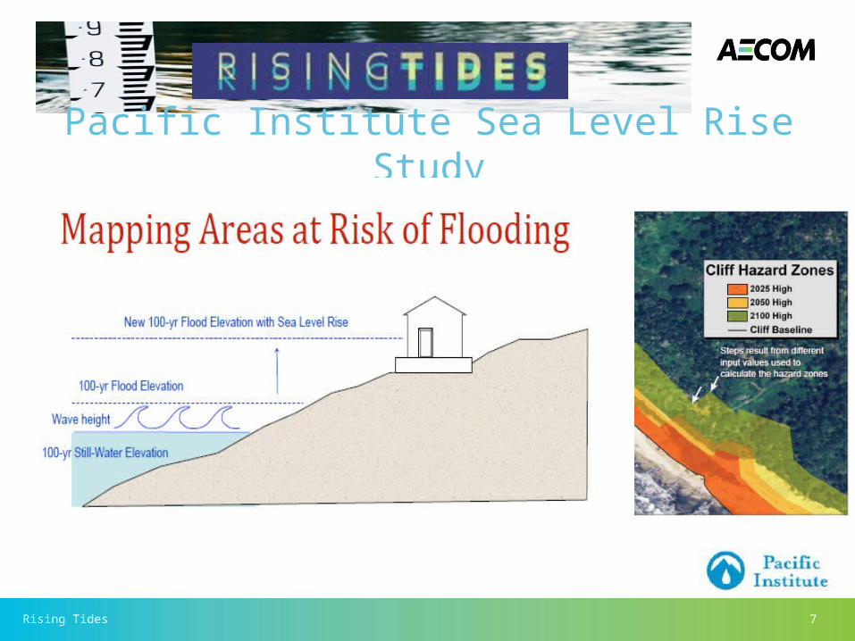
CA Projected 1.4 meter (4.5 ft) SLR by 2100
Pacific Institute Sea Level Rise Study

Rising Tides 6
Pacific Institute Sea Level Rise Study
Rising Tides 7
Pacific Institute Sea Level Rise Study

Rising Tides
POPULATION
An estimated 480,000 people will be at to risk increased 100-yr flooding, with San Mateo & Orange Counties each having 110,000 people impacted.
WETLANDS& COASTSAn estimated 670 square miles of wetlands will be impacted by 100-yr flooding, and 40 square miles of CA coast will be lost to due to SLR induced beach and bluff erosion.
ROADWAYS
An estimated 3,500 miles of roads and highways, and 280 miles of railways will be at risk of inundation by 100-yr flood event in 2100.
ENERGY
There are 30 coastal power plants that will be flooded by 100-yr event, which provide a combined energy output of 10,000 megawatts.
WASTEWATER
There are 29 wastewater treatment plants on San Francisco Bay (22) and Pacific Ocean (7) that treat 530 million gallons of sewage each day that will be impacted.
8
What is at risk in CA by 2100 w/ 1.4 m SLR?

Rising Tides 9
• 99 miles of major road and highway• 81 schools• 70 miles of railroad• 42 healthcare facilities• 22 wastewater treatment facilities• 11 fire stations• 9 police stations• 5 major ports
$36,000,000,000 at riskThirty-six billion dollars of shorelinedevelopment will be at risk of floodingby mid-century, and $62 billion by theend of the century.

Rising Tides 10
• Within the City of San Francisco the Sewer System collects 92% of the City’s wastewater and stormwater in a combined Sewer System that consists of: – 3 treatment facilities, – 4 outfalls, – 27 pump stations, – 36 combined sewer discharge (CSD) structures (or nearshore
outfalls), force mains, tunnels, transport/storage structures, – 25,000 catch basins, – 24,800 manholes, and – more than 976 miles of sewers.
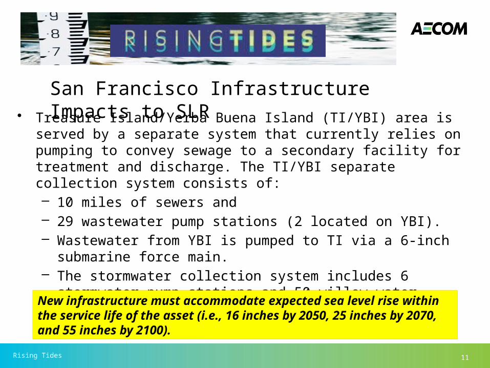
San Francisco Infrastructure Impacts from SLR
Rising Tides 11
• Treasure Island/Yerba Buena Island (TI/YBI) area is served by a separate system that currently relies on pumping to convey sewage to a secondary facility for treatment and discharge. The TI/YBI separate collection system consists of:– 10 miles of sewers and – 29 wastewater pump stations (2 located on YBI). – Wastewater from YBI is pumped to TI via a 6-inch submarine force
main. – The stormwater collection system includes 6 stormwater pump
stations and 50 willow water outfalls (at TI).
New infrastructure must accommodate expected sea level rise within the service life of the asset (i.e., 16 inches by 2050, 25 inches by 2070, and 55 inches by 2100).
San Francisco Infrastructure Impacts to SLR
Rising Tides 12
• In the Los Angeles-Long Beach-Santa Ana region, sea level rise could expose $96.5 billion of infrastructure to damage.
• The San Diego Unified Port District said a 55-inch rise was likely to result in substantial effects and flooding of some facilities in both urban and wildlife areas, according to the report.
• An assessment was released by the Munich, Germany, office of
the World Wildlife Fund, the Munich-based insurer Allianz, and the Tyndall Center for Climate Change Research at the University of East Anglia: It said, “cities like New York could face damages in the hundreds of billions of dollars if rising sea level is combined with hurricane storm surges.”
So. CA Infrastructure Impacts from SLR
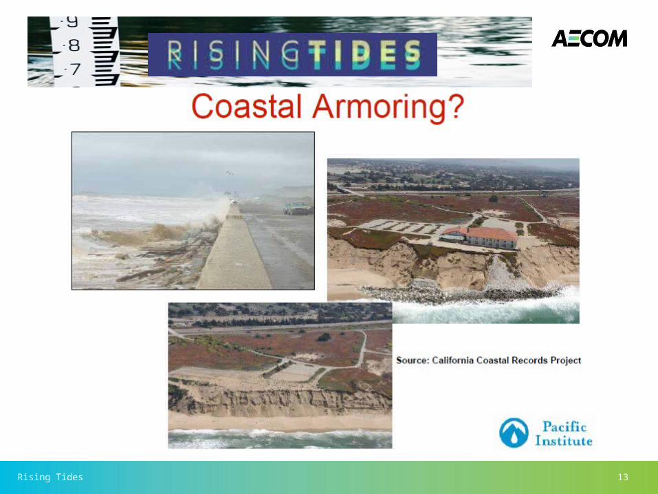
Rising Tides 13

Rising Tides 14
The Costs of Flood Protection in the Bay Area
The costs of flood protection vary by strategy. Generally, seawalls and levees bring additional costs, such as increasing erosion and removing habitat, while wetlands bring numerous additional benefits, including enhancing habitat and sequestering carbon.
Maintenance costs10% annually
10% annually
1–4% annually
unknown(source: SPUR May 2011)
Type of protection New levee
Raised/upgraded levee
New seawall
Restored tidal marsh
Range of costs from Bay Area projects( in year 2000 dollars)$725–$2,228 per linear foot
$223–$1,085 per linear foot
$2,646–$6,173 per linear foot
$5,000–$200,000 per acre

Rising Tides 15
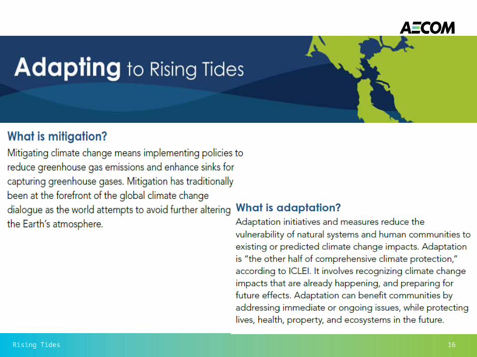
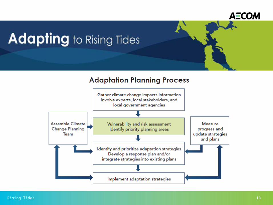
ART Project GoalThe goal of the ART project is to increase the preparedness and resilience of Bay Area communities to sea level rise and other climate change impacts while protecting ecosystem and community services.
Rising Tides 16

Rising Tides 17
Rising Tides 18

Rising Tides 19
City of Chula Vista Climate ChangeAdaptation Strategy• A climate change
working group composed of residential, business, and community-group representatives is developing the Climate
Change AdaptationStrategy, which will beincorporated into the City of Chula Vista’s current Climate Action Plan.

Rising Tides 20
City of Chula Vista Climate ChangeAdaptation Strategy• The strategy will
evaluate how Chula Vista could
adapt to potential climate change impacts in water and energy management, infrastructure and resources, public health, wildfires, ecosystems and biodiversity, and business and economy.

Rising Tides 21

Rising Tides 22
• AECOM is leading the effort in assisting MTC, BCDC and CalTrans with a climate change vulnerability and risk assessment of transportation assets in a subregion of the San Francisco Bay Area.
• This pilot project will produce a detailed subregional vulnerability analysis of sea level rise (SLR) impacts on regionally important transportation infrastructure.
SF Bay Metropolitan Transportation Commission

Rising Tides 23
• It will also identify implementable strategies for addressing vulnerabilities in ways that advance regional goals for transit-oriented focused growth.
• The subregional focus of this pilot will also serve as a testing ground for the FHWA conceptual risk assessment model to determine its strengths and areas where it can be improved.
SF Bay Metropolitan Transportation Commission
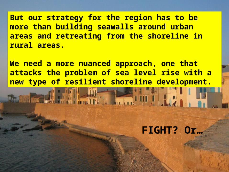
But our strategy for the region has to be more than building seawalls around urban areas and retreating from the shoreline in rural areas.
We need a more nuanced approach, one that attacks the problem of sea level rise with a new type of resilient shoreline development.
FIGHT? Or…

FLIGHT?