Embed Size (px)
Citation preview
MentorLinksMentorLinksLake Land CollegeLake Land College
andandKentucky Community and Technical College Kentucky Community and Technical College
System (KCTCS)System (KCTCS)
Strengthening GIS EducationStrengthening GIS Education
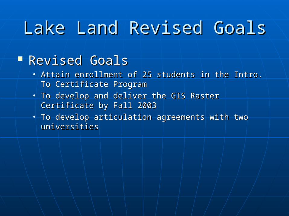
Lake Land Revised GoalsLake Land Revised Goals
Revised GoalsRevised Goals• Attain enrollment of 25 students in the Intro. To Attain enrollment of 25 students in the Intro. To
Certificate ProgramCertificate Program• To develop and deliver the GIS Raster Certificate by Fall To develop and deliver the GIS Raster Certificate by Fall
20032003• To develop articulation agreements with two universitiesTo develop articulation agreements with two universities
KCTCS Revised GoalsKCTCS Revised Goals
Offer the complete GIS certificate Offer the complete GIS certificate program by fall 05program by fall 05
Increase enrollment in all GIS classesIncrease enrollment in all GIS classes Articulate the GIS classes with local Articulate the GIS classes with local
Universities and High Schools Universities and High Schools
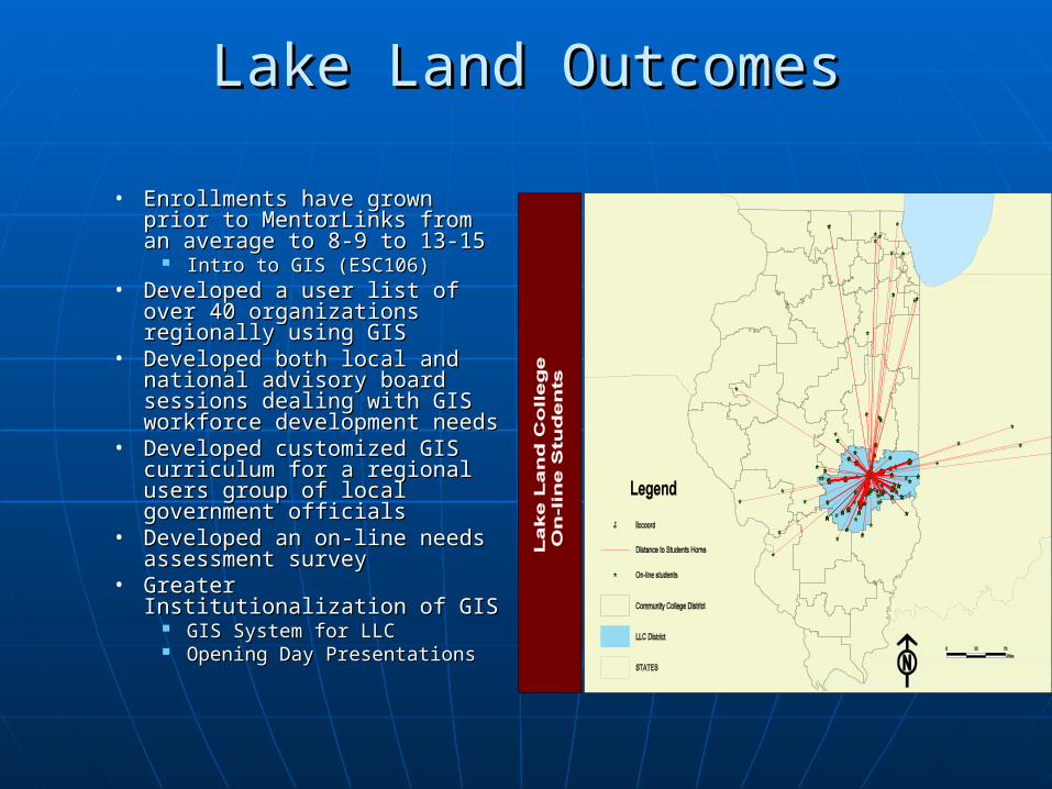
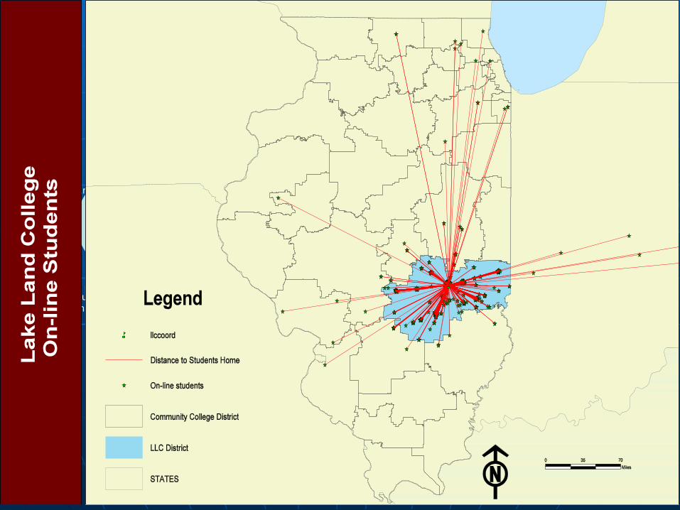
Lake Land OutcomesLake Land Outcomes
• Enrollments have grown prior Enrollments have grown prior to MentorLinks from an to MentorLinks from an average to 8-9 to 13-15average to 8-9 to 13-15
Intro to GIS (ESC106)Intro to GIS (ESC106)• Developed a user list of over Developed a user list of over
40 organizations regionally 40 organizations regionally using GISusing GIS
• Developed both local and Developed both local and national advisory board national advisory board sessions dealing with GIS sessions dealing with GIS workforce development needsworkforce development needs
• Developed customized GIS Developed customized GIS curriculum for a regional curriculum for a regional users group of local users group of local government officials government officials
• Developed an on-line needs Developed an on-line needs assessment survey assessment survey
• Greater Institutionalization of Greater Institutionalization of GIS GIS
GIS System for LLCGIS System for LLC Opening Day PresentationsOpening Day Presentations
Modular Curriculum
Professional
Development
Clearinghouse of Data
Articulations
Dissemination
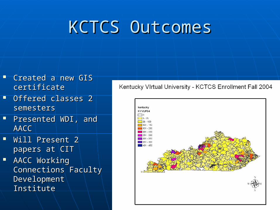
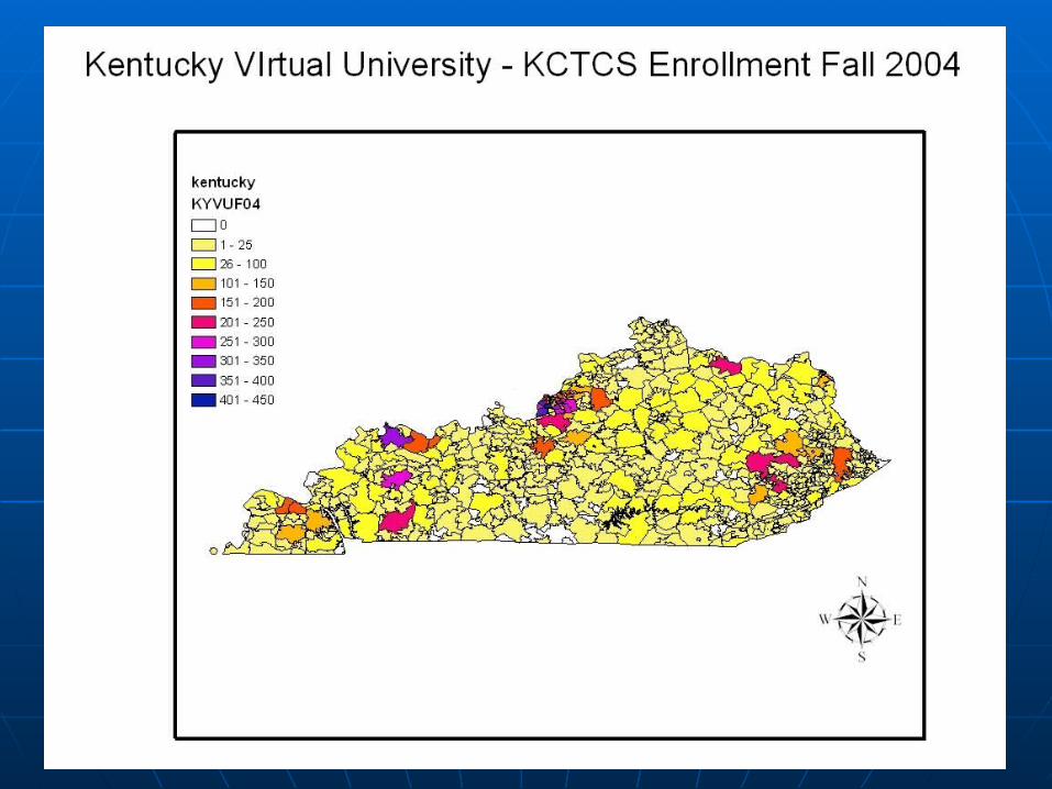
KCTCS OutcomesKCTCS Outcomes
Created a new GIS Created a new GIS certificatecertificate
Offered classes 2 Offered classes 2 semesterssemesters
Presented WDI, and Presented WDI, and AACCAACC
Will Present 2 papers at Will Present 2 papers at CITCIT
AACC Working AACC Working Connections Faculty Connections Faculty Development InstituteDevelopment Institute
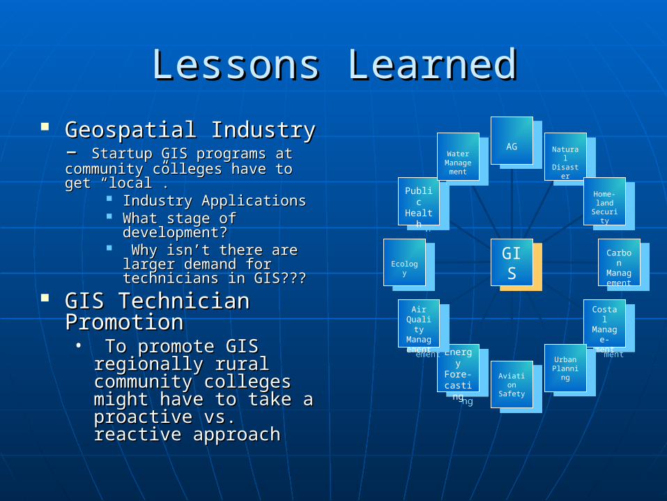
Lessons LearnedLessons Learned Geospatial Industry – Geospatial Industry –
Startup GIS programs at Startup GIS programs at community colleges have to get community colleges have to get “local”.“local”.
Industry ApplicationsIndustry Applications What stage of What stage of
development?development? Why isn’t there are larger Why isn’t there are larger
demand for technicians in demand for technicians in GIS???GIS???
GIS Technician GIS Technician PromotionPromotion• To promote GIS To promote GIS
regionally rural regionally rural community colleges community colleges might have to take a might have to take a proactive vs. reactive proactive vs. reactive approachapproach
AGAGNaturalDisaste
r
NaturalDisaste
r
Home-land
Security
Home-land
Security
Carbon
Management
Carbon
Management
CostalManag
e-ment
CostalManag
e-ment
UrbanPlannin
g
UrbanPlannin
gAviation
Safety
Aviation
Safety
Energy
Fore-castin
g
Energy
Fore-castin
g
Air Qualit
yManagement
Air Qualit
yManagement
Ecology
Ecology
Public Healt
h
Public Healt
h
Water Management
Water Management
GISGIS
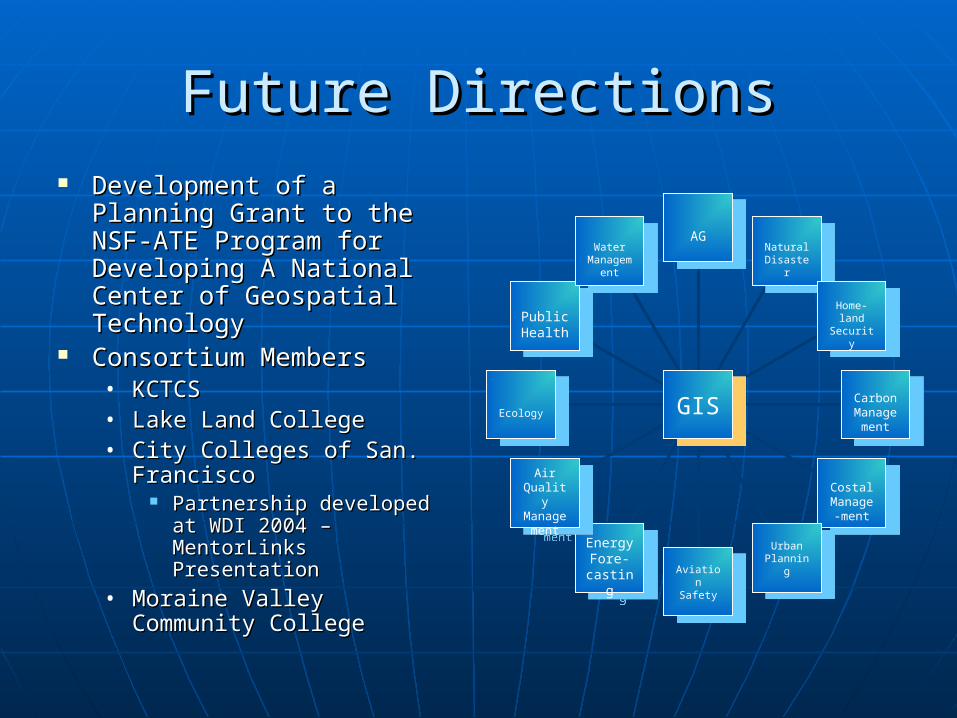
Future DirectionsFuture Directions Development of a Planning Development of a Planning
Grant to the NSF-ATE Grant to the NSF-ATE Program for Developing A Program for Developing A National Center of National Center of Geospatial TechnologyGeospatial Technology
Consortium MembersConsortium Members• KCTCS KCTCS • Lake Land CollegeLake Land College• City Colleges of San. City Colleges of San.
Francisco Francisco Partnership developed at Partnership developed at
WDI 2004 – MentorLinks WDI 2004 – MentorLinks PresentationPresentation
• Moraine Valley Community Moraine Valley Community CollegeCollege
AGAG
NaturalDisaster
NaturalDisaster
Home-land
Security
Home-land
Security
Carbon Manage
ment
Carbon Manage
ment
CostalManage-ment
CostalManage-ment
UrbanPlanning
UrbanPlanning
Aviation Safety
Aviation Safety
Energy Fore-
casting
Energy Fore-
casting
Air QualityManage
ment
Air QualityManage
ment
EcologyEcology
Public Health
Public Health
Water Manage
ment
Water Manage
ment
GISGIS
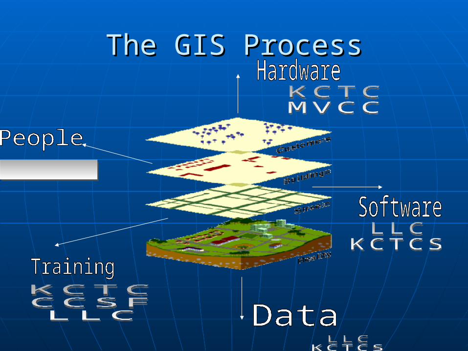
The GIS ProcessThe GIS Process
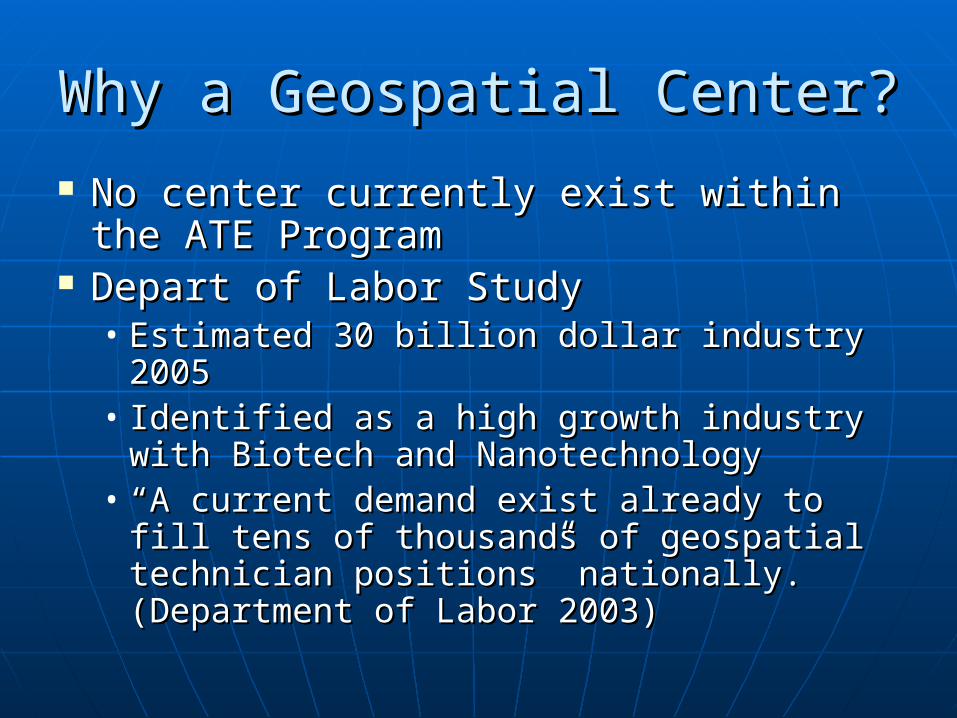
Why a Geospatial Center?Why a Geospatial Center?
No center currently exist within the No center currently exist within the ATE Program ATE Program
Depart of Labor StudyDepart of Labor Study• Estimated 30 billion dollar industry 2005Estimated 30 billion dollar industry 2005• Identified as a high growth industry with Identified as a high growth industry with
Biotech and NanotechnologyBiotech and Nanotechnology• ““A current demand exist already to fill A current demand exist already to fill
tens of thousands of geospatial tens of thousands of geospatial technician positions” nationally. technician positions” nationally. (Department of Labor 2003)(Department of Labor 2003)
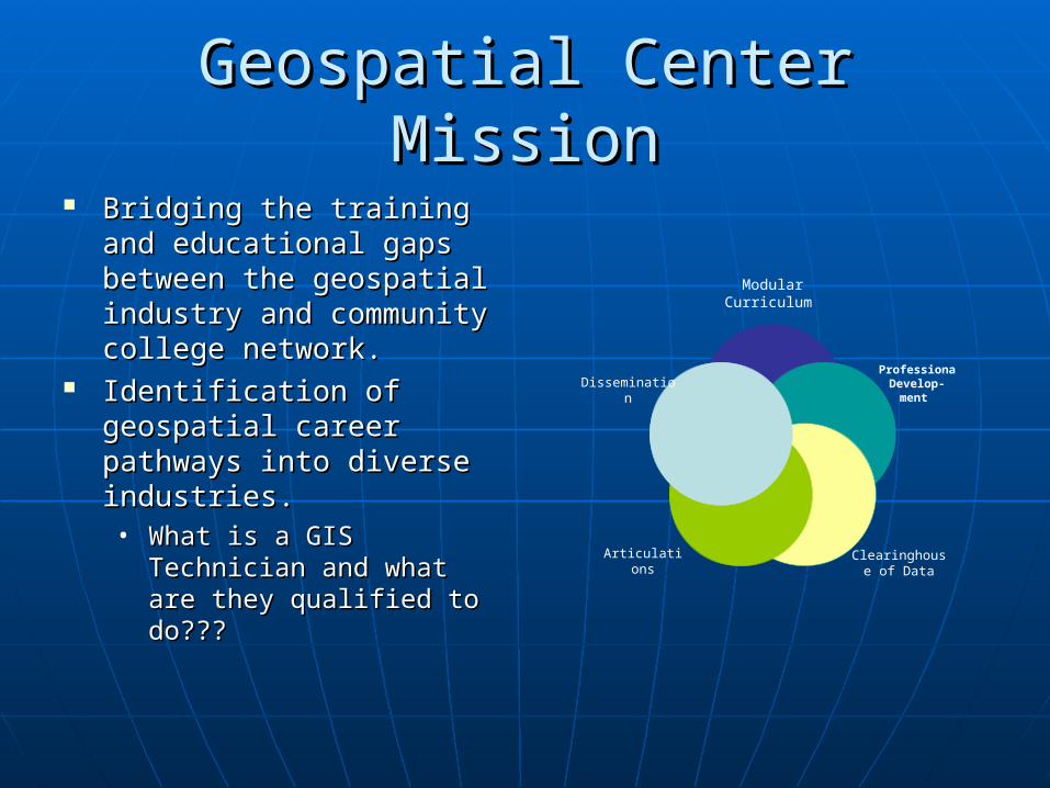
Geospatial Center MissionGeospatial Center Mission Bridging the training and Bridging the training and
educational gaps between educational gaps between the geospatial industry and the geospatial industry and community college community college network.network.
Identification of geospatial Identification of geospatial career pathways into career pathways into diverse industries.diverse industries.• What is a GIS Technician What is a GIS Technician
and what are they and what are they qualified to do???qualified to do???
Modular Curriculum
ProfessionaDevelop-
ment
Clearinghouse of Data
Articulations
Dissemination
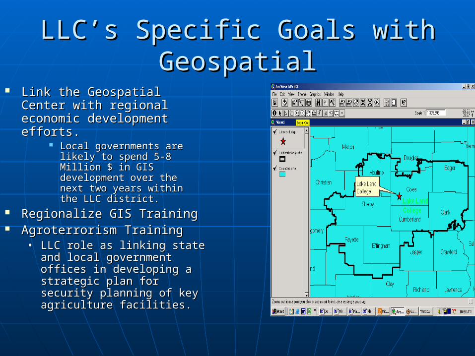
LLC’s Specific Goals with LLC’s Specific Goals with GeospatialGeospatial
Link the Geospatial Center Link the Geospatial Center with regional economic with regional economic development efforts. development efforts.
Local governments are Local governments are likely to spend 5-8 Million likely to spend 5-8 Million $ in GIS development over $ in GIS development over the next two years within the next two years within the LLC district.the LLC district.
Regionalize GIS Training Regionalize GIS Training Agroterrorism TrainingAgroterrorism Training
• LLC role as linking state LLC role as linking state and local government and local government offices in developing a offices in developing a strategic plan for security strategic plan for security planning of key agriculture planning of key agriculture facilities. facilities.
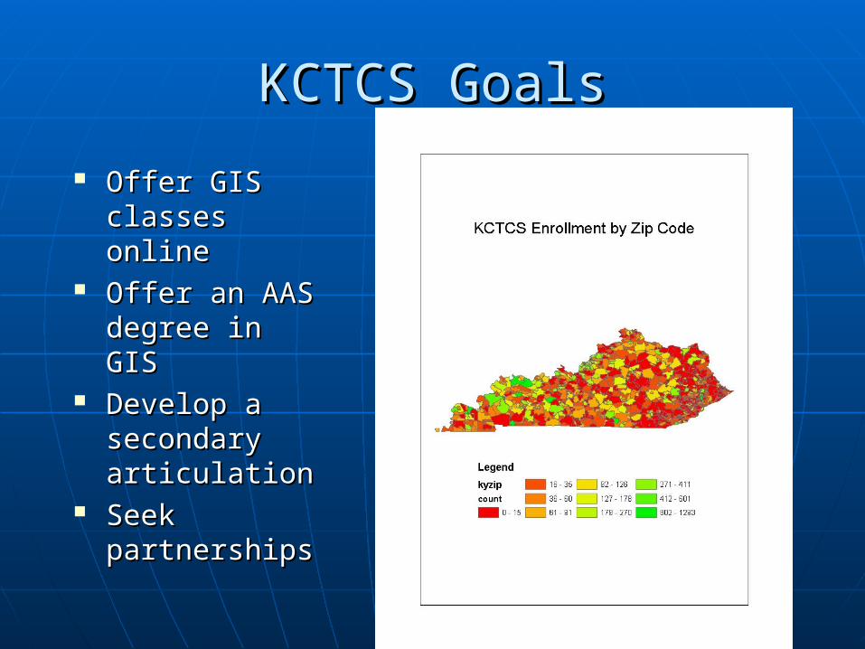
KCTCS GoalsKCTCS Goals
Offer GIS Offer GIS classes onlineclasses online
Offer an AAS Offer an AAS degree in GISdegree in GIS
Develop a Develop a secondary secondary articulationarticulation
Seek Seek partnerships partnerships
Geospatial IndustryGeospatial Industry