Embed Size (px)
Citation preview
MINUTES OF THE PLANNING COMMITTEE MEETING
OF THE BRIGHTON COUNCIL HELD
IN THE COUNCIL CHAMBER, COUNCIL OFFICES
OLD BEACH AT 5.15P.M. ON TUESDAY,
13TH
MAY, 2014
PRESENT: Cr Gray (Chairperson); Cr Foster; Cr Geard; Cr Owen and Cr Taylor.
IN ATTENDANCE: Cr Garlick, Cr Jeffries, Cr Williams; Mr R Sanderson (General Manager); Mr G Davoren (Deputy General Manager); Mrs J Banks (Governance Manager); Mr H Macpherson (Asset Services Manager) and Mr S Wells (Senior Planning Officer).
1. APOLOGIES:
Cr Geard moved, Cr Taylor seconded that Cr Curran be noted as an apology.
CARRIED
VOTING RECORD
In favour Against Cr Foster Cr Geard Cr Gray Cr Owen Cr Taylor
2. QUESTION TIME & DEPUTATIONS:
There was no requirement for question time.
3. DECLARATION OF INTEREST:
In accordance with Part 5, Section 48 of the Local Government Act 1993, the Chairman of a meeting is to request Councillors to indicate whether they have, or are likely to have an interest in any item on the agenda; and
~ 2 ~
Planning Committee Meeting 13/5/14
Part 2 Regulation 8 (7) of the Local Government (Meeting Procedures) Regulations 2005, the Chairman of a meeting is to request Councillors to indicate whether they have, or are likely to have, a pecuniary interest in any item on the agenda.
Accordingly, Councillors are requested to advise of any interest they may have in respect to any matter appearing on the agenda, or any supplementary item to the agenda, which the Council has resolved to deal with, in accordance with Part 2 Regulation 8 (6) of the
Local Government (Meeting Procedures) Regulations 2005.
There were no declarations of interest.
4. COUNCIL ACTING AS PLANNING AUTHORITY:
In accordance with the provisions of Part 2 Regulation 25 of the Local Government (Meeting Procedures) Regulations 2005, the intention of the Council to act as a planning authority pursuant to the Land Use Planning and Approvals Act 1993 is to be noted. In accordance with Regulation 25, the Council will act as a planning authority in respect to those matters appearing under Item 4. on this agenda, inclusive of any supplementary items.
4.1 SECTION 43A REQUEST - 46 BLACKSTONE DRIVE, OLD BEACH: COMBINED REZONING FROM RECREATION ZONE TO RESIDENTIAL ZONE AND SUBDIVISION OF 2 RESIDENTIAL LOTS AND BALANCE - SECTION 35 REPORT:
FILE REFERENCE: RZ 2014 / 02
Author: Senior Planner (S Wells)
Applicant: Brighton Council
Owner: Brighton Council
Location: 46 Blackstone Drive, Old Beach (Volume 134107 Folio 2) and unaddressed land (Volume 102112 Folio 101 & Volume 101886 Folio 4)
Application no.: RZ 2014 / 02 & SUB 2014 / 06
Zoning: Recreation Zone
Planning Instrument: Brighton Planning Scheme 2000
Date received: N/A
Date advertised: N/A
Decision required N/A
~ 3 ~
Planning Committee Meeting 13/5/14
Background:
Proposal
Council seeks to amend the Brighton Planning Scheme 2000 by:
rezoning part of Certificate of Title Volume 134107 Folio 2, known as 46 Blackstone Drive, Old Beach, from Recreation Zone to Residential Zone;
rezoning two small unaddressed public open space lots adjacent to the above parcel which are described by Certificate of Title Volume 102112 Folio 101 and Volume 101886 Folio 4 from Recreation Zone to Residential Zone.
Council also seeks subdivision approval for two lots within the rezoned land.
The application is a combined rezoning and subdivision application under Section 43A of the Land Use Planning and Approvals Act 1993 (LUPAA). The first section of this report addresses the proposed draft amendment and the second section addresses the subdivision into two residential lots and balance.
Site History
46 Blackstone Drive was originally dedicated as public open space through subdivision permit SUB 86/11/2 approved on 8 October 1987. At this time, the open space lot followed the alignment of a small creek and extended through to the East Derwent Highway with two pocket parks included at either end. The two pocket parks are lots 1 and 2 on the subdivision plan. The current title is the result of permit SUB 90 / 18 which removed the connectivity through to East Derwent Highway but enlarged the two pocket parks.
Public Land
Public open space land is classified as public land pursuant to section 177A of the Local Government Act 1993. All lots are classified as public land and all are owned by Council. The final realisation of the 2 proposed lots that are the subject of this report will require a separate legislative process to consider the sale of public land. This process requires further public notification and is subject to rights of appeal to the Resource Management and Planning Appeal Tribunal.
PLANNING SCHEME AMENDMENT
Site Description:
The land is located on the northern side of the residential waterfront area of Old Beach in close proximity to the Derwent River foreshore. The subject site is comprised of three separate titles.
46 Blackstone Drive is 7,142 m2 in size with an elongated, linear shape connecting two larger and more regular shaped pocket park areas at the western and eastern extent of the lot. These two pocket parks are lots 1 and 2 on the subdivision plan. The linear section runs west to east along a small creek and to the rear of a number
~ 4 ~
Planning Committee Meeting 13/5/14
of resident lots in Blackstone Drive. At the western boundary, it joins onto a similar shaped public open space lot which also contains a TasWater pump station. At the eastern boundary, the lot abuts a private residential lot which separates the lot from the East Derwent Highway. The land contains numerous trees and shrubs but which are largely contained within the small creek. Much of the land in proximity to rear property fences is cleared and maintained for a depth of 2 – 3m.
The western pocket park has a 19m frontage to Blackstone Drive. A gravel track, with locked boom gate, along the western boundary provides vehicular access to a TasWater pump station. This area is approximately 1200m2 in size and is predominantly grassed with some larger canopy trees. The land has a gradient of approximately 1 in 11 with a northerly aspect.
Solar access to the site is unaffected by adjoining buildings, vegetation or topography. The land has sewer, water and stormwater mains running along the western, eastern and rear boundaries.
The eastern pocket park has a 5m frontage to the cul-de-sac turning head of Blackstone Drive. This area is approximately 750m2 in size and is grassed and has no other vegetation. The land is relatively flat with a gradient of approximately 1 in 8 falling away from the street. Solar access to the site is unaffected by adjoining buildings, vegetation or topography. Stormwater and sewer mains run along the rear of the site with water mains contained within the road reserve. There is a shared vehicular crossing with adjoining land.
There are no structures on any section of the site.
The site, together with the adjoining land to the west, provides an informal link to the Derwent River foreshore however existing vegetation and limited extent of useable tracks currently precludes any practical use. The two pocket parks have not been developed for any recreation or other open space purpose.
Adjoining lots to the south are zoned residential and are a mixture of single dwelling and unit developments. Adjoining lots to the north are larger Rural Residential zoned lots, many of which have retained a significant covering of vegetation between the subject site and the dwellings on these lots.
Bridgewater is the closest Major Activity Centre to Old Beach. The subject site has good access to the East Derwent Highway via Morrisby Road and Jetty Road.
~ 5 ~
Planning Committee Meeting 13/5/14
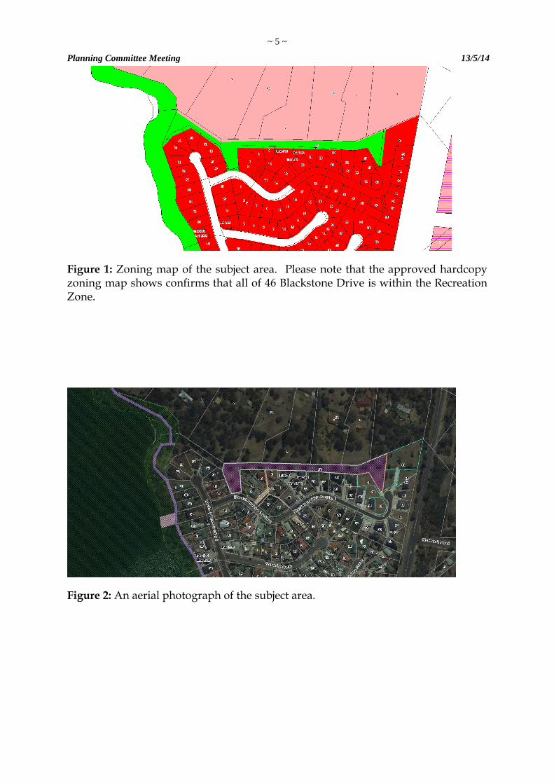
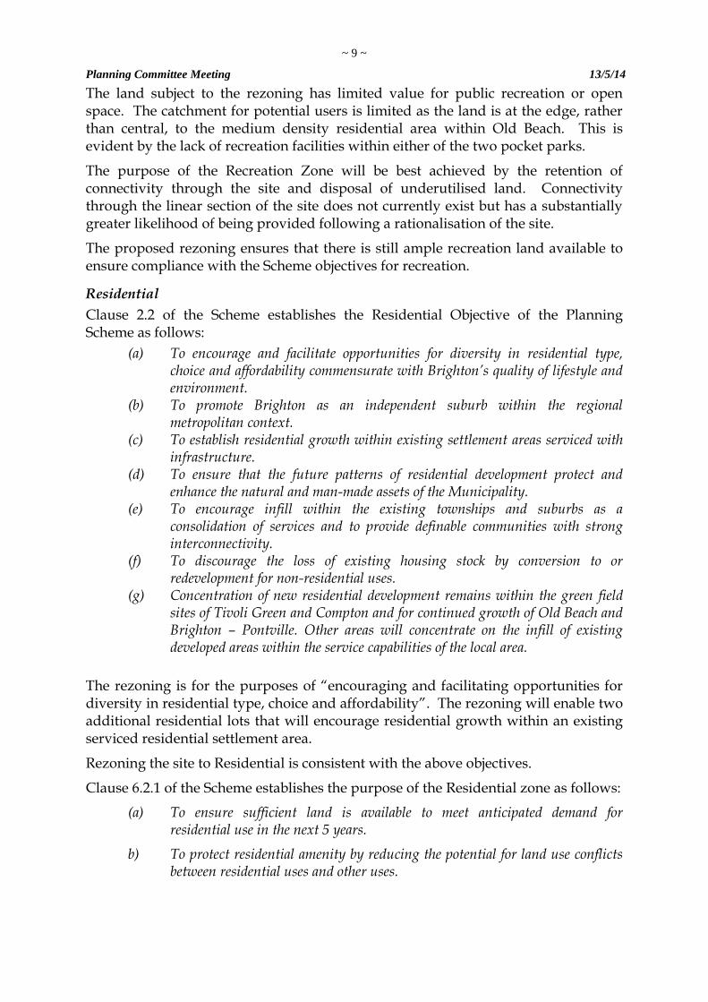
Figure 1: Zoning map of the subject area. Please note that the approved hardcopy zoning map shows confirms that all of 46 Blackstone Drive is within the Recreation Zone.
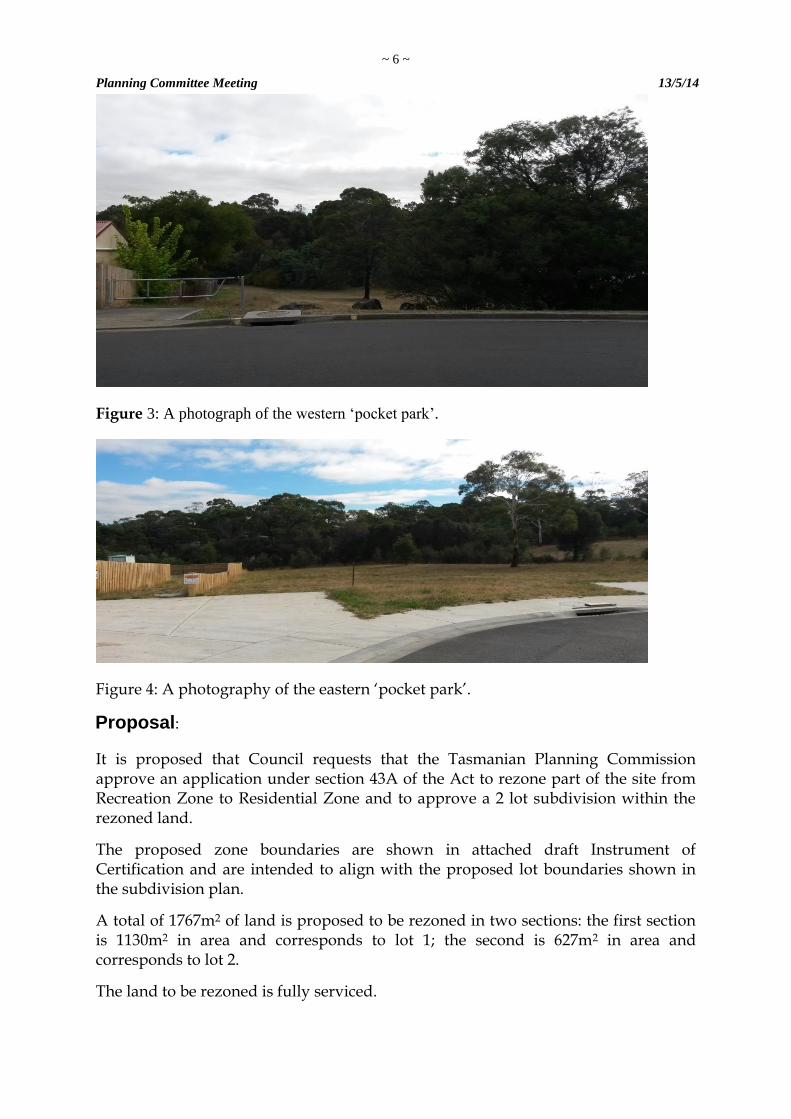
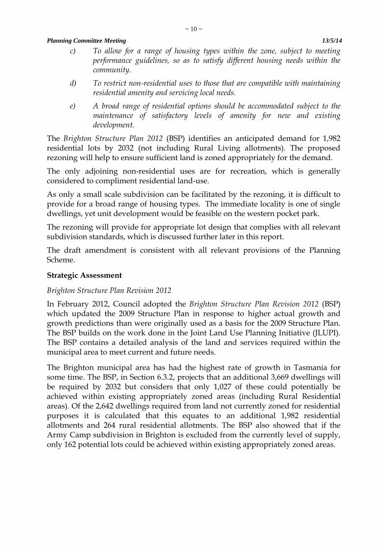
Figure 2: An aerial photograph of the subject area.
~ 6 ~
Planning Committee Meeting 13/5/14
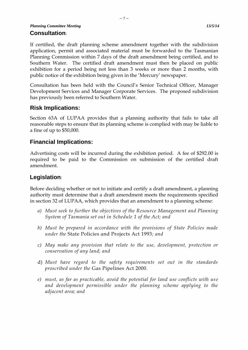
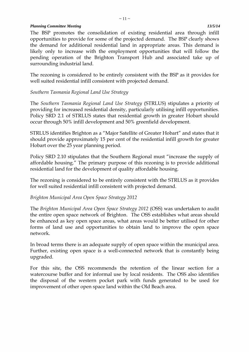
Figure 3: A photograph of the western ‘pocket park’.
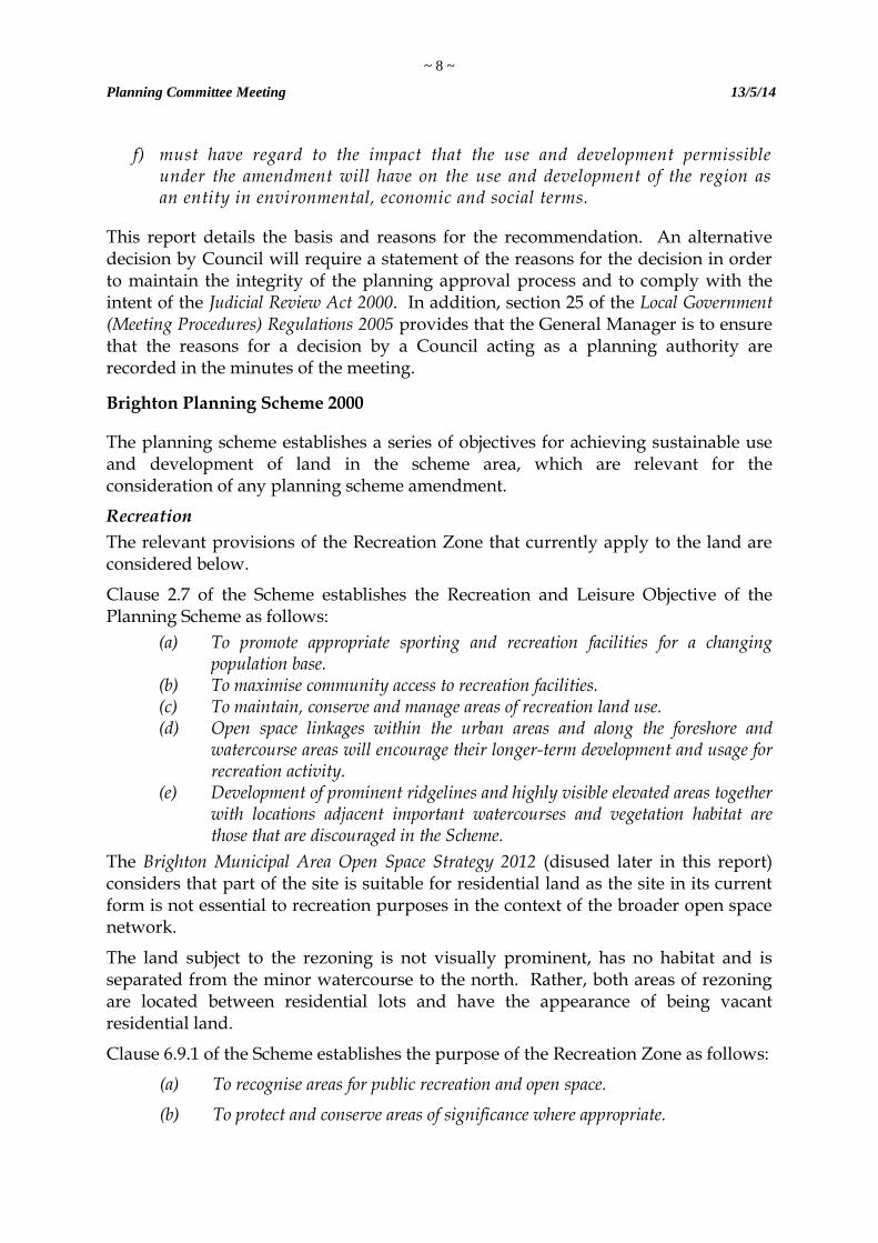
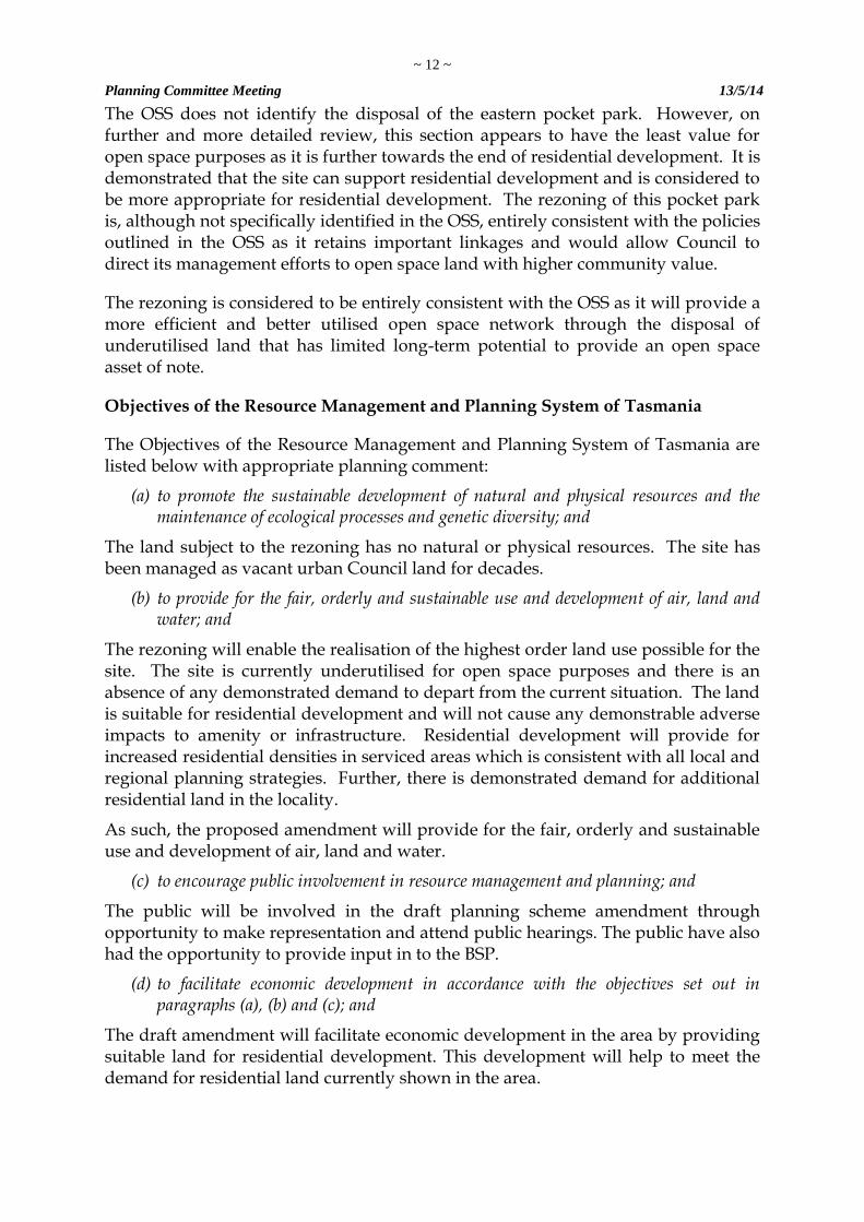
Figure 4: A photography of the eastern ‘pocket park’.
Proposal:
It is proposed that Council requests that the Tasmanian Planning Commission approve an application under section 43A of the Act to rezone part of the site from Recreation Zone to Residential Zone and to approve a 2 lot subdivision within the rezoned land.
The proposed zone boundaries are shown in attached draft Instrument of Certification and are intended to align with the proposed lot boundaries shown in the subdivision plan.
A total of 1767m2 of land is proposed to be rezoned in two sections: the first section is 1130m2 in area and corresponds to lot 1; the second is 627m2 in area and corresponds to lot 2.
The land to be rezoned is fully serviced.
~ 7 ~
Planning Committee Meeting 13/5/14
Consultation:
If certified, the draft planning scheme amendment together with the subdivision application, permit and associated material must be forwarded to the Tasmanian Planning Commission within 7 days of the draft amendment being certified, and to Southern Water. The certified draft amendment must then be placed on public exhibition for a period being not less than 3 weeks or more than 2 months, with public notice of the exhibition being given in the ‘Mercury’ newspaper.
Consultation has been held with the Council’s Senior Technical Officer, Manager Development Services and Manager Corporate Services. The proposed subdivision has previously been referred to Southern Water.
Risk Implications:
Section 63A of LUPAA provides that a planning authority that fails to take all reasonable steps to ensure that its planning scheme is complied with may be liable to a fine of up to $50,000.
Financial Implications:
Advertising costs will be incurred during the exhibition period. A fee of $292.00 is required to be paid to the Commission on submission of the certified draft amendment.
Legislation:
Before deciding whether or not to initiate and certify a draft amendment, a planning authority must determine that a draft amendment meets the requirements specified in section 32 of LUPAA, which provides that an amendment to a planning scheme:
a) Must seek to further the objectives of the Resource Management and Planning System of Tasmania set out in Schedule 1 of the Act; and
b) Must be prepared in accordance with the provisions of State Policies made under the State Policies and Projects Act 1993 ; and
c) May make any provision that relate to the use, development, protection or conservation of any land; and
d) Must have regard to the safety requirements set out in the standards proscribed under the Gas Pipelines Act 2000.
e) must, as far as practicable, avoid the potential for land use conflicts with us e and development permissible under the planning scheme applying to the adjacent area; and
~ 8 ~
Planning Committee Meeting 13/5/14
f) must have regard to the impact that the use and development permissible under the amendment will have on the use and development of the region as an entity in environmental, economic and social terms.
This report details the basis and reasons for the recommendation. An alternative decision by Council will require a statement of the reasons for the decision in order to maintain the integrity of the planning approval process and to comply with the intent of the Judicial Review Act 2000. In addition, section 25 of the Local Government (Meeting Procedures) Regulations 2005 provides that the General Manager is to ensure that the reasons for a decision by a Council acting as a planning authority are recorded in the minutes of the meeting.
Brighton Planning Scheme 2000
The planning scheme establishes a series of objectives for achieving sustainable use and development of land in the scheme area, which are relevant for the consideration of any planning scheme amendment.
Recreation
The relevant provisions of the Recreation Zone that currently apply to the land are considered below.
Clause 2.7 of the Scheme establishes the Recreation and Leisure Objective of the Planning Scheme as follows:
(a) To promote appropriate sporting and recreation facilities for a changing population base.
(b) To maximise community access to recreation facilities. (c) To maintain, conserve and manage areas of recreation land use. (d) Open space linkages within the urban areas and along the foreshore and
watercourse areas will encourage their longer-term development and usage for recreation activity.
(e) Development of prominent ridgelines and highly visible elevated areas together with locations adjacent important watercourses and vegetation habitat are those that are discouraged in the Scheme.
The Brighton Municipal Area Open Space Strategy 2012 (disused later in this report) considers that part of the site is suitable for residential land as the site in its current form is not essential to recreation purposes in the context of the broader open space network.
The land subject to the rezoning is not visually prominent, has no habitat and is separated from the minor watercourse to the north. Rather, both areas of rezoning are located between residential lots and have the appearance of being vacant residential land.
Clause 6.9.1 of the Scheme establishes the purpose of the Recreation Zone as follows:
(a) To recognise areas for public recreation and open space.
(b) To protect and conserve areas of significance where appropriate.
~ 9 ~
Planning Committee Meeting 13/5/14
The land subject to the rezoning has limited value for public recreation or open space. The catchment for potential users is limited as the land is at the edge, rather than central, to the medium density residential area within Old Beach. This is evident by the lack of recreation facilities within either of the two pocket parks.
The purpose of the Recreation Zone will be best achieved by the retention of connectivity through the site and disposal of underutilised land. Connectivity through the linear section of the site does not currently exist but has a substantially greater likelihood of being provided following a rationalisation of the site.
The proposed rezoning ensures that there is still ample recreation land available to ensure compliance with the Scheme objectives for recreation.
Residential
Clause 2.2 of the Scheme establishes the Residential Objective of the Planning Scheme as follows:
(a) To encourage and facilitate opportunities for diversity in residential type, choice and affordability commensurate with Brighton’s quality of lifestyle and environment.
(b) To promote Brighton as an independent suburb within the regional metropolitan context.
(c) To establish residential growth within existing settlement areas serviced with infrastructure.
(d) To ensure that the future patterns of residential development protect and enhance the natural and man-made assets of the Municipality.
(e) To encourage infill within the existing townships and suburbs as a consolidation of services and to provide definable communities with strong interconnectivity.
(f) To discourage the loss of existing housing stock by conversion to or redevelopment for non-residential uses.
(g) Concentration of new residential development remains within the green field sites of Tivoli Green and Compton and for continued growth of Old Beach and Brighton – Pontville. Other areas will concentrate on the infill of existing developed areas within the service capabilities of the local area.
The rezoning is for the purposes of “encouraging and facilitating opportunities for diversity in residential type, choice and affordability”. The rezoning will enable two additional residential lots that will encourage residential growth within an existing serviced residential settlement area.
Rezoning the site to Residential is consistent with the above objectives.
Clause 6.2.1 of the Scheme establishes the purpose of the Residential zone as follows:
(a) To ensure sufficient land is available to meet anticipated demand for residential use in the next 5 years.
b) To protect residential amenity by reducing the potential for land use conflicts between residential uses and other uses.
~ 10 ~
Planning Committee Meeting 13/5/14
c) To allow for a range of housing types within the zone, subject to meeting performance guidelines, so as to satisfy different housing needs within the community.
d) To restrict non-residential uses to those that are compatible with maintaining residential amenity and servicing local needs.
e) A broad range of residential options should be accommodated subject to the maintenance of satisfactory levels of amenity for new and existing development.
The Brighton Structure Plan 2012 (BSP) identifies an anticipated demand for 1,982 residential lots by 2032 (not including Rural Living allotments). The proposed rezoning will help to ensure sufficient land is zoned appropriately for the demand.
The only adjoining non-residential uses are for recreation, which is generally considered to compliment residential land-use.
As only a small scale subdivision can be facilitated by the rezoning, it is difficult to provide for a broad range of housing types. The immediate locality is one of single dwellings, yet unit development would be feasible on the western pocket park.
The rezoning will provide for appropriate lot design that complies with all relevant subdivision standards, which is discussed further later in this report.
The draft amendment is consistent with all relevant provisions of the Planning Scheme.
Strategic Assessment
Brighton Structure Plan Revision 2012
In February 2012, Council adopted the Brighton Structure Plan Revision 2012 (BSP) which updated the 2009 Structure Plan in response to higher actual growth and growth predictions than were originally used as a basis for the 2009 Structure Plan. The BSP builds on the work done in the Joint Land Use Planning Initiative (JLUPI). The BSP contains a detailed analysis of the land and services required within the municipal area to meet current and future needs.
The Brighton municipal area has had the highest rate of growth in Tasmania for some time. The BSP, in Section 6.3.2, projects that an additional 3,669 dwellings will be required by 2032 but considers that only 1,027 of these could potentially be achieved within existing appropriately zoned areas (including Rural Residential areas). Of the 2,642 dwellings required from land not currently zoned for residential purposes it is calculated that this equates to an additional 1,982 residential allotments and 264 rural residential allotments. The BSP also showed that if the Army Camp subdivision in Brighton is excluded from the currently level of supply, only 162 potential lots could be achieved within existing appropriately zoned areas.
~ 11 ~
Planning Committee Meeting 13/5/14
The BSP promotes the consolidation of existing residential area through infill opportunities to provide for some of the projected demand. The BSP clearly shows the demand for additional residential land in appropriate areas. This demand is likely only to increase with the employment opportunities that will follow the pending operation of the Brighton Transport Hub and associated take up of surrounding industrial land.
The rezoning is considered to be entirely consistent with the BSP as it provides for well suited residential infill consistent with projected demand.
Southern Tasmania Regional Land Use Strategy
The Southern Tasmania Regional Land Use Strategy (STRLUS) stipulates a priority of providing for increased residential density, particularly utilising infill opportunities. Policy SRD 2.1 of STRLUS states that residential growth in greater Hobart should occur through 50% infill development and 50% greenfield development.
STRLUS identifies Brighton as a “Major Satellite of Greater Hobart” and states that it should provide approximately 15 per cent of the residential infill growth for greater Hobart over the 25 year planning period.
Policy SRD 2.10 stipulates that the Southern Regional must “increase the supply of affordable housing.” The primary purpose of this rezoning is to provide additional residential land for the development of quality affordable housing.
The rezoning is considered to be entirely consistent with the STRLUS as it provides for well suited residential infill consistent with projected demand.
Brighton Municipal Area Open Space Strategy 2012
The Brighton Municipal Area Open Space Strategy 2012 (OSS) was undertaken to audit the entire open space network of Brighton. The OSS establishes what areas should be enhanced as key open space areas, what areas would be better utilised for other forms of land use and opportunities to obtain land to improve the open space network.
In broad terms there is an adequate supply of open space within the municipal area. Further, existing open space is a well-connected network that is constantly being upgraded.
For this site, the OSS recommends the retention of the linear section for a watercourse buffer and for informal use by local residents. The OSS also identifies the disposal of the western pocket park with funds generated to be used for improvement of other open space land within the Old Beach area.
~ 12 ~
Planning Committee Meeting 13/5/14
The OSS does not identify the disposal of the eastern pocket park. However, on further and more detailed review, this section appears to have the least value for open space purposes as it is further towards the end of residential development. It is demonstrated that the site can support residential development and is considered to be more appropriate for residential development. The rezoning of this pocket park is, although not specifically identified in the OSS, entirely consistent with the policies outlined in the OSS as it retains important linkages and would allow Council to direct its management efforts to open space land with higher community value.
The rezoning is considered to be entirely consistent with the OSS as it will provide a more efficient and better utilised open space network through the disposal of underutilised land that has limited long-term potential to provide an open space asset of note.
Objectives of the Resource Management and Planning System of Tasmania
The Objectives of the Resource Management and Planning System of Tasmania are listed below with appropriate planning comment:
(a) to promote the sustainable development of natural and physical resources and the maintenance of ecological processes and genetic diversity; and
The land subject to the rezoning has no natural or physical resources. The site has been managed as vacant urban Council land for decades.
(b) to provide for the fair, orderly and sustainable use and development of air, land and water; and
The rezoning will enable the realisation of the highest order land use possible for the site. The site is currently underutilised for open space purposes and there is an absence of any demonstrated demand to depart from the current situation. The land is suitable for residential development and will not cause any demonstrable adverse impacts to amenity or infrastructure. Residential development will provide for increased residential densities in serviced areas which is consistent with all local and regional planning strategies. Further, there is demonstrated demand for additional residential land in the locality.
As such, the proposed amendment will provide for the fair, orderly and sustainable use and development of air, land and water.
(c) to encourage public involvement in resource management and planning; and
The public will be involved in the draft planning scheme amendment through opportunity to make representation and attend public hearings. The public have also had the opportunity to provide input in to the BSP.
(d) to facilitate economic development in accordance with the objectives set out in paragraphs (a), (b) and (c); and
The draft amendment will facilitate economic development in the area by providing suitable land for residential development. This development will help to meet the demand for residential land currently shown in the area.
~ 13 ~
Planning Committee Meeting 13/5/14
(e) to promote the sharing of responsibility for resource management and planning between the different spheres of Government, the community and industry in the State.
Consultation will involve the Tasmanian Planning Commission, the Brighton Council and the community.
The proposed Planning Scheme Amendment as it relates to the Objectives of Part 2 of Schedule 1 of LUPAA is discussed below:
(a) to require sound strategic planning and co-ordinated action by State and local government;
The proposed amendment is seen as a strategic response to the demand for additional residential land as recognised in the JLUPI Land Use Strategy, the BSP and the STRLUS, which have all been adopted by Council. The proposed amendment is also consistent with the OSS as disposal of excess and underutilised land will provide for a more focused and better resourced open space network.
(b) to establish a system of planning instruments to be the principal way of setting objectives, policies and controls for the use, development and protection of land.
The proposal has been submitted in accordance with Section 34 of LUPAA. The proposed amendment will form part of the Planning Scheme, which controls the use, development and protection of land. The draft amendment will enable residential development to occur on land in a suitable area. The draft amendment has been considered against a suite of planning instruments, including STRLUS, the BPS and the OSS.
(c) to ensure that the effects on the environment are considered and provide for explicit consideration of social and economic effects when decisions are made about the use and development of land; and
The land contains no environmental values of note. The small-scale of the rezoning makes any broad social or economic effect unlikely to arise.
(d) to require land use and development planning and policy to be easily integrated with environmental, social, economic, conservation and resource management policies at State, regional and municipal levels; and
The proposed amendment supports this Objective and is consistent with State, Regional and local planning policies and strategies.
(e) to provide for the consolidation of approvals for land use or development and related matters, and to co-ordinate planning approvals with related approvals; and
This Objective is furthered by the use of Section 43a of the Act to apply for a combined rezoning and subdivision approval.
~ 14 ~
Planning Committee Meeting 13/5/14
(f) to secure a pleasant, efficient and safe working, living and recreati onal environment for all Tasmanians and visitors to Tasmania; and
The site is well suited to residential development. Further, the proposal retains open space linkages so that options for future development of trails in the local area are not lost. The rezoning will achieve efficiencies in the supply of both residential and open space land in the municipal area.
(g) to conserve those buildings, areas or other places which are of scientific, aesthetic, architectural or historical interest, or otherwise of spec ial cultural value; and
The area is not known to contain any items or places of scientific, aesthetic, architectural or historic interest.
If any Aboriginal heritage sites are discovered during potential future works then the Aboriginal Relics Act 1975 will apply for reporting and management purposes.
(h) to protect public infrastructure and other assets and enable the orderly provision and co-ordination of public utilities and other facilities for the benefit of the community; and
The site is fully serviced. Access to the nearby TasWater pump station can be retained.
(i) to provide a planning framework which fully considers land capability.
The capability of the site to support rural or agricultural pursuits is non-existent. The land is within an urban setting.
State Policies
The State Coastal Policy 1996 (Coastal Policy) came into operation on 10 October 1996. This Policy applies to the coastal zone, which includes all State waters and land within 1 km from the High Water Mark (HWM)1, and therefore applies to this site.
Three main principles guide Tasmania’s State Coastal Policy:
Natural and cultural values of the coast shall be protected.
The coast shall be used and developed in a sustainable manner.
Integrated management and protection of the coastal zone is a shared responsibility.
The proposed amendment will not prejudicially affect the principles or detailed provisions of the Coastal Policy. The land is centrally located within a residential area and has previously been developed. The potential for off-site impacts to occur that could impact on coastal values is slight. The draft amendment is, in particular, consistent with clause 2.4.2 which states:
1 State Coastal Policy Validation Act 2003

~ 15 ~
Planning Committee Meeting 13/5/14
Urban and residential development in the coastal zone will be based on existing towns and townships. Compact and contained planned urban and residential development will be encouraged in order to avoid ribbon development and unrelated cluster developments along the coast.
State Policy on Water Quality Management 1997
The State Policy on Water Quality Management 1997 (Water Quality Policy) came into operation on 27 September 1997. Clause 31.5 of the Water Quality Policy requires that a use or development be consistent with the physical capacity of the land so that the potential for erosion and subsequent water quality degradation is minimised.
Any future development will require a Soil and Water Management Plan as per Schedule 4 of the Planning Scheme, by means of a permit condition to ensure practical measures are taken to prevent pollution from the construction site.
The Revised State Policy for the Protection of Agricultural Land 2007 (PAL Policy)
The PAL Policy applies to all agricultural land in Tasmania. The subject land is located in a residential area with no legitimate agricultural potential and it is therefore considered that the Agricultural Policy does not apply to the land.
National Environmental Protection Measures (NEPM).
NEPMs are broad framework setting statutory instruments made under the National Environment Protection Council (Tasmania) Act 1995 and are taken to be State Policies. Eight NEPMs have been made to date which deal with air quality, movement of waste, site contamination and used packaging materials. None of the NEPMs are considered relevant to the proposed draft amendment.
Gas Pipeline safety
Section 32(a) of the Act provides that a draft amendment must have regard to the safety requirements for gas pipelines.
There are no issues of gas pipeline safety associated with the draft amendment.
Potential for Land Use Conflicts S 32 1 (e)
There are no potential land use conflicts caused by the proposed rezoning. The rezoning would simply allow for the infill of under-utilised parcels of vacant land within a well-established residential settlement. The additional residential land will not compromise the integrity of the open space network.
Regional Impacts s 32 1 (f)
As discussed earlier in this report, the proposed rezoning is entirely consistent with the STRLUS in terms of the mix of infill and greenfield residential development and is well within the Urban Growth Boundary defined within the Residential Strategy.
The proposed rezoning is likely to have a negligible regional impact. The addition of two residential lots will have negligible impact beyond the boundaries of Old Beach.
~ 16 ~
Planning Committee Meeting 13/5/14
New Brighton Planning Scheme
The endorsed Draft Interim Brighton Planning Scheme 2014 retains the existing Recreation Zone (which is translated into an Open Space Zone). With the boundaries of suitable residential land now identified it will be possible to incorporate this proposed amendment into the new scheme.
Conclusion
The proposed draft amendment seeks to rezone two parts of an underutilised area of open space from the Recreation Zone to the Residential Zone. The draft amendment will facilitate residential infill and provide for the orderly densification of Old Beach. Land that may provide future linkages and trails is to be retained in the current Recreation Zone.
The draft amendment is consistent with all relevant local and regional strategies and plans. The draft amendment is also consistent with all relevant policies and legislation and will help to satisfy a proven demand for additional residential land in appropriate locations while improving the quality of the open space network.
On the above basis, the amendment meets all the requirements for certification.
DEVELOPMENT APPLICATION
Proposal
The proposed subdivision provides for two residential lots and a balance open space lot.
Lot 1 is 1130m2 in size with an 18.2m frontage to Blackstone Drive. The lot is regularly shaped. Existing services run inside the northern boundary, which will require a variable width easement, and partway along the eastern boundary which will require an easement up to 3m wide (subject to location of existing services on site). Access is proposed from a new crossover as the location of a side entry pit precludes the efficient upgrading of the existing crossover.
Lot 2 is 627m2 in size with a 3.6m frontage to Blackstone Drive. The lot is an irregular triangle shape. Existing services run along the inside of the rear boundary, which will require a variable width easement. Access is proposed via the existing crossover.
The balance lot consists of the linear section of the site together with walkways at either end. The western most walkway has a minimum width of 4m and will provide for continued access to the TasWater pump station. The eastern most walkway has a minimum width of 4.2m with the exception of the initial segment from Blackstone Drive which narrows to 1.34m.
Planning Scheme
Subject to approval of the associated planning scheme amendment, lots 1 and 2 will be subject to the Residential Zone and the balance lot subject to the Recreation Zone. Scheme Objectives – Residential & Recreation
~ 17 ~
Planning Committee Meeting 13/5/14
The schemes objectives for residential and recreation land use and for the Residential Zone and Recreation Zone have been listed earlier in the report in terms of the appropriateness of the rezoning.
As the lots comply with the subdivision standards for the Residential Zone and as it is considered that the lots do not raise any other amenity or servicing issue, the subdivision is consistent with these objectives.
Decision Guidelines
The decision guidelines relating to the Residential zone pursuant to Clause 6.2.2 of the Planning Scheme are provided as follows:
(a) the building appearance from public streets and adjoining sites is visually compatible with surrounding development;
(b) the siting and design of the development protect the amenity of neighbours, minimise overshadowing and overlooking, enable passive surveillance without unreasonably diminishing privacy, and contribute to residential character and usability of private open space;
(c) issues relevant to multi-unit housing are addressed adequately; and (d) the design and siting of lots and buildings optimises solar access and
water usage, minimizes waste and contributes to efficient use of energy and water.
The proposed lots both have a northerly aspect and have no impediments to solar access. The lots require minimal works to occur and will provide for better efficiencies of existing public services.
The Recreation Zone has no applicable decision guideline.
Subdivision Standards
The subdivision standards relating to the Residential Zone pursuant to Clause 6.2.8 of the Planning Scheme are provided as follows:
(a) minimum lot size of 400m2 , except for the Residential zoned land with frontage to Stanfield Drive (not including that area within the St Ann’s Development Plan), where a minimum lot size of 2000m2 shall apply;
(b) average lot size of 550m2 where three or more lots are created, except for the Residential zoned land with frontage to Stanfield Drive (not including that area within the St Ann’s Development Plan), where an average lot size of 2500m2 shall apply;
(c) minimum frontage of 3.6m; (d) a building envelope with minimum dimensions of 10m x 15m clear of any
easements, the front boundary setback or any other title restrictions including rights of way, shall be shown on the plan; and
(e) where the division is of a building alone, lots must each have a minimum area of 200m2.
~ 18 ~
Planning Committee Meeting 13/5/14
Both lots comply with the minimum standards for size and frontage and all can accommodate a 10m x 15m building envelope clear of any future servicing easements.
The subdivision standards relating to the Recreation Zone one pursuant to Clause 6.9.8 of the Planning Scheme are provided as follows:
(a) lot configuration must reflect the minimum requirement to accommodate the designated use or development and its necessary infrastructure.
It is considered that the balance lot satisfy these requirements.
General Provisions
Information to accompany an Application – Clause 3.2
The subdivision plan prepared by Council is considered to satisfy the information
requirements stipulated in Clause 3.2.1 to 3.2.4.
Decision Guidelines – Clause 3.3
The criteria within Clause 3.3 of the Scheme must be considered before Council determines an application for planning approval.
All relevant matters under Clause 3.3 of the Scheme have been addressed throughout the various sections of this report with no significant issues arising.
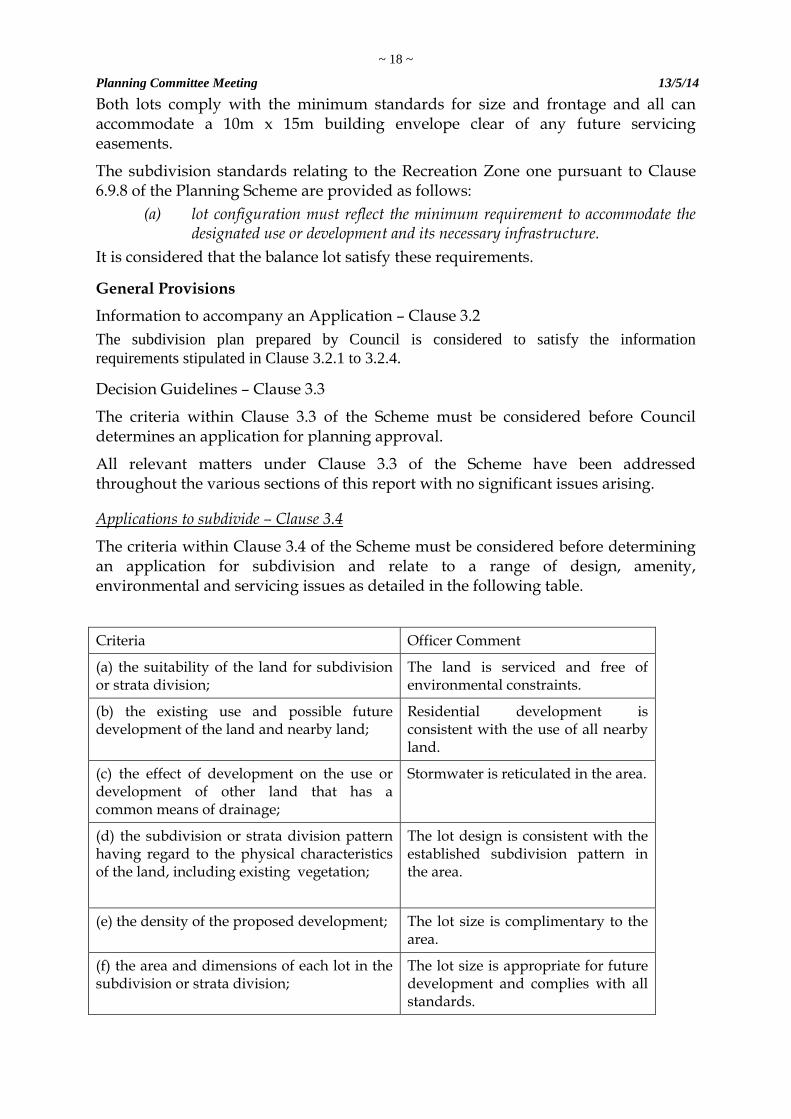
Applications to subdivide – Clause 3.4
The criteria within Clause 3.4 of the Scheme must be considered before determining an application for subdivision and relate to a range of design, amenity, environmental and servicing issues as detailed in the following table.
Criteria Officer Comment
(a) the suitability of the land for subdivision or strata division;
The land is serviced and free of environmental constraints.
(b) the existing use and possible future development of the land and nearby land;
Residential development is consistent with the use of all nearby land.
(c) the effect of development on the use or development of other land that has a common means of drainage;
Stormwater is reticulated in the area.
(d) the subdivision or strata division pattern having regard to the physical characteristics of the land, including existing vegetation;
The lot design is consistent with the established subdivision pattern in the area.
(e) the density of the proposed development; The lot size is complimentary to the area.
(f) the area and dimensions of each lot in the subdivision or strata division;
The lot size is appropriate for future development and complies with all standards.
~ 19 ~
Planning Committee Meeting 13/5/14
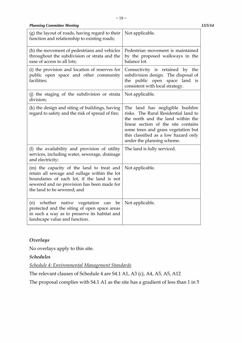
(g) the layout of roads, having regard to their function and relationship to existing roads;
Not applicable.
(h) the movement of pedestrians and vehicles throughout the subdivision or strata and the ease of access to all lots;
Pedestrian movement is maintained by the proposed walkways in the balance lot.
(i) the provision and location of reserves for public open space and other community facilities;
Connectivity is retained by the subdivision design. The disposal of the public open space land is consistent with local strategy.
(j) the staging of the subdivision or strata division;
Not applicable.
(k) the design and siting of buildings, having regard to safety and the risk of spread of fire;
The land has negligible bushfire risks. The Rural Residential land to the north and the land within the linear section of the site contains some trees and grass vegetation but this classified as a low hazard only under the planning scheme.
(l) the availability and provision of utility services, including water, sewerage, drainage and electricity;
The land is fully serviced.
(m) the capacity of the land to treat and retain all sewage and sullage within the lot boundaries of each lot, if the land is not sewered and no provision has been made for the land to be sewered; and
Not applicable.
(n) whether native vegetation can be protected and the siting of open space areas in such a way as to preserve its habitat and landscape value and function.
Not applicable.
Overlays
No overlays apply to this site.
Schedules
Schedule 4: Environmental Management Standards
The relevant clauses of Schedule 4 are S4.1 A1, A3 (c), A4, A5, A5, A12
The proposal complies with S4.1 A1 as the site has a gradient of less than 1 in 5
~ 20 ~
Planning Committee Meeting 13/5/14
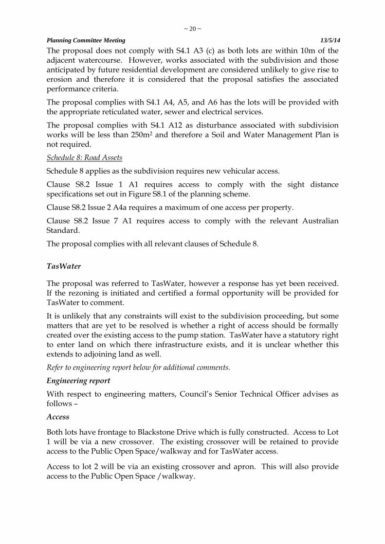
The proposal does not comply with S4.1 A3 (c) as both lots are within 10m of the adjacent watercourse. However, works associated with the subdivision and those anticipated by future residential development are considered unlikely to give rise to erosion and therefore it is considered that the proposal satisfies the associated performance criteria.
The proposal complies with S4.1 A4, A5, and A6 has the lots will be provided with the appropriate reticulated water, sewer and electrical services.
The proposal complies with S4.1 A12 as disturbance associated with subdivision works will be less than 250m2 and therefore a Soil and Water Management Plan is not required.
Schedule 8: Road Assets
Schedule 8 applies as the subdivision requires new vehicular access.
Clause S8.2 Issue 1 A1 requires access to comply with the sight distance specifications set out in Figure S8.1 of the planning scheme.
Clause S8.2 Issue 2 A4a requires a maximum of one access per property.
Clause S8.2 Issue 7 A1 requires access to comply with the relevant Australian Standard.
The proposal complies with all relevant clauses of Schedule 8.
TasWater
The proposal was referred to TasWater, however a response has yet been received. If the rezoning is initiated and certified a formal opportunity will be provided for TasWater to comment.
It is unlikely that any constraints will exist to the subdivision proceeding, but some matters that are yet to be resolved is whether a right of access should be formally created over the existing access to the pump station. TasWater have a statutory right to enter land on which there infrastructure exists, and it is unclear whether this extends to adjoining land as well.
Refer to engineering report below for additional comments.
Engineering report
With respect to engineering matters, Council’s Senior Technical Officer advises as follows –
Access
Both lots have frontage to Blackstone Drive which is fully constructed. Access to Lot 1 will be via a new crossover. The existing crossover will be retained to provide access to the Public Open Space/walkway and for TasWater access.
Access to lot 2 will be via an existing crossover and apron. This will also provide access to the Public Open Space /walkway.
~ 21 ~
Planning Committee Meeting 13/5/14
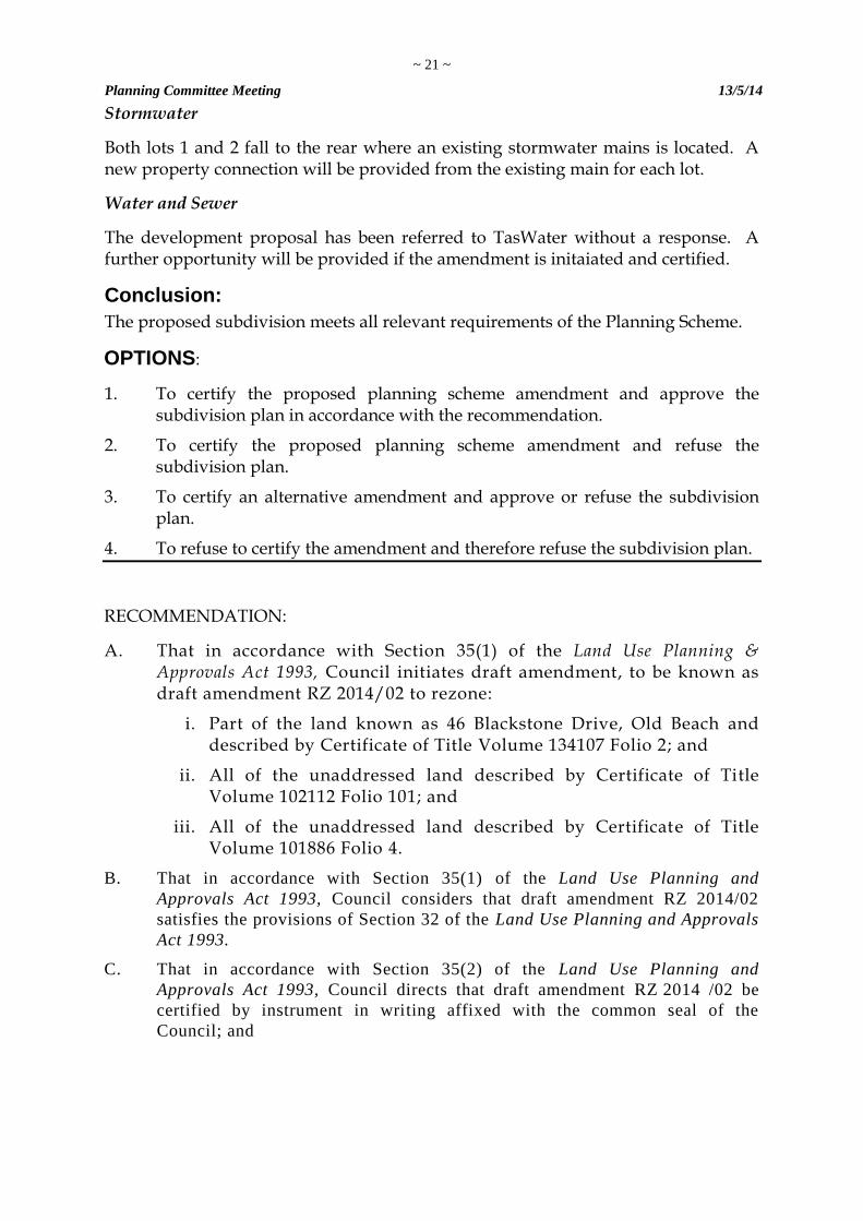
Stormwater
Both lots 1 and 2 fall to the rear where an existing stormwater mains is located. A new property connection will be provided from the existing main for each lot.
Water and Sewer
The development proposal has been referred to TasWater without a response. A further opportunity will be provided if the amendment is initaiated and certified.
Conclusion:
The proposed subdivision meets all relevant requirements of the Planning Scheme.
OPTIONS:
1. To certify the proposed planning scheme amendment and approve the subdivision plan in accordance with the recommendation.
2. To certify the proposed planning scheme amendment and refuse the subdivision plan.
3. To certify an alternative amendment and approve or refuse the subdivision plan.
4. To refuse to certify the amendment and therefore refuse the subdivision plan.
RECOMMENDATION:
A. That in accordance with Section 35(1) of the Land Use Planning & Approvals Act 1993, Council initiates draft amendment, to be known as draft amendment RZ 2014/02 to rezone:
i. Part of the land known as 46 Blackstone Drive, Old Beach and described by Certificate of Title Volume 134107 Folio 2; and
ii. All of the unaddressed land described by Certificate of Title Volume 102112 Folio 101; and
iii. All of the unaddressed land described by Certificate of Title Volume 101886 Folio 4.
B. That in accordance with Section 35(1) of the Land Use Planning and
Approvals Act 1993, Council considers that draft amendment RZ 2014/02
satisfies the provisions of Section 32 of the Land Use Planning and Approvals
Act 1993.
C. That in accordance with Section 35(2) of the Land Use Planning and
Approvals Act 1993, Council directs that draft amendment RZ 2014 /02 be
certified by instrument in writing affixed with the common seal of the
Council; and
~ 22 ~
Planning Committee Meeting 13/5/14
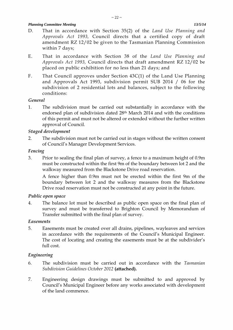
D. That in accordance with Section 35(2) of the Land Use Planning and Approvals Act 1993, Council directs that a certified copy of draft amendment RZ 12/02 be given to the Tasmanian Planning Commission within 7 days;
E. That in accordance with Section 38 of the Land Use Planning and Approvals Act 1993, Council directs that draft amendment RZ 12/02 be placed on public exhibition for no less than 21 days; and
F. That Council approves under Section 43C(1) of the Land Use Planning and Approvals Act 1993, subdivision permit SUB 2014 / 06 for the subdivision of 2 residential lots and balances, subject to the following conditions:
General
1. The subdivision must be carried out substantially in accordance with the endorsed plan of subdivision dated 28th March 2014 and with the conditions of this permit and must not be altered or extended without the further written approval of Council.
Staged development
2. The subdivision must not be carried out in stages without the written consent of Council’s Manager Development Services.
Fencing
3. Prior to sealing the final plan of survey, a fence to a maximum height of 0.9m must be constructed within the first 9m of the boundary between lot 2 and the walkway measured from the Blackstone Drive road reservation.
A fence higher than 0.9m must not be erected within the first 9m of the boundary between lot 2 and the walkway measures from the Blackstone Drive road reservation must not be constructed at any point in the future.
Public open space
4. The balance lot must be described as public open space on the final plan of survey and must be transferred to Brighton Council by Memorandum of Transfer submitted with the final plan of survey.
Easements
5. Easements must be created over all drains, pipelines, wayleaves and services in accordance with the requirements of the Council’s Municipal Engineer. The cost of locating and creating the easements must be at the subdivider’s full cost.
Engineering
6. The subdivision must be carried out in accordance with the Tasmanian Subdivision Guidelines October 2012 (attached).
7. Engineering design drawings must be submitted to and approved by Council’s Municipal Engineer before any works associated with development of the land commence.
~ 23 ~
Planning Committee Meeting 13/5/14
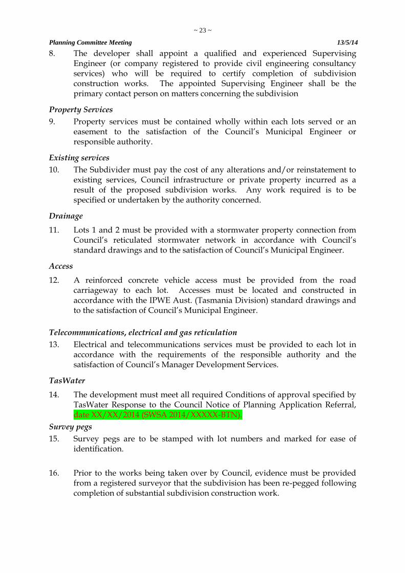
8. The developer shall appoint a qualified and experienced Supervising Engineer (or company registered to provide civil engineering consultancy services) who will be required to certify completion of subdivision construction works. The appointed Supervising Engineer shall be the primary contact person on matters concerning the subdivision
Property Services
9. Property services must be contained wholly within each lots served or an easement to the satisfaction of the Council’s Municipal Engineer or responsible authority.
Existing services
10. The Subdivider must pay the cost of any alterations and/or reinstatement to existing services, Council infrastructure or private property incurred as a result of the proposed subdivision works. Any work required is to be specified or undertaken by the authority concerned.
Drainage
11. Lots 1 and 2 must be provided with a stormwater property connection from Council’s reticulated stormwater network in accordance with Council’s standard drawings and to the satisfaction of Council’s Municipal Engineer.
Access
12. A reinforced concrete vehicle access must be provided from the road carriageway to each lot. Accesses must be located and constructed in accordance with the IPWE Aust. (Tasmania Division) standard drawings and to the satisfaction of Council’s Municipal Engineer.
Telecommunications, electrical and gas reticulation
13. Electrical and telecommunications services must be provided to each lot in accordance with the requirements of the responsible authority and the satisfaction of Council’s Manager Development Services.
TasWater
14. The development must meet all required Conditions of approval specified by TasWater Response to the Council Notice of Planning Application Referral, date XX/XX/2014 (SWSA 2014/XXXXX-BTN).
Survey pegs
15. Survey pegs are to be stamped with lot numbers and marked for ease of identification.
16. Prior to the works being taken over by Council, evidence must be provided from a registered surveyor that the subdivision has been re-pegged following completion of substantial subdivision construction work.
~ 24 ~
Planning Committee Meeting 13/5/14
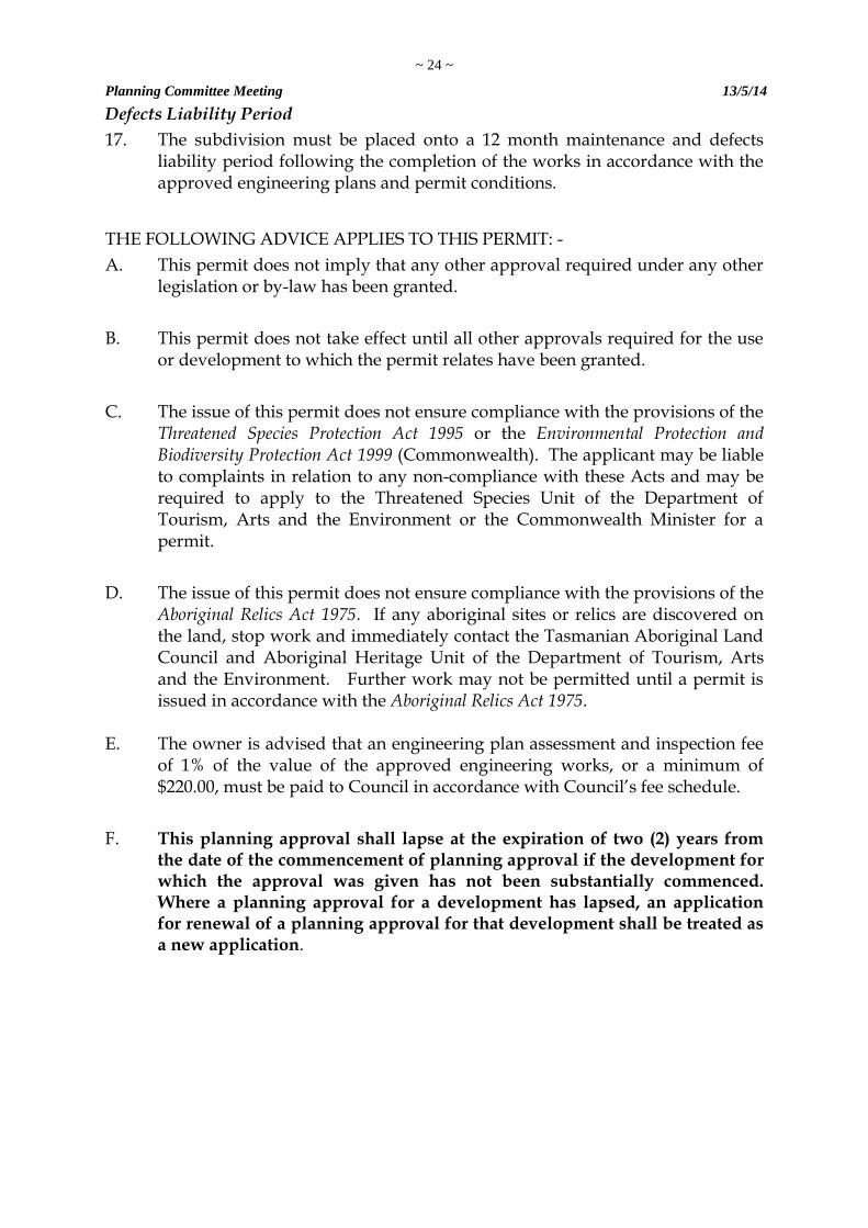
Defects Liability Period
17. The subdivision must be placed onto a 12 month maintenance and defects liability period following the completion of the works in accordance with the approved engineering plans and permit conditions.
THE FOLLOWING ADVICE APPLIES TO THIS PERMIT: -
A. This permit does not imply that any other approval required under any other legislation or by-law has been granted.
B. This permit does not take effect until all other approvals required for the use or development to which the permit relates have been granted.
C. The issue of this permit does not ensure compliance with the provisions of the Threatened Species Protection Act 1995 or the Environmental Protection and Biodiversity Protection Act 1999 (Commonwealth). The applicant may be liable to complaints in relation to any non-compliance with these Acts and may be required to apply to the Threatened Species Unit of the Department of Tourism, Arts and the Environment or the Commonwealth Minister for a permit.
D. The issue of this permit does not ensure compliance with the provisions of the Aboriginal Relics Act 1975. If any aboriginal sites or relics are discovered on the land, stop work and immediately contact the Tasmanian Aboriginal Land Council and Aboriginal Heritage Unit of the Department of Tourism, Arts and the Environment. Further work may not be permitted until a permit is issued in accordance with the Aboriginal Relics Act 1975.
E. The owner is advised that an engineering plan assessment and inspection fee of 1% of the value of the approved engineering works, or a minimum of $220.00, must be paid to Council in accordance with Council’s fee schedule.
F. This planning approval shall lapse at the expiration of two (2) years from the date of the commencement of planning approval if the development for which the approval was given has not been substantially commenced. Where a planning approval for a development has lapsed, an application for renewal of a planning approval for that development shall be treated as a new application.
~ 25 ~
Planning Committee Meeting 13/5/14
DECISION:
Cr Taylor moved, Cr Geard seconded that the recommendation be adopted.
CARRIED
VOTING RECORD
In favour Against Cr Foster Cr Geard Cr Gray Cr Owen Cr Taylor
The meeting closed at 5.30 p.m. Confirmed: (Mayor) Date: 20th May 2014