Embed Size (px)
Citation preview
©SNH
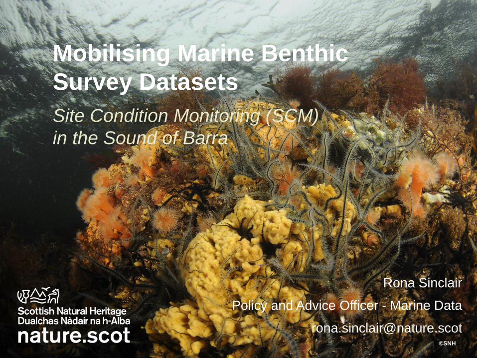
Mobilising Marine Benthic
Survey Datasets
Rona Sinclair
Policy and Advice Officer - Marine Data
Site Condition Monitoring (SCM)
in the Sound of Barra
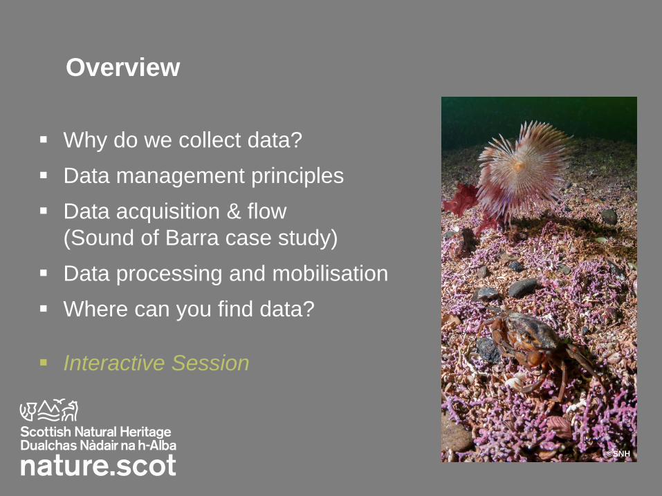
Overview
Why do we collect data?
Data management principles
Data acquisition & flow
(Sound of Barra case study)
Data processing and mobilisation
Where can you find data?
Interactive Session
©SNH
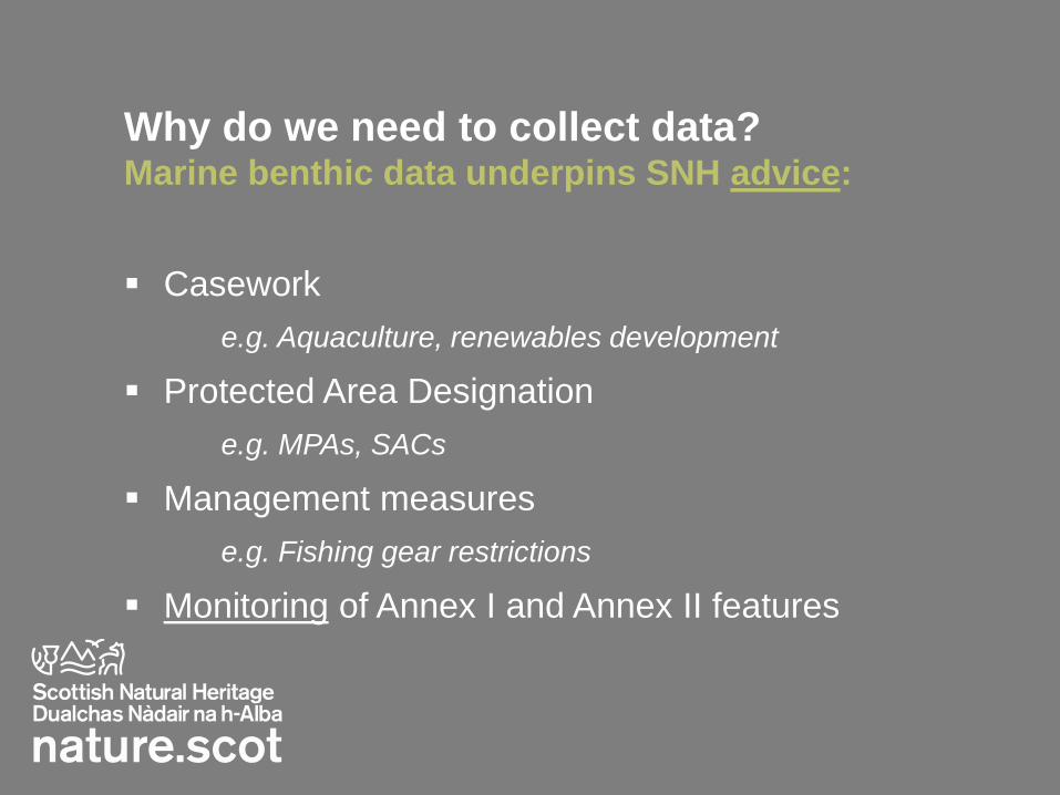
Why do we need to collect data? Marine benthic data underpins SNH advice:
Casework
e.g. Aquaculture, renewables development
Protected Area Designation
e.g. MPAs, SACs
Management measures
e.g. Fishing gear restrictions
Monitoring of Annex I and Annex II features
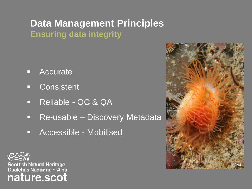
Data Management Principles Ensuring data integrity
Accurate
Consistent
Reliable - QC & QA
Re-usable – Discovery Metadata
Accessible - Mobilised
©SNH
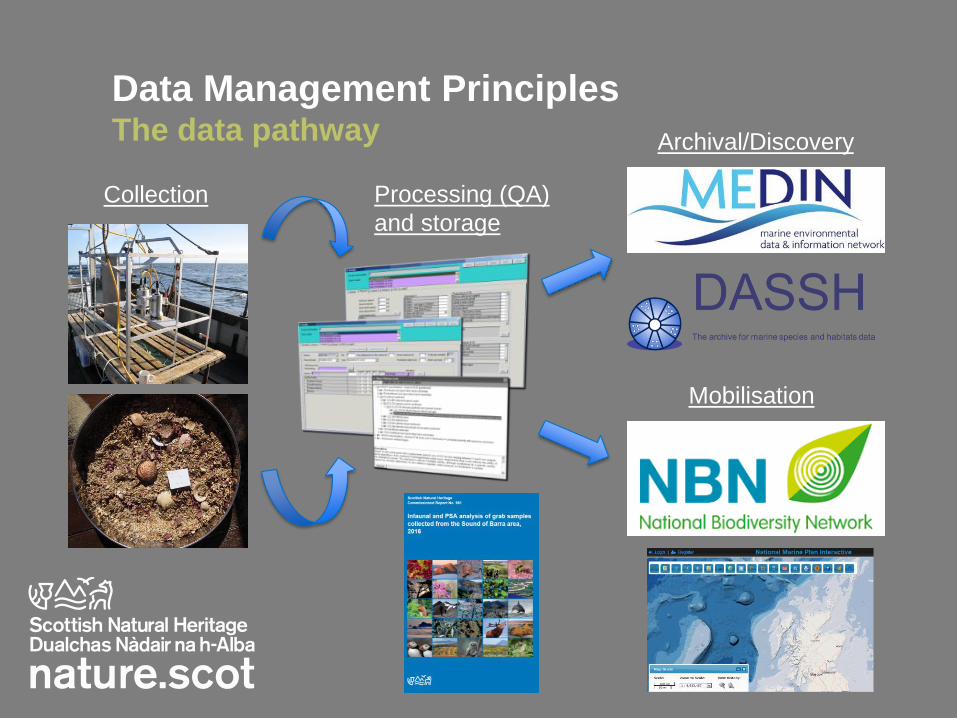
Data Management Principles The data pathway
Collection Processing (QA)
and storage
Archival/Discovery
Mobilisation

The Sound of Barra
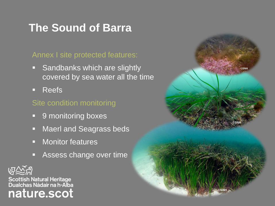
The Sound of Barra
Annex I site protected features:
Sandbanks which are slightly
covered by sea water all the time
Reefs
Site condition monitoring
9 monitoring boxes
Maerl and Seagrass beds
Monitor features
Assess change over time
©SNH
©SNH
©SNH
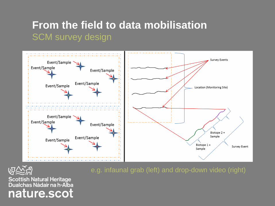
From the field to data mobilisation SCM survey design
e.g. infaunal grab (left) and drop-down video (right)

The Sound of Barra SCM Survey design
SNH Commissioned Report No’s. 959 and 961 (2017)
Determination of:
Species abundance
Biotope occurrence
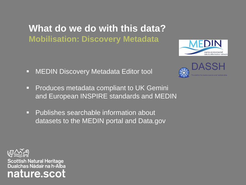
What do we do with this data? Mobilisation: Discovery Metadata
MEDIN Discovery Metadata Editor tool
Produces metadata compliant to UK Gemini
and European INSPIRE standards and MEDIN
Publishes searchable information about
datasets to the MEDIN portal and Data.gov
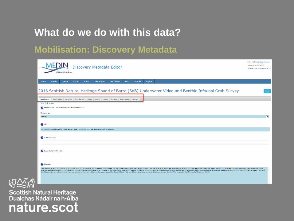
What do we do with this data?
Mobilisation: Discovery Metadata
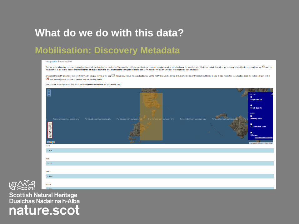
What do we do with this data?
Mobilisation: Discovery Metadata
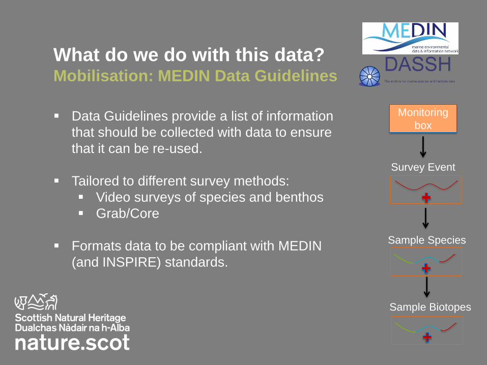
What do we do with this data? Mobilisation: MEDIN Data Guidelines
Monitoring
box
Survey Event
Sample Species
Sample Biotopes
Data Guidelines provide a list of information
that should be collected with data to ensure
that it can be re-used.
Tailored to different survey methods:
Video surveys of species and benthos
Grab/Core
Formats data to be compliant with MEDIN
(and INSPIRE) standards.
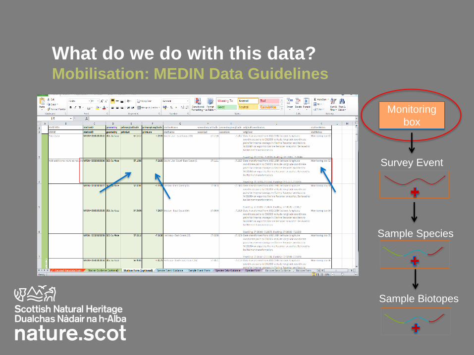
What do we do with this data? Mobilisation: MEDIN Data Guidelines
Monitoring
box
Survey Event
Sample Species
Sample Biotopes
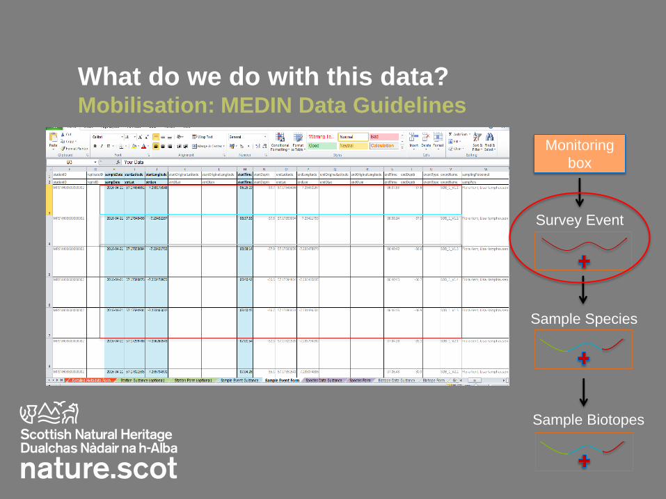
What do we do with this data? Mobilisation: MEDIN Data Guidelines
Monitoring
box
Survey Event
Sample Species
Sample Biotopes
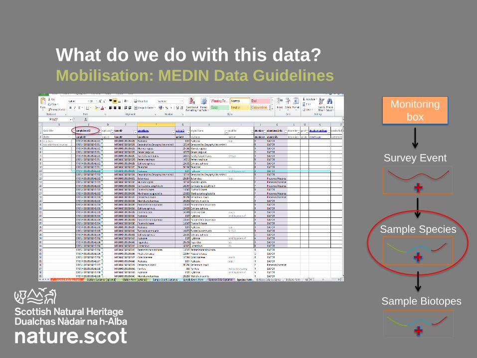
What do we do with this data? Mobilisation: MEDIN Data Guidelines
Monitoring
box
Survey Event
Sample Species
Sample Biotopes

What do we do with this data? Mobilisation: MEDIN Data Guidelines
Monitoring
box
Survey Event
Sample Species
Sample Biotopes
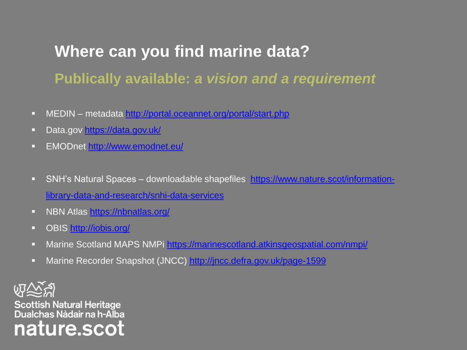
Where can you find marine data?
Publically available: a vision and a requirement
MEDIN – metadata http://portal.oceannet.org/portal/start.php
Data.gov https://data.gov.uk/
EMODnet http://www.emodnet.eu/
SNH’s Natural Spaces – downloadable shapefiles https://www.nature.scot/information-
library-data-and-research/snhi-data-services
NBN Atlas https://nbnatlas.org/
OBIS http://iobis.org/
Marine Scotland MAPS NMPi https://marinescotland.atkinsgeospatial.com/nmpi/
Marine Recorder Snapshot (JNCC) http://jncc.defra.gov.uk/page-1599
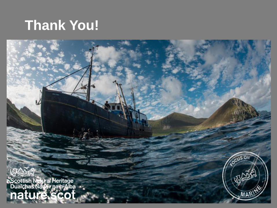
Thank You!

©SNH
Interactive Session Now it’s your turn!
Break into 8 groups?
Materials:
1 map of site location
Some background info on the survey
A spreadsheet of raw data
20 mins to work on the task (13:30 – 13:50)

Key outputs
1. Discovery metadata - summary table with essential survey details
required to understand:
What the dataset contains
Where the data were collected
How users can obtain the data
2. What is the key information that must be collected with each
sample to enable meaningful analysis and re-use of the dataset?
3. Draw up a survey design onto the site map based on the MEDIN
Guideline data spreadsheet provided and numerically summarise:
Location
Survey Event
Sample – showing biotope splits where necessary

How did you do? Discovery Metadata summary table
Discovery Metadata Field Description
Survey name 2016 SNH Sound of Barra underwater video SCM survey
Organisation Scottish Natural Heritage and Marine Scotland Science
Survey date 19/04/2016 to 22/04/2016
Vessel platform MRV Alba na Mara
Survey location Sound of Barra
Number of sites 9 boxes: 35 drop video drifts
Keywords Habitats and biotopes, species distribution,
Interest features Maerl (and seagrass) beds
Methods/equipment HD drop-down video camera
Dataset lineage/quality (processing
steps)
HD DDV equipment resolution 1920x1080 and lower res ‘nav’ camera 720x576;
time date position and depth overlay. Digital still photos at intervals. Depths
converted to below chart datum. Species identified using semi-quantitative
MNCR SACFOR scale. Transects split into segments at changes in biotope
using time/position data.
Contacts Scottish Natural Heritage data supply
Latitude/longitude, depth, time, date, event and sample ID
1.
2.
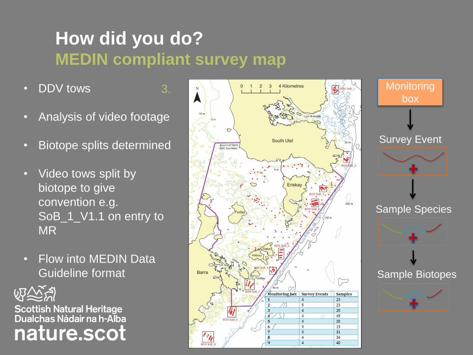
How did you do? MEDIN compliant survey map
Monitoring
box
Survey Event
Sample Species
Sample Biotopes
• DDV tows
• Analysis of video footage
• Biotope splits determined
• Video tows split by
biotope to give
convention e.g.
SoB_1_V1.1 on entry to
MR
• Flow into MEDIN Data
Guideline format
3.