Embed Size (px)
Citation preview
MODERN CENSUS in POLAND
Janusz DygaszewiczCentral Statistical Office in PolandGroup of Experts on Population and Housing Census
Geneva, 28-30 October 2009
• New implementation – mixed model• Acquisition of statistical data on-line• Solution architecture• The use of administrative sources • Geo-coding• Conclusions
Agenda
2
Mixed Model for Population and Housing Census
Mixed model - a combination of data from administrative sources with data
acquired on-line from statistical surveys
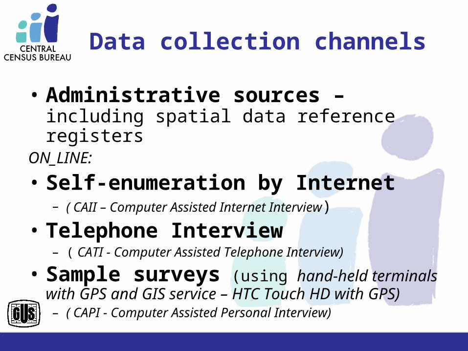
Data collection channels
• Administrative sources – including spatial data reference registers
ON_LINE:
• Self-enumeration by Internet– ( CAII – Computer Assisted Internet Interview)
• Telephone Interview – ( CATI - Computer Assisted Telephone Interview)
• Sample surveys (using hand-held terminals with GPS and GIS service – HTC Touch HD with GPS) – ( CAPI - Computer Assisted Personal Interview)
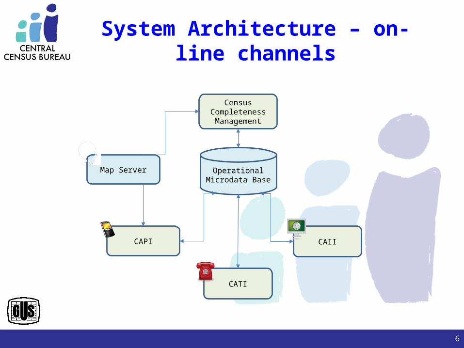
System Architecture – on-line channels
CAII
CATI
Map Server
CAPI
OperationalMicrodata Base
CensusCompletenessManagement
6
Supervisor – main actor
• Address Point and Census Area management• Data acquisition method choice (channels)
– CATI– CAPI
• Enumerator management– Census Area assignment– Address point assignment– Workday planning
7
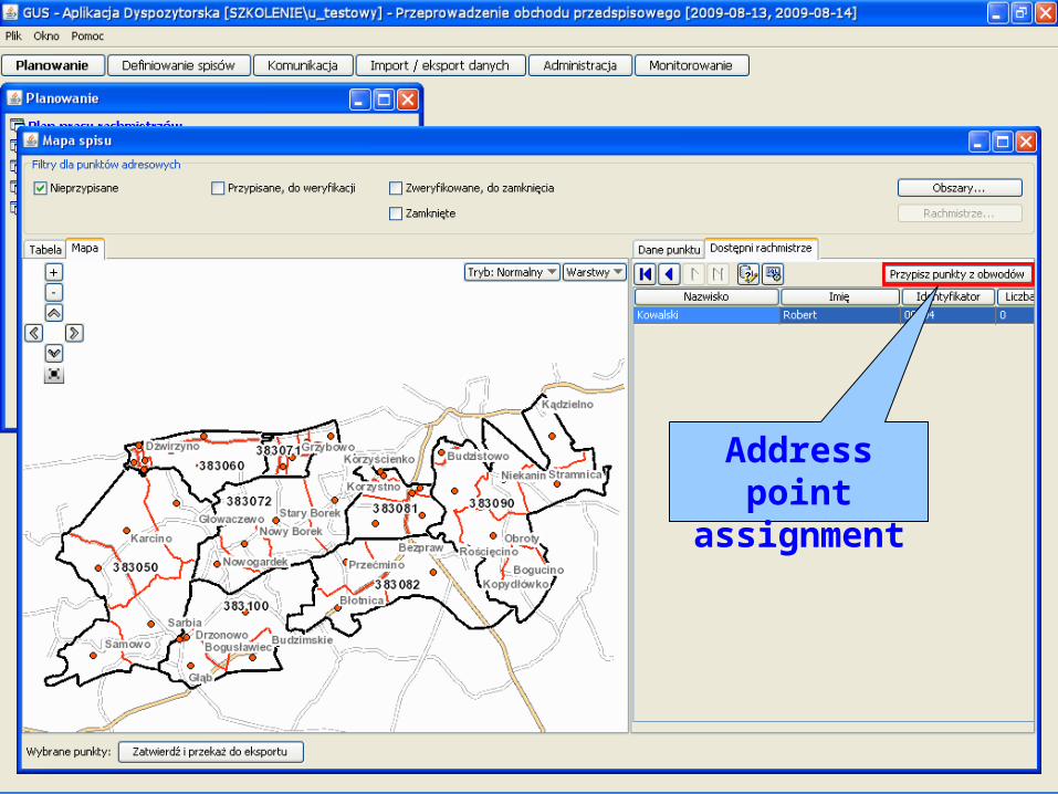
Address point assignment
Supervisor
• Questionnaire completeness analysis• Enumerator monitoring
– Census Progress– Localization and trail
• Census completeness monitoring• Emergency situation management
– Providing help for enumerators
• Providing necessary information to enumerators
9
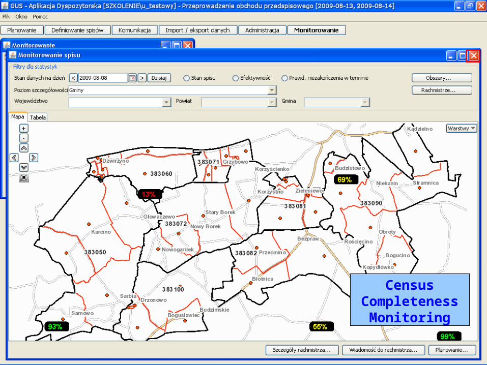
Census Completeness Monitoring
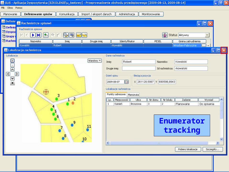
Enumerator tracking
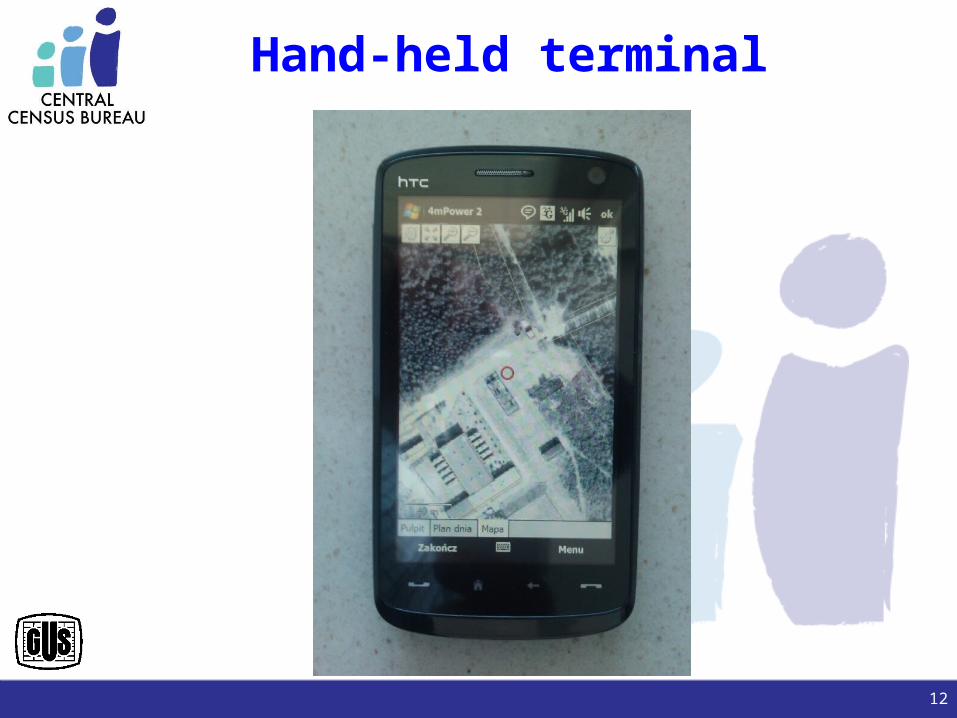
Hand-held terminal
12
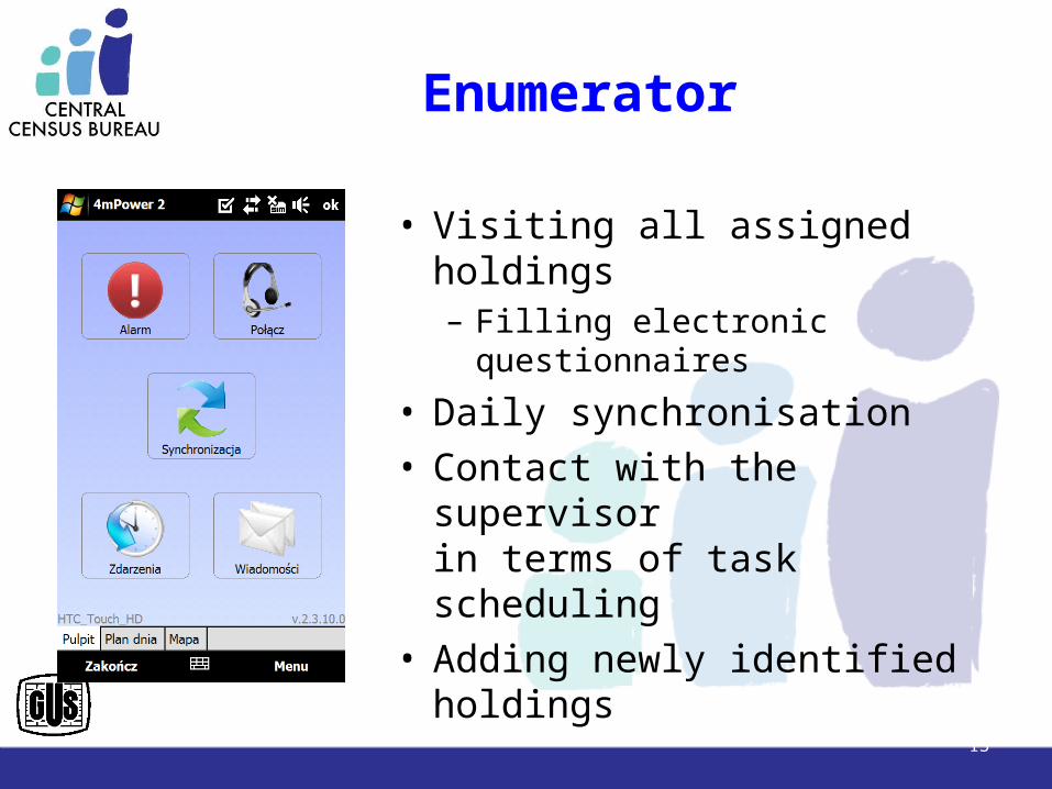
Enumerator
• Visiting all assigned holdings– Filling electronic questionnaires
• Daily synchronisation• Contact with the supervisor
in terms of task scheduling• Adding newly identified
holdings
13
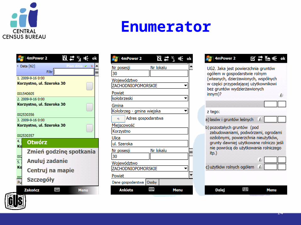
Enumerator
14
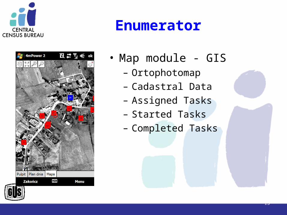
Enumerator
• Map module - GIS– Ortophotomap– Cadastral Data– Assigned Tasks– Started Tasks– Completed Tasks
15
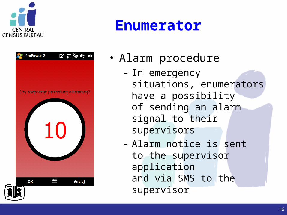
Enumerator
• Alarm procedure– In emergency situations,
enumerators have a possibilityof sending an alarm signal to their supervisors
– Alarm notice is sentto the supervisor applicationand via SMS to the supervisor
16
CENSUSData Processing Infrastructure
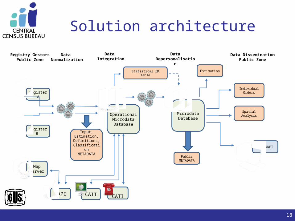
Solution architecture
18
CATICAII
Map Server
Register A
CAPI
MicrodataDatabase
OperationalMicrodataDatabase
Register B Input,
Estimation,Definitions,
ClassificationMETADATA
Statistical IDTable
Estimation
Public METADATA
Individual Orders
Spatial Analysis
INTERNET
Registry GestorsPublic Zone
Data Normalization
Data Integration
Data Depersonalisation
Data DisseminationPublic Zone
The Methodology of Linkage Data from Several Channels
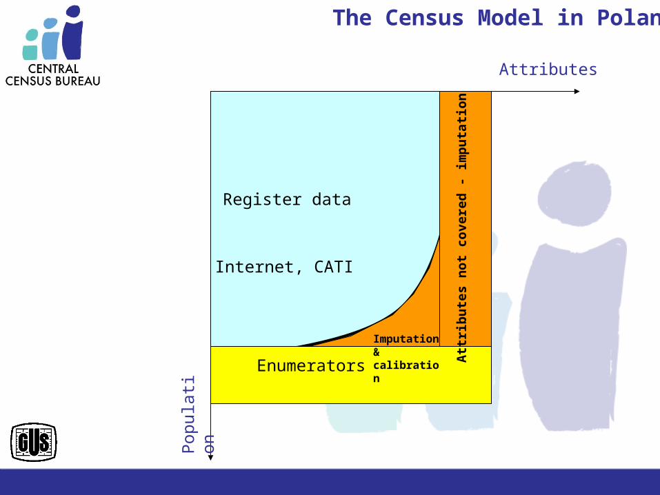
Pop
ulat
ion
Attributes
Register data
Enumerators
Imputation& calibration
Internet, CATI
The Census Model in Poland
Att
rib
ute
s n
ot
co
vere
d -
im
pu
tati
on
Pop
ulat
ion
Attributes
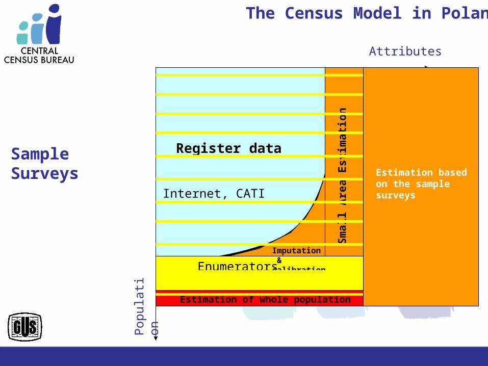
Register data
Enumerators
Sm
all A
rea
Est
imat
ion
Imputation & calibration
Internet, CATI
Estimation of whole population
The Census Model in Poland
Estimation based on the sample surveys
Sample Surveys
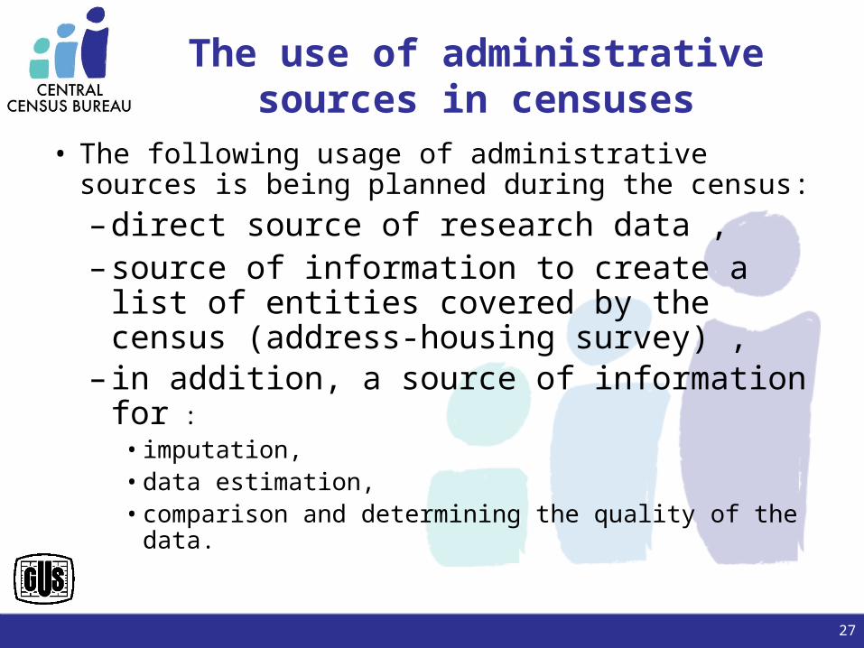
• The following usage of administrative sources is being planned during the census: – direct source of research data ,– source of information to create a list of
entities covered by the census (address-housing survey) ,
– in addition, a source of information for : • imputation, • data estimation, • comparison and determining the quality of the data.
The use of administrative sources in censuses
27
In Poland exist several hundred registers, but 3 of them could be pointed as the
base administrative registers
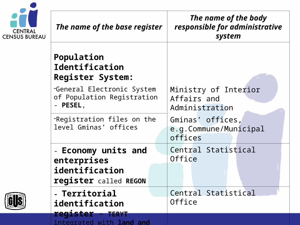
The name of the base registerThe name of the body responsible for
administrative system
Population Identification Register System:
General Electronic System of Population Registration - PESEL,
Ministry of Interior Affairs and Administration
Registration files on the level Gminas’ offices
Gminas’ offices, e.g.Commune/Municipal offices
- Economy units and enterprises identification register called REGON
Central Statistical Office
- Territorial identification register – TERYT integrated with land and building registers
Central Statistical Office
• This 3 base registers deliver unified identification system across other different registers and make it possible to integrate almost all administrative sources.
• Now, about 28 public registers were selected as administrative sources for census.
• Territorial Identification Register - TERYT is the most crucial for public statistics.
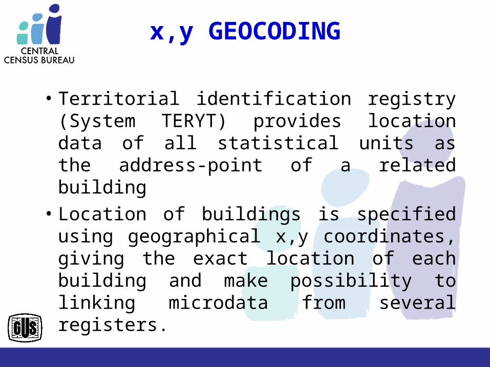
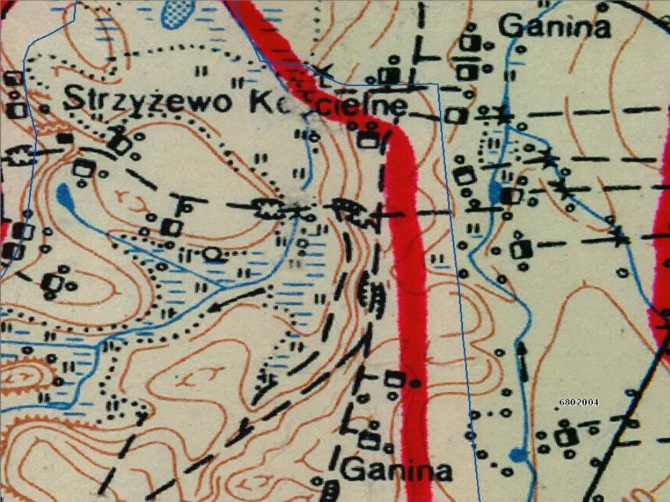
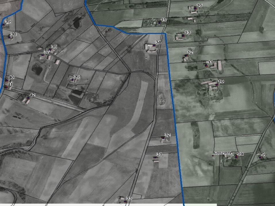
x,y GEOCODING
• Territorial identification registry (System TERYT) provides location data of all statistical units as the address-point of a related building
• Location of buildings is specified using geographical x,y coordinates, giving the exact location of each building and make possibility to linking microdata from several registers.
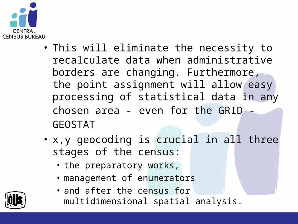
• This will eliminate the necessity to recalculate data when administrative borders are changing. Furthermore, the point assignment will allow easy processing of statistical data in any chosen area - even for the GRID - GEOSTAT
• x,y geocoding is crucial in all three stages of the census: • the preparatory works, • management of enumerators • and after the census for multidimensional spatial
analysis.
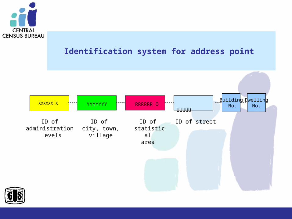
Identification system for address point
XXXXXX X YYYYYYY RRRRRR O UUUUUBuilding
No.Dwelling
No.
ID of administration
levels
ID of city, town,
village
ID of statistical
area
ID of street
5767
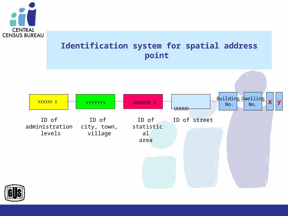
Identification system for spatial address point
XXXXXX X YYYYYYY RRRRRR O UUUUUBuilding
No.Dwelling
No.
ID of administration
levels
ID of city, town,
village
ID of statistical
area
ID of street
yx
5767
220 lat Statystyki PL
Dyrektor Projektu: J. Dygaszewicz 35220 lat Statystyki PL Dyrektor Projektu: J. Dygaszewicz 35
220 lat Statystyki PL
Dyrektor Projektu: J. Dygaszewicz 36220 lat Statystyki PL Dyrektor Projektu: J. Dygaszewicz 36
We expect that after the population census in 2011 spatial analysis, based on address point assignment, enable us to disseminate geostatistics data for more
than 40 000 settlements in Poland
Good cooperation between statistical services
and register-keepers are crucial for integration of
administrative data for statistical purposes.
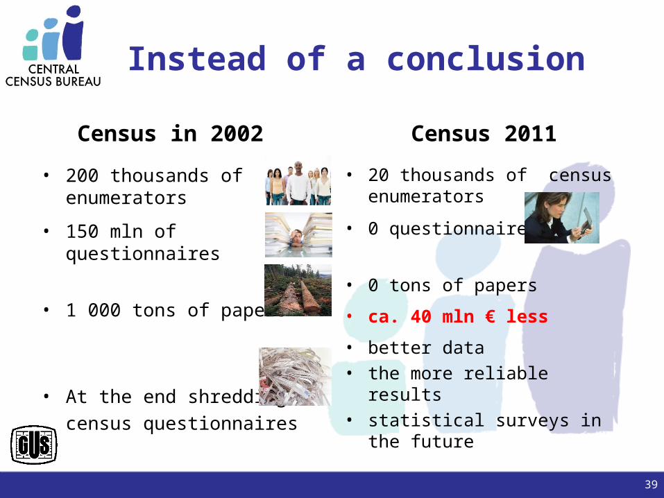
Instead of a conclusion
Census in 2002
• 200 thousands of census enumerators
• 150 mln of questionnaires
• 1 000 tons of papers
• At the end shredding census questionnaires
Census 2011
• 20 thousands of census enumerators
• 0 questionnaires
• 0 tons of papers
• ca. 40 mln € less
• better data• the more reliable results• statistical surveys in the future
39
Central Statistical Office - Poland
Thank you for your attention
Janusz Dygaszewicz
Central Statistical Office, PolandDirector of Central Census [email protected]