Embed Size (px)
Citation preview

Monitoring Global Change in Monitoring Global Change in Temperate Reef CommunitiesTemperate Reef Communities
• Larry Deysher – Ocean Imaging• Matt Edwards – San Diego State University• Jon Dykstra – Earth Satellite Corporation• Paul Dayton – Scripps Institution of Oceanography
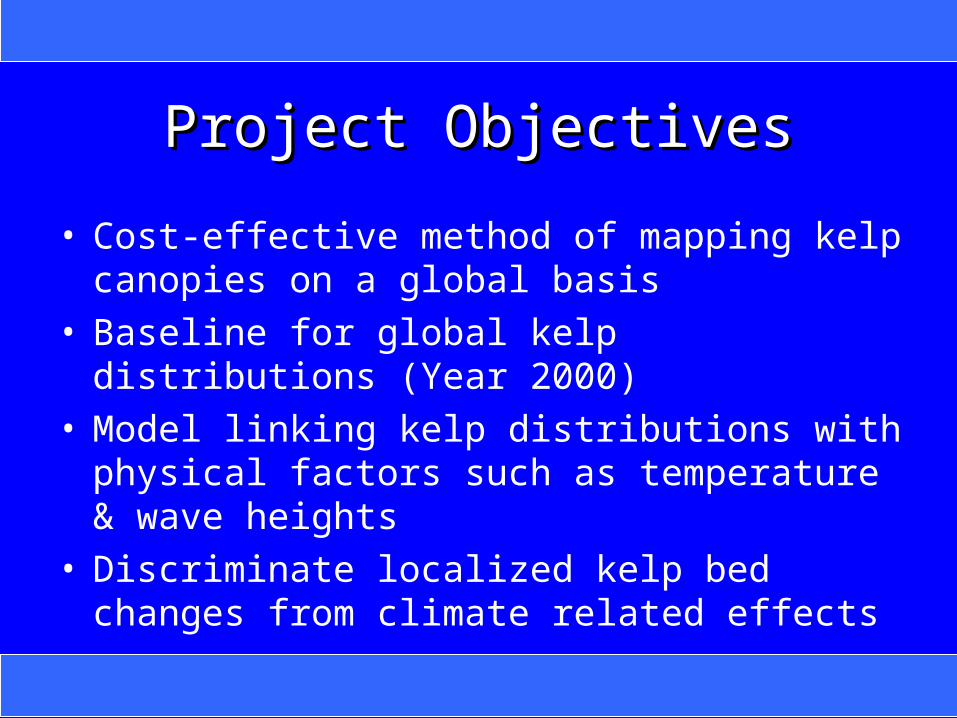
Project ObjectivesProject Objectives
• Cost-effective method of mapping kelp canopies on a global basis
• Baseline for global kelp distributions (Year 2000)• Model linking kelp distributions with physical
factors such as temperature & wave heights• Discriminate localized kelp bed changes from
climate related effects

Kelp Habitat StructureKelp Habitat Structure
Half–life 2 to 4 years Half–life 10’s to 100’s years
Photos: Mark Carr & Bill Bushing
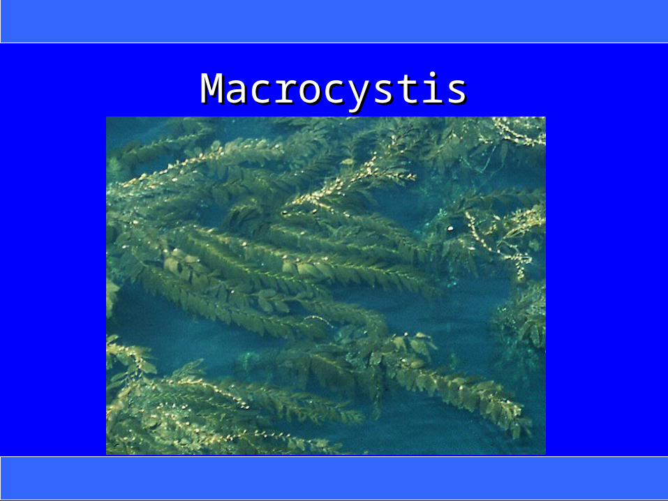
MacrocystisMacrocystis

NereocystisNereocystis
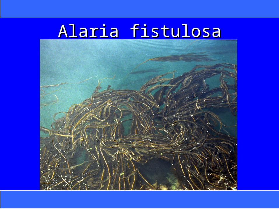
Alaria fistulosaAlaria fistulosa
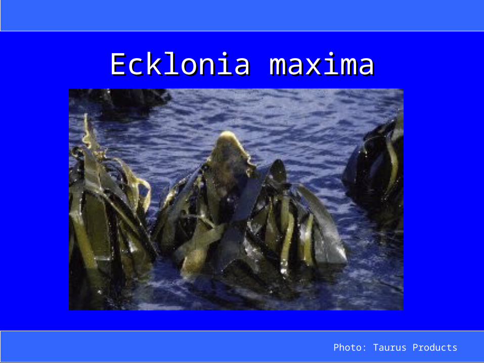
Ecklonia maximaEcklonia maxima
Photo: Taurus Products
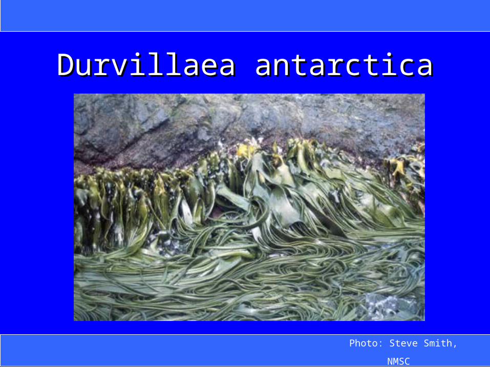
Durvillaea antarcticaDurvillaea antarctica
Photo: Steve Smith,
NMSC
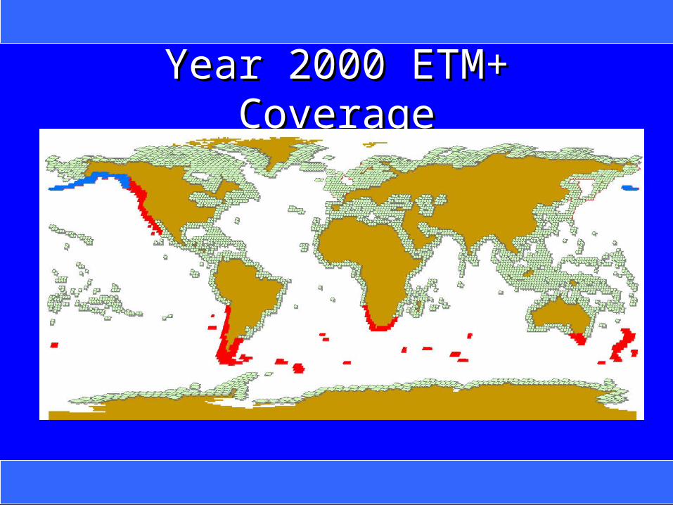
Year 2000 ETM+ CoverageYear 2000 ETM+ Coverage
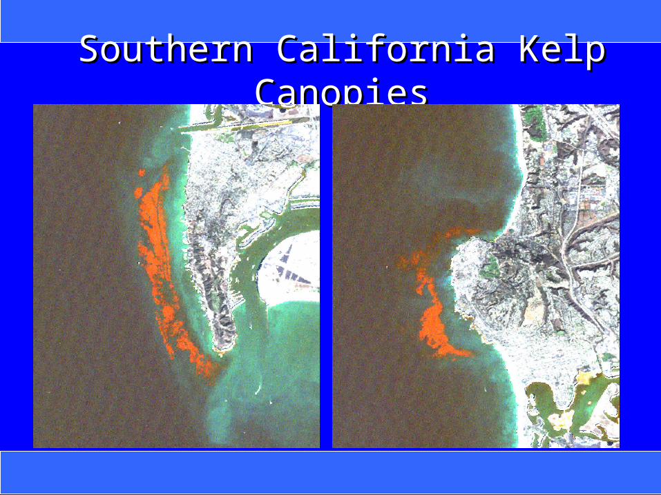
Southern California Kelp CanopiesSouthern California Kelp Canopies
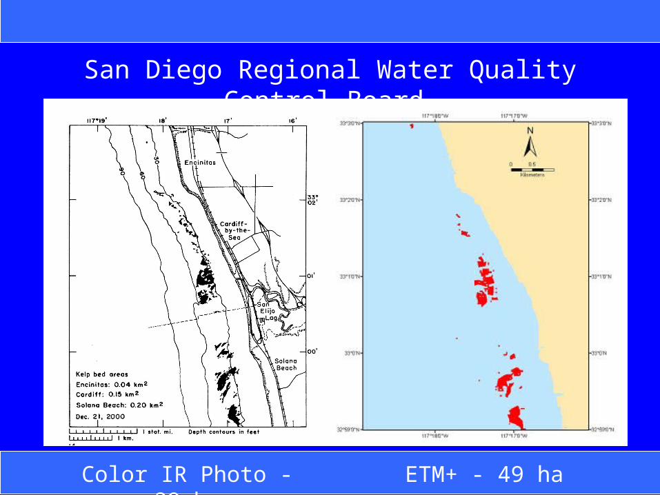
ETM+ - 49 haColor IR Photo - 39
ha
San Diego Regional Water Quality Control Board
Study AreaStudy Area


ETM+ 4 Aug 2002ETM+ 4 Aug 2002
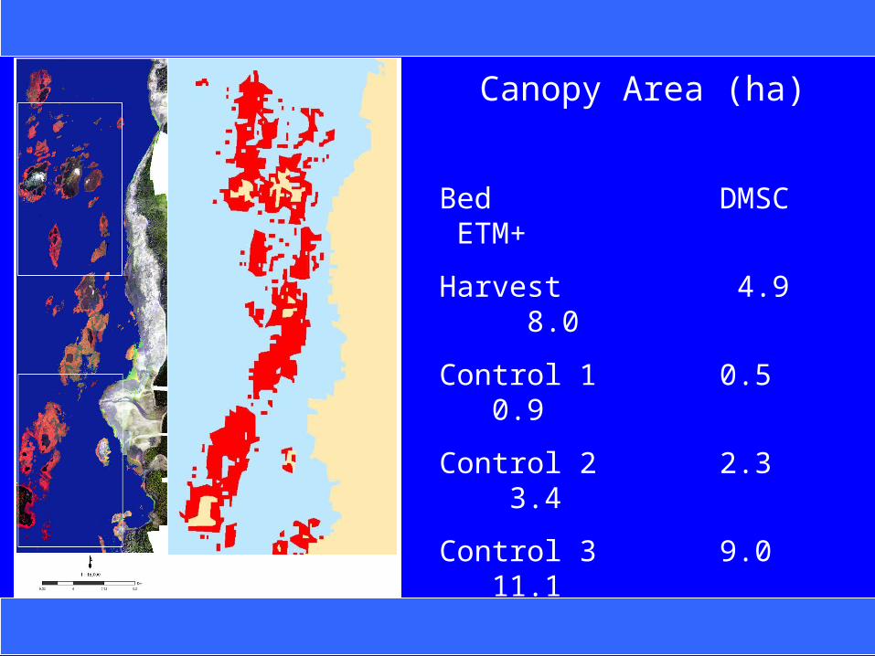
Canopy Area (ha)
Bed DMSC ETM+
Harvest 4.9 8.0
Control 1 0.5 0.9
Control 2 2.3 3.4
Control 3 9.0 11.1
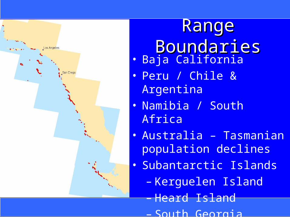
Range BoundariesRange Boundaries• Baja California• Peru / Chile & Argentina• Namibia / South Africa• Australia – Tasmanian
population declines• Subantarctic Islands
– Kerguelen Island– Heard Island– South Georgia Island
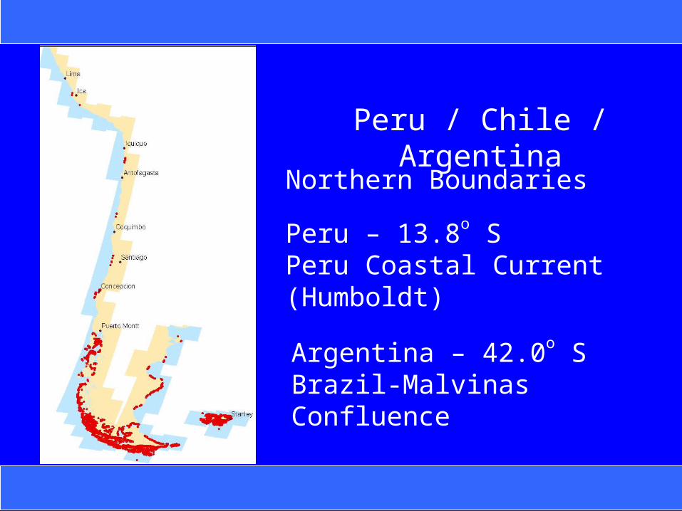
Peru / Chile / Argentina
Northern Boundaries
Peru – 13.8o SPeru Coastal Current (Humboldt)
Argentina – 42.0o SBrazil-Malvinas Confluence
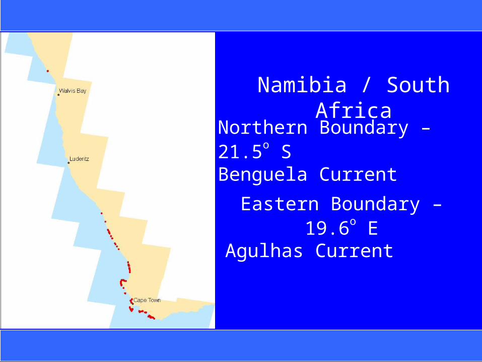
Namibia / South Africa
Northern Boundary – 21.5o SBenguela Current
Eastern Boundary – 19.6o E Agulhas Current
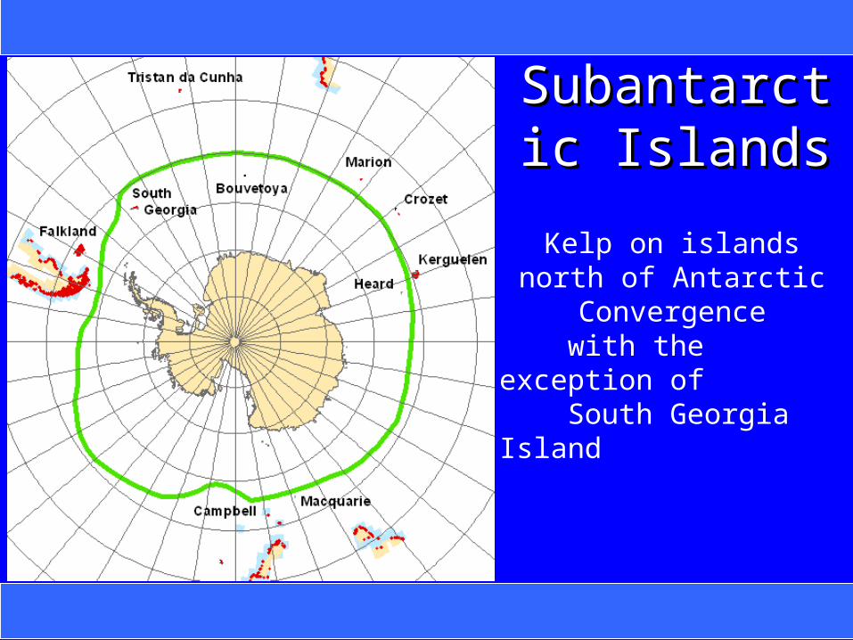
Subantarctic Subantarctic IslandsIslands
Kelp on islands north of Antarctic Convergence
with the exception of South Georgia Island
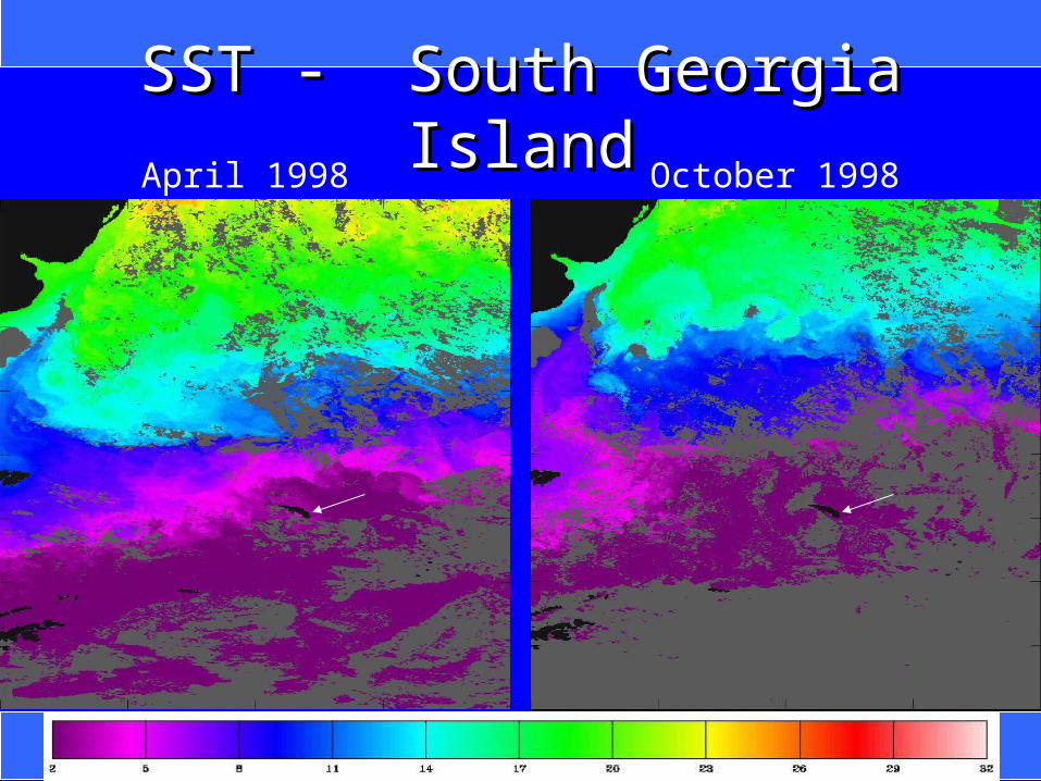
SST - South Georgia IslandSST - South Georgia IslandApril 1998 October 1998
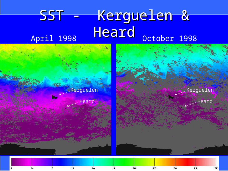
SST - Kerguelen & HeardSST - Kerguelen & HeardApril 1998 October 1998
Heard Heard
Kerguelen Kerguelen

SST Anomaly - Kerguelen & HeardSST Anomaly - Kerguelen & HeardApril 1998 October 1998
Heard Heard
Kerguelen Kerguelen
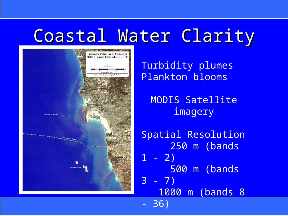
Coastal Water ClarityCoastal Water Clarity
Turbidity plumesPlankton blooms
MODIS Satellite imagery Spatial Resolution 250 m (bands 1 - 2) 500 m (bands 3 - 7) 1000 m (bands 8 - 36)

LaJolla Kelp Offshore ExpansionLaJolla Kelp Offshore Expansion
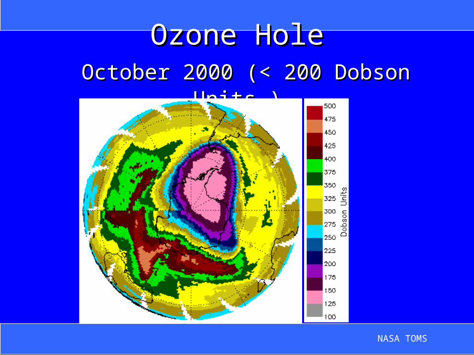
Ozone HoleOzone Hole October 2000 (< 200 Dobson Units )October 2000 (< 200 Dobson Units )
NASA TOMS

Isla de los EstadosIsla de los Estados
IIsla de los Estados
30 January 2001
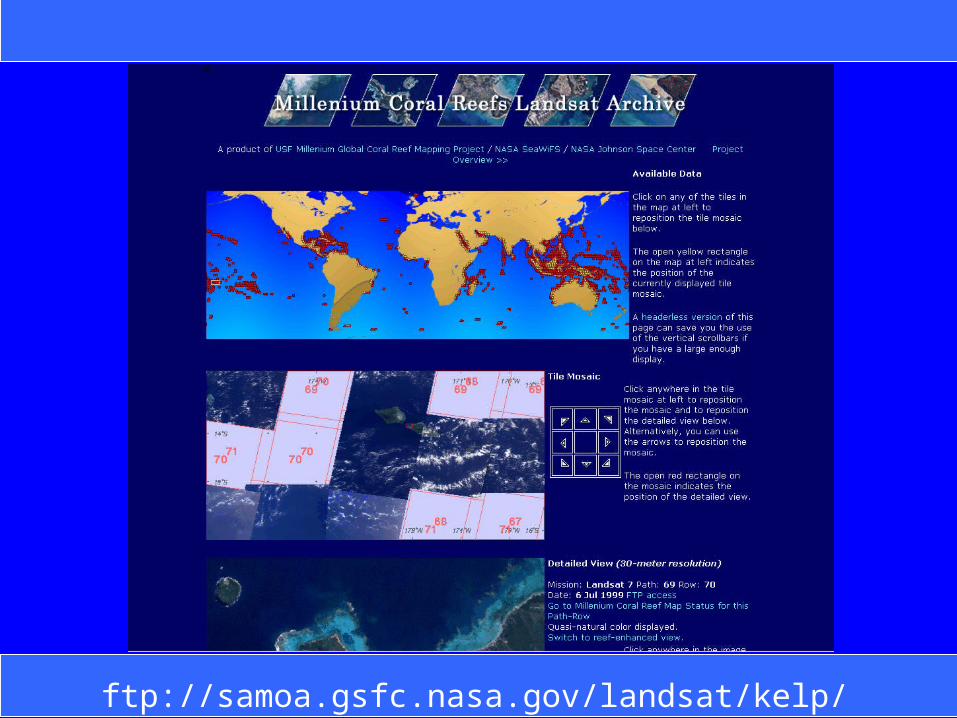
Data AvailabilityData Availability
ftp://samoa.gsfc.nasa.gov/landsat/kelp/