Embed Size (px)
Citation preview
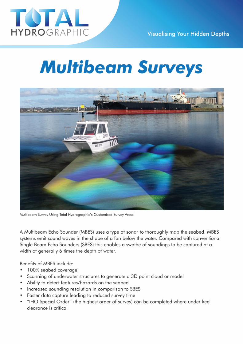
Multibeam Survey Using Total Hydrographic’s Customised Survey Vessel
Multibeam Surveys
Visualising Your Hidden Depths
A Multibeam Echo Sounder (MBES) uses a type of sonar to thoroughly map the seabed. MBES systems emit sound waves in the shape of a fan below the water. Compared with conventional Single Beam Echo Sounders (SBES) this enables a swathe of soundings to be captured at a width of generally 6 times the depth of water.
Benefits of MBES include:• 100% seabed coverage• Scanning of underwater structures to generate a 3D point cloud or model• Ability to detect features/hazards on the seabed• Increased sounding resolution in comparison to SBES• Faster data capture leading to reduced survey time• “IHO Special Order” (the highest order of survey) can be completed where under keel
clearance is critical
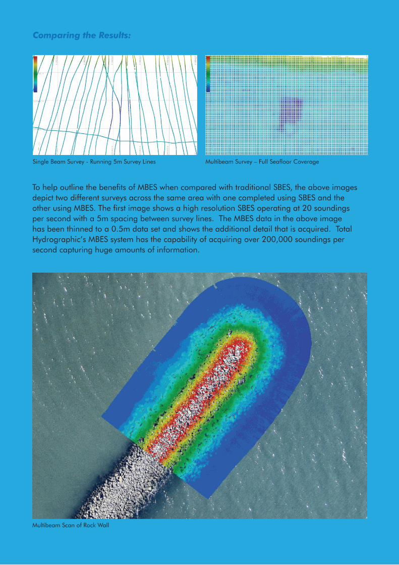
To help outline the benefits of MBES when compared with traditional SBES, the above images depict two different surveys across the same area with one completed using SBES and the other using MBES. The first image shows a high resolution SBES operating at 20 soundings per second with a 5m spacing between survey lines. The MBES data in the above image has been thinned to a 0.5m data set and shows the additional detail that is acquired. Total Hydrographic’s MBES system has the capability of acquiring over 200,000 soundings per second capturing huge amounts of information.
Single Beam Survey - Running 5m Survey Lines Multibeam Survey – Full Seafloor Coverage
Comparing the Results:
Multibeam Scan of Rock Wall
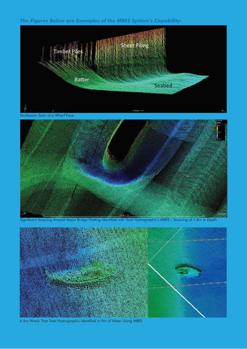
Multibeam Scan of a Wharf Face
Significant Scouring Around Major Bridge Footing Identified with Total Hydrographic’s MBES – Scouring of 1.8m in Depth
The Figures Below are Examples of the MBES System’s Capability:
A 6m Wreck That Total Hydrographic Identified in 9m of Water Using MBES
TOTAL HYDROGRAPHIC PTY [email protected]
www.totalhydrographic.com.au ACN: 604826708 ABN: 69604826708
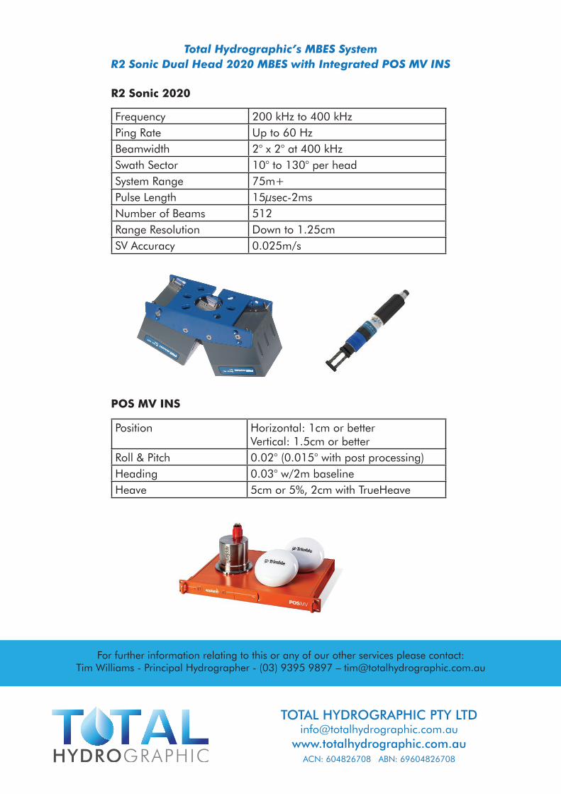
Frequency 200 kHz to 400 kHzPing Rate Up to 60 HzBeamwidth 2° x 2° at 400 kHzSwath Sector 10° to 130° per headSystem Range 75m+Pulse Length 15μsec-2msNumber of Beams 512Range Resolution Down to 1.25cmSV Accuracy 0.025m/s
Position
Horizontal: 1cm or betterVertical: 1.5cm or better
Roll & Pitch 0.02° (0.015° with post processing)Heading 0.03° w/2m baselineHeave 5cm or 5%, 2cm with TrueHeave
For further information relating to this or any of our other services please contact:Tim Williams - Principal Hydrographer - (03) 9395 9897 – [email protected]
Total Hydrographic’s MBES SystemR2 Sonic Dual Head 2020 MBES with Integrated POS MV INS
POS MV INS
R2 Sonic 2020