Embed Size (px)
Citation preview

1
Municipal Forest & Watershed Master Plan
Mayor and Board of Aldermen
Randy A. McClement, Mayor
Alderwoman Kelly Russell, President Pro Tem
Alderman Michael O’Connor
Alderman Phil Dacey
Alderman Josh Bokee
Alderwoman Donna Kuzemchak
Produced by:
The City of Frederick
Department of Public Works
140 West Patrick Street
Frederick, Maryland 21701
Telephone: 301.600.2843
www.cityoffrederick.com
Zack Kershner, P.E., Director of Public Works
Marc Stachowski, Deputy Director Operations
Jenny Willoughby, BCMA, Sustainability Manager

2
City of Frederick Ad Hoc Watershed Advisory Committee Members
Mark Boggs
Justin Collins
Ryan Delaney
Dave Diehl
Sally Fulmer
Clyde Hicks
Anthony Iacovelli
Dave Kalt
Mark Lawrence
Darius Mark
Pat Oliva
Kevin Sayers
John Switzer
Phillip vanWerkhoven
Joe Whitehair
*Special thanks to Maryland Department of Natural Resources for their partnership and
support in the management of the City Watershed.

3
Introduction
The City of Frederick Municipal Forest and Watershed, known as the Watershed to those who frequent
it, is more than 7,000 acres of forested land that protects one of the City’s four water supplies. Fishing
Creek Reservoir is solely under the City’s control and currently provides 11 to 14 percent of the water
supply. The Watershed also includes the headwaters of Tuscarora Creek watershed, home to a
genetically distinct brook trout population. Both Fishing and Tuscarora creek watersheds offer excellent
trout fishing opportunities within the Watershed and are some of the few remaining brook trout
streams in the region. The forest also is a Tree Farm, certified through the Maryland Tree Farm Program,
showing the City’s commitment to sustainable resources. In addition, the Watershed’s trail network
provides public access to green space and encourages stewardship.
This Master Plan serves to compile existing plans and assessments to create one overarching plan to
better manage the Watershed. It includes Maryland Department of Natural Resources (DNR) Forest
Stewardship Plan, trail assessments and sign schemes completed by the ad hoc Watershed Advisory
Committee, sustainable harvesting, prescribed burn plans, and other details necessary for maintaining
this space for superior water quality and water supply, offering recreational opportunities, and serving
as an educational and training ground for a variety of students.
Pine Swamp, one of the Watershed’s many ponds.

4
Water Quality and Supply
The primary purpose for the Watershed is maintaining water quality and supply. The first parcel of the
Watershed was purchased in 1870 and the first dam was constructed in 1899. The clearing for the
current reservoir location was completed in 1923 and the reservoir constructed in 1924. The current
capacity of the Reservoir is 50 million gallons.
The reservoir has lost some of its capacity from sedimentation since its construction. However, it has
never been dredged and water quality remains excellent. Hood College faculty and students completed
a bathymetric study of the reservoir to determine how much sediment had accumulated and where. It
was determined that about 7.9 million gallons of storage volume had been lost due to sediment
deposition.
According to the report, dredging along the original Fishing Creek channel and along the dam should
restore most of the capacity to the reservoir. This should be considered for inclusion in the budget in the
next five years to regain storage capacity (Appendix H).
Maintaining control of this water supply is critical to the City’s sustainability and resiliency. Linganore
Creek, Monocacy River, and the interconnection along the Potomac River, the City’s other water
supplies, are all outside the control of the City.
Fishing Creek

5
Tuscarora Creek watershed headwaters are located in the lower portion of the Watershed, where they
are protected from development. According to the Upper Monocacy River Watershed Restoration
Action Strategy, Tuscarora has a high percentage of eroded stream banks and highly erodible soils.
Crews walked 21.04 miles of stream and noted that about 60 percent had inadequate buffers, all located
downstream of the Watershed. The report stated that “the lower portion of the subwatershed is also
facing development pressures from Frederick City as well as an increase in impervious surfaces.”
Fishing Creek watershed headwaters are located in the middle and upper portions of the Watershed.
Downstream of the Fishing Creek Reservoir, crews walked 19.52 stream miles and noted that about 36
percent had inadequate riparian buffers and that about 25 percent had eroded banks.
Both Tuscarora and Fishing creek watersheds are Monocacy tributaries, one of the City’s water supply
sources. The City’s Monocacy intake is downstream of the confluence of both Fishing and Tuscarora
creeks and other tributaries. Our upstream choices to protect and preserve these forested lands will
have a direct impact on water quality and supply at the intakes downstream.
Brook trout caught in Frederick County, Md. Photo: John Mullican, Maryland DNR Fisheries Service

6
According to the “Eastern Brook Trout: Status and Threats” report by the Eastern Brook Trout Joint
Venture, “brook trout serve as indicators of the health of the watersheds they inhabit.” Further, “a
decline in brook trout populations can serve as an early warning that the health of the entire system is
at risk.” Both Fishing and Tuscarora watersheds support brook trout in their headwaters because those
areas are forested and protected, but downstream sections lack adequate riparian buffers. According to
the Venture’s report, the population is greatly reduced in these watersheds overall. However, the
reported noted that “As forests regrow and the state pursues more creative ways to reduce stormwater
runoff, reestablish streamside forests and improve water quality in the Chesapeake Bay watershed, the
potential for restoring brook trout in Maryland is strong.” Our protection of these headwater resources
is equally as critical as working to protect their downstream reaches for both water quality and supply.
Forest Products
The City was designated as a Tree Farm, the largest in the state, in 2016. The Tree Farm designation
indicates that forest products harvested from the Watershed in a sustainable manner. In previous years,
timber was harvested in areas that were easily accessible and not near critical habitat. Moving forward,
harvest operations will be completed to develop a forest with a balanced distribution of tree ages, sizes,
and species that can eventually provide a more even flow of forest products. Harvesting can help thin
forest stands and make certain trees more valuable in the future by reducing competition. Harvesting
also can reduce undesirable tree species and help reduce fuel loads.
A forest stand in the Watershed with oaks and understory

7
Following the gypsy moth infestation in the 1980s, many oaks were lost. From 1985 to 1991, about 546
acres of gypsy moth-killed forest were harvested as firewood by homeowners in the Frederick area
(Appendix A). Maryland DNR Foresters suggest that some areas of the Watershed would benefit from a
firewood harvest in the coming years (Appendix I).
Roads
Much of the sediment accumulation in Fishing Creek Reservoir is because of the roads. All roads in the
Watershed are currently owned and maintained by Frederick County. Many of the roads in the
Watershed are in poor condition, including severe rutting, potholes, and washouts in the gravel sections.
Delauter Road ford across Fishing Creek
Of particular concern is Delauter Road. This road fords Fishing Creek above the reservoir and is a major
contributor to gravel and sediment from the roadway to the creek. Its connection to the internal road
system serves no purpose except to offer an opportunity for off-road vehicles to play in the waterway.
Delauter Road also connects to Gambrill Park Road on the west side. Maryland DNR and the ad hoc
Watershed Advisory Committee suggested the road be closed to all traffic from the end of the private
driveway to its connection with Fishing Creek Road, about half of the road length. It should be noted
that Delauter Road will receive upgrades according to the Pennsylvania Dirt and Gravel Roads standards

8
through a grant awarded to Frederick County, but this patch will not last long with the off-roading
traffic.
The City has made great strides in reducing the off-road vehicles that cross waterways, which contribute
to sediment deposition. Much of the off-roading traffic accesses trails connected to Right Hand Fork
(eastern portion of Gambrill Park Road), Fishing Creek, Cold Deer (southern portion of Fishing Creek),
and Delauter roads. City staff suggests gaining control of Right Hand Fork, Cold Deer, Fishing Creek, and
Delauter Roads in an effort to better manage traffic, reduce dumping, and control off-road vehicles in
this area. These internal roads, except for half the length of Delauter Road, do not serve a purpose to
the neighboring community. However they do serve a purpose to certain legitimate Watershed user
groups and in case of medical emergency in the Watershed.
One of many mud-bogging spots along Gambrill Park Road (Right Hand Fork)
Staff suggests gates for visitors on these roads, requiring a swipe card to gain entry. This would allow
staff to know who is entering these critical areas and when, but still allow public access (Appendix D).
Staff understands that fishermen and hunters may be opposed to this because it would be a fee in
addition to their license, however, it is imperative to understand the value of the experience the City
hopes to provide.
By requiring a swipe card for these roads, traffic will be reduced to users who are specifically interested
in gaining entry to these areas in a vehicle for hauling out animals, shuttling bicycles, and carrying
equipment. Coincidentally, these also are the areas staff has seen the most dumping and off-road
9
violations. Access through the sanctioned trail network via foot and bicycle would not be restricted. In
addition, there are parking and trail access alternatives outside this proposed card-restricted zone.
Sensitive Species
The well-managed forests and excellent water quality mean that the Watershed provides habitat for a
variety of animals and plants, some of which are rarely found elsewhere. The Watershed is home to 36
sensitive species, of which, 22 are threatened and endangered species. The original Maryland DNR
assessment in 2005 included 14 sensitive species, 12 of which are rare, threatened, or endangered.
An example of habitat that might be home to the Watershed’s sensitive animal species.
Based on these continued assessments, the Watershed trail network will be amended to provide buffer
zones around critical habitat areas to the extent it is practicable. Some existing DNR fire roads cross
critical habitat. Smaller trails that branch into critical habitat from these fire roads will be rerouted or
closed to better direct users to more appropriate areas.
The majority of sensitive species are located in the middle and northern portions of the watershed, as
noted in the DNR Review of Recreation Committee Proposal. Specific locations of sensitive species are
not available to the general public. The City proposed a sanctioned trail network that takes into
10
consideration both the ad hoc Watershed Advisory Committee trail assessments and DNR’s
recommendations for trail locations, trail reroutes, and stream crossings (Appendix A and E).
Invasive Species
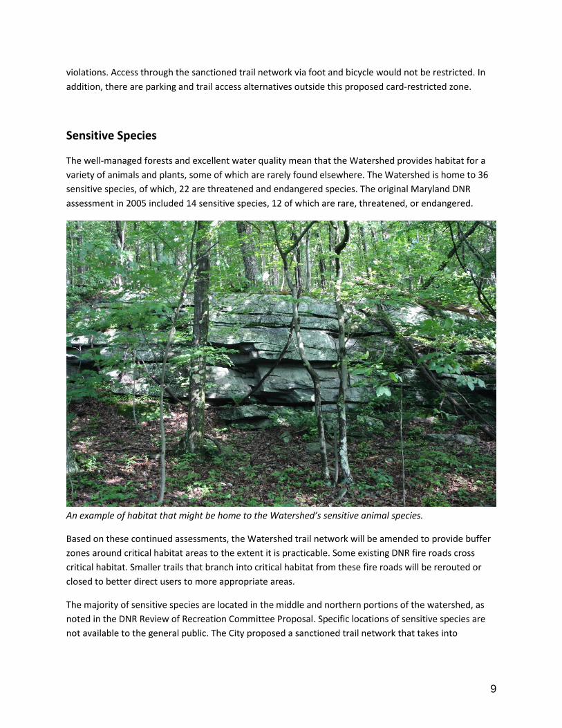
Maryland DNR Watershed Foresters and other DNR staff assist the City in on-going management of
invasive plant species, such as Japanese hops, tree-of-heaven, and Japanese barberry. In addition,
invasive insect pests such as hemlock woolly adelgid and gypsy moth pose a problem for forest health.
Bush honeysuckle, one of many invasive species in the Watershed.
Because of our proximity to the City and residential areas that do not require invasive species
management, seeds and rhizomes from invasive plants are carried into the Watershed by animals and
humans. Invasive insect pests often fly in from surrounding areas. To maintain the water quality of the
Watershed, we must maintain the quality of the forests.
Certain invasives need routine management, while others, like the gypsy moth, are more cyclical. The
DNR anticipates that 2017 will be a population boom for the gypsy moth and the treatment threshold
may be met. In this case, we may share in the resource costs for treatment with our state park
neighbors because all the forests on Catoctin Mountain will need care (Appendix A).

11
Fire
The DNR’s 2005 Forest Stewardship Plan indicates that fire, specifically prescribed burning, would be an
effective tool to better manage the tree species in the forest and encourage regeneration. The DNR’s
Forest Stewardship Plan states that “Fire has long played a role in the development of the forest
historically found on the Watershed, and prescribed burning could re-create some of these same
effects.”
While there has not been a prescribed burn to date, fire lines have been created near one of the
Watershed’s ponds in preparation for a burn. This burn was proposed specifically to aid in pitch pine
regeneration. The pitch pines in this area are at the end of their lifespan and require burning to
regenerate properly. A prescribed burn in this area also would also help oak regeneration.
Prescribed burn can help regenerate certain species and reduce fuel loads. Photo: MD DNR Forest Service
There are several areas in the Watershed that also would benefit from prescribed burning for fuel
reduction. With assistance from DNR Forest Service fire personnel, any burn would be well-planned and
well-staffed.
The largest forest fire in the Watershed broke out in 1930 and burned about 2,500 acres of the
Watershed. Prescribed burns in specific areas allow DNR staff to reduce fuels and regenerate species at
a time when fire can be managed. Those areas that are managed through prescribed burns are less likely
to produce a catastrophic fire (Appendix A).

12
Law Enforcement
The ad hoc Watershed Advisory Committee assisted the City in developing rules and a Watershed Rules
sign, which has been placed at parking areas throughout the Watershed. For many years, very little
enforcement has occurred in the Watershed.
The City now has contacts at both Frederick County Sheriff’s Office (FCSO) and the DNR Natural
Resources Police (NRP) for non-emergency situations. Following the last reports of traps on the trails in
fall 2015, FCSO assigned the City a detective to assist with strategies for eliminating this activity.
Beginning in 2015, FCSO and NRP provide monthly reports of calls and patrols to better understand
what sorts of issues might need to be addressed and where. Recent calls include controlled substance
violations, trespassing, fishing and hunting license checks, sex offenses, warrant service, traffic stops,
suspicious vehicles, and vehicles in the Watershed after hours.
In addition to patrols by law enforcement officers, citizens and volunteers regularly report off-road
vehicles and provide documentation, report trash and dumping, and other illegal behavior.
An example of dumping in the Watershed
Cameras were placed throughout the Watershed and have captured a number of off-road vehicles.
Anyone caught in a vehicle on trails or destroying the sides of the roads (also called mud-bogging),

13
dumping trash, or other property crimes on camera is first issued a warning letter and additional
violations will result in permanent trespass from the Watershed property for any use. Cameras also have
captured good behavior, such as trash collection. Staff will continue to use cameras to better manage
the Watershed and help inform law enforcement about hotspots.
Recreation Updates to Forest Stewardship Plan
The existing Recreation section of the DNR Forest Stewardship Plan was brief and did not provide
recommendations for managing the various user groups in the Watershed. While many of the trails in
the Watershed were created without permission, most are sustainable and only need small reroutes to
avoid habitat or tread issues (Appendix B).
The ad hoc Watershed Advisory Committee developed an extensive Recreation section as an addendum
to the existing DNR Forest Stewardship Plan that includes all known user groups. In addition, they
developed a trail assessment tool based on U.S. Forest Service trail assessment worksheets to evaluate
every trail mile that would be maintained by the City and its selected trail maintenance organization.
A trail in the Watershed

14
The Committee also proposed several standards from the U.S. Forest Service and International
Mountain Biking Association that the City approved to manage, repair, and build trails. These standards
will be applied to all trails in the Watershed.
Proposed Trail Network
The ad hoc Watershed Advisory Committee conducted trail assessments in fall 2015. These assessments
evaluated the tread, erosion issues, technical features, such as jumps, stream crossings, and slope to
determine which trails were sustainable from a maintenance perspective. These assessments were all
completed by knowledgeable volunteers and were used in determining which trails the Committee
proposed keeping in a sanctioned trail network.
The City then asked DNR to evaluate the trails from a habitat perspective. Their proposed trail network
closed trails that crossed sensitive habitat or private land.
The City reviewed each groups’ data sets and created a proposed sanctioned trail network (Appendix C)
that maintains habitat and water quality while providing a unique recreational experience to many user
groups. The City held a meeting with representatives from DNR and the City’s selected trail maintenance
organization, Mid-Atlantic Off-road Enthusiasts (MORE), to determine an implementation strategy.
The proposed sanctioned trail network includes 44 trail miles, about 37 of which are cross-country or
gently rolling grade trails for all trail users and about 7 of which are gravity trails specifically for the
downhill biking community. This trail network provides most of the trail experiences in the lower portion
of the Watershed because there are far fewer critical habitats in this section, per the DNR Review of
Recreation Committee Proposal. This also is the section where most of the gravity trails will be moved
for the same reason.
The middle section of the Watershed will see a near-complete reroute of the Catoctin Blue Trail onto
two adjacent trails. In addition, a network of trails that cross critical habitat will be closed and those
experiences offered in the lower portion of the watershed.
The upper section of the Watershed will see the most significant closures with the majority of the trails
in the northeast quadrant closed because of critical habitat for timber rattlesnakes and endangered
species.
Staff proposes to reroute, update, and build trails in the lower section of the Watershed, trails south of
Hamburg Road in the first year so we can direct users to those trails. Staff understands that closing a
trail without offering a similar experience elsewhere will not solve the problem of unsanctioned trail
building. As we offer better experiences in the south, more users will migrate to those trails, reducing
the enforcement issues on closed trails in the middle and upper watershed. Staff proposes repair and
closure of trails in the middle Watershed, from Hamburg Road to the south up to the junction of the
Catoctin Blue Trail with Fishing Creek Road in year two, and the upper Watershed, north of the junction
15
of Catoctin Blue Trail with Fishing Creek Road in year three. Should time allow, some tasks from years
two and three may be completed earlier.
As trails are rerouted and repaired, MORE volunteers will blaze them. In addition, posts will be placed at
trail junctions within the network and kiosks placed at major trailheads and road intersections. The ad
hoc Watershed Advisory Committee suggested adopting the new Maryland Park Service trail guidelines
because the Watershed is bounded to the north and south by state parks. Consistency in blazing and
signs will create a better user experience and will make it easier for medical personnel to locate injured
people in case of an emergency. As of June 2016, the guidelines are version 1.1, however, they may
change and staff will request updated versions periodically (Appendix F).
The Watershed Ad Hoc committee also proposed an Adopt-a-Kiosk program to help reduce trash in the
watershed, maintain informational kiosks, and reduce vandalism. The proposal is similar to Adopt-a
Road and Adopt-a-Trail programs in that kiosks are adopted by local businesses or organizations who
agree to pick up trash and maintain the kiosk at designated intervals throughout the year. Kiosks will be
located in parking areas and along trails between the boundaries of state park land and City Watershed
land (Appendix G).
Businesses or organizations will pay the initial one-time fee to install appropriate native plants around
the kiosk. Plants will be purchased by the City, but planted and maintained by the business or
organization. Fees were determined based on the size of the kiosks proposed (large and small) and the
number of plants needed to fill in the area. The fee also covers the cost of a small nameplate that will be
posted on the leg of the kiosk. If the club or business chooses not to continue to maintain the kiosk, the
nameplate can easily be removed.
City staff suggests requiring a special use permit for large events in the Watershed. In future years, the
City might explore a fee that applies to groups collecting a registration fee for their event. As an
example, National Parks require a special use permit and daily fee for events that have an entry fee and
that occur within specific areas of the Park. Also a consideration for the future, a parking or other fee
might help offset the cost of maintaining the roads and parking areas in the Watershed. Fees also might
be used as matching funds for trail maintenance grants.
Gambrill and Cunningham state parks use a similar system in which local scouts, clubs, and businesses
adopt specific trails to maintain. The benefit is that we will have more stewards caring for the
Watershed and reporting on issues such as vandalism, illegal activity, and large trash items.

16
Projects Overview—Future Improvements
Water Quality and Supply
Dredge Fishing Creek Reservoir to restore approximately 7.9 million gallons of storage capacity
lost due to sediment deposition by 2022. Estimated cost from dredging is about $3.9 million for
dredging with an additional $1 million for permits, land and easements, and trucking.
Gain control of Delauter Road and close section beyond private residence to eliminate creek
crossing in critical trout habitat and reduce sediment deposition by 2022.
Forest Products
Continue following Forest Stewardship Plan and any future iterations thereof to maintain and
improve forest stand health.
Harvest timber and pulpwood as recommended by Maryland DNR.
Allow for firewood sales in appropriate areas as recommended by Maryland DNR, beginning
with a small number of permits offered in summer 2017.
Roads
Gain control of Delauter, Fishing Creek/Cold Deer, Gambrill Park Road (Right Hand Fork section),
and portion of Mountaindale Road from Frederick County by end of 2018 fiscal year. Estimated
cost for roadway maintenance for the 11.5 miles of roadway is $21,000 per year.
Install gated access points at the entry of each controlled road section to continue public access,
but better understand who is using the area, and reduce dumping and mudbogging by end of
2019 fiscal year. Estimated cost for initial installation of gated access points is about $15,000
with about $1,000 estimated yearly maintenance costs.
Create dedicated equipment operator position for road, parking area, kiosk, and trail marker
maintenance for 2019 fiscal year. Estimated cost for an equipment operator is about $85,000
per year for salary and benefits.
Sensitive Species
Continue to work with Maryland DNR to protect critical habitat for the Watershed’s rare,
threatened, and endangered species.
Invasive Species
Continue to work with Maryland DNR to address the invasive species in the watershed to
improve forest health.
Fire
Continue to follow guidelines in the Forest Stewardship Plan and any future iterations thereof,
to improve forest health, reduce fuel loading, and regeneration with prescribed fire.
17
Follow Maryland DNR guidance on suggested prescribed burn locations that might not have
been planned, but whose need for burning becomes apparent.
Maintain close communication with Maryland DNR to establish emergency communications in
case of wildfire in the Watershed.
Law Enforcement
Continue to maintain and replace rule and other signs as needed.
Maintain close communication with Maryland Natural Resources Police and Frederick County
Sheriff’s Office to better direct City resources to address continuing issues.
Continue to place cameras in hotspot areas to capture offenses and submit to police resources
for further investigation.
Recreation Updates to Forest Stewardship Plan
Trail assessment tool and matrix aided in the assessment of trails and can continue to serve as
framework to do so in the future.
Addressed and acknowledged multiple user groups in the Watershed who value the space for
recreation and understand the importance of water quality and supply.
Proposed Trail Network
Proposed network is preliminary and may need to be tweaked on the ground as trails are
rerouted, closed, and reworked.
The network may need to change periodically to accommodate critical habitat areas or overuse
of specific trails.
Trails will need periodic assessment and maintenance to ensure they are well-marked, not
damaging habitat, contributing to sedimentation in streams, or that the trail itself is not
damaged from use.
The proposed initial network of trails consists of 44 trail miles, 37 of which are cross-country or
gently rolling grade trails, and 7 of which are gravity trails. Adjustments may need to be made as
these trails are restored and rerouted on the ground, though it should not result in significant
changes to trail miles. The initial trail network is expected to be completed by end of summer
2018. Trail tread maintenance materials will have an initial cost of about $5,000 for the first
three years and then $2,000 per year thereafter.
Trailhead and Watershed entry kiosks will be installed by the City and maintained by businesses
or organizations through an Adopt-a-Kiosk program, similar to Adopt-a-Road and Adopt-a-
Stream. Kiosks and trail markers will be installed by end of summer 2018. Kiosks and markers
will have an initial cost of about $10,000, and an annual maintenance cost of about $1,000.
Special use permits and associated fees should be explored.
Create advisory committee, including DNR representatives, one hunter, one runner, one
equestrian, one fisherman, one naturalist/birder/hiker/organized group, a MORE liaison, and

18
two staff from DPW Operations and Sustainability. Other staff and outside assistance will be
requested as needed. This committee can be created at the beginning of the 2018 fiscal year.
19
Resources
Source Water Assessments for City of Frederick: Frederick County, Maryland
http://www.mde.state.md.us/programs/Water/Water_Supply/Source_Water_Assessment_Program/Do
cuments/www.mde.state.md.us/assets/document/watersupply/SWAPS/Frederick/City%20of%20Freder
ick.pdf
Upper Monocacy WRAS
http://www.cbtrust.org/atf/cf/%7Beb2a714e-8219-45e8-8c3d-
50ebe1847cb8%7D/UPPER%20MONOCACY%20RIVER%20WRAS.PDF
Eastern Brook Trout Joint Venture
file:///C:/Users/jwilloughby/Downloads/brookiereportfinal-1-%20status%20and%20threats.pdf