Embed Size (px)
Citation preview
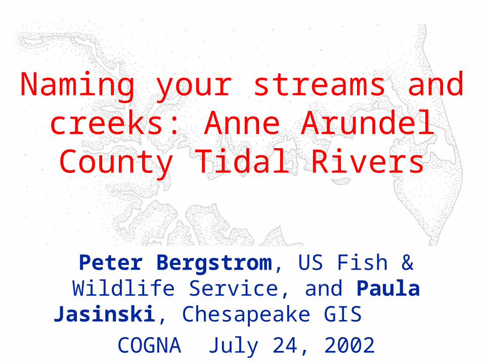
Naming your streams and creeks: Anne Arundel County Tidal Rivers
Peter Bergstrom, US Fish & Wildlife Service, and Paula Jasinski, Chesapeake GIS
COGNA July 24, 2002
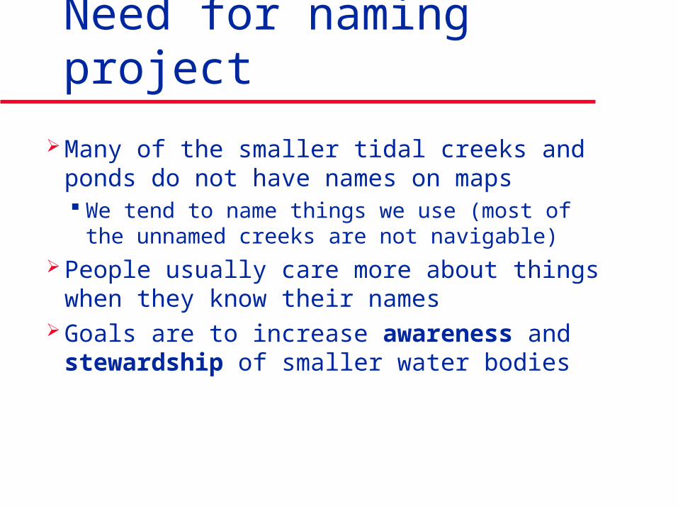
Need for naming project
Many of the smaller tidal creeks and ponds do not have names on maps We tend to name things we use (most of the
unnamed creeks are not navigable) People usually care more about things
when they know their names Goals are to increase awareness and
stewardship of smaller water bodies
History of project
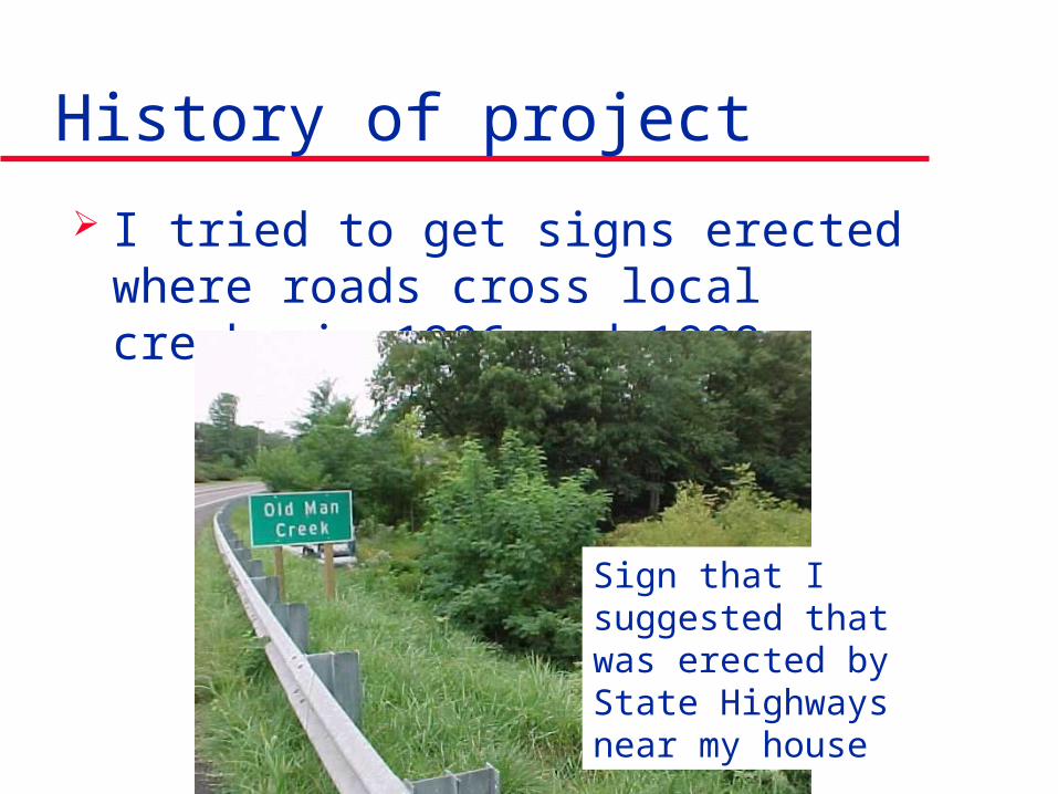
I tried to get signs erected where roads cross local creeks in 1996 and 1998
Sign that I suggested that was erected by State Highways near my house
History of project
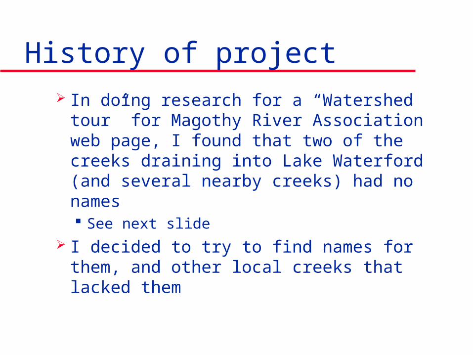
In doing research for a “Watershed tour” for Magothy River Association web page, I found that two of the creeks draining into Lake Waterford (and several nearby creeks) had no names See next slide
I decided to try to find names for them, and other local creeks that lacked them
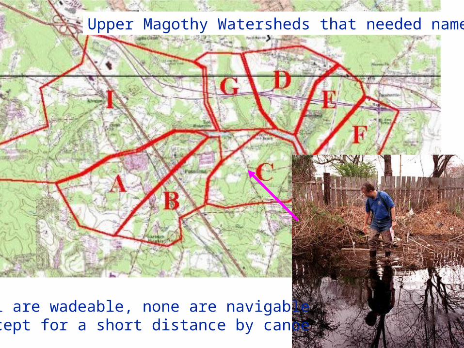
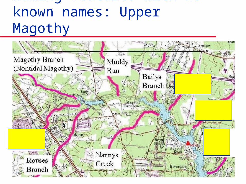
Upper Magothy Watersheds that needed names
All are wadeable, none are navigableexcept for a short distance by canoe
I wrote a grant to Chesapeake Bay Trust in early 2001 It was submitted (and supported with matching
funds) by Severn River Association, Magothy River Association, and South River Federation
Grant was awarded, and Paula Jasinski was hired as GIS Specialist to research names and prepare maps
Anne Arundel County printed the maps
History of project continued
History of project continued
Public meetings were held to solicit comments on any new or changed names
Proposed changes with documentation will be sent to US Board of Geographic Names for their review
Changes that are accepted will be added to on-line Federal GNIS database of place names, and may be used on future maps
Watershed groups could also make maps
Types of stream naming we did
Submitting names that were published in books, or on tax or sewer maps
Finding old names recorded on deeds Naming features that had no known names,
usually after nearest community or park Correcting errors in GNIS
Right name, but in wrong place Name spelled wrong, but in right place
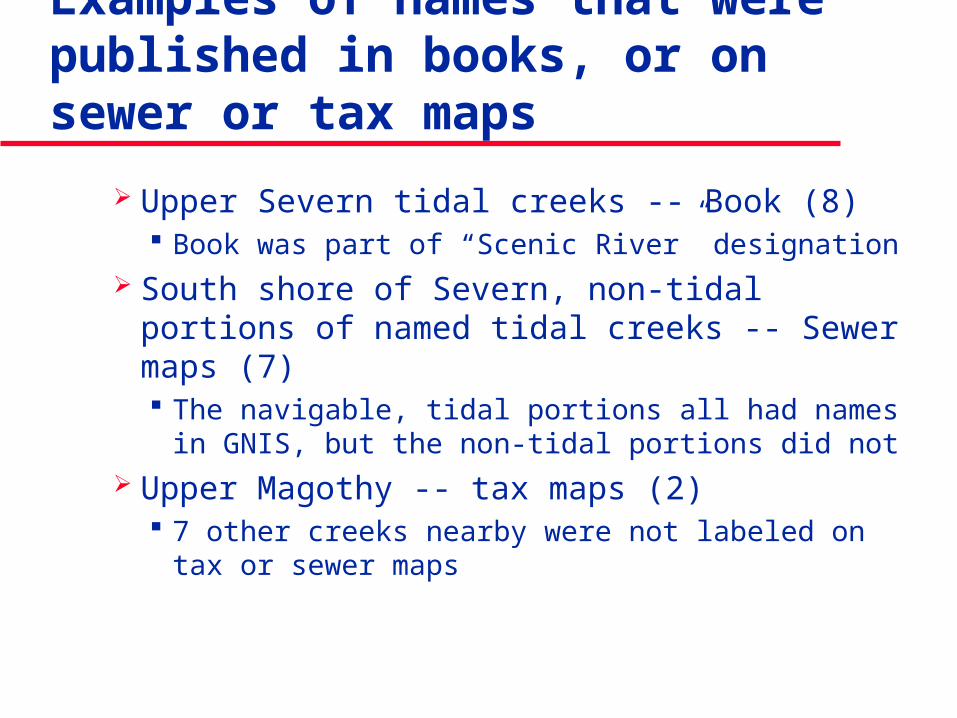
Examples of names that were published in books, or on sewer or tax maps
Upper Severn tidal creeks -- Book (8) Book was part of “Scenic River” designation
South shore of Severn, non-tidal portions of named tidal creeks -- Sewer maps (7) The navigable, tidal portions all had names in GNIS,
but the non-tidal portions did not Upper Magothy -- tax maps (2)
7 other creeks nearby were not labeled on tax or sewer maps
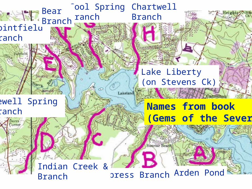
Lake Liberty(on Stevens Ck)
Arden PondCypress BranchIndian Creek &Branch
Sewell Spring Branch
Pointfield Branch
Cool Spring Branch
Bear Branch
Chartwell Branch
Names from book(Gems of the Severn)
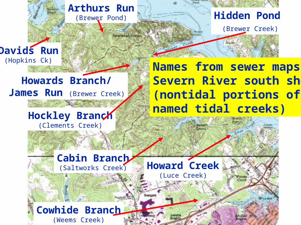
Davids Run(Hopkins Ck)
Arthurs Run(Brewer Pond)
Howards Branch/James Run (Brewer Creek)
Hockley Branch(Clements Creek)
Cabin Branch(Saltworks Creek) Howard Creek
(Luce Creek)
Cowhide Branch(Weems Creek)
Hidden Pond (Brewer Creek)
Names from sewer maps: Severn River south shore(nontidal portions ofnamed tidal creeks)
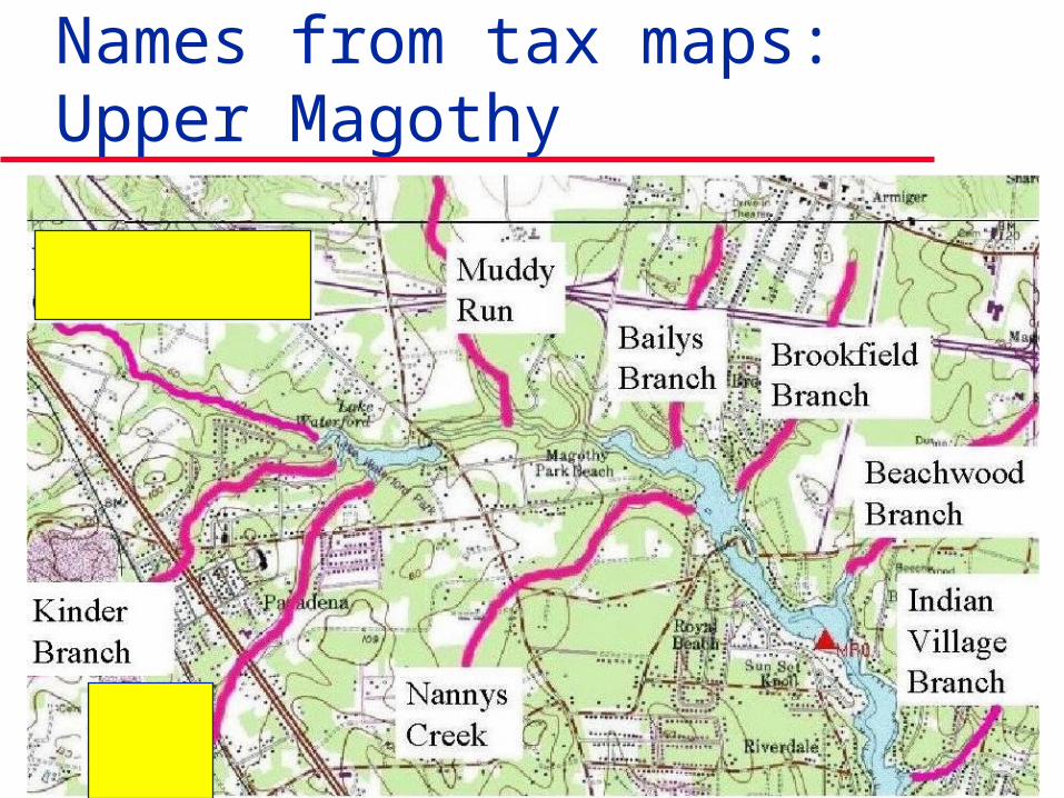
Names from tax maps: Upper Magothy
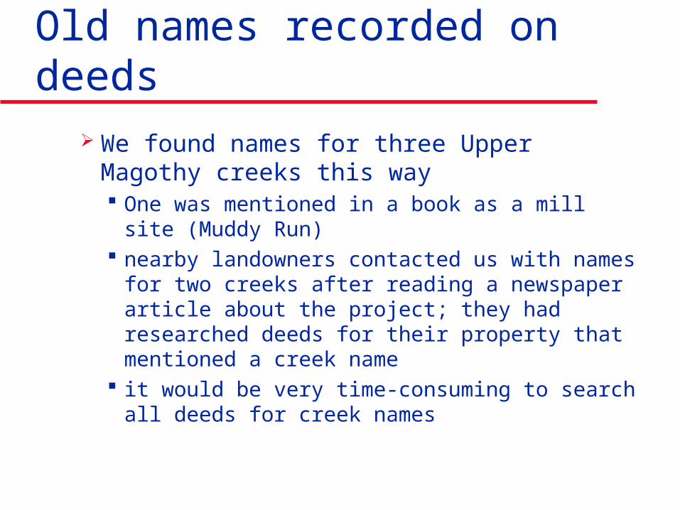
Old names recorded on deeds
We found names for three Upper Magothy creeks this way One was mentioned in a book as a mill site (Muddy
Run) nearby landowners contacted us with names for two
creeks after reading a newspaper article about the project; they had researched deeds for their property that mentioned a creek name
it would be very time-consuming to search all deeds for creek names
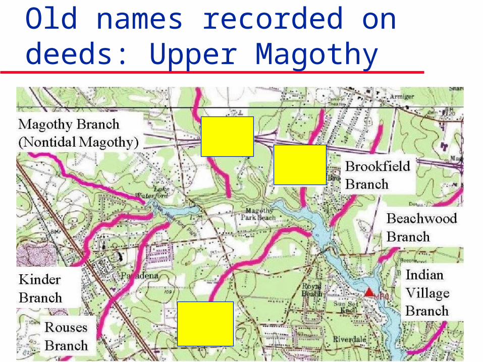
Old names recorded on deeds: Upper Magothy
Naming features with no known names
We had to do this for four Upper Magothy creeks
In three cases, we chose the name of the nearest community, as was done in naming upper Severn creeks in Gems of the Severn
In one case (Kinder Branch), we chose the name of the family that farmed the land at the headwaters & sold part of it for a county park
Naming features with no known names: Upper Magothy
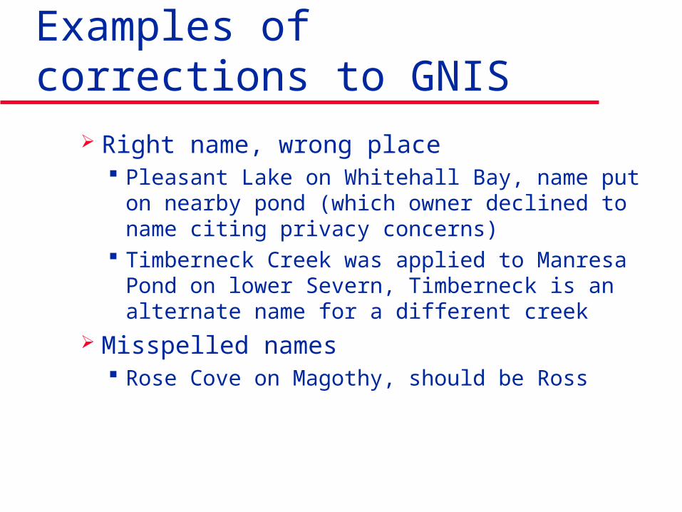
Examples of corrections to GNIS
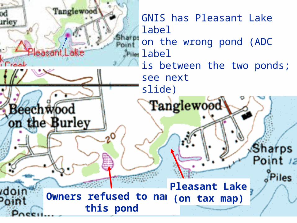
Right name, wrong place Pleasant Lake on Whitehall Bay, name put on
nearby pond (which owner declined to name citing privacy concerns)
Timberneck Creek was applied to Manresa Pond on lower Severn, Timberneck is an alternate name for a different creek
Misspelled names Rose Cove on Magothy, should be Ross
Owners refused to namethis pond
GNIS has Pleasant Lake labelon the wrong pond (ADC labelis between the two ponds; see nextslide)
Pleasant Lake(on tax map)
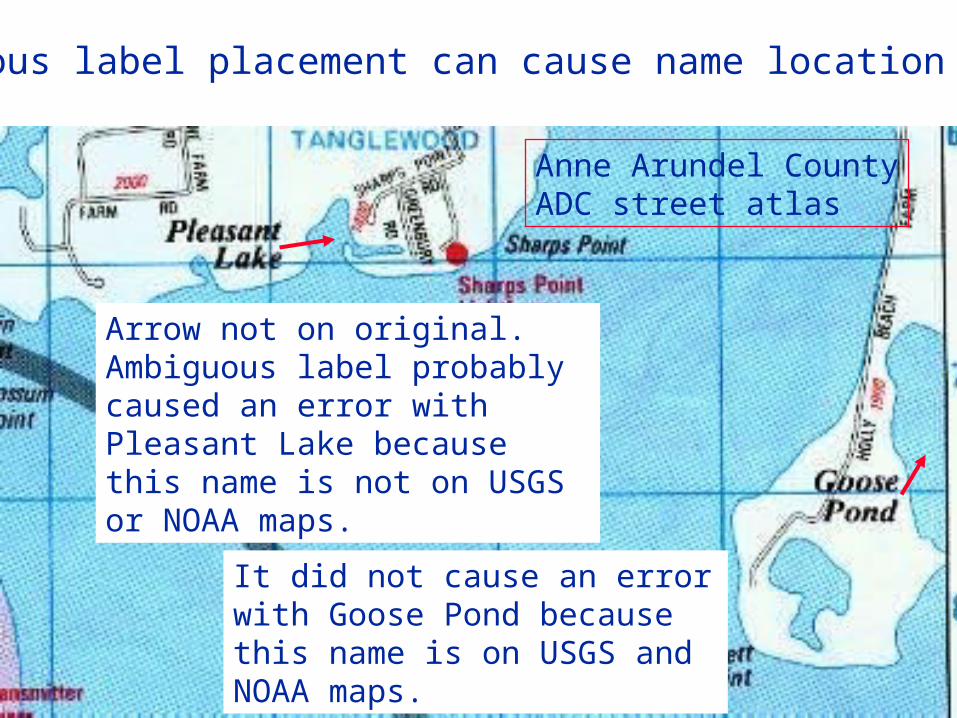
Ambiguous label placement can cause name location errors
Arrow not on original. Ambiguous label probably caused an error with Pleasant Lake because this name is not on USGS or NOAA maps.
It did not cause an error with Goose Pond because this name is on USGS and NOAA maps.
Anne Arundel CountyADC street atlas
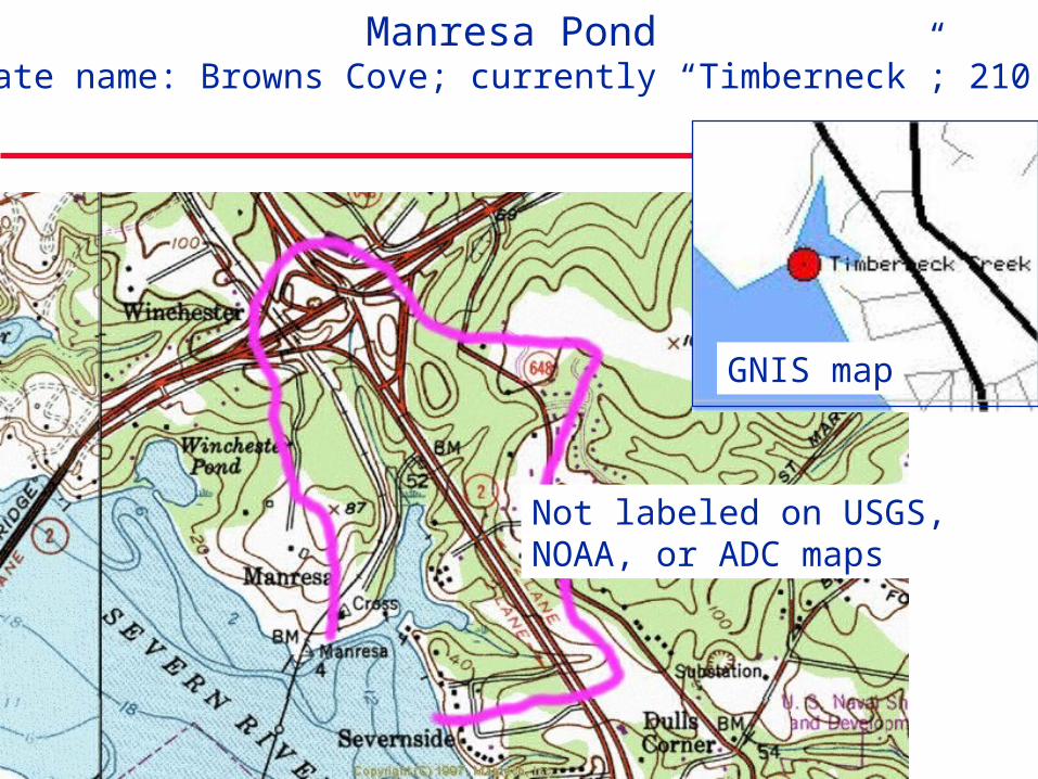
Manresa Pond(alternate name: Browns Cove; currently “Timberneck”; 210 acres)
Not labeled on USGS, NOAA, or ADC maps
GNIS map
Next steps in naming project
Submit changes to GNIS and get them approved (about 160 changes total)
Get artist to draw map of Magothy and label as many features as possible
Continue stream monitoring to identify any problems and increase stewardship
Request more creek name signs at road crossings (prefer ones with water visible)
Acknowledgments Colby Rucker
Gems of Severn author
Marianne Taylor Magothy: My river speaks
author
Wayne Cody Tim Schaefer George Dinwiddie Richard O Haffer Jonathan McKnight
Chesapeake Bay Trust Magothy River Assoc.
Paul Spadaro, Pres.
Severn River Assoc. Dave Wallace, Pres.
South River Fed. Drew Koslow, Pres.
Janis Markusic AA Co. Planning &
Zoning
Contact information
Peter Bergstrom 410-573-4554 [email protected]
Paula Jasinski 410-956-3917 [email protected]