Embed Size (px)
Citation preview
UPDATES ON OPERATIONAL PROCESSING FOR NOAA/NESDIS SOUNDING DATA PRODUCTS AND SERVICES
A.K. Sharma (Office Satellite Data and Products Distribution)… OSDPDTony Reale (Center for SaTellite Applications and Research) … STAR
POES Missions and Schedule (ATOVS… METOP … NPOESS)
Road Map for Atmospheric Soundings from IR and MW Sounders
Products Processing Update
Processing Changes
Systems Changes
Instruments Changes
ATOVS Soundings System Changes
Summary
NOAA/NESDIS Operation Updates
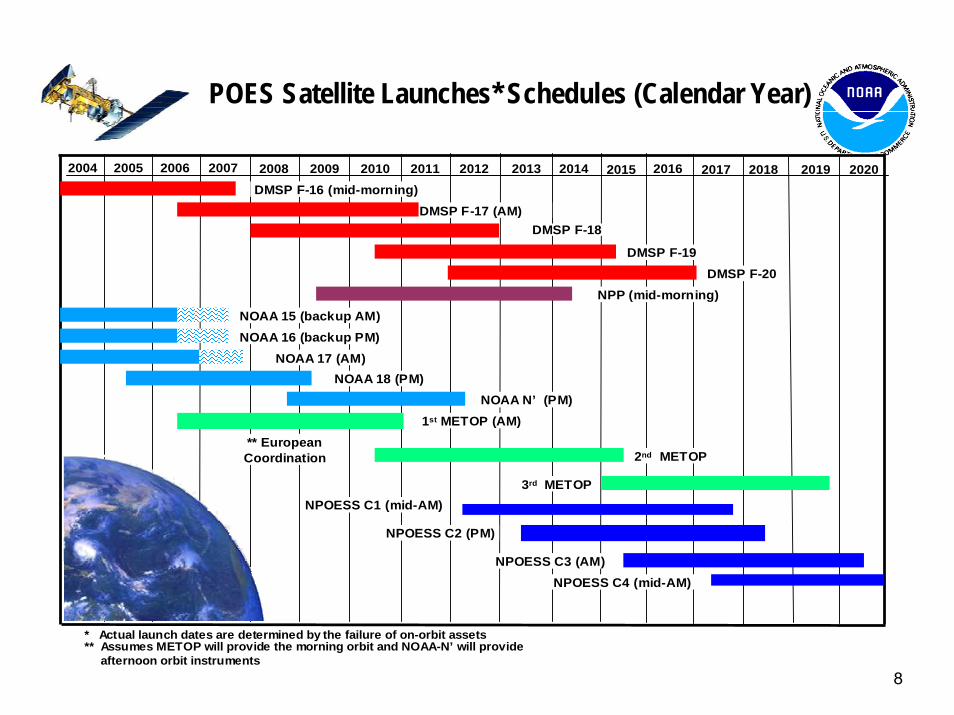
8
2009 20102004 2005 2006 2007 2008 2011 2012 2013 2014 2015 2016 2017 2018
* Actual launch dates are determined by the failure of on-orbit assets** Assumes METOP will provide the morning orbit and NOAA-N’ will provide
afternoon orbit instruments
1st METOP (AM)
DMSP F-16 (mid-morning)DMSP F-17 (AM)
DMSP F-19
NOAA 16 (backup PM)
NOAA 18 (PM)
NPOESS C1 (mid-AM)
** EuropeanCoordination
2019 2020
DMSP F-18
DMSP F-20NPP (mid-morning)
NOAA 17 (AM)
NOAA N’ (PM)
2nd METOP
3rd METOP
NPOESS C2 (PM)
NPOESS C3 (AM) NPOESS C4 (mid-AM)
POES Satellite Launches* Schedules (Calendar Year)
NOAA 15 (backup AM)
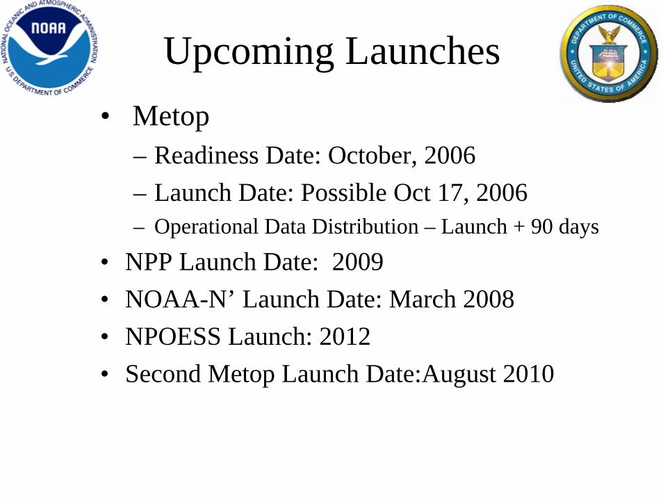
• Metop– Readiness Date: October, 2006– Launch Date: Possible Oct 17, 2006– Operational Data Distribution – Launch + 90 days
• NPP Launch Date: 2009• NOAA-N’ Launch Date: March 2008• NPOESS Launch: 2012• Second Metop Launch Date:August 2010
Upcoming Launches
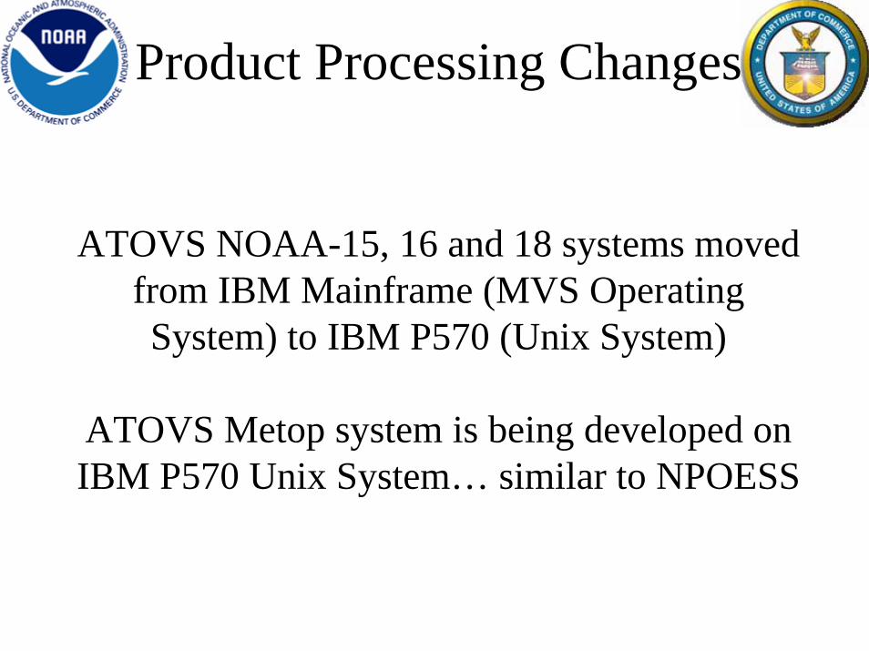
ATOVS NOAA-15, 16 and 18 systems moved from IBM Mainframe (MVS Operating System) to IBM P570 (Unix System)
ATOVS Metop system is being developed on IBM P570 Unix System… similar to NPOESS
Product Processing Changes
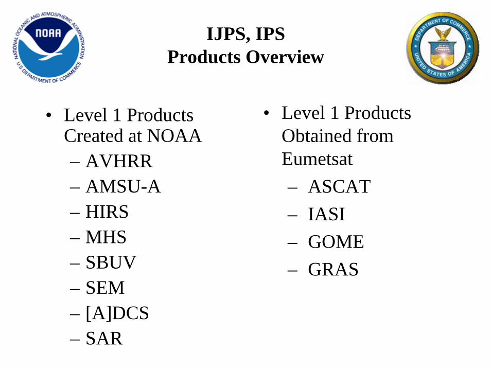
IJPS, IPSProducts Overview
• Level 1 Products Obtained from Eumetsat– ASCAT– IASI– GOME– GRAS
• Level 1 Products Created at NOAA– AVHRR– AMSU-A– HIRS– MHS– SBUV– SEM– [A]DCS– SAR
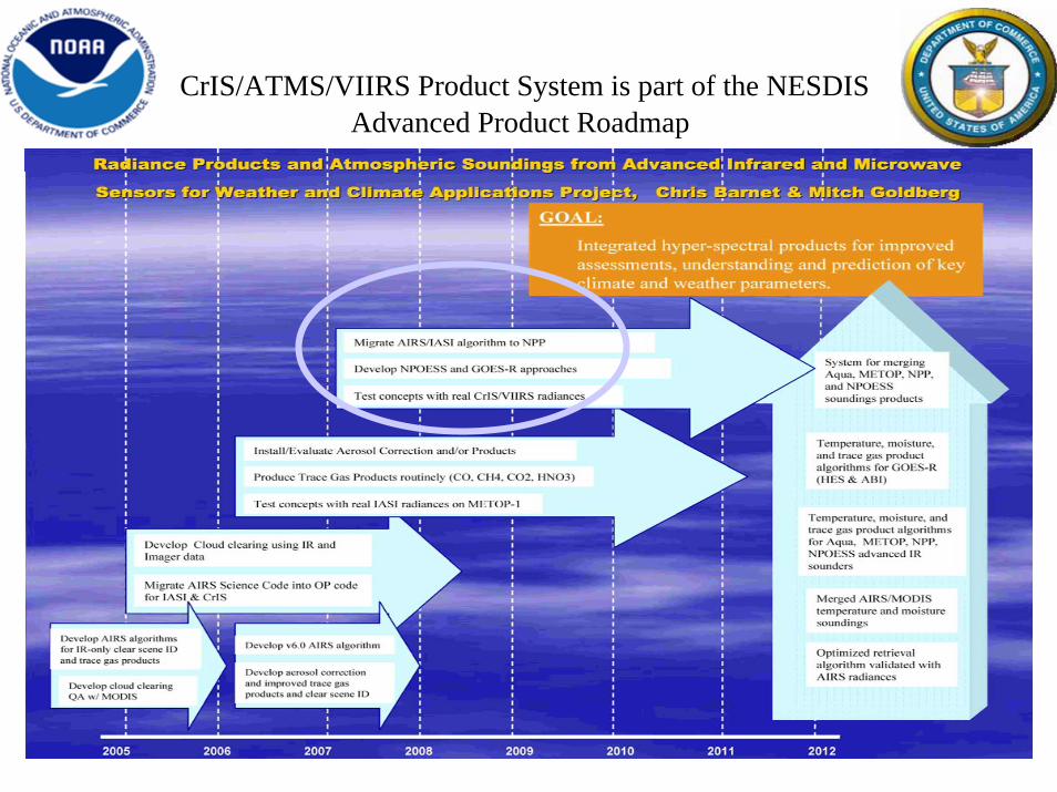
CrIS/ATMS/VIIRS Product System is part of the NESDIS Advanced Product Roadmap
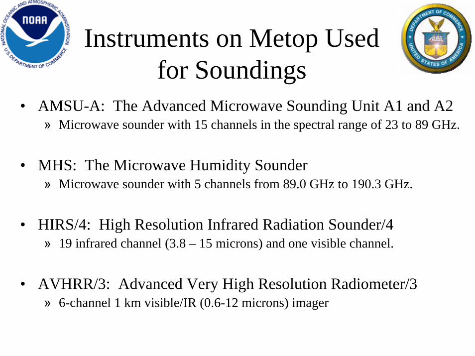
Instruments on Metop Used for Soundings
• AMSU-A: The Advanced Microwave Sounding Unit A1 and A2» Microwave sounder with 15 channels in the spectral range of 23 to 89 GHz.
• MHS: The Microwave Humidity Sounder» Microwave sounder with 5 channels from 89.0 GHz to 190.3 GHz.
• HIRS/4: High Resolution Infrared Radiation Sounder/4 » 19 infrared channel (3.8 – 15 microns) and one visible channel.
• AVHRR/3: Advanced Very High Resolution Radiometer/3» 6-channel 1 km visible/IR (0.6-12 microns) imager
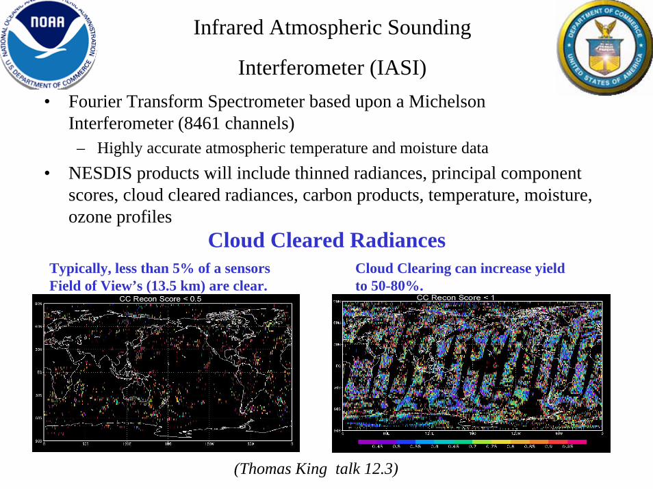
Infrared Atmospheric Sounding
Interferometer (IASI)• Fourier Transform Spectrometer based upon a Michelson
Interferometer (8461 channels)– Highly accurate atmospheric temperature and moisture data
• NESDIS products will include thinned radiances, principal component scores, cloud cleared radiances, carbon products, temperature, moisture, ozone profiles
Typically, less than 5% of a sensors Field of View’s (13.5 km) are clear.
Cloud Clearing can increase yield to 50-80%.
Cloud Cleared Radiances
(Thomas King talk 12.3)
•The IASI HIRS-like OLR Products would preserve the continuation of the HIRS OLR climate data record from future satellite instruments.
•The improved HIRS OLR will be the longest and continuous high quality satellite OLR product that has climate data record quality and would greatly complement the discontinuous broadband measurements.
•Improved and enhanced the capability in climate monitoring and climate analysis, especially through the implementation of the inter-satellite calibration and diurnal cycle adjustments.
•Improved quantitative accuracy and long-term stability in the Infrared Sounder OLR data record, which enables more accurate description and diagnostic studies of global climate.
•Data consistency can be preserved when AVHRR OLR is less likely available during NPOESS era.
•Data will be made available in December 2008
IASI HIRS like OLR Products from Metop
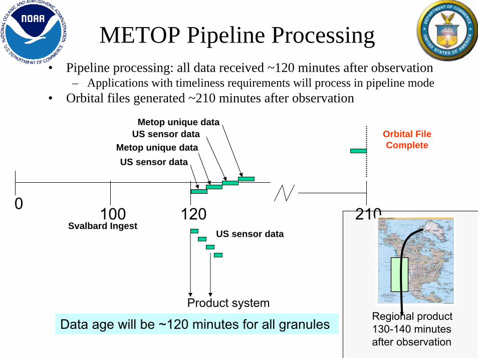
120 210
Metop unique data
US sensor data
Product system
Data age will be ~120 minutes for all granules
Svalbard Ingest
0 100
Regional product 130-140 minutes after observation
US sensor data
US sensor dataMetop unique data
METOP Pipeline Processing• Pipeline processing: all data received ~120 minutes after observation
– Applications with timeliness requirements will process in pipeline mode• Orbital files generated ~210 minutes after observation
Orbital File Complete
• MHS has shown improvement over AMSU-B
• N18 HIRS very unstable• N18 HIRS is Frequently un useable • HIRS-based operational products are
not operationally produced. • Improved timeliness for NOAA-18
blind orbits.
NOAA-18 Updates
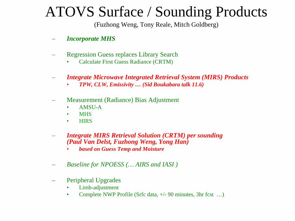
ATOVS Surface / Sounding Products(Fuzhong Weng, Tony Reale, Mitch Goldberg)
– Incorporate MHS
– Regression Guess replaces Library Search • Calculate First Guess Radiance (CRTM)
– Integrate Microwave Integrated Retrieval System (MIRS) Products• TPW, CLW, Emissivity … (Sid Boukabara talk 11.6)
– Measurement (Radiance) Bias Adjustment• AMSU-A• MHS • HIRS
– Integrate MIRS Retrieval Solution (CRTM) per sounding (Paul Van Delst, Fuzhong Weng, Yong Han)• based on Guess Temp and Moisture
– Baseline for NPOESS (… AIRS and IASI )
– Peripheral Upgrades• Limb-adjustment• Complete NWP Profile (Srfc data, +/- 90 minutes, 3hr fcst …)
Operational Product Environment to Provide
Integrated Validation Datasets and
Analysis
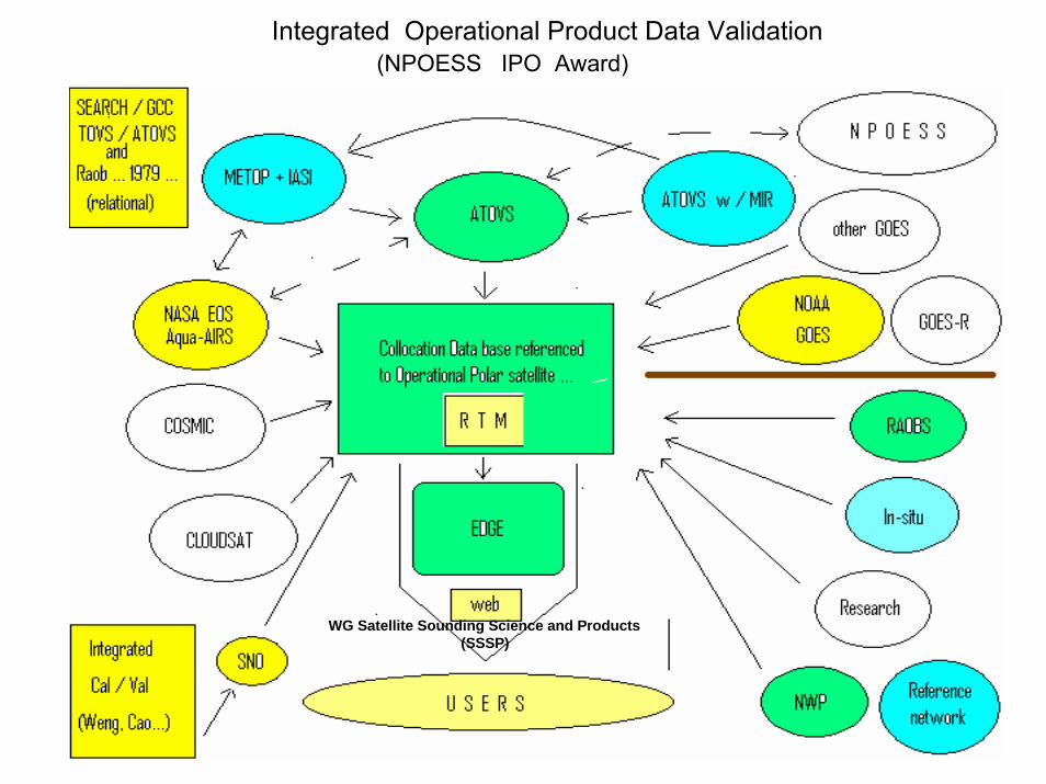
Integrated Operational Product Data Validation(NPOESS IPO Award)
WG Satellite Sounding Science and Products (SSSP)
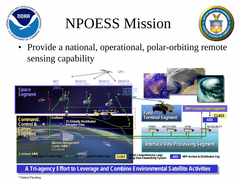
• Provide a national, operational, polar-orbiting remote sensing capability
CLASS
SpaceSegment
Command.Control &Comm.Segment
Command.Control &Comm.Segment
NPP1030(2005)
NPOESS1330 (2009)
NPOESS1730 (2011)
NPOESS2130 (2013)
Mission ManagementCenter (MMC)at Suitland
Mission ManagementCenter (MMC)at Suitland
Schriever MMCSchriever MMC
Interface Data Processing SegmentInterface Data Processing Segment
15 Globally DistributedReceptor Sites15 Globally DistributedReceptor Sites
Field Terminal SegmentField Terminal Segment
FNMOC NAVOCEANO AFWA NESDIS/NCEP
GPS
Low Rate Data/High Rate Data(LRD/HRD)
NPP Science Data Segment
ADS
NPP Data & Control Flow NPOESS Data & Control Flow CLASS ADSNOAA Comprehensive Large Array Data Stewardship System
SvalbardSvalbard
NPP Archive & Distribution Seg
A Tri-agency Effort to Leverage and Combine Environmental Satellite ActivitiesA Tri-agency Effort to Leverage and Combine Environmental Satellite Activities
*
* Patent Pending
NPOESS Mission
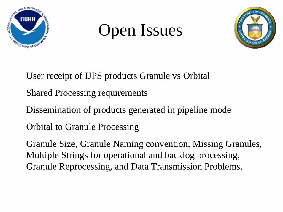
User receipt of IJPS products Granule vs Orbital
Shared Processing requirements
Dissemination of products generated in pipeline mode
Orbital to Granule Processing
Granule Size, Granule Naming convention, Missing Granules, Multiple Strings for operational and backlog processing, Granule Reprocessing, and Data Transmission Problems.
Open Issues
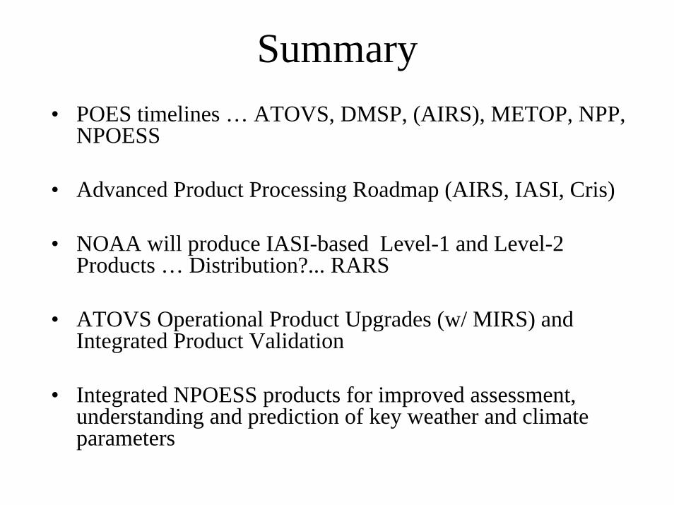
Summary• POES timelines … ATOVS, DMSP, (AIRS), METOP, NPP,
NPOESS
• Advanced Product Processing Roadmap (AIRS, IASI, Cris)
• NOAA will produce IASI-based Level-1 and Level-2 Products … Distribution?... RARS
• ATOVS Operational Product Upgrades (w/ MIRS) and Integrated Product Validation
• Integrated NPOESS products for improved assessment, understanding and prediction of key weather and climate parameters

Extras
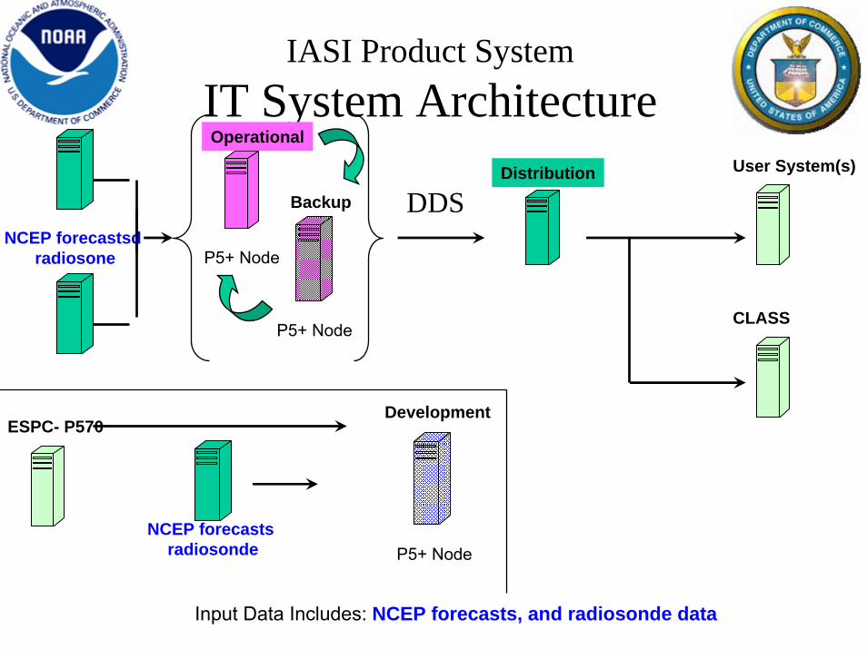
IASI Product SystemIT System Architecture
NCEP forecastsdradiosone P5+ Node
Operational
P5+ Node
Backup
P5+ Node
Development
Distribution User System(s)
Input Data Includes: NCEP forecasts, and radiosonde data
NCEP forecasts radiosonde
DDS
ESPC- P570
CLASS
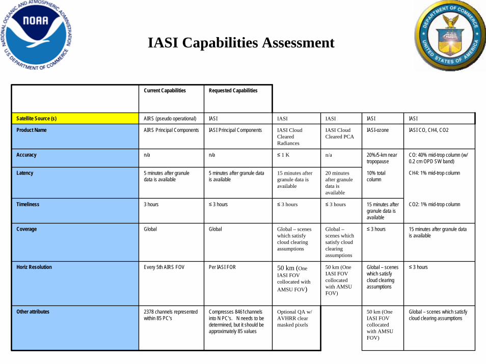
IASI Capabilities Assessment
Current Capabilities Requested Capabilities
Satellite Source (s) AIRS (pseudo operational) IASI IASI IASI IASI IASI
Product Name AIRS Principal Components IASI Principal Components IASI Cloud Cleared Radiances
IASI Cloud Cleared PCA
IASI-ozone IASI CO, CH4, CO2
Accuracy n/a n/a ≤ 1 K n/a 20%/5-km near tropopause
CO: 40% mid-trop column (w/ 0.2 cm OPD SW band)
Latency 5 minutes after granule data is available
5 minutes after granule data is available
15 minutes after granule data is available
20 minutes after granule data is available
10% total column
CH4: 1% mid-trop column
Timeliness 3 hours ≤ 3 hours ≤ 3 hours ≤ 3 hours 15 minutes after granule data is available
CO2: 1% mid-trop column
Coverage Global Global Global – scenes which satisfy cloud clearing assumptions
Global –scenes which satisfy cloud clearing assumptions
≤ 3 hours 15 minutes after granule data is available
Horiz Resolution Every 5th AIRS FOV Per IASI FOR 50 km (One IASI FOV collocated with AMSU FOV)
50 km (One IASI FOV collocated with AMSU FOV)
Global – scenes which satisfy cloud clearing assumptions
≤ 3 hours
Other attributes 2378 channels represented within 85 PC’s
Compresses 8461channels into N PC’s. N needs to be determined, but it should be approximately 85 values
Optional QA w/ AVHRR clear masked pixels
50 km (One IASI FOV collocated with AMSU FOV)
Global – scenes which satisfy cloud clearing assumptions
http://www.osdpd.noaa.gov/IPD/IPD.html
http://satprod.osd.noaa.gov/satprod/controlcenter.cfm
http://www.osdpd.noaa.gov/
http://www.oso.noaa.gov/
http://www.osd.noaa.gov/
http://www.class.noaa.gov/nsaa/products/welcome
http://www.ipo.noaa.gov/
OSDPD Product Access

ATOVS System-200X
• Online and Offline Systems
– Incorporate AMSU-B– Regression Guess replaces Library Search – Calculate First Guess Radiance (OPTRAN)– Measurement (Radiance) Bias Adjustment– “Unique” Retrieval Solution (OPTRAN)– Facilitate Channel Swapping
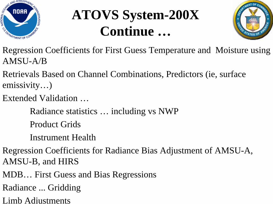
ATOVS System-200X Continue …
Regression Coefficients for First Guess Temperature and Moisture using AMSU-A/BRetrievals Based on Channel Combinations, Predictors (ie, surface emissivity…)Extended Validation …
Radiance statistics … including vs NWPProduct GridsInstrument Health
Regression Coefficients for Radiance Bias Adjustment of AMSU-A, AMSU-B, and HIRSMDB… First Guess and Bias RegressionsRadiance ... GriddingLimb Adjustments
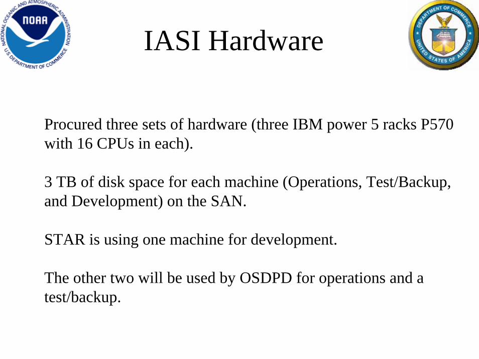
IASI Hardware
Procured three sets of hardware (three IBM power 5 racks P570 with 16 CPUs in each).
3 TB of disk space for each machine (Operations, Test/Backup, and Development) on the SAN.
STAR is using one machine for development.
The other two will be used by OSDPD for operations and a test/backup.
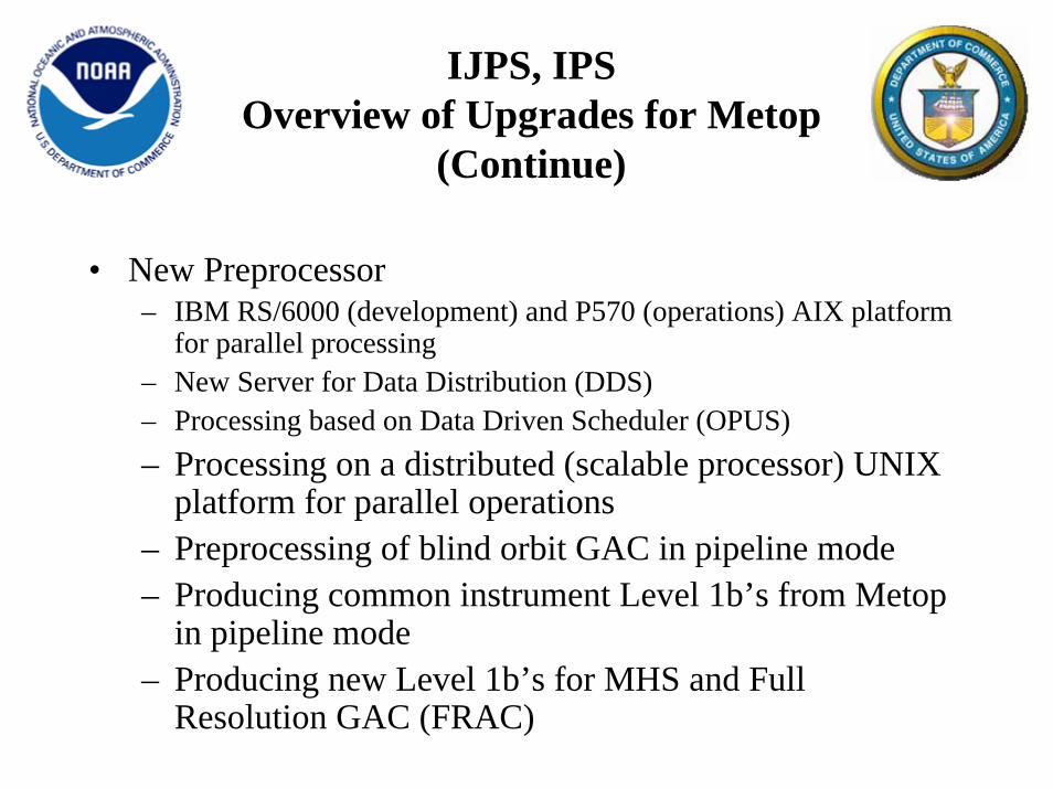
IJPS, IPSOverview of Upgrades for Metop
(Continue)
• New Preprocessor– IBM RS/6000 (development) and P570 (operations) AIX platform
for parallel processing– New Server for Data Distribution (DDS)– Processing based on Data Driven Scheduler (OPUS)– Processing on a distributed (scalable processor) UNIX
platform for parallel operations– Preprocessing of blind orbit GAC in pipeline mode– Producing common instrument Level 1b’s from Metop
in pipeline mode– Producing new Level 1b’s for MHS and Full
Resolution GAC (FRAC)
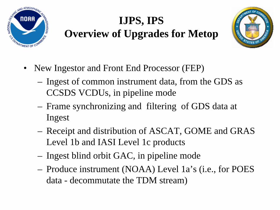
IJPS, IPSOverview of Upgrades for Metop
• New Ingestor and Front End Processor (FEP)– Ingest of common instrument data, from the GDS as
CCSDS VCDUs, in pipeline mode– Frame synchronizing and filtering of GDS data at
Ingest– Receipt and distribution of ASCAT, GOME and GRAS
Level 1b and IASI Level 1c products– Ingest blind orbit GAC, in pipeline mode– Produce instrument (NOAA) Level 1a’s (i.e., for POES
data - decommutate the TDM stream)

Metop Data Storage Requirements
Unique EUMETSAT Level 1
File Size (bytes) Bytes/Day ASCAT 1b 25,060,966 353,359,626 IASI 1c 2,083,059,139 29,371,133,854 GOME 1b 582,892,913 8,218,790,068 GRAS 1b 188,743,680 2,661,285,888
TOTAL: 2,879,756,698 40,604,569,436
File size and "Bytes/Day" are based on a 102-minute orbit and 14.1 orbits per day
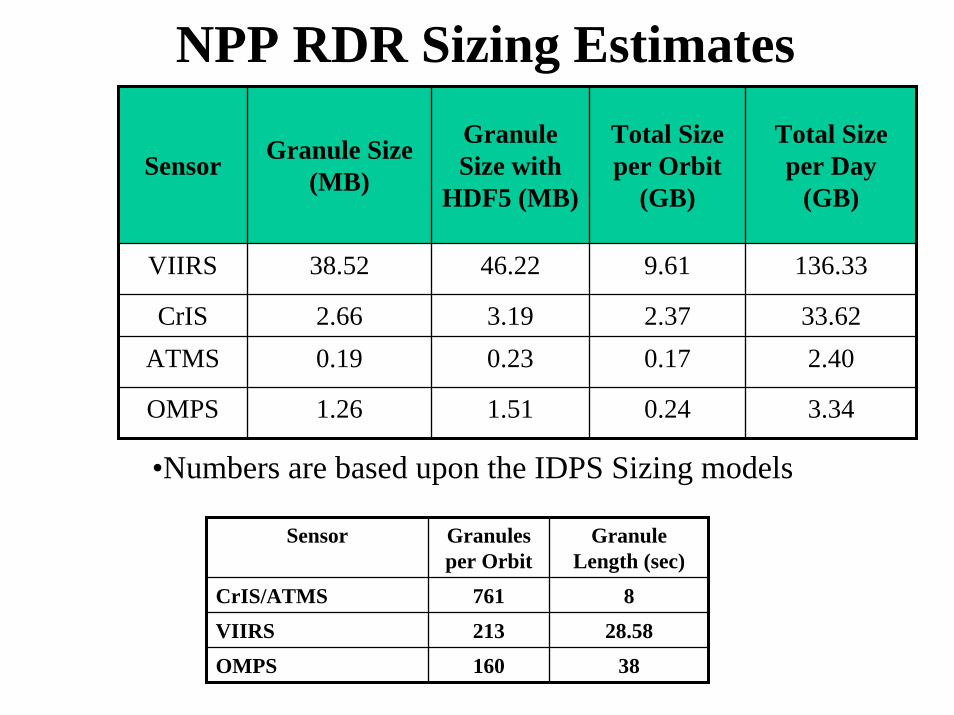
NPP RDR Sizing Estimates
Sensor Granule Size (MB)
Granule Size with
HDF5 (MB)
Total Size per Orbit
(GB)
Total Size per Day
(GB)
VIIRS 38.52 46.22 9.61 136.33
CrIS 2.66 3.19 2.37 33.62ATMS 0.19 0.23 0.17 2.40
OMPS 1.26 1.51 0.24 3.34
•Numbers are based upon the IDPS Sizing models
Sensor Granules per Orbit
Granule Length (sec)
CrIS/ATMS 761 8VIIRS 213 28.58
OMPS 160 38
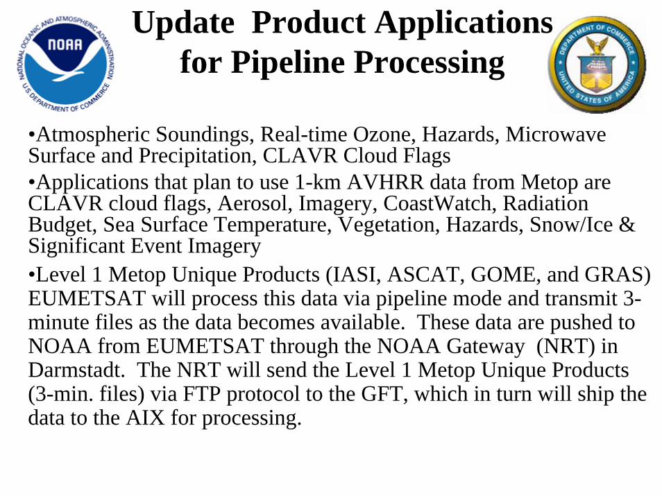
•Atmospheric Soundings, Real-time Ozone, Hazards, Microwave Surface and Precipitation, CLAVR Cloud Flags•Applications that plan to use 1-km AVHRR data from Metop are CLAVR cloud flags, Aerosol, Imagery, CoastWatch, Radiation Budget, Sea Surface Temperature, Vegetation, Hazards, Snow/Ice &Significant Event Imagery•Level 1 Metop Unique Products (IASI, ASCAT, GOME, and GRAS) EUMETSAT will process this data via pipeline mode and transmit 3-minute files as the data becomes available. These data are pushed to NOAA from EUMETSAT through the NOAA Gateway (NRT) in Darmstadt. The NRT will send the Level 1 Metop Unique Products (3-min. files) via FTP protocol to the GFT, which in turn will ship the data to the AIX for processing.
Update Product Applications for Pipeline Processing
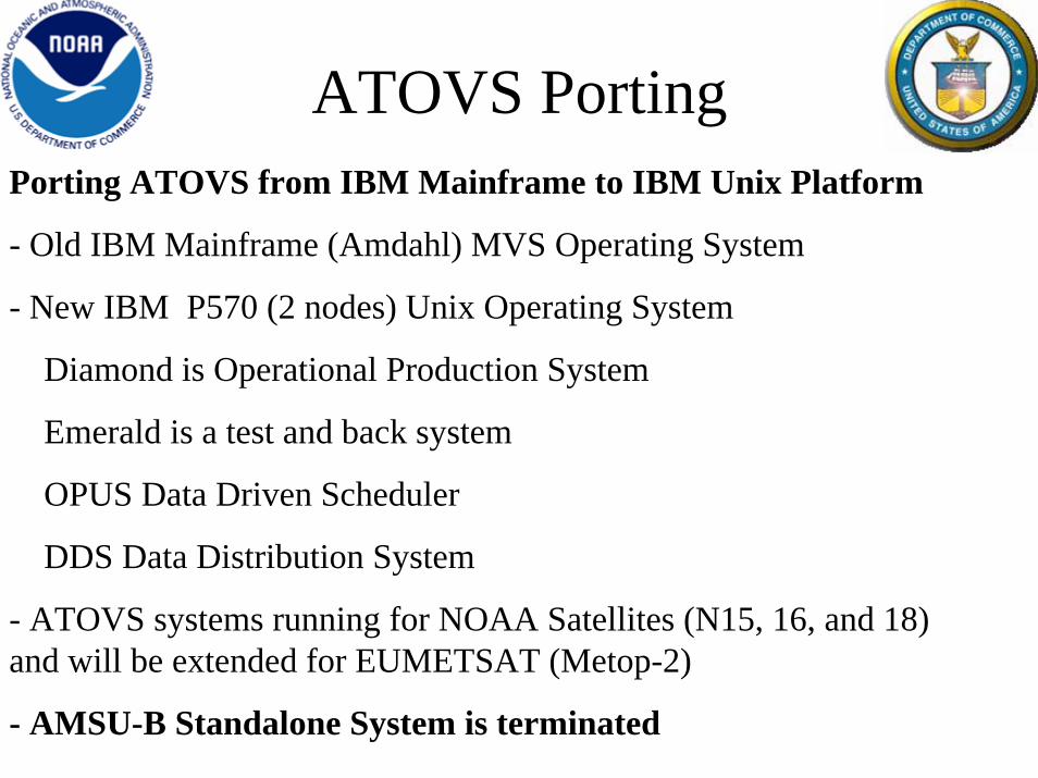
Porting ATOVS from IBM Mainframe to IBM Unix Platform
- Old IBM Mainframe (Amdahl) MVS Operating System
- New IBM P570 (2 nodes) Unix Operating System
Diamond is Operational Production System
Emerald is a test and back system
OPUS Data Driven Scheduler
DDS Data Distribution System
- ATOVS systems running for NOAA Satellites (N15, 16, and 18) and will be extended for EUMETSAT (Metop-2)
- AMSU-B Standalone System is terminated
ATOVS Porting