Embed Size (px)
Citation preview
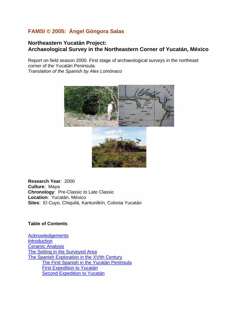
FAMSI © 2005: Ángel Góngora Salas Northeastern Yucatán Project: Archaeological Survey in the Northeastern Corner of Yucatán, México Report on field season 2000. First stage of archaeological surveys in the northeast corner of the Yucatán Peninsula. Translation of the Spanish by Alex Lomónaco
Research Year: 2000 Culture: Maya Chronology: Pre-Classic to Late Classic Location: Yucatán, México Sites: El Cuyo, Chiquilá, Kantunilkín, Colonia Yucatán
Table of Contents Acknowledgements Introduction Ceramic Analysis The Setting in the Surveyed Area The Spanish Exploration in the XVIth Century
The First Spanish in the Yucatán Peninsula First Expedition to Yucatán Second Expedition to Yucatán
The Cortés Expedition Montejo’s First Attempt to Conquer Yucatán Third Phase of the Conquest
The Province of Chauaca or Chikinchel El Cuyo The Site of Sacboh The Site of Chauaca or El Cafetal The Site of Sinsimato (Colonia Yucatán) The Site of Km. 11 The Site of Don Bon The Site of Misnebalam The Site of San Pedro Bacab The Site of Rancho Grande The Site of Teapa The Site of Conil (Chiquilá) The Site of Kantunilkín The Site of Labcah (Solferino) Site 1 Site 2 Site 3 Site 4 (Nohcachí) Site 5 (Nuevo León) Site 6 Site 7 Site 8 Site 9 Site 10 Site 11 Site 12 Site 13 Site 14 Site 15 Site 16 Site 17 Site 18 Site 19 Site 20
Settlement Pattern and Architecture in Northeastern Yucatán Final Comments List of Figures List of Photos List of Tables Sources Cited
2
Acknowledgements
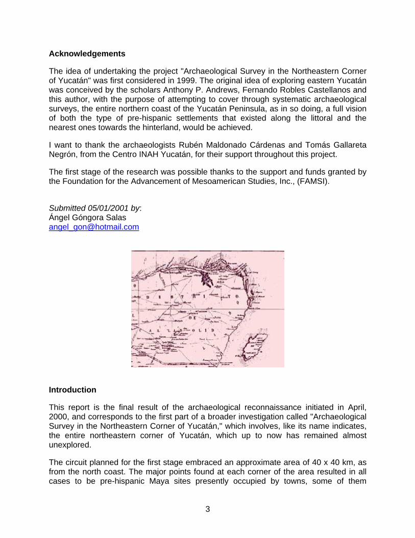
The idea of undertaking the project "Archaeological Survey in the Northeastern Corner of Yucatán" was first considered in 1999. The original idea of exploring eastern Yucatán was conceived by the scholars Anthony P. Andrews, Fernando Robles Castellanos and this author, with the purpose of attempting to cover through systematic archaeological surveys, the entire northern coast of the Yucatán Peninsula, as in so doing, a full vision of both the type of pre-hispanic settlements that existed along the littoral and the nearest ones towards the hinterland, would be achieved.
I want to thank the archaeologists Rubén Maldonado Cárdenas and Tomás Gallareta Negrón, from the Centro INAH Yucatán, for their support throughout this project.
The first stage of the research was possible thanks to the support and funds granted by the Foundation for the Advancement of Mesoamerican Studies, Inc., (FAMSI).
Submitted 05/01/2001 by: Ángel Góngora Salas [email protected]
Introduction
This report is the final result of the archaeological reconnaissance initiated in April, 2000, and corresponds to the first part of a broader investigation called "Archaeological Survey in the Northeastern Corner of Yucatán," which involves, like its name indicates, the entire northeastern corner of Yucatán, which up to now has remained almost unexplored.
The circuit planned for the first stage embraced an approximate area of 40 x 40 km, as from the north coast. The major points found at each corner of the area resulted in all cases to be pre-hispanic Maya sites presently occupied by towns, some of them
3
established in colonial times and others at a later date. The corners of the surveyed area were delimited to the northwest by the port of El Cuyo, to the northeast by the port of Chiquilá, to the southeast by the village of Kantunilkín, and finally at the southwest of the quadrant, by the town of Colonia Yucatán. So far, we have been unable to explore the entire area, as in most cases traveling distances had to be covered on foot and with the assistance of a guide; in addition, the survey included crossing savannas, walking along roads half-covered with water, and the occasional arrival to villages that maps presented as inhabited, but which in fact had been abandoned and whose access roads, therefore, lacked an appropriate maintenance; this may be the reason why this region of Yucatán has remained almost untouched by explorers.
During this survey we came across several archaeological sites unknown to experts, while others, mostly those located in the vicinities of paved roads, had been briefly visited. At times we were forced to wait several days to visit just one or two sites, because people who knew how to reach these places lacked the time that these walks involved, or showed no concern in regard to our interest for such places. However, we were not discouraged by the situation, and finally came to satisfactorily conclude this stage of the survey, while a very small area in the northeast corner of our investigation, near the Chiquilá port, still remains to be visited.
4
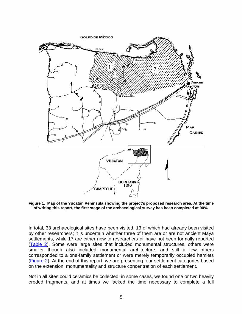
Figure 1. Map of the Yucatán Peninsula showing the project’s proposed research area. At the time
of writing this report, the first stage of the archaeological survey has been completed at 90%.
In total, 33 archaeological sites have been visited, 13 of which had already been visited by other researchers; it is uncertain whether three of them are or are not ancient Maya settlements, while 17 are either new to researchers or have not been formally reported (Table 2). Some were large sites that included monumental structures, others were smaller though also included monumental architecture, and still a few others corresponded to a one-family settlement or were merely temporarily occupied hamlets (Figure 2). At the end of this report, we are presenting four settlement categories based on the extension, monumentality and structure concentration of each settlement.
Not in all sites could ceramics be collected; in some cases, we found one or two heavily eroded fragments, and at times we lacked the time necessary to complete a full
5

reconnaissance of the surface and collection of archaeological material; but in general, ceramic samples were collected from 12 sites and they have all undergone analysis. We expect in short to have a full recollection of all the sites visited.
Artifacts other than ceramics were scarce, and only at the sites of Solferino, Km. 11 and Teapa, a small number of them was found in the hands of private individuals; they kindly facilitated the pieces to us, so that we had the opportunity to draw the artifacts and take pictures.
Of all the subject matters proposed in the project for completion of the field survey, only one remained unaccomplished: the topographical survey with the use of advanced measuring technology because the sites, as it may be observed, were covered with trees and weeds and we lacked the necessary personnel to clean and clear them up; thus, only sketches were drawn with the partial help of a compass and a measuring tape. The sketches should not be taken as surveys; instead, they are guidelines to provide some idea on how the main structures of settlements were distributed.
6
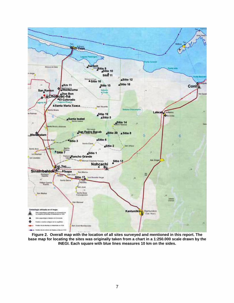
Figure 2. Overall map with the location of all sites surveyed and mentioned in this report. The
base map for locating the sites was originally taken from a chart in a 1:250.000 scale drawn by the INEGI. Each square with blue lines measures 10 km on the sides.
7

Ceramic Analysis
Regarding ceramics, and as stated in the Introduction, we only had the chance to collect samples from twelve sites: Colonia Yucatán, Chiquilá, Kilómetro 11, Nohcachí, Sacboh, Solferino, Teapa, Site 1, Site 5, Site 7, Site 8 and Site 14. Of all the sites mentioned, Site 8 yielded the largest amount of sherds in the collected sample, with a total of 95, while the poorest site, as far as samples are concerned, was Colonia Yucatán, with only three sherds.
The ceramic analysis was completed with the help of ceramist Maribel Gamboa. In total, 481 sherds were tested, 414 identified (Table 1) and the following forms were found: cajetes, cazuelas, bowls, censers, pots, flowerpots, fungus-shaped containers, incense-burners and tecomates.
Ceramic types found in each one of the sites visited during the survey:
Colonia Yucatán: Sacalum Black on Slate, Vista Alegre Striated.
Chiquilá: Baca Red, Batres Red, Chum Unslipped.
Kilómetro 11: Batres Red, Carolina Bichrome Incised, Colonial, Dzilám Fungus-Shaped Special, Dzilám Green Incised, Flor Cream, Huachinango Bichrome Incised, Laguna Verde Incised, Mateo Red on Cream, Sabán Coarse, Sapote Striated, Sierra Red, unnamed Red-on-Cream, Tacna Coarse, Timucuy Orange Polychrome.
Nohcachí: Dzilám Green Incised, Flor Cream, Huachinango Bichrome Incised, Laguna Verde Incised, Sabán Coarse, Sierra Red.
Sacboh: Batres Red, Chenmul Modelled, Dzilám Green Incised, Dzilám Olive Green, Encanto Striated, Mama Red, Mateo Red on Cream, Navulá Unslipped, Sabán Coarse, Sierra Red, Sisal Unslipped, Tancah Coarse, Vista Alegre Striated.
Site 1: Palmas Special Cream, Muna Slate, Vista Alegre Striated.
Site 5: Batres Red, Chancenote Striated, Encanto Striated, Huachinango Bichrome Incised, Muna Slate, Sabán Coarse, Vista Alegre Striated.
Site 7: Encanto Striated, Muna Slate, Teabo Red, Timucuy Orange Polychrome, Vista Alegre Striated.
Site 8: Cetelac with vegetal temper, Chenmul Modelled, Flor Cream, Huachinango Bichrome Incised, Kukulá Cream, Mama Red, Mateo Red on Cream, Muna Slate, Sabán Coarse, Sapote Striated, Sierra Red, Sisal Unslipped, Tancah Coarse, Vista Alegre Striated.
Solferino: Batres Red, Sabán Coarse, Tancah Coarse, Vista Alegre Striated.
8
Teapa: Chancenote Striated, Dzilám Green Incised, Huachinango Bichromatic Incised, Sabán Coarse, Tancah Coarse, Tituc Orange Polychrome.
The Setting in the Surveyed Area
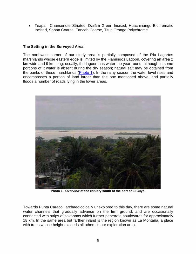
The northwest corner of our study area is partially composed of the Ría Lagartos marshlands whose eastern edge is limited by the Flamingos Lagoon, covering an area 2 km wide and 9 km long; usually, the lagoon has water the year round, although in some portions of it water is absent during the dry season; natural salt may be obtained from the banks of these marshlands (Photo 1). In the rainy season the water level rises and encompasses a portion of land larger than the one mentioned above, and partially floods a number of roads lying in the lower areas.
Photo 1. Overview of the estuary south of the port of El Cuyo.
Towards Punta Caracol, archaeologically unexplored to this day, there are some natural water channels that gradually advance on the firm ground, and are occasionally connected with strips of savannas which further penetrate southwards for approximately 18 km. In the same area but farther inland is the region known as La Montaña, a place with trees whose height exceeds all others in our exploration area.
9
To the south, in a strip of approximately 15 km in width from the coast is where the large savannas are more frequently found. Some of them have water all the year round and are surrounded by, and composed of a vegetation typical of these humid soils that prevent trees from growing in its amidst. These savannas have fish known as mojarras, and are the habitat of reptiles known as alligators. There is also an abundance of fresh water lagoons and cenotes; some of the streams emerge near the coast mingled with the salty waters, and are important for the use of humans and animals. Near the coast there are some natural depressions that run in a W-E direction, which flood in the rainy season and create water channels that were probably used in ancient times to navigate with small boats; one such depression is found immediately north of the archaeological zone of Sacboh. We may also find some wooded areas with trees adequate for construction, such as the fine wood of cedar trees and the zapotes.
In the last strip of land that runs southwards and delimits our study area, the savannas are scarcer and less extended. There are practically no lagoons, while the cenotes are more numerous and of different types: there are those near the earth’s surface, those exhibiting a wide open mouth with its water level below the level of the natural ground, and a third category, represented by the ones found inside the caves with small entrances or mouths in the stone slabs, wherefrom water may be obtained. The rejolladas and aguadas begin to occur, some of large dimensions. By the mid-XXth century, woods of cedar trees and mahogany still existed, having been used for the timber industry of Colonia Yucatán.
Presently, less than one-fourth of our workfield towards the northeastern corner is a part of the Ría Lagartos Biospheric Reserve; the remaining portion of the territory is composed partly of bovine cattle-raising ranches; some of them occupy large extensions of land and have cut down trees to gain pasture grounds, planting grass for the cattle. In a lesser degree, the land has been used to grow fruit trees or to create milpas. The timber industry has declined, but on the contrary, the illegal, immoderate cutting down of zapote trees still persists together with the hunt of wild animals, even within the boundaries of the natural reserve mentioned above.
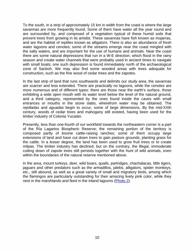
In the area, mount turkeys, deer, wild boars, quails, partridges, chachalacas, little tigers, jaguars and other predators such as the armadillos, jalebs, alligators, spider monkeys, etc., still abound, as well as a great variety of small and migratory birds, among which the flamingos are particularly outstanding for their amazing lively pink color, while they nest in the marshlands and feed in the inland lagoons (Photo 2).
10
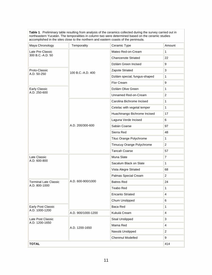
Table 1. Preliminary table resulting from analysis of the ceramics collected during the survey carried out in northeastern Yucatán. The temporalities in column two were determined based on the ceramic studies accomplished in the sites close to the northern and eastern coasts of the peninsula.
Maya Chronology Temporality Ceramic Type Amount
Mateo Red-on-Cream 1
Chancenote Striated 22
Late Pre-Classic 300 B.C.-A.D. 50
Dzilám Green Incised 9
Zapote Striated 3
Dzilám special, fungus-shaped 1
Proto-Classic A.D. 50-250
Flor Cream 9
Dzilám Olive Green 1
100 B.C.-A.D. 400
Unnamed Red-on-Cream 2
Carolina Bichrome Incised 1
Cetelac with vegetal temper 1
Huachinango Bichrome Incised 17
Laguna Verde Incised 6
Sabán Coarse 97
Sierra Red 48
Tituc Orange Polychrome 1
Timucuy Orange Polychrome 2
Early Classic A.D. 250-600
A.D. 200/300-600
Tancah Coarse 57
Muna Slate 7
Sacalum Black on Slate 1
Vista Alegre Striated 68
Late Classic A.D. 600-800
Palmas Special Cream 2
Batres Red 24
Teabo Red 1
Encanto Striated 4
Terminal Late Classic A.D. 800-1000
Chum Unslipped 6
A.D. 600-900/1000
Baca Red 1 Early Post Classic A.D. 1000-1200
A.D. 900/1000-1200 Kukulá Cream 4
Sisal Unslipped 3
Mama Red 4
Navulá Unslipped 2
Late Post Classic A.D. 1200-1650
A.D. 1200-1650
Chenmul Modelled 9
TOTAL 414
11
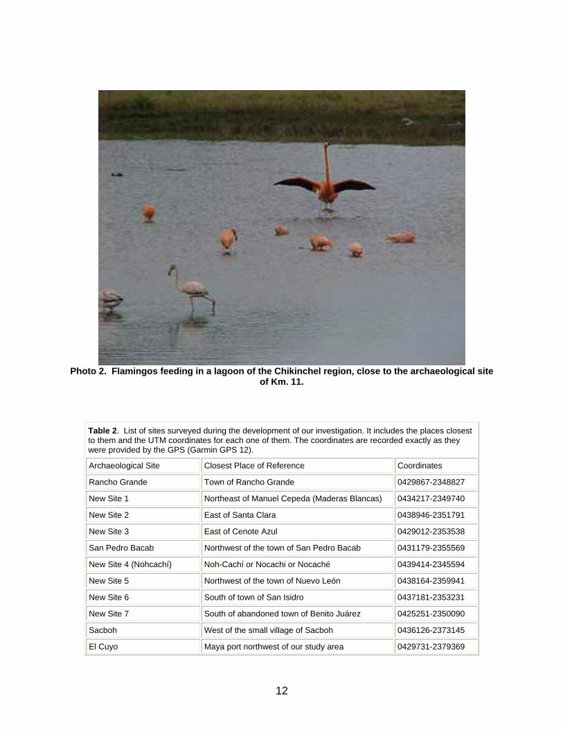
Photo 2. Flamingos feeding in a lagoon of the Chikinchel region, close to the archaeological site
of Km. 11.
Table 2. List of sites surveyed during the development of our investigation. It includes the places closest to them and the UTM coordinates for each one of them. The coordinates are recorded exactly as they were provided by the GPS (Garmin GPS 12).
Archaeological Site Closest Place of Reference Coordinates
Rancho Grande Town of Rancho Grande 0429867-2348827
New Site 1 Northeast of Manuel Cepeda (Maderas Blancas) 0434217-2349740
New Site 2 East of Santa Clara 0438946-2351791
New Site 3 East of Cenote Azul 0429012-2353538
San Pedro Bacab Northwest of the town of San Pedro Bacab 0431179-2355569
New Site 4 (Nohcachí) Noh-Cachí or Nocachi or Nocaché 0439414-2345594
New Site 5 Northwest of the town of Nuevo León 0438164-2359941
New Site 6 South of town of San Isidro 0437181-2353231
New Site 7 South of abandoned town of Benito Juárez 0425251-2350090
Sacboh West of the small village of Sacboh 0436126-2373145
El Cuyo Maya port northwest of our study area 0429731-2379369
12

Moctezuma In the Km. 11 before reaching the El Cuyo port 0426860-2369587
Colonia Yucatán (Sinsimato) Hill of the ruins between the Sierra and Colonia Yucatán
0425845-2344679
Teapa Vestiges north of the entrance to town, at the west 0426022-2344120
Misnebalam Archaeological vestiges located in the modern Rancho Alegre
0420077-2354853
Cueva Located between San Arturo and Nuevo Tesoco 0443100-2353409
New Site 8 Located in the lands of San Arturo, to the northeast
0443296-2355053
Probable new Site 9 It lies between the road from Sacboh to Nuevo Tekal
0436843-2373023
New Site 10 Site with low platforms, same road as 9 0437899-2372658
New Site 11 It lies within a ranch, same road as 9 0439902-2372127
New Site 12 In an ancient SEMARNAP road 0443645-2370662
New Site 13 Site with a platform after crossing Nocachí 0441741-2347018
New Site 14 In the lands of Nuevo Tesoco 0442068-2358144
Cenote It belongs to site 14 0442150-2358253
New Site 15 Between the road of the booth to Nuevo Tekal (Zavalo)
0438258-2368480
New Site 16 Settlement of the house of tulips 0434528-2369928
Chiquilá (Conil) Northeastern corner of the study area 0465270-2368213
Solferino (Labcah) South of Chiquilá 0455639-2361602
Kantunilkín Southeastern corner of the study area 0449626-2333722
El Cafetal (Chahuaca) Site southwest of Moctezuma 0422608-2365545
Laguna Chauaca Point of northern shore of lagoon 0422154-2365684
New Site 17 On the Colonia Yucatán-Kantunilkin road (border) 0433835-2342556
New Site 18 Northeast of Nuevo Tekal 0442690-2368849
New Site 19 Second site northwest of Nuevo León 0437398-2360189
New Site 20 Second site west of San Arturo 0439386-2355067
Cenote in Site 20 East of Site 20 0439526-2354992
Don Bon Site southeast of Moctezuma 0426534-2366073
13
The Spanish Exploration in the XVIth Century
The First Spanish in the Yucatán Peninsula
It seems that the first Spanish who accidentally reached the Yucatán shores were Jerónimo de Aguilar and Gonzalo Guerrero, who jointly with other seamen wrecked in 1511 near the island of Jamaica (Landa, 1992:12). When they reached the shores of Yucatán in the Caribbean, they were made prisoners by the chieftain of the village; later, Aguilar and Guerrero escaped and arrived someplace else where Aguilar lived as a prisoner until he rejoined Hernán Cortés’ expedition in 1519, while Guerrero married a native woman, had children, and became the war lord of a Maya village whose name still remains a mystery. According to the available data, by the time of the early expeditions to Yucatán, the villages of Jerónimo de Aguilar and Gonzalo Guerrero were located somewhere near Isla Mujeres (Díaz del Castillo, 1999:46-48), in the region we now know by the name of Ecab.
First Expedition to Yucatán
Around 1517, in Quadragesima, Francisco Hernández de Córdoba set sails from Cuba with three vessels, and for the first time touched the coasts of Yucatán, more precisely Isla Mujeres (Landa, op. cit.: 13). There, the Spanish were astonished at the sight of people wearing "cotton shirts and mantas, white and colored, feathers, earrings, brooches, and gold and silver jewelry, and the women’s chests and heads were covered" (Gómara, 1922:114-115).
When they headed to the coast at the north of the island and reached Cape Catoche, from their vessels they observed a village, a couple of leagues away from the coast and named it Gran Cairo, as they had never seen before such a large and populated village in the new territories. Several canoes came near the vessels and invited the Spanish to visit the village, the day after. So it happened: the Spanish went along with the natives, and in the vicinities of some brambly mounts they were attacked, and a great struggle began with the final victory of the strangers, who proceeded a bit farther into the hinterland, where they saw "a plaza with three stonemasonry houses known as cúes, which are temples full of idols" (Días del Castillo, op. cit.:5-6). This attack against the Spanish expedition was apparently planned by the shipwrecked Gonzalo Guerrero, who accidentally had arrived to Yucatán eight years before (Ibid.:47).
During the navigation around the coast, stone towers, moderately tall, were visible: these buildings rested on bleachers and the towers were topped with straw, and on top of some of them, small fruit trees, such as the guava tree, were found (Oviedo, 1851, I:497). Later, they surrounded the peninsula and arrived to Campeche, where after being defeated by the natives, they returned to Cuba (Landa, op. cit.:14).
14
It was during this journey that the name of Yucatán was given to the peninsula (Antochiw, 1994:89-90).
Second Expedition to Yucatán
One year later, in 1518, Juan de Grijalva left Cuba with four vessels and sailed once again to the new territories of Yucatán, and saw for the first time the island of Cuzmil (Cozumel); and they sailed south to Bahía de la Ascensión and then returned north to surround once more the peninsula and to explore Tabasco, Pánuco and Nueva España, and on their way back they tried to obtain supplies, and they fought so hard with the natives that the Spanish preferred to set sails and return to Cuba (Landa, op. cit.:14-15).
On their way back, they encountered a sandbank presently known as Arrecife Alacranes (Scorpion Reef), which forced them to approach the coasts of Yucatán (Antochiw, op. cit.:91), and they once again explored the area of the Lagartos River and went across an extended territory known as Coni (Conil, Chiquilá), according to what some natives said (Oviedo, op. cit., I:536).
In this second expedition, Francisco de Montejo, who would later initiate conquest operations in the peninsula, was the captain of one of the vessels.
The Cortés Expedition
When news arrived about the newfound lands and the wealth they contained, Hernán Cortés, in 1519, left Cuba with nine ships; among the members of this expedition was Francisco de Montejo and the pilot Alaminos; the latter had already been a part of the explorations conducted by Hernández de Córdoba and Juan de Grijalva. They arrived to Cuzmil (Cozumel) through the northern portion of the island, and it was during this stay in the isle that Cortés heard about the Spanish who had wrecked, back in 1511, and sent for them with messengers; only Jerónimo de Aguilar responded to his message and joined the expedition that would try to conquest the New Spain by skirting the peninsula (Landa, op. cit.:17).
Montejo’s First Attempt to Conquer Yucatán
Francisco de Montejo the Adelantado, born in Salamanca, finally conquered Yucatán. By the end of September, 1527, Montejo and his fleet attacked the island of Cozumel, where they encountered a positive reaction of the local inhabitants. Then, they crossed the channel that divided the island from the rest of the continent, anchored at a spot near Xelhá, and established the first Spanish settlement: Salamanca. Montejo left forty men in this place, and headed with over four hundred men on foot and on horseback (Garza, 1983:27, Rel. Valladolid) towards the northern shore, where they arrived to the
15

next port settlement known as Polé; they later reached Xamanhá, just off the island of Cozumel. His expedition moved on and crossed Mochi (a place with around 100 houses and several cúes or pyramids), to reach, finally, a settlement that was the capital of a province known as Belma (Oviedo, op. cit., III:225-226).
Belma was located by the sea, where the coast was densely populated. There, Montejo took a two-months rest, approximately, and was visited by chieftains of different places and provinces. Before arriving to the port of Conil they encountered many villages, some with nearly 500 houses, and others with up to 1,000 houses (Ibid.:226-227).
Once they left all these places behind, they proceeded bordering the coast and arrived to Cabo Catoche, then headed west to reach the large port of Conil, which had around 5,000 houses. Before reaching this port, there were four depopulated leagues, so the inhabitants of the place approached to greet them before their arrival, offering them water and food, and pushing canoes on the ground to be used as water troughs for the horses, which required numerous pitchers of water to get filled. In this depopulated area, the plain surface of the territory could be observed, with zones exhibiting patches of savannas and other extensions of land with dense woods; and as Montejo went farther ahead, and in the salty water, fresh water springs could be seen coming up to the surface, and these water springs were so abundant that they could not be counted (Ibid.:281-282).
After a two-month stay in the port of Conil, Montejo continued with his journey, this time towards the southwest and the inland, until he arrived to another large town known as Cachi, which displayed a remarkable commercial activity. Once this town was left behind, the expeditioners turned west and arrived to Sinsimato, a settlement with several copal trees, a resin used as incense in Maya ceremonies. From this location they departed north and encountered a larger town called Chauaca, main capital of the Chikinchel province, which a decade later would lead to the foundation of the Villa de Valladolid (Figure 2). From Chauaca, the Spanish cavalry and the rest of the people proceeded to the towns of Dzonotaké and then Sishá and Loche (Antochiw, op. cit.:106).
In the summer of 1528, Montejo returned to the New Spain in the search for more men and supplies to elaborate the plan of his second attempt to conquer the territories of Yucatán (Ibid.:106).
Third Phase of the Conquest
In 1537, following two attempts to subdue the Maya (the second phase of the conquest has not been considered in this work, as it does not present any important data related to our study area), Montejo the Adelantado, together with his son and his homonymous nephew, decided to prepare a third advance from Xicalango, to conquer Yucatán. After several years of struggles, Montejo the Adelantado instructed both his son and nephew
16

to culminate the conquest. On January 6, 1542, the city of Mérida was founded, on top of the pre-hispanic ruins of Tihó. Meanwhile, Montejo the nephew continued fighting and getting deeper into the northeastern territories of Yucatán, establishing his main camp in the well known village of Chauaca, where Montejo the Adelantado had fought a great battle during his first conquering attempt. From Chauaca he managed to surrender other towns, and it was right there that the Villa de Valladolid was initially founded on May 24, 1543; in spite of its proximity to the port of Conil, the territory proved unhealthy and very humid, causing the Spanish to move the Valladolid settlement to a new place in the spring of 1544, which was the Maya village of Sací (Ibid.: 109-110).
The Province of Chauaca or Chikinchel
According to the territorial division proposed by Roys (Roys, 1957:8), all sites visited during this project were a part of the province of Chikinchel, or they were at least settled in a homogeneous geographical setting that included cenotes, savannas, large trees, lagoons, rejolladas and aguadas.
It was said prior to the conquest that the natives who lived in Chikinchel were gracious and expressed themselves with propriety, compared with other populations in the area, and that the people from Chauaca were even more cultivated in his language, and more reasonable. The roads connecting the villages were in a very poor condition, with many curves and stones on the surface, while most people built their homes among the stones and on the bedrock surface. The Indian nobility wore cotton "xicoles" ornamented with feathers and many colors, and also wore an "ex" between the legs, a strip of woven manta tied at the belly, which after wrapping the legs, was left loose in two bands, one at the front and one at the back, both heavily adorned with feathers. Women wore a piece of manta which was left open at the sides of the body and was tied in the waist to better cover the body, and they braided their long hair and covered it with a cotton kerchief that hung loose at the front to cover their chests. Most Indians would only wear the "ex" (Garza, op. cit.:32-33, 39-40, Rel. de Valladolid).
It was said that in this province, when the head of a family died, the children and other members of his household were sold as slaves, before his passing. (Ibid.:44).
Some savannas like the Chauaca Lagoon and Agua Larga, for example, have a water supply all the year round (although the names of both lagoons mean the same, they are in fact located in different places).
In the area of the El Cuyo port and the Lagartos River, there’s still a production of natural salt which has been exploited since pre-hispanic times. In 1605, according to an A.G.I. report, México, this area produced 50,000 to 57,000 fanegas of salt per year (Roys, op. cit.:103).
Since the XVIth century, the rich fishery from the marshlands in the Lagartos River, south of El Cuyo, was well known; there were different fish species such as the sea
17
basses, the corvina, the hinds and the dogfish, which were transported to the cities of Valladolid and Mérida as food supplies (Garza, op. cit.:41, Rel. de Valladolid).
In the XVIth century, the traders from Chikinchel bought huaraches (sandals), small cotton mantas, wax and honey from the different villages in the region as well as other products elaborated there, with the purpose of reselling them to the Spanish. Some of these merchants would travel beyond the borders of their territories to obtain such products (Ibid.: 44).
El Cuyo
There are other names that refer to the same place: El Cuyo de la Angostura, El Cuyo de Chuacan, Cullo and Quio.
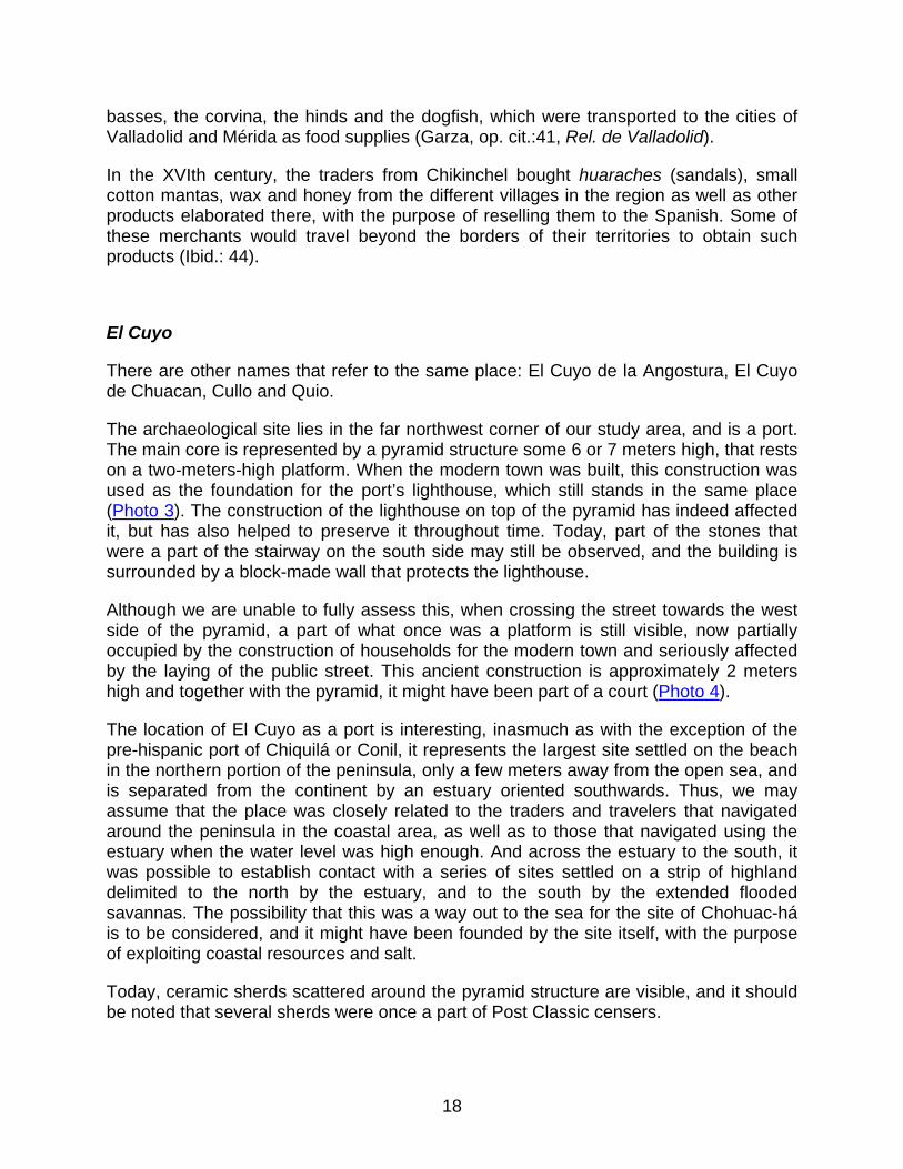
The archaeological site lies in the far northwest corner of our study area, and is a port. The main core is represented by a pyramid structure some 6 or 7 meters high, that rests on a two-meters-high platform. When the modern town was built, this construction was used as the foundation for the port’s lighthouse, which still stands in the same place (Photo 3). The construction of the lighthouse on top of the pyramid has indeed affected it, but has also helped to preserve it throughout time. Today, part of the stones that were a part of the stairway on the south side may still be observed, and the building is surrounded by a block-made wall that protects the lighthouse.
Although we are unable to fully assess this, when crossing the street towards the west side of the pyramid, a part of what once was a platform is still visible, now partially occupied by the construction of households for the modern town and seriously affected by the laying of the public street. This ancient construction is approximately 2 meters high and together with the pyramid, it might have been part of a court (Photo 4).
The location of El Cuyo as a port is interesting, inasmuch as with the exception of the pre-hispanic port of Chiquilá or Conil, it represents the largest site settled on the beach in the northern portion of the peninsula, only a few meters away from the open sea, and is separated from the continent by an estuary oriented southwards. Thus, we may assume that the place was closely related to the traders and travelers that navigated around the peninsula in the coastal area, as well as to those that navigated using the estuary when the water level was high enough. And across the estuary to the south, it was possible to establish contact with a series of sites settled on a strip of highland delimited to the north by the estuary, and to the south by the extended flooded savannas. The possibility that this was a way out to the sea for the site of Chohuac-há is to be considered, and it might have been founded by the site itself, with the purpose of exploiting coastal resources and salt.
Today, ceramic sherds scattered around the pyramid structure are visible, and it should be noted that several sherds were once a part of Post Classic censers.
18
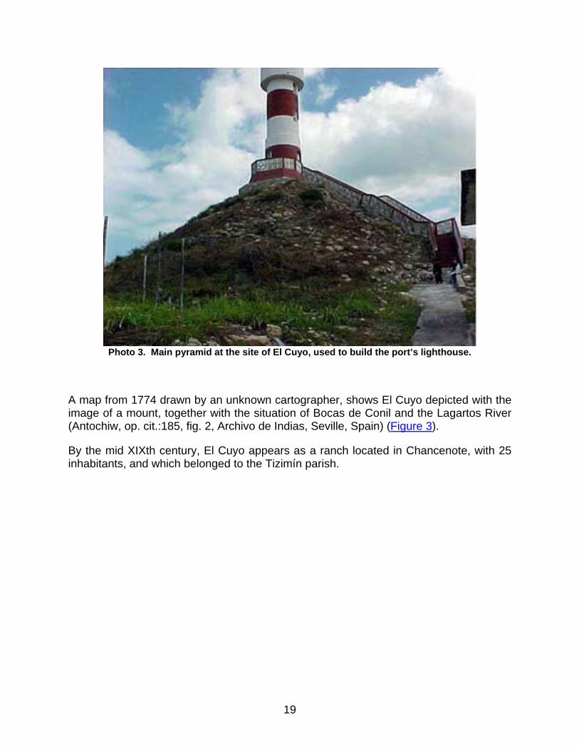
Photo 3. Main pyramid at the site of El Cuyo, used to build the port’s lighthouse.
A map from 1774 drawn by an unknown cartographer, shows El Cuyo depicted with the image of a mount, together with the situation of Bocas de Conil and the Lagartos River (Antochiw, op. cit.:185, fig. 2, Archivo de Indias, Seville, Spain) (Figure 3).
By the mid XIXth century, El Cuyo appears as a ranch located in Chancenote, with 25 inhabitants, and which belonged to the Tizimín parish.
19
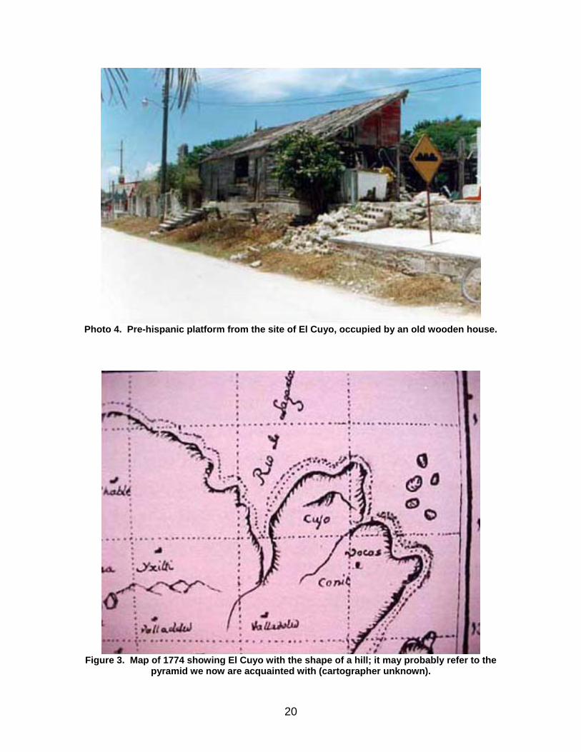
Photo 4. Pre-hispanic platform from the site of El Cuyo, occupied by an old wooden house.
Figure 3. Map of 1774 showing El Cuyo with the shape of a hill; it may probably refer to the
pyramid we now are acquainted with (cartographer unknown).
20
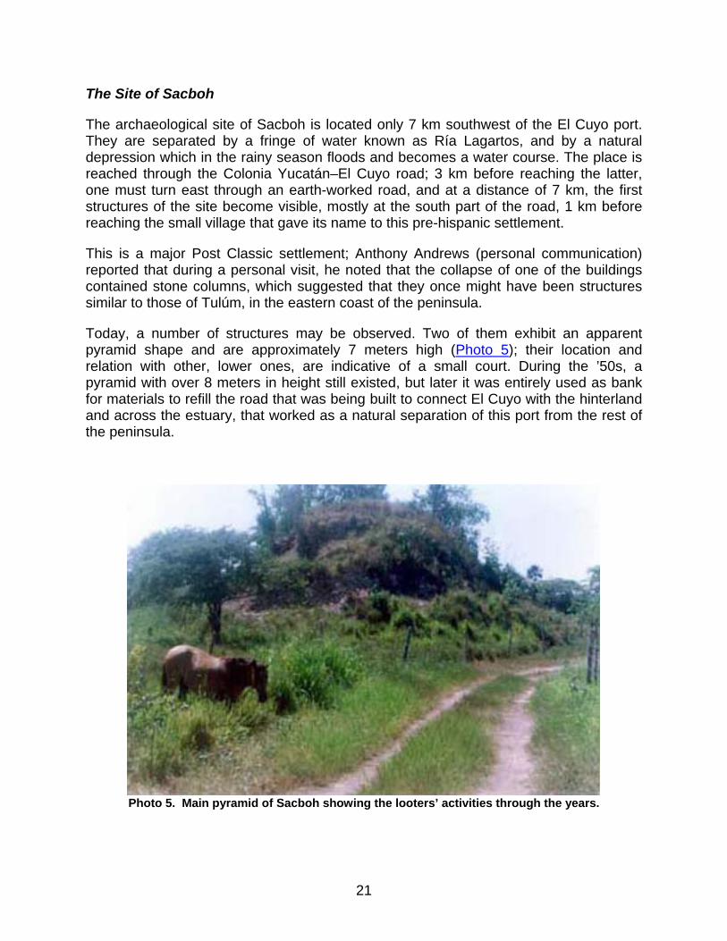
The Site of Sacboh
The archaeological site of Sacboh is located only 7 km southwest of the El Cuyo port. They are separated by a fringe of water known as Ría Lagartos, and by a natural depression which in the rainy season floods and becomes a water course. The place is reached through the Colonia Yucatán–El Cuyo road; 3 km before reaching the latter, one must turn east through an earth-worked road, and at a distance of 7 km, the first structures of the site become visible, mostly at the south part of the road, 1 km before reaching the small village that gave its name to this pre-hispanic settlement.
This is a major Post Classic settlement; Anthony Andrews (personal communication) reported that during a personal visit, he noted that the collapse of one of the buildings contained stone columns, which suggested that they once might have been structures similar to those of Tulúm, in the eastern coast of the peninsula.
Today, a number of structures may be observed. Two of them exhibit an apparent pyramid shape and are approximately 7 meters high (Photo 5); their location and relation with other, lower ones, are indicative of a small court. During the ’50s, a pyramid with over 8 meters in height still existed, but later it was entirely used as bank for materials to refill the road that was being built to connect El Cuyo with the hinterland and across the estuary, that worked as a natural separation of this port from the rest of the peninsula.
Photo 5. Main pyramid of Sacboh showing the looters’ activities through the years.
21
In a building located at the south edge of the site, of which very little was left, remains of several levels of stucco floors are noted, as well as rubble with abundant fragmentary ceramics and a number of snail remains.
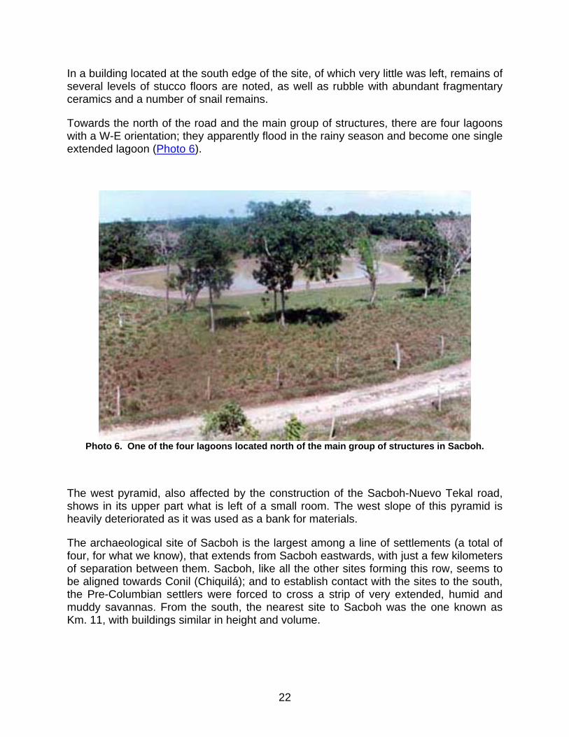
Towards the north of the road and the main group of structures, there are four lagoons with a W-E orientation; they apparently flood in the rainy season and become one single extended lagoon (Photo 6).
Photo 6. One of the four lagoons located north of the main group of structures in Sacboh.
The west pyramid, also affected by the construction of the Sacboh-Nuevo Tekal road, shows in its upper part what is left of a small room. The west slope of this pyramid is heavily deteriorated as it was used as a bank for materials.
The archaeological site of Sacboh is the largest among a line of settlements (a total of four, for what we know), that extends from Sacboh eastwards, with just a few kilometers of separation between them. Sacboh, like all the other sites forming this row, seems to be aligned towards Conil (Chiquilá); and to establish contact with the sites to the south, the Pre-Columbian settlers were forced to cross a strip of very extended, humid and muddy savannas. From the south, the nearest site to Sacboh was the one known as Km. 11, with buildings similar in height and volume.
22
The Site of Chauaca or El Cafetal
Probably, the original name of this site was Chohuac-há, which means "Abundant Water." Other names that refer to the same place are Chauaca, Chuaca and Xuaca.
The archaeological site is located approximately 14 km southwest of El Cuyo, and to get there, one must take the Colonia Yucatán–El Cuyo road; taking the direction of the latter, and one kilometer before reaching Moctezuma, there is a detour to the west with a paved and narrow road known as la costera (coastal drive). Two kilometers ahead, and from the road itself, at the entrance of the old ranch of El Cafetal, 1 kilometer away to the south, it appears–although it is not easily seen due to the distance–the great 12-meter-high structure that is a part of the main core of the site. The person in charge of the ranch is Sr. Manuel Pech and he lives in the modern town of Moctezuma.
According to historic documents, when Montejo the Adelantado was pursuing his conquest, the settlement was located north of a fresh water lagoon, at an approximate distance of one league (the equivalence of a league in modern terms is rather relative; although many modern peasants use it as the equivalent of approximately four kilometers, in conquest times it was taken for the distance one could cover on foot during one hour), and partially separated by the vegetation of a wet savanna. The lagoon was a water source throughout the year.
Chohuac-há, according to the historical-geographical accounts of the government of Yucatán, was located in the province of Chikinchel ("Western Grove") and constituted its major capital. Most likely, the Spanish heard about this town and region before entering the peninsula; thus they were forced to surround the coast to reach Conil and once in this port, they began their journey off the littoral. Therefore, the name of Chikinchel persisted since the XVIth century, being presently widely used to designate one of the polities present in the peninsula at the time of the Spanish contact, with Chauaca as its capital. The people of Chohuac-há were at war with towns such as Sinsimato and Dzonotaké, which assumedly were a part of Chikinchel. Chikinchel does not seem to have been a pre-hispanic polity, but rather a reference of the Ecab region to describe a geographical setting: the western grove.
The Relaciones de la Villa de Valladolid states that in the year 1542, Francisco de Montejo arrived to Tecoh. The nephew with sixty soldiers under his command headed to Izconti, located in the province of Cupules, where the people of Chikinchel sent a party to greet Montejo, to show their good will and their hopes for a peaceful relationship. From Izconti, Montejo traveled to Chohuac-há, perhaps because his uncle had already told him about the splendor of this site, and considering this was a good place to populate, he founded the first Villa de Valladolid in 1543, west of the lagoon, with the Maya village established north of this water source (Garza, op. cit.:29, Rel. de Valladolid). Thus, when the sun rose in the Villa de Valladolid, one could also see it rising on the lagoon (Ibid.:83, Rel. de Dzonot).
23
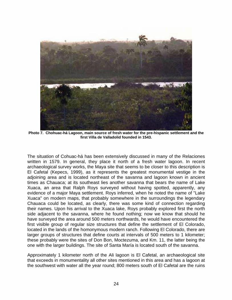
Photo 7. Chohuac-há Lagoon, main source of fresh water for the pre-hispanic settlement and the
first Villa de Valladolid founded in 1543.
The situation of Cohuac-há has been extensively discussed in many of the Relaciones written in 1579. In general, they place it north of a fresh water lagoon. In recent archaeological survey works, the Maya site that seems to be closer to this description is El Cafetal (Kepecs, 1999), as it represents the greatest monumental vestige in the adjoining area and is located northeast of the savanna and lagoon known in ancient times as Chauaca; at its southeast lies another savanna that bears the name of Lake Xuaca, an area that Ralph Roys surveyed without having spotted, apparently, any evidence of a major Maya settlement. Roys inferred, when he noted the name of "Lake Xuaca" on modern maps, that probably somewhere in the surroundings the legendary Chauaca could be located, as clearly, there was some kind of connection regarding their names. Upon his arrival to the Xuaca lake, Roys probably explored first the north side adjacent to the savanna, where he found nothing; now we know that should he have surveyed the area around 500 meters northwards, he would have encountered the first visible group of regular size structures that define the settlement of El Colorado, located in the lands of the homonymous modern ranch. Following El Colorado, there are larger groups of structures that define courts at intervals of 500 meters to 1 kilometer; these probably were the sites of Don Bon, Moctezuma, and Km. 11, the latter being the one with the larger buildings. The site of Santa María is located south of the savanna.
Approximately 1 kilometer north of the Ali lagoon is El Cafetal, an archaeological site that exceeds in monumentality all other sites mentioned in this area and has a lagoon at the southwest with water all the year round; 800 meters south of El Cafetal are the ruins
24
of San Ramón. Perhaps El Cafetal and San Ramón formed the ancient Chauaca?, or perhaps the group of small sites north of the Xuaca lake?; a somewhat more daring idea would be to suggest that all these sites altogether encompassed the settlement of Chauaca, and perhaps this is the reason why the Spanish refer that in 1528 it took them quite a time to arrive to the chieftain’s home, after encountering the first houses of that place. In any case, it seems clear that El Cafetal is Chohuac-há’s main core, as it is the one that stands closer to the water source of the lagoon, and exhibits monumental buildings of great volume.
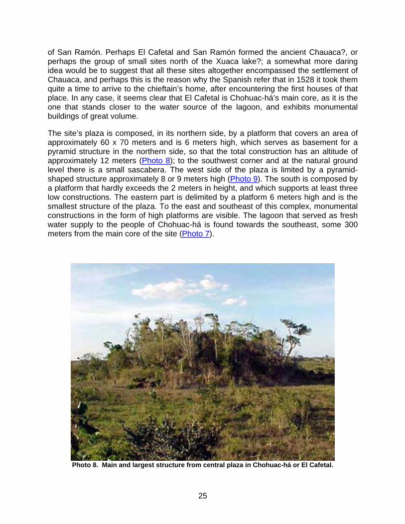
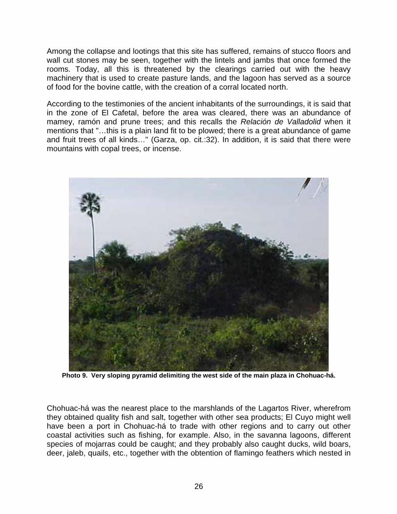
The site’s plaza is composed, in its northern side, by a platform that covers an area of approximately 60 x 70 meters and is 6 meters high, which serves as basement for a pyramid structure in the northern side, so that the total construction has an altitude of approximately 12 meters (Photo 8); to the southwest corner and at the natural ground level there is a small sascabera. The west side of the plaza is limited by a pyramid-shaped structure approximately 8 or 9 meters high (Photo 9). The south is composed by a platform that hardly exceeds the 2 meters in height, and which supports at least three low constructions. The eastern part is delimited by a platform 6 meters high and is the smallest structure of the plaza. To the east and southeast of this complex, monumental constructions in the form of high platforms are visible. The lagoon that served as fresh water supply to the people of Chohuac-há is found towards the southeast, some 300 meters from the main core of the site (Photo 7).
Photo 8. Main and largest structure from central plaza in Chohuac-há or El Cafetal.
25
Among the collapse and lootings that this site has suffered, remains of stucco floors and wall cut stones may be seen, together with the lintels and jambs that once formed the rooms. Today, all this is threatened by the clearings carried out with the heavy machinery that is used to create pasture lands, and the lagoon has served as a source of food for the bovine cattle, with the creation of a corral located north.
According to the testimonies of the ancient inhabitants of the surroundings, it is said that in the zone of El Cafetal, before the area was cleared, there was an abundance of mamey, ramón and prune trees; and this recalls the Relación de Valladolid when it mentions that "…this is a plain land fit to be plowed; there is a great abundance of game and fruit trees of all kinds…" (Garza, op. cit.:32). In addition, it is said that there were mountains with copal trees, or incense.
Photo 9. Very sloping pyramid delimiting the west side of the main plaza in Chohuac-há.
Chohuac-há was the nearest place to the marshlands of the Lagartos River, wherefrom they obtained quality fish and salt, together with other sea products; El Cuyo might well have been a port in Chohuac-há to trade with other regions and to carry out other coastal activities such as fishing, for example. Also, in the savanna lagoons, different species of mojarras could be caught; and they probably also caught ducks, wild boars, deer, jaleb, quails, etc., together with the obtention of flamingo feathers which nested in
26
the estuary, and sea mollusks that were traded in the gulf coast and the Caribbean Sea, in addition to the very valuable copal, apparently present in large quantities.
By 1544, the Villa de Valladolid, which had been settled in Chohuac-há for over one year, was relocated near the Maya settlement of Cupul de Sací, where it is presently found. This change of settlement took place, according to the settlers, because the lands of the first location were too humid, and during the rainy season the soil turned extremely muddy, making it difficult to move around, while in times of droughts the savannas exhaled unhealthy gases, in a way that many Spanish would get ill, while some of them even died (this was also the case with the natives). Once Chauaca was abandoned, the friars used to burn down the house of the natives that stayed there with the purpose of making them come closer to the doctrinary capital, so that many died and others ran to the hills (Ibid.:32-33, Rel. de Valladolid).
By 1579, the town included two hundred married Indians that were in a position to pay tributes, in addition to the old aged and the service staff who were also a part of the town. The town tributed thirteen and a half mantas, eighteen hens and eighteen pounds of wax. Only one farm had been founded, which produced indigo (Ibid.:249-250, Rel. de Chauaca). Possibly this farm was located in the modern town of Moctezuma, as ancient masonry constructions which are now a part of the ranch of El Cafetal are visible. At one time, the Moctezuma area was used by the Ancona family to grow henequen; at a different time, it was a rubber central with an owner whose last name was Baduy; coffee was also grown, and finally, and up to this day, it is used for cattle raising.
The Site of Sinsimato (Colonia Yucatán)
Possible true name: Sinsinbahtok. Other names referring to the same place: Cincinbahtok, Sinsinbuk, Simsimche, Zimzimche, and Simsimcha.
The name Sinsimato received by this proto-colonial settlement was probably due to a pronunciation error on the side of the settlers, as almost for sure the site was in fact Sinsinbahtok. This latter name is a reconstruction of "Cincinbahtok," reported in 1582 as a route that served the doctrinary capital of Dzonotaké (Roys, op. cit.:104).
A map presented by Tomás López in 1801, only shows two main houses of ancient ranches in this region, south of the port of El Cuyo: Misnebalam and Sincinbuk, being the latter similar to Simsimché or Simsimchá in more modern maps, (Ibidem). In 1848, a map drawn up by Santiago de Nigra de San Martín was found, where the site is referred to as Zimzimche (Antochiw, op. cit.:map 136), and later in a map of 1859 by Antonio Cubas, the location of Simsimchen as an intermediate point to reach Misnebalam is still shown, followed by Labcah, Monte Bravo and Yalahau; and southwest of Simsimchen is Dzonotaké, located approximately as shown in modern maps (Ibid.:display VIII). Still in another map from 1901 which is a sketch of the military staff, it is shown once again as Simsimche, but already connected through roads with Misnebalam to the north, and
27

Chancenote to the south; the latter probably was, at some point, the doctrinary capital (Ibid.:map 147).
For particular reasons, Roys favored the idea that the Sinsimato that settlers had mentioned was located in the area where the timber town of Colonia Yucatán was founded.
In effect, I also support the notion that the modern Colonia Yucatán was a part of the ancient Maya settlement of Sinsimato. According to the testimonies of the majority of the population, a group of structures was found east of the Colonia Yucatán–La Sierra road, where when the timber industry was at its peak, there was a sign that showed the way to the archaeological site, which read: A las ruinas, (to the ruins), with an arrow that pointed east. Probably this group of structures included the building reported by William R. Coe (Coe II, 1952:189-192) (see section corresponding to the site of Teapa), where a substructure was described with architectural characteristics similar to those of substructures 1 and 46 from the site of Dzibilchaltún, as also to others reported for the site of Oxkintok and Acancéh. After Coe’s visit in 1952, this group of structures, together with the one reported, were completely destroyed, and only some foundations were left, as well as partial alignments of what way back in time used to be monumental masonry constructions (Photo 10). Also, at the same place where Coe found the substructure, it supposedly existed, according to town witnesses, a pyramid building with rounded corners that supported a room with circular characteristics in its upper part.
Photo 10. Area where one of the main groups of Sinsimato was located, now completely
devastated. Presently, only small mounds are visible.
28
Still, basal alignments may be partially observed in the pasture grounds of modern ranches. The site of Teapa seems to correspond to the same group of structures, although researchers are sometimes confused and think that Colonia Yucatán and Teapa are two different sites; in fact, the structures are the same, though they may be reached through two different roads from each one of the towns.
The modern towns of Colonia Yucatán, La Sierra and Teapa are separated by short distances and may be enclosed in a radius of 1.5 kilometers, so that Sinsimato could very easily have embraced, extensionwise, these three modern towns.
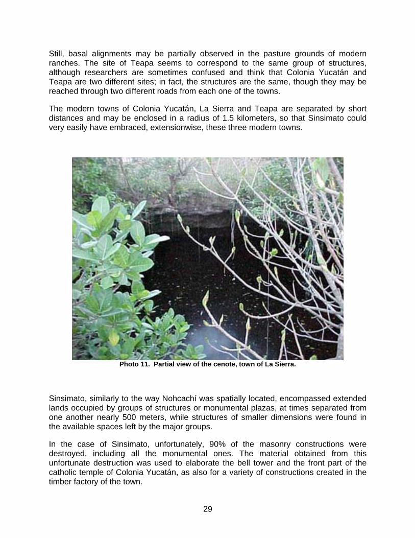
Photo 11. Partial view of the cenote, town of La Sierra.
Sinsimato, similarly to the way Nohcachí was spatially located, encompassed extended lands occupied by groups of structures or monumental plazas, at times separated from one another nearly 500 meters, while structures of smaller dimensions were found in the available spaces left by the major groups.
In the case of Sinsimato, unfortunately, 90% of the masonry constructions were destroyed, including all the monumental ones. The material obtained from this unfortunate destruction was used to elaborate the bell tower and the front part of the catholic temple of Colonia Yucatán, as also for a variety of constructions created in the timber factory of the town.
29
During the growth of the timber industry, when the houses that form the present settlement of Colonia Yucatán were built–according to the inhabitants’ sayings–a pre-hispanic pyramid some 7 meters high was destroyed and the place used to build a movie theatre and a bowling area in the town’s plaza. Two other structures of similar dimensions were demolished to build the police station and the wooden school, respectively. It would seem that in pre-hispanic times the three structures formed a large plaza, as shown by the arrangement of the modern structures to which they were related. As mentioned before, all three structures were of similar dimensions, from 7 to 8 meters high, and that’s all that is known about their architectural characteristics, as they only appeared as promontories with a pyramidal shape.
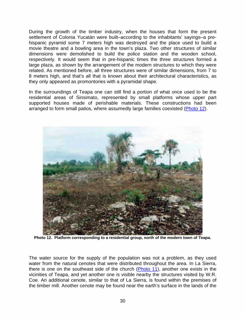
In the surroundings of Teapa one can still find a portion of what once used to be the residential areas of Sinsimato, represented by small platforms whose upper part supported houses made of perishable materials. These constructions had been arranged to form small patios, where assumedly large families coexisted (Photo 12).
Photo 12. Platform corresponding to a residential group, north of the modern town of Teapa.
The water source for the supply of the population was not a problem, as they used water from the natural cenotes that were distributed throughout the area. In La Sierra, there is one on the southeast side of the church (Photo 11), another one exists in the vicinities of Teapa, and yet another one is visible nearby the structures visited by W.R. Coe. An additional cenote, similar to that of La Sierra, is found within the premises of the timber mill. Another cenote may be found near the earth’s surface in the lands of the
30
modern town of Emiliano Zapata, 2 kilometers southwest of Colonia Yucatán. For what it seems, Sinsimato most certainly did not suffer a scarcity of water, the vital liquid, which by all means was easily obtained.
Oviedo refers that two leagues before reaching Sinsimato, a good number of copal trees had grown, a resin used as incense in pyramids and oratories, as also in sacrifices and other special occasions. It was also traded and taken to other regions; in this new town, the Spanish spent only one night before heading to Chuaca (Oviedo, op. cit., III:230).
Apparently, these trees are no longer there, and we ignore whether in fact they ever existed, as the trees in most of the territories assumedly visited by the expedition of Montejo the Adelantado, were cut down to open pasture grounds for the bovine cattle; we should as well keep in mind that in this region a powerful timber industry developed in the past, and in other words, this is equivalent to saying that woods were felled.
Testimonies from local people indicate that adjacent to where the pre-hispanic structures used to be, there were abundant "mount-type" prune trees as well as polbox (a native fruit of the region).
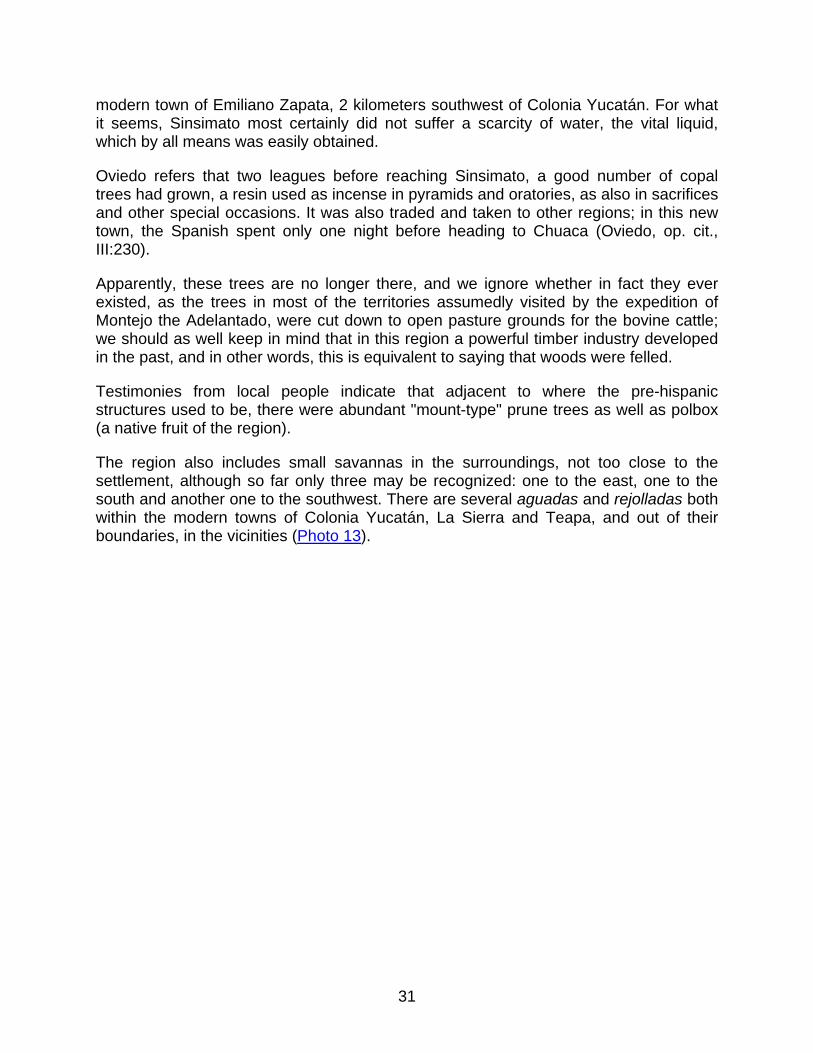
The region also includes small savannas in the surroundings, not too close to the settlement, although so far only three may be recognized: one to the east, one to the south and another one to the southwest. There are several aguadas and rejolladas both within the modern towns of Colonia Yucatán, La Sierra and Teapa, and out of their boundaries, in the vicinities (Photo 13).
31
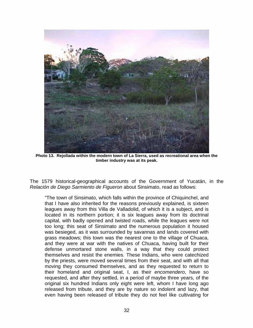
Photo 13. Rejollada within the modern town of La Sierra, used as recreational area when the
timber industry was at its peak.
The 1579 historical-geographical accounts of the Government of Yucatán, in the Relación de Diego Sarmiento de Figueron about Sinsimato, read as follows:
"The town of Sinsimato, which falls within the province of Chiquinchel, and that I have also inherited for the reasons previously explained, is sixteen leagues away from this Villa de Valladolid, of which it is a subject, and is located in its northern portion; it is six leagues away from its doctrinal capital, with badly opened and twisted roads, while the leagues were not too long; this seat of Sinsimato and the numerous population it housed was besieged, as it was surrounded by savannas and lands covered with grass meadows; this town was the nearest one to the village of Chuaca, and they were at war with the natives of Chuaca, having built for their defense unmortared stone walls, in a way that they could protect themselves and resist the enemies. These Indians, who were catechized by the priests, were moved several times from their seat, and with all that moving they consumed themselves, and as they requested to return to their homeland and original seat, I, as their encomendero, have so requested, and after they settled, in a period of maybe three years, of the original six hundred Indians only eight were left, whom I have long ago released from tribute, and they are by nature so indolent and lazy, that even having been released of tribute they do not feel like cultivating for
32
their subsistence any kind of food, but rather, they are at all times lying down as idlers, and as the lands are rich in fruits and game they use no other food, and thus, they are ill and pale because this food does not include the essential bread. And in this settlement, they are somehow more content. This is what we have been able to understand about this people" (Garza, op. cit.:218-219).
As to the location of Sinsimato, the encomendero states that the village was located amidst savannas and grass meadows, but he fails to specify whether the savannas were at a short distance or not; and as I mentioned before, there are indeed savannas in the surroundings of the modern town of Colonia Yucatán, although they are not so close as the savannas that surround the ancient village of Chohuac-há. He also indicates that Sinsimato was sixteen leagues north of Valladolid, which is at least approximately consistent with the location of modern Colonia Yucatán, located northeast. Other interesting information is that this town was the closest one to Chauaca, and in fact, no other towns are reported at that time and in that region, and in some old maps the name of Simsimché (Sinsimato) is already present, being one of the settlements that are closer to Chauaca. On the other hand it is said that the people of Sinsimato were at war with Chauaca, and this suggests that to fight against such a big and populated town as this one used to be, it had to be a town of a similar size as otherwise they would probably loose the battles, and the only archaeological site showing such dimensions in this region, fit to face such a confrontation, was the area of Sinsimato, while the rest of the region was occupied by smaller settlements. It would seem that only the site of Sinsimato could have been at war with Chauaca, in addition to Dzonotaké, which also had problems with it, as reported by Oviedo in his Historia General y Natural de las Indias. The encomendero Sarmiento also refers to Sinsimato’s abundance of fruit trees, and it should be recalled that in previous paragraphs we have mentioned that the early settlers of Colonia Yucatán had testified that "among the ruins there were many prune trees and trees of a fruit called polbox."
For all of the above we support the idea that Sinsimato was in fact located somewhere between the three modern towns mentioned several times in this text: Colonia Yucatán, La Sierra and Teapa. Oviedo refers to Sinsimato as a town larger than Cachi (Nohcachí), and the only settlement that may be reconstructed to locate Sinsimato is the area occupied by the three towns referred to, although at present the major constructions are no longer visible, inasmuch as what has survived to this day is but the shadow of what this village used to be, together with the testimonies of those who settled in the ’40s, in the XXth century, who still remember the greatness of this outstanding Maya center, one that survived until the eve of the conquest of Yucatán.
The Site of Km. 11
To reach this pre-hispanic settlement, one must take the road that connects Colonia Yucatán with El Cuyo, in the direction of the latter; 1 kilometer after crossing the town of Moctezuma there’s a road to the east which leads to several ranches, and 500 meters
33
away, approximately, the main structures of the site core are visible. With a careful observation, the tallest structures of the site may be admired from the edge of the paved road.
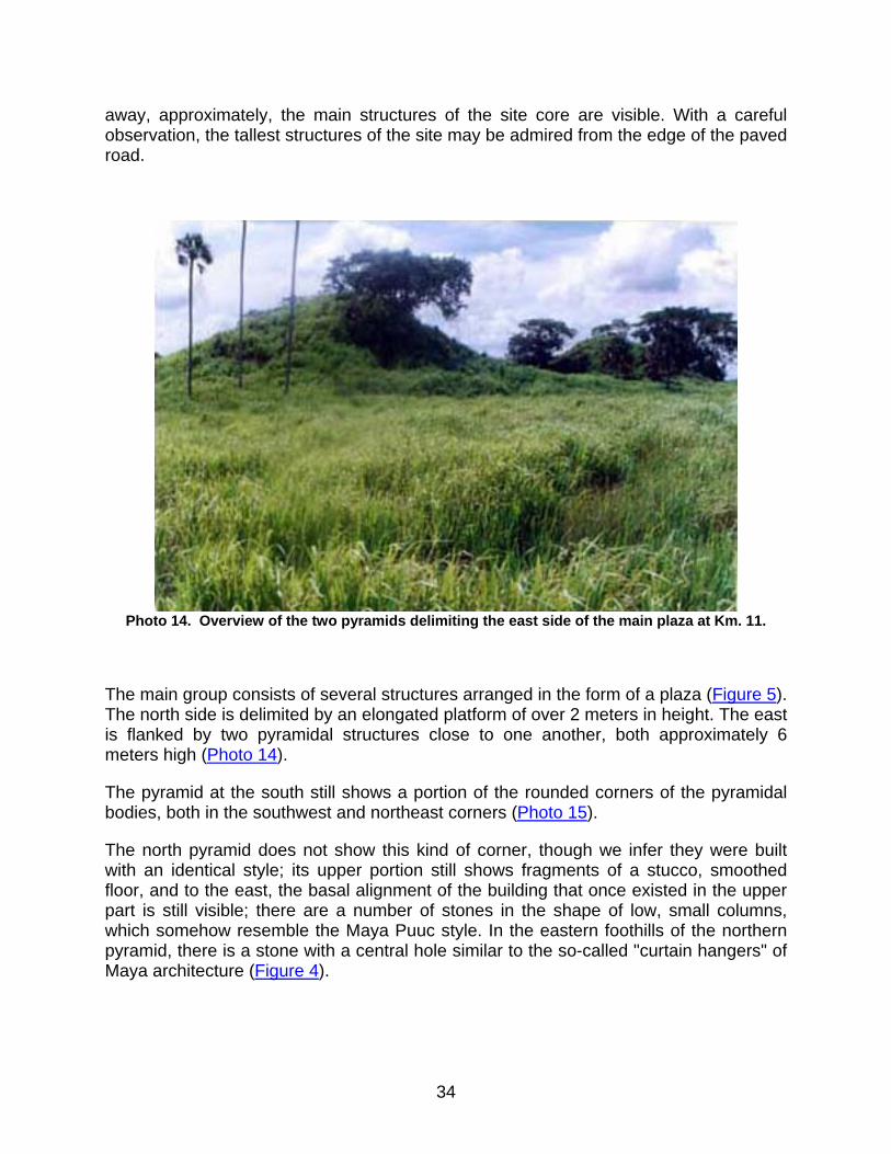
Photo 14. Overview of the two pyramids delimiting the east side of the main plaza at Km. 11.
The main group consists of several structures arranged in the form of a plaza (Figure 5). The north side is delimited by an elongated platform of over 2 meters in height. The east is flanked by two pyramidal structures close to one another, both approximately 6 meters high (Photo 14).
The pyramid at the south still shows a portion of the rounded corners of the pyramidal bodies, both in the southwest and northeast corners (Photo 15).
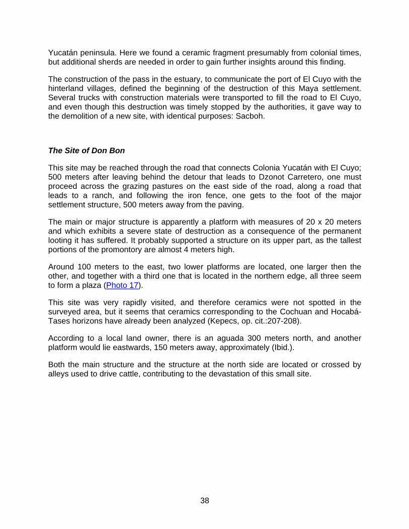
The north pyramid does not show this kind of corner, though we infer they were built with an identical style; its upper portion still shows fragments of a stucco, smoothed floor, and to the east, the basal alignment of the building that once existed in the upper part is still visible; there are a number of stones in the shape of low, small columns, which somehow resemble the Maya Puuc style. In the eastern foothills of the northern pyramid, there is a stone with a central hole similar to the so-called "curtain hangers" of Maya architecture (Figure 4).
34

As the site lies inside a cattle corral, the constant passing of the beasts over the structures has caused a shifting of the collapse that partially exposed the bodies of the pyramids and brought to the surface abundant ceramic material.
Figure 5. Sketch of the central area of the archaeological site Km. 11.
35
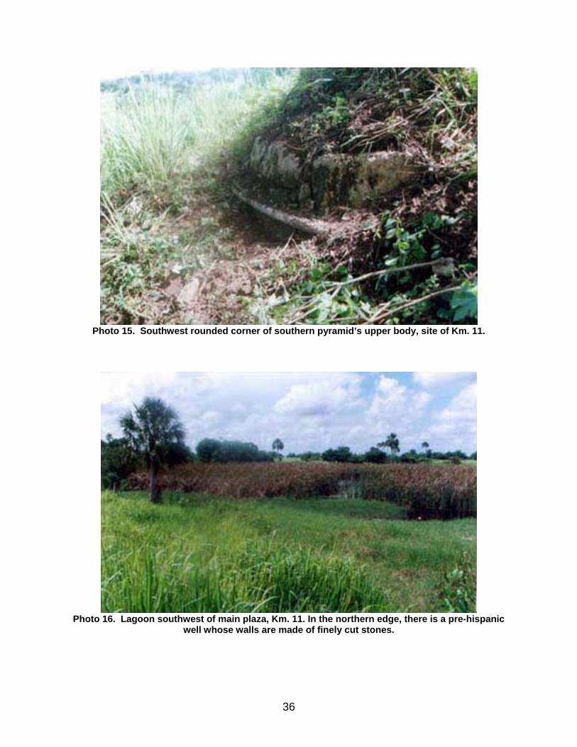
Photo 15. Southwest rounded corner of southern pyramid’s upper body, site of Km. 11.
Photo 16. Lagoon southwest of main plaza, Km. 11. In the northern edge, there is a pre-hispanic
well whose walls are made of finely cut stones.
36
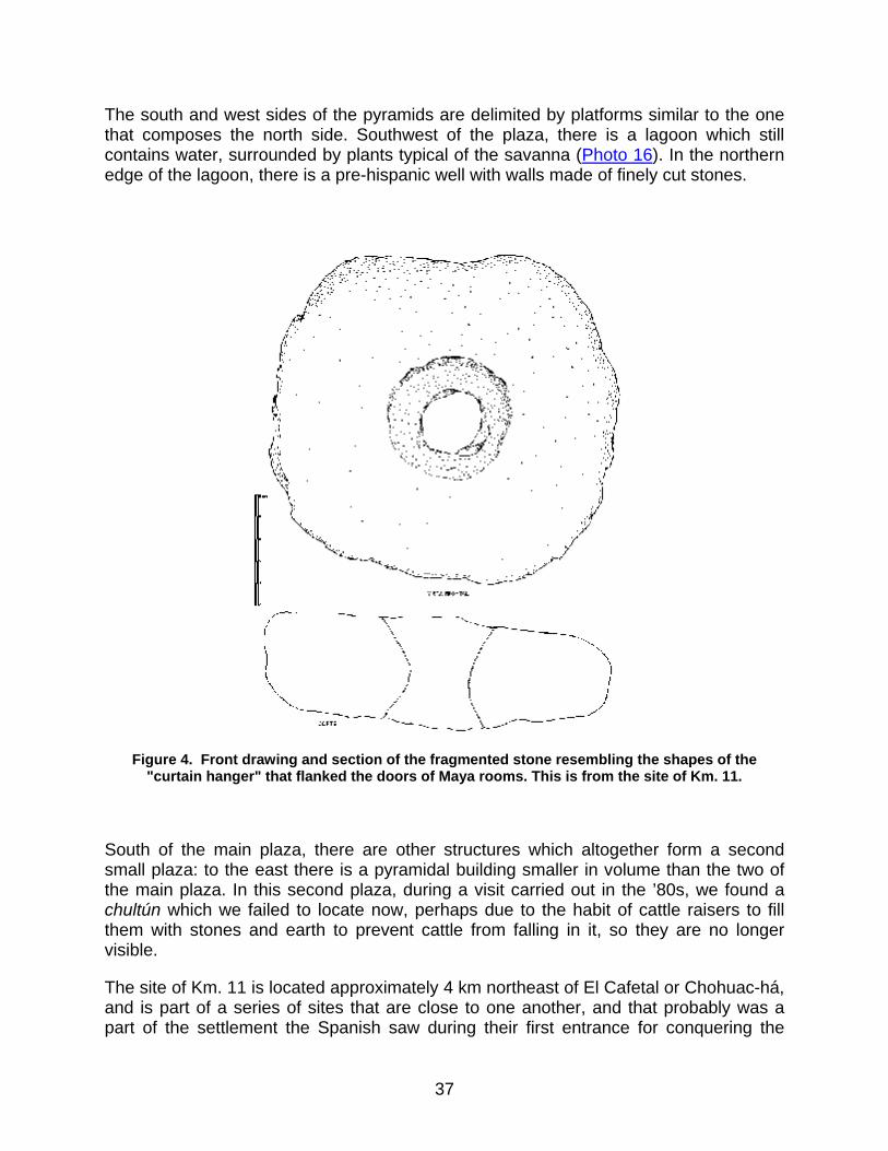
The south and west sides of the pyramids are delimited by platforms similar to the one that composes the north side. Southwest of the plaza, there is a lagoon which still contains water, surrounded by plants typical of the savanna (Photo 16). In the northern edge of the lagoon, there is a pre-hispanic well with walls made of finely cut stones.
Figure 4. Front drawing and section of the fragmented stone resembling the shapes of the
"curtain hanger" that flanked the doors of Maya rooms. This is from the site of Km. 11.
South of the main plaza, there are other structures which altogether form a second small plaza: to the east there is a pyramidal building smaller in volume than the two of the main plaza. In this second plaza, during a visit carried out in the ’80s, we found a chultún which we failed to locate now, perhaps due to the habit of cattle raisers to fill them with stones and earth to prevent cattle from falling in it, so they are no longer visible.
The site of Km. 11 is located approximately 4 km northeast of El Cafetal or Chohuac-há, and is part of a series of sites that are close to one another, and that probably was a part of the settlement the Spanish saw during their first entrance for conquering the
37
Yucatán peninsula. Here we found a ceramic fragment presumably from colonial times, but additional sherds are needed in order to gain further insights around this finding.
The construction of the pass in the estuary, to communicate the port of El Cuyo with the hinterland villages, defined the beginning of the destruction of this Maya settlement. Several trucks with construction materials were transported to fill the road to El Cuyo, and even though this destruction was timely stopped by the authorities, it gave way to the demolition of a new site, with identical purposes: Sacboh.
The Site of Don Bon
This site may be reached through the road that connects Colonia Yucatán with El Cuyo; 500 meters after leaving behind the detour that leads to Dzonot Carretero, one must proceed across the grazing pastures on the east side of the road, along a road that leads to a ranch, and following the iron fence, one gets to the foot of the major settlement structure, 500 meters away from the paving.
The main or major structure is apparently a platform with measures of 20 x 20 meters and which exhibits a severe state of destruction as a consequence of the permanent looting it has suffered. It probably supported a structure on its upper part, as the tallest portions of the promontory are almost 4 meters high.
Around 100 meters to the east, two lower platforms are located, one larger then the other, and together with a third one that is located in the northern edge, all three seem to form a plaza (Photo 17).
This site was very rapidly visited, and therefore ceramics were not spotted in the surveyed area, but it seems that ceramics corresponding to the Cochuan and Hocabá-Tases horizons have already been analyzed (Kepecs, op. cit.:207-208).
According to a local land owner, there is an aguada 300 meters north, and another platform would lie eastwards, 150 meters away, approximately (Ibid.).
Both the main structure and the structure at the north side are located or crossed by alleys used to drive cattle, contributing to the devastation of this small site.
38
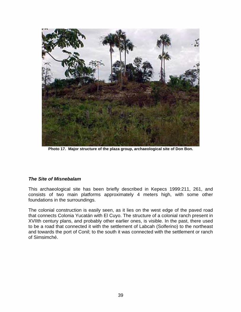
Photo 17. Major structure of the plaza group, archaeological site of Don Bon.
The Site of Misnebalam
This archaeological site has been briefly described in Kepecs 1999:211, 261, and consists of two main platforms approximately 4 meters high, with some other foundations in the surroundings.
The colonial construction is easily seen, as it lies on the west edge of the paved road that connects Colonia Yucatán with El Cuyo. The structure of a colonial ranch present in XVIIth century plans, and probably other earlier ones, is visible. In the past, there used to be a road that connected it with the settlement of Labcah (Solferino) to the northeast and towards the port of Conil; to the south it was connected with the settlement or ranch of Simsimché.
39
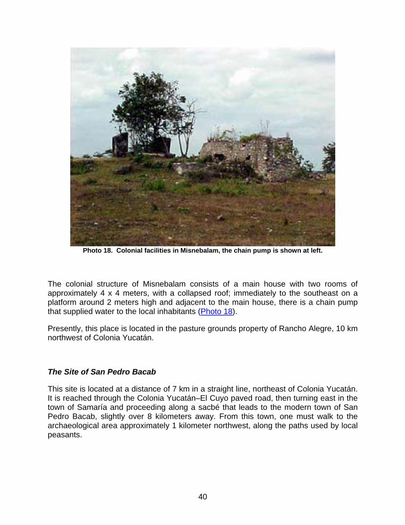
Photo 18. Colonial facilities in Misnebalam, the chain pump is shown at left.
The colonial structure of Misnebalam consists of a main house with two rooms of approximately 4 x 4 meters, with a collapsed roof; immediately to the southeast on a platform around 2 meters high and adjacent to the main house, there is a chain pump that supplied water to the local inhabitants (Photo 18).
Presently, this place is located in the pasture grounds property of Rancho Alegre, 10 km northwest of Colonia Yucatán.
The Site of San Pedro Bacab
This site is located at a distance of 7 km in a straight line, northeast of Colonia Yucatán. It is reached through the Colonia Yucatán–El Cuyo paved road, then turning east in the town of Samaría and proceeding along a sacbé that leads to the modern town of San Pedro Bacab, slightly over 8 kilometers away. From this town, one must walk to the archaeological area approximately 1 kilometer northwest, along the paths used by local peasants.
40
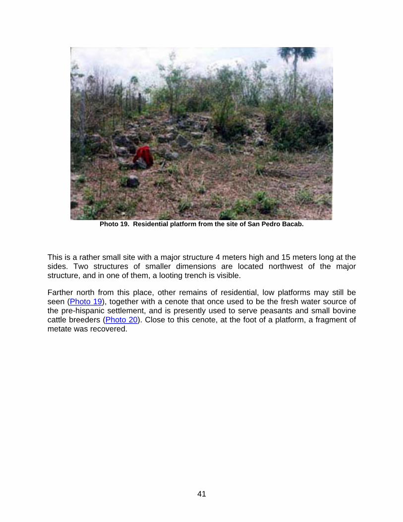
Photo 19. Residential platform from the site of San Pedro Bacab.
This is a rather small site with a major structure 4 meters high and 15 meters long at the sides. Two structures of smaller dimensions are located northwest of the major structure, and in one of them, a looting trench is visible.
Farther north from this place, other remains of residential, low platforms may still be seen (Photo 19), together with a cenote that once used to be the fresh water source of the pre-hispanic settlement, and is presently used to serve peasants and small bovine cattle breeders (Photo 20). Close to this cenote, at the foot of a platform, a fragment of metate was recovered.
41
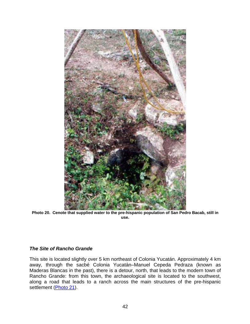
Photo 20. Cenote that supplied water to the pre-hispanic population of San Pedro Bacab, still in
use.
The Site of Rancho Grande
This site is located slightly over 5 km northeast of Colonia Yucatán. Approximately 4 km away, through the sacbé Colonia Yucatán–Manuel Cepeda Pedraza (known as Maderas Blancas in the past), there is a detour, north, that leads to the modern town of Rancho Grande: from this town, the archaeological site is located to the southwest, along a road that leads to a ranch across the main structures of the pre-hispanic settlement (Photo 21).
42
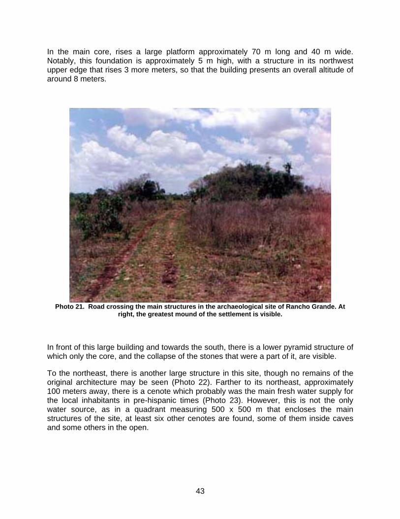
In the main core, rises a large platform approximately 70 m long and 40 m wide. Notably, this foundation is approximately 5 m high, with a structure in its northwest upper edge that rises 3 more meters, so that the building presents an overall altitude of around 8 meters.
Photo 21. Road crossing the main structures in the archaeological site of Rancho Grande. At
right, the greatest mound of the settlement is visible.
In front of this large building and towards the south, there is a lower pyramid structure of which only the core, and the collapse of the stones that were a part of it, are visible.
To the northeast, there is another large structure in this site, though no remains of the original architecture may be seen (Photo 22). Farther to its northeast, approximately 100 meters away, there is a cenote which probably was the main fresh water supply for the local inhabitants in pre-hispanic times (Photo 23). However, this is not the only water source, as in a quadrant measuring 500 x 500 m that encloses the main structures of the site, at least six other cenotes are found, some of them inside caves and some others in the open.
43
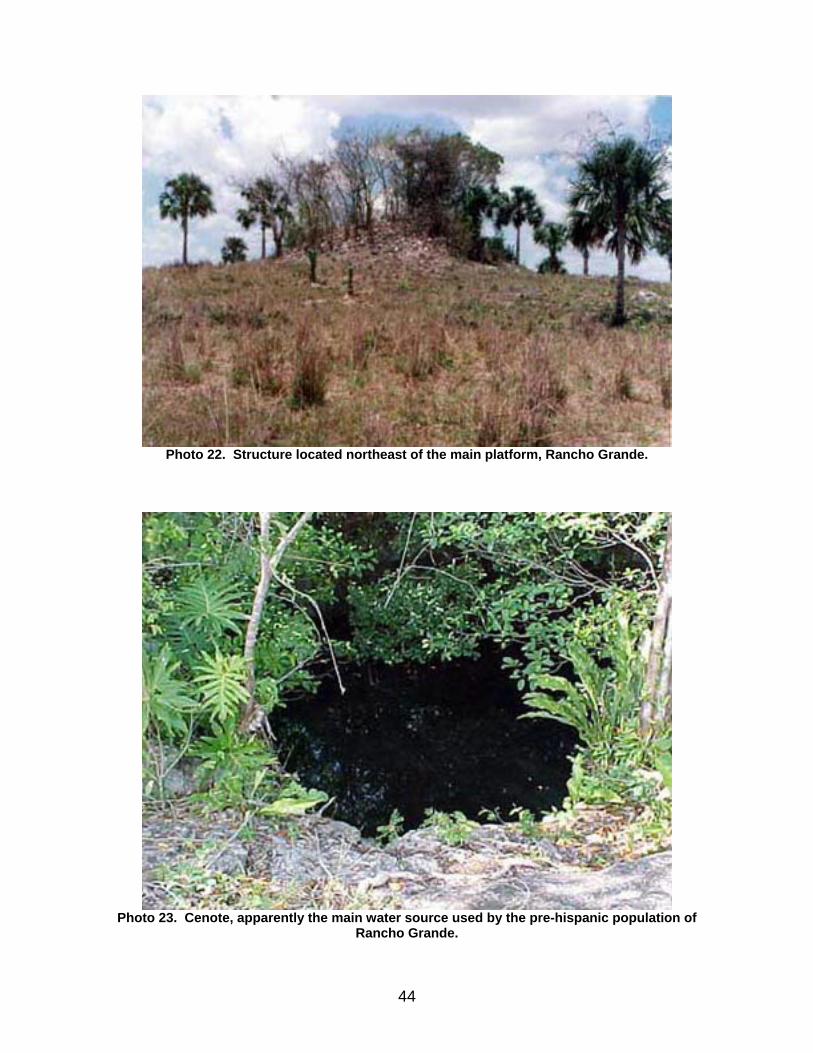
Photo 22. Structure located northeast of the main platform, Rancho Grande.
Photo 23. Cenote, apparently the main water source used by the pre-hispanic population of
Rancho Grande.
44

To the southeast, other groups of structures form courts and small plazas. And farther towards the southwest and at a distance of 400 m or more, there are still other structures over 4 m high.
The water source of the modern ranch where this archaeological site is found, is the same cenote used in pre-hispanic times: this cenote was used as a water well, with a rounded stone lid which was withdrawn to lay pipelines for pumping water.
The Site of Teapa
The archaeological settlement of Teapa is located slightly north of the homonymous modern town; it may be reached through the paved road that connects Colonia Yucatán with Kantunilkín, and is found 3 kilometers away from Colonia Yucatán, towards the southeast.
This seems to be the site Coe II described in the ’50s of the XXth century (Coe, op. cit.). Today, only a few residential platforms distributed in different plots of the town are visible. Coe reported a substructure with rounded corners, which we have described in the section of Sinsimato. This means that since ancient times and up to this day, to reach the place where the major group of structures is located, people could use two different roads, one from Colonia Yucatán and the other one from the town of Teapa, although the site was one and the same, a fact that caused some confusion among researchers: even though we have considered it as a separate site, in fact it did include portions of Sinsimato, similar to the remains identified as "Amado León" by Kepecs (Kepecs, op. cit.).
After Coe’s visit, and as I have already noted, the substructure reported by him was completely destroyed, and only some traces of the structure’s rubble were left in place together with a part of the basal alignments, though they hardly reflect what they were in pre-hispanic times or at the time of Montejo the Adelantado’s arrival in 1528.
Both east and west are found cenotes in the shape of caves, falling straight down and creating a two-meter space between the water surface and the natural ground surface.
Most likely Roys (Roys, op. cit.) visited a portion of this site, as also a portion of an adjacent ranch known as Simsimché, making reference to the ancient settlement of Sinsimato.
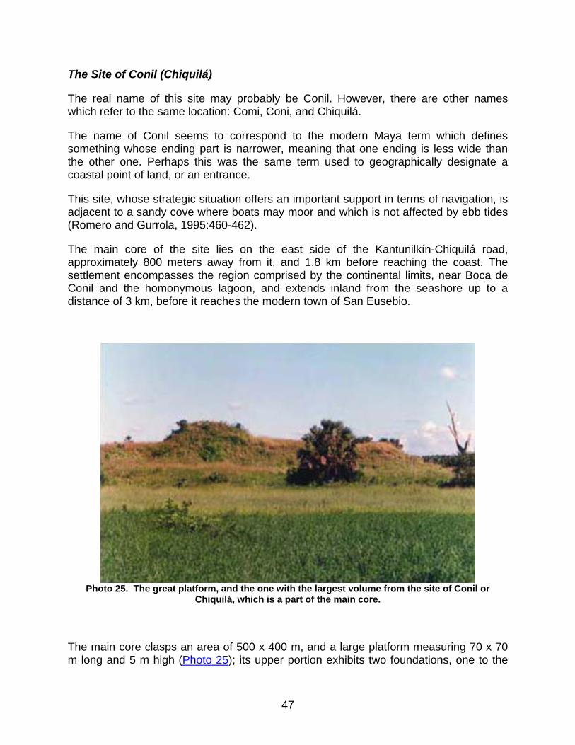
During our visit to this place, one inhabitant of the modern town of Teapa showed us an artifact consisting of a greenstone axe, recovered in one of the residential platforms located north of the site (Photo 24 and Figure 6, shown below).
45
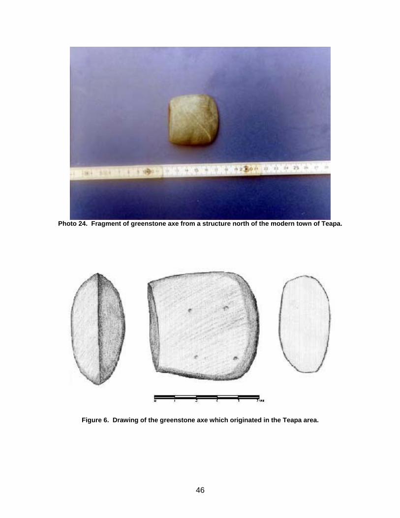
Photo 24. Fragment of greenstone axe from a structure north of the modern town of Teapa.
Figure 6. Drawing of the greenstone axe which originated in the Teapa area.
46
The Site of Conil (Chiquilá)
The real name of this site may probably be Conil. However, there are other names which refer to the same location: Comi, Coni, and Chiquilá.
The name of Conil seems to correspond to the modern Maya term which defines something whose ending part is narrower, meaning that one ending is less wide than the other one. Perhaps this was the same term used to geographically designate a coastal point of land, or an entrance.
This site, whose strategic situation offers an important support in terms of navigation, is adjacent to a sandy cove where boats may moor and which is not affected by ebb tides (Romero and Gurrola, 1995:460-462).
The main core of the site lies on the east side of the Kantunilkín-Chiquilá road, approximately 800 meters away from it, and 1.8 km before reaching the coast. The settlement encompasses the region comprised by the continental limits, near Boca de Conil and the homonymous lagoon, and extends inland from the seashore up to a distance of 3 km, before it reaches the modern town of San Eusebio.
Photo 25. The great platform, and the one with the largest volume from the site of Conil or
Chiquilá, which is a part of the main core.
The main core clasps an area of 500 x 400 m, and a large platform measuring 70 x 70 m long and 5 m high (Photo 25); its upper portion exhibits two foundations, one to the
47
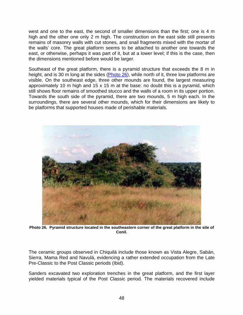
west and one to the east, the second of smaller dimensions than the first; one is 4 m high and the other one only 2 m high. The construction on the east side still presents remains of masonry walls with cut stones, and snail fragments mixed with the mortar of the walls’ core. The great platform seems to be attached to another one towards the east, or otherwise, perhaps it was part of it, but at a lower level; if this is the case, then the dimensions mentioned before would be larger.
Southeast of the great platform, there is a pyramid structure that exceeds the 8 m in height, and is 30 m long at the sides (Photo 26), while north of it, three low platforms are visible. On the southeast edge, three other mounds are found, the largest measuring approximately 10 m high and 15 x 15 m at the base: no doubt this is a pyramid, which still shows floor remains of smoothed stucco and the walls of a room in its upper portion. Towards the south side of the pyramid, there are two mounds, 5 m high each. In the surroundings, there are several other mounds, which for their dimensions are likely to be platforms that supported houses made of perishable materials.
Photo 26. Pyramid structure located in the southeastern corner of the great platform in the site of
Conil.
The ceramic groups observed in Chiquilá include those known as Vista Alegre, Sabán, Sierra, Mama Red and Navulá, evidencing a rather extended occupation from the Late Pre-Classic to the Post Classic periods (Ibid).
Sanders excavated two exploration trenches in the great platform, and the first layer yielded materials typical of the Post Classic period. The materials recovered include
48

what he has denominated Chiquilá censers, Tacna Red, Vista Alegre Striated, Chiquilá Variegated, Miscellaneous Unslipped Red Ware, Tacna Plain Striated, and regional polychromes (Sanders 1957:192-193).
Discussions around the location of the port of Conil are not new, as it has been previously identified like the site of Vista Alegre, but like Andrews notes, the site with the highest probabilities of belonging to Conil is Chiquilá (Andrews, 1998:1).
Following the conquest, the port of Conil continued to be used as such, though the amount of inhabitants decreased in early colonial time. In 1549, it housed approximately 360 individuals, 80 of which were contributors, and by 1565, the population amounted to ten households only (Ibid.:2).
The geographical situation of the site of Conil in pre-hispanic times had made of it a key settlement in the routes of trade and navigation, both towards the coast, and the towns in the hinterland. Its situation south of the lagoon or homonymous bay, with tranquil waters, facilitated navigation and provided a harbor for ships during dangerous storms. On the other side, east of Conil lies the savanna known as La Zanja, which connects with the coast and penetrates inside the peninsula; and most likely, when the water levels were at their peak, the small vessels had the possibility to access sites like Monte Bravo and San Ángel, as also all the others that were located across the savanna.
Fresh water supply was not a problem in Conil, as the area benefited from the springs, still present, that emerge among the salt water and are known as ojos de agua (springs). Therefore, it is evident that in ancient times, this was a large port which navigators necessarily used, both to get supplies on their way to the gulf coast or the Caribbean, and to buy or sell different products, or at least to visit the place and admire the great temples of the most prosperous and largest port in the entire Yucatecan coast.
In colonial times, in order to reach the port of Conil, travelers used a road that necessarily crossed the town of Nocachí.
In the first attempt to conquer Yucatán, around 1528-1529, Montejo the Adelantado took a two-month rest with his men in this port before proceeding inland to Cachi (Nohcachí) (Oviedo, op. cit.).
The Site of Kantunilkín
Cantaniqui is another name with which this site is known.
Kantunikín is a pre-hispanic site whose major structures are located within the household grounds of the modern population. Unfortunately, only the remains of two monumental structures are visible; one of them is located north of the old baseball field and the second one lies 60 m east of it, both are in a severe state of looting and destruction, and they appear merely as two rubble mounds (Photo 27).
49
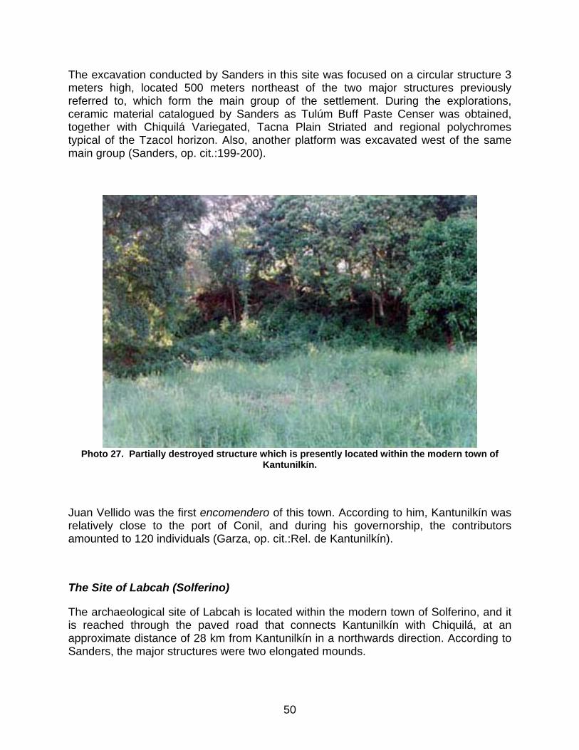
The excavation conducted by Sanders in this site was focused on a circular structure 3 meters high, located 500 meters northeast of the two major structures previously referred to, which form the main group of the settlement. During the explorations, ceramic material catalogued by Sanders as Tulúm Buff Paste Censer was obtained, together with Chiquilá Variegated, Tacna Plain Striated and regional polychromes typical of the Tzacol horizon. Also, another platform was excavated west of the same main group (Sanders, op. cit.:199-200).
Photo 27. Partially destroyed structure which is presently located within the modern town of
Kantunilkín.
Juan Vellido was the first encomendero of this town. According to him, Kantunilkín was relatively close to the port of Conil, and during his governorship, the contributors amounted to 120 individuals (Garza, op. cit.:Rel. de Kantunilkín).
The Site of Labcah (Solferino)
The archaeological site of Labcah is located within the modern town of Solferino, and it is reached through the paved road that connects Kantunilkín with Chiquilá, at an approximate distance of 28 km from Kantunilkín in a northwards direction. According to Sanders, the major structures were two elongated mounds.
50

During our visit to the site, we failed to find those structures–this however does not mean that they do not exist–but residential platforms are visible among the modern houses, while many other structures were destroyed with the development of the modern town. Upon our arrival to the town of Solferino, we learned that recently, the flat grounds of the sport field located at the northern edge of the town had been enlarged, and that during these developmental actions, a small structure had been destroyed, and several pre-hispanic artifacts found by the inhabitants of this place. We were shown only a small number of them, consisting of finely worked snail beads and a shell pectoral with star-shaped incisions; we were also given a shell bead which came from the site of Monte Bravo, located 6 km east of Solferino (Figure 7).
By 1846, and according to the census of that year, Labcah or Solferino had 136 inhabitants and belonged to the curacy of Tizimín (Brito, no date:35).
Site 1
It is located slightly over 9 straight kilometers northeast of Colonia Yucatán. One gets there using the same road that leads to the archaeological site of Rancho Grande, and it is located after the modern town of Manuel Cepeda Peraza (Maderas Blancas), 2 kilometers towards the northeast. It is easily found because the archaeological remains are seen at both sides of the sacbé, north and south.
The main structure is located east of the road, at a distance of 50 meters, and is visible from the road (Photo 28). It is a platform of approximately 3 meters high, with dimensions of 15 meters long and 10 meters wide, with a longitudinal axis that runs in an E-W direction. It was in the surroundings of this platform where the small sample of surface ceramic analyzed was found. This structure lies in the grazing fields of a modern ranch.
At the front of this main structure, north of the road, there is a rejollada, not too big in size. East of the rejollada, several low platforms were visible, and in one of them, the fragmented metate was recovered. Also, in the adjoining area of the main platform, other smaller structures that probably formed an entire residential area were spotted.
51

Figure 7. Artifacts found in possession of private individuals from the town of Solferino: (a) Shell
pectoral from Solferino, (b) Shell pendant from the Monte Bravo area, and (c) Snail bead from Solferino.
52
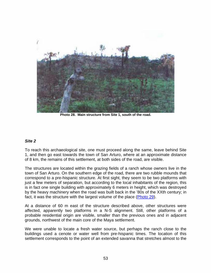
Photo 28. Main structure from Site 1, south of the road.
Site 2
To reach this archaeological site, one must proceed along the same, leave behind Site 1, and then go east towards the town of San Arturo, where at an approximate distance of 8 km, the remains of this settlement, at both sides of the road, are visible.
The structures are located within the grazing fields of a ranch whose owners live in the town of San Arturo. On the southern edge of the road, there are two rubble mounds that correspond to a pre-hispanic structure. At first sight, they seem to be two platforms with just a few meters of separation, but according to the local inhabitants of the region, this is in fact one single building with approximately 6 meters in height, which was destroyed by the heavy machinery when the road was built back in the ’80s of the XXth century; in fact, it was the structure with the largest volume of the place (Photo 29).
At a distance of 60 m east of the structure described above, other structures were affected, apparently two platforms in a N-S alignment. Still, other platforms of a probable residential origin are visible, smaller than the previous ones and in adjacent grounds, northwest of the main core of the Maya settlement.
We were unable to locate a fresh water source, but perhaps the ranch close to the buildings used a cenote or water well from pre-hispanic times. The location of this settlement corresponds to the point of an extended savanna that stretches almost to the
53
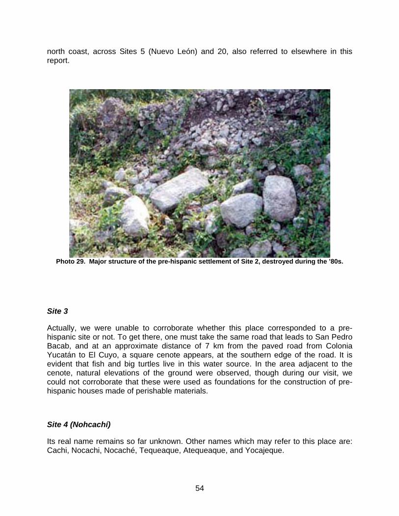
north coast, across Sites 5 (Nuevo León) and 20, also referred to elsewhere in this report.
Photo 29. Major structure of the pre-hispanic settlement of Site 2, destroyed during the ’80s.
Site 3
Actually, we were unable to corroborate whether this place corresponded to a pre-hispanic site or not. To get there, one must take the same road that leads to San Pedro Bacab, and at an approximate distance of 7 km from the paved road from Colonia Yucatán to El Cuyo, a square cenote appears, at the southern edge of the road. It is evident that fish and big turtles live in this water source. In the area adjacent to the cenote, natural elevations of the ground were observed, though during our visit, we could not corroborate that these were used as foundations for the construction of pre-hispanic houses made of perishable materials.
Site 4 (Nohcachí)
Its real name remains so far unknown. Other names which may refer to this place are: Cachi, Nocachi, Nocaché, Tequeaque, Atequeaque, and Yocajeque.
54
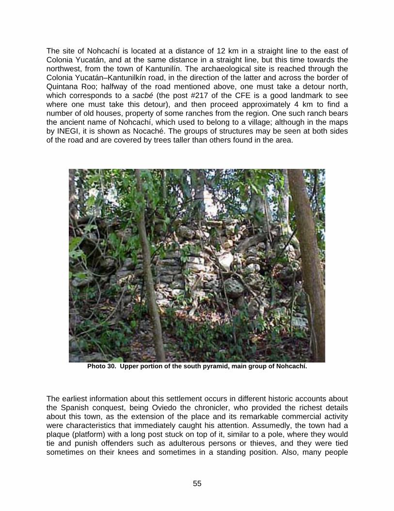
The site of Nohcachí is located at a distance of 12 km in a straight line to the east of Colonia Yucatán, and at the same distance in a straight line, but this time towards the northwest, from the town of Kantunilín. The archaeological site is reached through the Colonia Yucatán–Kantunilkín road, in the direction of the latter and across the border of Quintana Roo; halfway of the road mentioned above, one must take a detour north, which corresponds to a sacbé (the post #217 of the CFE is a good landmark to see where one must take this detour), and then proceed approximately 4 km to find a number of old houses, property of some ranches from the region. One such ranch bears the ancient name of Nohcachí, which used to belong to a village; although in the maps by INEGI, it is shown as Nocaché. The groups of structures may be seen at both sides of the road and are covered by trees taller than others found in the area.
Photo 30. Upper portion of the south pyramid, main group of Nohcachí.
The earliest information about this settlement occurs in different historic accounts about the Spanish conquest, being Oviedo the chronicler, who provided the richest details about this town, as the extension of the place and its remarkable commercial activity were characteristics that immediately caught his attention. Assumedly, the town had a plaque (platform) with a long post stuck on top of it, similar to a pole, where they would tie and punish offenders such as adulterous persons or thieves, and they were tied sometimes on their knees and sometimes in a standing position. Also, many people
55

attended the place for commercial transactions, and they had a large market with plenty of dealers (sales-people and consumers) offering different products and goods: supplies and food. The Spanish observed that the place was ruled by certain people that were some kinds of sheriffs and judges, who owned a house by the market, used as a consistory where conflicts were solved as they occurred, granting each of the disputing parties that which justly corresponded (Oviedo, op. cit., III:229:230).
After taking a two days rest at Nohcachí, the Spanish expedition proceeded towards a different town ahead, larger than others they had seen and known, and whose name was Cincimato (Sinsimato) (Ibid.).
Today, the archaeological remains of Nohcachí, even though they have been severely looted, are still an example of their ancient greatness. There are at least four major groups of monumental structures in an area a little larger than 500 x 500 meters, with smaller platforms in the surroundings, together with water wells and rejolladas (Figure 8).
Probably the larger and most important group is the one located northeast, and although in its present condition it is hard to establish what the original shape was, it may be inferred that it was a large platform slightly over 2 meters in height, with evidence in its upper portion of the presence of buildings, maybe of rooms with masonry walls and roofs made of perishable materials. Northeast of the platform and attached to it, there is a pyramidal building about 8 meters high which was also penetrated by looters; still in its upper levels, parts of the retaining walls of the construction system are visible, and in some areas, stones fixed with mortar are present (Photo 30). A similar pyramid has been identified scarcely 10 meters to the north.
Another group of structures is located southeast, approximately 600 meters away of the main group, wherefrom a pyramid approximately 6 meters high rises, with several minor structures around it (Photo 31).
56

Figure 8. Sketch of the Nohcachí settlement.
57
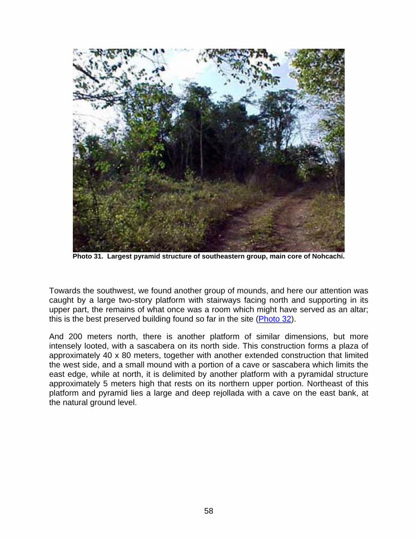
Photo 31. Largest pyramid structure of southeastern group, main core of Nohcachí.
Towards the southwest, we found another group of mounds, and here our attention was caught by a large two-story platform with stairways facing north and supporting in its upper part, the remains of what once was a room which might have served as an altar; this is the best preserved building found so far in the site (Photo 32).
And 200 meters north, there is another platform of similar dimensions, but more intensely looted, with a sascabera on its north side. This construction forms a plaza of approximately 40 x 80 meters, together with another extended construction that limited the west side, and a small mound with a portion of a cave or sascabera which limits the east edge, while at north, it is delimited by another platform with a pyramidal structure approximately 5 meters high that rests on its northern upper portion. Northeast of this platform and pyramid lies a large and deep rejollada with a cave on the east bank, at the natural ground level.
58
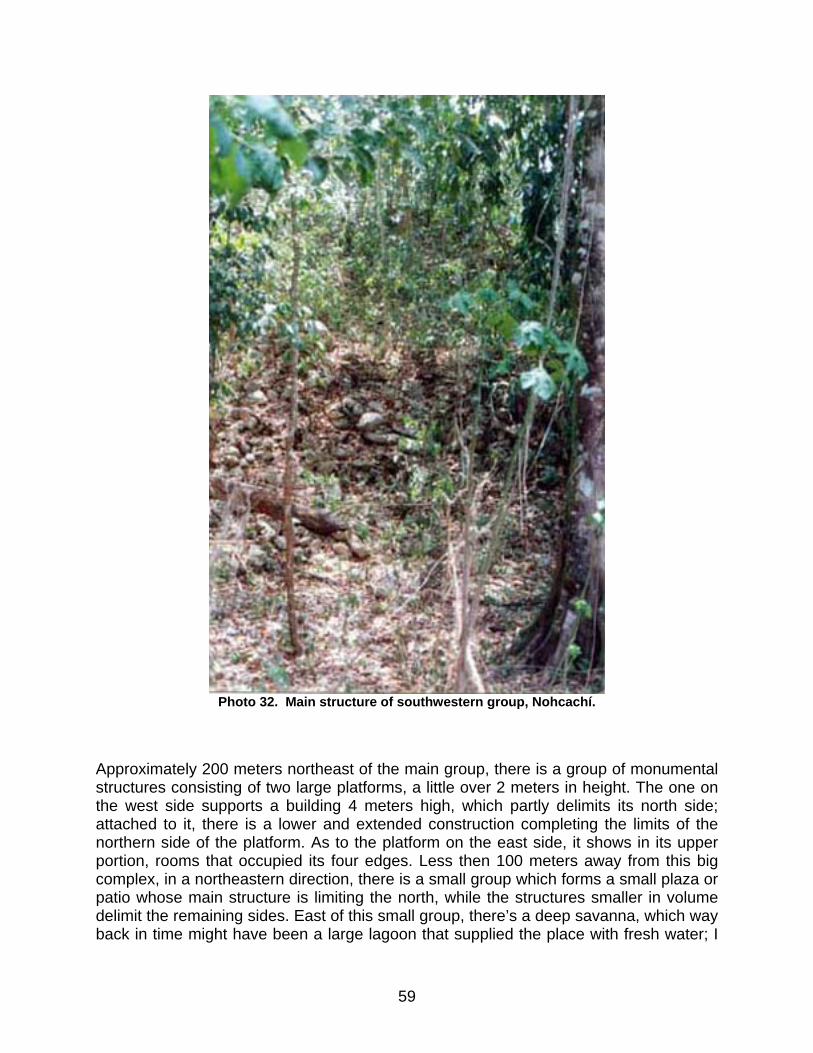
Photo 32. Main structure of southwestern group, Nohcachí.
Approximately 200 meters northeast of the main group, there is a group of monumental structures consisting of two large platforms, a little over 2 meters in height. The one on the west side supports a building 4 meters high, which partly delimits its north side; attached to it, there is a lower and extended construction completing the limits of the northern side of the platform. As to the platform on the east side, it shows in its upper portion, rooms that occupied its four edges. Less then 100 meters away from this big complex, in a northeastern direction, there is a small group which forms a small plaza or patio whose main structure is limiting the north, while the structures smaller in volume delimit the remaining sides. East of this small group, there’s a deep savanna, which way back in time might have been a large lagoon that supplied the place with fresh water; I
59
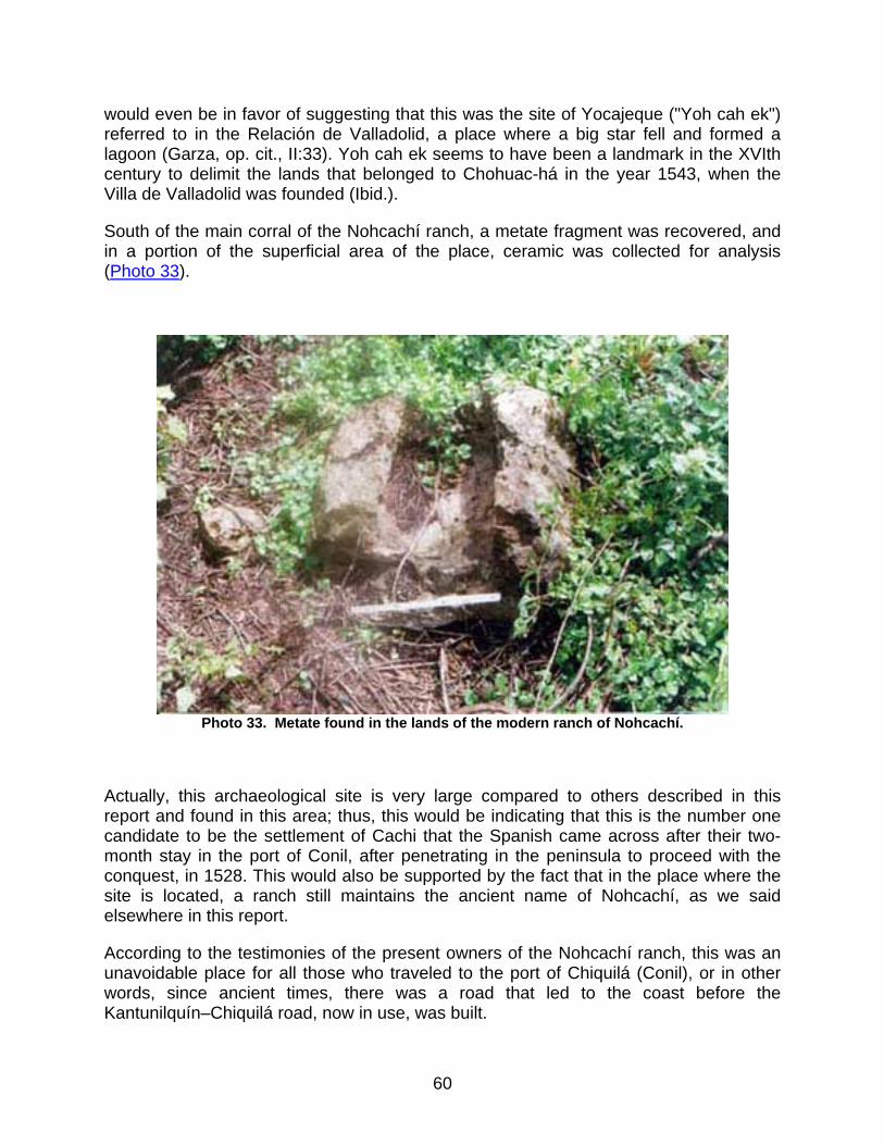
would even be in favor of suggesting that this was the site of Yocajeque ("Yoh cah ek") referred to in the Relación de Valladolid, a place where a big star fell and formed a lagoon (Garza, op. cit., II:33). Yoh cah ek seems to have been a landmark in the XVIth century to delimit the lands that belonged to Chohuac-há in the year 1543, when the Villa de Valladolid was founded (Ibid.).
South of the main corral of the Nohcachí ranch, a metate fragment was recovered, and in a portion of the superficial area of the place, ceramic was collected for analysis (Photo 33).
Photo 33. Metate found in the lands of the modern ranch of Nohcachí.
Actually, this archaeological site is very large compared to others described in this report and found in this area; thus, this would be indicating that this is the number one candidate to be the settlement of Cachi that the Spanish came across after their two-month stay in the port of Conil, after penetrating in the peninsula to proceed with the conquest, in 1528. This would also be supported by the fact that in the place where the site is located, a ranch still maintains the ancient name of Nohcachí, as we said elsewhere in this report.
According to the testimonies of the present owners of the Nohcachí ranch, this was an unavoidable place for all those who traveled to the port of Chiquilá (Conil), or in other words, since ancient times, there was a road that led to the coast before the Kantunilquín–Chiquilá road, now in use, was built.
60
On the other side, there’s a discussion on whether the settlement is in fact the legendary Cachi of Spanish historians, or one of the many sites located in the vicinities of that area.
The name of Cachi or Nocachi seems in fact to derive from another name, and could be a differed pronunciation of the true Maya name. Nocachí is the most complete word used to designate this town. A different and perhaps more accurate suggestion could be that of Yoh Cah Ek, a place that is said to be a bordering landmark of the province of Valladolid in the Relación of 1579, where it is mentioned (Ibid.). Actually, the Relación refers to it as Yocajeque, while the author reconstructs the name as Yoh Cah Ek in Maya, and what is interesting about this document is that after mentioning this name, the port of Conil is referred to as the last point in the continent, and we now know that Nocachí at that time was somewhere on the way towards the port of Conil; in addition it was an important site, as the conquerors had passed by in their first incursion to the east.
If we take the Relación de Atequeaque, also from 1579, we see that author de la Garza takes it as if it were the town of Cehac; could this perhaps be the site of Yocajeque as mentioned in the Relación de Valladolid?
To this day, the location of the town known as Cehac is uncertain, and the only known reference informs that it was four leagues away from Chancenote, the doctrinal capital, and that it was located at some point in the royal road belonging to the town and port of Conil. With this data, some researchers have situated on the map the assumed town of Cehac in one point as a probable location (Roys, op. cit.:fig. page 102; Garza, op. cit. II: fig. page 440) and this location is close to the archaeological site of Nohcachí, recently discovered.
The site of Nohcachí, provided it really is the Cachi settlement mentioned in the conquest documents, is consistent with the location given for Tequeaque in the Relación of that town: four leagues (a very relative unit measure) from Chancenote towards the port of Conil. Should this be correct, then consequently the name of Cehac that the author de la Garza has rebuilt, would in fact be the town of Nohcachí. We are not saying that Cehac doesn’t exist, but rather that these could be two different places; up to now though, the only thing we know almost for sure is that Nohcachí was the town that lay on the way to Conil.
Consequently, if Tequeaque and Nohcachí were in fact one and the same town, it means that at a certain point, it was a part of the doctrinal capital of Chancenote, just like Sinsimato (both sites are located at a similar distance from Chancenote in a straight line), and the doctrine was taught by the Franciscan friars based on that capital. The town was placed on a mount (a term used to define woods with tall trees) and had a church made of perishable materials with silk ornaments in the sacristy. There was a choirmaster with local singers. The town had 400 contributors and by 1579, this number had decreased to 28, who contributed 50 ducats per year; the town had very rich soil and subsistence resources and fruit trees were abundant (Garza, op. cit:284, Rel. de Atequeaque).
61

By the mid XIXth century, the so-called chorographic album of Yucatán was written, probably by Don Juan Pío Pérez, as suggested by the Mayanist Alfredo Barrera Vázquez before his passing. This work, which remained unfinished, is called Diccionario Corográfico Estadístico de Yucatán, and only listed and recorded the ranches, haciendas, towns, etc., whose names began with the letter "A" and on through the "G". This dictionary includes the name of Cachi, listed as a ranch with 20 inhabitants that belonged to the town of Labcaj (Solferino) in the Tizimín County. This information was originated sometime between 1825 and 1845 (Brito, op. cit.:27-28).
Today, the site of Nohcachí exhibits abundant ramón trees which survived to the development of grazing fields for the cattle, and are still found on top of the remains of the archaeological settlement. There are cenotes, pre-hispanic wells and large rejolladas in the area.
Site 5 (Nuevo León)
The archaeological site of Nuevo León is 1 kilometer away from the homonymous modern town and is located on the pasture fields of two local ranches. The site is accessed through the same road that leads to the site of Rancho Grande and to Site 1; after the latter and crossing the town of Santa Clara, there is a junction north that leads to the modern settlements of San Isidro and Nuevo León; the second is 7 km away from the junction; at this point one must take a road that leads to the ranch on the northwest side, which is known under the same name of the town, where the monumental structures of the archaeological site may be seen, at the north of the ranch’s facilities.
The central core of the settlement includes at least six large structures that occupy a space of approximately 80 x 70 meters, which jointly give shape to a large plaza (Figure 9). This plaza seems to be formed by a platform or a low leveling of the ground, according to evidence found in its southwestern corner, where part of an alignment of big stones, apparently attaching two buildings, is visible.
The structure delimiting this plaza on its southern side seems to be the one with the greatest volume and height. This is a platform of approximately 40 x 60 m, 5 m high, and with a longitudinal S-N axis, while on its southern edge and on top of it, rises a pyramidal structure with the wall remains of a room on its upper part; probably, the main access stairways are located north. The building presents a total height of 8 or 9 meters. In the south foothill of the mound, there is a rejollada with a pre-hispanic well on its western edge (Photo 36), which served as source of supply for the central portion of the site (Photo 34).
The west side of the plaza, 20 m from the major structure, is partially delimited by a pyramid building 7 m high, with an incorporated room at its north side, which might have had a vault (Photo 35). The rest is delimited by other two platforms with a space in-between, with a second rejollada.
62
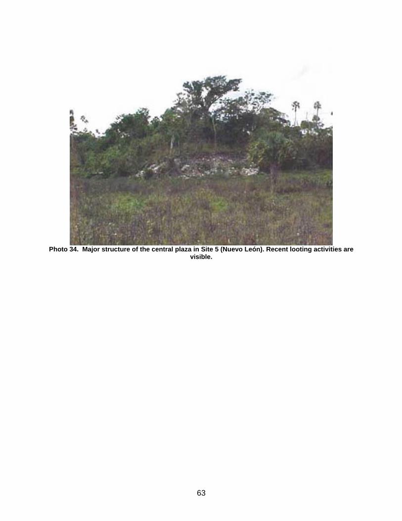
Photo 34. Major structure of the central plaza in Site 5 (Nuevo León). Recent looting activities are
visible.
63
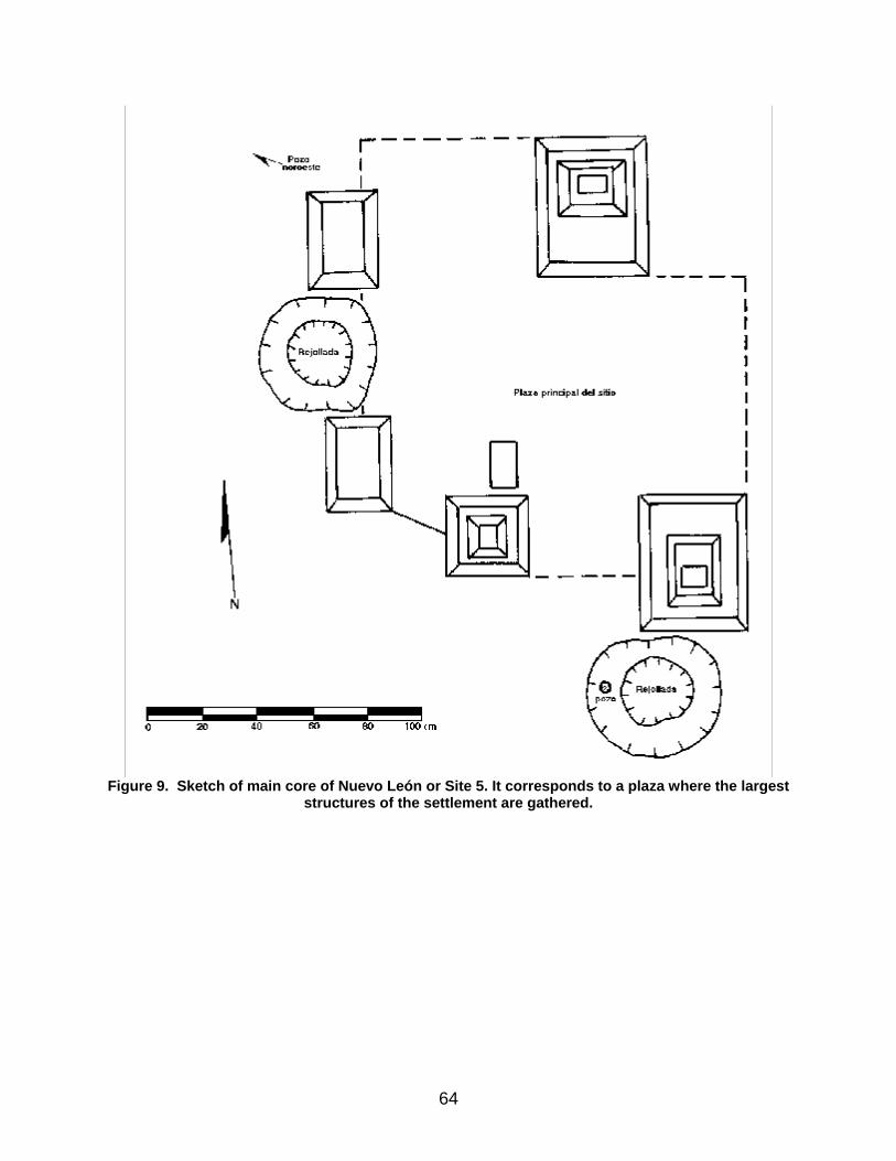
Figure 9. Sketch of main core of Nuevo León or Site 5. It corresponds to a plaza where the largest
structures of the settlement are gathered.
64
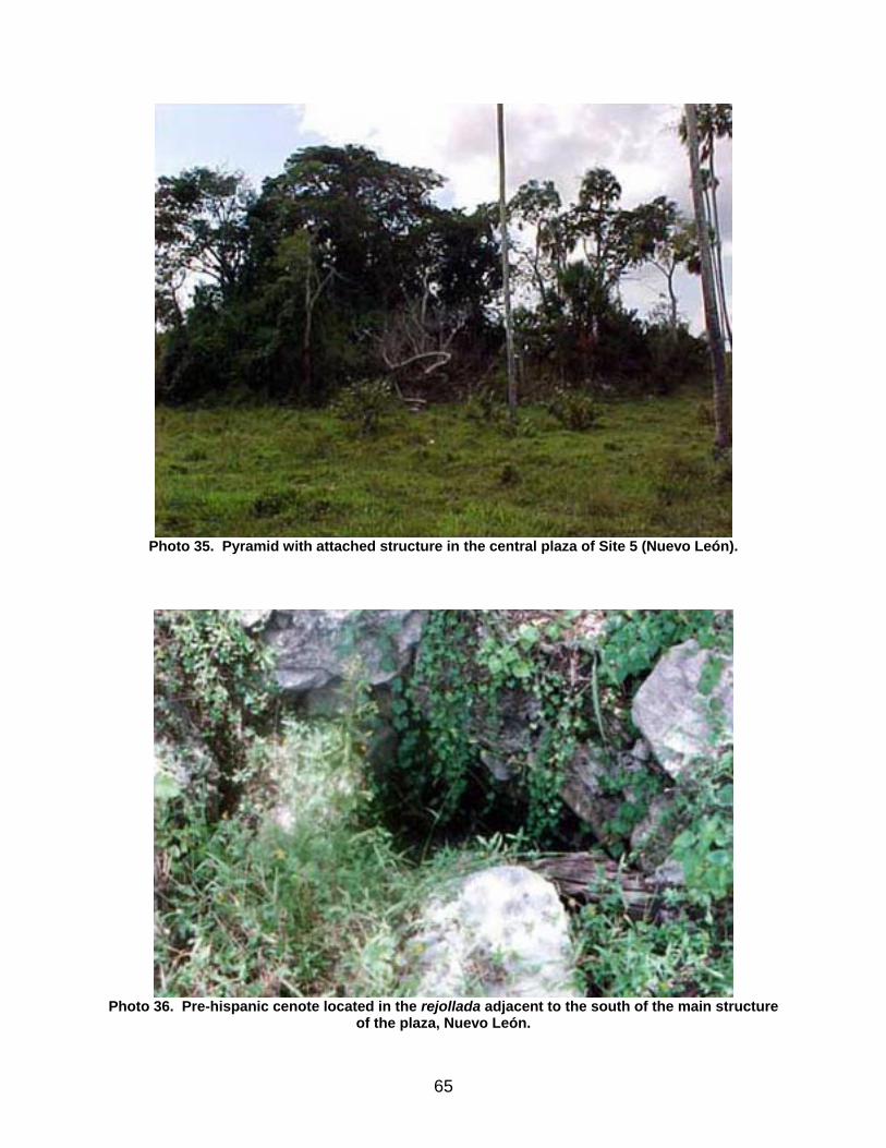
Photo 35. Pyramid with attached structure in the central plaza of Site 5 (Nuevo León).
Photo 36. Pre-hispanic cenote located in the rejollada adjacent to the south of the main structure
of the plaza, Nuevo León.
65
A second remarkable building for its size and height is the one that partially encloses the north side of the plaza, with approximately 50 x 40 m in extension and almost 8 m in height. It is a platform 4 m high, which supports a pyramidal structure on its northern edge, similar to the construction of the south side of that plaza, with a more squared shape.
During the survey, several mounds were observed in the surroundings of the main core and outside of it, some 800 m away. Within the town of Nuevo León, there is a foundation nearly 4 m high. Towards the northeast, approximately 150 m from the main core, another pre-hispanic well was discovered, similar to the one located south of the plaza.
The archaeological site of Nuevo León, as also Site 16 and Site 19, is part of a row of settlements that run in a S-N direction along the west edge of a savanna. Probably during the rainy season, this savanna was completely flooded, allowing the access of small boats and establishing additional and quicker contacts than those made by land with the coastal settlements, and likewise, with those located near the edge of the savanna.
When the first colonizers arrived to this region at the beginning of the ’70s in the XXth century, they referred that in the place where the archaeological remains were found, they had noted an abundance of pich, ramón and prune (quilín), and polbox trees, all producers of eatable fruit, together with cedar trees, very useful to build houses and to manufacture pieces of furniture and other objects.
Nuevo León corresponds to another one of the sites with more abundant monumental structures and larger extension in our surveyed area. Possibly the site catalogued as 19 in this work is a part of the same site representing a residential area, as they are relatively close to one another, at a distance of 1 km to the northwest of Site 5.
The partly megalithic architecture of the place has been compared with constructions from other settlements in the southern area of Yalahau, such as El Naranjal, which assumedly presents similarities with some extended platforms of this latter pre-hispanic town (Taube, 1995:55).
Site 6
Again, this is an area with several natural hillocks which seem to be Maya settlements, but as no evidence was found, such as ceramics for instance, they have not been considered as such in this report. The place is located on the east edge of the detour road that leads to San Isidro and Nuevo León.
66
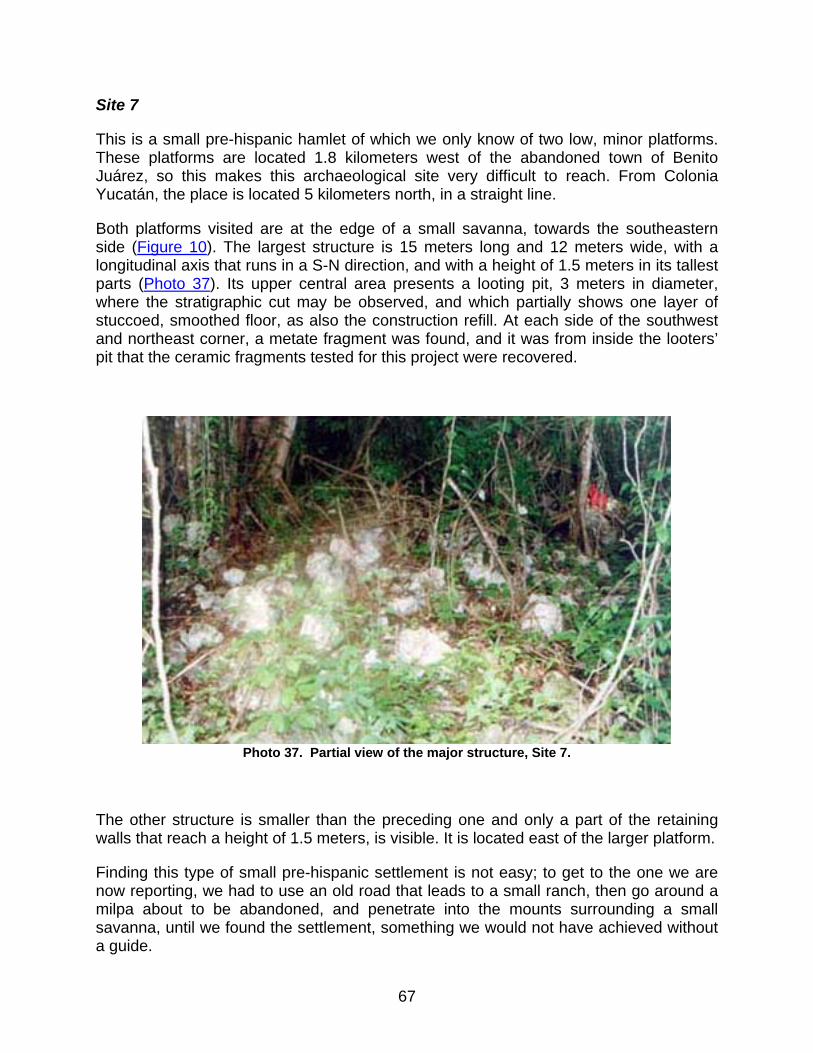
Site 7
This is a small pre-hispanic hamlet of which we only know of two low, minor platforms. These platforms are located 1.8 kilometers west of the abandoned town of Benito Juárez, so this makes this archaeological site very difficult to reach. From Colonia Yucatán, the place is located 5 kilometers north, in a straight line.
Both platforms visited are at the edge of a small savanna, towards the southeastern side (Figure 10). The largest structure is 15 meters long and 12 meters wide, with a longitudinal axis that runs in a S-N direction, and with a height of 1.5 meters in its tallest parts (Photo 37). Its upper central area presents a looting pit, 3 meters in diameter, where the stratigraphic cut may be observed, and which partially shows one layer of stuccoed, smoothed floor, as also the construction refill. At each side of the southwest and northeast corner, a metate fragment was found, and it was from inside the looters’ pit that the ceramic fragments tested for this project were recovered.
Photo 37. Partial view of the major structure, Site 7.
The other structure is smaller than the preceding one and only a part of the retaining walls that reach a height of 1.5 meters, is visible. It is located east of the larger platform.
Finding this type of small pre-hispanic settlement is not easy; to get to the one we are now reporting, we had to use an old road that leads to a small ranch, then go around a milpa about to be abandoned, and penetrate into the mounts surrounding a small savanna, until we found the settlement, something we would not have achieved without a guide.
67

This settlement possibly represents a place only temporarily occupied by a large Maya family.
Figure 10. Sketch of the pre-hispanic settlement of Site 7, with the drawing of a metate found in
the southwestern corner of the main platform.
Site 8
To reach this place, one must take the same road that leads to Rancho Grande, Site 1 and Site 2, and after leaving behind the modern town of San Arturo towards Nuevo Tesoco, at a distance slightly over 4 km, one must penetrate the mounts around 500 meters, and there is where the major core of the site is located. To visit the site, we recommend to refer to the authorities of San Arturo.
The major and largest structure is a pyramid approximately 8 meters high, built on a platform 2 meters high (Photo 38), and when climbing to the top of it, the treetops of the
68
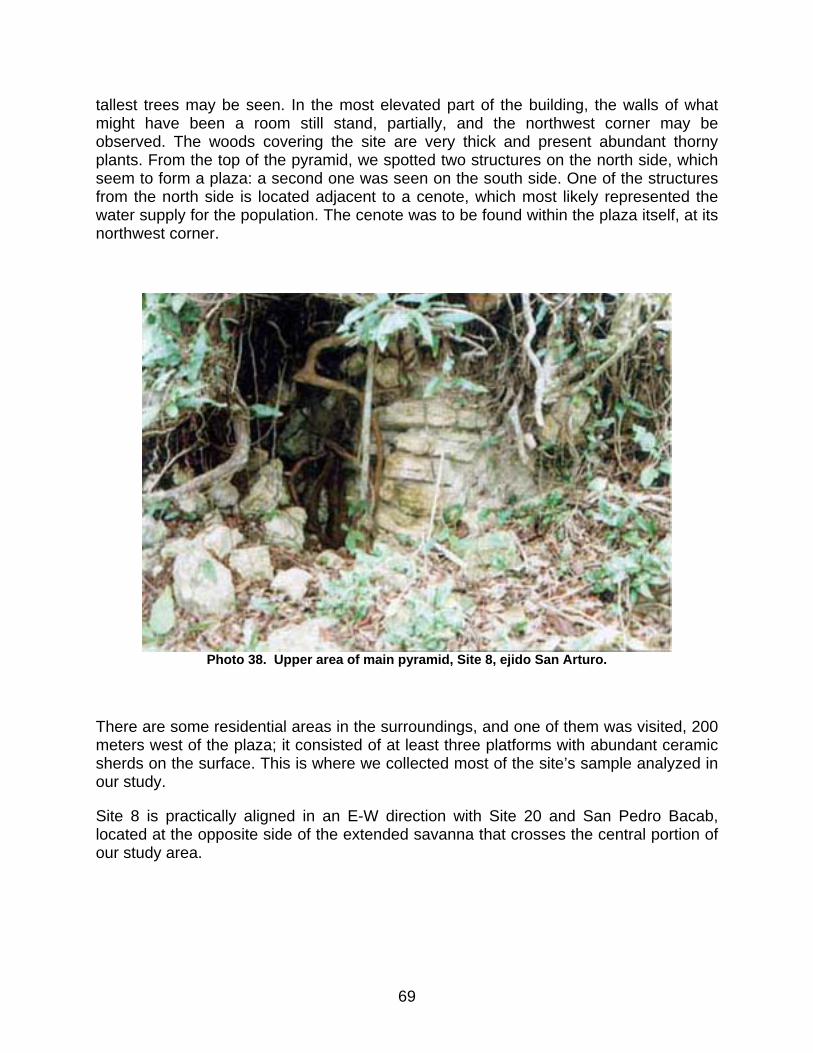
tallest trees may be seen. In the most elevated part of the building, the walls of what might have been a room still stand, partially, and the northwest corner may be observed. The woods covering the site are very thick and present abundant thorny plants. From the top of the pyramid, we spotted two structures on the north side, which seem to form a plaza: a second one was seen on the south side. One of the structures from the north side is located adjacent to a cenote, which most likely represented the water supply for the population. The cenote was to be found within the plaza itself, at its northwest corner.
Photo 38. Upper area of main pyramid, Site 8, ejido San Arturo.
There are some residential areas in the surroundings, and one of them was visited, 200 meters west of the plaza; it consisted of at least three platforms with abundant ceramic sherds on the surface. This is where we collected most of the site’s sample analyzed in our study.
Site 8 is practically aligned in an E-W direction with Site 20 and San Pedro Bacab, located at the opposite side of the extended savanna that crosses the central portion of our study area.
69
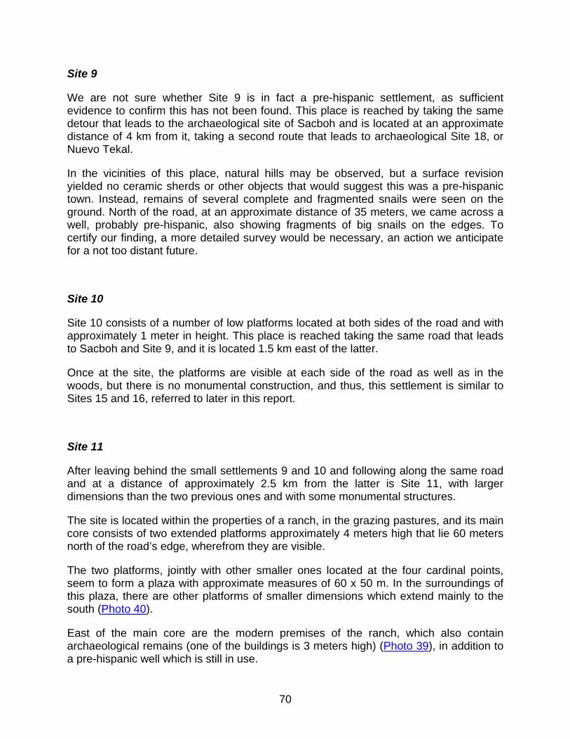
Site 9
We are not sure whether Site 9 is in fact a pre-hispanic settlement, as sufficient evidence to confirm this has not been found. This place is reached by taking the same detour that leads to the archaeological site of Sacboh and is located at an approximate distance of 4 km from it, taking a second route that leads to archaeological Site 18, or Nuevo Tekal.
In the vicinities of this place, natural hills may be observed, but a surface revision yielded no ceramic sherds or other objects that would suggest this was a pre-hispanic town. Instead, remains of several complete and fragmented snails were seen on the ground. North of the road, at an approximate distance of 35 meters, we came across a well, probably pre-hispanic, also showing fragments of big snails on the edges. To certify our finding, a more detailed survey would be necessary, an action we anticipate for a not too distant future.
Site 10
Site 10 consists of a number of low platforms located at both sides of the road and with approximately 1 meter in height. This place is reached taking the same road that leads to Sacboh and Site 9, and it is located 1.5 km east of the latter.
Once at the site, the platforms are visible at each side of the road as well as in the woods, but there is no monumental construction, and thus, this settlement is similar to Sites 15 and 16, referred to later in this report.
Site 11
After leaving behind the small settlements 9 and 10 and following along the same road and at a distance of approximately 2.5 km from the latter is Site 11, with larger dimensions than the two previous ones and with some monumental structures.
The site is located within the properties of a ranch, in the grazing pastures, and its main core consists of two extended platforms approximately 4 meters high that lie 60 meters north of the road’s edge, wherefrom they are visible.
The two platforms, jointly with other smaller ones located at the four cardinal points, seem to form a plaza with approximate measures of 60 x 50 m. In the surroundings of this plaza, there are other platforms of smaller dimensions which extend mainly to the south (Photo 40).
East of the main core are the modern premises of the ranch, which also contain archaeological remains (one of the buildings is 3 meters high) (Photo 39), in addition to a pre-hispanic well which is still in use.
70
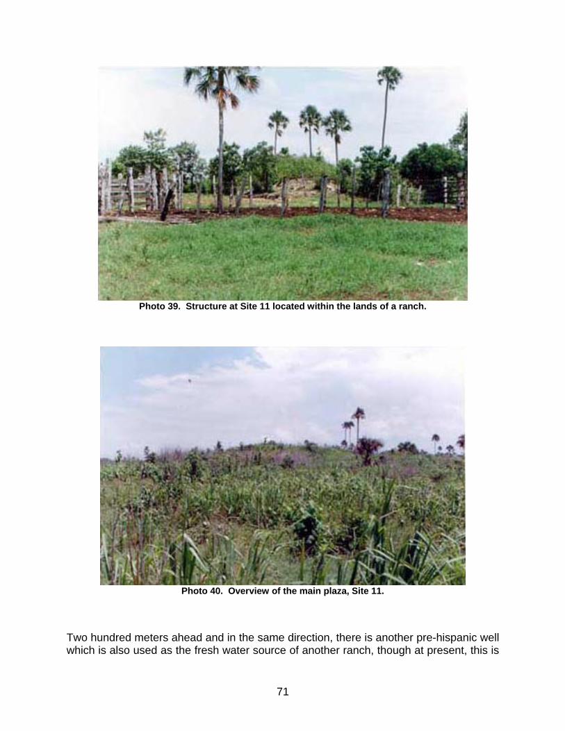
Photo 39. Structure at Site 11 located within the lands of a ranch.
Photo 40. Overview of the main plaza, Site 11.
Two hundred meters ahead and in the same direction, there is another pre-hispanic well which is also used as the fresh water source of another ranch, though at present, this is
71
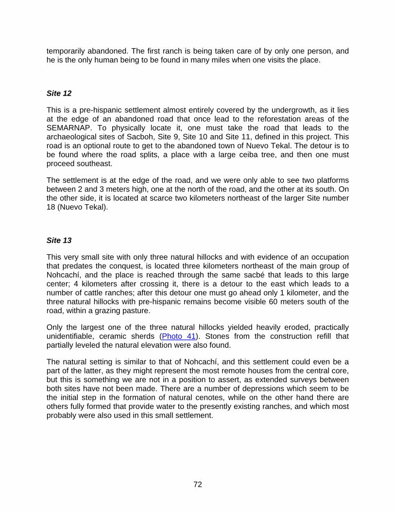
temporarily abandoned. The first ranch is being taken care of by only one person, and he is the only human being to be found in many miles when one visits the place.
Site 12
This is a pre-hispanic settlement almost entirely covered by the undergrowth, as it lies at the edge of an abandoned road that once lead to the reforestation areas of the SEMARNAP. To physically locate it, one must take the road that leads to the archaeological sites of Sacboh, Site 9, Site 10 and Site 11, defined in this project. This road is an optional route to get to the abandoned town of Nuevo Tekal. The detour is to be found where the road splits, a place with a large ceiba tree, and then one must proceed southeast.
The settlement is at the edge of the road, and we were only able to see two platforms between 2 and 3 meters high, one at the north of the road, and the other at its south. On the other side, it is located at scarce two kilometers northeast of the larger Site number 18 (Nuevo Tekal).
Site 13
This very small site with only three natural hillocks and with evidence of an occupation that predates the conquest, is located three kilometers northeast of the main group of Nohcachí, and the place is reached through the same sacbé that leads to this large center; 4 kilometers after crossing it, there is a detour to the east which leads to a number of cattle ranches; after this detour one must go ahead only 1 kilometer, and the three natural hillocks with pre-hispanic remains become visible 60 meters south of the road, within a grazing pasture.
Only the largest one of the three natural hillocks yielded heavily eroded, practically unidentifiable, ceramic sherds (Photo 41). Stones from the construction refill that partially leveled the natural elevation were also found.
The natural setting is similar to that of Nohcachí, and this settlement could even be a part of the latter, as they might represent the most remote houses from the central core, but this is something we are not in a position to assert, as extended surveys between both sites have not been made. There are a number of depressions which seem to be the initial step in the formation of natural cenotes, while on the other hand there are others fully formed that provide water to the presently existing ranches, and which most probably were also used in this small settlement.
72

Photo 41. Natural elevation used to build a house in pre-hispanic times, Site 13.
Site 14
To visit this site, one must head to the modern town of Nuevo Tesoco, northwest of San Arturo. In this place, one must hire a guide to proceed along the territory towards the northeast, as it is necessary to use roads that lead to the different milpas and plots of the town. The major buildings of the pre-hispanic site are found 1 km away, northeast of the town, and the site is part of a corn milpa.
The main structure is a platform around 4 meters high and it merely appears as a stone mound (Photo 42). At the northwestern corner, the platform is attached to a lower construction. And towards the northeast, 20 meters away, there is a small circular-shaped construction; in the same direction there is a cenote near the surface, which once was the fresh water supply of this minor Maya settlement (Photo 43). In the surroundings, natural hillocks are visible, with evidence of a pre-hispanic and even modern Maya occupation.
73
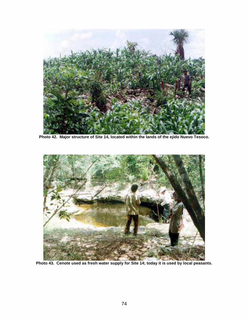
Photo 42. Major structure of Site 14, located within the lands of the ejido Nuevo Tesoco.
Photo 43. Cenote used as fresh water supply for Site 14; today it is used by local peasants.
74

Site 15
It is located 4 km southeast of the archaeological Site 16, and it is reached through the same road used to get to the latter. Site 15, also known as Závalo, is 12 km east of the paved road.
Photo 44. House built on a natural hillock with evidence of pre-hispanic occupation.
This is another small Maya settlement with small natural hillocks that show evidence of a pre-hispanic Maya occupation. One of these hillocks has been occupied by a modern house made of perishable materials, while a ranch is being developed, and a wooden corral built (Photo 44).
Interestingly, this settlement has a fresh water cenote, which once was the main source of water supply for the population, and where local inhabitants could also fish. During our visit, no ceramic material was found, perhaps partly due to the fact that the place is covered by undergrowths. Like the name of the place indicates, the cenote is the home of a large fish known as závalo (together with the mojarras) that up to this day represent the food for the small amount of people that live in the surroundings (Photo 45). At present, only two people live at the site of Závalo, and one of them only temporarily.
75
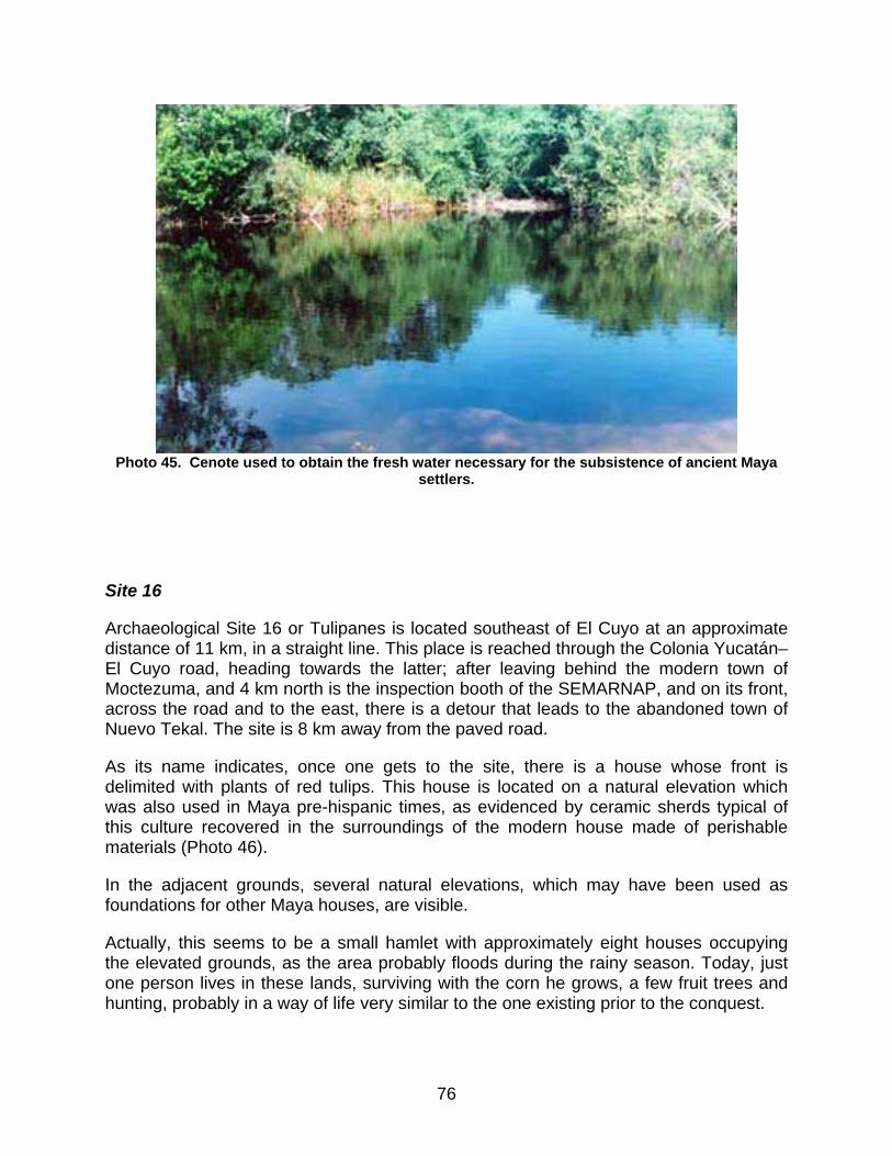
Photo 45. Cenote used to obtain the fresh water necessary for the subsistence of ancient Maya
settlers.
Site 16
Archaeological Site 16 or Tulipanes is located southeast of El Cuyo at an approximate distance of 11 km, in a straight line. This place is reached through the Colonia Yucatán–El Cuyo road, heading towards the latter; after leaving behind the modern town of Moctezuma, and 4 km north is the inspection booth of the SEMARNAP, and on its front, across the road and to the east, there is a detour that leads to the abandoned town of Nuevo Tekal. The site is 8 km away from the paved road.
As its name indicates, once one gets to the site, there is a house whose front is delimited with plants of red tulips. This house is located on a natural elevation which was also used in Maya pre-hispanic times, as evidenced by ceramic sherds typical of this culture recovered in the surroundings of the modern house made of perishable materials (Photo 46).
In the adjacent grounds, several natural elevations, which may have been used as foundations for other Maya houses, are visible.
Actually, this seems to be a small hamlet with approximately eight houses occupying the elevated grounds, as the area probably floods during the rainy season. Today, just one person lives in these lands, surviving with the corn he grows, a few fruit trees and hunting, probably in a way of life very similar to the one existing prior to the conquest.
76
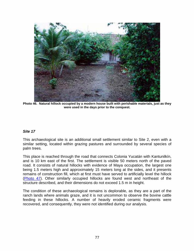
Photo 46. Natural hillock occupied by a modern house built with perishable materials, just as they
were used in the days prior to the conquest.
ite 17
aeological site is an additional small settlement similar to Site 2, even with a similar setting, located within grazing pastures and surrounded by several species of
reached through the road that connects Colonia Yucatán with Kantunilkín, and is 10 km east of the first. The settlement is visible 50 meters north of the paved
S
This arch
palm trees.
This place is
road. It consists of natural hillocks with evidence of Maya occupation, the largest one being 1.5 meters high and approximately 15 meters long at the sides, and it presents remains of construction fill, which at first must have served to artificially level the hillock (Photo 47). Other similarly occupied hillocks are found west and northeast of the structure described, and their dimensions do not exceed 1.5 m in height.
The condition of these archaeological remains is deplorable, as they are a part of the ranch lands where animals graze, and it is not uncommon to observe the bovine cattle feeding in these hillocks. A number of heavily eroded ceramic fragments were recovered, and consequently, they were not identified during our analysis.
77
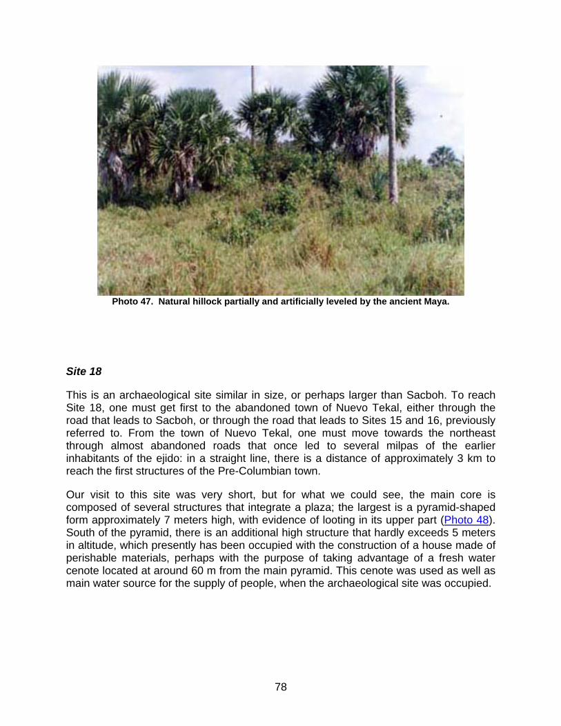
Photo 47. Natural hillock partially and artificially leveled by the ancient Maya.
Site 18
This is an archaeological site similar in size, or perhaps larger than Sacboh. To reach Site 18, one must get first to the abandoned town of Nuevo Tekal, either through the road that leads to Sacboh, or through the road that leads to Sites 15 and 16, previously referred to. From the town of Nuevo Tekal, one must move towards the northeast through almost abandoned roads that once led to several milpas of the earlier inhabitants of the ejido: in a straight line, there is a distance of approximately 3 km to reach the first structures of the Pre-Columbian town.
Our visit to this site was very short, but for what we could see, the main core is composed of several structures that integrate a plaza; the largest is a pyramid-shaped form approximately 7 meters high, with evidence of looting in its upper part (Photo 48). South of the pyramid, there is an additional high structure that hardly exceeds 5 meters in altitude, which presently has been occupied with the construction of a house made of perishable materials, perhaps with the purpose of taking advantage of a fresh water cenote located at around 60 m from the main pyramid. This cenote was used as well as main water source for the supply of people, when the archaeological site was occupied.
78

Photo 48. Major pyramid in the central core of Site 18 (Nuevo Tekal). Its upper portion shows a
looters’ pit.
In the surroundings, several structures are still visible, in the shape of extended promontories that are presently covered with abundant zacate, which makes it difficult to observe their surface.
This place is among the most difficult ones in terms of a survey, as its location is remote and a guide’s help is necessary in order to get there. Actually, just very few people prove willing to go to this place.
Site 19
Probably this is a remote group corresponding to the larger archaeological site catalogued as 5 in our research. Site 19 is located northwest of the modern town of Nuevo León, approximately 3 kilometers away from it; in order to get there, certain roads are to be taken which lead to ranches established in the region; in other words, getting to this site is not easy.
The place consists of a small rejollada with several structures around it, mostly on its northwestern side. They are small platforms, hardly exceeding 1 meter in height, and 10
79
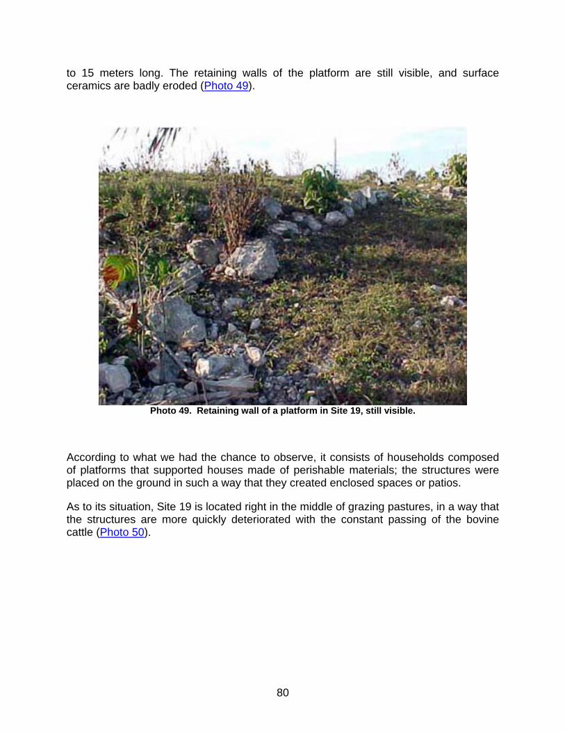
to 15 meters long. The retaining walls of the platform are still visible, and surface ceramics are badly eroded (Photo 49).
Photo 49. Retaining wall of a platform in Site 19, still visible.
According to what we had the chance to observe, it consists of households composed of platforms that supported houses made of perishable materials; the structures were placed on the ground in such a way that they created enclosed spaces or patios.
As to its situation, Site 19 is located right in the middle of grazing pastures, in a way that the structures are more quickly deteriorated with the constant passing of the bovine cattle (Photo 50).
80
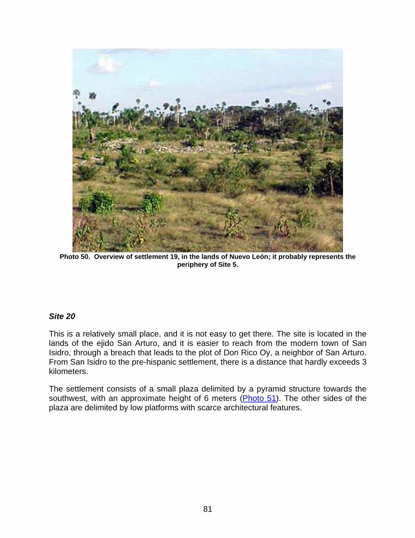
Photo 50. Overview of settlement 19, in the lands of Nuevo León; it probably represents the
periphery of Site 5.
Site 20
This is a relatively small place, and it is not easy to get there. The site is located in the lands of the ejido San Arturo, and it is easier to reach from the modern town of San Isidro, through a breach that leads to the plot of Don Rico Oy, a neighbor of San Arturo. From San Isidro to the pre-hispanic settlement, there is a distance that hardly exceeds 3 kilometers.
The settlement consists of a small plaza delimited by a pyramid structure towards the southwest, with an approximate height of 6 meters (Photo 51). The other sides of the plaza are delimited by low platforms with scarce architectural features.
81
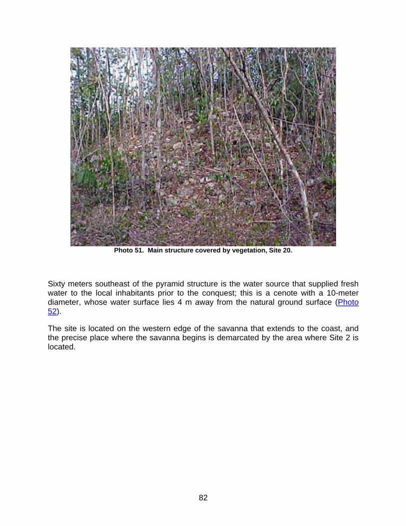
Photo 51. Main structure covered by vegetation, Site 20.
Sixty meters southeast of the pyramid structure is the water source that supplied fresh water to the local inhabitants prior to the conquest; this is a cenote with a 10-meter diameter, whose water surface lies 4 m away from the natural ground surface (Photo 52).
The site is located on the western edge of the savanna that extends to the coast, and the precise place where the savanna begins is demarcated by the area where Site 2 is located.
82
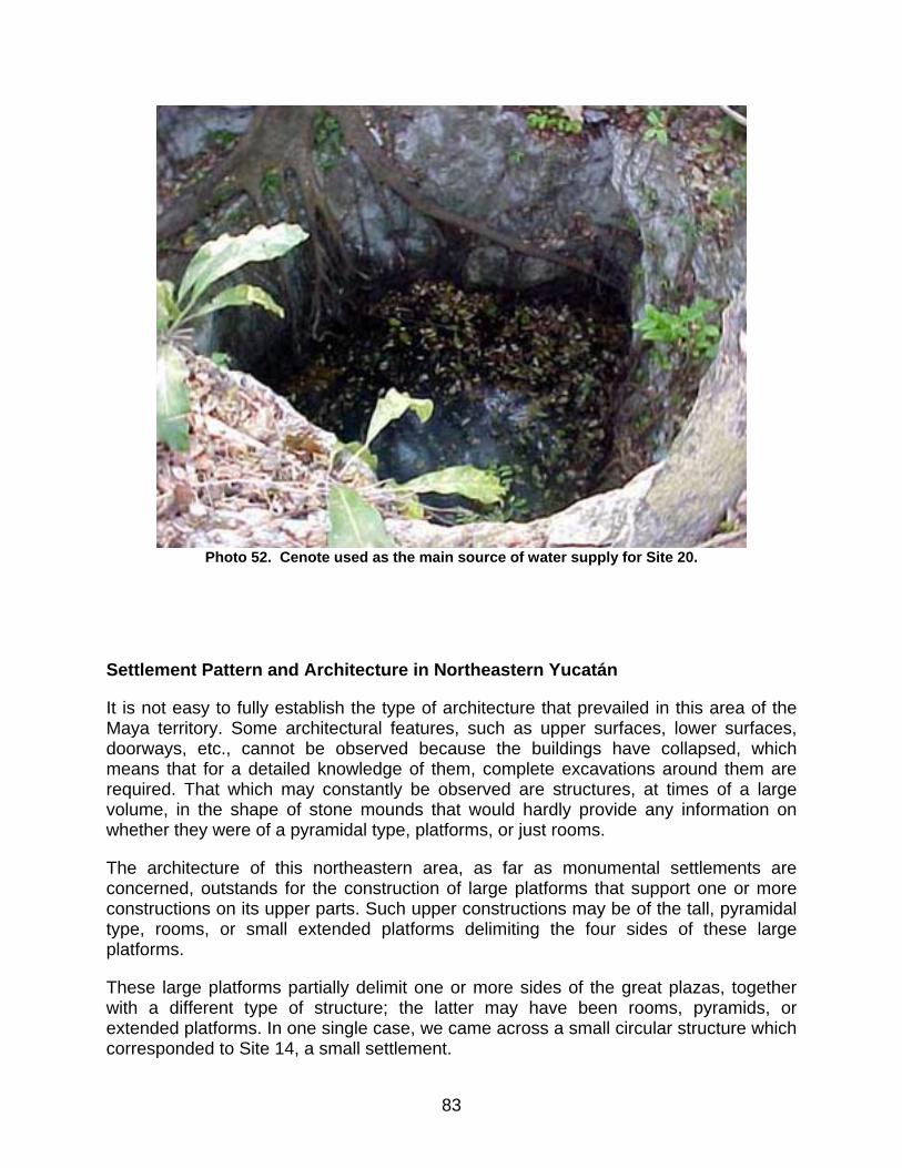
Photo 52. Cenote used as the main source of water supply for Site 20.
Settlement Pattern and Architecture in Northeastern Yucatán
It is not easy to fully establish the type of architecture that prevailed in this area of the Maya territory. Some architectural features, such as upper surfaces, lower surfaces, doorways, etc., cannot be observed because the buildings have collapsed, which means that for a detailed knowledge of them, complete excavations around them are required. That which may constantly be observed are structures, at times of a large volume, in the shape of stone mounds that would hardly provide any information on whether they were of a pyramidal type, platforms, or just rooms.
The architecture of this northeastern area, as far as monumental settlements are concerned, outstands for the construction of large platforms that support one or more constructions on its upper parts. Such upper constructions may be of the tall, pyramidal type, rooms, or small extended platforms delimiting the four sides of these large platforms.
These large platforms partially delimit one or more sides of the great plazas, together with a different type of structure; the latter may have been rooms, pyramids, or extended platforms. In one single case, we came across a small circular structure which corresponded to Site 14, a small settlement.
83
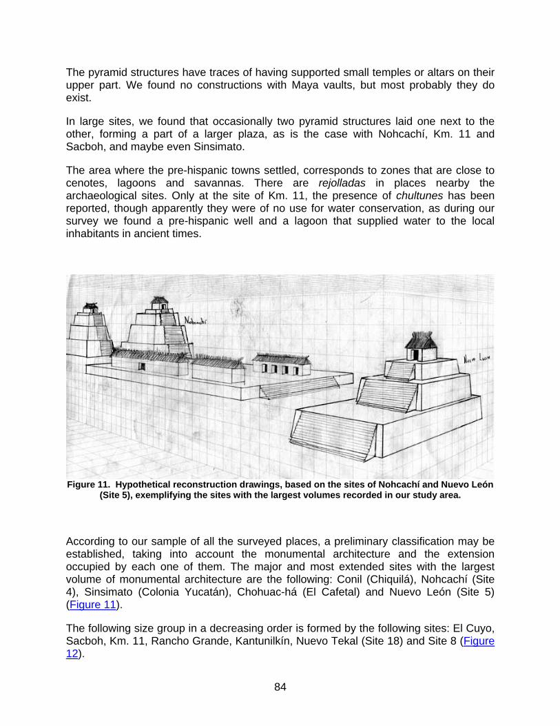
The pyramid structures have traces of having supported small temples or altars on their upper part. We found no constructions with Maya vaults, but most probably they do exist.
In large sites, we found that occasionally two pyramid structures laid one next to the other, forming a part of a larger plaza, as is the case with Nohcachí, Km. 11 and Sacboh, and maybe even Sinsimato.
The area where the pre-hispanic towns settled, corresponds to zones that are close to cenotes, lagoons and savannas. There are rejolladas in places nearby the archaeological sites. Only at the site of Km. 11, the presence of chultunes has been reported, though apparently they were of no use for water conservation, as during our survey we found a pre-hispanic well and a lagoon that supplied water to the local inhabitants in ancient times.
Figure 11. Hypothetical reconstruction drawings, based on the sites of Nohcachí and Nuevo León
(Site 5), exemplifying the sites with the largest volumes recorded in our study area.
According to our sample of all the surveyed places, a preliminary classification may be established, taking into account the monumental architecture and the extension occupied by each one of them. The major and most extended sites with the largest volume of monumental architecture are the following: Conil (Chiquilá), Nohcachí (Site 4), Sinsimato (Colonia Yucatán), Chohuac-há (El Cafetal) and Nuevo León (Site 5) (Figure 11).
The following size group in a decreasing order is formed by the following sites: El Cuyo, Sacboh, Km. 11, Rancho Grande, Kantunilkín, Nuevo Tekal (Site 18) and Site 8 (Figure 12).
84
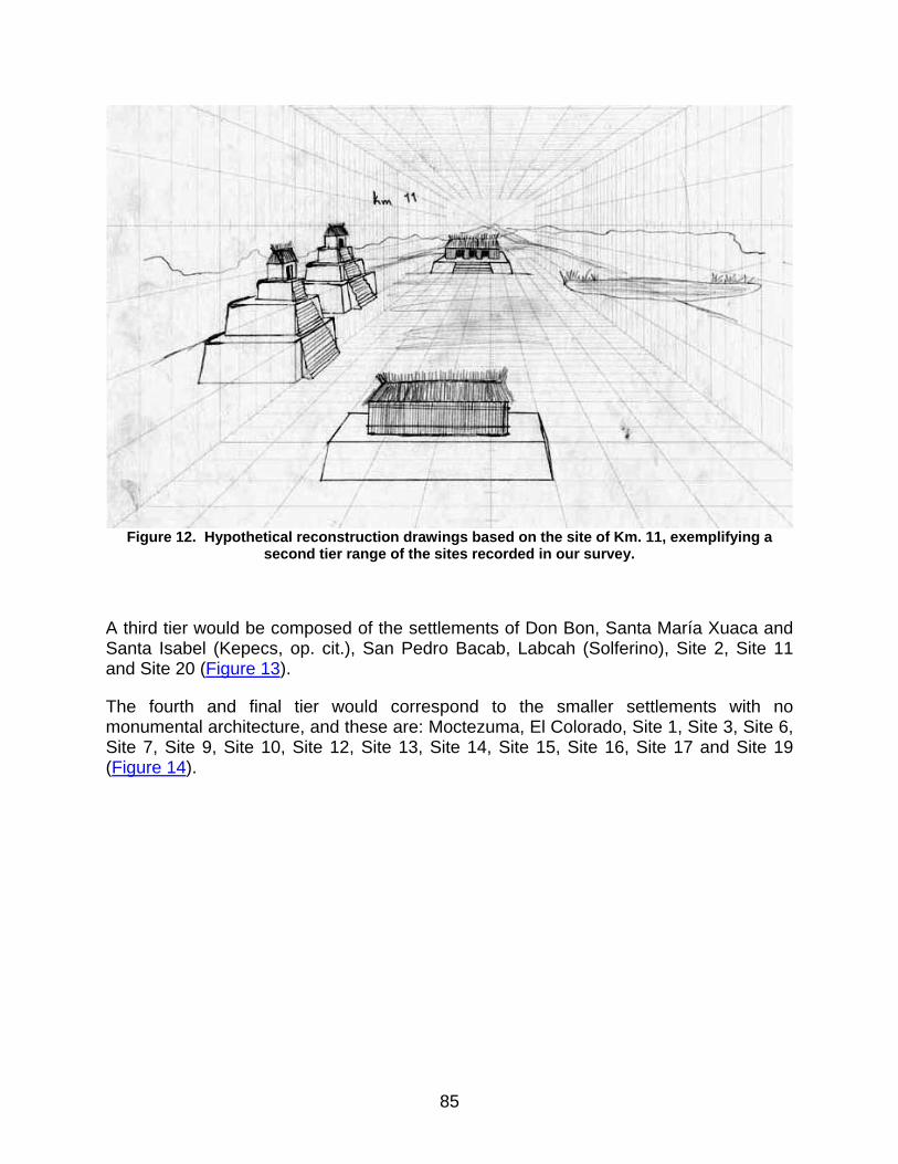
Figure 12. Hypothetical reconstruction drawings based on the site of Km. 11, exemplifying a
second tier range of the sites recorded in our survey.
A third tier would be composed of the settlements of Don Bon, Santa María Xuaca and Santa Isabel (Kepecs, op. cit.), San Pedro Bacab, Labcah (Solferino), Site 2, Site 11 and Site 20 (Figure 13).
The fourth and final tier would correspond to the smaller settlements with no monumental architecture, and these are: Moctezuma, El Colorado, Site 1, Site 3, Site 6, Site 7, Site 9, Site 10, Site 12, Site 13, Site 14, Site 15, Site 16, Site 17 and Site 19 (Figure 14).
85

Figure 13. Hypothetical reconstruction drawing exemplifying block 3 in relation to the size of the
sites in our survey area.
Figure 14. Hypothetical reconstruction drawing exemplifying the size and type of the last block
structures to which a portion of the visited sites belong.
86
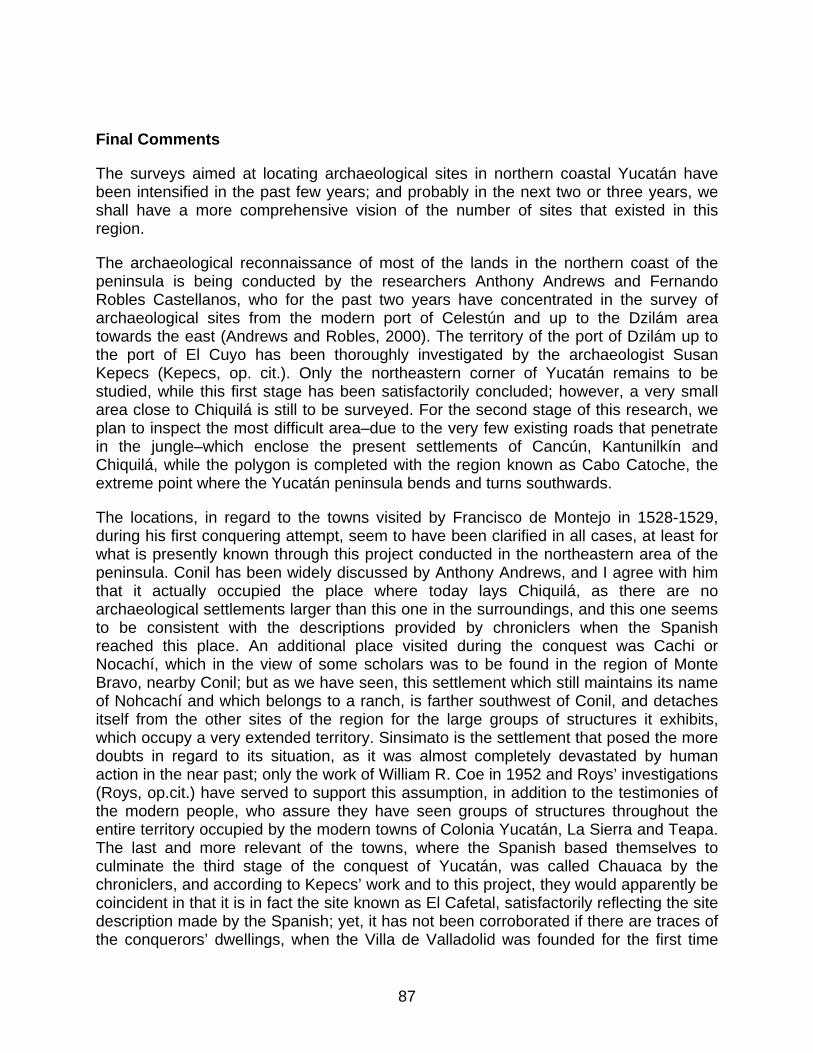
Final Comments
The surveys aimed at locating archaeological sites in northern coastal Yucatán have been intensified in the past few years; and probably in the next two or three years, we shall have a more comprehensive vision of the number of sites that existed in this region.
The archaeological reconnaissance of most of the lands in the northern coast of the peninsula is being conducted by the researchers Anthony Andrews and Fernando Robles Castellanos, who for the past two years have concentrated in the survey of archaeological sites from the modern port of Celestún and up to the Dzilám area towards the east (Andrews and Robles, 2000). The territory of the port of Dzilám up to the port of El Cuyo has been thoroughly investigated by the archaeologist Susan Kepecs (Kepecs, op. cit.). Only the northeastern corner of Yucatán remains to be studied, while this first stage has been satisfactorily concluded; however, a very small area close to Chiquilá is still to be surveyed. For the second stage of this research, we plan to inspect the most difficult area–due to the very few existing roads that penetrate in the jungle–which enclose the present settlements of Cancún, Kantunilkín and Chiquilá, while the polygon is completed with the region known as Cabo Catoche, the extreme point where the Yucatán peninsula bends and turns southwards.
The locations, in regard to the towns visited by Francisco de Montejo in 1528-1529, during his first conquering attempt, seem to have been clarified in all cases, at least for what is presently known through this project conducted in the northeastern area of the peninsula. Conil has been widely discussed by Anthony Andrews, and I agree with him that it actually occupied the place where today lays Chiquilá, as there are no archaeological settlements larger than this one in the surroundings, and this one seems to be consistent with the descriptions provided by chroniclers when the Spanish reached this place. An additional place visited during the conquest was Cachi or Nocachí, which in the view of some scholars was to be found in the region of Monte Bravo, nearby Conil; but as we have seen, this settlement which still maintains its name of Nohcachí and which belongs to a ranch, is farther southwest of Conil, and detaches itself from the other sites of the region for the large groups of structures it exhibits, which occupy a very extended territory. Sinsimato is the settlement that posed the more doubts in regard to its situation, as it was almost completely devastated by human action in the near past; only the work of William R. Coe in 1952 and Roys’ investigations (Roys, op.cit.) have served to support this assumption, in addition to the testimonies of the modern people, who assure they have seen groups of structures throughout the entire territory occupied by the modern towns of Colonia Yucatán, La Sierra and Teapa. The last and more relevant of the towns, where the Spanish based themselves to culminate the third stage of the conquest of Yucatán, was called Chauaca by the chroniclers, and according to Kepecs’ work and to this project, they would apparently be coincident in that it is in fact the site known as El Cafetal, satisfactorily reflecting the site description made by the Spanish; yet, it has not been corroborated if there are traces of the conquerors’ dwellings, when the Villa de Valladolid was founded for the first time
87
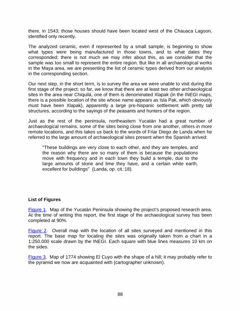
there, in 1543; those houses should have been located west of the Chauaca Lagoon, identified only recently.
The analyzed ceramic, even if represented by a small sample, is beginning to show what types were being manufactured in those towns, and to what dates they corresponded; there is not much we may infer about this, as we consider that the sample was too small to represent the entire region. But like in all archaeological works in the Maya area, we are presenting the list of ceramic types derived from our analysis in the corresponding section.
Our next step, in the short term, is to survey the area we were unable to visit during the first stage of the project; so far, we know that there are at least two other archaeological sites in the area near Chiquilá, one of them is denominated Xlapak (in the INEGI maps, there is a possible location of the site whose name appears as Isla Pak, which obviously must have been Xlapak), apparently a large pre-hispanic settlement with pretty tall structures, according to the sayings of the peasants and hunters of the region.
Just as the rest of the peninsula, northeastern Yucatán had a great number of archaeological remains, some of the sites being close from one another, others in more remote locations, and this takes us back to the words of Friar Diego de Landa when he referred to the large amount of archaeological sites present when the Spanish arrived:
"These buildings are very close to each other, and they are temples, and the reason why there are so many of them is because the populations move with frequency and in each town they build a temple, due to the large amounts of stone and lime they have, and a certain white earth, excellent for buildings" (Landa, op. cit.:18).
List of Figures
Figure 1. Map of the Yucatán Peninsula showing the project’s proposed research area. At the time of writing this report, the first stage of the archaeological survey has been completed at 90%.
Figure 2. Overall map with the location of all sites surveyed and mentioned in this report. The base map for locating the sites was originally taken from a chart in a 1:250.000 scale drawn by the INEGI. Each square with blue lines measures 10 km on the sides.
Figure 3. Map of 1774 showing El Cuyo with the shape of a hill; it may probably refer to the pyramid we now are acquainted with (cartographer unknown).
88
Figure 4. Front drawing and section of the fragmented stone resembling the shapes of the "curtain hanger" that flanked the doors of Maya rooms. This is from the site of Km. 11.
Figure 5. Sketch of the central area of the archaeological site Km. 11.
Figure 6. Drawing of the greenstone axe which originated in the Teapa area.
Figure 7. Artifacts found in possession of private individuals from the town of Solferino: (a) Shell pectoral from Solferino, (b) Shell pendant from the Monte Bravo area, and (c) Snail bead from Solferino.
Figure 8. Sketch of the Nohcachí settlement.
Figure 9. Sketch of main core of Nuevo León or Site 5. It corresponds to a plaza where the largest structures of the settlement are gathered.
Figure 10. Sketch of the pre-hispanic settlement of Site 7, with the drawing of a metate found in the southwestern corner of the main platform.
Figure 11. Hypothetical reconstruction drawings, based on the sites of Nohcachí and Nuevo León (Site 5), exemplifying the sites with the largest volumes recorded in our study area.
Figure 12. Hypothetical reconstruction drawings based on the site of Km. 11, exemplifying a second tier range of the sites recorded in our survey.
Figure 13. Hypothetical reconstruction drawing exemplifying block 3 in relation to the size of the sites in our survey area.
Figure 14. Hypothetical reconstruction drawing exemplifying the size and type of the last block structures to which a portion of the visited sites belong.
List of Photos
Photo 1. Overview of the estuary south of the port of El Cuyo.
Photo 2. Flamingos feeding in a lagoon of the Chikinchel region, close to the archaeological site of Km. 11.
Photo 3. Main pyramid at the site of El Cuyo, used to build the port’s lighthouse.
Photo 4. Pre-hispanic platform from the site of El Cuyo, occupied by an old wooden house.
89
Photo 5. Main pyramid of Sacboh showing the looters’ activities through the years.
Photo 6. One of the four lagoons located north of the main group of structures in Sacboh.
Photo 7. Chohuac-há Lagoon, main source of fresh water for the pre-hispanic settlement and the first Villa de Valladolid founded in 1543.
Photo 8. Main and largest structure from central plaza in Chohuac-há or El Cafetal.
Photo 9. Very sloping pyramid delimiting the west side of the main plaza in Chohuac-há.
Photo 10. Area where one of the main groups of Sinsimato was located, now completely devastated. Presently, only small mounds are visible.
Photo 11. Partial view of the cenote, town of La Sierra.
Photo 12. Platform corresponding to a residential group, north of the modern town of Teapa.
Photo 13. Rejollada within the modern town of La Sierra, used as recreational area when the timber industry was at its peak.
Photo 14. Overview of the two pyramids delimiting the east side of the main plaza at Km. 11.
Photo 15. Southwest rounded corner of southern pyramid’s upper body, site of Km. 11.
Photo 16. Lagoon southwest of main plaza, Km. 11. In the northern edge, there is a pre-hispanic well whose walls are made of finely cut stones.
Photo 17. Major structure of the plaza group, archaeological site of Don Bon.
Photo 18. Colonial facilities in Misnebalam, the chain pump is shown at left.
Photo 19. Residential platform from the site of San Pedro Bacab.
Photo 20. Cenote that supplied water to the pre-hispanic population of San Pedro Bacab, still in use.
Photo 21. Road crossing the main structures in the archaeological site of Rancho Grande. At right, the greatest mound of the settlement is visible.
Photo 22. Structure located northeast of the main platform, Rancho Grande.
Photo 23. Cenote, apparently the main water source used by the pre-hispanic population of Rancho Grande.
90
Photo 24. Fragment of greenstone axe from a structure north of the modern town of Teapa.
Photo 25. The great platform, and the one with the largest volume from the site of Conil or Chiquilá, which is a part of the main core.
Photo 26. Pyramid structure located in the southeastern corner of the great platform in the site of Conil.
Photo 27. Partially destroyed structure which is presently located within the modern town of Kantunilkín.
Photo 28. Main structure from Site 1, south of the road.
Photo 29. Major structure of the pre-hispanic settlement of Site 2, destroyed during the ’80s.
Photo 30. Upper portion of the south pyramid, main group of Nohcachí.
Photo 31. Largest pyramid structure of southeastern group, main core of Nohcachí.
Photo 32. Main structure of southwestern group, Nohcachí.
Photo 33. Metate found in the lands of the modern ranch of Nohcachí.
Photo 34. Major structure of the central plaza in Site 5 (Nuevo León). Recent looting activities are visible.
Photo 35. Pyramid with attached structure in the central plaza of Site 5 (Nuevo León).
Photo 36. Pre-hispanic cenote located in the rejollada adjacent to the south of the main structure of the plaza, Nuevo León.
Photo 37. Partial view of the major structure, Site 7.
Photo 38. Upper area of main pyramid, Site 8, ejido San Arturo.
Photo 39. Structure at Site 11 located within the lands of a ranch.
Photo 40. Overview of the main plaza, Site 11.
Photo 41. Natural elevation used to build a house in pre-hispanic times, Site 13.
Photo 42. Major structure of Site 14, located within the lands of the ejido Nuevo Tesoco.
Photo 43. Cenote used as fresh water supply for Site 14; today it is used by local peasants.
91
Photo 44. House built on a natural hillock with evidence of pre-hispanic occupation.
Photo 45. Cenote used to obtain the fresh water necessary for the subsistence of ancient Maya settlers.
Photo 46. Natural hillock occupied by a modern house built with perishable materials, just as they were used in the days prior to the conquest.
Photo 47. Natural hillock partially and artificially leveled by the ancient Maya.
Photo 48. Major pyramid in the central core of Site 18 (Nuevo Tekal). Its upper portion shows a looters’ pit.
Photo 49. Retaining wall of a platform in Site 19, still visible.
Photo 50. Overview of settlement 19, in the lands of Nuevo León; it probably represents the periphery of Site 5.
Photo 51. Main structure covered by vegetation, Site 20.
Photo 52. Cenote used as the main source of water supply for Site 20.
List of Tables
Table 1. Preliminary table resulting from analysis of the ceramics collected during the survey carried out in northeastern Yucatán. The temporalities in column two were determined based on the ceramic studies accomplished in the sites close to the northern and eastern coasts of the peninsula.
Table 2. List of sites surveyed during the development of our investigation. It includes the places closest to them and the UTM coordinates for each one of them. The coordinates are recorded exactly as they were provided by the GPS (Garmin GPS 12).
Sources Cited Andrews, Anthony P. 1998 El antiguo Puerto maya de Conil. Estudios de Cultura Maya, Centro de
Estudios Mayas, UNAM, México. In press. Andrews, Anthony and F. Robles
92

2000 Proyecto Costa Maya, Informe para el Consejo de Arqueología. INAH, National Geographic Society, University of South Florida. December.
Antochiw, Michel 1994 Historia cartográfica de la península de Yucatán. Grupo Tribasa/Gobierno de
Campeche. México, CINVESTAV. Chamberlain, Robert S. 1974 Conquista y Colonización de Yucatán. 1517-1550. Editorial Porrúa S.A.,
México. Díaz del Castillo, Bernal 1999 Historia verdadera de la conquista de la Nueva España. Porrúa, México,
18th Edition. Garza, Mercedes de la 1983 Relaciones histórico-geográficas de la Gobernación de Yucatán. 2 vols.,
Fuentes para el estudio de la Cultura Maya, 1. Instituto de Investigaciones Filológicas y Centro de Estudios Mayas, UNAM, México.
Garza T. De González, Silvia and E.B. Kurjack 1980 Atlas Arqueológico del Estado de Yucatán. 2 vols. INAH, México. Gomara, Francisco López de 1922 Historia General de las Indias. Tomo I, Madrid-Calpe. Landa, Fray Diego de 1992 Relación de las cosas de Yucatán. Ed. Dante, Colección Sureste, México. Oviedo y Valdéz, Gonzalo Fernando de 1851 Historia general y natural de las Indias. Islas y tierra firme del mar
océano. Madrid, Imprenta de la Real Academia de la Historia, Spain. Romero Rivera, María E., and Susana Gurrola Briones 1995 "Los sitios en las márgenes de la laguna Yalahau y Santa Rosa, desde el
punto de vista del estudio de la navegación como sistema," pp. 458-476. In Memorias del Segundo Congreso Internacional de Mayistas, UNAM, México.
Roys, Ralph 1957 The political geography of the Yucatán Maya. Publication 613, C.I.W.,
Washington D.C.
93
94
Sanders, Willian T. 1960 Prehistoric ceramics and settlement patterns in Quintana Roo,
México. Carnegie Institution of Washington, Publication 606, Contr. 60. Washington D.C.
Taube, Karl A. 1995 "The monumental architecture of the Yalahau region and megalithic style of the
northern Maya lowlands," pp. 23-58, In The view from Yalahau: 1993, archaeological investigations in northern Quintana Roo, México, eds. Scott Fedick and Karl Taube, Latin American Studies Program, Field Reports Series No. 2, University of California, Riverside.