Embed Size (px)
Citation preview

Oman Geospatial Forum 3rd Edition
23-24 November, 2015
Grand Hall, Sultan Qaboos University Muscat
Saleem Al-Hashmi Director of Geospatial Information
Geo-Enabling Oman

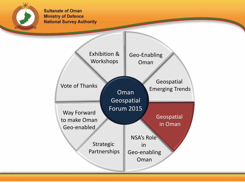
Oman Geospatial
Forum 2015
Geospatial Emerging Trends
Geo-Enabling Oman
Geospatial in Oman
NSA’s Role in
Geo-enabling Oman
Vote of Thanks
Way Forward to make Oman Geo-enabled
Strategic Partnerships
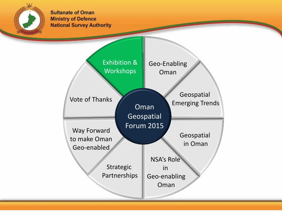
Exhibition & Workshops
Presentation Outline

Geospatial Emerging Trends
Geospatial in Oman
Vote of Thanks
Way Forward to make Oman Geo-enabled
NSA’s Role in
Geo-enabling Oman
Exhibition & Workshops
Strategic Partnerships
Geo-Enabling Oman
Oman Geospatial
Forum 2015

• Oman is witnessing rapid urbanization and increase in population in major cities
• Due to this there has been a tremendous uptake of Geospatial Technology in major sectors like Construction, Utilities, Oil & Gas and Natural resources
• Geospatial Technology was first introduced in Oman in late 1980 but became effective since the inception of NSA in 1984
• Currently prestigious organisations in Oman like NCSI, PDO, MoH, Haya, MRMWR etc are using this technology along with NSA
Geo-Enabling Oman - Theme
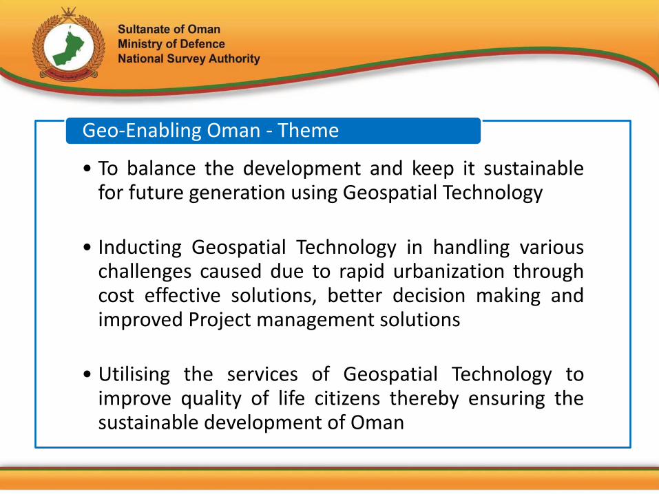
• To balance the development and keep it sustainable for future generation using Geospatial Technology
• Inducting Geospatial Technology in handling various challenges caused due to rapid urbanization through cost effective solutions, better decision making and improved Project management solutions
• Utilising the services of Geospatial Technology to improve quality of life citizens thereby ensuring the sustainable development of Oman
Geo-Enabling Oman - Theme

Geospatial Emerging Trends
Geospatial in Oman
Vote of Thanks
Way Forward to make Oman Geo-enabled
NSA’s Role in
Geo-enabling Oman
Exhibition & Workshops
Strategic Partnerships
Geo-Enabling Oman
Oman Geospatial
Forum 2015

Infrastructure projects planned between 2015-2017 such as Oman National Railway & Al Batinah Expressway
Oman’s current 5 year plan involves infrastructure projects for Airports, Ports and highway expansion
To promote tourism in country, government has planned and initiated several projects for Hotels and Resorts
Geospatial Technology improves the mechanics and management for building new infrastructure projects by integrating design and site data, providing framework for as-built data collection and thus simplifying communications between stakeholders
Construction & Infrastructure

Oman’s power requirements continue to rise due to urbanization and population growth
This requires increasing the generation capacity along with up-gradation and technological improvements to maximize the efficiency
Geospatial Technology plays a major role in efficient operation, expansion and planning for the future
Electricity

Oman’s economy is largely driven by industries such as Petrochemicals, Steel and Aluminum
Many world class exploration and production projects are under development, including investment in heavy enhanced oil recovery scheme
Oman government will continue to strengthen the economy by investing in Hydrocarbon industry where Geospatial Technology can play a special role to manage resources and preserving environment for future
Oil & Gas

Due to extreme changes in last 40 years or so, environment factors have been affected such as human beings, flora n fauna, soil, water, air, climate, landscape, material asset and cultural heritage
Currently environmental issues in Oman are mainly dealt within he context of nature conservation and protection
But no systematic base mapping focusing on environmental aspects has been produced considering spatial distribution
Establishment of new and a sustainable management of all protected areas seem to be an adequate proposal using Geospatial Technology is essential
Land use & Environment
Geospatial Emerging Trends
Geospatial in Oman
Vote of Thanks
Way Forward to make Oman Geo-enabled
NSA’s Role in
Geo-enabling Oman
Exhibition & Workshops
Strategic Partnerships
Geo-Enabling Oman
Oman Geospatial
Forum 2015

• Many Users • No common base-map • No common Standards for data
creation and sharing • Duplication of data and efforts • Data can not be used in combination

Geospatial Emerging Trends
Geospatial in Oman
Vote of Thanks
Way Forward to make Oman Geo-enabled
NSA’s Role in
Geo-enabling Oman
Exhibition & Workshops
Strategic Partnerships
Geo-Enabling Oman
Oman Geospatial
Forum 2015

www.nsaom.org.om
NSA’s Nationwide Geospatial Footprint
ONCN
Offers GPS data with cm level accuracy
ONGD-14
Localised Datum for accurate Surveys
ONGM Geoid Model
enables Orthometric
Heights
TOPO50K & 100K
Orthophoto, Seamless
Vector data &
Topographic Maps
Oman Geospatial
Manual
Standards, & Policies
Backbone for any Geospatial Activity / Project
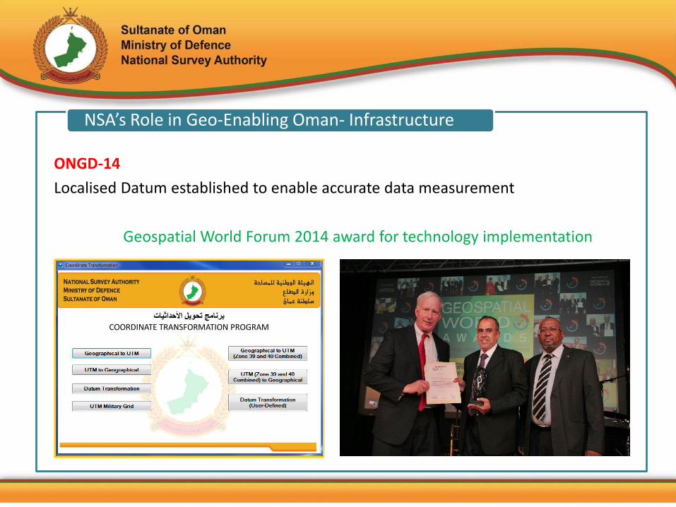
NSA’s Role in Geo-Enabling Oman- Infrastructure
ONGD-14
Localised Datum established to enable accurate data measurement
Geospatial World Forum 2014 award for technology implementation

NSA’s Role in Geo-Enabling Oman- Infrastructure
Oman National CORS Network (ONCN)
A network of Continuous Operating Reference Stations (CORS) that will continuously record Global Positioning System (GPS) signals and provide organizations, within the Sultanate of Oman, real time as well as post-processing positioning capabilities using single GPS receivers (Rover). Improves the Precision of GPS Collected Data This project is now under execution stage.
CORS Station at NSA HQ
NSA’s Role in Geo-Enabling Oman- Infrastructure
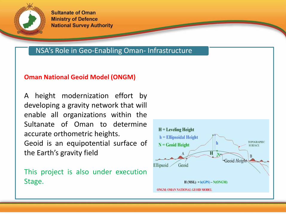
Oman National Geoid Model (ONGM)
A height modernization effort by developing a gravity network that will enable all organizations within the Sultanate of Oman to determine accurate orthometric heights. Geoid is an equipotential surface of the Earth’s gravity field This project is also under execution Stage.

NSA’s Role in Geo-Enabling Oman– Data Creation
TOPO100K Map TOPO50K Map
New 50K & 100K Mapping Expected Completion by 2015
Orthophoto
NATO STANAG rating AAOM12, highest rating in terms of currency, horizontal & vertical accuracy
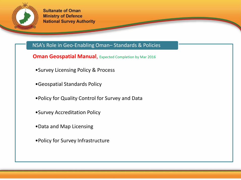
•Survey Licensing Policy & Process
•Geospatial Standards Policy
•Policy for Quality Control for Survey and Data
•Survey Accreditation Policy
•Data and Map Licensing
•Policy for Survey Infrastructure
NSA’s Role in Geo-Enabling Oman– Standards & Policies
Oman Geospatial Manual, Expected Completion by Mar 2016

•Custodian of Geographic Place Names
•Assist and Control Field Survey Operations
•Issuing flight permit and data vetting procedure
•Nationwide Mapping and Supply of Geospatial Data
•Training and Education through Institute of Topographic Sciences
NSA’s Role in Geo-Enabling Oman– Services

Geospatial Emerging Trends
Geospatial in Oman
Vote of Thanks
Way Forward to make Oman Geo-enabled
NSA’s Role in
Geo-enabling Oman
Exhibition & Workshops
Strategic Partnerships
Geo-Enabling Oman
Oman Geospatial
Forum 2015

Strategic Partnerships in Oman
Common Base Map
SDI Implementation
Integration of Geospatial and
Census Data

Strategic Partnerships in Oman
Geospatial Data Exchange
Datum Transformation
Field Survey Support

Vector Data, GCPs, GPNs,
VOBs
Raster Maps, Satellite Images,
Aerial Photos
DTM, DTED, Contours, Spot
Elevations
Strategic Partnerships in Oman

Geospatial Emerging Trends
Geospatial in Oman
Vote of Thanks
Way Forward to make Oman Geo-enabled
NSA’s Role in
Geo-enabling Oman
Exhibition & Workshops
Strategic Partnerships
Geo-Enabling Oman
Oman Geospatial
Forum 2015

•Use of Common base map for Geospatial Data Production
•Use of common standards, procedures and data model
•Easy mechanism for Data sharing and securing
•Use of localized datum (ONGD14)
•Empowering GIS users in Sultanate with Geospatial data & GIS technology
•Use of Geospatial data to benefit the people of Oman
Way forward to make Oman Geo-Enabled

Geospatial Emerging Trends
Geospatial in Oman
Vote of Thanks
Way Forward to make Oman Geo-enabled
NSA’s Role in
Geo-enabling Oman
Exhibition & Workshops
Strategic Partnerships
Geo-Enabling Oman
Oman Geospatial
Forum 2015
Geospatial Emerging Trends
Geospatial in Oman
Vote of Thanks
Way Forward to make Oman Geo-enabled
NSA’s Role in
Geo-enabling Oman
Exhibition & Workshops
Strategic Partnerships
Geo-Enabling Oman
Oman Geospatial
Forum 2015

Saleem Al-Hashmi Director of Geospatial Information
National Survey Authority, Ministry of Defence
Venue Date & Time Speaker Sr
Al Fahm Stage 23 Nov (13:30pm)
Yousuf Al-Nabhani
1
Al Fahm Stage 24 Nov (09:00am)
Bibhudatta Swain
2
Al Fahm Stage 24 Nov (10:00am)
Amol G Deshmukh
3
Meeting Room CG-38 24 Nov (09:00am)
Ahmed Al-Wardi
4
Meeting Room CG-38 24 Nov (11:30am)
Issa Al-Balushi 5
NSA Booth Technical Workshops


![PETROLEUM DEVELOPMENT OMAN (PDO) [Elmech] Development Oman - PDO [Elmec… · Petroleum Development Oman L.L.C. ... Postal Address : P.O.BOX 505- PC 114- SULTANATE OF OMAN Is registered](https://img.pdfslide.net/doc/110x75/5ac633c57f8b9a5c558dcb76/petroleum-development-oman-pdo-elmech-development-oman-pdo-elmecpetroleum.jpg)