Embed Size (px)
Citation preview

OPUS:
Online Positioning User Service
http://www.ngs.noaa.gov/OPUS/
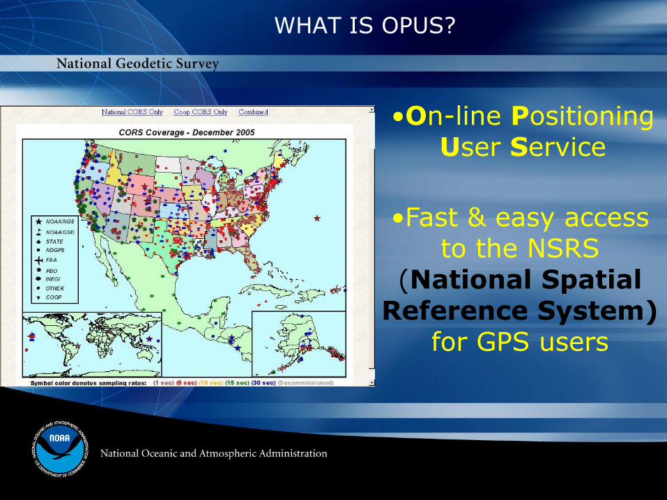
WHAT IS OPUS?
•On-line Positioning User Service
•Fast & easy access to the NSRS
(National Spatial Reference System)
for GPS users

http://www.ngs.noaa.gov/OPUS
You’ve got mail!
OPUS solution


NGS-modeled
antenna
GPS data
OPUS websitehttp://geodesy.noaa.gov/OPUS
your
datasheet
QA/QC
OPUS Concept
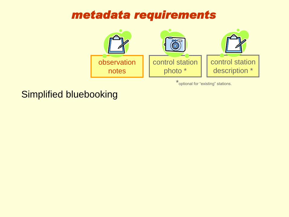
observation
notes
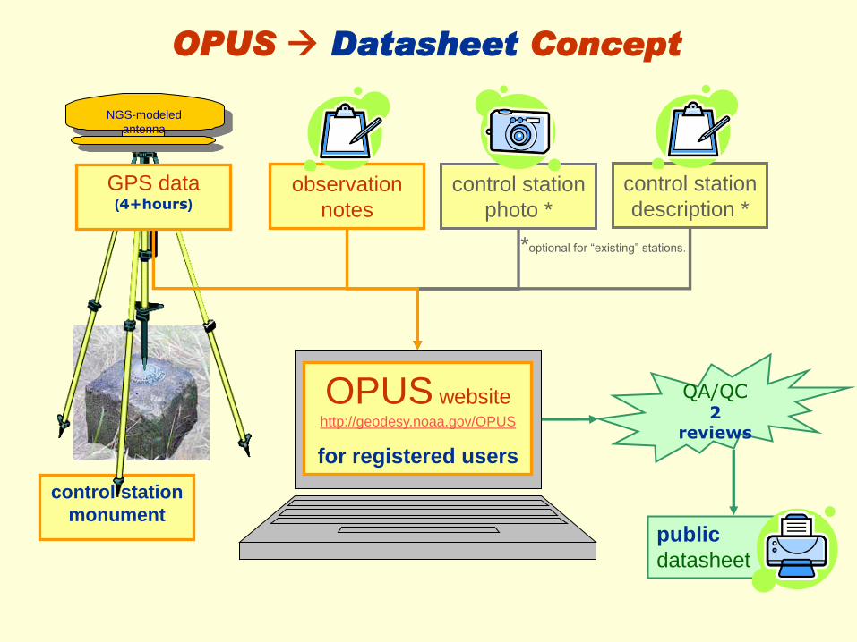
control station
photo *
control station
description *
control station
monument
NGS-modeled
antenna
GPS data (4+hours)
OPUS websitehttp://geodesy.noaa.gov/OPUS
for registered users
public
datasheet
QA/QC2
reviews
OPUS Datasheet Concept
observation
notes
*optional for “existing” stations.

Stable
Permanent
Unique
Recoverable
Safe
Z 125
1935--|--
control station
monument
control station requirements

GPS data requirements
“OPUSable”4+ hours of dual frequency data
NGS-calibrated antenna
OPUS must achieve:
≥ 90% observations used
≥ 80% ambiguities fixed
≤ 0.02m peak-to-peak horizontal
≤ 0.04m peak-to-peak vertical
NGS-modeled
antenna
GPS data (4+hours)
*optional for “existing” stations.
control station
description *control station
photo *
metadata requirements
observation
notes
Simplified bluebooking


OPUS websitehttp://geodesy.noaa.gov/OPUS
for registered users
OPUS registry
Registration stores the following:
•Name
•Address
•Agency
•Experience- GPS & OPUS


OPUS statistics checked by computer
Photos reviewed by NGS
Datasheet reviewed by agency
QA/QC2
reviews
quality control

Identical to normal datasheet
PLUS agency attribution
PLUS links to OPUS reports & statistics
public
datasheet
OPUS datasheet

Bench mark elevation retained
Position accuracy improved 95 feet!
One more tie between GRS80-NAVD88.

OPUS-DB benefits
• Data submittal
– Faster
– cheaper
• Consistent data processing
• Improve maintenance of NSRS
– Add GPS on bench marks
– Archive PLSS corners?

• GPS data only
• PAGES software only
• No direct tie to adjacent monuments
• No redundancy
• Reduced oversight
• Idiot-proofing?
• Field logs are not archived
OPUS-DB limitations

OPUS-DB data quality
• Registered, trained users
• 4+ hours of static GPS
• OPUS error checking
• NGS reviews each submittal
• Datasheet includes:
– “Caveat emptor” warning
– Datasheet includes DQA statistics
– Agency attribution
• Coordinates: first, best, average

• OPUS
» $$$ receiver, hours of data
• OPUS-DB
» $$$ receiver, hours of data, share results
• OPUS Projects
»Multiple $$$ receivers, share results
• OPUS Rapid Static
» $$$ receiver, minutes of data
• OPUS GIS
»¢¢ receiver, minutes of data
Many Flavors of OPUS Planned