Embed Size (px)
Citation preview
42E13NE8094 2.14598 CASTLEWOOD LAKE 010
COVER PAGE
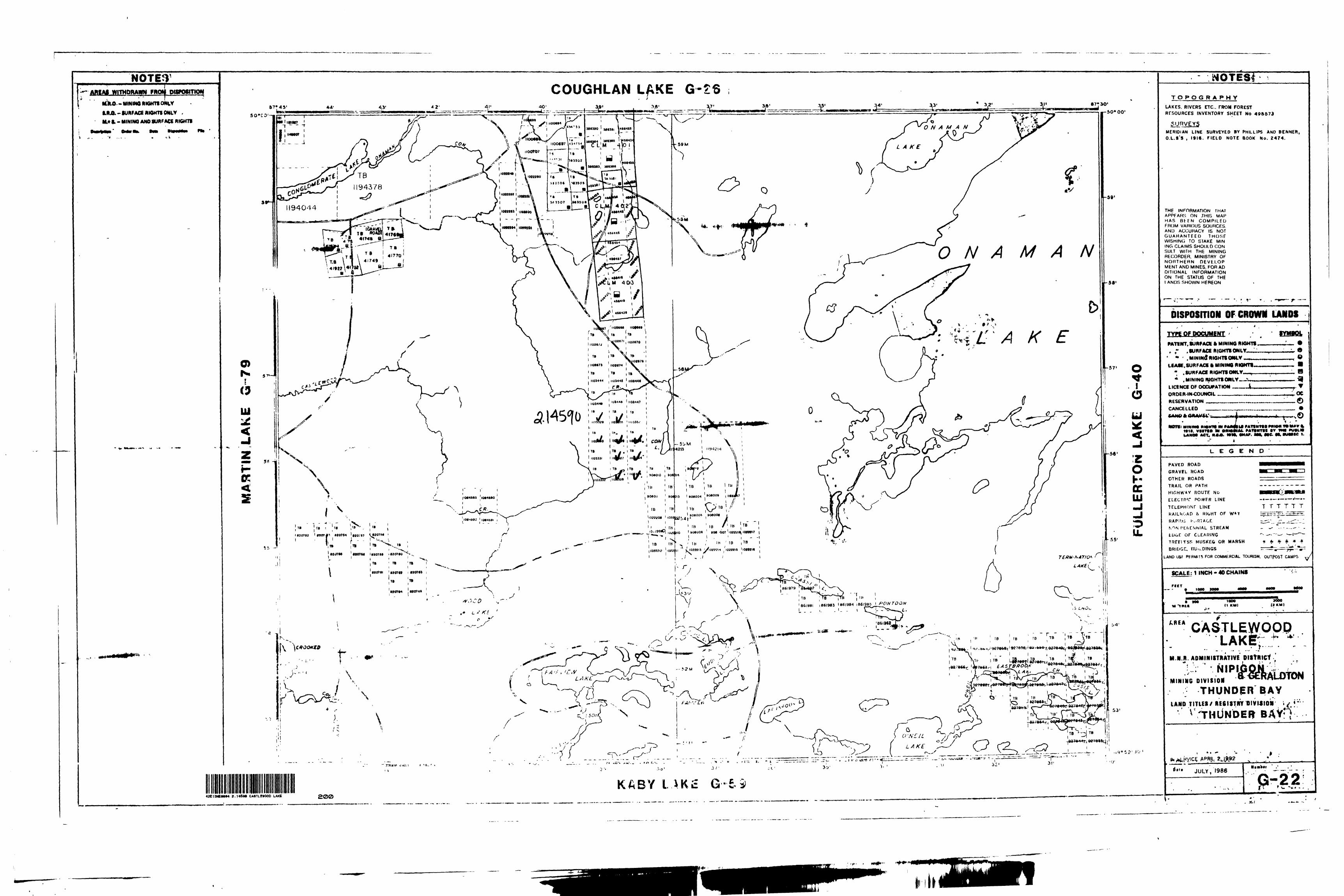
' CASTLEWOOD LAKE AREA
THUNDER BAY MINING DIVISION
MAP No. - G-22
12 MINING CLAIMS NUMBERED
TB- 110332^ TB-l 103330
1103325 1103331
1103326 11033321103327 1103352
1103328 11033541103329 1103355
COMMODITY GOLD - COPPER - SILVER
GP91-325
RECEIVEDMAY 2 6 1992
MINING LANDS BRANCH
FINAL REPORT
MYRON NELSON
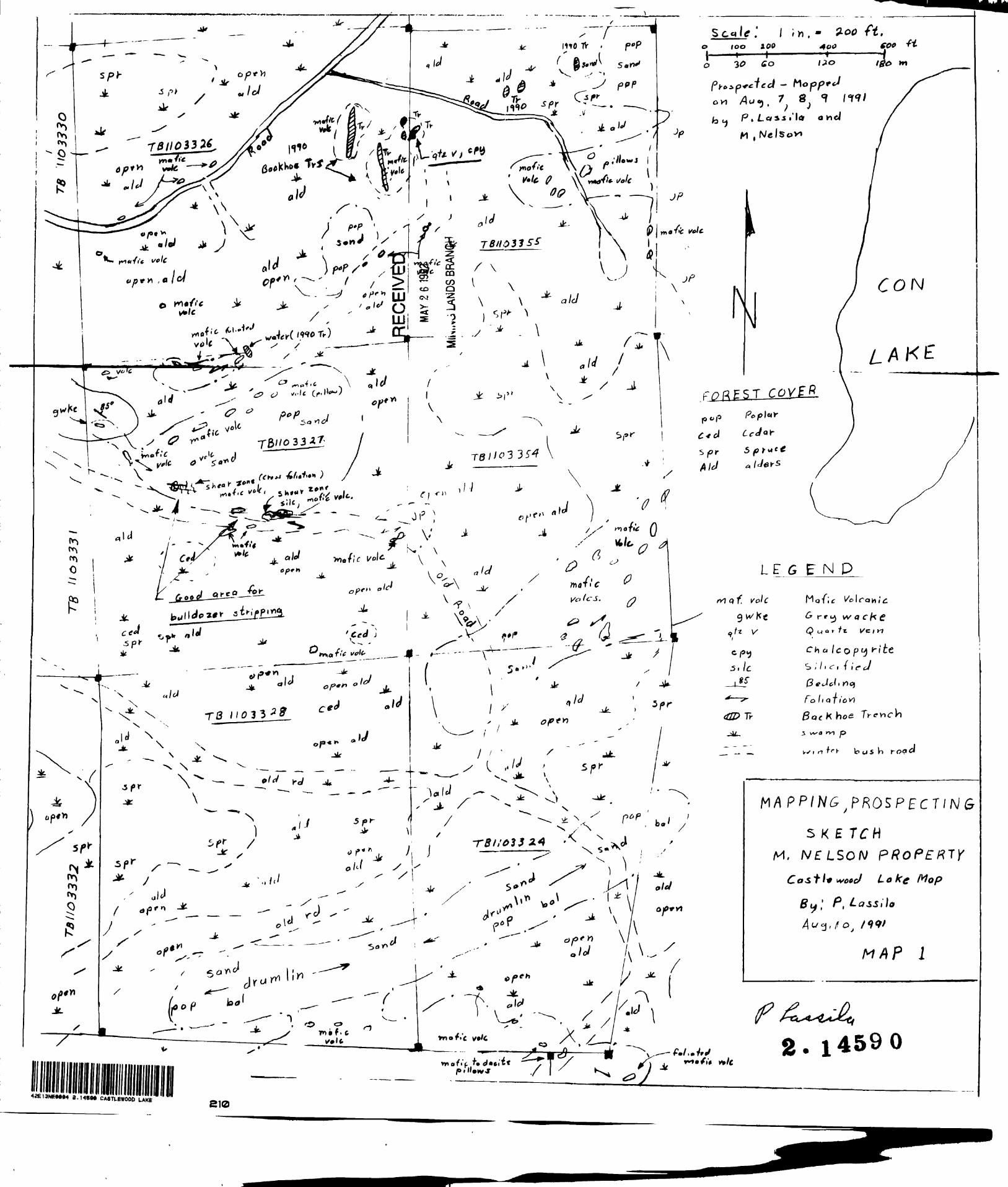
During the early part of August Kr. P. Lassila was hired by
myself to map and prospect some of my ground. A total of three days was spent going over six claims. Although we did not find
any mineral occurances we did locate a very large silicified shear zone on claim TB1103327 (see Lassila report k map). Since there was not time enough to do any work on this once the program
began, it will have to have some work done at a later date. This
shear zone is made up of what is known as puddingstone and this is usually a good indicator for base metal deposits. The trench ing program was started on October 10 and due to the moisture in
the ground the water became a serious problem in the trenches. We were only able to sample one trench and this could not be done
thoroughly due to the water. On October 13 I prospected on
claim TB1103325 and found a new showing. It consisted of fine galena, chalcopyrite and quite a lot of zinc and is about twelve feet wide. The mineralization occurs within the cerussite and chlorite banding and is folded quite badly. Rick McAdani was taken to the new showing the next day to open it up. A total of eight holes were drilled and blasted. This resulted in a trench
about eight feet across the zone. The backhoe was moved to this area and this showing was stripped off for about one hundred and fifty feet long and thirty feet wide. Two more trenches were blasted and samples taken. Silver and copper values were
not too high .but zinc went as high as ^.5^. We could not contine with the strike length of this zone because of the low ground at
each end. Any digging that was done was filled with water very quickly. Any more work that is done here will have to be done
in the dry part of the summer. The same thing applies to the
trenching on the gold zone to the south. Due to severe water
problems a detailed assay problem could not be done. The strike
length of the zone was extended another two hundred and fifty
feet. The assays taken this year were all very low.. I got as
PAGE 2
high as a .95 O.P.T. So any future work on this ground has to
be done in the hottest part of summer to get away from the
water problems. The zone held true in width from thirty
feet to fifty feet. No being able to sample this properlywas very dissapointing as Noranda, Homestake Minerals andFreewest Resources were quite interested in this property.On October 26, Mr. P. Lassila was again hired to map the new showing
and also map in the trenching (see Lassils maps #2 k #3)* OnOctober 2?, I went back to the property, to the north eastcorner of claim #TB1103325 and went in on an old road byfour wheel honda. ' Just south and west of the boundary lineI found a rusty zone on an outcrop. There was some fine
chalcopyrite in a piecf I broke off, so I went back to getthe drill and powder. One hole was put down and blasted, fine
chalco in quite a bit of the blast rock but not worth sampling.
The area will have to be looked at closer next year.
v" v .N B L SON' "tJ—\—"PROPERTY KWj. - .' -f i 'xj^M•..-. r'--/finw- \*
-**S"———^v
^T^ r
'-J.' - ,- \ ELMHIRST^ " ' -^~
MAP
t t
(\
O r~ > 1 2 ~̂D
X o
--
Q
i K)
r- o
5
M—
-J-
— S
ON.
^
vin
^**
"* *;
ft
V, 5
* ^ s
*t
o--
— - - -
- —
- -
- l
* l4
o~"T
r3T--
i"^-
feL. J
ixf:
1! i
—'*
i iiw
H *
s't
- _i
. - - -
i— -
i - -
Jj '..
^...L
i^~ "^
-Ht^
^r"-^
"m
i -
O
l A
*.
W K
l
WO
.
L-i.
s-Js
.
-- -
L- . J
.- --it
-U
-L
--J.-- J
\

42E13NE0004 2.14590 CASTLEWOOD LAKE020
REPORT ON MAPPING - PROSPECTING PROJECT
M.NELSON PROPERTY
Castlewood Lake Map (G-22)
NTS 43 E/13
Date: August 1991 By: P.Lassila 7.
2.1*520
42El3NETOM 2.14594 CASTLEWOOD LAKE 020C
LEGEND
RECOMMENDATIONS
INTRODUCTIONS
LOCATION AND ACCESS
PROPERTY
TOPOGRAPHY AND OUTCROP EXPOSURE
PREVIOUS WORK
GEOLOGY
PROSPECTING RESULTS f
FIGURE 1; LOCATION MAP
FIGURE 2; DETAILED LOCATION MAP
FIGURE 3; CLAIM MAP i
PAGEr
2,
MAP 1: MAPPING -PROSPECTING SKETCH
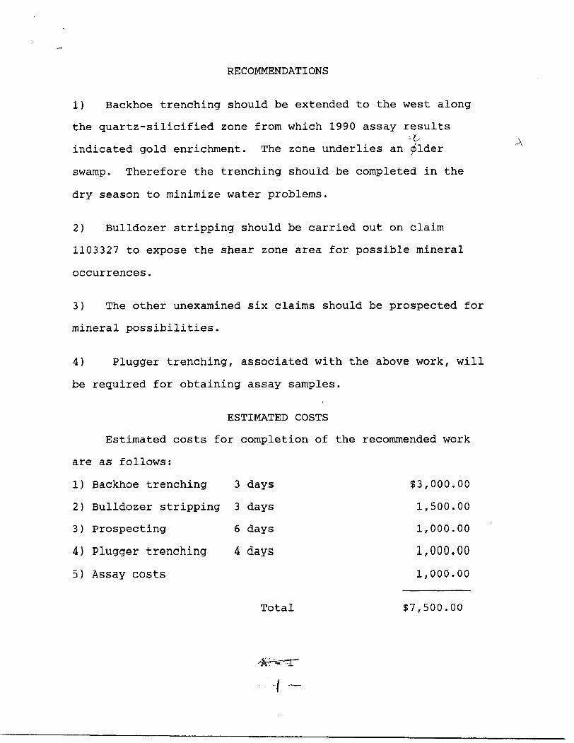
RECOMMENDATIONS
1) Backhoe trenching should be extended to the west along
the quartz-silicified zone from which 1990 assay results'L
indicated gold enrichment. The zone underlies an dlder
swamp. Therefore the trenching should be completed in the
dry season to minimize water problems.
2) Bulldozer stripping should be carried out on claim
1103327 to expose the shear zone area for possible mineral
occurrences.
3) The other unexamined six claims should be prospected for
mineral possibilities.
4) Plugger trenching, associated with the above work, will
be required for obtaining assay samples.
ESTIMATED COSTS
Estimated costs for completion of the recommended work
are as follows:
1) Backhoe trenching 3 days $3,000.00
2) Bulldozer stripping 3 days 1,500.00
3) Prospecting 6 days 1,000.00
4) Plugger trenching 4 days 1,000.00
5) Assay costs 1,000.00
Total S7,500.00
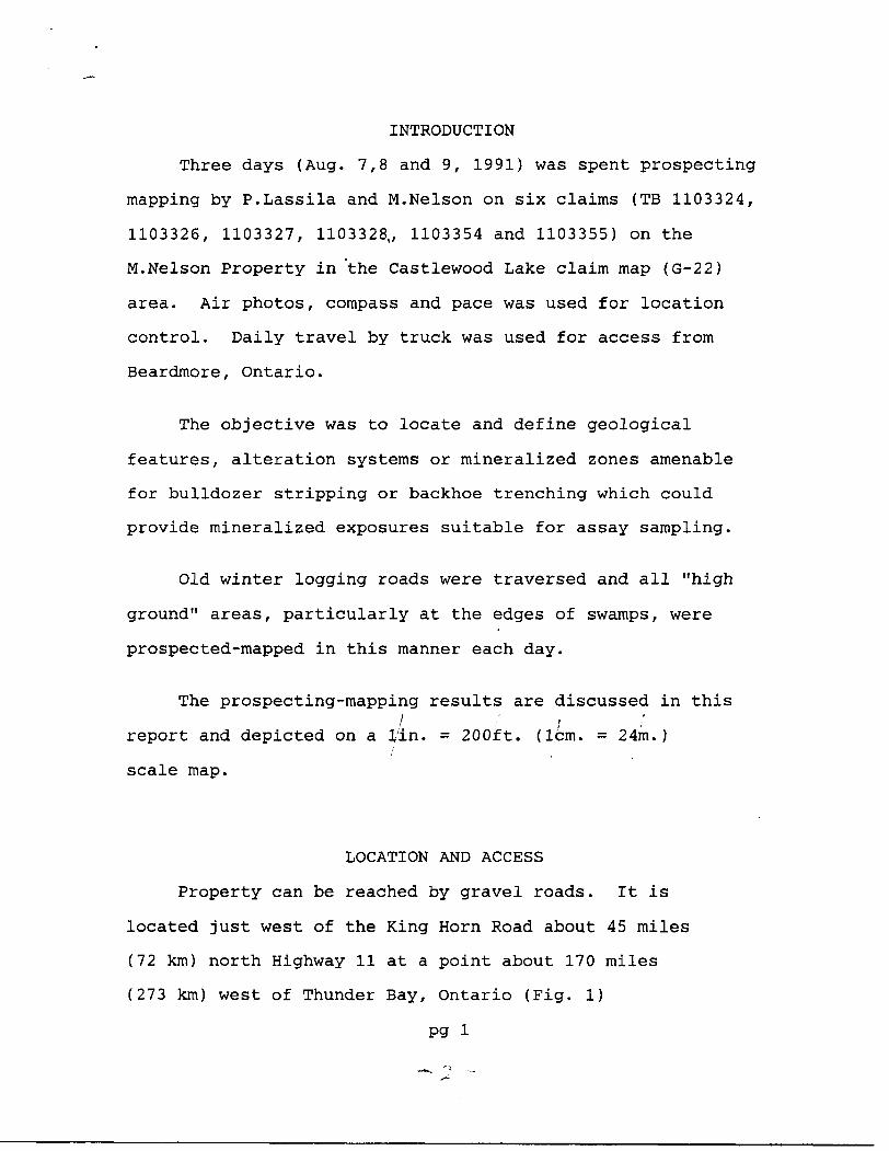
INTRODUCTION
Three days (Aug. 7,8 and 9, 1991) was spent prospecting
mapping by P.Lassila and M.Nelson on six claims (TB 1103324,
1103326, 1103327, 1103328,, 1103354 and 1103355) on the
M.Nelson Property in the Castlewood Lake claim map (G-22)
area. Air photos, compass and pace was used for location
control. Daily travel by truck was used for access from
Beardmore, Ontario.
The objective was to locate and define geological
features, alteration systems or mineralized zones amenable
for bulldozer stripping or backhoe trenching which could
provide mineralized exposures suitable for assay sampling.
Old winter logging roads were traversed and all "high
ground" areas, particularly at the edges of swamps, were
prospected-mapped in this manner each day.
The prospecting-mapping results are discussed in this
report and depicted on a lin. = 200ft. (lcm. = 24m.)
scale map.
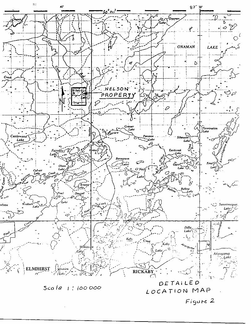
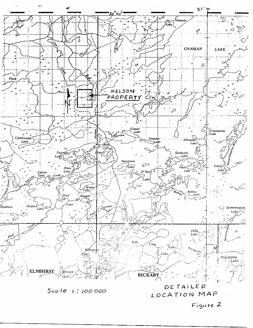
LOCATION AND ACCESS
Property can be reached by gravel roads. It is
located just west of the King Horn Road about 45 miles
(72 km) north Highway 11 at a point about 170 miles
(273 km) west of Thunder Bay, Ontario (Fig. 1)
pg i
-t——-—l—^n '' jJT' x-i' f-
Creek
v"- :N fi L SON- *PRO P g RT V"^•t,~^r--'-
K^O ..^
GA ( Termination V J Lake
-— ,' Ali gogama";-~~Lake s;
ELMHIRSTr?
5co ie j ; / TAILED LOCAT'OIM MAP
I'i'u he 2.
ITB ITB 'TBfl 456420 1456419 ' 456418
l j - ____ -\---i_____ J
MHII. - J.MIII2 ^.'.j 56427 I^Se-ttBljHSWS '
TB , Tfl ^TB JTB '
*"449 l "03448 "03447
^i C™ \Hf5MB ' 'UliC l Q 'l m S 1103377 l .03354
. J... L. IT
908006' 908//607
Scale l l
C. ^ s t i e W &O ot
G-22
CLAIM MAP
3
PROPERTY
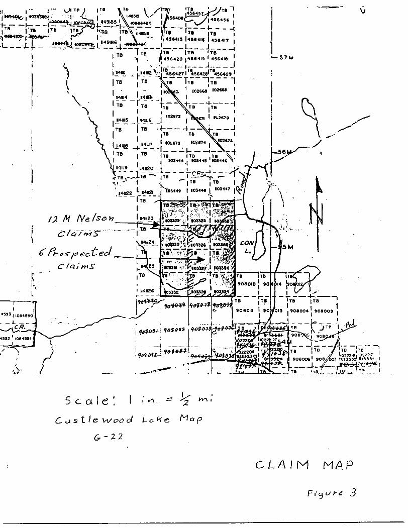
The six claims prospected-mapped are the southwest
part of a 12 claim group owned by M.Nelson, a resident
of Beardmore, Ontario. The 12 claim group consists of
claim numbers TB 1103324, 1103325, 1103326, 1103327,
1103328, 1103329, 1103330, 1103331, 1103332, 1103352,
1103354, and 1103355 (Fig. 3).
TOPOGRAPHY AND OUTCROP EXPOSURE
The survey area is covered by low, nearly flat ...VA
topographic relief with less than 5% outcrop exposure.
Most of the area is covered by alder and blackspruce
swamp which gently grades into sandy plains in some
locations. Subcrop evidently is under rather shallow
overburden with occasional low-relief outcrop exposures
irregularly dispersed in several locations.
This area has been heavily timber cut some twenty
years ago, leaving extensive semi-open areas covered
with alder brush in wetlands and poplar and jackpine
regeneration on drylands.
Outcrop is virtually nonexistent in swampy areas and
poorly to moderately exposed in dryland areas.
pg-2
PREVIOUS WORK
During 1990 backhoe trenching was conducted for
M.Nelson in several locations. A series of trenches in
the central part of claim TB 1103326 exposed a quartzitic
silicified zone. Assay results of up to 0.104 oz/t gold
was returned from 3m to 5m deep subcrop in one trench.
Another trench exposed significant chalcopyrite
mineralization.
At the time of the present prospecting nearly all
the trenches were water filled and the silicified zone could
not be observed or sampled.
GEOLOGY
Amukan's mapping (1976) of the general area indicates
that the prospected claims are underlain by mafic to
intermediate metavolcanics, some of which are pillowed.
Immediately to the west lies a one kilometer wide section
of metasediments which includes arsenite, greywacke and
conglomerate. Just to the east, on the west side of
Con Lake, is a south extending protrusion of the Onaman
Lake granitic batholith.
Within the volcanics extending north from the
prospected claims are several known copper, zinc and
lead sulfide occurrences. Similar sulfides may occur
along the southern extension of these volcanics onto the
Nelson Property.
pg-3-7 -
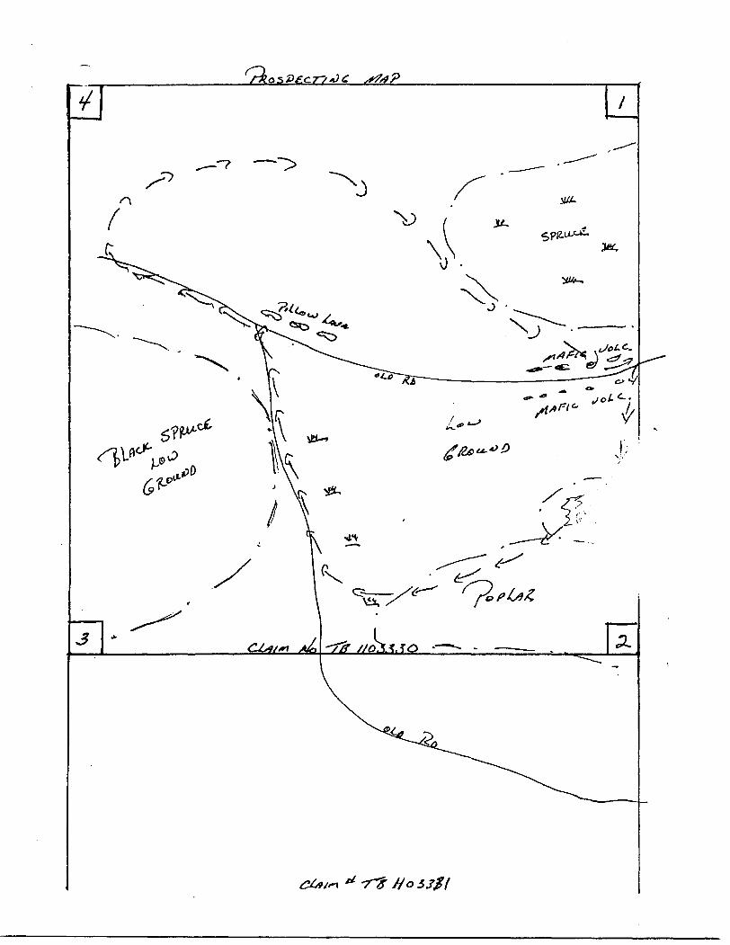
PROSPECTING RESULTS
The major prospecting problem on the Nelson ground
is insufficient outcrop exposure. Even so, one very
interesting structural zone with associated silicification
was discovered in the central part of claim TB 1103327.
This consists of a sheared, complexly foliated structural
system on which quartz veining and silicification was
observed. Foliation, crossfracturing and crossfoliation
has developed a hackly weathered surface texture. This
so-called "pudding stone" is commonly associated with
basemetal occurrences in this general area. Therefore,
although only very minor sulfide mineral was observed in
the few available outcrop exposures. this location,
deserves a bulldozer stripping program to search for a
possible basemetal and gold association. The outcrops
here are very flat lying and overburden appears to be
fairly shallow:- an ideal situation for developing rock
exposure by stripping.
In other locations on the property the outcrops consist
of volcanic flows, some of which are pillowed. Compositional
variations range from andesite to dacite.
i
T
REFERENCES
Amukum, S.E.
1977: Geology of the Tashota Area, District of
Thunder Bay; Ontario Geological Survey Report 167,
90p. Accompanied by Map 2354, scale l inch to 1/2 mile,
- 9 -
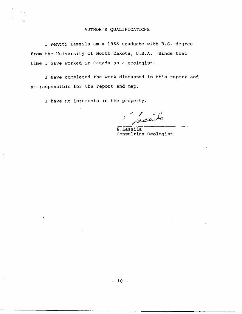
AUTHOR'S QUALIFICATIONS
I Pentti Lassila am a 1968 graduate with B.S. degree
from the University of North Dakota, U.S.A. Since that
time I have worked in Canada as a geologist.
I have completed the work discussed in this report and
am responsible for the report and map.
I have no interests in the property.
P.Lassila Consulting Geologist
- 10 -
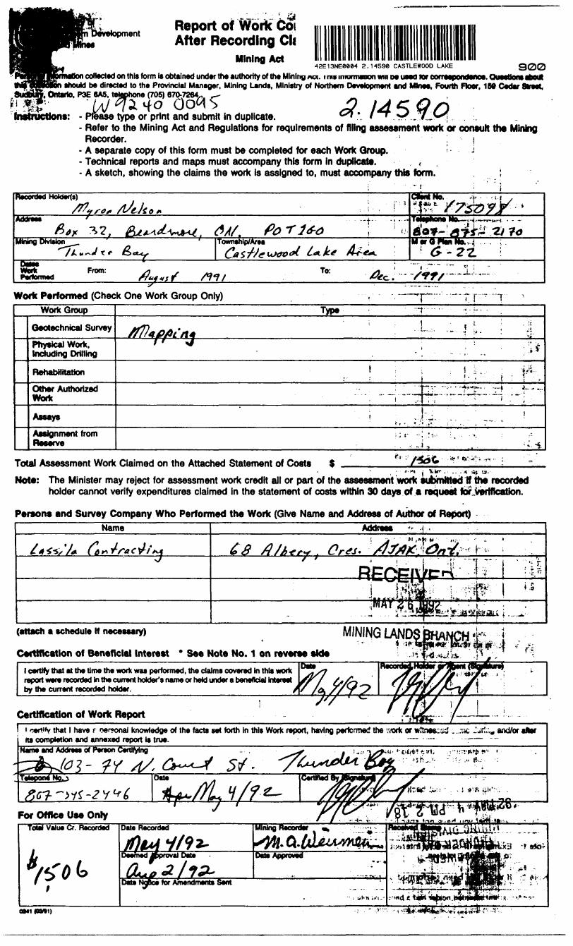
-- - Report of Work CoiAfter Recording Cli
Mining Act42E13NE8884 2.14598 CASTLEWOOD LAKE 900
i collected on this form is obtained under the authority of the Mining ACT. iraiinrormaiKxiwiiiMueeoioraxreepondeftoe.QueetlooseboUI i should be directed to the Provincial Manager. Mining Lands, Ministry of Northern Development and Mine*, Fourth Floer, 1M Cedar Stteet.
, Ontario, P3E 6A5, telephone (705) 670-7264., ,
o GCM S 3 l A ^ Q nInstructions: - Please type or print and submit in duplicate. ^ * l ' *J 71 J*S\
- Refer to the Mining Act and Regulations for requirements of filing assessment work or consult the Mining Recorder. ! j
- A separate copy of this form must be completed for each Work Group. i j- Technical reports and maps must accompany this form in duplicate. ,- A sketch, showing the claims the work Is assigned to, must accompany this form. , i
ReKOfOM
* f B e e '
Township/AreaMining DivisionO
Front:/f f/
To: .—.J.......
Work Performed (Check One Work Group Only) -p-:
Work Group
Geotechnical Survey
Physical Work, Including Drilling
Rehabilitation
Other Authorized Work
Assays
Assignment from Reserve
Type - ' -rf--- -.i.. .
/^u^. ' j ; .L, .:.j i l -ji} :, , if
, ! i j ; !-r t ; f:.:.-.. : ...^:....^::::^a^.z* ..|-
! ,....;J.":r ,-.'-'. ~~ - !
- . -. J,' ,, - ''-"i.
Total Assessment Work Claimed on the Attached Statement of Costs S . ^ .
Note: The Minister may reject for assessment work credit all or part of the assessment work submitted If the recorded holder cannot verify expenditures claimed in the statement of costs within 30 days of a request for.veftflcatlon.
Persons and Survey Company Who Performed the Work (Give Name and Address of Author of Report)Name Address
'/* c s
(attach a schedule W necessary) MINING LAND•- ] -
Certification of Beneficial Interest * See Note No. 1 on reverse aide
l certify that at the time the work was performed, the claims covered In this work report were recorded in the current holder's name or held under a beneficial Interest by the current recorded holder.
/VCertification of Work Report
have r rwironal knowledge of the facts set forth In this Work report, having perfermed the vrcrk or w3ne*iid . ns completion and annexed report is true. - — —
and/or after
Name and Addrws of Pereon Certifying
OM1(BM1)
Credits you are claiming in this report may be cut back. In order to minimize the adv which claims you wish to priorize the deletion of credits. Please mark f '1. D Credits are to be cut back starting with the claim listed last, working backwards,2. D Credits are to be cut back equally over all claims contained .in this report of work.3. D Credits are to be cut back as priorized on the attached appendix.
In the event that you have not specified your choice of priority, option one will be bnptemented.5.
Hotel: Examples of beneficial Interest are unrecorded transfers, option agreements,to the mining claims. ,L 4^. j - ,
Note 2: H work has been performed on patented or leased land, please complete the
with respect
1 certify that the recorded holder had a beneficial Interest In the patented or leased land at the time the work was performed.
Signature Date
Ontario
Ministry ofNorthern Developmentandjitnea
M .*du Devvioppement du Nord st de* mine*
Statement of Costs for Assessment Credit
ttat des coflts aux fins du credit devaluation
Mining Act/Lol *ur les mine*
Transaction No./N* de transaction
Personal Information collected on this form Is obtained under the authority of the Mining Act. This Information wffl be used to maintain a record and ongoing status of the mining dalm(s). Questions about this collection should be directed to the Provincial Manager, Minings Lands. Ministry of Northern Development and Mines. 4th Floor, 159 Cedar Street, Sudbury, Ontario P3E 6A5, telephone (706) 670-7264.
Les renseignements personnels contenus dans la presente formula sont recueillis en vertu de la Lol sur lee mines et serviront a tenir a jour un registre des concessions mlnieres. Adresser toute questton sur la collece de ess renseignements au chef provincial des terrains miniers, minlstere du DevekJppement du Nord et des Mines, 158, rue Cedar, 4" stage. Sudbury (Ontario) P3E 6A5, telephone (705) 670-7264.
1. Direct Costs/CoOt* directs
Type
Wages
Contractor'* and Consultant's
Type
Drafts de ('entrepreneur et do rexpert-
FoumNureo
EquipmentBM**^ nVfnkW
Location de
Description
Labour Main-d'oeuvrtField Supefytslon Supervision sur le terrain
RECEIVETyp- MAY 2 6 15
MINING LANDS 3RANCH
Total Direct Costs Total do* coots directs
2. Indirect Costs/Coots Indirect** * Note: When claiming Rehabilitation work Indirect costs are not
allowable as assessment work. Pour le remboursement des travaux de rehabilitation, les coOts indirect* ne aont pas admissibles en tant que travaux d'evaluation.
Type
Transportation Transport
Food and Lodging Nourrtture et
Mobilization and Demobilization MoblltMtiofi ttfUsTiJiKllianrtl*MfccivMiwoiiivmon
Description
Typ.
————————— rKc
Amount Montant
*jj •oI^K ?"
? E; '•-'^1 1- ——c — crr-^-^ 02 m
3 co a
* j
Sub Total of Indirect Costs Total partial des coOts Indirect*
Amount Allowable (not greater than 20H of Direct Costs) Montant admissible (n'excMant pas 20 H des coOts directs)TjfctAl UA!IIA fit A ••••••MAMcl f^m^^tt \t*t*mmm IttAm
(Total of Dfract and Altowabto d'evshistk Indirect eoMml (ToW dM ei
feducredttMl rttiiftmeti
Totals Total global
'~
3
*
O' si
0
/4oU
Note: The recorded holder will be required to verify expenditures claimed in this statement of costs within 30 days of a request for verification. If verification Is not made, the Minister may reject for assessment work all or part of the assessment work submitted.
Note : Le titulaire enregistre sera tenu de verifier les depenses demandees dans le present etat des codts dans les 30 jours suivant une demands i cet effet. Si la verification n'est pas effectuee, le ministre peut rejeter tout ou une partie des travaux devaluation presented.
RRng Discounts Remises pour depot
1. Work filed within two years of completion is claimed at KXW of the above Total Value of Assessment Credit.
1. Les travaux deposes dans les deux ans suivant leur achievement sont rembourees a 100 "to de la vateur totate susrnentionnee du credit d'taluabon.
2. Work filed three, four or five years after completion is claimed at 50*4 of the above Total Value of Assessment Credit. See calculations below:
Total Value of Assessment Credit Total Assessment Claimedx 0.50 -
2. Les travaux deposes trois, quatre ou cinq ans apres leur achievement sont rembourses a 50 to de la valeur totals du credit devaluation susmentionne. Voir les calculs ci-dessous.
Valeur totale du credit devaluationx 0,50
Evaluation totale demand**
Certification Verifying Statement of Coat*
l hereby certify:that the amounts shown are as accurate as possible and these costs were incurred while conducting assessment work on the lands shown on the accompanying Report of Work form.
that as(Recorded HoMer. Agent. PoeHton In Company)
to make this certification
Attestation de l'etat de* coQts
J'atteste par la presente :que les montants indiques sont le plus exact possible et que ces depenses ont ete" engagees pour effectuer les travaux d'evaluation sur les terrains indiques dans la formule de rapport de travail ci-joint.
l am authorized Et qu'a litre de je suis autorise(Utulalr* enregistr*. repr*s*ntant, poet* occup* dans la compagnie)
ft faire cotte attestation.
Slgnatur*
0212 (04/91) Nota : Dans Gette formi
Data
des personnes. le masculin est utilise au sens neutre. l
, ,Deve.oprnent Report of Work G fid!' ' ' ' -^ '*tA\^'
C aim 7,*~ *-, , V ' '
M llectH On t
•P','1-
Personal Information collectH On this form Is obtained under the authArfry-of the Mining Art. This Mo coBectton should be directed to the Provincial Manager, Mining Lands. Ministry of Northern Sudbury. Ontario. P3E 6A5. telephone (705) 670-7264.
Instructions: - Please type or print and submit in duplicate.- Refer to the Mining Act and Regulations for requirements of filing assessment work or consult ffi* Mining
Recorder. i [j- A separate copy of this form must be completed for each Work Group. Y- Technical reports and maps must accompany this form in duplicate. '- A sketch, showing the claims the work Is assigned to, must accompany this form.
Recorded Holders) NO*
Address
Division•ga -
Mining
**x t*Township/Area Plan No.
DatesIJInrlr vTvTH
PerformedFrom:
111
Work Performed (Check One Work Group Only)Work Group
Qeotechnical Survey
Physical Work, Including Drilling
Rehabilitation
Other Authorized Work
Assays
Assignment from Receive
Type - ; ,- . v- -ya
- ' : . Ut. r:,;i i- -: r ; -1 j
^^-^^-Aji^C/^^^oi l T' "
r MAY 2 6 TO? i
-:i . . cl^", -i' 'l . ' -
*i..-•i*— *;-*. -
:'
MIMING LANDS BftANCH j
: 1 ^ ^: l ' -. '
. ' ' ~- -
1 i. .*-^"-"1
•- ••.^4'--- ; -i
; ; -fTotal Assessment Work Claimed on the Attached Statement of Costa l , .. .? ,. i ;
Note: The Minister may reject for assessment work credit all or part of the assessment work submitted if the recorded holder cannot verify expenditures claimed in the statement of costs within. 30 days of a! request for verification.
Persons and Survey Company Who Performed the Work (Give Name and Address of Author of Report)Name
/u ^ AJ^k*^'
-
Address
fcoK ^1 , lUUxXU^v^^^j (^l
^oif
: ' ' : - ; s. .. . -. i ---T-i
(attach a schedule Jf necessary)
Certification of Beneficial Interest * See Note No. 1 on reverse sidel certify that at the time the work was performed, the cla
by the current recorded holder.
Ims covered In this work jnder a beneficial Interest
Certification of Work Reoort
1
jf r\ f Cv
'
fa
•^-, \
T 16-0
: P i rv^-4; :" l ji
U-i^ _ l.-J
l::.U J b:- ^ ,j -j i i
^^A'--- ' 'A^lb/2 ',S ; *5'f'U--,-'i-
l certify that l have a personal knowledge of the facts set forth in this Work report, having performed the work or wtesiesd earns during andfor \i*s r.-.^,rsi-jipn yffi annexed roport Is true. -/. - t
Name and Address of Person Certifying
For Office Use Only
OM1 (QM1)
YIAY 261592
LA sIDS SRAh CH
. -'^ - ..--sip-::. ' ,U,wrXCredits you are claiming in this report may be cut back. In order to minimize the adverse effects of sucri de which claims you wish to priorize the deletion of credits. Please mark (•J one of the following: ; "K' - -' * "
1. D Credits are to be cut back starting with the claim listed last, working backwards.V .;2. D Credits are to be cut back equally over all claims contained in this report of work. -3. D Credits are to be cut back as priorized on the attached appendix. T '
In the event that you have not specified your choice of priority, option one wW be Implemented. ,'
* ! ..!r..4J*"V^;'V';.f.-^.----.•: V ''! :!'^ ^
""•' i -.' t -t v : ' "i^ t'" 1
Note 1: Examples of benefldal Interest are unrecorded transfers, option agreements, memorandum of agissmsiils. s&Jsttti recpcat to the mining claims.
Note 2: If work has been performed on patented or leased land, plsaas complete the
l certify that the recorded holder had a beneficial interest in the patented or leased land at the time the work was performed.
Signature
Ontario
Ministry ofNorthern Developmentand Mines
stere duDeveloppement du Nord et des mines
Statement of Costs for Assessment Credit
litat des coOts aux fins du credit d'evaluation
Mining Act/Lol sur le* mines
Transaction NoJN* d* transaction
Personal information collected on this form is obtained under the authority of the Mining Act. This information will be used to maintain a record and ongoing status of the mining claim(s). Questions about this collection should be directed to the Provincial Manager, Minings Lands, Ministry of Northern Development and Mines, 4th Floor, 159 Cedar Street, Sudbury, Ontario P3E 6A5, telephone (705) 670-7264.
Le* renseignementa personnels corrtenus dans la present* formula sont recalls en vertu de la Lot sur le* nrine* rt sen/front a tertr a jour unreglstre des concessions mlnleres. Adresaer toute question sur la collece de ces renseignements au chef provincial des terrains mWers. mlnistere du Developpement du Nord ei des Mines, 180. rue Cedar, 4* stage, Sudbury (Ontario) P3E 6A5, telephone (70S) 670-7254.
1. Direct Costs/CoOts directs
Type
WagesSalalres
Contractor's and Consultant's Fee* Orottsde ('entrepreneur et de ('expert-COfMOll
Supplies Used Foumltures utm****
Equipment Rental Location de materiel
Description
Labour Main-d'oeuvre
Field Supervision Supervision sur le terrain
Typs
Type
RECEIV
Amount Montant
7^0
fED
MAY 2 6 1B92Typ*
MINING LANDS BRANCH
Total Direct Costs Total des coOts directs
Totals Total global
. ^*fc**^. ' * " :
SrSs^
"Wf:.^SK
2. Indirect Costs/CoOts Indirect** * Note: When claiming Rehabilitation work Indirect costs are not
allowable as assessment work. Pour le remboursement des travaux de rehabilitation, lee couts Indlrects ne sont pas admissible* en tant qua travaux d'evaluatlon.
Sub Total of Indirect Costs Total partial de* cotts Indlrects
Food and Lodging Nourrlture et hebergementMobilization and Demobilization Mobilisation et demobilisation
Amount Allowable (not greater than 20* of Wrect Costa) Uontant admissible (n'excedant pee M H des couts dtovcte)!Total Value of Aisaasmsnt Credit (Total of Direct and ASowaMe Indirect cocts)
Vatsur toW* du credtt d*svriua*M (Total e* wets t m
Note: The recorded holder will be required to verify expenditures claimed in this statement of costs within 30 days of a request for verification. If verification is not made, the Minister may reject for assessment work all or part of the assessment work submitted.
Note : Le titulaire enregistn} sera tenu de verifier lea depenees damandees dans le present etat des coOts dana let 30 jours suivant une demande a eel effet. Si la verification n'est pas effectuee, le mlnlstre petit rejeter tout ou une partie doa travaux d'evaluation presentee.
Filing Discounts Remises pour depot
1. Work filed within two years of completion is claimed at lOO'Vb of the above Total Value of Assessment Credit.
1. Les travaux deposes dans les deux ana suivant tour achievement sont rembouree* a 100 H de la vatour Mate eusmenttonrtee du crsdK d'evaluation.
2. Work filed three, four or five years after completion is claimed at SOIfe of the above Total Value of Assessment Credit. See calculations below:
Total Value of Assessment Credit Total Assessment Claimed
x 0.50 -
2. Les travaux depose* trot*, quatre ou dnq an* apres tour achievement sont remboursea a 50 K d* la valeur total* du credit devaluation susmentionne. Voir le* calcul* d-dea*ou*.
Valeur total* du credit d'evaluatlon
x 0,50Evaluation totato demandee
Certification Verifying Statement of Costs
l hereby certify:that the amounts shown are as accurate as possible and these costs were incurred while conducting assessment work on the lands shown on the accompanying Report ot Work form.
that as(Recofdbd Urtdbr, Agent. Position in Company)
t/to make this certification
Attestation de I'etat de* coot*
J'attesle par la presente :que les montants Indiques sont le plus exact possible et que ces depenses ont ete engegees pour effectuer les travaux d'evaluatlon sur les terrains Indiques dans Is formule de rapport de travail d-joint.
l am authorized Et qu'a tttre de Je suls autorise(Utulair* enregMrt, njpteMntant, pod* oocupe dans la oompagnl*)
a falre celt* attestation.
0212(04^1) Nota : Dans cette fomyU, lorsqu'U deskjne des personnes, le masculln est utilise au sens neutra.
Ontario
Ministry ofNorthern Developmentand Mines
Ministere du Developpement du Nord et des Mines
Mining Lands Branch Geoscience Approvals Section 159 Cedar Street, 4th Floor Sudbury, Ontario P3E 6A5
Telephone: Fax:
(705) 670-7267 (705) 670-7262
July 31, 1992Our File: 2. 14590 Transaction #W9240. 095
Mining Recorder .096Ministry of Northern Developmentand Mines435 James Street SouthP. O. Box 5000Thunder Bay, OntarioP7C 5G6
Dear Sir/Madam:
Subject: APPROVAL OF ASSESSMENT WORK CREDITS ON MINING CLAIMS TB1103324 ET AL. IN CASTLEWOOD LAKE AREA
The assessment work credits for the Prospecting work and Geological Mapping filed under Sections 9 and 12 of the Mining Act Regulations have been approved as originally filed.
The approval date is July 30, 1992.
Yours sincerely,
Ron C. GashinskiSenior Manager, Mining Lands BranchMines and Minerals Division
LJ/jl Enclosures:
cc: Resident GeologistThunder Bay, Ontario
ONTARIO GEOLOGICAL SURVhY GIS-ASSESSMENT FILES \
l SEP 2 2 1992 l
l
RECEIVED
Assessment Files Office Toronto, Ontario
NOTEITAREA! WITHDRAWN FROM DISPOSITION,, - '——~———7 -
MJU) . MINING KIGHTi OWtV
M.O.-SURFACE MIGHTS ONLY . M,* l-MINING AND SUBFACE BIGHT!
COUGHLAN LAKE G-26______. 3L9"
'- '- f ' - *xit*
A N
LAKE
f\ )45fl() \ "j ^ !C\* \ ~~ \ l unsm i nolRe '
901 OIS l 906004 , 90400* ,
O'-'20*} lUrffclO ' *0800* ' *M -COT '"* *i -m T i i i
KABY HK42EI3NEMM Z. 1469* CASTLEWOOD LAKt 200
NOTES*
TOPOGRAPHY
LAKES. RIVERS ETC.. FROM FOREST RFSOURCES INVENTORY SHEET No 495B73
5URVEY5MERIDIAN LINE SURVEYED BY PHILLIPS AND BENNER, O.L.S'S , 1916. FIELD NOTE BOOK No. 2474.
THE INFORMATION THAT APPFARS ON .THIS MAP HAS BtEN COMPILEDFROM VARIOUS SOURCES, AND ACCURACY IS NOT GUARANTEED THOSE WISHING TO STAKE MIN ING CLAIMS SHOULD CON SULT WITH THE MINING RECORDER, MINISTRY OF NORTHERN DEVELOP MENT AND MINES, FOR AD DITIONAL INFORMATION ON THE STATUS OF THEl ANDS SHOWN HEREON
V .
DISPOSITION OF CROWN UNOS
TYPE OP DOCUMENT 'PATENT.SUBFACE ft MINING NIGHTS., ~ .SURFACE RIGHTIONLT—^
' - - .MINING* RIGHTS ONLY———
SYMBOL
LEAfC.SURFACS ft MINING RtOHTf.* . SUR FACE fi IGHTf OMLV—r-* .MINING RIGHTSOMLV—X~.
LICENCE OF OCCUPATION ————i- ORDER IN-COUNCIL ^———————— RESERVATION ____________. CANCELLED ________^—....
oc
FMOTtt MIMNM main* m t***i* rATtnTta MIOM t***** 4ttU. VMTtO Ut ONWMA4. FATfMTM *V T*MJ MIVLW MkNM ACT. MM. MM, ONAT. Mi, MC M. MMCIC 1.
LEGEND
PAVED ROADGRAVEL ROADOTHER ROADS
TRAIL OR PATHHIGHW*Y ROUTE No
CLECTPT POWFR LINE
TCLEPHONf LINERAILKOAD ft RIOHT OF W* Y
'S K -RT AGE ^Z-~.. ~-~-^:- 'EhENNlAL STREAM - ^- .-•-...~--
OF CLEARING ^ — -~"—' —l-1-^TRCFITSS MUSKEG OR MARSH * ^ * * *BRIDGE. OU11. DINGS ~ ^J* ,. r—^ '-*
.AND USF PERMIT5 FOR COMMERCIAL TOURISM, OUTPOST CAMPS
T T T T T T—^-j-^tV-j- i -^t—^—,-y.
SCALE; 1 INCH - 40 CHAINS
e 1
M KM)JOOO
41 KM)
CASTLEWOOP'
M.N.R. ADMINISTRATIVE OIStRICf ,'
M.N.^GTHUNDER BAY
UNO TITLE*/ uteiiTmr oivnior V 'THIJNDEI?
JULY, 1986
-P-.??
V
\ ^1 y* '
o * f"P/'
LE 6 E" N P
Mafic Vo\co*ic
a leo p y Ir i tt
i 1 1 cr, {if
T81,'633M, NELSON
MAP l
f /s^-t^J2. 14590
eio