Embed Size (px)
Citation preview
OPUS and CORS
Online Positioning User Serviceand
NDGPS
http://www.ngs.noaa.gov/OPUS/[email protected]
NGS Mission - April 2007
• Dru Smith, NGS Chief geodesist, states:
– To define, maintain, and provide access
– to the National Spatial Reference System
– to meet our nation’s economic, social, and environmental needs.
NGS Mission
• NGS defines the National Spatial Reference System (NSRS) as the official system of the federal government which allows a user todetermine geodetic latitude, longitude and height, plus orthometric height, geopotential, acceleration of gravity and deflection of the vertical at any point within the United States or its territories.
• The NSRS contains information about its orientation and scalerelative to international reference frames, as well as the precise orbits of all satellites used in defining or accessing the NSRS.
• Furthermore, the NSRS encompasses the official national shoreline of the United States.
• Lastly, the NSRS also contains all necessary information to describe how all of these quantities change over time.
NSRS Definition & REAL-ization
• Dru Smith further writes:
• “The relation of the NSRS to global international reference frames must be firmly established through modern space geodetic techniques.”
• “It is in the best interest of the nation for NGS to directly own or operate a foundation set of CORS stations (specifically for defining, maintaining and providing access to the NSRS) as one part of the overall number of receivers in the collaborative CORS network.”
NDGPS is Fundamental to Mission of NGS
• The need for FEDERALLY OWNED and CONTROLLED ground-based satellite stations is essential to the long-term fulfillment of the NGS Mission!
• The NDGPS receivers represent an essential component of the needed backbone of the NGS Mission
NDGPS Must Continue to Operate
• Since there is a legitimate and essential NEED for the continued operation of the NDGPS system in its role as backbone in the NGS Mission, there is little extra cost in broadcasting a correction signal.
• Indeed, the correction signal is itself essential as part of the NGS Mission to “provide access” to the NSRS
• Since commercial broadcasters do not have to guarantee their corrections are TIED to NSRS!
NGS Includes NDGPS in CORS/OPUS
• In order to maximize access to the NSRS, NGS includes the NDGPS receivers (along with many others) in its CORS and OPUS services.
• CORS – Continuously Operating Reference System– Delivers standardized, archival GPS files
• OPUS – Online Positioning User Service– Delivers coordinates TIED to NSRS via a
convenient web-based user interface
• Since these 2 systems are IMMENSELY POPULAR, I will briefly outline them.
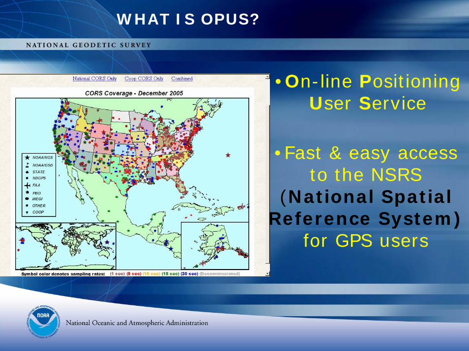
WHAT IS OPUS?
•On-line Positioning User Service
•Fast & easy access to the NSRS
(National Spatial Reference System)
for GPS users
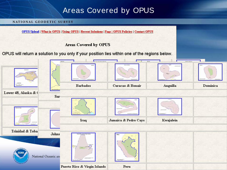
Areas Covered by OPUS
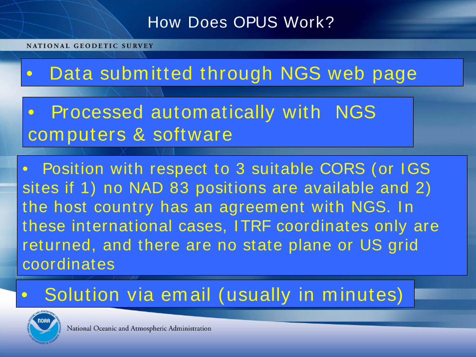
How Does OPUS Work?
• Data submitted through NGS web page
• Processed automatically with NGS computers & software
• Position with respect to 3 suitable CORS (or IGS sites if 1) no NAD 83 positions are available and 2) the host country has an agreement with NGS. In these international cases, ITRF coordinates only are returned, and there are no state plane or US grid coordinates
• Solution via email (usually in minutes)
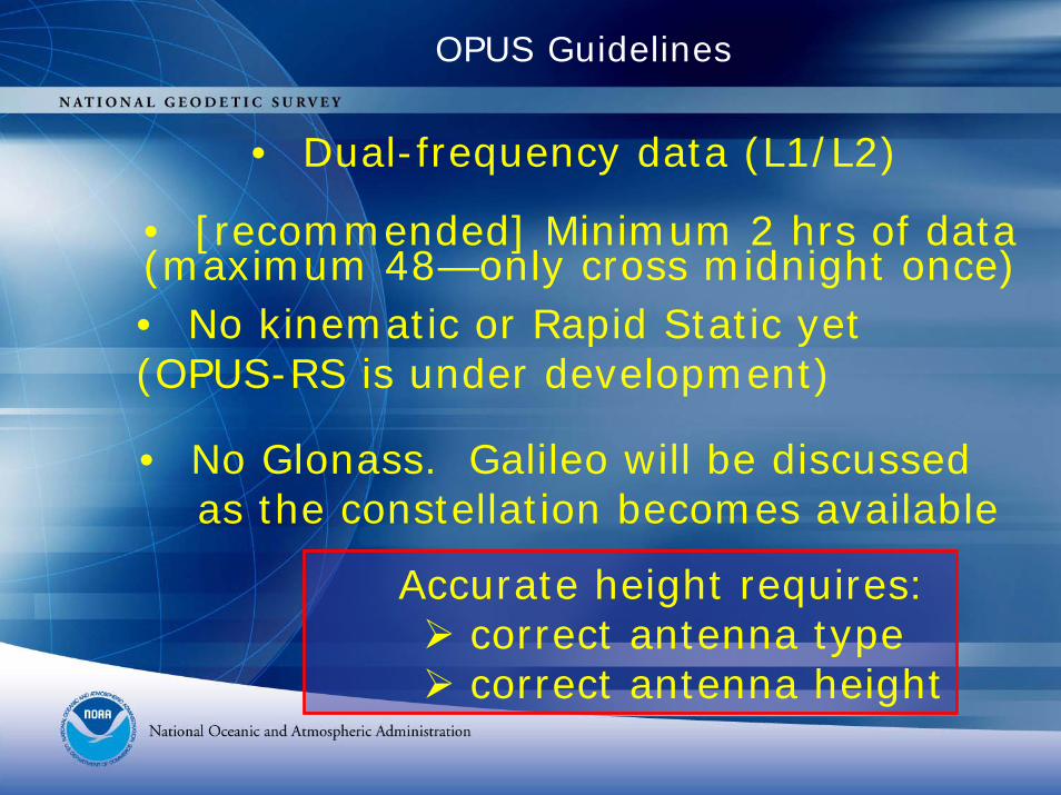
OPUS Guidelines
• Dual-frequency data (L1/L2)
• [recommended] Minimum 2 hrs of data (maximum 48—only cross midnight once)• No kinematic or Rapid Static yet (OPUS-RS is under development)
• No Glonass. Galileo will be discussed as the constellation becomes available
Accurate height requires:correct antenna typecorrect antenna height
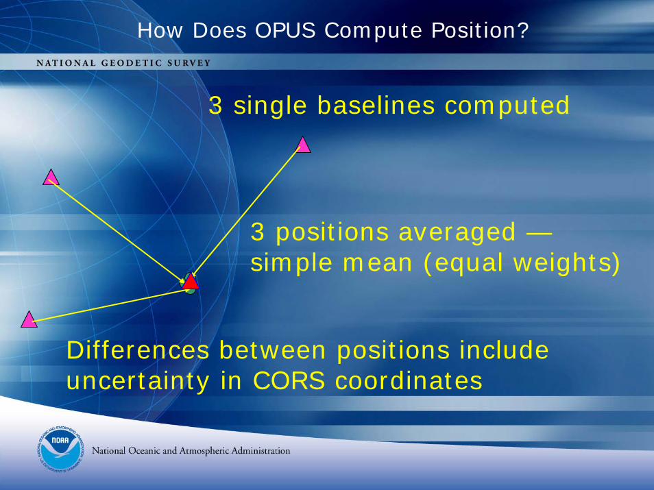
How Does OPUS Compute Position?
3 single baselines computed
3 positions averaged —simple mean (equal weights)
Differences between positions include uncertainty in CORS coordinates
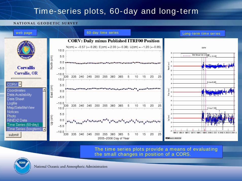
Time-series plots, 60-day and long-term
web page 60-day time series Long-term time series
The time series plots provide a means of evaluating the small changes in position of a CORS.
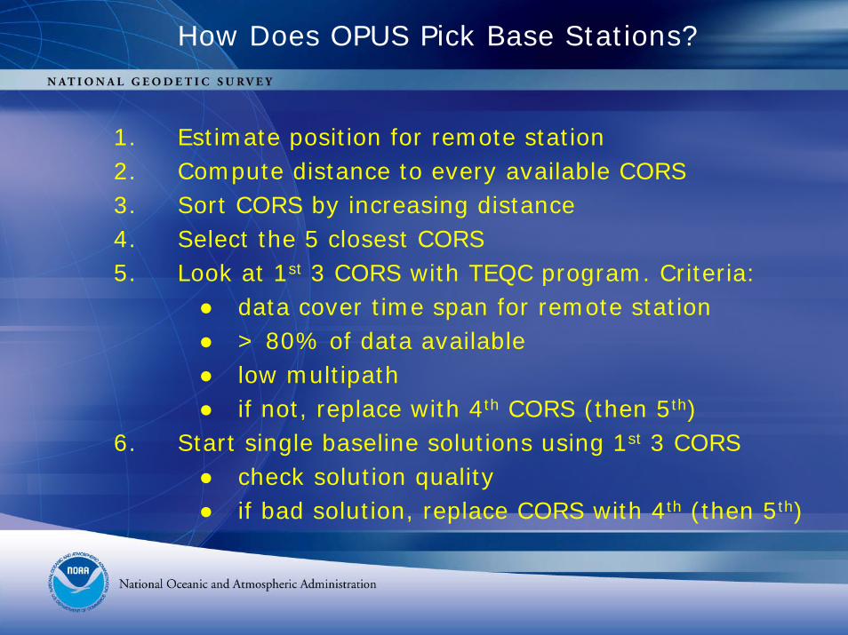
How Does OPUS Pick Base Stations?
1. Estimate position for remote station2. Compute distance to every available CORS3. Sort CORS by increasing distance4. Select the 5 closest CORS 5. Look at 1st 3 CORS with TEQC program. Criteria:
● data cover time span for remote station● > 80% of data available● low multipath● if not, replace with 4th CORS (then 5th)
6. Start single baseline solutions using 1st 3 CORS● check solution quality● if bad solution, replace CORS with 4th (then 5th)
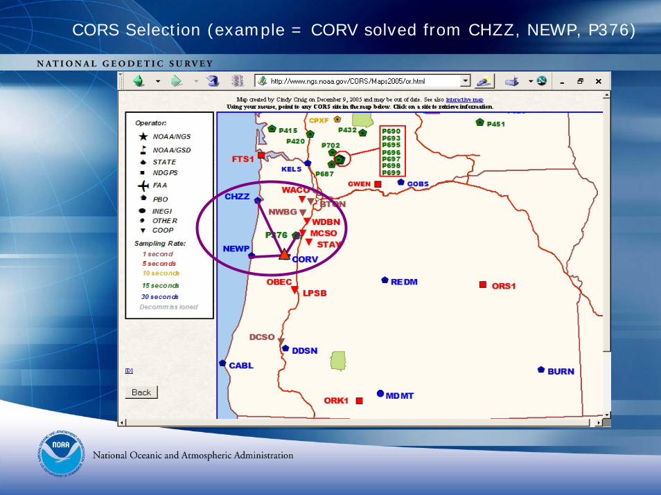
CORS Selection (example = CORV solved from CHZZ, NEWP, P376)
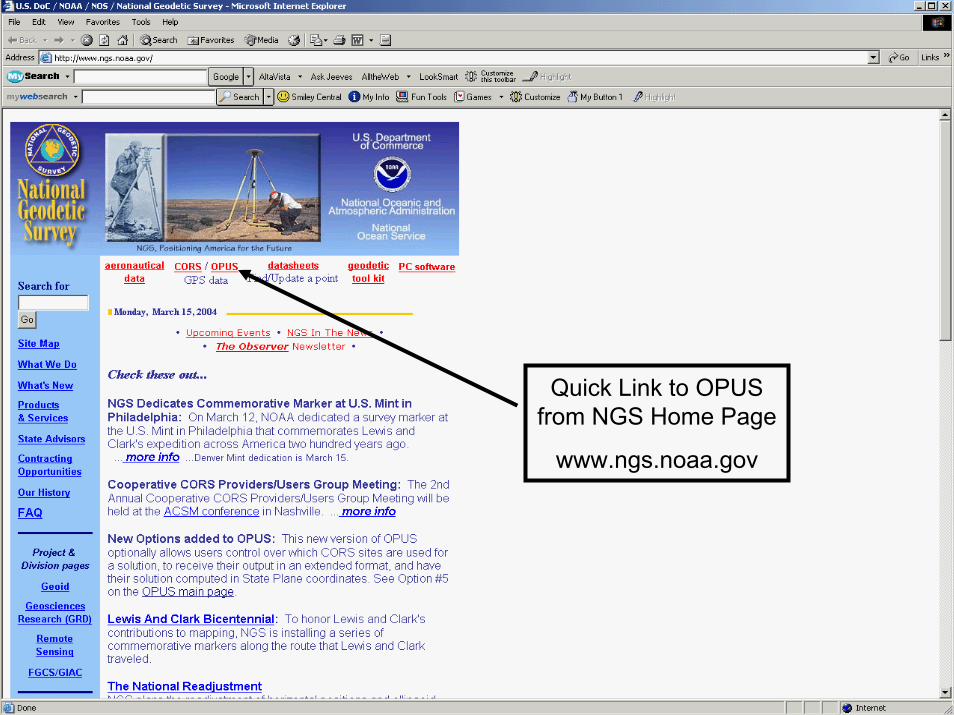
Quick Link to OPUS from NGS Home Page
www.ngs.noaa.gov
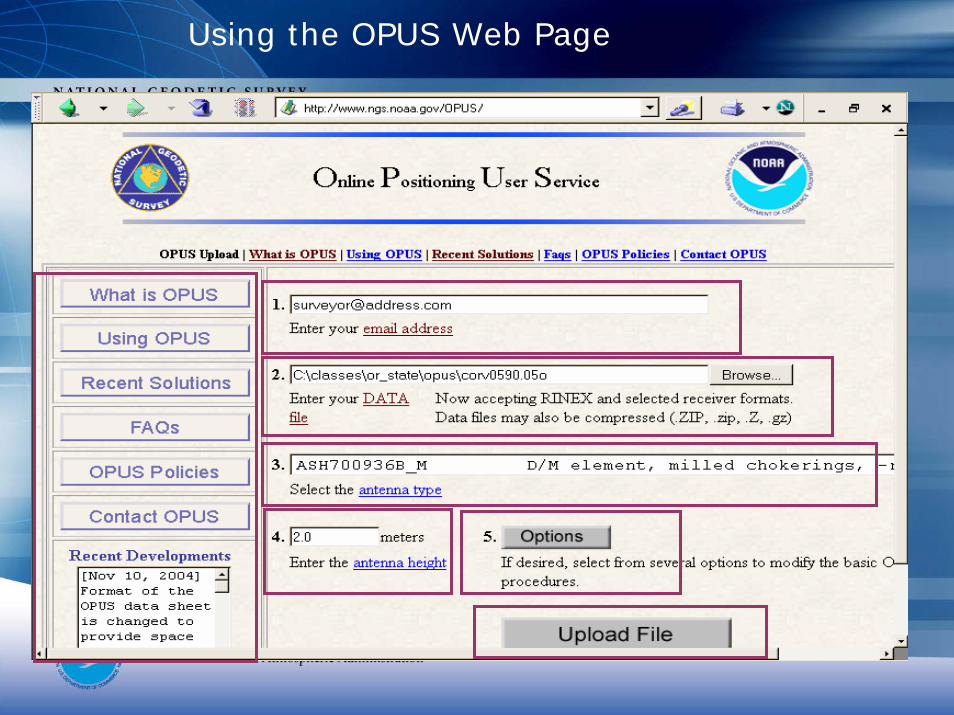
Using the OPUS Web Page
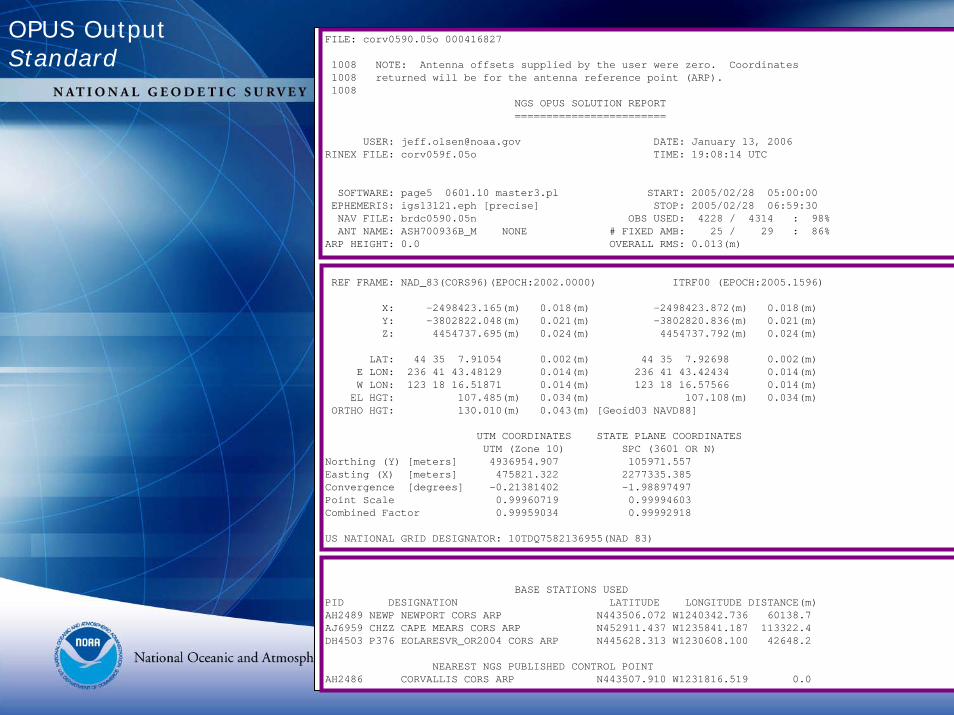
FILE: corv0590.05o 000416827
1008 NOTE: Antenna offsets supplied by the user were zero. Coordinates1008 returned will be for the antenna reference point (ARP).1008
NGS OPUS SOLUTION REPORT========================
USER: [email protected] DATE: January 13, 2006RINEX FILE: corv059f.05o TIME: 19:08:14 UTC
SOFTWARE: page5 0601.10 master3.pl START: 2005/02/28 05:00:00EPHEMERIS: igs13121.eph [precise] STOP: 2005/02/28 06:59:30NAV FILE: brdc0590.05n OBS USED: 4228 / 4314 : 98%ANT NAME: ASH700936B_M NONE # FIXED AMB: 25 / 29 : 86%
ARP HEIGHT: 0.0 OVERALL RMS: 0.013(m)
REF FRAME: NAD_83(CORS96)(EPOCH:2002.0000) ITRF00 (EPOCH:2005.1596)
X: -2498423.165(m) 0.018(m) -2498423.872(m) 0.018(m)Y: -3802822.048(m) 0.021(m) -3802820.836(m) 0.021(m)Z: 4454737.695(m) 0.024(m) 4454737.792(m) 0.024(m)
LAT: 44 35 7.91054 0.002(m) 44 35 7.92698 0.002(m)E LON: 236 41 43.48129 0.014(m) 236 41 43.42434 0.014(m)W LON: 123 18 16.51871 0.014(m) 123 18 16.57566 0.014(m)EL HGT: 107.485(m) 0.034(m) 107.108(m) 0.034(m)
ORTHO HGT: 130.010(m) 0.043(m) [Geoid03 NAVD88]
UTM COORDINATES STATE PLANE COORDINATESUTM (Zone 10) SPC (3601 OR N)
Northing (Y) [meters] 4936954.907 105971.557Easting (X) [meters] 475821.322 2277335.385Convergence [degrees] -0.21381402 -1.98897497Point Scale 0.99960719 0.99994603Combined Factor 0.99959034 0.99992918
US NATIONAL GRID DESIGNATOR: 10TDQ7582136955(NAD 83)
BASE STATIONS USEDPID DESIGNATION LATITUDE LONGITUDE DISTANCE(m)AH2489 NEWP NEWPORT CORS ARP N443506.072 W1240342.736 60138.7AJ6959 CHZZ CAPE MEARS CORS ARP N452911.437 W1235841.187 113322.4DH4503 P376 EOLARESVR_OR2004 CORS ARP N445628.313 W1230608.100 42648.2
NEAREST NGS PUBLISHED CONTROL POINTAH2486 CORVALLIS CORS ARP N443507.910 W1231816.519 0.0
OPUS OutputStandard
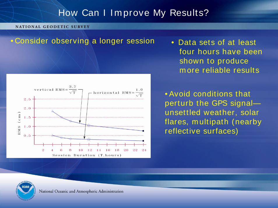
How Can I Improve My Results?
•Consider observing a longer session • Data sets of at leastfour hours have beenshown to producemore reliable results
•Avoid conditions that perturb the GPS signal—unsettled weather, solar flares, multipath (nearby reflective surfaces)
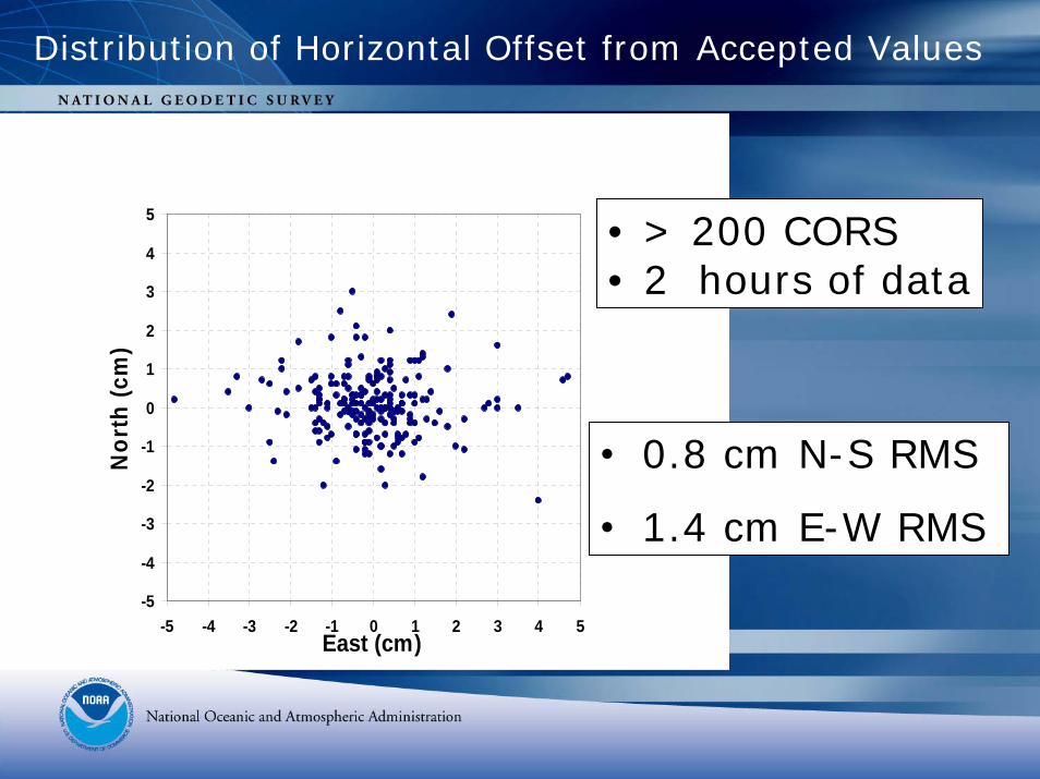
Distribution of Horizontal Offset from Accepted Values
-5
-4
-3
-2
-1
0
1
2
3
4
5
-5 -4 -3 -2 -1 0 1 2 3 4 5East (cm)
Nor
th (c
m)
• 0.8 cm N-S RMS
• 1.4 cm E-W RMS
• > 200 CORS • 2 hours of data
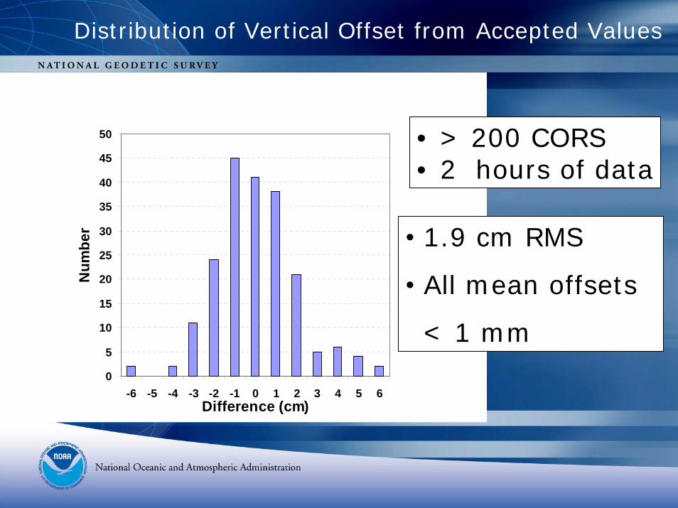
Distribution of Vertical Offset from Accepted Values
0
5
10
15
20
25
30
35
40
45
50
-6 -5 -4 -3 -2 -1 0 1 2 3 4 5 6Difference (cm)
Num
ber • 1.9 cm RMS
• All mean offsets
< 1 mm
• > 200 CORS• 2 hours of data
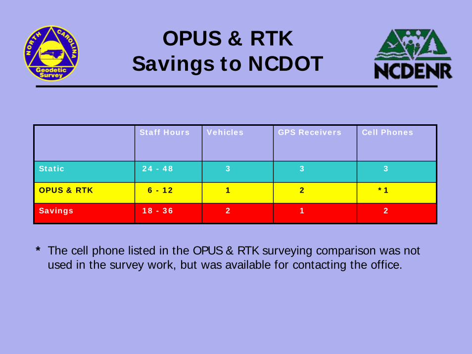
OPUS & RTK Savings to NCDOT
Cell PhonesGPS ReceiversVehiclesStaff Hours
2
1
3
18 - 36
6 - 12
24 - 48
Savings
OPUS & RTK
Static 33
21
*12
* The cell phone listed in the OPUS & RTK surveying comparison was not used in the survey work, but was available for contacting the office.
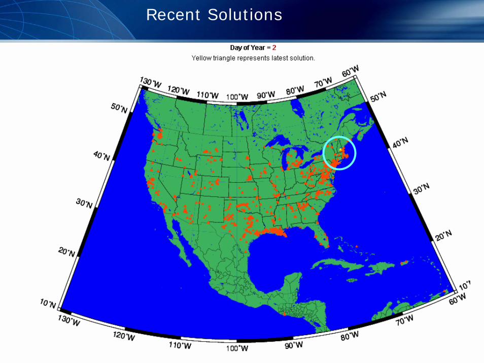
Recent Solutions
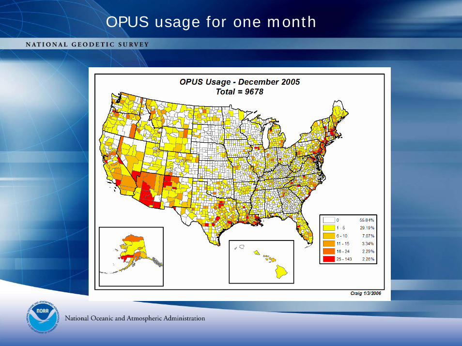
OPUS usage for one month
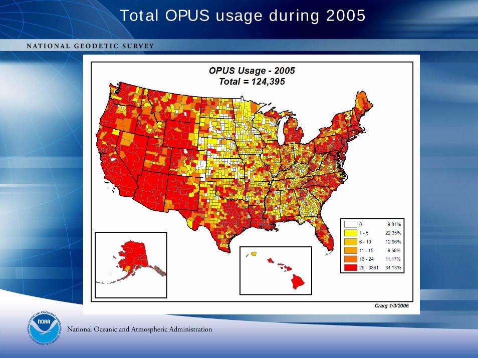
Total OPUS usage during 2005
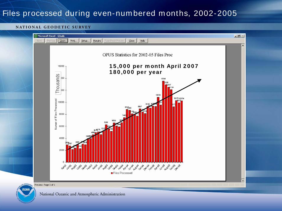
Files processed during even-numbered months, 2002-2005
15,000 per month April 2007 180,000 per year
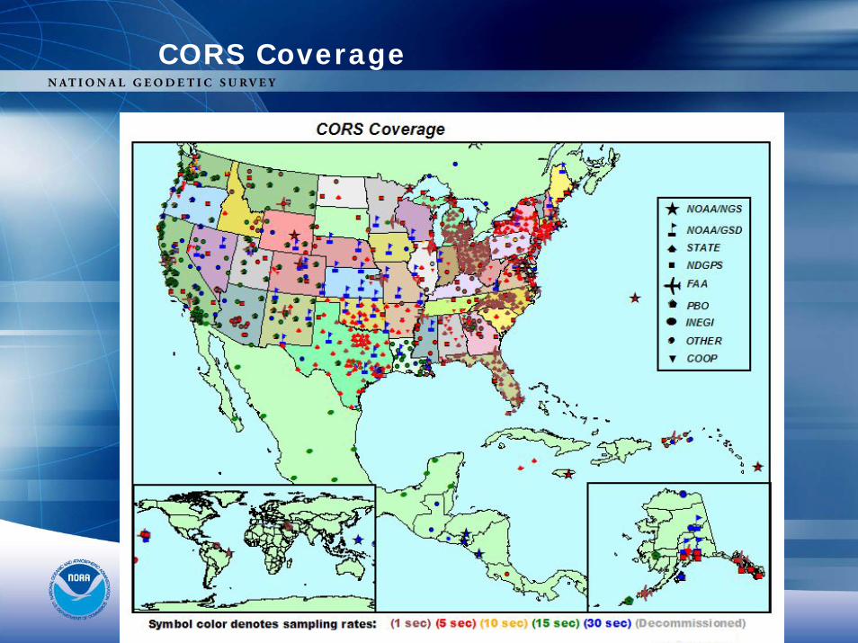
CORS Coverage
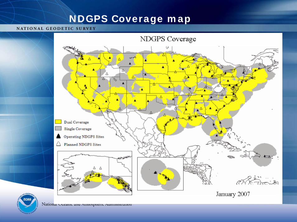
NDGPS Coverage map
NDGPS is VITAL!
• In short, NDGPS is VITAL to the mission of NGS and is widely popular in the active user community.
• NGS can prove how much usage the CORS/OPUS system has.
• The GPS Correction Beacon Signal is anonymous, but we know it has a wide, but silent, user base.
• NGS needs the broadcast to ensure that real-time users are TIED to NSRS!